Trekvogelpad (Migratory Bird Path)
How would you rate Trekvogelpad (Migratory Bird Path)?
Tap a star to share your experience and help other hikers.
Trekvogelpad: A 414 km Cross-Netherlands Nature Trail
HikeList Score
Trekvogelpad (Migratory Bird Path) scored 83/100 on HikeList's trail-quality metrics.
See score breakdownHide breakdown
- Ideal length 72
- Balanced challenge 90
- Scenery & wildness 67
- Varied terrain 100
- Accommodation 92
- Food & support 88
- Path quality 84
- Season flexibility 89
Computed from length, challenge, scenery & wildness, terrain variety, accommodation, food & support, path quality and season flexibility.
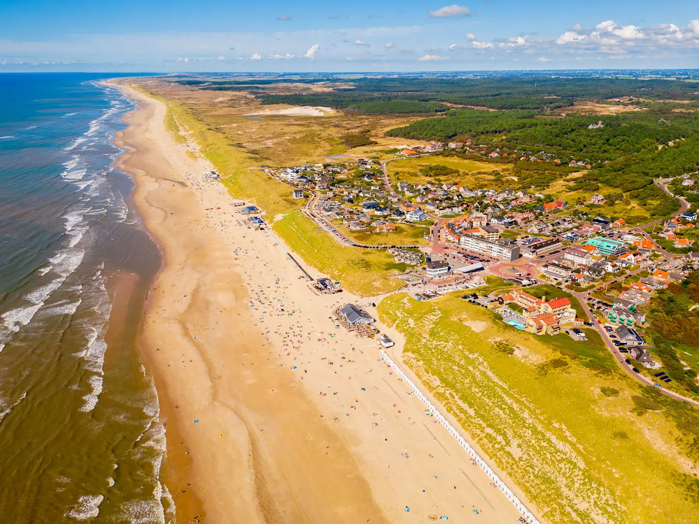
The Trekvogelpad, or Migratory Bird Path, is LAW 2: a 414 km point-to-point thru-hike across the central Netherlands from Bergen aan Zee on the North Sea coast to Enschede near the German border. Allow 21-23 days. It suits walkers who want long lowland landscapes and bird-rich habitats rather than altitude: dunes, peat meadows, wetlands, forest, heath and estates. The walking is flat and well waymarked, but rated moderate because the full route demands multi-week stamina.
Route Overview
The route runs west to east from the Zeeaquarium at Bergen aan Zee through North Holland, Utrecht, Gelderland and Overijssel. Key places include Alkmaar, Waterland and Amsterdam-Noord, Naarden-Bussum, Hilversum, Soest, the Utrechtse Heuvelrug, Amerongen, Rhenen, Ede, Otterlo, Hoenderloo, Vorden, Ruurlo, Eibergen and Enschede. It is a point-to-point trail, not a loop; the verified brief gives no transport details, so plan start and finish logistics separately. Waymarking is white-over-red in both directions. For related Dutch lowland walking, compare the coastal start with the Dutch Coastal Path or the eastern estate country on the Achterhoekpad.
History of the Trekvogelpad
The Trekvogelpad opened in 1999 to mark the centenary of Vogelbescherming Nederland, the Dutch bird-protection society. It stitched together three older routes: the Waterlandpad, Heuvelrugpad and Gelrepad. The name reflects its purpose: linking dunes, wetlands, heath and forests used as breeding and stopover habitats by migratory birds. It is the Netherlands’ second long-distance path after the Pieterpad and is billed as the country’s longest nature trail.
Notable highlights
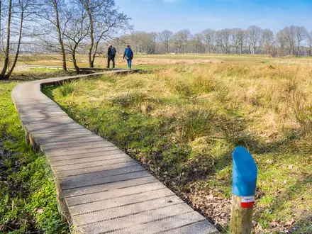
- Waterland and Broek in Waterland: Open peat-meadow polders north of Amsterdam, cut by ditches and known for meadow birds such as godwits and lapwings. Broek in Waterland adds a historic village of timber houses.
- Naardermeer near Naarden: The route passes the edge of the Naardermeer, the Netherlands’ first nature reserve, bought by Natuurmonumenten in 1906. Its reed marshes are important for herons, cormorants and other waterbirds.
- Utrechtse Heuvelrug: A wooded glacial ridge with forest, heath and estates such as Amerongen. The Kaapse Bossen lookout tower and Grebbeberg give rare wider views in an otherwise flat country.
- Nationaal Park De Hoge Veluwe: A paid-entry Veluwe reserve of heath, woodland and drift sand. It is also home to the Kröller-Müller Museum, Jachtslot Sint Hubertus and wildlife including red deer, wild boar and mouflon.
- Achterhoek estates around Vorden: Quiet rural walking through castle and estate country, with small streams and hedgerow landscapes. These eastern stages are consistently well rated by walkers.
- Haaksbergerveen and Buurserzand: Restored raised peat bogs and heathland near the German border. They give the final stages a wilder, bog-and-heath character before Enschede.
Challenges to expect
There is no real elevation challenge: the highest point is only about 80 m and total ascent is not verified. The difficulty is the length — 414 km over 21-23 days — plus mixed surfaces including sand, dirt, gravel and paved sections. Navigation is helped by white-over-red blazes, but urban edges and flat polder landscapes still require attention. Budget for accommodation, and for the paid section through Nationaal Park De Hoge Veluwe. For another northern lowland option, see the Drenthepad.
HikeList Score
Trekvogelpad (Migratory Bird Path) scored 83/100 on HikeList's trail-quality metrics.
See score breakdownHide breakdown
- Ideal length 72
- Balanced challenge 90
- Scenery & wildness 67
- Varied terrain 100
- Accommodation 92
- Food & support 88
- Path quality 84
- Season flexibility 89
Computed from length, challenge, scenery & wildness, terrain variety, accommodation, food & support, path quality and season flexibility.
Show more data Show less
- Coastal Dunes
- Peat Meadows
- Wetlands
- Forest
- Heathland
- Sand Drifts
- Country Estates
- Raised Peat Bogs
- Flat
- Dirt
- Sand
- Gravel
- Paved
- Campsites
- Hostels
- Bed And Breakfasts
- Hotels
- Family Friendly
- Pet Friendly
- Restrooms
- Water Sources
- Campsites
- Picnic Areas
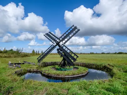
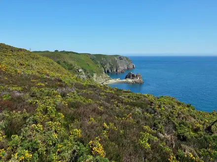
Photos from hikers
Taken on the trail by people who've reviewed Trekvogelpad (Migratory Bird Path).
Reviews
How would you rate Trekvogelpad (Migratory Bird Path)?
Tap a star to start your review — you could be the first.