Vaganski Vrh Summit Trail
How would you rate Vaganski Vrh Summit Trail?
Tap a star to share your experience and help other hikers.
Vaganski Vrh Summit Trail: Paklenica’s High Velebit Day Hike
HikeList Score
Vaganski Vrh Summit Trail scored 76/100 on HikeList's trail-quality metrics.
See score breakdownHide breakdown
- Ideal length 55
- Balanced challenge 80
- Scenery & wildness 88
- Varied terrain 100
- Accommodation 58
- Food & support 65
- Path quality 98
- Season flexibility 89
Computed from length, challenge, scenery & wildness, terrain variety, accommodation, food & support, path quality and season flexibility.
The Vaganski Vrh Summit Trail is a hard 20 km out-and-back day hike in Paklenica National Park, Croatia, climbing from Starigrad and Velika Paklenica canyon to Vaganski vrh at 1,757 m. It suits fit hikers who can handle a long 8–10 hour day, roughly 1,400 m of ascent, steep scree and exposed rocky ground. This is the highest peak of the Velebit range, not Croatia’s highest mountain overall. For a longer Adriatic mountain project, compare it with the Adriatic Long-Distance Trail.
Route Overview
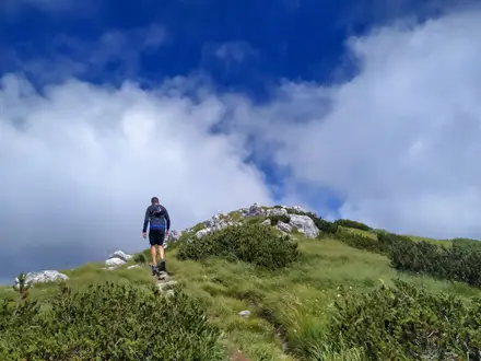
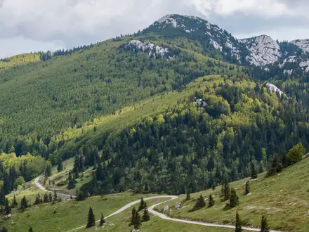
The classic route is an out-and-back from Starigrad via the main central entrance to Paklenica National Park. From the Velika Paklenica car park, the marked trail follows the canyon for about 6 km, taking roughly 2 hours to reach Paklenica mountain hut at around 480 m. From there, Lipa staza climbs steeply through forest and a narrow scree field to the Velebit ridge near Struge, around 1,400 m. The final section follows the ridge to the broad grassy summit of Vaganski vrh, then returns the same way. Alternative ridge lines pass Buljma pass and Struge shelter; a shorter, easier approach climbs from Bunovac/Malovan on the Lika side.
Velebit, Paklenica and the old coast-to-interior crossings
Velebit has long formed a natural barrier between Croatia’s interior and the Adriatic coast, crossed by old shepherd paths and mountain routes. Paklenica became a national park in 1949, partly to protect its black pine forests and limestone canyons. Velika Paklenica gorge also developed into one of Croatia’s best-known climbing areas from the 1930s to the 1960s, with classic Anića kuk routes such as Velebitaški first climbed in 1961.
Notable highlights
Velika Paklenica canyon: The lower approach follows this limestone gorge, with collapsed boulders, a year-round stream and walls up to about 400 m deep. It is also Croatia’s premier rock-climbing site, with around 600 marked routes.
Anića kuk: This iconic big wall marks the narrowest section of the gorge. Its long climbing lines include the classic 1961 Velebitaški route.
Paklenica mountain hut: The year-round hut sits at about 480 m, roughly 2 hours up the canyon, and is the usual staging point before the steep Lipa staza climb.
Lipa staza scree section: This is the crux of the coastal ascent, climbing sharply through forest and a narrow, steep scree field towards the Velebit ridge.
Struge shelter and ridge: The unstaffed shelter at around 1,400 m offers simple emergency-style accommodation, with spring water about 20 minutes away on Marasovac. From here the route continues along the high karst ridge.
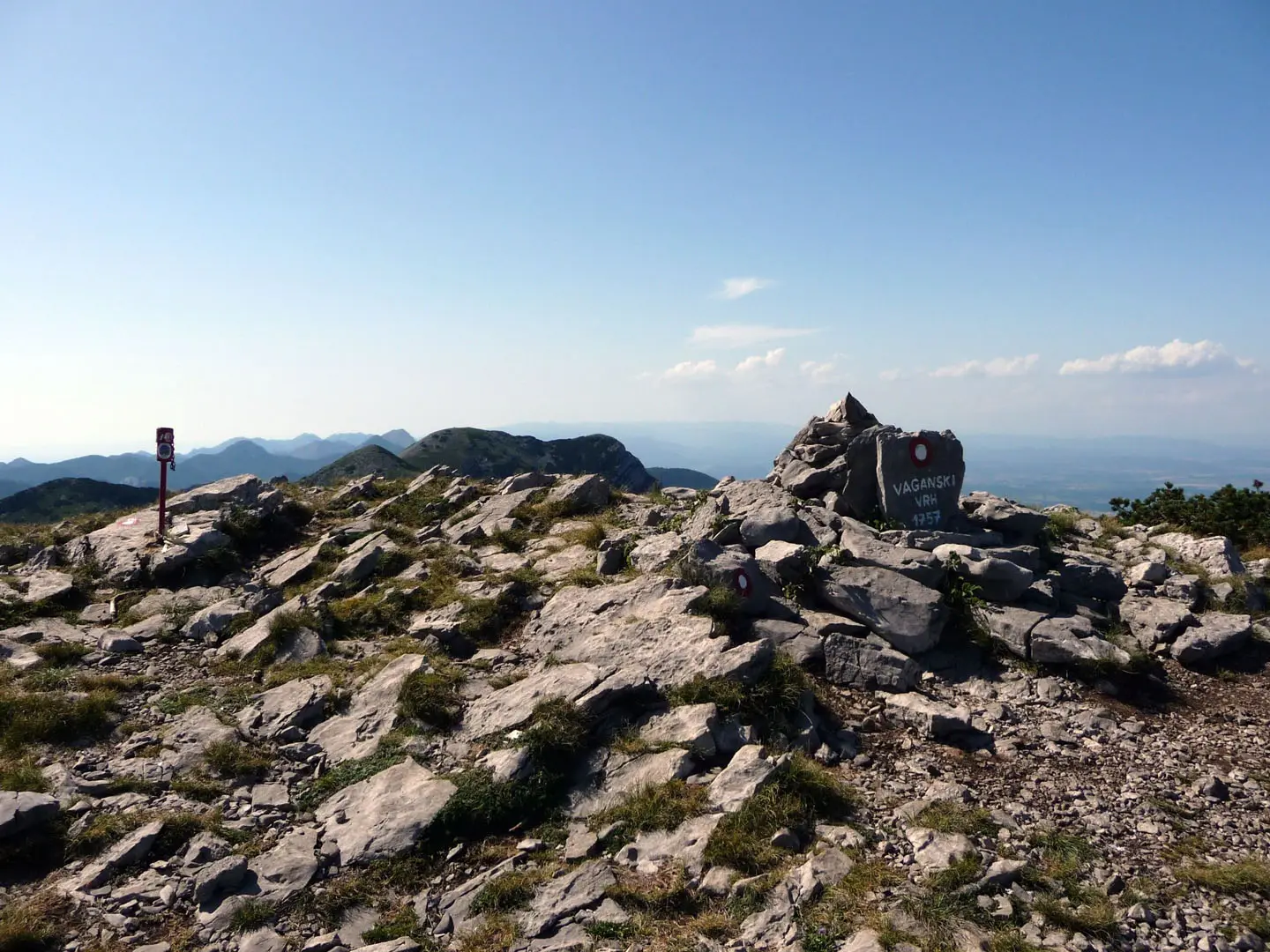
Vaganski vrh summit: The broad, flat, grass-covered top is the highest point of Velebit at 1,757 m. On clear days the panorama can include Dinara, distant Risnjak and the Adriatic islands — among them Brač, crowned by the island high point reached on the Brač Island Summit Trail (Vidova Gora).
Challenges to expect
Expect a long mountain day with roughly 1,400 m of ascent, much of it after the Paklenica hut. The Lipa staza scree is steep and tiring, and the upper ridge is rocky, exposed and vulnerable to fast weather changes. Snow can remain on the high karst ridge outside the main season. Struge has no food, so carry enough water and supplies, especially if splitting the route over 2 days. For gentler Croatian outings either side of a summit push, the waterfalls and boardwalks of the Krka Waterfalls Trail make an easy contrast.
HikeList Score
Vaganski Vrh Summit Trail scored 76/100 on HikeList's trail-quality metrics.
See score breakdownHide breakdown
- Ideal length 55
- Balanced challenge 80
- Scenery & wildness 88
- Varied terrain 100
- Accommodation 58
- Food & support 65
- Path quality 98
- Season flexibility 89
Computed from length, challenge, scenery & wildness, terrain variety, accommodation, food & support, path quality and season flexibility.
 Croatia
Show more data Show less
- Mountainous
- Canyon
- Forest
- Karst
- Gravel
- Dirt
- Rocky
- Scree
- Huts
- Shelters
- Pet Friendly
- Water Sources
- Campsites
- Shelters
Photos from hikers
Taken on the trail by people who've reviewed Vaganski Vrh Summit Trail.
Reviews
How would you rate Vaganski Vrh Summit Trail?
Tap a star to start your review — you could be the first.