Plitvice Lakes Loop
How would you rate Plitvice Lakes Loop?
Tap a star to share your experience and help other hikers.
Plitvice Lakes Loop: Route K Hiking Guide
HikeList Score
Plitvice Lakes Loop scored 81/100 on HikeList's trail-quality metrics.
See score breakdownHide breakdown
- Ideal length 55
- Balanced challenge 100
- Scenery & wildness 82
- Varied terrain 94
- Accommodation 75
- Food & support 81
- Path quality 98
- Season flexibility 89
Computed from length, challenge, scenery & wildness, terrain variety, accommodation, food & support, path quality and season flexibility.
The Plitvice Lakes Loop is the national park’s Route K, an 18.0 km, one-day circuit in central Croatia. Signed as K1 from Entrance 1 and K2 from Entrance 2, it is the longest waymarked walk in Plitvice Lakes National Park and links the Lower Lakes, Lake Kozjak and the Upper Lakes. Expect 6–8 hours on boardwalks, gravel and forest paths. It suits fit day hikers who want the full lake system on foot, not just the shorter shuttle-based programmes.
Route Overview
Start and finish at either Entrance 1, near the Lower Lakes and Veliki Slap, or Entrance 2, near the Upper Lakes. Both have ticket offices, parking, toilets and visitor facilities. The loop follows the full lake zone through the Lower Lakes canyon, past Veliki Slap and Sastavci, around or across Lake Kozjak, then through the quieter Upper Lakes including Gradinsko, Galovac and Prošćansko jezero. The standard official Route K includes the electric boat across Kozjak, covered by the park ticket; some hikers choose the longer-feeling variant that walks the forested shore instead. For another Croatian waterfall walk, compare Krka Waterfalls Trail.
Plitvice Lakes: National Park and UNESCO History
Plitvice Lakes was protected as a national park in 1949 and inscribed on the UNESCO World Heritage List in 1979 for its natural beauty and ongoing travertine formation. The wider area has been inhabited by Illyrian, Roman and later Slavic peoples. During the Croatian War of Independence, the park was the scene of the 1991 Plitvice Lakes incident, often cited as one of the first armed clashes of the war. It was later demined, restored and reopened as one of Croatia’s key protected landscapes.
Notable highlights
- Veliki Slap (about 78 m): Croatia’s tallest waterfall drops into the Lower Lakes area, fed by the Plitvica stream rather than lake-to-lake overflow. It is usually strongest in spring after snowmelt and rain.
- Lower Lakes canyon (Donja jezera): Four lakes sit in a steep limestone gorge, with boardwalks threading between cliffs, cascades and viewpoints. This is the most concentrated waterfall section of the loop.
- Lake Kozjak: The park’s largest and deepest lake sits around the midpoint of Route K. The official route uses the electric boat across Kozjak, though a full shore-walking variant is also described by independent guides.
- Upper Lakes (Gornja jezera): Twelve lakes lie in a softer dolomite valley, including Galovac and Prošćansko jezero. The feel is quieter and more wooded than the Lower Lakes.
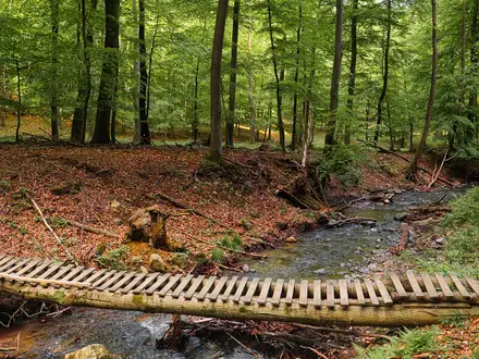
- Travertine boardwalks: Raised wooden walkways cross water, wetlands and growing tufa barriers, often without handrails. Stay on the marked path; swimming is banned to protect the fragile lake system.
- Forest ridge viewpoints: Sections such as Tomićevo Pogledalo climb away from the busiest boardwalks to give elevated views over the lake chain.
Challenges to expect
Route K is moderate because of length, not technical difficulty: allow 6–8 hours for the 18.0 km circuit. Boardwalks can be slippery when wet and are often narrow and unrailed. Summer brings heat, crowds and sold-out timed-entry tickets; winter can mean snow, ice and limited boat or train services. If you want a quieter forest-focused Croatian day hike, see the Jankovac Forest Trail; for a much longer undertaking, compare the Adriatic Long-Distance Trail.
HikeList Score
Plitvice Lakes Loop scored 81/100 on HikeList's trail-quality metrics.
See score breakdownHide breakdown
- Ideal length 55
- Balanced challenge 100
- Scenery & wildness 82
- Varied terrain 94
- Accommodation 75
- Food & support 81
- Path quality 98
- Season flexibility 89
Computed from length, challenge, scenery & wildness, terrain variety, accommodation, food & support, path quality and season flexibility.
 Croatia
Show more data Show less
- Karst
- Lakes
- Waterfalls
- Forest
- Canyon
- Boardwalk
- Gravel
- Dirt
- Hotels
- Guesthouses/Apartments
- Campsites
- Family Friendly
- Restrooms
- Water Sources
- Picnic Areas
In these collections
Photos from hikers
Taken on the trail by people who've reviewed Plitvice Lakes Loop.
Reviews
How would you rate Plitvice Lakes Loop?
Tap a star to start your review — you could be the first.