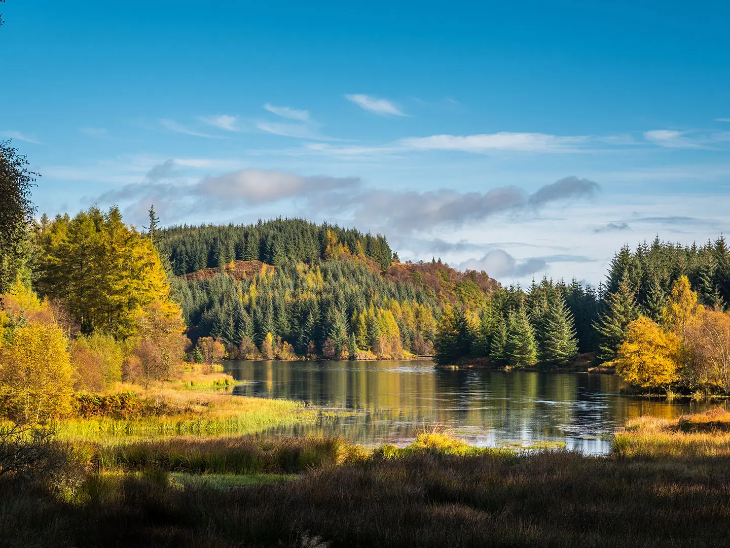
Trossachs Trail
How would you rate Trossachs Trail?
Tap a star to share your experience and help other hikers.
Trossachs Trail: Great Trossachs Path Hiking Guide
HikeList Score
Trossachs Trail scored 85/100 on HikeList's trail-quality metrics.
See score breakdownHide breakdown
- Ideal length 66
- Balanced challenge 100
- Scenery & wildness 71
- Varied terrain 89
- Accommodation 100
- Food & support 88
- Path quality 98
- Season flexibility 89
Computed from length, challenge, scenery & wildness, terrain variety, accommodation, food & support, path quality and season flexibility.
There is no single official waymarked walking route called the “Trossachs Trail”; the 48 km long-distance walk usually meant here is the Great Trossachs Path. It crosses the Trossachs in Scotland, within Loch Lomond & The Trossachs National Park, from Callander/Kilmahog to Inversnaid on Loch Lomond. Allow 2–3 days. The route is moderate: mostly low-level, well waymarked and beginner-friendly, but with long daily distances, mixed surfaces and a few short steep sections.
Route Overview
The Great Trossachs Path is a linear, point-to-point route, not a loop. It runs east–west between Callander, near Kilmahog, and Inversnaid on the shore of Loch Lomond, and can be walked in either direction. Key places include Loch Venachar, Brig o’ Turk, Loch Achray, Loch Katrine, Stronachlachar and Loch Arklet before the finish at Inversnaid. The path links two other Scotland’s Great Trails: the Rob Roy Way and the West Highland Way. It is waymarked with distinctive “T-tree” signs and is also used by cyclists and horse riders. The Loch Katrine steamship and local transport can help split sections into day walks.
History of the Trossachs and the Great Trossachs Path
The Great Trossachs Path was created by The Great Trossachs Forest partnership — Forestry and Land Scotland, RSPB Scotland and Woodland Trust Scotland — and opened in April 2015 to connect Loch Lomond with the heart of the Trossachs. The area’s visitor history is older: Sir Walter Scott’s poem The Lady of the Lake and novel Rob Roy helped popularise Loch Katrine and Rob Roy MacGregor’s country, making the Trossachs an early focus of Scottish tourism.
Notable highlights
- Loch Katrine (the scenic heart of the route): The path follows the loch’s largely traffic-free northern shore on a tarmac single-track road. The steamship Sir Walter Scott has operated here since 1900, and the loch supplies Glasgow’s drinking water.
- Brig o’ Turk (Trossachs village waypoint): A small village between Loch Venachar and Loch Achray, associated with Victorian artists and writers. It is a useful and characterful stop on the eastern half of the route.
- Inversnaid (Loch Lomond finish): The western end of the path, where it meets the West Highland Way. The waterfall on the Arklet Water is linked with a Gerard Manley Hopkins poem.
- Strath Gartney and the Great Trossachs Forest (woodland regeneration landscape): This section between Loch Katrine and Loch Arklet crosses a major native-woodland restoration area with good birdlife.
- Rob Roy country (historic Trossachs context): The wider area is closely associated with 18th-century outlaw Rob Roy MacGregor, and the route connects naturally with the Rob Roy Way. For a shorter local outing, see the Loch Katrine Circular Walk.
Challenges to expect
Expect Scottish rain at any time of year and midges in summer. The route is low-level with modest total ascent, but 2–3 day schedules mean some long walking days. Surfaces vary between forest tracks, gravel, tarmac single-track road, boardwalk, steps and occasional boggy patches. Navigation is helped by “T-tree” waymarks, though winter brings shorter daylight and wetter ground.
HikeList Score
Trossachs Trail scored 85/100 on HikeList's trail-quality metrics.
See score breakdownHide breakdown
- Ideal length 66
- Balanced challenge 100
- Scenery & wildness 71
- Varied terrain 89
- Accommodation 100
- Food & support 88
- Path quality 98
- Season flexibility 89
Computed from length, challenge, scenery & wildness, terrain variety, accommodation, food & support, path quality and season flexibility.
 United Kingdom
 Scotland
Show more data Show less
- Lochside
- Forest
- Hill
- Forest Tracks
- Tarmac Single Track Road
- Gravel
- Boardwalk
- Hotels
- Guesthouses
- Hostels
- Campsites
- Family Friendly
- Pet Friendly
- Restrooms
- Water Sources
- Campsites
- Picnic Areas
Photos from hikers
Taken on the trail by people who've reviewed Trossachs Trail.
Reviews
How would you rate Trossachs Trail?
Tap a star to start your review — you could be the first.