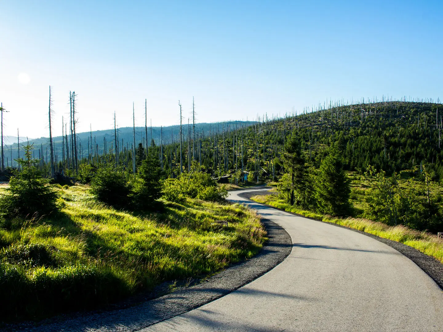
Třístoličník Summit Trail
How would you rate Třístoličník Summit Trail?
Tap a star to share your experience and help other hikers.
Třístoličník Summit Trail: Šumava Border Summit Hike
HikeList Score
Třístoličník Summit Trail scored 78/100 on HikeList's trail-quality metrics.
See score breakdownHide breakdown
- Ideal length 55
- Balanced challenge 100
- Scenery & wildness 98
- Varied terrain 71
- Accommodation 58
- Food & support 66
- Path quality 98
- Season flexibility 89
Computed from length, challenge, scenery & wildness, terrain variety, accommodation, food & support, path quality and season flexibility.
The Třístoličník Summit Trail is a short, demanding 8.5 km out-and-back day hike in Šumava National Park, on the Czechia–Germany border near the Austria tripoint. Starting at Nové Údolí, it climbs about 450 m through Bohemian Forest to granite summit tors, the Dreisesselfels and the nearby Bavarian Hochstein viewpoint. It suits hikers who want a half-day mountain walk with rocky ground, forest, border-ridge atmosphere and summit views, but not a technical route.
Route Overview
Start and finish at Nové Údolí, a Czech border hamlet reachable by the Stožec heritage railway. Follow the red waymarked trail uphill through Šumava National Park forest towards Třístoličník. The lower path is dirt and gravel; the upper approach becomes steeper, rockier and uses natural stone steps to reach the granite tors. The summit area sits on the Czech-German frontier: the Dreisesselfels rocks, Berggasthof Dreisessel and Hochstein viewpoint are adjacent or just over the Bavarian side. Return the same way. Stronger walkers commonly extend east along the border ridge towards Trojmezí and Plechý, but that is a different, longer route. For other Czech mountain days, compare the Elbe River Source Trail or Bílá Opava Valley Path.
A Border Summit with Three Thrones
Třístoličník, or Dreisesselberg in German, has marked the Bohemia-Bavaria frontier for centuries. The name means “three seats” or “three chairs” and is linked to folklore about the kings of Bavaria, Bohemia and Austria meeting to settle borders near the tripoint. The writer Adalbert Stifter helped make the area known in literature. A first hikers’ refuge was built in 1888 by the Bavarian Forest Club, and the present Dreisesselhaus dates from 1913.
Notable highlights
- Three granite thrones (Dreisesselfels): Pillow-shaped granite tors formed by woolsack weathering. These rocks gave the mountain its “three seats” name and are listed among Bavaria’s notable geotopes.
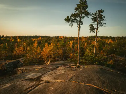
- Summit panorama: The rocks and Hochstein viewpoint look across the Bohemian Forest, Bavarian Forest and Mühlviertel, with Alpine views possible in clear weather.
- Berggasthof Dreisessel: A traditional summit inn beside the rocks, handy for food and drink on the hike, though it takes payment in euros only.
- Šumava National Park forest: The approach passes through one of Central Europe’s large protected forest landscapes, including bark-beetle-killed spruce stands managed as natural-process forest.
- Trojmezí tripoint extension: About 3 km east along the border ridge, Trojmezí is where Czechia, Germany and Austria meet. It is not part of the core 8.5 km out-and-back but is a common extension.
Challenges to expect
Expect a steady 450 m climb rather than a stroll. The upper route is steep, rocky and bouldery, with natural stone steps to the viewpoints, so it is unsuitable for bikes or pushchairs. Navigation is simple on the red-marked trail, but keep to marked paths in protected zones. In winter the ridge needs snowshoes or skis. There is no accommodation on the route; the summit inn is the main refreshment stop.
HikeList Score
Třístoličník Summit Trail scored 78/100 on HikeList's trail-quality metrics.
See score breakdownHide breakdown
- Ideal length 55
- Balanced challenge 100
- Scenery & wildness 98
- Varied terrain 71
- Accommodation 58
- Food & support 66
- Path quality 98
- Season flexibility 89
Computed from length, challenge, scenery & wildness, terrain variety, accommodation, food & support, path quality and season flexibility.
 Czechia
Show more data Show less
- Mountainous
- Forest
- Dirt
- Gravel
- Rocky
- Huts
- Campsites
- Family Friendly
- Pet Friendly
- Restrooms
- Campsites
- Shelters
- Picnic Areas
Photos from hikers
Taken on the trail by people who've reviewed Třístoličník Summit Trail.
Reviews
How would you rate Třístoličník Summit Trail?
Tap a star to start your review — you could be the first.