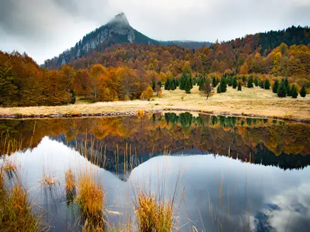
Tour du Mont Mézenc
How would you rate Tour du Mont Mézenc?
Tap a star to share your experience and help other hikers.
Tour du Mont Mézenc: A High Massif Central Day Hike
HikeList Score
Tour du Mont Mézenc scored 84/100 on HikeList's trail-quality metrics.
See score breakdownHide breakdown
- Ideal length 55
- Balanced challenge 100
- Scenery & wildness 98
- Varied terrain 94
- Accommodation 66
- Food & support 88
- Path quality 98
- Season flexibility 89
Computed from length, challenge, scenery & wildness, terrain variety, accommodation, food & support, path quality and season flexibility.
The Tour du Mont Mézenc is a 17.5 km waymarked loop around Mont Mézenc in the southern Massif Central, on the Haute-Loire–Ardèche border in France. It is a moderate one-day hike on forest tracks, dirt paths, open moorland and rocky summit ground, with an optional short detour to the 1,753 m summit. It suits hikers wanting a high, exposed volcanic plateau walk without committing to a multi-day route.
Route Overview
This is a loop, with common access from Les Estables, Croix de Pécata / Croix de Peccata, Croix de Boutières, or Chaudeyrolles for the 17.5 km variant. The walk circles Mont Mézenc across open meadows, subalpine heath, volcanic ridges and the Forêt domaniale du Mézenc, with the summit cone reached by a short rocky section if you take the detour. Key places include Croix de Boutières above the Cirque des Boutières, the northern viewpoint at Croix de Pécata, and Les Estables as the main base village. For other French mountain walking ideas, compare the Chartreuse Trail GR9 segment or the Ballons des Vosges Park Trails.
Watershed, Boundary and Pécata Legend
Mont Mézenc has long served as a natural marker: the summit area sits on the Atlantic–Mediterranean watershed and on the boundary between Haute-Loire and Ardèche. The surrounding high plateaus are tied to pastoral life and transhumance traditions. Locally, the walk is also associated with the legend of Jean de Pécata, a fugitive of the Mézenc plateau, reflected in the name Croix de Pécata.
Notable highlights
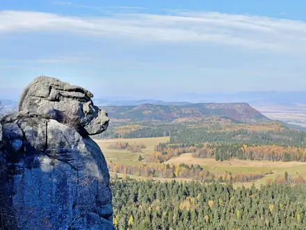
- Mont Mézenc summit (1,753 m): The highest point of both Ardèche and Haute-Loire, with an orientation table and summit cross. In clear weather, views reach the Rhône valley, the Alps and Mont Blanc.
- Croix de Boutières: A high Ardèche-side pass and trailhead overlooking the Cirque des Boutières. It is one of the best viewpoints on the east side of the massif.
- Cirque des Boutières: An eroded volcanic amphitheatre below the east face of Mont Mézenc. Its ring of volcanic sucs gives the walk its most distinctive geology.
- Forêt domaniale du Mézenc: A state-managed fir and beech forest on the lower slopes. It adds shade and shelter between the more exposed ridges.
- Croix de Pécata: A northern viewpoint and car park, often used for the shorter classic Tour and summit approach. It is also linked with the Jean de Pécata legend.
- Les Estables: The high base village on the Haute-Loire side, around 1,350 m. It is the local hub for hiking in summer and Nordic skiing in winter.
Challenges to expect
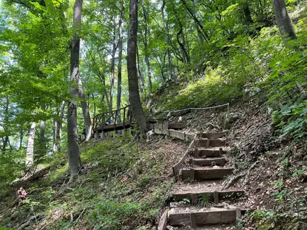
Expect a long but non-technical day, with around 500 m of ascent on mixed forest tracks, dirt paths, grassy plateau and rocky summit ground. The summit cone has a short rocky scramble. Weather is the main challenge: the plateau is exposed, windy and changeable, and winter snow turns the area into a Nordic ski and snowshoe zone. Carry layers and do not treat it as a lowland walk.
HikeList Score
Tour du Mont Mézenc scored 84/100 on HikeList's trail-quality metrics.
See score breakdownHide breakdown
- Ideal length 55
- Balanced challenge 100
- Scenery & wildness 98
- Varied terrain 94
- Accommodation 66
- Food & support 88
- Path quality 98
- Season flexibility 89
Computed from length, challenge, scenery & wildness, terrain variety, accommodation, food & support, path quality and season flexibility.
 France
Show more data Show less
- Mountainous
- Moorland
- Forest
- Meadow
- Dirt
- Rocky
- Grass
- Hotels
- Campsites
- Family Friendly
- Pet Friendly
- Restrooms
- Water Sources
- Campsites
- Shelters
- Picnic Areas
Photos from hikers
Taken on the trail by people who've reviewed Tour du Mont Mézenc.
Reviews
How would you rate Tour du Mont Mézenc?
Tap a star to start your review — you could be the first.