Stołowe National Park Circuit
How would you rate Stołowe National Park Circuit?
Tap a star to share your experience and help other hikers.
Stołowe National Park Circuit: Karłów’s Sandstone Labyrinth Loop
HikeList Score
Stołowe National Park Circuit scored 83/100 on HikeList's trail-quality metrics.
See score breakdownHide breakdown
- Ideal length 55
- Balanced challenge 100
- Scenery & wildness 85
- Varied terrain 83
- Accommodation 83
- Food & support 88
- Path quality 98
- Season flexibility 89
Computed from length, challenge, scenery & wildness, terrain variety, accommodation, food & support, path quality and season flexibility.
The Stołowe National Park Circuit is a 17.5 km loop day-hike from Karłów in the Stołowe Mountains of south-west Poland. It links Szczeliniec Wielki, the 919 m high point of the Table Mountains, with the rock maze of Błędne Skały. Allow a full day: the walking is moderate for fit hikers, but the 650 m ascent, long staircases and tight sandstone passages make it feel moderate-to-strenuous. It suits hikers who want the park’s two main sights in one compact mountain circuit.
Route Overview
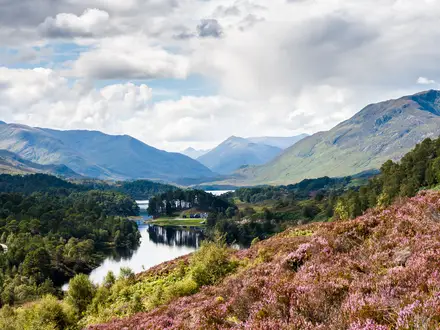
Start and finish in Karłów, a small village below Szczeliniec Wielki with bus access and car parks. The common loop climbs the stone staircase to Szczeliniec Wielki, follows the one-way summit route past rock figures and Piekiełko, then descends towards Pasterka. From there the route continues around Ostra Góra to Błędne Skały, whose ticketed one-way labyrinth is the second showpiece section. The return to Karłów uses the red PTTK trail. This is a genuine loop, not a traverse; longer point-to-point walks across the park exist but are separate routes. For other Polish mountain options, compare the Karkonosze Ridge Trail, Giewont Summit Trail or Five Lakes Valley Trail.
Sandstone mesas, early tourism and spa-country history
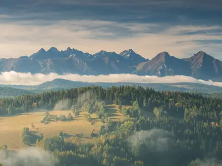
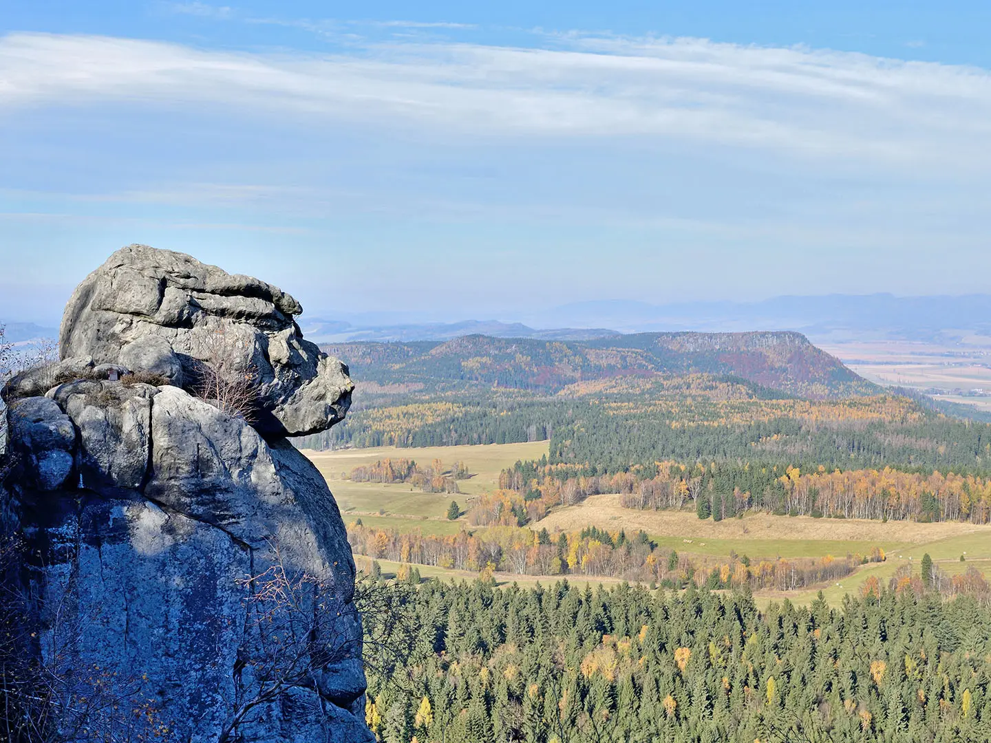
The Stołowe Mountains are built from Upper Cretaceous sandstone laid down around 70–90 million years ago, then shaped by long erosion into Poland’s only sandstone table-mountain range. The stone staircase to Szczeliniec Wielki dates from the 1790s, and the peak has attracted visitors for centuries; John Quincy Adams and, reputedly, Goethe are associated with early ascents. The wider Kłodzko Valley is linked with European spa culture, including Kudowa-Zdrój, Duszniki-Zdrój and Polanica-Zdrój. Stołowe Mountains National Park was created in 1993.
Notable highlights
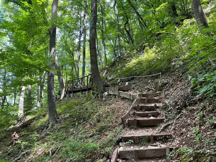
- Szczeliniec Wielki (919 m): The highest peak in the Table Mountains and the circuit’s high point. The climb uses a roughly 680-step 18th-century stone staircase before a one-way summit route across the plateau.
- Piekiełko (Little Hell): A narrow, shadowed rock ravine on the Szczeliniec Wielki summit route. Steps thread through the confined sandstone passage, making it one of the most memorable sections.
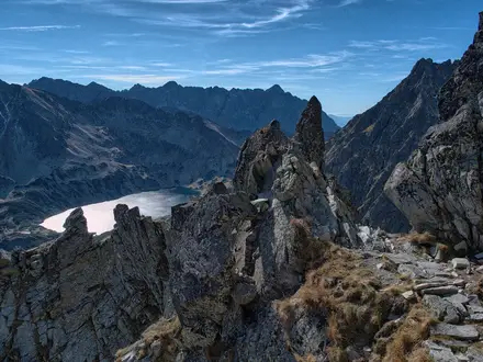
- Błędne Skały (Errant Rocks, about 853 m): A 21-hectare sandstone labyrinth of corridors, pillars, mushrooms and blocks. The one-way ticketed route includes passages tight enough to turn sideways.
- PTTK ‘Na Szczelińcu’ mountain hut: A year-round hut on the summit plateau with refreshments, shelter and viewing terraces over the Kłodzko Valley and towards the Czech border.
- The Monkey Man and other rock figures: Weathered sandstone forms such as Małpolud, the Camel and the Hen give the summit route its distinctive character.
- Pasterka: A quiet hamlet between Szczeliniec and Błędne Skały, useful as a natural midpoint between the two busier paid routes.
Challenges to expect
The main difficulty is not technical exposure but sustained effort: about 650 m of ascent, the long staircase to Szczeliniec Wielki, metal stairs and platforms, and tight rock corridors in Błędne Skały. Sandstone steps can be slippery when wet or icy. The two paid routes may have queues, timed entry or seasonal restrictions, so book ahead in busy periods. Stay on marked PTTK trails.
HikeList Score
Stołowe National Park Circuit scored 83/100 on HikeList's trail-quality metrics.
See score breakdownHide breakdown
- Ideal length 55
- Balanced challenge 100
- Scenery & wildness 85
- Varied terrain 83
- Accommodation 83
- Food & support 88
- Path quality 98
- Season flexibility 89
Computed from length, challenge, scenery & wildness, terrain variety, accommodation, food & support, path quality and season flexibility.
Show more data Show less
- Mountain
- Forest
- Rocky
- Dirt
- Rock
- Steps
- Hotels
- Guesthouses
- Mountain Huts
- Family Friendly
- Pet Friendly
- Restrooms
- Water Sources
- Campsites
- Shelters
- Picnic Areas
Photos from hikers
Taken on the trail by people who've reviewed Stołowe National Park Circuit.
Reviews
How would you rate Stołowe National Park Circuit?
Tap a star to start your review — you could be the first.