The Isle of Raasay Trail
How would you rate The Isle of Raasay Trail?
Tap a star to share your experience and help other hikers.
The Isle of Raasay Trail: Dun Caan Circuit Guide
HikeList Score
The Isle of Raasay Trail scored 88/100 on HikeList's trail-quality metrics.
See score breakdownHide breakdown
- Ideal length 55
- Balanced challenge 100
- Scenery & wildness 98
- Varied terrain 100
- Accommodation 100
- Food & support 74
- Path quality 98
- Season flexibility 89
Computed from length, challenge, scenery & wildness, terrain variety, accommodation, food & support, path quality and season flexibility.
The “Isle of Raasay Trail” is best treated as the Dun Caan circuit: a real full-day loop on Raasay, off Skye in Scotland. It starts and finishes at the Raasay ferry terminal at Churchton Bay, near Inverarish, and is about 16.5 km with roughly 600 m of ascent. Expect a moderate-to-hard hill walk: forestry tracks low down, then rough, boggy and partly pathless ground near the 443 m summit. It suits confident day hikers with navigation skills, not walkers expecting a waymarked long-distance trail.
Route Overview
Start at the Raasay ferry terminal at Churchton Bay, reached by the CalMac ferry from Sconser on Skye, then walk via Inverarish into the forestry tracks towards Loch a’ Mhuilinn and Loch na Meilich. The route then climbs onto open, rough moorland for Dun Caan, Raasay’s flat-topped summit. From the trig point, descend via the Inverarish Burn area and the old iron-mine railway track back towards Inverarish and the ferry. This is a circular day walk, not a point-to-point trail. For longer Scottish island and coastal routes, compare the Arran Coastal Way or the Assynt Coastal Path; for a rougher mountain day, see the Beinn Eighe Mountain Trail.
Raasay history on the route
Raasay has prehistoric and Iron Age remains, and was long associated with the MacLeods of Raasay, first at Brochel and later Raasay House. Bonnie Prince Charlie sheltered on the island for two days after Culloden in 1746, after which Raasay was harshly punished. Boswell and Johnson visited in 1773. The 19th-century Clearances emptied townships including Hallaig and Suishnish, while the early 20th-century iron-ore mine near Inverarish left the railway line used by part of today’s walk.
Notable highlights
- Dun Caan (443 m): Raasay’s flat-topped summit, capped with basalt columns and marked by a trig point. In clear weather it gives wide views to the Cuillin of Skye, Applecross, Torridon and the Outer Hebrides.
- Inverarish iron mine: The village sits beside relics of an iron-ore mine worked in the early 20th century. The old mine railway forms part of the return route.
- Loch na Meilich: The island’s water source, reached on the approach to Dun Caan through the central hill ground.
- Calum’s Road: A 1.75-mile road in north Raasay, hand-built by crofter Calum MacLeod between roughly 1964 and 1974. It is a separate car or bike excursion, not part of the Dun Caan loop.
- Brochel Castle: A ruined clifftop castle at the north end of Raasay and the start of Calum’s Road. It is also separate from the Dun Caan circuit.
- Hallaig and Suishnish: Cleared townships associated with the Highland Clearances; Hallaig is memorialised in Sorley MacLean’s Gaelic poem.
Challenges to expect
Do not expect a fully waymarked long-distance trail. The lower sections use forestry tracks and clearer paths, but the approach to Dun Caan is rough, boggy and often pathless. Navigation is important, especially in mist. Raasay weather changes quickly, with high rainfall year-round, so carry waterproofs, warm layers and sturdy footwear. Accommodation and services on the island are limited, and many walkers day-trip from Skye.
HikeList Score
The Isle of Raasay Trail scored 88/100 on HikeList's trail-quality metrics.
See score breakdownHide breakdown
- Ideal length 55
- Balanced challenge 100
- Scenery & wildness 98
- Varied terrain 100
- Accommodation 100
- Food & support 74
- Path quality 98
- Season flexibility 89
Computed from length, challenge, scenery & wildness, terrain variety, accommodation, food & support, path quality and season flexibility.
 United Kingdom
 Scotland
Show more data Show less
- Mountainous
- Coastal
- Forest
- Moorland
- Dirt
- Forestry Track
- Rocky
- Boggy Hill Ground
- Hotels
- Hostels
- Campsites
- B&Bs
- Wild Camping Spots
- Family Friendly
- Pet Friendly
- Campsites
- Water Sources
Download Our Full Guide to The Isle of Raasay Trail FREE!
Get our comprehensive guide to this hike for free. Save it for later reading or print out at home.
Photos from hikers
Taken on the trail by people who've reviewed The Isle of Raasay Trail.
The Isle of Raasay Trail: The Complete Guide
 i
Image by alex4photo
i
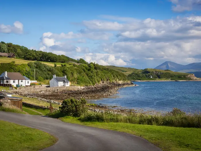
Image by alex4photo The Isle of Raasay Trail is best understood as the Dun Caan circuit: a full-day hill walk from the ferry at Churchton Bay to Raasay’s flat-topped summit and back. It suits confident day hikers who want a compact Hebridean objective with real hill terrain, not a waymarked long-distance trail.
The route starts easily, following road, woodland paths and forestry tracks near Inverarish before turning towards the island’s rougher interior. Higher up, the character changes to wet moorland, faint lines and open ground around Loch na Meilich and Dun Caan.
On a clear day, the reward is exceptional: the Cuillin across the Sound of Raasay, Applecross, Torridon and the Outer Hebrides from a 443 m summit capped with basalt columns. The return adds local history, using the old iron-mine railway line back towards Inverarish and the ferry.
This is still a serious island hill day. Expect boggy going, changeable weather, limited services and a hard deadline set by the last CalMac sailing back to Sconser.
This guide covers route stages, timing, accommodation, food, transport, terrain and common mistakes.
Stage-by-Stage Guide
Stage 1: Raasay ferry terminal, Churchton Bay, to Dun Caan and back
This is a full-day circular hill walk from the Raasay ferry terminal, not a waymarked long-distance stage. The route leaves Churchton Bay on the road north towards Inverarish, then uses easier low-level tracks and woodland paths before committing to the rougher open ground below Dun Caan.
Allow the day to be governed by ferry times, weather and visibility rather than distance alone. The full circuit from the ferry is about 16.5 km with roughly 600 m of ascent, and the rough upper section can make progress slower than the map distance suggests.
| Planning point | What to expect |
|---|---|
| Start / finish | Raasay ferry terminal at Churchton Bay |
| Main objective | Dun Caan, 443 m, Raasay’s flat-topped summit |
| Character | Road and forestry tracks low down; rough, boggy, partly pathless moorland higher up |
| Waymarking | Local forestry paths lower down; the Dun Caan hill section is unwaymarked |
| Best logistics | Day-trip from Skye if the CalMac timetable works, or stay on Raasay if beds are booked ahead |
From the ferry, the first part of the walk is the most straightforward. The route heads towards Inverarish, passing close to the main settlement area and the Isle of Raasay Distillery before entering the lower woodland and forestry-track section. These lower paths are easier underfoot than the hill ground and overlap with the island’s local colour-coded forestry walks.
Beyond the woodland, the route works inland through the Loch a’ Mhuilinn area towards Loch na Meilich. This is where the day changes character: the going becomes wetter, rougher and less defined, with boggy moorland and sections where the line is not obvious on the ground. In mist, this middle approach is the part where map, compass or reliable GPS navigation matter most.
Loch na Meilich sits below Dun Caan and is one of the key landmarks on the approach. It is the island’s water source, but walkers should not plan to rely on untreated hill water. Carry enough drinking water from the start, especially because there are no services once away from Inverarish and the ferry area.
The final approach to Dun Caan is steeper, though there is no scrambling. The summit is capped with basalt columns and marked by a trig point. In clear weather it gives the route’s best views: across the Sound of Raasay to the Cuillin of Skye, and out towards Applecross, Torridon and the Outer Hebrides.
The summit area is also where poor visibility can make the walk feel much more serious. The flat-topped hill, open moorland and intermittent path lines mean it is easy to lose the correct onward direction in cloud. If the top is in mist, treat the navigation as a hill-walking task rather than a casual island path.
The return descends by way of the Inverarish Burn area and then uses the old iron-mine railway line and forest road back towards Inverarish. This trackbed is a notable historical feature of the route, linked to the early-20th-century iron-ore workings near Inverarish, which had closed by 1922. Underfoot conditions generally become easier again once back on the forest roads and lower tracks.
Food and drink options should be treated as limited. There are no reliable refreshment points on the hill circuit itself, and island services are sparse, so carry lunch, snacks and water from the start. Any plan to eat before or after the walk on Raasay should be checked before travelling, particularly if timing the walk around a ferry crossing.
Accommodation at the end is limited but possible near Inverarish and the ferry side of the island. Options include Raasay House, Isle of Raasay Distillery accommodation, a small number of B&Bs and self-catering places, plus small campsite or hostel-style options and responsible wild camping under Scottish access rights. Summer beds should be booked well ahead; many walkers instead return to Skye the same day.
Public transport access depends on the CalMac ferry between Sconser on Skye and Raasay. The crossing takes about 25 minutes and runs roughly every 1–2 hours, but the timetable and especially the last sailing must be checked before travel. Missing the last ferry means being stranded on Raasay overnight unless accommodation is available.
Sconser is on the A87 between Broadford and Portree and is reachable by bus from Skye. The nearest railhead is Kyle of Lochalsh on the mainland side of Skye. If driving or cycling on Raasay, the core Dun Caan ascent can be shortened by starting from the path junction rather than the ferry, but the full circuit described here begins and ends at Churchton Bay.
Carry proper hill kit despite the modest summit height: waterproofs, warm layers, sturdy boots and navigation equipment are all appropriate. The island has high rainfall year-round, and the upper ground holds water, so lightweight town shoes or casual trainers are a poor choice. Winter adds short daylight, tighter ferry margins and harder navigation, making summer or a long spring/autumn day the safer planning window.
Recommended Itinerary
This is a single-day hill circuit, not a multi-day trail. The main planning choice is whether to walk the full loop from the ferry terminal or shorten the day by driving or cycling to the path junction for the core Dun Caan ascent.
Standard itinerary: full circuit from the ferry
Best for most day-trippers from Skye and anyone without a vehicle on Raasay. It gives the complete 16.5 km circuit, including the approach from Churchton Bay, the rough hill section over Dun Caan and the return by the old iron-mine railway line.
| Day | From | To | Approx. distance | Why this stage makes sense | Services/accommodation notes |
|---|---|---|---|---|---|
| 1 | Raasay ferry terminal, Churchton Bay | Dun Caan summit and back to Raasay ferry terminal via Inverarish and the old iron-mine railway line | 16.5 km | This is the full Dun Caan circuit from the ferry, avoiding the need for island transport. It fits into a long day if the first and last ferries are planned carefully, but the rough, boggy and partly pathless upper ground means timings can stretch in poor weather. | Services on Raasay are limited. Many walkers day-trip from Skye, but missing the last CalMac sailing from Raasay to Sconser would leave you on the island overnight. Check the ferry timetable, last sailing, weather and visibility before travelling. |
Slower option: stay on Raasay before or after the walk
Best for walkers who want more margin around ferry times, are travelling without a car, or want to avoid rushing the descent if visibility is poor. The walking day is still the same 16.5 km circuit, but staying on the island removes the pressure of connecting with the final ferry back to Sconser.
| Day | From | To | Approx. distance | Why this stage makes sense | Services/accommodation notes |
|---|---|---|---|---|---|
| 1 | Sconser / Raasay ferry terminal | Raasay accommodation near Inverarish or Churchton Bay | Short transfer only | Arriving the day before the hill walk gives more flexibility over weather and ferry timings. This is the most comfortable plan in short daylight or unsettled conditions. | Island accommodation is limited: options include Raasay House, Isle of Raasay Distillery accommodation, a few B&Bs and self-catering options, plus small campsite/hostel-style options. Book well ahead in summer. |
| 2 | Raasay ferry terminal / Inverarish area | Dun Caan summit and back to the ferry or accommodation | 16.5 km from the ferry | The full circuit can be walked without worrying about catching the last ferry immediately after finishing. Navigation is still required on the unwaymarked moorland around Dun Caan. | Carry food, water, waterproofs, warm layers and navigation equipment. Return ferry times should still be checked if leaving Raasay the same day. |
Faster option: shorter Dun Caan ascent from the path junction
Best for walkers with a car or bike on Raasay, or for those who want the summit without the full circuit from the ferry. This omits some of the lower approach and return, so it is not the complete HikeList route.
| Day | From | To | Approx. distance | Why this stage makes sense | Services/accommodation notes |
|---|---|---|---|---|---|
| 1 | Path junction below Dun Caan, reached by driving or cycling from the ferry area | Dun Caan summit and back | About 5.5 km for the core ascent | This is the shortest practical version of the walk and reduces the time pressure created by ferry schedules. The hill section remains rough, wet and unwaymarked, so it should not be treated as an easy waymarked stroll. | Transport from the ferry to the start point must be arranged independently. Parking, road access and current local conditions should be checked before travelling. |
Planning the Route
Treat it as a single hill day, not a staged trail
Plan the Dun Caan circuit as a full-day walk from the Raasay ferry terminal, with enough time for rough ground, navigation pauses and the return ferry. It is not naturally divided into daily stages: the route starts and finishes at Churchton Bay, passes near Inverarish early and late, and has no sequence of villages or accommodation stops along the way.
Most walkers should allow the day rather than trying to squeeze the circuit between tight ferry sailings. The lower forestry tracks can feel straightforward, but the approach to Dun Caan crosses wet, rough and partly pathless moorland where progress can slow sharply in poor visibility.
If staying overnight on Raasay, the route becomes logistically easier because the last ferry is less of a constraint. Island accommodation is limited, especially in summer, so beds should be booked well ahead rather than assumed on arrival.
Pace and timing
The main timing decision is whether to walk the full circuit from the ferry or shorten the day by starting closer to the Dun Caan path junction. From the ferry, the full loop is the proper all-in version of the route; by driving or cycling to the path junction, the core Dun Caan ascent is much shorter, at about 5.5 km.
For a day trip from Skye, an early CalMac sailing from Sconser is strongly preferable. Check both the outward and return timetable before travelling, and build in a buffer before the last sailing back from Raasay — missing it leaves you on the island overnight.
In winter, the route is harder to plan well. Short daylight, wet ground and changeable weather make the rough upper section less forgiving, and ferry timing becomes tighter.
Shortening, extending and section hiking
This is not a route that benefits from section hiking. Because it is a circular day walk with one start and finish point, splitting it over multiple days adds little unless it is being combined with a wider stay on Raasay.
The practical shorter option is to avoid the road and lower approach from the ferry by driving or cycling to the path junction used for the Dun Caan ascent. Walkers wanting something easier should use the lower forestry and Inverarish paths near the ferry rather than committing to the rough summit ground.
Hallaig, Calum’s Road and Brochel Castle are separate Raasay excursions, not part of the Dun Caan circuit. They should be planned as separate walks or car/bike trips rather than treated as natural extensions to this loop.
What to plan most carefully
| Planning point | Practical advice |
|---|---|
| Ferry | Check the CalMac Sconser–Raasay timetable and especially the last sailing before travelling. Do not plan the walk against a marginal return connection. |
| Navigation | Carry OS mapping for Raasay — OS Explorer 409 covers the island — plus a compass or reliable GPS. The hill section to Dun Caan is unwaymarked and can be confusing in mist. |
| Weather | Check the forecast for wind, rain and visibility. The summit is only 443 m, but the route crosses exposed, boggy moorland where poor visibility changes the seriousness of the day. |
| Footwear and clothing | Wear sturdy boots and carry full waterproofs and warm layers. Underfoot conditions can be very wet even outside winter. |
| Food and water | Carry what is needed for the full day. Services on Raasay are sparse, and there are no dependable resupply points on the hill section. |
| Accommodation | If staying on the island, book early in summer. Options are limited to a small number of hotel, distillery, B&B, self-catering, campsite or hostel-style places. |
Accommodation and overnight planning
There is no need to sleep out to complete the route, and many walkers do it as a day trip from Skye. Staying on Raasay can still be worthwhile if the aim is to avoid ferry pressure or explore other parts of the island, but the Dun Caan circuit itself remains a one-day walk.
Responsible wild camping is possible under Scottish access rights, but it should not be used as a fallback for poor ferry planning. Anyone intending to camp should be fully self-sufficient and follow low-impact practice, particularly because services and formal facilities on the island are limited.
Towns, Villages and Overnight Stops
This route is a circular day walk, so overnight planning is mainly about whether to base yourself on Raasay, stay on Skye and day-trip by ferry, or keep a contingency plan in case ferry timings change. There is no chain of trail towns and no accommodation-served multi-day itinerary along the Dun Caan circuit.
Island beds are limited and should be booked well ahead in summer. If staying on Raasay, plan food, evening meals and transport before arrival rather than assuming services will be available on the day.
Sconser, Skye
Sconser is the Skye-side ferry port for Raasay and the practical gateway to the walk. It sits on the A87 between Broadford and Portree, with bus access on Skye and the nearest railhead at Kyle of Lochalsh on the mainland side of Skye.
For most walkers, Sconser is a transit point rather than an overnight stop for the route itself. Accommodation and food plans in or around Sconser should be checked before travelling, especially if relying on public transport connections or an early ferry.
The key planning task here is the CalMac Sconser–Raasay ferry. The crossing takes about 25 minutes and runs roughly every 1–2 hours, but the current timetable and last sailing must be checked carefully; missing the final ferry back from Raasay can leave you stranded on the island.
Raasay Ferry Terminal / Churchton Bay
The walk starts and finishes at the Raasay ferry terminal at Churchton Bay. This makes it possible to complete the full Dun Caan circuit as a day trip from Skye, provided the ferry timetable, walking pace and weather all line up.
Churchton Bay is not a trail town in the long-distance sense. Treat it as the arrival point, start point and escape point, not as a place to solve missing food, kit or accommodation problems at short notice.
If returning to Skye the same day, allow a proper time margin for the final road section back to the ferry. The rough, boggy and partly pathless upper ground around Dun Caan can slow progress considerably in poor visibility or wet conditions.
Inverarish
Inverarish is the main village passed near the start and finish of the circuit. The route begins by following the road north from the ferry towards Inverarish before using forestry tracks and paths; the return also comes back through the Inverarish area after descending by the Inverarish Burn and old iron-mine railway line.
This is the most logical part of Raasay for an overnight stay if you want to walk without worrying about the last ferry back to Skye. Accommodation on the island is limited, with options including Raasay House, the Isle of Raasay Distillery accommodation, a few B&Bs and self-catering places, plus small campsite or hostel-style options.
Do not assume there will be flexible late availability, especially in summer. Book beds ahead, check meal arrangements at the same time, and carry enough hill food for the full circuit.
Inverarish also has route interest: it is associated with the former iron-mine workings, and the old iron-mine railway line forms part of the return to the ferry. It is a useful mental checkpoint near the end of the walk, but it should not be treated as a guaranteed resupply point.
Isle of Raasay Distillery area
The Isle of Raasay Distillery sits near the lower part of the route area around Inverarish and Churchton Bay. Its accommodation is one of the named island options, making it relevant for walkers who want to stay on Raasay before or after the Dun Caan circuit.
As with all island accommodation, availability, food arrangements and check-in times should be confirmed before booking travel. This is particularly important if arriving on a late ferry or walking the circuit before an onward departure.
For the walk itself, the distillery area is not a hill-stage stop or resupply point. Start the route with water, waterproofs, warm layers and enough food for a full day on rough ground.
Loch a' Mhuilinn area
Loch a' Mhuilinn is part of the lower-to-middle route area as the walk leaves the easier forestry sections and heads towards the open ground. It is not a settlement and has no accommodation or services.
This area marks the point where walkers should already be committed to hill conditions rather than village walking. If weather, visibility or timing are poor, it is better to make conservative decisions before pressing into the rougher moorland.
Loch na Meilich
Loch na Meilich is a hill loch below Dun Caan and one of the main landmarks on the approach to the summit. It lies within the rougher central moorland section, where the route is boggy, partly pathless and unwaymarked.
There are no overnight facilities, food stops or transport links here. It is a navigation landmark, not a stopping base.
Although Loch na Meilich is the island's water source, walkers should not plan the day around taking untreated water from hill lochs or burns. Carry enough drinking water from the start unless properly equipped and experienced in treating upland water.
Dun Caan summit
Dun Caan is the objective and high point of the walk, at 443 m. It is a flat-topped basalt summit with a trig point and, in clear weather, wide views towards the Cuillin of Skye, Applecross, Torridon and the Outer Hebrides.
It is not an overnight stop and has no shelter or services. The summit area is exposed, and mist can make navigation on the unwaymarked ground difficult.
Time spent on the top should be judged against the return route and ferry deadline. In poor weather, the summit is a place to navigate carefully and keep moving, not to linger.
Inverarish Burn and the old iron-mine railway line
The descent returns by the Inverarish Burn and then uses the old iron-mine railway line and forest road back towards Inverarish and the ferry. This section is important because it brings the walk back into easier terrain after the rougher hill ground.
There are no overnight stops or resupply points on this part of the route. Its practical value is as a more defined return line towards the village and ferry terminal.
Even once back on tracks, keep an eye on the ferry timetable. A comfortable summit time can still become tight if the descent has been slow, the ground is wet, or the last sailing is approaching.
Staying on Raasay versus day-tripping from Skye
Staying on Raasay removes the pressure of catching the last ferry immediately after the walk and gives more flexibility in poor weather. The trade-off is limited accommodation and sparse services, so advance booking is strongly recommended.
Day-tripping from Skye is common and works well in settled conditions with an early ferry. It requires stricter time management: check the outbound and return sailings, know the last ferry, and leave a margin for slow going on the upper moorland.
Responsible wild camping is possible under Scottish access rights, but this should be approached carefully on a small island with limited facilities. Camp discreetly, avoid enclosed or sensitive ground, leave no trace, and do not rely on being able to buy supplies after arrival.
Getting to the Start
The walk starts at the Raasay ferry terminal at Churchton Bay, near Inverarish. To reach it, travel first to Sconser on the Isle of Skye, then take the CalMac vehicle/passenger ferry across the Sound of Raasay.
The crossing takes about 25 minutes and normally runs roughly every 1–2 hours, but the timetable and the last sailing are critical. This should be checked before travelling, as missing the last ferry after the walk can leave you stranded on Raasay overnight.
By train
The nearest railhead is Kyle of Lochalsh, on the mainland side of Skye. From there, continue by onward road transport across Skye to Sconser, then take the ferry to Raasay.
Allow plenty of connection time between train, bus or taxi, ferry and the walk itself. This is a full hill day from the ferry, so late arrivals can make the ferry return and daylight margins uncomfortably tight.
By bus
Sconser is on the A87 between Broadford and Portree and is reachable by bus from Skye. Bus times, stop locations and onward ferry connections should be checked before travelling, especially outside the main summer season.
When planning by public transport, work backwards from the last Raasay–Sconser ferry. The rough upper section around Dun Caan can be slow in wet weather or mist, so do not plan on finishing at the absolute limit of the final sailing.
Taxis may be useful for linking Kyle of Lochalsh, Skye accommodation and Sconser, but availability can be limited and should be arranged in advance. This should be checked before travelling.
By car
Drive to Sconser on the A87, between Broadford and Portree, then use the CalMac ferry to Raasay. The service carries vehicles as well as foot passengers, but current sailings, fares and any vehicle requirements should be checked with CalMac before travelling.
From the Raasay ferry terminal, the full circuit begins on the road north towards Inverarish. Some walkers shorten the day by driving or cycling to the path junction for the core Dun Caan ascent, but the route covered here starts and finishes at the ferry terminal.
Parking arrangements at Sconser or on Raasay should be checked before travelling. Do not assume long-stay parking will be available without checking current local information.
From the nearest airport
There is no airport at the start or on Raasay. Most walkers approaching by air will still need to connect into the wider Scottish rail, bus or hire-car network, then reach Skye and Sconser by road before taking the ferry.
Because the final leg depends on the Sconser–Raasay ferry, airport arrival times need to leave a generous buffer. This should be checked before travelling.
Where to stay before starting
Many walkers day-trip from Skye, using the ferry from Sconser in the morning and returning the same day. This works well only if the ferry timetable, weather and expected walking time leave a safe margin for the return sailing.
Accommodation on Raasay is limited. Options include Raasay House, Isle of Raasay Distillery accommodation, a few B&Bs and self-catering places, plus small campsite or hostel-style options. Book well ahead in summer.
Staying on Raasay the night before gives the most relaxed start and removes the pressure of catching a morning ferry before beginning the walk. Staying on Skye can be simpler for transport and wider services, but it makes ferry timing part of the hill-day plan.
Getting Home from the Finish
This walk finishes where it starts: Raasay ferry terminal at Churchton Bay. Getting home is therefore mainly a ferry-timing problem rather than an end-to-end trail transfer. The key point is to be back at the terminal in time for the CalMac sailing from Raasay to Sconser; missing the last ferry can leave you on the island overnight.
Check the current CalMac Sconser–Raasay timetable before setting off, and build in a margin for slow going on the rough, boggy ground around Dun Caan. In poor visibility or winter daylight, the safe plan may be to turn back early or use a shorter option rather than risk a late finish.
By train
The nearest railhead is Kyle of Lochalsh, on the mainland side of Skye. To reach it from the finish, take the CalMac ferry from Raasay back to Sconser, then arrange onward travel across Skye towards Kyle of Lochalsh.
Public transport connections from Sconser are timetable-dependent and should be checked before travelling, especially if aiming for an evening train. If the ferry, bus and train times do not line up, staying on Raasay or Skye may be more practical than forcing a same-day connection.
By bus
After finishing at Churchton Bay, take the ferry back to Sconser. Sconser is on the A87 between Broadford and Portree, and is reachable by bus from Skye.
Bus services on Skye are not something to treat as turn-up-and-go for a hill day. Check the current timetable in both directions before starting the walk, and pay particular attention to the last useful bus after the ferry reaches Sconser.
If finishing late, the immediate problem is not the bus but the ferry. Once the last sailing has gone, onward bus connections from Sconser are irrelevant because you will still be on Raasay.
By car/taxi
If travelling by car, most walkers will either leave the vehicle at Sconser and cross as foot passengers, or take it over on the ferry and finish back beside it at Churchton Bay. In either case, the ferry timetable is the limiting factor for leaving the island.
The crossing between Sconser and Raasay takes about 25 minutes and normally runs roughly every 1–2 hours, but times vary. Check the current timetable and last sailing before committing to the full circuit.
Taxi use should be planned rather than improvised. Availability around Sconser, Raasay and rural Skye can be limited, and any late-day pickup should be arranged in advance. This should be checked before travelling.
From the nearest airport
There is no airport connection at the finish itself. Any airport journey still begins with the same sequence: walk back to Churchton Bay, take the CalMac ferry to Sconser, then continue by road or public transport across Skye and beyond.
Because airport transfers depend on ferry, bus and longer-distance travel timings, do not plan a tight same-day flight after the walk. This should be checked before travelling.
Where to stay at the finish
The finish is at the Raasay ferry terminal near Inverarish, so overnight options are the same as for the start of the walk. Accommodation on the island is limited, including Raasay House, Isle of Raasay Distillery accommodation, a small number of B&Bs and self-catering options, plus campsite or hostel-style options.
Book ahead in summer, especially if relying on an island bed after an uncertain hill day. If the weather is poor, visibility is low or ferry connections are awkward, staying on Raasay can be a sensible way to avoid rushing the descent from Dun Caan.
Many walkers instead return to Skye after the walk and stay around the Sconser, Broadford or Portree side depending on onward travel plans. If doing this, make sure the chosen accommodation still works with the last ferry and any bus or taxi connection from Sconser.
Which Direction Should You Walk?
Standard direction: ferry terminal → Inverarish → Loch na Meilich → Dun Caan → old iron-mine railway → ferry terminal
For the full Dun Caan circuit from Churchton Bay, the most practical direction is the standard clockwise-style circuit: leave the Raasay ferry terminal on the road towards Inverarish, continue through the lower woodland and moorland approach towards Loch na Meilich, climb Dun Caan, then return by the Inverarish Burn area, the old iron-mine railway line and forest road.
This gives the walk a sensible progression. The early kilometres are easier to follow on road, forestry track and clearer low-level paths, before the route commits to the rougher, boggier and partly pathless hill ground around Dun Caan. The summit remains the main objective rather than something reached too early.
The biggest practical advantage is the finish. After the hill section, the return uses easier-going old railway and forest-road terrain back towards Inverarish and the ferry. That is useful when tired, in deteriorating weather, or when working to the CalMac last sailing from Raasay to Sconser.
Reverse direction: ferry terminal → old iron-mine railway → Dun Caan → Loch na Meilich → Inverarish → ferry terminal
Walking the loop in reverse is possible in principle, but it is less convenient for most walkers. It puts the old railway and forest-road section near the start, then leaves the rougher hill ground and navigation around Dun Caan and Loch na Meilich for later in the day.
That matters on Raasay because the upper ground is unwaymarked, wet underfoot and more demanding in mist. If the day is shortening, the weather closes in, or progress is slower than expected, the reverse direction can leave the hardest navigation closer to the ferry deadline.
The reverse does not offer a clear climbing advantage. There is no scrambling either way, and the same rough moorland and steeper summit ground still has to be crossed. Direction choice is therefore more about timing and managing the finish than avoiding a particular technical section.
Transport, accommodation and weather considerations
Transport logistics are identical whichever way the loop is walked: the route starts and finishes at the Raasay ferry terminal at Churchton Bay. The important point is not direction, but leaving enough margin for the last CalMac sailing back to Sconser. This should be checked before travelling.
Accommodation flow is also irrelevant for most walkers because this is a one-day circular hill walk, not a multi-day trail. Anyone staying on Raasay can start from island accommodation if convenient, but the described full circuit is based on the ferry terminal start and finish.
Wind direction is not a decisive factor for this route. Dun Caan is an exposed island summit, so strong wind, low cloud and rain can affect either direction. In poor visibility, the standard direction still has the advantage of putting the easier forest-road and railway-line walking at the end.
Recommendation
Walk the Dun Caan circuit in the standard direction: ferry terminal, Inverarish, Loch na Meilich, Dun Caan, then back by the old iron-mine railway and forest road. It gives the best practical order for a ferry-based day walk, keeps the summit as the natural high point of the route, and makes the final return simpler when time, weather or tired legs become more important.
Accommodation Along the Route
Accommodation is not a stage-by-stage issue on the Isle of Raasay Trail because this is a circular day walk from the Raasay ferry terminal, not an inn-to-inn route. Most walkers either stay on Raasay for one or more nights, or day-trip from Skye and return on the CalMac ferry after the walk.
Island accommodation is limited. Options include Raasay House, accommodation at the Isle of Raasay Distillery, a few B&Bs and self-catering properties, small campsite or hostel-style options, and responsible wild camping under Scottish access rights. Book well ahead in summer, and do not assume a same-day bed will be available if the weather, ferry times or tiredness force a change of plan.
| Place | Accommodation level | Best for | Notes |
|---|---|---|---|
| Sconser, Skye | Limited / check before travelling | Walkers catching an early ferry to Raasay | Sconser is the ferry departure point for Raasay. Accommodation availability here should be checked before travelling; many walkers base themselves elsewhere on Skye and travel to Sconser for the ferry. |
| Raasay ferry terminal / Churchton Bay | Limited nearby | Starting the walk without relying on a same-day ferry connection | The walk starts and finishes here. Accommodation is sparse on the island, so staying nearby is convenient but needs advance booking. |
| Inverarish | Limited | The most practical island base for the Dun Caan circuit | Inverarish is passed near the start and finish of the loop and is close to the ferry area. Expect small-scale accommodation rather than a wide choice. |
| Isle of Raasay Distillery area | Limited | Walkers wanting a fixed base on Raasay | Distillery accommodation is one of the named island options. It is not a chain of walker stops; book early, especially in summer. |
| Dun Caan / Loch na Meilich / upper moorland | None | No overnight stop | There are no services, shelters or formal accommodation on the hill section. This is rough, boggy, partly pathless ground and should be treated as a day-walk environment. |
| Wild camping on Raasay | Possible, with care | Self-sufficient walkers with proper hill kit | Responsible wild camping is possible under Scottish access rights, but services are sparse and the ground can be very wet. Camp discreetly, avoid enclosed ground and water-source impacts, and carry everything needed. |
| Skye base before or after the walk | Better choice than Raasay, but off-route | Most day-trippers | Many walkers stay on Skye, take the ferry from Sconser, complete the circuit and return the same day. The last ferry must be checked carefully before committing to this plan. |
Best overnight strategy
For a simple day-walk plan, staying on Skye and travelling to Sconser for the ferry is usually the most flexible arrangement. It avoids relying on Raasay’s small accommodation supply, but it does make ferry timing critical. Missing the last sailing would leave you on the island overnight with limited options.
Staying on Raasay is the better option if you want a slower start, more weather flexibility, or time to visit other parts of the island separately. This is particularly useful in unsettled weather, when waiting for a clearer window can make a major difference on the unwaymarked moorland around Dun Caan.
Booking pressure and seasons
Book Raasay accommodation well ahead in summer. The island has only a small number of beds, and the walk is most practical in the longer daylight months when ferry timings and navigation margins are more forgiving.
Winter overnight planning is more restrictive. Short daylight, wet ground, fast-changing weather and tighter ferry margins make it a less forgiving time for this route, even though the walk itself is only a single day.
Luggage transfer, taxis and inn-to-inn walking
Luggage transfer is not relevant for the Dun Caan circuit. There are no daily stages, no chain of overnight stops, and no need to move bags between accommodations.
Taxi transfers should not be treated as a core planning solution unless arranged in advance. This should be checked before travelling. The practical choice is between staying on Raasay, staying on Skye and day-tripping by ferry, or carrying a lightweight overnight setup for responsible wild camping.
This route does not work as an inn-to-inn walk. It is best planned as a self-contained hill day with accommodation before and/or after the walk, not accommodation along the route itself.
Camping and Wild Camping
Does this route suit camping?
The Dun Caan circuit is a full-day hill walk, not a multi-day backpacking route. Most walkers either day-trip from Skye on the Sconser–Raasay ferry or stay on Raasay before or after the walk rather than camp part-way round the loop.
Camping is only worth considering if you want an overnight on the island, are linking this walk with other Raasay outings, or need flexibility around ferry times. It is not needed to complete the 16.5 km circuit.
Formal camping options
Accommodation on Raasay is limited, with a small campsite/hostel-style provision alongside options such as Raasay House, the Isle of Raasay Distillery accommodation, B&Bs and self-catering. Island beds and pitches should be booked well ahead in summer.
Do not assume you can arrive without a plan, especially if travelling on the last ferry of the day. Current campsite availability, booking requirements and prices should be checked before travelling.
Wild camping on Raasay
Responsible wild camping is possible in Scotland under access rights, but it must be lightweight, discreet and low-impact. On this walk, the practical reality is more restrictive than the map may suggest: Raasay is a small working island, the lower route passes close to Inverarish, roads and forestry tracks, and the upper ground is rough, wet, exposed moorland.
The area around the ferry terminal, Inverarish and the lower forestry paths is not a good place to wild camp unless a suitable legal and discreet pitch is clearly available. Keep well away from houses, roads, enclosed or cultivated ground, buildings and any operational forestry areas.
The open ground towards Dun Caan offers more space, but it is boggy, partly pathless and exposed to fast-changing weather. It is only a realistic option for experienced backpackers with proper hill kit, reliable navigation and a tent that can cope with wind and wet ground.
Where to pitch — and where not to
If wild camping, choose a small, discreet pitch on durable ground, arrive late, leave early and stay no more than one night in the same place. Avoid pitching on the summit of Dun Caan, by the trig point, on steep ground, beside paths, or anywhere that would be visible and intrusive from houses or tracks.
Loch na Meilich is the island’s water source, so extra care is needed around it. Do not camp right on the loch shore, wash in the water, empty food waste nearby, or toilet anywhere that could drain into the loch or its feeder burns.
Water and supplies
There are no reliable services once you leave the settled lower part of the walk. Carry enough water for the day, especially if doing the full circuit from the ferry.
Burns and lochs may be encountered on the hill, but untreated water should be filtered, boiled or otherwise treated. Avoid taking or using water in a way that could contaminate Loch na Meilich or any burn feeding it.
Fires, waste and Leave No Trace
Use a camping stove rather than an open fire. Open fires are a poor choice on Raasay’s forestry and peaty moorland terrain, where they can scar the ground and become difficult to control.
Pack out all rubbish, food scraps, wipes and sanitary products. Toilet well away from water, paths, buildings and camping spots, and leave no visible trace.
Seasonal considerations
High rainfall and wet ground are normal at any time of year, so a waterproof shelter, dry bags and warm layers matter even in summer. In winter, short daylight, saturated ground and poor visibility make a wild camp on the Dun Caan circuit much less forgiving.
Ferry planning still matters if camping on the island. Check the CalMac Sconser–Raasay timetable and the last sailing before travelling, as missing the final ferry without accommodation or a camping plan can leave you stranded on Raasay.
Food, Water and Resupply
This is a single hill day rather than a resupply-based trail. Treat the Dun Caan circuit as a self-contained walk: arrive on Raasay with the food and drink needed for the full 16.5 km circuit, plus a reserve in case slow going on the boggy upper ground delays the return to the ferry.
Services on Raasay are limited, and once you leave the ferry/Inverarish area there should be no expectation of buying food on the route. Rural and island opening hours can be short, seasonal and affected by Sundays or ferry disruption, so any planned café, hotel, distillery or shop stop should be checked before travelling.
What to carry
For the full circuit from Churchton Bay, carry lunch, high-energy snacks and enough water for a 5–7 hour hill walk. Around 1.5–2 litres per person is a sensible starting point in normal conditions; carry more in warm weather or if moving slowly over the rough moorland.
Do not plan to complete the walk on the assumption that water will be easily refillable. The route passes wet ground, hill lochs and burns, including the Loch na Meilich area and the Inverarish Burn descent, but any natural water should be filtered, boiled or chemically treated before drinking.
Food and water by section
| Section | Food availability | Water availability | Notes |
|---|---|---|---|
| Before boarding the Sconser–Raasay ferry | Best place to have food already bought and packed; do not rely on last-minute supplies unless checked | Fill bottles before travelling or before boarding where possible | Ferry timing matters: missing the last return sailing can leave you needing unplanned food and overnight arrangements on Raasay |
| Raasay ferry terminal / Churchton Bay to Inverarish | Limited island services nearby, but availability and opening hours should be checked before travelling | Start with full bottles; do not assume a public refill point | This is the last practical area for any possible facilities before the hill section |
| Inverarish to Loch na Meilich and Dun Caan | No food resupply | Natural water may be present in lochs, burns and boggy ground, but treat before drinking | Carry lunch and snacks from the start; the ground becomes rough, wet and partly pathless, so delays are plausible in poor visibility |
| Dun Caan descent via Inverarish Burn and the old iron-mine railway line | No food resupply until back near Inverarish/ferry area | Burns may be encountered, but treat all natural water | Keep some food and water in reserve for the return, especially if ferry times are tight |
| Back at Inverarish / Churchton Bay | Limited island services may be available depending on hours and season | Refill options should be checked before travelling | If day-tripping from Skye, plan around the CalMac timetable rather than assuming food will be available after the walk |
Practical resupply advice
Buy the day’s food before reaching the ferry if there is any doubt about island opening hours. A packed lunch, salty snacks and quick-access calories are more useful here than planning a sit-down stop, because the upper route has no facilities and the walking pace can be slow over wet moorland.
Anyone staying overnight on Raasay should book accommodation and meals ahead rather than arriving with no plan. Island beds and services are limited, particularly in summer, and self-catering visitors should bring essential provisions with them unless current local supply options have been checked.
Natural water is common in the landscape but not the same as safe drinking water. Loch na Meilich is a hill loch and part of the island’s water landscape, while the route also descends near Inverarish Burn; use a filter or other treatment method if topping up from either, and avoid taking water close to livestock, stagnant pools or visibly peaty runoff where a better source is available.
Terrain, Conditions and Difficulty in Practice
This is best treated as a rough Hebridean hill walk with an easy approach, not as a built or waymarked trail. The first and last sections are straightforward, but the character changes markedly once the route leaves the lower forestry tracks for the open ground around Dun Caan.
The full circuit from the ferry is harder than the shorter Dun Caan ascent sometimes walked from a higher path junction, because it adds the approach from Churchton Bay, the return through Inverarish and the old iron-mine railway line, and the cumulative climb back and forth across the island’s interior.
Underfoot by section
| Section | Typical terrain | What to watch for |
|---|---|---|
| Raasay ferry terminal / Churchton Bay to Inverarish | Road walking at the start, then easier tracks and clearer paths through the lower woodland | Simple underfoot compared with the hill, but allow time at the end for the return to the ferry rather than treating this as a short summit stroll |
| Inverarish / lower forestry paths towards the hill | Forestry tracks and colour-coded local paths in the lower woodland | This is the easiest part of the route and can give a misleading impression of the day ahead |
| Open moorland towards Loch na Meilich and Dun Caan | Rough, wet, boggy and partly pathless moorland | Slow going after rain, with more navigation required; progress can be much slower than the map distance suggests |
| Final approach to Dun Caan | Steeper hill ground, with the flat-topped basalt summit above | No scrambling is required, but care is needed on wet ground and in poor visibility |
| Descent via the Inverarish Burn area, old iron-mine railway line and forest road | A mix of rough descent, old railway trackbed and forest road | The easier line back can still feel long if the moorland section has taken more time than expected |
Bog, mud and wet ground
Wet ground is one of the main practical difficulties on this walk. Raasay has high rainfall year-round, and the upper moorland can remain boggy even outside obviously bad weather.
Sturdy waterproof boots are strongly preferable to lightweight shoes, especially for the full circuit. Waterproof trousers are also sensible, not just for rain but for brushing through wet vegetation on the rougher sections.
The boggy ground makes pacing unpredictable. A fit walker who moves quickly on tracks may still lose time crossing the pathless or faint-path sections below Dun Caan, particularly in mist or after prolonged rain.
Navigation and waymarking
The lower woodland routes near Inverarish include clearer paths and forestry tracks, but the Dun Caan hill section is unwaymarked. Do not expect continuous signs, posts or a long-distance trail standard of wayfinding.
In clear weather the flat-topped summit is a strong visual objective, but cloud can remove that advantage very quickly. The open moorland around Loch na Meilich and the approach to Dun Caan is where a map, compass and/or reliable GPS matter most.
Poor visibility also makes the descent more serious. It is easy to underestimate the return if the summit is reached late in the day, so ferry times and daylight should be part of the navigation plan rather than an afterthought.
Climbing, steepness and exposure
The route’s high point is Dun Caan at 443 m, but the full circuit involves roughly 600 m of ascent overall. That makes it a proper hill day despite the modest summit height.
There is no scrambling on the normal route, and this is not a technically exposed ridge walk. The difficulty is more about rough ground, wet footing, changing weather and the need to find the line across open moor.
The summit area is exposed to wind and weather. In clear conditions it gives the classic wide view across to Skye, Applecross, Torridon and the Outer Hebrides, but in cloud it can feel much more committing than the height suggests.
Road, tracks, gates and other obstacles
The route starts with road walking north from the ferry towards Inverarish before moving onto lower tracks and paths. The return also uses more forgiving ground, including the old iron-mine railway line and forest road.
Stiles, gates, fences and livestock are not the defining difficulty of this walk; the main planning issues are the wet moorland, unwaymarked upper section and ferry deadline. Any temporary access changes should be checked before travelling.
Seasonal conditions
Summer gives the most forgiving combination of long daylight and easier ferry planning, but it does not guarantee dry ground. After rain, the moorland can still be saturated and slow.
Spring and autumn can be excellent in clear weather, but shorter days increase the pressure to manage time carefully. Mist, low cloud and wind can turn the upper section from a moderate hill walk into a much more serious navigation exercise.
Winter makes the route significantly less forgiving. Short daylight, wet ground, fast-changing weather and tighter ferry margins mean the full circuit is best left to walkers who are comfortable with winter hill navigation and conservative timing.
Weather and Best Time to Walk
Summer is the safest and most straightforward season for the full Dun Caan circuit, mainly because of the longer daylight and easier ferry planning. The walk is only 16.5 km, but the rough, boggy and partly pathless upper ground can slow progress sharply in poor visibility or after sustained rain.
Spring and autumn can also be good for confident hillwalkers, provided the forecast is settled and the CalMac Sconser–Raasay timetable leaves enough margin for the return ferry. In winter, the route is much less forgiving: short daylight, wet ground, fast-changing weather and the need to make the last sailing all make the full circuit a tighter proposition.
Seasonal planning
| Season | What to expect | Practical advice |
|---|---|---|
| Spring | Longer days return, but the hill ground can still be very wet. Mist on the open moorland remains a serious navigation issue. | A good season in settled weather. Carry full waterproofs, warm layers and reliable navigation. |
| Summer | Best overall season for daylight and ferry flexibility. The route can still be wet underfoot because Raasay has high rainfall year-round. | Start early enough to allow for slow going on the rough upper section and check the last ferry before setting off. Island accommodation should be booked well ahead. |
| Autumn | Often still realistic for a fit, well-equipped walker, but daylight shortens and poor weather leaves less margin. | Treat it as a proper hill day, not a casual island stroll. Be prepared to turn back if visibility drops on the unwaymarked ground. |
| Winter | Short daylight, wet ground and quick weather changes make navigation harder and ferry timings tighter. | Not the best season for most walkers. Only attempt the full circuit with strong navigation skills, proper hill kit and a timetable plan that leaves a generous safety margin. |
Rain, bog and visibility
Underfoot conditions matter more than the modest summit height suggests. The lower sections use forestry tracks and clearer paths near Inverarish, but the approach to Dun Caan crosses open, rough, boggy moorland where a path may be indistinct or absent.
After wet weather, expect slow progress and wet boots. Sturdy waterproof footwear is strongly preferable to lightweight trainers, and waterproof trousers are worth carrying even when the forecast looks acceptable.
Mist is the main weather hazard on the hill section. Dun Caan is unwaymarked, and the moorland around Loch na Meilich and the summit approach needs map-and-compass or reliable GPS navigation in poor visibility.
Daylight and ferry timing
Because the walk starts and finishes at the Raasay ferry terminal, weather planning and transport planning are linked. Missing the last ferry from Raasay can leave you stranded on the island, so the CalMac timetable and last sailing must be checked before travelling.
In summer, the longer day gives more room for delays on the boggy ground. Outside summer, an early ferry and an early start are much more important, especially if the forecast includes rain, low cloud or deteriorating conditions.
If the weather is poor
If Dun Caan is in cloud or the forecast is deteriorating, the lower forestry and Inverarish paths near the ferry are the more sensible option. They are easier, more sheltered and avoid the unwaymarked upper moorland.
The summit panorama is one of the main reasons to climb Dun Caan, so there is little benefit in pushing onto the top in thick mist unless navigation is the objective and the party is fully equipped for it.
Safety Notes
Emergency help and communications
In an emergency in the UK, call 999 or 112 and ask for Police, then Mountain Rescue if the incident is on the hill. Give the location as clearly as possible, using a grid reference from a map or GPS if available.
Do not rely on having mobile signal throughout the Dun Caan circuit. The upper moorland is open and relatively remote for a small island walk, and help may take time to reach you. Carry an offline map, spare battery power and a whistle; a paper map and compass are strongly recommended rather than relying only on a phone.
Navigation and terrain
The lower sections near Inverarish use clearer forest tracks and local paths, but the route to Dun Caan is not waymarked. The upper ground is rough, boggy and partly pathless, and navigation becomes significantly harder in mist or low cloud.
The summit of Dun Caan is only 443 m, but it is still a proper hill objective. Expect wet ground, uneven footing and some steep ground near the summit. Sturdy waterproof boots are a better choice than light trainers, especially after rain.
If visibility closes in, avoid pressing on purely by following vague trods. Use the map and compass or GPS to stay on the intended line, and be prepared to turn back before the summit if progress becomes slow or uncertain.
Weather, exposure and daylight
Raasay gets high rainfall year-round, and the exposed moorland around Dun Caan can feel much harsher than the sheltered forest tracks below. Waterproofs, warm layers, hat and gloves are sensible even in summer.
Summer and long daylight give the safest margin for the full 16.5 km circuit from the ferry. In winter, short daylight, wet ground and fast-changing weather make the route more serious, and ferry timings become tighter.
Heat is less often the main hazard than wind, rain and cold, but sun exposure can still matter on the open hill. Carry enough water and sun protection when conditions are clear, as there are limited services once away from Inverarish and the ferry area.
Ferry timing and retreat options
Check the CalMac Sconser–Raasay ferry timetable before setting off, especially the last sailing back to Skye. Missing the last ferry can leave you stranded on the island overnight.
Build in a time buffer for slow going on the boggy upper section. If the weather deteriorates, the ground proves slower than expected, or the ferry deadline is becoming tight, turn back early rather than trying to complete the full circuit.
Roads, tracks and local access
The walk begins on the road north from the ferry towards Inverarish before reaching the forest and hill sections. Take normal care with traffic, particularly around the ferry terminal where vehicles may arrive and leave in groups after a sailing.
On forest roads and tracks, stay alert for occasional vehicles or forestry activity. Keep gates and access points as found, and follow any temporary local notices if work is taking place. This should be checked before travelling if forestry closures or diversions are a concern.
Water, bogs and lochs
The route passes wet moorland and the area around Loch na Meilich, which is the island’s water source. Avoid contaminating lochs and burns: camp, wash and toilet well away from water, and do not use soaps or chemicals in or near them.
Treat any water taken from burns or lochs before drinking. Boggy ground can also hide deep, waterlogged patches, so use care when crossing saturated sections rather than forcing a straight line.
Solo walking
Solo walkers should be particularly conservative with timing and navigation. Leave a route plan and expected return time with someone reliable, including the fact that the walk starts and finishes at the Raasay ferry terminal at Churchton Bay.
Carry enough food, warm clothing and a headtorch to cope with delay. The route is a day walk, but the combination of unwaymarked moorland, limited island services and ferry dependence means it should not be treated as a casual stroll beyond the lower forestry loops.
Final checks before setting off
Before leaving Sconser or the Raasay ferry terminal, check:
- the latest CalMac ferry timetable and last sailing;
- the hill weather forecast, especially wind, rain and visibility;
- that offline mapping or paper OS mapping is available;
- that waterproofs, warm layers, food, water and a headtorch are packed;
- that there is enough daylight for a 5–7 hour hill walk plus a ferry buffer;
- that someone knows the intended route and expected return time.
Gear Recommendations
This is a hill day walk, not a serviced long-distance trail, so kit should be chosen for wet Hebridean ground, fast-changing weather and unwaymarked moorland navigation. The lower forestry tracks can feel straightforward, but the approach to Dun Caan crosses rough, boggy and partly pathless ground where poor footwear or weak navigation quickly becomes a problem.
Footwear
Wear sturdy walking boots or very robust trail shoes with good grip. Waterproof boots are the safer choice for most walkers because the upper moorland can be very wet, and the ground around the Dun Caan approach is rough rather than neatly surfaced.
Gaiters are useful after rain or in a wet season, especially if taking the full circuit from the ferry rather than the shorter core ascent. Lightweight road shoes or casual trainers are a poor choice for the hill section, even if they feel adequate on the forestry tracks near Inverarish.
Waterproofs and warm layers
Carry full waterproofs: jacket and overtrousers. Raasay has high rainfall year-round, and the exposed summit of Dun Caan can be windy and cold even when the ferry terminal and woodland feel mild.
A warm mid-layer, hat and gloves are sensible outside settled summer weather. In spring and autumn, add an extra insulating layer, as the full route can take 5–7 hours and ferry timings may leave little margin for delays.
Navigation
Do not rely on waymarking for the hill. The lower forestry sections coincide with local colour-coded paths, but the Dun Caan section is unwaymarked and can be difficult in mist.
Carry a map and compass and know how to use them. OS Explorer 409 covers Raasay, Rona and Scalpay. A phone GPS or downloaded GPX is useful, but it should not be the only navigation tool; carry a power bank if using a phone for mapping, ferry times or emergency communication.
Food and water
Carry enough food and water for the full day from the start. Services on Raasay are sparse, and the route does not pass reliable resupply points once committed to the hill circuit.
Do not plan the day around taking water from Loch na Meilich or burns on the route. If carrying a filter, treat it as a back-up rather than a reason to start under-supplied.
Trekking poles
Trekking poles are optional but genuinely useful here. They help with balance on boggy moorland, reduce strain on the descent and make it easier to judge soft ground before stepping onto it.
They are less necessary if only walking the lower forestry loops near Inverarish, but for the full Dun Caan circuit they are worth considering.
Day walkers from Skye
Most walkers treating this as a day trip from Skye should carry a complete hillwalking day pack, even in summer:
- Waterproof jacket and overtrousers
- Warm layer, hat and gloves
- Map, compass and/or GPS with offline mapping
- Power bank if using a phone for navigation or ferry information
- Food and water for the full route
- Headtorch, especially outside midsummer or if taking an afternoon ferry
- Small first-aid kit and emergency spare layer
Check the CalMac Sconser–Raasay ferry timetable before setting off, especially the last sailing. Missing it means being stranded on the island for the night.
Staying on Raasay rather than day-tripping
There is no inn-to-inn version of this walk. If staying overnight on Raasay, pack as for a single hill day plus whatever is needed for booked accommodation, keeping in mind that island services are limited and beds should be booked well ahead in summer.
Do not reduce hill kit just because accommodation is nearby at the beginning or end. Once above the forestry tracks, the key risks are still weather, wet ground and navigation.
Campers
Camping gear is only relevant if staying on Raasay before or after the walk; the Dun Caan circuit itself is a day route. A compact, weatherproof shelter, warm sleep system and reliable stove/food plan are sensible because accommodation and services on the island are limited.
Responsible wild camping is possible under Scottish access rights, but camp choice should be conservative in poor weather and all gear must be carried without assuming resupply. Keep the walking pack manageable: heavy overnight loads will feel awkward on the boggy, uneven ground around the hill.
Fast walkers and shorter-route hikers
Driving or cycling to the path junction makes the core Dun Caan ascent much shorter, but it does not remove the need for hill kit. The rough, boggy and unwaymarked upper section is the part where navigation and weather protection matter most.
Fast walkers should still carry waterproofs, insulation, navigation, food, water and a phone power back-up. Moving quickly is a poor substitute for proper kit if mist drops onto the summit plateau or the ground is wetter than expected.
Seasonal extras
In summer, carry sun protection as well as waterproofs; exposed sections can still burn on bright days, particularly around the open moorland and summit. In warm, still conditions, insect repellent can make stops more comfortable.
In spring and autumn, prioritise warmth, a headtorch and conservative timing around the ferry. Winter is a more serious undertaking because of short daylight, wet ground and fast-changing weather, and the route is best left to walkers confident with winter hill navigation and tight transport margins.
Budget and Costs
The Isle of Raasay Trail, as described here, is a single-day Dun Caan circuit rather than a multi-day trail, so the budget is usually simple: ferry fare, food for the day, and any accommodation on Skye or Raasay. The largest variable is whether you day-trip from Skye or stay on the island.
All prices are in pounds sterling (£). Ferry, accommodation and food prices change seasonally, so current prices should be checked before booking.
Main cost items
| Cost item | What to allow for |
|---|---|
| Ferry | A return CalMac crossing between Sconser and Raasay. Foot passengers are the cheapest option; taking a vehicle costs more. Check the Sconser–Raasay timetable and fares before travelling, especially the last sailing. |
| Accommodation | Not required if day-tripping from Skye. On Raasay, options are limited and include Raasay House, Isle of Raasay Distillery accommodation, a few B&Bs and self-catering places, plus small campsite/hostel-style options. Summer beds should be booked well ahead. |
| Food and drink | Carry lunch, snacks and enough water for the full hill day. Services are sparse on Raasay, so buying supplies before leaving Skye is usually the safest budget choice. |
| Local transport | No local transport is needed for the full circuit because the walk starts and finishes at the Raasay ferry terminal. If using a taxi on Skye to reach Sconser, or any local lift arrangement, availability and prices should be checked before travelling. |
| Luggage transfer | Not relevant for this route. It is a circular day walk, not an accommodation-to-accommodation trail. |
| Guided or self-guided packages | Not normally necessary for this walk. Confident hikers can plan it independently with ferry times, map/GPX and proper hill kit. Any guided hill day should be priced directly with the provider. |
Budget approach
The cheapest way to walk the route is as a foot-passenger day trip from Skye. Stay on Skye or travel in for the day, take the CalMac ferry from Sconser, carry all food and drink, and return on the same day.
This keeps spending mainly to the ferry fare and packed food. It also avoids the higher cost and limited availability of island accommodation.
Responsible wild camping may reduce accommodation costs where appropriate under Scottish access rights, but Raasay is a small island with limited services and exposed, wet ground. Campers still need to budget for ferry travel, food carried in, and robust wet-weather kit.
Mid-range approach
A mid-range plan usually means staying either on Skye before and after the walk, or booking one of Raasay’s simpler accommodation options if available. This gives more flexibility with ferry timing and avoids rushing the last sailing after a slow, wet or misty hill day.
Food costs remain controllable if breakfast and packed lunch are arranged before travelling. Do not assume supplies can be easily bought at short notice on Raasay.
Comfortable approach
A comfortable plan is to stay on Raasay itself, using accommodation such as Raasay House, the Isle of Raasay Distillery accommodation, a B&B or self-catering property. This removes the pressure of catching an outward ferry immediately after the walk and allows a more relaxed start or finish.
This is usually the most expensive option because island accommodation is limited, especially in summer. Book early and check cancellation terms, ferry disruption arrangements and meal availability before committing.
Costs that do not apply here
There is no need to budget for luggage transfer, stage-to-stage transport, hut fees or multiple nights along the trail. The full route returns to Churchton Bay in one day, so costs are much closer to a Scottish hill day than a long-distance walking holiday.
Luggage Transfer, Guided Tours and Support Services
The Dun Caan circuit is a single-day loop from the Raasay ferry terminal, so most long-distance walking support services are unnecessary. There is no stage-to-stage baggage move, no official waymarked trail infrastructure and no sequence of overnight stops to link together.
Support planning here is mainly about ferry timing, where to leave overnight luggage, whether to arrange local transport to shorten the walk, and making sure any guided help is booked before arriving on Raasay.
Luggage transfer
Conventional luggage-transfer couriers are not normally relevant for this route. The walk starts and finishes at Churchton Bay, so day walkers can leave non-essential kit in a vehicle, at accommodation by prior arrangement, or avoid bringing it onto the island at all if day-tripping from Skye.
If staying on Raasay, ask the accommodation in advance whether bags can be stored before check-in or after check-out. Island accommodation is limited, and informal bag storage should not be assumed, especially in summer.
Wild campers should plan to carry all overnight equipment. The Dun Caan circuit has wet, rough and partly pathless ground higher up, so heavy overnight loads will make the hill section slower and more tiring than the figures suggest.
Guided walks
A guide is not essential for competent hillwalkers in clear conditions, but it can be a sensible choice for walkers who are not confident navigating rough, unwaymarked moorland. The upper approach to Dun Caan is not a signposted tourist path, and mist can make route-finding difficult around Loch na Meilich and the summit area.
Any guided walk should be arranged before travelling to Raasay rather than on arrival. Availability, meeting points and costs vary, and this should be checked before travelling.
A guide is most useful if:
- visibility is likely to be poor and the group lacks navigation confidence;
- the walk is part of a wider Skye or Raasay holiday and fixed ferry timings matter;
- the group wants a shorter ascent option rather than the full 16.5 km circuit from the ferry;
- walkers want help interpreting the island’s landscape and former iron-mine workings around Inverarish.
Even with a guide, carry normal hill kit: waterproofs, warm layers, sturdy footwear, food, water and a means of navigation. The guide does not remove the need to be equipped for wet ground and fast-changing Hebridean weather.
Self-guided walking packages
Packaged self-guided holidays are not usually the natural fit for the Dun Caan circuit, because it is a one-day circular hill walk rather than a multi-day trail. A self-guided Skye or Inner Hebrides itinerary may include Raasay as a day excursion, but the important details remain ferry logistics, accommodation availability and weather.
If booking any walking-holiday package that includes Raasay, check exactly what is covered. Useful points to clarify are whether the Sconser–Raasay ferry is included, whether transport on Raasay is provided, whether the route is the full circuit from Churchton Bay or the shorter Dun Caan ascent, and what happens if weather or ferry disruption affects the day.
Taxi and transport support
The main fixed transport link is the CalMac ferry between Sconser on Skye and Churchton Bay on Raasay. Check the current timetable carefully, especially the last sailing back to Sconser, as missing it can leave you on the island overnight.
Local taxi or private-transfer arrangements may be useful if staying away from the ferry, if shortening the walk by starting nearer the Dun Caan path junction, or if linking the hill day with other Raasay sights. Availability on a small island should not be assumed; this should be checked before travelling.
For most walkers, the simplest plan is to arrive on an early ferry, walk directly from the terminal via Inverarish, and allow a generous buffer before the final return sailing. In poor visibility, strong wind or very wet ground, the upper section can take longer than expected, so do not plan the day around the last possible ferry unless there is an overnight fallback.
Shorter Hikes and Best Sections
The Isle of Raasay route is already a single-day circuit rather than a multi-day trail, so “sections” need treating differently here. The realistic choices are the full Dun Caan circuit from the ferry, a shorter summit ascent from the Dun Caan path junction, or the easier low-level forestry and Inverarish paths near Churchton Bay.
Best full-day walk: Dun Caan circuit from the ferry
| Start | End | Approx. distance | Best for | Transport notes |
|---|---|---|---|---|
| Raasay ferry terminal, Churchton Bay | Raasay ferry terminal, Churchton Bay | 16.5 km | The complete hill circuit, summit views, Loch na Meilich and the old iron-mine railway return | CalMac ferry from Sconser to Raasay; check the timetable and last sailing before travelling |
This is the best option if you want the full Raasay hill day without needing a car on the island. It starts directly from the ferry, passes through the Inverarish area, climbs into rougher central moorland, reaches Dun Caan, then returns using the old iron-mine railway line and forest road.
The appeal is variety: low woodland and forestry tracks, open boggy ground, the hill loch below Dun Caan, the flat-topped summit and the historical railway return. It is also the best public-transport version because there is no need to arrange a lift to the higher start point.
Allow enough margin for the ferry. The crossing from Sconser takes about 25 minutes and normally runs roughly every 1–2 hours, but missing the final sailing can leave you on Raasay overnight.
Best shorter summit option: Dun Caan from the path junction
| Start | End | Approx. distance | Best for | Transport notes |
|---|---|---|---|---|
| Dun Caan path junction | Dun Caan path junction | Around 5.5 km | Reaching the summit with much less road and forestry walking | Requires driving or cycling to the path junction; parking and current access arrangements should be checked before travelling |
This is the most useful shortened version for walkers who mainly want Dun Caan itself. It cuts out much of the approach from Churchton Bay and focuses on the rougher hill section towards Loch na Meilich and the summit.
Shorter does not mean easy. The upper ground remains boggy, partly pathless and unwaymarked, so navigation and proper hill kit are still needed, especially in mist.
Best section for scenery: Loch na Meilich and Dun Caan
| Start | End | Approx. distance | Best for | Transport notes |
|---|---|---|---|---|
| Dun Caan path junction or Raasay ferry terminal | Return to the same start | Around 5.5 km from the path junction; 16.5 km from the ferry for the full circuit | The island’s strongest hill views: Loch na Meilich, Dun Caan and panoramas to Skye, Applecross, Torridon and the Outer Hebrides | Use the ferry-start circuit for a car-free day; use the shorter version only if you can drive or cycle to the path junction |
The scenic heart of the walk is the approach past Loch na Meilich and the final climb onto Dun Caan. In clear weather the summit gives the broadest views on the island, including the Cuillin of Skye across the Sound of Raasay.
Choose the full circuit if the journey from sea level is part of the appeal. Choose the shorter path-junction version if time is limited or if ferry timings make the full 16.5 km circuit too tight.
Best for beginners and families: lower Inverarish and forestry paths
| Start | End | Approx. distance | Best for | Transport notes |
|---|---|---|---|---|
| Raasay ferry terminal or Inverarish area | Return to the same start | Short local loops; distances should be checked before travelling | Easier woodland and low-level walking without committing to Dun Caan | Starts close to the ferry area; still check the return sailing if day-tripping from Skye |
The lower paths near Inverarish are the sensible choice for beginners, families or anyone without hill-navigation skills. These sections use clearer tracks and local forestry paths rather than the rough, boggy and unwaymarked ground higher up.
This is not the same experience as climbing Dun Caan, but it still gives a useful taste of Raasay without the exposure to poor visibility on the central moorland. It is also easier to abandon or shorten if the weather deteriorates.
Best for public transport: full circuit from Churchton Bay
| Start | End | Approx. distance | Best for | Transport notes |
|---|---|---|---|---|
| Raasay ferry terminal, Churchton Bay | Raasay ferry terminal, Churchton Bay | 16.5 km | Walkers arriving without a car | Ferry from Sconser; Sconser is on the A87 between Broadford and Portree and is reachable by bus from Skye. The nearest railhead is Kyle of Lochalsh |
For public-transport users, the full circuit from the ferry is the cleanest plan. It avoids needing onward transport on Raasay and returns to the same ferry terminal.
The main constraint is time. Build the day around the ferry timetable first, then decide whether the full circuit is realistic in the forecast conditions.
Weekend, 3–5 day sections and accommodation-based versions
There is no meaningful “best weekend section” or “best 3–5 day section” of the Isle of Raasay Trail because this route is a one-day circular hill walk, not a staged long-distance trail. Stretching it into multiple days would mean adding separate Raasay walks or off-route excursions rather than section-hiking the Dun Caan circuit itself.
For an overnight or weekend visit, the practical plan is to stay near Inverarish or the ferry area, walk Dun Caan on the best-weather day, and use any spare time for lower local paths. Island accommodation is limited, with options including Raasay House, the Isle of Raasay Distillery accommodation, B&Bs, self-catering and small campsite or hostel-style options; book well ahead in summer.
Hallaig, Calum’s Road and Brochel Castle are worthwhile Raasay objectives but they are not sections of this loop. Treat them as separate walks or car/bike excursions, not extensions of the Dun Caan circuit.
Best for camping
| Start | End | Approx. distance | Best for | Transport notes |
|---|---|---|---|---|
| Raasay ferry terminal, with a local overnight base | Raasay ferry terminal | 16.5 km for the full hill circuit | Walkers wanting to stay on the island rather than rush the ferry day | Ferry timetable still matters, especially for arrival and departure days |
Camping is not needed to complete the route, but it can make the day less pressured if ferry times are awkward or the weather window is uncertain. There is scope for responsible wild camping under Scottish access rights, and there are also limited small campsite or hostel-style options on the island.
Do not plan to camp on the hill simply to split the Dun Caan circuit unless conditions and access responsibilities are well understood. The upper ground is wet, exposed and boggy, and the route is short enough to complete as a day walk.
Highlights and Points of Interest
The Dun Caan circuit is a compact hill walk, but it has a strong mix of summit views, island history and moorland character. The main sights are on or close to the walking line; Hallaig, Calum’s Road and Brochel Castle are notable Raasay places, but they are separate excursions and should not be treated as part of this loop.
On the Dun Caan Circuit
| Highlight | Why it matters | Practical note |
|---|---|---|
| Sound of Raasay views | The ferry crossing from Sconser and the lower paths near Churchton Bay give wide views across the Sound towards the Skye coast and the Cuillin. | These are the easiest views of the day and require no hill conditions. They are also a useful fallback if the summit is in cloud. |
| Inverarish | The small village near the ferry is closely tied to Raasay’s former iron-mining history and is passed near the start and finish of the walk. | It is the natural place to orientate yourself before committing to the hill section. Services on the island are limited, so do not rely on picking up supplies here without checking ahead. |
| Woodland and forestry tracks above Inverarish | The lower part of the route is the most straightforward section, using clearer paths and tracks through woodland before the walk opens out onto rougher ground. | These paths are easier underfoot than the upper moorland and suit a slower start or short local walk if weather makes Dun Caan unsuitable. |
| Loch na Meilich | This hill loch sits below Dun Caan and is one of the key natural features on the approach through the island’s central moorland. It is also Raasay’s water source. | The ground around the loch and the approach to the summit can be wet and rough. Allow time here for navigation, especially in mist. |
| Dun Caan summit | At 443 m, Dun Caan is Raasay’s highest point and the clear objective of the walk. Its flat-topped basalt summit, basalt columns and trig point make it a distinctive island landmark. | In clear weather the summit gives a 360° panorama to the Cuillin of Skye, Applecross, Torridon and the Outer Hebrides. In cloud, the summit area is unwaymarked and navigation becomes the main issue rather than sightseeing. |
| Inverarish Burn descent | The descent from the high ground leads back towards the lower island through rougher moorland and then into easier terrain. | This is not just a return leg: keep enough attention and energy for route-finding after the summit, particularly if visibility deteriorates. |
| Old iron-mine railway line | Part of the return follows the trackbed of the railway that served the early-20th-century iron-ore mine near Inverarish. The mine had closed by 1922, but the route still gives a clear link to the island’s industrial past. | This is one of the more distinctive historical features actually on the circuit, so it is worth allowing time to notice it rather than treating the return as a simple walk-out. |
| Isle of Raasay Distillery area | The route passes near the distillery area close to the ferry-side settlement, adding a contemporary island landmark to the walk. | Any visitor opening, tours or food-and-drink options should be checked before travelling, especially if timing the walk around ferry sailings. |
Off-Route Places Worth Separate Time
| Place | Why it is notable | How to treat it in your plans |
|---|---|---|
| Hallaig | Hallaig is a cleared crofting township on the east side of Raasay, emptied in the 1850s and memorialised in Sorley MacLean’s Gaelic poem Hallaig. | It is not on the Dun Caan circuit. Plan it as a separate walk rather than adding it casually to the hill day. |
| Calum’s Road and Brochel Castle | At the far north of the island, Calum’s Road is the 1¾-mile road hand-built by crofter Calum MacLeod between 1964 and 1974, running between Brochel and Arnish. Brochel Castle is a ruined clifftop castle nearby. | These are well away from the Dun Caan loop and are better treated as a separate car or bike excursion, with ferry times and daylight checked carefully. |
Common Mistakes and Planning Tips
This is a short but serious hill circuit, and most problems come from treating it as either an easy forestry walk or a flexible island stroll. Plan it as a full hill day with a ferry deadline.
| Common mistake | How to avoid it |
|---|---|
| Assuming this is a waymarked long-distance trail | Treat the route as the Dun Caan circuit: a circular day walk from the Raasay ferry terminal, not a signposted multi-day trail. The lower woodland sections use clearer tracks and local forestry paths, but the hill section towards Dun Caan is unwaymarked and needs proper navigation. |
| Missing the last ferry back to Sconser | Check the CalMac Sconser–Raasay timetable before travel and build the whole day around the final sailing. The crossing takes about 25 minutes and runs roughly every 1–2 hours, but the last boat is the critical one; missing it leaves you on Raasay overnight unless accommodation is available. |
| Underestimating the full circuit from the ferry | The full route from Churchton Bay is about 16.5 km with roughly 600 m of ascent and can take 5–7 hours. The much shorter Dun Caan ascent only applies if starting higher up from the path junction by car or bike, so make sure the route description or GPX matches the start point being used. |
| Expecting easy going all the way to the summit | The lower approach through Inverarish and the forestry tracks can feel straightforward, but the ground changes higher up. Expect rough, boggy, partly pathless moorland around Loch na Meilich and Dun Caan, with slower progress than the distance suggests. Sturdy boots are a better choice than light town or trainer-style footwear. |
| Relying only on phone signal or visible paths | Carry a map and compass or a reliable offline GPS route, and know how to use them. OS Explorer 409 covers Raasay, Rona and Scalpay. Mist, low cloud and wet moorland can make the unwaymarked upper section confusing, especially around the approach to and descent from Dun Caan. |
| Starting too late for the conditions | On a long summer day the circuit is manageable for fit, well-equipped walkers, but short daylight in winter makes the ferry timing and navigation margins much tighter. Start early enough to complete the walk, return to the ferry terminal and still have a buffer before the final sailing. |
| Carrying too little food or water | Do not plan the day around finding supplies on the hill. Services on Raasay are sparse, and the route crosses open moorland with no dependable refreshment stop on the circuit. Carry enough food, water and spare layers from the start. |
| Booking island accommodation too late | Raasay has limited beds, including Raasay House, the Isle of Raasay Distillery accommodation, a few B&Bs and self-catering options, plus small campsite or hostel-style options. In summer, book well ahead rather than assuming a bed will be available if ferry or weather plans change. |
| Adding Hallaig, Calum’s Road or Brochel Castle to the walking day | These are separate Raasay objectives, not part of the Dun Caan circuit. Hallaig lies off-route on the east side of the island, while Calum’s Road and Brochel Castle are far to the north. Visit them as separate walks or car/bike excursions, not as casual add-ons to the full ferry-to-summit circuit. |
| Ignoring the forecast because Dun Caan is only 443 m | Dun Caan is not high by mainland hill standards, but it is exposed, wet and navigation-sensitive. Check the forecast for rain, wind and visibility before setting out, and carry waterproofs and warm layers even when the ferry crossing starts in good weather. |
Final Advice
The Dun Caan circuit is best treated as a proper Hebridean hill day, not a casual island stroll and not a long-distance trail. It suits confident walkers who are comfortable with wet ground, rough moorland and unwaymarked navigation above the forestry tracks.
The main planning risk is time. Check the CalMac Sconser–Raasay timetable before travelling, build in a margin for slow going on the boggy upper section, and know the last sailing back to Skye. Missing it means an unplanned night on an island with limited accommodation.
The most rewarding part of the walk is the final approach to Dun Caan and the summit view from Raasay’s flat-topped high point. In clear weather, the panorama across the Sound of Raasay to the Cuillin, Applecross, Torridon and the Outer Hebrides is the reason to make the full circuit rather than only staying on the lower forest paths.
This is not a route to think of as a thru-hike or section hike. Walkers short on time, or those with transport on the island, can reduce the day by starting nearer the path junction for the core Dun Caan ascent, but the full circuit from the ferry gives the most complete version of the walk.
Do not rely on waymarking once the route leaves the easier forestry sections. Carry proper hill kit, waterproofs, warm layers, sturdy boots and reliable navigation, and be prepared to turn back if mist or deteriorating weather makes the moorland section difficult to follow.
Reviews
How would you rate The Isle of Raasay Trail?
Tap a star to start your review — you could be the first.