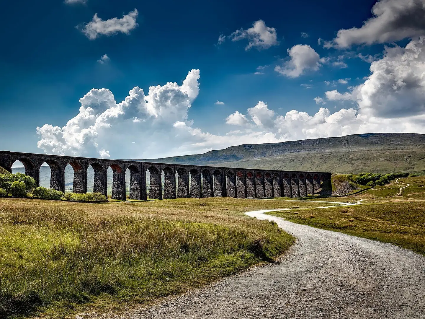
The Dales Way
How would you rate The Dales Way?
Tap a star to share your experience and help other hikers.
The Dales Way: A Gentle First Long-Distance Walk
HikeList Score
The Dales Way scored 94/100 on HikeList's trail-quality metrics.
See score breakdownHide breakdown
- Ideal length 100
- Balanced challenge 100
- Scenery & wildness 78
- Varied terrain 100
- Accommodation 100
- Food & support 88
- Path quality 98
- Season flexibility 89
Computed from length, challenge, scenery & wildness, terrain variety, accommodation, food & support, path quality and season flexibility.
The Dales Way is a waymarked point-to-point walk in northern England, running about 129 km (80 miles) from Ilkley, West Yorkshire, to Bowness-on-Windermere, Cumbria. Most hikers take 6-8 days, commonly 6. It is easy to moderate: mostly gentle riverside and valley walking through the Yorkshire Dales, with one tougher upland crossing near Cam Fell before the Lake District finish. It suits fit beginners planning a first British multi-day route, while still giving experienced walkers classic Dales villages, limestone country and a Windermere finale.
Route Overview
The route starts at the riverside marker by the Old Bridge over the River Wharfe in Ilkley and heads north-west via Addingham, Bolton Abbey, Strid Woods, Burnsall, Grassington, Kettlewell, Buckden and Hubberholme. From Yockenthwaite and Beckermonds/Oughtershaw it climbs to the watershed near Cam Fell on Cam High Road, then drops through Gearstones, Dentdale, Dent and Sedbergh. The final section follows the Lune valley, Burneside and Staveley to Bowness-on-Windermere. It is a point-to-point walk, not a loop, so plan separate start and finish logistics. For comparison, see the Annandale Way, Beacons Way or Anglesey Coastal Path.
History of The Dales Way
The Dales Way was devised by the West Riding Ramblers' Association in 1968, with Colin Speakman and Tom Wilcock among the key figures. The first recorded end-to-end walk was made in 1969 by a group of Bradford Grammar School Venture Scouts. Although it was originally proposed as a National Trail, it has never gained that official status. Its appeal has lasted because it links the Yorkshire Dales National Park with the Lake District National Park on a relatively accessible long-distance line.
Notable highlights
Bolton Abbey and Strid Woods (early Wharfedale): The path passes the romantic 12th-century priory ruins at Bolton Abbey before entering Strid Woods. Here the River Wharfe is forced through the narrow, fast-flowing channel known as the Strid.
Wharfedale villages (Burnsall to Hubberholme): Burnsall, Grassington, Kettlewell and Hubberholme give the walk its classic Yorkshire Dales character: stone bridges, field barns, meadows and riverside miles along the Wharfe.
Cam Fell watershed (around 520 m): This is the route's high point and the most remote, exposed section. The crossing uses Cam High Road, an old Roman road, to pass over the Pennine watershed.
Dent and Dentdale (post-watershed descent): After the high ground, the route drops into Dentdale and reaches Dent, a cobbled village set below the Howgill-fringed scenery.
Sedbergh and the Howgill Fells (Dales to Lakes transition): Sedbergh, England's official Book Town, sits beneath the smooth Howgill Fells as the route turns towards the Lake District.
Lake Windermere finish (Bowness-on-Windermere): The walk ends on the shore of Lake Windermere at Bowness, inside the Lake District National Park. Windermere is England's largest natural lake.
Challenges to expect
Expect straightforward walking rather than technical terrain, but do not underestimate the Cam Fell crossing: it is the route's most remote and exposed section, and deep winter is best avoided there. Underfoot is mixed, with field paths, riverside tracks, stone flags, quiet lanes, gravel and some rocky going. Waymarking is maintained by the Dales Way Association, but accommodation planning matters because not every stay is directly on the path and many providers are cash-only.
HikeList Score
The Dales Way scored 94/100 on HikeList's trail-quality metrics.
See score breakdownHide breakdown
- Ideal length 100
- Balanced challenge 100
- Scenery & wildness 78
- Varied terrain 100
- Accommodation 100
- Food & support 88
- Path quality 98
- Season flexibility 89
Computed from length, challenge, scenery & wildness, terrain variety, accommodation, food & support, path quality and season flexibility.
 United Kingdom
 England
Show more data Show less
- Riverside
- Valley
- Farmland
- Limestone
- Moorland
- Lakeland Fringe
- Field Paths
- Riverside Tracks
- Stone Flags
- Quiet Lanes
- Roman Road
- Gravel
- Rocky
- B&Bs
- Guesthouses
- Inns
- Farmhouse Stays
- Hostels
- Campsites
- Family Friendly
- Dog Friendly On Leash
- Restrooms
- Established Campsites
- Shelters
- Picnic Areas
- Public Transport Access Points
Download Our Full Guide to The Dales Way FREE!
Get our comprehensive guide to this hike for free. Save it for later reading or print out at home.
In these collections
Photos from hikers
Taken on the trail by people who've reviewed The Dales Way.
The Dales Way: The Complete Guide
 i
Image by Pixabay
i
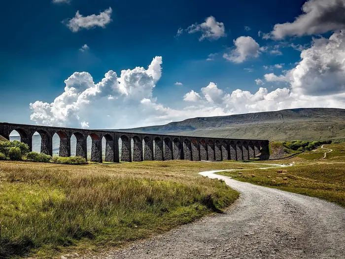
Image by Pixabay The Dales Way is one of England's most-loved long-distance walks: an 80-mile (129 km) journey from Ilkley, through the green heart of the Yorkshire Dales, over the high watershed at Cam Fell and gently down to the shores of Lake Windermere. It follows river valleys for much of its length — the Wharfe, the Dee, the Rawthey and the Kent among them — linking a string of welcoming Dales villages with proper pubs, tea rooms and a warm bed for the night. There are no mountains to climb and no scrambling involved, which is exactly why so many walkers choose it as their first multi-day trail.
What it asks for is steady legs rather than technical skill: six to eight days of rolling miles, a few long valley days and one big, open crossing in the middle. This guide covers everything you need to plan and walk it well — a full stage-by-stage breakdown, how many days to allow, where to sleep and eat, how to reach the start and get home from the finish, what the ground is really like underfoot, and the small mistakes that catch people out.
Stage-by-Stage Guide
Distances below follow the 6-stage split used in this guide. Published mileages for the Dales Way vary slightly between sources, so if you are booking accommodation, baggage transfer or tight public transport connections, check the day’s line on your map/GPX rather than treating any single figure as exact.
Stage 1: Ilkley to Burnsall
Approx. 21 km
This is a gentle, confidence-building first day, almost entirely shaped by the River Wharfe. From the Dales Way marker by the Old Bridge in Ilkley, the route leaves the edge of the built-up area quickly and settles into riverside and field-path walking towards Addingham, Bolton Abbey, Strid Woods and Burnsall.
Underfoot, expect grassy field paths, riverside tracks, stiles and field gates. It is not technically difficult and navigation is usually straightforward: for much of the day you are simply following the Wharfe upstream. After wet weather, however, riverside sections can be muddy, slippery or affected by flooding, so do not assume this easy day will always be fast.
The main landmarks come in a useful order for pacing the day. Addingham gives an early village reference point. The Bolton Abbey Estate is the major mid-stage highlight, with the 12th-century Bolton Priory ruins, then the woodland section through Strid Woods. Beyond this, the route passes Barden Bridge and Barden Tower before finishing at Burnsall, a compact Wharfedale village with an arched stone bridge and riverside green.
Food and water: Ilkley has full start-of-walk services. Bolton Abbey has cafés/tea rooms around the Cavendish Pavilion and Strid Wood area, making it the obvious mid-stage stop if open. Burnsall has the Red Lion by the river and a village shop/tea room, but the choice is much more limited than in larger places such as Grassington.
Accommodation: Burnsall has a small choice of inn/B&B-style accommodation, including riverside options such as the Red Lion and local B&Bs. It is a small village, so book ahead in summer rather than expecting walk-in availability.
Transport and access: Ilkley has a railway station, which makes the start easy by public transport. Burnsall is on minor roads. Wharfedale bus services serve villages such as Burnsall and Grassington, but they are limited and should be checked before travelling.
Navigation notes: This is one of the easiest stages to follow, but still carry a map or GPX. The Dales Way is waymarked, not foolproof, and field exits can be missed if you stop paying attention.
Warning — The Strid: Treat The Strid with real seriousness. In Strid Woods, the River Wharfe is forced through a gap only a couple of metres wide, where all the width becomes depth. Bolton Abbey signage warns that it is dangerous and has claimed lives. Do not attempt to cross, scramble on the rocks or stand close to the wet edge. Keep children and dogs well back.
Stage 2: Burnsall to Hubberholme
Approx. 20 km
This is classic Wharfedale: limestone, stone villages, river meadows, drystone walls and higher pasture. It is still moderate walking rather than hard hill country, but it has more variety than Stage 1 and a little more height above the valley.
Leaving Burnsall, the route passes Loup Scar, a limestone scar above the Wharfe, before reaching Grassington. Grassington is the largest village in Wharfedale and the most useful resupply point on the whole Dales Way, so plan to use it properly. North of Grassington, the path climbs onto higher limestone pastures and terraces around Conistone, giving broader views over the dale before dropping back towards the river. The route then continues through Kettlewell and Buckden to tiny Hubberholme.
Underfoot, expect a mix of field paths, riverside paths, drystone-wall country and higher limestone pasture. There are many stiles and gates. The high-level section above Grassington and Conistone needs a little more care than the simple riverside walking, especially in mist or poor visibility, but it remains waymarked and on established paths.
Food and water: Grassington is the key stop, with cafés, shops, pubs, an outdoor shop, food-store options and the National Park Centre. Kettlewell has pubs and a village shop, though you should check current opening days locally. Buckden has the Buck Inn and a small shop/tea room. Hubberholme itself is very small, with The George Inn the main place to eat or stay.
Accommodation: Do not leave this stage’s accommodation vague. Hubberholme has very limited beds, essentially centred on The George Inn. Many walkers overnight at Buckden or Kettlewell instead, where there is more choice. Beds in this part of Wharfedale are limited and fill in summer, so book ahead.
Transport and access: The road access is via minor dales roads. Wharfedale bus services serve Grassington, Kettlewell and Buckden, but they are infrequent and must be checked before relying on them for a start, finish or bailout.
Navigation notes: Mostly straightforward. The section above Grassington/Conistone is the one place to watch your line more carefully, particularly where paths, walls and pasture exits multiply.
Warnings: Expect livestock in fields throughout, including cattle and sheep. Keep dogs under close control, especially during lambing. In wet conditions, limestone can be slick and grassy descents back towards the river can be slower than expected.
Stage 3: Hubberholme to Dent
Approx. 23 km
This is the serious day of the Dales Way. It is the route’s only genuinely remote upland crossing and needs to be treated differently from the gentler Wharfedale stages. Start early, carry enough food and water, and do not set out onto Cam Fell in poor visibility unless you are confident with map and GPX navigation.
From Hubberholme, the route follows Langstrothdale beside the upper Wharfe, now more beck-like than river, through Yockenthwaite and Beckermonds to Oughtershaw. From Oughtershaw it climbs steeply towards the wild peat moors of Cam Fell. The walking becomes more exposed and can be genuinely boggy, passing scattered farm buildings and the lonely area around Cam Houses before crossing the North Sea/Irish Sea watershed.
The route meets the Pennine Way and joins the Cam High Road, an old Roman road, at the Dales Way’s official high point of 520 m. The Cam High Road itself is firmer underfoot than the boggier approach, but the whole crossing is exposed to wind, rain and mist. The descent leads by good track to Gearstones on the B6255, about 1.5 miles east of Ribblehead. From there, the official Dales Way follows quiet roads and lanes down Dent Head and Dentdale for roughly 4 miles, then field paths and riverside walking beside the River Dee into Dent.
Underfoot, this stage has the widest range of the whole route: riverside and beck paths, moorland track, boggy grassland, Roman road, quiet tarmac, then field and riverside paths in Dentdale. Waterproof footwear is strongly advised, and in wet weather the boggy ground can make the day feel much longer than the bare distance suggests.
Food and water: There are no reliable shops, cafés or facilities once you leave Buckden/Hubberholme until Dentdale/Dent. Carry all food and water for the day. The Station Inn at Ribblehead is about 1.5 miles off-route; opening hours vary and should be checked before treating it as part of your plan.
Accommodation: Dent is a popular overnight stop with pubs, cafés and B&Bs. There are also a few isolated farmhouse/B&B and hostel-type options in Dentdale, plus possible accommodation around Ribblehead/Winshaw, but supply is thin. If you want to split this stage, book well ahead and confirm exactly how far your chosen accommodation is from the Dales Way line.
Transport and access: Do not assume Dent railway station is in Dent village. It is about 4.8 miles, or roughly 8 km, by road east of the village, around 120 m higher, with a steep access road. It is England’s highest mainline station, on the Settle–Carlisle line, but it is not a casual end-of-day stroll from Dent for most walkers. Dentdale roads are remote and bus options are very limited.
Navigation notes: The valleys are generally easy to follow. The Cam Fell crossing is different: waymarking is not enough on its own in mist, heavy rain or low cloud. Carry a map and a GPX/app, and remember that mobile signal can be patchy or absent on the tops.
Warnings and alternatives: This is the most exposed section of the Dales Way, with remote peat moor, bog, no services and limited signal. The official route also includes around 4 miles of quiet road walking down Dentdale. An alternative high-level line over Blea Moor/Craven Wold avoids some road but is rougher and more exposed, reaching just over 550 m. The Pennine Bridleway also gives a watershed alternative between Cam Houses and Upper Dentdale. These variants are for confident navigators and should be checked carefully before use.
Stage 4: Dent to Sedbergh
Approx. 14 km
After the Cam Fell crossing, this is a shorter recovery day through Dentdale and towards the Howgill Fells. It is not a rest day, but the scale is more forgiving, and many walkers appreciate the chance to reach Sedbergh early enough for laundry, resupply or simply a slower afternoon.
The route leaves Dent by following the River Dee out of Dentdale, then crosses low fell and pasture before approaching the River Rawthey near Millthrop, just outside Sedbergh. The landscape also begins to change: the limestone feel of the Yorkshire Dales gives way towards older Silurian slates more typical of the Lake District side of the route. The rounded Howgill Fells become a stronger presence as you approach Sedbergh.
Underfoot, expect riverside and field paths, quiet lanes, a low fell/pasture crossing, stiles and gates. It is moderate rather than difficult, though the fell and pasture section still needs ordinary care in poor weather or if visibility is reduced.
Food and water: Dent has cafés, pubs and a shop at the start. Sedbergh has good resupply for the next stage, including village shops, a Spar-type food option, cafés, pubs and bookshops.
Accommodation: Sedbergh is a sensible overnight with a reasonable choice of inns, B&Bs and guesthouses. It is also a practical place to reset before the longer stage to Burneside.
Transport and access: Sedbergh has bus links, including towards Kendal and Oxenholme, but services are limited and should be checked before travelling. The nearest useful rail access is via Oxenholme/Kendal by bus connection; Dent station is remote from Dent village, as noted in Stage 3.
Navigation notes: The route is mostly easy and waymarked. Pay attention on the low fell and pasture crossing between the Dee and Rawthey, where the line is less obvious than a riverside path.
Warnings: Livestock, stiles and field gates remain a constant feature. After rain, field paths and pasture can be slippery, and low-level sections near rivers may be wet underfoot.
Stage 5: Sedbergh to Burneside
Approx. 21 km
This is a long and surprisingly committing day because there is nowhere obvious to stop for food in the middle. It is not high or technical, but it demands good provisioning and steady pacing.
From Sedbergh, the route follows the River Rawthey downstream, then turns up the River Lune through the Lune Gorge on the edge of the Howgill Fells. It crosses the river at the historic Crook of Lune Bridge, an old packhorse-type bridge and historically the boundary of the former West Riding of Yorkshire. The Lune Gorge is scenic but also a major transport corridor: the Dales Way passes under two Victorian railway viaducts and crosses the M6 motorway and the West Coast Main Line railway before descending through the valley of the River Mint and continuing west towards Burneside on the River Kent.
Underfoot, expect riverside paths, pastureland, field paths, quiet lanes, many stiles and gates, plus some boggy or narrow/overgrown sections. The motorway crossing is by a dedicated bridge; it is not a safety problem in normal use, but the noise does intrude for a while.
Food and water: Sedbergh is the place to stock up. There is nothing reliable in the middle of the stage, so carry enough food and water for the full day. Burneside has limited facilities, including the Jolly Anglers and a small shop. Staveley, a little further along the route, has more choice, including cafés and eateries (the Hawkshead Brewery Beer Hall closed in 2024 — check before relying on it).
Accommodation: Burneside has limited B&B/inn-style options. Many walkers choose to stay at or near Staveley, or use Kendal for a wider range of accommodation. Whatever you choose, book ahead and check whether you need to walk on, detour or use transport at the end of the day.
Transport and access: This is one of the better-connected points on the western half of the Dales Way. Burneside has its own railway station on the Oxenholme–Windermere branch line, and Staveley and Kendal are also on or near that line. Buses serve Kendal. This makes Burneside a useful place to break the walk, join the route or bail out.
Navigation notes: The route is generally waymarked, but this is not a day to drift along without checking. The Lune Gorge, field paths, viaducts and motorway/railway crossings create enough junctions and man-made features that a GPX track is useful.
Warnings: Carry provisions from Sedbergh. Expect boggy patches and overgrown/narrow paths in places. Take care with livestock and field exits, and allow time for slower going if the ground is wet.
Stage 6: Burneside to Bowness-on-Windermere
Approx. 16 km
The final day is shorter, but it still has proper walking before the finish. It begins beside the River Kent, then leaves the river for tracks and field paths over a series of low hills on the Lakeland fringe. The character becomes more noticeably Lake District as the views open towards the fells and, eventually, Windermere.
Underfoot, expect riverside path at first, then field paths and tracks over rolling low hills, with stiles, gates and some gorse. There are a few spikier little tops and junctions where you need to keep an eye on the waymarks, but there is no technical ground and no sustained high-level walking.
The emotional high point is the approach to the Dales Way Bench/viewpoint above Bowness, where the route looks over Lake Windermere before descending into Bowness-on-Windermere to finish. It is a satisfying end because the lake appears as a genuine arrival rather than just a town finish.
Food and water: Burneside has limited start-of-day facilities. Staveley comes early and is a useful stop, with cafés and eateries (the Hawkshead Brewery Beer Hall closed in 2024 — check before relying on it). Bowness-on-Windermere has abundant cafés, pubs, restaurants and shops.
Accommodation: Bowness and nearby Windermere have a very large choice of hotels, guesthouses, B&Bs and hostels, reflecting its status as a major tourist area. It is easier to book than the small Dales villages, but summer weekends can be busy and prices are often higher.
Transport and access: Windermere railway station is about 1.5 miles (roughly 2.4 km) uphill from Bowness, on the Oxenholme–Windermere branch line with connections to the West Coast Main Line at Oxenholme. Buses and taxis run between Bowness and Windermere station, and there are plentiful onward bus links.
Navigation notes: Mostly easy and waymarked, but the low-hill section has several junctions and field-path choices. Keep your GPX or map handy rather than assuming the finish will guide itself.
Warnings: The final stage is short enough to feel relaxed, but do not switch off too early. Mud, livestock, stiles and gorse-lined paths can still slow you down, especially after rain. If you have a same-day train from Windermere, allow time to descend into Bowness and then get back up to Windermere station.
Recommended Itinerary
Distances on the Dales Way vary slightly between guidebooks, GPX files and accommodation operators. Use the figures below for planning shape, but check official mapping before booking, especially if you are splitting days differently or staying off-route.
Standard 6-day itinerary
This is the common Dales Way split and the best default for a fit walker who is happy with several 20 km-plus days. The two days to treat with most respect are Day 3 over Cam Fell and Day 5 from Sedbergh towards Burneside. Day 4 is deliberately short and works well as a recovery day.
| Day | From | To | Approx. distance | Why this stage makes sense | Services/accommodation notes |
|---|---|---|---|---|---|
| 1 | Ilkley | Burnsall | 21 km | A straightforward opening day along Wharfedale, starting at the Dales Way marker by the Old Bridge over the River Wharfe and passing Addingham, Bolton Abbey and Strid Woods before reaching a proper overnight village. | Burnsall is a reliable first stop with accommodation, including riverside inn accommodation and village/farm B&Bs. It is a better overnight target than trying to push too far on day one. |
| 2 | Burnsall | Hubberholme | 20 km | A classic Wharfedale day through the main dale villages, with Grassington and Kettlewell falling naturally along the stage before the route continues towards Buckden and Hubberholme. | Hubberholme has very limited accommodation. The George Inn is the key on-route bed and should be booked early. If it is full, plan around Buckden instead; Buckden has the Buck Inn and a shop. Do not assume you can find a last-minute bed here. |
| 3 | Hubberholme | Dent | 23 km | This is the big hill day of the walk: the route leaves upper Wharfedale/Langstrothdale, crosses the watershed near Cam Fell on the Cam High Road, reaches the route’s high point, crosses the Pennine Way, then descends into Dentdale. | Carry food. There is no shop on the route between Buckden and Dent. Dent is a good overnight village with pubs, cafés, Dent Stores, B&B options and a campsite, but arrive with enough energy in reserve — this is the stage most walkers consider breaking up. |
| 4 | Dent | Sedbergh | 14 km | A short, easier day after the Cam Fell crossing. It gives you a late start, a gentler recovery day, or spare time if the previous day took longer than expected. | Sedbergh is one of the best service stops on the route, with shops, provisions, pubs serving evening meals and a wider range of accommodation. It is a sensible place to reset before the longer country towards Burneside. |
| 5 | Sedbergh | Burneside | 21 km | The other demanding day. The walking is not as obviously high as Cam Fell, but it is a long stage through the Lune Valley and onward with fewer settlements and fewer easy bail-out points. | Food and accommodation opportunities are thinner on this part of the Dales Way. Burneside has limited accommodation, including the Jolly Anglers Inn and some B&B options, but many walkers arrange accommodation shortly before or after Burneside, or stay at Staveley or detour into Kendal. Book this night carefully. |
| 6 | Burneside | Bowness-on-Windermere | 16 km | A manageable final stage, passing Staveley before the finish at Lake Windermere. It keeps the last day short enough for onward travel. | Staveley has useful services if you need food before the finish. Bowness-on-Windermere is a full tourist resort with abundant accommodation, food and onward transport options; Windermere has a railway station. |
Slower 7- or 8-day variant
Choose a slower itinerary if this is your first long-distance walk, you are carrying your own pack, you want more time in Wharfedale, or you are uneasy about the Cam Fell crossing. The aim is to break the two harder parts: Hubberholme to Dent, and Sedbergh to Burneside/Bowness.
A sensible slower pattern is:
| Day | From | To | Approx. distance | Why this stage makes sense | Services/accommodation notes |
|---|---|---|---|---|---|
| 1 | Ilkley | Grassington | Check official mapping before booking | Gives a shorter first section through lower Wharfedale and leaves time for Bolton Abbey and Strid Woods without rushing. | Grassington has B&Bs, a bunk barn, shops, pubs and cafés, and is the largest village in Upper Wharfedale. |
| 2 | Grassington | Buckden or Hubberholme | Check official mapping before booking | Keeps the Wharfedale villages as a separate, enjoyable day rather than pushing straight into the approach to Cam Fell. | Kettlewell has an independent hostel, pubs and a shop. Buckden is a practical alternative to Hubberholme because it has the Buck Inn and a shop. Hubberholme is very limited and must be booked early. |
| 3 | Buckden or Hubberholme | Dent Head or Cowgill | Check official mapping before booking | Breaks the hardest standard day and avoids doing the full Cam Fell crossing and all of Dentdale in one push. | Accommodation around Dent Head/Cowgill is limited and can be seasonal. Check current openings and book ahead before relying on this split. |
| 4 | Dent Head or Cowgill | Dent | Check official mapping before booking | Leaves a shorter run down Dentdale and gives time to recover in Dent rather than arriving tired at the end of a long upland day. | Dent has pubs, cafés, Dent Stores, B&B options and a campsite. It is a good place to resupply after the no-shop stretch from Buckden. |
| 5 | Dent | Sedbergh | 14 km | Keeps the short Dent–Sedbergh stage as a recovery day. | Sedbergh has strong services: shops, provisions, pubs serving evening meals and varied accommodation. |
| 6 | Sedbergh | Staveley | Check official mapping before booking | Splits the long Sedbergh-to-finish section and avoids relying on limited Burneside accommodation. | Staveley is a useful stop with B&Bs, shops, bakery, cafés, pubs, a Spar and a butcher. |
| 7 | Staveley | Bowness-on-Windermere | Check official mapping before booking | Makes the final day short and simple, with time for travel after reaching Lake Windermere. | Bowness-on-Windermere has plentiful accommodation, food and transport; Windermere has a railway station. |
For an 8-day version, add an extra Wharfedale night at Burnsall, Grassington or Kettlewell, depending on where you can get accommodation. That makes most sense for walkers who want shorter early days or more time in the villages. The limiting factor is not the path but the beds: Hubberholme, Dent Head/Cowgill and Burneside all need early checking.
Faster 5-day variant
A faster Dales Way is possible, but it suits experienced, fit walkers who are comfortable with long days, sparse resupply and pre-booked accommodation. It is not the best choice for a first British long-distance walk.
| Day | From | To | Approx. distance | Why this stage makes sense | Services/accommodation notes |
|---|---|---|---|---|---|
| 1 | Ilkley | Grassington or Kettlewell | Check official mapping before booking | Compresses the lower Wharfedale start and positions you further up the dale for day two. | Grassington and Kettlewell both have walker services, but availability still needs checking before committing to the faster plan. |
| 2 | Grassington or Kettlewell | Hubberholme or Buckden | Check official mapping before booking | Sets up the Cam Fell crossing for the next day without trying to combine too much upland walking late in the day. | Hubberholme is very limited. Buckden can be the safer practical target because it has a shop and inn accommodation. Book before travel. |
| 3 | Hubberholme or Buckden | Dent | About 23 km from Hubberholme to Dent; check official mapping if starting at Buckden | Keeps the hardest upland crossing as its own day, over Cam Fell and down Dentdale. | Carry food. There is no shop on the route between Buckden and Dent. Dent is the first proper resupply point after this stretch. |
| 4 | Dent | Burneside or Staveley | About 35 km if combining the standard Dent–Sedbergh and Sedbergh–Burneside stages; check official mapping before booking | A long compression day, rolling the short Dent–Sedbergh stage into the longer Lune Valley section. This is the day that makes the 5-day plan hard. | Sedbergh is the key service point en route. Burneside accommodation is thin; Staveley has stronger services and may be easier to plan around. |
| 5 | Burneside or Staveley | Bowness-on-Windermere | 16 km from Burneside to Bowness; check official mapping if starting at Staveley | Keeps the final day manageable and leaves time for onward travel from the Windermere/Bowness area. | Staveley has useful food and village services. Bowness has full finish-town facilities. |
A 4-day crossing is only for very strong walkers after checking official mileage and accommodation. The Dales Way may be moderate overall, but the sparse sections around Hubberholme, Cam Fell and the Sedbergh-to-Burneside leg leave little room for poor planning.
Planning the Route
How many days to allow
Most walkers should plan the Dales Way as a 6-day walk, with daily stages shaped by where you can sleep and eat rather than by neat mileage. The route is commonly described as a 6–8 day walk, and that range is realistic for independent walkers booking their own accommodation.
Published distances vary slightly between sources — around 80 miles / 128–129 km is the useful planning figure, but confirm exact stage distances against current mapping before booking beds or transport.
| Pace | Who it suits | Practical notes |
|---|---|---|
| 5 days | Fit, experienced walkers happy with longer days | Possible, but it compresses the gentler Wharfedale sections and gives less flexibility for weather on the Cam Fell crossing. |
| 6 days | The standard independent itinerary | Works well with the main accommodation stops, including the long middle day over the watershed. |
| 7–8 days | First-time long-distance walkers, slower walkers, or anyone wanting shorter days | Sensible if you want more time in Wharfedale, Dentdale or Sedbergh, or if you want to split the harder middle section. |
| Around 4 days | Strong, experienced walkers only | Possible for some, but not the best way to enjoy this route and it leaves little margin for logistics or weather. |
The Dales Way is usually better walked steadily rather than quickly. Much of the appeal is in the riverside walking, villages and valley stages; racing through Wharfedale turns a forgiving long-distance route into a booking and mileage exercise.
The standard 6-day shape
This is the common structure used by many walkers and matches the natural line of available overnight stops:
| Day | From | To | Approx. distance |
|---|---|---|---|
| 1 | Ilkley | Burnsall | 21 km |
| 2 | Burnsall | Hubberholme | 20 km |
| 3 | Hubberholme | Dent | 23 km |
| 4 | Dent | Sedbergh | 14 km |
| 5 | Sedbergh | Burneside | 21 km |
| 6 | Burneside | Bowness-on-Windermere | 16 km |
The short-looking Dent to Sedbergh day is not a mistake: it sits after the harder watershed stage and before the longer push towards Burneside. If you are building your own itinerary, avoid judging the route by distance alone; the spread of accommodation and food stops matters more.
The accommodation bottleneck: Hubberholme to Dentdale
The main planning crux is the middle of the walk. The southern half through Ilkley, Bolton Abbey, Burnsall, Grassington, Kettlewell, Buckden and Hubberholme has relatively frequent villages, so you have some flexibility. After that, the route crosses the watershed near Cam Fell on the Cam High Road, and services thin out sharply.
The difficult planning section is roughly Buckden / Hubberholme over Cam Fell towards Dentdale. This is the longest-feeling, least serviced part of the Dales Way, with limited accommodation, food and public transport. The watershed section from Buckden towards Gearstones is the most difficult part of the route, with the greatest ascent and descent, more remote ground and limited facilities.
In practice:
- Book the remote middle first, before fixing the easier southern and northern nights.
- Do not assume you can arrive in Hubberholme, Langstrothdale, Oughtershaw, Gearstones or Ribblehead and find a bed.
- Some walkers split the hard middle section by stopping around Cam Houses or Gearstones / Ribblehead, but beds are limited and some options may be off-route. This should be checked before travelling.
- If you are unsure about fitness, navigation or bad-weather walking, splitting the watershed day is often a better plan than forcing the standard 6-day schedule.
Where stages are flexible — and where they are not
| Part of route | Flexibility | Why it matters |
|---|---|---|
| Ilkley to Upper Wharfedale | Good | Ilkley, Grassington and other Wharfedale villages give more choice of beds and services. |
| Burnsall, Kettlewell, Buckden, Hubberholme | Moderate to limited | Good walking country, but accommodation becomes more constrained as you go north. |
| Hubberholme / Langstrothdale to Dentdale | Limited | This is the key bottleneck: long, remote, with few services. Plan food, weather and overnight stop carefully. |
| Dent to Sedbergh | Reasonable | Dent and Sedbergh are natural stops, with Sedbergh one of the larger service points on the route. |
| Sedbergh to Burneside / Staveley / Bowness | Reasonable | More options reappear as you approach the Lake District fringe, but book ahead in busy periods. |
Accommodation choice is generally strongest at Ilkley, Grassington, Sedbergh and Bowness-on-Windermere. There is reasonable choice in places such as Burnsall, Kettlewell, Buckden, Dent, Burneside and Staveley, but not enough to leave booking until late in peak season. The remote middle around Hubberholme / Langstrothdale, Oughtershaw and Gearstones / Ribblehead is the area to secure first.
Booking strategy
For an independent walker, accommodation is the first thing to solve. Beds in the small Dales villages are limited, and evening meals are not guaranteed everywhere.
A practical order is:
- Fix the watershed night or nights first — Hubberholme / Langstrothdale, Oughtershaw, Cam Houses, Gearstones / Ribblehead or Dent, depending on your itinerary.
- Book the rest of the route around that — especially Burnsall, Kettlewell, Buckden and Dent.
- Confirm evening meals where you are staying, particularly in the smaller settlements.
- Only then book baggage transfer or fixed transport, if using it.
Booking ahead is essential rather than optional. For peak summer, weekends and holiday periods, aim to book well in advance; some accommodation guidance suggests at least three months ahead, and the remote middle should not be left until last.
Food, resupply and water planning
Food planning matters more on the Dales Way than the gentle profile suggests. There is a long stretch with no shops between roughly Kettlewell and Dent, and not every village has a shop. Honesty boxes or small refreshment stops may appear in places, but they should be treated as a bonus, not a plan.
For the watershed day, carry:
- lunch;
- enough snacks for a long day;
- spare food in case weather or navigation slows you down;
- enough water to be self-sufficient between reliable refill points.
Where you can refill during each day should be checked before travelling. The safest routine is to leave each overnight stop with full bottles and not rely on cafés, pubs or farm stops being open.
Navigation and mapping
The Dales Way is waymarked and generally well signposted, using the distinctive Dales Way waymark adopted by the highway authorities. It is suitable for walkers with limited navigation experience in good conditions, but it is not a route to do with no map at all.
The section where navigation matters most is the open crossing near Cam Fell and the Cam High Road. In mist, rain or low cloud, this part feels very different from the riverside paths of Wharfedale.
Carry at least one reliable offline navigation option:
- a current printed map or guidebook mapping;
- an offline GPX route on a phone or GPS device;
- enough battery capacity for a full day.
GPX/KMZ files are available from Walking Englishman, and Colin Speakman’s Dales Way: The Complete Guide includes 1:25,000 strip maps and the link routes. OS Explorer mapping also covers the route. Check you are using current mapping before relying on any downloaded file.
Weather and seasonal planning
Late spring to autumn is the normal walking season. May and September are often good planning choices because conditions are usually more favourable and the busiest summer pressure may be lower.
The route is not high by mountain standards, but weather still affects the plan:
- riverside and valley paths can become muddy, boggy or slippery outside the main season;
- the Cam Fell watershed is exposed and can be serious in poor visibility or strong weather;
- daylight matters on the longer stages, especially if you are walking the standard Hubberholme to Dent day;
- even early autumn can bring cool, wet days.
If possible, give yourself flexibility around the watershed day. Start early, check the forecast, and avoid committing to a long exposed crossing late in the day.
Shortening, extending and rest days
The Dales Way is easy to adapt at the beginning and end, but less easy to break cleanly in the middle.
Good ways to make it easier include:
- walking it over 7–8 days instead of 6;
- adding a rest or short day around Grassington, Dent or Sedbergh;
- splitting the watershed section by arranging accommodation around Cam Houses or Gearstones / Ribblehead, if available;
- finishing earlier or starting later using public transport access points where they suit your itinerary.
There are also three official Dales Way Link routes that extend the walk into Ilkley from nearby cities:
| Link route | Approx. distance | Notes |
|---|---|---|
| Leeds Link | 17 miles | Reaches Ilkley via the Meanwood Valley Trail. |
| Bradford Link | 12.5 miles | Reaches Ilkley via Shipley Glen. |
| Harrogate Link | 16.5 miles | Reaches Ilkley via the Washburn Valley. |
These are useful if you want a longer walk-in to the official start rather than arriving directly by train.
Section-hiking and public transport
Section-hiking is practical for much of the Dales Way, but not everywhere. The main problem is the central gap around Hubberholme, Langstrothdale and Cam Fell, and there is no easy direct public-transport link between Kettlewell and Sedbergh. A clean split around the watershed will often need a taxi.
| Place / section | Public transport usefulness | Planning notes |
|---|---|---|
| Ilkley | Very good | Ilkley has frequent electric trains from Leeds and Bradford Forster Square. |
| Upper Wharfedale: Grassington, Kettlewell, Buckden | Useful but limited | Served by DalesBus services, including Sunday 874, Saturday 74 with 72A onward connections, weekday 74A minibus on Mon/Wed/Fri, and Upper Wharfedale Venturer 72A Mon–Sat. Services are seasonal or limited and must be checked. |
| Ribblehead / Gearstones area | Useful for sectioning | Ribblehead station on the Settle–Carlisle line helps access the central section; Gearstones is just over a mile away. |
| Dent | Useful, with a caveat | Dent station is on the Settle–Carlisle line, but Dent village is about 4.8 miles / 8 km away by road and around 400 ft / 120 m below the station. |
| Sedbergh | Limited but possible | Around three buses a day Mon–Sat on service S1 to/from Kendal; Sedbergh can also be reached from Dent station via S1 / Western Dales Bus. This should be checked before travelling. |
| Burneside and Staveley | Good | Both are on the Windermere branch line and also served by Stagecoach 555 between Lancaster, Kendal and Windermere. |
| Bowness-on-Windermere | Good via Windermere | Bowness is about 1.5 miles (roughly 2.4 km) from Windermere station, or use Stagecoach 599. |
For a full thru-walk, transport is straightforward at the ends: start by rail to Ilkley and leave via Windermere after finishing at Bowness-on-Windermere. For section walks, check current bus timetables before committing to accommodation, especially in Upper Wharfedale and around Sedbergh.
Permits and access
No permit or fee is required to walk the Dales Way. It follows public-rights-of-way style access through the Yorkshire Dales and into the Lake District fringe. Wild camping is not a general legal right in England, so camping plans should be based on campsites or explicit permission.
Towns, Villages and Overnight Stops
The Dales Way is easy to stage in the lower dales and at the Lake District end, but the middle of the walk has a long sparse section between upper Wharfedale, Cam Fell and Dentdale. Book the smaller places early, especially Hubberholme, Dent and Burneside, and do not assume that every village has a shop or evening meal available.
As a rough planning rule:
| Best for | Places to prioritise |
|---|---|
| Full resupply and widest choice | Ilkley, Grassington, Sedbergh, Bowness-on-Windermere |
| Classic Dales overnights | Burnsall, Kettlewell, Hubberholme, Dent |
| Camping/hostel-style options | Kettlewell, Dentdale/Dent, Sedbergh area, Burneside area |
| Rail access | Ilkley, Ribblehead/Dent area, Burneside, Staveley, Windermere |
| Thinnest food and bed section | Hubberholme to Cam Fell to upper Dentdale |
Bus services in the Dales and western dales are often limited, seasonal, Sunday/Bank-Holiday only, request-based, or restricted to certain weekdays. Check the current timetable before relying on any bus.
Ilkley
Ilkley is the natural place to stay the night before starting. The Dales Way begins at the marker by the Old Bridge over the River Wharfe, a short walk from the town centre and Ilkley railway station.
For walkers, Ilkley is the last large, straightforward resupply point before the route settles into smaller villages. The Grove and Brook Street have shops, cafes, delis and bookshops, and there are supermarkets in town. There is also a Tourist Information Centre in the Town Hall on Station Road.
Accommodation choice is broad: hotels, guesthouses, B&Bs and pubs or inns with rooms, including options close to the station, town centre and riverside. If you are arriving late by train, staying centrally makes the morning start simple.
Transport is excellent by Dales Way standards. Ilkley station is on the Wharfedale Line, with frequent services to Leeds and Bradford Forster Square. The bus and train station are close to the town centre, and Ben Rhydding is a second station in the parish.
Why stop here: easy rail access, full food shopping, plenty of places to eat, and no need to rush to the start marker on the first morning.
Addingham
Addingham is passed early on the first day as the route follows the Wharfe out of Ilkley. It is more useful as a short break than as a planned overnight for most through-walkers.
The village has a couple of pubs and a shop, but opening times should not be assumed. This should be checked before travelling. If you started late from Ilkley, Addingham can be a sensible place for an early drink or snack before the quieter riverside stretch towards Bolton Abbey.
Why stop here: an early refreshment option rather than a normal Dales Way overnight.
Bolton Abbey
Bolton Abbey is one of the main early stopping points on Day 1, with the priory ruins beside the Wharfe and visitor facilities on the estate. It is not really a through-walker overnight base in the way Burnsall, Grassington or Kettlewell are, but it can be useful for mid-morning refreshments.
The estate has tea room/cafe provision, kiosks, car parks and visitor facilities aimed mainly at day visitors. Opening is seasonal and should be checked before travelling if you are counting on food there.
Why stop here: refreshments and toilets if open, plus a natural pause before Strid Woods and the upper part of the first day.
Strid Woods
Strid Woods follows Bolton Abbey as the path continues beside the Wharfe. This is a walking section rather than an overnight stop. The key practical note is the Strid itself, where the river narrows into fast, dangerous water. Do not enter or attempt to cross the water.
There are no village services in the woods, so treat any refreshments as part of the Bolton Abbey estate provision and check opening times before relying on them.
Why stop here: a short scenic pause, not a logistics base.
Burnsall
Burnsall sits on the Wharfe and is a very natural first-night stop from Ilkley, roughly 13 miles / about 21 km from the start. It is directly on the route and has enough walker infrastructure to work well without feeling like a large service village.
Accommodation includes the Red Lion, a 16th-century inn on the route with en-suite rooms, plus the adjoining Manor House and several B&Bs. Food is available at the Red Lion, and Wharfe View Tea Rooms is noted as open year-round. Burnsall is still a small village, so do not expect supermarket-style resupply.
Transport is limited but useful at certain times. Burnsall is served by DalesBus Wharfedale services, including Sunday 874 linking Bolton Abbey, Burnsall, Grassington, Kettlewell and Buckden, and Saturday 74 from Ilkley via Burnsall to Grassington. Ordinary weekday options are limited; check the current timetable before relying on a bus.
Why stop here: a well-placed first overnight, quieter than bigger service bases, with a proper inn and tea room.
Grassington
Grassington is one of the best service stops on the Dales Way, but it is not quite on the riverside line of the trail. The village sits up the hill on the west side of the Wharfe, so allow a short detour off the route rather than expecting to walk straight through it on the river path.
For practical purposes, Grassington is the main Upper Wharfedale hub. It has a cobbled central square, grouped shops, a mini-supermarket/community shop, a pharmacy, pubs, cafes and tearooms. It is the obvious place to top up food and any small essentials after leaving Ilkley.
Accommodation choice is strong for a Dales village: B&Bs, guesthouses, country inns and pubs with rooms. Food options are also good, with several pubs, cafes and tearooms, including the bookshop-cafe at The Stripey Badger.
Grassington has some of the best bus links on the route. Services include the 72 from Skipton, with Upper Wharfedale Venturer 72A/72B continuing towards Kettlewell and Buckden on Monday to Saturday, Saturday 74 from York/Ilkley, and Sunday/Bank Holiday DalesBus 874, with seasonal 875/876 services on the Leeds/Ilkley-Grassington-Buckden-Hawes corridor. Skipton is the nearest railhead, reached by bus. Timetables should be checked before travelling.
Why stop here: best mid-route service base in Wharfedale, good resupply, good accommodation choice, and a practical join/leave point for section walkers via Skipton.
Kettlewell
Kettlewell is directly on the Dales Way and is a strong overnight choice further up Wharfedale. It is often used as a second-night stop, particularly by walkers who prefer more services than tiny Hubberholme can offer.
Accommodation is good for the size of the village. Options include traditional inn accommodation, The Kettlewell Hostel (independent, YHA-affiliated), B&Bs and local camping. The hostel is particularly useful for budget walkers and those needing practical facilities such as drying space, laundry and packed lunches.
Kettlewell has a village shop, pubs and tearooms, making it one of the last properly useful resupply points before the route becomes much thinner. If you are walking on to Buckden, Hubberholme or over Cam Fell the next day, buy food here rather than assuming you can fill the gap later.
Transport is by Upper Wharfedale buses: 72A/72B from Grassington/Skipton on Monday to Saturday, and Sunday DalesBus 874. Check the current timetable before relying on them.
Starbotton, between Kettlewell and Buckden, is a tiny hamlet with a pub. Treat it as a possible refreshment stop only if you have checked current opening.
Why stop here: good balance of village atmosphere, food, beds, hostel/camping possibilities and last reliable shopping before the sparse upper dale.
Buckden
Buckden is a handsome northern Wharfedale village on the Dales Way, below Buckden Pike. It is a useful overnight alternative if Kettlewell is too early or Hubberholme is full.
The village has a shop, a restaurant and The Buck Inn, a Georgian coaching inn with en-suite rooms. There are also B&Bs and holiday cottages in the area. For walkers, the important point is that Buckden is the last village with a shop before Hubberholme and the upland section beyond.
Buckden is also the practical bus head of upper Wharfedale. The Upper Wharfedale 72A/72B services run here on Monday to Saturday, and Sunday/Bank Holiday DalesBus 874, with seasonal 875/876 services, also serve the area. Check current timetables before relying on any of these.
Why stop here: last shop before the sparse stretch, useful bus access, and a sensible bail-out point if weather or legs are not right for the high ground ahead.
Hubberholme
Hubberholme is a tiny hamlet just beyond Buckden, where Wharfedale becomes Langstrothdale. It is a classic quiet overnight before the longest and most remote middle section of the walk, but it has very few services.
The George Inn is the key facility: a traditional pub with rooms, evening meals, cask ales and packed lunches. It is noted as closed on Tuesdays, and it is described as the last pub until Dentdale. This should be checked before travelling. Other beds include Church Farm and a bunkhouse barn, with a small number of additional B&B options in the area.
There is no village shop. If you stay here, arrive with the food you need for the following day, or arrange packed lunch in advance. This is not a place to turn up and improvise in busy season.
There is no regular bus to the hamlet itself. The nearest practical bus access is Buckden, so onward transport from Hubberholme is effectively by walking back to Buckden, taxi, lift or private vehicle.
Why stop here: atmospheric, quiet and well placed before the Cam Fell day, but book ahead and plan food carefully.
Yockenthwaite
Yockenthwaite is a tiny cluster of farms in Langstrothdale on the riverside path. It is a pass-through place, not a service village. The Yockenthwaite stone circle is nearby, but for walking logistics the important point is that there are no reliable shops, pubs or resupply options here.
Carry your own food and enough water for the long stretch beyond Hubberholme. Some farmhouse accommodation may exist in the wider dale, but it is sparse and should be booked well in advance rather than treated as a fall-back.
Why stop here: normally you do not; pass through and keep your food plan independent.
Beckermonds / Oughtershaw
Beckermonds and Oughtershaw mark the upper dale-head section before the route climbs towards the watershed. They are scattered farmstead areas rather than villages with walker services.
Do not count on shops, pubs or casual refreshments here. If you are trying to shorten the Hubberholme-to-Dent stage with a farmhouse stay or camping arrangement in this area, it must be checked and booked before travelling.
Why stop here: only with a pre-arranged bed or pitch; otherwise this is a remote through-section.
Cam Fell and the Cam High Road
The crossing near Cam Fell on the Cam High Road is the high point of the Dales Way, at around 520 m. It is an exposed upland section on a Roman road and is the most remote part of the walk in terms of services.
There are no shops, pubs, cafes or reliable shelter across the watershed. Carry the food and water you need, and have layers ready for wind and rain even if the lower dale felt benign.
Why stop here: you do not overnight here under normal Dales Way planning; treat it as the committing middle of the route and be self-sufficient.
Gearstones
Gearstones is an isolated former drovers’ inn area near Ribblehead on the B6255. It is not a village and should not be treated as a reliable refreshment stop.
The Station Inn at Ribblehead is the nearest pub but lies off to the side of the Dales Way, and opening should be checked before travelling. Ribblehead railway station on the Settle-Carlisle line is nearby enough to be useful as an escape or join point for the upland section, but it is a detour from the route and trains are infrequent, around every two to three hours.
Why stop here: mainly for section-walking logistics or escape planning, not as a normal overnight base.
Dentdale
After the watershed the route drops into Dentdale and follows the River Dee towards Dent and Sedbergh. This is a gentler valley after the high ground, but it remains thin for shops until Dent village.
There are scattered farms, B&Bs and campsites in the dale, including camping options listed at or near Dent such as High Laning and Conder Farm. If you want to split the long Hubberholme-to-Dent stage, research and book in advance; do not assume you can find a last-minute bed in the valley.
Why stop here: useful for splitting the remote middle stage if you have a booked bed or pitch.
Dent
Dent is one of the best overnight stops on the route: a cobbled village in Dentdale, commonly used at the end of the Hubberholme-to-Dent stage. It has enough services to feel like a reward after the upland crossing, but it is still small enough that booking ahead matters.
Accommodation includes two traditional pubs with rooms, The Sun Inn and The George & Dragon, plus campsites such as High Laning and Conder Farm, and cottage accommodation. The George & Dragon is also associated with Dent Brewery and serves food.
For food and daytime stops, Dent has cafes and tearooms including Stone Close Tearoom and Meadowside Cafe, light refreshments at Dent Village Heritage Centre, and a small village shop. Shop and cafe hours should be checked before travelling, especially outside peak season.
The main transport trap is Dent railway station. It is not in Dent village. The station is on the Settle-Carlisle line, about 4.8 miles / 8 km by road from the village and around 400 ft / 120 m above it. Trains can be useful but are infrequent, around every two to three hours, and reaching the station usually means a steep uphill walk, a pre-arranged taxi or, on certain days, the Western Dales Bus.
Bus links are limited. Western Dales Bus S1 services connect Kendal/Oxenholme, Sedbergh and, on certain days, Dent village or Dent station. The routing varies by day, including Wednesday S1W to Dent village and Saturday S1S to Dent station. Check the current Western Dales Bus timetable before relying on it.
Why stop here: excellent Dales Way overnight after the remote crossing, with pubs, food and camping, but do not make casual assumptions about transport from the village.
Sedbergh
Sedbergh is the major service stop after Dent and one of the most useful towns on the whole route. It sits at the foot of the Howgill Fells and is known as England’s official book town. On most itineraries it makes a short day from Dent, which can be welcome after the harder middle section.
Facilities are strong by Dales Way standards: shops, a supermarket/Co-op, banks/cash, pubs, cafes and bookshops along and around the main street. This is the best resupply between Grassington and the finish, and a good place to reset before the long Lune Valley day.
Accommodation choice is good: inns and pubs with rooms, hotels, farmhouse B&Bs, the Howgills Barn bunkhouse and campsites in the area. It is a popular overnight, so book ahead in the main walking season.
Public transport is useful but awkward. Sedbergh has no railway station. Western Dales Bus S1 minibus services link with Kendal and Oxenholme station, with only a few journeys a day Monday to Saturday and routing that varies by day. Oxenholme on the West Coast Main Line and Dent station are the nearest railheads, but both require bus or taxi arrangements. Check current timetables before relying on a bus out of Sedbergh.
Why stop here: proper resupply, good eating options, bookshops, and a practical section start/finish despite limited transport.
Lune Valley
The section between Sedbergh and Burneside is a long, quiet day through farmland and riverside country in the Lune Valley before the route crosses the M6/A6 area towards Burneside. There are scattered farms, some farmhouse B&Bs and campsites on or near the route, including Grayrigg Camping directly on the Dales Way and Lambrigg Camping.
There are no substantial villages with shops and pubs across this stretch, so leave Sedbergh with food and water for the day. If you intend to stop short, arrange accommodation in advance.
Kendal lies a short way off-route and is the nearest town for major resupply or accommodation overflow if Burneside is full.
Why stop here: only if you have pre-booked a farm stay or campsite; otherwise plan it as a carry-food walking day from Sedbergh to Burneside.
Burneside
Burneside is a large village on the River Kent, around 2 miles north of Kendal, and is a practical end to the penultimate stage. It is directly useful for walkers because it has transport, but bed availability in the village itself is limited.
Amenities include a grocery/village store, bakery, chip shop and some pub provision, including the Jolly Anglers Inn, which has reopened under new management — confirm current opening and food times. Accommodation in Burneside itself is thin, with more emphasis on nearby campsites such as Sprint Mill and Burneside Hall. Many walkers use Kendal for accommodation overflow, or continue towards Staveley depending on their itinerary.
Burneside has a station on the Oxenholme–Windermere (Lakes) Line with a roughly hourly service. Stagecoach 555 also serves the Kendal-Windermere corridor.
Why stop here: good staging for a shorter final day and very useful rail/bus access, but plan beds carefully.
Staveley
Staveley sits on the River Kent on the final section between Burneside and Bowness. The trail follows the Kent north to Staveley before climbing over higher ground for the final approach to Bowness.
For walkers, Staveley is the best refreshment stop on the last day. Mill Yard has independent shops, cafes and galleries, and Wilf’s Cafe is a well-known stop with riverside decking over the Kent. The Eagle & Child is a pub by the river bridge. Hawkshead Brewery’s beer hall in Staveley has been reported closed as of September 2024, so do not rely on it without checking before travelling. There is also a village shop.
Staveley railway station is on the Lakes Line. The timetable is not always strictly hourly, so check train times. Stagecoach 555 also serves the corridor.
Why stop here: late breakfast, lunch or a bad-weather bail-out before the final miles to Bowness.
Bowness-on-Windermere
Bowness-on-Windermere is the finish of the Dales Way on the shore of Lake Windermere. The official finish is at the Dales Way marker by the Royal Oak Inn, which is also commonly treated as the finishing pub.
Bowness is a busy Lake District resort with plenty of shops, pubs, restaurants, hotels, guesthouses and B&Bs. There is no difficulty finding services, but availability and prices can be tight in summer, at weekends and during holiday periods, so book accommodation ahead if you plan to stay after finishing.
Food and celebration options are plentiful, including the Royal Oak, The Albert and many other pubs and restaurants. Lake steamers and Windermere Lake Cruises also operate from the area if you are staying on.
The key finish logistics point is the railway station: it is in Windermere, not at the Bowness lakeshore finish. Windermere station is about 1.5 miles (roughly 2.4 km) uphill from Bowness, roughly a 25–30 minute walk, or a short bus/taxi ride. Stagecoach 599 and 555 link Bowness, Windermere and Kendal. Windermere station is the terminus of the Oxenholme-Windermere Lakes Line, with roughly hourly trains connecting at Oxenholme for the West Coast Main Line.
Why stop here: full services, easy onward transport via Windermere, and the obvious place to eat, sleep and recover after finishing.
Getting to the Start
The Dales Way starts in Ilkley, West Yorkshire, at the Old Bridge over the River Wharfe, also known as Ilkley Bridge. There is a Dales Way start marker by the bridge; the grid reference commonly given for the start is SE117478. From Ilkley railway station and town centre it is a short walk to the riverside start, usually about 10 minutes on foot through the town and Ilkley Riverside Gardens / Ilkley Park area.
By train
Train is the simplest way to reach the start, especially because the Dales Way is a point-to-point walk and you finish at Bowness-on-Windermere, 80 miles away from Ilkley.
Ilkley has its own railway station, at the end of the Wharfedale Line. Direct trains run between Ilkley and both Leeds and Bradford Forster Square, operated by Northern.
For most walkers the journey is straightforward:
| Coming from | Practical route |
|---|---|
| London | Train to Leeds, then change for Ilkley on the Wharfedale Line. Leeds–London King’s Cross services are operated by LNER and take about 2 hours 13 minutes. |
| Manchester, York, Newcastle, Edinburgh or the South West | Travel to Leeds, then change for Ilkley. Leeds has services by operators including LNER, Northern, CrossCountry and TransPennine Express. |
| Bradford | Use Bradford Forster Square for a direct train to Ilkley. |
| Local Wharfedale stops | Ilkley is reached via stations including Guiseley, Menston, Burley-in-Wharfedale and Ben Rhydding. |
Leeds to Ilkley is about 30 minutes by train. As a general pattern, Monday to Saturday daytime services are roughly twice hourly to Leeds and hourly to Bradford Forster Square, with reduced evening and Sunday frequencies. This should be checked before travelling.
In practice, book a through ticket to Ilkley rather than to Leeds. If you are starting the walk the same day, leave some margin: you still need to walk from the station to the Old Bridge and may want time to buy food or use town facilities before leaving Ilkley.
By bus
Ilkley bus station is on Station Road, adjacent to the railway station, so changing between bus and train is easy.
There are buses on the Leeds–Otley–Ilkley corridor, and local Wharfedale services also link places such as Otley, Menston, Burley-in-Wharfedale and Ilkley. Service numbers and operators have changed in recent years, and the old X84 may have been replaced by services numbered 25 and 26. This should be checked before travelling.
For most walkers, the train is faster and simpler than the bus. If you do plan to use buses, check the current First Bus, Connexions and local timetable information, especially for Sundays, evenings and public holidays. This should be checked before travelling.
By car
Ilkley is on the A65 Leeds–Skipton corridor and is also close to the A660 route from Leeds via Otley. From the motorway network you would generally head for Leeds or Bradford, then use the A65 or A660 depending on your approach.
Driving to the start is easy enough; leaving a car there is the awkward part. The Dales Way is a point-to-point route, so if you park in Ilkley you will finish at Bowness-on-Windermere with your car still 80 miles away.
Ilkley has several Bradford Council pay-and-display car parks. Standard town-centre parking is generally aimed at shorter stays rather than a week-long walk, although a multi-day / long-stay option has been introduced in Ilkley town centre and may be useful for Dales Way walkers. Current availability, rules and charges should be checked with Bradford Council before leaving a car for several days. This should be checked before travelling.
Private off-street parking can also be pre-booked through services such as JustPark or YourParkingSpace, but do not assume a space is suitable for a full multi-day hike unless the listing explicitly allows it.
If you are being dropped off, the easiest plan is to aim for central Ilkley or the station area, then walk down to the Old Bridge. Local taxis operate in Ilkley and can be useful for short transfers to accommodation or from nearby transport hubs.
From the nearest airport
The nearest airport is Leeds Bradford Airport, about 10 miles from Ilkley and roughly 20–25 minutes by road in normal conditions.
There is no single direct bus from Leeds Bradford Airport to Ilkley. By public transport you normally need to travel via Otley by bus, or use a bus-and-train combination via the rail network; typical journey times are around an hour or a little more, depending on connections. This should be checked before travelling.
A taxi or pre-booked transfer from Leeds Bradford Airport to Ilkley is the quickest option. Indicative fares are roughly £25–£40, but airport transfer prices vary by time, operator and demand. This should be checked before travelling.
For long-haul flights or wider UK and international connections, Manchester Airport is the larger alternative. From there, the usual public-transport approach is to travel by rail towards Leeds, then change onto the Wharfedale Line for Ilkley. Train times and connections should be checked before travelling.
Where to stay before starting
Ilkley is a practical place to spend the night before starting the Dales Way. It is a sizeable spa town with a good choice of hotels, inns, guesthouses and B&Bs, and it has better services than many of the smaller villages you pass later on the route.
A central example is The Crescent Inn on Brook Street, a real-ale pub with rooms, around 350 yards from Ilkley railway station and only a short walk from the Dales Way start. There are also numerous other B&Bs and guesthouses in and around Ilkley; availability changes, so book what suits your budget and walking plan.
Staying in Ilkley the night before is sensible if you want an unhurried start. Day 1 to Burnsall is about 21 km, so beginning fresh, fed and already at the start is noticeably easier than adding a long morning journey before you walk.
Getting Home from the Finish
The Dales Way finishes at Bowness-on-Windermere, down by Lake Windermere. The nearest railway station is Windermere station, in the separate town of Windermere, about 1.5 miles (roughly 2.4 km) uphill from Bowness. Treat these as two separate steps: first finish the trail at the lake, then get yourself up to Windermere station.
By train
Windermere station is the railhead for the finish. It is operated by Northern Trains, has station code WDM, and is the northern terminus of the Windermere Branch Line.
The branch line runs:
| Direction from Windermere | Route |
|---|---|
| Towards the main line | Windermere → Staveley → Burneside → Kendal → Oxenholme Lake District |
This is useful because Staveley and Burneside are also on the final stages of the Dales Way, so the railway shadows part of the last section.
Services on the branch are generally hourly, with the fastest Windermere–Oxenholme journey about 16 minutes. The key interchange is Oxenholme Lake District, which is on the West Coast Main Line. From Oxenholme, mainline trains connect with places including London Euston, Preston, Wigan North Western, Warrington, Lancaster, Carlisle, Glasgow Central and Edinburgh.
For most walkers, the normal pattern is:
- Finish at Bowness-on-Windermere.
- Get up to Windermere station by bus, taxi or on foot.
- Take the branch train to Oxenholme Lake District.
- Change there for a mainline train home.
There are also some direct Windermere–Manchester Airport services via Manchester Piccadilly, Bolton, Preston and Lancaster. These are roughly every two hours and take about 1 hour 56 minutes between Windermere and Manchester Airport, but they are less frequent than the branch shuttle to Oxenholme. This should be checked before travelling.
Useful indicative journey times are:
| Journey | Typical time |
|---|---|
| Windermere – Oxenholme | about 16 minutes fastest |
| Lancaster – Windermere | about 40 minutes |
| Manchester – Windermere | about 2 hours |
| Manchester Airport – Windermere direct | about 1 hour 56 minutes |
Windermere station has a staffed ticket office, ticket machine, toilets, waiting room and cycle hire. Published ticket office hours vary by day and should be checked before relying on them.
Do not assume there will be a late train. Last trains are timetable-dependent, Sunday services are reduced, and the last Oxenholme–Windermere service is earlier on Sundays than weekdays. If you are finishing late, especially on a Sunday, check the last realistic connection the night before. This should be checked before travelling.
By bus
Stagecoach Cumbria & North Lancashire runs buses between Bowness and Windermere station, including routes 555 and 599.
| Route | Usefulness for Dales Way finishers |
|---|---|
| 555 Lakeslink | Year-round service on the Lancaster–Kendal–Windermere–Ambleside–Keswick corridor. Useful for Windermere station, Kendal and wider Lakes travel. |
| 599 Lakeland Experience | Open-top Bowness–Windermere–Ambleside–Grasmere service, mainly seasonal from Easter/autumn and summer periods. Useful in season, but do not rely on it without checking. |
The Bowness–Windermere station hop is about 1.5 miles (roughly 2.4 km) and the bus takes roughly 5–7 minutes. In season there are buses roughly every 30 minutes, making this the easiest way to avoid the uphill walk with a full pack. This should be checked before travelling.
For getting properly home, the train via Windermere and Oxenholme is usually the better option. Long-distance coach options from Bowness are limited and not generally the obvious way out from the trail. This should be checked before travelling.
By car/taxi
If you do not want to wait for a bus, a taxi is the simplest transfer from Bowness to Windermere station. Local firms serving the Bowness/Windermere area include Bowness Taxis and Lakeside Taxis; Lakeside Taxis has been listed on 015394 88888. Phone numbers and availability should be checked before relying on them.
There is also a taxi presence at Windermere station, but do not count on one being immediately available at busy times. Bowness and Windermere are very busy in peak season and at weekends, so book ahead if you have a train connection.
Walking from Bowness to Windermere station is straightforward but not especially pleasant after a week on the trail: about 1.5 miles (roughly 2.4 km), 20–30 minutes, uphill, mostly along the main road via A5074 / Lake Road. It is perfectly doable, but with a heavy pack the bus or a taxi is the easier choice unless you actively want the extra walk.
If you left a car at the start in Ilkley, remember that you have finished about 80 miles away. The standard way back is by rail from Windermere via Oxenholme and onward connections towards Ilkley. The exact route and connections should be checked before travelling.
Leaving a car in Bowness for the whole walk is awkward: it is a busy tourist town and long-stay parking is not an easy option. Most car-based walkers are better off either using rail at both ends or arranging their car around the Ilkley start rather than trying to store it at the finish.
From the nearest airport
The most convenient major airport for the finish is Manchester Airport. Some trains run direct between Windermere and Manchester Airport, via Manchester Piccadilly, Bolton, Preston and Lancaster, taking about 1 hour 56 minutes and running roughly every two hours. This is unusually handy for international walkers, but the direct trains are not as frequent as the Windermere–Oxenholme shuttle, so check the timetable before building a flight connection around them.
Other usable airports include Liverpool John Lennon, Leeds Bradford, Newcastle, Glasgow and Edinburgh, but these require changes. Glasgow and Edinburgh are reachable using West Coast Main Line connections from Oxenholme. Airport rail and bus links change often, so all flight connections should be checked before travelling.
Where to stay at the finish
Bowness-on-Windermere and Windermere together have a large choice of accommodation: hotels, guesthouses, B&Bs and inns. There is far more choice here than in many places along the Dales Way, but it is also one of the busiest visitor hubs in the Lake District, so book ahead for summer dates, weekends and bank holidays.
If you are likely to finish late in the day, staying overnight is often the sensible option. The branch-line service can thin out in the evening, Sunday trains are reduced, and onward mainline connections from Oxenholme may not line up well. Rather than rushing the final miles and worrying about the last train, consider booking a night in Bowness or Windermere and travelling home the next morning.
The same logistics apply if walking the Dales Way in reverse: Bowness is then your start point, but you still need to get between Bowness and Windermere station before or after the walk.
Which Direction Should You Walk?
For most walkers, the best direction is the standard one: Ilkley to Bowness-on-Windermere. That is the traditional Dales Way line, the direction used by the main guidebooks and the way most baggage-transfer and self-guided walking itineraries are set up.
The reverse, Bowness-on-Windermere to Ilkley, is perfectly possible. The route is waymarked both ways, and a map or GPX works either way round. But unless you have a specific transport or accommodation reason to reverse it, the standard direction gives the better overall walking experience.
Standard direction vs reverse
| Factor | Ilkley to Bowness-on-Windermere | Bowness-on-Windermere to Ilkley |
|---|---|---|
| Tradition | The normal and most common direction. Guidebooks and stage plans generally assume this line. | The reverse direction. Less common, but entirely feasible. |
| Scenery progression | Builds well: Wharfedale first, Cam Fell in the middle, then Dentdale, Sedbergh, the Lune Valley and the approach to Windermere. | Starts with the Lakeland fringe, then gradually winds down into softer Wharfedale. Some find the finish less satisfying. |
| Hardest climb | The main ascent to the Cam Fell watershed comes after you have settled into the walk. | You still cross Cam Fell, but the pull from the western side can feel like a longer uphill effort. |
| Finish | Strong finish above Lake Windermere, with the Dales Way seat/viewpoint and descent into Bowness. | Lower-key finish at Ilkley, pleasant but less dramatic after starting near Windermere. |
| Transport | Very good: start near Ilkley station; finish near Windermere station via Bowness/Windermere link. | Also good, and can be better if you want frequent onward trains from Ilkley towards Leeds or Bradford. |
| Accommodation and baggage | Best aligned with the usual overnight sequence and baggage-transfer setup. | Doable, but confirm baggage transfer and accommodation sequence carefully. |
Why the standard direction works so well
Walking from Ilkley gives you a gentle opening along the River Wharfe. The first part of the route passes through classic Wharfedale country: Addingham, Bolton Abbey, Strid Woods, Burnsall, Grassington, Kettlewell, Hubberholme and the upper dale beyond. For a first long-distance walk, this is a good way to start: the terrain is mostly riverside, valley and field-path walking rather than immediate upland commitment.
The route then tightens and becomes more remote as you move towards Yockenthwaite, Beckermonds / Oughtershaw and the watershed near Cam Fell. In the standard direction, the steepest and most committing section comes roughly in the middle of a six-day itinerary, on the Hubberholme to Dent day. By then, you have a couple of walking days in your legs, but you are not yet tired from the full route.
After the high point on the Cam High Road, the second half trends broadly down through Dentdale, Dent, Sedbergh, the Lune Valley, Burneside and Staveley before the final approach to Bowness-on-Windermere. It is not one continuous descent — the Dales Way remains undulating — but the big psychological work of the route is done once Cam Fell is behind you.
The best argument for the standard direction is the sense of journey. You start in Wharfedale, cross the high watershed, then gradually draw towards the Lake District. Seeing the Lakeland fells come into play near the end, then dropping to Lake Windermere, gives the walk a proper finish. The Dales Way seat and viewpoint above Bowness is a much more satisfying final marker than simply stopping in a town because the mileage has run out.
Are the climbs easier one way?
The Dales Way is not a mountain route, but the crossing near Cam Fell is the one section that deserves respect. The route reaches about 520 m at the watershed on the Cam High Road, and the official route description treats the Langstrothdale/Cam Fell section as the most challenging part of the walk.
In the standard direction, you climb from the Wharfedale side after Oughtershaw and then descend towards Gearstones / Ribblehead and on towards Dentdale. In reverse, you are effectively tackling the watershed from the western side. Neither way is extreme by British long-distance trail standards, but most walkers will find the standard direction the more natural way to take the main climb: it comes after an easier warm-up through Wharfedale and before the long, rewarding second half towards the Lakes.
Whatever direction you choose, do not treat Cam Fell as just another riverside section. It is more exposed than the valley walking, and poor visibility or bad weather will matter more here than on the lower stages. Carry proper navigation, even though the route is waymarked.
Transport: good at both ends, but different
One reason the Dales Way works so well as an independent walk is that both ends have rail access.
At the Ilkley end, the start by the Old Bridge over the River Wharfe is only a few hundred metres from Ilkley railway station. Ilkley has fast, frequent electric trains from Leeds and Bradford Forster Square, which makes it an easy place to begin and a flexible place to finish if walking in reverse.
At the Bowness-on-Windermere end, the nearest railhead is Windermere station, about 1.5 miles (roughly 2.4 km) from Bowness. There is also the Stagecoach 599 bus between Bowness and Windermere town/station. Trains from Windermere run roughly hourly to Oxenholme, where you connect with the West Coast Main Line for Lancaster, Preston, Manchester and onward travel.
So transport does not force the decision. If you are travelling from Yorkshire, starting at Ilkley is extremely simple. If you want to finish with mainline connections via Oxenholme, Bowness/Windermere works well. If your homeward journey is easier via Leeds, Bradford or York, the reverse direction may make sense because finishing at Ilkley gives you a high-frequency rail exit.
Exact train frequencies, operators and Stagecoach 599 times: This should be checked before travelling.
Wind and weather
Do not choose your direction because of the prevailing wind. The UK often gets south-westerly winds, but the Dales Way runs broadly south-east to north-west. That means a south-westerly is more of a crosswind than a clear tailwind or headwind, whichever way you walk.
This is different from some west-to-east routes where prevailing Atlantic weather can be a stronger argument. On the Dales Way, wind direction is effectively neutral. The more important weather question is visibility and exposure on the Cam Fell watershed, plus normal valley conditions underfoot after rain.
Accommodation and baggage flow
Accommodation planning usually favours Ilkley to Bowness-on-Windermere. The common six-day pattern uses stops such as Burnsall, Hubberholme, Dent, Sedbergh and Burneside, and most published itineraries are written that way round. Baggage-transfer services and self-guided packages are also generally marketed around the standard sequence.
That does not mean the reverse is difficult, but it does mean you should be more deliberate. If you want luggage moved, confirm that the operator will run the route from Bowness to Ilkley. If you are booking your own rooms, check that the spacing still works for your daily distances and that your start and finish dates do not leave you stuck in a place with limited availability.
Walking in reverse can occasionally help if accommodation pressure is awkward in the usual direction, because you are not following the main flow of walkers. But do not assume that will solve the problem automatically. Confirm each night before committing to trains.
When the reverse direction makes sense
Consider Bowness-on-Windermere to Ilkley if:
- your journey home is much easier from Ilkley, especially towards Leeds, Bradford or York;
- you specifically want the Lake District scenery at the start rather than as the finale;
- accommodation availability works better by booking against the normal flow;
- your baggage-transfer or walking-holiday provider confirms they can run the itinerary in reverse.
Navigation is not a major objection to the reverse. The Dales Way is waymarked both ways, and with an OS map, guidebook or GPX you should be able to follow it either way. The main drawbacks are the less dramatic finish and the fact that more planning material assumes you are walking from Ilkley to Bowness.
Recommendation
Walk the Dales Way from Ilkley to Bowness-on-Windermere unless you have a strong personal reason not to.
That direction matches the guidebooks, the usual accommodation flow and most baggage-transfer arrangements. It eases you in along the River Wharfe, puts the main Cam Fell crossing in the middle of the walk, then gives you Dentdale, Sedbergh, the Lune Valley and the approach to Windermere as a proper build towards the finish.
For a first British long-distance walk, or for anyone who wants the route to feel like a journey rather than just a line on the map, Ilkley to Bowness is the better choice.
Accommodation Along the Route
The Dales Way works well as a B&B, guesthouse or inn-to-inn walk, but only if you treat accommodation as the main constraint. The route is popular, the villages are small, and the awkward sections are not caused by hard terrain so much as by thin beds in the right places.
The strongest overnight bases are Ilkley, Burnsall, Grassington, Kettlewell, Dent, Sedbergh and Bowness-on-Windermere. The weakest links are Hubberholme / upper Langstrothdale / Cam Fell to Dent and Sedbergh to Burneside, where you may need to adjust stages, use a remote farmhouse or hostel, or sleep off-route.
Book ahead. In July-August, school holidays and at weekends, small villages can sell out completely. For peak dates, start with the scarce stops rather than the start and finish: Hubberholme or Buckden, any Langstrothdale / Oughtershaw break, Dent, and Burneside or a Kendal alternative.
Accommodation by Place
| Place | Accommodation level | Best for | Notes |
|---|---|---|---|
| Ilkley | Good | Night before the start | Town with hotels, guesthouses and B&Bs, plus a railway station. Options include Ilkley Riverside Hotel, the Dalesway Hotel Bar & Restaurant, One Tivoli Place and the Wheatley Arms. A practical place to arrive by train and start fresh next morning. |
| Addingham / Bolton Abbey / Strid Woods | Limited | Occasional early stop or shorter first day | Some accommodation exists around Addingham and Bolton Abbey, including estate-style options, but this is not the normal budget overnight cluster. Most walkers continue to Burnsall. |
| Burnsall | Good | Classic first night | Very popular end to the first stage. Options include The Red Lion, The Devonshire Fell, Wharfe View Farm B&B and other village B&Bs. Book early for weekends. |
| Grassington | Good | Services, resupply, alternative Stage 1/2 overnight | Largest service centre in this part of Wharfedale, with B&Bs, guesthouses, shops, pubs, cafes and an ATM. Many walkers detour into or overnight here. Options include Ashfield House and Tucked Away House. |
| Kettlewell | Good | Village overnight, budget/hostel option | Good choice for its size, with B&Bs, pubs and The Kettlewell Hostel (independent, YHA-affiliated). Useful if Burnsall-to-Hubberholme does not fit your plan. |
| Buckden | Good | Last practical upper-Wharfedale base before the remote section | Better choice than most places beyond it, with The Buck Inn, a village shop/cafe, nearby B&Bs and a campsite. Often used as the last place with real choice before Stage 3. |
| Hubberholme | Limited | Traditional Stage 2 finish if booked early | Essentially one main option: The George Inn. If it is full, you need to look back to Buckden, to scattered Langstrothdale options, or alter the stage. Do not leave this one late. |
| Yockenthwaite / Deepdale / Langstrothdale | Limited | Pre-arranged farmhouse stays | Scattered farmhouse B&Bs or self-catering only. Not a reliable accommodation cluster. Useful if you have booked a specific place in advance. |
| Beckermonds / Oughtershaw | Limited | Breaking the long remote Stage 3 | Swarthghyll Farm has self-catering walkers’ flats with meals by arrangement, and there is a hostel at Oughtershaw. These are useful for avoiding one long push from Hubberholme or Buckden to Dent. |
| Cam Fell / Cam High Road | None | No overnight option | Open moorland watershed and the high point of the route. Plan to cross it as part of a longer day, not to stop here. |
| Gearstones / Ribblehead area | Limited | Off-route fallback only | The Station Inn at Ribblehead is roughly 1.5 miles off the Dales Way, and Gauber bunk barn is around 2 miles off. Some places may have weekend minimum-stay rules. This should be checked before travelling. |
| Dentdale / Cowgill / Dent Head | Limited | Pre-arranged dale accommodation | A few dale B&Bs/farmhouses and an independent hostel in the upper Dentdale / Dent Head area. Reliable choice improves once you reach Dent village. |
| Dent | Good | Natural Stage 3 finish | Good small-village overnight with The Sun Inn, The George & Dragon, B&Bs and campsites including High Laning and Conder Farm. Note that The Sun Inn has restricted early-week opening. There is no shop on route between Buckden and Dent village, so carry food for the whole stage. |
| Sedbergh | Good | Main service stop between Dent and the Lakes | Widest choice between the route ends: inns, farmhouse B&Bs, apartments, bunkhouse and campsites, plus shops, cafes and an ATM. Options include The Dalesman Country Inn, The Black Bull Inn, Bramaskew, Summerhill B&B, Howgills Apartments, Howgills Barn, Lincoln’s Inn Bridge Farm and Waterside Farm. Small B&Bs should be checked before relying on them. |
| Lune Valley | Limited | Camping or a long through-stage | Very few settlements and almost no on-route B&B choice. Listings are mainly campsites, including Lambrigg and Grayrigg close to the Dales Way. Most inn-to-inn walkers plan to reach Burneside or detour to Kendal. |
| Burneside | Limited | End of Stage 5 if you can secure a bed | Limited beds and basic services. Options include the Jolly Anglers Inn and a small number of studios/B&Bs such as Braeside Studios, which has required a two-night minimum. Many walkers use Burneside station or a taxi to stay in Kendal instead. |
| Staveley | Limited | Final-day alternative bed or lunch stop | Useful services on the last stage, including Wilf’s Cafe, shops and the Eagle & Child with rooms (the Hawkshead Brewery Beer Hall closed in 2024 — check before relying on it). Also has a railway station on the Windermere branch. |
| Ings | Limited | Fallback near the finish | The Watermill Inn at Ings has been used as a one-night fallback when Bowness/Windermere providers wanted two-night stays. Useful if the finish-area accommodation is awkward. |
| Bowness-on-Windermere / Windermere | Good | Finish night and onward travel | Large choice of hotels, guesthouses, B&Bs, pubs and restaurants. The catch is minimum stays: in peak season and at weekends, some Bowness and Windermere providers require two nights, which can be awkward for a one-night trail finish. Windermere town, with the railway station, gives another accommodation pool. |
The Main Accommodation Pressure Points
1. Hubberholme to Dent is the key booking problem.
This is the remote middle of the Dales Way. If you sleep at Hubberholme, you are relying heavily on The George Inn unless you have another Langstrothdale arrangement. Beyond that, beds are scattered until Dentdale and Dent. There is also no shop on route between Buckden and Dent village, so your accommodation plan and food plan need to match.
Practical fixes:
- Book The George Inn at Hubberholme very early, or base the night at Buckden instead.
- Use a pre-arranged stop around Beckermonds / Oughtershaw, such as Swarthghyll Farm or the Oughtershaw hostel, to split the long stage.
- Push through to Dent if your fitness, weather and daylight make that sensible.
- Carry enough food from Buckden or earlier for the whole remote section.
2. Sedbergh to Burneside is thin for beds.
After Sedbergh, the route passes through quiet Lune Valley farmland with very limited on-route accommodation. Campsites are more common than B&Bs along this stretch. Burneside has only limited accommodation, so do not assume you can simply arrive and find a room.
Practical fixes:
- Book Burneside early if you want to stay on the line of the route.
- Use Kendal as an off-route overnight base if Burneside is full or unsuitable.
- Use Burneside station or a local taxi to leave and rejoin the trail.
- Choose accommodation that includes an evening meal where there is no reliable pub or shop nearby.
3. Bowness can be awkward for one night.
There are plenty of beds at the finish, but the issue is minimum stays. In peak season and at weekends, some Bowness-on-Windermere and Windermere accommodation providers require two nights. If you only want one finish night, ask directly before booking. Ings or Staveley can work as fallbacks if the finish area is expensive or tied up with minimum stays.
Booking Strategy
For a standard 6-day itinerary, book in this order:
- Hubberholme / Buckden / Langstrothdale / Dent — solve the remote Stage 3 first.
- Burneside or Kendal — solve the Sedbergh-to-Lakes gap.
- Bowness-on-Windermere or Windermere — check one-night availability if finishing at a weekend or in summer.
- Burnsall, Grassington or Kettlewell — popular Wharfedale villages can still sell out.
- Ilkley and Sedbergh — stronger choice, but still worth booking ahead.
Many small B&Bs have no website and take bookings by phone. A few may be cash-only. ATMs are scarce on the route, with Grassington and Sedbergh the key cash points, so carry enough cash for small providers, packed lunches, campsites or pub tabs where cards are not guaranteed.
Inn-to-Inn, Hostels and Camping
Inn-to-inn walking is realistic on the Dales Way, especially if you use the classic village stops: Ilkley, Burnsall, Grassington or Kettlewell, Buckden or Hubberholme, Dent, Sedbergh and Bowness. The important caveat is that two nights may not fall exactly where you want them: the Cam Fell crossing and the Sedbergh-to-Burneside stretch often dictate the itinerary.
Hostel and bunkhouse options help in a few places rather than throughout the whole route. The Kettlewell Hostel (independent, YHA-affiliated) is the clearest route-side hostel option in Wharfedale. Oughtershaw and upper Dentdale can help split the remote middle if booked in advance. Sedbergh also has bunkhouse-style accommodation.
Camping is possible as part of an accommodation mix, with campsites around Buckden, Dent, Sedbergh and the Lune Valley. The Lune Valley listings are particularly useful because conventional B&B choice is so thin there. Do not rely on turning up late at small sites in peak season; book where possible.
Luggage Transfer and Off-Route Transfers
Baggage transfer makes the Dales Way much easier to manage as an inn-to-inn walk because you can carry only a daypack while still staying in small villages. Sherpa Van runs Dales Way baggage transfer and also offers an accommodation-booking service. Their published pricing has been around £17 per bag per move, with a minimum booking charge and a maximum bag weight. This should be checked before travelling. Brigantes is another established Dales Way baggage-transfer operator.
Transfers can also solve accommodation gaps. If Burneside is full, many walkers sleep in Kendal and return to the route next morning by rail or taxi. On the final approach, Burneside, Staveley and Windermere all have stations on the Windermere branch, which gives useful flexibility if you need to step off the trail for a bed.
Camping and Wild Camping
Camping the Dales Way is entirely possible, but it needs more planning than a B&B itinerary. The campsites do not line up neatly with the standard 6-day schedule, and several of the obvious overnight towns either have no tent site close by or require a detour, a farm arrangement, or a roofed night.
The most important planning source is the Dales Way Association accommodation listing, which can be filtered for campsites, bunkhouses, bunk barns and camping barns. Use it before booking anything: small farm sites change hands, alter tent policies, open seasonally or stop taking tents. Treat any price mentioned below as indicative only — check current prices before booking.
Does the Dales Way suit camping?
Yes, but it suits a flexible camper better than someone trying to copy the standard 6-day itinerary exactly.
Key points:
- Official campsites exist along the route, including farm sites, pub camping, small tent fields and larger commercial sites.
- Spacing is uneven, especially around the upland crossing near Cam Fell and the long Sedbergh to Burneside section.
- Ilkley, Grassington and Sedbergh do not have campsites within roughly a 2-mile radius, so these places often mean either a detour, a non-camping night, or camping by prior arrangement with a landowner.
- Buckden is the last easy place to provision before the high Cam Fell crossing, with no shop on the route until Dent village.
- There is also a long no-store stretch between Sedbergh and Burneside, which matters more if you are carrying all food.
- Many small sites are seasonal or take only a few tents, so ring ahead rather than assuming you can just arrive.
For most walkers, the best camping sections are Wharfedale, where there are several options near the River Wharfe, and the Dentdale / Lune Valley / Burneside end, where farm sites can help break up the later stages. The awkward part is joining these together without creating very short or very long days.
Campsites and camping options in trail order
This table is for planning shape rather than booking from directly. Always confirm current opening, tent availability, facilities and prices with the site or the Dales Way Association listing.
| Area | Camping options | Practical notes |
|---|---|---|
| Early Wharfedale / Bolton Abbey / Appletreewick | Masons Campsite, Appletreewick; Catgill Farm; Howgill Lodge | Masons is right on the Dales Way beside the River Wharfe and has substantial facilities: washrooms, showers, laundry, disabled facilities, dog-friendly pitches, on-site food and drink, glamping and river access. It is useful if you want to split the first day out of Ilkley. Catgill and Howgill Lodge are additional early-route options near Bolton Abbey. |
| Grassington / Threshfield area | Wood Nook Farm, near Grassington / Threshfield | Roughly 2 miles off route. Reported facilities include hot showers and a small shop. It has been described as midgey and a little hard to find, so check details before relying on it. Grassington itself does not have a campsite within roughly 2 miles. |
| Kettlewell | Kettlewell Camping; Wharfe Camp Kettlewell | Useful for a slower Wharfedale itinerary. Kettlewell Camping is a family site more or less on the route. Wharfe Camp Kettlewell is adults-only, quiet, and about a 5-minute walk from the village. |
| Buckden | Buckden Camping | A working farm right on or immediately by the Dales Way, with tent pitches and camping pods. Pods have electricity and a mattress; bring your own bedding. There can be a two-night minimum on summer weekends, so check before planning around it. Buckden is the last campsite with easy facilities before the exposed Cam Fell watershed. There is also a very basic sheepfold-style option at Buckden using National Park public toilets, but this should be verified locally. |
| Oughtershaw / Beckermonds / Cam Fell approach | Swarthghyll Farm; reported field camping at Beckermonds | This is the remote, awkward section. Swarthghyll is past Oughtershaw, around 396 m / 1,300 ft, and is very exposed to wind and weather. Facilities reported include indoor toilet, sink with hot/cold water and a hot shower. Call ahead. Beckermonds field camping has been reported at a B&B and is more sheltered than Swarthghyll, but must be verified locally. |
| Dentdale / Dent | Ewegales Farm, Cowgill; Dent campsites including a Camping & Caravanning Club-type site, George & Dragon pub campsite, High Laning Camping & Caravan Park, Conder Farm Campsite, and Dentdale Pods | Ewegales Farm is very basic and the route passes through the campsite field; a shower has been reported, but there are no food provisions on site. Dent has several options, including pub camping and listed campsites. Reported prices such as about £11pp or £5pp are only historic indications — check current prices before booking. Dentdale Pods are a glamping option on a working farm. |
| Sedbergh area | Lincolns Inn Bridge Farm Campsite; Waterside Farm Caravan Park; Farm and Fell; Howgills Barn | Sedbergh itself has no campsite within roughly 2 miles, so do not arrive expecting a central tent field. Pinfold was historically a campsite but is reported as no longer taking tents, so do not rely on it for tent camping unless you have checked otherwise. Howgills Barn is a roofed bunk-barn alternative. |
| Lune Valley / Grayrigg / Lambrigg / Patton area | Grayrigg Camping; Lambrigg Camping; Low Barn, Shaw End Estate; Law Barn, Patton Bridge; Grayrigg Foot Farm | These farm sites help solve the awkward Sedbergh to Burneside gap. Grayrigg Camping is listed as directly on the Dales Way and is a small site for seven tents, so book or ring ahead. Lambrigg Camping is listed with views of the Howgills. Low Barn offers walled-garden camping with toilet and wash basin, and meals may be pre-ordered. Law Barn and Grayrigg Foot Farm have also been reported as camping options with meals. |
| Burneside / Staveley / Windermere approach | Burneside Hall Farm; Sprint Mill; Kentmere Farm Pods; Gowan Bank Farm; sites around Kendal / Windermere | Burneside Hall Farm is adjacent to the route and very basic, with toilet, cold-water sink and outside hot tap reported. Sprint Mill is listed for camping. Kentmere Farm Pods and Gowan Bank Farm offer glamping-style options near the final miles. Kendal and Windermere have other campsites a short bus or taxi from the trail; this should be checked before travelling. |
Planning a camping itinerary
Do not start by choosing “six equal days” and then looking for campsites. Start with the campsites, then build your days around them.
A practical approach is:
- Decide whether you are prepared to use one or two non-camping nights in places such as Ilkley, Grassington or Sedbergh.
- Identify your likely first campsite in Wharfedale — for example around Appletreewick, Kettlewell or Buckden depending on your pace.
- Plan the Cam Fell crossing carefully, because the Oughtershaw / Beckermonds / Swarthghyll area is remote and exposed.
- Carry enough food from Buckden to reach Dent, as there is no shop on the route between them.
- For Sedbergh to Burneside, either use one of the Lune Valley / Grayrigg / Lambrigg / Patton farm sites or be ready for a longer carry with limited shops.
- Do not assume you can camp in Bowness-on-Windermere itself. Many campers use a farm or glamping site back along the route, or a site elsewhere around Windermere such as Low Wray, which is a detour.
If you are walking in summer, weekends and bank holidays need particular care. Some small farm sites have very limited space, and policies on tents, minimum stays and meals can change.
Wild camping: legal position and practical reality
For this route, the honest advice is simple: do not plan the Dales Way as a wild-camping trail. Use official campsites, bunk barns or accommodation, or ask the landowner for permission.
Yorkshire Dales National Park
Most of the Dales Way is in or around the Yorkshire Dales National Park. Wild camping is not permitted anywhere in the Yorkshire Dales without prior permission from the landowner.
The National Park Authority states that it does not have the power to allow camping on private land and does not permit camping on the small amount of land it owns. Around 97% of the park is privately owned, much of it small farms and shooting estates, and there is no general right to wild camp. Fly-camping and sleeping overnight in vehicles in car parks are also not allowed. If you are found camping without permission, you are likely to be asked to move on.
In practice, some upland farmers may allow a small, tidy group to pitch for one night if asked politely. That is permission, not a right, and it cannot be assumed. Ask before pitching, arrive late, leave early, pay if requested, and make it easy for the farmer to say no.
Lake District end
The final approach to Bowness-on-Windermere is in the Lake District, but that does not make the Dales Way a free wild-camping route.
Wild camping in the Lake District is technically not permitted without landowner permission. It is widely tolerated in some high-fell situations if done responsibly, but the official guidance is specific: camp above the highest fell wall, away from towns, villages and lake shores, stay one night only, keep groups tiny, leave no trace and do not light fires.
That tolerance does not fit the Dales Way’s normal line into Bowness, which is low-level valley walking rather than a high-fell crossing. Wild camping is not allowed on the shores of Lake Windermere. Do not try to finish by pitching beside the lake or in a busy tourist area.
Water for campers
Water is usually not far away in the valleys. The route follows the River Wharfe for long stretches, then crosses towards Dentdale, the Lune Valley, and the Kent / Sprint area near Burneside. However, this is farmed, grazed land with sheep and cattle throughout.
For drinking water:
- Treat water from rivers and becks by filtering, boiling or using chemical treatment.
- Do not assume upland water near Cam Fell or the Cam High Road will be clean, convenient or easy to find.
- Fill up before the exposed crossing and before any long, dry-feeling section.
- The most reliable water is at campsites, pubs, cafés and village facilities.
A filter is useful if camping, but it is not a substitute for carrying enough water over the more exposed ground.
Leave No Trace and campsite etiquette
The Dales Way passes through working farmland for much of its length. Good camping behaviour matters here because many of the best options are small farm sites rather than anonymous commercial campsites.
Follow these rules:
- Carry out all litter. Do not bury food waste or packaging.
- Shut gates behind you and use marked paths through fields.
- Keep dogs under close control around livestock, and on a lead near ground-nesting birds in spring and early summer.
- Toilet well away from water, paths, walls, buildings and livestock areas. Pack out toilet paper.
- Do not light fires when farm camping or wild camping by permission. Use a stove instead.
- In the Lake District, official wild-camping guidance explicitly says no fires.
- Check locally for temporary fire bans or wildfire warnings in dry weather.
- Keep noise down at small farm sites; many are part of someone’s home and working land.
Seasonal issues
The normal Dales Way season is spring, summer and autumn, and that is also when camping makes most sense.
Watch for:
- Seasonal opening: many small sites are not year-round.
- Limited tent space: some sites take only a handful of tents, such as Grayrigg Camping’s listed seven-tent capacity.
- Changed tent policies: Pinfold near Sedbergh is a useful warning, as it is reported to have stopped taking tents.
- Midges: lower, damp or wooded sites can be midgey in summer; Wood Nook has specifically been reported this way.
- Exposure: upland sites around Oughtershaw and Swarthghyll can feel cold and windy even in summer.
- Winter closures: winter camping is only for experienced, committed walkers, and many sites may be closed. This should be checked before travelling.
The safest booking habit is to phone or email each site shortly before your walk, confirm that they take backpacking tents, ask whether you need to book, and check whether they offer food, showers, charging or any restrictions that affect walkers.
Food, Water and Resupply
The Dales Way is not a wilderness food-carry, but it does punish lazy resupply planning. Lower Wharfedale is easy: Ilkley, Bolton Abbey, Burnsall, Grassington, Kettlewell and Buckden give you regular chances for cafes, pubs and small shops. The finish is also straightforward, with Sedbergh, Burneside, Staveley and Bowness-on-Windermere covering the final part of the route.
The two sections to plan around are:
- Kettlewell/Buckden to Dent over Cam Fell — the key gap. Kettlewell is the last place with a shop until Dent, around 25 miles further on, with Buckden also marking the last small shop before the no-shop stretch. If you are walking the standard itinerary, this affects the whole Hubberholme to Dent day.
- Sedbergh to Burneside through the Lune Valley — a long, thinly serviced day with very few practical food stops. Leave Sedbergh with lunch and full bottles.
Treat small-village shops, tea rooms and dale pubs as useful but not guaranteed. Rural hours can be short, seasonal and especially awkward on Sundays or early in the week. If your plan depends on one specific shop, cafe or pub being open, This should be checked before travelling.
Stage-by-stage food and water planning
| Section | Food availability | Water availability | Notes |
|---|---|---|---|
| Ilkley to Burnsall | Very good at the start. Ilkley has supermarkets, shops, cafes, pubs, takeaways, bakeries and outdoor shops. Addingham has pubs and limited village facilities. Bolton Abbey / Strid Woods has the Cavendish Pavilion cafe by the route, with hot food, sandwiches, cakes and takeaway options. Burnsall has pub food and tea-room/cafe options. | Fill up in Ilkley before starting. You should be able to top up at cafes, pubs and village facilities if they are open. | A light food carry is fine on this stage, but still carry snacks. Cavendish Pavilion hours can change seasonally; This should be checked before travelling. Burnsall is a small village, so do not arrive assuming a late shop resupply. |
| Burnsall to Hubberholme | Good for most of the day. Grassington, just off route, is the best resupply stop in lower Wharfedale, with shops, cafes, pubs, outdoor shops, Boots and an ATM. Kettlewell has cafes, pubs and a village shop. Buckden has Buckden Village Stores & Tea Rooms and the Buck Inn. Hubberholme has The George Inn but no village shop. | Refill at accommodation, then use pubs, cafes and shops through Grassington, Kettlewell and Buckden. | This is the day to prepare for the remote middle. Buy lunch and snacks for the next day at Grassington, Kettlewell or Buckden. Kettlewell is the last place with a shop until Dent; do not assume it will be open when you arrive. If staying at Hubberholme, arrange a packed lunch in advance if needed. |
| Hubberholme to Dent | Very limited to none for most of the day. Yockenthwaite and Langstrothdale have no practical services. Beckermonds / Oughtershaw and the Cam Fell crossing have no shops or pubs. Nethergill Farm has been reported as having an honesty-box tea-and-flapjack stop, but this is not a resupply and may not be operating. Gearstones has no useful on-route resupply. The Station Inn at Ribblehead is roughly 1.5 miles off-route to the east, so treat it as a detour or escape option, not an on-route lunch stop. Food becomes reliable again in Dent. | Start with full bottles. Do not rely on finding a tap between Hubberholme/Buckden and Dent unless you have arranged something with accommodation. Surface water exists in becks and rivers but should be treated. | This is the most important carry of the route: packed lunch, snacks and roughly 1.5–2 litres+ per person, more in warm weather. The Cam High Road over Cam Fell is exposed and has no food, no shop and no shelter. Dent has Dent Stores, pubs and cafes; Dent Stores also offers cashback up to £50 with a minimum purchase because there is no ATM in Dent. |
| Dent to Sedbergh | Good at both ends, limited in between. Dent has Dent Stores, pubs and cafes/tea rooms. Sedbergh is the best provisioning town in the back half, with a SPAR supermarket with Post Office, baker, butcher, greengrocer, outdoor shop, cafes, pubs and an ATM. | Fill in Dent before leaving and top up again in Sedbergh. | This is a shorter stage on the standard itinerary, so you do not need to carry heavily if you leave Dent prepared. The Sun Inn at Dent has restricted weekday opening; The George & Dragon serves food. Specific pub and shop hours should be checked before travelling. Use Sedbergh to restock properly and draw cash. |
| Sedbergh to Burneside | Thin. Sedbergh is the place to buy lunch before leaving. The Lune Valley section has very few settlements and essentially no reliable on-route shops or cafes. Burneside has a small grocery store, bakery, chip shop and the Jolly Anglers Inn. | Start with full bottles from Sedbergh. Do not count on taps during the day. Top up on arrival in Burneside. | This is the second serious food-and-water planning day. Carry a packed lunch, snacks and roughly 1.5–2 litres+ per person, more in heat. The Jolly Anglers Inn serves evening food in a narrow window, so if staying in Burneside, plan your arrival and meal accordingly; This should be checked before travelling. Kendal is a detour / one train stop away with full-town services if needed. |
| Burneside to Bowness-on-Windermere | Good. Burneside has basic provisions. Staveley, about half a mile off the trail, has a SPAR, Wilf’s Cafe and other cafes/shops around Mill Yard (the Hawkshead Brewery Beer Hall closed in 2024 — check before relying on it). Bowness-on-Windermere and nearby Windermere have abundant cafes, pubs, restaurants, takeaways, supermarkets and shops. | Fill in Burneside. Refill in Staveley if you detour in, then finish at Bowness. | This is an easy final-day food stage if you are happy to detour into Staveley. Carry normal snacks and water, but you should not need a heavy food bag unless walking out of season or deliberately avoiding stops. |
Best resupply points
For most walkers, the practical resupply rhythm is:
- Ilkley — start with everything you need for Day 1. It is also a good place to buy trail snacks or gas before setting off.
- Grassington — the best early-route resupply and cash stop. Worth the short detour if you need proper supplies.
- Kettlewell or Buckden — final top-up before the no-shop stretch to Dent. Buy food here only if you have checked the shop is open, or carry it from Grassington.
- Dent — first proper resupply after Cam Fell. Use Dent Stores for food and cashback if needed.
- Sedbergh — best back-half resupply. Buy your Sedbergh-to-Burneside packed lunch here and draw cash if needed.
- Burneside / Staveley / Bowness-on-Windermere — easy final-stage food, with full resort services at the finish.
There are no useful rural petrol-station resupply stops on the Dales Way’s middle sections. It is primarily a footpath through farmland, valleys and moorland, not a road-based trail where garage shops solve poor planning.
Cash and payment
Do not assume you can draw cash whenever you like. The practical cash points on the route are Grassington and Sedbergh. Dent has no ATM, though Dent Stores offers cashback up to £50 with a minimum purchase.
Many places now take cards, but some small shops, pubs, tea rooms and B&Bs may still prefer or require cash, especially for small purchases. Draw enough at Grassington or Sedbergh to cover rural extras, packed lunches, honesty boxes, campsites, buses/taxis if used, and any cash-only accommodation balance.
Water strategy
Tap water is the reliable source on this route. UK mains tap water is safe to drink unless signed otherwise, so fill bottles every morning at your accommodation and top up at pubs, cafes, tea rooms and village shops when you pass them. Ask politely; walker-friendly Dales businesses are used to it. Public toilets in service villages and towns can also be useful top-up points where available.
Most walkers do not need to carry a filter on the Dales Way. The service network is good enough if you plan properly. A filter or purification tablets only make sense if you are camping, walking in hot weather, or deliberately relying on becks between settlements.
Do not drink untreated from rivers or becks, especially below farms. The Wharfe, the Lune and the smaller becks may look clean, but this is grazed sheep-and-cattle country and surface water should be filtered, purified or boiled before drinking.
How much to carry
On the well-served Wharfedale stages, many walkers are comfortable with around 1 litre of water, topping up at cafes, pubs and villages. Carry more in warm weather, if you drink heavily, or if you are walking outside normal opening hours.
On the two committing days, be more conservative:
- Hubberholme/Buckden to Dent over Cam Fell: packed lunch, snacks and 1.5–2 litres+ per person.
- Sedbergh to Burneside through the Lune Valley: packed lunch, snacks and 1.5–2 litres+ per person.
In hot, dry or windy conditions, increase that. The Cam Fell crossing in particular can feel exposed, and walkers have reached Dent very thirsty after warm weather despite the route’s generally riverside reputation.
Terrain, Conditions and Difficulty in Practice
The Dales Way is easier than many British national trails in terms of gradient and technical terrain, but it is not a surfaced promenade. In practice, the difficulty comes from three things: repeated long days, mud underfoot, and the exposed watershed crossing near Cam Fell. There is no scrambling, no technical rock, no sustained high ridge walking and no tidal or wading section. Most walkers who are comfortable doing 20 km days on mixed field paths will find the route manageable, provided they take the moorland day seriously.
Total ascent over the route is roughly 1,950–2,250 m depending on the source and GPS track (the LDWA gives about 2,246 m), with the high point at about 520 m on the Cam High Road near Cam Fell. Treat the exact ascent figure as track-dependent rather than absolute. The important practical point is that the climbing is spread thinly: most days are valley walking with gentle undulation, while Stage 3 contains the one properly upland crossing.
What is underfoot
Expect a varied but generally non-technical surface: riverside tracks, grassy field paths, stone flags, farm tracks, quiet lanes, limestone pasture, moorland, gravel and some rocky ground. The route is well walked, and much of it is straightforward underfoot in dry weather. After rain, the same sections can become slow and tiring.
| Section | Typical surface and feel | Practical difficulty |
|---|---|---|
| Ilkley to upper Wharfedale | Riverside and field paths beside the River Wharfe, woodland paths through Strid Woods, village lanes and well-used tracks | Easy walking in good conditions, but riverside paths can be slippery or flood-prone after heavy rain |
| Grassington / Conistone area | Higher limestone pastures and terraces, drystone-wall country, firmer grassland | Often drier and better drained than valley fields; good going in clear weather |
| Langstrothdale to Cam Fell | Quiet lanes, then wet moorland around Cam Houses and the watershed | The hardest underfoot section on the official route: peat, bog, clarty ground and exposed terrain |
| Cam High Road | Firm old Roman road / good track | Fast and simple once reached, but exposed in poor weather |
| Dent Head and Dentdale | Long quiet-lane descent on the official route, plus field paths in the dale | The tarmac is easy to follow but hard on feet; Dentdale field paths can be very muddy |
| Dent to Sedbergh and onwards | Pasture, riverside and valley paths, quiet lanes, field crossings | Mostly moderate walking, with mud the main slowing factor |
| Lune Valley / Lune Gorge | Field paths, riverside sections, crossings of transport corridors, some narrow or boggy field sections | Not technically hard, but footing can be awkward in wet or overgrown places; motorway noise near the M6 |
| Burneside / Staveley to Bowness | Tracks and field paths over low rolling Lakeland-fringe hills, with gorse and small spiky tops | Easy to moderate but more undulating than it first appears, with a final descent towards Windermere |
Mud, bog and wet ground
Mud is the main thing that turns the Dales Way from a gentle long-distance walk into a tiring one. The field paths and valley sections are often well defined, but many are unmade paths through pasture. In wet spells they can become heavy, slippery and slow, especially where livestock have churned gateways and fence lines.
The worst ground on the official line is the approach to the Cam High Road around Cam Houses and the watershed near Cam Fell. This is proper peaty moorland rather than a neat gravel path. Expect bog, wet grass, sunken troughs and clarty patches, particularly outside the drier months. Once you reach the Cam High Road itself, the going improves markedly because it is a firm old Roman road / track.
Dentdale is another section to take seriously in wet conditions. Walkers regularly find long stretches of muddy going there, and paths in Dentdale can become difficult or impassable in places after bad weather. If you are walking after prolonged rain, allow more time than the mileage suggests.
For most walkers, waterproof boots are the sensible choice rather than lightweight trail shoes, especially outside summer. The route is much pleasanter from late spring to autumn, when daylight is longer and the ground is more likely to be dry. Winter and early spring can mean short days, boggier fields, slippery riverside paths and a more serious Cam Fell crossing.
Road walking and hard surfaces
There are quiet lane sections throughout the Dales Way, but the main one to know about is on Stage 3 after the watershed. The official route includes roughly 4 miles of quiet-lane / road walking coming down from the Gearstones / Ribblehead area into Dentdale. It is low-traffic by the standards of road walking, but it is still hard tarmac, and it comes after the moorland crossing when feet and knees may already be tired.
There are also shorter lane sections in Langstrothdale, occasional connecting sections elsewhere, and the urban start and finish through Ilkley and Bowness-on-Windermere. If you are used to soft hill paths, the road sections may be more wearing than the climbs.
There is a high-level alternative over Craven Wold / Blea Moor, reaching just over 550 m. It avoids some of the Dentdale tarmac but replaces it with rougher, more exposed moorland. It is only sensible for confident navigators in good weather.
The exposed Cam Fell crossing
The watershed crossing near Cam Fell is the one section where the Dales Way changes character. Most of the route is low-level, sheltered and close enough to farms, villages or lanes that it rarely feels remote. The Buckden / Hubberholme to Gearstones section is different: open peat moor, around 520 m at the high point, exposed to wind, rain and poor visibility, with no facilities for many miles and patchy-to-no mobile signal on the tops.
The climb out of Oughtershaw / Langstrothdale is a stiff pull, then the route continues more gradually towards the watershed. In fine weather this can be one of the best parts of the walk. In low cloud it can feel featureless and much more serious than the rest of the trail. Waymarking on the Dales Way is generally good, but the hardest terrain is exactly where you should not rely on waymarks alone. Carry a map and a GPX/app, and know how to use them.
Stage 3 is also the longest day in the standard six-day schedule at about 23 km, so the moor is not the only issue: it is a full-distance day with the route’s highest and most exposed ground in the middle of it.
Climbs and descents
There is no single brutal climb on the official route. Most ascent comes as steady valley undulation, short pulls out of villages, and low rolling ground. The notable exception is the pull from Oughtershaw / Langstrothdale up towards Cam Fell. It gains height quickly at first, then eases towards the watershed.
The descent from the watershed towards Gearstones and down Dentdale is long rather than technically difficult. The hard surface of the lane can be tiring, particularly if your footwear is wet from the moor. Later in the walk, the final day from Burneside / Staveley towards Bowness crosses low rolling hills on the fringe of the Lake District. These are not big hills, but they add more up-and-down than some walkers expect at the end of the route.
Stiles, gates, fences and livestock
This is a working-farmland walk for much of its length. Expect lots of stiles, gates and field boundaries, especially through the pastoral lower sections. There are more than 100 stiles and gates on the route, with a mix of ladder stiles, squeeze stiles, wooden step stiles and stone-wall step stiles. Some are being replaced by walkers’ gates, but you should still expect regular stop-start movement.
This matters more than it sounds. Stiles slow your pace, squeeze stiles can be awkward with a full rucksack, and repeated ladder or wall stiles can aggravate tired knees by the end of a long day. They can also be awkward for dogs. If you are booking tight accommodation check-in times or planning long sections, do not assume you will maintain the same pace as on open hill tracks.
You will cross fields with sheep and cattle throughout the route. Keep dogs under close control, especially during lambing and calving periods in spring, and give cattle plenty of space, particularly cows with calves. This is ordinary farm walking rather than an unusual hazard, but it is constant and it affects how quickly and smoothly you move through the route.
Rivers, bridges and the Strid
The Dales Way follows rivers for long stretches, but all river crossings are by bridge. There are no fords, no wades and no tidal sections. Examples include the Old Bridge at Ilkley, Barden Bridge, the arched bridge at Burnsall and Crook of Lune Bridge. Tide tables are irrelevant because the route is entirely inland.
The one water hazard that deserves specific attention is the Strid in Strid Woods on Stage 1. Here the River Wharfe is forced through a very narrow gap, only about 6 ft / a couple of metres wide, with deep, fast water and hidden underwater crevices. The warning signage is blunt: 'DANGER! The Strid is DANGEROUS and has claimed lives in the past. Please stand well back and beware slippery rocks.'
You walk past the Strid, not across it. Do not stand on the wet rocks, do not try to jump or cross it, and keep children and dogs well back. After heavy rain, riverside paths in this area can also be slippery or flooded.
Lune Gorge, railway and motorway crossings
On Stage 5 the route passes through the Lune Gorge. This is not difficult mountain terrain, but it is a distinctive and sometimes less peaceful part of the walk. The route passes under Victorian railway viaducts, crosses the River Lune at the historic Crook of Lune Bridge, then crosses the M6 by a dedicated footbridge near Lambrigg Head and also crosses the West Coast Main Line railway.
The M6 crossing is a proper footbridge, not a road crossing, so it is not a traffic safety problem. The main effect is noise: for a stretch, the valley’s usual quiet has to compete with the motorway. Some field sections in the Lune area can be boggy, narrow or overgrown, so keep an eye on footing even though the gradients are modest.
Seasonal effect on difficulty
Late spring to autumn, roughly May to October, gives the best balance of daylight, milder weather and drier ground. In this window the Dales Way is a moderate walk for fit beginners and a relaxed route for experienced long-distance walkers, provided the daily distances are within range.
Outside that window, the same route becomes more demanding. Field paths hold mud, riverside paths can be slippery, and the Cam Fell watershed is more exposed to wind, cold, snow or poor visibility. Short daylight particularly affects the longer stages: Stage 3, with the watershed crossing, and Stage 5, with about 21 km through the Lune Valley and limited resupply. Limestone and upland sections tend to dry faster than the heavier valley fields and Dentdale, so conditions can vary sharply within the same day.
If exact mileages matter for your accommodation or transport plan, check your chosen map or GPX before travelling rather than relying on any single quoted distance. The walking itself is not technical; the challenge is putting together several days of mixed, sometimes muddy ground without underestimating the one exposed moorland crossing.
Weather and Best Time to Walk
Best months for the Dales Way
For a full thru-walk, plan on April to October, with the most reliable walking window usually May to September. That gives you longer daylight, milder temperatures and generally firmer ground. The route is still wet by many standards, but underfoot conditions are usually at their best from late spring into early summer.
For a first Dales Way, a sensible plan is to aim for:
- May or June — best balance of daylight, manageable temperatures, spring/early-summer ground conditions and fewer school-holiday crowds.
- April — often good, but expect cold mornings, wet ground after winter and possible weather on the Cam Fell crossing.
- September — a strong option if you want quieter accommodation and cooler walking, though rainfall increases and daylight shortens.
The main compromises are:
- July and August are warmest but busiest, especially during English school summer holidays. Book accommodation early.
- October can still be walkable, but it is noticeably wetter, darker and more prone to heavy going underfoot.
- November to March is not recommended for most full-route walkers. The route is possible for experienced, well-equipped walkers in settled weather, but short days, flooding, boggy ground, snow risk on Cam Fell and reduced accommodation make it a much more serious undertaking.
Typical monthly weather
These are regional Yorkshire Dales averages, not a precise forecast for every point on the route. The high ground around Cam Fell will usually feel colder, wetter and windier than the valleys, and the Windermere / Bowness end is in one of the wettest parts of England.
| Month | Avg daily high | Avg daily low | Rainfall | Wet days | Daylight |
|---|---|---|---|---|---|
| Jan | 3°C | -1°C | 193 mm | 22 | ~8h |
| Feb | 3°C | -1°C | 132 mm | 16 | ~10h |
| Mar | 5°C | 0°C | 161 mm | 19 | ~12h |
| Apr | 8°C | 1°C | 105 mm | 16 | ~14h |
| May | 12°C | 4°C | 102 mm | 16 | ~16h |
| Jun | 15°C | 7°C | 107 mm | 16 | ~17h |
| Jul | 16°C | 9°C | 114 mm | 16 | ~17h |
| Aug | 16°C | 9°C | 149 mm | 17 | ~15h |
| Sep | 14°C | 7°C | 165 mm | 18 | ~13h |
| Oct | 10°C | 5°C | 192 mm | 19 | ~10h |
| Nov | 6°C | 1°C | 198 mm | 20 | ~8h |
| Dec | 4°C | 0°C | 211 mm | 20 | ~7h |
The practical message is simple: there is no dry season. Even in midsummer, expect rain on a multi-day walk. Carry full waterproofs, a warm layer and a waterproofed packing system whatever the forecast says at the start.
Rain, rivers and flooding
Rain is the biggest practical weather issue on the Dales Way. Much of the route follows rivers and valley bottoms: the River Wharfe from Ilkley through Addingham, Bolton Abbey, Burnsall and onward through Wharfedale and Langstrothdale; later river and valley walking continues towards the Lune Valley and the final approach to Bowness-on-Windermere.
After heavy or prolonged rain, riverside paths can become flooded or impassable. The Dales Way Association maintains current information on flooding, hazards and suggested alternatives, and that should be checked before travelling if the weather has been wet. Live flood alerts for the Upper and Lower River Wharfe can also be checked online through the UK flood-warning service.
Be especially conservative around the Strid in Strid Woods, where the Wharfe narrows dramatically. In spate, the river is fast, powerful and dangerous. Do not go close to the water for photographs or to inspect it after rain.
The final Lake District side of the walk can be markedly wetter than the Ilkley end. Do not assume that a dry start in Wharfedale means dry conditions near Windermere.
Cam Fell: the weather-serious day
Most of the Dales Way is gentle by long-distance-walking standards, but the crossing near Cam Fell on the Cam High Road is the section where weather matters most. The route reaches its high point here at about 520 m, and this is remote, exposed country with limited accommodation and no other facilities on the difficult middle section.
In good summer weather it can feel straightforward. In poor weather it should be treated as a proper hill day. Expect:
- stronger wind than in the valleys;
- colder temperatures on the watershed;
- boggy ground in wet periods, even where stone flags help;
- reduced visibility in hill fog or low cloud;
- more serious navigation if the line becomes indistinct;
- snow and white-out risk in winter conditions.
For the Hubberholme to Dent stage, which includes the upland crossing and is one of the longer standard days, check a mountain forecast rather than relying only on a town forecast. Use the MWIS Yorkshire Dales & North Pennines forecast for the middle of the route, and the MWIS Lake District forecast for the Windermere end.
Carry map and compass and know how to use them. GPS is useful, but on Cam Fell in mist, rain or winter conditions it should not be your only navigation plan.
Wind, fog and cold
The Dales Way is not a high mountain route, but open moorland and broad valleys catch weather. The Cam Fell crossing is the obvious exposed point, while the Howgill Fells / Lune Valley side near Sedbergh can also be windy. Strong winds can slow you down and make a moderate mileage day feel much harder.
Fog and low cloud are most important on the upland middle section. If visibility is poor, avoid drifting off the waymarked line and give yourself more time than the mileage suggests.
Temperatures are modest even in summer. Average highs in July and August are only around 16°C in the regional figures, with nights around 9°C. A warm layer is sensible year-round, especially if you are stopping for lunch on exposed ground or arriving damp at accommodation.
Daylight and stage planning
Daylight is a major reason the Dales Way is easier from spring to early autumn. In May to July, you have roughly 16–17 hours of daylight, giving generous margin for the longer stages and the Cam Fell crossing. In April and September, there is still enough daylight for a normal 6-day schedule if you start at sensible times.
In December and January, usable daylight is only about 7–8 hours. That makes a long stage such as Hubberholme to Dent much tighter, particularly if the ground is boggy, the riverside paths are flooded, or the Cam Fell crossing is in poor visibility. Always check actual sunrise and sunset for your dates.
Trail surface by season
| Season | What to expect underfoot | Planning advice |
|---|---|---|
| Late winter / early spring | Muddy fields, wet riverside paths, boggy moorland, possible snow on higher ground | Waterproof boots or shoes with good grip; allow extra time; check flood notices |
| Late spring / early summer | Generally the firmest and most pleasant conditions, though rain is still common | Best all-round period for a first thru-walk |
| High summer | Mostly good valley walking, but still with frequent wet days; long grass and ticks more likely | Book accommodation early; do daily tick checks |
| Autumn | Wetter ground, shorter days, colder evenings, more chance of flooded riverside sections | Keep stages realistic and start early |
| Winter | Heavy ground, short daylight, flood risk, snow or ice possible on Cam Fell | Not recommended for most full-route walkers |
Accommodation and services by season
Accommodation demand is strongest in the popular April–May window, on bank-holiday weekends and during July–August school holidays. If you are walking in those periods, book early, especially in the smaller villages and around the remote middle of the route.
Out of season, the issue reverses: some B&Bs, inns and campsites reduce hours or close, and many campsites on or near the route operate only roughly from late March to October. The remote middle section around the Cam Fell crossing has the thinnest services. If walking outside the main season, pre-book every night and confirm that places are open. This should be checked before travelling.
Ticks and midges
Ticks are a real consideration in the Yorkshire Dales. They are mainly active from March to October, with human bites peaking in June to August, though mild winter days can still be a risk. The Yorkshire Dales has been identified as one of the higher-risk areas in England for infected tick nymphs.
Practical precautions:
- keep to paths where possible;
- avoid brushing through long grass and bracken unnecessarily;
- wear long trousers or cover your legs in high-growth sections;
- check yourself each evening, especially behind knees, around socks and waistbands;
- carry a tick tool and remove ticks promptly.
Midges can be annoying in still, damp summer conditions near water at dawn and dusk, but they are not usually a defining problem on the Dales Way in the way they can be in the Scottish Highlands.
Is the Dales Way realistic in winter?
For most walkers, no — not as a full thru-walk. The lower valley sections can be walked in winter by fit, well-equipped walkers in a good weather window, but the route as a whole becomes much less forgiving.
The main winter problems are:
- very short daylight, especially for the longer days;
- flood-prone riverside paths along the Wharfe and other valleys;
- boggy, slow ground on the moor;
- snow, ice, fog and navigation difficulty around Cam Fell;
- reduced accommodation and campsite availability;
- fewer margins if a stage takes longer than planned.
If you do attempt it in winter, shorten the daily stages, use indoor accommodation, carry proper navigation equipment, check flood and mountain forecasts, and be prepared to change plans. For most independent hikers, the sensible full-route season remains April to October, with May, June and September the strongest choices.
Safety Notes
The Dales Way is a moderate, mostly low-level route and is a sensible first British long-distance walk for a fit, prepared walker. The safety picture is not complicated: take rivers seriously, be disciplined on the Cam Fell crossing, and do not rely on mobile signal as your only backup.
Emergency procedure
In an emergency in the UK, dial 999 or 112 and ask for Police, then Mountain Rescue.
Be ready to give:
- your location — ideally an OS grid reference if you can
- the nature of the incident
- the number of people involved
- the casualty’s age, gender and injuries
- your mobile number
After calling, do not move from your position until contacted by the rescue team, unless staying there puts you in immediate danger. 112 works the same as 999 in the UK and may connect via another available network on a roaming/foreign phone.
Register for emergency text before the walk
You can text the emergency services on 999, but only if you have registered first.
Before your trip, text register to 999 and follow the reply. It takes only a couple of minutes. In poor signal, a text can sometimes get through where a voice call cannot.
If you need to use it, start the message with Police, then give the incident details and your location.
Mobile signal is patchy
Do not plan as if you will always have reception. The Yorkshire Dales National Park warns that you may be unable to get a mobile signal or mobile internet connection in towns and villages as well as off the beaten track. Free WiFi is available at many pubs and cafés, and there are BT public payphones around the Park, but they can be far apart.
A GPS or mapping device that receives satellite information should still show your location even without phone signal. Carry:
- a charged phone
- a power bank
- offline mapping or GPX
- a paper map and compass, or another reliable backup
Tell someone where you are walking each day and when you expect to arrive. This matters most on the Hubberholme / Yockenthwaite to Cam Fell section, where you should not assume you can call for help.
The main remote section: Cam Fell and the Cam High Road
The most serious upland section is the crossing from upper Wharfedale / Langstrothdale via Beckermonds and Oughtershaw onto Cam Fell, then along the Cam High Road. This is the high point of the Dales Way at about 520 m, crossing the North Sea / Irish Sea watershed before the route drops towards Ribblesdale and Dentdale.
This is the part of the walk where upland judgement matters. Expect open, exposed, boggy peat moorland, fewer landmarks, few or no facilities for a long stretch, and harder navigation in mist, low cloud or driving rain.
Before committing to this section:
- check the weather, wind and visibility forecast
- do not start late in the day
- carry full waterproofs and warm layers, even in summer
- have map and compass skills, or a GPX with a real backup
- carry enough food and water for the full crossing
- be willing to wait, shorten the day or avoid the crossing in genuinely bad weather
Lower roads and valleys lie either side of the crossing, but any escape or diversion options should be checked on the map before setting off.
Water safety: the Strid and riverside walking
On Day 1 the route passes through Strid Woods beside Bolton Abbey, where the River Wharfe narrows into the Strid. It can look narrow enough to step or jump across, but it is a deep, fast, undercut channel with submerged ledges and caves. It has drowned people.
At the Strid:
- never try to jump or cross it
- keep well back from the edge
- do not scramble onto the rocks for a photo
- keep children and dogs close
- take extra care after rain, when rocks and riverside paths are more dangerous
The Dales Way also follows rivers and low meadows for long stretches, including the River Wharfe, the Dee in Dentdale, the Lune, and watercourses near Burneside. After prolonged or heavy rain, riverside paths can flood, meadows can become very muddy and slippery, and becks may run higher than expected. In serious flood, low riverside sections may be impassable. This should be checked locally or against current conditions before setting off.
Livestock and farmed fields
The route crosses many farmed fields with sheep and cattle. Most encounters are straightforward if you give animals space and avoid startling them.
- Walk around cattle rather than through the middle of a herd.
- Do not get between cows and calves.
- Keep dogs on a short lead near livestock.
- If cattle chase you, let the dog off the lead so you can both reach safety separately.
- Stay calm and avoid running unless you must.
- Leave gates as you find them.
There are many gates and stiles. Wet, worn stiles can be slippery, so take your time, especially late in the day when you are tired.
Road walking and road crossings
The Dales Way uses some quiet lanes and short road sections, with busier crossings near towns and villages. Treat minor lanes with respect: traffic can still appear quickly, especially on bends.
- Walk facing oncoming traffic where there is no pavement.
- Use verges where available.
- Take extra care on blind bends.
- Be visible in poor light or bad weather.
This is not one of the route’s major hazards, but it matters if you are walking with children, a group, or a tired dog.
Weather: wind, rain, cold and heat
Away from Cam Fell, much of the route is valley and riverside walking, but conditions can still change quickly. The upland crossing is fully exposed to wind, rain and rapid temperature drops, and hill fog can reduce visibility sharply.
Carry waterproofs and an insulating layer even when the day starts well. Hypothermia is a risk if you become wet and windchilled, particularly on Cam Fell or during long pauses.
In summer, open dales, moorland and farmland can offer little shade. Carry enough water, use sun protection, and do not assume every village or stop will have what you need exactly when you arrive.
Outside high summer, days shorten quickly. Start early enough to complete the remote or upland part of the day in daylight.
Ticks and Lyme disease
The Yorkshire Dales is one of the higher-risk areas in England and Wales for ticks carrying Lyme disease, particularly in long grass, bracken and wooded edges during the warmer months from spring to autumn.
Reduce the risk by:
- wearing long trousers or keeping ankles covered
- using repellent
- staying on the path where possible
- avoiding brushing through long grass and bracken
- checking yourself and dogs at the end of each day
- removing ticks promptly with a tick tool
See a GP if a tick bite is followed by a spreading bull’s-eye rash or flu-like symptoms.
Solo walking
The Dales Way is well-waymarked, popular and mostly low-level, so it is a reasonable solo walk for a prepared hiker. The caveats are the Cam Fell crossing, rivers after heavy rain, and unreliable phone signal.
If walking solo:
- leave your route and expected arrival time with someone
- agree a check-in routine
- register for the 999 text service before travelling
- carry a whistle
- consider a way of getting help on the remote section that does not depend on phone signal
Daily pre-start checklist
Before setting off each morning, check:
- the day’s weather, wind and visibility, especially before Cam Fell
- whether heavy rain has made riverside paths muddy, flooded or unsafe
- where you can refill water and buy food that day
- that your phone and power bank are charged
- that your maps, GPX or GPS are ready offline
- that someone knows your plan and expected arrival
- on Day 1, that everyone in your group understands the danger of the Strid
The route is forgiving when conditions are good, but the safe approach is to make these checks routine rather than waiting until something has already gone wrong.
Gear Recommendations
The Dales Way does not need technical mountain kit, but it does punish poor wet-weather preparation. Most of the route is riverside, valley and field walking; the kit decisions are driven by mud, wet grass, changeable Yorkshire Dales and Lakeland-fringe weather, limited resupply on a couple of stages, and the exposed Cam Fell crossing.
Footwear: waterproof, worn-in, and comfortable on lanes
Waterproof footwear is the most important gear choice for this route. Field paths, riverside sections and the Cam Fell moor can all be muddy or waterlogged, and dry-looking days can still mean wet feet from grass and bog.
- Waterproof walking boots are the safest all-round choice. They give more ankle protection and cope better with boggy ground, cold wet days and saturated pasture.
- Waterproof trail or approach shoes can work for fit, light-pack walkers in drier spells. They are a legitimate option, but less forgiving on boggy Cam Fell and after prolonged rain.
- Break them in before the walk. This is not the place to discover that new boots rub on a 20 km day.
- Consider foot swelling. Some walkers prefer a half-size up for multi-day walking, especially in warmer weather.
- Do not over-trust the word waterproof. Boots and shoes only keep water out up to the cuff; deep bog, flooded paths or water pouring down waterproof trousers can still soak socks.
Gaiters are not mandatory, but they are genuinely useful on the Dales Way. Full-length gaiters over waterproof boots help keep mud, grit and wet vegetation out, especially on Stage 3 over Cam Fell and on any day after heavy rain. If you are walking in a dry summer spell with light shoes, you may decide they are not worth carrying; in spring, autumn or a wet forecast, they are worth packing.
Waterproofs and warm layers
Carry proper waterproofs even if the forecast looks reasonable. The route crosses wet country, and first-hand accounts of the Dales Way commonly include several days of rain in a single walk.
Pack:
- Waterproof jacket with taped seams and a hood.
- Waterproof overtrousers. Do not leave these behind; they are essential on wet, windy days and on exposed ground.
- Rucksack liner or dry bags. A pack cover helps, but a liner is more reliable for keeping spare clothes, electronics and sleeping kit dry.
- Warm mid-layer, such as a fleece or light insulated jacket.
- Warm hat or buff and lightweight gloves, even in summer. Cam Fell and the Lakeland-fringe hills can be cool and windy.
A poncho can be a budget option for an inn-to-inn walker with a small daypack, but it is less suitable in wind on the exposed Cam Fell section and less practical with a large camping pack.
Navigation and power
The Dales Way is generally well waymarked, but you should not rely on waymarks alone. The Cam Fell section is open, exposed and can be featureless in mist, with patchy or absent mobile signal.
Best practice:
- Download offline mapping before you leave. Phone GPS still works without mobile signal if the maps are already stored on the device.
- Carry a GPX track and know how to follow it before the Cam Fell day.
- Take a power bank. A 10,000 mAh power bank is a sensible size for most inn-to-inn walkers using phone navigation; campers should consider more capacity.
- Carry a paper backup or guidebook. A strip-map guidebook is more practical than carrying every full OS sheet.
- Take a compass and know the basics, particularly for the upland crossing in poor visibility.
Useful map options include:
| Navigation option | Best for | Notes |
|---|---|---|
| Offline OS mapping app plus GPX | Most walkers | Convenient, accurate and avoids carrying several paper maps; download everything before travelling. |
| Strip-map guidebook | Inn-to-inn walkers and first-time long-distance hikers | Current options include Colin Speakman’s Dales Way – the Complete Guide, Terry Marsh’s Cicerone The Dales Way, and the Trailblazer Dales Way: Ilkley to Bowness-on-Windermere. |
| Full OS Explorer sheets | Walkers wanting full paper coverage | The official route coverage uses OS Explorer 297, OL2, OL30, OL19 and OL7. Carrying all five is more than most walkers need. |
Water and food carry
Most lower stages pass villages, pubs or cafés where tap water can usually be refilled, but do not assume every village has a shop or that rural opening hours will suit you. Stage 3 and Stage 5 need more planning.
| Part of route | Carrying advice |
|---|---|
| Typical lower-level days | Around 1–1.5 litres is usually enough between stops, topping up with tap water when available. |
| Stage 3: Hubberholme/Buckden over Cam Fell to Dentdale/Dent | Carry roughly 2 litres per person, more in hot weather, plus a full day’s food and emergency snacks. There is no reliable mid-stage resupply. |
| Stage 5: Sedbergh to Burneside | Carry roughly 2 litres per person in warm conditions and enough food for the day. There is nowhere obvious to rely on mid-stage. |
There are plenty of becks, rivers and streams in the landscape, including the Wharfe, Dee, Rawthey, Lune and Kent, but this is sheep and cattle country. Do not drink untreated surface water. If you are camping or planning to use natural sources, carry a filter or purification method. For most inn-to-inn walkers, filling bottles with tap water at villages is simpler and safer.
For food, carry more than you think you will need on the remote days. Grassington is a useful resupply point, but after Buckden/Hubberholme you should be self-sufficient until Dentdale/Dent. Also be cautious with rural and Sunday opening hours; local shop details should be checked before travelling.
Trekking poles
Poles are optional on the gentle riverside stages, but they are useful enough on this route to consider seriously.
They help with:
- Balance and probing on boggy ground over Cam Fell.
- The climb out of Oughtershaw towards the Cam High Road.
- Descents off the watershed.
- Easing knees on the long quiet tarmac lane down Dentdale.
- Carrying a heavier camping pack.
If you normally use poles, bring them. If you have knee issues or are camping, they are strongly recommended.
Camping gear
If you are camping rather than staying in B&Bs, guesthouses, inns or hostels, your kit changes the walk significantly. A full backpacking load makes Stage 3 over Cam Fell and Stage 5 to Burneside noticeably harder.
For a camping setup, plan on:
- 50–65 litre rucksack with a robust liner.
- Tent suitable for soft, wet ground and potentially exposed pitches.
- 3-season sleeping bag, with warmer choices for spring and autumn.
- Insulated sleeping mat.
- Stove and fuel, because hot food and drink are not reliably available between villages.
- Extra water capacity for dry stretches.
- Trekking poles, especially if your pack is heavy.
Wild camping in England has no general legal right; landowner permission is required. Most camping walkers should plan around actual campsites and carry gear that copes with wet ground.
Sun, insects and ticks
Do not pack only for rain. Open limestone pasture and the Lakeland-fringe hills can be exposed in clear weather.
Carry:
- Sun cream.
- Sunglasses.
- Sun hat.
- Insect repellent, especially for still, damp evenings and the Lakeland end.
- Tick-removal tool, such as a tick twister or fine tweezers.
Ticks are a real issue on this route. Published surveillance data identifies the Yorkshire Dales as one of the higher-density areas in England and Wales for ticks carrying Lyme-disease bacteria. The risk is greatest from late spring through summer into autumn, particularly in long grass, bracken, heather, rough pasture and moorland.
Practical steps:
- Wear long trousers in overgrown sections.
- Consider tucking trousers into socks in long grass or bracken.
- Use repellent if you are prone to bites.
- Check yourself daily, especially after moorland or rough pasture.
- Remove ticks promptly and watch for a spreading bull’s-eye rash.
Seasonal adjustments
| Season | Gear implications |
|---|---|
| Spring | Expect wet ground, cool upland wind and the start of peak tick activity. Carry warm gloves, hat and reliable waterproofs. If walking with a dog during lambing, take and use a lead. |
| Summer | Still carry waterproofs and warm layers, but add sun protection, tick protection and insect repellent. Water capacity matters more on the longer dry stretches. |
| Autumn | Shorter daylight, colder wind and wetter underfoot conditions make the Cam Fell day more serious. Add insulation and be stricter about navigation backup. |
| Winter | Not the normal season for this route. Cam Fell can hold snow or ice and poor visibility makes navigation more serious. If attempted, winter hill kit and competent winter navigation are needed. Most walkers should avoid winter. |
Gear by walker type
| Walker type | Recommended setup |
|---|---|
| Inn-to-inn hikers | A 20–30 litre daypack is enough if your main bag is moved separately or you are travelling light. Carry waterproofs, warm layer, hat, gloves, 1.5–2 litres of water depending on the stage, day food, emergency snacks, offline map/GPX, guide or paper backup, power bank, small first-aid kit, blister kit and tick tool. |
| Campers and self-sufficient walkers | Carry full backpacking kit, more food, more water capacity, stove and a strong pack liner. Keep weight under control: the route is moderate, but heavy packs make Cam Fell, boggy sections and long lane walking much harder. |
| Fast or section hikers | Waterproof trail shoes can be viable in dry spells, and a small pack is fine for low-level sections. Do not strip out safety kit for Cam Fell: waterproofs, warm layer, gloves, offline navigation, power bank, water and food still need to come with you. Rail access at Ilkley, Burneside and Windermere can make short sections easier to plan, but the weather kit stays non-negotiable. |
A small first-aid and blister kit is worth carrying whoever you are: blister plasters or Compeed, tape, basic painkillers, any personal medication, and the tick tool. Avoid over-packing technical gear; this is not a scrambling or high-ridge route. Pack for wet feet, wet weather, one exposed upland day, limited resupply gaps and ticks.
Budget and Costs
Prices on the Dales Way vary a lot by season, weekend demand, room availability and whether you are walking solo or sharing. Treat the figures below as planning ranges in GBP, not fixed quotes. Check current prices before booking.
The four biggest cost swings are:
- Camping/hostel versus B&B/inn accommodation.
- Solo versus two sharing. Solo walkers often pay a clear premium because many small places sell rooms rather than beds.
- Peak-season and weekend availability. The Dales villages do book up.
- How far you travel to Ilkley and home from Windermere/Oxenholme. The local rail hops are cheap; the mainline fare is the variable part.
Accommodation costs
Accommodation is normally the biggest line item for an independent inn-to-inn walk.
| Style | Practical planning range | Notes |
|---|---|---|
| Camping | about £5-£15 pp/night | Dent-area examples range from about £5 pp/night for a basic site to about £11 pp/night at a larger campsite. A pure camping itinerary is not always neat because campsites do not fall conveniently at every natural stage, especially around the remote middle and the Lune Valley. |
| Bunkhouse / hostel | around £30 pp/night | Dorm beds at YHA/independent hostels are typically around £20-£35, but exact Dales Way prices should be checked before booking. Kettlewell has hostel options on or near the route. |
| B&B / guesthouse / inn | about £45-£70 pp/night sharing | A realistic working figure for an en-suite room is roughly £90-£130 for a double/twin, more in peak season, at weekends or for single occupancy. |
| Comfortable inn / hotel | £75+ pp/night | Useful if you want en-suite rooms, easier dinner arrangements and less compromise on location, but costs rise quickly. |
For a standard 6-day walk with 5 overnight stops between Ilkley and Bowness, B&B accommodation at about £45-£70 pp/night sharing gives a working accommodation cost of roughly £225-£350 pp for the walking nights. If you also need a night before the start in Ilkley and/or a night after finishing at Bowness/Windermere, add those separately.
Carry some cash. ATMs are scarce on the route, with Grassington and Sedbergh the main reliable places to draw it, and a few small B&Bs may still prefer cash or phone booking.
Food and drink
Breakfast is usually included with B&B/inn accommodation. Lunch, dinner and drinks are where the daily spend moves.
| Item | Planning range |
|---|---|
| Cafe lunch or packed lunch | about £6-£12 |
| Pub main meal | about £14-£22 |
| Food and drink per walking day | about £20-£35 if eating a pub dinner and buying lunch |
You can spend less by self-catering and carrying food, but shops are sparse. Grassington and Sedbergh are the main resupply points, and there is no shop on route between Buckden and Dent, so food for that stage needs planning in advance. Pub drinks also add up quickly over six nights.
Transport to and from the route
The Dales Way is rail-friendly, but the total transport cost depends mainly on where you are travelling from.
- Start: Ilkley. Ilkley is on the Wharfedale Line, with services from Leeds and Bradford Forster Square. Leeds to Ilkley singles have been seen from roughly £2.30-£3.40, so the final hop to the start is usually only a few pounds. The main cost is your longer journey into Leeds or Bradford.
- Finish: Bowness-on-Windermere. The route finishes at Bowness, with the railway station at Windermere town. Windermere is on the branch line to Oxenholme, where you connect with West Coast Main Line services. Windermere to Oxenholme singles have been seen from about £7.80-£11.
- Rail fares change by date, time and booking window. This should be checked before travelling. Advance singles can be much cheaper than buying late.
- Using the Windermere branch during the walk. Burneside, Staveley and Windermere stations can help on the final stages if you choose to sleep off-route in Kendal or Windermere and rejoin by train, rather than paying for scarce on-route beds.
- Driving. Driving creates the usual point-to-point problem: you finish 80 miles from the car. Many car-based walkers park at one end and return by train, but long-stay parking costs at Ilkley or Windermere vary. This should be checked before travelling.
Taxis and off-route transfers
Taxis are commonly used to plug accommodation gaps, for example where a B&B is off the line of the path, or around the final stages if staying away from the route. There is no reliable route-wide taxi fare. Expect rural Dales/Cumbria taxi pricing, book ahead, and check the fare locally before relying on it. This should be checked before travelling.
Luggage transfer
Baggage transfer is useful on the Dales Way because it lets you walk with a daypack while staying in B&Bs, inns or guesthouses.
- Sherpa Van lists Dales Way baggage transfer at £17 per bag, per move, with a £34 minimum booking, a 20 kg maximum per bag, and a minimum of one bag for the whole walk.
- For the standard 6-stage itinerary with 5 between-night moves, that works out at roughly £85 per bag for the trip, but confirm the current per-move price and exact number of moves before booking.
- Sherpa Van also offers an accommodation-booking service listed at £50 pp for 1-7 nights, with hotels paid directly as you walk.
- Brigantes is another established Dales Way operator; check current per-bag or per-day pricing before comparing.
Self-guided package costs
A self-guided package can be good value if you want accommodation, luggage transfer, route notes/maps and some transfer logistics arranged for you. It is usually more expensive than booking everything yourself, but it removes a lot of admin on a route where beds can be limited.
Typical 2026 operator prices sit broadly in these bands:
| Package type | Typical price range | Notes |
|---|---|---|
| Shorter self-guided itinerary, two sharing | from about £800 pp | Example prices include 6 walking days / 7 nights with B&B, baggage transfer and mapping. |
| Standard/longer self-guided itinerary, two sharing | about £900-£1,400+ pp | Longer itineraries and more comfortable accommodation cost more. |
| Solo or single-occupancy package | often about £1,000-£2,300+ pp | Solo walkers pay a significant premium. |
Check exactly what is included. Most packages include breakfast and luggage transfer; lunches, dinners, drinks and travel to/from the route are usually extra. Some include taxi transfers between accommodation and the path, and some do not.
Guided or fully escorted Dales Way trips are less common than self-guided packages and will usually cost more. Ask operators directly for current guided prices.
Rough whole-trip budgets for a 6-day walk
These sketches assume the standard 6 walking days and 5 overnight stops on the route, and exclude your mainline travel to Leeds/Bradford and home from Oxenholme/Windermere. Add pre- and post-walk nights if needed.
| Approach | Assumptions | Rough cost |
|---|---|---|
| Tight budget | Camping/hostel mix where it works, mostly self-catering, no baggage transfer | about £150-£400 pp, but a pure camping itinerary may force an occasional B&B, hostel or taxi |
| Mid-range independent | B&B/inn rooms at about £45-£70 pp/night sharing, pub dinners, bought lunches | about £350-£665 pp without baggage transfer; about £440-£750 pp with one bag moved by Sherpa Van |
| Comfortable independent | Better inns/hotels at £75+ pp/night, pub meals, luggage transfer, possible taxis or off-route stays | from about £680 pp, before mainline rail and any extra nights |
| Self-guided package | Accommodation, breakfast, baggage transfer and route materials arranged by an operator | about £800-£1,400+ pp sharing; solo options often £1,000-£2,300+ pp |
For most walkers booking independently and sleeping in B&Bs or inns, a sensible planning figure is the mid-range independent budget, then add your rail fare, any pre/post-walk accommodation, and a cash contingency for taxis, pub drinks and small places that do not take card.
Luggage Transfer, Guided Tours and Support Services
The Dales Way is very well served by baggage couriers and walking-holiday companies. If you want to walk inn-to-inn with only a daypack, this is one of the easier English long-distance paths to arrange that way — but the support is seasonal and should be booked, not assumed.
For current operators, start with the official Dales Way Association services page: https://www.dalesway.org/services.htm. It lists approved baggage and holiday providers and is the best single place to check before committing money.
Luggage transfer only
Two dedicated baggage couriers cover the full Ilkley to Bowness/Windermere route. Both move bags door-to-door between booked accommodation, so you carry waterproofs, food, water and valuables in a daypack.
All prices below are indicative 2026 figures and must be checked at booking.
| Provider | Coverage and season | Indicative baggage cost | Key details |
|---|---|---|---|
| Sherpa Van | Full Dales Way, Ilkley to Bowness/Windermere. 2026 operating dates run roughly 30 March to 18 October. | £17 per bag per transfer; minimum charge £34 per booking. | Maximum 20 kg per bag. Also offers accommodation booking for a separate fee. Unusual or complex itineraries should be discussed with them directly. |
| Brigantes Walking Holidays | Full Dales Way, Ilkley to Bowness. Walks starting after 1 April and ending before 30 September. | Roughly £15 per bag per day, with a single-bag surcharge (solo walkers around £30); confirm current pricing. | Maximum around 17 kg per bag. Bags collected by 9am and delivered to that night’s accommodation. Prices may vary with mileage and road access. |
In practice, luggage transfer often works out at roughly £15 per bag per day for two people or two bags, with the solo single-bag rate (around £30) being the main higher-cost case. If you are walking solo and trying to keep costs down, compare both providers carefully.
Use baggage transfer if:
- you want a lighter, more enjoyable walk through Wharfedale, Dentdale and the Lake District fringe;
- you are staying in B&Bs, inns or guesthouses each night;
- you are a first-time long-distance walker and do not want to carry a full pack for six days;
- you have booked off-route accommodation and need your main bag moved there.
It is less useful, or impossible, if:
- you are camping and need to carry your shelter and cooking kit anyway;
- you are walking outside the courier season — neither provider runs in deep winter;
- you are fit and happy carrying everything;
- your itinerary is very unusual, in which case this should be checked before travelling.
Book baggage transfer a few weeks ahead in summer. In May to September, and especially at weekends, do not leave it until the day before.
Self-guided walking-holiday packages
A self-guided package is the most common supported way to walk the Dales Way. You still walk independently, but the company books the accommodation, arranges daily luggage transfer and provides route notes, maps, a guidebook and/or a navigation app.
Typical inclusions are:
- pre-booked B&B, inn or guesthouse accommodation in the correct order;
- daily baggage transfer;
- route pack, printed maps, guidebook and/or GPX/app navigation;
- breakfast in most cases;
- a support phone line.
Usually not included:
- travel to Ilkley and from Bowness/Windermere;
- lunches;
- most evening meals;
- travel insurance;
- drinks and personal spending.
Established Dales Way package operators include:
| Operator | Details |
|---|---|
| Contours Walking Holidays | Ilkley to Bowness options including a 3-night short break and full-trail itineraries of 6, 7, 8 or 9 walking days. Includes accommodation, luggage transfer and a custom holiday pack with maps and directions. Indicative 2026 prices ranged from about £436 pp for the short break to about £1,414 pp for the longest full-trail option. |
| Macs Adventure | Typical product: 8 days / 7 nights, Ilkley to Bowness, with B&B/guesthouse/inn accommodation, breakfast, daily luggage transfer, maps, GPX tracks and route information through the Macs Adventure app, plus UK phone support. Runs mainly April to October, with some shoulder-season dates. Current GBP price should be checked. |
| Mickledore | Cumbria-based self-guided Dales Way holidays with accommodation booking and luggage transfer. Check current prices. |
| Shepherds Walks Holidays | Self-guided Dales Way holidays, including 7-day and 8-day versions. Check current prices. |
| Celtic Trails Walking Holidays | Self-guided Dales Way tours. Details should be checked before booking. |
| Walkers’ Britain | Self-guided Dales Way, including an 8-day version. Details should be checked before booking. |
| Embark Walking Holidays | Listed by the Dales Way Association as a walking-holiday operator. Details should be checked before booking. |
| Discovery Travel | Listed by the Dales Way Association as a walking-holiday operator. Details should be checked before booking. |
A package is worth considering if you are walking in peak season, are short on planning time, or are worried about finding beds in the smaller places. Accommodation can be tight around Hubberholme, Buckden, Dent, Dentdale, Burneside and Staveley, and this is where an operator’s booking experience is genuinely useful.
A package is unnecessary if you are a confident independent planner, are happy to phone B&Bs yourself, or are trying to keep costs down. A DIY trip with stand-alone luggage transfer is usually cheaper than a full walking-holiday package.
Guided group walking
Companies such as HF Holidays offer guided Dales Way trips, the main domestic option of this kind. Their Dales Way guided trail is a different style of trip from the usual point-to-point walk.
HF Holidays’ format, on recent departures, typically runs as:
- 7 nights / 8 days;
- guided small groups, maximum 16;
- led by experienced HF leaders;
- based at HF country houses rather than moving accommodation every night;
- guests are transported to and from each day’s section of the path;
- includes en-suite accommodation, breakfast, packed lunch, three-course evening meal, guided walks and daily transport;
- graded moderate;
- prices and dates should be checked directly with HF Holidays.
For 2027 the accommodation pattern runs as 3 nights at Newfield Hall near Malham and 4 nights at Thorns Hall near Sedbergh. Because of the fixed-base and minibus arrangement, this is not a classic linear inn-to-inn Dales Way. It is better thought of as a sociable, fully catered way to walk the route with a leader.
A guided trip suits solo walkers who want company, people who do not want to navigate, and anyone who wants meals, transport and daily logistics handled. It will not suit you if you value solitude, flexible starts and finishes, or the rhythm of stopping in a different trail village each night.
International and specialist operators may also sell guided Dales Way trips. Details, dates and inclusions should be checked before travelling.
Taxis and local transfers
Rural taxis are useful on the Dales Way, but they are not something to rely on at short notice. Phone signal can be patchy in the upper dales and Dentdale, and there are few cars available compared with a town or city.
Use taxis for:
- reaching off-route accommodation;
- getting to a pub or village if your bed is not on the path;
- station transfers;
- rescuing a late finish;
- bridging a gap if you cannot get accommodation exactly where you planned;
- the transport-poor middle of the route around Cam Fell, Dentdale and Sedbergh.
Useful local firms and areas of use:
| Firm | Useful area / notes |
|---|---|
| Sedbergh Taxi / Sedbergh Taxi Service | Useful for the Cumbrian half, including Dent, Dentdale, Sedbergh and the Lune Valley. Also advertises Dales Way walker luggage transfers and rail transfers to Oxenholme, Garsdale, Kirkby Stephen, Dent station, Kendal and the Lakes. |
| Theo’s Taxis | Sedbergh-based local taxi and transfer service. |
| Kettlewell Taxis | Useful for the Wharfedale section around Grassington, Kettlewell, Buckden and Hubberholme. Carries people and luggage. |
| The Dales Cab Company | Yorkshire Dales private hire, also offering taxi and Sherpa-style luggage transfer. |
Dent station is not in Dent village; it is about 4.8 miles / 8 km away by road and involves a steep climb of around 400 ft / 120 m. If you are planning to use it, arrange the transfer in advance rather than assuming you can sort it on arrival.
Book taxis the night before at the latest, and earlier for morning rail connections or busy weekends. Carry at least one backup number.
What to book in advance
| Service | When to book | Why it matters |
|---|---|---|
| Accommodation | Well ahead for May to September and all weekends. | Beds in small dales villages are the limiting factor on this route. Hubberholme, Buckden, Dent, Dentdale, Burneside and Staveley can be awkward if left late. |
| Luggage transfer | A few weeks ahead in peak summer. | Couriers are seasonal and busy. Sherpa Van and Brigantes do not operate through deep winter. |
| Self-guided package | Several weeks to months ahead for popular dates. | Operators need to secure the same scarce accommodation you would otherwise be booking yourself. |
| Guided HF Holidays trip | Months ahead. | Fixed departure dates and limited group size. |
| Taxis | At least the night before; earlier for station runs. | Rural availability is limited, especially around Dentdale, Sedbergh and the upper dales. |
If there is one part of the Dales Way not to leave vague, it is the middle of the walk: Hubberholme, Dentdale and Sedbergh. Accommodation, taxi availability and onward options are all thinner there than at Ilkley, Grassington or Bowness.
Shorter Hikes and Best Sections
You do not need to walk the full Dales Way to get a worthwhile trip. The easiest shorter sections are where transport runs close to the path: Wharfedale from Ilkley to Buckden, and the Lake District finish around Burneside, Staveley, Windermere and Bowness. The awkward bit is the remote middle over Cam Fell and the Cam High Road, where public transport is very limited or absent.
All distances below are approximate. Bus and train times change, and several DalesBus services are weekend-only or limited-day services. This should be checked before travelling.
| Best for | Recommended section | Approx distance | Why this section works |
|---|---|---|---|
| Easy day walk / first taste | Bolton Abbey to Grassington | 17 km / 10.5 miles | Gentle Wharfedale walking, villages, cafés and good bus options |
| Full classic first day | Ilkley to Grassington | 26 km / 16.3 miles | Starts at the Dales Way marker and covers the best-known lower Wharfedale stretch |
| Weekend | Ilkley to Grassington, overnight at Burnsall | 26 km / 16.3 miles total | A low-commitment inn-to-inn trip with train and bus access |
| 3–5 day section | Ilkley to Dent or Sedbergh | About 64–78 km / 40–49 miles | The Yorkshire Dales half: Wharfedale, Langstrothdale, Cam Fell and Dentdale |
| Best scenery | Grassington to Buckden or Hubberholme | Up to about 19 km / 12 miles | Limestone pastures, Upper Wharfedale, Kettlewell, Buckden and Langstrothdale |
| Villages and accommodation | Ilkley to Kettlewell or Buckden | Flexible | The strongest run of pubs, cafés, B&Bs, inns and bus-linked villages |
| Camping | Upper Wharfedale: Appletreewick, Grassington, Kettlewell, Buckden, Hubberholme | Flexible | Campsites are close to the trail and villages are spaced conveniently |
| Standalone final day | Burneside to Bowness-on-Windermere | 14–16 km / about 9 miles | Easy public transport and a proper Lake Windermere finish |
| Quiet rail-access day | Dent Station to Sedbergh | 16 km / 10 miles | Dentdale, Dent village and a finish at Sedbergh, but transport is sparse |
Best easy day walk: Bolton Abbey to Grassington
Distance: about 17 km / 10.5 miles
Time: allow about 5 hours walking, plus stops
Best for: beginners, families used to walking, first-time Dales Way hikers, public transport
This is the best single-day sample of the Dales Way. It follows the River Wharfe through the classic early part of the route, passing Bolton Priory ruins, Strid Woods, Barden Bridge, Burnsall, Loup Scar, the Hebden suspension footbridge and Linton Falls before reaching Grassington.
The walking is mostly gentle riverside path and track, with no serious climbing. It is also one of the most forgiving sections logistically: there are villages, pubs, cafés and bus stops along or near the line of the walk, so it does not feel committing in the way the central upland section does.
Transport: buses run along Wharfedale, which makes this the easiest linear day on the Dales Way. DalesBus 874 runs on Sundays year-round between Wetherby, Leeds, Otley, Ilkley, Bolton Abbey, Burnsall, Grassington, Kettlewell and Buckden. DalesBus 74 runs on Saturdays between York, Harrogate, Otley, Ilkley, Bolton Abbey, Burnsall and Grassington. The 74A minibus runs on Monday, Wednesday and Friday between Ilkley, Bolton Abbey, Strid Wood, Appletreewick, Burnsall, Grassington and Hebden. This should be checked before travelling.
Important safety note: the Strid is genuinely dangerous. The river narrows into a deceptively small-looking channel, but it is deep, powerful and undercut. Do not try to step or jump across it, and keep children and dogs well back from the edge.
Full classic first day: Ilkley to Grassington
Distance: about 26 km / 16.3 miles
Best for: a long day walk, fit beginners wanting the proper start, car-free walkers
If you want the real Dales Way opening without committing to the full route, start at the Dales Way marker by Ilkley’s Old Bridge over the River Wharfe and walk through Addingham, Bolton Abbey, Strid Woods, Burnsall and on to Grassington.
This gives you the official start, the lower Wharfedale riverside walking and the well-known Bolton Abbey to Grassington section in one day. It is not technically hard, but it is a full day on your feet, so treat it as a long walk rather than a casual stroll.
Transport: Ilkley has a railway station. From Grassington, use the Wharfedale bus services back towards Ilkley where they are running. This should be checked before travelling.
Best weekend: Ilkley to Grassington, overnight at Burnsall
Distance: about 26 km / 16.3 miles total
Suggested split: Ilkley to Burnsall, then Burnsall to Grassington
Best for: a first inn-to-inn weekend, testing kit, low-pressure long-distance walking
This is the simplest Dales Way weekend. Day one follows the Wharfe from Ilkley through Addingham, Bolton Abbey and Strid Woods to Burnsall. Day two is much shorter, continuing beside the river towards Grassington, so you have time for a slower start, poor-weather flexibility or a longer stop around Linton Falls.
Burnsall is a natural overnight stop on the route, with riverside accommodation including the Red Lion and other local options. Grassington gives a practical finish, with more services than the smaller villages further up the dale.
Transport: travel by train to Ilkley, walk to Grassington, then use the Wharfedale buses back towards Ilkley or onwards as needed. This should be checked before travelling.
Best 3–5 day section: Ilkley to Dent or Sedbergh
Distance: roughly 64 km / 40 miles to Dent, or about 78 km / 49 miles to Sedbergh, using the standard stage distances
Best for: hikers short on time who want the main Dales character of the route
This is the strongest shorter thru-walk version of the Dales Way. It takes in lower Wharfedale, Upper Wharfedale, Langstrothdale, the high crossing near Cam Fell on the Cam High Road, then Dentdale and either Dent or Sedbergh.
If your interest is mainly the Yorkshire Dales landscape, this is the section to choose. You get the river valleys, limestone country, dales villages and the one more serious upland crossing, without needing to continue through the later Lune Valley and Lakeland-fringe miles.
A practical version is:
| Section | Character | Notes |
|---|---|---|
| Ilkley to Burnsall / Grassington | Lower Wharfedale | Easy transport and services |
| Grassington to Hubberholme / Buckden | Upper Wharfedale and Langstrothdale | Strong scenery and village stops |
| Hubberholme to Dent | Remote upland crossing via Cam Fell and the Cam High Road | Hardest section to split because transport is poor |
| Dent to Sedbergh | Dentdale to the edge of the Howgill Fells | Shorter day, but transport still needs planning |
Transport: Dent Station is on the Settle–Carlisle railway, but it is not in Dent village; it is about 4.8 miles / 8 km away by road and around 400 ft / 120 m above it. Sedbergh is served by the Western Dales Bus S1 to Kendal from Monday to Saturday, with limited services. The S1 is extended to Dent village on Wednesdays and to Dent Station on Saturdays. This should be checked before travelling.
Best section for scenery: Grassington to Buckden or Hubberholme
Distance: Grassington to Hubberholme is about 19 km / 12 miles
Best for: limestone scenery, Upper Wharfedale villages, photographers, strong day walkers
For many walkers, this is where the Dales Way feels most like the Dales. From Grassington the route leaves the river for higher limestone pastures and terraces, passing the Conistone area, with views towards Kilnsey Crag. It then returns to easier valley walking through Kettlewell and Buckden before reaching the quieter feel of Langstrothdale around Hubberholme.
If you want a shorter and simpler day, finish at Buckden rather than Hubberholme, because the transport is easier. Hubberholme is a beautiful place to reach on foot, but it is less convenient as a bus finish.
Transport: Upper Wharfedale Venturer 72A runs Monday to Saturday between Grassington, Kettlewell and Buckden. DalesBus 874 covers the same corridor on Sundays. This should be checked before travelling.
Best for villages, pubs and accommodation: Ilkley to Kettlewell or Buckden
Distance: flexible, depending on how many days you allow
Best for: inn-to-inn walking, relaxed pacing, first long-distance trips
The Wharfedale corridor from Ilkley through Addingham, Bolton Abbey, Burnsall, Grassington, Kettlewell and Buckden has the best concentration of places to stay and eat on the Dales Way. If you want to walk shorter days, stop early, take a bus around a poor-weather section or build a comfortable inn-to-inn trip, this is the part of the route that gives you the most options.
Grassington is the strongest base if you want services and flexibility. Kettlewell is also a good base for Upper Wharfedale, with the Dales Way passing through and bus links along the valley.
Transport: the parallel Wharfedale bus network is the key advantage here: Ilkley to Grassington has some bus provision on several days of the week, and Grassington to Kettlewell/Buckden is covered by the 72A from Monday to Saturday and the 874 on Sundays. This should be checked before travelling.
Best for camping: Upper Wharfedale
Best area: Appletreewick, Grassington, Kettlewell, Buckden and Hubberholme
Best for: lightweight walkers who still want villages, pubs and resupply nearby
Upper Wharfedale is the most practical camping part of the Dales Way because campsites sit on or close to the trail, and the villages are close enough together to make short stages possible. Options on or beside the route include Buckden Camping, Kettlewell Camping / Wharfe Camp, Masons Campsite at Appletreewick, Wood Nook and a summer pop-up at Grassington.
This is a better camping bet than the remote middle of the route, where formal campsites are scarce and transport escape options are poor. The River Wharfe runs alongside much of this section, but any river water should be treated or filtered.
Wild camping is not a legal right in England and needs the landowner’s permission. If you are planning anything outside a formal campsite, ask locally, arrive late, leave early and follow Leave No Trace principles.
Best standalone final day: Burneside to Bowness-on-Windermere
Distance: about 14–16 km / around 9 miles
Best for: a satisfying Lake District finish, easy public transport, half-day or short day walk
The final stage works very well as a separate walk. From Burneside the route follows the River Kent towards Staveley, then crosses a series of low hills as the Lakeland views open up. The finish above Bowness gives the classic Dales Way ending, with the descent to Lake Windermere immediately afterwards.
It is not the wildest part of the route, but it has a proper sense of arrival and is by far the easiest Lake District section to organise without a car.
Transport: Burneside and Staveley are on the Windermere branch line. Stagecoach 555 also serves Burneside and Staveley on the Lancaster–Kendal–Windermere corridor. From Bowness, Stagecoach 599 links Bowness with Windermere. This should be checked before travelling.
Good quiet linear walk: Dent Station to Sedbergh
Distance: about 16 km / 10 miles
Time: allow about 4.5 hours walking, plus stops
Best for: a quieter Dales taster using the Settle–Carlisle railway
This is a useful way to sample the Dentdale side of the Dales Way without walking the whole route. Start at Dent Station on the Settle–Carlisle line, drop down into Dentdale, pass through the cobbled village of Dent, then continue along the Dales Way to Sedbergh on the edge of the Howgill Fells.
The catch is the transport. Dent Station is high above Dent village, not in it, and both the Settle–Carlisle trains and Western Dales Bus S1 are infrequent. Plan the day around the actual departure times, not around a vague assumption that there will be another service later.
Transport: Dent Station is on the Settle–Carlisle railway. Sedbergh is linked by Western Dales Bus S1 towards Kendal, with limited services and specific extensions to Dent village or Dent Station on certain days. This should be checked before travelling.
Sections to avoid as standalone day walks
The hardest part to do as a one-day linear walk is Buckden / Hubberholme to Dentdale via Cam Fell and the Cam High Road. It is one of the most important sections of the full Dales Way, because it crosses the route’s high point near Cam Fell, but it has no useful public transport across the middle.
If you want to walk this section, the sensible options are:
- include it as part of a multi-day Dales Way itinerary;
- arrange a two-car shuttle;
- pre-book a taxi;
- use Ribblehead Station only if your route plan genuinely works, noting that it is still over a mile from Gearstones near the upland crossing.
Do not rely on finding a bus or easy lift out of the Cam High Road section. In poor weather, it is also the part of the Dales Way where navigation and clothing matter most.
Highlights and Points of Interest
The Dales Way is not a route of constant summits; its best moments are rivers, villages, old tracks, limestone edges and the gradual shift from Wharfedale to Cumbria. If you have spare time, spend it in the early Wharfedale villages, around Bolton Abbey and Strid Woods, in Dent and Sedbergh, and at the finish above Windermere.
Best places to slow down
| Place / section | Why it is worth extra time | Practical note |
|---|---|---|
| Ilkley start and River Wharfe | The route begins at the Dales Way stone marker/bench by the Old Bridge over the River Wharfe. | Ilkley Moor and the Cow and Calf rocks are iconic, but they are not on the Dales Way; treat them as a pre-walk detour. |
| Bolton Abbey and Strid Woods | Ruined Augustinian priory, riverside walking and the dramatic narrowing of the Wharfe at the Strid. | The Strid is dangerous; do not try to jump it or get close to the water’s edge. |
| Burnsall, Grassington and Kettlewell | Classic Wharfedale villages with bridges, pubs, stone houses and easy riverside interest. | Grassington is the obvious early place to pause for food, shops and a proper break. |
| Hubberholme and Langstrothdale | Quiet upper-dale walking, St Michael and All Angels church, the George Inn and the approach to the wilder ground beyond. | After Hubberholme there is no pub directly on the Dales Way until the Sportsman Inn at Cowgill in Dentdale. |
| Cam Fell and the Cam High Road | The high point of the route, on an old Roman road, with a real sense of crossing the watershed from Yorkshire towards Cumbria. | This is the most exposed section of the walk; save time and energy for it. |
| Dentdale and Dent | Quiet dale walking beside the River Dee, then the cobbled village of Dent. | Dent station is a notable curiosity, but it is well away from Dent village and sits much higher; do not assume it is convenient. |
| Sedbergh and the Howgill fringe | England’s official book town, set below the rounded Howgill Fells. | The Dales Way skirts the Howgills; the tops are a side-trip, not part of the main route. |
| Lune Valley | Packhorse-style bridge, quiet river walking and the impressive Lowgill/Lune viaduct nearby. | A good section for walkers who enjoy valley detail rather than big settlements. |
| Final approach to Bowness | Brant Fell, the Dales Way bench and the first properly staged view of Lake Windermere. | Do not rush the last climb; the viewpoint is the emotional finish before the descent into Bowness. |
Ilkley: the start, and an optional moorland warm-up
The official start is the stone marker/bench by the Old Bridge over the River Wharfe in Ilkley. There is a matching commemorative stone-and-slate bench at each end of the route, which makes the finish above Windermere feel like a proper bookend rather than just a last road into town.
Ilkley itself is a useful place to arrive early rather than simply step off the train and start walking. Riverside Gardens sit beside the Wharfe, and the first miles set the tone: river, field paths and valley walking rather than mountain drama.
If you want a stronger sense of place before starting, Ilkley Moor and the Cow and Calf rocks above the town are the obvious extra. They are off the Dales Way, which follows the river, but the millstone-grit outcrop gives big views over Wharfedale and works well as a half-day pre-walk option.
Bolton Abbey, Bolton Priory and the Strid
Bolton Abbey is one of the strongest early highlights. The route passes through the Bolton Abbey estate on a permissive path, with the ruined Augustinian priory on the banks of the Wharfe. The priory was founded around 1154 and dissolved by Henry VIII in 1539; the nave survived and remains in use as the parish church.
The riverside section through Strid Woods is memorable in a different way. Strid Wood is ancient acidic oak woodland, with bluebells in spring and a chance of seeing river and woodland wildlife such as otters, roe deer, woodpeckers and kingfishers.
The Strid itself is where the broad River Wharfe is forced through a narrow rocky gap. It is impressive, but it is also one of the places on the Dales Way where you need to be actively sensible. The water is fast, deep and notoriously dangerous. Do not attempt to jump the Strid, and do not treat the rocks beside it as a play area, especially when they are wet.
Burnsall, Loup Scar and Grassington
Burnsall is one of the classic Wharfedale stops: a village green, a stone bridge over the Wharfe and the Red Lion close to the river. Just downstream, the route passes Loup Scar, where limestone cliffs and a plunge pool give one of the best short scenic moments of the early walk. It is a good place to slow down rather than simply push on to the next village.
Grassington is busier and more useful. Its cobbled square is surrounded by stone buildings, shops, cafés and pubs, and the village has become familiar to many walkers as a filming location for All Creatures Great and Small. Below the village, Linton Falls on the Wharfe is the obvious photo stop, with the footbridge giving a good vantage point.
For planning, Grassington is the main early hub where it makes sense to build in time for food, supplies or a longer rest. If you are walking a six-day itinerary, the temptation is to keep moving; but this is one of the places where an extra hour is rarely wasted.
Kettlewell, Buckden and upper Wharfedale
North of Grassington, the Dales Way becomes more intimate and more dale-like. Kettlewell is another classic Upper Wharfedale village, with pubs and shops, and makes a natural pause before the route continues towards Buckden.
Buckden sits near the head of Wharfedale before the route turns into Langstrothdale. The scenery here feels quieter and more enclosed than the lower valley. It is also where you should start thinking ahead: the following miles towards Hubberholme, Yockenthwaite, Beckermonds and Oughtershaw lead towards the open moorland crossing near Cam Fell, so do not rely on frequent services beyond the villages.
Hubberholme, the George Inn and Langstrothdale
Hubberholme is small but worth noticing. St Michael and All Angels church is closely associated with J. B. Priestley, who called Hubberholme “the smallest, pleasantest place in the world”; his ashes are buried in the churchyard.
Opposite the church is the George Inn, another memorable Dales Way stop with Priestley associations. It is also a practical landmark: after the George Inn there is no pub directly on the Dales Way until the Sportsman Inn at Cowgill in Dentdale. If you are used to planning around regular village pubs, this is the section where that assumption can catch you out.
Langstrothdale beyond Hubberholme is one of the quieter parts of the route. It is less about headline sights and more about the gradual thinning-out of the valley before the watershed.
Yockenthwaite stone circle and Beckermonds
Near Yockenthwaite, the Dales Way passes close to Yockenthwaite stone circle, on the north bank of the Wharfe. It is a scheduled monument and is better understood as a Bronze Age ring cairn: a small ring of kerbstones thought to have formed the edge of a burial cairn. Its exact interpretation is debated, but as a prehistoric feature beside the path it is one of the most easily missed points of interest on the walk.
At Beckermonds, Greenfield Beck and Oughtershaw Beck come together to form the River Wharfe. This is a neat geographical moment: you have been following the Wharfe upstream for much of the walk, and here you are close to its beginning. Oughtershaw is the last hamlet before the route heads for the more exposed moorland around Cam Fell.
Cam Fell, the Cam High Road and the watershed
The upland crossing near Cam Fell is the route’s biggest change of mood. The Dales Way reaches its high point at about 520 metres on the Cam High Road, a Roman road. The road originally ran from the Roman fort at Bainbridge towards Ingleton, and the straight, old-track feel of the walking is very different from the riverside miles earlier in the route.
This is also the watershed. Behind you, water drains east through the Wharfe, Ouse and Humber towards the North Sea; ahead, it drains west towards the Irish Sea. It is the point where the walk stops feeling purely Yorkshire Dales and starts becoming a journey towards Cumbria and the Lake District.
For many walkers, this is the most memorable day of the Dales Way. It is not technically difficult in normal conditions, but it is the wildest and most exposed part of the route, and it deserves proper hill-walking respect. Carry layers, food and water, and do not leave it too late in the day.
As the route descends towards Gearstones and Ribblehead, there are views towards the Ribblehead Viaduct on the Settle–Carlisle railway, with Ingleborough and Whernside in the wider landscape. The Dales Way passes near the viaduct rather than over it; reaching the structure itself is a detour.
Dentdale, Cowgill and Dent
Dentdale is a fine reward after the high ground. The Dales Way follows the River Dee down the dale, with quieter walking than the busier parts of Wharfedale. The Sportsman Inn at Cowgill is a useful landmark because it is the first pub directly on the route since Hubberholme.
Dent village is one of the best overnight stops for character. Its narrow cobbled streets and whitewashed cottages feel distinct from the Wharfedale villages earlier in the walk. At the meeting of the cobbled streets is the pink-granite memorial fountain to Adam Sedgwick, the Dent-born geologist who became a Cambridge professor and an important figure in modern geology.
Dent station is often mentioned because it is England’s highest operational main-line railway station, at about 350 metres. Be careful with this in your planning: it is about 4.8 miles / 8 km by road from Dent village and sits around 400 ft / 120 m above it. It is an interesting landmark, not a convenient village station.
Sedbergh, the Howgills and Brigflatts
Sedbergh is England’s official book town and is a good place to pause if you like browsing second-hand, new or specialist bookshops. It also has one of the best settings on the route, sitting under the Howgill Fells.
The Howgills are smooth, rounded grassy hills, quite unlike the limestone country and river valleys already walked through. The Dales Way only fringes them, so do not expect a high-level Howgill traverse on the standard route. If you want to explore the tops, that is an extra hill day or side-trip and should be planned separately.
Brigflatts Quaker Meeting House is a worthwhile cultural detour south of Sedbergh, near the River Rawthey. Built in 1675, it is the oldest Friends’ meeting house in the North of England and is linked to the early history of Quakerism. If you want to visit the interior or plan around opening arrangements, this should be checked before travelling.
The Lune Valley and Lowgill Viaduct
After Sedbergh, the Dales Way follows quieter country through the Lune Valley. One notable feature is the Crook of Lune Bridge, a very narrow, historic packhorse-style bridge over the River Lune that once marked the boundary between the West Riding of Yorkshire and Westmorland.
The route also passes close to the Lowgill, or Lune, Viaduct on the old Ingleton–Tebay railway line. It is a strong piece of Victorian railway engineering in a peaceful valley setting, and one of the better photographic stops on the later stages.
This section is subtler than Wharfedale or Cam Fell. Its appeal is in the river, old crossings, railway remains and the feeling of moving west towards the Lakes rather than in one single viewpoint.
Burneside, Staveley and the approach to Windermere
The final approach follows the River Kent down to Burneside and continues past the Staveley area before the last climb. These closing miles are gentler than the Cam Fell crossing, but they should not be dismissed as just the walk-out. The landscape is now the Lakeland fringe, and the route is building towards the finish rather than simply reaching a town.
The key final moment is the climb over Brant Fell to the Dales Way bench above Bowness-on-Windermere. The bench is inscribed “FOR THOSE WHO WALK THE DALES WAY” and is positioned so that Lake Windermere is revealed from the viewpoint. It is the place to stop, take the pack off and actually finish the walk in your head before descending into Bowness.
Lake Windermere itself is the official end-point setting, and the contrast with the Old Bridge over the Wharfe at Ilkley is satisfying: river source country, watershed, dales, valleys and finally England’s largest natural lake.
Wildlife and natural features to watch for
The Dales Way is a river walk for much of its length, so keep an eye on the Wharfe, Dee, Lune and Kent rather than only the hills. Kingfishers, dippers, herons and otters are all part of the river-world of the route, with Strid Woods particularly noted for otters, roe deer, woodpeckers and kingfishers.
In spring, Strid Woods can have bluebells. In the limestone sections, look for cliffs and river features such as Loup Scar, and for the broader limestone character of Wharfedale. On the Cam Fell moors, the interest shifts to open upland, wider skies and upland birds such as curlew.
Off-route highlights worth considering
These are worthwhile, but do not mistake them for part of the direct Dales Way line:
- Ilkley Moor and the Cow and Calf rocks — a good pre-walk half-day above Ilkley, not on the riverside Dales Way.
- Ribblehead Viaduct — visible on the descent towards Gearstones/Ribblehead, but the route passes near rather than over it.
- Dent station — England’s highest operational main-line station, but several miles from Dent village and much higher up.
- Howgill tops — the route skirts the Howgills; climbing the fells is an additional hill outing.
- Brigflatts Quaker Meeting House — a meaningful cultural detour near Sedbergh; check current visiting details before relying on access.
Common Mistakes and Planning Tips
1. Leaving accommodation too late
This is the mistake that causes the most real problems on the Dales Way. The route passes through small villages where beds are limited, and in the remote middle there may be only a handful of realistic options.
Where it bites hardest: Hubberholme / Langstrothdale, Cam Houses, Gearstones / Ribblehead and the watershed section before Dentdale. Ilkley, Grassington, Sedbergh and Bowness-on-Windermere are generally easier places to work with because they have more accommodation.
Fix: book the remote middle nights first, then build the rest of your itinerary around them. If you are walking in peak summer, on a bank-holiday weekend, or want short stages, start booking early rather than assuming you can be flexible. Some places may have minimum-stay rules or particular booking conditions. This should be checked before travelling.
If you do not want to spend time solving the accommodation gaps yourself, a self-guided operator or baggage-transfer company that books beds can be useful on this route.
2. Making the Cam Fell day too ambitious
The Dales Way is often described as a gentle first long-distance walk, but the middle crossing over Cam Fell is different from the riverside stages. The high point is around 520 m on the Cam High Road, and the Buckden / Hubberholme to Dentdale section has the greatest sense of remoteness, more ascent and descent, fewer facilities and slower going in poor weather.
Published total distances also vary slightly between sources, and stage mileages in the central section are easy to underestimate. Do not plan a borderline-long day here unless you are confident in your fitness, navigation and pace with a loaded pack.
Fix: give the watershed day extra time. If you are unsure, split the crossing by overnighting around Cam Houses or Gearstones / Ribblehead where possible, rather than forcing a long day from Wharfedale to Dent. Confirm exact stage distances against current mapping before booking accommodation.
3. Assuming every village has a shop
The Dales Way feels village-rich in Wharfedale, but the middle of the route has a long no-shop stretch. There is no shop en route between Buckden and Dent village, and walkers should not rely on finding food between Kettlewell / Buckden and Dent. After Buckden, do not assume there will be an eatery on the path before Dent; eating at Ribblehead may involve a detour.
Fix: carry a packed lunch, snacks and enough water for the watershed day. Stock up in the larger places such as Ilkley, Grassington and Sedbergh, and make sure you have what you need before leaving Kettlewell / Buckden for the central crossing. Honesty boxes or occasional refreshments are a bonus, not a plan.
4. Ignoring Sunday, seasonal and weekday closures
In small Dales villages, your evening meal may depend on one pub. Pubs and shops can have closing days, short food-serving windows, and seasonal changes. A practical example is Hubberholme, where the George Inn has published limited opening and food times and recommends booking a table; exact days and hours can change. This should be checked before travelling.
Public transport also needs day-specific checking. The Upper Wharfedale Venturer 72A between Grassington, Kettlewell and Buckden runs Monday to Saturday, not Sundays. Rural transport around the middle of the route is thin, and stations such as Dent, Garsdale and Kirkby Stephen are unstaffed with no taxi ranks; rural taxi availability can be very limited.
Fix: before finalising your itinerary, check:
- whether your overnight village has an open pub or food option on that day;
- whether you need to book dinner;
- village shop opening times, especially Sundays;
- the actual bus or train timetable for the day you intend to travel;
- whether a taxi is genuinely available if you are section-hiking.
5. Underestimating transport from the finish
The Dales Way finishes at Bowness-on-Windermere by Lake Windermere, but the railway station is at Windermere, a separate settlement about 1.5 miles (roughly 2.4 km) away and uphill from Bowness. After the final walking day, that extra climb with a pack is easy to resent.
Fix: treat finishing the route and reaching the railway station as two separate steps. Use the Stagecoach 555 / 599 bus or a taxi from Bowness to Windermere station rather than assuming you will want to walk it.
For onward rail travel, the usual pattern is Windermere to Oxenholme Lake District, then a mainline connection. Some trains run through to Manchester Airport, but not every service. Last trains and Sunday services need checking carefully. This should be checked before travelling. If you expect to finish late, or you are finishing on a Sunday, consider staying overnight in Bowness / Windermere and travelling the next morning.
6. Planning section hikes around awkward transport points
Dent railway station sounds useful on paper, but it is several miles from Dent village and involves awkward access for walkers. It is not the same as stepping off a train onto the Dales Way. There is also no simple direct public-transport link between Kettlewell and Sedbergh, so splitting the route cleanly around the watershed can be harder than it looks.
Fix: if section-hiking, build sections around places with more realistic transport: Ilkley, Grassington area, Sedbergh, Burneside, Staveley and Windermere. For the central section, budget time and money for a pre-booked taxi if public transport does not line up. Taxi availability in the Dales should not be assumed. This should be checked before travelling.
7. Relying only on waymarks
The Dales Way is waymarked and is generally straightforward, but it is not a route to walk with signposts as your only navigation. Waymarks can be missed, paths across farmland can be unclear, and the open watershed around Cam Fell has fewer obvious landmarks, especially in mist or low cloud.
Fix: carry an offline GPX and a paper map, and know how to use them. OS mapping covers the route, and current guidebooks such as Colin Speakman’s Dales Way: The Complete Guide include strip maps. A phone with offline mapping is useful, but keep a battery reserve and do not make it your only tool.
8. Using an old GPX or out-of-date guidebook
The Dales Way has been realigned in several places over the years. Old GPS tracks and older guidebooks can put you on a former line, especially near farms, road crossings and railway / motorway infrastructure. Recent and historic changes have included riverside permissive paths, off-road alternatives to road walking, diversions around farms, and safer crossings or bridge replacements.
Fix: download a fresh GPX shortly before you go and check the Dales Way Association route-updates page for current diversions. Do this even if you have walked the route before. Route changes can take years to appear consistently across maps, apps and guidebooks.
9. Carrying the wrong amount of water
On much of the southern and western part of the walk you pass villages, pubs and cafés often enough that carrying excessive water becomes dead weight. The exception is the long, exposed middle day over Cam Fell towards Dentdale, where services are sparse and there are no shops between Buckden and Dent.
Fix: vary what you carry by day. Carry less water on village-rich stages where you know you can refill, but take extra water and food for the Buckden / Hubberholme to Dent section. The route follows or crosses rivers and becks, including the Wharfe, Dee and Lune, but natural water should be treated with caution because of livestock and farmland upstream. Filter or treat it if you have to use it.
10. Treating the whole route as “easy” and not checking the weather
The Dales Way is moderate rather than mountainous, but bad weather changes the character of the Cam Fell crossing. Mist, low cloud, driving rain and wet ground can make the exposed middle section slower and harder to navigate. Outside the main walking season, shorter days and muddier valley paths also matter.
Fix: check a hill or mountain forecast for the Cam Fell day, not just a town forecast for the nearest village. Start early, carry full waterproofs and a warm layer even in summer, and be willing to shorten, delay or split the crossing if the weather is genuinely poor.
11. Small planning traps worth avoiding
| Mistake | Better plan |
|---|---|
| Leaving a car at Bowness-on-Windermere for the whole walk | Use rail at both ends where possible, or leave the car at Ilkley and return by train. Long-stay parking in a busy tourist town can be awkward. |
| Rushing the Wharfedale start | The early stages through Bolton Abbey, Strid Woods, Burnsall, Grassington, Kettlewell and Hubberholme are worth time. If you want a slower walk, take 7–8 days rather than forcing everything into 6. |
| Forgetting food arrangements when booking accommodation | Ask whether an evening meal is available, whether you need to book a table, and whether your host can provide a packed lunch for the next day. This should be checked before travelling. |
| Assuming permits are a problem | No route permit or fee is needed for the Dales Way. Camping still needs proper planning: use campsites or get landowner permission rather than assuming wild camping is allowed. |
Final Advice
Who the Dales Way suits best
The Dales Way is one of the best first long-distance walks in Britain, provided you are already comfortable walking roughly 13–23 km a day for several days in a row. It is shorter and less strenuous than routes such as the Pennine Way or Coast to Coast, and much of the walking follows rivers, valleys, field paths, quiet lanes and dales tracks rather than sustained mountain terrain.
That makes it ideal if you want to test yourself on a multi-day route before committing to something bigger. It is also a good choice for experienced walkers who want a scenic week without constant hard climbing. Do not confuse “beginner-friendly” with “effort-free”, though: the crossing near Cam Fell on the Cam High Road is upland, remote and exposed, and the full route still adds up to roughly 1,950–2,250 m of ascent depending on the source and GPS track.
The main thing to plan carefully
Accommodation is the real constraint on the Dales Way. The walking is generally straightforward and the route is waymarked, but the villages are small and beds close to the path can be limited. In some places you may need to stay off-route and arrange a taxi pick-up or drop-off.
Book your overnight stops before you commit to daily mileages. This matters most in the remote middle of the route around Buckden, Hubberholme, the Cam Fell crossing and Dent, where accommodation and facilities are sparse. The long approach towards Burneside near the end can also feel thin for services.
In practice:
- book early, especially for summer weekends;
- let available accommodation shape your stages;
- do not assume every village has spare beds, food or evening options;
- use current accommodation lists or the Dales Way Handbook, but verify details before relying on them.
The part to savour
Do not rush Wharfedale. The early and middle sections through Bolton Abbey, Strid Woods, Burnsall, Grassington, Kettlewell and Hubberholme are the classic Dales Way: the River Wharfe, stone bridges, dales villages and steady walking that suits the rhythm of a long-distance trail.
The route’s real strength, though, is the change in character. It begins gently along river and valley, becomes lonelier and more exposed over the watershed near Cam Fell, then drops through Dentdale and Dent before passing Sedbergh, the Lune Valley and the final approach to Lake Windermere. That contrast is what makes the walk more memorable than its modest distance suggests.
Thru-hike or section-hike?
The Dales Way works best as a full thru-hike. At 129 km / 80 miles, it is short enough to fit into a week for most walkers, and the progression from Ilkley to Bowness-on-Windermere gives the route a satisfying shape.
Section-hiking is perfectly possible, especially in the lower dales where Ilkley has rail access and Wharfedale has better transport options than the remote middle. The harder section to break cleanly is the Cam Fell / Cam High Road area, where public transport access, accommodation and facilities are more limited. If you can spare the time, walking it end-to-end is usually simpler and more rewarding.
Final warning before you book
Plan the finish as carefully as the start. The Dales Way ends at Bowness-on-Windermere by Lake Windermere, but the nearest railway station is at Windermere, about 1.5 miles (roughly 2.4 km) away and uphill from Bowness. You can continue on foot, use a local bus or take a short taxi, but do not assume you will step straight from the trail onto a train.
Windermere trains connect at Oxenholme for the West Coast Main Line, including services towards London, Manchester and Lancaster. Timetables and local transport details should be checked before travelling. If you expect to finish late, it may be more relaxed to stay in Bowness or Windermere rather than racing for a connection.
The three big takeaways are simple: book accommodation early, respect the Cam Fell crossing despite the route’s gentle reputation, and give yourself time to enjoy Wharfedale rather than treating the Dales Way as just a tick-box 80 miles.
Setting off from the spa town of Ilkley, the route heads northwest along the banks of the River Wharfe, passing riverside woodland and picturesque meadows. You’ll stroll through Addingham and over ancient stone bridges, before continuing towards the attractive village of Bolton Abbey with its impressive priory ruins. The section ends in Burnsall, a Dales village known for its stone bridge and scenic riverside setting.
Leaving Burnsall, walk upstream through the heart of Wharfedale, passing through charming villages such as Grassington and Kettlewell. This section is marked by gentle gradients, riverside paths, and rich wildflower meadows, especially in summer. The trail leads on to the peaceful hamlet of Hubberholme, nestled by the river.
From Hubberholme, the trail follows the narrowing Wharfe Valley to Cam Fell, offering expansive moorland views and a sense of remoteness as you leave the villages behind. Reaching Cam Houses, walkers join an old Roman road before descending to the charming village of Dent, set amidst the dramatic scenery of Dentdale.
This stage leaves Dent and traces the River Dee through wooded valleys and rolling farmland, passing tiny hamlets such as Cowgill. The trail gradually opens up to views of the Howgill Fells before arriving in Sedbergh, known for its bookshops and historic architecture.
Departing Sedbergh, the Dales Way heads northwest, venturing through the Lune Valley and passing through the villages of Beck Foot and Crook of Lune. The route follows a mix of riverside and pastoral paths, bringing hikers into the outskirts of the Lake District National Park near Burneside.
For the final section, walkers skirt the River Kent and cross undulating farmland, passing the villages of Staveley and Bowston. The path gradually climbs before descending into Bowness-on-Windermere, offering rewarding views over Lake Windermere and a celebratory finish at the water’s edge.
Useful Links
Hand-picked external resources for planning and researching the The Dales Way — official trail sites, maps and GPX downloads, baggage transfer and local information. Each link opens in a new tab.
Official & reference
-
 Dales Way - Wikipedia en.wikipedia.org
Encyclopaedic overview of the 126 km (78.5 mile) Ilkley-to-Bowness route: its 1968 origins, the two national parks it crosses, the river valleys it follows, the Cam Fell watershed, and link routes from Leeds, Bradford and Harrogate.
-
 Dales Way - LDWA Long Distance Paths ldwa.org.uk
The Long Distance Walkers Association's reference entry for the trail, with verified distance and ascent statistics, an elevation profile, the waymark image, and a concise authoritative route description.
Maps & GPX
-
 Dales Way - Walking Englishman (maps and GPS files) walkingenglishman.com
A long-running walking site offering free downloadable GPX and Google Earth route files, plus maps, statistics and a personal walk report covering the whole Dales Way for navigation and planning.
-
 Dales Way - komoot collection komoot.com
An interactive stage-by-stage komoot collection breaking the full 127 km route into five mapped stages with elevation data, durations and GPX export for use in the komoot app.
Planning & logistics
-
 Dales Way baggage transfer - Sherpa Van sherpavan.com
Door-to-door luggage transfer covering all six Dales Way stages from Ilkley to Bowness, with current per-bag pricing, weight limits and season dates so you can walk with just a daypack.
Local area & national parks
-
 Yorkshire Dales National Park (official) yorkshiredales.org.uk
Official National Park Authority site for the first half of the route, with visitor information, maps, parking and things to see across Wharfedale, Dentdale and the dales the trail passes through.
-
 Lake District National Park (official) lakedistrict.gov.uk
Official National Park Authority site for the Windermere finish, covering planning your visit, the Windermere and Ambleside area, walking routes and getting around the Lake District.
External links are provided for convenience and are not affiliated with HikeList. Always check official sources for the latest trail conditions before you set out.
Reviews
How would you rate The Dales Way?
Tap a star to start your review — you could be the first.