Texel Island Circular Trail
How would you rate Texel Island Circular Trail?
Tap a star to share your experience and help other hikers.
Texel Island Circular Trail: Around the Wadden Island
HikeList Score
Texel Island Circular Trail scored 81/100 on HikeList's trail-quality metrics.
See score breakdownHide breakdown
- Ideal length 63
- Balanced challenge 90
- Scenery & wildness 74
- Varied terrain 100
- Accommodation 83
- Food & support 88
- Path quality 84
- Season flexibility 89
Computed from length, challenge, scenery & wildness, terrain variety, accommodation, food & support, path quality and season flexibility.
The Texel Island Circular Trail is a flat, coastal loop around Texel, the largest Dutch Wadden Island off North Holland in the Netherlands. The headline route is 60 km over 2 days, matching the organised Om 't Eiland / Rondje Texel format. It suits fit walkers who are comfortable with 28–32 km days on beach, dunes, dyke and farmland; the terrain is non-technical, but soft sand and exposed wind make it moderate rather than easy.
Route Overview
Om 't Eiland starts at the ferry harbour at 't Horntje, where the TESO ferry arrives from Den Helder. The organised 2-day loop heads along Texel’s east side via Oudeschild and Oosterend to De Cocksdorp and De Krim, then returns via De Slufter, the forest near De Koog, the west-coast beaches and dunes, and Den Hoorn. Self-guided walkers can instead follow the yellow-and-red Streekpad WaddenWandelen markers, signed locally as Rondje Texel: this waymarked version starts and ends at 't Horntje and is about 76 km in four stages. For a longer mainland coast option, compare the Dutch Coastal Path (Hollands Kustpad).
Texel’s walking, sheep and seafaring history
Texel’s core is the Hoge Berg, an Ice Age push moraine, making it older geologically than the sandier Wadden Islands farther east. For centuries the island was shaped by sheep farming, including the Texel breed, and by maritime trade: Oudeschild was an important anchorage for VOC ships in the 17th century. The circular walk is modern. The original one-day Rondje Texel march was later reorganised into the 2-day Om 't Eiland event, while the Streekpad WaddenWandelen created a self-guided four-stage circuit.
Notable highlights
- De Slufter: A tidal salt marsh on Texel’s north-west coast with an open connection to the North Sea. High tides can flood the valley, and late summer sea lavender is a major seasonal draw.
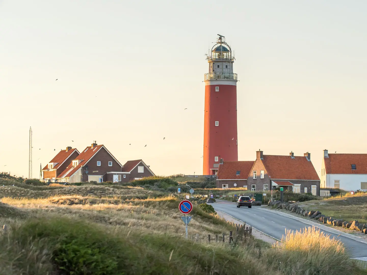
- Eierland Lighthouse: The red lighthouse near De Cocksdorp marks the island’s northern tip. It is a clear landmark on the route and can be climbed for wide views over beach, dunes and sea.
- Duinen van Texel National Park: The west-coast dune belt includes drifting dunes, wet dune valleys, De Slufter, De Muy, De Geul and the planted Dennen forest behind De Koog.
- Oudeschild: Texel’s historic working harbour on the Wadden Sea side, linked to the Dutch East India Company anchorage and now home to the fishing fleet and Kaap Skil maritime museum.
- Hoge Berg and the tuunwallen: A low glacial moraine south-east of Den Burg, framed by old earthen field walls that define Texel’s sheep-farming landscape.
- Wadden Sea: The east side follows the UNESCO-listed tidal sea, with birdlife including spoonbills, eiders and waders; seals haul out on the Noorderhaaks sandbank.
Challenges to expect
The route is flat and low-altitude, but the 60 km format is still demanding: expect 28–32 km walking days, soft beach sand, sandy dune paths and exposed wind. Weather changes quickly on the open coast, and autumn or winter conditions can be cold, wet and very windy. Streekpad signage can be patchy, so carry a map or GPX. Some areas in Duinen van Texel National Park have seasonal access restrictions for breeding birds. For another lowland wetland walk, see the Biesbosch National Park Trail.
HikeList Score
Texel Island Circular Trail scored 81/100 on HikeList's trail-quality metrics.
See score breakdownHide breakdown
- Ideal length 63
- Balanced challenge 90
- Scenery & wildness 74
- Varied terrain 100
- Accommodation 83
- Food & support 88
- Path quality 84
- Season flexibility 89
Computed from length, challenge, scenery & wildness, terrain variety, accommodation, food & support, path quality and season flexibility.
 Netherlands
Show more data Show less
- Beach
- Dunes
- Forest
- Farmland
- Wetland
- Sand
- Dirt
- Gravel
- Paved
- Hotels
- Hostels
- Campsites
- Family Friendly
- Pet Friendly
- Restrooms
- Water Sources
- Campsites
- Picnic Areas
In these collections
Photos from hikers
Taken on the trail by people who've reviewed Texel Island Circular Trail.
Start at the ferry harbour at 't Horntje and follow the east side of Texel past Oudeschild and Oosterend towards De Cocksdorp. The Om 't Eiland overnight is at De Krim, the holiday village in the far north.
Leave De Krim and continue via De Slufter, the forest around De Koog, the North Sea beach and the west-coast dunes. The day finishes at Den Hoorn in the south of the island.
Reviews
How would you rate Texel Island Circular Trail?
Tap a star to start your review — you could be the first.