South Downs Way
How would you rate South Downs Way?
Tap a star to share your experience and help other hikers.
South Downs Way: A Complete Hiking Guide
HikeList Score
South Downs Way scored 92/100 on HikeList's trail-quality metrics.
See score breakdownHide breakdown
- Ideal length 98
- Balanced challenge 100
- Scenery & wildness 85
- Varied terrain 83
- Accommodation 100
- Food & support 94
- Path quality 80
- Season flexibility 89
Computed from length, challenge, scenery & wildness, terrain variety, accommodation, food & support, path quality and season flexibility.
The South Downs Way is a 160 km waymarked National Trail across the chalk downs of south-east England, from Winchester in Hampshire to Eastbourne in East Sussex. Most walkers take about 8 days. It is a moderate point-to-point walk: navigation is straightforward, but the full route adds up to around 4,150 m of ascent and the ridge is exposed. It suits reasonably fit walkers who want rolling downland, historic hillforts and a non-technical long-distance trail.
Route Overview
The route runs between Winchester and Eastbourne, most commonly west to east, following ancient droveways and the chalk escarpment entirely within the South Downs National Park. From Winchester it climbs towards Cheesefoot Head, Old Winchester Hill and Butser Hill, then continues via Queen Elizabeth Country Park, Cocking, Amberley, the River Arun, Chanctonbury Ring, the Adur valley, Devil’s Dyke, Ditchling Beacon and the Ouse valley near Lewes. At Alfriston the eastern end splits: the inland bridleway goes via Jevington for about 11.9 km, while the optional coastal footpath crosses the Seven Sisters and Beachy Head for about 16.9 km before Eastbourne. It is a linear trail, so plan separate transport back. If comparing UK trips, see the Beacons Way or the Anglesey Coastal Path.
History of the South Downs Way
The South Downs Way was approved as a National Trail in March 1963 and opened in July 1972. It became the UK’s fifth National Trail and the first to be designated as a long-distance bridleway, which is why most of it is open to walkers, cyclists and horse riders. The original route ran across the South Downs to Eastbourne; in 1987 it was extended west to Winchester. The chalk ridge itself is much older travel country, marked by prehistoric droveways, Bronze Age barrows and Iron Age hillforts.
Notable highlights
- Old Winchester Hill: A downland nature reserve early on the route, crowned by an Iron Age hillfort with Bronze Age burial barrows inside the ramparts. It gives wide views over the Meon valley.
- Butser Hill: The highest point on the South Downs Way at about 270 m, beside Queen Elizabeth Country Park near Petersfield. It is also the high point of the chalk escarpment.
- Chanctonbury Ring: A prehistoric hillfort near Steyning, dated to the late Bronze or early Iron Age. Its ring of beech trees, first planted in 1760, makes it one of the route’s clearest landmarks.
- Devil’s Dyke: A dramatic dry chalk valley above Brighton and a popular viewpoint over the Weald. It is one of the most distinctive landforms on the central South Downs.
- Ditchling Beacon: At about 248 m, this is the highest point in East Sussex and has the remains of an Iron Age hillfort. It is a useful high marker before the route drops towards the Ouse valley.
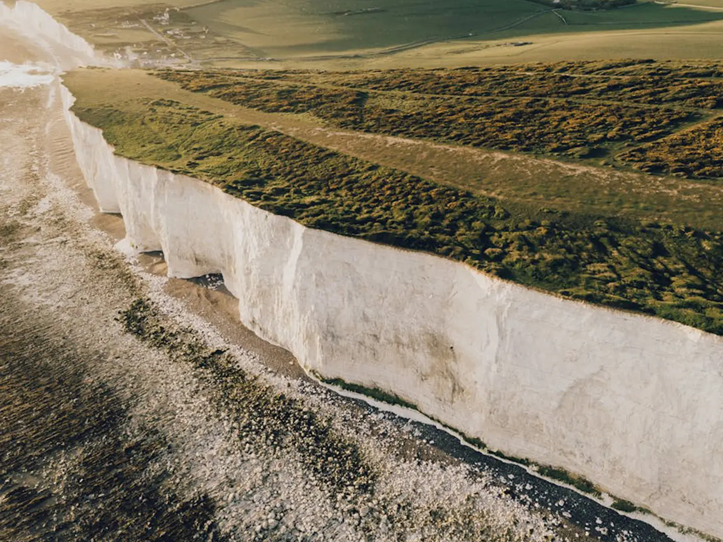
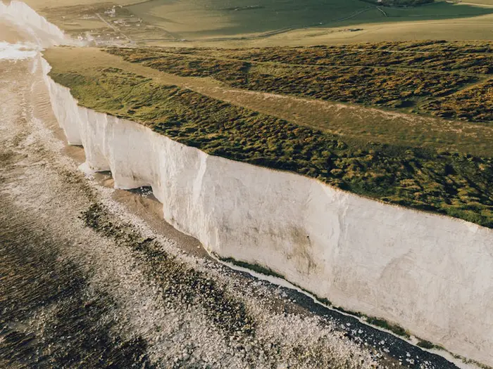
- Seven Sisters and Beachy Head: On the optional coastal finish from Alfriston, the trail crosses bright chalk sea cliffs before descending to Eastbourne. Beachy Head is noted as the highest chalk cliff in Britain.
Challenges to expect
The walking is not technical, but the distance, repeated climbs and roughly 4,150 m of total ascent make the full trail a sustained effort. The open ridge has little shade or shelter, so wind, sun and rain are all felt. Chalk and flint tracks can become muddy and very slippery after rain, especially in winter. Accommodation and services are usually in villages or towns off the ridge, so plan each day carefully.
HikeList Score
South Downs Way scored 92/100 on HikeList's trail-quality metrics.
See score breakdownHide breakdown
- Ideal length 98
- Balanced challenge 100
- Scenery & wildness 85
- Varied terrain 83
- Accommodation 100
- Food & support 94
- Path quality 80
- Season flexibility 89
Computed from length, challenge, scenery & wildness, terrain variety, accommodation, food & support, path quality and season flexibility.
 United Kingdom
 England
Show more data Show less
- Grassland
- Hills
- Forest
- Dirt
- Gravel
- Paved
- Hotels
- Guesthouses
- Hostels
- Campsites
- Family Friendly
- Dog Friendly On Leash
- Restrooms
- Potable Water Sources
- Established Campsites
- Picnic Areas
- Public Transport Access Points
Download Our Full Guide to South Downs Way FREE!
Get our comprehensive guide to this hike for free. Save it for later reading or print out at home.
In these collections
Photos from hikers
Taken on the trail by people who've reviewed South Downs Way.
South Downs Way: The Complete Guide
 i
Image by JACK REDGATE
i
Image by JACK REDGATE The South Downs Way is a 160 km National Trail from Winchester to Eastbourne, crossing the chalk downs of Hampshire and Sussex inside the South Downs National Park. It suits reasonably fit walkers who want a non-technical long-distance route with strong waymarking, good rail access and a satisfying west-to-east journey from city to sea.
The walk begins near Winchester’s City Mill and quickly moves into rolling Hampshire farmland, hedgerows, pasture and valley crossings, including the River Meon at Exton. Further east, the route becomes more open and ridge-like, with long views north to the Weald and south towards the Channel.
Its character comes from steady rhythm rather than drama: chalk and flint tracks, grassy paths, quiet lanes and repeated climbs over open downland. Along the way are Old Winchester Hill, Butser Hill, Chanctonbury Ring, Devil’s Dyke and Ditchling Beacon, linking ancient hillforts, droveways, chalk grassland and exposed viewpoints.
The final day from Alfriston gives walkers a genuine choice: the classic coastal footpath over the Seven Sisters, Belle Tout and Beachy Head, or the quieter inland bridleway via Jevington. The route opened in 1972 as the UK’s first long-distance bridleway, so walkers share much of it with cyclists and horse riders.
This is not a technical hike, but it is a sustained one: roughly 4,150 m of ascent, little shelter on the ridge, slippery chalk after rain and overnight stops that often sit off the main line of the trail. Accommodation, food and water all need planning, especially in peak season.
This guide covers stages, daily planning, accommodation, camping, food and water, transport, terrain, weather, gear, luggage transfer, shorter sections, highlights and common mistakes.
Stage-by-Stage Guide
The following stages follow the 8-day itinerary used on this page. Distances are approximate, and daily effort can change noticeably if accommodation is off the ridge or if you detour for food, rail access or a campsite.
Stage 1: Winchester to Exton — approx. 20 km
The South Downs Way starts at Winchester City Mill on Bridge Street, close to the cathedral and King Alfred statue area. The start is not especially prominent in the city, so do not assume the railway station is the trailhead; Winchester station is about 1 km north-west of the official western terminus.
After leaving Winchester, the route crosses the M3 by footbridge and settles quickly into fields, hedgerows and gentle chalk paths. This is a good introduction to the South Downs Way: rolling rather than severe, but with enough climbing to show how the next week will feel.
Key landmarks include Cheesefoot Head, also known for the Matterley Bowl, a large natural chalk amphitheatre with wide views across Hampshire and towards the Solent and Isle of Wight. The route also passes Chilcomb, Telegraph Hill and Beacon Hill Nature Reserve, where chalk grassland, wildflowers and butterflies are a highlight in spring and summer.
Beacon Hill is the main physical feature of the day. The climb is one of the steeper efforts on this stage, and the descent into the Meon Valley can be muddy and slippery after rain.
Food and water planning matters from the first day. Fill up in Winchester before starting; water taps at Holden Farm and Lomer Farm are useful but their current status and exact availability should be checked before travelling. The Milbury's Inn at Beauworth can work as a lunch stop with a small detour, while The Shoe Inn in Exton is the main end-of-stage pub option; check opening hours before relying on it for dinner.
Accommodation in Exton is limited. Crossways B&B is in the village, but most walkers should book well ahead because there are few easy alternatives directly at the stage end.
There is strong rail access at the start, with Winchester served by direct trains from London Waterloo and south-coast cities including Southampton, Portsmouth and Bournemouth. There is no useful intermediate railway access on this stage, so treat it as a committed day once leaving Winchester.
Navigation is generally straightforward once the acorn waymarks pick up outside the city. The urban start and a few agricultural track crossings are the places to pay most attention; a GPX track is useful even though this is a National Trail.
Stage 2: Exton to Buriton — approx. 21 km
This is a more demanding day than Stage 1, with several climbs and more exposed ridge walking. From Exton the trail climbs past Salt Hill and moves onto open chalk downland, with wide views becoming a regular feature.
Old Winchester Hill is the first major highlight. It is a downland nature reserve and scheduled Iron Age hillfort, with Bronze Age burial barrows inside the ramparts and broad views over the Meon Valley. In season, the chalk grassland is notable for orchids, butterflies and other downland flowers.
The route continues over Hyden Hill and Tegdown Hill before reaching Butser Hill, the highest point on the South Downs Way at about 270 m. This is also one of the most exposed places on the route: in poor weather it can feel far more serious than the height suggests.
From Butser Hill the trail descends to Queen Elizabeth Country Park, a very useful rest and resupply point with a visitor centre, café, shop and toilets. After this, a short road and path section leads into Buriton, a flint-built village with a duck pond.
Food and water options are better than on some ridge days but still need planning. The Butser Hill summit area can have a café or kiosk, and Queen Elizabeth Country Park is the main reliable stop, though seasonal opening should be checked. Buriton has The Five Bells pub, but opening hours vary, so check before arrival.
Accommodation is limited in Buriton, with B&Bs, guesthouses and pub-with-rooms options. The Sustainability Centre near Old Winchester Hill is also relevant for some itineraries, offering yurt or hostel-style accommodation and a café, but it must be worked into the day deliberately.
Petersfield railway station is about 3 km (around 2 miles) north of Buriton by footpath and road, making this one of the better escape or section-hiking points in the western half of the trail. Buses also link Queen Elizabeth Country Park with Petersfield, and taxis between Buriton and Petersfield are practical.
Waymarking is usually clear, including through Queen Elizabeth Country Park. Butser Hill can be disorientating in mist or low cloud, so carry a map, compass or GPX and do not rely only on sightlines.
Stage 3: Buriton to Cocking — approx. 18 km
This is the shortest day on the 8-stage schedule, but it is still proper ridge walking with exposed sections, flint tracks and a notable descent at the end. It works well as a recovery day after the Butser Hill stage.
Leaving Buriton, the South Downs Way passes through chalk pits and woodland before climbing back to the ridge. Harting Down is one of the day’s best sections, with sweeping dry chalk valleys, rich grassland and long views north over the Sussex Weald and, in clear conditions, south towards the Channel.
South Harting is a short downhill detour of about 500 m and is one of the most useful service points on the day. The village has The White Hart pub, a convenience shop and bus links, so it is worth considering even if it adds a little descent and re-ascent.
Further east, the route passes Beacon Hill at Harting, a Bronze Age hillfort and scheduled ancient monument, then the Devil’s Jumps near Treyford, a row of five Bronze Age bowl barrows visible from the trail. Uppark House is around 1 km east of the route and can be seen as a possible cultural detour, but opening hours should be checked before leaving the trail.
There are no dependable food or water points on the open ridge, so start from Buriton with enough for the day unless detouring to South Harting. Cocking has a café or tearoom near the car park and The Blue Bell Inn a short detour off the trail; opening hours should be checked in advance.
Cocking has B&Bs and Manor Farm Campsite, while South Harting has guesthouse options if the itinerary is adjusted. As with most South Downs villages, accommodation is limited and should be booked ahead.
South Harting has bus links to Chichester and Petersfield. Cocking has local buses but no railway station; onward travel usually involves bus or taxi links towards Chichester or Haslemere.
Navigation is generally simple on the ridge, but watch the line through Harting Down where paths and car park access can distract from the National Trail. The descent to Cocking can be hard on tired legs, especially if the flint and chalk are wet.
Stage 4: Cocking to Amberley — approx. 19 km
This is the most wooded stage of the South Downs Way and feels different from the open ridge days either side. The trail passes through Charlton Forest, Murray Downland and Graffham Downland Trust reserves, mixing ancient woodland with chalk glades and enclosed paths.
The wooded character gives welcome shelter in hot or windy weather, but it also means slower, muddier going after rain. Chalk and flint tracks may drain quickly elsewhere, but forest sections can hold mud.
Graffham Down and Tegleaze add more chalk downland interest, including Bronze Age burial mounds. At Bignor Hill, the route crosses the line of the Roman road Stane Street; the Roman influence is unusually clear underfoot here.
Bignor Roman Villa is about 1.5 km north of the route and is a worthwhile detour for walkers with time, particularly for its mosaic floors. It is seasonal, so opening hours and admission prices should be checked before committing to the extra distance.
The main on-trail food stop is Cadence Cycle Club / Upwaltham Barn Café near Upwaltham. It is directly on the trail and popular with walkers and cyclists, but current opening days vary by season and should be checked.
Amberley, on the River Arun, is a major practical waypoint and a natural halfway marker for the South Downs Way. The village has tea rooms, pubs including The Black Horse, a village store and several accommodation options, including B&Bs, guesthouses, a bunkhouse and nearby camping.
Amberley railway station is one of the best intermediate access points on the entire route. It sits in the village, with Arun Valley line trains towards London Bridge or Victoria and towards Chichester and Portsmouth.
Navigation is slightly more demanding than on the open ridges because woodland junctions are less visually obvious. Keep following the National Trail acorns, and use a GPX track through Charlton Forest if visibility or waymarking feels uncertain.
Stage 5: Amberley to Steyning — approx. 21 km
The day begins with a stiff climb out of Amberley towards Amberley Mount. Once height is gained, the route settles into open rolling chalk along Rackham Hill, Kithurst Hill and the long approach to Chanctonbury Ring.
Kithurst Hill has a visible Second World War Churchill tank wreck just off the trail, a distinctive landmark on an otherwise open stretch. From here the views north over the Weald are often excellent.
Chanctonbury Ring is the outstanding feature of the stage. The beech trees, first planted in 1760, encircle the site of a late Bronze Age or early Iron Age hillfort, with Roman temple remains also found inside. The trees were badly damaged in the 1987 storm but have largely regrown, and the ring remains one of the most recognisable landmarks on the South Downs Way.
After Chanctonbury, the route drops steeply towards Washington, just off the trail. The Frankland Arms and the village store make Washington a useful lunch and resupply point, although opening hours should be checked.
The trail then crosses the River Adur and the A283 at Botolphs, where there is an ancient chapel and a water point near the road. From here, walkers can continue to Steyning or use YHA Truleigh Hill if shaping the day differently.
Steyning is one of the most useful overnight towns on the route, with pubs, cafés, shops, a Co-op supermarket and a good range of B&Bs, guesthouses and inns. It is a much stronger resupply stop than most ridge villages.
There is no railway station in Steyning. Shoreham-by-Sea is the nearest rail option by bus or taxi, and buses also link Steyning with Brighton and Worthing.
Navigation is normally straightforward, but the Washington turn-off can be missed when moving quickly along the ridge. The descent towards Steyning includes some lane walking and road margins, so stay alert in poor light or busy periods.
Stage 6: Steyning to Pyecombe — approx. 18 km
Stage 6 climbs back from Steyning to the ridge and then follows one of the most open and popular sections of the South Downs Way. Views begin to open towards the coast, and the walking is classic chalk ridge terrain.
Truleigh Hill comes early on the ridge and is useful whether or not it is the chosen overnight stop. YHA Truleigh Hill sits directly on the South Downs Way and can provide accommodation, camping, self-catering facilities and basic food or café options, depending on current opening.
Devil’s Dyke is the dominant landmark of the day. This dramatic dry chalk valley is roughly a kilometre long and has extensive views over the Weald, but the National Trust car park and pub mean it can be busy, especially at weekends.
Below Devil’s Dyke, Saddlescombe Farm is another useful stopping point, with the seasonal Wildflour Café on the trail. Continue past Fulking Escarpment and towards the Jack and Jill windmills at Clayton, a classic South Downs landmark; Jill, the white post mill, opens on some summer Sundays and Bank Holidays.
The route crosses the A273 and passes through Pyecombe Golf Club before dropping to Pyecombe. The golf course section is signed, but the line can feel less obvious than the open ridge, so follow the acorns carefully across the fairways.
Food and water are available at Truleigh Hill YHA, Devil’s Dyke pub and sometimes Saddlescombe Farm, but all should be checked for current hours if being relied on. Pyecombe itself has limited services, including the Pyecombe Garage shop and a church tea station, so do not arrive assuming a full resupply.
Accommodation in Pyecombe is limited. Some walkers use YHA Truleigh Hill by adjusting the stage, while Housedean Farm campsite lies east of Pyecombe near the A27 and can suit some itineraries.
Pyecombe has no railway station, but Hassocks station is about 2 km away and is a very useful access point on the London Bridge to Brighton main line. Bus links are also available from the Devil’s Dyke area towards Brighton.
This stage is exposed in wind, rain and strong sun. The easy access around Devil’s Dyke also means more day visitors, dogs and side paths, so keep an eye on the National Trail waymarks rather than simply following the busiest track.
Stage 7: Pyecombe to Alfriston — approx. 27 km
This is the longest and most demanding stage in the 8-day itinerary. It combines distance, repeated climbing, exposed ridge walking and some harder-surfaced farm roads, so tiredness is a real planning issue.
From Pyecombe the route climbs towards Ditchling Beacon, the highest point in East Sussex at about 248 m. The summit area has Iron Age hillfort earthworks, a National Trust car park and extensive views towards Brighton, the sea and the Weald.
After the Beacon the trail descends towards the A27 crossing at Housedean, where careful attention to signs is needed around the bridge or underpass area.
Housedean Farm has a campsite nearby and a water point, making it an important mid-stage planning marker. After climbing away from the A27, the route runs across open chalk farmland with tumuli, dew ponds and long views, and crosses the Greenwich Meridian near Mill Hill above Rodmell, where a wooden fingerpost marks the line between the eastern and western hemispheres.
The route descends to the River Ouse at Southease, a tiny village with a round-towered flint Norman church and a level crossing on the Lewes-Seaford line. Southease station is directly on the trail, with trains to Lewes, Newhaven and Seaford, making it the best place to split this long day.
YHA South Downs at Itford Farm, just beyond Southease, is a major accommodation and rest point, with hostel beds, private rooms, camping and café facilities. It is popular and should be booked ahead.
If continuing from Southease to Alfriston, the route climbs again over Itford Hill towards Firle Beacon, an exposed open ridge at about 218 m. This section can be very windy and feels remote in poor weather despite being close to lowland roads and villages.
Charleston Farmhouse is around 1.5 km north of the trail near Firle and can be detoured to if time allows. It is seasonal, so opening hours and admission should be checked before leaving the route.
The final descent leads into Alfriston in the Cuckmere valley. The village has a strong range of services for walkers, including pubs, tea rooms, a village store, B&Bs, inns and guesthouses; Alfriston Camping Park is a short detour.
Food and water must be planned carefully on this stage. Pyecombe has only limited starting supplies, Ditchling Beacon may have a seasonal van, Housedean has a water point, Southease/YHA South Downs can provide a major break, and Alfriston has full village services.
Transport options are strongest at Southease and Lewes. Southease station is on the Lewes-Seaford line, while Lewes, around 2 km off-route from the Southease area, has more frequent trains towards London and Brighton.
For many walkers, splitting this stage at Southease or using Lewes for accommodation or transport makes the itinerary more comfortable. If walking Pyecombe to Alfriston in one day, start early, carry enough water and allow time for the exposed Firle Beacon section after Southease.
Stage 8: Alfriston to Eastbourne — approx. 17 km via the coastal route, approx. 13.7 km via the inland bridleway
The final stage is unusual because the South Downs Way splits at Alfriston Bridge. Walkers can take the coastal footpath over the Seven Sisters and Beachy Head, while cyclists and horse riders must use the inland bridleway via Jevington.
The coastal route is the classic walking finish and is about 16.9 km. From Alfriston it follows the River Cuckmere south towards Litlington, where the White Horse pub and the Litlington White Horse chalk figure are the main landmarks.
The route then enters Friston Forest, using forest paths and a long flight of steps before dropping to Westdean. From there it reaches Seven Sisters Country Park and the cliff-top approach to Cuckmere Haven.
The Seven Sisters are far harder than they look on a map. Each chalk headland involves a steep climb and descent, and the cumulative ascent is a serious final-day effort, especially in wind, rain or hot sun.
Birling Gap is the key service point on the coastal route, with a National Trust café, shop, toilets and beach access by steps. Beyond it, the trail passes Belle Tout Lighthouse and Beachy Head, the highest chalk cliff in Britain, before descending into Eastbourne via Holywell and the seafront.
The coastal cliffs are unprotected and subject to erosion and undercutting. Stay well back from cliff edges at Seven Sisters, Birling Gap and Beachy Head, and do not walk close to the edge in wet or windy conditions.
The inland bridleway via Jevington is about 13.7 km and is the route for cyclists and horse riders. It is less dramatic than the cliffs but shorter and generally easier on tired legs, with chalk tracks, woodland and some village lane walking.
From Alfriston Bridge the inland route climbs towards Windover Hill, where the Long Man of Wilmington chalk figure can be seen from the northern escarpment. A short detour gives the best view.
Jevington is the main village on the inland route, with The Eight Bells pub and a blue plaque marking the former Hungry Monk restaurant, associated with Banoffee Pie. The route then climbs to Willingdon Hill, with final ridge views before dropping through the outskirts of Eastbourne and joining the finish near the seafront.
Food and water depend heavily on the chosen finish. On the coastal route, Litlington, Birling Gap and Beachy Head are the key stops; on the inland route, Jevington is the main village service point. Opening hours should be checked before relying on any pub or café.
Eastbourne has the widest accommodation choice on the entire route, with hotels, B&Bs and guesthouses along the seafront and in town. Booking is still sensible for summer weekends, but the options are far broader than in the small villages along the trail.
Eastbourne railway station is under 2 miles from the trail end and has direct trains to London Victoria, plus services towards Brighton, Lewes, Hastings and Ashford International. Taxis are readily available between the seafront and the station.
Navigation on both finishes is usually clear, but the coastal path attracts many day walkers and side paths near Beachy Head. Follow the South Downs Way acorns into Eastbourne rather than informal paths near the cliff edge.
Recommended Itinerary
Nearly all walkers take the South Downs Way west to east, from Winchester to Eastbourne, so the journey builds towards the Seven Sisters, Beachy Head and the coast. The 8-day schedule below is the most balanced version for fit walkers who are happy with around 18–27 km per day and have accommodation booked in advance.
Distances are approximate and vary slightly with the exact overnight stop, off-route accommodation and the final route choice into Eastbourne. Check official mapping before booking if your accommodation is away from the trail.
Standard 8-day itinerary
| Day | From | To | Approx. distance | Why this stage makes sense | Services/accommodation notes |
|---|---|---|---|---|---|
| 1 | Winchester | Exton | 20 km | A manageable opening day from the western terminus, climbing out of Winchester via Cheesefoot Head and on towards Old Winchester Hill. Exton gives a natural break in the Meon valley before the higher ground of the next stage. | Exton has limited services, including The Shoe Inn, small B&B options and The Bucks Head Inn just south of the village. Accommodation is scarce, so book early. No direct rail escape; Petersfield is the practical taxi option. |
| 2 | Exton | Buriton | 21 km | This is one of the more physical early days, with the route building towards Butser Hill, the highest point on the South Downs Way, beside Queen Elizabeth Country Park. Buriton is a sensible overnight stop before the trail continues east into West Sussex. | Queen Elizabeth Country Park has useful facilities, including café, toilets and visitor centre. Buriton has pub and B&B options, with more choice around Petersfield. Petersfield railway station is about 3 km north of Buriton. |
| 3 | Buriton | Cocking | 18 km | A slightly shorter day after the Butser Hill stage, crossing fine chalk downland around Harting Down and Beacon Hill. Cocking is well placed before the longer west-to-east push towards Amberley. | Cocking has limited accommodation and services, including The Blue Bell at Cocking. There is also a small car park and café near the trail at Cocking Hill. Book ahead, as options are few. |
| 4 | Cocking | Amberley | 19 km | The route passes through the Slindon Estate and over Bignor Hill before dropping to the River Arun. Amberley is one of the strongest trail logistics points, with rail access and a better accommodation spread than many ridge-top sections. | Amberley has a station on the Arun Valley line, plus pubs, B&Bs, South Downs Bunkhouse and hotel options including Amberley Castle. The station is close to the trail; note the short platform and board the correct carriages when travelling by train. |
| 5 | Amberley | Steyning | 21 km | A good full day over open downland, passing Washington and climbing to Chanctonbury Ring, one of the clearest landmarks on the route. Steyning gives a proper town stop after several smaller villages. | Washington has limited facilities, including the Frankland Arms. Steyning has a Co-op, several pubs, cafés, restaurants and B&Bs, making it a useful resupply and recovery stop. |
| 6 | Steyning | Pyecombe | 18 km | This stage crosses the River Adur at Botolphs, then climbs towards Devil's Dyke, one of the best viewpoints on the central South Downs. Pyecombe works as a short-stage finish before the long eastern day to Alfriston. | Devil's Dyke has seasonal facilities and The Devil's Dyke pub. Pyecombe has The Plough and limited B&B accommodation, including The Stables at The Forge. Many walkers use Hassocks or Brighton for more choice. |
| 7 | Pyecombe | Alfriston | 27 km | The longest day of the standard itinerary. It crosses Ditchling Beacon, drops towards the Ouse valley at Southease, then continues via Firle Beacon to Alfriston. Keeping this as one long day leaves the final walk into Eastbourne more enjoyable. | Southease has YHA South Downs and a railway station on the Lewes–Seaford line. Alfriston is one of the best final-quarter bases, with pubs, tea rooms, shops, B&Bs and hotels. If 27 km is too much, split here at Southease or use Lewes off-route. |
| 8 | Alfriston | Eastbourne | 17 km | The classic finish is the coastal route via Cuckmere Haven, the Seven Sisters, Belle Tout and Beachy Head. The alternative inland bridleway via Jevington is shorter and quieter. | Coastal route: about 16.9 km, more dramatic, more ascent and very exposed. Inland route: about 13.7 km via Jevington, faster and fully off-road. Seasonal facilities are available at Exceat/Cuckmere Haven and Birling Gap. Eastbourne has full services and a railway station under 2 miles from the seafront finish. |
Slower 9–10 day variant
A 9- or 10-day schedule suits first-time multi-day walkers, anyone wanting shorter days, and hikers who prefer time for pub stops, village detours and slower mornings. It also reduces the risk of the long Pyecombe–Alfriston day becoming a slog.
The most useful adjustment is to split Day 7:
| Change | How it helps | Notes |
|---|---|---|
| Split Pyecombe to Alfriston at Southease | Breaks the 27 km standard day into two easier sections | YHA South Downs is near Southease, and Southease station can be useful, though timetables should be checked before relying on it. |
| Use Lewes as an off-route overnight stop | Gives access to a larger town and better transport links | Lewes is off-route to the north, so allow for taxi, bus or extra walking. This should be checked before travelling. |
| Add an early shorter day around East Meon | Softens the opening section before Butser Hill and Buriton | Useful for walkers easing into the trail. Accommodation and exact stage distances should be checked before booking. |
At 10 days, the average walking day is roughly 16 km, which is often a better fit if carrying a full pack or walking in wet conditions when chalk and flint become slippery.
Faster 7-day variant
A 7-day South Downs Way is realistic only for fit walkers with multi-day experience who are comfortable with at least one very long day. The difficulty is not the navigation; it is the spacing of accommodation and the repeated climbs along an exposed ridge.
The simplest fast conversion is to remove one overnight stop from the standard itinerary:
| Fast option | What changes | Who it suits |
|---|---|---|
| Combine Buriton to Cocking and Cocking to Amberley | Creates a long Buriton–Amberley day of about 37 km | Strong walkers who want to keep the rest of the itinerary close to the standard plan. This is too long for many hikers with a full pack. |
| Combine Amberley to Steyning and Steyning to Pyecombe | Creates a long Amberley–Pyecombe day of about 39 km | Walkers who prefer to keep the early stages moderate and accept a demanding central day. Accommodation planning is essential. |
| Use off-route accommodation around Lewes or nearby transport links | Can reduce reliance on small villages such as Pyecombe | Best for walkers willing to use taxis, buses or trains to make the 7-day schedule work. Check official mapping and transport before booking. |
Avoid assuming that a 7-day itinerary is simply the 8-day plan with one stop removed. Some omitted stops create 37–39 km days, and Winchester to Buriton as an opening day would be about 41 km, which is a hard first day on a multi-day trail.
Booking notes for any itinerary
Book well ahead for May to September, especially at Exton, Cocking, Pyecombe and Alfriston, where accommodation is limited or demand is high. Most services sit below the ridge in villages and towns, so the overnight stop often determines the real day length.
Luggage transfer is available from operators on the South Downs Way, including services running in the main walking season. Confirm current dates, bag limits and prices before booking.
Planning the Route
How many days to allow
Most walkers should plan the South Downs Way as a 7–9 day walk, with 8 days the most practical baseline. That gives daily distances of roughly 19–21 km on many days, while still leaving enough time for descents to accommodation, pub meals, resupply stops and bad-weather delays.
A 5–6 day itinerary is possible for strong, experienced hikers, but it turns the route into a high-mileage endurance walk with less flexibility. A 10-day itinerary suits walkers who want shorter days, later starts, village time and a less pressured finish over the Seven Sisters.
The route is not technically difficult, so the choice is less about mountaineering ability and more about sustained daily effort. Repeated chalk climbs, exposed weather and off-route accommodation detours make an apparently moderate day feel longer than the map distance suggests.
| Itinerary style | Best for | Planning implications |
|---|---|---|
| 5–6 days | Very fit walkers travelling light | Long daily mileage, fewer accommodation options, little margin for poor weather |
| 7–9 days | Most reasonably fit walkers | Best balance of distance, logistics and recovery; 8 days is the standard plan |
| 10 days | Leisurely walkers, social groups, first long-distance hikers | Easier days, more village time, but more nights to book and higher total cost |
Build the itinerary around accommodation, not perfect distances
The main planning reality is that the trail stays high on the chalk ridge while most beds, pubs, shops and transport sit down in valleys or villages. Stage ends are therefore dictated by where accommodation is available, not by evenly spaced mileage.
Many overnight stops require descents of 1–3+ miles off the ridge. This is normal on the South Downs Way and should be included when judging each day’s effort, especially if staying in places such as Buriton, South Harting, Steyning, Storrington or Lewes.
Useful overnight areas on or near the route include Winchester, Exton, Buriton, Cocking, Amberley, Washington, Steyning, Upper Beeding, Pyecombe, Lewes, Southease, Alfriston and Eastbourne. Amberley is particularly convenient because the station is close to the trail; YHA Truleigh Hill is also unusually close to the route near Washington/Upper Beeding.
Book accommodation before fixing the rest of the plan. In peak season, late May to September, small B&Bs, pubs and rural guesthouses can fill 3–4 months ahead, especially on bank holidays and summer weekends. Outside peak season, a few weeks’ notice is often enough, but opening days can be reduced.
Typical budget ranges are around £20 per night for campsites, from about £25 for hostel dorms, and roughly £50–£100+ for B&Bs or pub rooms. Prices vary significantly by season and room type, so confirm current prices before booking.
Direction of travel
The standard direction is west to east, from Winchester to Eastbourne. This gives the best progression: inland chalk downland first, then the bigger visual finish over the Seven Sisters and Beachy Head.
West-to-east also usually puts the prevailing south-westerly wind behind you, which matters on an exposed ridge with little shelter. Winchester is straightforward to reach by rail, and Eastbourne has direct trains back towards London, so the logistics work well in this direction.
Walking east to west is entirely possible and has no major access disadvantage. The trade-off is that the coastal climax comes on the first day, and headwinds are more likely over the open downs.
The final route choice: Seven Sisters or Jevington
The Alfriston-to-Eastbourne leg needs a decision before the final morning. There are two signed options, and the better choice depends on weather, daylight, fitness and whether you are walking, cycling or riding.
| Option | Distance | Access | Character | When to choose it |
|---|---|---|---|---|
| Coastal footpath via Seven Sisters and Beachy Head | ~16.9 km / 10.5 miles | Walkers only | Dramatic chalk cliffs, repeated steep ups and downs, classic coastal finish | Good visibility, settled weather, enough daylight and energy |
| Inland bridleway via Jevington | ~13.7 km / 8.5 miles | Walkers, cyclists and horse riders | Shorter downland route through Jevington into Eastbourne | Poor weather, strong wind, fog, fading light or tired legs |
The coastal option is the finish most thru-hikers aim for, but it is more demanding than its distance suggests. Keep well back from cliff edges, particularly in wind, rain or mist.
Cyclists and horse riders must use the inland bridleway route via Jevington. Walkers should also choose the inland route if the forecast makes cliff walking unsafe or if finishing late in the day.
Section hiking and shortening the route
The South Downs Way is one of the easier National Trails to section-hike because rail access is strong at both ends and several intermediate stations sit close enough to the route. This makes it practical to walk over weekends, link two or three days together, or leave the trail if weather or injury intervenes.
Key rail access points include Winchester, Petersfield, Amberley, Hassocks, Southease, Lewes and Eastbourne. Amberley is especially useful because it is only a few minutes’ walk from the trail, though long trains use a short platform there and passengers should use the front four carriages.
Good section combinations include Petersfield to Amberley over about three days, Amberley to Hassocks over two or three days, and Hassocks through Lewes, Southease, Alfriston and Eastbourne over two or three days. Alfriston to Eastbourne also works as a strong standalone day walk if the coastal forecast is good.
Local buses serve some villages, but services are often infrequent and may be limited outside Monday to Saturday. Traveline South East and the South Downs National Park public transport guidance should be checked before travelling.
Food and resupply planning
Do not assume that every named village on the map has a shop. The ridge can give long stretches with no guaranteed food supply, and Sunday opening hours at rural pubs and village shops can be limited.
Reliable service centres include Winchester at the start, Alfriston near the end and Eastbourne at the finish. Other useful food or pub stops include Cocking, Amberley, Washington/Steyning, South Harting, Lewes and East Dean, but several require detours from the ridge.
Plan to carry food for 10–20 mile sections where there may be no dependable resupply on the trail itself. Evening meals should be booked ahead in small villages where the pub may be the only practical option.
Water on the ridge
Water is a real planning item on the South Downs Way because much of the route is exposed and high above valley settlements. There are around 15 free public water taps along the trail, installed by the South Downs National Park Authority and the South Downs Society, with spacing often around 5–10 miles. Several walker sites, including the South Downs Way Double tap list, map their current locations.
Useful taps include Lomer Farm, Meon Springs, the Sustainability Centre, Queen Elizabeth Country Park, Cocking, Upwaltham, Amberley, Washington, Botolphs, YHA Truleigh Hill, Saddlescombe, Housedean Farm, Southease Church, Litlington and Jevington Church. Some taps are seasonal or unreliable in cold weather, including Saddlescombe in winter and Housedean Farm in cold conditions.
Always refill when water is available rather than waiting until bottles are empty. In summer, carry at least 1.5–2 litres capacity between taps; in hot, windy weather, more may be needed.
For walks between November and March, check the current tap list before setting off, as some taps are turned off to prevent freezing. This should be checked before travelling.
Navigation and maps
The route is very well waymarked with National Trail acorn signs, and navigation on the main line is generally straightforward. Most problems occur around valley crossings, road junctions, accommodation detours and in mist on the open ridge.
A phone app such as OS Maps or AllTrails is useful, but offline access is important because mobile signal can be patchy on the downs. Carry either an offline GPX or a paper backup rather than relying on live data.
GPX files are available from the National Trail website, Walking Englishman and OS Maps. Ordnance Survey Explorer sheets 119, 120, 121, 122, 123 and 132 cover the full trail; check the current National Trail mapping advice before buying paper maps.
Weather, surfaces and seasonal timing
Late spring to early autumn is the easiest planning window: longer daylight, more open accommodation, more dependable village services and the best chance of all water taps being in use. April and October can also work well, with quieter trails and changeable but often suitable weather.
Winter walking is possible, but it needs more preparation. Chalk and flint can become extremely slippery after rain, frost or repeated wet weather, daylight is short, some taps may be off, and rural pubs or B&Bs may reduce opening.
The ridge is exposed to wind, sun and rain. Waterproofs, sun protection and warm layers can all be needed on the same day, and trekking poles are strongly useful on wet chalk descents.
Access, permits and trail users
No permit is required to walk the South Downs Way, and there are no entry fees for the National Trail itself. The route is open year-round, although weather, daylight, accommodation and water availability change the practical difficulty.
The official trail is a bridleway route used by walkers, cyclists and horse riders. The exception is the walkers-only coastal alternative between Alfriston and Eastbourne via the Seven Sisters and Beachy Head; cyclists and horse riders use the inland bridleway via Jevington.
Expect farm tracks, livestock fields, gates, kissing gates, short lane sections and shared-use paths. Close gates behind you and be prepared to meet bikes and horses on the broader chalk tracks.
Towns, Villages and Overnight Stops
Accommodation planning matters more on the South Downs Way than the navigation. Much of the walking is along an exposed chalk ridge, while many beds, pubs and shops sit down in villages below it, so allow for an end-of-day descent and a morning climb back to the trail.
For peak season, especially mid-March to the end of September, book key overnight stops 3–4 months ahead where possible. As a broad planning guide, B&Bs and hotels commonly start around £75+ per night, hostel or bunkhouse beds around £40, and camping around £15; current prices should be checked before booking.
The best-connected intermediate trail stops are Amberley and Southease, where railway stations sit on or very close to the route. Elsewhere, rail access usually means walking or taking a bus to towns such as Petersfield, Hassocks, Lewes or Eastbourne.
| Route area | Best overnight use | Practical note |
|---|---|---|
| Winchester | Start / night before | Best place for supplies before setting off |
| Exton / East Meon | End of Day 1 area | Limited beds; book early |
| Buriton / Petersfield | End of Day 2 area | Petersfield is the main resupply town nearby |
| Cocking / Midhurst | End of Day 3 area | Cocking has limited services; Midhurst gives more choice off-route |
| Amberley | End of Day 4 area | Excellent rail access at the River Arun crossing |
| Steyning / Washington | End of Day 5 area | Steyning has better services; Washington is smaller and quieter |
| Truleigh Hill / Pyecombe | Day 6 area | YHA Truleigh Hill is on-trail; Pyecombe has limited village services |
| Southease / Lewes / Alfriston | Day 7 area | Southease has the YHA and station; Alfriston is the main village stop |
| Eastbourne | Finish | Full services and onward rail travel |
Winchester
Winchester is the western start of the South Downs Way, with the trail marker by the City Mill / Bridge Street close to the city centre. Winchester railway station is about 1 km north-west of the start and is served by South Western Railway, with direct trains from London Waterloo and south-coast cities including Southampton and Portsmouth.
This is the best place to stay the night before starting if travelling in from elsewhere. The city has supermarkets, independent food shops, outdoor-friendly supplies, pubs, restaurants and cafes, so it is the easiest point for last-minute food and kit purchases.
Accommodation ranges from hotels and pub rooms to more expensive city-centre options. Winchester is also a popular visitor destination in its own right, so summer weekends can book up early.
Exton
Exton is the usual first-night target on an 8-day itinerary, reached after roughly 20 km from Winchester. The route drops steeply into the Meon valley here, with walkers using the path over pasture while the horse and cycle route uses the lane.
It is a small village rather than a full-service stop. The Shoe Inn is the key pub and riverside rest point, while Manor House B&B has very limited room availability, so overnight plans should not be left loose.
There is no supermarket in Exton. If staying here, carry enough food and essentials from Winchester, and confirm evening meals and breakfast arrangements before arriving.
East Meon
East Meon is a useful alternative in the same early-route area, but it requires a detour of about 4 km from the main trail. It is worth considering when Exton accommodation is full or when a shorter or more flexible first two days are preferred.
The village has pub options including Ye Olde George Inn and the Bucks Head. If relying on any lift, pick-up or transfer arrangement from the trail, this should be agreed directly with the accommodation before travelling.
Buriton
Buriton sits at the foot of the South Downs escarpment near the Queen Elizabeth Country Park and Butser Hill section. It is a natural second-night stop on the standard itinerary, around 41 km from Winchester.
The village has two pubs, with the Five Bells the main local pub, plus a local shop. Accommodation in Buriton itself is limited, so it is common to combine this stop with Petersfield if village beds are unavailable.
Petersfield is about 2 miles north and is connected to Buriton by a local bus (currently route 94), with the exact route and timetable worth checking before travelling. If staying in Buriton, check food opening times and availability before setting out from Exton.
Petersfield
Petersfield is off-route to the north of Buriton, but it is the most useful town for the Hampshire section of the South Downs Way. It works well as an overnight substitute for Buriton, a resupply stop, or an escape point around Days 2–3.
The town has supermarkets, including Waitrose, independent shops, banks, a post office, tourist information, pubs and restaurants. It is a practical place to restock properly before continuing east.
Petersfield railway station has services on the London Waterloo line, with connections towards Portsmouth, Guildford, Haslemere and Havant. Returning to the trail requires the walk or bus connection back towards Buriton.
South Harting
South Harting lies below Harting Down, about 1 km south of the trail. It is best treated as a lunch, water or top-up stop rather than a core overnight base.
The village has the White Hart pub, a post office and a village store in a compact cluster. Accommodation is limited, so do not rely on South Harting for an unbooked night.
Bus 91/92 connects the village with Petersfield and Midhurst. Petersfield is the nearest railway station, about 4 miles away.
Cocking
Cocking is the standard third-night stop, reached after the descent from Cocking Hill at roughly 59 km from Winchester. It is a small but important trail village because it breaks the western half of the route into manageable days.
The village has a small post office/shop, useful for resupply, and the Blue Bell, which has a restaurant and a small number of B&B rooms. Choice is limited, so Cocking is one of the places to book early.
Buses from the Cocking and Midhurst area connect towards Petersfield and Chichester. Midhurst, about 4 km south, has more facilities and can be used as an off-route alternative if Cocking is full.
Bignor and Sutton area
Between Cocking and Amberley, the Bignor and Sutton area offers off-route options rather than a major trail village. It can be useful for walkers needing to split the Cocking-to-Amberley section differently.
The White Horse Inn at Sutton is a higher-end dining option, and Folly Hide offers glamping shepherd’s hut accommodation. Bignor Roman Villa is nearby for walkers with time and interest, but this area should be planned deliberately rather than assumed as a spontaneous stop.
Amberley
Amberley is one of the most useful overnight stops on the whole route. It sits at the River Arun crossing, around 78 km from Winchester, with Amberley railway station close to the village.
The station is on the Arun Valley line, with Southern Railway services towards London Victoria via Gatwick Airport, Croydon, Redhill, Crawley and Horsham, and south towards Bognor Regis and Chichester. This makes Amberley a strong place to start or finish a section hike.
The village has pubs including the Bridge Inn and the Black Horse, with rooms at the Black Horse. Amberley Castle is the premium luxury option, while glamping pods and farm pitches are available nearby.
There are several cafes, but Amberley is still a village rather than a large resupply town. If you need a bigger food shop, plan that separately rather than assuming full supermarket facilities here.
Storrington
Storrington sits off-route, roughly 3–4 km south of the ridge between Amberley and Steyning. It is a practical resupply detour rather than a standard overnight stop on the main line.
The town has supermarkets, shops and cafes, making it useful if food stocks are running low in the West Sussex section. Factor the detour into the day’s distance and ascent, as the main trail continues along the Downs above.
Washington
Washington is a small village below the Downs near Chanctonbury Ring, around the Day 5 area. It can work as a quieter alternative to Steyning, but services and beds are limited.
The Frankland Arms is the key pub stop and offers food and water refills, with a village shop attached to the pub area. Holt House B&B is the main mid-range accommodation option, and should be booked ahead.
Compass Travel bus 100 runs from Washington to Pulborough, Storrington, Steyning, Albourne and Burgess Hill on Monday to Saturday. Washington is useful, but it is not a major resupply point.
Steyning
Steyning is the principal overnight town between Amberley and the Brighton area, and is the usual fifth-night stop on an 8-day schedule. The South Downs Way passes above the town, so walkers descend from the ridge to stay here.
The town has a Co-op supermarket on the high street, independent cafes, pubs and several B&Bs, including Springwells House. It is a better resupply and meal stop than the smaller villages on either side.
There is no railway station in Steyning itself. The nearest stations are Shoreham-by-Sea or Hassocks, with bus connections towards Brighton and Shoreham.
YHA Truleigh Hill
YHA Truleigh Hill is directly on the South Downs Way above Upper Beeding, near Truleigh Hill. It is one of the most convenient budget overnight options on the route because it avoids dropping all the way into a town.
The hostel has dorm beds, private rooms and self-catering facilities, making it particularly useful for solo walkers, cyclists and anyone trying to keep costs down. Book ahead, especially in the main walking season.
The nearest mainline stations are Shoreham-by-Sea and Southwick, both several miles away. For a linear itinerary, it works best as a booked trail stop rather than an improvised escape point.
Devil’s Dyke
Devil’s Dyke is a major viewpoint and rest point above Brighton, but it is not a normal overnight stop. There is no accommodation directly at the viewpoint.
There is a pub and visitor facilities at the top of the dry chalk valley. A seasonal bus links Devil’s Dyke with Brighton, which is about 8 km south and has full city facilities and mainline trains to London Victoria.
For most walkers, Devil’s Dyke is a food, drink or transport point within the Steyning-to-Pyecombe stage rather than an end-of-day target.
Pyecombe and Clayton
Pyecombe is a small village just north of Brighton, used as the standard sixth-night stop on the 8-day itinerary. It sits close to the South Downs Way, with Jack and Jill windmills nearby at Clayton.
Services in Pyecombe itself are limited, so accommodation should be arranged in advance. The Stables at The Forge provides accommodation on or very near the route and is well placed between Steyning and the Lewes area.
Hassocks railway station is about 2 km north of Pyecombe and is the most useful escape or access station for this part of the route. It has Southern Railway services to London Victoria and Brighton.
Clayton church, with 11th-century paintings, is a worthwhile minor detour if time allows. For practical planning, the more important point is that Pyecombe is small: do not arrive expecting a broad choice of shops and evening meals.
Ditchling and Ditchling Beacon
Ditchling Beacon is one of the major high points of the South Downs Way at about 248 m, and the highest point in East Sussex. It has a car park and often has an ice cream van in season, but it is not an overnight village.
Ditchling village lies about 2 km north off the route. It has the White Horse pub with accommodation and a post office, so it can be used as an off-route stop if it fits the day’s plan.
There is a bus from Ditchling Beacon down to Brighton for escape. Plumpton, a few kilometres east, has a bus connection to Lewes.
Lewes
Lewes is off-route to the north of the Southease and Kingston area, but it is one of the best service towns in the eastern half of the trail. It suits walkers who want a proper town night, outdoor gear shops, supermarkets, banks, restaurants, pubs and cafes.
Lewes railway station has Southern Railway services to London Victoria, Eastbourne and Brighton. Journey times are around 1 hour 15 minutes to London Victoria, around 25 minutes to Eastbourne and around 15 minutes to Brighton.
Accommodation options include the Newmarket Inn close to the trail area, Lewes Bed & Breakfast, and other town B&Bs and hotels. Some walkers use Southease station to reach Lewes by train rather than walking fully into town.
The main drawback is the detour. On the long Pyecombe-to-Alfriston day, adding Lewes can make the stage significantly more demanding unless the itinerary is adjusted.
Southease and Rodmell
Southease is the Ouse valley crossing and one of the most important practical points on the eastern South Downs Way. The route passes right by Southease railway station and YHA South Downs.
YHA South Downs is a refurbished Sussex farmhouse barn directly beside the trail and station. It is one of the best budget stops on the route, but there is no pub or shop in Southease itself, so plan food carefully and use the hostel’s self-catering facilities where needed.
Southease station is on the East Coastway line, with services between Seaford, Lewes and Brighton. Services can be limited, typically around hourly or fewer, so check timetables before relying on it.
Rodmell is about 1 km away and is small and quiet. It has the Abergavenny Arms pub and Monk’s House, associated with Virginia Woolf, but it is not a major resupply stop.
Alfriston
Alfriston is the key final overnight village before Eastbourne and is commonly the end of Day 7 on the standard schedule. It sits by the River Cuckmere and has far more walker services than the smaller eastern villages.
The village has several pubs, including The George Inn and Ye Olde Smugglers Inne, plus cafes, tea rooms, a local bakery, post office, convenience store and newsagent. Accommodation includes The George Inn, Chestnuts B&B, Wingrove House, Smugglers accommodation and Alfriston Camping south of the village.
There is no railway station in Alfriston. The nearest stations are Berwick, about 3 km away on the Seaford branch, and Polegate, about 5 km away; buses connect Alfriston with Seaford, Eastbourne and Lewes.
Alfriston is also the decision point for the finish. Walkers can take the coastal Seven Sisters and Beachy Head footpath to Eastbourne, about 16.9 km, or the inland bridleway via Jevington, about 13.7 km.
Jevington
Jevington is relevant only if taking the inland bridleway finish from Alfriston to Eastbourne. It is a small, quiet village and makes a useful rest stop before the final approach to town.
The village has the Eight Bells pub but no shops. Do not rely on Jevington for significant resupply, and carry what is needed from Alfriston.
Seven Sisters, Cuckmere Haven and Beachy Head
The coastal finish is the classic walking finale from Alfriston to Eastbourne, using the Seven Sisters and Beachy Head route. It is a walkers’ option rather than the bridleway line used by cyclists and horse riders.
There is no overnight accommodation on the cliffs themselves. Cuckmere Haven has the shingle beach at the mouth of the River Cuckmere, with seasonal cafe facilities nearby at Exceat Farm.
Birling Gap has National Trust cafe/shop facilities and toilets, with seasonal opening. Beachy Head has a clifftop visitor area and the Beachy Head Inn, useful before the final descent towards Eastbourne.
Eastbourne
Eastbourne is the eastern finish of the South Downs Way, with the route ending at the seafront and pier. It is a large seaside town with supermarkets, shops, restaurants, cafes, pubs and a wide range of accommodation from seafront hotels to budget B&Bs.
Eastbourne railway station is about 1.5–2 km from the trail end and is walkable from the seafront. Southern Railway services run on the East Coastway line towards Lewes, Brighton and London Victoria, with Thameslink also serving London Bridge and St Pancras.
Typical rail journey times are around 25 minutes to Lewes, 45 minutes to Brighton and about 1 hour 30 minutes direct to London Victoria, or around 1 hour 45 minutes via Lewes. Build in enough time after the finish for food, a train connection, or an overnight stay if completing the route late in the day.
Getting to the Start
The South Downs Way is normally walked west to east, so getting to the start means reaching Winchester in Hampshire. The official western terminus is the South Downs Way marker beside Winchester City Mill on Bridge Street, SO23 9BH, close to the bottom of the High Street and the River Itchen.
Winchester is one of the easiest National Trail starts to reach by public transport. The main logistical decision is whether to arrive the night before, or take an early train and start walking straight away towards Exton.
By train
Train is the simplest option for most walkers. Winchester railway station is about 1 km north-west of the City Mill start, usually 15–20 minutes on foot through the city centre.
South Western Railway runs direct services from London Waterloo to Winchester. Journey times are around 1 hour, with the fastest services typically taking about 56–70 minutes, and trains running roughly every 30 minutes through much of the day.
Direct trains also make Winchester straightforward from several south-coast and regional stations:
| From | Typical journey to Winchester |
|---|---|
| Southampton Central | about 15 minutes |
| Portsmouth | about 45 minutes via Southampton |
| Bournemouth | about 50–60 minutes via Southampton |
| Basingstoke | about 20 minutes |
From the Midlands and the North, rail journeys usually connect into the London Waterloo–Winchester main line, commonly by changing at Basingstoke or Woking. Birmingham New Street to Winchester is roughly 2.5 hours with a change.
Advance tickets can be much cheaper than walk-up Anytime fares. Train times, service frequency and fares should be checked before travelling.
From the station, walk into the city centre towards the High Street and Bridge Street. Most walkers start opposite Winchester City Mill, then follow the riverside path towards College Walk before the route climbs out of the city.
A few walkers choose to start where the trail passes Petersfield Road, SO23 0DA, on the south-eastern edge of Winchester. This cuts out the city-centre approach, but the City Mill marker is the proper western terminus.
By bus
National Express coaches run between London Victoria Coach Station and Winchester, stopping at Winchester Park & Ride near the city. There are up to around 8 services per day, with a journey time of about 1 hour 55 minutes and advance fares from around £9.50 one way. This should be checked before travelling.
Bluestar Bus Route 1 links Southampton City Centre with Winchester Bus Station. It can be useful if arriving via Southampton and not using the train.
The South Downs Rambler is a seasonal bus linking Winchester and Petersfield. It normally runs on Sundays from mid-July to mid-September, plus August Bank Holiday Monday, and is most useful for day-section walkers or anyone returning to Winchester after an early stage. This should be checked before travelling.
For local bus planning around Winchester and the South Downs, use Traveline or Traveline South East before setting off. Rural services can be limited, especially on Sundays and bank holidays.
By car
Winchester sits close to the M3 corridor between London and Southampton. From London and the north, approach via the M3 to Junction 9 for Winchester; from Southampton and the south coast, use the A3090 or A33 north into the city.
Driving to the start is less convenient than it first appears because the South Downs Way is a linear point-to-point trail. Leaving a car in Winchester means arranging transport back from Eastbourne at the end before driving home.
Long-stay parking needs planning. Options to investigate in Winchester include:
| Parking option | Practical note |
|---|---|
| Chesil Street long-stay car park | A practical city option for multi-day parking; check current tariffs and stay limits |
| Winchester railway station car park | Weekly parking may be available; check current rates with the car park operator |
| Petersfield Road, SO23 0DA | Some on-street parking near where the trail leaves the city; always check signs and restrictions before leaving a car |
| Central car parks such as Friarsgate or Tower Street | Convenient but may be expensive or unsuitable for extended stays |
St Catherine’s Park and Ride is not suitable for a full South Downs Way walk because the maximum stay is 24 hours.
For an 8–10 day walk, public transport to Winchester is usually easier than leaving a vehicle at the start. If driving is unavoidable, book or check long-stay parking before travelling and allow time to reach the City Mill trailhead from the car park.
From the nearest airport
Southampton Airport is the most convenient airport for the Winchester start. Southampton Airport Parkway station has direct trains to Winchester, taking around 7–15 minutes, with frequent services through the day.
A taxi or private hire from Southampton Airport to Winchester normally takes about 20–30 minutes. Fares vary by operator and time of day, so this should be checked before travelling.
London Heathrow is also workable, though less direct. Options include rail via London and onward from Waterloo to Winchester, rail connections via the wider South Western Railway network, or National Express coach services to Winchester. Total public-transport journey times are typically around 2–2.5 hours, depending on the connection.
London Gatwick is usually less convenient for this trailhead. Expect to travel via London Victoria or Thameslink connections, then cross to London Waterloo for a train to Winchester; total journey time is usually 2 hours or more.
For international arrivals, Southampton is the easiest gateway if flight options work. Heathrow offers more flights but requires more onward planning.
Where to stay before starting
Winchester has a good range of pre-walk accommodation, including budget hotels, independent hotels, B&Bs and guesthouses. Options include Premier Inn, Travelodge, Station Rooms, Winchester Royal Hotel and The Old Vine, alongside other listings in and around the city centre.
Staying centrally keeps the logistics simple: the railway station, cathedral area and City Mill trailhead are all walkable. This is useful if starting early on the Winchester to Exton stage, which is around 20 km and climbs out of the city fairly soon after the start.
Accommodation should be booked ahead in peak season, especially from May to September and at weekends. Winchester is busy with visitors year-round, so last-minute rooms can be limited or expensive.
Getting Home from the Finish
The South Downs Way finishes at or near Eastbourne seafront and pier. Eastbourne is one of the easiest National Trail finish points to leave by public transport, with a mainline railway station, frequent coastal buses and a good supply of taxis.
If you take the coastal Seven Sisters and Beachy Head finish from Alfriston, allow a full walking day before making firm evening travel plans. That final route is around 16.9 km and commonly takes 6–6.5 hours; the inland bridleway via Jevington is shorter at around 13.7 km and usually easier to fit around onward transport.
By train
Eastbourne railway station is under 2 miles from the seafront finish. From the pier area, it is usually a 20–25 minute walk through town via Elms Avenue, Elms Road and Terminus Road, or a very short taxi ride if arriving tired or carrying heavy kit.
Southern Railway operates the main services from Eastbourne. Timetables and fares change, so check Southern Railway or National Rail before committing to a late finish.
| Destination | Typical route | Journey time / frequency | Notes |
|---|---|---|---|
| London Victoria | Direct Southern Railway service | Fastest around 1h 23m; average about 1h 37m; roughly every 30 minutes in the daytime | The simplest onward route for London and national connections. Advance fares can be much cheaper than walk-up tickets. |
| Brighton | Direct Southern Railway service | Around 35–40 minutes; several services per hour | Useful for Brighton, Hove and south-coast connections. |
| Gatwick Airport | Direct Southern Railway service | Around 53–64 minutes; roughly hourly | The most practical airport link from Eastbourne. |
| Winchester | Eastbourne to London Victoria, cross London to Waterloo, then train to Winchester | Allow around 3h 30m including the London connection | The usual public-transport option if returning to the start. |
Railcard holders can usually reduce eligible fares by up to one third. Bike carriage rules on Southern services should be checked before travel, especially for cyclists finishing the bridleway route or anyone travelling with bulky kit.
Late-evening trains to London normally run, but the last service should be checked on the day. If reaching Eastbourne after about 19:00, or after a slow coastal finish in poor weather, staying overnight is often the calmer option.
By bus
Local buses run from the Eastbourne town-centre area, with stops around Cornfield Road and Gildredge Road near the station. From the pier area to the station, local Stagecoach services take roughly 5 minutes and are useful if the final walk into town feels one step too far.
For Brighton, the Brighton & Hove Coaster 12 / 12X runs along the A259 coast road between Eastbourne and Brighton. Route 12X runs Monday to Saturday in the daytime, about every 20 minutes, while route 12 covers Sundays and evening periods; the full Eastbourne–Brighton journey takes around 77 minutes. This is slower than the train but a useful scenic coastal option.
National Express also serves Eastbourne for longer coach journeys, with services bookable online. Routes and timings are timetable-dependent and should be checked before travelling.
Metrobus route 500 runs directly from Eastbourne to Gatwick Airport South Terminal. It departs from Gildredge Road, runs hourly every day, and takes around 2 hours 16–24 minutes; fares are typically around £5–6, but current prices should be checked before relying on it.
By car/taxi
There is no need for a car at the finish, but taxis are useful for the short hop from the seafront to Eastbourne station, especially after the Seven Sisters and Beachy Head route. The pier-to-station fare is typically around £5–8, depending on traffic and demand.
Eastbourne taxi ranks include Bolton Road and Eastbourne railway station. Local taxi numbers include 01323 720720 and 01323 726726, and Uber operates in Eastbourne. Booking ahead is sensible if finishing late, during busy summer weekends or in poor weather.
If a car has been left near Winchester, the practical return is usually by train: Eastbourne to London Victoria, cross London to Waterloo, then Waterloo to Winchester. Allow about 3h 30m with connection time, and do not plan this too tightly after the final stage.
From the nearest airport
Gatwick is by far the most convenient airport from Eastbourne. Direct Southern Railway services take around 53–64 minutes, and the Metrobus 500 offers a cheaper but much slower direct bus alternative.
Heathrow, London City and Southampton are all possible but less straightforward. As a rough planning guide, allow about 2.5–3 hours for Heathrow via London, about 2.5 hours for London City via London and the DLR, and about 2.5 hours for Southampton by rail via Brighton with a change. These airport journeys should be checked against current train and bus timetables before booking flights.
Where to stay at the finish
Eastbourne has far more accommodation than most South Downs Way stage stops, so it is a good place to pause rather than forcing a late journey home. The seafront and pier area put you closest to the finish, restaurants and the next morning’s transport.
Options range from budget guesthouses and Eastbourne YHA to B&Bs, seafront hotels and larger full-service hotels. Seafront examples include The View Hotel, Port Hotel, By the Sea B&B and Breakers B&B; typical prices vary widely, with budget beds and guesthouses at the lower end and seafront hotels higher, especially in summer.
Belle Tout Lighthouse is a distinctive converted lighthouse B&B near Beachy Head, directly relevant if taking the coastal finish. It needs booking well ahead and is better treated as a special final-night stay than an easy last-minute option.
Booking ahead is still advisable in July and August, on bank-holiday weekends and if arriving late. Outside peak periods, Eastbourne is usually much easier for last-night accommodation than the smaller downland villages earlier on the trail.
Which Direction Should You Walk?
The South Downs Way can be walked in either direction, but the standard and most satisfying direction is west to east: Winchester to Eastbourne. This is the traditional flow of the trail, the way most guidebooks and accommodation lists are arranged, and the direction that gives the route its strongest finish.
Walking east to west is entirely practical. The waymarking works both ways, transport access is still good, and some walkers choose the reverse direction for a quieter or different-feeling journey. For a first South Downs Way, however, there are several strong reasons to start in Winchester and finish at the coast.
Standard direction: Winchester to Eastbourne
West to east gives the route a clear sense of progression. The early Hampshire stages from Winchester through Exton and Buriton are pleasant chalk downland, but they are generally less dramatic than what comes later.
As the trail moves east, the ridge feels more defined, the views open out, and the walking builds towards the East Sussex finish. Ending with the Alfriston-to-Eastbourne section — either over the Seven Sisters and Beachy Head or via the inland Jevington bridleway — gives the walk a proper finale rather than using its most dramatic scenery at the start.
The prevailing wind is another practical advantage. Across the South Downs it is commonly south-westerly, so walking west to east usually puts it more behind you than in your face. On an exposed chalk ridge with little shelter, that can make a noticeable difference over a week.
Transport also works neatly in this direction. Winchester is easy to reach by direct train from London Waterloo in about 1 hour, and also from south-coast cities including Southampton, Portsmouth and Bournemouth. At the end, Eastbourne has direct trains to London Victoria taking about 1 hour 30 minutes.
Reverse direction: Eastbourne to Winchester
Walking east to west is a valid option, especially for walkers who have already completed the route once, or anyone who wants to begin with the coast and finish in a historic city. Eastbourne has strong rail access, and Winchester is also a convenient rail finish.
The trade-off is that the route begins with its biggest visual set-piece. If you take the coastal finish in reverse, the Seven Sisters and Beachy Head come on the first day or two, followed by a gradual move into less dramatic inland downland. Winchester is a rewarding place to finish, but it does not have the same visual impact as arriving at the English Channel after 100 miles.
Reverse walkers should also plan accommodation carefully. The common overnight pattern — Exton, Buriton, Cocking, Amberley, Steyning, Pyecombe and Alfriston on an 8-day itinerary — is normally described west to east, and many B&Bs, inns, hostels and luggage arrangements are geared around that flow. East-to-west bookings are still possible, but stage lengths and off-ridge transfers need checking carefully before committing.
Is one direction easier?
Not significantly. The South Downs Way has roughly 4,150 m of ascent, but there is no huge single climb; the effort comes from repeated rolling ascents and descents across the chalk ridge.
The hardest terrain choice by direction is the coastal option near Eastbourne. The Seven Sisters section involves a sequence of steep climbs and descents over chalk headlands. Walked west to east, it comes at the end when legs are tired, but it works brilliantly as the route’s climax; walked east to west, it comes early on fresher legs but uses up the best scenery immediately.
The inland Jevington bridleway option is shorter than the coastal route from Alfriston to Eastbourne, at about 13.7 km rather than roughly 16.9 km via the coast. That choice matters more for the final day than the overall direction.
Direction comparison
| Factor | Winchester → Eastbourne | Eastbourne → Winchester |
|---|---|---|
| Tradition | Standard and most common direction | Less common, but fully possible |
| Scenery progression | Builds from Hampshire downland to the Seven Sisters and Beachy Head | Starts with the most dramatic scenery, then becomes more understated |
| Wind | Prevailing south-westerly wind is often more favourable | More likely to face the prevailing wind on exposed sections |
| Climbing | No major advantage, though the Seven Sisters come at the end | No major advantage, though the Seven Sisters come early |
| Accommodation flow | Best aligned with common stage plans and walker services | Requires more careful re-planning of stages and bookings |
| Transport | Simple: train to Winchester, train home from Eastbourne | Also workable, but less aligned with the usual trail flow |
| Finish | Strong coastal finale at the Channel | Historic city finish, but less dramatic visually |
Recommendation
Walk the South Downs Way west to east, from Winchester to Eastbourne. It is the traditional direction, suits the prevailing south-westerly wind, matches the usual accommodation and stage planning, and gives the route its best psychological arc: a steady journey across the downs towards the sea.
The reverse direction is practical and worthwhile for repeat walkers, but for most first-time hikers the coast should be the finish, not the opening act.
Accommodation Along the Route
The South Downs Way is straightforward to walk inn-to-inn, but accommodation planning is more awkward than the walking suggests. Much of the trail stays high on the chalk ridge, while most beds are in villages and towns below it, so many overnight stops involve a descent off the line and a climb back up the next morning.
The route has hotels, B&Bs, guesthouses, country inns with rooms, a few bunkhouses, official campsites and one key hostel: YHA South Downs at Southease. It does not have a continuous hostel chain or guaranteed accommodation at every natural stopping point, so the small western villages need booking first.
Most walkers go west to east, from Winchester to Eastbourne, and accommodation planning below follows that order.
Accommodation by stop
| Place | Accommodation level | Best for | Notes |
|---|---|---|---|
| Winchester | Good | Night before starting; easy first-morning logistics | City-level choice with hotels, B&Bs and guesthouses. Winchester railway station is about 1 km north-west of the western terminus. |
| Cheriton / Exton | Limited | Day 1 stop on an 8-day itinerary | Exton is very small. Options include The Bucks Head in Exton and Crossways B&B. Book early for summer. |
| East Meon | Limited | Alternative to Exton | Has an inn, guesthouse and small lodge, making it a useful nearby option if Exton is full. |
| Buriton | Limited | Day 2 stop; quiet village overnight | Very small village with no shops. There is village accommodation, but dinner is not available in Buriton on Sunday evenings. Petersfield, off-route to the north, has much more choice and a railway station. |
| Petersfield | Good | Backup for Buriton; rail access | Off-route to the north, around 3 km from Buriton. Useful when Buriton is full or when a train-accessible stop is needed. |
| Cocking | Limited | Day 3 stop | Options include The Blue Bell with rooms and Moonlight Cottage B&B close to the trail. Pre-booking is essential. |
| Bignor / Amberley | Moderate to good | Comfortable inn or hotel stop; rail access | Amberley is one of the strongest overnight stops on the route, with options including Amberley Castle, The Sportsman Inn, B&Bs and self-catering. South Downs Bunkhouse near Houghton gives a budget option. Amberley railway station is on the Arun Valley line. |
| Washington | Limited | Natural stop between Amberley and Steyning | One of the scarcest accommodation points on the whole route. The Holt House has only three rooms. Book this stop before building the rest of the itinerary around it. |
| Storrington | Limited to moderate | Backup for Washington | Off-route south of the trail, around 3 km from Washington. Useful if Washington is full. |
| Steyning / Upper Beeding | Good | Strong mid-route service stop | A market town area with meaningful choice, including inns, B&Bs and a hostel option. Good for evening meals, shops and a slightly easier logistics day. |
| Pyecombe | Limited | Practical trail stop if booked carefully | Pyecombe itself is minimal, so availability can be tight. Consider nearby Ditchling or a transfer to Lewes if needed. |
| Ditchling | Moderate | Stop before or after Ditchling Beacon | Options include The White Horse Inn, The Bull, guesthouse accommodation and self-catering. A logical overnight base near the Beacon. |
| Lewes | Good | Larger-town backup; rail access | Off-route to the north, around 7 km from the Pyecombe / Ditchling area. Useful for more hotels, B&Bs, pubs and rail connections. |
| Southease / Rodmell | Good value | Hostel users; section walkers; Ouse valley stop | YHA South Downs is the main hostel on the route, close to the trail and about 300 m from Southease railway station. It has dorm beds, private options, camping pods, bell tents, Landpods, a self-catering kitchen and café/dining room. |
| Alfriston | Good | Last proper overnight stop before Eastbourne | Well-serviced Cuckmere valley village with hotels, pub accommodation and B&Bs. Good meal options and a strong base before the final stage. |
| Eastbourne | Good | Finish-night stay; onward rail travel | Large seaside town with hotels, guesthouses, hostels and chains. Availability is usually broad, but seafront and central rooms fill quickly on summer weekends. Eastbourne railway station is under 2 miles from the trail end. |
Where accommodation is tightest
The western half is the part to secure first. Exton, Buriton, Cocking and Washington all have limited accommodation, often only a handful of rooms across one or two properties.
Washington is the tightest stop. If there is no room there, Storrington or a taxi transfer towards Steyning may be needed, but this should be arranged in advance rather than left until arrival.
There is no true hostel chain along the route. Between Winchester and YHA South Downs at Southease, hostel-style budget accommodation is sparse, so walkers relying mainly on dorm beds need a more flexible plan than inn-to-inn walkers.
Best-served overnight bases
Winchester, Amberley, Steyning, Lewes, Alfriston and Eastbourne offer the strongest accommodation choice. These are the places where an itinerary is easiest to adjust, especially if a rest night, train connection or baggage-transfer handover is needed.
Amberley is a particularly useful stop because the trail drops into the River Arun valley and the railway station gives an easy access point. Alfriston is the last proper village stop before the Eastbourne finish and is worth booking early in summer.
Petersfield and Lewes are not on the ridge-top line of the South Downs Way, but both are practical backup towns with stations. They are useful when the smaller trail villages are full, or when a section walker needs to leave or rejoin the route by public transport.
Booking strategy
For late May to early September, book accommodation 3–4 months ahead where possible. The limited stops should be booked before the larger towns, because one full B&B in Exton, Cocking or Washington can force a different daily-distance plan.
In April, May, late September and October, availability is usually better, but small village accommodation still fills quickly at weekends. Aim for at least 6–8 weeks ahead on the western half and around popular stops such as Amberley and Alfriston.
Calling ahead a few days in advance can work outside peak periods, but it is risky for an 8-day thru-hike in summer. It is especially risky if walking as a pair or group, because small B&Bs may only have one or two suitable rooms.
When booking B&Bs and inns, ask about early breakfast, packed lunches, drying space and whether evening meals are available. This matters on the South Downs Way because shops and pubs are often below the ridge rather than directly on the day’s walking line.
Seasonal and weekend pressure
Summer weekends are the most competitive, particularly in Winchester, Amberley, Alfriston and Eastbourne, as these places also attract non-walking visitors. Smaller villages can sell out even when larger towns still have rooms.
Shoulder season is often easier for cost and availability, but not all small B&Bs operate year-round. Winter accommodation logistics are significantly harder, with some smaller places closed from November to March; this should be checked before travelling.
Campsites are not available continuously along the route and many operate seasonally, commonly around April to September. Campers need to plan legal overnight stops in advance rather than assume that a pitch will exist at each stage end.
Luggage transfer and taxi transfers
Luggage transfer is a practical solution on this trail, especially for inn-to-inn walkers. It allows the route to be walked with a day pack while staying in villages below the ridge, where rooms are available but access may be awkward with a full pack.
Luggage Transfers Ltd covers the full Winchester to Eastbourne route from 1 March to 31 October, seven days a week. South Downs Discovery also offers South Downs Way baggage transfers, with per-transfer pricing; current rates should be checked when booking.
Taxi transfers can solve specific accommodation gaps, especially around Buriton / Petersfield, Washington / Storrington / Steyning and the Pyecombe / Lewes area. They are best arranged in advance, as small villages may not have easy late-evening taxi availability.
Typical costs
Approximate accommodation ranges are:
| Style | Typical cost |
|---|---|
| Hostel or camping | £15–40 per person per night |
| B&B, guesthouse or inn | £50–85 per person per night |
| Comfortable hotel or country inn | £85+ per person per night |
| Premium country-house stay, such as Amberley Castle | £150–200+ per night |
Prices vary sharply by date, room type and location. Expect higher rates around the coast and at popular villages such as Alfriston and Eastbourne, and confirm current prices before booking.
Camping and Wild Camping
Camping is entirely workable on the South Downs Way, but it needs more planning than a B&B itinerary. The trail stays high on an exposed chalk ridge for long stretches, while many campsites sit in valleys, villages or farms just off the line of the route.
A camping itinerary often works better over about 9–10 days rather than the standard 8-day walking schedule. This gives more flexibility to match overnight stops to available campsites, especially on the thinner western and central sections.
Wild camping rules on the South Downs Way
There is no general right to wild camp in England and Wales, and that applies on the South Downs Way. The South Downs National Park is predominantly privately owned agricultural land, and camping without the landowner’s explicit permission is trespass.
National Trail users do not normally have a right to wild camp along the route. Permission should be sought from the landowner before pitching anywhere outside an established campsite.
This is not like Scotland or the former Dartmoor-style open-access wild camping model. The South Downs Way has no blanket permission to camp on open downland, National Trust land, farmland, woods or access land.
Some experienced long-distance walkers do pitch discreetly without permission, arriving late and leaving early, but this is not legal without the landowner’s consent and should not be treated as a planned accommodation strategy. Use official campsites wherever possible.
Is the South Downs Way good for camping?
Yes, with sensible staging. There is a reasonable spread of official campsites, and in several places they are directly on or very close to the trail.
The main challenge is spacing. A few stages have limited options, so it is easy to create either a very short day or a long day with an off-route walk at the end.
Camping works best from late spring to early autumn, broadly when campsites are open and daylight is long. Most sites operate roughly April to October, with some opening from March, but exact opening dates vary and should be checked before travelling.
The chalk downs usually drain well, but prolonged rain can still make campsite fields muddy. The trail itself also becomes slippery on wet chalk and flint, particularly outside the main walking season.
Campsites by stage
The table below lists the main camping options on or near the South Downs Way. Prices and facilities change, so confirm current costs, opening dates and booking rules before committing to an itinerary.
| Stage | Main camping options | Planning notes |
|---|---|---|
| Winchester to Exton | Holden Farm Camping, Cheriton; Morn Hill Caravan Club near Winchester; Brocklands Farm accessible from the Exton area | Holden Farm is near the route and has toilets, hot showers, a shop and fire pits. Morn Hill is useful for a late start from Winchester, about an hour’s walk from the city start. |
| Exton to Buriton | Wetherdown Lodge & Camping at the Sustainability Centre, East Meon; Upper Parsonage Farm near Butser Hill | One of the thinner camping stretches. Wetherdown is on or near the trail, with toilets, solar showers and food options. Upper Parsonage Farm is about 0.75 miles off route. Some walkers use a B&B in Buriton or Petersfield instead. |
| Buriton to Cocking | Manor Farm Campsite in the Cocking area; New House Farm Camp Site near East Dean; Graffham Camping Club Site | Manor Farm is directly on the trail and is the most straightforward camping stop, with toilets, hot showers and a farm shop. New House Farm and Graffham are around 2 miles off route. |
| Cocking to Amberley | Gumber Camping Barn & Campsite; Littleton Farm Campsite near Upwaltham; Houghton Farm Campsite near Amberley | Gumber, on the National Trust Slindon Estate, is one of the strongest camping stops on the route, with field camping and barn accommodation. It requires advance booking. |
| Amberley to Steyning | Washington Caravan and Camping Park | Camping options are limited on this stretch. Washington Caravan and Camping Park is about 1 mile off the trail near Washington/Steyning. High Titten wild campsite at Amberley is closed and should not be relied on. |
| Steyning to Pyecombe | YHA Truleigh Hill; Saddlescombe Farm Campsite; Housedean Farm | YHA Truleigh Hill is directly on the trail and has hostel facilities plus a camping field. Saddlescombe Farm is directly on the South Downs Way near Brighton but has no showers. Housedean Farm is near the route between Upper Beeding and Kingston near Lewes. |
| Pyecombe to Alfriston | YHA South Downs at Southease; Pleasant Rise Farm; Alfriston Camping Park | This is a long stage in the 8-day itinerary. YHA South Downs is directly on the trail at the Ouse valley crossing and is useful for breaking the day. Alfriston Camping Park is a practical final-night campsite before Eastbourne. |
| Alfriston to Eastbourne | Foxhole Campsite at Seven Sisters Country Park, if taking the coastal route | No campsite is normally needed on the final day if finishing in Eastbourne. Foxhole is a useful option near Cuckmere Haven for walkers using the Seven Sisters coastal finish. |
Notable campsite details
Holden Farm Camping at Cheriton is a useful early trail campsite, with tent camping, toilets, hot showers, a shop and fire pits. Expect roughly £15–£20 per adult, depending on the current tariff and season.
Wetherdown Lodge & Camping at the Sustainability Centre, East Meon, is one of the key options between Exton and Buriton. Facilities include toilets, solar showers, a wood-fired pizza oven and café/restaurant facilities; typical pricing is around £12 per person.
Upper Parsonage Farm near Butser Hill is about 0.75 miles off the South Downs Way. It has toilets, hot showers and meal options, with typical camping around £10 per person.
Manor Farm Campsite in the Cocking area is directly on the route and fits naturally into a walking itinerary. It has toilets, hot showers and a farm shop, with typical pricing around £10 per person.
Gumber Camping Barn & Campsite is a particularly useful stop between Cocking and Amberley. It offers field camping and sleeping platforms in a converted Sussex flint barn, with kitchen and bathroom facilities, a BBQ, drying room and bike racks. It is car-free for visitors, requires advance booking through the National Trust and usually operates roughly March to October.
Washington Caravan and Camping Park is the main practical camping stop between Amberley and Steyning. It sits about 1 mile off the route near Washington and has toilets, showers, laundry, WiFi and food available. Expect a pitch charge plus a per-adult fee; recent typical pricing is around £8–£12 per pitch plus about £6 per adult.
YHA Truleigh Hill is directly on the South Downs Way above Upper Beeding. It has full hostel facilities including showers, dining room, drying room and WiFi, plus a sloped camping field.
Saddlescombe Farm Campsite is directly on the South Downs Way near Brighton and operates from 1 April to 30 September. Listed 2026 prices are Adult £13 per night, Child £6 and Dog £5, with under-5s free. Facilities are basic: toilet block and water tap in the camping field, but no showers. Campfires are prohibited and raised BBQs are permitted.
YHA South Downs at Southease is directly on the trail at the River Ouse crossing. It offers hostel accommodation, pods, dorms and camping from around £10 per night, with full hostel facilities.
Alfriston Camping Park is a strong final camping stop before the walk to Eastbourne. It has modern shower blocks, washing facilities and level pitches, but no phone charging.
Foxhole Campsite in Seven Sisters Country Park is relevant if breaking the final coastal route near Cuckmere Haven. It is vehicle-free, with space for a limited number of tents and a camping barn with raised sleeping platforms. Current opening and pricing should be checked before travelling.
The awkward camping gaps
The Exton to Buriton section is the most awkward western stretch for campers. Wetherdown Lodge is the main practical option; otherwise, plan for an off-route stay or use accommodation in Buriton or Petersfield.
Amberley to Steyning is another thin section. Washington Caravan and Camping Park is the main camping option, but it adds an off-route walk.
Between Steyning/Washington and Pyecombe, camping directly on the line of the route is limited. Saddlescombe Farm is well placed, but it sits towards the eastern side of the stage, so check the day’s mileage carefully before booking.
Water for campers
Established campsites listed above provide drinking water, but the ridge itself has very few natural water sources. The chalk downs drain quickly, and streams are scarce on the high ground.
Plan water around villages, pubs, cafés and campsite taps rather than streams. Natural sources should not be relied on without treatment, especially on agricultural land where pollution is a risk.
A capacity of at least 1–2 litres between reliable sources is sensible on normal days, with more care needed in hot, windy weather. The exposed ridge has little shade, so water planning matters more than the modest height of the hills suggests.
Booking and seasonal practicalities
Book campsites in advance during May, June, July, August, school holidays, Bank Holiday periods and Friday or Saturday nights. Smaller walker-friendly sites can fill quickly, especially those directly on the trail.
Gumber, Saddlescombe and Alfriston are particularly worth booking ahead. Gumber requires advance booking through the National Trust.
For Sunday nights, late September and October, ring ahead rather than assuming a site is open. Some sites reduce capacity, close earlier than expected or have different arrangements outside peak season.
One-night stays are often possible, but policies vary. This should be checked when booking, especially at smaller farm campsites and club sites.
Fires, waste and Leave No Trace
Open fires are not appropriate on the South Downs Way outside designated campsite facilities. Much of the route crosses farmland, woodland, National Trust land and sensitive chalk grassland, and fire risk can be high in dry weather.
Use only the facilities a campsite explicitly permits. Holden Farm has fire pits, Gumber has BBQ facilities and Saddlescombe allows raised BBQs, but Saddlescombe prohibits campfires.
Pack out all litter. Do not expect bins along the trail between campsites.
If away from campsite toilets, carry a trowel and bury human waste at least 50 m from any watercourse. Toilet paper and hygiene products should be packed out, not buried.
Keep tents to official pitches, avoid damaging chalk grassland, and leave gates, livestock and farm access exactly as found. The route is a working agricultural landscape as well as a National Trail.
Food, Water and Resupply
The South Downs Way is not a wilderness route, but food and water planning matters more than the map might suggest. The trail spends long periods on a chalk ridge, while most villages, shops and pubs sit below the crest in the valleys. Expect frequent short diversions for supplies rather than regular services directly on the path.
The best places for a proper food shop are Winchester, Steyning, Pyecombe, Alfriston and Eastbourne. Amberley also has useful village supplies, while Cocking, Washington, Buriton and smaller villages are more limited and should not be treated as guaranteed resupply points without checking opening times.
Water on the chalk ridge
Do not rely on natural water on the South Downs Way. Chalk drains quickly, so the ridge has very little surface water, and the streams and rivers are mostly down in the valleys. The River Meon, River Arun, River Adur, River Ouse and River Cuckmere are crossed or approached, but river water should not be drunk untreated.
There is a network of free water taps along the route, often on farm buildings, at troughs, churches, visitor centres or hostels. These taps are a major part of South Downs Way logistics, but availability can change, so use a current tap map before setting off and refill whenever there is a sensible opportunity.
As a baseline, carry 1.5–2 litres of water per person on normal walking days. In hot weather, on the longer Pyecombe–Alfriston stage, or when camping and cooking, increase this to 2.5 litres or more. The ridge is exposed to sun and wind, and there is little shade.
Food strategy
Carry enough food for the full day unless the next stop is definitely open. Many smaller cafés and tearooms are seasonal, some close mid-week, and Sunday hours can be short or unpredictable. This is especially important outside the main May–September walking season.
For an 8-day itinerary, the safest approach is to start each morning with lunch, snacks and emergency food already packed. Use pubs, cafés and village shops as welcome additions rather than the only plan for the day.
Stage-by-stage resupply table
| Section | Food availability | Water availability | Notes |
|---|---|---|---|
| Winchester to Exton | Winchester has full city supplies, including Sainsbury’s, M&S Food Hall, Co-op, cafés and bakeries. Meon Springs Fly Fishery / Whitewool Farm near Exton has a café, and Exton has The Shoe Inn. | Taps include Holden Farm Camping, Lomer Farm and Meon Springs / Whitewool Farm. | Stock up in Winchester. There are no shops on the ridge between Winchester and Exton. |
| Exton to Buriton | Very limited on-trail food until Queen Elizabeth Country Park Visitor Centre Café, one of the key Hampshire stops. Buriton has the Five Bells pub but limited shop provision. | Queen Elizabeth Country Park Visitor Centre is a key refill point. | The café is directly useful after Butser Hill, but seasonal and daily hours should be checked before relying on it. |
| Buriton to Cocking | South Harting is a short off-trail detour with The White Hart pub. Cocking has Moonlight Cottage Tearooms, Cadence Cycle Club near Cocking Hill car park, Richline Farm Shop / Manor Farm Cocking and The Bluebell pub, but several have limited opening. | Manor Farm, Cocking has a tap. | Carry food for the full stage. Cocking tearooms and farm shop hours are limited, especially outside March–October and early in the week. |
| Cocking to Amberley | Facilities around Heyshott and Graffham are limited. Amberley has Riverside Tearooms, the Bridge Inn, the Black Horse and Amberley Village Stores. Storrington is a larger off-route resupply option. | A stone trough near Amberley is a useful water point. | This is one of the weaker resupply sections. Do not assume the small villages before Amberley will provide food. |
| Amberley to Steyning | Washington has the Frankland Arms and a small village shop attached to the pub, plus the Café at the Old Workshop. The South Downs Fodder Box near Upper Beeding is directly on the Way. Steyning has a Co-op, cafés and pubs. | Water points include Washington, Botolphs and Truleigh Hill YHA. Washington can be unreliable; check before depending on it. | This is one of the better-supplied parts of the route if Washington, Upper Beeding and Steyning are used. |
| Steyning to Pyecombe | Truleigh Hill YHA café is on the trail and open to non-guests. Devil’s Dyke pub, Saddlescombe Farm’s Wildflour Café and Pyecombe’s Plough Inn give several options. Pyecombe Garage has M&S Simply Food and Co-op, making it a strong resupply point. | Truleigh Hill YHA and Saddlescombe Farm are useful refill points. | This is the best-served stage for on-trail food. Saddlescombe Farm and the Coffee Mill at Jack and Jill Windmills can be seasonal or variable; check before relying on them. |
| Pyecombe to Alfriston | Ditchling Beacon may have a weekend coffee van. The A27 / Newmarket area has a layby café and convenience store. YHA South Downs at Southease has a café. Rodmell has the Abergavenny Arms. Alfriston has pubs, cafés, a small village store and newsagent. | Housedean Farm, the A27 / Newmarket area and Southease Church are key water points. YHA South Downs is also useful. | This is the longest stage at about 27 km. Carry 2+ litres and enough food for the full day, especially between the A27 area, Southease and Alfriston. |
| Alfriston to Eastbourne | Alfriston is a good place to leave fully stocked. On the coastal route, Saltmarsh Farm House, Birling Gap National Trust Café and the Beachy Head pub provide options. Eastbourne has full town facilities. | Birling Gap public toilets are a useful water point on the coastal route. | The inland Jevington bridleway option has fewer food stops than the coastal Seven Sisters / Beachy Head route. Choose the final route with food and water in mind. |
Best resupply points
Winchester is the place to buy the first day’s food and any forgotten supplies. The route leaves the city quickly and does not pass a reliable ridge-top shop on the way to Exton.
Steyning is one of the most useful mid-route resupply stops, with a Co-op, cafés and pubs. It is a good place to reset food supplies before the eastern half of the trail.
Pyecombe is unusually practical for a small trail stop because of the petrol station shops at Pyecombe Garage, including M&S Simply Food and Co-op. This is especially useful before the long Pyecombe to Alfriston day.
Alfriston is very well provided for a trail village, with several pubs, cafés, a small village store and a newsagent. Stock up here before choosing either the coastal finish or the inland Jevington bridleway to Eastbourne.
Key gaps and cautions
The first major gap is Winchester to Exton, where there are no shops on the ridge. Begin with enough lunch, snacks and water even if planning to use Meon Springs or the pub at Exton.
The Buriton to Cocking stage is open downland with little on-trail food before Cocking. Cocking’s services are useful but not all are open daily, and winter provision is limited.
The Cocking to Amberley section through the Heyshott and Graffham area has very limited reliable food. This is a stage where packed food is safer than planning around a café or village stop.
The Pyecombe to Alfriston stage needs the most careful planning because it is the longest standard day. Fill water early, carry food for the full distance and do not rely on the Ditchling Beacon coffee van unless its opening is certain.
Sundays, winter and rural opening hours
Village shops, tearooms and farm cafés often have reduced hours on Sundays, and some close on Mondays or Tuesdays. Several smaller stops operate mainly from spring to autumn, with limited or weekend-only service in winter.
Before booking an itinerary around a particular pub lunch, café stop or shop, check the current opening days directly. If walking outside peak season, carry an extra day’s worth of snacks as a buffer rather than assuming every village will be open.
Terrain, Conditions and Difficulty in Practice
The South Downs Way is not technically difficult, but it is harder on the body than its modest elevations suggest. The route is well waymarked and there is no scrambling, rock climbing or sustained rough-country navigation, yet the combination of hard chalk-and-flint surfaces, repeated ridge climbs and long exposed sections makes it a sustained multi-day effort.
The practical difficulty comes from accumulation: roughly 4,150 m of ascent over 160 km, much of it on firm tracks that give little cushioning. Fit walkers often find the trail straightforward in terms of route-finding, but tiring underfoot by the middle days if footwear, socks and pacing are not well managed.
Path surfaces underfoot
The dominant surface is chalk and flint, especially from Winchester through to around Amberley. Many of these sections follow old droveways, ancient tracks and the chalk escarpment, with embedded flint nodules breaking through eroded chalk. In dry weather this makes for fast, clean walking, but it can feel hard and uneven after several consecutive days.
The eastern half, from Amberley towards Eastbourne, has more open grassland and some more varied farmland and valley walking, but chalk and flint remain a major part of the route. There are also dirt and gravel tracks, grassy paths, quiet lanes and some paved stretches, though road walking is not a defining feature of the trail.
Chalk drains well and the open ridge often dries faster than many UK long-distance trails. That does not mean it is reliable in wet weather: bare chalk becomes very slippery after rain, particularly on descents, and winter chalk mud can be sticky, adhesive and slow going.
Well-cushioned footwear matters more here than on softer trails. In summer, dry flint and compacted chalk can cause foot fatigue, blisters and swelling, while in winter deep-lugged soles are useful for grip on slick chalk and muddy woodland sections.
Climbs, descents and the rolling ridge
The South Downs are not mountains, but the trail is rarely flat for long once it starts crossing the main valleys. The defining pattern is to descend from the ridge to a river or village area, then climb back up to open downland.
The Meon, Arun, Adur, Ouse and Cuckmere valleys all interrupt the ridge and add work to the day. These descents and re-ascents are what turn a moderate-looking route into a sustained endurance walk.
Notable harder sections include the long climb to Old Winchester Hill, which steepens in its latter stages, and the Harting Down area, where steep ascents and descents come on open National Trust grassland. Butser Hill, beside Queen Elizabeth Country Park, is the highest point of the trail at about 270 m, while Ditchling Beacon is the second high point at about 248 m and is fully exposed.
The final coastal option from Alfriston to Eastbourne is often the hardest section in practice, despite not being the longest day. The Seven Sisters involve repeated steep descents and re-ascents over the chalk-cliff summits of Went Hill Brow, Bailey's Hill, Flagstaff Point, Brass Point, Rough Brow, Short Brow and Haven Brow, followed by the Beachy Head area and a steep descent towards Eastbourne.
Walkers wanting a gentler finish can take the inland Jevington bridleway instead. It avoids the cliff terrain and is shorter, at approximately 13.7 km compared with about 16.9 km for the coastal route.
Terrain by section
| Section | What the ground is like | Practical difficulty |
|---|---|---|
| Winchester to Queen Elizabeth Country Park / Buriton | Chalk downland, grassland, farmland and the long climb to Old Winchester Hill. Queen Elizabeth Country Park brings the main woodland section of the whole trail. | A steady opening to the route, with harder climbing than some expect. Woodland can be muddier than the open ridge after rain. |
| Buriton to Amberley | Heavy chalk-and-flint track work, open grassland, Harting Down, Cocking, Heyshott Down, Rackham Hill and Chanctonbury Ring. | Hard underfoot and exposed. Harting Down is one of the steeper rolling sections, and repeated flint tracks can be tiring on feet. |
| Amberley to the Lewes area | More mixed terrain: farmland, valley-floor paths near the Arun and Adur crossings, open downs above Steyning and Washington, Devil's Dyke and Ditchling Beacon. | Varied walking, but still exposed on the higher ground. Ditchling Beacon is open, windy in poor weather and a notable climb. |
| Southease to Alfriston and Eastbourne | Ouse and Cuckmere valley walking, then either inland bridleway via Jevington or the coastal Seven Sisters and Beachy Head route. | The coastal finish is the most demanding terrain on the trail, with steep repeated cliff climbs and descents. The inland option is easier and avoids cliff exposure. |
Exposure, shade and weather
The open ridge is a major part of the South Downs Way experience and a major planning factor. There is little shade for long stretches, especially across the open chalk grassland, and there is limited shelter from wind and rain.
In summer, heat and sun exposure can be more wearing than the gradients. Long days on reflective chalk, hard tracks and exposed downs can make foot swelling and dehydration more likely, so pacing and sun protection matter.
In poor weather, the same openness becomes a wind and rain issue. Ditchling Beacon, Devil's Dyke, Harting Down and the coastal finish can feel very exposed when conditions deteriorate.
Queen Elizabeth Country Park is the main wooded section and feels noticeably different from the rest of the route. There are smaller woodland patches elsewhere, but the South Downs Way should be planned as an exposed ridge walk rather than a sheltered woodland trail.
Mud, slipperiness and winter conditions
The route is not generally boggy, and prolonged standing mud is less common than on many lowland UK trails because chalk drains quickly. The problem is not deep bog but loss of grip: wet chalk can be extremely slick.
Steep chalk descents are the main hazard after rain. A slope that feels easy in dry summer conditions can become slow and awkward when the surface turns greasy.
Winter makes the trail slower and more committing. Chalk mud sticks to boots, woodland sections become muddier, daylight is shorter and exposed ridge weather is less forgiving. Snow and ice are not typical conditions, but they are possible, and winter is not the best season for inexperienced walkers without good waterproofs and grippy footwear.
Road walking and road crossings
The South Downs Way is mostly off-road, but it is not completely separated from roads. There are short sections on quiet lanes where the route links bridleways and valley villages.
More importantly, the trail crosses several busy A-roads, including the A3, A272, A24, A283 and A27. These crossings are brief but require attention, especially in poor visibility, with tired legs or when walking in a group.
Road walking is not a major physical burden on this route. The bigger impact is rhythm: descents to road or valley level are often followed by a climb back to the ridge.
Gates, stiles, livestock and shared use
The South Downs Way was developed as a bridleway throughout, so walkers should expect to share the trail with cyclists and horse riders. This is particularly noticeable at weekends and near busier areas such as the Brighton and Eastbourne ends of the route.
Because it is a bridleway, there are very few stiles. Most field boundaries use gates, including kissing gates and farm gates, which makes the route more accessible underfoot than many stile-heavy English long-distance paths.
Livestock are common on the chalk grassland and in lowland farmland. Expect sheep grazing, cattle in some fields and livestock around areas such as Devil's Dyke and the valley approaches. Dogs should be kept under close control and gates left as found.
Horse traffic can churn some sections in wet weather, especially on softer ground and near gateways. Cyclists can also appear quickly on wider downhill tracks, so it is worth staying aware even where the walking feels straightforward.
Seasonal conditions
| Season | Conditions in practice | Planning implications |
|---|---|---|
| Spring | The chalk usually dries out steadily after winter, though early spring can still bring slippery mud. Wildflowers become a feature from May. | A good season once daylight improves, but keep winter-level footwear expectations if walking after prolonged rain. |
| Summer | Usually the fastest and driest underfoot, with firm chalk, exposed flint and long daylight. Heat and lack of shade are the main issues. | Prioritise sun protection, foot care and realistic pacing on hard surfaces. The ridge can feel much hotter than shaded lowland paths. |
| Autumn | Often still good for walking, especially in September. Rain becomes more frequent into October and chalk begins to turn slippery. | A strong season if conditions are settled, but wet spells can change the difficulty of descents quickly. |
| Winter | Slippery chalk mud, muddier woodland, short days and more exposed weather. Snow and ice are uncommon but possible. | Walkable, but slower and harder. Best for experienced walkers with waterproofs, warm layers and deep-lugged boots. |
What makes the route easier or harder than expected
The South Downs Way is easier than many upland trails because it is non-technical, well waymarked and rarely remote in a mountainous sense. The bridleway character also means fewer stiles and generally clear, broad lines to follow.
It becomes harder than expected because the climbing is cumulative, the surface is unforgiving and the ridge is exposed. The route repeatedly asks for moderate effort rather than presenting one single major climb, and that steady demand builds over an 8-day itinerary.
The most common practical problems are sore feet from hard chalk and flint, slipping on wet chalk, underestimating the heat on open summer downs, and finishing tired on the Seven Sisters. Treat it as a sustained endurance walk, not a gentle lowland stroll, and the difficulty is much easier to manage.
Weather and Best Time to Walk
Best months: late May to September
Late May to September is the most reliable window for walking the South Downs Way end to end. The days are long, the chalk ridge is usually at its driest and firmest, and accommodation, pubs, campsites and services are at their fullest seasonal availability.
June and July give around 15–17 hours of daylight, which makes the longer stages much easier to manage without rushing. May and September still give roughly 14 hours of daylight, usually with more comfortable walking temperatures than high summer.
The downland is at its best in late spring and summer, with cowslips and orchids in May–June and chalk grassland flowers continuing through the warmer months. This is also the busiest period, especially at weekends, around bank holidays, and near Devil's Dyke, Seven Sisters, Beachy Head and other popular access points.
Peak-season accommodation should be booked well ahead. For a continuous May–September crossing, allow at least three months for B&Bs, inns and campsites, and longer if walking over weekends or school holidays.
Seasonal conditions at a glance
| Season | Walking conditions | Main planning issues |
|---|---|---|
| March–April | Improving from late March, but still changeable; muddy sections can remain after winter | Cold starts, rain, hail or sudden warm spells; ticks become active; accommodation availability can still be patchy |
| Late May–June | One of the best periods: long days, flowers, generally firm chalk | Book ahead; carry enough water on exposed ridge sections |
| July–August | Warmest and often driest | Heat, strong sun, almost no shade on the ridge, busy accommodation and day-walking hotspots |
| September | Still a strong choice, with decent daylight and usually drier ground | Shorter evenings than midsummer; book weekends ahead |
| October–November | Quieter and often attractive, but wetter and less predictable | Short days, slippery chalk, cold nights, reduced accommodation from late October |
| December–February | Feasible but demanding | Very short days, wind chill, slippery chalk, occasional snow or ice, fog, limited rural accommodation |
Heat, sun and water in summer
The South Downs Way may not be high, but it is very exposed. Much of the route follows an open chalk ridge with little shade, particularly across the higher and more open sections between Butser Hill, Ditchling Beacon and the Eastbourne finish.
In July and August, average highs are around 18–22°C, but hot days above 25°C are increasingly common in southern England. On the chalk crest, the combination of sun, reflected heat and limited shelter can make these days much harder than the map suggests.
Natural water sources are effectively absent on the ridge, so water must be planned around villages, pubs, accommodation and known services off the trail. On hot days, carry more than feels necessary at the start of the day, especially on longer stages such as Pyecombe to Alfriston.
The hard chalk and flint surface can also be tiring on feet in warm weather. Well-cushioned trail shoes or boots with sturdy soles are useful; thin soles can feel harsh after several consecutive days on chalk and flint tracks.
Rain, mud and the chalk surface
The South Downs are among the drier parts of England, with average annual rainfall of roughly 700–900mm, generally wetter towards Hampshire and drier near the coast east of Brighton. Even so, the trail should not be treated as an all-weather dry route.
Chalk drains quickly compared with peat or clay, so the South Downs Way often dries faster than many British long-distance trails. After persistent rain, however, chalk becomes sticky, greasy and extremely slippery, especially on slopes and where algae or polished chalk is exposed.
Flint embedded in the chalk is hard and abrasive. In wet conditions it can be slick underfoot; in dry conditions it is tough on soles and feet. Poles are useful in wet weather and strongly recommended in winter or after prolonged rain.
The muddiest and most awkward conditions are most likely from late autumn through early spring. October to January is the wettest part of the year across much of England, and repeated wet days can make descents and chalky lanes slow and tiring.
Wind and exposure
The prevailing wind is from the west, which is one practical reason most walkers go west to east, from Winchester to Eastbourne. In normal conditions this gives a better chance of having the wind behind rather than in the face.
The ridge is exposed for long stretches, with little shelter from Butser Hill eastwards and again across the high open ground towards Ditchling Beacon and Beachy Head. A moderate wind at low level can feel much stronger on the crest of the Downs.
Spring and autumn often bring the strongest sustained winds. Headwinds and sidewinds are most noticeable on open tops, high escarpment paths and the coastal finish; in poor forecasts, allow extra time and avoid planning the longest days without flexibility.
Fog and the Eastbourne finish
Fog and sea mist are most relevant on the final approach to Eastbourne, especially if taking the coastal route over the Seven Sisters and Beachy Head. Visibility can deteriorate quickly near the coast in spring and autumn.
In poor visibility, the coastal Seven Sisters and Beachy Head route is not the sensible choice. The chalk cliff edges are unprotected, can be unstable, and are dangerous in fog; the inland Jevington bridleway is the safer alternative when visibility is poor or strong winds are forecast.
Morning fog is also possible inland in autumn and winter. Navigation on the National Trail is generally straightforward, but a map, GPS route and the ability to follow the line without relying only on views are still important.
Winter: realistic, but not the easiest version of the trail
A winter South Downs Way crossing is possible for fit, well-equipped walkers, but it is a much more serious proposition than the same route in June or September. The main constraints are daylight, surface conditions, exposure and reduced accommodation availability.
In December and January there may be only 7–8 hours of usable daylight. Some standard stages of 18–27 km become tight unless started early, and any off-route detour to accommodation or transport needs to be factored in before setting out.
January average highs are around 7–8°C, with lows commonly around 2–4°C, but wind chill on the open ridge can make conditions feel much colder. Wet and windy winter days carry a real hypothermia risk despite the modest altitude.
Snow is not common, but Butser Hill and Ditchling Beacon can occasionally see light snow, and icy chalk can be treacherous. Wet chalk with algae can become glass-like underfoot, making poles and grippy footwear particularly valuable.
Many rural B&Bs and some village pubs reduce hours or close for periods between November and March. YHA South Downs at Southease operates year-round, but all accommodation and food options should be checked before travelling.
Ticks and insects
Ticks are a genuine consideration on the South Downs Way from spring through autumn, with peak activity usually from May to September. The route passes through long grass, bracken, woodland edges and chalk downland habitat where ticks may be present.
Particular care is sensible around ferny or bracken sections, woodland edges and enclosed paths, including areas such as Queen Elizabeth Country Park, Chanctonbury Ring and hedgerows around the Alfriston area. Some ticks carry Lyme disease.
Use repellent, check clothing and skin at the end of each walking day, and remove ticks promptly with a proper tick remover. In dense vegetation, tucking trousers into socks is practical rather than stylish.
Accommodation and services by season
From May to September, expect the widest choice of B&Bs, inns, campsites and luggage-transfer-compatible overnight stops, but also the highest demand. Weekends, bank holidays and school holidays can book out early in the smaller villages below the ridge.
Campsites typically operate from April or May to October, though opening dates vary. Smaller B&Bs and guesthouses may reduce availability from late October and through winter, especially mid-week.
Because many services sit off the ridge rather than directly on the trail, seasonal opening hours matter. Food, water and overnight stops should be planned before each stage, and current opening times should be checked before travelling.
Forecasts to check before setting out
Use the Met Office forecast for the nearest towns and ridge sections, not just a broad regional forecast. The Saturday Walkers Club also provides a South Downs Way walking-weather page, which is useful for scanning conditions along the trail.
Pay particular attention to wind speed and direction, rain in the preceding days, heat warnings, fog on the Eastbourne coastal finish, and any winter ice risk. On this trail, the forecast affects not only clothing but also footwear, water carry, stage timing and whether the inland or coastal final route is the safer option.
Safety Notes
The South Downs Way is a non-technical National Trail, but it should not be treated as a casual stroll. The main risks are exposure on the open chalk ridge, slippery chalk and flint after rain, fast road crossings, livestock, heat and dehydration, and — on the coastal finish — unstable chalk cliffs.
Emergency help and mobile signal
In an emergency in the UK, call 999 or 112. On the coastal section around Beachy Head, the Seven Sisters or Cuckmere Haven, ask for the Coastguard if someone is in danger near the cliffs.
Mobile reception is generally good because much of the route follows an open ridgeline. Short dead spots can still occur in valleys, woodland and lower sections, so do not rely on signal for navigation or emergency planning.
For non-emergency trail matters, the South Downs Way Trail Manager can be contacted at [email protected].
Weather exposure on the ridge
Large parts of the South Downs Way are open and exposed, with little shade or shelter for several miles at a time. This matters in both hot and cold weather: the same ridge that feels easy in calm spring conditions can become difficult in strong wind, heavy rain or a heatwave.
In hot weather, start early where possible, use sun protection and carry enough water between taps, villages and accommodation stops. The exposed stretches around Chanctonbury Ring, Devil’s Dyke and Ditchling Beacon can feel especially punishing in afternoon heat.
In cold, wet or windy weather, carry waterproofs and spare warm layers even on shorter days. Butser Hill and Ditchling Beacon are exposed high points, and wind chill can be significant despite the modest altitude.
Winter brings shorter daylight, more mud and the possibility of ice on chalk paths. The trail is at its safest and most straightforward from late spring to early autumn, roughly May to September.
Chalk, flint and underfoot conditions
Wet chalk can become very slippery, especially on bare tracks and steep descents. Morning dew can also make chalk surfaces treacherous before any rain has fallen.
Flint is hard and sharp underfoot. Wear supportive footwear with reliable grip, and deal with hot spots early before they become blisters. Trekking poles are useful on wet descents, particularly when carrying a multi-day pack.
There is no technical scrambling and no major river crossing hazard on the standard route, but the cumulative effort is real: the full trail involves roughly 4,150 m of ascent over repeated climbs and descents.
Water, heat and dehydration
The open downs offer little shade, and dehydration is one of the most realistic summer risks. Carry at least 2 litres of water in warm conditions, and more if walking long exposed stages or if accommodation and resupply points are off the ridge.
Water taps are marked on the National Trail mapping and are typically spaced every 5–6 miles, but availability should still be checked before setting off each day. Do not assume every village diversion will have an open shop, pub or café when needed.
Plan breaks carefully in hot weather. If temperatures are high, avoid crossing the most exposed ridge sections during the hottest part of the afternoon where possible.
Road crossings
The South Downs Way crosses several significant roads. Treat every A-road crossing as a serious hazard, even where sightlines look good.
Key crossings include:
| Location | Hazard | Practical note |
|---|---|---|
| A24 near Washington | Dual carriageway with four lanes of fast traffic | A central refuge island allows a staged crossing; an official bridge alternative at Washington village avoids the road crossing and is the better choice for nervous walkers |
| A283 near Steyning / Botolphs / Upper Beeding | Busy single-carriageway with heavy traffic, including HGVs | Wait for a clear gap and do not be rushed by other walkers |
| A273 at Pyecombe | Fast-moving A-road | Take time before crossing and check both directions carefully |
| Other A-roads including the A272, A286, A285 and A29 | Traffic speed varies, but all require care | Stop fully before crossing rather than walking straight out from the trail |
Quiet lanes and paved sections also occur along the route. Walk facing oncoming traffic where there is no pavement, use verges where safe, and stay visible in poor light.
Livestock and dogs
Sheep and cattle graze widely across the South Downs, and the route crosses many fields with livestock. Give animals space, close gates properly and follow any temporary signs from farmers.
Cows with calves are the main livestock risk. Do not approach calves, and give the herd a wide berth even if this means slowing down or taking a less direct line across a field.
If cattle move towards you, stay calm, do not run, spread your arms to appear larger and move quietly away. Dog walkers should keep dogs on a short lead around sheep; if cattle charge towards you and your dog, release the lead rather than holding on.
Coastal finish: cliff safety
The coastal finish over the Seven Sisters, Beachy Head and Belle Tout has the most serious objective hazard on the South Downs Way. The chalk cliffs are extremely unstable and can collapse without warning; cracks and overhangs are often not visible from above.
Stay well back from cliff edges at all times. Do not approach the edge for photographs, and be especially cautious in strong wind, poor visibility or coastal fog.
Do not walk below the cliffs on the beach unless tide times and escape options have been checked. An incoming tide can cut walkers off and force them beneath unstable cliffs.
The coastal route is optional. The inland Jevington bridleway finish from Alfriston to Eastbourne avoids the cliff edge entirely and is the safer choice in high winds, fog, poor weather or for anyone uncomfortable near exposed cliff tops.
Solo walking and quieter sections
The South Downs Way is popular in season, especially from May to September, and solo walkers will often meet others during the day. It can be much quieter in winter and on the early Hampshire stages between Winchester and the Petersfield area.
Tell someone your planned route and expected finish time each day. Save useful taxi numbers for overnight stops before setting out, as injury, heat exhaustion or an unexpected delay may require leaving the ridge by minor road.
Carry an offline map or GPX file and do not depend solely on mobile data. A map and compass remain useful if a phone battery fails or visibility deteriorates.
Check before setting off each day
Before leaving your accommodation or campsite, check:
- the weather forecast, including wind, heat, heavy rain and visibility;
- daylight remaining for the planned stage;
- water tap locations and likely resupply points;
- the day’s road crossings and any off-route diversions to accommodation;
- phone battery, offline maps and GPX files;
- waterproofs, warm layer, first-aid kit, torch, whistle, spare food and enough water;
- tide times if walking below or near the coastal cliffs rather than staying on the inland route or cliff-top path;
- whether the coastal finish is sensible, or whether the inland Jevington option is safer that day.
Gear Recommendations
The South Downs Way is not a technical trail, but it is hard on kit in three specific ways: long days on firm chalk and flint, repeated climbs and descents, and prolonged exposure to wind, sun and rain on the ridge. Gear should be chosen for comfort over 160 km, not for mountain scrambling.
Most walkers can keep the kit list simple. The biggest gains come from well-tested footwear, reliable waterproofs, enough water capacity, sun protection and a pack that is not overloaded.
Footwear for chalk and flint
Both lightweight boots and trail running shoes work on the South Downs Way, provided they are already broken in. The route has no scrambling or rocky mountain ground, but flint nodules and hard chalk tracks can be foot-jarring, especially over consecutive days.
In dry summer conditions, breathable trail shoes are often a good choice because chalk drains quickly and dries relatively fast. They should still have a grippy outsole and enough cushioning for long sections of firm track, gravel droveway and quiet lane.
For autumn, winter, spring or a wet forecast, waterproof walking shoes or lightweight boots are the safer option. Wet chalk can become extremely slippery, particularly on descents, and winter chalk-and-flint tracks can be muddy and treacherous.
Allow room for feet to swell over several days. Many walkers do better sizing up slightly, especially if using thicker socks.
Pack:
- 2–3 pairs of good walking socks, ideally merino or synthetic rather than cotton
- Blister plasters such as Compeed, plus normal plasters and antiseptic wipes
- Optional sock liners or anti-chafe balm if prone to blisters
- Lightweight sandals or flip-flops for evenings if staying indoors
Do not treat blister care as an afterthought on this route. The combination of hard surfaces, repeated climbs and full walking days can damage feet quickly once rubbing starts.
Waterproofs and wind protection
A waterproof jacket is essential in every season. The ridge has limited shelter, and rain accompanied by wind can chill walkers quickly even outside winter.
Waterproof trousers are strongly recommended, not just for heavy rain but for wet chalk, long grass and exposed sections where there is nowhere to wait out bad weather. They should overlap well over boot tops to stop water funnelling into footwear.
A pack cover or dry bags are worth carrying. On the exposed ridge, rain can hit side-on, and spare layers need to stay dry.
Useful wet-weather items include:
- Lightweight waterproof jacket for summer; more robust shell for cooler months
- Waterproof trousers
- Pack cover and/or dry bags
- Gaiters for muddy spring, autumn or winter sections
Warm layers
The South Downs are low by mountain standards, but the route is exposed. You can cool down very quickly when stopping on the ridge, especially in wind or rain.
Carry a wicking base layer and a warm mid-layer. A fleece, light synthetic jacket or down jacket is usually enough for a typical inn-to-inn summer kit list, but cooler seasons need more insulation.
Keep one warm layer accessible near the top of the pack rather than buried below spare clothing. This matters on long exposed stretches between villages and when stopping for lunch away from shelter.
Seasonal additions:
| Season | Extra clothing advice |
|---|---|
| Late spring to summer | Sun hat, sunglasses, light insulating layer and waterproof jacket still required |
| Autumn and spring | Full waterproofs, warm mid-layer, hat and gloves accessible during the day |
| Winter | Extra insulation, gloves, warm hat and potentially traction aids if icy conditions are expected |
Winter walking on the South Downs Way is not ideal for typical walkers because chalk and flint can become very slippery when muddy or icy. Trail conditions should be checked before each stage.
Navigation
The South Downs Way is a National Trail and is generally well waymarked with acorn signs on posts, gates and stiles. However, a navigation backup is still sensible because waymarks can be missed at junctions, in poor visibility or when crossing farmland and lanes.
Carry at least one offline navigation method. A phone app with downloaded mapping and a GPX track is usually sufficient for confident walkers, but a paper map or guidebook remains a useful backup.
Recommended navigation setup:
- Offline OS mapping or equivalent at 1:25,000 scale
- GPX track downloaded before starting
- Power bank for phone navigation
- Guidebook or paper mapping if not comfortable relying on a phone alone
- What3Words or another location-sharing app for emergencies
Mobile signal is generally good on the open ridge, but it can be patchy in valleys. Do not rely on live data for maps or route finding.
Water capacity
Water planning matters more than many first-time South Downs Way walkers expect. The ridge is exposed, villages and services are often off-route, and hot weather on chalk slopes can be draining.
There are water taps and refill points at intervals along the trail, with known locations including Beauworth, Exton, Queen Elizabeth Country Park, Lomer Farm, Washington and Jevington, as well as pubs and cafés in villages. Some taps can be turned off in winter or temporarily out of use, so never plan around arriving empty.
Typical carrying capacity:
| Walker type | Recommended capacity |
|---|---|
| Inn-to-inn walker in normal conditions | 2–3 litres total capacity |
| Hot summer day | 2.5–3 litres total capacity |
| Camper | Around 3 litres, depending on campsite access and cooking needs |
| Fast/section hiker | At least 1.5–2 litres between known refill points, more in heat |
A filter is not essential for most walkers because the trail has a reasonable network of taps and village refills. It can be useful as a backup if camping or walking in quieter seasons, but it should not replace proper water planning.
Food carry and resupply
Most accommodation and services are in villages and towns off the ridge, so carry enough food for the walking day rather than assuming frequent shops on the trail itself. Lunch, snacks and an emergency reserve are the sensible minimum.
Inn-to-inn walkers can usually keep food weight modest by eating breakfast and dinner at accommodation or in nearby villages. Still, exposed ridge walking burns energy quickly, and there are sections where there may be no convenient café or shop at the right time of day.
Campers need more self-sufficiency but should avoid overpacking. Resupply is feasible in settlements off the ridge, though it requires planning around the chosen overnight stops.
Useful trail food includes:
- Packed lunch for each day
- High-energy snacks that are easy to eat in wind or rain
- Electrolytes or salty snacks for hot days
- A small emergency food reserve in case a village stop is missed or a tap is out of action
Trekking poles
Trekking poles are highly recommended on the South Downs Way. The trail is non-technical, but the total ascent is about 4,150 m, and the repeated climbs and descents take a toll over a week.
Poles are particularly useful on slippery chalk descents after rain and on long, firm tracks where joint impact builds through the day. They are a strong choice for anyone with knee or ankle issues.
Foldable or telescopic poles are easiest for accommodation stays, trains and buses. Rubber tips may be useful on paved or hard-surfaced sections if preferred.
Pack size and weight
A lighter pack makes a significant difference on this route. The walking is sustained rather than technical, so unnecessary weight becomes the main enemy over repeated 18–27 km days.
Typical pack sizes:
| Style | Pack size | Weight target |
|---|---|---|
| Inn-to-inn walker | 25–35 litres | Under 9 kg including food and water |
| Camper | 45–60 litres | Under 13 kg including food and water |
| Luggage-transfer walker | Daypack | Under 4 kg for daily essentials |
Quick-dry clothing helps keep weight down. For most inn-to-inn walkers, 2–3 sets of socks and underwear are enough if washing items overnight.
Camping gear
Camping is possible using official campsites, but the South Downs Way is not a route for carrying excessive kit. Keep the camping setup compact and suitable for exposed downland conditions.
A good one- or two-person tent is preferable. Freestanding or semi-freestanding designs can be helpful because chalk ground can be hard to peg, although designated campsites usually have better grass pitches.
Campers should pack:
- Lightweight tent suitable for wind and rain
- Sleeping bag appropriate to the season
- Insulating sleeping mat
- Lightweight stove and small gas canister if cooking
- Head torch
- Dry bags for sleeping kit and spare clothing
- Water capacity of around 3 litres
A 3-season sleeping bag is normally appropriate for summer use, with more warmth or a liner needed in spring and autumn. Winter camping requires more specialised insulation and should not be treated as a standard South Downs Way setup.
Power, phone and safety kit
A power bank is essential if using a phone for navigation, photos, bookings and train information. A 10,000 mAh unit is a practical size for multi-day walking, with charging each night at accommodation where possible.
Carry a basic first aid and safety kit even though the trail is accessible and well used. The most likely problems are foot damage, slips on wet chalk, heat exposure and getting cold when stopped in bad weather.
Minimum safety kit:
- Blister kit with more Compeed and plasters than seems necessary
- Antiseptic wipes and basic pain relief
- Foil blanket
- Whistle
- Head torch
- Fully charged phone and power bank
- Emergency contact details and accommodation information
Sun and insect protection
The chalk ridge is very exposed, with long stretches of little or no shade. Sun protection is essential from late spring to early autumn and still useful on bright overcast days.
Pack high-factor sun cream, sunglasses and a cap or brimmed hat. The reflected glare from pale chalk and long hours in the open can catch walkers out even when temperatures feel moderate.
Ticks are present in long grass on the downs. Use insect repellent from roughly May to September and check carefully at the end of each day, especially around the groin, armpits and hairline.
Gear by walking style
| Walking style | Priorities |
|---|---|
| Inn-to-inn | Comfortable footwear, full waterproofs, 2–3 litre water capacity, blister kit, power bank, compact spare clothing |
| Camping | Lighter tent and sleep system, 45–60 litre pack, around 3 litres water capacity, stove if needed, careful food planning |
| Fast or section hiking | Trail shoes in dry conditions, minimal pack, reliable offline navigation, enough water for exposed sections, windproof/waterproof layer |
| Wet-season walking | Grippy footwear, waterproof trousers, gaiters, warm layer, hat and gloves, extra caution on chalk descents |
Whatever the style, avoid starting with untested shoes or a heavy pack. On the South Downs Way, comfort over repeated days is more important than carrying specialist mountain equipment.
Budget and Costs
The South Downs Way can be walked cheaply by camping and self-catering, but costs rise quickly if using B&Bs and pubs because many overnight stops are small villages with limited beds. Solo walkers usually pay noticeably more per person than two people sharing a twin or double room.
All figures below are in GBP (£) and should be treated as planning ranges. Accommodation, rail fares and baggage services change by season and availability, so check current prices before booking.
Typical total cost for an 8-day walk
These estimates assume a standard Winchester-to-Eastbourne thru-hike. Add extra if staying in Winchester before the start or Eastbourne after the finish.
| Style | Accommodation | Food | Transport | Luggage transfer | Likely total per person |
|---|---|---|---|---|---|
| Budget camping | £120–£200 | £80–£150 | £40–£80 | £0 | £240–£430 |
| Mid-range B&B / hostel mix | £480–£800 | £200–£320 | £50–£100 | Optional | £730–£1,220 |
| Comfortable inn-to-inn | £720–£1,200+ | £300–£450 | £50–£100 | £155–£200 | £1,200–£1,950+ |
A packaged self-guided trip can be competitive with a comfortable independent itinerary once accommodation booking, luggage transfers and route materials are included. Full-trail self-guided packages are commonly around £900–£1,600 per person, with Contours listing South Downs Way holidays from about £1,044–£1,588 per person depending on duration.
Accommodation costs
Camping is the cheapest option, but it still needs planning because campsites are not evenly spaced along the ridge. Most accommodation and services sit off the South Downs Way in villages and towns, so the cheapest itinerary is not always the simplest one.
| Accommodation type | Typical cost per person | Planning notes |
|---|---|---|
| Campsites | £15–£30 per night | Best-value option; book ahead in busy periods and plan around where official sites exist. |
| YHA South Downs dorm near Southease | from about £15 per night | Seasonal opening and current prices should be checked before booking. |
| YHA South Downs camping | around £10 per person | Useful low-cost stop on the trail near Southease. |
| B&Bs, pubs and guesthouses | £70–£120 per person per night | Many rooms are priced per room, so solo walkers pay more proportionally. |
| Shared twin/double in pubs or guesthouses | about £60–£100 per person | Usually better value for two people walking together. |
| Hotels and upmarket inns | £90–£200+ per person per night | Prices rise in peak season, at weekends and on bank holidays. |
Manor Farm Cocking is an en-route campsite at Cocking village, and YHA South Downs near Southease is one of the most useful budget stops on the eastern half of the trail. Winchester, Alfriston and Eastbourne have more choice, but they can also be expensive in peak season.
Book early for May to September, bank holiday weekends and small overnight stops such as Exton, Buriton and Cocking. Three months ahead is sensible for the main season; earlier is better if the itinerary depends on a particular village with limited beds.
Food and drink costs
Food spending depends heavily on whether breakfast is included. Many B&Bs include breakfast, which can reduce daily costs and make a pub or guesthouse stay better value than the room rate first suggests.
| Food option | Typical cost |
|---|---|
| Packed lunch and snacks from village shops | £5–£10 |
| Café or tearoom lunch | £8–£12 |
| Pub main meal and drink | £20–£25 |
| Budget self-catering day | £15–£25 |
| Mid-range day with one pub meal | £25–£45 |
| Comfortable day eating out more often | £45–£60+ |
Winchester and Eastbourne have the widest supermarket and restaurant choice. Steyning has a Co-op supermarket and is one of the better resupply points on the route; Alfriston has a small village shop plus several pubs and tearooms.
Do not rely on buying food on the ridge. The Buriton-to-Cocking and Cocking-to-Amberley sections are particularly limited, and the open escarpment generally has long stretches without shops or cafés. Carry enough food and water for the full walking day, especially in warm weather.
Transport costs
Rail access is one of the South Downs Way’s budget advantages. Most walkers do not need a car: start at Winchester and return from Eastbourne, with intermediate stations useful for section walking or changing plans.
| Journey | Typical cost | Notes |
|---|---|---|
| London Waterloo to Winchester | advance from about £10–£15; off-peak about £40; anytime about £48 one-way | Direct trains take about 1 hour. |
| Eastbourne to London Victoria | advance about £10–£20; typical off-peak about £25–£45 | Allow about 1h30–2h. |
| Eastbourne to Brighton | about £10–£15 | Useful for south-coast connections. |
| Winchester to Eastbourne by train | about £55–£80 | Useful for section hikers or car logistics; journey time varies with changes. |
A London-based walker should budget roughly £30–£80 return if booking rail fares in advance, or £70–£120+ when buying late or travelling at peak times.
Local buses can help with off-ridge accommodation, missed connections or section walks, and the South Downs National Park transport guidance highlights the Discovery day ticket for local buses and trains. Current coverage and prices should be checked before travelling.
Taxis are sometimes useful for reaching off-route accommodation or escaping a poor-weather day, but costs vary by village and availability. In smaller places, arrange taxis in advance rather than assuming one will be waiting near the trail.
Luggage transfer costs
Luggage transfer is popular on the South Downs Way because the route is well served by villages, pubs and B&Bs, but the ridge walking is still exposed and repetitive enough that a lighter day pack makes a real difference.
South Downs Discovery lists luggage transfer at £22 per bag per transfer, or £27 for two bags per transfer. For an 8-day itinerary with 7 transfers, budget roughly £155–£200 per bag for the full route.
Luggage Transfers Ltd covers the full 100 miles and operates from 1 March to 31 October, with pricing handled through booking. South Down Bag Transfers also offers flexible and last-minute plans. Confirm current prices, bag limits and collection requirements before booking.
Budget approaches that work well
Lowest cost: camp where official sites fit the itinerary, use YHA South Downs if it matches the stage plan, self-cater breakfasts and lunches, and book advance rail fares. This is the only approach likely to keep the full walk near the £240–£430 range.
Best balance: mix B&Bs, pubs and the occasional hostel, with packed lunches and pub dinners. This keeps the pack lighter than a camping itinerary and avoids the highest hotel prices, but still requires early booking in villages with limited accommodation.
Most comfortable: book inns or hotels, eat out most evenings and use luggage transfer. This is the easiest way to manage the logistics, but expect the total to sit around £1,200–£1,950+ per person, especially in May to September.
Luggage Transfer, Guided Tours and Support Services
The South Downs Way is one of the easier National Trails to walk independently, but support services can make the logistics much smoother. This is especially true because many overnight stops sit below the ridge rather than directly on the path, and some small villages have limited accommodation.
Most walkers travel west to east, from Winchester to Eastbourne, and support services are generally set up around that direction. East-to-west trips are possible, but transfer timings and accommodation availability should be checked before booking.
Luggage transfer services
Luggage transfer suits walkers who want to carry only a daypack while staying in B&Bs, inns, guesthouses or hotels. It is particularly useful on the quieter middle sections where accommodation, food and onward transport may be off the ridge.
A typical system is simple: leave your main bag at your accommodation in the morning, walk the day’s stage, and collect it at the next night’s stop. Operators set their own bag limits, pick-up rules and delivery windows, so current terms should be checked before travelling.
| Provider | What they offer | Useful details |
|---|---|---|
| Luggage Transfers Ltd | Dedicated baggage transfer for the full South Downs Way | Operates 1 March to 31 October; bookings are made direct via the website; phone +44 (0)1326 567247; email [email protected] |
| South Downs Bag Transfers | Baggage transfer service for the route | Phone 0116 444 0786; contact directly for current coverage, prices and availability |
Luggage Transfers Ltd gives office hours as 9 am–7 pm daily during March–October and can take bookings close to departure, including up to the day before where availability allows. In practice, booking earlier is safer in May–August and on weekends, when accommodation and transfer demand are highest.
Do not assume winter baggage transfer will be available. The main dedicated luggage-transfer season is March–October, and off-season walkers should plan either to carry their own kit or make specific arrangements in advance.
Self-guided walking-holiday packages
Self-guided packages are the easiest option for walkers who want the trail organised but still want to walk independently. These usually include pre-booked accommodation, daily luggage transfers, route notes or maps, and support if plans go wrong.
They are a good fit for first-time long-distance trail walkers, overseas visitors, or anyone short on planning time. They cost more than arranging everything independently, but remove much of the work of matching overnight stops to available accommodation.
| Company | Typical South Downs Way offering | Indicative cost / notes |
|---|---|---|
| Contours Walking Holidays | Full trail or shorter western/eastern sections; accommodation, luggage transfer and a customised holiday pack | Approx. £460–£1,588 pp depending on itinerary; phone +44 (0)1629 821900 |
| Macs Adventure | Self-guided full-trail holidays with accommodation, daily baggage transfers and 24/7 support | 8-day option from approx. £1,020 pp; 10-day option from approx. £1,225 pp; phone +44 (0)141 530 7493 |
| Hillwalk Tours | Flexible self-guided itineraries with accommodation, daily luggage transfer, route notes, GPS tracks via the HiiKER app, printed maps and 24/7 support | March–October departures; approx. £499 pp for 4 days/3 nights to £1,699 pp for 13 days/12 nights; luggage delivered before 4 pm; deposit £150 pp |
| South Downs Discovery | Regional specialist offering 2- to 10-day South Downs Way holidays | From approx. £350 pp; includes en-suite accommodation, breakfast, luggage transfers, personalised notes and OS map booklet |
| Footprints of Sussex | Guided and self-guided South Downs Way arrangements | Phone +44 (0)1903 813381; offers annual guided walks and tailored packages |
| Mickledore | Flexible self-guided arrangements | Accommodation and itinerary coordination; phone +44 (0)17687 72335 |
| Celtic Trails Walking Holidays | Self-guided packages with luggage transfer and walker transfers between accommodation and path | Includes walk pack with Trail Guide and mapping; phone +44 (0)1291 689774 |
| Absolute Escapes | Self-guided packages with accommodation, baggage transfers and 24/7 support | Phone +44 (0)131 610 1210 |
Prices vary by date, room type, itinerary length and single supplements, so current prices should be checked before booking. Single rooms are often limited in small villages and may add a substantial supplement.
For summer trips, package holidays are best booked several months ahead. A 3–6 month lead time is sensible for popular dates, especially if walking the full Winchester to Eastbourne route over a fixed holiday period.
Guided walking options
Guided trips suit walkers who prefer a group, a set daily structure and a leader handling route decisions. They are also useful for solo walkers who want company, or for anyone new to multi-day walking who would rather not manage navigation, timing and logistics alone.
HF Holidays offers guided South Downs walking holidays based at Abingworth Hall, with 3-, 4-, 5- and 7-night options, experienced leaders and full-board accommodation. HF Holidays also offers a 7-night self-guided option.
Footprints of Sussex offers annual guided South Downs Way walks and tailored guided arrangements. Guided departures are more date-dependent than self-guided trips, so availability should be checked early.
A guided holiday is not necessary for navigation on the South Downs Way. The route is a well-waymarked National Trail, and most reasonably fit walkers are able to follow it independently with a map, guidebook or GPS backup.
Taxi and local transfer services
Taxi transfers matter on the South Downs Way because many beds are not directly on the ridge. A short lift can avoid an unwanted road walk down to a village at the end of the day and back up to the trail the following morning.
They are also useful for section hikers using railway stations, for reaching off-route accommodation, or for dealing with injury, bad weather or a missed connection. Do not leave these arrangements until the last minute in summer, as local operators may have limited vehicles.
| Provider | Area covered | Useful details |
|---|---|---|
| 14U Cars, Petersfield | Western half of the route, including Winchester to Amberley | Specialises in South Downs Way walker transport; offers baggage pick-up/drop-off and walker transfers; phone 01730 300738; email [email protected] |
| Steyning Village Taxis | Mid-route area including Amberley, Henfield, Steyning, Upper Beeding, St Botolph’s, Pyecombe, Lewes, Storrington and Washington | 7-seater with luggage storage; useful for accommodation below the ridge; phone 07825 794634; email [email protected] |
Taxi costs are normally quoted for the specific journey rather than as a fixed trail tariff. Ask for the price, pick-up point, mobile signal expectations and backup plan when booking.
What to book ahead
Book accommodation first, then fit luggage transfer and taxis around it. The small villages along the South Downs Way can fill quickly, particularly in May–August and on Friday or Saturday nights.
For an independent trip with luggage transfer, arrange the courier as soon as overnight stops are fixed. Standalone luggage transfer may be flexible close to departure, but relying on last-minute availability is risky in peak season.
For a package holiday, book early if dates are fixed. Operators can often tailor itineraries, but their ability to do so depends on room availability in the right overnight stops.
For taxis, book any known off-route transfers in advance rather than assuming a car will be available at the end of the walking day. This is especially important around places such as Steyning, Washington, Storrington and other villages below the ridge.
When support services are unnecessary
Support services are optional, not essential. Fit and experienced walkers who are comfortable carrying a 10–12 kg pack can complete the South Downs Way independently, especially if accommodation is booked carefully and daily stages are kept realistic.
The route is non-technical, well signed and has strong rail access at Winchester and Eastbourne, with useful intermediate rail options near parts of the trail. For walkers happy to organise accommodation, carry kit and manage transport, independent planning is usually the most cost-effective approach.
Shorter Hikes and Best Sections
The South Downs Way is unusually easy to break into shorter trips because several railway stations sit on or close to the trail. Winchester and Eastbourne work well as the full-route endpoints, while Petersfield, Amberley, Hassocks, Southease and Lewes are the most useful intermediate access points.
Most shorter itineraries still work best west to east, especially if finishing with the Seven Sisters and Beachy Head. For bus-based starts or finishes, check current timetables before travelling, as rural and weekend services can change.
Best single day walk: Devil's Dyke from Brighton
| Detail | Practical notes |
|---|---|
| Start / end | Devil's Dyke, returning by bus, train or a loop back to the Dyke |
| Approx distance | Roughly 11–13 km for a Devil's Dyke–Clayton windmills loop or one-way walk |
| Best for | A high-value day walk from Brighton or London without needing a car |
| Transport | Brighton & Hove Bus route 77 runs from Brighton city centre to Devil's Dyke on Saturdays, Sundays and bank holidays; journey about 30 minutes. Timetables should be checked before travelling. |
Devil's Dyke sits directly on the South Downs Way, about 8 km north of Brighton. It gives quick access to classic open downland, the famous dry chalk valley and broad views over the Weald without committing to a long linear stage.
From the Dyke, walk west towards Truleigh Hill and Steyning for open ridge walking, or east towards Pyecombe and the Clayton windmills. If finishing near Clayton, Hassocks station is around 4 km from the trail; otherwise return to Devil's Dyke for the bus.
There are useful facilities close to the route: The Devil's Dyke pub is at the top, and the National Trust tea room at Saddlescombe Farm lies on the South Downs Way east of the Dyke. This is the simplest “taste of the South Downs Way” for walkers staying in Brighton.
Best scenic day walk: Alfriston to Eastbourne via Seven Sisters
| Detail | Practical notes |
|---|---|
| Start / end | Alfriston to Eastbourne |
| Approx distance | About 16.9 km by the coastal route; about 13.7 km by the inland Jevington bridleway |
| Best for | The most dramatic finish: Seven Sisters, Birling Gap, Belle Tout and Beachy Head |
| Transport | Bus 125 links Eastbourne Gildredge Road, near the station, with Alfriston in about 35 minutes; bus 126 runs on Sundays. Eastbourne station has direct trains to London Victoria. |
This is the standout single day on the route for walkers who want the coastal finale without walking the whole trail. The coastal South Downs Way footpath crosses the Seven Sisters and continues past Birling Gap, Belle Tout and Beachy Head before dropping towards Eastbourne.
The inland bridleway via Jevington is shorter and is also open to cyclists. Walkers choosing the coastal option should expect repeated climbs and descents over chalk headlands, even though the distance is modest.
Alfriston has pubs and cafés, while the Seven Sisters Visitor Centre at Exceat and Birling Gap provide useful food-and-drink stops. From the Cuckmere / Seven Sisters area, the 12 Coaster bus runs frequently to Eastbourne; current times should be checked before relying on it.
Best weekend section: Lewes to Eastbourne via Alfriston
| Day | Route | Approx distance | Notes |
|---|---|---|---|
| 1 | Lewes to Alfriston | 18.8 km | Ridge walking past Firle Beacon, with Bronze Age barrows and a possible lunch stop at Firle |
| 2 | Alfriston to Eastbourne, coastal route | 16.9 km | Seven Sisters, Birling Gap, Belle Tout and Beachy Head |
Lewes to Eastbourne is the best two-day section for maximum scenery in a short trip. It combines one strong downland day with the classic coastal finish, and both ends are easy by rail.
Lewes has direct trains from London Victoria and regular trains from Brighton. Eastbourne has direct trains to London Victoria, making this section suitable for a car-free weekend and same-day arrival.
Alfriston is the natural overnight stop. It has pubs, hotel and B&B options, but accommodation should be booked ahead in busy periods because this is one of the most popular short breaks on the South Downs Way.
Best 3–5 day section: Amberley to Eastbourne
| Option | Route | Approx distance | Who it suits |
|---|---|---|---|
| 4 days | Amberley → Steyning → Pyecombe → Alfriston → Eastbourne | About 68 km | Fit walkers wanting a compact eastern-half itinerary |
| 5 days | Amberley → Washington → Pyecombe → Southease → Alfriston → Eastbourne | About 68 km overall | Walkers wanting shorter days and easier pacing |
Amberley to Eastbourne is the strongest 3–5 day slice of the South Downs Way. It includes Chanctonbury Ring, Devil's Dyke, Ditchling Beacon, the Ouse valley, Alfriston, Seven Sisters and Beachy Head.
Amberley station is on the Arun Valley Line, with services towards London Victoria via Gatwick and Horsham. Eastbourne is a straightforward rail finish, with direct trains to London Victoria.
The 4-day version has a long Pyecombe to Alfriston day of about 27 km, so it suits walkers already comfortable with sustained mileage on rolling ground. The 5-day version breaks the eastern half more gently by using Southease and Alfriston as intermediate stops.
Luggage transfer operators cover the South Downs Way in the main walking season, including services advertised from March to October. Dates, coverage and prices should be confirmed before booking.
Best section for beginners: Southease to Eastbourne
| Detail | Practical notes |
|---|---|
| Start / end | Southease to Eastbourne, usually via Alfriston |
| Approx distance | About 11 km from Southease to Alfriston, then about 16.9 km from Alfriston to Eastbourne by the coastal route |
| Best for | First-time multi-day walkers wanting simple access, short stages and clear overnight options |
| Transport | Southease station is right on the trail, with trains from Lewes and Brighton; Eastbourne has direct trains to London Victoria. |
Southease to Eastbourne is the most manageable short overnight version of the trail. Southease station sits beside the route, and YHA South Downs is a short walk away, so logistics are unusually simple for a National Trail section.
The first day to Alfriston is short enough to allow a late start or relaxed pace. The second day gives the full coastal finish to Eastbourne, though the Seven Sisters still require steady climbing and descending.
This is also a good choice for walkers testing footwear, packing systems or luggage transfer before attempting a longer section. Services are available at Southease, Alfriston and Eastbourne, but food and water should still be planned around opening hours.
Best section for public transport
| Section | Why it works |
|---|---|
| Winchester to Petersfield / Buriton area | Winchester has direct trains from London Waterloo and south-coast cities; Petersfield has trains towards London Waterloo, Guildford and Portsmouth. |
| Amberley to Eastbourne | Rail at both ends, with intermediate options near Hassocks, Southease and Lewes. |
| Lewes to Eastbourne | The simplest weekend rail section, with direct London links at both ends. |
| Devil's Dyke day walk | Works well from Brighton using the weekend and bank-holiday bus to Devil's Dyke. |
For rail-based section hiking, the eastern half is the easiest part of the South Downs Way. Amberley, Hassocks, Southease, Lewes and Eastbourne allow walkers to build flexible one-day, weekend or 4–5 day itineraries without a car.
Southease is particularly useful because the station is right on the trail. Hassocks is useful for Pyecombe and Clayton, although there is an off-trail walk between the Downs and the station.
The South Downs National Park transport guidance and Discovery day ticket are useful for combining local buses and trains. Exact validity, fares and timetables should be checked before travelling.
Best section for villages and accommodation: Lewes to Eastbourne
| Detail | Practical notes |
|---|---|
| Start / end | Lewes to Eastbourne via Alfriston |
| Approx distance | About 36 km over 2 days using the coastal finish |
| Best for | A short break with strong overnight options, pubs, cafés and rail access |
| Transport | Direct trains to Lewes from London Victoria and Brighton; direct trains back from Eastbourne to London Victoria. |
Lewes, Alfriston and Eastbourne give this section the easiest mix of scenery and services. Lewes is a well-served market town with accommodation, pubs and restaurants; Alfriston is the classic overnight village before the coastal finale; Eastbourne has full town services at the end.
This is a better choice than the more remote western sections for walkers who do not want long off-ridge detours for beds and meals. Even here, accommodation should be booked ahead in peak season, especially in Alfriston.
Best quieter western section: Winchester to Amberley
| Detail | Practical notes |
|---|---|
| Start / end | Winchester to Amberley |
| Approx distance | About 90 km |
| Best for | A quieter, less visited half-trail with Hampshire downland, Old Winchester Hill, Butser Hill and Harting Down |
| Transport | Winchester has direct trains from London Waterloo; Amberley station gives a rail finish on the Arun Valley Line. |
Winchester to Amberley is the best choice for walkers who want the western character of the South Downs Way rather than the famous coastal finish. It includes the Meon valley, Old Winchester Hill, the trail high point at Butser Hill beside Queen Elizabeth Country Park, Harting Down and the approach towards the Arun valley.
This section needs more careful planning than the eastern half because many services and beds sit off the ridge. Villages such as Exton, Buriton, Cocking and Amberley are useful stage points, but availability can be limited compared with Lewes, Brighton-side access points and Eastbourne.
Best camping section
| Detail | Practical notes |
|---|---|
| Suggested area | Central and eastern sections between Steyning / Washington and Southease |
| Approx distance | Varies by chosen campsites and access points; this should be checked before travelling. |
| Best for | Walkers using official campsites while keeping reasonable access to water, villages and transport |
| Transport | Steyning and Washington rely on bus access; Southease has a station directly on the trail. |
Camping works best where official sites line up with sensible stages, rather than by trying to camp wherever a day ends. The central section around Steyning, Washington and onwards towards Southease is a practical area to investigate because it keeps access to villages and transport better than some of the more isolated western ridge sections.
Wild camping is not legal on the South Downs Way across the private and National Park land crossed by the route. Use official campsites and book ahead in the main walking season.
Highlights and Points of Interest
The South Downs Way is strongest when treated as more than a ridge walk. Its best moments combine open chalk views, prehistoric hillforts, river valleys, downland wildlife and a final choice between inland bridleway and the Seven Sisters coast.
Most walkers travel west to east, from Winchester to Eastbourne, which puts the most dramatic coastal scenery at the end. The highlights below follow that direction and are useful places to build in extra time, short detours or slower walking days.
Best places to allow extra time
| Place | Why linger |
|---|---|
| Winchester | Historic start city, cathedral, Great Hall and City Mill before the first walking day |
| Old Winchester Hill | Early route highlight with an Iron Age hillfort, Bronze Age barrows, chalk grassland and Meon valley views |
| Queen Elizabeth Country Park / Butser Hill | Highest point on the South Downs Way, with woodland, downland and practical access near Petersfield |
| Chanctonbury Ring | One of the clearest skyline landmarks on the route; a short detour from the main line |
| Devil's Dyke | Major dry chalk valley and viewpoint above Brighton and the Weald |
| Ditchling Beacon | Highest point in East Sussex and a significant ridge summit before the Ouse valley |
| Alfriston | Attractive final village stop with historic buildings and services before the last leg |
| Seven Sisters and Beachy Head | The classic coastal finish for walkers, more strenuous but the most memorable ending |
Winchester: historic start before the open downs
Winchester is worth arriving early for, particularly if starting the walk the next morning. The western terminus is by the City Mill / Bridge Street area, close to the River Itchen and within easy reach of the city centre.
Winchester Cathedral is one of the city’s major sights: a medieval cathedral with Norman origins, the burial place of Jane Austen, and home to the medieval Winchester Bible. The Great Hall contains the famous King Arthur’s Round Table exhibit, while the National Trust’s City Mill is a working mill with a history of more than 1,000 years.
Old Winchester Hill and the Meon valley
Old Winchester Hill is one of the first major downland summits after leaving Winchester. The South Downs Way and Monarch’s Way both cross the summit area, making it an easy highlight to include without a meaningful detour.
The hill is crowned by an Early/Middle Iron Age hillfort at 197 m above the Meon valley. Inside the ramparts are three Bronze Age round barrows, giving the site a clear sense of layered prehistoric use.
The hill is also a National Nature Reserve and SSSI, with chalk grassland, woodland and scrub. In late spring and summer look for wild thyme, bellflowers, orchids and butterflies such as Chalkhill Blue and Silver-spotted Skipper.
Butser Hill and Queen Elizabeth Country Park
Butser Hill is the highest point on the South Downs Way at about 270 m. It should not be confused with Black Down, which is the highest point in the South Downs National Park but is not on the trail.
The route climbs through Queen Elizabeth Country Park, Hampshire’s largest country park, before crossing the high chalk escarpment and descending towards Buriton. The park combines open downland with large areas of woodland, and the A3 through the park makes this one of the more practical access or escape points on the route.
On a clear day, views can reach south towards the Isle of Wight and north across the Hampshire countryside. The chalk grassland around Butser Hill is also valuable for flowers and butterflies, including Duke of Burgundy and Chalkhill Blue.
Chanctonbury Ring: landmark hillfort above Steyning and Washington
Chanctonbury Ring is one of the most recognisable landmarks on the South Downs ridge. Its clump of beech trees sits on the skyline above the Weald, slightly north of the main South Downs Way line.
The South Downs Way passes close to the Ring, with a very short detour to the top. It is worth the extra effort for the views north across the Sussex Weald and for the sense of scale along the escarpment.
The site is a late Bronze Age / early Iron Age hillfort. Beech trees were first planted around the ramparts in 1760 by Charles Goring of Wiston House; many were later lost in the Great Storm of 1987, with younger trees now maturing in their place.
Optional detour: Cissbury Ring
Cissbury Ring is not directly on the South Downs Way, but it is a worthwhile optional detour for walkers with time and energy. It sits on a spur about 1.5 km south of the main ridge route near Findon.
It is the largest hillfort in Sussex and the second largest in England, covering about 60 acres. Beneath the Iron Age ramparts are more than 270 Neolithic flint mine shafts, some up to 12 m deep, making this one of the most important prehistoric sites near the route.
Because it is off the main line, not every end-to-end walker includes it. It is best treated as an added historical detour rather than a core part of a standard-distance walking day.
Devil’s Dyke: dry valley and viewpoint above Brighton
Devil’s Dyke is one of the most dramatic natural features directly on the South Downs Way. It lies above Brighton and Pyecombe, where the ridge gives wide views over the Sussex Weald and along the Downs.
The Dyke is a deep V-shaped dry chalk valley, about 100 m deep and roughly a kilometre long, often described as the deepest, widest and longest dry valley in Britain. It was formed naturally around the end of the last ice age, and the surrounding hilltop reaches 217 m.
The hilltop also has visible Iron Age ramparts and a long history as a visitor viewpoint. The area is recognised by the South Downs National Park as a Dark Sky Discovery Site, making it one of the better places on the route for clear-night skies when conditions allow.
Jack and Jill Windmills at Clayton
Immediately west of Pyecombe, the Jack and Jill windmills are an unmistakable landmark on the ridge above Clayton. They are directly on or immediately beside the South Downs Way.
Jack is a tower mill built in 1866 and is now a private house. Jill is a post mill built in 1821, moved to Clayton in 1852, and restored to working order; visitor opening is typically seasonal and should be checked before travelling.
Ditchling Beacon: high point of East Sussex
Ditchling Beacon is the highest point in East Sussex at about 248 m and one of the most important summits on the eastern half of the route. The South Downs Way passes directly over the summit.
The Beacon has the remains of an Iron Age hillfort, with a bank and ditch still visible in places. From the trig point there are broad views south to the sea, north over the Weald, and along the east–west line of the Downs.
After Ditchling Beacon, the route eventually drops towards the Ouse valley near Lewes and Southease. This makes it a useful psychological marker: the high western and central ridge walking begins to give way to the final East Sussex stages.
Alfriston: final village before the last leg
Alfriston, on the River Cuckmere, is one of the best places on the route to slow down rather than simply pass through. It is the last genuine village before Eastbourne and a practical final overnight stop for many walkers.
St Andrew’s Church is known as the Cathedral of the South Downs and dates from around 1360. Nearby, Alfriston Clergy House is a 14th-century thatched Wealden hall house and was the first property acquired by the National Trust in 1896.
The village also has a medieval stone market cross, pubs, tea rooms, a shop and accommodation options including historic inns. This is the key decision point before the final stage: coastal footpath over the Seven Sisters and Beachy Head, or the inland bridleway via Jevington.
Final route choice: Seven Sisters coast or inland via Jevington
From Alfriston to Eastbourne, walkers can choose between two legitimate finishes. The coastal route is the classic walking finish; the inland route is the bridleway option and remains suitable for cyclists and horse riders.
| Final option | Character | Best for |
|---|---|---|
| Coastal footpath via Cuckmere Haven, Seven Sisters and Beachy Head | About 16.9 km; walkers only; more strenuous, with repeated steep climbs and descents over chalk headlands | The most dramatic end-to-end finish |
| Inland bridleway via Windover Hill, Jevington and Willingdon Hill | About 13.7 km; quieter downland route; open to cyclists and riders | A shorter, less exposed finish or the required option for non-walkers |
The coastal route follows the Cuckmere valley to Cuckmere Haven, then crosses the Seven Sisters: Haven Brow, Short Brow, Rough Brow, Brass Point, Flagstaff Point, Bailey’s Brow and Went Hill Brow. The section is beautiful but physically demanding, with a repeated rise-and-fall profile rather than an easy clifftop stroll.
East of the Seven Sisters, the route passes Birling Gap, Belle Tout and Beachy Head before reaching Eastbourne. Beachy Head is the highest chalk sea cliff in Britain at 162 m, with the Beachy Head Lighthouse standing at the cliff base.
The inland route heads from Alfriston towards Jevington, passing Windover Hill above the Long Man of Wilmington. The Long Man is a 72 m hill figure on the steep chalk face above Wilmington, most clearly seen from the valley below rather than from the ridge itself.
Wildlife and chalk grassland along the route
Chalk grassland is one of the defining habitats of the South Downs Way. The trail passes through National Nature Reserves, SSSIs and open downland where the best wildlife is often found on warm, calm days in late spring and summer.
Butterflies are a major feature, with species including Chalkhill Blue, Adonis Blue, Duke of Burgundy and Silver-spotted Skipper. Wildflowers can include wild thyme, cowslips, orchids, bellflowers and rockrose.
Bird and animal sightings vary by season and time of day. Possible highlights include green woodpeckers, nightingales in scrubby areas in spring, roe deer, fallow deer, barn owls and peregrines near the sea cliffs around Beachy Head.
Common Mistakes and Planning Tips
The South Downs Way is well waymarked and non-technical, but the planning mistakes tend to be logistical rather than navigational. Accommodation, water, food and transport all need more thought than the modest height of the downs suggests.
1. Leaving accommodation too late
Mistake: Assuming that villages on or near the route will always have spare rooms. The South Downs Way runs through popular walking country close to London, Brighton and the south coast, and summer weekends and bank holidays can fill quickly.
Many overnight places have only one or two B&Bs, a single inn, or a limited campsite option. Exton, Cocking, Amberley, Steyning/Washington, Pyecombe/Clayton and Alfriston are all points where a full village can force a detour, taxi transfer or altered stage.
Fix: Book as soon as dates are fixed, ideally at least three months ahead for May–September. Secure the constrained stops first, then fill in the easier nights. If the obvious stage-end village is full, look one village further on, use a slightly larger off-route town, or pre-arrange a taxi transfer rather than hoping to solve it on the day.
2. Assuming every village has a shop or café
Mistake: Treating every place name on the map as a reliable resupply point. The trail often stays high on the chalk ridge while shops, pubs and cafés sit in the valleys below, and some settlements are very small.
Exton is tiny and should not be relied on for mid-afternoon food without checking opening times. Buriton is attractive but limited, with Petersfield the stronger nearby resupply option. Cocking has a small shop/post office with limited hours, and Richline Farm Shop at Manor Farm Cocking has restricted opening; this should be checked before travelling.
Fix: Carry a full day’s food from the previous night’s accommodation or from a known town. Winchester, Petersfield, Steyning and Alfriston are stronger resupply points; Amberley can be useful but should still be treated as limited. Buy extra food before long ridge sections rather than assuming a hamlet will have an open shop.
3. Underestimating water carry
Mistake: Expecting streams or easy natural water on the ridge. The South Downs are chalk: rain drains through quickly, and there are very few natural surface water sources on the trail itself.
Water taps have been installed at more than 13 locations, including places such as the Sustainability Centre, Queen Elizabeth Country Park visitor centre, Manor Farm near Cocking and river crossings. However, some taps are seasonal, some are turned off from October to March, and any tap can be out of use without much notice.
Fix: Carry at least 2 litres from each known water point, more in hot weather. Check the National Trails water tap leaflet or map before setting off, and do not plan a day around one tap being guaranteed. Some gaps between reliable water points can exceed 20 km.
4. Planning stages that are too long
Mistake: Looking at the highest point of only 270 m and assuming the walking is easy. The route is a repeated sequence of climbs and descents, with roughly 4,150 m of total ascent over 160 km.
An 8-day schedule averages around 20 km per day and is realistic for fit walkers, but it is not a soft itinerary. The Pyecombe to Alfriston stage is around 27 km and comes late in the route, when accumulated fatigue is already a factor.
Fix: Use the 8-day itinerary as a sensible baseline, not as something that must be compressed. Five- or six-day schedules suit fast, experienced walkers only. If needed, split the longer eastern section by using Lewes off-route or by adjusting the previous night’s accommodation so that the Pyecombe–Alfriston day is shorter.
5. Forgetting the final-day route choice from Alfriston
Mistake: Assuming there is only one way to finish at Eastbourne. From Alfriston, walkers must make a deliberate choice between the inland bridleway and the coastal footpath.
The coastal option via the Seven Sisters and Beachy Head is about 16.9 km, footpath only, and significantly harder because of repeated steep chalk climbs. The inland bridleway via Jevington is about 13.7 km, easier, and shared with cyclists and horse riders.
Fix: Decide before leaving Alfriston. If an early afternoon train from Eastbourne is important, the inland Jevington route is the safer choice. If taking the coastal route, allow a full walking day and start early rather than treating it as a quick scenic finish.
6. Not planning the journey home from Eastbourne
Mistake: Finishing the walk and only then working out how to get back. The South Downs Way is a linear route, and Eastbourne is not close to Winchester by direct public transport.
Eastbourne station is under 2 miles from the trail end and has direct trains to London Victoria taking about 1 hour 30 minutes. Returning from Eastbourne to Winchester usually requires changes and can take around 2–3 hours in total.
Fix: Check the specific train times for the finish date before starting the walk. Sunday and bank holiday services can be reduced, and local bus options may be limited. If the final walking day is long or weather-dependent, booking a night in Eastbourne can be less stressful than racing for a late train.
7. Relying only on waymarks through junctions
Mistake: Assuming the acorn waymarks remove the need for navigation. The South Downs Way is generally well signed, but it shares bridleways, chalk tracks, farm crossings and byways with many other paths.
At field edges, farm entrances and track junctions, signs can be easy to miss, especially in poor visibility, long grass or after storm damage. The route is straightforward overall, but a missed turning can add distance at the end of an already long day.
Fix: Use the waymarks alongside a current GPX file on a phone app or GPS device. Download the official GPX from National Trails before setting off, and carry enough battery capacity to use it throughout the day.
8. Using an old guidebook or outdated GPX
Mistake: Following an old route file without checking whether it still matches the National Trail. The South Downs Way has had minor adjustments over time, and older GPX files can include diversions or alignments that are no longer current.
Fix: Download a fresh GPX from the official National Trails route page shortly before the walk. If using a guidebook, check that it is a recent edition and compare it with the current official route where it matters, especially around junction-heavy sections.
9. Ignoring the weather on the exposed ridge
Mistake: Packing for sheltered lowland walking. Much of the trail is open chalk downland with little shade, few buildings and limited protection from wind, sun or rain.
In warm weather, heat and dehydration can become the problem. In cold rain or strong wind, the ridge can feel far more serious than its height suggests. Wet chalk and flint can also become very slippery, particularly outside dry summer conditions.
Fix: Check the forecast every morning. Carry waterproof jacket and overtrousers even if the day starts clear, and use footwear with enough grip for wet chalk. In spring, autumn and winter, assume conditions on the ridge may be rougher than in the village where the day begins.
10. Booking luggage transfer outside its normal season
Mistake: Planning a light-pack trip in winter and then discovering that baggage transfer is not operating. South Downs Way luggage transfer services typically run from around March to October.
Fix: Check directly with providers before booking accommodation around baggage transfer. If walking from November to February, be prepared to carry a full pack unless a provider has agreed otherwise. Confirm current prices, operating dates and cancellation terms before paying.
11. Treating Lewes as if it is on the trail
Mistake: Using Lewes as an overnight stop without allowing for the detour. Lewes is a useful town with accommodation, services and a station, but it sits about 4 km north of the South Downs Way.
That detour can be practical, especially for splitting the longer eastern stages, but it adds distance at the end of one day and again when rejoining the route next morning.
Fix: Add the Lewes approach and return to the day’s mileage and timing. If staying closer to the line of the route matters more than town facilities, the YHA South Downs near Southease is the more direct overnight option.
12. Mentally winding down too early
Mistake: Treating the final third as a gentle run-in after the central downs. The East Sussex section still has demanding walking, including Ditchling Beacon, the drop towards the Ouse valley, the approach to Alfriston and then either the inland or coastal finish to Eastbourne.
Fix: Keep proper food, water and weather planning in place through the last two days. Do not leave the longest stage, the hardest final-day option and the journey home all to chance.
Final Advice
The South Downs Way is one of the most approachable long-distance National Trails in England, but it still rewards proper planning. It suits reasonably fit walkers who can handle repeated 18–27 km days, steady climbing, exposed chalk ridges and hard flint tracks without needing technical mountain skills.
It is a strong choice for a first multi-day trail: well waymarked, non-technical, rail-accessible and never truly remote. It is also busy enough in places that walkers should expect to share the route with cyclists and horse riders, particularly on popular bridleway sections.
What to plan most carefully
Accommodation is the key planning constraint. Most beds and services sit off the ridge in villages or nearby towns, so daily stages need to be built around where you can actually sleep, eat and resupply rather than around neat map distances.
Book well ahead for May to September, especially around popular overnight points such as Amberley, Steyning, Alfriston and Eastbourne. If finishing late in Eastbourne, consider staying overnight rather than relying on an evening onward connection after a tiring final day.
Water also needs attention. The ridge can have long settlement-free stretches, and exposed summer days can feel much harder than the modest height of the Downs suggests. Carrying around 1.5–2 litres is sensible on warm ridge days, with more if conditions demand it.
Thru-hike or section hike?
The full west-to-east thru-hike from Winchester to Eastbourne is the best way to experience the route’s shape: cathedral city, chalk ridge, historic hillforts, river valleys and the final cliffs above the Channel. Most first-time walkers should plan on roughly 7–10 days, with 8 days a practical standard schedule.
Section hiking is also unusually easy for a National Trail. Rail access at places such as Petersfield, Amberley, Hassocks, Southease, Lewes and Eastbourne makes weekend or day-stage walking realistic without complicated logistics.
For a single standout day, Alfriston to Eastbourne is the obvious choice. For a longer sample of the trail, the central and eastern Downs give a strong mix of ridge walking, villages and viewpoints.
The best direction and best finish
Walk west to east unless there is a specific reason not to. This direction saves the most dramatic scenery for the end, gives the psychological pull of finishing at the sea, and is the direction most walkers choose.
The final decision is the Alfriston-to-Eastbourne route choice. The coastal footpath via the Seven Sisters and Beachy Head is longer and hillier than the inland Jevington bridleway, but it is the iconic finish and the section most walkers will remember.
Take the coastal option in good conditions if legs and weather allow. Use the inland route if weather is poor, visibility is low, or fatigue makes the extra ascent and distance unwise.
Final warnings
Do not underestimate the chalk. In dry weather it can be hard and tiring underfoot; after rain, especially in winter, chalk and flint can become muddy, polished and very slippery.
The ridge is exposed, with little shade or shelter. Start early in hot weather, carry enough water, and have windproof and waterproof layers even outside winter.
Do not rely only on acorn waymarks. The South Downs Way is well signed, but a GPX track, offline mapping and the National Trail maps are useful back-up, particularly around path junctions and the final coastal approaches.
The strongest recommendation is simple: book the overnights early, walk west to east, and keep enough energy in reserve for the Seven Sisters and Beachy Head. That final approach to Eastbourne is the South Downs Way at its most memorable.
This first section leaves the historic city of Winchester, passing through the wooded terrain of Cheesefoot Head and lush Hampshire fields. The route gently ascends over Beacon Hill, offering views of the Meon Valley, and continues through quiet farmland before descending into the picturesque village of Exton. Expect a mix of chalk tracks and grassy paths, with some short climbs.
Beginning from Exton, this section takes you up Old Winchester Hill and through ancient woodlands and open fields. The trail skirts the Meon Valley and climbs through Salt Hill before passing through the scenic Queen Elizabeth Country Park. The day ends at Buriton, a traditional village nestled near chalk pits and tranquil lakes.
From Buriton, the route rises onto the South Downs ridge, offering broad views over the Sussex Weald. The trail passes through Harting Down, a nature reserve, and traverses open fields and woodlands before reaching the rural setting of Cocking. Hikers will find more ascent and descent over rolling landscapes on this stretch.
Leaving Cocking, the way climbs up to Heyshott Down and follows the escarpment, crossing through woodland and grassland. Panoramic views stretch across the Arun Valley before descending into the charming riverside village of Amberley. Expect well-trodden chalk paths with a few steep segments and open downland.
This segment leaves Amberley and ascends Rackham Hill, traversing rolling downs with views to the Channel. The trail crosses picturesque farmland, passes Chanctonbury Ring—a prehistoric hill fort—and descends towards the unspoilt town of Steyning. Trail surfaces alternate between chalk, grass, and farm tracks.
Departing Steyning, hikers quickly regain the ridge, with sweeping vistas across Sussex and towards the sea. The track goes above Devil’s Dyke and through undulating countryside, finishing in Pyecombe, a small village close to the Downs. Expect breezy conditions in exposed areas and predominantly grassy, firm terrain.
From Pyecombe, the route climbs over the classic chalk hills, passing Ditchling Beacon—one of the highest points on the South Downs—and continues past the market town of Lewes before descending to Rodmell. The journey features open ridge walking and ancient tracks, with far-reaching countryside views.
Leaving Rodmell, the trail follows the undulating contours of the Downs, heading east through rural landscapes and quiet woodlands. It crosses above Southease and passes through open pastures to reach the historic village of Alfriston on the River Cuckmere. This day offers sustained views and a peaceful stretch away from towns.
The final stage leaves Alfriston and soon ascends to the iconic Seven Sisters chalk cliffs, running parallel to the English Channel. Hikers enjoy dramatic sea views across Belle Tout and Beachy Head headlands before descending into the vibrant coastal town of Eastbourne, marking the end of the South Downs Way.
Useful Links
Hand-picked external resources for planning and researching the South Downs Way — official trail sites, maps and GPX downloads, baggage transfer and local information. Each link opens in a new tab.
Official & reference
-
 South Downs Way - National Trails nationaltrail.co.uk
The official National Trail site for the South Downs Way, with an interactive accommodation/services map, stage descriptions, downloadable leaflets, circular walks and trip-planning tools.
-
 South Downs Way - South Downs National Park Authority southdowns.gov.uk
The managing National Park authority's overview of the trail, covering access points, day-walk options and the route's landmarks for walkers, runners and riders.
-
 South Downs Way - Wikipedia en.wikipedia.org
Encyclopedic overview of the trail's history, designation, route, elevation and connecting paths, useful for background research and orientation.
Maps & GPX
-
 South Downs Way GPS files - Walking Englishman walkingenglishman.com
Free downloadable GPX and KMZ route files plus interactive maps, a full route description and stage statistics for the whole Winchester-to-Eastbourne trail.
-
 South Downs Way GPX & KML downloads - Saturday Walkers Club walkingclub.org.uk
Free GPX (standard and simplified) and KML route downloads for the South Downs Way, with practical guidance on loading them into Garmin devices and mapping apps for offline use.
-
 South Downs Way National Trail - LDWA Long Distance Paths ldwa.org.uk
The Long Distance Walkers Association's detailed trail record, including distance/ascent data, Ordnance Survey map references, interactive mapping, guidebook listings and baggage-support suppliers.
Planning & logistics
-
 Luggage Transfers - Walking the South Downs Way luggagetransfers.co.uk
An established baggage-transfer service (operating March-October) covering the full 100 miles between Winchester and Eastbourne, moving bags between your chosen accommodations each day.
- Public Transport - South Downs National Park Authority southdowns.gov.uk
Official guidance on reaching and getting around the trail by train and bus, with rail links from London, the Discovery day ticket and the Traveline journey planner, helpful for this linear point-to-point route.
External links are provided for convenience and are not affiliated with HikeList. Always check official sources for the latest trail conditions before you set out.
How long does it take to hike the South Downs Way?
Most hikers complete the South Downs Way in 7 to 10 days, depending on pace and daily distance covered. Experienced walkers may finish it in less time, while those seeking a more leisurely journey might take up to two weeks.
What time of year is best to do the South Downs Way?
The best time to hike the South Downs Way is from late spring to early autumn (May to September), when weather conditions are generally mild, daylight hours are long, and the trail is at its most scenic with blooming wildflowers and clear views.
Can you wild camp on the South Downs Way?
Wild camping is generally not permitted along the South Downs Way, as much of the land is privately owned or protected. Instead, use official campsites or accommodation along the route, and always seek landowner permission if considering a wild camp.
Where to stay when walking the South Downs Way?
Along the South Downs Way, walkers can stay at a variety of accommodations including B&Bs, inns, hotels, hostels, and official campsites located in or near villages and towns along the route. Popular overnight stops include Winchester, Exton, Buriton, Amberley, Steyning, Pyecombe, Lewes, Alfriston, and Eastbourne. Booking in advance is recommended, especially during peak walking season.
What is the best stretch of the South Downs Way?
Many consider the stretch between Alfriston and Eastbourne to be the best part of the South Downs Way, featuring the iconic Seven Sisters chalk cliffs, dramatic coastal views, and the scenic finish at Beachy Head.
How many days to cycle South Downs Way?
Most cyclists complete the South Downs Way in 2 to 3 days, depending on fitness level, weather conditions, and daily mileage. Experienced riders may finish in a single day, while others might take a more leisurely pace over three days.
Where do the South Downs start and finish?
The South Downs Way starts in Winchester, Hampshire and finishes in Eastbourne, East Sussex.
What is the most beautiful part of the South Downs Way?
The section between Alfriston and Eastbourne, featuring the dramatic white cliffs of the Seven Sisters and panoramic views from Beachy Head, is widely regarded as the most beautiful part of the South Downs Way.
Is the South Downs Way well signposted?
Yes, the South Downs Way is well signposted throughout its length, marked by National Trail acorn symbols and clear direction posts at key junctions, making navigation straightforward for most walkers and cyclists.
What is the route of the South Downs Way?
The South Downs Way runs for approximately 100 miles (160 km) from Winchester in Hampshire to Eastbourne in East Sussex, following the ridgeline of the South Downs. It passes through scenic countryside, traditional villages, and landmarks such as Queen Elizabeth Country Park, Devil’s Dyke, and the Seven Sisters cliffs.
What is the halfway point on the South Downs Way?
The approximate halfway point on the South Downs Way is near the village of Amberley in West Sussex. This makes Amberley a popular stop for rest or overnight accommodation.
Can you ride the South Downs Way on a gravel bike?
Yes, you can ride the South Downs Way on a gravel bike. The trail consists mainly of well-maintained chalk and gravel tracks, but there are some rough, hilly, or muddy sections, so wider tires and sturdy equipment are recommended.
What is the record time for the South Downs Way?
The fastest known time (FKT) for running the full South Downs Way is under 13 hours, while the cycling record is just over 6 hours. Record times can change, so check recent sources for the latest figures if needed.
How many days does it take to walk the South Downs Way?
It typically takes 7 to 10 days to walk the South Downs Way, depending on your pace and daily distance covered.
What villages are on the South Downs Way?
Villages along or near the South Downs Way include Exton, Buriton, Cocking, Amberley, Steyning, Pyecombe, Rodmell, Alfriston, and Jevington, offering convenient stops for rest, accommodation, and resupply.
What towns are on the South Downs Way?
Towns on or near the South Downs Way include Winchester, Lewes, Steyning, and Eastbourne. These towns offer a range of services, accommodation, and access to public transport for walkers along the route.
What is the South Downs famous for?
The South Downs is famous for its rolling chalk hills, picturesque countryside, stunning coastal scenery, the iconic white cliffs of the Seven Sisters, historic villages, and rich biodiversity of wildflowers and wildlife.
How hard is the South Downs Way?
The South Downs Way is considered moderately challenging. While the trail features frequent ascents and descents along chalk ridges, the paths are generally well-maintained, making it accessible to most reasonably fit hikers with good planning and preparation.
Are there toilets on the South Downs Way?
Public toilets can be found in some villages, towns, and country parks along the South Downs Way, but they are not present on remote sections of the trail. Plan ahead and use facilities when available.
What kind of bike is best for the South Downs Way?
A mountain bike or a sturdy gravel bike with wide, puncture-resistant tires is best for the South Downs Way, as the route includes a mix of chalk, gravel, and occasionally rough or muddy sections. Choose a bike suited for off-road terrain and capable of handling hills and varying surfaces.
Reviews
How would you rate South Downs Way?
Tap a star to start your review — you could be the first.