Via Engiadina
How would you rate Via Engiadina?
Tap a star to share your experience and help other hikers.
Via Engiadina: Engadine High Path Hiking Guide
HikeList Score
Via Engiadina scored 87/100 on HikeList's trail-quality metrics.
See score breakdownHide breakdown
- Ideal length 91
- Balanced challenge 80
- Scenery & wildness 85
- Varied terrain 89
- Accommodation 91
- Food & support 88
- Path quality 87
- Season flexibility 76
Computed from length, challenge, scenery & wildness, terrain variety, accommodation, food & support, path quality and season flexibility.
The Via Engiadina is a 160 km waymarked point-to-point hike through the Engadine valley in Graubünden, south-east Switzerland. Officially SchweizMobil Route 87, it runs from Maloja to Vinadi in 12 stages, mostly on the sunny northern flank above the young River Inn. Expect moderate to demanding mountain walking, with 7,800 m of ascent, forest paths, alpine meadows and rockier high sections. It suits fit hikers who want village-based nights rather than mountain-refuge logistics.
Route Overview
The classic direction is west to east: Maloja, Silvaplana, Celerina/Marguns near St. Moritz, Bever, Zuoz, Zernez, Lavin, Guarda, Ardez, Ftan, Sent, Tschlin and finally Vinadi near the Tyrol/Austria border. Some itineraries start or finish around Scuol/Ramosch, and many walkers choose shorter Upper or Lower Engadine sections rather than the full 12 stages. The trail is a village-to-village mountain route, not a loop, with accommodation in settlements each evening. Transport details are not specified in the verified brief. For a more glaciated Graubünden objective, compare the Bernina Trek or the shorter Diavolezza Glacier Trail.
History and waymarking
The Via Engiadina is a modern waymarked long-distance trail forming SchweizMobil Route 87. It is signed across its 12 stages and maintained by the Bündner Arbeitsgemeinschaft für Wanderwege. Although the trail designation is modern, the line links older village-to-village paths on the sunny side of the Engadine, a Romansh-speaking valley known for its sgraffito-decorated houses, traditional settlements and long-established alpine culture.
Notable highlights
- Guarda (Lower Engadine village): One of the best-preserved Engadine villages and a site of national heritage importance, with whitewashed sgraffito houses and narrow flower-filled lanes. It is also associated with the children’s book character Schellen-Ursli.
- Ardez (sgraffito and Steinsberg ruin): A compact Engadine village known for painted façades showing dragons, mermaids and mythical creatures. The Steinsberg castle ruin above the village gives the approach extra interest.
- Zuoz (Upper Engadine square): Widely regarded as the finest village square in the Upper Engadine, framed by typical Engadine houses with funnel windows and sgraffito decoration.
- Zernez and the Swiss National Park: Zernez is the gateway to the Swiss National Park, founded in 1914. The Via Engiadina skirts the park boundary and gives views towards the Engadine Dolomites.
- Corviglia (2,557 m): The highest point of the route, above St. Moritz, with views over the Upper Engadine lakes and the glaciated Bernina massif. If high alpine scenery is your priority, also look at the Alpine Pass Route.
- Grevasalvas (above Maloja): A tiny hamlet on the first stage, used as a film location for Heidi. Its stone houses and views over Lake Sils make it an early highlight.
Challenges to expect
The Via Engiadina is not technically extreme, but the full route is physically demanding: 160 km, 12 stages and about 7,800 m of ascent. Expect long mountain days, steeper rocky or loose sections on higher stages, and snow risk outside the late-June to early-October season. Navigation is helped by SchweizMobil Route 87 waymarking, but alpine weather can still make exposed sections harder. For another Graubünden traverse, see the Davos to Arosa Panorama Trail.
HikeList Score
Via Engiadina scored 87/100 on HikeList's trail-quality metrics.
See score breakdownHide breakdown
- Ideal length 91
- Balanced challenge 80
- Scenery & wildness 85
- Varied terrain 89
- Accommodation 91
- Food & support 88
- Path quality 87
- Season flexibility 76
Computed from length, challenge, scenery & wildness, terrain variety, accommodation, food & support, path quality and season flexibility.
 Switzerland
Show more data Show less
- Mountainous
- Forest
- Alpine Pasture
- Natural Mountain Footpath
- Forest Track
- Rocky
- Gravel
- Paved
- Inns
- Guesthouses
- Hotels
- Family Friendly
- Pet Friendly
- Restrooms
- Water Sources
- Campsites
- Shelters
Download Our Full Guide to Via Engiadina FREE!
Get our comprehensive guide to this hike for free. Save it for later reading or print out at home.
Photos from hikers
Taken on the trail by people who've reviewed Via Engiadina.
Via Engiadina: The Complete Guide
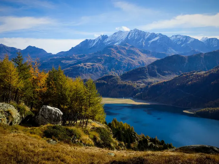 i
Image by Reto
i
Image by Reto The Via Engiadina is a long, high-level traverse of the Engadin, following SchweizMobil Route 87 from Maloja (Malögia) above Lake Sils to Vinadi near the Tyrol/Austria border. It suits fit hill walkers who want a full Alpine journey without committing to mountain-hut nights.
The route stays mostly on the sunny northern flank above the young River Inn, linking Romansh villages, larch and Swiss stone pine forest, alpine pastures and broad valley viewpoints. Stage ends are in settlements such as Silvaplana, Bever, Zuoz, Zernez, Guarda, Ardez, Scuol, Sent and Tschlin, so accommodation and public transport are never far from the line.
This is also one of Switzerland’s most practical long-distance walks to section-hike. The Rhaetian Railway runs along much of the valley from St. Moritz to Scuol-Tarasp, while PostBus services cover gaps including Maloja and Vinadi.
Do not underestimate it as a village-based route. The full walk is 160 km over 12 stages, with roughly 7,700–7,800 m of ascent, a high point of about 2,558 m near Corviglia and Lej Alv, and real snow risk outside the usual late-June to early-October season.
This guide covers stages, daily planning, accommodation, food, transport, terrain and the common mistakes to avoid.
Stage-by-Stage Guide
Stage 1: Maloja to Silvaplana — approx. 13 km
The opening stage leaves Maloja (Malögia), the official western start of SchweizMobil Route 87, and begins the high-level traverse above the Upper Engadine lakes. It is a good first day for settling into the character of the route: village-to-village walking, mountain-path waymarking and wide views from the sunny side of the valley.
The key landmark is Grevasalvas, the small stone hamlet above Lake Sils known as a filming location for the 1978 Heidi film. The stage then continues towards the Silvaplana area, with views over the Upper Engadine lake landscape.
Underfoot, expect a mix of mountain footpath, tracks and some paved stretches near settlements. The route is waymarked as Route 87, but carry a map or GPX because the Engadine uses Romansh place names and village approaches can be less obvious than the open hillside.
Maloja has PostBus access but no railway station. Silvaplana is a proper village stop for the night, with hotel and guesthouse options; book ahead in July and August. Carry food and water from the start unless current opening times for intermediate services have been checked.
Seasonal snow is less of an issue than on Stage 2, but the route is still Alpine walking. Early season snow patches, wet grass and changed waymarking after winter should be checked before travelling.
Stage 2: Silvaplana to Celerina (Marguns) — approx. 15 km
This is the highest and most committing stage of the Via Engiadina. The route climbs into the Corviglia area above St. Moritz and reaches the trail’s high point at about 2,558 m near Lej Alv, a deep-blue tarn with one of the best panoramas of the whole walk.
Views open over the Upper Engadine lakes and towards the glaciers of the Bernina group. It is the most obviously high-Alpine day on the full route, and the one where weather, snow and wind matter most.
Terrain can be steeper, rockier and looser than on the lower forest-and-meadow stages. There is no technical climbing, but this should be treated as a mountain day rather than a simple valley walk.
Accommodation is normally taken down in Celerina (Schlarigna) or nearby Samedan rather than in a mountain hut. Celerina and Samedan are on the Rhaetian Railway corridor, making this a practical place to stop, start or bail out if the weather turns. Current lift, rail and bus options should be checked before relying on them.
Do not count on finding food or water on the high section unless services have been checked in advance. Start with enough water, warm clothing and navigation backup, and avoid this stage when snow or poor visibility makes the high route unsafe.
Stage 3: Celerina (Marguns) to Bever — approx. 10 km
After the high point of Stage 2, this is a shorter linking stage through the Upper Engadine settlements. The route continues along the northern valley flank, with Celerina, Samedan and Bever forming the main practical points for accommodation and transport.
Expect easier pacing than the previous day, but not a completely flat valley stroll. The Via Engiadina repeatedly drops towards village level and climbs back onto the sunny side of the valley, so the day still involves mountain-path walking, forest tracks, gravel and some paved village approaches.
Samedan is an important valley settlement, and Bever is a quiet overnight stop with village-based accommodation. The Rhaetian Railway serves this part of the Engadine, so this stage is one of the easiest to shorten, skip or use as a section-walk day.
Food and water are best planned around the start and finish villages, with any intermediate refreshment checked locally. Navigation is generally straightforward on Route 87 waymarks, but pay attention through built-up areas where several paths and local routes may meet.
Stage 4: Bever to Zuoz — approx. 11 km
This stage continues east through the Upper Engadine towards Zuoz, one of the most attractive historic villages on the route. It is a moderate day by Via Engiadina standards, with the usual mix of high-path walking, forest, pasture and village access tracks.
Zuoz is the main highlight: its village square is widely regarded as one of the finest in the Upper Engadine, framed by traditional Engadine houses with funnel windows and sgraffito decoration. Arriving with time to explore the old centre is worthwhile.
The walking is not technically difficult, but the route remains a mountain path and can include rougher or wetter sections after poor weather. Expect some paved walking near villages and do not assume every minor track junction is obvious without a map or GPX.
Bever and Zuoz both sit on the Engadine public-transport corridor, with rail access at or near the stage points. Accommodation in Zuoz should be booked ahead in the main summer season, and current opening outside peak periods should be checked before travelling.
Carry lunch and sufficient water unless village services have been checked. This is a good stage for reassessing pace before the longer push to Zernez on Stage 5.
Stage 5: Zuoz to Zernez — approx. 19 km
This is one of the longer stages of the full Via Engiadina and needs an efficient start. The route leaves Zuoz and continues down-valley, passing near S-chanf before reaching Zernez, the gateway to the Swiss National Park.
The stage keeps the classic Route 87 character: sunny-side traversing above the Inn, with forest, alpine pasture, streams, gravel or forest tracks and stretches of natural mountain path. Because of the distance, small delays from rough ground, route junctions or poor weather can add up.
Zernez is a major practical stop on the route and a natural place for a rest, resupply or section break. It is associated with the Swiss National Park, founded in 1914 and Switzerland’s only national park, and the route gives views towards the Engadine Dolomites as it approaches this part of the valley.
Accommodation is village-based in Zernez, with hotels, inns and guesthouses rather than mountain huts. Rail access makes Zernez one of the most useful transport points on the whole traverse.
Carry food and enough water for a long day; do not depend on services between Zuoz and Zernez unless they have been checked. In unsettled weather, this is a stage where distance rather than technical difficulty is the main pressure.
Stage 6: Zernez to Lavin — approx. 14 km
From Zernez the route continues into the Lower Engadine feel of the walk, still on the sunny northern flank above the Inn. The stage is a mid-length day and a useful transition after the longer Zuoz–Zernez leg.
The scenery remains broad and open, with forest, pasture and views across the valley. The walking is varied rather than technical: expect natural footpath, tracks, gravel and some paved sections as the route leaves and enters villages.
Lavin is the overnight village for the standard stage. It has access to the Rhaetian Railway corridor, making it a practical point for section hikers or anyone needing to shorten the itinerary.
Plan food and water around Zernez and Lavin unless current services along the way have been checked. Accommodation in Lavin should be arranged in advance, especially in high summer and around the autumn larch season.
Navigation follows Route 87, but the usual mountain-route discipline still applies: check the day’s line before leaving, watch for local path junctions and verify any diversions before travelling.
Stage 7: Lavin to Guarda — approx. 13 km
This stage links Lavin with Guarda, one of the signature villages of the Via Engiadina. The walking is a manageable mid-length day, but it still follows the high-path pattern of climbs, traverses and descents rather than a flat valley-floor route.
Guarda is the clear highlight. It is one of the best-preserved Engadine villages, a Wakker Prize winner for heritage conservation, and known for its whitewashed sgraffito houses and connection with Schellen-Ursli.
The terrain is typical Lower Engadine high-path walking: forest, meadow, gravel tracks, mountain footpath and village lanes. After rain, shaded forest sections and steeper path segments can be slower, so avoid planning the day as if it were a simple 13 km lowland walk.
Lavin has rail access, while Guarda is at or near the valley’s public-transport network; check the current railway and PostBus arrangements for exact connections. Accommodation in Guarda is limited by village size, so book early and check seasonal opening.
Carry lunch and water from Lavin unless services have been checked. Route 87 waymarks are the main navigation aid, but take extra care on village exits and where local paths branch towards farms or neighbouring settlements.
Stage 8: Guarda to Ardez — approx. 14 km
The stage from Guarda to Ardez continues through one of the most culturally distinctive parts of the Lower Engadine. It is another village-to-village day on the sunny valley side, with historic settlements, sgraffito façades and wide views across the Inn valley.
Ardez is a compact Lower Engadine village below the ruined Steinsberg castle tower. It is known for painted sgraffito façades, including the well-known “Adam and Eve” house.
Walking conditions are mixed: natural mountain path, forest or pasture tracks, gravel and some paved sections through settlements. The route is not technically difficult, but the repeated undulations and occasional rougher ground mean sturdy footwear remains important.
Accommodation is available in and around the stage-end villages, but capacity in smaller Engadine settlements can be limited. Ardez is on or near the Rhaetian Railway corridor, which makes this a practical access point for a shorter Lower Engadine section.
Carry sufficient food and water unless opening times have been checked. Navigation is generally clear on Route 87, but do not rely solely on village names in English-language form: local signs may use Romansh or dual names.
Stage 9: Ardez to Ftan / Scuol — approx. 14 km
This stage brings the route towards the main tourism and transport hub of the Lower Engadine. The itinerary is commonly treated as Ardez to Ftan / Scuol, and walkers should check the current Route 87 line when booking accommodation because some itineraries split the Ardez–Scuol–Sent section differently.
Ftan sits above the valley, while Scuol (Schuls) is the major spa and service centre below, known for its mineral springs, old village quarter and fountains. Ending in Scuol gives the widest choice of accommodation and transport, while Ftan may suit walkers keeping higher on the flank.
Terrain remains varied, with hillside paths, pasture and forest sections, tracks and paved approaches into settlements. Expect more route choices and local paths near Ftan and Scuol than on quieter rural stages, so navigation needs attention despite the waymarking.
Scuol-Tarasp is the eastern end of the Rhaetian Railway valley line, making this one of the best places to start, finish, rest or re-plan the walk. Accommodation options are broader here than in the smaller villages, though Engadine prices still apply.
Food and water are easiest to organise at Ardez and Scuol. If staying in Ftan, confirm accommodation, evening meals and onward transport before travelling.
Stage 10: Ftan / Scuol to Sent — approx. 12 km
This shorter stage links the Scuol / Ftan area with Sent, a sunny Lower Engadine village on a terrace high above the Inn. It is a useful day after the busier Scuol section and gives time to explore Sent on arrival.
Sent is one of the character villages of the route, with grand sgraffito houses, distinctive “Sent gables” and wide valley views. The approach is part of the appeal, as the route returns to quieter hillside walking after the main service hub.
The terrain is a mix of mountain footpath, tracks, meadow and village lanes. Although the distance is modest, the route can still involve climb and descent between valley-side terraces, so allow more time than the kilometres alone suggest.
Public transport is strongest at Scuol; onward access to Sent is by the local bus network rather than the main railway. Current PostBus times should be checked before relying on a connection, especially outside peak season.
Carry water from the start and check food options at Sent when booking accommodation. Navigation can be slightly more complex around Scuol and Ftan because of local paths and settlement edges; follow current Route 87 signing and mapping rather than assuming the shortest line between villages.
Stage 11: Sent to Tschlin — approx. 17 km
Sent to Tschlin is a longer Lower Engadine stage and should be planned as a full walking day. The route continues east along the sunny side of the valley, with the Inn below and the Austrian border drawing closer beyond the Martina area.
The day is less about one single landmark and more about sustained high-path walking between remote-feeling Engadine villages. Sent’s terrace views set up the stage, while Tschlin provides a quiet overnight stop near the eastern end of the valley.
Expect the familiar combination of natural mountain path, forest and pasture tracks, gravel and paved sections through settlements. The length makes weather, heat on the sunny flank and water management more important than on the shorter stages.
Tschlin is a small village, so accommodation and evening meals should be booked ahead and seasonal opening checked. Public transport here is by bus connections rather than the Rhaetian Railway; current timetables should be checked before travelling.
Carry lunch and enough water for the whole stage unless services have been checked in advance. Navigation is normally by Route 87 waymarks, but this is not a stage to start late or under-prepared, as options become more limited towards the eastern end of the route.
Stage 12: Tschlin to Vinadi — approx. 11 km
The final stage descends the Via Engiadina towards its official eastern finish at Vinadi, a small hamlet on the River Inn near Martina and close to the Tyrol/Austria border. It is shorter than the previous day, but still needs normal mountain-walking preparation.
The character changes from village-to-village traverse to end-of-valley completion. The route finishes quietly above the Inn rather than in a large resort, so transport and timing matter more here than at Scuol or Zernez.
Terrain remains mixed, with footpath, tracks and some paved or road-edge sections possible near settlements and the valley floor. Take care on steeper or looser path sections, particularly in wet weather, and keep following the Route 87 signs all the way to the official endpoint rather than stopping short at Martina.
Vinadi has a PostBus stop on the Scuol / Martina–Samnaun line. Services should be checked before travelling, as missing the last practical connection can complicate the finish.
Do not rely on food or water at the finish unless current facilities have been checked. Book the previous night in Tschlin carefully, carry what is needed for the final day, and allow enough time to connect back towards Scuol or onward transport.
Recommended Itinerary
Standard 12-day itinerary
The cleanest way to walk the full Via Engiadina is to follow the 12 SchweizMobil Route 87 stages from Maloja to Vinadi. This keeps each day village-based, avoids mountain-hut logistics and makes good use of the Engadine’s rail and PostBus network for arrival, departure or bad-weather adjustments.
Stage distances are approximate. Check official mapping, current public transport and accommodation opening before booking, especially outside the main summer season.
| Day | From | To | Approx. distance | Why this stage makes sense | Services/accommodation notes |
|---|---|---|---|---|---|
| 1 | Maloja | Silvaplana | 13 km | A manageable first day from the official western start, with early Upper Engadine scenery and the hamlet of Grevasalvas above Lake Sils. | Maloja is reached by PostBus rather than railway. Silvaplana has village-based accommodation; book ahead in high season. |
| 2 | Silvaplana | Celerina (Marguns) | 15 km | This is the highest stage of the route, climbing into the Corviglia area above St. Moritz and passing the Lej Alv high point at about 2,558 m. | Treat this as a key weather-and-snow stage. Accommodation is available in the Celerina/Samedan area, with St. Moritz nearby but generally expensive. |
| 3 | Celerina (Marguns) | Bever | 10 km | A shorter recovery day after the high stage, continuing along the Upper Engadine flank without forcing a long mileage. | Bever and nearby valley settlements are on or near the Rhaetian Railway, making this a practical place to adjust plans. |
| 4 | Bever | Zuoz | 11 km | Another moderate stage, giving time to reach Zuoz without rushing through one of the Upper Engadine’s most attractive historic villages. | Zuoz has village accommodation; reserve in advance during July–August. |
| 5 | Zuoz | Zernez | 19 km | One of the longer standard days, taking the route down-valley towards the Swiss National Park gateway at Zernez. | Zernez is a useful resupply, accommodation and transport point, with Rhaetian Railway access. |
| 6 | Zernez | Lavin | 14 km | A solid Lower Engadine transition stage after Zernez, with the route continuing on the sunny side above the Inn. | Lavin has village accommodation; check seasonal opening before relying on a specific overnight stop. |
| 7 | Lavin | Guarda | 13 km | A sensible day into Guarda, one of the best-preserved Engadine villages, leaving time to enjoy the village rather than arriving late. | Guarda is a popular heritage village; accommodation should be booked ahead. |
| 8 | Guarda | Ardez | 14 km | Keeps the Lower Engadine stages balanced and links two of the route’s key historic villages. | Ardez has village-based accommodation below the Steinsberg castle tower; check availability early in the main season. |
| 9 | Ardez | Ftan / Scuol | 14 km | A practical stage into the Scuol area, with the exact overnight choice affecting the next day. | Some itineraries split this section differently via Ftan or Scuol. Decide the overnight stop before booking and check the current Route 87 mapping. Scuol is the main Lower Engadine service and rail hub. |
| 10 | Ftan / Scuol | Sent | 12 km | A moderate day from the Scuol area up to Sent, keeping the final Lower Engadine stages well spaced. | Sent has village accommodation on a terrace above the Inn. If staying in Scuol the previous night, check the exact start point and transport options before setting off. |
| 11 | Sent | Tschlin | 17 km | A longer penultimate stage across the lower valley, suitable once legs are adapted to the route’s repeated climbs and descents. | Tschlin is a smaller village overnight; check accommodation opening before committing to this stage. |
| 12 | Tschlin | Vinadi | 11 km | A shorter final day to the official eastern finish at Vinadi near Martina and the Tyrol/Austria border. | Vinadi has a PostBus stop on the Scuol/Martina–Samnaun line. Confirm the current timetable before finishing here, as onward travel depends on bus connections. |
Slower option: 13–15 days
A slower schedule suits walkers who want more time in the villages, prefer shorter mountain days, or are walking near the edge of the season when snow or weather may affect the higher sections. The simplest approach is to keep the 12 walking stages but add one or more rest or contingency nights.
The most useful extra nights are usually in transport hubs or larger service villages, such as the Celerina/Samedan/St. Moritz area, Zernez or Scuol. These places give better options for laundry, resupply, public transport and weather decisions than the smallest villages.
This slower version is also the better choice if accommodation availability forces a less direct booking pattern. The Rhaetian Railway and PostBus network make it realistic to sleep off-route or move by public transport, but the exact logistics should be checked before travelling.
Faster option: 9–11 days
A faster itinerary is possible for very fit, experienced hill walkers, but it is less forgiving. The route has roughly 7,700–7,800 m of cumulative ascent, and combining stages can turn moderate village-to-village days into long mountain days with repeated climbing and descending.
The most obvious stages to combine are the shorter Upper Engadine days around Celerina, Bever and Zuoz, or some of the moderate Lower Engadine stages between Lavin, Guarda, Ardez, Ftan/Scuol and Sent. Do this only after checking official mapping, ascent, accommodation and exit transport for the exact combination.
A faster schedule works best for walkers carrying light packs, booking flexible accommodation and staying within the main snow-free season. It is not the best choice for a first long Alpine trek or for anyone wanting time to explore the historic Engadine villages.
Planning the Route
The Via Engiadina is easiest to plan as a village-to-village traverse rather than a hut-to-hut mountain route. The official Route 87 itinerary uses 12 stages from Maloja to Vinadi, and those stage breaks generally make sense because they finish in Engadine settlements with accommodation and public transport rather than on remote passes or in mountain huts.
Most walkers should allow the full 12 days if completing the whole line. Trying to compress the route makes the cumulative ascent and repeated climbs back onto the valley flank more punishing, and removes the main advantage of this trail: reliable village nights and flexible transport at the end of many stages.
How many days to allow
A fit walker can follow the official 12-stage structure without needing to solve complicated accommodation logistics in the mountains. Daily distances are moderate on paper, but the route repeatedly drops towards village level and climbs back onto the sunny northern flank above the Inn, so ascent and underfoot conditions matter as much as kilometres.
A slower schedule is sensible if you want time in the main villages, especially Zuoz, Zernez, Guarda, Ardez, Scuol and Sent. Rest days are easiest to place where rail and services are strongest, particularly around St. Moritz/Celerina/Samedan, Zernez and Scuol.
A faster schedule is possible only for very strong walkers who are comfortable combining stages and accepting longer days with more ascent. This is usually less attractive on this route than on lower-level long-distance paths, because the value of the Via Engiadina lies in its high-level traverses, village stops and changing Engadine scenery rather than in covering distance quickly.
Stage planning and where to sleep
Accommodation is the key booking constraint. The standard route is village-based, with hotels, inns and guesthouses at or near the stage settlements; no mandatory mountain-hut nights are required on the normal line.
Book ahead in July and August, and be particularly careful around the St. Moritz area, where prices are high and availability can tighten. Outside the main summer season, some village accommodation may reduce opening days or close between seasons, so current opening should be checked before travelling.
The official stage pattern broadly follows these overnight points:
| Route section | Practical planning notes |
|---|---|
| Maloja to Silvaplana | Start logistics depend on reaching Maloja by PostBus, as there is no railway at Maloja itself. |
| Silvaplana to Celerina / Samedan area | Includes the high point above St. Moritz/Corviglia near Lej Alv; snow and weather matter most here. |
| Celerina / Samedan to Bever and Zuoz | Shorter village-to-village days make this part relatively flexible for pacing. |
| Zuoz to Zernez | A longer day in the official itinerary; plan food and timing rather than assuming frequent hillside services. |
| Zernez to Lavin, Guarda and Ardez | Good Lower Engadine section-hiking terrain, with rail access in the valley helping with bail-out or rest-day plans. |
| Ardez to Ftan / Scuol and Sent | Some itineraries split this area differently; keep accommodation and transport aligned with the exact version being walked. |
| Sent to Tschlin and Vinadi | The final stages are quieter and more committing in feel; the finish at Vinadi depends on PostBus connections. |
Some commercial and alternative itineraries stop at Scuol or split the Ardez–Sent section differently, often involving Ftan. For the full Via Engiadina described here, the official eastern finish is Vinadi, not Scuol.
Shortening the route
This is one of the easiest Alpine long-distance walks in Switzerland to shorten because the Engadine has excellent public transport. The Rhaetian Railway runs along the valley from St. Moritz down to Scuol-Tarasp, and PostBus services cover gaps including Maloja at the start and Vinadi at the finish.
Common shorter plans include walking only the Upper Engadine from Maloja towards Zernez, or choosing a Lower Engadine section between Zernez, Guarda, Ardez, Scuol, Sent and Tschlin. These options keep the high-path character without committing to the full 12-stage traverse.
Section hiking is very practical. Many stage starts and finishes are at or near rail or bus-served villages, so a walker based in one valley town can complete individual stages and return by public transport. Timetables should be checked before travelling, especially for early starts, late finishes and the Vinadi connection.
Direction of travel
The official Route 87 direction is Maloja to Vinadi, west to east, following the length of the Engadine from the Upper Engadine towards the Tyrol/Austria border. Planning in this direction keeps the route aligned with the signed itinerary and with most stage descriptions.
Walking the route in reverse is possible in practical terms, but it requires more care with stage notes, timing and accommodation. The main logistical issue is not navigation but ensuring that the quieter eastern end around Vinadi, Tschlin and Sent works with bus times and booked nights.
Food, water and daily supplies
Because the route returns to Engadine villages each evening, this is not an expedition-style food carry. Plan to buy evening meals and breakfast in villages, and carry lunch, snacks and enough water for the full walking day.
Do not rely on finding food on the high traverse sections between villages. Services may be limited, seasonal or off-route, and this should be checked before travelling if a café, shop or restaurant is needed for a specific day.
Water planning is still important despite the village-based format. The path crosses streams and passes settlements, but availability on the hillside should not be assumed; start each day with enough water for warm weather, exposed climbs and delays.
Navigation and maps
The Via Engiadina is SchweizMobil national hiking route No. 87 and is waymarked with the standard Swiss hiking and mountain-path signage. In normal summer conditions, navigation is straightforward for walkers used to Alpine paths.
A map or offline GPX track is still strongly recommended. The route uses a mix of mountain footpath, forest track, gravel, rocky ground and occasional paved sections, and a wrong turn can cost time where the path repeatedly crosses side slopes above the valley.
Check for temporary diversions before setting out, especially after storms, late snow or maintenance work. The official SchweizMobil route page is the best starting point for the current line of Route 87.
Weather, snow and season timing
Plan the Via Engiadina for summer or early autumn, roughly late June to early October. The route’s highest point is on Stage 2 above St. Moritz/Corviglia near Lej Alv at about 2,558 m, and snow can remain or return on higher ground outside the main season.
Late September and early October can be an excellent window for larch colour, but shorter days and colder mornings reduce the margin for slow starts. In early season, check snow conditions on the higher stages before committing to the full route.
Weather planning matters even though the route is village-based. A poor forecast can make high traverses uncomfortable or unsafe, especially on rockier, looser or more exposed mountain-path sections, so build enough flexibility into bookings to adjust if necessary.
Transport planning
Public transport is a major strength of this route and should be built into the plan from the start. Maloja is reached by PostBus rather than rail, while the finish at Vinadi is served by the PostBus line between the Scuol/Martina area and Samnaun.
For the middle of the route, the Rhaetian Railway gives useful access along the valley, including the St. Moritz to Scuol-Tarasp corridor. This makes it straightforward to leave the route, skip a stage in bad weather, take a rest day, or walk selected sections without carrying everything.
Check current Rhaetian Railway and PostBus timetables before booking fixed onward travel. This is especially important at the start, the final stage to Vinadi, and any plan that depends on a same-day connection out of the valley.
The main planning priorities
For most walkers, the order of importance is:
- Accommodation — book village nights early in peak summer, and check seasonal opening outside July and August.
- Weather and snow — the higher stages need genuinely summer conditions, especially around Corviglia and Lej Alv.
- Transport — use the Rhaetian Railway and PostBus network to build flexibility into the itinerary.
- Daily food and water — carry what is needed between villages; do not assume hillside services.
- Navigation — follow Route 87 waymarks, but carry an offline map or GPX and check diversions.
The route does not require mountain-refuge booking strategy, technical climbing plans or complicated resupply logistics. The practical challenge is coordinating a sustained 12-day Alpine walking schedule with village accommodation, public transport and safe conditions on the higher mountain-path sections.
Towns, Villages and Overnight Stops
The Via Engiadina is planned as a village-to-village route. Standard nights are in Engadine settlements rather than mountain huts, with hotels, inns and guesthouses forming the backbone of the itinerary.
Accommodation should be booked ahead in July and August, and also around the golden-larch period in late September and early October. The Upper Engadine, especially the St. Moritz area, is expensive by hiking-route standards; budget in CHF and check seasonal opening outside the main summer and autumn windows.
Public transport is one of the route’s main practical strengths. The Rhaetian Railway runs along the Engadine from St. Moritz down to Scuol-Tarasp, while PostBus services cover gaps including Maloja at the start and Vinadi at the finish. Timetables, last connections and any seasonal changes should be checked before travelling.
| Route point | Overnight role | Practical note |
|---|---|---|
| Maloja (Malögia) | Start-night option | Useful if arriving the evening before; reached by PostBus, with no railway at Maloja itself. |
| Silvaplana | Standard Stage 1 night | Good first night before the high Corviglia / Lej Alv stage. |
| Celerina (Schlarigna) / Samedan | Standard Stage 2 area | Use Celerina or nearby Samedan depending on accommodation and route logistics. |
| Bever | Standard Stage 3 night | Smaller village stop; book meals and lodging carefully. |
| Zuoz | Standard Stage 4 night | Attractive Upper Engadine base with accommodation in the standard itinerary. |
| Zernez | Standard Stage 5 night | Key mid-route stop and gateway to the Swiss National Park. |
| Lavin | Standard Stage 6 night | Smaller Lower Engadine overnight; check dinner arrangements. |
| Guarda | Standard Stage 7 night | Historic village stop; book early due to limited village capacity. |
| Ardez | Standard Stage 8 night | Compact Lower Engadine village with accommodation in the itinerary. |
| Ftan / Scuol | Standard Stage 9 area | Stage split varies between Ftan and Scuol; plan the exact night before booking. |
| Sent | Standard Stage 10 night | Sunny terrace village before the more remote eastern stages. |
| Tschlin | Standard Stage 11 night | Last standard overnight before Vinadi; do not leave booking late. |
| Vinadi | Finish point | Treat mainly as a transport finish unless specific accommodation is arranged. |
Maloja (Malögia)
Maloja is the official western start of SchweizMobil Route 87, at the head of the Upper Engadine by the Maloja Pass above Lake Sils. It is a sensible place to stay the night before starting, especially if arriving from elsewhere in Switzerland and wanting an unhurried first morning.
Accommodation is available in the village-based style of the route, but Maloja is not a railhead. Access is by PostBus, so the arrival timetable matters, particularly if checking in late or starting immediately after travelling.
For food and supplies, do not assume late opening. Confirm dinner at your accommodation and buy any first-day snacks before leaving a larger transport hub if timing is tight.
Grevasalvas
Grevasalvas is a small stone hamlet on Stage 1 above Lake Sils. It is one of the memorable early places on the route, with views over the Upper Engadine lakes and a strong sense of traditional mountain settlement.
Treat Grevasalvas primarily as a scenic waypoint, not as a standard overnight stop. If considering it for a non-standard night, accommodation and meal availability should be checked before travelling.
There is no need to plan major resupply here. Continue to Silvaplana for the standard first overnight logistics.
Sils im Engadin/Segl
Sils im Engadin/Segl sits near the Stage 1 line in the Upper Engadine, between Maloja and Silvaplana. It can be useful for walkers adjusting the first day, staying nearby before the route, or shortening the opening stage.
It is not listed as a standard stage end on the 12-day itinerary, so using it changes the rhythm of the first two days. Check the exact walking link back to Route 87 and the current bus connections before booking around Sils rather than Maloja or Silvaplana.
As with other Upper Engadine villages, expect prices to reflect the region. Accommodation, dinner and breakfast arrangements should be fixed in advance in the main season.
Silvaplana
Silvaplana is the standard end of Stage 1 and the start point for the demanding Stage 2 towards the Corviglia / Lej Alv high point. It is one of the more important early overnight stops because the following day reaches the highest part of the whole route.
Use Silvaplana to reset food, water and weather plans before committing to the higher traverse above St. Moritz. Snow patches, poor visibility or early-season conditions on Stage 2 can have a much bigger impact than on the lower forest and village stages.
Accommodation is available in the usual Engadine village pattern of hotels, inns and guesthouses. Transport is handled through the regional public-transport network rather than a railway station at Maloja-style convenience, so check the current PostBus and rail connections before relying on them.
St. Moritz (San Murezzan) / Corviglia
The route does not need a night in St. Moritz itself, but Stage 2 passes high above the town through the Corviglia area and near Lej Alv, the high point of the Via Engiadina at about 2,558 m. This is the main place where Upper Engadine resort infrastructure sits close to the walking line.
St. Moritz is useful as a logistics and transport reference point, with the Rhaetian Railway starting its Engadine valley run here towards Scuol-Tarasp. It is also the obvious place to use if an itinerary needs to be shortened, paused or restarted around Stage 2.
Accommodation and services around St. Moritz are expensive. If staying here instead of Silvaplana, Celerina or Samedan, book early and make sure the accommodation location fits the actual walking stage, not just the nearest famous place name.
Celerina (Schlarigna) / Marguns
Celerina, with the route stage described as Celerina / Marguns, is the standard end area for Stage 2. Because this follows the highest day on the route, it is a valuable overnight point rather than a place to rush through.
When booking, check exactly where the accommodation sits in relation to the stage finish and the next day’s start. Some walkers will use nearby Samedan instead, which can work well if accommodation availability or price is better.
The Rhaetian Railway runs through the Upper Engadine valley from St. Moritz, giving this area strong public-transport usefulness for joining, leaving or section-walking. Check the current local connection between your lodging, the railway and the marked route.
Samedan
Samedan is not the named end of the official Stage 2 in the same way as Celerina / Marguns, but it is included in the accommodation pattern for this part of the route. It is a practical alternative overnight base between the high Corviglia day and the shorter onward stage towards Bever.
Choose Samedan if it gives a better lodging fit than Celerina, but do not assume the walking distance is identical to the standard stage plan. Confirm how you will connect from the marked Route 87 line to your accommodation and back again the next morning.
Its position on the Engadine transport corridor makes it useful for section hikers. Current Rhaetian Railway and local bus times should be checked before building a tight itinerary around it.
Bever
Bever is the standard end of Stage 3 and start of Stage 4. It is a quieter overnight after the more developed Upper Engadine resort area, and it helps keep the official 12-stage rhythm manageable.
Accommodation is available, but this is the type of village where booking ahead matters. Confirm whether dinner is available at your lodging or whether another meal option is needed.
Bever is also useful for transport flexibility because many stage points in this part of the Engadine lie at or near the Rhaetian Railway corridor. Check the precise station or bus-stop access for your accommodation before using it as a start or exit point.
Zuoz
Zuoz is the standard Stage 4 overnight and one of the strongest village stops on the Upper Engadine half of the route. Its well-known village square and traditional Engadine houses make it a place worth arriving early enough to look around, not just a bed for the night.
For hikers, the main value is practical: it breaks the route before the longer Stage 5 towards Zernez. Use the evening here to sort food, weather and departure time, especially if the next day’s 19 km stage is being walked in unsettled conditions.
Hotels, inns and guesthouses form the overnight base. Book ahead in the main season and check meal times, as mountain-walking days can finish later than standard hotel dinner windows.
S-chanf
S-chanf lies near the route between Zuoz and Zernez. It is not one of the standard overnight stops in the 12-stage itinerary, but it can be relevant when adjusting the longer Upper Engadine stage.
Using S-chanf as a break point changes the official Zuoz–Zernez day, so it works best for section hikers or anyone deliberately slowing the itinerary. Accommodation, food and transport details should be checked before travelling.
Do not rely on S-chanf as an unplanned resupply or bailout without checking current public-transport times. The Engadine has excellent transport overall, but stage-by-stage timing still matters.
Zernez
Zernez is the standard end of Stage 5 and a key mid-route overnight. It is also the gateway to the Swiss National Park, and Route 87 skirts the park boundary with views towards the Engadine Dolomites.
This is one of the best places on the route to pause, reorganise or build in a rest night. It sits at the transition between the Upper Engadine and the Lower Engadine stages, so it is a natural point for walkers doing only Maloja–Zernez or starting a shorter eastern section.
Accommodation is available in the village-based pattern. Transport links on the Engadine valley corridor make Zernez useful for joining or leaving the route, but exact Rhaetian Railway and bus times should still be checked before booking onward travel.
Lavin
Lavin is the standard end of Stage 6, after the first stage east of Zernez. It is a smaller Lower Engadine overnight stop, so the main planning issue is certainty: book a room and know where dinner is coming from.
The village suits the character of the route well, with the walking day ending back in a historic valley settlement rather than at a hut. It is a good place to keep the itinerary steady before the route continues to Guarda.
Public transport in the Lower Engadine makes Lavin useful for section walkers, but do not plan a tight start or finish without checking the current Rhaetian Railway and bus timetable.
Guarda
Guarda is the standard end of Stage 7 and one of the most distinctive overnight villages on the Via Engiadina. It is known for whitewashed sgraffito houses, flower-filled lanes and its association with Schellen-Ursli.
It is a worthwhile stop in its own right, but it is also a small heritage village rather than a large service centre. Book accommodation early, especially in peak summer and during the autumn colour period, and confirm dinner arrangements.
Because Guarda sits as a village stop rather than a major hub, allow time for any connection between transport, lodging and the marked trail. This should be checked before travelling.
Ardez
Ardez is the standard Stage 8 overnight, a compact Lower Engadine village below the ruined Steinsberg castle tower. It is also known for painted sgraffito façades, including the well-known Adam and Eve house.
For walkers, Ardez is a practical stop before the route moves towards Ftan and Scuol. It keeps the Lower Engadine section in manageable daily stages and gives another village-based night without needing hut logistics.
Accommodation is available, but capacity should not be treated as unlimited. Reserve ahead and check food options, particularly outside the main season when some village services may be quieter.
Ftan
Ftan is important because the Ardez–Scuol part of the Via Engiadina is sometimes described or split via Ftan, while the official stage pattern can also be handled through Scuol. It is therefore a planning point as much as an overnight village.
If booking in Ftan, check that the chosen itinerary matches the version of the stage being walked. Do not assume that an Ardez–Ftan night and an Ardez–Scuol night create the same following day.
Ftan can be useful for walkers who prefer a village night above Scuol rather than dropping fully to the Lower Engadine hub. Transport and luggage logistics, if used, should be checked before travelling.
Scuol (Schuls)
Scuol is the main Lower Engadine hub on the route and the standard stage area between Ardez/Ftan and Sent. It is known for its mineral springs, old village quarter and fountains, but for hikers its bigger value is transport, services and accommodation choice.
The Rhaetian Railway runs to Scuol-Tarasp, making Scuol one of the easiest places to start, stop, resume or leave the Via Engiadina. This is especially useful because some walkers finish shorter itineraries here even though the official Route 87 continues to Vinadi.
Scuol is a strong place to resupply, wash kit, take a rest night or handle changes caused by weather or snow on higher sections. Accommodation should still be booked ahead in peak periods, and current rail and PostBus times should be checked before committing to onward travel.
Sent
Sent is the standard end of Stage 10, set on a sunny terrace high above the Inn. It is known for grand sgraffito houses and distinctive Sent gables, but the practical point is that it positions walkers for the more easterly stages towards Tschlin and Vinadi.
Accommodation is available in the route’s normal village-based style. As with the smaller Lower Engadine villages, confirm dinner and breakfast rather than assuming flexible opening hours.
Sent can also work as a start or finish for a shorter Lower Engadine section. Public transport connections should be checked before travelling, especially if relying on early or late services.
Tschlin
Tschlin is the standard final overnight before the official finish at Vinadi. It is an important booking point because there is no standard mountain-hut fallback and the next day ends at a hamlet rather than a major town.
Plan this night carefully. Confirm accommodation, evening meal, breakfast timing and any onward luggage or transport arrangements before setting out from Sent.
Tschlin also gives a clear decision point near the eastern end of the valley. If weather, fitness or transport plans change, check current local bus options rather than assuming it will be simple to improvise late in the day.
Martina
Martina lies near the eastern end of the route, close to the official finish at Vinadi and the Tyrol/Austria border area. It is not the official end of Route 87, but it matters for transport planning because the Vinadi PostBus stop is on the Scuol/Martina–Samnaun line.
Use Martina as a reference point when checking PostBus services from the finish. If planning to stay, eat or transfer here rather than continuing directly from Vinadi, current accommodation and bus details should be checked before travelling.
Do not confuse Martina with the official finish. The route continues to Vinadi.
Vinadi
Vinadi is the official eastern finish of the Via Engiadina, a hamlet on the River Inn near Martina and close to the Tyrol/Austria border. It is a quiet end point rather than a major service centre.
The key practical fact is transport: Vinadi has a PostBus stop on the Scuol/Martina–Samnaun line. Check the timetable before the final stage from Tschlin, as missing a connection here is more consequential than arriving late in a larger resort village.
Treat Vinadi mainly as the finish and exit point. If an overnight at or near the finish is desired, accommodation availability should be checked before travelling; otherwise plan to travel onward by bus after completing the route.
Getting to the Start
The official western start of Via Engiadina Route 87 is Maloja (Malögia), at the head of the Upper Engadine by the Maloja Pass above Lake Sils. Maloja has no railway station, so the final approach is normally by PostBus from the Upper Engadine.
By train
The practical rail approach is to travel by Rhaetian Railway (Rhätische Bahn) into the Engadine, then change to PostBus for Maloja. St. Moritz is the key Upper Engadine railhead for the start, with onward bus connections towards Maloja.
A common rail route into the valley is via Chur and the Rhaetian Railway’s Albula line to St. Moritz. From there, continue by PostBus to Maloja. Current rail and bus timings should be checked before travelling, especially if arriving late in the day or planning to start walking immediately.
The Rhaetian Railway also runs along the Engadine valley towards Scuol-Tarasp, which is useful if joining the route part-way along, but it does not serve Maloja itself.
By bus
Maloja is reached by PostBus. This is the essential final link for walkers arriving by public transport, as the railway stops further east in the Upper Engadine.
Allow enough connection time at St. Moritz or another Upper Engadine interchange, particularly with luggage and in poor weather. PostBus services in mountain valleys can vary by season and day of week; this should be checked before travelling.
For walkers not beginning at Maloja, PostBus and rail access make it possible to start at many later stage points, including villages such as Silvaplana, Celerina, Bever, Zuoz, Zernez, Lavin, Guarda, Ardez, Ftan, Scuol, Sent and Tschlin, depending on the section chosen.
By car
Maloja can be reached by road over the Maloja Pass. Driving may suit walkers staying locally before starting, but it is less convenient for the full route because Via Engiadina is a point-to-point walk ending at Vinadi near Martina, close to the Tyrol/Austria border.
If leaving a car in Maloja, plan the return from Vinadi carefully. The finish has a PostBus stop on the Scuol/Martina–Samnaun line, with onward access back into the Rhaetian Railway network via Scuol-Tarasp, but journey times and connections should be checked before travelling.
Long-stay parking arrangements at Maloja are not detailed here and should not be assumed. Ask accommodation providers or the local tourist office before committing to a car-based plan. This should be checked before travelling.
From the nearest airport
There is no airport at the start of the trail. If flying in, the practical plan is to continue by rail into Switzerland’s public transport network, reach Chur, take the Rhaetian Railway to St. Moritz, then use PostBus for the final leg to Maloja.
Exact airport choice, transfer time and same-day feasibility depend on flight arrival time and current train and bus timetables. This should be checked before travelling.
Where to stay before starting
The simplest option is to stay in Maloja the night before Stage 1, so the walk to Silvaplana can begin without a morning bus connection. Maloja has village-based accommodation rather than mountain-hut logistics.
Other workable bases are Upper Engadine settlements with public transport access, such as Sils im Engadin/Segl, Silvaplana or St. Moritz, then travelling to Maloja by PostBus for the start. St. Moritz and the surrounding Engadine are expensive, especially in the main summer season, so booking ahead is sensible.
Check seasonal opening dates outside July–August and around the late-September to early-October autumn window, as some village accommodation can be quieter outside the main season.
Getting Home from the Finish
Vinadi is a small hamlet at the eastern end of the Engadin, close to Martina and the Tyrol/Austria border. It is not a rail terminus, so the normal exit from the Via Engiadina is by PostBus first, then by Rhaetian Railway from the Lower Engadine.
Do not treat the final stage as finished until the onward connection has been checked. Vinadi is a quiet endpoint, and late-afternoon or evening bus options may be limited compared with the train service from the main valley stations.
By train
There is no railway station at Vinadi. The railhead for the finish is Scuol-Tarasp, the eastern end of the Rhaetian Railway line through the Engadin.
From Scuol-Tarasp, trains run back along the valley towards the main Engadine rail corridor, with onward connections towards St. Moritz and Chur. This is the most practical way to return towards the rest of Switzerland after completing the full Route 87 traverse.
The usual sequence is:
| Step | Connection |
|---|---|
| 1 | Finish walking at Vinadi |
| 2 | Take the PostBus from Vinadi towards Scuol-Tarasp |
| 3 | Continue by Rhaetian Railway from Scuol-Tarasp |
| 4 | Connect onwards towards St. Moritz, Chur or the wider Swiss rail network |
Train and bus times should be checked together, not separately. A well-timed bus can make the exit straightforward; a missed late connection may mean a long wait or an unplanned overnight stay.
By bus
Vinadi has a PostBus stop on the Scuol/Martina–Samnaun line. This is the key public-transport link at the finish and the normal way to leave the trail without arranging a private transfer.
Use the PostBus to reach Scuol-Tarasp for the railway, or to connect with other local Lower Engadine services where relevant. Timetables are seasonal and time-dependent, so this should be checked before travelling, especially if finishing on a Sunday, public holiday or late in the day.
If the final stage from Tschlin to Vinadi is likely to take longer than planned, build in a safety margin. The route finishes in a hamlet rather than a large resort, so it is unwise to rely on finding multiple late onward options on arrival.
By car/taxi
Vinadi is reachable by road, but the Via Engiadina is a point-to-point walk and leaving a car at the finish creates a long retrieval problem unless the whole trip has been planned around public transport.
Most walkers are better served by using the Rhaetian Railway and PostBus network rather than driving to both ends. If a car has been left elsewhere in the Engadin, the practical approach is usually to take the PostBus to Scuol-Tarasp and continue by train and bus back to the chosen valley station or village.
Taxi availability in Vinadi itself should not be assumed. If a private transfer is needed, arrange it in advance from a larger Lower Engadine base such as Scuol, and confirm the pick-up point, price and timing before starting the final stage.
From the nearest airport
There is no airport at the finish. For flights after the hike, plan the journey from Vinadi by PostBus to Scuol-Tarasp, then by Rhaetian Railway and onward Swiss rail connections to the chosen airport.
The best airport depends on the onward country and flight plans, and the full rail-and-bus journey from the Lower Engadine can be long. Airport-specific routings and journey times should be checked before booking flights, and a same-day international departure after walking into Vinadi is only sensible with a generous time buffer.
Where to stay at the finish
Vinadi is a quiet hamlet, so do not assume there will be suitable accommodation or services at the trail end. The more practical overnight bases are the established Lower Engadine villages on or near the final stages, especially Tschlin before the last day, or Scuol after leaving the finish by bus.
If the final day is being used as a travel day, book accommodation or onward transport around the PostBus timetable from Vinadi. In July–August and around the autumn walking season, accommodation in the Engadin should be booked ahead; outside the main season, village services and hotel opening dates should also be checked before travelling.
Which Direction Should You Walk?
Standard direction: Maloja to Vinadi
The standard and official direction for SchweizMobil Route 87 is Maloja (Malögia) to Vinadi. This is the direction used by the 12-stage itinerary, starting at the head of the Upper Engadine near the Maloja Pass and following the valley eastwards through the Upper and Lower Engadine to the Tyrol/Austria border.
This direction gives the route a clear geographical logic: Upper Engadine lakes and Bernina views first, then the historic villages around Zuoz, Zernez, Guarda, Ardez, Scuol and Sent, before the quieter eastern end at Tschlin and Vinadi. It feels like a full down-valley traverse rather than a collection of linked day walks.
It is also the easier direction in terms of cumulative effort. The full official traverse has roughly 7,700–7,800 m of ascent, while published ascent/descent figures indicate more total descent than ascent when walked west to east. In reverse, that balance is flipped, so expect more climbing overall.
The main drawback is that the route’s high point, around 2,558 m near Corviglia and Lej Alv above St. Moritz, comes very early on Stage 2. In early season, or after fresh snow, this section deserves particular attention before committing to the full itinerary.
Reverse direction: Vinadi to Maloja
Walking east to west is entirely possible as a route concept, but it is not the standard way to follow the Via Engiadina. It starts with the quiet, remote-feeling Lower Engadine end near Vinadi and builds towards Scuol, Zernez, the Upper Engadine villages and finally Maloja.
The main appeal of the reverse direction is psychological and scenic: the high Upper Engadine, the lakes around Sils and Silvaplana, and the St. Moritz/Corviglia area come late in the walk rather than at the beginning. If the aim is to finish among the bigger mountain and lake scenery of the Upper Engadine, reverse direction can be attractive.
The trade-off is practical. Starting at Vinadi means beginning from a hamlet served by PostBus on the Scuol/Martina–Samnaun line, so the first day depends on bus timing before the walk has properly begun. This should be checked before travelling. In the official direction, the more awkward bus leg from Vinadi comes at the end, when missing a connection is usually less disruptive than missing the start of a booked itinerary.
Reverse direction also places the highest section near the end and increases the total ascent. That may suit strong walkers who want to build into the route, but it is not the easier physical option.
Transport and accommodation considerations
Both directions benefit from the Engadine’s excellent public transport. The Rhaetian Railway runs along the valley from St. Moritz to Scuol-Tarasp, and PostBus services fill the gaps, including Maloja and Vinadi. This makes either direction workable, and it is straightforward to break the route at many stage points.
Accommodation flow is simplest in the official direction because the standard stage sequence runs Maloja, Silvaplana, Celerina/Samedan, Bever, Zuoz, Zernez, Lavin, Guarda, Ardez, Ftan/Scuol, Sent, Tschlin and Vinadi. In reverse, the same village-based pattern can be used, but bookings and daily logistics need to be read backwards from the official itinerary.
There is no strong direction-based weather advantage to rely on. Snow on the higher stages, afternoon storms and seasonal hotel opening matter far more than whether the walk is taken west–east or east–west.
Recommendation
For most walkers, the best choice is the official west-to-east direction: Maloja to Vinadi. It follows the recognised Route 87 itinerary, has the more natural down-valley progression, involves less cumulative climbing than the reverse, and makes the quiet border-side finish at Vinadi feel like a proper end point.
Choose the reverse only if there is a specific reason: better personal transport connections, a desire to save the Upper Engadine scenery for the finish, or a preference to delay the Corviglia/Lej Alv high point until later in the walk. Otherwise, plan the Via Engiadina from Maloja to Vinadi.
Accommodation Along the Route
The Via Engiadina is well suited to inn-to-inn walking. The standard Route 87 itinerary is village-based throughout, with nights in Engadine settlements rather than mountain huts, so there is no need to carry hut gear or plan isolated refuge nights.
Accommodation is usually in hotels, inns, Gasthöfe and guesthouses. The main planning issue is not remoteness, but availability and cost: the Engadine is expensive by Alpine walking standards, and prices are particularly high around St. Moritz, Celerina and the Upper Engadine resort villages.
Booking ahead is strongly recommended in July and August, and also for popular autumn weekends when the larches turn colour. Outside the main summer and early autumn season, some smaller village hotels and guesthouses may close or reduce opening days, so every overnight should be checked before travelling.
Where to stay
Most walkers follow the official stage-end pattern: Maloja, Silvaplana, Celerina or Samedan, Bever, Zuoz, Zernez, Lavin, Guarda, Ardez, Ftan or Scuol, Sent and Tschlin. These stops keep the walk village-to-village and avoid awkward transfers.
The strongest accommodation choice is in the larger tourism and transport centres: the St. Moritz/Celerina/Samedan area, Zernez and Scuol. Smaller heritage villages such as Guarda, Ardez, Sent and Tschlin are more atmospheric, but choice can be limited and rooms should not be left to chance in peak season.
If a preferred small village is full, the Rhaetian Railway and PostBus network make it realistic to sleep in a nearby valley base and return to the route the next morning. This is especially useful around the Upper Engadine and between Zernez, Lavin, Guarda, Ardez and Scuol, where public transport access is one of the route’s major advantages.
| Place | Accommodation level | Best for | Notes |
|---|---|---|---|
| Maloja (Malögia) | Good | Starting the full route | Official western start. Reached by PostBus rather than railway, so arrive the day before if making an early start. |
| Silvaplana | Good | Stage 1 overnight | A practical first night with Upper Engadine services. Expect resort-area pricing. |
| Celerina (Schlarigna) / Samedan | Good | Stage 2 or 3 logistics | Useful accommodation area after the high Corviglia/Lej Alv stage. Samedan and Celerina give strong transport options; St. Moritz is nearby but generally expensive. |
| Bever | Limited to moderate | Quieter village night | A smaller Engadine stop. Book ahead rather than assuming walk-in availability. |
| Zuoz | Good | Historic Upper Engadine village stay | One of the more rewarding overnight villages on the route, with traditional Engadine architecture and services. |
| Zernez | Good | Mid-route reset and transport hub | Strong practical stop before the Lower Engadine stages, with rail access and services. Also useful for rest-day planning. |
| Lavin | Limited to moderate | Quiet Lower Engadine overnight | Smaller than Zernez or Scuol. Check seasonal opening before relying on a specific guesthouse or inn. |
| Guarda | Limited | Characterful village stay | A highlight village, but accommodation choice is not large. Book early in high season and autumn colour weekends. |
| Ardez | Limited to moderate | Lower Engadine heritage village | Good for keeping to the official stage rhythm, but availability can be tighter than in Scuol. |
| Ftan / Scuol | Good in Scuol; more limited in Ftan | Flexible stage split and services | Scuol is the main Lower Engadine hub and usually the safest choice where flexibility, transport and services matter. Ftan can work for a quieter overnight if accommodation is available. |
| Sent | Limited to moderate | Scenic terrace-village overnight | A logical stop before the longer Sent–Tschlin stage. Book ahead, especially at weekends. |
| Tschlin | Limited | Final night before Vinadi | Small village near the eastern end of the route. Secure accommodation before committing to this stage split. |
| Vinadi | None / not normally used as an overnight base | Route finish | The official finish is a hamlet by the Inn with a PostBus stop. Plan to continue by PostBus after finishing unless current local accommodation has been checked before travelling. |
Booking strategy
For a full 12-day traverse, book the smaller villages first: Guarda, Sent, Tschlin, Lavin and Bever are the places most likely to shape the itinerary. Once those nights are secured, fill in the larger bases such as Zernez, Scuol and the St. Moritz/Celerina/Samedan area.
Half-board can be useful in smaller villages where evening dining options may be limited or seasonal. If not booking half-board, check whether the accommodation serves dinner or whether there is a nearby restaurant open on the relevant night.
Do not assume late check-in will be possible in small guesthouses. Mountain stages, afternoon storms and transport delays can all affect arrival time, so give realistic arrival estimates when booking.
Luggage transfer, taxis and using public transport
The route works well for walkers carrying their own overnight kit because every standard night is in a village. There are no mandatory hut approaches, and the repeated rail and PostBus access reduces the risk of being trapped by a single full accommodation stop.
Luggage transfer may be possible through hotels, local services or walking-holiday operators, but arrangements vary by village and season. This should be checked before travelling, and bags should not be sent to a small guesthouse unless the property has agreed to receive them.
Taxis can help if a small village is full or if a walker needs to sleep off-route, but public transport will often be the simpler solution. The Rhaetian Railway serves the Engadine valley as far as Scuol-Tarasp, while PostBus services cover gaps including Maloja at the start and Vinadi at the finish.
For section-hikers, this transport network makes accommodation planning much easier: stay in a larger base such as the St. Moritz/Celerina/Samedan area, Zernez or Scuol, then use train or bus to reach individual stages. Current rail and PostBus timetables should be checked before booking accommodation around a fixed walking plan.
Camping and Wild Camping
The Via Engiadina is primarily a village-to-village route, not a hut or camping trek. The standard 12-stage itinerary finishes in Engadine settlements such as Silvaplana, Celerina/Samedan, Bever, Zuoz, Zernez, Lavin, Guarda, Ardez, Scuol, Sent and Tschlin, where the expected overnight pattern is hotels, inns and guesthouses.
Camping can still work for some walkers, but it needs more planning than simply carrying a tent. Do not assume that every stage village has a campsite, or that any campsite will be close to the Route 87 line. This should be checked before travelling, especially outside July and August when some valley services quieten down.
Does the route suit camping?
Camping is not the most natural fit for the full Via Engiadina. The route repeatedly climbs above the valley villages and then drops back to settlements, so a camping itinerary may require extra descent, road walking or public-transport links to reach legal overnight places.
The added weight of tent, mat, stove and food is also significant on a 160 km mountain route with roughly 7,700–7,800 m of ascent. Fit walkers who are used to carrying a camping load may manage it, but most hikers will find the trail more efficient with village accommodation.
The best camping-based approach is usually selective rather than purist: use official campsites where they fit, and combine them with guesthouses where they do not. The Rhaetian Railway and PostBus network makes this easier, because many stage points can be reached or left by public transport.
Campsites and practical planning
No campsite should be treated as guaranteed without checking its current opening dates, booking requirements and exact location. The Engadine is busy in high summer, and the St. Moritz / Upper Engadine area is particularly expensive and heavily booked.
When planning a camping itinerary, check each intended overnight against:
| Planning point | Why it matters on the Via Engiadina |
|---|---|
| Distance from Route 87 | A campsite in the valley may add a descent and re-ascent from the high path. |
| Public transport access | Trains and PostBus services can bridge awkward gaps where camping is not available at the stage end. |
| Seasonal opening | Some accommodation and valley services reduce opening outside the main summer period. |
| Food supply | Smaller villages may not offer the same resupply options as larger places such as Zernez or Scuol. This should be checked before travelling. |
| Weather backup | Snow, storms or cold nights can affect higher sections, especially outside the late-June to early-October walking season. |
Wild camping
Do not plan the Via Engiadina as a wild-camping traverse unless the local rules for each night have been checked in advance. Wild camping rules in Switzerland are local and can depend on the commune, land ownership, altitude, protected-area status and current fire or conservation restrictions.
The route crosses alpine pastures, forest and village land on the north side of the Inn. Much of this is working landscape rather than empty wilderness, so permission and local restrictions matter. Pitching close to villages, farms, grazing animals, waymarked paths or water sources is poor practice and may not be allowed.
Particular caution is needed around Zernez and the Swiss National Park area. The Via Engiadina skirts the park boundary, and protected areas have stricter conservation rules than ordinary mountain terrain. Camping, bivouacking, fires and leaving marked paths may be restricted or prohibited; this should be checked locally before relying on any overnight plan.
Water, cooking and fires
The route passes villages regularly and crosses alpine streams, but natural water should not be assumed safe to drink untreated. The safest plan is to fill up in settlements and carry enough for the higher traverses; if using stream water, treat or filter it.
Open fires are not a sensible default on this route. Forest, alpine meadow, dry summer conditions and local fire bans can all make fires inappropriate or illegal. Use a stove only where permitted, and check current local restrictions before cooking outside an official campsite.
Leave No Trace essentials
If camping is used anywhere on or near the Via Engiadina, keep the impact minimal:
- Use official campsites wherever possible.
- Camp only where it is clearly permitted, or with landowner/local permission.
- Arrive late, leave early and avoid visible or sensitive locations.
- Never camp inside protected areas unless the local rules explicitly allow it.
- Keep well away from livestock, huts, farms, villages and watercourses.
- Pack out all rubbish, including food scraps and sanitary waste.
- Do not light fires unless they are clearly permitted and safe.
- Leave alpine meadows, forest floors and pasture gates exactly as found.
For most walkers, the simplest and lowest-risk plan is to treat camping as an occasional cost-saving option, not the backbone of the whole traverse. The Via Engiadina is best supported by its villages and transport links, and any camping itinerary should be built around legal, open, confirmed overnight places.
Food, Water and Resupply
The Via Engiadina is a village-to-village walk, so food planning is easier than on a hut-to-hut Alpine route. You sleep in settlements each night, and the Rhaetian Railway/PostBus network makes it straightforward to leave the route for supplies if needed.
Do not, however, treat every stage as a café walk. Much of Route 87 traverses the sunny mountain flank above the Inn, with long stretches through forest, pasture and higher ground where there may be no dependable food stop between the stage villages.
Food strategy
Plan to buy or arrange lunch before setting off each morning. Hotels, inns and guesthouses may be able to provide a packed lunch, but this should be checked when booking or on arrival.
The larger valley centres are the safest places to resupply properly. St. Moritz, Samedan, Zernez and Scuol are the key practical hubs along or near the route; smaller villages such as Bever, Guarda, Ardez, Sent and Tschlin should be treated as places where accommodation and meals may be available, but where shop opening hours can be limited or seasonal.
Sunday trading, lunch breaks, public holidays and seasonal closures matter in the Engadine, especially outside July–August. Buy the next day’s trail food the evening before where possible, and do not rely on finding an open shop early in the morning in a small village.
For a normal stage, carry:
- lunch for the day;
- high-energy snacks for the climbs and higher traverses;
- a small reserve meal or extra snack in case a village shop or restaurant is closed;
- more food than usual on the longer or more committing stages, especially Zuoz–Zernez and Sent–Tschlin.
Prices in the Engadine are high by hiking-route standards, particularly around St. Moritz. Self-catering from village shops where available will usually be cheaper than relying entirely on restaurants, but availability should be checked locally.
Water
Start each day with full bottles from your accommodation. Most stages pass villages at the beginning and end, but the route often spends hours above the valley, so water should be treated as a hillwalking essential rather than something to pick up casually.
A sensible starting load for most walkers is around 1.5–2 litres per day stage, with more in hot weather, on the higher Stage 2 over the Corviglia/Lej Alv area, and on longer days such as Zuoz–Zernez or Sent–Tschlin. The sunny north-facing flank of the Engadine can feel exposed in clear summer weather.
The route crosses alpine pastures and passes clear streams, but natural water should not automatically be considered safe. Livestock, settlements and side valleys can all affect water quality, so use a filter, purification tablets or another treatment method if taking water from streams.
Village fountains are common in Swiss mountain settlements, and Scuol is known for its mineral springs and fountains, but individual fountains are not always drinking water. Look for local signage; if there is any doubt, fill from accommodation, cafés or shops instead.
Food and water by section
| Section | Food availability | Water availability | Notes |
|---|---|---|---|
| Maloja – Silvaplana | Food at the start and finish; possible limited options in small settlements such as Grevasalvas should not be relied on. | Fill in Maloja before starting; refill at the finish in Silvaplana. Natural water should be treated if used. | Carry lunch from Maloja. This is the first stage, so do not assume the route immediately provides services. |
| Silvaplana – Celerina / Marguns | Food at Silvaplana and Celerina/Samedan area; St. Moritz lies below the high Corviglia section, but the high route itself should be planned as self-sufficient. | Start full from Silvaplana. Carry enough for the climb and high ground around Corviglia/Lej Alv. | This is the highest stage of the route, reaching about 2,558 m. Weather and snow conditions can make stops less comfortable outside high summer. |
| Celerina / Marguns – Bever | Food is easiest around Celerina/Samedan and at Bever accommodation. | Fill before leaving; refill at Bever. | A shorter stage, but still carry snacks and water rather than depending on an intermediate stop. |
| Bever – Zuoz | Food at the stage villages; Zuoz is a good overnight resupply point if services are open. | Fill in Bever and again in Zuoz. Treat natural water if used. | Check village opening hours, particularly outside the main summer season. |
| Zuoz – Zernez | Food at Zuoz and Zernez; do not rely on a mid-stage food stop. | Start with full bottles from Zuoz. Carry extra water in hot weather. | One of the longer stages at about 19 km. Carry a full lunch and reserve snacks. |
| Zernez – Lavin | Zernez is a practical resupply point; Lavin is a smaller overnight village where opening hours may be limited. | Fill in Zernez; refill at Lavin. | Zernez is the gateway to the Swiss National Park area, so it is a sensible place to sort food before continuing into the Lower Engadine. |
| Lavin – Guarda | Food at the start and finish only should be assumed. | Fill in Lavin. Refill in Guarda where available. | Guarda is a small heritage village; book meals/accommodation ahead and check what is open. |
| Guarda – Ardez | Food in Guarda and Ardez, subject to village opening hours. | Fill before leaving Guarda; refill in Ardez. | Carry lunch. Small Lower Engadine villages can be quiet outside peak season. |
| Ardez – Ftan / Scuol | Food at Ardez, Ftan and especially Scuol, which is the main Lower Engadine hub. | Fill in Ardez; Scuol is a reliable place to reset water and supplies. | This is a good section to restock properly before the final stages towards Sent, Tschlin and Vinadi. |
| Ftan / Scuol – Sent | Scuol offers the best resupply on this part of the route; Sent should be treated as an overnight meal/accommodation stop rather than a guaranteed shopping point. | Fill in Scuol or Ftan before climbing/continuing; refill in Sent. | Buy food for the following day before leaving Scuol if possible. |
| Sent – Tschlin | Food at Sent and Tschlin only should be assumed. | Start with full bottles. Carry extra water in warm weather. | At about 17 km, this is a longer late-route stage. Carry lunch and spare snacks. |
| Tschlin – Vinadi | Food in Tschlin before departure; Vinadi is the finish hamlet and should not be treated as a resupply base. | Fill in Tschlin. Carry enough to finish the route comfortably. | Arrange onward transport and food plans in advance; Vinadi has PostBus access but limited village services should be expected. |
Terrain, Conditions and Difficulty in Practice
The Via Engiadina is not a technical Alpine route, but it is a demanding long-distance mountain walk. The practical difficulty comes from repeated daily climbing and descending, a total ascent of roughly 7,700–7,800 m, and long sections of natural mountain path above the Inn valley rather than from scrambling or climbing.
Most walkers with good hill fitness and sure-footedness should find the walking straightforward in settled summer weather. The same route becomes much more serious with lingering snow, wet rock, poor visibility or fatigue over consecutive days.
Underfoot: what the walking is actually like
Expect a varied mix of Swiss mountain footpaths, forest tracks, gravel tracks, short paved sections and village approaches. The route follows the sunny northern flank of the Engadine, so much of the walking is on traversing paths through Swiss stone pine and larch forest, alpine pasture and open slopes above the River Inn.
The higher stages include rockier, looser and steeper ground. These sections are still hiking terrain, not technical climbing terrain, but they require care with foot placement, especially on descents or after rain.
Paved walking is part of the route where it enters and leaves villages such as Silvaplana, Bever, Zuoz, Zernez, Guarda, Ardez, Scuol, Sent and Tschlin. It is not primarily a road walk, but the village-to-village nature of the itinerary means there are inevitably some hard-surface links and settlement sections.
Climbs, descents and accumulated effort
The route repeatedly drops towards village level and climbs back onto the valley flank. This pattern is what makes the Via Engiadina feel harder than the moderate daily distances might suggest.
Stage 2, from Silvaplana towards Celerina/Marguns, is the highest stage, reaching about 2,558 m in the Corviglia / Lej Alv area above St. Moritz. This is the only stage that rises much above 2,500 m, but it is a clear mountain day and should be treated as such.
The longer days also matter. Zuoz to Zernez is approximately 19 km, and Sent to Tschlin is approximately 17 km; on a multi-day traverse these stages can feel substantial when combined with ascent, descent and a pack.
Technicality and exposure
There is no mandatory scrambling, climbing or via ferrata-style terrain on the standard Route 87 line. The route is waymarked as a Swiss hiking/mountain-path route with the standard yellow and white-red-white signage.
That does not make it a lowland trail. On mountain paths, steep grass, loose gravel, rocky steps and narrow traversing sections can still be consequential in bad weather or when snow remains. Good footwear and confident movement on uneven ground are important.
Mud, water and loose ground
The Via Engiadina is not known as a boggy route, and the sunny valley flank helps many paths dry quickly in normal summer conditions. However, forest paths, pasture sections and streamside crossings can be wet or slippery after rain.
Loose gravel and small stones are a more relevant issue than deep mud, particularly on steeper higher sections and descents. Poles are useful for many walkers because the route involves repeated descent as well as ascent.
Snow and seasonal conditions
The normal walking season is roughly late June to early October, when the higher sections are usually clear of snow. Outside this window, snow can make the higher stages substantially harder or unsuitable for ordinary hiking equipment.
Stage 2 is the key weather-and-snow stage because it reaches the Corviglia / Lej Alv high point above St. Moritz. Snow conditions on higher sections should be checked before travelling, especially in early summer, after autumn snowfall, or following a cold spell.
Late September and early October can bring excellent walking conditions and larch colour, but days are shorter and fresh snow is more likely than in mid-summer. July and August give the most reliable high-route window, though afternoon storms and heat on exposed sunny slopes can still affect pacing.
Livestock and pasture sections
The route crosses alpine pasture as well as forest and village terrain. Where livestock is present, stay on the marked path, give animals space, close any gates if encountered, and avoid cutting corners across grazing land.
Dogs, if taken, should be managed carefully around livestock and through villages. Local restrictions or seasonal requirements should be checked before travelling.
What makes the Via Engiadina easier
The logistics reduce the objective commitment compared with more remote hut-to-hut routes. Most stage ends are Engadine villages, and the Rhaetian Railway and PostBus network makes it possible to shorten, skip or leave sections if weather, injury or fatigue becomes an issue.
Waymarking is another advantage. Route 87 is a national SchweizMobil route, so navigation is generally simpler than on an improvised high-level traverse, though a map or offline GPX is still sensible in mist or at junctions.
Village-based nights also help recovery. You are not carrying hut sleeping gear or several days of food, so pack weight can be kept moderate if accommodation is booked ahead.
What makes it harder in practice
The main challenge is consistency: 12 consecutive mountain days, approximately 160 km, and a large cumulative height gain. Even fit walkers can find the later Lower Engadine stages harder if early days have been walked too fast.
The route’s repeated rise-and-fall profile also means that a short stage is not automatically an easy stage. Daily ascent, surface, heat, and the final descent into a village can matter as much as distance.
Weather can change the character quickly. In dry, clear summer conditions the Via Engiadina is a well-waymarked Alpine high path; in rain, low cloud or snow it demands more careful navigation, slower movement and a willingness to use the valley transport network rather than force a stage.
Weather and Best Time to Walk
Best season
The normal walking season for the Via Engiadina is late June to early October, when the higher sections are usually clear enough for mountain walking. The safest planning window is July to September, especially for walkers completing the full 12-stage route without wanting to build in snow-related alternatives.
The route’s key weather constraint is altitude. Stage 2 above St. Moritz/Corviglia reaches about 2,558 m near Lej Alv, and although most of the trail stays lower on forest, pasture and village-level paths, snow can still affect exposed or higher ground outside the main summer season.
Late September and early October can be excellent, especially for the larch colour, but conditions are less forgiving: shorter days, colder mornings and a higher chance of early snow on the upper sections. Anyone planning the full route at the end of the season should keep the itinerary flexible and check current trail and snow conditions before travelling.
Month-by-month planning guide
| Period | What to expect | Practical verdict |
|---|---|---|
| Before late June | Snow may remain on higher paths, especially around the Corviglia/Lej Alv high point and other shaded or elevated sections. Some villages and hotels may also still be quiet outside the main season. | Usually too early for the full route unless conditions are specifically favourable. This should be checked before travelling. |
| Late June | Start of the usual walking season. Higher sections may be clear, but lingering snow is still possible after a heavy winter. | Viable in good conditions, but do not assume every high path is summer-clear. |
| July–August | Main summer season, with the best chance of snow-free paths and the widest accommodation availability. The Engadine is busy and expensive, particularly around St. Moritz. | Best all-round window for a full traverse; book accommodation ahead. |
| September | Often a strong month for this route: cooler walking conditions, generally more settled autumn days, and less peak-season pressure than August. | One of the best choices for fit walkers, provided shorter daylight is accounted for. |
| Late September–early October | Prime larch-colour period, but mornings can be cold and early snow becomes a real risk on high ground. Some seasonal accommodation may begin to close or reduce availability. | Excellent if conditions hold; build in flexibility and check openings before booking. |
| After early October | Snow, ice, cold and short daylight increasingly affect planning. Village services may be reduced outside the main season. | Not a sensible default period for the full long-distance walk. |
Heat, storms and exposure
The Via Engiadina runs on the sunny side of the valley, so summer days can feel hot on open pastures, forest edges and south-facing traverses even in the mountains. Carry enough water between villages and start longer stages early in settled high-summer weather.
Afternoon thunderstorms are a standard Alpine risk in summer. This matters most on the higher, more exposed stages and on any section with rockier or looser ground, where wet surfaces can quickly become slower and less secure. Check the mountain forecast each evening and again in the morning, and be prepared to shorten a stage using the Engadine’s rail and PostBus links if storms are expected.
Wind and rapid changes in visibility should also be treated seriously. The route is well waymarked, but fog or low cloud can make navigation slower on open high-level sections, especially around the Corviglia area and other pasture or meadow terrain above the valley.
Snow and winter walking
The full Via Engiadina is not a realistic winter hiking route in its standard form. It is a long mountain-path traverse with a high point above 2,500 m and a known snow risk outside high summer. Winter conditions would change the route from a waymarked hiking itinerary into a snow-covered mountain journey requiring different skills, equipment and risk assessment.
Early-season snow patches can also linger into late June, while fresh snow can arrive again in autumn. The critical point is not only whether the villages are accessible, but whether the higher connecting paths are safe and passable on foot. Current snow and trail conditions should be checked before travelling.
Trail surface by season
In dry summer weather the route is a mix of mountain footpath, forest track, gravel, rocky sections and some paved stretches. After rain, the steeper, rockier or looser parts can become slower, and forest paths may be muddy or slippery.
In early summer, snowmelt can leave paths wet and soft in places. In autumn, frost or early snow can make shaded sections icy in the morning, particularly where the path sits high above the valley before dropping back to village level.
Daylight and stage timing
The official itinerary is spread across 12 stages, with several days long enough to require proper pacing rather than late starts. In July and August there is ample daylight for most fit walkers, but in September and October earlier starts become more important, especially on the longer middle and Lower Engadine stages.
Do not rely on being able to walk late into the evening outside high summer. If conditions deteriorate, the Rhaetian Railway and PostBus network makes it practical to stop, skip or rejoin at many valley points, but current timetables should be checked before relying on them.
Accommodation and seasonal availability
July and August are the busiest months and accommodation should be booked well ahead, particularly in the Upper Engadine around St. Moritz, Silvaplana, Celerina and Samedan. Prices in the Engadine are high, so booking early is as much a budget issue as a bed-availability issue.
Outside the main summer season, some village hotels, inns and guesthouses may reduce opening days or close seasonally. This is especially important in smaller stage villages, where alternatives may be limited. Opening dates should be checked before booking travel, particularly for late June, late September and October itineraries.
Safety Notes
The Via Engiadina is well waymarked and village-based, but it is still a sustained Alpine route: 160 km, around 7,700–7,800 m of ascent, and one stage reaching about 2,558 m above St. Moritz/Corviglia. Treat it as a mountain walk, not a low-level valley path.
Emergency and communications
Save the relevant Swiss emergency numbers before starting the route. This should be checked before travelling.
Do not rely on having mobile signal at every point. The route repeatedly leaves villages for forest, pasture and open mountainside, and higher or more enclosed sections may have patchy reception. Carry an offline map or downloaded GPX track as well as enough battery capacity for a full day.
Weather, snow and exposure
The normal walking season is roughly late June to early October, when the higher sections are usually clear of snow. Outside that window, snow can make the route significantly more serious, especially on the higher stages and around the Corviglia / Lej Alv high point on Stage 2.
Weather can change quickly at altitude. Even though the route follows the sunny side of the Engadine, open pasture and high-path sections can become cold, windy and exposed in poor conditions. Carry waterproofs, warm layers, sun protection and enough water every day, not just on the higher stages.
Terrain and navigation
Route 87 is waymarked with Swiss hiking signs, but the surface varies: forest tracks, gravel, natural footpaths, rocky or looser ground, paved village approaches and short steeper climbs. Good walking shoes or boots with reliable grip are strongly recommended.
After rain, rocky and forested sections can be slippery. On steeper or looser ground, keep spacing from other walkers and avoid rushing descents into villages.
Heat, cold and water
The Engadine can feel hot on sunny open slopes, particularly where the path traverses pasture or climbs away from the valley. Start early on warm days, carry sufficient water, and do not assume every stream is a safe drinking source.
Cold is also a real risk, especially with wind, rain or lingering snow on the higher parts of the route. A warm layer and waterproof shell should be carried even on bright mornings.
The route follows the valley above the River Inn and crosses or passes clear streams, but there are no special water hazards such as tides or major river fords on the standard route. Take ordinary care near fast, cold water, wet rocks and stream edges after heavy rain.
Livestock and rural sections
The route crosses alpine pastures, so livestock may be present in summer. Give animals space, pass calmly, close any gates as found, and keep clear of calves. If walking with a dog, keep it under close control and follow local signs.
Roads, villages and transport links
Most of the walk is on paths and tracks, but there are paved stretches and village approaches. Take care where the route meets roads, farm access tracks or busier settlement edges, especially in the larger Engadine villages and around transport hubs.
The Rhaetian Railway and PostBus network is a useful safety net because many stage points have rail or bus access. Timetables, seasonal services and the final connection from Vinadi should be checked before relying on them for a planned exit.
Solo hiking
Solo walkers should be comfortable with full-day mountain stages, route-finding in poor visibility and dealing with a missed bus or delayed arrival. Leave a daily plan with someone reliable, including the intended stage end and accommodation.
Because this is a village-to-village route rather than a hut trek, there are regular opportunities to shorten, pause or leave the trail. Use them early if the weather deteriorates, snow remains on high sections, or tiredness builds over several days.
Check before setting off each day
- Latest mountain weather forecast for the Engadine.
- Snow conditions on higher sections, especially early or late in the season.
- Any trail closures, diversions or path damage.
- Rhaetian Railway and PostBus times for the day’s start, finish and possible bail-out points.
- Accommodation opening and booking for the next night.
- Food and water availability between villages.
- Daylight, expected walking time and total ascent for the stage.
- Phone battery, offline maps, emergency contacts and a backup plan if the stage takes longer than expected.
Gear Recommendations
Via Engiadina is village-to-village, so most walkers can keep packs relatively light. The main gear decisions are about mountain weather, repeated ascent and descent, rocky or loose sections, and the snow risk on higher ground outside the main summer window.
Footwear
Wear proper hiking footwear with a grippy sole. The route mixes footpath, forest track, gravel, rocky ground and some paved stretches, so lightweight mountain boots or robust trail shoes are both workable for experienced walkers in dry summer conditions.
Choose boots if carrying a heavier pack, walking early or late in the season, or wanting more ankle support on the steeper and looser sections. Fast section hikers with strong ankles may prefer trail shoes, but they still need enough grip for Alpine paths rather than road-style trainers.
Waterproofs and warm layers
Carry a waterproof jacket on every stage, even when starting under clear skies. This is a high Alpine valley route with long exposed traverses above the Inn, and weather can change quickly.
A warm mid-layer is essential, especially for Stage 2 above St. Moritz/Corviglia, where the route reaches about 2,558 m near Lej Alv. Add hat and gloves for late June, September and early October, or whenever the forecast is cool.
Outside high summer, snow can affect the higher sections. If there is snow on the route, ordinary summer walking kit may not be enough; conditions should be checked before committing to the stage.
Navigation
Via Engiadina is waymarked as SchweizMobil Route 87 with standard Swiss hiking and mountain-path signage, but do not rely on signposts alone. Carry an offline map or downloaded GPX track, plus enough phone battery to navigate if visibility drops or a diversion is in place.
A paper map is sensible for the full traverse, particularly if walking several stages in poor weather or using public transport to alter the plan. Trail diversions should be checked before travelling.
Water and food
Carry enough water for a full stage. The route passes villages at stage ends and sometimes near intermediate points, but mid-stage services should not be assumed, especially outside July and August.
Streams are part of the landscape, but untreated stream water should not be relied on as the main plan. A filter or purification tablets are useful if choosing to refill away from villages.
Pack lunch and snacks each day unless there is a definite food stop on the planned section. Some villages are quiet outside the main season, and opening hours can be limited; this should be checked before travelling.
Trekking poles
Trekking poles are strongly recommended for the full 12-stage traverse. The route has roughly 7,700–7,800 m of cumulative ascent, repeated drops back towards village level, and several steeper or looser sections.
Poles are particularly useful when carrying a multi-day pack, descending tired at the end of a stage, or walking after rain when forest and rock sections may be slippery.
Power and electronics
A small power bank is worth carrying, especially for walkers using a phone for navigation, transport timetables and accommodation details. Although the route is close to regular villages and public transport, a flat phone is still a problem on a long mountain stage.
Keep key booking details, emergency contacts and the day’s route available offline. Mobile reception should not be treated as guaranteed on every hillside section.
Sun, heat and insects
The route follows the sunny northern flank of the Engadine, often above the valley floor, so sun protection matters. Carry sunglasses, high-factor sunscreen and a cap or brimmed hat.
In warm weather, light long sleeves can be more comfortable than relying only on sunscreen. Insect repellent is a minor but useful addition for forest, pasture and streamside sections.
Seasonal extras
For late June and early July, check snow conditions on the higher stages, especially around the Stage 2 high point above St. Moritz/Corviglia. For late September and early October, pack for colder starts, shorter daylight and the possibility of early snow.
If snow or ice is present, extra traction may be needed, but this is not a route to force through in unsuitable conditions. The Rhaetian Railway and PostBus network makes it practical to shorten, delay or skip a stage if conditions are poor.
Inn-to-inn hikers
Most Via Engiadina walkers sleep in hotels, inns and guesthouses in the Engadine villages, so there is no need to carry a tent, stove or full camping system. A light multi-day pack with spare clothing, waterproofs, warm layers, food, water and navigation is the right approach.
Because accommodation is village-based, pack for comfort over 12 consecutive walking days rather than for self-sufficiency. A compact evening layer and lightweight footwear for villages can be useful, but avoid adding weight that will be carried over every climb.
Campers
The standard Route 87 itinerary is not built around mountain-hut or wild-camping logistics. Anyone planning to camp must check where camping is legally permitted and where established camping options exist before travelling.
Do not assume that a tent can be pitched near each stage end. If camping, the additional weight makes supportive footwear, poles and careful food planning more important.
Fast and section hikers
The excellent Rhaetian Railway and PostBus access makes lightweight day hiking practical on many sections. For a single stage in settled summer weather, a small pack with waterproofs, warm layer, water, food, navigation and sun protection is usually more appropriate than full trek luggage.
Do not strip the kit too far on higher or more remote-feeling stages. Even fast walkers need mountain basics, particularly on the Silvaplana–Celerina/Marguns stage over the Corviglia area and on any long section between villages.
Budget and Costs
The Via Engiadina is a Switzerland hike in an expensive Alpine valley, so the budget is driven mainly by accommodation and meals rather than permits or hut fees. All budgeting should be in Swiss francs (CHF), and current prices should be checked before booking.
The standard route is village-based: hotels, inns and guesthouses in places such as Maloja, Silvaplana, Celerina/Samedan, Bever, Zuoz, Zernez, Lavin, Guarda, Ardez, Ftan/Scuol, Sent and Tschlin. There are no required mountain-hut nights on the official Route 87 itinerary, which makes logistics straightforward but usually more expensive than a hut-to-hut trek.
Main cost items
| Cost item | What to expect on this route | Budget note |
|---|---|---|
| Accommodation | Village hotels, inns and guesthouses rather than huts | Usually the largest cost; Engadine prices are high, especially around St. Moritz, Celerina and the Upper Engadine |
| Food | Breakfast may be included with accommodation; lunches can often be bought in villages; evening meals are usually in hotel restaurants or village restaurants | Supermarket/picnic lunches help control costs; restaurant meals add up quickly over 12 stages |
| Transport to/from the route | Rhaetian Railway to the Engadine, PostBus to Maloja, and train/PostBus connections from the Lower Engadine/Vinadi area | Excellent public transport makes taxis largely avoidable; check current SBB/Rhätische Bahn/PostBus fares before travelling |
| Local transport | Useful for shortening, skipping or exiting stages via the Rhaetian Railway and PostBus network | A practical fallback in poor weather or if accommodation availability forces a split-stage plan |
| Taxis | Not normally needed because rail and PostBus access is strong | Can be expensive in Switzerland; use only as a contingency and agree the fare in advance |
| Camping | Not part of the standard Route 87 accommodation model | Do not assume camping will be available at each stage end; campsite availability and local rules should be checked before travelling |
| Luggage transfer | May be available through accommodation providers or self-guided package operators | This should be checked before travelling; confirm whether transfer covers the full Maloja–Vinadi route |
| Guided/self-guided packages | Some operators sell organised Via Engiadina itineraries, sometimes ending at Scuol or using different stage splits | Check the itinerary carefully if the aim is to complete the official Route 87 to Vinadi |
Budget approach
A lower-cost Via Engiadina plan means booking the simplest available rooms well ahead, avoiding the most expensive hotel categories, and keeping food costs down with picnic lunches. Flexibility helps: staying in Samedan rather than Celerina, or Scuol rather than smaller nearby villages, may give more choice depending on availability.
Public transport is the main tool for controlling costs. The Rhaetian Railway and PostBus network makes it possible to base in one or two valley towns for selected sections, or to move accommodation where rooms are better value, rather than relying on taxis.
This is still unlikely to be a cheap long-distance walk by European standards. A full 12-stage traverse requires many nights in one of Switzerland’s higher-priced mountain regions, and budget rooms can sell out in July and August.
Mid-range approach
Most independent walkers should budget for simple hotels or guesthouses, breakfasts where included, packed lunches, and a restaurant meal most evenings. This is the most realistic style for the full Route 87 because it matches the village-to-village structure of the trail.
Booking ahead is particularly important in the Upper Engadine around Maloja, Silvaplana, St. Moritz, Celerina and Samedan. The Lower Engadine may feel quieter, but smaller villages can have limited accommodation and seasonal opening, so availability rather than price may dictate the overnight stop.
Comfortable approach
A comfortable budget allows for better hotel rooms, restaurant meals throughout, luggage transfer where available, and occasional public-transport shortcuts without worrying about small fare differences. This approach suits walkers who want the long mountain days without carrying a full multi-day load.
Around St. Moritz and the Upper Engadine, comfortable hotels can be significantly more expensive than elsewhere on the route. Prices also vary strongly by season, weekends, events and availability, so current rates should be checked before booking.
Cost-saving tactics specific to the Via Engiadina
- Use the rail and PostBus network instead of taxis. Maloja is reached by PostBus, many intermediate points are on or near the Rhaetian Railway, and Vinadi has a PostBus stop on the Scuol/Martina–Samnaun line.
- Book accommodation early for July and August. Waiting can leave only expensive rooms, especially in the Upper Engadine.
- Consider walking a section rather than the full 12 stages. Maloja–Zernez or a Lower Engadine section gives much of the route character with fewer accommodation nights.
- Check whether breakfast is included. If it is, a substantial breakfast plus a packed lunch from village shops can reduce daytime spending.
- Verify seasonal opening. Some valley villages are quieter outside the main summer season, and closed hotels can force a more expensive or less convenient overnight plan.
- Check package itineraries carefully. Some organised Via Engiadina trips finish at Scuol or use a different Ardez–Ftan–Scuol/Sent split rather than following the full official Maloja–Vinadi Route 87.
Luggage Transfer, Guided Tours and Support Services
The Via Engiadina is easier to support than many Alpine long-distance routes because it stays village-based throughout. There are no mandatory hut nights, and most stage ends are in Engadine settlements with hotels, inns or guesthouses. The Rhaetian Railway and PostBus network also gives strong fall-back options if a stage needs to be shortened or skipped.
That said, do not assume luggage transfer is automatically available between every overnight stop. If walking independently and wanting bags moved, arrange this before booking the whole itinerary, especially for smaller villages and the quieter shoulder season.
Luggage transfer
A full-route baggage service is most straightforward when booked as part of a self-guided walking package. These packages typically combine accommodation booking, luggage movement between overnight stops, route notes and local support contact details.
Independent walkers should ask each hotel or guesthouse whether luggage forwarding can be arranged to the next village. This is particularly important on the Lower Engadine stages, where the route passes through smaller places such as Guarda, Ardez, Sent and Tschlin. Prices and availability vary, so current details should be checked before booking.
Carrying your own kit is a realistic option for fit walkers because the route sleeps in villages rather than remote huts. Pack weight still matters: the full line is 160 km with roughly 7,700–7,800 m of ascent, and the repeated climbs from village level back onto the sunny valley flank make a heavy bag tiring over 12 days.
Self-guided walking holidays
Self-guided packages suit walkers who want the independence of walking alone or in a private group but do not want to book every hotel, bag transfer and local contingency separately. They are also useful in July and August, when Engadine accommodation can be expensive and busy, particularly around St. Moritz, Silvaplana and Celerina/Samedan.
Companies such as Eurotrek offer Via Engiadina-style itineraries, but check the exact start and finish before booking. Some commercial itineraries finish at Scuol or cover only part of the Engadine, while the full SchweizMobil Route 87 runs from Maloja to Vinadi.
When comparing packages, check:
| Point to check | Why it matters |
|---|---|
| Full route or section only | Some itineraries cover the Upper Engadine, the Lower Engadine or finish at Scuol rather than Vinadi. |
| Overnight villages | The official 12-stage line uses village-based stops from Maloja through Silvaplana, Celerina/Samedan, Bever, Zuoz, Zernez, Lavin, Guarda, Ardez, Ftan/Scuol, Sent and Tschlin to Vinadi. |
| Luggage rules | Weight limits, labels, latest drop-off times and delivery times vary. |
| Transport at start and finish | Maloja has PostBus access but no railway; Vinadi is served by PostBus on the Scuol/Martina–Samnaun line. |
| Season | The higher sections are normally a late-June to early-October proposition, depending on snow. |
| Changes and bad-weather support | Useful on Stage 2 above St. Moritz/Corviglia, the route’s highest section at about 2,558 m. |
Guided options
A guide is not usually necessary for competent mountain walkers in settled summer weather. The Via Engiadina is a waymarked SchweizMobil national hiking route, signed as Route 87, and it returns to villages regularly.
Guided walking can still be worthwhile for groups, less experienced Alpine hikers, or anyone wanting local interpretation of the Engadine villages, landscape and Romansh culture. It may also be useful early or late in the season if snow lingers on higher ground. Availability, dates and prices should be checked before travelling.
Taxis, rail and bus support
Public transport is the main support system on this trail. The Rhaetian Railway runs along the Engadine from St. Moritz down to Scuol-Tarasp, with stations at or near many stage points, while PostBus services cover gaps including Maloja at the start and Vinadi at the finish.
This makes it easy to:
- skip a stage in poor weather;
- shorten a long day;
- return to a previous overnight base;
- walk only the Upper Engadine or Lower Engadine section;
- leave the route at towns such as Zernez or Scuol.
Taxi transfers are best treated as a backup rather than the default plan. They can be useful for late arrivals, missed connections, luggage problems or accommodation away from the trail, but costs in the Engadine can be high and availability in smaller villages should not be assumed. Ask accommodation to arrange taxis locally and confirm prices before committing.
What to book ahead
Book accommodation well ahead for July and August, and also for late September or early October if aiming for the larch-colour season. Seasonal opening can vary in smaller villages, so do not rely on turning up without a reservation.
For a supported trip, arrange luggage transfer or a self-guided package before fixing non-refundable travel. For an independent trip, check current Rhaetian Railway and PostBus timetables for Maloja, Scuol-Tarasp, Martina/Samnaun services and Vinadi before travelling.
Shorter Hikes and Best Sections
The Via Engiadina is unusually easy to split because the Rhaetian Railway follows the Engadine valley from St. Moritz to Scuol-Tarasp, while PostBus services cover gaps including Maloja and Vinadi. That makes single stages, weekends and partial traverses much more practical than on many Alpine long-distance routes.
Distances below use the official stage distances rounded from the route brief. Check current Rhaetian Railway and PostBus timetables before travelling, especially for early starts, late finishes and the final Vinadi connection.
| Best for | Section | Approx. distance | Why choose it | Transport notes |
|---|---|---|---|---|
| Best day walk | Maloja → Silvaplana | 13 km | A manageable introduction to the Upper Engadine, with Grevasalvas above Lake Sils and broad lake-and-valley views. | Maloja is reached by PostBus; Silvaplana is served by bus connections. |
| Best high-level scenery | Silvaplana → Celerina / Marguns | 15 km | The route’s highest stage, reaching about 2,558 m near Corviglia and Lej Alv above St. Moritz, with views towards the Upper Engadine lakes and Bernina glaciers. | Start/end logistics are good via the St. Moritz area, but this is a mountain day and snow conditions matter outside high summer. |
| Best easy taster | Celerina / Marguns → Bever | 10 km | One of the shorter official stages, useful for walkers who want the character of the route without committing to a long day. | Celerina, Samedan and Bever sit in the well-served Upper Engadine transport corridor. |
| Best weekend section | Lavin → Guarda → Ardez | 27 km over 2 stages | A compact Lower Engadine weekend linking two of the valley’s strongest village highlights: Guarda and Ardez. | Lavin and Ardez have valley transport access by the Rhaetian Railway corridor; check exact station-to-village links before booking. |
| Best 3-day village section | Lavin → Guarda → Ardez → Ftan / Scuol | 41 km over 3 stages | Strong choice for sgraffito villages, Lower Engadine architecture and an easy finish in Scuol, the main spa and tourism hub. | Rail access is straightforward at Scuol-Tarasp and along much of this part of the valley; local links to hillside villages should be checked. |
| Best 5-day traverse | Maloja → Zernez | 68 km over 5 stages | The classic Upper Engadine half: lakes, Grevasalvas, the Corviglia high point, Zuoz and the approach to Zernez by the Swiss National Park. | Start at Maloja by PostBus; finish at Zernez on the Rhaetian Railway. |
| Best for public transport | Any stage between Celerina / Samedan and Scuol | Varies | This central run is the easiest part to shorten, skip or bail from because the railway stays close to many stage points. | Use the Rhaetian Railway for valley returns; buses fill local gaps. |
| Best for accommodation choice | St. Moritz / Celerina / Samedan area to Scuol | Varies | The route remains village-based throughout, but the larger tourism centres give the widest choice and more flexibility than tiny hamlets. | Book ahead in July–August and check seasonal opening in smaller villages. |
Best day walk: Maloja to Silvaplana
Maloja to Silvaplana is the most straightforward one-day sample of the Via Engiadina. At about 13 km, it is long enough to feel like a real mountain walk but avoids the route’s highest ground.
The main draw is Grevasalvas, the tiny stone hamlet above Lake Sils, with views across the Upper Engadine lakes. It is a good first section for walkers deciding whether to continue with more of Route 87.
Maloja has no railway, so plan the start by PostBus. Silvaplana is also a bus-served finish; timetable frequency and connections should be checked before travelling.
Best scenic mountain day: Silvaplana to Celerina / Marguns
This is the standout high-level stage for views. The route climbs above St. Moritz towards the Corviglia area and reaches its high point at about 2,558 m near Lej Alv.
It is also one of the more serious single-day choices. Expect a demanding mountain path rather than a casual valley walk, and treat snow or poor visibility as a real planning factor outside the main summer window.
Transport is helped by the St. Moritz/Celerina area, but the exact start and finish logistics depend on where accommodation is booked and which local services are running. This should be checked before travelling.
Best weekend: Lavin to Ardez via Guarda
Lavin to Ardez makes a strong two-day Lower Engadine section, using official stages 7 and 8 for about 27 km in total. It gives a concentrated taste of the older Romansh villages without needing a full week.
Guarda is one of the best-known villages on the route, with whitewashed sgraffito houses and lanes associated with Schellen-Ursli. Ardez adds another compact historic village, below the ruined Steinsberg castle tower.
This section works well because both ends sit within the Lower Engadine public-transport corridor. Allow time for the climb to and from village level, as the Via Engiadina repeatedly drops and regains height above the Inn valley.
Best 3–5 day section: Maloja to Zernez
For a proper short traverse, Maloja to Zernez is the strongest 5-day option. It covers the first five official stages — Maloja, Silvaplana, Celerina / Marguns, Bever, Zuoz and Zernez — for about 68 km.
This section includes the Upper Engadine lake scenery, Grevasalvas, the high point near Corviglia and Lej Alv, and Zuoz, widely regarded as one of the finest village squares in the Upper Engadine. Zernez makes a logical finish because it is the gateway to the Swiss National Park and has Rhaetian Railway access.
It is not an easy option simply because it is shorter than the full route. The Silvaplana to Celerina / Marguns stage is high, and the Zuoz to Zernez day is about 19 km, so this suits fit walkers comfortable with consecutive Alpine days.
Best for villages and accommodation: Lavin to Scuol
Lavin to Scuol over three official stages is one of the best cultural sections of the Via Engiadina. It links Lavin, Guarda, Ardez, Ftan and Scuol in about 41 km, with a strong concentration of traditional Engadine houses and sgraffito façades.
This is also a practical village-based short trip. Nights can be planned in established settlements rather than huts, and Scuol gives a larger finish point with spa-town facilities and onward railway access.
Accommodation in the Engadine can be expensive, and smaller villages may have limited availability or seasonal closures. Book ahead in July–August and check opening dates before fixing walking days.
Best for beginners
The Via Engiadina as a whole is demanding, but beginners with reasonable fitness can sample it on shorter stages rather than attempting a full traverse. Celerina / Marguns to Bever, at about 10 km, and Bever to Zuoz, at about 11 km, are sensible first choices from the official itinerary.
These stages avoid the route’s highest point and sit in a part of the valley with good public-transport options nearby. They still include mountain-path walking, so proper footwear, weather protection and enough food and water remain necessary.
Avoid using the Silvaplana to Celerina / Marguns high stage as a first Via Engiadina day unless conditions are settled and the group is already comfortable on Alpine paths.
Best for public transport
For maximum flexibility, choose a section between Celerina / Samedan and Scuol. The Rhaetian Railway runs along the valley through this part of the Engadine, with stations at or near many stage points, making it easier to shorten a day or return to a base.
Maloja and Vinadi are still usable for a point-to-point itinerary, but both depend on PostBus rather than rail. The Vinadi finish in particular should be planned around current bus times on the Scuol/Martina–Samnaun line.
Camping and bivvy-style trips
The standard Via Engiadina is not designed around camping. It is a village-to-village route with hotels, inns and guesthouses at stage ends, and no mountain-hut nights are required.
Anyone planning to camp should treat it as a separate logistics project rather than assuming camping is available at or near each official stage end. Current campsite availability, local rules and legal restrictions should be checked before travelling.
Highlights and Points of Interest
The Via Engiadina is as much a cultural traverse as a mountain walk: the line links historic Romansh villages, sgraffito-painted houses, high pastures, Swiss stone pine and larch forest, and long views across the Inn valley. The best places to build in extra time are the Upper Engadine lake section, the high point above St. Moritz, the village centres of Zuoz, Guarda and Ardez, and the Lower Engadine around Scuol, Sent and Tschlin.
Stage-by-stage highlights
| Stage | Highlight | Why it matters for walkers |
|---|---|---|
| 1: Maloja to Silvaplana | Grevasalvas and the Upper Engadine lakes | Grevasalvas is a tiny stone hamlet above Lake Sils, used as a filming location for the 1978 Heidi film. It is one of the most memorable early viewpoints over the Upper Engadine lakes. |
| 2: Silvaplana to Celerina / Marguns | Corviglia and Lej Alv | This is the route’s high point, around 2,558 m, above St. Moritz. The path reaches the deep-blue tarn of Lej Alv, with broad views over the Upper Engadine lakes and towards the glaciers of the Bernina group. |
| 4–5: Bever to Zuoz to Zernez | Zuoz | Zuoz is widely regarded as having the finest village square in the Upper Engadine, framed by traditional Engadine houses with funnel windows and sgraffito decoration. It is a strong choice for a longer overnight stop. |
| 5–6: Zuoz to Zernez to Lavin | Zernez and the Swiss National Park boundary | Zernez is the gateway to the Swiss National Park, founded in 1914 and Switzerland’s only national park. The Via Engiadina skirts the park boundary, with views towards the Engadine Dolomites. |
| 7: Lavin to Guarda | Guarda | Guarda is one of the best-preserved Engadine villages and won the Wakker Prize for heritage conservation in 1975. Its whitewashed sgraffito houses, flower-filled lanes and association with Schellen-Ursli make it one of the route’s key cultural stops. |
| 8: Guarda to Ardez | Ardez and Steinsberg castle tower | Ardez is a compact Lower Engadine village known for painted sgraffito façades, including the well-known “Adam and Eve” house. The ruined Steinsberg castle tower stands above the village. |
| 9–10: Ardez to Ftan / Scuol to Sent | Scuol | Scuol is the spa and tourism hub of the Lower Engadine, known for its mineral springs, old village quarter and fountains. It is also a practical place to pause, resupply or shorten the route using the Rhaetian Railway. |
| 10–11: Scuol / Ftan to Sent to Tschlin | Sent | Sent sits on a sunny terrace high above the Inn and is known for grand sgraffito houses and distinctive “Sent gables”. The village gives wide valley views and is worth time beyond simply passing through. |
| 11–12: Sent to Tschlin to Vinadi | Tschlin, Vinadi and the Inn | The final stages feel quieter and more remote as the route approaches the eastern end of the Engadine. Vinadi marks the official finish above the River Inn near Martina, close to the Tyrol/Austria border. |
Best viewpoints
Corviglia / Lej Alv is the standout high-level viewpoint on the official route. At about 2,558 m, it is the only stage that climbs much above 2,500 m and gives the most expansive mountain panorama, including the Upper Engadine lakes and the Bernina glaciers.
Grevasalvas above Lake Sils is the best early viewpoint. The combination of stone hamlet, lake setting and open Upper Engadine scenery makes it worth lingering over, especially on the first day from Maloja.
Sent’s terrace above the Inn is one of the strongest Lower Engadine viewpoints. The village setting gives a broad perspective over the valley after several days of high-path walking above the River Inn.
Villages worth extra time
Zuoz is the main Upper Engadine village highlight. Its square, traditional Engadine houses, funnel windows and sgraffito decoration make it more than just a stage end.
Guarda is one of the best places to slow down on the Lower Engadine half of the route. It is especially rewarding for walkers interested in architecture, village conservation and Romansh cultural landscape.
Ardez is smaller and more compact, but its sgraffito façades and position below the ruined Steinsberg castle tower make it a strong short stop. Allow time to look around the village rather than treating it only as an overnight point.
Scuol is the most practical Lower Engadine pause. Its mineral springs, old village quarter and transport links make it useful for a rest day, resupply or route break.
Natural and cultural themes along the route
The walking repeatedly moves between alpine pasture, forest, streams and historic village terraces on the sunny northern side of the valley. Swiss stone pine and larch forest are part of the route’s character, with late September and early October especially valued for golden larch colour when conditions remain suitable.
The Inn, known in Romansh as the En, is the valley’s constant reference point. The Via Engiadina usually stays above the river rather than following it closely, so the appeal is often the view down to the valley floor and across to the surrounding ranges.
The built heritage is a major reason to choose this route over a purely high-mountain hut trek. Sgraffito decoration, whitewashed Engadine houses, village squares and Romansh place names are encountered throughout, especially from Zuoz eastwards through Guarda, Ardez, Sent and Tschlin.
Common Mistakes and Planning Tips
Mistake: treating the Via Engiadina as an easy valley walk
The route follows the Engadine valley, but it is not a low-level riverside stroll. Route 87 repeatedly climbs from village level onto the sunny northern flank above the Inn, with around 7,700–7,800 m of cumulative ascent over the full traverse.
Fix: plan it as a sustained Alpine mountain walk. The stages are not technically difficult, but the repeated climbing, rocky or loose sections and 12-day duration make fitness and pacing more important than the individual daily distances suggest.
Mistake: booking accommodation too late
The route is village-based, not hut-based, with nights in places such as Maloja, Silvaplana, Celerina/Samedan, Bever, Zuoz, Zernez, Lavin, Guarda, Ardez, Scuol, Sent and Tschlin. Accommodation in the Engadine is expensive, especially around St. Moritz, and smaller villages can be quiet outside the main season.
Fix: book ahead for July and August, and check seasonal opening before building the itinerary around a specific village. Allow CHF-level Swiss prices in the budget rather than assuming hut-walk costs.
Mistake: assuming the route has mountain huts on the standard itinerary
The standard Via Engiadina does not require mountain-refuge nights. Each stage is designed to finish in or near an Engadine settlement.
Fix: plan luggage, meals and overnight stops around villages and guesthouses. This makes the route logistically simpler than a hut-to-hut trek, but it also means accommodation availability at stage ends matters.
Mistake: ignoring snow and weather on the higher stages
The prime walking season is roughly late June to early October, but snow can affect high ground outside the main summer window. Stage 2 reaches the route high point at about 2,558 m near Corviglia and Lej Alv above St. Moritz.
Fix: check snow conditions, the mountain forecast and any route diversions before setting out, especially early or late in the season. Do not assume that a valley route is automatically clear just because the villages are snow-free.
Mistake: confusing different “Via Engiadina” itineraries
The full hike described here is SchweizMobil Route 87 from Maloja to Vinadi. There is also a shorter Lower Engadine use of the name, and some itineraries or operators finish at Scuol rather than continuing to Vinadi.
Fix: when booking, downloading GPX files or comparing stages, check that the route is the full Maloja–Vinadi traverse. The official endpoint is Vinadi, not Scuol.
Mistake: underestimating the finish logistics at Vinadi
Maloja has no railway station and is reached by PostBus. Vinadi is a small hamlet near Martina at the eastern end of the Lower Engadine, with onward travel by PostBus on the Scuol/Martina–Samnaun line.
Fix: check current Rhaetian Railway and PostBus timetables before committing to start and finish times. This matters most at the beginning and end of the walk, where the railway does not sit directly at the route endpoint.
Mistake: assuming every village has the same level of services
The route passes many settlements, but they are not all equivalent as service bases. Larger centres such as St. Moritz, Zernez and Scuol are different from small villages and hamlets such as Grevasalvas, Guarda, Sent, Tschlin or Vinadi.
Fix: check food, accommodation and transport availability for each overnight stop before travelling. Carry enough food and water for the day’s walking, but there is no need to pack as if this were a remote hut trek.
Mistake: planning stages only by distance
Several stages look modest in kilometres, but the terrain is a mix of footpath, forest track, gravel, rocky ground and paved sections, with repeated climbs back onto the valley flank. The harder days are shaped by ascent, surface and weather, not just distance.
Fix: compare each day’s distance with its position on the route and expected climbing. The longer Zuoz–Zernez and Sent–Tschlin stages deserve particular attention when planning pace, daylight and accommodation timing.
Mistake: relying on old GPX tracks or non-official stage splits
Some route descriptions split the Ardez–Sent section differently, including variants via Ftan or Scuol. Stage information also varies between official, tourism and GPS-based platforms.
Fix: use the current SchweizMobil Route 87 line as the base reference, then treat GPX files as navigation aids rather than the final authority. Check for diversions before departure and follow the current waymarks on the ground.
Mistake: depending only on waymarks
Swiss waymarking is excellent, and Route 87 is signed with standard Swiss hiking and mountain-path markings. That does not remove the need for basic navigation, especially in forest, pasture, poor visibility or where a village has several path junctions.
Fix: carry an offline map or current GPS track, know the day’s main villages, and keep the Rhaetian Railway/PostBus corridor in mind as a bailout option. The strong public transport network is one of the route’s biggest planning advantages.
Mistake: starting too fast in the Upper Engadine
The early stages include the climb to the route high point above St. Moritz, and the first few days pass through the more expensive Upper Engadine accommodation zone. Fatigue or a missed booking here can disrupt the rest of the itinerary quickly.
Fix: arrive with enough time to reach Maloja by PostBus, avoid building a tight first-day schedule around long transfers, and keep Stage 2 conservative if weather or snow conditions are uncertain.
Mistake: not using public transport to tailor the route
The full 160 km traverse is a serious 12-stage commitment, but the Engadine’s rail and PostBus network makes shorter sections practical. Many walkers complete only Maloja–Zernez, the Upper Engadine, or a Lower Engadine section.
Fix: if time, fitness or accommodation availability is limited, plan a section walk rather than forcing the whole route. Stations and bus links along the valley make it straightforward to start, pause or leave the trail at many points, provided current timetables are checked before travelling.
Final Advice
Via Engiadina is best suited to fit, experienced hill walkers who want a sustained Alpine traverse without mountain-hut logistics. The walking is not technical, but 160 km, around 7,700–7,800 m of ascent and 12 consecutive mountain stages make the full Maloja–Vinadi route a serious undertaking.
The main planning priority is timing. Aim for the usual snow-free window from late June to early October, and be especially cautious with early-season plans around the higher stages, including the Corviglia / Lej Alv section above St. Moritz at about 2,558 m. Snow conditions, trail diversions, transport times and seasonal hotel opening should all be checked before travelling.
Accommodation also deserves early attention. The route is village-based, which makes the logistics easier than a hut-to-hut route, but Engadine prices are high and beds in popular places around St. Moritz, Silvaplana, Celerina and the main Lower Engadine villages can be limited in July and August.
The most rewarding aspect of the route is its continuity: a long, sunny high path above the Inn, linking Romansh villages, larch and Swiss stone pine forest, alpine pastures and broad views towards the Bernina glaciers and the Engadine Dolomites. Stages through places such as Zuoz, Guarda, Ardez, Scuol and Sent are as much about the valley culture and architecture as the walking itself.
For many walkers, Via Engiadina works exceptionally well as a section hike. The Rhaetian Railway and PostBus network make it easy to walk Maloja–Zernez, a Lower Engadine section, or selected stages without committing to the full 12 days. The full thru-hike is more satisfying as a complete valley journey, but it is not the only good way to experience the route.
Do not underestimate it because the nights are in villages and the waymarking is excellent. Carry proper mountain clothing, allow for rapid weather changes, keep daily timings realistic, and build in flexibility if walking the whole route. With careful planning, Route 87 is one of Switzerland’s finest village-to-village Alpine traverses.
Reviews
How would you rate Via Engiadina?
Tap a star to start your review — you could be the first.