Severn Way
How would you rate Severn Way?
Tap a star to share your experience and help other hikers.
Severn Way: Source-to-Sea River Walk
HikeList Score
Severn Way scored 92/100 on HikeList's trail-quality metrics.
See score breakdownHide breakdown
- Ideal length 87
- Balanced challenge 100
- Scenery & wildness 98
- Varied terrain 94
- Accommodation 83
- Food & support 94
- Path quality 80
- Season flexibility 89
Computed from length, challenge, scenery & wildness, terrain variety, accommodation, food & support, path quality and season flexibility.
The Severn Way is a 344 km point-to-point trail following the River Severn from its source on the Plynlimon plateau in mid-Wales to Severn Beach on the Bristol Channel. It is a moderate long-distance walk, often listed as a 14-day hike for fit walkers, though many take two to three weeks. Expect demanding open moorland near the source, then easier riverbank, towpath, town and estuary walking through Powys, Shropshire, Worcestershire and Gloucestershire. See more long-distance hikes in England.
Route Overview
The route is normally walked north-to-south, source to sea. It starts at the Severn source on Plynlimon, with the official approach from Rhyd-y-benwch car park near Llanidloes and an optional higher variant from Eisteddfa Gurig over Plynlimon Fawr. From Hafren Forest it traces the valley through Llanidloes, Newtown, Welshpool, Shrewsbury, Ironbridge Gorge, Bridgnorth, Bewdley, Worcester, Tewkesbury and Gloucester, then finishes at Severn Beach. A signed optional Bristol Link continues via Avonmouth, Shirehampton and the Avon Gorge into Bristol. If you like canal and riverside walking, compare the easier Ashby Canal Trail; for tougher Welsh upland terrain, see the Beacons Way.
History of the Severn Way
The River Severn, also known in Welsh as Afon Hafren and in Latin as Sabrina, is Britain’s longest river at about 354 km. The Severn Way as a recreational long-distance path opened at Easter 1989, first as a roughly 50-mile route from Tewkesbury south past Gloucester and Berkeley to Shepperdine. It was later extended upstream to the source on Plynlimon and downstream to the estuary, with the Bristol Link added as an optional continuation.
Notable highlights
- The source of the Severn on Plynlimon: The trail begins in blanket bog on the Plynlimon/Pumlumon plateau in the Cambrian Mountains. The optional summit variant reaches Plynlimon Fawr at 752 m, the route’s high point.
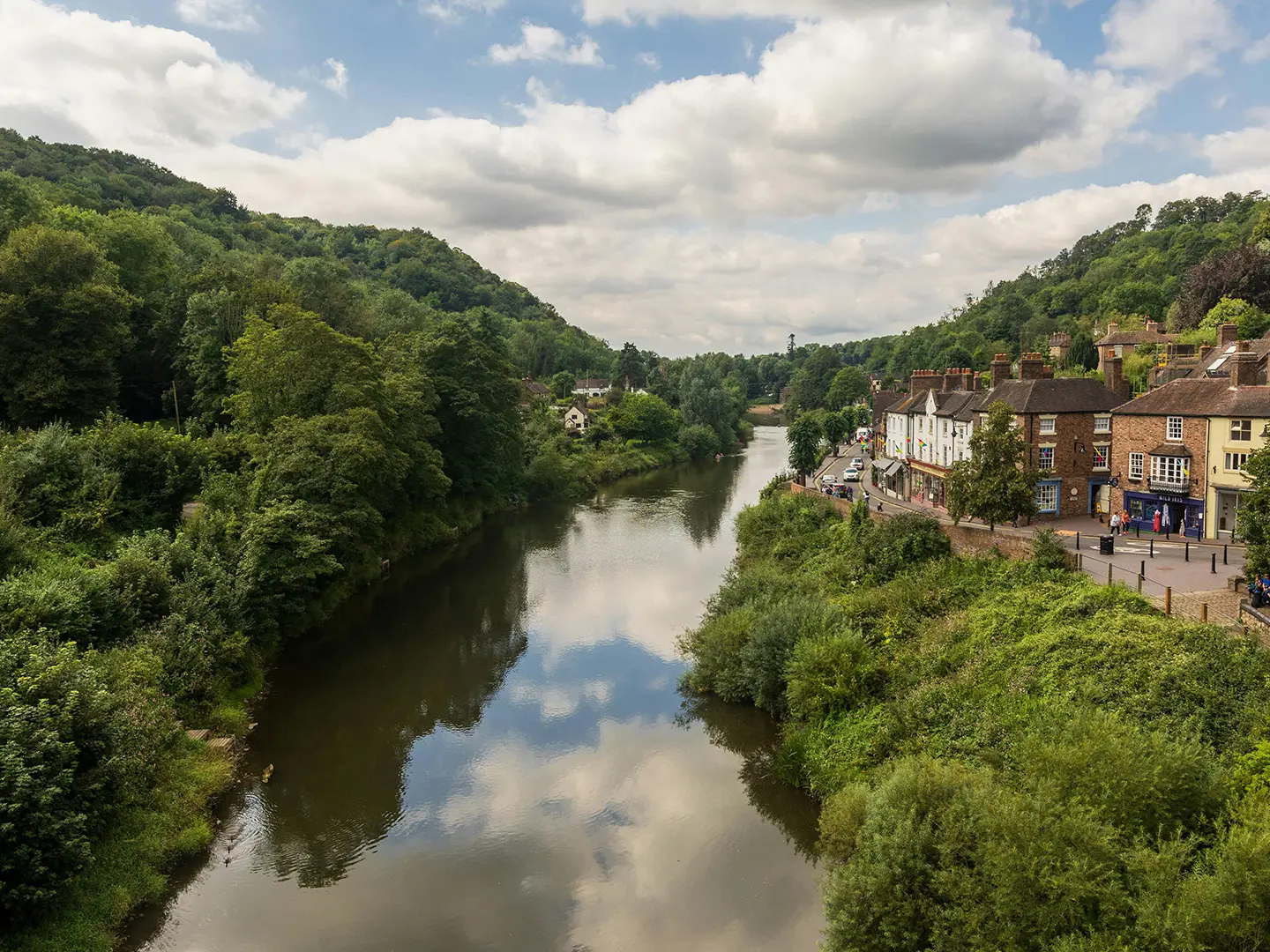
- Ironbridge Gorge: A UNESCO World Heritage Site where the Severn cuts through a wooded gorge associated with the Industrial Revolution. The route passes the Iron Bridge of 1779, the first major cast-iron bridge.
- Worcester Cathedral: In Worcester, the path runs close to the medieval cathedral above the riverbank. It is also the burial place of King John.
- Tewkesbury Abbey: At the confluence of the Severn and the Avon, Tewkesbury is marked by its Norman abbey church and large Romanesque tower.
- Slimbridge and the Severn Estuary wetlands: The final stages skirt tidal estuary, saltmarsh and grazing marsh near WWT Slimbridge, an important wetland area for wintering wildfowl.
- Severn Beach: The official finish is on the Bristol Channel, beneath the Severn road bridges, where the river reaches the sea.
Challenges to expect
The hardest walking comes early: open Plynlimon moorland, boggy ground, limited waymarking and the route’s main ascent are concentrated in the first three Welsh stages. After that, the trail becomes much flatter but can be disrupted by river flooding, estuary conditions, bank erosion and flood-defence works. Check current diversions before setting off, especially outside May to September.
HikeList Score
Severn Way scored 92/100 on HikeList's trail-quality metrics.
See score breakdownHide breakdown
- Ideal length 87
- Balanced challenge 100
- Scenery & wildness 98
- Varied terrain 94
- Accommodation 83
- Food & support 94
- Path quality 80
- Season flexibility 89
Computed from length, challenge, scenery & wildness, terrain variety, accommodation, food & support, path quality and season flexibility.
 United Kingdom
 England
 Wales
WalesShow more data Show less
- Mountain
- River Valley
- Hills
- Wetland
- Dirt
- Gravel
- Paved
- Hotels
- Hostels
- Campsites
- Family Friendly
- Dog Friendly On Leash
- Restrooms
- Potable Water Sources
- Established Campsites
- Picnic Areas
- Public Transport Access Points
Download Our Full Guide to Severn Way FREE!
Get our comprehensive guide to this hike for free. Save it for later reading or print out at home.
In these collections
Photos from hikers
Taken on the trail by people who've reviewed Severn Way.
Severn Way: The Complete Guide
 i
Image by Neal Smith
i
Image by Neal Smith The Severn Way is a classic source-to-sea walk following Britain’s longest river for 344 km / 215 miles from the Plynlimon / Pumlumon uplands in mid-Wales to Severn Beach on the Bristol Channel. It suits fit walkers who want a long journey with real variety, historic towns and good public-transport options, without committing to a sustained mountain route.
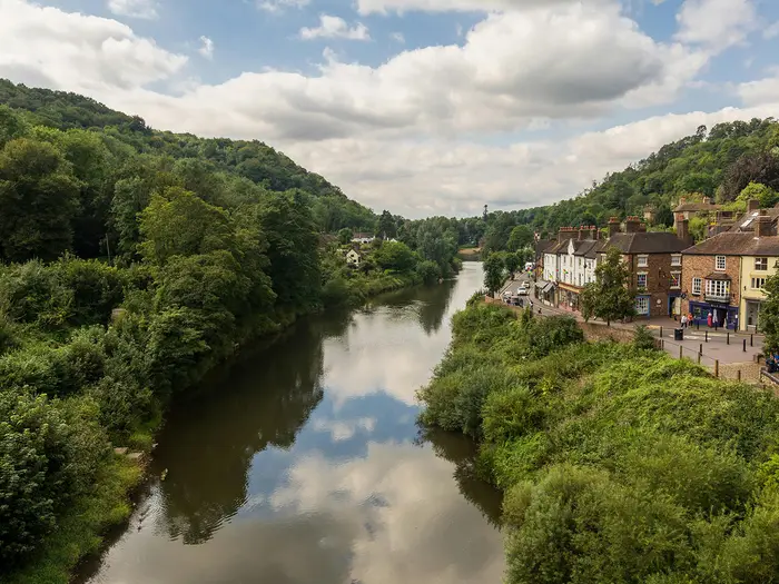
Its strength is the river’s changing character. The Severn — Afon Hafren in Welsh — begins as a peat-stained trickle in blanket bog near Hafren Forest, becomes a broad meandering river through Shrewsbury and the Severn Valley, then opens into tidal wetland and estuary towards Slimbridge, Aust and Severn Beach.
The route threads together Cambrian hill country, farmland, towpaths, market towns and major heritage sites. Ironbridge Gorge, Worcester Cathedral, Tewkesbury Abbey, the Severn Valley Railway and the wetlands around WWT Slimbridge all sit naturally on the line of the walk rather than as detours from it.
The honest difficulty is front-loaded. The first two or three Welsh stages demand care on open moorland, boggy ground and faint paths around Plynlimon and Hafren Forest; after Welshpool the walk is mostly low-level riverside, towpath, floodplain and town walking, with around 2,740 m of ascent in total, though ascent figures vary by source.
Planning still matters. Riverbank erosion, flooding and flood-defence works can create closures and diversions, including sections around Stourport-on-Severn, Worcester and the lower estuary near Aust and Severn Beach, so the LDWA path record and current local notices should be checked before setting off.
This guide covers stages, days, accommodation, food, transport, terrain and the common mistakes that make the Severn Way harder than it needs to be.
Stage-by-Stage Guide
The stage plan below follows the long, fit-walker schedule used on this route page. Several of these days are substantial, especially Shrewsbury to Ironbridge and Bewdley to Worcester; walkers wanting shorter days should use the Cicerone 22-stage breakdown to split the route more gently.
Before setting out, check the LDWA Severn Way path record and local council notices for current closures and diversions. Riverbank erosion, flood-defence works and seasonal flooding can change the practical route, particularly near Worcester, Stourport and on the Severn Estuary.
Stage 1: Plynlimon (source) to Llanidloes (~23 km)
This is the hardest and most serious stage of the Severn Way. The usual start is Rhyd-y-benwch car park in Hafren Forest, from where the route follows forest tracks and the young River Severn (Afon Hafren) before climbing onto open moorland and blanket bog near the source.
The official source is marked by a large post, reached across peat bog using flagstones and stepping stones. Some stones can be sunken or waterlogged, so waterproof boots and careful foot placement matter from the start.
A more demanding optional variant begins at Eisteddfa Gurig and crosses Plynlimon Fawr / Pen Pumlumon Fawr, the 752 m summit and route high point. This is longer, rougher and more exposed than the standard Hafren Forest start, with rough ground after the summit before intercepting the source path.
After the source, the route descends the Severn valley towards Llanidloes, with the greatest descent of the whole walk concentrated into this day. The upper ground is open, boggy and poorly waymarked; lower down, the route becomes easier on grass, forestry tracks and valley paths.
There are no reliable food or water sources on the open moorland above Hafren Forest. Carry enough water and food from the start. Llanidloes has shops, cafés, pubs and accommodation, including hotels, B&Bs and a bunkhouse.
Public transport is the main complication. No public transport reaches the Hafren Forest start, so most walkers arrange a taxi from Llanidloes. Llanidloes has no railway station; Caersws, on the Cambrian Line, is the nearest railhead and is around 10 km away.
Navigation is the key warning for this stage. In mist or low cloud, the Plynlimon plateau is not a place to rely on waymarks alone; carry a map, compass and/or reliable GPX. Allow extra time, especially if taking the summit variant.
Stage 2: Llanidloes to Newtown (~23 km)
The route leaves Llanidloes on riverside and field paths through the upper Severn valley. The river is still relatively young and fast-moving here, and the walking is more varied than the flatter English floodplain stages later on.
Caersws is the main intermediate place on the stage and is useful both for facilities and transport. Between Caersws and Newtown there are some steeper sections, so this should not be treated as a completely flat river day.
Food and water are limited between Llanidloes and Caersws, though Caersws has basic facilities. Newtown / Y Drenewydd is a useful resupply point, with supermarkets, cafés, pubs and shops.
Newtown is also one of the better accommodation stops in the Welsh section, with hotels, B&Bs and guesthouses. It is a sensible place to restock before the longer valley and canal stages towards Welshpool and the Shropshire border.
For transport, both Caersws and Newtown are on the Cambrian Line, making this a practical stage for section walkers or for an early exit in poor weather. Navigation is easier than Stage 1, with Severn Trow signs and clearer field paths, but a GPX remains useful across fields and lanes.
After wet weather, expect mud and slippery field edges. The day is not technically difficult, but the climbs between Caersws and Newtown can be a surprise after the riverside start.
Stage 3: Newtown to Welshpool (~25 km)
This is the longest Welsh stage in the schedule, but the walking is generally straightforward. Much of the day follows the Montgomery Canal towpath, including sections that have been resurfaced and are easy underfoot.
The canal and the River Severn run through the same broad corridor here, giving a very different feel from the exposed Plynlimon start. Expect level towpath, field-edge paths and occasional riverbank walking, with good wildlife interest along the canal.
The Montgomery Canal is a key feature of the day and a useful navigation handrail. Welshpool / Y Trallwng is the main town at the end of the stage, with Powis Castle available as a worthwhile detour for walkers with time and energy.
Services are limited along the towpath between Newtown and Welshpool, so carry lunch and water. Welshpool has full town facilities: supermarkets, pubs, restaurants, cafés and accommodation.
Welshpool is also a strong logistics point, with a Cambrian Line railway station and good bus connections. It is the last major rail-accessible hub before Shrewsbury.
Navigation is among the easiest on the route: follow the towpath and Severn Way waymarks. In winter or after prolonged rain, check towpath conditions, as non-resurfaced sections can become muddy.
Stage 4: Welshpool to Melverley (~21 km)
From Welshpool, the Severn Way leaves the canal corridor and follows the river north and east towards the Wales–England border. The stage is largely flat, crossing floodplain, embankments and field paths.
The Breidden Hills are a useful visual landmark to the north, while Crew Green marks the border area. The finish at Melverley is very small, with St Peter’s Church, a remarkable timber-framed church above the floodplain, the main landmark.
This is a stage where logistics matter more than the distance suggests. There are very limited services between Welshpool and Melverley, and Melverley itself has no pub, shop or café at the overnight stop.
Carry food and water from Welshpool. Accommodation at Melverley is very limited, so most walkers need to arrange a B&B in the wider area, use taxi support, or alter the stage split around Crew Green or Llandrinio.
Public transport is limited at this end of the stage. Crew Green and Melverley have no railway station, so taxis from Welshpool or Shrewsbury are the realistic options if accommodation is not directly on route.
Navigation is not difficult in settled weather, but floodplain paths can be confusing when wet or partially underwater. This section is vulnerable to flooding in winter and spring; do not assume the embankment path will be passable after heavy rain.
Stage 5: Melverley to Shrewsbury (~20 km)
This is another lowland floodplain day, following the Severn across Shropshire on embankments, pasture edges and riverside paths. The walking is mostly flat and physically easier than the early Welsh stages, though mud and floodwater can slow progress.
Montford Bridge is the main intermediate place, with its historic stone bridge over the Severn. From there, the route continues towards Shrewsbury, entering the town through the famous river loop that almost encircles the historic centre.
Food options are limited early in the day. Montford Bridge has a pub, but opening times should be checked before relying on it. Shrewsbury has full services, including supermarkets, cafés, restaurants, pubs and a wide range of accommodation.
Shrewsbury is one of the best logistical hubs on the whole Severn Way. It has a mainline railway station, strong bus links and a broad choice of hotels, guesthouses, B&Bs and hostel-style accommodation.
The Severn Trow waymarking is generally good across the floodplain and into town. The main issue is conditions underfoot: after prolonged rain, the embankment and riverside paths can be flooded, muddy or slow.
If walking outside the drier months, check river levels and local path conditions before leaving Melverley. This is a straightforward stage in good conditions, but a frustrating one if the Severn is high.
Stage 6: Shrewsbury to Ironbridge (~28 km)
This is one of the longest and most demanding days in the schedule. The route leaves Shrewsbury with some road walking before regaining more attractive riverside and countryside paths through the Severn’s meanders.
The stage passes Atcham, near Attingham Park, then continues through the valley towards the Ironbridge Gorge. Wroxeter Roman settlement is a worthwhile detour, and Buildwas Abbey is another notable historic site on the approach to the gorge.
Terrain varies more than many later stages: lanes, riverside paths, woodland and a short but noticeable climb near Buildwas Park. The Wrekin is a prominent landmark from parts of the stage, especially around Cressage Bridge.
Food and water need planning. Atcham has a pub, while Cressage has limited services, but there are long stretches without easy resupply. Ironbridge Gorge has cafés, pubs, restaurants and tourist facilities at the end of the day.
Accommodation in Ironbridge and the wider gorge includes B&Bs, hotels and hostel options, but it is a popular visitor area, so book ahead. Transport links are by bus to Telford and Shrewsbury; the nearest rail access is at Telford Central or Wellington, both away from the riverside route.
Navigation is mixed. Waymarking helps, but the combination of lanes, riverside paths, woodland and urban sections through Ironbridge Gorge makes a GPX advisable.
A footbridge between Atcham and Emstrey has had access issues; check the LDWA path record before setting out. Many walkers will prefer to split this stage using shorter intermediate stops such as Atcham or Cressage.
Stage 7: Ironbridge to Bridgnorth (~15 km)
After the long day into Ironbridge, this is a shorter but still important stage. The route leaves the World Heritage Site through the gorge, passing Coalport before entering a quieter and more remote stretch of the Severn Valley.
Coalport and Jackfield bring industrial history, including china and tile heritage, before the route settles into riverside countryside. The Severn Valley Railway shadows the valley through this area, and steam trains may be visible or audible from the path.
The stretch from Coalport to Bridgnorth has very limited facilities and few practical escape points. The walking itself is not especially hard, but the valley feels noticeably more remote than the distance suggests.
Ironbridge has full services at the start. Coalport has a pub and is the last realistic refreshment point before Bridgnorth, so carry water and food for the remainder of the day.
Bridgnorth is a strong overnight stop, with shops, cafés, pubs and accommodation. The town is split between Low Town by the river and High Town on the sandstone cliff, linked by the inland cliff railway.
Bridgnorth is also the northern terminus of the Severn Valley Railway. It can be useful for leisure-based logistics and section walking, but it is seasonal and should not be treated like a normal year-round rail service; check timetables carefully.
Navigation is generally straightforward along the river, with Severn Trow waymarks. The main warning is self-sufficiency between Coalport and Bridgnorth: do not start this section short of food or water.
Stage 8: Bridgnorth to Bewdley (~24 km)
This stage continues down the Severn Valley through Hampton Loade, Highley and Upper Arley before reaching Bewdley. It is mostly flat riverside walking, with broad valley views and the Severn Valley Railway running close by for much of the day.
Hampton Loade is known for its historic pedestrian ferry, while Highley reflects the area’s mining heritage. Upper Arley is a useful village stop, with Arley Arboretum nearby and a riverside pub close to the railway station.
Food and drink are available at intervals, but should still be planned. Hampton Loade has pub or café options near the ferry, Highley may have a station café on steam-running days, and Upper Arley has a riverside pub. Bewdley has full town services.
Accommodation can be found at Bridgnorth, Hampton Loade, Upper Arley and Bewdley, though options outside the towns are limited. Bewdley is the most reliable end-point, with hotels, B&Bs, pubs and shops.
The Severn Valley Railway between Bridgnorth and Kidderminster makes this one of the easier sections to break into shorter walks, provided trains are running. Services are seasonal and can be limited or absent in winter and off-peak periods, so check before planning a stage around them.
Navigation is usually simple: follow the river and the Severn Trow signs. If planning to use Hampton Loade Ferry, check that it is operating before relying on it; if not, a road detour will be needed.
Stage 9: Bewdley to Worcester (~37 km)
This is the longest stage in the schedule and should be treated as a serious day, even though much of the terrain is level. At around 37 km, it is a long river walk with some smaller rises, urban navigation and potential diversion issues.
The route passes Stourport-on-Severn, where the Staffordshire and Worcestershire Canal meets the Severn, before continuing south towards Holt Fleet and Worcester. Stourport’s canal basins make it a good mid-stage focus and the obvious place to split the day if needed.
Food and water are available in Stourport, and there is a riverside pub at Holt Fleet. Worcester has full city services and is one of the major accommodation and resupply points on the whole route.
Stourport is useful for buses to Kidderminster, which has mainline rail connections. Worcester has two railway stations, Foregate Street and Shrub Hill, with wider rail links, making it a practical place to pause, finish a section, or restart.
Navigation can be awkward around Stourport, canal basins and the approach to Worcester. Waymarks should be backed up with mapping or a GPX, especially where the riverside path is affected by closures.
There are significant route warnings on this stage. The Northwick area north of Worcester has had a west-bank riverside path collapse, with diversion via the A443 listed, and the Lincomb Lock area near Stourport has also had riverside path damage. Check the LDWA path record before walking, and avoid assuming the riverside line is open after heavy rain.
Many walkers should split this day, especially if carrying full kit or walking outside high summer. As a single stage, it is not a good choice for a first long-distance walking day.
Stage 10: Worcester to Tewkesbury (~26 km)
This stage follows the Severn south-west from Worcester through low-lying riverside country. Depending on the exact line and any diversions, the day can feel closer to 30 km than the headline distance, so check your mapping before committing to an early finish time.
The terrain alternates between riverside pasture, damp woodland and floodplain paths. The walking is mostly level, but it can be slow when the ground is wet.
Kempsey is passed on the way south, and the M50 viaduct is a prominent modern landmark across the valley. The approach to Tewkesbury crosses the historic Mythe Bridge, designed by Thomas Telford, before entering a town shaped by the confluence of the Severn and the Avon.
Food and water are limited between Worcester and Tewkesbury. Ripple has a pub, and Upton-upon-Severn can be used as a refreshment stop if the chosen route variant takes you that way. Tewkesbury has full services, including shops, pubs, cafés and accommodation.
Tewkesbury is a good overnight halt, but it has no railway station. The nearest station is Ashchurch, with onward rail links, and buses connect Tewkesbury with Ashchurch and Cheltenham.
Navigation is generally good on the riverside path, but take care around the approach to Tewkesbury, including the Mill Avon channels and Severn Ham meadow. Steps near Mill Avon can be slippery when wet.
Flooding is the main hazard. If the Severn is high, the floodplain approach to Tewkesbury may be impassable; check conditions before leaving Worcester, particularly in autumn, winter and after prolonged rain.
Stage 11: Tewkesbury to Gloucester (~22 km)
From Tewkesbury, the Severn Way continues south from the Avon confluence through flat farmland and low-lying pasture. The river is broader here, and the character of the walk gradually changes towards the tidal lower Severn.
The stage is not especially technical, but it is exposed to wet ground and wind across the floodplain. Expect field paths, riverside tracks and a more industrial feel as Gloucester approaches.
The main highlights are at the end of the day. Gloucester Docks provide a strong historic finish, with restored warehouses and the National Waterways Museum area, while Gloucester Cathedral is a worthwhile short detour into the city centre.
Food and water are limited on the route between towns, so carry enough from Tewkesbury. Gloucester has full city services, with cafés and restaurants around the docks and a wider choice in the city.
Accommodation is plentiful in Gloucester compared with the rural stages: city hotels, B&Bs and budget options. Gloucester railway station gives mainline access towards London Paddington, Bristol, Birmingham and Cheltenham.
Navigation becomes more involved on the approach into Gloucester, where dockland, industrial edges and road sections create several possible lines. A GPX or detailed mapping is recommended for the city fringe.
The river begins to show tidal influence in this lower section. Check conditions and any current route notices if walking in poor weather or outside the main season.
Stage 12: Gloucester to Berkeley (~28 km)
This stage marks the clear transition from river walk to estuary walk. From Gloucester, the route follows the Gloucester and Sharpness Canal for a substantial distance, giving flat, direct towpath walking through low agricultural land.
The canal towpath is generally easy to follow, but it can be muddy or slippery in winter. The straightness of the walking makes progress efficient, though exposed sections can feel long in bad weather.
Frampton-on-Severn is the main village landmark, with its large green and limited services. Around Upper Framilode, the old Stroudwater Canal meets the Severn, and later the route reaches Sharpness, an active commercial dock with a swing-bridge crossing at the canal entrance lock.
After Sharpness, Purton Hulks is an unusual highlight: old wooden vessels deliberately grounded to protect the canal bank from the tidal river. Berkeley, the stage end, is a small historic market town with Berkeley Castle as the major visitor attraction.
Services between Gloucester and Berkeley are sparse. Frampton-on-Severn has a pub and limited facilities, Sharpness has limited services, and Berkeley has pubs and shops. Carry food and water from Gloucester.
Accommodation at Berkeley is more limited than in Gloucester, so book ahead. Frampton-on-Severn may also work as an alternative stopping point depending on availability.
Public transport is less convenient here than on the central valley stages. Berkeley has no direct railway; onward travel generally involves buses towards Cam & Dursley station or Thornbury, and details should be checked before travelling.
Navigation is simple on the canal towpath but needs attention at Sharpness. Take care at the swing-bridge and canal entrance lock, where the correct line may not be obvious; use up-to-date mapping or GPX.
Beyond Sharpness, the Severn is tidal and the path uses flood embankments exposed to wind and weather. Check conditions before committing to the lower estuary stages.
Stage 13: Berkeley to Severn Beach (~30 km), with optional Bristol Link
The final standard stage follows the Severn Estuary on flood embankments, field paths, tracks and lanes towards Severn Beach. It is a long and exposed day, with the official finish on the seafront at Severn Beach beneath the Severn road bridges.
From Berkeley, the route passes the Slimbridge area, where WWT Slimbridge Wetland Centre is a major planned stop for bird hides, café facilities and estuary wildlife. Bird numbers are especially significant in the winter months, though the walking season is generally better from May to September.
Further south, the route passes Oldbury-on-Severn and Aust. Oldbury has one of the few pubs directly on the estuary path, while Aust gives the classic views of the Severn Bridge and the Prince of Wales Bridge near the old ferry crossing.
The final approach to Severn Beach includes gravel tracks through paddocks, flood embankments, a wooded section, steps crossing the M48, quiet lanes and a tarmac seafront path. The finish itself is practical rather than ceremonial; do not expect a major plaque or monument marking the end.
Food and water need planning carefully. Berkeley has pubs and shops, Slimbridge has the WWT café subject to opening hours, Oldbury-on-Severn and Aust have pubs, and Severn Beach has only limited services. Do not rely on the finish for a substantial meal.
Accommodation at Severn Beach is very limited. Many walkers either take the train away from the finish, arrange accommodation near Aust or continue logistics towards Bristol.
Severn Beach railway station is the key transport exit, with services on the Bristol line. Check the timetable before starting the day, particularly if finishing late, as services are not highly frequent.
Navigation is one of the main issues on this stage. The final 10 km into Severn Beach can be awkward, and waymarking near Littleton Pill has caused problems; carry up-to-date GPX and mapping. King Charles III Coast Path acorn waymarks appear on parts of this section, but they should not replace route checking.
The estuary is exposed, windy and affected by flood-defence works. The Aust to Redwick section has had ongoing flood-defence closures and seasonal access changes, so check the LDWA path record and local notices before setting out.
The signed Bristol Link is optional. It continues from Severn Beach via Avonmouth, Shirehampton and the Avon Gorge into Bristol city centre, adding roughly 24 km, and should normally be planned as an additional day rather than an afterthought at the end of the source-to-Severn-Beach route.
Recommended Itinerary
Distances on the Severn Way vary slightly between guidebooks, mapping platforms and diversion lines, so treat the figures below as planning distances and check official mapping before booking accommodation. Current riverbank-erosion, flood-defence and estuary diversions should also be checked before setting off, particularly around Stourport/Lincomb Lock, Worcester/Northwick and between Aust and Severn Beach.
The standard plan below follows the hike-page schedule to the official finish at Severn Beach. It is a fit-walker itinerary: most days are moderate, but the first Welsh stages need care and Day 9 is a very long walking day.
Standard itinerary: fit walker schedule
| Day | From | To | Approx. distance | Why this stage makes sense | Services/accommodation notes |
|---|---|---|---|---|---|
| 1 | Plynlimon source | Llanidloes | ~23 km | This is the main mountain and moorland start, with the source section completed before reaching the first substantial town. It should not be underestimated: the ground can be boggy and waymarking is more limited than later on. | The source area is remote, so carry food and waterproof hill kit. Llanidloes is the first practical overnight hub; book ahead, especially if starting in peak season. |
| 2 | Llanidloes | Newtown | ~23 km | A full but manageable valley stage between two Powys market towns, avoiding the need to rely on very small intermediate settlements. | Llanidloes and Newtown have the best services on this stretch. Caersws is small, though useful for rail access; do not assume every village shop or pub will be open. |
| 3 | Newtown | Welshpool | ~25 km | Welshpool is the logical end point after the upper Severn valley, with better accommodation and onward transport than the smaller villages before it. | Newtown and Welshpool have shops and accommodation. Book Welshpool early if walking in holiday periods. |
| 4 | Welshpool | Melverley | ~21 km | This keeps the Welshpool-to-Shrewsbury section to two moderate days rather than one very long push. | Melverley is a tiny hamlet with very limited accommodation. Advance booking is essential; if suitable accommodation is not available, re-plan this stage before committing to the schedule. |
| 5 | Melverley | Shrewsbury | ~20 km | A shorter day into a major town, useful after the limited-service border section. Shrewsbury is one of the best resupply and accommodation points on the route. | Montford Bridge is small. Shrewsbury has a wide range of hotels, B&Bs, hostels, shops and transport connections. |
| 6 | Shrewsbury | Ironbridge | ~28 km | One of the longer stages, but it links two strong overnight bases and brings the route into Ironbridge Gorge. | Start with supplies from Shrewsbury. Atcham has limited services. Ironbridge has a good range of accommodation, but it is a popular visitor base, so book ahead. |
| 7 | Ironbridge | Bridgnorth | ~15 km | This deliberately short day gives time for Ironbridge Gorge and avoids making the previous long stage even harder. Bridgnorth is a natural overnight stop above the river. | Ironbridge and Bridgnorth both have good accommodation options. This is a sensible day to keep short rather than combine with neighbouring stages. |
| 8 | Bridgnorth | Bewdley | ~24 km | A practical Severn Valley stage through the heritage railway corridor, with Bewdley providing a strong overnight base before the long Worcester day. | Services exist at places such as Hampton Loade, Highley and Upper Arley, but opening times should be checked. The Unicorn Inn at Hampton Loade and The Harbour Inn at Upper Arley are useful named stops; the Severn Valley Railway is seasonal. |
| 9 | Bewdley | Worcester | ~37 km | This is the longest stage in the schedule and effectively combines shorter guidebook stages. It suits only strong walkers with an early start and good underfoot conditions. | Consider splitting at Stourport-on-Severn if 37 km is too much, as it has accommodation and services. Worcester has city-level accommodation and transport. Check current diversions near Stourport/Lincomb Lock and Worcester/Northwick. |
| 10 | Worcester | Tewkesbury | ~26 km | A moderate, mostly low-level riverside day through the Severn valley, ending at another strong accommodation town. | Worcester is a major resupply point. Upton-upon-Severn can be useful on the way, but opening times should be checked. Tewkesbury has a good range of accommodation. |
| 11 | Tewkesbury | Gloucester | ~22 km | A manageable day across the Vale of Gloucester, with city facilities at the end. This also sets up the longer estuary stages that follow. | Tewkesbury and Gloucester both have strong accommodation and resupply options. Gloucester is a useful place to pause or re-plan before the lower estuary section. |
| 12 | Gloucester | Berkeley | ~28 km | The route begins to feel more estuarine and services become more spread out, so Berkeley is a practical stopping point before the final long stage. | Gloucester has city-level services. Sharpness is very limited. Berkeley has accommodation, but choice is limited, so book ahead. |
| 13 | Berkeley | Severn Beach | ~30 km | A long final estuary stage to the official source-to-sea finish beneath the Severn bridges. It is a logical endpoint, but not a stage to leave unplanned. | Services are sparse compared with the river towns. Slimbridge, Oldbury-on-Severn and Aust are useful reference points; the Anchor Inn at Oldbury-on-Severn and Boars Head at Aust may be useful if open. Severn Beach is small with limited accommodation, so book ahead or plan onward travel. The optional Bristol Link adds about 24 km via Avonmouth, Shirehampton and the Avon Gorge. |
Slower itinerary: 18–22 days
This is the better choice for most recreational walkers, especially with a full pack. It reduces the pressure on the early Powys stages and avoids making the Bewdley-to-Worcester day the crux of the whole trip.
The most useful adjustment is to split Day 9 at Stourport-on-Severn, turning the longest day into two more comfortable stages. Additional nights in Shrewsbury, Worcester, Tewkesbury or Gloucester also make sense, as these are the best places for rest, resupply and transport.
Cicerone divides the route into 22 shorter reference stages, which is a practical framework if daily distances of around 20 km or less are preferred. The first source stages should still be planned carefully: shorter mileage does not remove the need for upland navigation, waterproofs and a realistic start-time.
Faster itinerary
The 13-stage plan above is already a fast schedule for a 344 km river route, particularly because it includes a 37 km day from Bewdley to Worcester and several 26–30 km days later on. Compressing it further is only sensible for very fit walkers travelling light, with accommodation already secured and diversion information checked before departure.
A faster walker should still be cautious about the first three Welsh stages, where boggy ground and exposed conditions can slow progress. On the lower river and estuary, closures and flood-related diversions can add time even where the terrain is flat.
Section-walking options
The Severn Way works well as a section walk because the route repeatedly reaches towns with rail or good bus access. Useful break points include Llanidloes, Welshpool, Shrewsbury, Bridgnorth, Bewdley, Worcester, Gloucester and Severn Beach.
A practical way to divide the route is by the natural county sections: Powys from the source towards Crew Green, Shropshire through Shrewsbury and Ironbridge to Upper Arley, Worcestershire to Tewkesbury, and Gloucestershire onward to Severn Beach or the optional Bristol Link. Transport is strongest from Welshpool, Shrewsbury, Worcester, Gloucester and Severn Beach; the remote Plynlimon source remains the hardest point to reach.
Planning the Route
How many days to allow
A 14-day schedule is a fit-walker itinerary, not the most comfortable way to walk the Severn Way. It works if accommodation is booked tightly, daily starts are early and long flat stages are treated as full walking days rather than half-day strolls.
Most walkers should allow 16–18 days for a practical end-to-end walk to Severn Beach. Two to three weeks gives more margin for bad weather on Plynlimon / Pumlumon, riverbank diversions, rest time in the larger towns and shorter days where accommodation is awkward.
Cicerone divides the route into 22 shorter reference stages, which is useful if you prefer easier days or want to use the route for day walks. Commercial itineraries also vary widely, from strenuous 12-night schedules to more moderate 19-night versions, which gives a realistic sense of how flexible the route can be.
| Pace | Typical use | Planning implications |
|---|---|---|
| 13–14 walking days | Fit walkers on a direct schedule | Long days, limited spare time, accommodation must be lined up in advance |
| 16–18 walking days | Most independent walkers | More realistic daily distances and better use of town accommodation |
| 20–22 walking days | Slower walkers, short-stage itineraries or sightseeing | Easier logistics, but more accommodation bookings and higher trip cost |
Fast or slow?
The Severn Way is better planned as a steady journey rather than a fast crossing. The first Welsh stages demand more care than their mileage suggests: open moorland, blanket bog, faint paths and exposed weather around the source are not the place to chase time.
After Llanidloes the terrain eases considerably, and the Shropshire and Worcestershire sections allow longer days if needed. This is where strong walkers can make up time, especially between river towns where navigation is simpler and the gradients are modest.
Do not underestimate the lower estuary. The stages from Gloucester towards Severn Beach are mostly flat, but they are long, exposed and affected by flood-defence works, bank erosion and diversions. They can feel more committing than the map profile suggests.
A slower itinerary also makes practical sense because Shrewsbury, Ironbridge, Worcester, Tewkesbury and Gloucester all reward at least a half-day. Building in short days around these places is often more useful than adding a formal rest day in the middle of nowhere.
Stage breaks and accommodation
Daily stages are strongly shaped by where accommodation actually exists. The route follows the river through plenty of towns, but the spacing is uneven, and the early Powys section has the thinnest choice.
The main overnight hubs with the broadest choice are Llanidloes, Newtown, Welshpool, Shrewsbury, Bridgnorth, Stourport-on-Severn, Worcester, Tewkesbury, Gloucester and Severn Beach. Bristol gives many more options if you take the optional Bristol Link, but it is not the standard finish.
Smaller overnight possibilities include Caersws, Abermule, Berriew, Ironbridge / Coalbrookdale, Hampton Loade, Bewdley, Kempsey, Upton-upon-Severn, Berkeley and Slimbridge. These are useful for breaking up long days, but availability can be limited and should not be assumed.
| Section | Accommodation planning notes |
|---|---|
| Source / Hafren Forest to Llanidloes | Remote start; book the first night arrangement carefully and carry enough food for the day |
| Llanidloes to Welshpool | Thin Powys accommodation compared with later stages; book ahead rather than improvising |
| Welshpool to Shrewsbury | Melverley has very limited provision; aim for Shrewsbury or arrange any Montford Bridge option in advance |
| Shrewsbury to Bridgnorth / Ironbridge | Good walking base towns, but Ironbridge is a popular visitor area and can fill early |
| Bridgnorth to Worcester | More service points, with Bridgnorth, Bewdley, Stourport-on-Severn and Worcester useful for overnight planning |
| Worcester to Gloucester | Upton-upon-Severn and Tewkesbury make natural breaks; check for flood-related diversions |
| Gloucester to Severn Beach | Long, exposed estuary planning; Berkeley, Slimbridge and Severn Beach are important accommodation points |
There is no single booking system for the Severn Way. Hotels, inns, guesthouses, B&Bs, hostels and campsites all appear along the route, but availability varies sharply by area and season.
Book well ahead for the Welsh stages, weekends, school holiday periods, Shrewsbury and Ironbridge. Many rural pubs have closed in recent years, so do not rely on old map symbols for meals or beds; check directly before travelling.
Campsites exist along the route, and Slimbridge YHA is a useful hostel near the final estuary stages. Campers still need to plan carefully, because the first stages and the estuary do not always offer convenient end-of-day options exactly where a schedule wants them.
Section hiking, shortening and extending
The Severn Way is very practical as a section hike. It passes rail-connected towns including Welshpool, Shrewsbury, Worcester Foregate Street / Shrub Hill, Gloucester and Severn Beach, with bus connections at many stage towns.
The two simplest long sections are Source to Shrewsbury and Shrewsbury to Severn Beach. A three-part version split at Shrewsbury and Worcester is also practical, especially for walkers using weekends or short blocks of annual leave.
The route also divides naturally by county: Powys, Shropshire, Worcestershire and Gloucestershire. These sections are not equal in feel: Powys contains the roughest upland start, while Gloucestershire includes the long estuary approach.
The Severn Valley Railway between Bridgnorth and Kidderminster gives an additional mid-route escape option in the Shropshire section. Services and operating days vary by season, so this should be checked before travelling.
Shortening the route is straightforward because rail-accessible towns occur every few days. Extending it is equally simple: the optional Bristol Link continues from Severn Beach via Avonmouth, Shirehampton and the Avon Gorge into Bristol, adding roughly 24 km / 15 miles. The standard source-to-sea finish remains Severn Beach.
Planning priorities
Accommodation is the first priority. Book the first three Welsh-stage nights early, then lock in any smaller-stage stops such as Melverley alternatives, Ironbridge / Coalbrookdale, Hampton Loade, Berkeley or Slimbridge. Larger towns offer more choice, but weekends and holidays can still be tight.
Transport to the start needs arranging in advance. The source area is the hardest part of the route to reach by public transport. Caersws is the nearest railway station, but walkers usually need a pre-booked taxi or arranged lift to Hafren Forest / Rhyd-y-benwch car park; taxis in mid-Wales are limited, so do not leave this until arrival.
Closures and diversions must be checked before setting off. The Severn Way is affected by riverbank erosion, flood-defence works and reroutes, especially on the lower river. Check the LDWA Severn Way path record shortly before the walk and again before affected stages.
Known problem areas for current planning include the path opposite Northwick north of Worcester, south of Stourport-on-Severn near Lincomb Lock, the permanent reroute north of Gloucester via Maisemore, Ashleworth and Tirley, and flood-defence works on the lower estuary between Aust and Severn Beach. These can change the day’s mileage and make an apparently simple riverside stage more awkward.
Navigation matters most at the beginning. Waymarking with the Severn Trow logo is generally better in England, but the Plynlimon / Pumlumon source stages can be faint, boggy and exposed. Carry OS mapping, a loaded GPX file and the ability to navigate without relying solely on phone signal.
Weather planning is not optional. May to September is the best window, but the source section can still have serious mountain weather. Check the mountain forecast for Stage 1, and outside the main season check river flooding, estuary conditions and bank diversions before committing to long days.
Food and water stops should not be assumed in rural Powys. Some village-to-village sections have no reliable food available during the walking day. Carry enough for a full day plus emergency supplies, and confirm evening meals where accommodation is not in a larger town.
No permit is required. The route uses public rights of way and has no trail fee. Normal access responsibilities still apply: follow signed diversions, respect closures and avoid pressing on along eroded riverbanks or flood-defence works.
Towns, Villages and Overnight Stops
Accommodation on the Severn Way is generally straightforward once the route leaves the Plynlimon / Pumlumon source area, but the spacing is uneven. The safest approach is to book the Welsh source stages, Melverley, Ironbridge, Berkeley and the final estuary section before setting off, then use the larger towns for rest days, laundry, resupply and transport connections.
Do not rely on pub symbols on maps for overnight planning in small villages. A number of rural pubs have changed opening patterns or closed in recent years, so food, rooms and evening opening should be checked before travelling.
Plynlimon / Pumlumon Source and Hafren Forest
The standard practical start is Rhyd-y-Benwch car park and picnic site in Hafren Forest, below the source of the River Severn / Afon Hafren. There is no accommodation, shop, pub or reliable resupply at the start, so walkers need to arrive self-sufficient for the first stage to Llanidloes.
The Hafren Forest Hideaway offers walker- and cyclist-friendly self-catering cabins a short distance from the forest, making it a useful pre-walk base if available. Otherwise, most walkers base themselves in Llanidloes, Caersws or Newtown and arrange a lift, taxi or other transport to the forest.
Public transport is the weak point of the whole route here. Anyone starting from the optional higher Eisteddfa Gurig variant or heading for the source from Hafren Forest should plan transport carefully and check current local options before travelling.
Llanidloes
Llanidloes is the first real town and the normal first overnight stop, about 23 km from the source. It is the place to recover from the boggier, more remote opening stage and to restock before the next day towards Newtown.
The town has independent shops, bakeries, cafés, several pubs and a SPAR supermarket. Accommodation includes hotels, B&Bs, self-catering cottages and guesthouse-style options such as Ty Capel and The Old Vicarage.
There is no railway station in Llanidloes. The nearest station is Caersws on the Cambrian Line, about 9 miles east, with local bus or taxi links to Llanidloes and Newtown; current bus times should be checked before committing to a public-transport start.
Public toilets are available at The Gro, free, open daily 07:00–21:00. Llanidloes is small enough that summer accommodation should be booked ahead, especially if starting on a weekend.
Caersws
Caersws is not a major overnight hub, but it is strategically useful because it has the nearest railway station to Llanidloes. The station is on the Cambrian Line, with trains towards Shrewsbury and Aberystwyth.
Facilities are limited, with only basic village services and a pub. It can work as an entry or exit point for the Welsh section, but walkers should not assume there will be a wide choice of beds or evening food without checking in advance.
Newtown / Y Drenewydd
Newtown, or Y Drenewydd, is the largest town in Powys and a strong second-night stop, roughly 46 km from the source. It is the first sizeable resupply point after the opening Welsh stages.
There is a good range of supermarkets, cafés, pubs and restaurants, plus B&Bs, hotels and self-catering accommodation. The Nags Head at Garthmyl, a few kilometres along the next stage, is another accommodation option for walkers adjusting their itinerary.
Newtown station is on the Cambrian Line, with direct trains towards Shrewsbury and Aberystwyth. This makes it one of the easiest places in Mid Wales to join, leave or pause the Severn Way.
North of Newtown, the route follows the Montgomery Canal towpath towards Welshpool. Stock up in town if planning a long day or if accommodation ahead is booked in a smaller place.
Abermule
Abermule is an intermediate settlement between Newtown and Welshpool. It should be treated mainly as a route marker rather than a reliable overnight base.
If planning to stop here rather than continuing to Welshpool, accommodation and food must be arranged in advance. This should be checked before travelling.
Berriew
Berriew sits between Newtown and Welshpool on the Welsh section. It can be useful for breaking the stage, but it is not one of the main Severn Way service hubs.
Do not assume late food, shops or accommodation will be available without a booking. Walkers with a fixed itinerary should check opening times and bed availability before leaving Newtown.
Welshpool / Y Trallwng
Welshpool, or Y Trallwng, is the main overnight stop at the end of the third stage, about 71 km from the source. It is the largest town in northern Powys and a practical place for resupply, laundry and transport connections.
The town has shops, supermarkets, pubs, restaurants and cafés. Accommodation includes hotels, B&Bs and holiday lets; the Westwood Park Hotel is a traditional coaching inn used by walkers on the Severn Way, Offa’s Dyke and Glyndŵr’s Way.
Welshpool station is on the Cambrian Line, with trains towards Shrewsbury and Aberystwyth, and many services continuing towards Birmingham International. The station is a short walk from the town centre, but it does not have a café.
The Severn Way follows the Montgomery Canal through Welshpool. Powis Castle is a worthwhile add-on for walkers arriving early or taking a short rest day.
Melverley
Melverley is the usual stop after Welshpool on some itineraries, around 92 km from the source, but it is a very small village. It has limited accommodation and no shop, so it needs more planning than the larger towns either side.
The Tontine Inn has stopped operating as a pub and now offers guest accommodation only, so do not rely on it for an evening meal; St Peter’s Church is a notable timber-framed church above the floodplain. Food and rooms should be checked before travelling, as there are few fallback options locally.
Public transport is minimal. If a problem arises, a taxi to Shrewsbury, about 10 miles away, is the practical escape option.
Montford Bridge
Montford Bridge is a small Severn crossing between Melverley and Shrewsbury. The route passes through the hamlet, where the Wingfield Arms is the key pub.
It is more useful as a break point than as a planned overnight stop. Accommodation and food should be checked before travelling if relying on it.
Shrewsbury
Shrewsbury is the first large urban stop in England and one of the most useful logistical points on the whole route. It is the natural place to pause after the thinly serviced Welshpool to Melverley to Shrewsbury stretch.
There is a wide spread of hotels, B&Bs, guesthouses, hostel-style accommodation and self-catering options. Food choices are extensive, with pubs, restaurants, cafés, supermarkets, independent shops and high-street retailers in and around the centre.
Shrewsbury railway station is a major hub served by Transport for Wales and West Midlands Railway, with direct trains to Birmingham New Street, Cardiff Central, Manchester Piccadilly, Wolverhampton, Telford and Crewe. The station has a café, toilets, ticket machines and waiting rooms, and is around 15–20 minutes on foot from the town centre.
This is the last major rail-connected town until Worcester. It is a sensible place for a rest day, kit replacement, or for joining and leaving the route when section-hiking.
Atcham
Atcham lies south-east of Shrewsbury on the stage towards Ironbridge. It is not a primary overnight hub for most Severn Way itineraries.
Use it as an intermediate point unless a specific bed or meal stop has been booked. This should be checked before travelling.
Ironbridge Gorge
Ironbridge Gorge is a major overnight stop and one of the busiest visitor areas on the trail. The gorge includes several linked settlements, including Ironbridge, Coalbrookdale, Jackfield and Coalport, so check exactly where accommodation sits in relation to the next morning’s route.
There is a good range of accommodation for a small area: YHA Ironbridge Coalport, B&Bs, guesthouses, pubs with rooms, Library House, Coalport Station Holidays and riverside pub options such as the Woodbridge Inn at Coalport. Demand can be high in season, so early booking is strongly recommended.
Ironbridge village has a post office, pharmacy, independent shops and cafés. There are several pubs, but opening and food times should be checked rather than assumed from map symbols.
There is no railway station in Ironbridge itself. Telford Central is the nearest mainline station, about 5 km away, and bus 8 links Telford with Bridgnorth through the gorge area; current times should be checked before relying on it.
Bridgnorth
Bridgnorth is a strong overnight stop after Ironbridge, around 155 km from the source. The town is split between High Town on the sandstone cliff and Low Town beside the river, linked by the Bridgnorth Cliff Railway.
Accommodation is good for walkers, with central inns, B&Bs, guesthouses and holiday lets. Named options include the Golden Lion Inn, The Bear Inn, Black Horse Hotel and The Vine.
There are shops, pubs and restaurants in both parts of town. Bridgnorth has no mainline railway, but it is the northern terminus of the Severn Valley Railway heritage line and has bus links to Telford, Wolverhampton and Kidderminster.
From here south towards Bewdley, the Severn Valley Railway shadows the walking route for much of the way. That gives useful section access and bailout points at Hampton Loade, Highley, Upper Arley and Bewdley.
Hampton Loade
Hampton Loade is a tiny riverside hamlet on the Bridgnorth to Bewdley section. It is best treated as a lunch, pub or camping stop rather than a full-service village.
There is a pub presence, with the Lion Inn and Unicorn Inn noted locally, and a campsite with electric hook-ups on the east bank. There is no shop.
The Severn Valley Railway has a halt at Hampton Loade. This can be useful if cutting a stage short, but heritage railway operating days and times vary and should be checked before travelling.
Highley
Highley is a small former mining village on the same Severn Valley Railway corridor. It has an SVR station and the Engine House visitor centre, where a café can be useful during opening hours.
Facilities are limited but more useful than the smallest hamlets, with a small village shop for basic supplies and the Ship Inn noted nearby. Overnight options are limited, so book ahead if using Highley to split the Bridgnorth to Bewdley stage.
Upper Arley
Upper Arley is a riverside village with a footbridge across the Severn and an SVR station nearby. It is a good mid-stage stopping point between Bridgnorth and Bewdley.
There is a village pub and a small shop, but it should not be treated as a guaranteed accommodation hub. Check food opening and room availability before building an itinerary around it.
Bewdley
Bewdley is a well-preserved riverside town and a popular overnight stop at the end of the Bridgnorth section, around 179 km from the source. It has a good food and drink scene, with pubs, riverside cafés and tea rooms.
Accommodation includes inns, B&Bs and guesthouses. The Mug House Inn and Severn Valley Guest House are useful examples of town-centre or near-centre options.
The town has independent shops and a small supermarket. It is not on the mainline rail network, but there are regular bus links to Kidderminster, where trains run to Birmingham New Street; the Severn Valley Railway also links Bewdley with Bridgnorth and Kidderminster.
Some itineraries continue beyond Bewdley to Stourport-on-Severn or all the way to Worcester. That makes for a long day, so book and resupply accordingly.
Stourport-on-Severn
Stourport-on-Severn is a useful intermediate stop between Bewdley and Worcester, around 186 km from the source. It is a Georgian canal-junction town where the Staffordshire & Worcestershire Canal meets the River Severn.
The restored Canal Basins are central to the town, with narrowboats, cafés, restaurants, independent shops and visitor facilities nearby. There are various inns and hotels, including pub-with-rooms options.
Stourport is not a mainline rail town. Bus services link it with Kidderminster and Worcester, but current times should be checked.
It is a good resupply point before the longer approach to Worcester. Be aware that ongoing diversion issues have affected the Stourport and Lincomb Lock area, so the LDWA Severn Way path record should be checked before this stage.
Holt Fleet
Holt Fleet is a hamlet at a Severn bridge between Stourport and Worcester. It is mainly useful as a refreshment point, with pubs noted on either side of the bridge.
Overnight options are limited. If planning to stop here rather than continuing to Worcester, book a specific bed and check evening food before travelling.
Worcester
Worcester is the next major city stop and one of the most important resupply points on the route, around 216 km from the source. The riverside path runs close to Worcester Cathedral, and the city centre has the full range of urban services.
Accommodation is extensive, including chain hotels, independent hotels, guesthouses, B&Bs and self-catering. Diglis House Hotel is a riverside option, and there are choices across most budgets.
Worcester has supermarkets, pharmacies, outdoor and general retail, cafés, pubs and restaurants. Many walkers use it for an extra night, especially after a long day from Bewdley or Stourport.
There are two mainline stations. Worcester Foregate Street is the most central, with services including Birmingham, Hereford, Malvern and London Paddington via the Cotswold Line; Worcester Shrub Hill has GWR services including London Paddington, Bristol and Cardiff. From Shrub Hill, the route can be regained by walking down Cromwell Street to the canal footbridge and towpath.
There are known ongoing path diversions around Worcester, including the Northwick area and flood-defence works. Check the LDWA Severn Way path record and local notices before arriving.
Kempsey
Kempsey is a village a few kilometres south of Worcester. It has basic facilities but is not a major overnight hub.
Most walkers pass through or continue towards Upton-upon-Severn or Tewkesbury. If using Kempsey to shorten a stage, accommodation and evening food should be arranged before leaving Worcester.
Upton-upon-Severn
Upton-upon-Severn is one of the best small-town stops between Worcester and Tewkesbury. It is a popular lunch, pub or overnight option, particularly for walkers who want to split the stage more gently.
The town has several pubs and places to eat, including the White Lion Hotel, Ye Olde Anchor Inn, the Swan Hotel and the Yorkshire Grey just outside town. There are independent shops on the historic High Street, and the Old Allotments campsite is nearby.
There is no railway station. The nearest stations are Great Malvern, about 8 km west, and Worcester, about 12 km north; bus links to Malvern and Worcester are limited and current timetables should be checked.
Upton has a busy festival calendar, which can affect room availability and pub capacity. Book ahead if arriving in summer or at weekends.
Tewkesbury
Tewkesbury is the usual overnight stop after Worcester, around 263 km from the source, and one of the strongest small-town bases on the Severn Way. It sits at the confluence of the Severn and the Avon, so flooding can affect approaches and riverside paths.
Accommodation is good, with hotels, chain options, B&Bs and campsite or cabin-style choices. Named options include the Abbey Hotel, Travelodge, Premier Inn, Jessop House, Monkspool B&B and Coach House cabins campsite.
The town centre has pubs, cafés, bistros, restaurants and shops. Tewkesbury Abbey is close to the route and is the main landmark, but the practical value of the town is its compact services after the rural riverside walking south of Worcester.
There is no mainline station in the town centre. Ashchurch for Tewkesbury is about 3 km away on the Cheltenham–Gloucester line, with infrequent services; alternatively, buses connect with Cheltenham or Gloucester for wider rail options. Check current timetables before planning an exit here.
Gloucester
Gloucester is the last fully urban service hub before the long estuary section and is a key place to pause, resupply and check route conditions. It is reached after the Tewkesbury to Gloucester stage, around 285 km from the source.
The city has a full range of accommodation, including chain hotels, independent hotels, apartments and unusual dockside options such as the stay-aboard SULA Lightship. Other named options include The Lock House and The Judges Lodgings.
Gloucester Docks have restaurants, bars and shops, and the wider city centre has supermarkets, pharmacies and all normal services. This is the best place to stock up before the more rural and semi-rural kilometres towards Berkeley, Oldbury-on-Severn, Aust and Severn Beach.
Gloucester station is a strong section-hiking access point, with GWR services to London Paddington, Bristol Temple Meads, Cheltenham and Cardiff Central, plus services towards Manchester Piccadilly. South of the city, the Severn Way follows the Gloucester & Sharpness Canal towpath into a much more open landscape.
Elmore
Elmore lies south of Gloucester on the estuary approach. It is not one of the main overnight hubs, and facilities should be treated as limited.
Use Gloucester or Berkeley for more dependable services unless a specific local booking has been made. This should be checked before travelling.
Frampton-on-Severn
Frampton-on-Severn is a village on the Gloucester & Sharpness Canal section, known for its long village green. It is a pleasant break point rather than a major accommodation centre.
The Bell Inn on the green is the key pub, and there is limited accommodation locally. Walkers relying on Frampton for an evening meal or bed should book and check opening times in advance.
Sharpness
Sharpness is the working docklands village at the southern end of the Gloucester & Sharpness Canal, where the route transitions towards the Severn Estuary bank. It is an important navigation point rather than a full-service stop.
Facilities are limited. Do not leave essential resupply until Sharpness unless current shop and food options have been checked.
Berkeley
Berkeley is the usual stop after Gloucester on many itineraries, with the route passing through or close to the town depending on the line followed. It is a small market town, not a large accommodation hub, so booking ahead matters.
There is a pub and some B&B availability, but choices are limited compared with Gloucester or Tewkesbury. Berkeley Castle is the main local landmark and is open seasonally.
There is no railway station. Public transport is by bus or taxi to nearby towns, and services can be infrequent; check current timetables before relying on Berkeley as an exit point.
Slimbridge and WWT Slimbridge
Slimbridge is best known to walkers for WWT Slimbridge Wetland Centre, just off the route on the Severn Estuary. The centre has a café and shop during opening hours and is especially important for wintering wildfowl, cranes and waders.
There is no overnight accommodation at the centre itself. Nearby village B&Bs may work for walkers, but these should be booked in advance.
The wetland centre is a worthwhile detour for walkers with time, but it should not be treated as a guaranteed resupply point outside visitor opening hours. Check seasonal hours before planning the day around it.
Oldbury-on-Severn
Oldbury-on-Severn is a small village slightly inland from the estuary and one of the more useful final-stage overnight points. It can help split the long Berkeley to Severn Beach section.
The Anchor Inn on Church Road is the key practical stop and offers rooms as well as food. There is no shop, so carry food as needed and check pub food and room availability before travelling.
The village church stands on an elevated mound above the surrounding levels, which is a useful local landmark. From here southwards, route choices and conditions can be affected by estuary-side diversions.
Aust
Aust is a hamlet below the old M48 Severn Bridge crossing and marks the final approach to Severn Beach. The Boars Head is the main service point near the bridge, with food and a field at the rear for tents and campervans, but it does not advertise indoor B&B rooms, so walkers wanting a bed should check directly or look further afield.
It is a practical last refreshment stop, and campers can use it for a shorter final day into Severn Beach. There are limited alternatives nearby, so book ahead and check food times.
The estuary section between Aust and Severn Beach has been affected by bank-erosion and flood-defence closures. Always check the LDWA Severn Way path record before setting out from Aust.
Severn Beach
Severn Beach is the official finish of the Severn Way, about 344 km from the source. It is a quiet residential settlement beneath the Severn road bridges, with limited facilities at the finish itself.
There is a café and a convenience store but no village pub, and accommodation choices are not extensive. Many walkers finish and take the train to Bristol the same day rather than staying locally.
Severn Beach station is on the Severn Beach Railway Line, with direct GWR services to Bristol Temple Meads via Avonmouth and Clifton Down. The journey is roughly 40–45 minutes and services are generally around hourly, but current timetables should be checked before fixing onward travel.
Because the final estuary kilometres are vulnerable to closures and diversions, check the LDWA path record before leaving Oldbury-on-Severn or Aust. This is particularly important outside the May to September walking season.
Avonmouth, Shirehampton and Bristol Optional Link
Bristol is not the standard finish. The official source-to-sea route ends at Severn Beach, while the optional Bristol Link continues for roughly 24 km via Avonmouth, Shirehampton and the Avon Gorge into Bristol city centre.
Avonmouth and Shirehampton are useful route places on the extension, but Bristol is the main accommodation and transport hub. Bristol Temple Meads is a major GWR station, and the city has a very large choice of hotels, hostels, apartments, restaurants, shops and onward transport.
Walkers choosing the Bristol Link should book it as an extra day or as part of a longer final day only if fitness, daylight and current route conditions allow. Anyone wanting a clean logistical finish can stop at Severn Beach and use the rail line into Bristol instead.
Getting to the Start
The standard walkers’ start for the Severn Way is Rhyd-y-benwch car park in Hafren Forest, Powys. It is about 6 miles / 9.7 km west of Llanidloes on narrow minor roads.
Use OS grid reference SN 857 869 rather than relying only on the postcode. The sat-nav postcode SY18 6PT covers a wide area and may not take you to the entrance gate; the What3Words reference is trace.mostly.senders.
Rhyd-y-benwch has free parking, Blue Badge spaces and temporary toilets, but no café, no permanent staff and no overnight parking. The optional higher start at Eisteddfa Gurig on the A44 is even more remote and is mainly practical by car or pre-booked taxi.
By train
The nearest useful railway station is Caersws, on the Cambrian Line. Transport for Wales trains run through Shrewsbury, Welshpool, Newtown, Caersws and Machynlleth, with onward branches towards Aberystwyth / Pwllheli.
From England, Shrewsbury is the main rail hub for reaching the start area. It has direct rail links from places including London Euston, Birmingham New Street, Manchester and Cardiff, then a change onto the Cambrian Line for Caersws or Newtown.
Through-trains also run from Birmingham International onto the Cambrian Line via Shrewsbury. Birmingham to Caersws is typically around 2.5–3 hours, but train times and connections should be checked before travelling.
| Rail station | Usefulness for the start |
|---|---|
| Caersws | Nearest station for Llanidloes and Hafren Forest; onward bus or taxi needed. |
| Newtown | One stop east of Caersws; slightly farther from Llanidloes but a larger town with more services. |
| Shrewsbury | Best interchange when approaching from England; change here for the Cambrian Line. |
There is no train to Llanidloes or Hafren Forest. From Caersws or Newtown, continue by bus to Llanidloes or arrange a taxi for the final approach.
By bus
The key bus for the start is the X75 operated by Celtic Travel, running between Shrewsbury / Newtown and Aberystwyth via Caersws, Llanidloes, Llangurig and Ponterwyd. In Llanidloes, it stops at the Red Lion Hotel stop.
The service is roughly four-hourly Monday to Saturday, with no Sunday service. Rural timetables can change, so this should be checked before travelling with Traveline Cymru or Celtic Travel.
From Newtown to Llanidloes, the bus journey is about 30 minutes. Caersws is also on the X75 route, making it the most natural rail-to-bus connection for many walkers.
No public bus runs to Rhyd-y-benwch car park itself. From Llanidloes, the remaining 6 miles / 9.7 km to the forest car park must be covered by taxi or on foot along minor roads.
A practical alternative is to walk the waymarked riverside route from Llanidloes upstream to Rhyd-y-benwch, which is about 8 miles / 13 km and adds roughly a half-day before reaching the source area. This is useful if bus timings or taxi availability do not line up.
Taxis should be booked in advance. Llanidloes has local firms, but this is a very rural area and there are no app-based cabs such as Uber or Lyft. Local taxi numbers can change, but known Llanidloes contacts include 01686 413667, 01686 412047 and 01686 412337; Mucky Weekends in Llanidloes also offers minibus and coach hire, including forest car park drop-offs and pick-ups.
A taxi from Caersws to Llanidloes takes about 12 minutes and is typically around £15–£25, depending on fare changes and availability. Llanidloes to Rhyd-y-benwch usually takes 15–20 minutes on narrow forest roads; confirm the fare when booking.
By car
Driving to the start is straightforward until the final approach from Llanidloes. The last 6 miles / 9.7 km to Rhyd-y-benwch use narrow single-track lanes with passing places, so allow extra time and do not treat the final section like a normal A-road transfer.
Typical driving approaches are:
| Approach | Typical route |
|---|---|
| Birmingham / English Midlands | M54, then A5 west, then A458 or A489 towards Newtown, A470 to Llanidloes, then minor roads to Hafren Forest. Around 2 hours from Birmingham. |
| Shrewsbury | A458 west towards Welshpool, then A483/A489 towards Newtown and Llanidloes, or A490 south then A470. Around 1.5 hours. |
| Cardiff / South Wales | A470 north via the Brecon Beacons and Rhayader to Llanidloes. Around 2.5–3 hours from Cardiff. |
Parking at Rhyd-y-benwch is free, with Blue Badge spaces, but overnight parking is not permitted. Leaving a car here for a two- to three-week end-to-end walk is therefore not practical.
For most walkers arriving by car, the better plan is to stay in Llanidloes the night before and arrange a taxi to Rhyd-y-benwch on the first morning. If a support driver is available, they can drop walkers at the start and take the car away.
The optional Eisteddfa Gurig start on the A44 is mainly car-accessible. There is no public transport to Eisteddfa Gurig itself, so walkers choosing the Plynlimon Fawr summit variant should pre-arrange transport rather than assuming a same-day connection will be possible.
From the nearest airport
Birmingham Airport is the most practical major airport for reaching the Severn Way start. It has regular rail links into Birmingham, with onward rail connections via Shrewsbury to the Cambrian Line; Birmingham Airport to Caersws is typically around 2–2.5 hours by train, depending on connections.
By car, Birmingham Airport to the Plynlimon / Hafren Forest start area is also around 2–2.5 hours in normal conditions. This makes it the simplest airport choice for many international walkers starting at the source.
Cardiff Airport is a reasonable alternative for South Wales arrivals. Driving north via the A470 takes roughly 2.5–3 hours; a public-transport approach is possible via Cardiff, Newtown and the X75 bus, but connections should be checked carefully before booking flights.
Manchester Airport can work if rail times align, with trains to Shrewsbury taking around 2.5–3 hours, followed by the Cambrian Line towards Caersws or Newtown. Travellers arriving through London airports usually continue by rail via London and Shrewsbury.
Where to stay before starting
Llanidloes is the natural base for the night before starting. It is the nearest useful town to Rhyd-y-benwch, has X75 bus access, and is close enough for a short pre-booked taxi transfer to Hafren Forest in the morning.
Accommodation in Llanidloes is modest but adequate for a pre-walk night. Options include the Unicorn Boutique Hotel, Red Lion Hotel, Mount Inn, Coach & Horses B&B, Ty Capel B&B and other local B&Bs listed on booking platforms.
Typical room prices are around £50–£100 B&B, but current rates should be checked when booking. Llanidloes also has pubs, cafés, a small Co-op and local shops for last-minute food and supplies.
Newtown / Y Drenewydd is a viable alternative if accommodation in Llanidloes is full. It is larger, has a Cambrian Line station and more town services, but it is farther from the trailhead and still requires a bus or taxi connection towards Llanidloes and Hafren Forest.
Do not plan on arriving at Rhyd-y-benwch late in the day expecting services. The car park has no accommodation, no café and no overnight parking, so the most reliable plan is to sleep in Llanidloes and travel to the start early the next morning.
Getting Home from the Finish
The official Severn Way finish is at Severn Beach, not Bristol. Severn Beach is a small village on the Bristol Channel, so onward transport needs a little planning, especially if finishing late, on a Sunday, or outside the main walking season.
The optional Bristol Link continues for roughly 24 km / 15 miles via Avonmouth, Shirehampton and the Avon Gorge into central Bristol. If you take that extension, getting home is much simpler because Bristol has major rail, coach and accommodation options.
By train
Severn Beach station is the main way out from the official finish. It is the terminus of the Severn Beach Line, operated by Great Western Railway (GWR), with direct trains to Bristol Temple Meads taking about 37–38 minutes.
Trains run roughly hourly to and from Severn Beach on weekdays and Saturdays, with an approximately hourly daytime service on Sundays. Evening and Sunday services can be limited, so check current times with National Rail or GWR before fixing your finish-day plans.
The line runs through useful intermediate stations including Avonmouth, Shirehampton, Sea Mills, Clifton Down, Redland, Montpelier, Stapleton Road, Lawrence Hill and Bristol Temple Meads. It also passes through the Avon Gorge, making it a practical and scenic exit from the route.
From Bristol Temple Meads, onward rail connections are straightforward:
| Destination | Typical service |
|---|---|
| London Paddington | GWR, about 1 hr 40–45 min, frequent services |
| Cardiff Central | GWR / Transport for Wales, about 50 min |
| Birmingham New Street | CrossCountry, about 1 hr 40 min |
| Manchester Piccadilly | CrossCountry via Birmingham, about 2 hr 45 min–3 hr |
| Scotland | CrossCountry services, usually a long journey with changes or limited direct options |
Bristol Parkway is another useful rail hub, particularly for faster intercity services north or to London. From Severn Beach, Stagecoach bus 10 links to Bristol Parkway in about 66 minutes; from there, GWR runs to London Paddington, and CrossCountry serves Birmingham, Manchester and routes towards Scotland.
If section-walking and finishing at Gloucester instead of Severn Beach, Gloucester station has good onward rail links. GWR runs towards London Paddington via Stroud, Kemble, Swindon and Reading; CrossCountry runs to Birmingham New Street; and Transport for Wales serves Cardiff Central. Gloucester is also a practical overnight stop before travelling home.
By bus
Buses from Severn Beach are useful as backups or for reaching Bristol Parkway, Avonmouth, Thornbury or south Bristol, but they are less convenient than the train for most walkers heading home. Frequencies are limited and routes can change, so check Traveline, First Bus or Stagecoach before relying on them.
Useful services include:
| Route | Main use for walkers |
|---|---|
| Stagecoach 10 | Severn Beach to Bristol Parkway station, about 66 minutes |
| Stagecoach 12 | Severn Beach to Bristol Parkway via Redwick, Cribbs Causeway and Aztec Park |
| First Bristol 37 | Severn Beach to Avonmouth, Shirehampton, Ashton Gate and south Bristol |
| First Bristol AZ1 | Bristol city centre to Severn Beach area, primarily a worker-focused route |
| Eurocoaches 918 | Severn Beach to Pilning, Almondsbury, Tockington and Thornbury |
For most end-to-end walkers, the simplest public-transport plan is still: walk to Severn Beach station, take the train to Bristol Temple Meads, then connect onward.
By car/taxi
There is no dependable taxi rank to rely on at Severn Beach, so taxis should be pre-booked. Local operators and app-based services in the Bristol area may cover the village, but availability is not guaranteed at short notice.
As a guide, a taxi from Severn Beach to Bristol city centre takes about 22 minutes and may cost around £30–£45. A taxi to Bristol Airport takes about 30 minutes and may cost around £55–£75. Get a live quote before travelling, especially for evening, weekend or airport journeys.
A taxi can be worthwhile if several walkers are sharing, if the last train has gone, or if a direct airport transfer is needed. Otherwise, the train to Bristol Temple Meads is usually the cleaner and cheaper exit.
From the nearest airport
The nearest major airport is Bristol Airport, at Lulsgate, about 12–13 miles south of Bristol city centre. It is not practical to walk there from Severn Beach.
From the official finish, either pre-book a taxi direct to the airport, or take the train from Severn Beach to Bristol Temple Meads and then use the Bristol Airport Flyer A1 bus. The Airport Flyer takes about 30–35 minutes from Temple Meads in normal conditions and runs regularly during the day.
Flight-day plans should allow generous time for the train connection, the cross-city airport transfer and any evening or Sunday timetable gaps on the Severn Beach Line.
Where to stay at the finish
Severn Beach has limited facilities. There is a café on Station Road, a Morrisons convenience store and a seafront Tea Cottage, but no traditional pub remains in the village and accommodation is sparse.
Because of that, most walkers should plan to leave Severn Beach the same day. If finishing late, the safest approach is to check the last train in advance or book onward accommodation before setting out on the final stage.
Bristol is the best overnight base after finishing. It has a much wider choice of hotels, hostels, B&Bs and restaurants, especially around the city centre and Temple Meads, and it gives immediate access to national rail and coach services.
If using the optional Bristol Link, you finish in central Bristol rather than at Severn Beach. Bristol Temple Meads is about 1.5–2 miles from the central finish area and can be reached on foot, by local bus or by taxi.
Thornbury is another possible overnight alternative, reached from Severn Beach by route 918, with some accommodation in a small market-town setting. This is less convenient for national onward travel than Bristol, so check both the bus timetable and accommodation availability before relying on it.
Which Direction Should You Walk?
The Severn Way is best walked source to sea, from Plynlimon / Pumlumon and Hafren Forest to Severn Beach. This is the traditional direction, the guidebook-supported direction, and the way the route makes most practical sense on the ground.
Walking downstream follows the river’s natural development: a small upland stream in blanket bog, then a Welsh river valley, then Shropshire and Worcestershire riverside paths, and finally the tidal Severn Estuary beneath the bridges at Severn Beach. Reversing the route is possible, but it gives fewer logistical advantages and puts the hardest walking at the end.
Source to sea: the standard direction
The usual direction is broadly north-to-south / Wales-to-England: Plynlimon / Hafren Forest → Llanidloes → Newtown → Welshpool → Shrewsbury → Ironbridge → Bridgnorth → Worcester → Tewkesbury → Gloucester → Severn Beach.
This direction has several real advantages:
| Planning factor | Source to sea advantage |
|---|---|
| Waymarking | The Severn Trow waymarks are easiest to follow downstream. |
| Terrain | The hardest upland stages come first, before fatigue builds. |
| Transport | The awkward remote start is dealt with at the beginning; the finish has a railway station. |
| Accommodation | The scarcer Welsh source-stage beds can be booked first, with larger towns later. |
| Finish | Severn Beach gives a clear source-to-sea endpoint on the Bristol Channel. |
The first three stages are the most demanding part of the whole trail: open Plynlimon moorland, boggy ground, faint paths, limited waymarking and the descent through Hafren Forest. Starting with this terrain is usually better than meeting it after nearly 215 miles of walking.
After the Welsh source section, the route becomes much more forgiving. From the middle and lower Severn onwards it is mainly riverbank, towpath, town riverside, meadow and estuary walking, with far less sustained climbing.
Transport is easier if you finish at Severn Beach
The Plynlimon / Hafren Forest end is the hardest point to reach. There is no railway station in Hafren Forest itself. The nearest station is Caersws on the Cambrian Line, with onward travel needed to Llanidloes and then to the usual start at Rhyd-y-benwch car park.
Celtic Travel operates buses between Caersws and Llanidloes, and taxis from Llanidloes to the Hafren Forest start are possible, including services such as Llani Cars by arrangement. Timetables, taxi availability and booking requirements should be checked before travelling.
Doing the route source-to-sea gets this awkward access problem out of the way at the start, when plans are fixed and energy is high. From there, transport options improve as the route passes places such as Welshpool, Shrewsbury, Worcester, Gloucester and finally Severn Beach.
Severn Beach has its own station on the Severn Beach Line, with services to Bristol Temple Meads. From Bristol Temple Meads there are onward mainline connections to cities including London, Cardiff, Birmingham and Manchester. Current train times should be checked before booking travel.
In reverse, the transport problem lands at the worst possible moment: after finishing on or near the Plynlimon plateau, you still need to get back out via local road transport, bus and rail connections.
Scenery builds better downstream
The source-to-sea direction gives the route its strongest structure. You begin with the small, peat-stained beginnings of the River Severn in the Cambrian Mountains, then follow it as it grows through Welsh towns, Shropshire’s river loops, Ironbridge Gorge, Worcestershire meadows, Worcester, Tewkesbury, Gloucester and the broad estuary.
This progression matters on a long river walk. The route feels as though it is moving towards something: the river widens, the settlements grow, the history becomes more layered, and the final stages open out into saltmarsh, wetland and the Bristol Channel.
Ending at Severn Beach, beneath the Severn bridges, gives a clear physical finish. Ending in boggy upland near the river source can be satisfying for some walkers, but it is less practical and usually less dramatic as an endpoint.
Climbs, descent and fatigue
The Severn Way is not a mountain traverse, but direction still matters. The route begins high in the Plynlimon / Pumlumon area and finishes at sea level, so the overall line is downhill, even though there are many small rises and dips along the way.
The optional high-level start from Eisteddfa Gurig over Plynlimon Fawr / Pen Pumlumon Fawr makes this difference more obvious, as it includes the route’s optional high point at 752 m. The standard source start is lower, but still places the roughest terrain at the beginning.
Walking in reverse means saving the boggiest, most exposed and most navigationally awkward ground for the end. For most walkers, that is the poorer trade-off.
Weather and wind
The UK’s prevailing winds are generally south-westerly. Because the Severn Way trends broadly from mid-Wales towards the Severn Estuary, walking source-to-sea is marginally more favourable than walking sea-to-source, when winds are more likely to feel like a headwind over longer stretches.
This is not a fixed rule, because the river bends constantly and weather can come from any direction. However, it is another small reason why the standard downstream direction is usually the more comfortable choice.
The Plynlimon source stages can be exposed in strong westerly weather. Tackling them at the beginning, rather than as the final test of the walk, is the more sensible arrangement.
Accommodation flow
Accommodation is more limited around the remote Welsh source stages than it is later in the walk. Llanidloes, Caersws, Newtown and Welshpool need more careful planning than the larger towns further downstream.
Source-to-sea walking lets you book the scarce early accommodation first, then move into sections where there are generally more towns and more public transport options. In reverse, any delay or change of plan pushes you towards the most accommodation-sensitive part of the route at the end.
This matters especially if walking a two- to three-week schedule, when weather, tiredness or riverbank diversions can force changes. Before setting off, check current route closures and diversions on the LDWA path record, particularly for riverbank erosion, flood-defence works and estuary sections.
When walking in reverse may make sense
Walking sea to source is possible, and section hikers can choose whichever direction best fits the day’s transport. For a single stage, the practical answer may simply be the direction with the better bus or train connection.
For a full thru-hike, reverse direction only has a clear advantage if travel to and from the Caersws / Llanidloes end is much easier for your own journey than travel via Bristol. That will be unusual for most walkers, because Severn Beach and Bristol Temple Meads give a much easier finish than the remote Plynlimon start.
Reverse walkers should also expect to pay closer attention to waymarking at junctions, because the route is easier to read downstream. Carrying reliable mapping or a GPS route is particularly important if walking against the standard direction.
Recommendation
Walk the Severn Way source to sea, from Plynlimon / Hafren Forest to Severn Beach. It is the traditional and most practical direction: the waymarking is easier to follow, the hardest terrain comes first, transport improves as the walk progresses, accommodation planning becomes simpler, and the finish at the Bristol Channel gives the route its natural conclusion.
The optional Bristol Link can then be added from Severn Beach via Avonmouth, Shirehampton and the Avon Gorge into Bristol if a city-centre finish is preferred.
Accommodation Along the Route
The Severn Way works well as an inn-to-inn walk through the main river towns, but it is not evenly supplied. Llanidloes, Newtown, Welshpool, Shrewsbury, Ironbridge, Bridgnorth, Bewdley, Stourport-on-Severn, Worcester, Upton-upon-Severn, Tewkesbury and Gloucester are the most dependable overnight bases.
The awkward sections are the remote Welsh source approach, the Melverley / Montford Bridge area, the smaller villages between Shrewsbury and Ironbridge, and the estuary stages south of Gloucester. In these places, accommodation may mean one inn, a handful of B&Bs, a campsite, or a transfer away from the route.
Booking ahead is strongly recommended from May to September. It is essential for small towns, the final estuary section, summer weekends, Bridgnorth during Severn Valley Railway event weekends, Worcester during major city events, and Tewkesbury around the Medieval Festival in July.
Best overnight bases
For a conventional end-to-end schedule, the strongest accommodation anchors are:
- Llanidloes — the first practical overnight stop after the source; small but usable.
- Newtown — the most reliable accommodation base in the early Welsh section.
- Welshpool — a good market-town stop with rail access.
- Shrewsbury — one of the best hubs on the route, with the widest choice before the English middle stages.
- Ironbridge Gorge — good range, including hostel accommodation, but busy in peak season.
- Bridgnorth — a strong overnight stop, though weekends can be pressured by heritage railway events.
- Bewdley or Stourport-on-Severn — useful for managing the long Bewdley–Worcester section.
- Worcester — excellent choice and the best mid-route resupply base.
- Upton-upon-Severn or Tewkesbury — both work well between Worcester and Gloucester.
- Gloucester — the last major city hub before the thin estuary section.
- Berkeley — the most practical small-town base before the final approach to Severn Beach.
Thin sections to plan carefully
There is no accommodation at the Rhyd-y-benwch car park / Hafren Forest start. Walkers need to pre-arrange transport to the start and either stay in Llanidloes afterwards or arrange a vehicle-based plan for the first day.
Melverley and Montford Bridge are very limited. Some itineraries avoid stopping at Melverley and continue towards Shrewsbury, but that needs a longer day or a transfer.
Atcham is not a dependable overnight stop for most walkers. Most schedules are better planned from Shrewsbury through to Ironbridge, or with an arranged transfer if a shorter day is needed.
The estuary stages from Gloucester to Severn Beach are the other main pinch point. Frampton-on-Severn, Sharpness, Slimbridge, Oldbury-on-Severn and Aust all have limited supply, so Gloucester, Berkeley and a pre-booked finish-night option near Severn Beach are the sensible anchors.
Luggage transfer, taxis and package options
Self-guided operators such as Contours Walking Holidays and Let’s Go Walking offer packages with pre-booked accommodation and luggage transfer. This is particularly useful on the Welsh source stages and the estuary section, where independent bookings can be awkward.
Taxi transfers can also solve thin accommodation gaps, especially around Melverley, Atcham, Sharpness, Slimbridge, Oldbury-on-Severn and Aust. Do not assume a taxi will be available at short notice in the smaller villages; transfers should be arranged in advance and current availability should be checked before travelling.
Do not rely only on map symbols for pubs or accommodation. Pubs and B&Bs change hands or close, so every overnight stop, meal stop and campsite should be checked directly before booking the surrounding stages.
Accommodation table
| Place | Accommodation level | Best for | Notes |
|---|---|---|---|
| Source / Hafren Forest | None | — | No accommodation at the Rhyd-y-benwch car park start; pre-arrange transport and overnight in Llanidloes or elsewhere. |
| Llanidloes | Limited | Inn-to-inn walkers | Good first overnight stop; B&Bs, guesthouses and the historic Angel Inn. Book ahead. |
| Caersws | Limited | Quiet shorter-stage stop | Small village with some B&B options, including Mid Wales Arts B&B; not a full-service town. |
| Newtown | Good | All walkers | Largest town in Powys; good range of hotels, guesthouses and B&Bs. Reliable early-route base. |
| Berriew | Limited | Shorter-day walkers | Pretty village with the Horseshoes Inn and some B&Bs; small supply, so book ahead. |
| Welshpool | Good | All walkers | Market town with hotels and B&Bs, including Tynllwyn Farm B&B; useful rail access. |
| Melverley | Very limited | Only with advance booking | Remote hamlet beside the Severn; very thin accommodation. Many walkers push on or arrange a transfer. |
| Montford Bridge | Limited | Campers or short-stage planners | A few B&B options; Severn House campsite near the bridge may suit campers, but permission and current availability should be checked before travelling. |
| Shrewsbury | Good | All walkers | Excellent accommodation hub with B&Bs, inns and hotels; book ahead for busy summer weekends. |
| Atcham | Very limited | — | Too thin to rely on as a standard overnight; push to Ironbridge or arrange a transfer. |
| Ironbridge Gorge | Good | All walkers | Hotels, guesthouses and YHA Ironbridge Coalport on the riverbank; book early in peak season. |
| Hampton Loade | Limited | Short scenic stop | The Unicorn Inn offers B&B accommodation and food; caravan and camping options nearby. Limited supply. |
| Bridgnorth | Good | All walkers | Range of B&Bs, hotels and inns; book ahead in summer and on Severn Valley Railway event weekends. |
| Highley / Upper Arley | Very limited | Only with advance booking | Small riverside settlements; accommodation is thin. Upper Arley has the Harbour Inn (a riverside pub for food and drink) and limited B&B options nearby. |
| Bewdley | Good | All walkers | Riverside town with B&Bs, inns and guesthouses; useful base before the long Worcester day. |
| Stourport-on-Severn | Good | Stage-splitters | Good place to split the long Bewdley–Worcester stage; hotels, B&Bs and inns. |
| Holt Fleet | Very limited | Food stop only | Riverside pub stop, but not a reliable overnight base. |
| Worcester | Good | All walkers | Major city hub with budget hotels, B&Bs and higher-end options; mainline rail and strong resupply. |
| Kempsey | Very limited | — | Small village south of Worcester; most walkers continue to Upton-upon-Severn or Tewkesbury. |
| Upton-upon-Severn | Good | All walkers | Popular walker stop with B&Bs, inns and guesthouses; book ahead in summer. |
| Tewkesbury | Good | All walkers | Good market-town base with hotels, B&Bs and inns; book ahead around summer events and the Medieval Festival. |
| Elmore | None | — | Tiny hamlet with no practical accommodation for walkers. |
| Gloucester | Good | All walkers | City-centre choice including budget hotels, mid-range hotels and B&Bs; last major hub before the estuary. |
| Frampton-on-Severn | Limited | Slow pacers | Pretty canal-side village; Perrots House B&B and the Bell Inn are useful, but supply is very limited. |
| Sharpness | Very limited | — | Small canal port with extremely limited accommodation; use Frampton-on-Severn, Berkeley or a transfer. |
| Berkeley | Limited | Estuary walkers | Practical small-town base with the Malt House Hotel and some B&Bs; book ahead. |
| Slimbridge | Very limited | WWT visitors | Limited village accommodation and holiday cottages; no overnight accommodation at WWT Slimbridge. |
| Oldbury-on-Severn | Limited | Only with advance booking | Tiny village; the Anchor Inn is the main accommodation and food option. |
| Aust | Very limited | Campers / final-stage planners | The Boars Head near the Severn bridges has food and a camping field but no advertised indoor rooms; check directly or stay further afield. |
| Severn Beach | Very limited | Finish-night only | Official finish with minimal accommodation; a nearby Travelodge at the M48 motorway services is commonly used for convenience. Book ahead for Friday or Saturday finishes. |
Camping and Wild Camping
The Severn Way is campable, but it is not a purpose-built camping trail. The route is more naturally arranged around towns, inns and B&Bs, with formal campsites filling useful gaps in Powys, Shropshire, Worcestershire and Gloucestershire.
Camping works best for walkers who are prepared to plan nights carefully rather than assume there will be a pitch at the end of every stage. The first Welsh source section and the urban stretches through Shrewsbury, Worcester and Gloucester need particular thought.
Campsites on or near the route
Formal campsites are the safest and most reliable option. Opening seasons vary, and many smaller sites operate mainly from Easter to autumn, so book ahead and confirm current facilities before relying on them.
| Section | Campsite | Practical use for Severn Way walkers |
|---|---|---|
| Llanidloes | Red Kite Touring Park | About 1 mile from Llanidloes town centre; the Severn Way skirts the park. Useful after the source-to-Llanidloes day or before starting Day 2. |
| Caersws / Newtown | Maesmawr Farm Resort | Adjacent to the Severn Way and advertises direct access to the trail. Useful around the Llanidloes–Newtown–Welshpool stages. |
| Welshpool | Severn Caravan Park | On the River Severn near Welshpool; accepts tents and also offers bunkhouse accommodation. Contact: 01938 580238. Useful for a Welshpool overnight. |
| Welshpool / Leighton | Severn Lodge | Small certificated location near Welshpool, around a 10-minute walk to town. Suitability for tents should be checked before travelling. |
| Ironbridge / Coalbrookdale | Irongorge Camping | Less than 1 mile from Ironbridge, with tent pitches, electric hookups, showers/toilets, washing-up area and USB charging. Also has pods and shepherd’s huts. Useful for the Ironbridge overnight. |
| Hampton Loade | Unicorn Inn Campsite | Riverside pub site directly on the Severn Way, with tent camping, electric hookups and shower block. Walking distance from Hampton Loade station on the Severn Valley Railway. Open all year. Contact: 01746 861515. |
| Bewdley | Hopley’s Family Camping | Around a 20-minute walk to Bewdley, with food options on site. Useful after the Bridgnorth–Bewdley section. |
| Stourport-on-Severn | Lickhill Manor Caravan Park | Riverside family park near Stourport-on-Severn. Useful where an overnight is needed between Bewdley and Worcester. |
| Near Tewkesbury | Lower Lode Inn | Riverside inn with a lawned camping field on the banks of the Severn near Tewkesbury, offering both non-electric and electric-hookup pitches; confirm current prices before booking. Open Easter to autumn. |
| Arlingham | West End Farm Campsite | In a perry pear orchard on an organic farm in the Severn horseshoe bend. Adjacent to the Severn Way, with footpaths from the camping field to the trail. |
| Arlingham | Passage Farm Caravan and Campsite | Family-run farm site at Arlingham, with footpaths from the camping field to the Severn Way. |
| Near Frampton-on-Severn | Baldwin’s Brook Glamping | Directly adjacent to the Severn Way; the trail is about a 10-minute walk from the site. Mainly hardstanding pitches and ensuite glamping pods rather than a conventional backpacker campsite. |
The best-established camping rhythm is through Shropshire, Worcestershire and Gloucestershire, where sites appear close enough to the route to build a tent-based itinerary with planning. The Powys valley also has useful sites, but the remote source-to-Llanidloes stage has no formal campsite on the high ground itself.
Wild camping: legal position
There is no general legal right to wild camp in England or Wales. Camping without the landowner’s permission is trespass; it is normally a civil matter, but the landowner can ask you to leave and you must do so.
On the Severn Way, almost all lowland riverbank, meadow, woodland edge and floodplain is privately owned, even where a public right of way follows the bank. A footpath gives the right to pass, not the right to pitch a tent.
Discreet one-night bivvying along the Severn is sometimes tolerated when done responsibly, but it is never guaranteed. Ask permission wherever practicable, especially on farms, near villages, beside pubs, on managed riverside land and anywhere with livestock.
Where wild camping is most and least realistic
The most plausible area for a low-profile bivvy is the Welsh source section around Plynlimon / Pumlumon and Hafren Forest, because it is the highest and most remote part of the walk. Even there, the ground is not simply free-to-camp open mountain: it includes farmland, forestry and managed land, so permission from Hafren Forest / Natural Resources Wales should be sought where possible.
Between Llanidloes, Newtown and Welshpool, the route is mostly through river meadow and farmland. Wild camping here is harder to arrange discreetly and should be treated as permission-only.
From Welshpool through Shropshire and Worcestershire, formal campsites are a better solution. The Severn Way often feels rural, but the banks, fields and woods are still private land, with villages, estates, angling stretches and managed riverside access.
South of Bewdley the route becomes increasingly populated, urban and managed. Shrewsbury, Worcester and Gloucester are poor places to rely on wild camping, while the lower Severn includes flood-defence embankments, farmland, wetlands and conservation areas.
The final Gloucestershire and estuary stages are generally not suitable for informal camping. WWT Slimbridge is managed conservation land, and camping is not appropriate there; around Berkeley, Aust and the Severn Beach approach, managed flood-defence and estuary land make wild camping impractical.
The key camping gap: Plynlimon to Llanidloes
The source-to-Llanidloes day is the main challenge for campers. It is around 23 km and crosses the most remote ground on the trail, with boggy upland terrain before the descent towards the Severn valley.
There is no formal campsite on or near the high source section itself. Walkers who cannot comfortably complete the stage in one day need to plan a legal overnight in advance, seek local permission, or be equipped for a very discreet emergency-style bivvy if conditions force it.
This is also the section where weather, navigation and ground conditions matter most. A camping plan that looks simple on a map can become slow and uncomfortable in mist, rain or saturated bog.
Water for campers
Do not treat the River Severn as a drinking-water source without proper filtration and treatment. Along its length it can carry agricultural runoff, urban drainage and flood debris.
On the Plynlimon source stages, streams are available, but water still passes through upland bog and agricultural land. Treat all natural water with a reliable filter and, where appropriate, chemical treatment.
From Day 2 onwards, tap water from campsites, pubs, cafés and accommodation is the dependable option. Most established campsites provide drinking water, but this should still be checked when booking, especially at small farm sites and glamping-focused sites.
Carry more water than usual on the remote first day, on the Welshpool to Melverley section, and on any lower-estuary day affected by diversions. Flood-defence works, bank erosion closures or reroutes can move you away from expected services.
Leave No Trace and fire rules
If camping away from a formal site with permission, keep the camp minimal and out of sight. Pitch late, leave early, stay one night only and leave no trace of the pitch.
Follow these rules as a minimum:
- Use a stove; do not light open fires.
- Camp at least 200 ft / 60 m from water where possible.
- Keep well away from houses, farm buildings, livestock, crops and angling spots.
- Do not damage riverbanks, flood defences, fences, gates or vegetation.
- Carry out all litter, food waste and toilet paper.
- Bury human waste only where appropriate, well away from watercourses, paths and farmland; in sensitive or busy areas, carry it out.
- Move immediately and politely if asked by a landowner or land manager.
Some formal campsites provide fire pits, but that does not mean fires are acceptable elsewhere. On moorland, forestry land, dry grassland, flood banks and conservation land, fires are a serious risk and should be avoided.
Seasonal and practical considerations
May to September is the most practical camping window, with longer daylight and better odds of campsites being open. Outside this period, expect more closures, wetter ground and a higher chance of river flooding or flood-defence diversions.
Riverside pitches can be cold, damp and exposed, even in summer. After heavy rain, low river meadows and campsite fields may be waterlogged or unavailable, so contact the site before arrival if conditions have been poor.
Before setting off, check current Severn Way diversions, especially around Worcester, Stourport / Lincomb Lock and the Aust to Severn Beach estuary section. A diversion can turn a planned short campsite approach into a much longer road or field-edge walk.
Food, Water and Resupply
Food is straightforward in the main towns but uneven on the rural and estuary stages. Treat the Severn Way as a town-to-town resupply walk, not a trail with guaranteed facilities every few miles.
The most reliable resupply points are Llanidloes, Newtown, Welshpool, Shrewsbury, Ironbridge, Bridgnorth, Bewdley, Worcester, Tewkesbury and Gloucester. Berkeley and Severn Beach have more limited provision, so the final day should not be left to chance.
A significant number of rural pubs along the route have closed in recent years. Do not rely on pub symbols on older maps or guidebooks; check current opening hours before building a day around a specific stop, especially in Powys, rural Shropshire and Gloucestershire.
Water on the Severn Way
There are no food or tap-water facilities from the source on Plynlimon / Pumlumon through Hafren Forest to Llanidloes. Streams and the infant River Severn are plentiful in the upper section, but this is sheep-grazing and agricultural land, so all natural water should be filtered or treated before drinking.
Below Llanidloes, do not treat the River Severn as a normal drinking-water source. The river passes through agricultural and urban areas for much of the route, and river or canal water should not be drunk without proper purification.
The practical strategy is to fill bottles at accommodation, town cafés, pubs, visitor centres and shops. On remote stages, leave with enough water for the full walking day, plus a filter or purification tablets where natural water may be used as a backup.
The Gloucester to Sharpness Canal section is not a canal-water resupply route. Use pubs, cafés, community shops and visitor facilities instead.
Food and resupply by section
| Section | Food availability | Water availability | Notes |
|---|---|---|---|
| Source → Llanidloes | None | Streams only; treat or filter | Carry all food and water from the previous night. There are no facilities on Plynlimon or in Hafren Forest. |
| Llanidloes → Newtown | Limited between towns; Abermule has a useful pub stop | Tap water at towns and pubs | Caersws is very limited. Newtown is a full resupply point with supermarkets, shops and cafés. |
| Newtown → Welshpool | Berriew has cafés, tearooms or pubs | Tap water at pubs and towns | Welshpool is the main resupply point, with supermarkets and plenty of food options. |
| Welshpool → Shrewsbury | Very limited across the rural two-stage stretch; Montford Bridge has The Wingfield Arms | Tap water where pubs are open | Melverley is tiny. Carry food from Welshpool and check any pub stop before relying on it. |
| Shrewsbury → Ironbridge | Limited at Atcham; good facilities in Ironbridge | Tap water in settlements and towns | Shrewsbury is a major resupply point. Ironbridge has cafés, restaurants and a Co-op Food on the Wharfage. |
| Ironbridge → Bridgnorth | Hampton Loade and Highley may offer pub or Severn Valley Railway kiosk options | Tap water at pubs when open | Railway kiosks operate only when heritage trains are running. Bridgnorth has Tesco Express, Co-op Food, Aldi, cafés and pubs. |
| Bridgnorth → Bewdley | Sparse until Upper Arley; The Harbour Inn is the key stop | Tap water at pub when open | Carry from Bridgnorth, especially outside peak season or weekends. Bewdley has riverside cafés, bars, restaurants and supermarkets. |
| Bewdley → Worcester | Good mid-stage options at Stourport-on-Severn; pubs at Holt Fleet and Grimley | Tap water at towns and pubs | This is the longest stage on the standard schedule. Worcester is a major city and full resupply point. |
| Worcester → Tewkesbury | Limited at Kempsey; Severn Stoke pub; excellent choice in Upton-upon-Severn | Tap water at pubs and towns | Upton is the best mid-stage resupply. Between Upton and Tewkesbury, carry what is needed for a rural riverside section. |
| Tewkesbury → Gloucester | Lower Lode Inn and limited village options; long gaps | Tap water at pubs and inns | Carry from Tewkesbury. Gloucester is a major city with supermarkets, cafés and restaurants. |
| Gloucester → Berkeley | Frampton-on-Severn pubs and community shop; Saul Junction cafés; limited options at Sharpness | Tap water at pubs, cafés and visitor facilities | This canal-side section has useful stops but not continuous services. Check Frampton shop and café hours. |
| Berkeley → Severn Beach | Slimbridge WWT café, Oldbury Anchor Inn, Aust Boar's Head; otherwise limited | WWT visitor centre and pubs where open | Remote estuary walking. Severn Beach has limited facilities, so plan food before the finish. |
Key places to plan around
Llanidloes is the first proper resupply after the source. It has shops, cafés and pub food, including The Angel Inn on the High Street, and should be treated as the reset point after the upland start.
Newtown and Welshpool make the Powys stages much easier to manage, but the walking between them still has thinner facilities than later parts of the route. Abermule and Berriew are useful food stops, provided opening times fit the day.
Shrewsbury, Worcester and Gloucester are the strongest resupply hubs on the route. These are the best places to restock lunches, snacks, blister supplies and any specialist food that may not be available in small villages.
Ironbridge, Bridgnorth and Bewdley are good overnight food stops with pubs, cafés and shops. Between these towns, do not assume every riverside village will have a shop open.
Upton-upon-Severn is the key food stop between Worcester and Tewkesbury. It has multiple pubs and a supermarket, making it the safest place to restock before the quieter riverside stretch into Tewkesbury.
On the final stages, Frampton-on-Severn, Saul Junction, Slimbridge, Oldbury-on-Severn and Aust are the important service points. The estuary section towards Severn Beach feels much more remote than the map may suggest, and the finish itself is not a major resupply town.
Sundays, Mondays and seasonal hours
Rural pubs and village shops can keep short Sunday hours, close on Monday or Tuesday, or reduce hours outside the main walking season. This matters most in Powys, rural Shropshire, the Gloucester and Sharpness Canal section, and the final estuary stages.
Severn Valley Railway kiosks at Hampton Loade, Highley and Upper Arley should be treated as a bonus, not a plan. They operate around heritage railway running days and may not be open when walkers pass.
For any stage with only one named pub or village shop, check opening times before setting off that morning. If a stop is uncertain, carry lunch and enough water to reach the next confirmed town.
Terrain, Conditions and Difficulty in Practice
The Severn Way is moderate overall, but the effort is very unevenly distributed. The first Welsh stages demand proper hillwalking judgement; much of the rest is low-level river, canal and floodplain walking where distance, mud and closures are usually more significant than ascent.
This is not a rocky or technical trail. There is no scrambling and very little rough mountain ground after the source area, but long grass, flood mud, bog, stiles, wet towpaths and unavoidable road sections all affect pace.
The hardest walking is at the start
The Plynlimon / Pumlumon source section is the serious part of the route. The ground is open blanket bog and moorland, with faint paths in places and exposed conditions at 610–752 m altitude.
From the usual Rhyd-y-benwch / Hafren Forest approach, the source path is partly stoned or paved through low peat mounds, bracken and heather. Some stepping stones across boggy ground have sunk, so expect tussock-hopping after rain or in winter.
The optional Plynlimon Fawr / Pen Pumlumon Fawr variant is more demanding. It crosses open moorland to the 752 m summit, with a fenceline to help in places but sparse waymarking; map-and-compass or confident GPS navigation is needed in poor visibility.
Hafren Forest gives easier going on forestry tracks, unsurfaced gravel and boardwalk with anti-slip matting. Below the forest, the final approach into Llanidloes includes a long tarmac-lane section, so the first day combines boggy upland walking, forest track and a sustained road plod.
Terrain by section
| Section | Typical terrain | Practical difficulty |
|---|---|---|
| Plynlimon source to Llanidloes | Open moorland, blanket bog, stoned source path, forestry tracks, boardwalk and tarmac lanes | The most exposed and navigationally serious part of the route; bog and poor visibility can slow progress sharply |
| Llanidloes to Welshpool | Lanes, farm tracks, fields, hill farms, stiles, some steep climbs, then Montgomery Canal towpath into Welshpool | Varied and still moderately tiring; easier once the canal towpath is reached |
| Welshpool to Shrewsbury | Flat river floodplain, riverside pasture, grass-topped flood banks, livestock fields, kissing gates and stiles | Physically straightforward in dry weather, but wet and muddy after heavy rain; signposting is less consistent after crossing into Shropshire |
| Shrewsbury to Ironbridge | Riverside paths, quiet lanes, gentle undulation and flood-prone ground beside the Severn | Moderate rather than hard; conditions depend heavily on river levels |
| Ironbridge to Bridgnorth | Wooded gorge paths, steps, short climbs and descents, some hard-surfaced forestry or service-road sections | Shorter but hillier than many river stages; woodland paths can be muddy |
| Bridgnorth to Bewdley | Riverbank, meadow paths, quiet pasture and wooded riverside sections | Mostly easy walking on grass and earth paths |
| Bewdley to Worcester | Long low-level day, towpath and riverside meadow, with known collapsed-path diversions near Stourport and Worcester | Distance, mud and diversions make this one of the harder lowland days |
| Worcester to Gloucester | Flat riverside paths, field edges and Gloucestershire floodplain | Easy underfoot in dry conditions, but flood risk remains significant |
| Gloucester to Berkeley | Gloucester and Sharpness Canal towpath, estuary-edge walking, short road sections near Sharpness | Generally flat and simple; towpath mud can be slippery in wet weather |
| Berkeley to Severn Beach | Flood-defence banks, sea-wall and estuary-edge paths, field crossings, road sections near Oldbury-on-Severn and Aust, flat promenade finish | Very flat but exposed; winter waterlogging and flood-defence works can affect progress |
Climbs, descents and exposure
The route’s main ascent and descent are concentrated in the opening day. The first stage includes the sustained drop from the source area towards Llanidloes, with roughly 730 m of descent overall.
After Llanidloes, the route is not continuously flat immediately. The Caersws–Newtown–Welshpool area still has farm tracks, lanes, stiles and some steep climbs, especially on the approach towards Welshpool.
Ironbridge Gorge adds modest but noticeable topography. The valley sides rise steeply above the river in places, so the path climbs away from the Severn and uses short ascents, descents and steps through woodland.
South of Bridgnorth the trail becomes increasingly low-level. From Worcester to Severn Beach, the difficulty is rarely about climbing; it is more often about wet ground, exposure to wind, route diversions and the cumulative effect of long flat kilometres.
Mud, flooding and seasonal conditions
May to September gives the best chance of firm ground and easier progress. Outside that window, the Severn Way can become much harder than its height profile suggests.
The Plynlimon moorland is boggy after rain and can be serious in poor weather at any time of year. Mist, wind and saturated peat make the source section the main place where hillwalking judgement is required.
The Melverley–Shrewsbury floodplain uses raised embankments and low riverside ground. After winter rain, this section can be wet, muddy and slow, and it should not be treated as a guaranteed all-weather riverside stroll.
North and south of Worcester, the riverside paths are particularly prone to deep post-flood mud, with sticky river silt and debris remaining after water levels fall. This is also one of the areas most affected by bank collapse and diversions.
South of Gloucester, the Gloucester and Sharpness Canal towpath is normally straightforward, but it can become slippery with mud in wet or winter conditions. The Berkeley–Slimbridge and estuary sections can also involve waterlogged bridleways and flooded field crossings outside the drier months.
Road walking
There is unavoidable road walking, especially in the Welsh stages. The lower part of the first day into Llanidloes includes about 8 km on tarmac lanes, and further lane sections occur between Llanidloes, Caersws, Newtown and Welshpool.
Road walking is less dominant through much of the English river section, but it does not disappear. Expect brief road sections near Sharpness and Aust, and current diversions may add more road walking where riverbank paths are closed.
As of the 2025 LDWA notices, the Northwick closure north of Worcester uses a signed diversion above the river along the A443. This should be checked before travelling, as diversions can change.
Stiles, gates and livestock fields
The Welsh and early border sections include farm fields, hill farms, stiles and field-edge paths. Some stiles can be awkward, including around Pentre, so large packs and tired legs will slow progress.
Kissing gates become more common on the English sections, but the route is not stile-free. Walkers with dogs should expect livestock fields and should plan for leads, gates and occasional awkward crossings.
Floodplain pasture can be deceptively slow. Even when flat, cattle-trodden grass, wet gateways and churned field edges can reduce pace more than the map suggests.
Navigation and waymarking
The Severn Way is waymarked with the Severn Trow logo and named posts, but signage is not uniform along the whole route. The Welsh source section needs independent navigation ability, and signposting becomes less reliable in places after the route enters Shropshire.
A map, guidebook or reliable offline GPS track is sensible for the full route. It is especially important on Plynlimon, through agricultural sections with multiple field exits, and wherever flood or erosion diversions alter the normal riverside line.
Current closures and diversions that affect difficulty
Riverbank erosion, collapsed paths and flood-defence works are a real planning issue on the Severn Way. These are not minor inconveniences: they can add road walking, require alternative footpaths or change the character of a day.
Before setting off, check the LDWA Severn Way path record for current notices, particularly for:
- Northwick, north of Worcester, where a collapsed riverside path is closed until May 2026 and a signed A443 diversion is in place.
- Lincomb Lock, south of Stourport-on-Severn, where a collapsed riverside path has required diversion.
- Haw Bridge to Maisemore, where the reroute via the west bank is now permanent.
- Atcham to Emstrey footbridge, where an alternative route may be needed.
- Aust to Redwick / Old Passage on the estuary, where flood-defence construction has affected access.
These details should be checked before travelling, especially outside May–September or after prolonged rain.
Footwear and underfoot comfort
Waterproof walking boots are the safest all-round choice for the full Severn Way. They are particularly valuable on Plynlimon, through wet pasture, on muddy floodplains and on winter towpaths.
Trail shoes can work in dry summer conditions from Welshpool southwards, especially on towpaths and firm riverside paths. They are a poor choice for wet Plynlimon bog, post-flood Worcester mud or waterlogged estuary fields.
Gaiters are useful in the Welsh bog and on muddy floodplain stages. Trekking poles are not essential, but they help with balance on slippery banks, sunken stepping stones, wet towpaths and tired legs on long flat days.
Weather and Best Time to Walk
The best window for the Severn Way is May to September. This gives the best balance of daylight, lower flood risk, open accommodation and more reliable conditions on the Plynlimon / Pumlumon source section.
Late spring and early autumn are usually the most practical choices. May–June gives long days and improving ground conditions, while September is often cooler and still has enough daylight for standard 20–28 km stages. July and August are workable, but accommodation pressure is higher around school holidays and bank holidays.
Flooding is the main seasonal hazard on this route. Even though most of the Severn Way is low-level and straightforward underfoot, riverside paths, towpaths and floodplain sections can become completely impassable after prolonged rain.
Seasonal planning at a glance
| Period | Practical verdict | What to expect |
|---|---|---|
| April | Possible, but often wet underfoot | Saturated soils after winter, muddy meadows, boggy Plynlimon paths and lingering flood risk. |
| May–June | Best overall | Long daylight, improving ground, lower flood risk than winter, and good availability before peak summer pressure. |
| July–August | Good, but book ahead | Warmest and generally driest period; lowland temperatures commonly sit around 18–22°C, though Plynlimon remains cooler and windier. Summer storms can still raise the river quickly. |
| September | Excellent | Often the best compromise: cooler walking, around 13 hours of daylight and less pressure than high summer. |
| October | Conditional | Attractive autumn colour in Hafren Forest and the Severn Valley, but rainfall increases and daylight drops to around 11.5 hours. Flood checks become more important. |
| November–March | Not recommended for a thru-hike | High flood risk, short days, possible snow or ice on Plynlimon, more closures/diversions and reduced rural accommodation. |
Plynlimon, bog and upland weather
The opening Welsh stages need the most respect in poor weather. Plynlimon / Pumlumon sits in one of the wettest upland areas of Wales, and mist, fog and low cloud are common even outside winter.
The source-area paths cross blanket bog, so heavy rain can make the first stage slow and tiring. Boggy ground can remain wet even in summer, and winter or early-spring conditions can add snow, ice and frozen bog surfaces.
The optional summit variant over Pen Pumlumon Fawr should only be used in clear visibility. The plateau is exposed, featureless in places and much harder to navigate when cloud drops or wind-driven rain arrives.
Flooding and diversions
Flooding is the defining weather issue on the Severn Way. High-risk areas include the Shropshire floodplains around Shrewsbury, Ironbridge and Bridgnorth, the Bewdley and Stourport sections, the Worcestershire lowlands around Worcester/Northwick and Kempsey, the Tewkesbury confluence, Gloucester, and the lower estuary approaches near Aust and Severn Beach.
In Shrewsbury, the towpath between the Quarry and the weir closes when the Welsh Bridge gauge exceeds 1.6 m; in these conditions the path is flooded and impassable. Ironbridge and Bridgnorth are also vulnerable during major Severn flood events.
Known problem areas can change, but walkers should pay particular attention to current notices around Worcester/Northwick, Lincomb Lock south of Stourport, and lower estuary sections near Aust and Redwick. Check the LDWA Severn Way path record and local diversion notices before each stage, especially from November to April or after heavy rain.
Daylight and stage timing
Daylight is generous in summer and becomes a real constraint by late autumn. At Shrewsbury’s latitude, June gives roughly 16.5 hours of daylight, September about 13 hours, October about 11.5 hours, and December only around 8 hours.
This matters most on the longer days, such as Shrewsbury to Ironbridge, Bewdley to Worcester, Gloucester to Berkeley and Berkeley to Severn Beach. In October, start early and avoid adding long detours unless conditions are settled.
Wind, cold and exposed sections
The Plynlimon / Pumlumon plateau is the most exposed part of the route. Westerly weather systems, rain and wind can combine to make navigation and warmth more serious issues than the modest overall height of the trail suggests.
Once beyond Llanidloes, exposure drops sharply and the walk becomes mainly valley, farmland, towpath and town riverside walking. The other notably exposed section is the lower estuary, where open flood banks and saltmarsh can feel cold and windy, particularly in winter and early spring.
Accommodation and seasonal availability
Most accommodation is easiest to arrange from May to October. Rural B&Bs and campsites in the Welsh source stages may have a restricted season, and options are thinner before the route reaches the larger river towns.
Book ahead for July, August and bank-holiday periods. In winter, some rural accommodation may close entirely, which is another reason the full route is poorly suited to a cold-season thru-hike.
Insects and ticks
Ticks are present in Hafren Forest and in wooded or grassy sections such as Ironbridge Gorge, the Severn Valley between Bewdley and Stourport, and the Slimbridge area. Peak activity is generally May to October.
Use repellent, avoid sitting in long grass, and check for ticks after each stage. Midges can appear in warm, still, damp conditions in wooded valleys, especially early or late in the day, but they are usually a minor nuisance rather than a major planning factor.
Safety Notes
The Severn Way is generally a moderate, low-level river walk, but its safety risks are unevenly spread. The first Welsh stage has genuine upland hazards, while later stages are more affected by flooding, mud, diversions, road walking and livestock.
For emergencies in the UK, call 999 or 112. Carry a charged phone, but do not rely on mobile coverage on the Plynlimon / Pumlumon source section; leave each day’s route plan with someone who can raise the alarm if needed.
Plynlimon / Pumlumon and the source section
The most serious walking on the Severn Way is at the start, between the source area on Plynlimon / Pumlumon and Llanidloes. Expect open mountain moorland, blanket bog, peat, faint paths and limited waymarking, especially away from the main Hafren Forest approach.
Mobile signal is unreliable above the tree line in Hafren Forest and on the Pumlumon plateau. In poor visibility, a map-and-compass or reliable GPS device is essential; the line may be obvious in clear weather but can become confusing in mist, low cloud or heavy rain.
Weather can change quickly at 600–750 m. Cold, wet and windy conditions can make this section serious even in summer, so waterproofs, warm layers, gloves and a headtorch belong in the pack on Stage 1, not just in winter.
The optional variant from Eisteddfa Gurig over Plynlimon Fawr / Pen Pumlumon Fawr is more isolated and should be treated as an upland route for experienced, compass-competent walkers. The untracked Open Access land between the Severn and Wye sources is boggy and not waymarked; it should only be attempted in clear weather by walkers confident in remote navigation.
Flooding, mud and riverbank erosion
Flooding is the main recurring safety and logistics issue on the Severn Way. The River Severn floods regularly in winter, and low riverside paths can remain deep in mud, debris and standing water after levels have dropped.
The best walking window is May to September. Outside that period, check flood warnings and path closures before each stage, particularly through Worcestershire, Gloucestershire and the lower estuary.
Current and recurring problem areas include:
| Area | Safety issue |
|---|---|
| North of Worcester / Northwick | Collapsed riverbank opposite Northwick; closure in place until at least May 2026, with a signed diversion along the A443 |
| South of Stourport-on-Severn / Lincomb Lock | Path damage where the route has fallen away near the river |
| Haw Bridge to Maisemore, north of Gloucester | East-bank route permanently rerouted to the west bank due to erosion |
| St Peters to Kempsey, Worcester | Diversion associated with Worcester Southern Link Road Improvements, using the A38 |
| Atcham to Emstrey footbridge | Footbridge out of service; check current status before walking |
| Aust, Redwick and Severn Beach–Chittening Warth | Flood-defence works and closures have affected the final estuary stages |
Check the LDWA Severn Way path record before setting off and again before affected stages: ldwa.org.uk/ldp/members/show_path.php?path_name=Severn+Way. Flood warnings should also be checked through the Environment Agency service: check-for-flooding.service.gov.uk.
Estuary hazards: Gloucester to Severn Beach
The route is not tidal for most of its length, but tidal conditions matter on the lower estuary stages, roughly from Gloucester southwards. The Severn Estuary has one of the highest tidal ranges in the world, and water levels can rise extremely quickly.
On large spring tides, the Severn Bore can create a sudden, sharp rise in river level near the bank. Do not stand at the very edge of the riverbank, especially around the Sharpness, Awre and Frampton-on-Severn area.
Stay on established paths and flood banks. The estuary mudflats are soft and can trap the unwary, and flood-defence steps, grassy banks and riverside paths can be slippery after rain.
Road walking and diversions
Most of the Severn Way is on paths, tracks, towpaths and riverside ground, but some road walking is unavoidable, especially where erosion or engineering works have forced diversions. Traffic can move quickly on rural roads in Wales, Shropshire and Worcestershire.
On road sections, face oncoming traffic where there is no pavement, use verges with care and wear bright or high-visibility clothing in poor light. Take particular care on the A443 diversion north of Worcester and the A38 diversion between St Peters and Kempsey.
Livestock and dogs
The route passes through many fields of cattle and sheep, particularly in the Shropshire and Gloucestershire sections. Give livestock space, close gates behind you and avoid walking between cows and calves.
If cattle move towards you, stay calm and move steadily away rather than running. Dogs should normally be kept under close control; if cattle become aggressive and a dog is at risk, release the dog rather than trying to hold it on the lead.
Non-dairy bulls under 10 months may legally be present in fields crossed by public rights of way. If any bull or herd behaves threateningly, leave the field by the safest available route.
Heat, cold and drinking water
After the Welsh stages, the route is mostly low-level, but long flat sections of towpath, flood plain and estuary can be exposed in hot weather. Carry enough water between towns and do not assume shade will be available on embankments or open riverside sections.
River water should not be drunk untreated. The Severn, its tributaries and canal sections require proper filtration or treatment before use.
Cold exposure is mainly a concern on Plynlimon / Pumlumon and in wet, windy conditions, but it can also affect tired walkers on long days after prolonged rain. Pack insulation and waterproofs even when the forecast looks benign.
Solo walking
Solo walking is realistic on the settled lower sections, where towns, roads and rail access are more frequent. Stage 1 across the source moorland is a different proposition and is not recommended in poor weather unless navigation skills are strong.
Solo walkers should leave a route plan, expected finish time and accommodation details with someone reliable each day. A fully charged phone, backup power and offline mapping are sensible on the whole route and essential for the remote Welsh start.
Daily pre-walk checks
Before setting off each day, check:
- LDWA path notices for current closures, diversions and erosion problems.
- Environment Agency flood warnings, especially in Worcestershire, Gloucestershire and after heavy rain.
- Mountain weather from MWIS or the Met Office before Stage 1 or any Plynlimon / Pumlumon variant.
- Tide and bore conditions only for the lower estuary stages from Gloucester southwards.
- Road diversion details where the route is using the A443, A38 or other roads.
- Daylight, food and water gaps, particularly on longer stages and the remote Welsh source section.
Gear Recommendations
Gear for the Severn Way needs to cover two very different routes in one: the exposed, boggy Plynlimon / Pumlumon opening in mid-Wales, then a long, mostly low-level river, towpath, town and estuary walk to Severn Beach. Do not pack only for an easy riverside trail — the first two or three days still require proper upland kit.
Footwear
Waterproof walking boots with ankle support are strongly recommended for the full route and essential for the Welsh source stages. The Plynlimon opening crosses blanket bog, wet grass and rough ground where trail shoes or non-waterproof footwear can quickly become a liability.
Choose a boot with a waterproof membrane and a mid-to-stiff sole. That combination works well for the uneven moorland at the start and the long, hard-surfaced towpath and promenade mileage later through Shropshire, Worcestershire and Gloucestershire.
Low gaiters are worth carrying for Plynlimon to Llanidloes, where bog splashes, wet heather and rough grass are common. Full gaiters are sensible for the optional summit variant from Eisteddfa Gurig in wetter conditions. After Welshpool, gaiters become optional unless prolonged rain has left flood-plain paths muddy.
Some inn-to-inn walkers carry lightweight shoes or sandals for evenings and rest stops in larger towns such as Shrewsbury, Worcester, Tewkesbury and Gloucester. They are not walking footwear for the route itself, but they help feet recover after repeated hard-surface days.
Waterproofs and Layers
A reliable waterproof jacket is essential throughout. The Plynlimon plateau can be cold, windy and wet even in summer, and lower river sections can still be exposed in poor weather.
Waterproof trousers are essential for the Welsh stages and useful for the whole route in spring, autumn or after unsettled weather. Once on the lowlands they may spend more time in the pack, but they are still worth carrying on a multi-day traverse.
Carry a warm mid-layer, such as a fleece or light insulated layer, for the first two or three exposed days. It is less critical on the lower English stages, but still useful for cold evenings, early starts and damp rest stops.
Use wicking base layers rather than cotton. The long flat days can be warm, especially on towpaths and estuary sections, so clothing should dry quickly and manage sweat well.
Sun protection is more important than the route’s river setting might suggest. A hat, sunglasses and sunscreen are useful on the open estuary stages from Gloucester to Severn Beach and on exposed canal towpaths, including the Montgomery Canal and Gloucester & Sharpness Canal sections.
Navigation
The Severn Way is waymarked for much of its length with the Severn Trow logo and named posts, but the Plynlimon moorland opening has limited waymarking. Basic map-and-compass competence is needed for Stage 1, especially in mist or poor weather.
The Cicerone guidebook, Walking the Severn Way, is the most practical single printed reference for most walkers. It covers the 215-mile / 344 km route in 22 short reference stages and includes 1:50,000 OS-based mapping with route overlays.
A GPX file should be downloaded before setting off and stored offline. Route files are available from Walking Englishman, Cicerone and gps-routes.co.uk, but ongoing riverbank-erosion and flood-defence diversions may not appear on older files.
Check the LDWA path record and current diversions before departure, and again before affected days if walking in sections. This is particularly important around known diversion-prone riverbank and estuary sections, including areas near Worcester/Northwick, Stourport/Lincomb Lock and Aust to Severn Beach.
For paper mapping, the full route requires a large number of OS Explorer sheets, so many walkers use the Cicerone guide plus a GPX app. If carrying full paper coverage, OS Explorer sheets listed for the route include OL14, 154, 155, 167, 179, 190, 204, 214, 215, 216, 218, 219, 240, 241 and 242. OS Landranger sheets 126, 127, 135, 136, 138, 150, 162 and 172 offer broader 1:50,000 coverage with fewer sheets.
Pack Size, Water and Food
Pack light. After the remote Welsh source stages, the route passes frequent towns and villages, so food carry rarely needs to exceed one day’s worth.
Inn-to-inn and B&B walkers usually need a 30–40 litre pack for waterproofs, spare layers, food, water, navigation kit and daily essentials. If using a baggage-transfer service such as Contours Walking Holidays, a 10–20 litre daypack is usually enough.
Campers should expect to carry a 55–65 litre pack for tent, sleeping bag, mat, cooking kit and extra food. Carrying full camping equipment through the boggy Plynlimon opening is demanding, so allow extra time on the first day.
Carry at least 1.5 litres of water capacity for the Welsh stages and longer rural sections through Shropshire and Worcestershire. On many lower stages, 1 litre is usually sufficient because towns and villages such as Welshpool, Shrewsbury, Bewdley and Worcester provide regular resupply points.
Natural water near Plynlimon may be filtered in an emergency on Stage 1. Treat lowland river and canal water as unsuitable for drinking.
A hydration bladder can work well on the long, flat canal and riverbank days, where steady drinking is easier than repeatedly stopping to remove bottles.
Trekking Poles
Trekking poles are strongly recommended for the opening moorland stages. They help with balance on boggy, uneven ground and reduce fatigue when crossing rough grass.
They also earn their place later on long lowland stages, especially where hard towpaths and flood-defence tracks create repetitive impact. In paved town sections such as Shrewsbury, Ironbridge and Bewdley they are less critical and may be stowed.
Power, Phone and Small Essentials
Carry a power bank. The Plynlimon opening has no charging opportunities, mobile signal can be intermittent across the Welsh stages and parts of Shropshire, and navigation apps drain batteries quickly on long days.
Download offline maps before leaving accommodation each morning. Signal can be poor on Plynlimon and in parts of the Severn Valley gorge near Ironbridge.
A headtorch is useful for early starts, late finishes, camping and spring or autumn walking. It is also handy in darker lanes and riverside approaches to towns.
Seasonal and Specialist Extras
Insect repellent is useful from May to August, particularly in Hafren Forest and on wetland or estuary sections near WWT Slimbridge and the Severn Estuary.
Binoculars are worthwhile if the final stages are being walked with wildlife in mind. The Slimbridge and estuary area is notable for wintering wildfowl, including Bewick’s swans from October to February, white-fronted geese and waders.
After prolonged rain, mud on flood-plain paths can be significant even on the lower route. In those conditions, gaiters and trekking poles become useful again well beyond the Welsh stages.
Kit by Walking Style
| Walking style | Route-specific gear priorities |
|---|---|
| Inn-to-inn / B&B | Waterproof boots, reliable waterproof jacket, waterproof trousers for the Welsh stages, warm layer, GPX/offline maps, power bank and a 30–40 litre pack. With baggage transfer, a 10–20 litre daypack is enough for daily essentials. |
| Camping | Full multi-day camping kit, 55–65 litre pack, stove and food planning, plus the same waterproof and navigation kit as inn-to-inn walkers. Campsites should be planned in advance; wild camping should not be relied on, and in England it is not legal without appropriate permission. |
| Fast or section hiking | A lighter daypack, fast-drying clothing and careful use of public transport can work well on lowland sections. Trail shoes may be acceptable for dry, lowland day sections, but boots remain the safer choice if including Plynlimon or walking after heavy rain. |
Budget and Costs
The Severn Way can be walked fairly cheaply if camping and self-catering are used, but a full end-to-end walk with B&Bs quickly becomes a four-figure trip. Prices below are indicative and should be checked before booking, especially for accommodation, rail fares and organised packages.
All figures are in GBP (£). The estimates below assume the standard source-to-Severn-Beach route of 344 km / 215 miles; continuing on the optional Bristol Link adds roughly another day for many walkers.
Typical end-to-end budget
| Style | Accommodation | Food | Approx. daily spend | 14-day total, excluding travel |
|---|---|---|---|---|
| Camping / budget | £12–£20 per night | £20–£30 per day | £35–£55 | £500–£750 |
| Mid-range B&B / pub rooms | £65–£80 per person per night | £30–£45 per day | £95–£125 | £1,300–£1,750 |
| Comfortable inns / hotels | £90–£120+ per person per night | £45–£65 per day | £135–£185 | £1,900–£2,600 |
| Organised self-guided package | Package price varies | Meals extra | Package + food | From about £1,529–£2,374 pp, plus meals |
A mid-range B&B walk is the most realistic planning model for many independent walkers. At an average of about £75 per person per night, accommodation alone comes to roughly £1,050 for a 14-night trip.
Accommodation costs
B&Bs, guesthouses and pub rooms are the main paid-accommodation option along the route. Expect roughly £60–£100 per person per night for an en-suite room with breakfast, with village pubs often nearer £50–£70 and town-centre hotels in places such as Shrewsbury, Worcester and Gloucester often £80–£120+.
Hostel and bunk-room options are limited compared with some UK long-distance trails. Where available, budget around £25–£35 per person per night, but do not build an itinerary that assumes hostel availability every night.
Camping can reduce costs substantially. Typical tent-pitch costs are around £12–£25 per person per night, with £15–£20 a useful planning figure for a basic site with showers and toilets. Some farm-style sites are found around the Severn Valley section, including the Hampton Loade and Upper Arley area, but availability should be checked before travelling.
Wild camping is not a general solution for this route. It may be relevant on the Welsh upland source stages where permitted and practised responsibly, but the lower English sections are largely private farmland, towpath, village and town walking.
Food and resupply costs
Breakfast is usually included in B&B and guesthouse rates. If self-catering from supermarkets and shops, food can be kept to around £10–£15 per day, but that requires planning around the bigger resupply towns.
A more realistic walking-day budget is £20–£35 for a budget approach, £35–£50 if using pubs and cafés most days, and £50+ for restaurant dinners or more comfortable eating. A pub main meal with a drink is typically around £12–£18, while a packed lunch or café sandwich is usually around £5–£10.
Good resupply points include Newtown, Welshpool, Shrewsbury, Worcester and Gloucester. Smaller places such as Llanidloes, Berriew, Melverley and Hampton Loade may have pub food but limited shop choice, so plan packed lunches before reaching them.
The first day from the Plynlimon / Pumlumon source area to Llanidloes needs particular care. There are no facilities at the start, so carry food and water for the full day.
Transport to and from the route
The start is the most expensive and awkward transport leg because the source on Plynlimon is remote. Most walkers use rail to Newtown or Caersws, then a taxi connection towards Llanidloes and Hafren Forest / Rhyd-y-benwch.
| Journey element | Indicative cost |
|---|---|
| London to Shrewsbury by advance rail fare | £25–£60 one way |
| Shrewsbury to Newtown / Caersws | About £6–£10 |
| Newtown / Caersws to Llanidloes taxi | About £18–£25 |
| Llanidloes to Hafren Forest / Rhyd-y-benwch taxi | About £15–£25 |
| Total London to start area, with advance fares | About £40–£100 |
A night in Llanidloes before starting can be worth the extra accommodation cost, as it avoids relying on an early taxi connection from the railway station and gives more flexibility for the remote first stage.
At the finish, Severn Beach station links to Bristol Temple Meads on the Severn Beach Line. The local fare is very low, typically about £2.20–£3.20, but services can be irregular, so check the timetable before committing to a late finish.
| Journey element | Indicative cost |
|---|---|
| Severn Beach to Bristol Temple Meads | About £2.20–£3.20 |
| Bristol Temple Meads to London Paddington, advance | £25–£60 |
| Bristol Temple Meads to London Paddington, walk-up off-peak | About £80–£120+ |
| Severn Beach to Bristol by taxi | About £30–£40 |
| Total Severn Beach to London, advance fares | About £30–£65 |
For a London-based end-to-end trip, budget roughly £70–£165 for transport to the start and home from the finish if booking advance rail fares. Walk-up fares can be much higher.
Mid-route transport and taxi costs
One advantage of the Severn Way is the number of rail-accessible towns after the remote Welsh start. Welshpool, Shrewsbury, Worcester and Gloucester are useful places to join, leave or split the route.
Local taxis are most useful in the Welsh source section and for awkward rural accommodation links. Budget around £20–£40 for short rural transfers, and check availability in advance where a taxi is essential to the day’s plan.
The Severn Valley Railway shadows the route between Bridgnorth and Kidderminster and can be useful as an optional heritage outing rather than a core transport solution. Adult Freedom of the Line tickets are around £26, with shorter return journeys around £15; timetables and fares should be checked before planning around it.
Luggage transfer and organised packages
Standalone luggage transfer may be possible on parts of the route, but coverage is not as standardised as on the busiest National Trails. Some operators quote from around £23 per bag transfer on southern English trails, but Severn Way coverage, pricing and remote Welsh-stage availability should be checked directly before relying on it.
Organised self-guided holidays are the simplest way to combine accommodation booking with luggage movement. Contours offers full Severn Way packages from around £1,529 per person for 12 nights / 11 walking days, around £1,891 for 15 nights / 14 days, and around £2,374 for 19 nights / 18 days. These include accommodation, luggage transfer and a holiday pack, but meals are extra.
Let’s Go Walking also offers full-route and section options, including source-to-Shrewsbury and Worcester-to-Bristol itineraries. Prices should be checked before booking.
Optional extras
A guidebook is a small but useful cost on this route, particularly for the source stages and diversion-prone river sections. The Cicerone guide to the Severn Way is typically around £18–£22.
Optional visitor attractions can add noticeably to the budget if included. WWT Slimbridge is around £17.22 per adult when booked online in advance, while Ironbridge Gorge Museums offer an annual passport at around £34 for adults, with single-site tickets also available. Worcester Cathedral and Tewkesbury Abbey are free to enter, with donations welcomed.
Cost-saving tips
Book long-distance rail tickets 8–12 weeks ahead where possible, especially for London–Shrewsbury and Bristol–London journeys. Advance fares can be much cheaper than walk-up tickets.
Use the larger towns for supermarket resupply. Buying lunch supplies in Welshpool, Shrewsbury, Worcester or Gloucester is usually cheaper and more reliable than depending on cafés in smaller villages.
Consider walking in the shoulder season, especially May or September, for lower accommodation pressure. Outside the main May–September window, check river flooding, estuary conditions and current diversions before setting off.
Do not assume hostels will appear at convenient intervals. If keeping costs low, a camping-based itinerary with occasional B&B nights is more realistic than a hostel-based plan for the whole Severn Way.
Luggage Transfer, Guided Tours and Support Services
Support on the Severn Way is useful, but it is not as straightforward as on some busier National Trails. The route is long, accommodation is unevenly spaced in the Welsh source section, and there is no single dedicated baggage-courier network covering the whole trail for independent walkers.
For many hikers, the simplest supported option is a self-guided walking-holiday package: accommodation booked for you, luggage moved between stops, and route notes or a guidebook supplied. Fully independent walkers can still complete the route without support, but should plan the first few days around Plynlimon / Pumlumon and Hafren Forest carefully.
Self-guided walking-holiday packages
Two operators offer self-guided Severn Way packages with accommodation and daily luggage transfer included. These suit walkers who want to walk independently without carrying a full pack, especially on the source-to-Welshpool section where accommodation is less flexible.
| Operator | What is included | Route options and notes |
|---|---|---|
| Contours Walking Holidays | Accommodation in B&Bs, guesthouses and inns, daily luggage transfer, and a custom holiday pack | Full Severn Way from source to Severn Beach, plus shorter North and South Severn Way options. Published full-route options include 12 nights / 11 walking days, 15 nights / 14 walking days, and 19 nights / 18 walking days. |
| Lets Go Walking | Accommodation in guesthouses, inns or small hotels, daily luggage transfer aiming for 4pm delivery, guidebook, and a 9am–9pm support line during the hiking season | Bookable in either direction from April to 15 October. Options include the full route, source to Shrewsbury, Shrewsbury to Worcester, and Worcester to Bristol, with relaxed-pace versions available. |
Contours lists full source-to-Severn-Beach packages from about £1,529 per person for 12 nights, £1,891 for 15 nights, and £2,374 for 19 nights. These are indicative operator prices and should be checked when booking; seasonal changes and solo supplements may apply.
Lets Go Walking asks for an £85 per-person deposit, with the balance due six weeks before the start. Its full-route itinerary is described as source to Bristol, so confirm whether the holiday includes the optional Bristol Link beyond Severn Beach via Avonmouth, Shirehampton and the Avon Gorge.
Independent luggage transfer
Independent walkers should not assume that a specialist baggage courier will cover the Severn Way. Major UK trail baggage firms such as Sherpa Van and Luggage Transfers Ltd are not route-standard options for this trail in the way they are on some other long-distance paths.
If booking your own accommodation, the practical choices are:
- carry a light pack and keep overnight kit minimal;
- ask accommodation providers whether they can help with a one-off bag move;
- use local taxi or private-hire firms for occasional transfers;
- book through a self-guided operator if daily luggage movement is essential.
Ad hoc taxi-based bag drops can work on the more populated English sections, but they require advance arrangement and clear pick-up and drop-off details. They are less reliable as a flexible system through the remote Welsh source stages, where there are longer gaps between services.
Guided and escorted options
The Severn Way is primarily a self-guided trail rather than a regular escorted-group walking holiday. The available commercial packages are designed for independent walkers following the route themselves, with accommodation and luggage handled in the background.
Walkers wanting leadership for a specific section, such as the Plynlimon / Pumlumon start or the optional summit variant from Eisteddfa Gurig, could arrange a local Mountain Leader or walking guide independently. This is most relevant for parties unsure about upland navigation, boggy ground or poor-weather decision-making near the source.
For the lower river sections from Shrewsbury southwards, a guide is usually unnecessary for competent walkers. Support is more useful there for luggage, accommodation booking and occasional transfers rather than navigation.
Taxi transfers and ad hoc support
Taxis and private-hire vehicles are useful on the Severn Way, but they are best treated as local transport rather than a dedicated trail-support system. They can help with bail-outs, station links, accommodation gaps, or reaching the remote start around Plynlimon / Pumlumon and Hafren Forest.
General private-hire options exist in the main towns and cities along the corridor. Examples include Severn Taxis in the Worcester area, HALO Cars around Gloucester and Cheltenham, and Terry’s Private Hire at Stourport-on-Severn, which offers courier and long-distance journeys. Shrewsbury also has multiple local private-hire firms.
For the start, arrange transport in advance to Rhyd-y-benwch car park near Llanidloes, or to Eisteddfa Gurig if taking the higher optional variant. Do not rely on turning up and finding onward transport to the source area at short notice.
Who should use support services?
A self-guided package is most worthwhile for walkers who want the full route arranged in one booking, want luggage transfer every day, or are concerned about accommodation scarcity in the Welsh stages. It is also useful for anyone walking to a fixed holiday window and not wanting to spend time matching overnight stops to available beds.
Independent walkers have the easiest time from Shrewsbury southwards, where towns and transport options are more frequent. On these sections, carrying a light pack and booking accommodation directly is often simpler and cheaper than using a full package.
The first few days from the source through Llanidloes, Newtown and Welshpool deserve the most attention. Limited services, longer gaps and the more demanding terrain mean that baggage, accommodation and start transport should be planned before committing to dates.
What to book ahead
Book self-guided packages well ahead for the main May–September season; three to six months is sensible for popular dates. Both Contours and Lets Go Walking require a deposit when booking, and current prices, single-room supplements and baggage limits should be checked before committing.
If arranging luggage or taxi support independently, contact providers before the walk starts rather than trying to organise each day on the trail. Give precise accommodation details, collection times and a mobile number, and do not expect same-day flexibility outside agreed collection and delivery windows.
Also check whether any package or transfer arrangement covers the optional Bristol Link. The standard Severn Way finish is Severn Beach; Bristol is an extension, and it may need to be added specifically when booking.
Shorter Hikes and Best Sections
The Severn Way works well as a section hike. The most accessible and rewarding short trips are generally in Shropshire and Worcestershire, where the path is lower, better served by towns and easier to join by rail or bus.
The Welsh source stages are the least suitable for a casual day out unless you are comfortable with upland navigation, boggy ground and limited facilities. For a first taste of the route, the Ironbridge, Bridgnorth, Bewdley, Worcester and Tewkesbury sections are much easier to plan.
Natural Section-Hiking Blocks
| Block | Approximate distance | Character | Practical notes |
|---|---|---|---|
| Powys / Wales: Plynlimon to Crew Green | ~95 km / 59 miles | Remote source country, Hafren Forest, Llanidloes, Newtown and Welshpool | Most demanding block; boggy upland ground near the source and longer facility gaps. |
| Shropshire: Crew Green to Upper Arley | ~87 km / 54 miles | Shrewsbury, Ironbridge Gorge, Bridgnorth and the Severn Valley | Best overall section for scenery, transport and varied towns. |
| Worcestershire: Upper Arley to Tewkesbury | ~63 km / 39 miles | Bewdley, Stourport-on-Severn, Worcester, Upton-upon-Severn and Tewkesbury | Flat, well-serviced river walking with frequent accommodation options. |
| Gloucestershire / Estuary: Tewkesbury to Severn Beach | Variable; around 77 km+ depending on options | Gloucester, Sharpness, Slimbridge wetlands, Aust and Severn Beach | More exposed estuary walking; check current diversions, especially near the lower Severn. |
Best Day Walk: Ironbridge to Bridgnorth
| Start | Finish | Distance | Time needed |
|---|---|---|---|
| Ironbridge | Bridgnorth | ~15 km / 9.5 miles | 1 day |
This is the best single-day sample of the Severn Way. It starts at the Ironbridge Gorge UNESCO World Heritage Site, passes through wooded riverside scenery and finishes in Bridgnorth, a strong end point with pubs and accommodation.
The walking is mostly riverside and wooded gorge path, with good underfoot conditions and one or two short climbs. Hampton Loade is a useful mid-route stop, with the Unicorn Inn and a Severn Valley Railway station.
For access, Ironbridge is served by buses from Telford, including line 4 from Telford bus and train station. Bridgnorth is served by buses from Wolverhampton and Telford, including line 8 between Ironbridge and Bridgnorth. The Severn Valley Railway also terminates at Bridgnorth, but it runs to a heritage timetable, so operating days and times should be checked at svr.co.uk before travelling.
Best Weekend Section: Shrewsbury to Bridgnorth via Ironbridge
| Start | Finish | Distance | Time needed |
|---|---|---|---|
| Shrewsbury | Bridgnorth | ~43 km / 27 miles | 2–3 days |
This is the strongest weekend version of the route. A fit walker can do it as Shrewsbury to Ironbridge on day one, then Ironbridge to Bridgnorth on day two; a three-day plan gives more time for Shrewsbury, Atcham and the Ironbridge Gorge.
The route leaves Shrewsbury by the river, passes Atcham and the Wroxeter Roman city area, then crosses gentle Shropshire farmland before entering the gorge at Buildwas. The Shrewsbury to Ironbridge day is the longer section at about 28 km and includes one longer climb near Buildwas Park.
Shrewsbury has a mainline station with rail links from Birmingham, Wolverhampton, Crewe and Cardiff. From Bridgnorth, use bus connections towards Telford or Wolverhampton, or the Severn Valley Railway to Kidderminster for onward mainline rail. Current bus times should be checked on Traveline before booking a one-way trip.
Best 3–5 Day Section: Shrewsbury to Bewdley
| Start | Finish | Distance | Time needed |
|---|---|---|---|
| Shrewsbury | Bewdley | ~67–70 km / 42 miles | 3–4 days, or 5 easier days |
This is the best multi-day section for walkers who want the Severn Way’s most varied and memorable middle stretch without committing to the full route. It links Shrewsbury, Ironbridge, Bridgnorth, Hampton Loade, Highley, Upper Arley and Bewdley.
The appeal is the sequence: historic town, open river farmland, wooded gorge, clifftop Bridgnorth, Severn Valley Railway scenery and riverside villages. Accommodation is strongest in Shrewsbury, Ironbridge, Bridgnorth and Bewdley; book ahead for weekends and summer dates.
Start at Shrewsbury mainline station. From Bewdley, either use bus services to Kidderminster or take the Severn Valley Railway when it is operating, then continue by mainline rail from Kidderminster. The heritage railway is seasonal and does not run like a normal commuter service, so its timetable should be checked before relying on it.
Best Section for Scenery: Ironbridge Gorge to Bewdley
| Start | Finish | Distance | Time needed |
|---|---|---|---|
| Ironbridge | Bewdley | ~39 km / 24 miles | 2 days |
For concentrated scenery, choose Ironbridge to Bewdley. This section follows the wooded Severn Valley through gorge, riverside meadows, small settlements and railway-side stretches, with Bridgnorth as the natural overnight stop.
Hampton Loade is one of the most useful and attractive stops, with a riverside pub and Severn Valley Railway station. Upper Arley is another quiet riverside village with an SVR station and a seasonal ferry crossing; ferry operation should be checked locally before relying on it.
Transport works best by using Telford and local buses for Ironbridge, and Kidderminster for the Bewdley end. The Severn Valley Railway can make this section especially convenient, but only on operating days.
Best Section for Beginners: Worcester to Tewkesbury
| Start | Finish | Distance | Time needed |
|---|---|---|---|
| Worcester | Tewkesbury | ~26 km / 16 miles | 1 long day or 2 easier days |
Worcester to Tewkesbury is the easiest introduction to the Severn Way. It is flat, well-waymarked and follows towpath and riverside walking through the Worcestershire flood plain, with no significant climbs.
Useful stops include Kempsey and Upton-upon-Severn, before the finish at Tewkesbury Abbey. Worcester has full city facilities and mainline rail at Foregate Street and Shrub Hill; Tewkesbury has good town facilities but no rail station.
For public transport, use Worcester by train and Tewkesbury by bus, including connections towards Cheltenham Spa. Bus services can be infrequent, so current Stagecoach or Traveline times should be checked before travelling. This stretch is also in the part of the route where river flooding and flood-defence diversions can affect the path, so check the LDWA path record before setting out.
Best Section for Public Transport: Shrewsbury to Worcester
| Start | Finish | Distance | Time needed |
|---|---|---|---|
| Shrewsbury | Worcester | ~93 km / 58 miles | 4–5 days |
Shrewsbury to Worcester is the most transport-friendly long section. Both ends have mainline railway stations, and there are useful exit points along the way at Bridgnorth, Bewdley and Stourport-on-Severn.
This section also gives a strong cross-section of the route: Shrewsbury, Ironbridge Gorge, Bridgnorth, the Severn Valley Railway corridor, Bewdley, Stourport-on-Severn and the approach to Worcester. It is a good choice for walkers who want a proper multi-day trip but still want options to shorten the walk if weather, flooding or fatigue intervene.
Use National Rail for Shrewsbury and Worcester Foregate Street or Shrub Hill. For intermediate exits, check Traveline for buses and svr.co.uk for the Severn Valley Railway, particularly around Bridgnorth, Hampton Loade, Highley, Arley and Bewdley.
Best Section for Villages and Accommodation: Bewdley to Tewkesbury
| Start | Finish | Distance | Time needed |
|---|---|---|---|
| Bewdley | Tewkesbury | ~63 km / 39 miles | 2–3 days |
Bewdley to Tewkesbury is the most consistently serviced part of the Severn Way. It passes Stourport-on-Severn, Holt Fleet, Worcester, Kempsey and Upton-upon-Severn before reaching Tewkesbury.
This is the section to choose if regular pubs, cafés, B&Bs and town facilities matter more than remoteness. Worcester is the obvious overnight or resupply point, while Upton-upon-Severn is one of the best riverside towns on the route for a shorter stopover.
Transport is straightforward at Worcester, with mainline rail at Foregate Street and Shrub Hill. Bewdley is best linked via bus or the Severn Valley Railway to Kidderminster, and Tewkesbury uses bus connections, including services towards Cheltenham Spa. Check current bus times before fixing accommodation.
Best Section for Camping: Bridgnorth to Upper Arley
| Start | Finish | Distance | Time needed |
|---|---|---|---|
| Bridgnorth | Upper Arley | ~24 km / 15 miles | 1–2 days |
The Shropshire Severn Valley is the most practical short camping section, especially around the Bridgnorth, Hampton Loade, Highley and Upper Arley stretch. It combines riverside walking, woodland, small settlements and several Severn Valley Railway stations for easy access or early exit.
Do not treat the Severn Way as a continuous wild-camping route. Use established campsites where available, or obtain landowner permission before camping; current campsite availability and permissions should be checked locally before travelling.
River water should not be relied on unless it is properly filtered or treated. The Severn Valley Railway can be useful for transport, but its seasonal timetable must be checked in advance.
Highlights and Points of Interest
The source on Plynlimon / Pumlumon and Hafren Forest
The opening stage is the wildest part of the Severn Way. The source of the River Severn, or Afon Hafren, lies on open sphagnum bogland on the Pumlumon plateau in the Cambrian Mountains, marked by a carved wooden post at around 610 m on the standard approach.
This is where the contrast of the route is clearest: the Severn begins as a narrow, peaty upland stream, far removed from the broad tidal estuary at the finish. Underfoot conditions are often wet and indistinct, so this is a highlight that also demands proper upland judgement.
The optional higher variant from Eisteddfa Gurig climbs to Plynlimon Fawr / Pen Pumlumon Fawr at 752 m, the route’s high point, with wide views across mid-Wales. This summit is not reached on the standard source start.
Below the source, Hafren Forest gives a more sheltered descent through the upper valley. Look out for Severn-Break-its-Neck waterfall and Blaen Hafren Falls, as well as red kites, buzzards, summer ospreys, dippers and grey wagtails along the young river.
Llanidloes, the first proper town
Llanidloes is the first significant overnight stop after the source and feels like a natural place to pause after the remote opening stage. It is a compact Welsh market town with medieval buildings, a partly medieval market hall and several pubs.
For walkers starting from Rhyd-y-benwch or the Plynlimon area, Llanidloes is also the first point where the route begins to feel less like an upland approach and more like a long river journey.
Montgomery Canal and Welshpool
Between Newtown, Welshpool and the English border, the walk includes quiet sections of the Montgomeryshire Canal. The towpath gives flat, historic waterway walking after the bog and valley paths of the first Welsh stages.
Welshpool is a useful and worthwhile stop in its own right. Powis Castle, just outside the town, is not directly on the Severn Way but is one of the best short detours on the Welsh section, with a medieval stronghold and notable hanging terraced gardens.
Shrewsbury: the Severn in a medieval loop
Shrewsbury is one of the strongest town highlights on the route. The Severn almost encircles the historic centre, and the path brings walkers into a dense medieval street pattern with timber-framed buildings, river bridges and major town landmarks.
Key points of interest include English Bridge, Welsh Bridge, The Wyle Cop, Shrewsbury Castle, Shrewsbury Cathedral and the abbey church. It is a good place to build in extra time if the schedule allows, especially before the longer stage towards Ironbridge.
Ironbridge Gorge and the Iron Bridge
Ironbridge Gorge is the route’s most internationally recognised historic highlight. The Severn cuts through a wooded gorge here, with steep oak-clad valley sides and strong river scenery.
The Iron Bridge, completed in 1779, is the world’s first major cast-iron arch bridge and remains free to walk across. It is the centrepiece of the UNESCO World Heritage Site, widely known as a cradle of the Industrial Revolution.
The gorge is also a good place for a slower day. The Museum of the Gorge, Coalbrookdale Museum of Iron, Jackfield Tile Museum, Coalport China Museum and Blists Hill Victorian Town are among the main visitor sites in the valley, while Benthall Hall lies about a mile from the Iron Bridge.
Bridgnorth and the Severn Valley Railway
Bridgnorth is one of the most memorable settlements on the middle Severn. The town is split between Low Town beside the river and High Town on the sandstone cliff above.
The Bridgnorth Cliff Railway, opened in 1892, links the two levels and is one of the oldest and steepest inland funicular railways in England, climbing about 34 m on a gradient of roughly 33 degrees. Castle Hill Walk at the top gives excellent views across the town and valley, with castle ruins on the cliff edge.
From Bridgnorth towards Bewdley, the Severn Valley Railway shadows the river closely. This 16-mile heritage line runs between Bridgnorth and Kidderminster, passing river villages such as Hampton Loade and Highley, and can be useful for day sections as well as being a highlight in its own right.
Bewdley and the Worcestershire river towns
Bewdley marks the entry into Worcestershire and is one of the most attractive riverside towns on the Severn Way. Its Georgian frontages, bridge and riverside quay make it a good overnight stop before the long walk towards Worcester.
Worcester is the major city highlight of this section. The Severn Way passes beneath Worcester Cathedral, a largely Norman and Gothic building whose construction began in 1084 and which contains the burial place of King John.
The riverside path also passes the County Cricket Ground, a notably scenic county cricket venue beside the Severn. Worcester has the range of services expected of a cathedral city, making it a practical place to restock or break the walk.
Upton-upon-Severn is smaller but worth noticing, especially for the copper-clad “Pepperpot” tower and views west towards the Malvern Hills. Nearby Upton Ham is a seasonally flooded riverside grassland SSSI with notable flora and ground-nesting birds.
Tewkesbury: confluence, abbey and floodplain
Tewkesbury sits at one of the most dramatic natural junctions on the route, where the Severn meets the Avon. The flat floodplain setting gives the town and abbey a strong sense of arrival after the riverbank walking from Worcester.
Tewkesbury Abbey is a major highlight, with a great Norman and Perpendicular church and the largest surviving Norman tower in England. The tower dominates the surrounding meadows, including Ham Field and Severn Ham, both part of the town’s floodplain character.
The medieval town centre, with many timber-framed buildings, makes Tewkesbury a good place to allow extra time rather than treating it only as an overnight halt.
Gloucester, the docks and the ship canal
Gloucester is another strong urban highlight, with the historic tidal limit of the Severn and a major cathedral city centre. Gloucester Cathedral has a Norman nave, Gothic choir and the tomb of Edward II; its cloisters are also known from the early Harry Potter films.
The Gloucester Docks give the route a different character, with Victorian warehouses and the start of the Gloucester & Sharpness Canal. From here, the Severn Way follows the canal towpath through flatter Gloucestershire landscapes.
The Gloucester & Sharpness Canal opened in 1827 and was built to bypass the hazardous upper Severn estuary. It is one of Britain’s widest ship canals, designed for large sailing vessels, and provides easy, level walking after the varied riverbank stages upstream.
Purton Hulks and Berkeley Castle
Near Purton, north of Sharpness, the route passes one of the most unusual sights on the whole trail: the Purton Hulks. More than 80 vessels, including Severn trows, steel barges and concrete ships, were deliberately beached between 1909 and 1965 to protect the riverbank from erosion into the canal.
The result is the largest ship graveyard in mainland Britain, with decaying hulls lying between the canal and the riverbank. It is a distinctive photographic stop on an otherwise flat and easy section.
Berkeley Castle is a short detour near Berkeley and is worth considering if time allows. The medieval castle has been occupied since the 12th century, is associated with the murder of Edward II in 1327, and opens seasonally to visitors.
WWT Slimbridge and the Severn Estuary wetlands
WWT Slimbridge lies beside the Severn Way on the final estuary stages and is one of the most important wetland wildlife reserves in the world. Founded by Sir Peter Scott in 1946, it is a major stop for anyone interested in birds and wetland conservation.
In winter, the reserve can hold up to 30,000 wild ducks, geese and swans, including European white-fronted geese and Bewick’s swans from Arctic Russia. Across the wider estuary, more than 250 bird species have been documented, with kingfishers, otters and peregrine falcons also among the wildlife to look for.
The Estuary Tower viewpoint gives broad views over the Severn Estuary, helping to set the final stages in context. Opening times and admission details should be checked before travelling.
The Severn Estuary and Severn Beach finish
The last stages show the Severn at its greatest scale. The river broadens into a tidal estuary with grazing marsh, sea wall, mudflats and saltmarsh, with views across to the Welsh coast.
The Severn Estuary has one of the largest tidal ranges in the world, reaching up to 14 m on spring tides in the inner estuary. Even without leaving the path, the shift from upland source to wide estuary is one of the defining experiences of the route.
The official finish is Severn Beach, beneath the Severn road bridges on the Bristol Channel. The M48 Severn Bridge and the Second Severn Crossing frame the final approach; walkers continuing beyond here are taking the optional Bristol Link via Avonmouth, Shirehampton and the Avon Gorge into Bristol.
Common Mistakes and Planning Tips
The Severn Way is straightforward in concept — follow the River Severn from source to estuary — but several parts catch out well-prepared walkers. The main traps are not technical difficulty; they are access to the remote start, live riverside closures, sparse services in Powys and misplaced confidence that a river walk will be flat, fully serviced and easy to navigate.
1. Assuming the Plynlimon start is easy by public transport
The usual start at Rhyd-y-benwch car park in Hafren Forest is about 6 miles west of Llanidloes and is not served by bus. There is no phone signal at the car park, so arriving and then trying to call a taxi is a poor plan.
Fix: pre-arrange a taxi or lift from Llanidloes before travelling. Alternatively, start walking from Llanidloes itself, adding roughly 8 miles before reaching the source area. Llanidloes has bus links to Caersws station on the Cambrian line.
The optional Eisteddfa Gurig start for the Plynlimon Fawr variant can be reached from the Llanidloes–Aberystwyth bus route on the A44, but timetables should be checked with Traveline Cymru before relying on this.
2. Treating the first day as an easy river stroll
The Severn Way becomes a mostly low-level river route, but it does not begin that way. The opening stages cross open Plynlimon / Pumlumon moorland, with boggy ground, faint paths and limited waymarking near the source.
In mist, rain or low cloud, map-and-compass navigation or a reliable GPS is genuinely needed. Even in summer, the Plynlimon plateau can feel serious in cold, wet weather.
Fix: treat Day 1 as a mountain day rather than a gentle valley walk. Carry full waterproofs, warm layers, map, compass and a charged navigation device, and check the forecast specifically for the Plynlimon plateau before leaving Llanidloes.
If using the optional Eisteddfa Gurig variant over Plynlimon Fawr, allow for the extra effort: it adds about 420 m of ascent and reaches the route’s optional high point at Pen Pumlumon Fawr.
3. Planning mileage as if the whole route is flat
Following a river does not mean flat walking. The route’s total ascent is approximate and varies by source — the hike page uses about 2,740 m, while other route summaries quote nearer 2,048 m — but either figure is enough to affect pacing over a long-distance walk.
The Powys stages include repeated undulations, and the Shropshire section between Ironbridge and Bridgnorth also involves more climbing than many walkers expect.
Fix: do not build the itinerary from distance alone. Keep the first five days realistic, and avoid placing the longest day immediately after the Plynlimon and upper-valley stages unless fitness and weather are firmly in your favour.
4. Not checking live closures and diversions
The Severn Way is particularly prone to riverside closures caused by bank erosion, flood-defence works and unstable paths. A GPX line may lead straight into a closed or unsafe section if it has not been updated.
Problem areas to check carefully include:
| Area | Planning issue |
|---|---|
| West bank opposite Northwick, north of Worcester | Collapsed path and closure, with diversion via the A443 |
| South of Stourport-on-Severn near Lincomb Lock | Riverside path has fallen away; the diversion turn-off is well before the damaged section |
| Haw Bridge to Maisemore, Gloucester area | Route permanently rerouted to the west bank via the Three Choirs Way since April 2022 |
| Worcestershire between St Peters and Kempsey | Footpath diversion affecting the A38 stretch |
| Aust to Severn Beach | Flood-defence works have affected access; current status should be checked before travelling |
Overgrowth is another real obstacle in summer, especially where Himalayan balsam, nettles and brambles narrow or block riverside sections.
Fix: check the LDWA Severn Way path record immediately before setting off and again during the walk if conditions change. Follow signed diversions on the ground and do not rely on an old GPX file alone.
5. Using an outdated guidebook or old GPX track
Diversions and permanent reroutes mean the walked line can differ from older guidebooks and downloaded files. The Gloucester-area reroute is a good example of a change that can make an old route line misleading.
Fix: download a recent GPX close to the walk date, then cross-check it against the LDWA path record for closures and temporary diversions. If the waymarks, warning notices or diversion signs disagree with the GPX, use the current signed route rather than forcing the old line.
6. Trusting old pub and café symbols
Rural pub availability has changed along the Severn, and OS map symbols or older guidebook entries are not enough for food planning. Some pubs that once served walkers have closed, changed hours or operate seasonally.
This matters most on the quieter rural stages, where the next guaranteed town may be many miles away. On the Bridgnorth–Bewdley stretch, facilities are available around Hampton Loade, Highley and Upper Arley, but opening hours can still vary.
Fix: check each planned pub, café or village shop before the stage, especially outside weekends and holiday periods. Carry a full lunch and emergency snacks whenever the day depends on a single rural stop.
7. Leaving Powys accommodation too late
Accommodation is sparse between the source and Welshpool. Llanidloes, Newtown and Welshpool are the main practical hubs, while smaller places such as Caersws, Abermule and Berriew have far fewer options.
The issue continues into the early English stages. Melverley and Montford Bridge have very limited accommodation, so a stage ending there can be awkward without an advance booking or a planned transfer.
Fix: book the Welsh and early-English nights months ahead where possible, particularly in a fixed 13–14 day itinerary. If a small-village finish cannot be booked, adjust the stage to end in a larger settlement or arrange a lift to nearby accommodation before committing to the day’s plan.
8. Carrying too little water on the lower Severn
The path often runs beside the river, but the Severn is not a drinking-water source. Long sections through Worcestershire and Gloucestershire farmland can have no reliable tap, shop or café between settlements.
This is especially relevant between Worcester and Tewkesbury and on the estuary-side stages south of Gloucester, where the route can feel deceptively close to habitation without offering easy resupply.
Fix: leave each town or village with enough water for the whole open section. As a practical baseline, carry at least 1.5–2 litres when the day has uncertain services, more in hot weather.
9. Ignoring Sunday and seasonal service reductions
Sunday transport is particularly thin on the Welsh sections, and buses in Powys should not be assumed to fit a walking itinerary. Shops in smaller settlements such as Berriew, Abermule and Kempsey may also have reduced hours or Sunday closures.
At the finish, Severn Beach has rail links towards Bristol, but arriving late without a checked train time can mean a long wait. Sunday services can still be workable, but the final train pattern should be checked before the last stage.
Fix: build any bus-dependent stages around current Traveline Cymru timetables. For the finish, check the GWR timetable for Severn Beach before walking the final day, especially if arriving in the evening or on a Sunday.
10. Walking outside May–September without a flood plan
The Severn floods repeatedly in autumn and winter. After high water, riverside paths can remain muddy, slippery and debris-strewn long after the water level has dropped.
Worcestershire and Gloucestershire are especially vulnerable because the route uses low riverbank, flood-plain and managed flood-defence sections.
Fix: May to September is the most reliable walking window. Outside that period, check Environment Agency and Natural Resources Wales flood information before each stage, and have a road-walking or transport contingency for sections that become impassable.
11. Not planning the Severn Beach finish
Severn Beach is the standard source-to-sea finish, but it is a small place with little walker infrastructure and no accommodation in the village itself. It is not the same as finishing in Bristol city centre; the Bristol Link is an optional continuation.
Trains from Severn Beach run to Bristol Temple Meads, with onward connections from Bristol to major cities, but the timetable matters if finishing late. Turning up cold, tired and without a train time is an avoidable end-of-walk problem.
Fix: check the current GWR timetable before the final stage. If the last full day from Berkeley towards Severn Beach looks too tight, consider stopping earlier around Berkeley, Oldbury-on-Severn or Aust and finishing in better light the next day.
Final Advice
Who the Severn Way suits best
The Severn Way is best for fit walkers who enjoy multi-day walking and are comfortable managing their own navigation, accommodation and bad-weather decisions. It is not a technically hard route overall, but the opening Welsh stages around Plynlimon / Pumlumon are a genuine upland start, with boggy ground, exposed moorland and limited waymarking.
From Shropshire onwards, the character changes markedly. Much of the route becomes riverbank, towpath, farmland edge and town riverside walking, making the middle and lower Severn suitable for a wider range of walkers, including section hikers and those returning to long-distance walking.
The main thing to plan carefully
Accommodation and diversions matter more than the headline mileage. Book beds well ahead, especially in Powys, where options are thinner around the source stages and long detours for accommodation can distort an otherwise sensible itinerary.
Before each section, check the LDWA path record for current closures and diversions. The Severn Way is particularly prone to riverbank erosion, flood-defence works and temporary reroutes, with known problem areas including north Worcester near Northwick, south of Stourport near Lincomb Lock, north of Gloucester around Haw Bridge and Maisemore, and the lower estuary between Aust and Severn Beach.
Flooding is the main year-round hazard. After heavy rain, low riverside sections can remain muddy, debris-strewn or impassable for some time, so check Natural Resources Wales alerts for the Welsh sections and Environment Agency alerts for England before setting off.
Thru-hike or section hike?
A full source-to-Severn-Beach walk is a satisfying long-distance journey, but 14 days is a fit-walker schedule rather than a relaxed one. Many walkers will be better served by 16–22 days, especially if allowing for weather, accommodation availability and diversion logistics.
Section hiking is a particularly sensible way to complete this route. The natural county chunks — Powys, Shropshire, Worcestershire and Gloucestershire including the estuary — work well as separate trips, with useful public transport access at major towns such as Welshpool, Shrewsbury, Worcester, Gloucester and Severn Beach.
The most rewarding parts
The route’s strength is the gradual change in character: Welsh upland source, quiet upper valley, Shropshire gorge, cathedral cities and finally the wide tidal estuary. Ironbridge Gorge, Worcester, Tewkesbury, Gloucester, WWT Slimbridge and the finish beneath the Severn bridges give the walk a clear sense of progression.
The official finish is Severn Beach. The Bristol Link via Avonmouth, Shirehampton and the Avon Gorge is an optional extension, not the standard end, so plan onward transport and accommodation according to the endpoint actually being walked.
Final recommendation
Walk the Severn Way between May and September if possible, carry current mapping and GPX files, and do not rely on an old guidebook line where riverbank diversions are active. Treat the Welsh source stages as mountain walking, even though most of the route that follows is low-level.
Also note that Plynlimon Fawr / Pen Pumlumon Fawr, the 752 m high point, is reached only on the optional summit variant from Eisteddfa Gurig. The standard source start from Rhyd-y-benwch is lower, and total ascent figures for the full route vary between sources, so use ascent numbers as approximate planning guidance rather than an exact measure.
The journey begins at the remote source of the River Severn on the slopes of Plynlimon in the Cambrian Mountains. Hikers follow moorland tracks and faint paths as the infant river begins its descent, traversing open upland landscapes with panoramic views. The route heads southeast through Hafren Forest—an area of conifers and boggy ground—before following riverside trails and minor lanes through the Montgomeryshire countryside towards the town of Llanidloes, an inviting stop after a challenging introduction.
Leaving Llanidloes, the route continues to trace the River Severn's southward flow, primarily along riverbanks and quiet back roads. The path moves through a patchwork of farmland and woodland, with rich wildlife and occasional glimpses of the river’s broadening valley. Gentle undulations lead to Caersws, then on to the market town of Newtown, passing rural villages and historical landmarks typical of mid-Wales.
The route continues northeast along more developed riverbanks, fields, and wooded slopes as it heads toward Welshpool. This section travels through the attractive Severn Valley, passing through the villages of Abermule and Berriew. Gentle gradients and mostly well-trodden footpaths make for steady progress, with historic buildings, canal sections, and open countryside as highlights before arriving in the bustling market town of Welshpool.
Departing Welshpool, the trail quickly leaves urban areas and tracks north through quiet fields and by the Montgomery Canal. Crossing into England, the Severn Way wends through a flatter, pastoral landscape, with serene views of the river and opportunities to observe birdlife. The day’s walk ends at the hamlet of Melverley, known for its beautiful timber-framed church.
From Melverley, hikers move east, crossing flat floodplain meadows and tracing the Severn’s twisting loops through the heart of Shropshire countryside. The route skirts villages like Montford Bridge and gently ascends before following riverside paths directly into the historic town of Shrewsbury, where medieval architecture and the famous Severn bridges provide a fitting destination for the day.
Leaving Shrewsbury, the Severn Way heads southeast through a mix of woodlands, meadows, and river terraces, interspersed with occasional road sections. The trail follows the river’s curves and offers changing vistas until it reaches the iconic Ironbridge Gorge, a UNESCO World Heritage Site and the location of the world’s first iron bridge—a highlight for many walkers.
This stage continues along the stunning Severn Gorge, with woodland trails, old railway lines, and riverside paths leading ever southward. The path features scenic viewpoints, dramatic cliffs, and tranquil stretches as it approaches the attractive market town of Bridgnorth, perched high above the river.
Following the river downstream, this section passes through the heart of Shropshire's countryside and along stretches of the Severn Valley Railway. Villages like Hampton Loade and Arley provide pleasant rest points amidst woodlands and pasture. The approach to Bewdley is charming, offering riverside promenades and the historic town’s lively atmosphere.
Departing Bewdley, the route hugs the river through Worcestershire’s lush pastures and wooded areas. Riverside paths and nature reserves follow the Severn's increasingly broad course towards Stourport and onward past Holt Fleet’s distinctive bridge. Arriving in the cathedral city of Worcester offers a chance to explore heritage landmarks and relax by the riverside.
Continuing south, this stage features riverside meadows and floodplains rich with birdlife. The trail follows the Severn close by as it moves through Kempsey and Upton-upon-Severn, where historic pubs and lively culture mark the halfway point. The path continues with gentle walking to the medieval riverside town of Tewkesbury, known for its abbey and confluence with the River Avon.
This stage leaves Tewkesbury and heads south through open meadows and agricultural land with wide river views. The Severn’s character grows ever more tidal as you approach the outskirts of Gloucester. The day’s walk is marked by rich wildlife and tranquil countryside before entering the historic city, where the docks and cathedral are major highlights.
Leaving Gloucester, the route embarks on the lower Severn, with the river's vast tidal sweep flanked by expansive wetlands and hamlets. The path undulates through Elmore, Frampton-on-Severn, and Sharpness, occasionally diverting inland due to the river’s tidal banks and private land, before reaching the historic town of Berkeley, renowned for its impressive castle.
The final section heads through the Gloucestershire countryside towards the southern end of the estuary, passing through Oldbury-on-Severn and Aust, near the Severn Bridge. Tidal landscapes, views across the estuary, saltmarsh habitats, and occasional industrial elements feature on this concluding stretch. The Severn Way typically finishes at Severn Beach or continues through urban parkland and harborside settings into central Bristol for those who wish to complete the trail at the symbolic mouth of the river.
Useful Links
Hand-picked external resources for planning and researching the Severn Way — official trail sites, maps and GPX downloads, baggage transfer and local information. Each link opens in a new tab.
Official & reference
-
 Severn Way - Wikipedia en.wikipedia.org
Concise reference overview of the waymarked 224-mile (360 km) Severn Way: route from the Plynlimon source through Shrewsbury, Ironbridge, Worcester and Gloucester to the estuary, plus history and connecting trails.
-
 Severn Way - Long Distance Walkers Association ldwa.org.uk
The LDWA's authoritative path record with the official 360 km distance, start/finish points, the route profile, the Ordnance Survey sheets needed, and important up-to-date notes on riverbank-erosion closures and diversions.
Maps & GPX
-
 Severn Way GPX, maps and statistics - Walking Englishman walkingenglishman.com
Free downloadable GPX and Google Earth (KMZ) files plus embedded maps, full distance/ascent statistics and the list of 14 OS Explorer maps covering the whole source-to-sea route.
-
 Severn Way Walking Route - GPS Routes gps-routes.co.uk
Interactive OS and OpenStreetMap views with a downloadable GPS route, an elevation profile, and practical on-trail detail including pubs, cafes and accommodation with postcodes from Plynlimon to Bristol.
Planning & logistics
-
 Severn Way Self-Guided Walking Holiday - Contours contours.co.uk
Self-guided packages for the full trail or its north/south sections (7-19 nights) with booked accommodation and door-to-door luggage transfer, useful for walkers who want their bags moved each day.
Local area & national parks
-
 The Severn Way: Plynlimon to Bristol - Shropshire's Great Outdoors shropshiresgreatoutdoors.co.uk
Shropshire Council's official outdoors guide to the trail, with detailed coverage of the 55 miles through Shropshire (Melverley, Shrewsbury, Ironbridge, Bridgnorth) including waymarking and terrain notes.
-
 Severn Way Walk - Visit Mid Wales visitmidwales.co.uk
Regional tourism page for the Welsh source region around Plynlimon and Llanidloes, with context on the river's source on the boggy plateau and nearby attractions such as Hafren Forest and Llyn Clywedog.
-
 WWT Slimbridge Wetland Centre wwt.org.uk
Official visitor site for the major Severn Estuary wetland reserve the trail passes in its final Gloucestershire stages, with opening times, access and the wildfowl and estuary wildlife to look out for.
External links are provided for convenience and are not affiliated with HikeList. Always check official sources for the latest trail conditions before you set out.
Reviews
How would you rate Severn Way?
Tap a star to start your review — you could be the first.