Salzburger Almenweg
How would you rate Salzburger Almenweg?
Tap a star to share your experience and help other hikers.
Salzburger Almenweg: A 350 km Hut-to-Hut Loop in Pongau
HikeList Score
Salzburger Almenweg scored 82/100 on HikeList's trail-quality metrics.
See score breakdownHide breakdown
- Ideal length 66
- Balanced challenge 100
- Scenery & wildness 85
- Varied terrain 83
- Accommodation 66
- Food & support 88
- Path quality 98
- Season flexibility 76
Computed from length, challenge, scenery & wildness, terrain variety, accommodation, food & support, path quality and season flexibility.
The Salzburger Almenweg is a 350 km loop through the Pongau region of SalzburgerLand in Austria, usually walked as 25 stages. It is a moderate hut-to-hut trail overall, but stages vary from easy pasture walking to more demanding alpine sections. Expect high alpine meadows, forest, rocky crossings, tarns and working Almen, with more than 120 managed huts along the route. It suits hikers who want flexible sections as well as those planning the full circuit from Werfen.
Route Overview
The loop starts and ends in railway-connected Werfen in the Salzach valley, below Hohenwerfen Castle. From there it circles the Pongau via the Tennengebirge, the Hochkönig region around Mühlbach, Dienten and Maria Alm, Saalfelden, the Gastein valley, Großarltal and Hüttschlag, St. Johann im Pongau, Kleinarl, Flachau, Zauchensee, Obertauern, Radstadt, Filzmoos and Werfenweng. Because each stage links valley towns with road or cable-car access, you can start or finish almost anywhere. For related Austrian mountain routes, compare the Gastein Valley Trail, the Hohe Tauern Panorama Trail or the Dachstein Rundwanderweg.
History of the Salzburger Almenweg
Opened in 2006, the Salzburger Almenweg was created to link the Pongau’s dense network of working alpine pastures into one long-distance circuit. Its focus is not just scenery, but living Alm culture: managed huts, regional food and summer grazing landscapes. The route celebrates its 20th anniversary in 2026 and is now one of Austria’s best-known long-distance trails.
Notable highlights
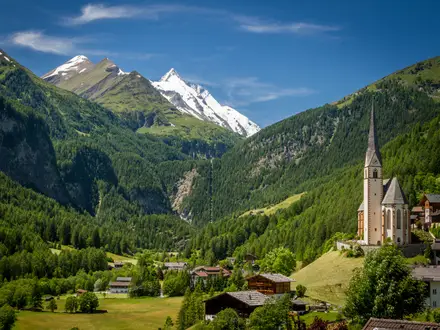
- Werfen and Hohenwerfen Castle: The trail starts and finishes in Werfen, a railway-connected town in the Salzach valley. Hohenwerfen Castle, an 11th-century clifftop fortress, stands above the valley, with the Eisriesenwelt ice cave nearby.
- Hochkönig massif: Early stages cross open high-pasture terraces below the Hochkönig, the 2,941 m high point of the Berchtesgaden Alps. The Dienten and Maria Alm area gives the route its classic Alm scenery.
- Gastein valley: The Almenweg drops into the Gasteinertal, known for Bad Gastein’s thermal spa setting and waterfall, before climbing towards Sportgastein in the Hohe Tauern.
- Großarltal and Hüttschlag: The “valley of alms” has around 40 managed huts in a single valley, making it one of the most hut-rich parts of the route.
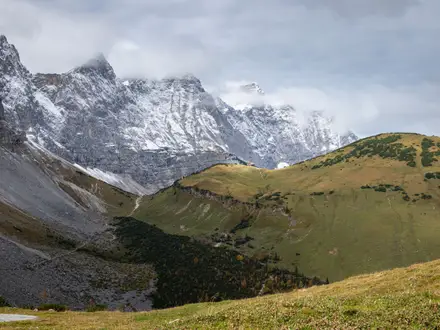
- Tauern crest at Obertauern: The route reaches its high point at 2,237 m near Obertauern, briefly sharing the Tauernhöhenweg past small mountain lakes on the main Alpine ridge.
- Rossbrand above Radstadt: The Rossbrand is known for a wide 360-degree panorama over the Dachstein, Hohe Tauern and surrounding peaks.
Challenges to expect
Although rated moderate overall, the Salzburger Almenweg is a serious multi-day alpine route: 350 km, about 20,000 m of ascent and many days above 1,000 m. Snowmelt and hut opening times set the practical season, and weather can change quickly on the higher Tauern sections. Waymarking uses the blue gentian logo, but carry maps or GPS. Cash is often useful at huts, and cable cars can shorten some climbs.
HikeList Score
Salzburger Almenweg scored 82/100 on HikeList's trail-quality metrics.
See score breakdownHide breakdown
- Ideal length 66
- Balanced challenge 100
- Scenery & wildness 85
- Varied terrain 83
- Accommodation 66
- Food & support 88
- Path quality 98
- Season flexibility 76
Computed from length, challenge, scenery & wildness, terrain variety, accommodation, food & support, path quality and season flexibility.
Show more data Show less
- Mountainous
- Alpine Pasture
- Forest
- Rocky
- Dirt
- Gravel
- Huts
- Hotels
- Family Friendly
- Pet Friendly
- Restrooms
- Water Sources
- Campsites
- Shelters
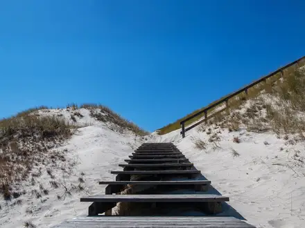
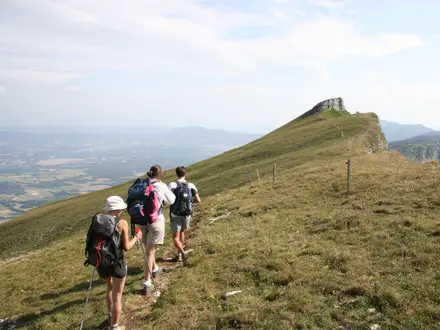
Photos from hikers
Taken on the trail by people who've reviewed Salzburger Almenweg.
Reviews
How would you rate Salzburger Almenweg?
Tap a star to start your review — you could be the first.