Samarina to Smolikas Summit
How would you rate Samarina to Smolikas Summit?
Tap a star to share your experience and help other hikers.
Samarina to Smolikas Summit: High Pindus Ridge Hike
HikeList Score
Samarina to Smolikas Summit scored 73/100 on HikeList's trail-quality metrics.
See score breakdownHide breakdown
- Ideal length 55
- Balanced challenge 74
- Scenery & wildness 98
- Varied terrain 64
- Accommodation 58
- Food & support 65
- Path quality 98
- Season flexibility 76
Computed from length, challenge, scenery & wildness, terrain variety, accommodation, food & support, path quality and season flexibility.
Samarina to Smolikas Summit is a hard high-mountain day hike in northern Greece, climbing from Samarina village to Mount Smolikas at 2,637 m. The standard outing is an out-and-back of about 18 km, usually taking a long day of roughly 8–10 hours with breaks. It suits strong, experienced hikers who are comfortable with sustained ascent, rocky alpine terrain, exposed ridges and navigation in cloud. Smolikas is Greece’s second-highest peak and the highest summit in the Pindus range.
Route Overview
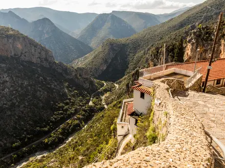
The trail starts by the village football pitch on the upper edge of Samarina, then climbs through birch and pine forest before breaking into the alpine zone. The line runs broadly east to west, passing towards Kapetan Tsekouras, onto the NE ridge of Mosia, over Mikri Mosia, past Laimos and up the east side of Smolikas summit. With no transport at the top, most walkers retrace the same route to Samarina. A longer point-to-point crossing can continue west to Agia Paraskevi, but that changes the logistics. For wider Greek mountain planning, compare the Agrafa Mountains Circuit or the E6 European Long-Distance Trail Greek Section.
Samarina and the Old Via Normale
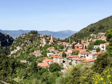
Samarina is a historic Aromanian, or Vlach, mountain settlement in the Pindus, long associated with stock-breeding, woollen flokati weaving and mountain trade. The village is quiet in winter and fills each August for the Dormition feast. The Samarina ridge was also the original Via Normale up Smolikas in the 1970s and 1980s, before improved roads made the shorter Pades and Palioseli approaches more commonly used.
Notable highlights
- Samarina village (approx 1,420–1,450 m): One of the highest villages in Greece and the Balkans, and a historic Vlach summer settlement. Its landmark church, Megali Panagia, is known for the black pine growing from its roof.
- Smolikas summit (2,637 m): Greece’s second-highest peak after Mount Olympus and the highest point of the Pindus range. The summit gives wide views towards Tymfi, Gramos, Vasilitsa and the northern interior.
- Mosia and the alpine ridge: The traverse crosses a chain of high named tops including Kapetan Tsekouras, Mosia, Mikri Mosia and Laimos. The true top of Mosia involves exposed grade III+ scrambling and is usually bypassed, but the ridge remains airy.
- Northern Pindos National Park: The route lies within a major protected mountain area with ophiolite peaks, glacial relics and wildlife including Balkan chamois, brown bear and birds of prey.
- Birch, pine and alpine flora: The lower slopes pass through birch, black pine, beech and fir, then open into grassland and rock above roughly 2,000 m. Early summer can be especially good for alpine plants.
Challenges to expect
Expect a sustained climb from about 1,420–1,450 m to 2,637 m, with roughly 1,500 m of cumulative ascent because the ridge repeatedly re-climbs. The lower trail is waymarked, but the alpine section relies on metal poles that can be sparse or hard to see in cloud. Water is limited above the treeline, and snow can linger into early summer or return in autumn.
HikeList Score
Samarina to Smolikas Summit scored 73/100 on HikeList's trail-quality metrics.
See score breakdownHide breakdown
- Ideal length 55
- Balanced challenge 74
- Scenery & wildness 98
- Varied terrain 64
- Accommodation 58
- Food & support 65
- Path quality 98
- Season flexibility 76
Computed from length, challenge, scenery & wildness, terrain variety, accommodation, food & support, path quality and season flexibility.
Show more data Show less
- Mountainous
- Forest
- Dirt
- Rocky
- Huts
- Wild Camping Spots
- Pet Friendly
- Water Sources
- Campsites
- Shelters
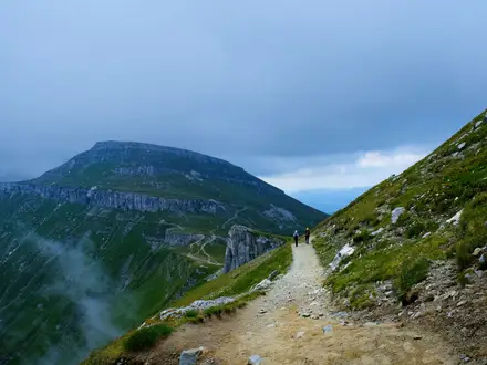
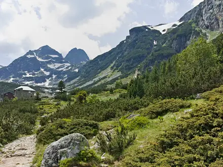
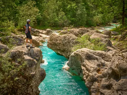
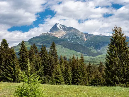
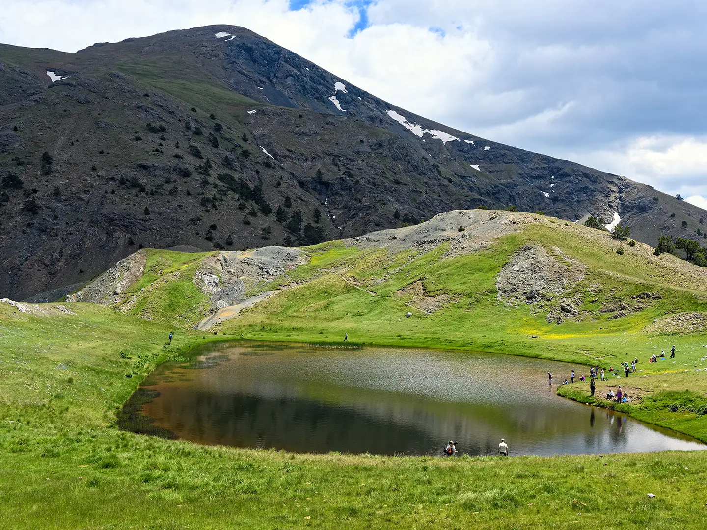
Photos from hikers
Taken on the trail by people who've reviewed Samarina to Smolikas Summit.
Start by the football pitch on the upper edge of Samarina and climb through forest towards Kapetan Tsekouras. Continue onto the NE ridge of Mosia, over Mikri Mosia, past Laimos and up the east side of Smolikas summit at 2,637 m. Most hikers return the same way to Samarina; strong parties can instead descend west to Agia Paraskevi as a point-to-point crossing.
Reviews
How would you rate Samarina to Smolikas Summit?
Tap a star to start your review — you could be the first.