PR8 SMR (Rocha da Pena Trail)
How would you rate PR8 SMR (Rocha da Pena Trail)?
Tap a star to share your experience and help other hikers.
Rocha da Pena Trail: A Short Algarve Karst Ridge Walk
HikeList Score
PR8 SMR (Rocha da Pena Trail) scored 73/100 on HikeList's trail-quality metrics.
See score breakdownHide breakdown
- Ideal length 55
- Balanced challenge 100
- Scenery & wildness 98
- Varied terrain 64
- Accommodation 45
- Food & support 45
- Path quality 98
- Season flexibility 89
Computed from length, challenge, scenery & wildness, terrain variety, accommodation, food & support, path quality and season flexibility.
The Rocha da Pena Trail is a 6.7 km, 1-day, moderate loop in the central Algarve, Portugal, between Salir and Benafim. Officially waymarked as PR18 LLE, it climbs a karst limestone ridge in the Local Protected Landscape of Rocha da Pena, crosses the plateau to clifftop viewpoints and returns through small hamlets. It suits hikers wanting a half-day Algarve walk with rocky footing, birdlife, wildflowers and strong views without needing overnight logistics.
Route Overview
The loop starts and finishes at the village of Rocha, near the trailhead car park and Bar das Grutas cafe, reached via Salir. The waymarked route climbs steeply onto the Rocha da Pena plateau, follows rough limestone paths along the cliff edge, passes viewpoints and the short side path to Talefe summit, then descends on loose, rocky ground through Penina before returning to Rocha. Rocha is roughly 25 minutes’ drive north of Loulé and about 50 minutes north of Faro. For other Portugal walking ideas, compare the Fishermen’s Trail on the Rota Vicentina, Arouca Geopark Trails and Peneda-Gerês National Park Trails.
Rocha da Pena history
Rocha da Pena has long been used as a refuge and lookout. Two dry-stone defensive walls on the plateau are attributed to Iron Age peoples, using the natural cliff as part of the fortification. Local legend links the Algar dos Mouros cave with Moors hiding during the 13th-century Christian reconquest of the Algarve, when nearby Salir was retaken. Penina preserves rural heritage from lime-burning and small-scale farming, including a restored lime-burning chimney dated 1821.
Notable highlights
Algar dos Mouros (Cave of the Moors): A limestone cave or pothole near the top of the ridge, reached by a short detour from the main loop. It is tied to local reconquest legend and shelters bats today.
Iron Age defensive walls: Two dry-stone walls cross the plateau, attributed to pre-Roman Iron Age communities. They are the route’s main archaeological feature and show how the ridge’s cliffs were used defensively.
Talefe summit (479 m): The highest point of Rocha da Pena is reached by a short side path. It gives the best southern panorama over the Barrocal and towards the Algarve coast.
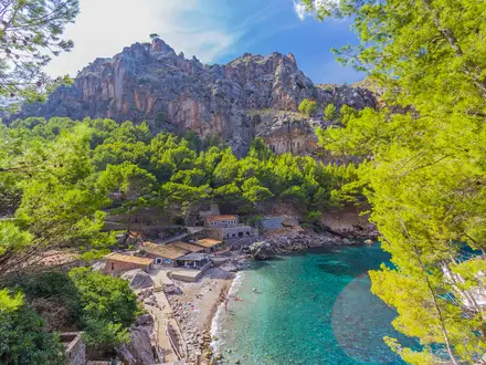
Limestone cornice and karst plateau: Rocha da Pena is a classified geomonument, with a craggy limestone cornice and karren fields of runnels and grykes. The exposed rock makes this a compact introduction to Algarve karst geology.
Penina hamlet and lime kiln: The descent passes through Penina, where a small mini-museum and restored lime-burning chimney recall traditional rural industry.
Birdlife and wildflowers: The protected landscape records over 70 bird species and more than 400 plant species. Wild orchids, peonies and Narcissus calcicola are among the spring highlights, especially from January to April.
Challenges to expect
The walk is short, but not flat or smooth. Expect a steep, stony climb at the start, rough limestone on the plateau, exposed cliff edges and loose stones on the descent; reddish clay can be slippery when wet. There is little shade on the plateau, so avoid high summer heat. Facilities are limited beyond the trailhead cafe and small hamlets.
HikeList Score
PR8 SMR (Rocha da Pena Trail) scored 73/100 on HikeList's trail-quality metrics.
See score breakdownHide breakdown
- Ideal length 55
- Balanced challenge 100
- Scenery & wildness 98
- Varied terrain 64
- Accommodation 45
- Food & support 45
- Path quality 98
- Season flexibility 89
Computed from length, challenge, scenery & wildness, terrain variety, accommodation, food & support, path quality and season flexibility.
 Portugal
Show more data Show less
- Hills
- Mountainous
- Dirt
- Rocky
- Accommodation Not Required
- Family Friendly
- Pet Friendly
- Picnic Areas
Photos from hikers
Taken on the trail by people who've reviewed PR8 SMR (Rocha da Pena Trail).
Reviews
How would you rate PR8 SMR (Rocha da Pena Trail)?
Tap a star to start your review — you could be the first.