Pindus Traverse
How would you rate Pindus Traverse?
Tap a star to share your experience and help other hikers.
Pindus Traverse: Expert Trek Across Greece’s Wild Spine
HikeList Score
Pindus Traverse scored 79/100 on HikeList's trail-quality metrics.
See score breakdownHide breakdown
- Ideal length 75
- Balanced challenge 48
- Scenery & wildness 98
- Varied terrain 64
- Accommodation 92
- Food & support 81
- Path quality 98
- Season flexibility 89
Computed from length, challenge, scenery & wildness, terrain variety, accommodation, food & support, path quality and season flexibility.
The Pindus Traverse is an expert, approximately 350 km mountain trek through the northern Pindus range in north-western Greece, usually planned over about 20 days. This is not one fixed official footpath: walkers link village paths, old shepherd and mule trails, refuge routes and sections of the E4/E6 to cross Zagori, Vikos-Aoos National Park, Smolikas and Valia Kalda. It suits experienced, self-sufficient hikers who can navigate partly waymarked or unmarked high terrain.
Route Overview
This listing treats the traverse as a point-to-point Konitsa-to-Metsovo line, walkable in either direction. From Konitsa and the Aoos gorge it threads through the Zagori stone villages — including Aristi, Papingo, Monodendri, Kipi and Tsepelovo — before taking in Vikos Gorge, Mount Tymfi, Astraka refuge and Drakolimni. The route then pushes towards Samarina, Mount Smolikas, the Pindus (Valia Kalda) National Park, the Arkoudorema valley, Vovousa, Aoos Springs lake and Metsovo. Because no single authority defines the “Pindus Traverse”, plan it as a route concept rather than a signed trail. Compare the Greek E4 long-distance route, the E6 Greek section and the Agrafa Mountains Circuit if you are weighing up other demanding Greek mountain routes.
Highland Routes, Stone Villages and Pindus History
The Pindus has long been a highland frontier crossed by shepherds, traders and pastoral Vlach and Sarakatsani communities moving flocks to summer pastures. Zagori’s villages prospered under Ottoman-era autonomy, funding stone churches, mansions and packhorse bridges that still shape the walking routes. The range’s remoteness also made it a refuge during the Greek War of Independence, the Second World War and the civil war. Vikos-Aoos and Valia Kalda later became national parks, while Terra Pindus is now working to revive old paths as a continuous long-distance trail.
Notable highlights
- Vikos Gorge: A roughly 32 km limestone gorge below Mount Tymfi, with the clear Voidomatis river emerging at its lower end. It is one of the defining landscape features of any Zagori crossing.
- Zagori stone villages: Papingo, Monodendri, Kipi and Tsepelovo are traditional grey-stone settlements linked by cobbled kalderimi paths. They are the social and logistical heart of the northern Pindus walk.
- Stone arched bridges of Zagori: Bridges such as Plakidas/Kalogeriko and Kokkoros were built to carry packhorse routes over Pindus torrents. They make the lower village sections feel very different from the alpine stages.
- Mount Smolikas and Drakolimni: Smolikas reaches 2,637 m, the high point of the Pindus range and this traverse if summited. Its Dragon Lake lies near 2,200 m and is tied to local legend.
- Mount Tymfi and Drakolimni: Tymfi’s high ground, including Gamila at 2,497 m, is commonly approached from Astraka refuge. The lake at about 2,000 m is one of the classic high days above Zagori.
- Pindus (Valia Kalda) National Park: The “Great Cold Valley” protects black pine and beech forest around the Arkoudorema valley. It is one of the wilder, more self-sufficient parts of the traverse.
Challenges to expect
Expect long mountain days, rocky alpine ground, forest and dirt tracks, cobbled village paths and short minor-road links. Waymarking is patchy or absent on several sections, so GPS, maps and confident navigation are essential. Snow can linger on Smolikas and Tymfi into early summer, while lower valleys can be hot in summer. Resupply is spread out, especially around Valia Kalda and the Smolikas-to-Aoos stretches.
HikeList Score
Pindus Traverse scored 79/100 on HikeList's trail-quality metrics.
See score breakdownHide breakdown
- Ideal length 75
- Balanced challenge 48
- Scenery & wildness 98
- Varied terrain 64
- Accommodation 92
- Food & support 81
- Path quality 98
- Season flexibility 89
Computed from length, challenge, scenery & wildness, terrain variety, accommodation, food & support, path quality and season flexibility.
 Greece
Show more data Show less
- Mountainous
- Forest
- Rocky
- Dirt
- Hotels
- Hostels
- Huts
- Campsites
- Wild Camping Spots
- Pet Friendly
- Water Sources
- Campsites
- Shelters
In these collections
Photos from hikers
Taken on the trail by people who've reviewed Pindus Traverse.
Begin your traverse from the town of Konitsa, quickly ascending into the verdant hills above the Aoos river. The route follows forested trails and old shepherd paths, passing vistas overlooking deep river valleys. After crossing the impressive stone Konitsa Bridge, continue along undulating woodland terrain until you reach the Zagorian village of Aristi.
Departing from Aristi, ascend steadily along forest tracks into the mountains, gaining elevation toward the charming double village of Papingo. Today’s segment skirts the boundaries of the Vikos–Aoos National Park, with frequent glimpses of limestone cliffs and pine forests. The day concludes in the traditional stone-built village of Papingo.
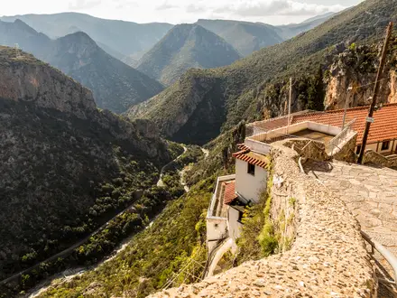
After a night in Papingo, descend towards the entrance of Vikos Gorge. This famous natural wonder features breathtaking chasms and dramatic river-carved rock formations. Follow the marked trail along the gorge bottom, passing through lush vegetation before ascending steeply to reach the small village of Vikos.
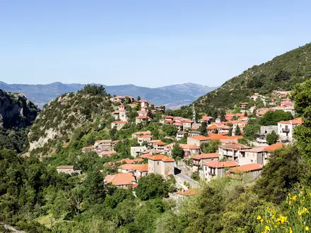
Descend again to the Vikos Gorge and follow the riverside path, traversing wooden bridges and ancient mule tracks. The trail climbs out of the gorge, revealing panoramic views before entering Monodendri, one of Zagori’s best-preserved villages, known for its stone architecture and lively cultural history.
From Monodendri, hike along a series of historic cobblestone paths that connect Zagori’s stone villages. Pass through shaded forests and cross iconic arched bridges, like the Kokkoros and Plakidas bridges. Today ends in the scenic village of Kipi, renowned for its preserved traditional structures.
Leaving Kipi, ascend through oak and beech forests, with several gentle crests and valleys. The trail weaves through lesser-known villages and open pastures, eventually reaching Tsepelovo, a village famous for its stone fountains and vibrant local life.
Depart Tsepelovo via a mix of forest tracks and open country paths, gradually gaining altitude. The itinerary covers a blend of wooded ridges and scenic glades, ultimately bringing you to the traditionally-built village of Laista.
Today’s route offers a remote mountain feel, following less-frequented trails that traverse high country terrain. Pass through old-growth forests, with cold mountain streams and large meadows, before arriving in the quiet village of Skamneli.
Rise early for a day of substantial elevation gain, trekking over ridgelines and alpine pastures towards the village of Fourka. Expect some rugged trail and rocky footing, alongside panoramic viewpoints of the surrounding Pindus ranges.
Leave Fourka to approach one of the trail’s highest segments. Navigate rolling meadows and sparse woodland as you cross into the highlands near Samarina, a well-known Vlach village and a hub for shepherding traditions.
Start with a steady climb out of Samarina, traversing subalpine slopes and open ridges. The landscape becomes increasingly wild as you approach Smolikas Refuge, nestled just below the iconic second-highest summit of Greece.
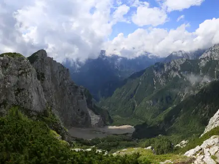
Summit day for Mount Smolikas. Ascend to the famed Dragon Lake, perched in a glaciated cirque below the summit, before pushing to the peak at 2637m. Descend carefully through alpine meadows and stony paths, arriving at the village of Palioselli.
Today’s trek heads southeast, descending into forested valleys and crossing streams on rustic wooden bridges. Follow remote dirt tracks before reaching the tranquil village of Perivoli, tucked into the heart of pine woods.
From Perivoli, enter the pristine wilderness of Valia Kalda National Park. The route follows winding streams, lush glades, and ancient forests. The terrain is remote and wild, with few signs of civilization, providing an immersive nature experience.
Continue through the heart of Valia Kalda, navigating alongside mountain rivers and thick woodlands. Look for signs of unique wildlife, such as otters or wild boar. The route exits the park near the riverside village of Vovousa.
Ascend from Vovousa through quiet pine forests and across small plateaus. The journey today offers solitude as you traverse remote hills to reach the slopes of Mavrovouni, with options to wild camp or use simple shepherd shelters.
Descend gently toward the sparkling waters of Aoos Lake. Today’s walk is defined by tranquil woodland paths, lakeside meadows, and views of the water framed by forested hills. Reach the shores of Aoos Lake, an ideal spot for a restful evening.
Leaving Aoos Lake, climb gradually through fir forests and high pastures. This segment navigates over old shepherd tracks, cresting hills above the lake before descending toward the mountain village of Anilio, near Metsovo.
Head from Anilio along scenic ridgelines, steadily losing elevation as you approach the vibrant town of Metsovo. The trail passes occasional chapels and open meadows with expansive views before finally entering the cultural heart of the southern Pindus.
The final day begins in bustling Metsovo, ascending toward panoramic vistas on the Avgo Ridge. Follow less-trodden paths through high alpine meadows and wind up the traverse with inspiring views across the Pindus range, marking the conclusion of a true mountain epic.
Reviews
How would you rate Pindus Traverse?
Tap a star to start your review — you could be the first.