Haute Route (Chamonix to Zermatt)
How would you rate Haute Route (Chamonix to Zermatt)?
Tap a star to share your experience and help other hikers.
Haute Route: Chamonix to Zermatt Hiking Guide
HikeList Score
Haute Route (Chamonix to Zermatt) scored 80/100 on HikeList's trail-quality metrics.
See score breakdownHide breakdown
- Ideal length 89
- Balanced challenge 44
- Scenery & wildness 88
- Varied terrain 94
- Accommodation 75
- Food & support 88
- Path quality 98
- Season flexibility 76
Computed from length, challenge, scenery & wildness, terrain variety, accommodation, food & support, path quality and season flexibility.
The Walker’s Haute Route is a demanding point-to-point alpine trek from Chamonix in France to Zermatt in Switzerland, linking Mont Blanc and the Matterhorn. The classic walking line is approximately 215 km and usually takes 12–14 walking days. It suits fit, experienced hikers comfortable with high passes, rocky trails, scree, long climbs and cumulative ascent of more than 14,000 m. This is not a casual hut walk: several days exceed 1,000–1,600 m of ascent.
Route Overview
The route runs west to east from Chamonix beneath Mont Blanc to car-free Zermatt beneath the Matterhorn. Typical waypoints include Argentiere, Trient, Champex, Le Chable or Verbier, Cabane du Mont Fort, Col de Prafleuri, Arolla, La Sage, Cabane de Moiry, Zinal, Gruben, St Niklaus or Grachen, Randa and Zermatt. It is a hut-to-hut and village-to-village trek using mountain refuges, auberges, hotels and occasional campsites. No permit or trail fee is required, and walkers can use cable cars or postbuses on some valley sections. For another Swiss high-pass thru-hike, compare the Alpine Pass Route or the hut-based Bernina Trek.
From mountaineering line to walker’s route
The original Haute Route was pioneered around 1861 as a high mountaineering line by members of the British Alpine Club, including Wills, Mathews and Tuckett, linking Mont Blanc to the Matterhorn across glaciers and high cols. It was first skied in 1911, which helped give the route its French name. The Walker’s Haute Route is the later non-glaciated hiking variant: it stays below about 3,000 m, needs no mountaineering equipment and was popularised in English by Kev Reynolds’ Cicerone guidebook.
Notable highlights
- Matterhorn finale at Zermatt: The trek ends in car-free Zermatt beneath the 4,478 m Matterhorn, the symbolic counterpart to Mont Blanc at the start.
- Charles Kuonen Suspension Bridge: On the final Europaweg approach near Randa, walkers cross a 494 m footbridge hanging up to 85 m above the Grabengufer ravine.
- Col de Prafleuri (2,987 m): The highest point of the classic walking route, this stony pass gives the central section a wild, high-mountain feel.
- Fenetre d’Arpette (2,665 m): A demanding optional high pass above Champex with close views of the Trient Glacier; the gentler Bovine route is the usual alternative.
- Val de Zinal and the Imperial Crown: Balcony paths above Zinal look towards the Weisshorn, Zinalrothorn, Ober Gabelhorn, Dent Blanche and Matterhorn.
- Lac de Moiry and Moiry Glacier: A turquoise reservoir backed by glacier scenery, reached via Cabane de Moiry and one of the scenic high points of the middle route.
Challenges to expect
Expect sustained alpine days rather than technical climbing. The main difficulties are repeated 1,000 m-plus ascents, rocky single-track, scree, boulder fields, exposed-feeling high passes and changeable mountain weather. Snow can remain outside the mid-July to mid-September season. Navigation is generally well waymarked, especially in Switzerland, but poor visibility can make cols serious. If glacier scenery is your priority, also see the Aletsch Glacier Panorama Trail.
HikeList Score
Haute Route (Chamonix to Zermatt) scored 80/100 on HikeList's trail-quality metrics.
See score breakdownHide breakdown
- Ideal length 89
- Balanced challenge 44
- Scenery & wildness 88
- Varied terrain 94
- Accommodation 75
- Food & support 88
- Path quality 98
- Season flexibility 76
Computed from length, challenge, scenery & wildness, terrain variety, accommodation, food & support, path quality and season flexibility.
 Switzerland
Show more data Show less
- Mountainous
- Alpine
- Forest
- Pasture
- Rocky
- Dirt
- Gravel
- Huts
- Hotels
- Campsites
- Pet Friendly
- Restrooms
- Water Sources
- Campsites
- Shelters
Download Our Full Guide to Haute Route (Chamonix to Zermatt) FREE!
Get our comprehensive guide to this hike for free. Save it for later reading or print out at home.
Articles related to this hike
In these collections
Photos from hikers
Taken on the trail by people who've reviewed Haute Route (Chamonix to Zermatt).
Haute Route (Chamonix to Zermatt): The Complete Guide
 i
Image by A.Pushkin
i
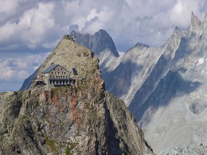
Image by A.Pushkin The Walker’s Haute Route is a serious hut-and-village trek from Chamonix-Mont-Blanc to Zermatt, linking two of the Alps’ great mountain towns without requiring glacier travel or mountaineering kit. It starts beneath Mont Blanc, crosses into Switzerland at the Col de Balme, then works east through the Valais towards the Matterhorn.
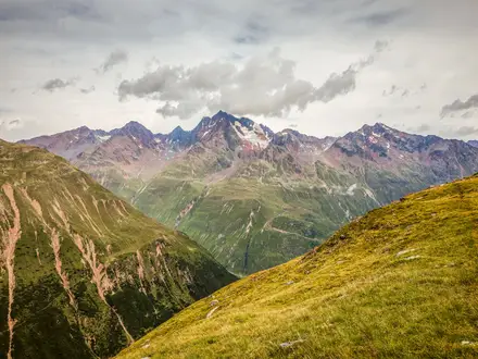
This is high-alpine walking rather than a gentle long-distance trail. Expect rocky paths, scree, boulder fields, exposed cols, reservoir crossings, glacier foregrounds and long balcony traverses above deep valleys.
The rewards are large: the Grand Combin from the Cabane du Mont Fort, the wild stony crossing of the Col de Prafleuri, Lac de Moiry below the Moiry Glacier, and the late approach to Zermatt with the Matterhorn ahead. Villages such as Champex-Lac, Arolla, Zinal, Gruben and St. Niklaus break up the route, but the days between them can still feel remote.
The route suits fit, experienced mountain walkers who are comfortable with repeated 1,000–1,700 m climbs, long descents and fast-changing weather. It is usually planned for mid-July to mid-September, with beds in huts and village lodging booked well ahead.
This guide covers the stages, day planning, accommodation, food, transport, terrain and common mistakes on the Haute Route.
Stage-by-Stage Guide
The stages below follow the 11-stage outline used on this page. Stage lengths are approximate: the Walker’s Haute Route has several accepted variants, and hut availability, weather and trail diversions can change the practical itinerary. Book each night to match the exact line you intend to walk.
Stage 1: Chamonix to Trient
The opening stage leaves Chamonix-Mont-Blanc and heads up-valley towards Argentière before climbing to the Col de Balme, the frontier pass between France and Switzerland. This is the first clear mountain day of the route: a long ascent from the Chamonix valley, then a descent into the Swiss Valais to Trient.
Underfoot, expect waymarked mountain paths, with French GR-style marking on the French side and Swiss mountain-path signage after the border. The Col de Balme is the key landmark, with the classic backward view across the Mont Blanc massif before the route drops away from France.
Food and supplies are best dealt with in Chamonix or Argentière before the climb. Do not rely on finding food or water on the high part of the stage; carry enough for a full mountain day.
Trient has village accommodation suitable for the first Swiss night, but beds should still be reserved in advance. Chamonix is reached by road or rail transfer, with Geneva the nearest major airport; road access exists at both ends, but local transport times should be checked before travelling.
Navigation is usually straightforward in clear weather, but the Col de Balme is an exposed frontier pass and can be confusing in cloud. Early-season snow on the higher ground is possible outside the reliable mid-July to mid-September window.
Stage 2: Trient to Champex-Lac
This stage links Trient with the lake resort of Champex-Lac and is one of the first major route-choice days. The demanding Fenêtre d’Arpette variant climbs to 2,665 m above Champex and gives close views of the Trient Glacier; the Bovine route is the gentler standard alternative.
The Fenêtre d’Arpette is a serious mountain crossing with steep, rocky and potentially loose ground. It should be treated as a good-weather option for strong walkers only. The Bovine line is still a mountain stage, but it avoids the highest and roughest ground.
Carry food and water from Trient unless you have specifically planned an intermediate stop. Champex-Lac has accommodation, food and normal village services at the end of the day.
Road access and onward public transport around Champex-Lac should be checked before travelling. Navigation matters here because choosing the wrong variant can turn a moderate day into a much harder one; decide between Fenêtre d’Arpette and Bovine before leaving Trient, using the current weather and snow conditions rather than ambition.
Stage 3: Champex-Lac to Le Châble
The route drops from Champex-Lac towards Le Châble, giving a shorter and generally less severe day after the Trient–Champex crossing. Expect lower-level paths through forest, pasture and valley-side terrain rather than the high scree and boulder fields that dominate the central stages.
This is a useful recovery and logistics stage, but it should not be dismissed as a rest day: the descent can still be tiring with a multi-day pack. Path conditions are typically less technical than the previous stage, though wet forest paths and pasture tracks can be slippery.
Stock up in Champex-Lac before leaving and plan to resupply properly in Le Châble. Water and food between the main settlements should not be assumed unless already identified on your map or accommodation plan.
Le Châble has accommodation options and is an important transport and linking point below Verbier. Postbuses and cable cars serve this part of the route, including the Le Châble / Verbier area, and can be useful for shortening or rejoining stages; current timetables should be checked before travelling.
Navigation is mainly about staying on the intended valley-side line rather than drifting onto roads or local tracks. This is also the point to check the next night’s hut booking carefully, because the route now climbs back into higher, more remote terrain.
Stage 4: Le Châble to Cabane du Mont Fort
This stage climbs from Le Châble towards Verbier and on to Cabane du Mont Fort, moving from valley settlement back into the high alpine hut system. It is a sustained uphill day, with a marked change from village walking to ski-area tracks, alpine pasture and mountain paths.
The main practical challenge is the height gain. The route passes through or near Verbier before continuing to the hut, and the higher ground begins to open views towards the Grand Combin across the Val de Bagnes.
Le Châble and Verbier are the key places for food before the hut. Cabane du Mont Fort is a manned mountain hut and is normally used on a demi-pension basis, but lunch food and daytime water should still be carried from the valley.
Cable cars in the Le Châble / Verbier area can be used to shorten the climb or adjust the stage, but operating dates and times vary and should be checked before travelling. Accommodation at Cabane du Mont Fort must be booked ahead, especially in the main mid-July to mid-September season.
Navigation through resort terrain can be less obvious than expected because ski tracks, service roads and footpaths intersect. Use the Swiss yellow and white-red-white signs with a proper map rather than following the broadest track.
Stage 5: Cabane du Mont Fort to Cabane de Prafleuri
This is one of the defining high-mountain stages of the Walker’s Haute Route. From Cabane du Mont Fort the route traverses wild, stony terrain towards the Col de Prafleuri, the highest point of the classic walking route at 2,987 m, before descending to Cabane de Prafleuri.
Expect rough mountain paths, scree, moraine-like ground and boulder fields. The walking is non-glaciated on the Walker’s variant, but it is still serious high-alpine terrain and feels remote in poor visibility.
There are no reliable village services between the huts, so carry lunch, snacks and enough water for the full day. Cabane de Prafleuri provides the overnight stop and should be reserved well ahead.
This stage has limited easy escape options once committed. Public transport is not part of the normal day’s logistics between the two huts.
Navigation must be treated seriously. In cloud, rain or lingering snow, the stony landscape around the high cols can make the line difficult to follow, and this is not a place to depend only on paint marks or other walkers.
Some itineraries use variants in this central section, including lines via Cabane de Louvie and the Grand Désert. Booked huts, maps and daily route choices must all match the same variant.
Stage 6: Cabane de Prafleuri to Arolla
This stage leaves Cabane de Prafleuri and passes the Barrage de la Grande Dixence before crossing towards Arolla by the high route around Pas de Chèvres / Col de Riedmatten. The Grande Dixence dam is a major landmark: at 285 m high, it is one of the tallest concrete gravity dams in the world.
The day mixes descent to the dam area with another demanding high crossing. Terrain includes rocky mountain paths, stony cols and exposed-feeling high ground, followed by the descent towards Arolla.
Food should be carried from Cabane de Prafleuri unless you have checked a reliable intermediate option. Arolla has village accommodation and is a natural place for a proper resupply and lower-altitude night after the hut-to-hut section.
Road access exists in the Arolla valley, but current public transport arrangements should be checked before travelling. This can be an important exit or adjustment point if weather has disrupted the central stages.
Navigation around Pas de Chèvres / Col de Riedmatten requires attention because route choices in this area can vary with conditions and itinerary. Snow, cloud or wet rock make the high crossings more serious; start early enough to avoid being forced over the pass late in the day.
Stage 7: Arolla to La Sage / Les Haudères
This is a shorter stage through the Val d’Hérens, linking Arolla with Les Haudères and La Sage. After several demanding hut-and-col days, it gives a useful chance to recover, wash kit, buy supplies and reset before the next major crossing.
The walking is generally lower and less technical, with forest, alpine pasture and village paths replacing the roughest scree and boulder fields. Even so, the route remains alpine: weather can still change quickly, and wet paths can be slippery.
Arolla, Les Haudères and La Sage are the practical food and accommodation points. Do not assume every hamlet has the supplies needed for the next high day; buy what is required before leaving the valley.
Accommodation is available in or near La Sage and Les Haudères, including village-style lodging, but reservations are still advisable. Road access and local public transport in the Val d’Hérens should be checked before travelling.
Navigation is simpler than on the high passes, but the main planning issue is where to sleep. La Sage is the usual launch point for the Col de Torrent stage, while Les Haudères may mean a different start or an additional link in the morning.
Stage 8: La Sage to Zinal
This is a long and strenuous stage crossing from the Val d’Hérens towards the Val de Zinal. The route climbs to the Col de Torrent at 2,916 m, drops towards Lac de Moiry and the Moiry Glacier foreground, then continues over the Col de Sorebois before descending to Zinal.
The terrain is varied and demanding: high grassy slopes, rough mountain paths, reservoir-side ground and another significant pass before the final descent. The turquoise Lac de Moiry and the glacier-backed basin are major highlights, followed later by views into the Val de Zinal.
Start with a full day’s food from La Sage unless a staffed stop has been built into the plan. Cabane de Moiry may be used by some itineraries, but opening dates, meal availability and route fit should be checked before relying on it.
Zinal has accommodation and is one of the useful valley service points on the eastern half of the trek. Postbus connections serve Zinal, making it a practical place to shorten, pause or rejoin the route; current times should be checked before travelling.
Navigation is important because this is a long two-pass day with several terrain changes. Poor weather on the Col de Torrent, around Lac de Moiry or on the Col de Sorebois can make the stage much harder, so leave enough time for slow progress on rough ground.
Stage 9: Zinal to Gruben
The route leaves Zinal and crosses the Forcletta to reach Gruben (Meiden). This is another full mountain day, moving from the French-speaking Valais towards the German-speaking side of the canton.
Expect a long climb out of the valley, high open terrain around the pass and a descent to the small settlement of Gruben. The stage is less built-up than the Zinal start might suggest, so treat it as a remote crossing rather than a village-to-village stroll.
Carry food and water from Zinal. Services between Zinal and Gruben should not be assumed, and accommodation in Gruben is limited enough that booking ahead is essential.
Public transport options from Gruben should be checked before travelling. This is not a stage where transport can be improvised easily if the weather turns or accommodation plans change.
Navigation over the Forcletta needs care in cloud, especially if snow lingers on the higher ground. The language shift is also noticeable from this point onwards, with German place names and Walliserdeutsch becoming more common around Gruben, St. Niklaus and beyond.
Stage 10: Gruben to St. Niklaus
The final major pass day crosses the Augstbordpass at 2,894 m before making a long descent into the Mattertal at St. Niklaus. This is a physically hard stage, not because of technical climbing but because of the sustained ascent and the knee-testing descent of more than 1,500 m.
The Augstbordpass is a high, stony crossing and can hold snow outside the main season. Underfoot, expect rocky mountain paths, scree and rough descent terrain that can be slow with tired legs.
Leave Gruben with a full day’s food and water. St. Niklaus is the next significant service point and has accommodation at the end of the stage.
St. Niklaus is one of the better transport access points late in the route, with on-route public transport serving the Mattertal area. Grächen is also served by local transport and may be used in some itineraries; current timetables should be checked before travelling.
Navigation is usually clear in settled weather, but the scale of the descent matters. Do not underestimate how long the drop into the Mattertal can take, especially in rain, on loose ground or with sore knees.
Stage 11: St. Niklaus to Europahütte / Zermatt
The final stage follows the high approach towards Zermatt, using the Mattertal balcony terrain associated with the Europaweg. It is the Matterhorn finale of the route, with the first full views of the 4,478 m Matterhorn / Cervin / Monte Cervino as the path works towards car-free Zermatt.
This is not a ceremonial walk-in. The Europaweg is a high mountain path above the Mattertal, with exposed-feeling sections and a history of rockfall-related diversions on the final approach to Zermatt.
Food and water should be planned from St. Niklaus or Grächen, depending on the exact line used. Randa and Zermatt are the lower-valley and finish-point service locations, but do not rely on intermediate options without checking current opening and route access.
Some walkers break this section at Europahütte; others continue or descend according to accommodation, weather and the open trail line. Europahütte and Zermatt accommodation should be booked ahead, and any Europaweg closures or diversions should be checked before travelling.
Public transport is available at key Mattertal points, and Zermatt is the car-free finish of the trek. From Zermatt, the Matterhorn Gotthard Bahn runs down the Mattertal to Visp for onward SBB trains.
Navigation on this stage is as much about current trail status as map reading. If the Europaweg is closed or diverted, follow official local instructions rather than trying to force the original line.
Recommended Itinerary
For a first traverse, plan on 12–14 walking days rather than trying to force the whole route into the shortest possible schedule. The stage distances below use the core stage data for the classic Walker’s Haute Route line; exact daily mileage varies with variants, hut choices and any trail diversions, so check official mapping before booking.
Standard itinerary: 11 core stages, with 1–3 extra split or buffer days
| Day | From | To | Approx. distance | Why this stage makes sense | Services/accommodation notes |
|---|---|---|---|---|---|
| 1 | Chamonix | Trient | 20 km | A full opening mountain day crossing from France into Switzerland over the Col de Balme. It gives an immediate high-pass start and avoids spending too long in the Chamonix valley. | Chamonix has the broadest pre-trek services. Trient is a small overnight stop, so accommodation should be reserved ahead. |
| 2 | Trient | Champex-Lac | 15 km | A logical crossing to Champex-Lac, with the choice between the demanding Fenêtre d’Arpette variant and the gentler Bovine route. The high option should only be taken in suitable weather and conditions. | Champex-Lac is a good place to reset after two mountain days. Book village lodging ahead in season. |
| 3 | Champex-Lac | Le Châble | 14 km | This is a shorter transition stage from the Champex area into the Val de Bagnes approach. It helps set up the climb towards Verbier and the hut section that follows. | Le Châble is a useful valley stop with onward transport options around Le Châble/Verbier. It is a practical point for resupply and schedule adjustments. |
| 4 | Le Châble | Cabane du Mont Fort | 13 km | The route climbs from the valley back into high-alpine terrain, positioning you well for the central cols. Ending at Cabane du Mont Fort avoids making the following high traverse too long. | Cabane du Mont Fort is a mountain-hut night; reserve well ahead and expect half-board-style hut arrangements. |
| 5 | Cabane du Mont Fort | Cabane de Prafleuri | 15 km | One of the key high-mountain stages, crossing the Col de Prafleuri area, the highest point of the classic Walker’s Haute Route at 2,987 m. It is serious in poor visibility and should not be treated as a routine trail day. | Cabane de Prafleuri is another hut night with limited capacity. There are no meaningful services between the huts, so carry what is needed for the day. |
| 6 | Cabane de Prafleuri | Arolla | 17 km | This stage links the Prafleuri hut to the Val d’Hérens side, passing the Grande Dixence area and crossing via the Pas de Chèvres / Col de Riedmatten options before descending to Arolla. | Arolla is an important valley overnight stop after the exposed central section. It is a sensible place to recover, regroup or wait out poor weather. |
| 7 | Arolla | La Sage / Les Haudères | 12 km | A deliberately shorter day after the harder hut-and-col stages. It gives useful recovery time before the long crossing towards Zinal. | La Sage and Les Haudères offer village-based overnight options. Reserve ahead, especially if relying on a specific half-board lodging. |
| 8 | La Sage | Zinal | 20 km | A long and rewarding stage over the Col de Torrent, past the Lac de Moiry / Cabane de Moiry area and on towards the Col de Sorebois before descending to Zinal. This is a big day and is a prime candidate for a slower split. | Zinal is a useful serviced valley point with transport options. If splitting this stage, check current hut and lodging availability around Lac de Moiry / Cabane de Moiry before booking. |
| 9 | Zinal | Gruben | 17 km | This crosses from the Val de Zinal towards Gruben via the Forcletta, moving into the eastern, German-speaking Valais section of the route. It keeps the final two major stages in a manageable sequence. | Gruben (Meiden) is a small overnight stop; beds are limited compared with larger valley towns, so book early. |
| 10 | Gruben | St. Niklaus | 17 km | The Augstbordpass is the last major pass of the route, followed by a long descent into the Mattertal. This is a hard-on-the-knees day and should not be underestimated. | St. Niklaus is a practical valley base with transport links and more flexibility than the small high-valley stops. It is a good place to reassess conditions before the Europaweg / Matterhorn finale. |
| 11 | St. Niklaus | Europahütte / Zermatt | 21 km | The final approach follows the high Mattertal line towards Zermatt, with the Europaweg providing the classic Matterhorn finish when open and conditions allow. This is a long final stage and may be better split. | Zermatt is car-free and has onward rail via the Matterhorn Gotthard Bahn. Check current Europaweg conditions, trail diversions and hut availability before relying on this stage as planned. |
Slower variant: 12–14 walking days
This is the best choice for most strong walkers tackling the route for the first time. It gives more margin for weather, lingering snow on high cols, tired legs and accommodation availability.
Sensible places to add time include:
- Chamonix to Trient: split the opening approach using Argentière if a gentler first day is needed. Check official mapping before booking.
- Le Châble to Cabane du Mont Fort: break the climb around Verbier if the hut approach would make the day too compressed.
- La Sage to Zinal: split the long crossing around Lac de Moiry / Cabane de Moiry where availability allows.
- St. Niklaus to Zermatt: split the final Mattertal approach using Grächen, Randa or Europahütte, depending on the chosen line, trail conditions and accommodation availability.
A slower schedule is also useful if travelling early or late in the normal season, when snow, storms or trail diversions can make the high passes less predictable.
Faster variant: 11 walking days
The table above represents the faster end of a complete walking schedule. It suits very fit, experienced mountain walkers who are comfortable with repeated long days, high passes, scree, boulder fields and limited margin for bad weather.
Going faster than this is not recommended for most independent hikers. Cable cars and postbuses at valley points such as Le Châble/Verbier, Zinal, St. Niklaus and Grächen can shorten or link stages if needed, but current operating times should be checked before travelling.
Planning the Route
Planning the Walker’s Haute Route is governed more by accommodation, high-pass conditions and transport links than by the headline distance. The route is well established and waymarked, but it is not a trail to improvise day by day: huts and village rooms are limited, weather can change quickly, and several stages commit you to crossing high, rocky cols before the next practical overnight stop.
Treat published itineraries as frameworks rather than fixed truths. Distances and stage lengths vary depending on variants, especially in the central Valais, so final bookings should match the exact line you intend to walk.
How many days to allow
Most walkers should allow 12–14 walking days, with 14 days the better choice for a first crossing or for anyone who wants more margin around weather, fatigue and long descents. A 12-day schedule suits very fit, experienced mountain walkers who are comfortable backing up hard days without much recovery time.
Walking the route quickly is rarely the best strategy. The cumulative strain comes from repeated big climbs and descents, rocky footing, high cols and long days above easy escape points, not just from the daily kilometres.
If travel dates are fixed, build in some flexibility where possible. A spare day is particularly useful if snow lingers on the passes, thunderstorms affect afternoon crossings, or the final Europaweg approach is diverted or closed.
Let accommodation shape the itinerary
The natural rhythm is hut-to-village-to-hut rather than campsite-style freedom. Key overnight anchors include places such as Trient, Champex-Lac, Le Châble / Verbier, Cabane du Mont Fort, Cabane de Prafleuri, Arolla, La Sage / Les Haudères, Zinal, Gruben (Meiden), St. Niklaus, Grächen and Zermatt.
Book the mountain huts and smaller village lodgings first, then adjust the rest of the itinerary around those reservations. Huts such as Cabane du Mont Fort, Cabane de Prafleuri and Cabane de Moiry are important planning points because they sit between demanding high-alpine stages where there may be no easy alternative at the end of the day.
Most hut and auberge arrangements are based around demi-pension — dinner, bed and breakfast. Lunches, trail snacks and any special dietary needs still need planning, especially before long high-pass days.
Some itineraries use variants, including lines through Cabane de Louvie and the Grand Désert, while others follow the more commonly planned sequence via Cabane du Mont Fort and Col de Prafleuri. Do not mix accommodation bookings from different variants without checking that the stages still connect sensibly.
Shortening, extending and section hiking
The route can be shortened or adjusted at several valley access points, but not on every stage. Once committed to a high col such as Col de Prafleuri, Col de Torrent, Forcletta or Augstbordpass, the realistic plan is usually to continue to the next valley or hut rather than expect an easy midway exit.
Postbuses and cable cars serve several useful points, including Le Châble / Verbier, Zinal, St. Niklaus and Grächen. These can help shorten a stage, recover time after bad weather, or create a practical start or finish for a section hike. Current timetables, operating dates and last services should be checked before travelling.
Section hiking is practical because both ends of the route are accessible and several Swiss valley points have public-transport links. Sensible sections are best planned around major access points rather than arbitrary passes, as the hardest terrain sits between the valleys.
Extending the trip is usually best done by adding rest or buffer nights rather than adding extra high-level detours. The Walker’s Haute Route already gives sustained high-alpine walking, and extra variants should be judged against weather, snow conditions and the group’s condition at the time.
Key route choices
The first major choice is the crossing between Trient and Champex-Lac. The Fenêtre d’Arpette is a demanding high variant with close views of the Trient Glacier; the Bovine route is the gentler standard alternative. In poor weather, lingering snow or low visibility, the easier line is often the more sensible mountain decision.
The central section around Le Châble, Verbier, Cabane du Mont Fort, Col de Prafleuri and Cabane de Prafleuri needs careful booking because variants change both the terrain and the overnight stops. This is also where the route reaches its highest point at Col de Prafleuri, so weather and snow conditions matter.
Late in the route, the Europaweg gives the classic balcony approach towards Zermatt and the Matterhorn, but it has been affected by rockfall closures and diversions in past seasons. Check the current status before relying on it for the final approach.
Food, water and resupply planning
Plan food around village stops and booked accommodation. Breakfast and dinner are often covered by half-board, but lunches and snacks should be arranged before remote days where there are no guaranteed services between overnight points.
Do not assume that every high section has convenient drinking water or refreshment options. Refill before leaving villages and huts, and carry enough for long exposed climbs, especially in hot weather.
Pack weight matters. The Walker’s Haute Route does not require ropes, crampons or glacier equipment on the walking variant, but the daily ascent makes every unnecessary kilogram noticeable. A lightweight hut-to-hut setup with robust waterproofs, warm layers, sun protection, navigation tools and emergency essentials is the right approach.
Navigation, maps and weather
The route uses French GR-style waymarks on the opening French section and Swiss yellow / white-red-white mountain-path signs through Valais. These are helpful, but they are not a substitute for proper navigation in cloud, snow patches or stormy conditions.
Carry appropriate mapping: IGN mapping for the French opening section and Swisstopo 1:50,000 sheets for the Swiss Valais sections are the standard planning basis. A dedicated guidebook and offline digital mapping are also sensible, but batteries and signal should not be relied on as the only navigation system.
The best planning window is mid-July to mid-September. Snow can linger on the high cols outside that window, and early-season crossings may be slower or more serious than the map distance suggests. Early to mid-September often brings fewer crowds and more settled conditions, but hut opening dates and transport schedules still need checking.
Transport, borders and money
Chamonix-Mont-Blanc is the start, with Geneva the nearest major airport and onward access by bus, transfer or rail connections via Martigny or St-Gervais. Zermatt is car-free, so the finish is normally by train on the Matterhorn Gotthard Bahn down the Mattertal to Visp for onward Swiss rail connections.
The route crosses from France into Switzerland at Col de Balme. Carry normal cross-border travel documents and remember the currency shift: euros apply around Chamonix and Argentière, while Swiss francs are the practical currency for most accommodation, huts, food and transport for the rest of the trek.
Planning is not mainly permit-led; it is booking-led and weather-led. Any current local access rules, hut policies, transport changes or trail diversions should be checked before travelling.
Towns, Villages and Overnight Stops
The Walker’s Haute Route is normally planned around a mix of valley villages, resort towns and high mountain huts. Accommodation should be booked ahead, especially the huts and smaller villages where bed numbers are limited and there may be little flexibility if a stage has to be changed.
Swiss francs (CHF) are the main currency for most overnight stops, transport and hut costs. Euros (EUR) apply only at the French start around Chamonix-Mont-Blanc and Argentière.
Chamonix-Mont-Blanc
Chamonix-Mont-Blanc is the classic starting point, beneath Mont Blanc in Haute-Savoie. It is the best place to arrive early, check kit, buy maps or missing mountain equipment, and make sure all onward hut and village bookings are in place.
Accommodation and food options are broad compared with anywhere else on the route, ranging from simple hiker lodging to hotels. It is also the last French stop before the route crosses into Switzerland over the Col de Balme.
Chamonix is reached by road or rail transfer. Genève (Geneva) is the nearest major airport, roughly 1–1.5 hours away by bus or transfer, and Chamonix can also be reached by train via Martigny or St-Gervais. Current transfer and rail times should be checked before travelling.
Argentière
Argentière lies up the Chamonix valley and is passed early on the opening stage towards the Col de Balme. It can be useful if accommodation in central Chamonix is limited, or if a walker wants to position slightly closer to the first climb.
It is still part of the French start area, so costs and payments are generally in euros. Do not treat Argentière as a substitute for the Swiss resupply points later in the trek; once the route crosses the frontier, planning revolves around booked beds and half-board lodging.
Col de Balme
The Col de Balme is the frontier pass between France and Switzerland on the first day. It is not a village stop, but it is a key planning point because it marks the shift from the Chamonix valley into the Swiss Valais.
In poor visibility or unstable weather, the crossing deserves proper mountain judgement rather than being treated as a simple border walk. The descent leads towards Trient, the first Swiss overnight stop on the classic line.
Trient
Trient is the usual first overnight stop after leaving Chamonix and crossing the Col de Balme. It sits on the Swiss side of the route and is a practical mountain-village stop rather than a large service centre.
Accommodation should be reserved in advance, especially in the main July–September walking season. Expect the usual Haute Route pattern of simple village lodging and half-board options rather than wide late-night choice.
Trient is also the base for the next decision: the standard route towards Champex-Lac or the harder Fenêtre d’Arpette variant. The Fenêtre d’Arpette is a serious high-pass option and should only be chosen in suitable weather and conditions.
Champex-Lac
Champex-Lac is the next major overnight village and a common place to recover after the Trient stage. It sits before the descent towards Le Châble and works well as a booked village night rather than a remote hut night.
There is more accommodation choice than in the smallest hamlets, but it remains a popular stop on a very popular trek. Book early and avoid assuming that spare beds will be available on arrival.
For food and resupply, Champex-Lac is a better bet than the high huts, but exact shop and restaurant opening times vary by season. This should be checked before travelling.
Le Châble
Le Châble is an important valley stop below Verbier and one of the more useful logistical points on the route. It is normally reached after descending from Champex-Lac and sits before the climb towards the high Verbier/Mont Fort section.
This is a sensible place to pause, resupply where possible, or adjust the itinerary before committing to the higher hut stages. Accommodation is available in the valley area, though advance booking remains advisable.
Le Châble is one of the on-route locations served by public transport and can be linked with Verbier by local uplift. Current postbus, rail and cable-car arrangements should be checked before relying on them for a stage plan.
Verbier
Verbier sits above Le Châble and is a major resort option near the route. It can be useful for hikers who prefer a larger service base before heading to Cabane du Mont Fort, or who need to shorten the climb using local transport where available.
Accommodation and food options are broader than in the small valley villages and huts, but prices can be high by mountain standards. Confirm current rates and cancellation terms before booking.
Verbier is also useful as a bail-out or restart point because Le Châble/Verbier is served by transport. Cable-car times are seasonal and should be checked before travelling.
Cabane du Mont Fort
Cabane du Mont Fort is the first of the key high mountain hut stops on the classic central section. It sits above the Le Châble/Verbier area and positions walkers for the rough, high traverse towards Col de Prafleuri.
This is not a flexible village stop: bed space is limited and reservations are essential in season. Most walkers should expect hut-style lodging, usually with half-board rather than self-contained hotel facilities.
The hut is valuable because it breaks up a demanding high-alpine section and gives an early start for the stony terrain ahead. Carry what is needed for the day; huts are not full-service resupply towns.
Col de Prafleuri
Col de Prafleuri is the highest point on the classic Walker’s Haute Route at 2,987 m. It is a stony pass rather than an overnight stop, but it strongly influences how the Mont Fort–Prafleuri stage should be planned.
Because this is high, rocky ground, weather, snow remnants and visibility matter. Do not build an itinerary that relies on arriving late at Cabane de Prafleuri after a slow crossing unless fitness and conditions make that realistic.
Cabane de Prafleuri
Cabane de Prafleuri is the usual overnight after crossing the high central section from Cabane du Mont Fort. It is a remote hut stop and should be booked well ahead.
Expect hut logistics: a reserved bed, simple facilities and a half-board meal arrangement where offered. Carry snacks and any specific dietary items needed for the next day, as this is not a village resupply point.
The next stage continues towards the Grande Dixence area and onward to Arolla, crossing more serious mountain terrain. Weather forecasts and trail conditions should be checked before leaving the hut.
Barrage de la Grande Dixence
The route passes the Barrage de la Grande Dixence after Cabane de Prafleuri. It is a major landmark on the route, but it should not be treated as a dependable overnight or resupply point unless current services have been checked.
For planning purposes, most itineraries use it as part of the long mountain day towards Arolla rather than as the main stop. Timings through this section should leave enough margin for the onward crossing via Pas de Chèvres or Col de Riedmatten.
Pas de Chèvres / Col de Riedmatten
Pas de Chèvres and Col de Riedmatten are route choices on the approach to Arolla. They are not settlement stops, but they are important because they sit between the Grande Dixence area and the safety of the valley.
Conditions here can affect the day significantly. If weather is poor or snow remains, current local advice should be checked before committing to either crossing.
Arolla
Arolla is a key valley overnight after the high Prafleuri–Grande Dixence section. It is one of the more welcome stops on the route because it follows several demanding days of rocky passes and hut-based walking.
Accommodation should still be booked in advance, but Arolla gives a more settled village base than the high huts. It is a logical place to dry kit, reset food supplies where possible and reassess the next section through the Val d’Hérens.
Food and shop availability should be checked before travelling, especially outside the busiest summer weeks. Do not rely on Arolla for specialist gear replacement unless this has been arranged in advance.
Les Haudères
Les Haudères is one of the Val d’Hérens villages used around the shorter Arolla to La Sage / Les Haudères stage. It can work as an overnight alternative to La Sage depending on accommodation availability and the exact itinerary chosen.
This is a practical valley stop rather than a large resort. Booking ahead matters, and hikers should check whether evening meals are available at their lodging or nearby.
Les Haudères is useful because it breaks the route before the next major climb over Col de Torrent. If staying here instead of La Sage, make sure the next day’s distance and ascent are recalculated accurately.
La Sage
La Sage is the classic launch point for the stage over Col de Torrent towards Lac de Moiry and Zinal. It is a small village stop, so reserved lodging is important.
This is not a place to arrive without a plan in peak season. Confirm dinner, breakfast and any packed-lunch arrangements directly with the accommodation before setting off from Arolla.
La Sage is especially useful because it places walkers well for an early start on the long day to Zinal. The Col de Torrent stage is one of the big mountain days of the route and should not be underestimated.
Col de Torrent
Col de Torrent is the high pass between La Sage and the Moiry/Zinal side of the route. It is not an overnight location, but it is a major pacing point on one of the longer stages.
An early start from La Sage is sensible, particularly if continuing all the way to Zinal. Snow, poor visibility or thunderstorms can make this high section serious, so conditions should be checked before leaving the valley.
Lac de Moiry / Cabane de Moiry
Lac de Moiry is the reservoir reached after crossing Col de Torrent, with Cabane de Moiry offering a high-hut option in the Moiry area. Some itineraries use the hut to split or vary the stage, while others continue towards Zinal.
Cabane de Moiry should be treated like the other popular alpine huts: book early, expect limited bed space and confirm opening dates before planning around it. It is a valuable stop for hikers who want a hut night in the Moiry glacier foreground rather than a full valley descent.
If continuing to Zinal, plan food and water for the whole day rather than assuming services around the lake. Current local facilities and transport, if needed, should be checked before travelling.
Col de Sorebois
Col de Sorebois sits between the Moiry side and Zinal. It is another important pass rather than a settlement, and it can feel like the final sting in the La Sage–Zinal day.
It is relevant for timing: fatigue can accumulate after Col de Torrent and Lac de Moiry. Leave enough daylight and energy for the descent to Zinal.
Zinal
Zinal is one of the most useful overnight stops in the second half of the route. It lies in the Val de Zinal and is a practical place to rest, resupply where possible, and prepare for the crossing towards Gruben.
Accommodation availability is broader than in the smaller hamlets, but it is still a popular Haute Route stop and should be booked ahead. Food and shop opening times vary by season and should be checked before relying on them.
Zinal is one of the on-route valley points served by postbus, making it useful for shortening, pausing or rejoining the trek. Current timetables should be checked before travelling.
Forcletta
Forcletta is the pass between Zinal and Gruben (Meiden). It is not an overnight stop, but it marks a transition into the quieter German-speaking side of the route.
The stage is a full mountain day, so Gruben accommodation should be secured before leaving Zinal. There are limited alternatives once committed to the crossing.
Gruben (Meiden)
Gruben, also known as Meiden, is the usual overnight between Forcletta and the Augstbordpass. It is a small and important stop because it sits between two demanding pass days.
Accommodation is limited compared with places such as Chamonix, Verbier, Zinal or Zermatt, so early booking is especially important. Confirm dinner and breakfast arrangements when booking, as walkers should not assume multiple food options on arrival.
This is also where the language environment has shifted into the German-speaking Valais. Place names and local signage reflect that change as the route approaches the Mattertal.
Augstbordpass
Augstbordpass is the last major high pass of the route and leads to the long descent towards St. Niklaus. It is lower than Col de Prafleuri, but it is still a serious crossing at 2,894 m.
The descent from Augstbordpass is notably hard on tired legs, dropping more than 1,500 m into the Mattertal at St. Niklaus. Book accommodation or onward transport with realistic timing rather than assuming a quick finish to the day.
St. Niklaus
St. Niklaus is a major valley point in the Mattertal after the Augstbordpass descent. It is one of the most important logistical stops near the end of the route because transport links are available here.
Accommodation can be used either as a standard overnight before the Europaweg/Zermatt approach or as a flexible point to shorten, pause or exit the trek. St. Niklaus is served by on-route public transport, so current train or postbus connections should be checked before travelling.
After St. Niklaus, many itineraries continue towards the high balcony route above the Mattertal. The final approach has been affected by Europaweg and trail diversions in past seasons, so current route status should be checked locally before setting off.
Grächen
Grächen sits above the Mattertal and is one of the transport-served places that can help with planning the final section. It is useful for hikers adjusting the St. Niklaus–Zermatt approach or linking into/out of the route.
Accommodation and food are more likely to be available here than on the high balcony sections, but exact services and transport timings should be checked before travelling. Grächen can be a practical alternative stop if the final-stage plan changes.
Randa
Randa lies in the Mattertal on the approach to Zermatt. It is relevant to hikers because the final route options around the Europaweg and valley approach can change with trail conditions.
Use Randa as a planning reference point rather than assuming one fixed final-day line. Any Europaweg closures, rockfall diversions or local reroutes should be checked before committing to the high balcony approach.
Zermatt
Zermatt is the finish of the Walker’s Haute Route and is a car-free resort beneath the Matterhorn / Cervin / Monte Cervino. It is the best place to allow a buffer night if travel plans, weather delays or tired legs make the final stage longer than expected.
Accommodation choice is broad, but Zermatt is popular and can be expensive, so booking ahead is sensible. Confirm whether the lodging location is convenient for the station, especially when arriving with a full pack at the end of the trek.
Departure is by the Matterhorn Gotthard Bahn down the Mattertal to Visp for onward SBB trains. Typical onward journeys are around 2.5 hours to Geneva and around 3.5 hours to Zürich, but current timetables should be checked before travelling.
Getting to the Start
The Walker’s Haute Route starts in Chamonix-Mont-Blanc, in Haute-Savoie, France. It is an international point-to-point trek, so the cleanest logistics are usually to arrive by public transport, walk to Zermatt, then leave by rail from Zermatt via Visp.
By train
Chamonix is not on a major intercity rail line, so rail access normally involves a mountain-line connection rather than a direct high-speed train. The two main rail approaches are via St-Gervais on the French side or via Martigny on the Swiss side.
For walkers coming from elsewhere in Switzerland, the Martigny approach can be useful, especially if linking from the Swiss rail network. From France, St-Gervais is the usual rail gateway into the Chamonix valley. Exact routings, connection times and seasonal engineering works should be checked before travelling.
Allow enough margin if arriving the day before the trek. A missed connection into Chamonix can affect the first stage, which is a full mountain day over the Col de Balme to Trient.
By bus
The most straightforward public-transport approach for many international walkers is a bus or shared transfer from Genève (Geneva) to Chamonix-Mont-Blanc. The journey is roughly 1–1.5 hours by bus or road transfer, depending on traffic, operator and arrival point.
Services can be busy in the summer trekking season, especially around weekends and major flight arrival times. Book ahead where possible, and check the current timetable and luggage rules before travelling.
By car
Driving to Chamonix is possible, but it is rarely the simplest option for a full thru-hike because the route finishes in Zermatt, in Switzerland, not back in France. Zermatt is car-free, and onward travel from the finish is normally by the Matterhorn Gotthard Bahn down the Mattertal to Visp for mainline SBB trains.
If leaving a vehicle in or near Chamonix, long-stay parking arrangements, prices and restrictions should be checked before travelling. A return journey from Zermatt to Chamonix by public transport or transfer will also need to be planned separately.
For this route, a car is most useful only if someone is dropping walkers at the start, or if a wider Alps trip makes returning to Chamonix worthwhile. Otherwise, public transport avoids an awkward cross-border vehicle retrieval at the end.
From the nearest airport
The nearest major airport for the start is Genève (Geneva). From there, Chamonix-Mont-Blanc is reached by bus, shared transfer or private road transfer in about 1–1.5 hours.
Geneva is also a practical airport because the trek ends in Switzerland: from Zermatt, trains run down to Visp for onward SBB connections, with Geneva around 2.5 hours from Zermatt. Zürich is also reachable from the finish by rail, at around 3.5 hours from Zermatt, but it is less convenient for starting in Chamonix.
Flight arrival times should be matched carefully with onward transfer times. Arriving late in the evening may make it sensible to stay in Chamonix before starting rather than attempting any walking on arrival day.
Where to stay before starting
Stay in Chamonix-Mont-Blanc the night before the first stage. It gives the simplest start for the classic opening day towards Argentière, the Col de Balme and Trient, and allows time for final kit checks before crossing into Switzerland.
Accommodation in Chamonix should be booked ahead in the main summer season. The route is popular from mid-July to mid-September, and the first days depend on being fresh, organised and ready for a sustained alpine start rather than arriving rushed from an airport transfer.
If using an itinerary that begins further up the Chamonix valley, such as around Argentière, check how that changes the first day’s distance and ascent before booking. The standard start remains Chamonix-Mont-Blanc.
Getting Home from the Finish
The Walker’s Haute Route finishes in Zermatt, a car-free mountain resort at the head of the Mattertal. The cleanest exit is by rail: take the Matterhorn Gotthard Bahn down the valley to Visp, then connect with SBB trains for the rest of Switzerland or onward international travel.
Finishing times are often less predictable than on lower-level trails, especially if the final approach is affected by weather, fatigue or any Europaweg diversion. If there is any doubt about catching an onward train or flight, plan to stay in Zermatt and travel the following morning.
By train
Zermatt has a railway station, and this is the main public-transport exit from the trek. Trains run down the Mattertal on the Matterhorn Gotthard Bahn to Visp, where there are onward SBB rail connections.
From Visp, typical onward rail journeys are approximately:
| Destination | Typical route | Approximate journey time from Zermatt |
|---|---|---|
| Geneva | Matterhorn Gotthard Bahn to Visp, then SBB onward | ~2.5 hours |
| Zürich | Matterhorn Gotthard Bahn to Visp, then SBB onward | ~3.5 hours |
Timetables, platform connections and late-evening services should be checked before travelling, especially if planning to leave Zermatt on the same day as finishing. Swiss rail connections are usually straightforward, but a delayed finish can quickly make an evening onward journey tight.
By bus
Bus is not the usual way to leave Zermatt itself. The practical public-transport exit from the car-free resort is the train down the Mattertal, with bus or road connections generally made farther down the valley or from larger transport hubs such as Visp.
Postbuses are useful elsewhere on or near the route — for example around valley points such as Zinal, St. Niklaus and Grächen — but they are more relevant for shortening stages or leaving the trek early than for departing from the official finish in Zermatt. Any bus connection should be checked before travelling.
By car/taxi
Do not plan a conventional car pick-up in central Zermatt: the resort is car-free. If being collected by car, the simplest plan is normally to take the train down from Zermatt and arrange pick-up at a road-accessible transport point, commonly after the rail descent towards Visp.
Taxi and transfer arrangements around Zermatt are subject to local access rules and can be expensive. Availability, pick-up points and current prices should be checked before booking.
From the nearest airport
For flights after the trek, the practical approach is to leave Zermatt by train via Visp, then continue by SBB rail towards a major Swiss airport city. Geneva and Zürich are the main onward rail options given for this route, with approximate train times from Zermatt of around 2.5 hours to Geneva and 3.5 hours to Zürich.
Avoid booking a flight too close to the expected finish time. The final walking day is still a mountain stage, and bad weather, trail diversions or a late arrival into Zermatt can make same-day international travel stressful. Build in at least one overnight buffer if the flight is important or non-refundable.
Where to stay at the finish
Staying overnight in Zermatt is usually the most relaxed option after completing the Haute Route. It avoids rushing the final descent, gives flexibility if the weather delays the last stage, and makes the rail journey out the next morning much simpler.
Accommodation in Zermatt should be booked ahead in peak trekking season. The route finishes in a major mountain resort beneath the Matterhorn, so demand can be high and prices are typically higher than in smaller valley villages.
Which Direction Should You Walk?
The Walker’s Haute Route is normally walked west to east, from Chamonix-Mont-Blanc to Zermatt. This is the classic direction: it starts beneath Mont Blanc, crosses into Switzerland at the Col de Balme, works steadily through the Valais, and finishes beneath the Matterhorn in car-free Zermatt.
The route can be walked in reverse, but there are few practical advantages unless accommodation availability, travel plans or a section-hike schedule make it necessary.
Chamonix to Zermatt: the standard direction
This is the best direction for most walkers. It follows the traditional Mont-Blanc-to-Matterhorn arc and gives the route a strong sense of progression, with the biggest visual prize — the Matterhorn / Cervin / Monte Cervino — saved for the final approach into Zermatt.
Logistically, it also works well. Chamonix is straightforward to reach by bus, transfer or rail connections via Genève (Geneva), Martigny or St-Gervais, while Zermatt has an excellent rail exit on the Matterhorn Gotthard Bahn down the Mattertal to Visp for onward Swiss trains. Finishing with a train journey out of Zermatt is simpler than needing to arrange a road transfer after the final walking day.
Accommodation planning is also most natural in this direction because published itineraries, hut sequences and many walkers’ stage plans are built around the eastbound route. Beds still need to be booked well ahead, especially in huts such as Cabane du Mont Fort, Cabane de Prafleuri and Cabane de Moiry, but the standard direction is the easiest one to match to common 12–14 day itineraries.
Zermatt to Chamonix: the reverse direction
Walking from Zermatt to Chamonix is entirely possible, but it changes the feel of the trek. Instead of building towards the Matterhorn, the route begins with it and gradually moves away into the central and western Valais before finishing below Mont Blanc.
Transport is still workable, as Zermatt is reached by rail via Visp and Chamonix can be left by road or rail transfer. However, many walkers find the standard direction more convenient because the fixed, car-free Zermatt railway exit comes at the end, when onward travel is often the priority.
The physical difficulty is not greatly reduced in either direction. The Haute Route is a succession of big climbs and descents whichever way it is walked, with around 14,000 m of ascent overall. Reversing the route mainly swaps the character of certain days: for example, the long descent from Augstbordpass to St. Niklaus in the standard direction becomes a long climb if walked westbound.
Weather and trail-finding
There is no strong reason to choose direction based on prevailing weather. The bigger issue is timing: the reliable walking window is usually mid-July to mid-September, with lingering snow possible on the high cols outside that period and poor visibility making exposed or stony sections more serious.
Waymarking is not a major direction problem. The route uses French GR-style marks on the opening French section and Swiss yellow or white-red-white mountain-path signposts through Switzerland, so competent mountain walkers should be able to navigate either way with proper maps, guidebook notes and current trail information.
Recommendation
Walk Chamonix to Zermatt unless there is a specific reason not to. It is the traditional and most common direction, fits the usual hut-and-village accommodation flow, gives a cleaner transport finish by rail from Zermatt, and delivers the strongest scenic and psychological finale with the Matterhorn at the end of the trek.
Accommodation Along the Route
Accommodation on the Walker’s Haute Route is a mix of alpine huts, village auberges/gîtes and valley hotels. The standard pattern is not luxury hotel-to-hotel walking every night: the high central section normally depends on manned huts such as Cabane du Mont Fort, Cabane de Prafleuri and, for some itineraries, Cabane de Moiry.
Most walkers book demi-pension, meaning dinner, bed and breakfast. This is the simplest system on a route where food options can be limited between villages and where the walking days are long enough without searching for meals after arrival.
Booking strategy
Book ahead for the full route, especially between mid-July and mid-September. Beds are limited in huts and smaller villages, and the Haute Route is popular during the reliable summer window.
The most important nights to fix first are the constrained high or small-place stops: Cabane du Mont Fort, Cabane de Prafleuri, Cabane de Moiry if using it, Gruben (Meiden), and any small village overnight such as Trient, La Sage or Les Haudères. Once those are secure, build the easier valley and resort nights around them.
Opening dates, meal arrangements and current prices should be checked before booking. Use CHF as the main budgeting currency, as almost the whole route is in Switzerland; EUR only applies around the Chamonix-Mont-Blanc / Argentière start.
Where accommodation is easiest and hardest
The strongest choice is at the ends and in the larger resort or valley centres: Chamonix-Mont-Blanc, Le Châble / Verbier and Zermatt. Zinal, St. Niklaus, Grächen and Randa also work as practical valley stops for adjusting the later stages.
The tighter points are the high huts and smaller mountain villages. Gruben (Meiden) is a particularly important booking point because it sits between Forcletta and Augstbordpass, with no equivalent large resort directly on that stage.
High passes and landmarks such as Col de Balme, Col de Prafleuri, Pas de Chèvres / Col de Riedmatten, Col de Torrent, Col de Sorebois, Forcletta and Augstbordpass are not overnight bases. Treat them as exposed transit points between booked accommodation.
| Place | Accommodation level | Best for | Notes |
|---|---|---|---|
| Chamonix-Mont-Blanc / Argentière | Good | Pre-trek night, final kit checks, flexible start | The French start has the broadest choice before the route climbs towards Col de Balme. Book early in the main summer season. |
| Trient | Limited | First Swiss overnight after Col de Balme | A small-stage end rather than a large resort base. Reserve rather than assuming walk-in space. |
| Champex-Lac | Limited | Overnight after the Trient–Champex section | Useful whether taking the standard Bovine line or the harder Fenêtre d’Arpette variant. |
| Le Châble / Verbier | Good | Valley reset before the high hut section | One of the better places to regroup, resupply and choose a more comfortable hotel night before Cabane du Mont Fort. Cable cars serve the Le Châble / Verbier area. |
| Cabane du Mont Fort | Limited | First high hut night on the classic line | A key demi-pension hut stop before the traverse towards Col de Prafleuri. Book well ahead. |
| Cabane de Prafleuri | Limited | High central Haute Route stage | One of the most important reservations on the route, positioned after the Col de Prafleuri area. Do not leave this night unplanned. |
| Barrage de la Grande Dixence | None | Transit landmark | Plan accommodation before or after this section, typically around Cabane de Prafleuri and Arolla depending on itinerary. This should be checked before travelling. |
| Arolla | Limited | Valley stop after the Grande Dixence / Pas de Chèvres or Col de Riedmatten section | A useful recovery night after the rocky central stages. Reserve in advance. |
| Les Haudères / La Sage | Limited | Shorter valley-stage night and start for Col de Torrent | These villages are practical overnight points before the climb towards Col de Torrent and Lac de Moiry. |
| Lac de Moiry / Cabane de Moiry | Limited | High hut option near the Moiry section | Cabane de Moiry is a booked hut-style overnight, not a casual fallback. Check opening dates and availability before building an itinerary around it. |
| Zinal | Good | Valley base after Col de Sorebois | A useful place to reset before the Forcletta stage. Postbus services serve Zinal, which can help with itinerary adjustments. |
| Gruben (Meiden) | Limited | Essential overnight between Forcletta and Augstbordpass | A small, high-valley stop and one of the route’s main accommodation bottlenecks. Book early. |
| St. Niklaus | Good | Valley stop after the long descent from Augstbordpass | A practical Mattertal base with onward transport options. Useful if shortening or reorganising the final approach. |
| Grächen / Randa | Limited | Adjusting the final stages towards Zermatt | Useful for breaking or modifying the approach to Zermatt, especially if conditions or trail diversions affect the Europaweg. This should be checked before travelling. |
| Europahütte | Limited | High final-stage option if using the Europaweg approach | Availability and access should be checked before travelling, particularly because the Europaweg has been affected by rockfall closures and diversions in past seasons. |
| Zermatt | Good | Finish, rest day, onward railway travel | Car-free resort finish beneath the Matterhorn. Book ahead if arriving in peak summer or at weekends. |
Inn-to-inn, luggage and transfer planning
The route can work for inn-to-inn walkers only with compromises. A comfortable lodging-based itinerary is straightforward in the larger valley places, but the classic high line includes hut nights where the accommodation is simpler and availability is more constrained.
Walkers wanting luggage transfer should not assume door-to-door bag movement across the whole route. The most realistic approach is to plan lighter for the hut sections and use luggage services only where staying in road-accessible valley accommodation; coverage should be checked before travelling.
Private taxis are not a reliable substitute for booking the route properly, because the awkward sections are usually high passes and hut-to-hut traverses rather than road gaps. Postbuses and cable cars at places such as Le Châble / Verbier, Zinal, St. Niklaus and Grächen can help shorten, link or escape stages, but timetables should be checked before relying on them.
Camping and Wild Camping
The Walker’s Haute Route is fundamentally a hut-and-village trek, not a classic camping route. The standard logistics are built around manned mountain huts, auberges, gîtes and village hotels, often on half-board, with several stages ending at places such as Cabane du Mont Fort, Cabane de Prafleuri and Cabane de Moiry rather than in valley settlements with obvious camping infrastructure.
Camping can work for experienced, self-sufficient walkers, but it makes the route more complicated. You must carry a heavier pack over repeated high passes, scree, moraine and long ascents, and you cannot assume that each stage-end has a legal or convenient place to pitch.
Campsites and planned camping
If camping is part of the plan, build the itinerary around valley locations first, not the high huts. The most realistic places to investigate are the larger settlements and valley stops on or near the route, such as Chamonix-Mont-Blanc, Argentière, Trient, Champex-Lac, Le Châble, Arolla, Les Haudères, La Sage, Zinal, St. Niklaus, Grächen, Randa and Zermatt.
Do not assume that a campsite exists at every one of these places, or that it will be close to the trail. Campsite availability, opening dates, booking requirements and local rules should be checked before travelling.
A practical camping itinerary may also need more use of buses, cable cars or valley detours than a hut-based itinerary. This is especially relevant where the route naturally crosses high, stony ground between huts, such as the Cabane du Mont Fort to Cabane de Prafleuri section and the central Valais stages around the high cols.
Wild camping and bivouacking
Wild camping rules are not uniform across this route. The trek starts in France, then crosses into Switzerland at the Col de Balme, and local restrictions can vary by country, canton, commune, landowner and protected area.
The safe planning assumption is simple: do not rely on wild camping unless local permission or current local rules make it clearly lawful. This should be checked before travelling, especially around villages, huts, pasture, reservoirs, protected mountain areas and the approaches to Zermatt.
Pitching beside a hut without permission is poor practice and may not be allowed. If an emergency bivouac becomes unavoidable, it should be discreet, late, brief and leave no trace, but this is not a substitute for a legal camping plan.
Where camping is most and least suitable
| Part of the route | Camping practicality |
|---|---|
| Chamonix-Mont-Blanc to Champex-Lac | More realistic to investigate, because the route passes established valley settlements before and after the Col de Balme. Rules still need checking locally. |
| Champex-Lac to Le Châble / Verbier | Potentially more workable than the high central stages, with valley access and public transport options nearby. |
| Cabane du Mont Fort to Cabane de Prafleuri | Poor camping terrain for a planned camp: high, exposed, rocky, and committed. Most walkers use huts here. |
| Cabane de Prafleuri to Arolla | High-alpine terrain, reservoir infrastructure and serious passes make legal, comfortable camping difficult to plan with confidence. |
| Arolla, Les Haudères, La Sage and Zinal | These valley villages are more logical places to investigate camping or low-level alternatives. |
| Zinal to Gruben and over the Augstbordpass | Demanding mountain terrain with long climbs and descents; do not assume suitable or legal pitches. |
| St. Niklaus, Grächen, Randa and Zermatt approach | Better access to transport and services, but local restrictions and the car-free resort finish at Zermatt mean camping arrangements must be checked in advance. |
Water and cooking
Water planning is different when camping. Villages, huts and serviced alps are the most reliable places to fill bottles, while high cols, scree, moraine, boulder fields and long balcony traverses can be dry or have water that is awkward to reach.
Glacial or reservoir-fed water should not be treated as automatically drinkable. Carry a reliable purification method, and avoid contaminating streams near pasture, huts or village water sources.
Fires are inappropriate on this route and may be prohibited locally. Use a stove only where permitted, with care in dry grass, around pasture and near huts or buildings.
Seasonal and safety considerations
Mid-July to mid-September is the normal walking season, but camping adds exposure to cold, storms and lingering snow on the high cols, especially early in the season. A tent that feels adequate in a valley campsite may be a poor choice for a windy, exposed alpine pitch.
The extra weight of camping gear matters on the Haute Route. The trek involves repeated 1,000–1,700 m ascents, rocky single-track, scree and long descents, so a camping load should be kept deliberately light and tested before the trip.
Leave No Trace essentials
Camp only where it is legal and appropriate, and use established campsites where possible. Keep well away from huts, farms, grazing animals, water sources, paths and private buildings unless permission has been given.
Pack out all rubbish, including food scraps. Human waste must be dealt with responsibly and never left near streams, lakes, reservoirs, huts, pasture or villages.
For most walkers, the most reliable and responsible approach is to book huts and village accommodation well ahead, then use camping only where a legal campsite or explicit local permission fits the itinerary.
Food, Water and Resupply
The Walker’s Haute Route is best planned as a half-board hut-and-village trek, not as a self-catered wilderness route. Most walkers eat breakfast and dinner where they sleep, then carry a packed lunch or buy picnic food for the day ahead.
Food is easy at the start and finish, and generally manageable in the main valley villages. It becomes much more limited on the high hut stages, where there may be no food source between breakfast and the evening hut meal.
How to plan food
Book accommodation with demi-pension / half-board where available. This is the normal system in the alpine huts and many village lodgings: dinner, bed and breakfast, with the option to buy or request a packed lunch.
Carry enough food for each walking day before leaving your overnight stop. On the higher stages, especially around Cabane du Mont Fort, Col de Prafleuri, Cabane de Prafleuri, Lac de Moiry / Cabane de Moiry, Forcletta, Gruben (Meiden) and Augstbordpass, do not assume there will be anywhere to buy food during the day.
Good resupply points are the larger resort or valley settlements on the route, including Chamonix-Mont-Blanc, Champex-Lac, Le Châble / Verbier, Arolla, Les Haudères, La Sage, Zinal, St. Niklaus, Grächen, Randa and Zermatt. Exact shop choice, opening hours and seasonal closures should be checked before travelling.
Small Swiss mountain villages can have limited opening hours, lunch closures and Sunday restrictions. Avoid arriving with no food buffer late in the day, especially before a high pass stage.
Water on the route
Refill whenever you can at accommodation, huts and villages. Mountain huts may have limited water supplies, so ask before filling large bottles and be prepared to buy drinks where necessary.
Natural water is common in alpine terrain, but it should not automatically be treated as safe. Streams can be affected by livestock, huts, settlements, glacial sediment or runoff, so filtering or treating natural water is sensible unless a source is clearly signed as potable.
Most walkers should start each day with around 1.5–2 litres of water. On hot days, exposed climbs, long high traverses or stages with uncertain refills, carrying 2–3 litres is more prudent.
Food and water by section
| Section | Food availability | Water availability | Notes |
|---|---|---|---|
| Chamonix-Mont-Blanc / Argentière to Trient | Good at the start in Chamonix-Mont-Blanc and Argentière; limited once climbing towards Col de Balme. | Refill before leaving town; use signed potable sources only or treat natural water. | Buy the first day’s lunch before setting off. After the frontier pass, do not rely on finding food until Trient. |
| Trient to Champex-Lac | Food mainly at the overnight villages. | Refill at accommodation; natural sources should be treated if used. | The Fenêtre d’Arpette variant is a serious high route, so carry all food and enough water from the start of the day. |
| Champex-Lac to Le Châble / Verbier | Better resupply in valley settlements, especially around Le Châble / Verbier. | Village refills are the safest plan. | This is one of the more useful places to restock before the hut-based central section. Opening hours should be checked before travelling. |
| Le Châble / Verbier to Cabane du Mont Fort | Food available before the climb; evening meal normally through the hut if booked half-board. | Refill before leaving; hut water arrangements can vary. | Carry lunch and snacks for the climb. Do not assume mid-stage food availability. |
| Cabane du Mont Fort to Cabane de Prafleuri | Very limited: this is a high alpine hut-to-hut day. | Carry enough from the hut; treat any natural water. | One of the most committing food sections. Arrange breakfast, dinner and ideally packed lunch with the huts. |
| Cabane de Prafleuri to Arolla via the Grande Dixence area | Limited until reaching Arolla. | Refill at the hut before departure; treat natural sources. | Carry the full day’s lunch. Weather delays on this exposed terrain make spare snacks worthwhile. |
| Arolla to Les Haudères / La Sage | Better village-based food options than the hut stages, but still not urban-level resupply. | Refill in villages and accommodation. | Useful section for topping up snacks before Col de Torrent and the Moiry area. Check current shop hours. |
| La Sage to Zinal via Col de Torrent, Lac de Moiry and Col de Sorebois | Limited between overnight stops, with long high ground. | Carry sufficient water from the start; treat natural sources. | Plan this as a full self-contained mountain day unless staying at or using services around Cabane de Moiry. This should be checked before travelling. |
| Zinal to Gruben (Meiden) via Forcletta | Food mainly at Zinal and Gruben. | Refill before leaving Zinal; treat natural sources. | A remote-feeling crossing into the German-speaking Valais side. Carry lunch, snacks and enough water for the whole pass. |
| Gruben to St. Niklaus via Augstbordpass | Very limited before St. Niklaus. | Refill in Gruben; treat natural water. | The long descent after Augstbordpass is hard work, so do not run low on food or water just because the stage ends in a valley town. |
| St. Niklaus / Grächen / Randa to Zermatt | Better access to village and resort services, ending in Zermatt. | Refill in settlements; carry enough for balcony paths and exposed sections. | The Europaweg approach can be affected by diversions, so carry food and water for a longer-than-expected day. Trail status should be checked before travelling. |
Practical resupply strategy
Carry one full day of food at a minimum: lunch, high-energy snacks and an emergency reserve. On hut-to-hut days, add extra snacks in case weather, route-finding or rough ground slows progress.
Do not depend on cafés, petrol stations or casual roadside food stops. This is a mountain route through huts, passes and villages, and services are concentrated around overnight settlements rather than along the trail.
If using packed lunches from huts or hotels, request them the evening before. Vegetarian, allergy-specific or other dietary requirements should be raised when booking accommodation, not on arrival, as hut kitchens have limited supplies.
Terrain, Conditions and Difficulty in Practice
The Walker’s Haute Route is a sustained high-alpine walking route, not a mountaineering route. The classic walker’s line avoids glacier travel and does not require ropes or crampons in normal summer conditions, but it is still a serious trek with repeated high passes, long climbs, loose ground and exposed mountain paths.
The real difficulty is cumulative. A single stage may feel manageable to a fit hillwalker, but 12–14 consecutive days with around 14,000 m of total ascent, frequent 1,000–1,700 m climbing days and rough descents makes this far harder than a lowland long-distance trail.
Path surfaces and underfoot conditions
Expect a mix of good alpine footpaths, rocky single-track, scree, moraine, boulder fields, forest paths, pasture tracks and short settlement approaches. The easier walking is usually in the lower valleys, forests and dairy alp areas; the harder ground comes on and around the high cols.
The stoniest sections are in the central Valais, especially around Cabane du Mont Fort, Col de Prafleuri, Cabane de Prafleuri and the onward high terrain towards Arolla. Col de Prafleuri is the highest point of the classic route at 2,987 m and gives a good measure of the route’s character: remote, rocky, slow-going and exposed to weather.
Scree and boulder fields slow progress more than distance alone suggests. Poles are useful for balance and for protecting knees on long descents, particularly late in the trek after Augstbordpass, where the descent towards St. Niklaus is long and sustained.
Mud and bog are not the defining problems on this route. After rain, however, forest sections, pasture paths and polished rock can become slippery, and steep descents become more tiring and less forgiving.
Climbs, descents and daily effort
The Haute Route repeatedly climbs from inhabited valleys or huts to high passes, then drops hard into the next valley system. This means effort is rarely flat or even: many days are built around one major ascent and one major descent, with rough ground near the top.
The opening stages from Chamonix-Mont-Blanc over Col de Balme to Trient, then onwards towards Champex-Lac, introduce the pattern early. Later, the route becomes more consistently alpine, especially from Le Châble / Verbier through Cabane du Mont Fort, Col de Prafleuri, Cabane de Prafleuri and towards Arolla.
The eastern half remains demanding rather than easing into a simple finish. Col de Torrent, Col de Sorebois, Forcletta and Augstbordpass all keep the route high and physical before the final approach through the Mattertal towards Zermatt.
Exposure and technical difficulty
This is an expert hiking route because of terrain, remoteness, height and weather exposure, not because it requires climbing equipment. Confident footwork on loose rock, steep traverses and narrow mountain paths is essential.
Some sections feel exposed, especially on high cols, balcony traverses and rough stony terrain where a slip would have consequences. These places are much more serious in poor visibility, rain, wind or lingering snow.
The Fenêtre d’Arpette above Champex-Lac is a demanding optional variant with close views of the Trient Glacier. The Bovine route is the gentler standard alternative and is the more sensible choice in poor weather, for tired legs, or for walkers wanting to reduce technical stress early in the trek.
Snow, weather and seasonal change
The reliable walking window is mid-July to mid-September. Outside that period, snow can linger or return on the high cols, making route-finding and foot placement significantly harder.
Early in the season, expect the highest passes to be the main concern rather than the valleys. Col de Prafleuri, Col de Torrent, Forcletta and Augstbordpass are all high enough for snow or old snow patches to affect progress when conditions are not fully settled.
Early-to-mid September often brings more settled conditions and fewer walkers, but days are shorter and cold weather is more likely at altitude. Hut opening dates, current trail conditions and any diversions should be checked before travelling.
Lower valleys, pasture and livestock
Between the high passes, the route drops through larch and pine forest, alpine pasture, dairy alps and villages such as Arolla, Les Haudères, La Sage, Zinal, Gruben (Meiden), St. Niklaus and Grächen. These sections give useful recovery from the roughest ground, but they can still involve steep paths and tiring descents.
Livestock may be present in pasture areas. Gates and fences should be left as found, dogs should be kept under close control where required, and animals should be given space, particularly around dairy alps and narrow paths.
Reservoirs, dams and glacier foregrounds
The route passes major high-mountain infrastructure and glacial landscapes, including Barrage de la Grande Dixence and Lac de Moiry. These sections can feel more open and exposed than wooded valley walking, with little shelter in bad weather.
Glacier foregrounds, moraine and stony terrain are part of the route’s character, but the Walker’s Haute Route does not normally require walking on glaciers. If snow cover obscures the path, the difficulty changes substantially and conservative route choices are appropriate.
Waymarking and navigation in practice
The route is waymarked, using French GR-style markings on the opening French section and Swiss yellow or white-red-white mountain-path signposts through Valais. In clear weather, navigation is usually straightforward for experienced mountain walkers.
Waymarking should not be treated as a substitute for navigation skills. In cloud, storms, snow patches or after a long descent when fatigue sets in, map-and-compass or GPS navigation remains important, especially around high passes and broad stony ground.
The Europaweg / final Mattertal approach has been affected by rockfall closures and diversions in past seasons. Current route status should be checked before relying on that line into Zermatt.
What makes the route harder than it looks on paper
| Factor | Practical effect on the hike |
|---|---|
| Repeated ascent | Around 14,000 m of total climbing makes fatigue cumulative, even for fit walkers. |
| Rough ground | Scree, boulders and moraine slow pace and require constant concentration. |
| Long descents | Knees, feet and quads take a heavy load, especially after Augstbordpass towards St. Niklaus. |
| High cols | Weather, wind, lingering snow and poor visibility can make otherwise walkable passes serious. |
| Accommodation spacing | Hut and village stops shape the day; shortening a stage is not always simple without using valley transport. |
| Variants | Choices such as Fenêtre d’Arpette versus Bovine can change the difficulty of a day substantially. |
What makes it more manageable
Good waymarking, regular huts and villages, and the absence of required glacier travel make the Walker’s Haute Route achievable for strong, experienced hikers who plan carefully. Several valley points have postbus or cable-car access, including places such as Le Châble / Verbier, Zinal, St. Niklaus and Grächen, which can help with shortening or linking stages when needed.
The route is best approached as a demanding alpine hut-and-village traverse rather than a fast thru-hike. Conservative pacing, early starts, booked accommodation and a willingness to use lower alternatives in poor weather are what make the difference between a hard but controlled trek and an unnecessarily risky one.
Weather and Best Time to Walk
Best season
The most reliable window for the Walker’s Haute Route is mid-July to mid-September. This is when the high walking passes are most likely to be free of problematic snow and when the hut-and-village accommodation pattern is most practical.
Early to mid-September is often the best compromise: the route is usually quieter than August, the weather can be more settled, and the main high cols such as the Col de Prafleuri, Col de Torrent and Augstbordpass are generally in their most walkable summer condition. The trade-off is shorter daylight and colder mornings, so early starts matter.
| Period | Practical verdict |
|---|---|
| June and earlier | Not a normal walking season for this route. Snow can linger on the high cols and hut/service availability may be limited. |
| Early July | Possible in some years, but still early for the highest passes. Snow conditions and hut opening dates should be checked before travelling. |
| Mid-July to August | Main trekking season. Best chance of open trails and services, but also the busiest period, so accommodation must be booked well ahead. |
| Early to mid-September | Often the best overall window: fewer crowds, generally good conditions, but cooler temperatures and shorter days. |
| Late September and October | Increasingly unreliable for a full thru-hike. Fresh snow, closed huts and reduced transport can affect plans. This should be checked before travelling. |
| Winter and spring | Not realistic as a normal walking itinerary. The Walker’s Haute Route is a summer high-alpine trek, not a winter hiking route. |
Snow and trail conditions
Snow is the main seasonal constraint. The route stays below about 3,000 m and does not require glacier travel on the Walker’s variant, but it still crosses serious high-alpine terrain, including the Col de Prafleuri at 2,987 m, the Col de Torrent at 2,916 m and the Augstbordpass at 2,894 m.
Outside the mid-July to mid-September window, snow can remain or return on these cols. Even small snow patches can make rocky traverses, scree, moraine and boulder fields slower and more serious, especially in poor visibility.
After heavy rain or cold weather, expect rough sections to feel more committing. Wet rock, loose scree and high exposed paths require more time than the map distance suggests.
Weather hazards on the route
This is a high-alpine trek with changeable mountain weather. A benign valley morning can become a poor-visibility day on a pass, and several stages have long exposed sections where turning round or descending is not always quick.
Low cloud and fog are especially important on the central and eastern passes, where the path crosses stony, open ground. Navigation should not rely only on painted marks or signposts; carry reliable mapping and be able to use it.
Wind and cold are also realistic summer hazards at altitude. Even in the main season, clothing should cover a full range of conditions: sun protection for long exposed climbs, waterproofs for rain, and warm layers for high cols and hut starts.
Daylight and daily timing
July and August give the longest practical walking days. September still works well, but the shorter daylight makes it more important to leave early, particularly on long stages such as La Sage to Zinal, Zinal to Gruben, Gruben to St. Niklaus, and the approach towards Zermatt.
Early starts also give more margin for weather changes and for slower travel over scree or boulder fields. On this route, a late start can quickly turn a normal mountain day into a rushed descent in deteriorating conditions.
Accommodation and seasonal availability
The Haute Route depends on a chain of mountain huts, village auberges, gîtes and hotels, with many walkers using half-board. Beds are limited in the popular mid-summer window, so booking well ahead is part of the weather plan as much as the logistics plan: bad weather is much easier to manage when there is a secure bed at the end of the stage.
Hut opening dates, cable-car timetables, postbus connections and any trail diversions should be checked before travelling. This is particularly important at the beginning and end of the season, and for the final approach where Europaweg diversions have affected walkers in past seasons.
When not to go
Do not plan the full Walker’s Haute Route as an ordinary hike in winter, spring or late autumn. The route’s appeal is that it gives a non-glaciated walking line from Chamonix-Mont-Blanc to Zermatt, but that only holds under summer mountain conditions.
For most independent hikers, the sensible planning choice is simple: book for mid-July to mid-September, build in flexibility where possible, and be prepared to change route or use valley transport if a high pass is unsafe on the day.
Safety Notes
Emergency planning
The Walker’s Haute Route is a serious high-alpine trek, not a technical mountaineering route. The standard walking line avoids glacier travel and does not normally require ropes or crampons, but it still crosses repeated high cols, rocky terrain, scree, moraine and exposed mountain paths.
For emergencies in France and Switzerland, 112 is the key emergency number to know. Carry details of your accommodation for each night, your next valley escape option, and a paper or offline map source such as IGN for the French opening section and Swisstopo for the Swiss stages.
Mobile signal should not be relied on throughout the route. Long sections between huts, passes and valleys can feel remote, especially around the Col de Prafleuri, the Cabane de Prafleuri area, the Col de Torrent, Forcletta and the Augstbordpass.
Weather, snow and visibility
Mid-July to mid-September is the most reliable walking window, but high-alpine weather can change quickly. The route reaches nearly 3,000 m at the Col de Prafleuri, and several other passes sit high enough for cold wind, cloud, hail or lingering snow to become serious hazards.
Poor visibility matters on this route. Rocky single-track, scree, boulder fields and exposed traverses are far harder to follow safely in cloud, and navigation errors can become consequential on the higher cols.
Check the mountain weather forecast before setting off each day, not just the valley forecast. If thunderstorms, fresh snow, high wind or poor visibility are forecast for a high pass, use a valley option, public transport link or rest day rather than forcing the stage.
Terrain hazards
The main underfoot risks are loose rock, scree, boulder fields, moraine and long descents. The descent from the Augstbordpass towards St. Niklaus is notably knee-testing, with a large drop into the Mattertal.
Take particular care around high passes such as the Col de Balme, Col de Prafleuri, Pas de Chèvres / Col de Riedmatten, Col de Torrent, Col de Sorebois, Forcletta and the Augstbordpass. These are places to move steadily, keep spacing between walkers on loose ground, and avoid rushing to meet hut check-in or transport times.
The Fenêtre d’Arpette variant above Champex-Lac is a demanding high-pass option. In poor weather, lingering snow or low visibility, the gentler Bovine route is the safer alternative.
Heat, cold and exposure
The Haute Route combines hot valley approaches with cold, exposed high ground. A stage can begin in warm forest or pasture and later cross a windy col close to 3,000 m, so clothing needs to cover both heat and sudden cold.
Carry sun protection for long open sections and enough warm, waterproof layers for slow progress or delays on passes. Starting early is often the safest approach on long stages, particularly where afternoon weather may deteriorate.
Water, reservoirs and glacier foregrounds
This is not a route defined by river fords or tidal hazards, but water still needs sensible handling. Do not assume water is available at regular intervals between huts, villages and high cols; plan each day’s supply before leaving accommodation.
The route passes major reservoir and dam environments, including the Barrage de la Grande Dixence and Lac de Moiry. Stay on marked paths and respect any barriers or local instructions around dam infrastructure, reservoir margins and glacier foregrounds.
Livestock and alpine pasture
Lower sections pass through alpine pasture and dairy alps. Give cattle and other livestock plenty of space, avoid walking between animals and their young, and move calmly rather than trying to push through a herd.
If a path through pasture feels blocked, wait or detour only where it is safe and does not damage the ground. Keep food packed away and do not approach or feed animals.
Solo hiking
Solo hikers should treat this as a committed mountain route. The walking is waymarked, but the combination of long days, high passes, exposure and remote hut-to-hut sections leaves little margin for fatigue or poor decisions.
Leave a daily plan with your accommodation where possible, including the intended route and destination. If walking alone, be conservative with weather decisions and do not take optional high variants unless conditions are clearly suitable.
What to check each morning
Before leaving each day, check:
- The mountain weather forecast for the actual pass or ridge section ahead.
- Whether snow, ice, rockfall or poor visibility affects the planned high col.
- Current trail diversions, especially on the Europaweg / final approach towards Zermatt, where rockfall closures have affected the route in past seasons.
- Hut or accommodation opening status and that the night’s booking is secure.
- Cable-car and postbus times if using a valley link, shortcut or bad-weather escape. This should be checked before travelling.
- That offline maps, battery power, food, water and warm layers are adequate for a full mountain day.
The safest approach is to treat every stage as a mountain day, even when it starts or finishes in a village. The route is non-glaciated on the Walker’s variant, but its height, terrain and weather exposure demand experienced judgement throughout.
Gear Recommendations
The Walker’s Haute Route is not a technical mountaineering route, but it is a sustained high-alpine trek. Gear should be chosen for repeated 1,000–1,700 m climbing days, rocky cols, scree, exposed sections and fast-changing weather below 3,000 m.
Do not pack for a lowland hut-to-hut walk. The route is waymarked, but poor visibility, lingering snow on high passes and long distances between safe stopping points can make lightweight mistakes costly.
Footwear
Choose footwear that is already proven on long mountain days with heavy ascent and descent. Stiff-soled walking boots or robust mountain trail shoes both work for experienced hikers, but they must cope with scree, boulder fields, moraine and rough single-track.
Prioritise grip, edging and underfoot protection over minimal weight. The descent from the Augstbordpass towards St. Niklaus is particularly knee-testing, and the stony central sections around Col de Prafleuri are hard on feet.
Waterproof footwear is useful in early season or after storms, but breathability matters during long climbs. Whatever style is chosen, carry blister treatment and spare socks; there are enough village stops to adjust kit, but not enough to ignore foot problems for several days.
Waterproofs and Warm Layers
A proper waterproof jacket is essential, not optional. The route crosses high exposed cols including Col de Balme, Col de Prafleuri, Col de Torrent, Forcletta and Augstbordpass, where wind and rain can arrive quickly.
Carry waterproof trousers as well as a jacket. They may spend most of the trek in the pack, but they are important for cold rain, wind-driven weather and long exposed traverses where stopping is difficult.
A practical layering system should include:
| Layer | Route-specific purpose |
|---|---|
| Wicking base layer | Long climbs and warm valley approaches |
| Light fleece or active mid-layer | Moving warmth on high passes |
| Insulated jacket | Hut evenings, cold starts, rest stops and bad-weather delays |
| Hat and gloves | Useful even in mid-summer on exposed cols |
| Waterproof shell | Wind, rain and storm protection |
Avoid relying on a single thick layer. The route repeatedly drops into villages and climbs back to high ground, so adjustable layers are more useful than bulky insulation.
Navigation
The route is waymarked with Swiss yellow and white-red-white footpath signs, with French GR-style marking on the opening section from Chamonix-Mont-Blanc. Even so, navigation should not depend only on paint marks and signposts.
Carry offline mapping and a physical map or guidebook extract. Swisstopo 1:50,000 mapping covers the Swiss Valais sections, while IGN mapping is appropriate for the French opening stage; the Cicerone guide also includes route mapping.
A phone with offline maps is useful, but it should be backed up with a power bank. Long days, cold mornings and heavy GPS use can drain batteries quickly, especially if the phone is also being used for accommodation details, weather checks and transport times.
Poor visibility matters on this route. Sections around stony cols, moraine and open high ground can feel much more serious when cloud comes down, so compass skills and the ability to follow a map remain relevant.
Water and Food Carry
Carry enough water for long climbs between dependable services. The route passes villages, huts, reservoirs and alpine pasture areas, but the high cols themselves should be treated as dry, exposed mountain terrain until the next certain refill point.
Do not rely casually on untreated streams, especially around moraine, glacier foregrounds, livestock areas or reservoir catchments. If using natural water, carry a filter or purification method.
Most walkers using huts, auberges and hotels will book demi-pension, which normally covers dinner, bed and breakfast. Lunch, snacks and emergency food still need planning, because some stages are long and there may be no convenient food stop between overnight points.
Carry at least one reserve meal or substantial emergency food portion. Bad weather, a closed facility, a slower-than-expected pass crossing or a changed variant can turn a planned hut-to-hut day into a much longer mountain day.
Trekking Poles
Trekking poles are strongly recommended. They help on the repeated steep climbs, but their biggest value is on long descents, loose scree and boulder-strewn sections.
They are especially useful on the central high-level stages around Cabane du Mont Fort, Col de Prafleuri and Cabane de Prafleuri, and on the long descent after Augstbordpass into the Mattertal. Use rubber tips where required or appropriate on hard surfaces and village approaches.
Camping Gear
The standard Walker’s Haute Route is best planned as a hut-and-village trek, using manned mountain huts, auberges, gîtes and hotels booked ahead. Carrying full camping kit adds considerable weight on a route with around 14,000 m of ascent and many steep high passes.
Campers need to check the current rules before travelling. The route crosses France and Switzerland, then multiple Swiss communes and mountain areas, and camping restrictions can vary by location, altitude and protected area.
If camping is part of the plan, keep the shelter system genuinely mountain-capable: a stable tent, warm sleep system, reliable stove if needed, and the ability to withstand cold rain and wind. Do not assume that camping will remove the need to reserve huts or village accommodation on awkward stages; legal and practical options may not align neatly with the walking itinerary.
Power, Documents and Small Essentials
Carry a power bank suitable for several long navigation days. Charging opportunities depend on the accommodation used and may be limited or shared in huts.
Keep booking details, emergency contacts, insurance information and key transport notes available offline. The route crosses from France into Switzerland early at Col de Balme, so passports or appropriate identity documents should be carried.
A compact first-aid kit should focus on mountain-walking problems: blisters, minor cuts, pain management, taping and any personal medication. Add a headtorch, even when planning to finish each stage in daylight; slow progress over scree or an afternoon storm can delay arrival.
Sun, Heat and Insects
Sun protection is essential at altitude. Carry high-factor sunscreen, sunglasses and a brimmed cap or sun hat for long exposed climbs and balcony traverses.
Heat can still be an issue despite the alpine setting, particularly on lower valley sections and sustained south-facing climbs. A light long-sleeved layer can be more useful than relying only on sunscreen.
Insects are not the defining gear issue on this route, but repellent can be useful around lower pastures, wooded sections and still evenings in villages.
Seasonal Extras
The reliable trekking window is mid-July to mid-September, but snow can linger on high cols outside the main season and sometimes into early summer conditions. Before an early or late departure, check current pass conditions and be ready to change variants, wait, or use valley transport.
The Walker’s variant does not require ropes, glacier equipment or crampons in normal summer conditions. If conditions suggest snow or ice gear may be needed, that is a sign to reassess the plan rather than treat the route as a casual summer walk. This should be checked before travelling.
Early-to-mid September often brings more settled weather and fewer crowds, but colder mornings and shorter daylight make warm layers, gloves and a headtorch more important.
Inn-to-Inn Hikers
Inn-to-inn hikers should keep packs as light as safety allows. The main load should be waterproofs, warm layers, navigation, water, food for the day, first aid and hut or village essentials.
Because accommodation is usually pre-booked, avoid carrying duplicate “just in case” town clothing. One clean evening layer and a small set of spare walking clothes is usually more useful than a heavy change of outfit for every stage.
Check each hut or lodging booking for what is provided and what must be brought. Requirements for items such as towels, hut footwear or sleeping liners can vary, and this should be checked before travelling.
Campers
Campers should be realistic about weight. A full camping load makes the long climbs to places such as Cabane du Mont Fort, Col de Prafleuri, Col de Torrent and Augstbordpass substantially harder.
A camping kit for this route must be suitable for high-alpine weather, not just valley campsites. Shelter stability, insulation and waterproof packing matter more than saving a few grams on fragile equipment.
Because legal camping options and practical resupply points are not guaranteed stage by stage, campers should plan each night specifically rather than assuming a pitch will appear near the end of the day. This should be checked before travelling.
Fast and Section Hikers
Fast hikers can reduce overnight kit if using valley bases, postbuses, cable cars or selected accommodation, but should not reduce mountain safety kit. Waterproofs, insulation, navigation, headtorch, first aid, food and sufficient water remain essential on every section.
Section hikers using transport links around places such as Le Châble/Verbier, Zinal, St. Niklaus, Grächen or Zermatt should carry enough gear to cope if the planned descent or onward connection is missed. Cable-car and postbus times change by season and should be checked before travelling.
For single-stage or short-section days, the temptation is to carry a small running vest only. That can be appropriate for very experienced mountain users in stable weather, but the high cols and exposed traverses still demand proper waterproof protection, warm layers and offline navigation.
Budget and Costs
The Walker’s Haute Route is a relatively expensive hut-and-village trek because most of the route is in Switzerland and many nights are in popular alpine resorts or staffed mountain huts. Use Swiss francs (CHF) as the main budgeting currency; euros (EUR) are only relevant for the short French start around Chamonix-Mont-Blanc and Argentière.
Current prices vary significantly by hut, room type, season, cancellation terms and whether half-board is included, so check current prices before booking. The biggest costs are accommodation, food and transport at either end of the trek.
Main cost categories
| Cost | What to budget for | Planning notes |
|---|---|---|
| Accommodation | Mountain huts, refuges, village auberges/gîtes and hotels | Most walkers use demi-pension — dinner, bed and breakfast — which simplifies food planning but raises the nightly cost. Beds are limited and should be reserved well ahead. |
| Food and drink | Lunches, snacks, drinks, extra hut meals and supermarket supplies | Half-board usually covers breakfast and dinner only. Lunch supplies still need budgeting, especially between smaller villages and hut sections. |
| Transport to Chamonix | Flight/train/bus/transfer to the start | Genève (Geneva) is the nearest major airport and is roughly 1–1.5 hours from Chamonix by bus or transfer. Chamonix is also reachable by train via Martigny/St-Gervais. |
| Transport from Zermatt | Matterhorn Gotthard Bahn from car-free Zermatt to Visp, then onward SBB trains | Zermatt is car-free, so onward travel normally starts by rail down the Mattertal to Visp. Typical onward rail journeys are around 2.5 hours to Geneva and 3.5 hours to Zürich. |
| On-route transport | Postbuses, cable cars and possible valley transfers | Useful at places such as Le Châble/Verbier, Zinal, St-Niklaus and Grächen. Timetables and operating dates should be checked before travelling. |
| Taxis | Emergency shortcuts, missed connections or bad-weather changes | Treat taxis as a contingency rather than a normal budgeting tool; Swiss mountain-valley taxi costs can be high and availability should not be assumed late in the day. |
| Luggage transfer | Bag movement between road-accessible villages | This is only practical where road access exists and will not cover every hut stage. Availability and prices should be checked before relying on it. |
| Guided or self-guided packages | Accommodation booking, route notes, baggage options and support | Package prices vary widely depending on inclusions. Compare carefully against the cost of booking huts, village lodging and transport independently. |
Budget, mid-range and comfortable approaches
| Style | Typical approach | Trade-offs |
|---|---|---|
| Lowest practical cost | Dormitory beds where available, demi-pension in huts, simple village lodging, supermarket lunches when passing through villages, public transport instead of taxis | Still not a cheap trek: Switzerland, limited hut capacity and resort towns keep baseline costs high. Flexibility is limited because accommodation must be booked ahead. |
| Mid-range | Mix of hut dorms, small auberges/gîtes and modest hotels; half-board most nights; occasional paid lunches or café stops; public transport for route adjustments | The most realistic independent-hiker budget for the route. It balances comfort with the need to stay close to the classic stage line. |
| Comfortable | Private rooms where available, more hotel nights in places such as Chamonix-Mont-Blanc, Champex-Lac, Arolla, Zinal, Grächen or Zermatt, restaurant meals, selective taxis or luggage transfer | Significantly more expensive and still constrained by availability. Private rooms in huts and smaller villages can sell out early. |
Accommodation costs
Accommodation is the core budget item. The route is not a continuous campsite or bothy-style trail; the standard model is booked alpine lodging, usually with half-board.
Mountain huts such as Cabane du Mont Fort, Cabane de Prafleuri and Cabane de Moiry are normally priced differently from valley hotels, and dormitory beds are usually cheaper than private rooms where those exist. Village accommodation varies from simple gîtes and auberges to resort hotels, particularly at the Chamonix and Zermatt ends.
Because most walkers take 12–14 walking days, allow for at least the walking-night accommodation plus pre- and post-trek nights if arriving in Chamonix the day before or staying in Zermatt after finishing. Current hut and hotel tariffs should be checked before booking, especially for half-board, linen or towel arrangements, and cancellation terms.
Food and drink
Half-board reduces the need to carry heavy food, but it does not remove lunch and snack costs. Plan to buy or carry daytime food for long stages over high cols, especially where the route runs between huts or through quiet valleys rather than large villages.
Chamonix-Mont-Blanc, Le Châble, Arolla, Zinal, St. Niklaus, Grächen and Zermatt are the kinds of places where resupply or paid meals may be possible, but opening hours and availability should be checked before relying on them. Drinks, packed lunches and extra snacks bought in huts can add up quickly.
Transport costs
The start and finish logistics are straightforward but not free. Most international arrivals use Genève (Geneva) for Chamonix, with bus, rail or transfer options; the return from Zermatt begins by rail on the Matterhorn Gotthard Bahn to Visp for onward SBB trains.
On-route postbuses and cable cars can be useful for shortening stages, avoiding a bad-weather high pass or leaving the route early from valley points such as Le Châble/Verbier, Zinal, St-Niklaus or Grächen. These should be treated as flexible add-ons rather than assumed savings, and current timetables, operating dates and fares should be checked before travelling.
Camping and low-cost alternatives
Do not build a budget around camping unless suitable legal campsites at the required stage points have been checked in advance. The standard Walker’s Haute Route is planned around huts and village accommodation, and several key high sections depend on staffed mountain huts rather than valley campsites.
A cheaper itinerary usually comes from choosing dormitory beds, booking early, avoiding unnecessary rest days in expensive resorts, carrying lunches from supermarkets where practical, and using public transport rather than taxis.
Contingency budget
A contingency allowance is important on this route. Poor weather, lingering snow on high cols, trail diversions, fatigue or an injury can force an extra hotel night, a valley transfer, a cable car, a postbus connection or a revised booking.
The final Europaweg approach has been affected by rockfall closures in past seasons, so transport or accommodation plans near Randa, Grächen and Zermatt may need adjusting. Trail conditions, diversions and transport options should be checked before travelling.
Luggage Transfer, Guided Tours and Support Services
The Walker’s Haute Route can be walked independently, but it is not a route where full end-to-end baggage transfer is always straightforward. Several nights are in high mountain huts or remote cabanes, and luggage couriers can normally only serve road-accessible villages, hotels and valley settlements.
For many walkers, the practical compromise is to carry a full hut pack on the high sections and use baggage transfer only where the itinerary stays in villages. Anyone booking a supported package should check exactly which nights receive luggage and which require carrying overnight kit.
Luggage transfer
Luggage transfer is most useful on the village-based sections around places such as Champex-Lac, Le Châble, Arolla, Les Haudères, La Sage, Zinal, St. Niklaus, Grächen, Randa and Zermatt. It is far less useful on stages ending at Cabane du Mont Fort, Cabane de Prafleuri or Cabane de Moiry, where walkers should expect to carry what they need for the night.
A supported itinerary may therefore use a “split bag” approach: one main bag sent ahead to the next accessible valley point, and a rucksack containing hut essentials, spare warm layers, waterproofs, food, water and sleep-sheet items for the mountain nights. This should be planned before accommodation is booked, not improvised once on the trail.
Key points to check before booking baggage support:
| Issue | What to check |
|---|---|
| Hut nights | Whether luggage is delivered at all, or whether it skips ahead to the next road-accessible stop |
| Cross-border start | Whether the service covers the Chamonix-Mont-Blanc start and the move into Switzerland after the Col de Balme |
| Zermatt finish | How luggage is delivered or collected in car-free Zermatt |
| Bag limits | Maximum weight, size, labelling and collection times |
| Missed stages | What happens if weather, illness or a route diversion forces a change of plan |
| Accommodation rules | Whether each hotel, auberge or gîte will receive and hold bags |
Prices, weight limits and operating dates vary by operator and season, so current details should be checked before booking.
Self-guided walking-holiday packages
Self-guided packages suit walkers who are fit and experienced enough for the terrain but do not want to manage every hut reservation, hotel booking and transport link themselves. These packages typically include pre-booked accommodation, route notes or GPX files, luggage transfer where possible, and practical support for changes caused by weather or trail disruption.
They do not remove the need for mountain judgement. The route still involves long climbs, rocky cols, scree, exposed sections and rapidly changing alpine weather, so walkers must be able to navigate, assess conditions and turn back or use valley transport when necessary.
Before paying a deposit, check whether the itinerary follows the standard line via Cabane du Mont Fort and Cabane de Prafleuri, includes variants such as Fenêtre d’Arpette, or uses cable cars, buses or transfers to shorten stages. Also check whether demi-pension is included at huts and village lodgings, and whether any nights are in dormitories rather than private rooms.
Guided trips
A guided Walker’s Haute Route trip is most useful for walkers who want route-finding support, daily decision-making in poor weather, and help managing the harder high-alpine stages. A guide can be especially valuable on rocky or exposed sections, in early season when snow may linger on high cols, or for groups with mixed confidence levels.
Guided trips are still physically demanding. They are not a shortcut around the required fitness: repeated 1,000–1,700 m ascent days, long descents and high passes remain part of the route.
When comparing guided options, check group size, guide qualifications, included accommodation, luggage arrangements, contingency plans for bad weather, and whether cable cars or postbuses are used to modify the itinerary. Departure dates should also be checked carefully, as the reliable walking season is relatively short.
Taxis, postbuses and cable cars
Taxis and local transfers can be useful for reaching accommodation, dealing with injury, bypassing a storm-hit stage or reconnecting with the itinerary after using public transport. On-route public transport and lift options serve several valley points, including Le Châble / Verbier, Zinal, St. Niklaus and Grächen.
These services should be treated as contingency tools rather than a guaranteed escape from every high section. Once committed to remote cols and hut-to-hut stages, there may be no simple road access until the next valley.
Cable-car and postbus timetables change by season and weather, and some services may not run early or late in the day. Current times should be checked before relying on them for a stage plan.
When support is unnecessary
Experienced alpine walkers who are comfortable booking huts directly, carrying a hut pack and using Swiss transport can complete the route without a package. The main tasks are reserving accommodation well ahead, keeping the pack light, and building enough flexibility into the itinerary for weather or route changes.
Support becomes more worthwhile if accommodation availability is tight, if a group wants private rooms where possible, if carrying a full pack is a concern, or if the logistics of a two-country point-to-point trek feel like a distraction from the walking.
Shorter Hikes and Best Sections
The Walker’s Haute Route can be broken into excellent shorter trips, but even the “short” options are still alpine walks. Choose sections by access, accommodation availability and current trail conditions, especially where high cols, snow patches or Europaweg diversions may affect the route.
Distances below use the classic stage distances and should be treated as approximate, as variants can change both distance and ascent.
| Best for | Section | Approx. distance | Why choose it | Transport notes |
|---|---|---|---|---|
| Best single-day taster | Chamonix-Mont-Blanc to Trient via Argentière and Col de Balme | 20 km | A full-value opening stage with the frontier crossing at Col de Balme and big views back to the Mont Blanc massif. This is the best one-day sample of the route’s character, but it is a strenuous mountain day rather than an easy walk. | Chamonix is reached by bus/transfer from Genève (Geneva) or by train via Martigny/St-Gervais. Onward transport from Trient should be checked before travelling. |
| Best weekend section | Chamonix-Mont-Blanc to Champex-Lac via Trient | 35 km over 2 days | A compact two-day version of the route’s opening: Col de Balme on day one, then the Trient–Champex crossing on day two. Strong walkers can consider the Fenêtre d’Arpette variant in good conditions; the Bovine route is the gentler standard alternative. | Chamonix has the best access at the western end. Local onward transport from Champex-Lac should be checked before travelling. |
| Best 3–5 day high-mountain section | Le Châble / Verbier to Arolla, or continue to La Sage / Les Haudères | 45 km to Arolla; 57 km to La Sage / Les Haudères | This is one of the strongest concentrated sections of the trek: Cabane du Mont Fort, views to the Grand Combin, Col de Prafleuri, Cabane de Prafleuri, Barrage de la Grande Dixence and the crossing towards Arolla by Pas de Chèvres / Col de Riedmatten. It gives the feel of the central Haute Route without committing to the full traverse. | Le Châble / Verbier is one of the easier on-route access points, with postbuses and cable cars serving the area. Transport from Arolla, La Sage or Les Haudères should be checked before travelling. |
| Best scenery in a single stage | La Sage to Zinal via Col de Torrent, Lac de Moiry and Col de Sorebois | 20 km | A demanding but spectacular stage linking a high grassy col, the turquoise Lac de Moiry, glacier scenery around Moiry and a final crossing to Zinal. This is a strong choice for walkers who want one of the route’s most varied mountain days. | Zinal is served by postbus. Access to La Sage should be checked before travelling. |
| Best for fit walkers new to alpine hut-to-hut trekking | Arolla to La Sage / Les Haudères | 12 km | This is the shortest listed stage and gives a lower-commitment taste of the Val d’Hérens side of the route, with village lodging rather than a remote hut finish. It is still mountain walking, so it is not suitable for complete beginners in poor weather or without proper equipment. | Public transport arrangements for Arolla, La Sage and Les Haudères should be checked before travelling. |
| Best public-transport-friendly short traverse | Zinal to St. Niklaus via Gruben (Meiden) | 34 km over 2 days | A neat two-day traverse over the Forcletta and Augstbordpass, finishing with the long descent into the Mattertal at St. Niklaus. It is logistically attractive because both ends are recognised valley access points, but the walking is serious and the descent from Augstbordpass is knee-testing. | Zinal and St. Niklaus are served by on-route public transport. Current postbus/cable-car times should be checked before booking accommodation. |
| Best for villages and accommodation | Champex-Lac to Cabane du Mont Fort via Le Châble / Verbier | 27 km over 2 days | A good choice for walkers who want a mix of lakeside village, valley services and a classic hut night. It links Champex-Lac, Le Châble, Verbier above the valley and Cabane du Mont Fort without yet entering the most remote central terrain. | Le Châble / Verbier has useful postbus and cable-car links. Transport to Champex-Lac should be checked before travelling. |
Camping
Camping is not the natural way to plan the Walker’s Haute Route. The route is set up around booked mountain huts, refuges, auberges, gîtes and village hotels, often on demi-pension.
No specific camping section should be treated as the default option. Wild-camping rules and permitted sites vary between France and Switzerland and between communes, so this should be checked before travelling. For most walkers, pre-booked huts and village accommodation are the more reliable and practical choice.
Highlights and Points of Interest
The Walker’s Haute Route is memorable less for single attractions than for the sequence of high passes, glacier views, reservoir landscapes and contrasting Valais villages. If building in rest time, the most obvious places to linger are Chamonix-Mont-Blanc before the start, Champex-Lac or Arolla mid-route, Zinal before the final high passes, and Zermatt at the finish.
Col de Balme and the Mont Blanc farewell
The first major landmark is the Col de Balme (2,191 m), the frontier pass between France and Switzerland. It gives a final wide view back towards the Mont Blanc massif before the route drops into the Swiss Valais.
This is also the first clear change in character: the busy Chamonix valley gives way to quieter Swiss mountain terrain around Trient. In settled weather it is worth allowing time on the pass rather than treating it only as a border crossing.
Fenêtre d’Arpette or the Bovine route
Above Champex-Lac, walkers choose between the demanding Fenêtre d’Arpette (2,665 m) variant and the gentler Bovine route. The Fenêtre d’Arpette is the more dramatic option, with close views of the Trient Glacier, but it is a serious high pass and should only be taken in suitable weather and conditions.
The Bovine route is the standard alternative and is the more conservative choice in poor visibility, bad weather or lingering snow. This decision is one of the most important early route choices on the trek.
Champex-Lac
Champex-Lac is one of the more attractive village stops on the western half of the route. Its lakeside setting makes it a natural place to slow the pace, especially after the first Swiss stages.
It is also a practical decision point before the Arpette/Bovine choice. If adding a short rest or easier half-day early in the walk, Champex-Lac is one of the better candidates.
Cabane du Mont Fort and the Grand Combin views
From Le Châble and Verbier, the route climbs into a more sustained hut-and-high-col section. Cabane du Mont Fort is a key mountain-hut stop, and the balcony traverse from this area opens major views across the Val de Bagnes towards the Grand Combin (4,314 m).
This part of the route is a strong contrast to the village stages: more exposed, more alpine, and more dependent on clear weather. It is one of the sections where an early start is especially worthwhile.
Col de Prafleuri — the high point of the Walker’s Haute Route
The Col de Prafleuri (2,987 m) is the highest point on the classic Walker’s Haute Route. It is a wild, stony pass and gives the central section much of its high-mountain character.
This is not a technical mountaineering crossing on the Walker’s variant, but it is still serious mountain walking. Scree, boulders, lingering snow early in the season and poor visibility can all make this section feel much more demanding.
Barrage de la Grande Dixence
After the Prafleuri section, the route passes the foot of the Barrage de la Grande Dixence. At 285 m high, it is one of the tallest concrete gravity dams in the world and one of the most distinctive man-made landmarks on the trek.
The dam is a useful contrast to the cols and huts: a huge engineered structure set among high Valais mountain terrain. It also marks a clear transition towards the Arolla and Val d’Hérens section.
Pas de Chèvres, Col de Riedmatten and Arolla
Between the Grande Dixence area and Arolla, the route passes through another rugged high-alpine zone, with the Pas de Chèvres and Col de Riedmatten forming important route landmarks. Conditions here should be treated seriously, particularly in poor weather.
Arolla is one of the best mid-route places to pause. It breaks up a demanding central section and sits in a strong mountain setting before the route continues towards Les Haudères and La Sage.
Val d’Hérens villages: Les Haudères and La Sage
Les Haudères and La Sage bring the route back into village terrain after the stonier central cols. These settlements are useful overnight stops and give the trek a different rhythm before the next high crossing.
This is a good area to recover, repack and prepare for the long stage over Col de Torrent towards the Moiry side of the route. Accommodation should still be booked ahead, especially in the main summer season.
Col de Torrent, Lac de Moiry and Cabane de Moiry
The crossing of Col de Torrent (2,916 m) is one of the finest high-pass days on the route. From the col, the route drops towards Lac de Moiry, a turquoise reservoir backed by the Moiry Glacier.
The Lac de Moiry / Cabane de Moiry area is one of the best places to spend extra time if the itinerary allows. It combines a big pass, reservoir scenery, glacier foregrounds and classic hut-country terrain in one compact section.
Col de Sorebois and Zinal
From the Moiry side, the route continues over Col de Sorebois and descends to Zinal. This is another strong viewpoint section, with the route moving into the Val de Zinal landscape.
Zinal is a practical and scenic stop before the final third of the trek. It is also one of the places where on-route transport links may help shorten or adjust stages, though current services should be checked before travelling.
Val de Zinal and the “Imperial Crown”
Balcony paths above Zinal look towards the famous group of high peaks often referred to as the Imperial Crown. The skyline includes the Weisshorn (4,506 m), Zinalrothorn, Ober Gabelhorn and Dent Blanche.
This is one of the great panorama sections of the Walker’s Haute Route. In clear weather, it rewards taking time rather than rushing through the stage.
Forcletta, Gruben and the language shift
The crossing towards Gruben (Meiden) takes the route over the Forcletta and into a quieter part of the eastern Valais. Around this section the route also shifts from the French-speaking Valais into the German-speaking Valais, where local place names and signs reflect the change.
Gruben is a small mountain settlement rather than a large resort stop. It is mainly important as a staging point before the final major pass, the Augstbordpass.
Augstbordpass and the descent to St. Niklaus
The Augstbordpass (2,894 m) is the last big pass of the route. It is lower than the Col de Prafleuri but still a major high-alpine crossing and a fitting final test before the Mattertal.
The descent from the pass to St. Niklaus is long and knee-testing, with more than 1,500 m of height loss. This is one of the days where poles and careful pacing make a real difference.
Europaweg and the Matterhorn finale
The final approach towards Zermatt follows high balcony terrain above the Mattertal, with the Europaweg delivering the first full views of the Matterhorn / Cervin / Monte Cervino (4,478 m). This is the visual climax of the Chamonix-to-Zermatt traverse.
The Europaweg has been affected by rockfall closures and diversions in past seasons, so current trail status should be checked before travelling. If open and conditions are suitable, it is one of the defining sections of the route.
Zermatt
Zermatt is the natural place to spend extra time at the end of the trek. The village is car-free and sits directly beneath the Matterhorn, making it a strong contrast to the smaller hut and village stops earlier on the route.
It is also the main transport exit point, with the Matterhorn Gotthard Bahn running down the Mattertal to Visp for onward Swiss rail connections. Build in enough time here if using Zermatt as both the finish celebration and the onward travel hub.
Common Mistakes and Planning Tips
The Walker’s Haute Route is logistically straightforward compared with a technical alpine route, but it is unforgiving of weak planning. Most problems come from treating it like a flexible low-level trail rather than a hut-and-village crossing of high Valais passes.
| Common mistake | Better plan |
|---|---|
| Booking huts and village rooms late | Reserve key accommodation well ahead, especially Cabane du Mont Fort, Cabane de Prafleuri, Cabane de Moiry and smaller village stops. Most walkers use demi-pension, so beds and meals are part of the same booking. |
| Assuming the 215 km figure means moderate days | Plan around the ascent: roughly 14,000 m overall, with repeated 1,000–1,700 m climbing days. A 15–20 km stage over scree, boulders and high cols can take far longer than the same distance on a national trail. |
| Confusing the Walker’s Haute Route with the mountaineering Haute Route | The Walker’s variant is non-glaciated and does not require ropes or crampons in normal summer conditions, but it is still an expert-level trek. It crosses serious high passes below about 3,000 m, including Col de Prafleuri and Augstbordpass. |
| Starting too early in the season | Aim for the reliable mid-July to mid-September window. Snow can linger on high cols outside this period, and hut opening dates should be checked before travelling. |
| Relying only on waymarks | Carry proper mapping as well as any GPS track. Use Swisstopo 1:50,000 mapping for the Swiss Valais sections and IGN mapping for the French opening stage from Chamonix-Mont-Blanc. |
| Using an old GPX without checking diversions | Treat GPX files as aids, not authority. Trail diversions can affect high paths, and the Europaweg approach to Zermatt has had rockfall-related closures in past seasons. This should be checked before travelling. |
| Not leaving transport flexibility | Several valley points have postbus or cable-car access, including Le Châble/Verbier, Zinal, St-Niklaus and Grächen. Build in enough flexibility to shorten or link stages if weather, fatigue or accommodation availability forces a change. |
| Underestimating the finish logistics | Zermatt is car-free. Departure is by the Matterhorn Gotthard Bahn down the Mattertal to Visp for onward SBB trains, so do not plan around driving directly out of Zermatt. |
| Treating every village as a full resupply stop | The route passes villages and huts, but services vary and should not be assumed. Plan food between booked stops, and check what is available at smaller overnight places before relying on them. |
| Ignoring the language and currency shift | The trek starts in France, then spends most of its time in Switzerland. EUR applies around Chamonix/Argentière, but CHF is the practical currency for the majority of accommodation, huts and transport. French-speaking Valais gives way to German-speaking Valais from around Gruben/St. Niklaus eastwards. |
Accommodation: do not leave the central huts to chance
The most damaging planning error is assuming beds can be found day by day. The route is popular in the short summer season, and several stages depend on mountain huts rather than large resort towns.
Book the sequence before committing to travel dates. If one key hut is full, adjust the itinerary rather than forcing an over-long day across difficult terrain.
Always check cancellation terms, meal arrangements and current opening dates before booking. Demi-pension is common, but exact inclusions and prices change.
Pace: plan for climbing, not just distance
Published distances vary because walkers choose different variants, but the classic line is about 215 km with roughly 14,000 m of ascent. That ascent is the defining planning figure.
Do not compress the route unless the whole party is already comfortable with consecutive high-alpine days. The 12-stage option is realistic only for strong walkers; the 14-stage guidebook rhythm gives more margin for weather and fatigue.
The long descents also matter. The descent from Augstbordpass towards St. Niklaus is knee-testing, and tired legs late in the trek are a real issue.
Weather: high passes need go/no-go decisions
The route crosses exposed cols such as Col de Prafleuri, Col de Torrent, Forcletta and Augstbordpass. Poor visibility, fresh snow or storms can make these sections serious even though no technical glacier equipment is normally needed on the Walker’s variant.
Check the mountain forecast before committing to each high stage. If the forecast is poor, use a valley transport link or wait rather than crossing a remote pass in bad conditions.
Variants: choose deliberately, not at the junction
Some sections have recognised alternatives, such as the Fenêtre d’Arpette above Champex-Lac versus the gentler Bovine route. The higher option is more demanding and should be chosen only in suitable weather by walkers comfortable on rougher ground.
Do not make variant decisions from distance alone. Exposure, snow, navigation and the condition of the party matter more than saving or adding a few kilometres.
Navigation: waymarked does not mean foolproof
Swiss yellow and white-red-white signposts are generally excellent, and the French opening section uses GR-style waymarks. That does not remove the need for independent navigation.
Carry offline mapping, a reliable GPX, and paper or downloaded map coverage that works without mobile signal. In poor visibility on scree, moraine and boulder fields, a missed line can cost significant time and energy.
Transport: use it as a safety valve
The Haute Route is not a wilderness traverse from start to finish; valley transport is part of sensible planning. Postbuses and cable cars at places such as Le Châble/Verbier, Zinal, St-Niklaus and Grächen can help shorten stages or recover a disrupted itinerary.
Do not rely on these services without checking current timetables. Cable-car and postbus schedules are seasonal and can affect whether a bad-weather escape is practical on a given day.
Final approach: check the Europaweg before committing
The Europaweg gives the classic high-level Matterhorn finale above the Mattertal, but it is also a section where closures and diversions have affected walkers in past seasons. Rockfall risk is the key issue.
Check current trail status before relying on the Europaweg approach to Zermatt. If it is closed or conditions are unsuitable, plan an alternative using the Mattertal valley options rather than improvising late in the day.
Final Advice
The Walker’s Haute Route is best suited to fit, experienced mountain walkers who are comfortable with repeated long ascents, rough high-level paths, scree, boulder fields and exposed cols. It is not a technical mountaineering route on the Walker’s variant, but it should still be treated as a serious alpine traverse rather than a straightforward hut-to-hut holiday.
The main planning priority is accommodation. Mountain huts and village lodging on the Chamonix–Zermatt line are limited, popular and often based around half-board, so the itinerary should be built around confirmed beds before transport or rest days are finalised. Hut opening dates, cable-car and postbus timetables, and any Europaweg diversions should be checked before travelling.
The most rewarding aspect is the sustained high-alpine continuity: Col de Balme out of the Mont Blanc area, the stony central cols around Col de Prafleuri, the Val d’Hérens and Lac de Moiry, then the final approach through the Mattertal towards Zermatt and the Matterhorn. The route works best as a full thru-hike if time, fitness and weather allow, because the gradual west-to-east progression is a major part of its appeal.
Section hiking is still practical. Valley access at places such as Le Châble / Verbier, Zinal, St. Niklaus, Grächen and Zermatt makes it possible to shorten the route, leave in bad weather or return for separate blocks. This is a sensible approach for walkers with limited time or those who want to avoid committing to every high pass in one journey.
Aim for the mid-July to mid-September window, with early-to-mid September often offering a useful balance of settled conditions and fewer crowds. Outside the core season, lingering snow on high cols can change the character of the route significantly. Carry proper mountain navigation, keep daily plans flexible, and be ready to use valley transport or lower alternatives when weather, snow or closures make the high line unsafe.
Depart from Chamonix and ascend the Col de Balme, crossing from France into Switzerland. The route offers magnificent panoramic views of the Mont Blanc massif and drops down through alpine meadows and forested paths into the small village of Trient. Snowfields may be present early in the season near the pass.
Choose between the demanding ascent over Fenêtre d’Arpette or the gentler Bovine Route. The path features dramatic glacial vistas, lush forests, and alpine pastures. Arrive at the lakeside village of Champex, nestled beside a beautiful mountain lake.
Descend through forests and alpine farmland, passing small Swiss hamlets. The path winds its way into the valley with views of waterfalls and surrounding peaks, eventually reaching the riverside village of Le Châble.
Ascend steeply through forests and pastures to the picturesque Cabane de Louvie, overlooking Lac de Louvie. This high mountain hut offers stunning views and a classic alpine hut experience.
Cross the Grand Désert, a striking glacial basin, and navigate rocky mountain trails to reach Cabane de Prafleuri. Expect rugged high-alpine terrain and possibly lingering snowfields, with magnificent views across the Pennine Alps.
Start with a traverse by the Grand Dixence Dam before climbing and descending the Pas de Chèvres or Col de Riedmatten. Take in panoramic mountain views before reaching the alpine resort village of Arolla.
Descend gently through larch forests and traditional Swiss pastures, passing rural hamlets before arriving in Les Haudères, a charming alpine village in the heart of Val d’Hérens.
A committing mountain day crosses the Col de Torrent and descends to Lac de Moiry, with the path continuing over Col de Sorebois. Finish with a descent into the alpine village of Zinal, surrounded by towering peaks.
Climb steadily from Zinal through forests to the Forcletta Pass, entering the German-speaking region of Valais. Descend into the small, quiet village of Gruben for an overnight rest.
Ascend the Augstbord Pass with sweeping views of the surrounding summits, followed by a long descent to Jungen and a final walk or cable car ride to St. Niklaus in the Mattertal Valley.
Follow the lower Mattertal Valley, passing through hamlets and forests with increasing glimpses of the Matterhorn. The trail leads to the car-free mountain resort town of Zermatt, marking the trek’s triumphant finish.
After arrival in Zermatt, many hikers spend a day exploring the town, recovering, or taking in iconic Matterhorn viewpoints. Optional excursions include the Gornergrat railway, local museums, or simply relaxing in this historic mountaineering hub.
Reviews
How would you rate Haute Route (Chamonix to Zermatt)?
Tap a star to start your review — you could be the first.