Pennine Bridleway
How would you rate Pennine Bridleway?
Tap a star to share your experience and help other hikers.
Pennine Bridleway: A Practical Guide for Hikers
HikeList Score
Pennine Bridleway scored 89/100 on HikeList's trail-quality metrics.
See score breakdownHide breakdown
- Ideal length 89
- Balanced challenge 100
- Scenery & wildness 66
- Varied terrain 100
- Accommodation 100
- Food & support 88
- Path quality 92
- Season flexibility 89
Computed from length, challenge, scenery & wildness, terrain variety, accommodation, food & support, path quality and season flexibility.
The Pennine Bridleway is a 330 km / 205 mile National Trail through northern England, usually taking 12–14 days on foot or horseback for the full route. It is a moderate point-to-point trail from Derbyshire to Cumbria, designed for horse riders and cyclists but fully walkable. Expect firm off-road tracks, quiet lanes, moorland, limestone plateau and Pennine weather. It suits hikers wanting a lower, more rideable alternative to the Pennine Way, with two optional circular loops.
Route Overview
The main southern start is Middleton Top visitor centre near Wirksworth and Carsington Water, on the High Peak Trail; horse riders may prefer Hartington Station on the Tissington Trail. The route runs broadly south to north through the White Peak, Peak District moorland, South Pennine reservoir country, the Mary Towneley Loop area, Wycoller, the Ribble Valley, Settle and Yorkshire Dales limestone country, then Cam and Dent fells towards Ravenstonedale on the A683, with an alternative finish at Kirkby Stephen. It is a point-to-point trail with two optional loops: the Mary Towneley Loop and Settle Loop. For lower-level Derbyshire planning, compare the Amber Valley Route and Ashby Canal Trail.
Why the Pennine Bridleway Exists
The trail was inspired by Mary, Lady Towneley, who rode 250 miles / 402 km from Northumberland to Derbyshire in September 1986 to highlight the poor state of England’s bridleways and the lack of a long-distance route for riders. A feasibility study followed from 1987 to 1990, and the route was approved as a National Trail in 1995. The Mary Towneley Loop opened in 2002, the Settle Loop in 2005, and the full National Trail opened in June 2012.
Notable highlights
- Mary Towneley Loop (47 miles / 76 km): A waymarked circular route through the South Pennines on the Lancashire–Yorkshire border. It was the first section of the Pennine Bridleway to open and is a popular multi-day challenge for riders and mountain bikers.
- Settle Loop (10 miles / 16 km): A circular route above Settle in the Yorkshire Dales. It makes a strong day walk or ride and can be extended via the local bridleway network towards Malham.
- High Peak Trail start: The southern end uses the trackbed of the former Cromford and High Peak Railway. This gives a firm, near-level start through the White Peak limestone landscape.
- Packhorse and drovers’ road heritage: The route links old packhorse routes and drovers’ roads, with South Pennine industrial remains such as derelict mills, gritstone walls and old chimneys.
- Horse-rider-first National Trail: It is the only National Trail in England specifically designed for horse riders, with gates, surfaces and gradients chosen for horses and cyclists as well as walkers.
- Wild Boar Fell and the Howgills finish: The northern section crosses the remote Cam and Dent fells, skirts Wild Boar Fell, and finishes near Ravenstonedale on the edge of the Howgill Fells.
Challenges to expect
This is not a high-mountain trail, but it is still a Pennine route: expect hills, exposed moorland, steep-sided valley crossings and changeable weather. Surfaces are generally more forgiving than the Pennine Way, but can include gravel, grassed stone tracks, stone setts and worn causey flags. Winter conditions make the exposed upland sections more demanding, so April to October is the most practical season.
HikeList Score
Pennine Bridleway scored 89/100 on HikeList's trail-quality metrics.
See score breakdownHide breakdown
- Ideal length 89
- Balanced challenge 100
- Scenery & wildness 66
- Varied terrain 100
- Accommodation 100
- Food & support 88
- Path quality 92
- Season flexibility 89
Computed from length, challenge, scenery & wildness, terrain variety, accommodation, food & support, path quality and season flexibility.
 United Kingdom
 England
Show more data Show less
- Moorland
- Limestone Plateau
- Wooded River Valleys
- Reservoir Hills
- Fell Country
- Minor Roads
- Gravel Tracks
- Grass Tracks
- Stone Setts
- Causey Flags
- Hotels
- Guesthouses
- Inns
- Hostels
- Campsites
- Stabling
- Family Friendly
- Dog Friendly On Leash
- Restrooms
- Potable Water Sources
- Established Campsites
- Shelters
- Picnic Areas
Download Our Full Guide to Pennine Bridleway FREE!
Get our comprehensive guide to this hike for free. Save it for later reading or print out at home.
In these collections
Photos from hikers
Taken on the trail by people who've reviewed Pennine Bridleway.
Pennine Bridleway: The Complete Guide
 i
Image by Ryan Thomas
i
Image by Ryan Thomas The Pennine Bridleway is the Pennines by old highways rather than high drama: packhorse lanes, drovers’ roads, converted railway paths and firm upland tracks running from Middleton Top in Derbyshire to the Howgill-edge finish near Ravenstonedale. It suits walkers who want a long, practical northbound journey through the hills, with steadier gradients and generally firmer going than the Pennine Way.
The route crosses the White Peak, the South Pennines and the Yorkshire Dales, linking places such as Hayfield, Hebden Bridge, Wycoller, Settle, Cam High Road and Mallerstang. Its character changes steadily: easy railway trackbeds at the southern end, gritstone moor and reservoir country in the middle, then limestone, open fell and remote Dales tracks farther north.
This is also England’s only National Trail purpose-built for horse riders, so the line is broad, rideable and shared with mountain bikers as well as walkers. The Mary Towneley Loop and Settle Loop add two substantial waymarked circuits for those extending the route or tackling it in sections.
Do not mistake “bridleway” for easy walking throughout. The trail is long, hilly and exposed, with sparse accommodation across some upland stretches, changeable Pennine weather and several days where planning matters more than raw difficulty.
This guide covers stages, daily pacing, accommodation, food, transport, terrain and the common mistakes to avoid.
Stage-by-Stage Guide
The stages below use the seven-stage outline on this page. They are long walking days, especially on the South Pennine and Yorkshire Dales sections, and many walkers will split them into shorter days to match accommodation, weather and transport.
Stage 1: Middleton Top / Middleton-by-Wirksworth to Parsley Hay — 21 km
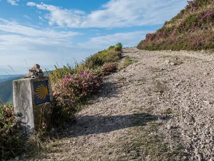
This is the easiest introduction to the Pennine Bridleway: a firm, well-graded start from Middleton Top on the High Peak Trail. The route uses the trackbed of the former Cromford and High Peak Railway, giving steady going across the White Peak limestone plateau rather than the boggier upland ground found later in the trail.
Underfoot, expect hard-packed former railway surface, gravel and broad multi-use trail. Gradients are generally gentle, but the route is exposed enough for wind and rain to matter, particularly outside settled summer weather.
The main landmark is the High Peak Trail itself, with Middleton Top visitor centre marking the practical southern trailhead. Horse riders are advised to use Hartington Station on the Tissington Trail as their alternative start rather than Middleton Top.
Food and water planning is straightforward at the start but should not be treated casually. Visitor-centre facilities and seasonal opening hours should be checked before travelling, and walkers should carry enough for the day rather than depending on finding services on the plateau.
Accommodation at or near Parsley Hay is limited compared with larger trail towns, so this stage end needs booking in advance. Hartington, a little further north on the Tissington Trail, is the key alternative planning point for riders and may also be useful for walkers arranging beds.
For access to the start, Cromford and Matlock stations on the Derwent Valley line are close to the Middleton Top area. Parsley Hay itself is not a major public-transport hub, so any onward bus, taxi or accommodation transfer should be arranged in advance; this should be checked before travelling.
Navigation is generally simple on the converted railway, but it is still worth carrying the Harvey National Trail map or the relevant OS Explorer sheet. The main risk on this stage is complacency: the surface is easy, but it is a shared trail used by walkers, cyclists and horse riders, and the weather can still be bleak on the open limestone plateau.
Stage 2: Parsley Hay to Hayfield — 34 km
This is a longer stage that carries the route north through the White Peak and towards the gritstone edge of the Dark Peak. It links the easier railway-style going around Parsley Hay and Hartington with a more varied mix of bridleways, lanes and upland tracks as the trail approaches Hayfield.
The route passes the Hartington area, then continues by or near Tideswell and Peak Forest before reaching Hayfield via the Sett Valley Trail. The Sett Valley Trail is another former railway path, giving a useful, firm approach into one of the most important trail towns on the southern half of the route.
Surfaces vary more than on Stage 1. Expect a mix of hard tracks, limestone plateau paths, quiet minor roads and bridleway sections, with more climbing and descending as the route leaves the easier converted railway corridors.
Hayfield is the key highlight and logistics point. It sits below the Kinder Scout area and marks the transition from the gentler White Peak into more serious Pennine moorland walking.
Food and water should be planned around the named settlements rather than assumed along the way. Hartington, Peak Forest and Hayfield are the obvious places to consider, but opening hours, shops, pubs and cafés can vary; carry a full day’s food and enough water between reliable stops.
Accommodation is much easier to arrange in Hayfield than at exposed rural points on the approach. Book ahead, especially at weekends and during the April to October walking season.
Public transport for the exact stage end should be checked before travelling. Hayfield is a practical trail town, but walkers should not assume late onward connections without checking current bus and rail links.
Navigation becomes more important on this stage as the route moves between railway paths, lanes and bridleway sections. Watch for the National Trail acorn and blue bridleway-arrow waymarks at junctions, and be prepared for muddy or rougher going where the route leaves surfaced railway paths.
Stage 3: Hayfield to Summit, near Walsden — 32 km
This is the first stage where the Pennine Bridleway feels fully South Pennine. From Hayfield the route heads towards Tintwistle and Bottoms Reservoir, then on through the industrial Pennine fringe around Charlesworth, Diggle, Uppermill, Hollingworth Lake and Littleborough before reaching Summit near Walsden.
The terrain is more complex than the distance suggests. Expect moorland edges, reservoir country, old packhorse and drovers’ routes, quiet lanes and firmer bridleway surfaces, with repeated climbs and descents across steep-sided valleys.
This stage also includes the most important pre-walk access check on the southern half of the trail. A roughly 5-mile gap north of Hayfield, between Monks Road and Bottoms Reservoir near Tintwistle, has historically required a road or off-route link rather than continuous dedicated bridleway; check the current official route, access notes and any diversions before travelling.
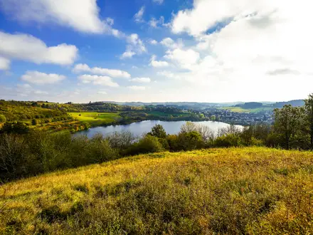
Hollingworth Lake and the South Pennine reservoirs give the stage much of its character. This is a landscape of moorland, gritstone walls, old transport routes, mills and reservoir infrastructure rather than remote wilderness, but the high ground can still be very exposed.
Food and water options are best treated as settlement-based. Hayfield, Diggle, Uppermill, Littleborough and the Walsden/Summit area are the planning points, but do not rely on finding open services at the exact time needed; carry enough for the full crossing.
Accommodation at the stage end needs care. Summit is a small place name near Walsden, not a large trail town, and beds may be more practical in nearby valley settlements such as Littleborough or around the Calder Valley line; this should be checked before travelling.
Transport access improves around Littleborough and the Calder Valley rail corridor. Littleborough has a station, and there is rail access near the route in this South Pennine section, but current train times and any onward road transfer to the actual stage end should be checked before relying on them.
Navigation can be awkward because the trail threads through a built-up and semi-rural Pennine landscape rather than simply following an open ridge. Pay close attention at road crossings, reservoir edges and where old lanes split; this is not the trail’s highest ground, despite the stage ending at a place called Summit.
Stage 4: Summit to Hebden Bridge — 34 km
This stage continues across the South Pennine watershed to Hebden Bridge, one of the strongest accommodation and resupply hubs on the whole route. The walking is a mix of upland bridleways, old packhorse lines, moorland tracks and valley approaches.
The Mary Towneley Loop is the major route feature in this part of the Pennine Bridleway. It is a 47-mile / 76 km waymarked circular loop and a serious multi-day route in its own right, so walkers following the linear trail should be clear in advance whether they are including it or staying on the point-to-point line.
Expect open moorland, reservoir-edge country and gritstone Pennine tracks. The surfaces are generally firmer than the parallel Pennine Way, but wet weather can still leave moorland sections rough, muddy and slow.
The key highlight is the gradual approach into Calderdale. Hebden Bridge sits in a steep, wooded valley and gives a marked contrast after the open moorland and reservoirs of the previous day.
Food and water should be carried from the start unless specific intermediate stops have been planned. Hebden Bridge is the reliable end-of-stage resupply point; moorland water should not be relied upon without treatment.
Accommodation is plentiful by Pennine Bridleway standards in Hebden Bridge, including inns, guesthouses, B&Bs and other trail-town options. It is still worth booking ahead because the town is a popular base and a natural stopping point.
Hebden Bridge station is on the Calder Valley line, making this one of the better places to join, leave or split the trail. Current train times should be checked before travelling, especially if planning a late finish.
Navigation requires care where the linear route and Mary Towneley Loop meet or run close to one another. Follow the National Trail acorn and blue bridleway-arrow symbols, and check the map at junctions rather than assuming every Pennine Bridleway sign is taking you in the intended direction.
Stage 5: Hebden Bridge to Settle — 34 km
This is a major transition stage from Calderdale and the Lancashire moors towards the Yorkshire Dales. It leaves Hebden Bridge, climbs through the Heptonstall and Heptonstall Moor area, and continues by way of places including Worsthorne, Wycoller, Earby, Barnoldswick and Long Preston before reaching Settle.
The stage has a varied feel: steep valley exits, open moorland, old packhorse and drovers’ roads, small settlements and the first real sense of entering limestone Dales country. Wycoller is a notable landmark, with its conservation village setting, ruined hall and old clapper and packhorse bridges in Wycoller Country Park.
Underfoot, expect a mixture of stone tracks, setted or flagged old routes, grassed bridleways, gravel tracks and minor roads. Stone and setts can be slippery in wet weather, and the moorland crossings can feel bleak in low cloud or strong wind.
Settle is the key objective and one of the best places on the whole route for logistics. It sits at the edge of classic Three Peaks limestone country and makes a natural place to rest, resupply or break the route.
Food and water should be planned carefully. Hebden Bridge and Settle are the dependable end points, while smaller places on the route may have variable services; carry enough food and water to complete the stage without relying on every village having an open shop or pub.
Accommodation is plentiful in Settle compared with the upland sections before and after it, with hotels, inns, guesthouses, B&Bs, hostels and campsites in the wider trail-town mix. Book ahead in the main walking season and around weekends.
Settle station is on the Settle–Carlisle line, making this a strong access point for section-hikers. Road access is also possible through the settlements along the stage, but public transport away from the rail line should be checked before travelling.
Navigation is not technically difficult, but there are many changes of track, lane and bridleway across a long day. The main warnings are exposure on Heptonstall Moor and the Lancashire moors, livestock in enclosed fields, and fatigue from a stage that is more varied and demanding than a simple distance figure suggests.
Stage 6: Settle to Garsdale Head — 32 km
This is the highest and most committing stage of the outline itinerary. From Settle the route enters the Yorkshire Dales limestone country around Stainforth, Austwick, Clapham and near Horton-in-Ribblesdale before climbing to the Cam Fell and Cam High Road area.
The Cam High Road section is the highest ground on the Pennine Bridleway, at roughly 590 m. The route does not climb a single summit, but this old Roman and packhorse road gives a sustained high-level crossing, shared briefly with the Pennine Way and Dales Way, before the line turns west towards Newby Head.
After Newby Head, the route continues over the Dent Fell / Great Knoutberry Hill area towards Garsdale Head. This is serious upland terrain: firm by Pennine standards in places, but exposed, weather-dependent and slower in poor visibility.
The Settle Loop is an optional 10-mile / 16 km circular route above Settle. It makes a strong standalone walk or ride, but adding it to this stage would make an already long day substantially harder, so it is best treated as a separate day unless deliberately planned.
Food and water planning is critical. Settle is the last major resupply point at the start of the stage, and although the route passes or runs near Dales villages, services should not be assumed; carry enough food and water for a full high-level day.
Accommodation at or near Garsdale Head is sparse and should be booked well ahead. This is one of the stages where the available bed determines the itinerary more than the map distance.
Transport access is possible via the Settle–Carlisle line, with Settle at the start of the stage and Garsdale, Dent and Horton-in-Ribblesdale serving the wider Dales section. Exact station access from the trail and current train times should be checked before travelling.
Navigation needs particular attention on Cam Fell, Cam High Road, the crossing to Newby Head and the onward line over Dent Fell / Great Knoutberry Hill. In mist, wind or heavy rain, this stage has the clearest exposure risk on the route; carry proper waterproofs, warm layers, map and compass or reliable offline mapping.
Stage 7: Garsdale Head to Ravenstonedale — 22 km
The final stage is shorter on paper but remains remote and exposed. From Garsdale Head the route crosses into the northern Pennines and skirts the Mallerstang valley below Wild Boar Fell before finishing near Ravenstonedale on the A683.
The character is open fell and high valley country rather than a gentle walk-out. Tracks are generally in keeping with the Pennine Bridleway’s firm, multi-use design, but weather can make the northern finish feel severe, especially in wind, rain or low cloud.
Mallerstang and the dark mass of Wild Boar Fell are the main landscape highlights. The finish itself is practical rather than ceremonial: the official National Trail ends on the A683, known here as The Street, on the edge of the Howgill Fells.
Food and water should be carried from the start unless accommodation or services have been specifically arranged. Do not assume there will be convenient shops or cafés at the road finish.
Accommodation planning depends on whether the day ends at Ravenstonedale, the A683 trail end, or Kirkby Stephen. The waymarked alternative continues on public rights of way to Kirkby Stephen, about 6 km from the official finish, and this is the practical railhead for many walkers.
Public transport is best planned around Kirkby Stephen station on the Settle–Carlisle line. If finishing at the A683 near Ravenstonedale, arrange pickup, onward walking to Kirkby Stephen, or a taxi in advance; this should be checked before travelling.
Navigation is straightforward if the distinction between the official finish and the Kirkby Stephen alternative is understood before setting out. The main warnings are exposure, sparse services and the need to make a firm finish plan rather than arriving at the A683 without onward transport.
Recommended Itinerary
Plan the Pennine Bridleway around accommodation and transport points, not just daily distance. The continuous point-to-point is about 280 km / 174 miles, while the 330 km / 205 mile figure includes the Mary Towneley Loop and Settle Loop.
For most walkers, a 12-day plan to Kirkby Stephen is the most practical baseline. It keeps the big Pennine stages more manageable, allows for the sparse accommodation in the South Pennines and Yorkshire Dales, and avoids treating every 30 km-plus section as a routine day.
Distances are approximate. Where a stage has been split between named places and no reliable distance is given here, check official mapping before booking.
Standard 12-day walking itinerary
| Day | From | To | Approx. distance | Why this stage makes sense | Services/accommodation notes |
|---|---|---|---|---|---|
| 1 | Middleton Top / Middleton-by-Wirksworth | Parsley Hay | 21 km | A straightforward opening day on firm former railway trackbed, giving time to settle into the route without a hard upland crossing. | Check accommodation or transfer options around Parsley Hay before committing to this as an overnight stop. |
| 2 | Parsley Hay | Hartington / Peak Forest / Tideswell area | Check official mapping before booking | Breaks the long White Peak crossing towards Hayfield and gives flexibility around the riders’ alternative start at Hartington Station. | Do not assume a bed directly on the line of the route; Hartington, Tideswell and Peak Forest are the key settlement names to work around. Horse riders should arrange stabling or grazing in advance. |
| 3 | Hartington / Peak Forest / Tideswell area | Hayfield | Check official mapping before booking | Finishes in a proper trail town before the route becomes more moorland in character. | Hayfield is one of the better accommodation and resupply stops on the southern half of the trail. Book ahead at weekends and in peak walking months. |
| 4 | Hayfield | Tintwistle / Charlesworth area | Check official mapping before booking | A useful shorter day after Hayfield, especially because the route north of Hayfield has historically required careful checking for access gaps or diversions. | Check the current official route, gate notices and any diversion information before setting out. Accommodation may require an off-route arrangement. |
| 5 | Tintwistle / Charlesworth area | Littleborough / Summit area | Check official mapping before booking | Positions you well for the South Pennine reservoir and moorland section without forcing a very long day into Hebden Bridge. | Littleborough has rail access on the Calder Valley line. Summit is a place name near Walsden, not the highest point of the trail. |
| 6 | Littleborough / Summit area | Hebden Bridge | Up to 34 km from Summit | A strong South Pennine day ending at one of the best service hubs on the route. | Hebden Bridge has plentiful accommodation compared with the surrounding moorland. It is also a useful resupply and transport point on the Calder Valley line. |
| 7 | Hebden Bridge | Wycoller / Earby / Barnoldswick area | Check official mapping before booking | Splits the long Hebden Bridge to Settle section and avoids carrying the full crossing in one day. | Accommodation becomes more limited after leaving Hebden Bridge. Fix the overnight stop before finalising the day’s distance. |
| 8 | Wycoller / Earby / Barnoldswick area | Settle | Check official mapping before booking | Brings you into the Yorkshire Dales at a major trail town, with time to resupply before the higher ground north of Settle. | Settle is a key accommodation, food and transport hub, with rail access on the Settle–Carlisle line. |
| 9 | Settle | Clapham / Horton-in-Ribblesdale area | Check official mapping before booking | A sensible positioning day through the limestone Dales before the exposed Cam Fell and Cam High Road crossing. | Clapham and Horton-in-Ribblesdale are useful settlement names for planning, but accommodation should be booked early. Horton-in-Ribblesdale lies on the Settle–Carlisle line. |
| 10 | Clapham / Horton-in-Ribblesdale area | Garsdale Head | Check official mapping before booking | This is the high Pennine section, taking in Cam Fell, Cam High Road, Newby Head and the Dent Fell / Great Knoutberry Hill area. Keep this day flexible in poor weather. | Services are sparse. Garsdale is on the Settle–Carlisle line, but accommodation and onward transport should be arranged before arrival. |
| 11 | Garsdale Head | Ravenstonedale / A683 finish | 22 km | A final upland day skirting Mallerstang and Wild Boar Fell before the official National Trail finish near Ravenstonedale. | The official finish is on the A683, not at a railway station. Arrange accommodation, collection or the onward walk to Kirkby Stephen in advance. |
| 12 | Ravenstonedale / A683 finish | Kirkby Stephen | About 6 km | The practical finishing leg if using the waymarked alternative to reach the nearest town and railhead. | Kirkby Stephen is the most practical rail finish, on the Settle–Carlisle line. Confirm current train, bus and taxi options before travelling. |
Slower variant
A slower plan suits walkers carrying camping kit, anyone using B&Bs or inns with fixed check-in times, horse riders needing stabling or grazing, and walkers travelling in spring or autumn when daylight and weather windows can be shorter.
The easiest way to slow the route down is to split the long stages around Hayfield to Littleborough/Summit, Hebden Bridge to Settle, and Settle to Garsdale Head. These are the sections where exposed moorland, sparse accommodation and transport logistics matter more than the mileage on paper.
If walking the full 330 km / 205 mile version, add the two optional loops rather than trying to absorb them into an already long day. The Settle Loop is 16 km and works well as a separate day from Settle; the Mary Towneley Loop is 76 km and should be planned as its own multi-day add-on using current official mapping and pre-booked accommodation.
Horse riders are advised to start at Hartington Station rather than Middleton Top. Stabling, grazing and horse-friendly stops should be confirmed before fixing the itinerary.
Faster variant
The following 7-day schedule is only for very fit walkers used to repeated 30 km-plus Pennine days, or for riders and mountain bikers adapting the distances to their own pace. It is not the best default for a first walking attempt, especially with full overnight kit.
| Day | From | To | Approx. distance | Why this stage makes sense | Services/accommodation notes |
|---|---|---|---|---|---|
| 1 | Middleton Top / Middleton-by-Wirksworth | Parsley Hay | 21 km | A firm, relatively gentle opening stage on the High Peak Trail. | Check overnight options around Parsley Hay before booking the rest of the trip. |
| 2 | Parsley Hay | Hayfield | 34 km | A long push through the southern section to reach a strong trail town before the South Pennines. | Hayfield is the key overnight and resupply point. Book ahead. |
| 3 | Hayfield | Summit, near Walsden | 32 km | Crosses into the more industrial South Pennine landscape of reservoirs, moor edges and old tracks. | Check the current route north of Hayfield before setting out. Littleborough is a useful nearby rail-access point. |
| 4 | Summit | Hebden Bridge | 34 km | A demanding South Pennine day ending in one of the route’s best service hubs. | Hebden Bridge has good accommodation choice compared with the surrounding moorland and is on the Calder Valley line. |
| 5 | Hebden Bridge | Settle | 34 km | A big linking stage from Calderdale towards the Yorkshire Dales. | This is a section to book carefully; possible planning points along the way include Wycoller, Earby, Barnoldswick and Long Preston. |
| 6 | Settle | Garsdale Head | 32 km | The high day of the fast itinerary, crossing towards Cam Fell, Cam High Road, Newby Head and Dent Fell / Great Knoutberry Hill. | Start early, carry enough food, and treat this as an exposed upland day. Settle and Garsdale are both on the Settle–Carlisle line. |
| 7 | Garsdale Head | Ravenstonedale / A683 finish | 22 km | A shorter final stage through the remote northern end near Mallerstang and Wild Boar Fell. | The official finish is not the most convenient public-transport endpoint. Continue about 6 km to Kirkby Stephen if using the practical rail finish. |
Planning the Route
The Pennine Bridleway is easiest to plan as a series of accommodation-linked stages rather than as a wilderness trek. The walking is generally on firm tracks, old lanes and bridleways, but the route crosses long, exposed Pennine and Dales sections where bad weather can make a nominally straightforward day feel much harder.
Most walkers should allow 12–14 days for a comfortable end-to-end itinerary. Strong walkers can compress the route, but doing so usually means repeated 30 km-plus days and less flexibility around sparse accommodation, especially north of Hebden Bridge and through the Yorkshire Dales.
How many days to allow
A brisk schedule is possible because the route is lower and firmer than the Pennine Way, but it is still a long upland route with roughly 5,100 m of ascent on the point-to-point line. The best plan for most independent walkers is to keep daily distances moderate enough to absorb weather, navigation delays and the occasional long climb out of a valley.
The official National Trail walking/horseback timing of around 12 days from Hartington to Ravenstonedale is a useful benchmark, but it excludes the southern Middleton Top approach and the two optional loops. If walking from Middleton Top and finishing via Kirkby Stephen, a 12–14 day plan is more realistic for most hikers.
A very fast itinerary can be built around seven long stages, but those days are consistently demanding and leave little margin. They suit fit walkers travelling light and already comfortable with long Pennine days, not first-time long-distance hikers.
| Planning style | Typical approach | Best suited to |
|---|---|---|
| Fast end-to-end | Long days, often around 30 km or more | Fit walkers with pre-booked accommodation and minimal kit |
| Standard end-to-end | 12–14 walking days | Most independent walkers wanting manageable stages |
| Slower itinerary | Shorter days with extra nights in trail towns | Walkers adding the loops, using public transport, or wanting weather flexibility |
| Section hike | Breaks based around rail-served towns | Walkers with limited time or those avoiding a full continuous trip |
Let accommodation shape the stages
Accommodation availability is one of the main practical constraints. Trail towns and larger villages such as Hayfield, Hebden Bridge and Settle are natural overnight and resupply points, but accommodation becomes thinner across the high moorland and Dales sections.
Book ahead for upland nights, especially in the Yorkshire Dales and the northern section towards Garsdale Head, Mallerstang and Ravenstonedale. Do not assume there will be a convenient spare room, campsite pitch or evening meal at the exact distance that suits your legs.
Horse riders need to plan even more tightly. The route was built for horses, but stabling and grazing must be arranged in advance, and the rider-friendly start is Hartington Station rather than Middleton Top.
Start, finish and useful exit points
The practical southern access is via Middleton Top near Middleton-by-Wirksworth, with Cromford and Matlock the nearest rail options on the Derwent Valley line. Walkers can start from Middleton Top, while horse riders are advised to begin at Hartington Station on the Tissington Trail.
At the northern end, the official National Trail finishes on the A683 near Ravenstonedale. For most walkers using public transport, it is sensible to continue on the waymarked alternative to Kirkby Stephen, the nearest town with a railway station, about 6 km from the official finish.
The route is also practical to section-hike. Useful rail-served or near-rail points include Littleborough, Hebden Bridge, Settle, Horton-in-Ribblesdale, Garsdale, Dent and Kirkby Stephen, with services on the Calder Valley line and Settle–Carlisle line. Always confirm current train and bus times before relying on them.
Shortening, extending and using the loops
The two circular loops change how the route is planned. The Mary Towneley Loop is a substantial 47-mile / 76 km circuit in the South Pennines and can be walked as part of a longer Pennine Bridleway itinerary or as a separate multi-day trip.
The Settle Loop is much shorter at 10 miles / 16 km and works well as an extra day from Settle or as a standalone day walk or ride. It is the easier loop to add without disrupting an end-to-end schedule.
For a purer point-to-point walk, many hikers follow the continuous line and leave one or both loops for another trip. Including both loops brings the full National Trail distance up to 330 km / 205 miles, so they should be treated as a meaningful extension rather than a minor detour.
Food, water and daily logistics
Plan food around the main settlements rather than expecting frequent services. Hayfield, Hebden Bridge and Settle are the strongest resupply and accommodation hubs, while smaller places may have limited or seasonal facilities.
Carry enough food for the day before leaving town, particularly before moorland and Dales sections. Water availability should also be planned conservatively: do not rely on upland streams, and refill at accommodation, cafés or confirmed public facilities where possible.
Even though the route uses many firm tracks and old lanes, it is not a promenade trail. Long sections cross open moorland, limestone plateau and exposed fell where shelter is limited and a delayed arrival can become a real problem if accommodation or food is not already arranged.
Navigation and route checks
The Pennine Bridleway is waymarked with the National Trail acorn and a blue bridleway-arrow symbol, but a map is still essential. The Harvey National Trail Pennine Bridleway map covers the whole route at 1:40,000, while relevant OS Explorer sheets give more local detail.
Pay particular attention to route line changes, diversions and access notices before setting off. A roughly 5-mile gap north of Hayfield, between Monks Road and Bottoms Reservoir near Tintwistle, has historically required a road or off-route link rather than a dedicated bridleway; the current official route and any remaining gaps should be checked before travelling.
Do not confuse Summit near Walsden with the trail’s high point. Summit is a place name on the South Pennine section; the highest ground is much farther north around Cam Fell and Cam High Road, at roughly 590 m.
Weather and timing
The best planning window is April to October, when daylight, weather and upland surface conditions are generally most favourable. Outside that window, shorter days, colder weather and wetter ground make the exposed sections more committing.
The route is often firmer and drier underfoot than the Pennine Way, but it still crosses open Pennine moorland and high Dales tracks. Waterproofs, warm layers, gloves and a reliable navigation set-up belong in the pack even in summer.
Weather should be allowed to influence stage length. A route that looks modest on paper can be slow in wind, hill fog or persistent rain, particularly around the South Pennine moors, Cam High Road, Newby Head, Dent Fell / Great Knoutberry Hill and the northern approach past Mallerstang.
Towns, Villages and Overnight Stops
Accommodation planning on the Pennine Bridleway is uneven. Hayfield, Hebden Bridge and Settle are the strongest overnight and resupply hubs, while the high moorland and Yorkshire Dales sections need more careful booking because settlements are smaller and farther apart.
Walkers can usually build an itinerary around inns, pubs, guesthouses, B&Bs, hostels and campsites, but availability changes sharply by season. Horse riders should book stabling or grazing well ahead and should not assume that a general B&B or pub can accommodate horses.
Middleton-by-Wirksworth / Middleton Top
Middleton Top is the main southern trailhead, near Middleton-by-Wirksworth, on the High Peak Trail. It is a practical start point rather than a major trail town, so most walkers should arrange their first night either before arrival or nearby rather than turning up without a plan.
Cromford and Matlock stations, on the Derwent Valley line from Derby, are the nearest rail options for reaching this end of the route. Local onward transport to the trailhead should be checked before travelling.
Food and last-minute supplies should be sorted before setting off unless a specific local option has been checked in advance. The first day follows firm former railway trackbed towards Parsley Hay, but it is still worth starting with enough food for the full stage.
Parsley Hay
Parsley Hay is a useful staging point on the High Peak / Tissington Trail section and fits naturally as an early overnight stop on many itineraries. It is not a large settlement, so accommodation and evening food should be arranged before arrival.
This is also where riders and walkers using the Tissington Trail corridor may find the route logistics simpler than on later upland sections. Do not assume walk-in beds, camping space or horse facilities are available without booking.
Hartington
Hartington is important because horse riders are advised to start at Hartington Station on the Tissington Trail rather than at Middleton Top. For riders, this makes it a key planning point for arrival, vehicle logistics, stabling and the first overnight stop.
Walkers may also use Hartington as a more northerly start or as part of a shorter White Peak section. Current accommodation, food and transport arrangements should be checked before travelling, particularly if relying on local buses or horse-friendly facilities.
Tideswell and Peak Forest
Tideswell lies near the route and Peak Forest is on the line of the route through the Peak District section before the trail heads towards Hayfield. These places are useful as contingency or split-stage options if the Parsley Hay to Hayfield stage is too long.
They should not be treated as automatic resupply points unless accommodation, food and opening times have been checked in advance. This part of the route is still relatively accessible compared with the northern moors, but accommodation can be scattered away from the exact line.
Hayfield
Hayfield is one of the best overnight stops on the Pennine Bridleway. The route reaches it via the Sett Valley Trail, and it makes a natural base before the route climbs into more exposed South Pennine country.
Accommodation is more plentiful here than in the smaller upland settlements, with the broader mix of pubs, guesthouses, B&Bs and campsites found in the main trail towns. It is a sensible place to resupply, dry kit, eat properly and adjust plans before the longer moorland stages northwards.
Transport from Hayfield should be checked locally before relying on it. There is a historical route-planning issue north of Hayfield, where a gap between Monks Road and Bottoms Reservoir near Tintwistle has previously required a road or off-route link rather than continuous dedicated bridleway; check the current official route, diversions and access notices before setting out.
Tintwistle / Bottoms Reservoir and Charlesworth
Tintwistle, Bottoms Reservoir and Charlesworth sit on or near the South Pennine transition after Hayfield. They are more useful as route markers, access points or short-stage options than as guaranteed overnight bases.
This is a section where walkers and riders should pay close attention to the current line of the route and any access changes. Accommodation, food and onward transport should be checked before travelling.
Diggle and Uppermill
Diggle and Uppermill sit on the South Pennine section before the trail continues towards Hollingworth Lake and Littleborough. They can help break up the long crossing between Hayfield and the Calderdale area if a shorter itinerary is needed.
Use them as planned stops only after checking beds, food and any transport links. For horse riders, stabling and grazing must be arranged directly in advance.
Hollingworth Lake and Littleborough
Hollingworth Lake and Littleborough form a practical South Pennine service area on the route. Littleborough has a station on the Calder Valley line, making it one of the more useful places for joining, leaving or section-hiking the trail.
This is a good place to plan a resupply or overnight break before continuing towards Summit and Hebden Bridge. Train times should always be checked before relying on them, especially when connecting to the start or finish of a long day.
Summit, near Walsden
Summit is a place name near Walsden and Littleborough, not the highest point of the Pennine Bridleway. It appears as a useful staging point on some itineraries between Hayfield and Hebden Bridge.
Accommodation and food options should be checked before committing to an overnight here. It is a practical area for splitting the South Pennine section, but Hebden Bridge is the stronger service hub.
Mary Towneley Loop
The Mary Towneley Loop is an optional 47-mile / 76 km circular route on the Lancashire–Yorkshire border. It is often treated as a separate multi-day walk or ride, and it can also be added to an end-to-end Pennine Bridleway itinerary if time and accommodation allow.
Because it crosses South Pennine watershed country, overnight planning should be deliberate rather than improvised. Book accommodation and, for riders, stabling or grazing well ahead, and check how the loop affects daily distances before adding it to a through-walk.
Hebden Bridge
Hebden Bridge is one of the most important overnight stops on the route. It sits in Calderdale after the South Pennine crossings and is a natural place to rest, resupply and reset before the route continues north-west towards Lancashire and the Yorkshire Dales.
Accommodation is relatively plentiful compared with the smaller moorland settlements, with a useful mix of pubs, guesthouses, B&Bs and other trail-friendly options. It is also one of the best places on the route for food and practical supplies.
Hebden Bridge has a station on the Calder Valley line, which makes it a strong access point for section walkers. Check current train times before planning tight connections.
Heptonstall / Heptonstall Moor
Heptonstall and Heptonstall Moor sit immediately beyond Hebden Bridge on the higher ground. They are useful route points but, for most walkers, Hebden Bridge is the more practical overnight base.
If using Heptonstall or nearby accommodation to shorten a stage, check food availability, access to the route and onward transport before booking. Conditions become more exposed as the route moves back onto the moors.
Worsthorne and Wycoller
Worsthorne and Wycoller are useful Lancashire-side stops between Calderdale and the approach to the Yorkshire Dales. Wycoller is a small conservation village in Wycoller Country Park, known on the route for its ruined hall and old clapper and packhorse bridges.
These are attractive places to pass through, but they should be treated as small-settlement logistics rather than full-service trail towns. Accommodation, evening meals and any horse facilities should be booked or checked in advance.
Earby and Barnoldswick
Earby and Barnoldswick are practical settlements on the transition from the South Pennines towards the Dales. They can work as overnight or resupply points depending on how the Hebden Bridge to Settle section is divided.
This is a useful area for avoiding an overlong day into Settle, but exact accommodation and food options should be checked before travelling. Riders should confirm stabling and grazing directly with providers.
Long Preston
Long Preston lies before Settle on the approach into the Yorkshire Dales section. It can be useful for walkers who want to shorten the approach to Settle or avoid arriving late after a long moorland day.
Settle remains the stronger hub nearby, so Long Preston is best used as a planned stop rather than an assumed service point. Check accommodation, meals and transport before building it into an itinerary.
Settle
Settle is the key Yorkshire Dales trail town on the Pennine Bridleway. It is one of the best places on the whole route for accommodation, food, resupply and rest before the higher Dales crossing towards Cam Fell, Newby Head and Garsdale Head.
Accommodation is generally more plentiful here than in the surrounding villages, with the main mix of inns, guesthouses, B&Bs, hostels and campsites found on this trail. It is a sensible place to build in a shorter day or rest stop if walking the full route.
Settle is on the Settle–Carlisle line, making it a useful access point for section-hiking. Confirm current rail times before travelling.
Settle Loop
The Settle Loop is an optional 10-mile / 16 km circular route above Settle. It is a good add-on for walkers or riders with extra time, and it can also be used as a standalone day route from the town.
Adding the loop to a through-walk affects both mileage and accommodation timing. Most walkers should use Settle as the base rather than trying to combine the loop with an already long northbound day.
Stainforth, Austwick and Clapham
Stainforth, Austwick and Clapham are useful Dales villages on or near the route after Settle. They give options for shorter stages, side access and alternative overnight planning before the route heads into more exposed country.
These villages should not be treated as guaranteed full-service stops without checking current accommodation and food. If planning a lower-mileage Dales itinerary, they can be valuable, but bookings should be made ahead in busy periods.
Horton-in-Ribblesdale
Horton-in-Ribblesdale lies near the route and has a station on the Settle–Carlisle line. It is a useful access or exit point for section walkers in the Three Peaks area.
For an end-to-end walker, Horton-in-Ribblesdale may be more useful as a transport or contingency point than as a standard overnight on the main line. Accommodation and food should be checked before travelling, particularly if diverting from the direct route.
Cam Fell / Cam High Road and Newby Head
Cam Fell and the Cam High Road are not settlement stops, but they are critical for overnight planning. This is the highest part of the Pennine Bridleway, at roughly 590 m, and the route is exposed, remote and more committing than the early railway-path sections.
There should be no assumption of food, shelter or accommodation on the high crossing itself. Plan the day so that the overnight stop before and after this section is secure, and carry enough food and clothing for poor upland weather.
Newby Head is another important route point rather than a full-service village. Check onward accommodation carefully before crossing towards Dent Fell, Great Knoutberry Hill and Garsdale Head.
Dent Fell / Great Knoutberry Hill and Garsdale Head
The crossing over Dent Fell / Great Knoutberry Hill leads into the Garsdale Head area. This is one of the sparsest parts of the route for accommodation, so it should be booked well ahead.
Garsdale is on the Settle–Carlisle line, making it a useful rail access or escape point for section walkers. Do not rely on late changes here without checking current train times and the exact location of accommodation in relation to the route.
Food options are limited compared with Settle or Hebden Bridge, so carry enough supplies to cover the stage and the next morning if necessary. Horse riders should confirm stabling or grazing well in advance.
Mallerstang and Wild Boar Fell
The route skirts the Mallerstang valley below Wild Boar Fell on the northern approach to the finish. This is remote Pennine country and should be planned as an upland crossing, not as a village-to-village stroll with frequent services.
Accommodation and food are sparse in this final section, so the night before the finish needs careful booking. Carry enough food and bad-weather kit to avoid depending on unplanned stops.
Ravenstonedale and the A683 finish
The official National Trail finish is on the A683, known as The Street, near Ravenstonedale on the edge of the Howgill Fells. It is not a town-centre finish with immediate rail access, so onward travel needs planning.
Ravenstonedale may be useful for accommodation or pick-up logistics, but availability should be checked before travelling. If finishing at the official A683 point, arrange transport, collection or the onward walk to Kirkby Stephen in advance.
Kirkby Stephen
Kirkby Stephen is the practical northern finish for many walkers because it is the nearest town with a railway station, about 6 km from the official A683 finish near Ravenstonedale. A waymarked alternative continues on public rights of way to the town.
It is the best place to aim for if finishing by public transport. Kirkby Stephen station is on the Settle–Carlisle line, but current train times and the link between the town, station and trail finish should be checked before travelling.
For accommodation, food and end-of-walk logistics, Kirkby Stephen is more practical than stopping at the roadside official finish. If booking a final night, reserve it in advance rather than assuming same-day availability.
Getting to the Start
The main southern trailhead is Middleton Top visitor centre, near Middleton-by-Wirksworth in Derbyshire, on the High Peak Trail. Horse riders are advised to start instead at Hartington Station on the Tissington Trail, a little further north.
By train
The nearest practical railheads for the Middleton Top start are Cromford and Matlock, both on the Derwent Valley line from Derby. For most walkers travelling from elsewhere in the UK, the simplest rail plan is to reach Derby, then take the local line towards Cromford or Matlock and arrange the final transfer from there.
Middleton Top is not directly at a railway station, so allow for a taxi or local bus connection from Cromford or Matlock. Taxi availability can be limited in rural Derbyshire, especially early, late or on Sundays, so booking ahead is sensible. Train times and local onward transport should be checked before travelling.
By bus
Local bus services may be useful for reaching Middleton-by-Wirksworth, Wirksworth, Cromford or Matlock before transferring to Middleton Top, but routes and frequencies change. This should be checked before travelling.
If relying on buses, build in a margin rather than planning a long first walking day immediately after arrival. The first section heads out along the High Peak Trail towards Parsley Hay, so a delayed start can leave limited flexibility if accommodation is already fixed.
By car
Drivers should navigate to Middleton Top visitor centre, near Middleton-by-Wirksworth. It is the recognised southern trailhead for walkers and cyclists using the High Peak Trail start.
Do not assume that visitor-centre parking is suitable for leaving a vehicle for the full length of the Pennine Bridleway. Long-stay parking arrangements, opening times, charges and any overnight restrictions should be checked before travelling. For an end-to-end walk, it is usually easier to arrive by public transport or be dropped off, because the route finishes far to the north near Ravenstonedale or, more practically for rail, Kirkby Stephen.
Horse riders should note the recommended alternative start at Hartington Station on the Tissington Trail rather than Middleton Top. Any horsebox parking, stabling or grazing arrangements at the start need to be arranged in advance.
From the nearest airport
There is no airport directly serving the trailhead. For international or domestic flights, the practical approach is to choose an airport with onward rail connections to Derby, then continue by the Derwent Valley line to Cromford or Matlock and arrange the final local transfer to Middleton Top.
Because the final leg is rural, avoid planning a late-evening arrival unless a taxi or overnight stay has already been booked. Flight-to-train connections and the last onward services should be checked before travelling.
Where to stay before starting
The most convenient pre-walk bases are the settlements around the southern trailhead and the nearby rail corridor, including Middleton-by-Wirksworth, Wirksworth, Cromford and Matlock. Staying nearby the night before makes the first day easier, especially if walking to Parsley Hay on a fixed accommodation booking.
Accommodation should be booked ahead in the main walking season. Riders should book horse-friendly accommodation, stabling or grazing well in advance, particularly if starting from Hartington Station rather than Middleton Top.
Getting Home from the Finish
The official Pennine Bridleway finish is on the A683 near Ravenstonedale, not in a town and not at a railway station. For most walkers, the practical end point is Kirkby Stephen, reached by the waymarked alternative on public rights of way, about 6 km from the A683 finish.
If transport is tight, plan the final day around Kirkby Stephen rather than assuming there will be easy onward travel from the roadside finish near Ravenstonedale.
By train
Kirkby Stephen station is the practical railhead for the northern end of the route. It is on the Settle–Carlisle line, which also serves other useful trail-area stations including Settle, Horton-in-Ribblesdale, Garsdale and Dent.
The station is about 6 km beyond the official A683 finish if using the waymarked alternative into Kirkby Stephen. Build this extra distance into the final day, especially after the exposed Mallerstang and Wild Boar Fell section.
Train times on the Settle–Carlisle line should be checked before travelling. Services are not the same as urban commuter routes, and a late finish can easily mean waiting a long time or needing to stay locally.
By bus
Local bus options around Ravenstonedale, Kirkby Stephen and the upper Eden area are timetable-dependent and should not be assumed to run late in the day. This should be checked before travelling.
For end-to-end walkers, the safest plan is to treat Kirkby Stephen station as the main public transport exit. If a bus is needed from Ravenstonedale or the A683 finish, check the current timetable before fixing accommodation, train reservations or onward connections.
By car/taxi
The official finish on the A683 is reachable by road, so a pre-booked taxi or arranged lift can work well, especially for groups, riders, cyclists or anyone finishing at the roadside rather than continuing to Kirkby Stephen.
Do not rely on finding a taxi at the A683 finish. Mobile reception, availability and rural call-out times can all affect plans, so book ahead and give a clear pickup point.
If leaving a vehicle for the finish, check the parking arrangement in advance. For most walkers, being collected from Kirkby Stephen is simpler than arranging a pickup from the isolated National Trail endpoint.
From the nearest airport
This is not a finish with straightforward airport logistics. The practical approach is to leave via Kirkby Stephen station on the Settle–Carlisle line, then connect through the national rail network to whichever airport suits the onward journey.
Airport rail connections, late-evening services and any need for an overnight stop should be checked before booking flights. Avoid planning a same-day flight unless the final walking day, train connection and transfer time are all secure.
Where to stay at the finish
Staying overnight at the finish is often the least stressful option, particularly if reaching the A683 late in the afternoon or continuing the extra distance to Kirkby Stephen after a full upland day.
Kirkby Stephen is the nearest town with a railway station and is the most practical place to aim for at the end of the walk. Ravenstonedale may suit walkers or riders being collected locally, but onward public transport is less straightforward from the official roadside finish.
Accommodation in this northern section is more limited than in larger trail towns such as Hebden Bridge or Settle, so book ahead. Horse riders should also confirm stabling or grazing before committing to the final itinerary.
Which Direction Should You Walk?
Standard direction: south to north
Most walkers should plan the Pennine Bridleway south to north, from Middleton Top / Middleton-by-Wirksworth towards Ravenstonedale, with Kirkby Stephen as the practical rail finish. This follows the way the route is usually broken down: Derbyshire first, then the South Pennines, then the Yorkshire Dales and the remote northern finish below Wild Boar Fell and the Howgill edge.
The main advantage is progression. The early stages use the High Peak Trail, Tissington Trail area and Sett Valley Trail, giving a firm, forgiving start before the route becomes more upland, exposed and committing across the South Pennines and Dales.
South to north also gives the stronger finish. The highest ground around Cam Fell and the Cam High Road comes late in the walk, followed by Newby Head, Dent Fell / Great Knoutberry Hill, Garsdale Head and Mallerstang before the end near Ravenstonedale. Continuing to Kirkby Stephen makes the finish more practical, as it gives access to the Settle–Carlisle line about 6 km beyond the official A683 trail end.
Reverse direction: north to south
Walking north to south is perfectly workable, but it changes the character of the route. You begin with the more remote northern sections around Ravenstonedale, Mallerstang, Garsdale Head and the high Dales, then gradually work south into the busier South Pennines and the easier railway-path terrain of Derbyshire.
This can suit walkers who want to tackle the wildest ground early, or who find accommodation availability works better in that direction. It can also make sense for section-hikers using the Settle–Carlisle line at Kirkby Stephen, Garsdale, Dent, Horton-in-Ribblesdale or Settle.
The drawback is that the opening logistics are less satisfying. The official northern end is on the A683 near Ravenstonedale rather than in a trail town, so most walkers will need to use Kirkby Stephen as the practical access point. Local onward transport or the link to the A683 should be checked before travelling.
Direction compared
| Factor | South to north | North to south |
|---|---|---|
| Route convention | Best matches the usual start at Middleton Top or Hartington and finish near Ravenstonedale / Kirkby Stephen | Less common, but straightforward to navigate with the same waymarking |
| Terrain progression | Easier start on firm former railway lines, building towards higher Dales and Mallerstang | Harder and more remote sections come early, with a gentler Derbyshire finish |
| Transport | Start near Cromford and Matlock; finish by continuing to Kirkby Stephen for the Settle–Carlisle line | Start logistics depend on reaching Ravenstonedale / the A683 from Kirkby Stephen; finish near Cromford and Matlock |
| Accommodation flow | Good for easing into the walk, but upland nights in the Dales and near the northern end still need early booking | Can work well if northern accommodation is available first; early remote stages need careful planning |
| Weather exposure | No reliable directional advantage; exposed moorland and fell sections can be difficult in either direction | Same exposure, but the highest and remotest ground comes sooner |
| Finish psychology | Stronger: the route builds towards the high Dales, Mallerstang and the Howgill-edge finish | Quieter finish: the final stages become easier and less dramatic towards Middleton Top |
Are the climbs easier one way?
There is no decisive climbing advantage. The Pennine Bridleway is designed for horses, cyclists and walkers, so its gradients are generally more moderate than many fell-walking routes, but it still crosses steep-sided valleys, moorland edges and high Pennine ground.
South to north feels more gradual because the first stages include long sections of firm railway path. North to south can feel tougher at the beginning because the Dales and Mallerstang sections arrive before you have built much trail rhythm.
Recommendation
Walk south to north unless there is a strong accommodation or transport reason to reverse it. Starting at Middleton Top gives the best terrain progression, saves the highest and most remote ground for later, and creates a more satisfying finish via Ravenstonedale and Kirkby Stephen.
For horse riders, the southern start is usually Hartington Station rather than Middleton Top. For walkers, Middleton Top remains the natural southern trailhead.
Accommodation Along the Route
Accommodation on the Pennine Bridleway is mixed rather than consistently spaced. It works well as an inn-to-inn walk in places, but only if overnight stops are planned around the available beds rather than copied directly from a mileage table.
The strongest accommodation hubs on the route are Hayfield, Hebden Bridge and Settle. These are the places where walkers have the best chance of finding a choice of hotels, inns, guesthouses, B&Bs, hostels and campsites, and they also make useful resupply and rest-stage points.
The awkward sections are the upland and Dales crossings: around Parsley Hay, Summit near Walsden, the high ground beyond Settle, Garsdale Head, Mallerstang and the official roadside finish near Ravenstonedale. In these areas accommodation is sparse, and some stage ends are better treated as route points rather than guaranteed places to sleep.
Booking strategy
Book ahead for the whole route if walking in the main April to October season. Weekend pressure is most likely around the better-known trail towns and holiday areas, especially Hayfield, Hebden Bridge, Settle and the Yorkshire Dales section.
Do not leave the high moorland and Dales nights to chance. A long day over Cam Fell, Cam High Road, Newby Head, Dent Fell / Great Knoutberry Hill and towards Garsdale Head has very little flexibility once accommodation is missed or unavailable.
Horse riders need to plan even more tightly. Horse-friendly accommodation, stabling and grazing exist along the Pennine Bridleway, but they must be arranged in advance and should be confirmed directly with the accommodation before booking the human bed.
Accommodation by key place
| Place | Accommodation level | Best for | Notes |
|---|---|---|---|
| Middleton Top / Middleton-by-Wirksworth | Limited | Starting the route | The trailhead is at Middleton Top visitor centre, not a large accommodation hub. Nearby transport points include Cromford and Matlock; accommodation and transfers should be arranged before travelling. |
| Hartington | Limited | Alternative start for horse riders | Riders are advised to start at Hartington Station on the Tissington Trail. Check horse-friendly accommodation, stabling and grazing before committing to this start. |
| Parsley Hay | Limited | First-night area or transfer point | Useful as a route point on the High Peak / Tissington Trail network, but do not assume a broad choice of beds at the trail itself. Many walkers will need nearby accommodation or a pre-arranged lift. |
| Hayfield | Good | Major overnight hub | One of the best-supported trail towns on the southern half of the route. A sensible place to build a shorter day, resupply or reset before the higher South Pennine moors. |
| Tintwistle / Charlesworth / Diggle / Uppermill / Hollingworth Lake / Littleborough | Limited | Breaking up the South Pennine section | Accommodation is more scattered than in the main hubs. If using these places to shorten stages, check the exact distance from the trail and whether an evening taxi or local transport is needed. |
| Summit near Walsden | Limited | Route break only | “Summit” is a place name near Walsden, not the trail high point. Treat it as a planning point rather than a reliable accommodation centre unless a bed has been booked nearby. |
| Hebden Bridge | Good | Major overnight, resupply and rest stop | One of the strongest accommodation bases on the Pennine Bridleway. A practical place to pause before or after the Mary Towneley Loop area and the moorland sections around Heptonstall and Worsthorne. |
| Wycoller / Earby / Barnoldswick / Long Preston | Limited | Splitting the long run towards Settle | These places can help make the approach to the Yorkshire Dales more manageable, but choice is not as strong as in Hebden Bridge or Settle. Book before relying on them. |
| Settle | Good | Key Dales accommodation hub | The main accommodation and resupply base before the high Yorkshire Dales crossing. Also useful for walkers adding the Settle Loop or taking a rest day. |
| Stainforth / Austwick / Clapham / Horton-in-Ribblesdale area | Limited | Alternative Dales overnights | These settlements sit near the route through limestone country and can help adjust stage lengths. Check exact access from the Pennine Bridleway and current availability. |
| Cam Fell / Cam High Road / Newby Head | None | High crossing only | This is exposed upland ground, not an overnight base. Accommodation must be secured before and after this section. |
| Garsdale Head | Limited | Strategic high-Dales night | A useful but sparse stopping area on the Settle–Carlisle line. Book early, especially if walking the Settle to Garsdale Head stage without a transfer. |
| Mallerstang / Wild Boar Fell area | Limited | Final remote section | The route skirts remote country below Wild Boar Fell. Do not rely on finding last-minute accommodation between Garsdale Head and the Ravenstonedale finish. |
| Ravenstonedale A683 finish | None at the trail end itself | Official finish point | The National Trail ends on the A683 near Ravenstonedale, so the finish is not automatically an accommodation stop. Arrange a lift, nearby accommodation or continue on the waymarked alternative towards Kirkby Stephen. |
| Kirkby Stephen | Limited | Practical finish railhead | The nearest town with a railway station, about 6 km from the official A683 finish by the waymarked alternative. A sensible final-night or departure base, but availability should be checked before travelling. |
Inn-to-inn walking, transfers and luggage
The Pennine Bridleway can be walked inn-to-inn, but it is not as simple as booking evenly spaced overnight stops. The best plan is to anchor the itinerary around Hayfield, Hebden Bridge, Settle, Garsdale Head and the Ravenstonedale / Kirkby Stephen finish, then adjust the intermediate days around confirmed beds.
Taxi transfers can solve awkward gaps where the trail passes through sparse country or where the best accommodation is slightly off route. This is particularly useful around Parsley Hay, the South Pennine moorland section, the high Dales crossing and the final approach to Ravenstonedale. Local taxi availability and current prices should be checked before booking.
If using luggage transfer, confirm that the operator covers the exact Pennine Bridleway itinerary, including outlying inns, farms, campsites or horse-friendly stops. Do this before fixing the daily stages, because a bag-drop restriction can dictate where it is practical to stay.
Hostels, including YHA options, and campsites can reduce costs, but opening dates and booking rules vary. Always check current availability, especially outside the busiest summer months or when walking midweek through quieter upland areas.
Camping and Wild Camping
Camping is possible on the Pennine Bridleway, but it needs more planning than on a trail with regular valley campsites. The route passes useful service hubs such as Hayfield, Hebden Bridge and Settle, yet the high moorland and Yorkshire Dales sections have long gaps where formal camping, shops and easy escape options are limited.
Because this is a multi-use National Trail with many firm tracks and old bridleways, it is physically well suited to carrying camping kit. The main challenge is not the surface, but the spacing of legal overnight stops: camping stages may need to be shorter, longer or off-route compared with a simple inn-to-inn itinerary.
Campsites on and near the route
Expect the best camping prospects around the larger trail towns and more settled sections, especially the southern Peak District approaches, Hayfield, Hebden Bridge and Settle. These are the places to build a camping itinerary around before filling in the harder upland gaps.
The White Peak railway-trail sections near Middleton Top, Parsley Hay and Hartington are generally easier to plan than the higher Pennine crossings because the route is closer to villages, visitor facilities and road access. The same applies around Settle, where the trail reaches a major resupply point before entering the more committing Dales and fell sections.
North of Settle, camping logistics become more serious. The crossing over Cam Fell and Cam High Road, the traverse towards Newby Head and Dent Fell / Great Knoutberry Hill, and the final approach through Mallerstang towards Ravenstonedale are exposed and sparsely served. Formal accommodation and campsites in this part of the route should be booked well ahead, and any off-route walk to a legal camping place should be allowed for in the day’s distance.
Do not assume that every village on or near the Pennine Bridleway has a campsite, shop or evening meal option. Current campsite opening dates, booking requirements and facilities should be checked before travelling, particularly outside peak summer and on the more remote northern stages.
Wild camping legality
Wild camping is not a general legal right in England. On the Pennine Bridleway, camping outside a recognised campsite should only be done with the landowner’s permission.
This matters because much of the route crosses private farmland, managed moorland, National Park landscapes and access land where the right to walk or ride does not automatically include the right to camp. A discreet tent pitched without permission may still be trespass, even on open moorland.
The practical answer is to use formal campsites where available, or ask locally and directly if a landowner, pub, farm or accommodation provider can allow a pitch. If permission is not clearly granted, move on to a legitimate overnight stop rather than treating the open moor as a default option.
Where camping works best
Camping works best when the itinerary is shaped around the settled parts of the trail:
- Middleton Top / White Peak to Hartington and Hayfield: generally better for planning because the route follows established railway trails and passes closer to visitor facilities and villages.
- South Pennine towns and valleys around Hayfield, Littleborough and Hebden Bridge: useful for resupply and for breaking up long moorland sections.
- Settle and the Yorkshire Dales villages: a key place to reset food, fuel and overnight plans before the exposed Cam Fell and northern Dales crossings.
- Kirkby Stephen alternative finish: often the practical end point for walkers using rail, and a more useful service base than the official A683 finish near Ravenstonedale.
The least forgiving camping sections are the high moorland crossings, the Cam Fell / Cam High Road area, the Newby Head and Dent Fell / Great Knoutberry Hill crossing, and the Mallerstang approach near Wild Boar Fell. In poor weather these are not good places to be searching late for an informal pitch.
Water and fuel planning
Carry enough water from settlements, campsites and reliable services rather than relying on moorland streams. The route passes reservoirs, becks and upland watercourses, but these should not be treated as ready drinking water.
Any natural water used in an emergency should be filtered or treated. Avoid taking water from livestock-heavy ground, drainage channels, stagnant pools or streams immediately below farms, roads or grazing areas.
Plan stove fuel before leaving the larger trail towns. Do not assume small villages or visitor facilities will stock the type of gas canister or fuel needed for a lightweight camping stove.
Fires, stoves and moorland risk
Open fires are not appropriate on this route. The Pennine Bridleway crosses moorland, rough grass, peat, farmland edges and dry-stone-wall country where fire damage can spread quickly and leave long-lasting scars.
Use a compact stove only where it is safe, stable and permitted by the campsite or landowner. In very dry, windy or high-risk conditions, even stove use needs extra caution, especially on exposed moorland.
Never light fires on peat, heather, grass, access land, bridleway verges or near walls and gates. Fire restrictions and local warnings should be followed immediately when issued.
Leave No Trace expectations
Camp only with permission or on a recognised site, pitch late only where allowed, and leave early without drawing attention to the land or disturbing livestock. Keep tents well away from gates, farm tracks, water troughs, walls, buildings and rights of way.
Pack out all rubbish, including food waste, tea bags, wipes and sanitary products. Human waste should never be left near watercourses, paths, farm infrastructure or campsites; use proper facilities wherever available.
The Pennine Bridleway is shared with horse riders and cyclists, so avoid blocking bridleways, gates, passing places or surfaced tracks with tents, cooking kit or drying gear. Horses can be easily unsettled by flapping tents and loose equipment, especially in narrow lanes or enclosed track sections.
Seasonal considerations
The best camping season broadly matches the recommended Pennine Bridleway walking season of April to October. Even then, nights on the higher moors and Dales can be cold, wet and windy, and exposed sections can feel severe in poor visibility.
Spring and autumn itineraries need warmer sleep systems and more conservative daily distances. Summer brings longer daylight but also busier campsites in popular areas such as the Peak District and Yorkshire Dales, so booking ahead remains important.
A camping traverse is entirely realistic for a self-sufficient walker, but it is not a route to improvise night by night. Build the plan around known legal pitches, carry enough food and water for the sparse upland sections, and treat any wild-camping arrangement as something that must be agreed locally rather than assumed.
Food, Water and Resupply
The Pennine Bridleway is not a wilderness route, but resupply is uneven. Food is straightforward in the main trail towns — especially Hayfield, Hebden Bridge and Settle — and much less reliable on the moorland crossings, high Dales sections and the northern approach to Ravenstonedale.
Plan each day around known settlements, not around hopeful pub or café stops. Rural opening hours can be short, seasonal and affected by Sunday or bank-holiday trading, so evening meals, packed lunches and breakfast arrangements should be checked when booking accommodation.
Food planning
For most walkers, the safest pattern is to buy a full day’s lunch and snacks whenever staying in a larger trail town. On the longer 32–34 km stages, assume that there may be no dependable mid-stage food unless a stop has been checked in advance.
Accommodation may be as important as shops for resupply. Many inns, B&Bs and hostels can provide breakfast and sometimes packed lunches, but this should be arranged ahead, particularly before the higher sections between Settle, Cam Fell, Newby Head, Dent Fell / Great Knoutberry Hill, Garsdale Head and Mallerstang.
Do not assume supermarket-level choice outside the larger towns. Smaller places on or near the route — including villages such as Peak Forest, Wycoller, Long Preston, Stainforth, Austwick, Clapham and Horton-in-Ribblesdale — may be useful stopping points, but current food options and opening times should be checked before relying on them.
Water planning
Reliable water is most easily obtained from accommodation, pubs, cafés and visitor facilities when open. Start each day with enough water to reach the next certain refill point, especially on exposed moorland and fell sections where services are sparse.
Natural water is present in the Pennines, but it should not be treated as safe to drink untreated. The route passes livestock country, old industrial landscapes, reservoirs and upland catchments; any stream or beck water should be filtered or purified if used at all.
On cool days, many walkers will manage with normal day-walk quantities topped up at stops. In warm weather, or on the long stages over open ground, carry enough for a full day’s walking; for many people that means 2 litres or more, plus capacity for extra if camping or cooking.
Resupply by section
| Section | Food availability | Water availability | Notes |
|---|---|---|---|
| Middleton Top / Middleton-by-Wirksworth to Parsley Hay and Hartington area | Limited once away from the southern trailhead; do not assume full resupply at Parsley Hay or Hartington Station without checking. | Fill before leaving the start or accommodation. Any visitor-centre or café water availability should be checked before travelling. | The early route uses converted railway lines and limestone plateau. Carry lunch and snacks from the start or from nearby pre-trail accommodation. |
| Parsley Hay / Hartington area to Hayfield | Better at the end of the stage in Hayfield; intermediate village options should be checked. | Carry enough for the full stage unless definite stops are planned. | This is one of the longer walking days in the sample itinerary, so start with a packed lunch rather than relying on chance openings. |
| Hayfield to Tintwistle / Charlesworth / Diggle / Uppermill / Hollingworth Lake / Littleborough / Summit | Food options are more frequent around the South Pennine settlements, but not every place will suit a walking schedule. | Refill opportunities are more likely in settlements, pubs and accommodation than on the moors. | Check the current route north of Hayfield, including any access gaps or diversions, as this can affect where practical stops fall. |
| Summit / Littleborough area to Hebden Bridge | Hebden Bridge is a major resupply point. Food between the South Pennine settlements and Hebden Bridge should still be planned rather than assumed. | Fill before the moorland sections and refill in settlements where services are open. | A good point to restock for the next, more rural section towards the Dales. |
| Hebden Bridge to Wycoller / Earby / Barnoldswick / Long Preston / Settle | Hebden Bridge and Settle are the strongest resupply points. Smaller settlements en route may have useful food stops, but opening times should be checked. | Refill at accommodation and open pubs/cafés; carry enough across the moorland stretches. | This section can feel deceptively settled on the map but still has long exposed Pennine ground between services. |
| Settle to Stainforth / Austwick / Clapham / Horton-in-Ribblesdale / Cam Fell / Newby Head / Garsdale Head | Settle is the key place to buy food before the high Dales crossing. Do not rely on food being available on Cam Fell, Cam High Road or around Newby Head. | Leave Settle with a full water carry. Natural water on the high ground should be filtered or purified if used. | This is one of the most important sections for carrying a full day’s food, with extra snacks for bad weather or slow going. |
| Garsdale Head to Mallerstang / Ravenstonedale A683 finish / Kirkby Stephen | Sparse until the finish area; Kirkby Stephen is the practical town finish for onward travel and resupply. | Start with enough water for the whole stage unless accommodation or confirmed stops are arranged. | The official trail ends on the A683 near Ravenstonedale, not in a large service centre. If continuing to Kirkby Stephen, allow for the extra distance before food and transport. |
| Mary Towneley Loop and Settle Loop | Treat both loops as self-contained outings unless stopping in known towns or pre-booked accommodation. | Carry water for the day and refill only where services have been checked. | The loops are popular, but popularity does not guarantee all-day food or water availability. Seasonal and Sunday opening can matter. |
Practical carry strategy
For B&B, inn or hostel itineraries, carry breakfast only if it is not included, plus a packed lunch, hill snacks and an emergency meal or substantial spare snack. This is particularly useful before the Settle–Garsdale Head and Garsdale Head–Ravenstonedale sections.
For camping itineraries, food weight becomes more significant because shops are not evenly spaced. Resupply in the larger towns and avoid leaving a major stop without enough food to cover the next remote night and the following day.
Water planning should be conservative. Begin exposed stages full, refill whenever a reliable tap is available, and never pass an open service stop late in the day assuming another will appear before accommodation.
Terrain, Conditions and Difficulty in Practice
The Pennine Bridleway is not technically difficult in the mountaineering sense: there is no scrambling, no summit objective and much of the route was deliberately built or upgraded for horses and bikes as well as walkers. In practice, the challenge comes from accumulated distance, repeated Pennine climbs, hard surfaces underfoot, exposed upland crossings and the need to keep moving through long sections between settlements.
It is generally firmer and better graded than the Pennine Way, but it should not be treated as an easy rail-trail. The route mixes smooth converted railway paths with rough old packhorse roads, grassed stone tracks, limestone plateau, open moorland, exposed fell and some quiet minor roads.
Surfaces underfoot
The easiest walking is on the converted railway sections: the High Peak Trail, Tissington Trail and Sett Valley Trail. These give firm, usually well-drained going with gentle gradients, especially in the southern part of the route around Middleton Top, Parsley Hay, Hartington Station and the approach to Hayfield.
Away from those trackbeds, the character changes quickly. Expect old packhorse lanes, drovers’ roads, stone setts, causey flags, gravel tracks and grassed stone tracks. These are usually straightforward to follow, but they can be hard on feet over a long day and slippery when wet, particularly where polished stone, grass and mud meet.
The moorland and fell sections are the most variable. The brief is simple: surfaces are often better than on nearby footpath-only Pennine routes, but upland ground can still be wet, rough and exposed after rain or in poor weather.
Where the walking feels easiest and hardest
| Section / area | What to expect in practice |
|---|---|
| Middleton Top, High Peak Trail, Tissington Trail and Parsley Hay | Firm former railway trackbed, generally easy gradients and fast walking. The challenge is more distance and weather exposure on open limestone plateau than technical ground. |
| Peak District to Hayfield | A mix of easier tracks, minor roads and bridleway links. The Sett Valley Trail gives a notably gentler approach into Hayfield. |
| Hayfield to the South Pennines | The route becomes more demanding as it climbs onto higher Pennine moorland. A historically awkward gap north of Hayfield between Monks Road and Bottoms Reservoir near Tintwistle has required road or off-route linking in the past; check the current official route, diversions and access notices before travelling. |
| Littleborough, Summit, Hebden Bridge and the Mary Towneley country | Expect South Pennine reservoirs, gritstone moor edges, old lanes and steep-sided valley country. The place name Summit near Walsden is not the trail’s high point, but this part can still feel strenuous because of repeated climbs and descents. |
| Hebden Bridge, Heptonstall Moor, Wycoller and towards Settle | A harder-feeling section because accommodation and services become more spaced out in places, and the route crosses exposed moorland and old packhorse terrain. Surfaces may be firm but are not always smooth. |
| Settle, Stainforth, Austwick, Clapham and Ribblesdale | Limestone country brings stony tracks, open upland and hard surfaces. The Settle Loop adds a compact but worthwhile extra section over limestone moors if included. |
| Cam Fell, Cam High Road, Newby Head, Dent Fell / Great Knoutberry Hill and Garsdale Head | The highest and most exposed part of the trail. The route reaches roughly 590 m around Cam Fell / Cam High Road, then continues through remote Dales and fell-edge terrain where wind, rain and low cloud can make navigation and pacing harder. |
| Mallerstang, Wild Boar Fell flank and Ravenstonedale finish | Remote northern ground with a strong upland feel. Even near the end, the route should still be treated as fell-and-moor walking rather than a simple valley stroll. |
Climbs, descents and effort
The Pennine Bridleway avoids the sharper summit terrain of the Pennine Way, but it still crosses the grain of the Pennines. Repeated climbs out of valleys, long gradual pulls onto moorland and descents on hard tracks create more fatigue than the moderate grading can suggest.
The total ascent is best treated as approximate, at around 5,100 m for the point-to-point route. That is spread over many climbs rather than concentrated into a few major mountain days, which makes pacing important: a 32–34 km day on firm tracks can still feel hard when it includes exposed upland and repeated height gain.
Descents are not usually technical, but they can be wearing. Stone tracks, setts and gravel are stable but unforgiving, especially with a multi-day pack.
Road walking and shared-use sections
The route uses some quiet minor roads as well as bridleways and tracks. These are part of the character of a long bridleway linking old lanes and rights of way, rather than a continuous off-road mountain path.
Where road or lane sections occur, allow for normal traffic awareness, especially around settlements, reservoirs and valley crossings. The route is also shared with horse riders and mountain bikers, so walkers should expect to meet faster-moving users on descents, blind bends and narrower tracks.
Mud, wet ground and weather exposure
Compared with many Pennine footpaths, the Pennine Bridleway is usually drier and firmer underfoot. That does not mean mud-free: open moorland, grassed tracks, gateways and higher fell sections can become wet and rough, particularly after prolonged rain.
The most important condition is exposure. South Pennine moors, Heptonstall Moor, the Mary Towneley Loop, the limestone uplands above Settle, Cam Fell, Cam High Road, Dent Fell / Great Knoutberry Hill and the Mallerstang approach can all feel bleak in wind, rain or low cloud.
Navigation is helped by National Trail waymarking, but poor visibility still matters on open ground. Carry proper mapping and do not rely solely on following the next waymark across high moorland.
Gates, access and enclosed country
Because this is a bridleway-based National Trail, expect many gates and access controls rather than a simple succession of walker-only stiles. Gates slow progress, especially for groups, riders and anyone completing long daily distances.
Always follow current gate and access notices. Diversions, temporary closures and any remaining route-link issues should be checked on the official route information before setting off.
Seasonal conditions
April to October is the sensible main season, matching the National Trail’s own recommendation for more favourable weather and upland surfaces. Even then, the Pennines can deliver wet, windy and cold conditions on exposed ground, so waterproofs and warm layers are not optional.
Spring can bring better visibility and improving daylight, but wet ground may persist on moorland tracks. Summer gives the longest days and the best margin for longer stages, though exposed sections still need full hillwalking kit rather than fair-weather clothing.
Autumn can be excellent, but shorter daylight makes the longer 30 km-plus stages less forgiving. Outside the main season, the high moorland and fell sections require more conservative planning, earlier starts and a clear willingness to shorten or leave the route if conditions deteriorate.
Weather and Best Time to Walk
The practical walking season for the Pennine Bridleway is April to October, which is also the period recommended for the National Trail. This gives the best balance of usable daylight, more favourable upland weather and generally better conditions on the exposed moorland and Dales sections.
Although the route is firmer and generally drier underfoot than the Pennine Way, it is still a long Pennine hill route. The high ground around Cam Fell / Cam High Road, Newby Head, Dent Fell / Great Knoutberry Hill and the approach through Mallerstang is exposed to wind, rain, hill fog and rapid changes in conditions.
Best months
| Period | What to expect | Planning advice |
|---|---|---|
| April to June | Often the best window for a full end-to-end: improving daylight, spring conditions and fewer issues with short days. Upland weather can still be cold, wet and windy. | Carry full waterproofs and warm layers. Do not treat spring as lowland walking, especially north of Settle. |
| July to August | Longest daylight and the easiest period for fitting in the longer stages. Weather can still be unsettled on the Pennines, with exposed sections feeling severe in wind and rain. | Book accommodation well ahead, especially around trail hubs such as Hayfield, Hebden Bridge and Settle, and for sparse upland nights. |
| September to October | A good late-season option, with generally manageable daylight early on but shorter days as autumn progresses. Wet and windy spells become more consequential on high moorland. | Build in realistic stage lengths and avoid committing to long exposed days late in October unless the forecast is favourable. |
Winter walking
A full winter traverse is not the normal choice for this route. The bridleway surfaces are comparatively robust, but winter brings short daylight, colder conditions, wet tracks, stronger winds and a greater risk of snow, ice or hill fog on the higher Pennine sections.
The route remains most realistic in winter as selected day walks or short sections close to transport and accommodation, rather than as a 12–14 day end-to-end. Anyone attempting longer winter sections should be prepared for navigation in poor visibility and have flexible plans for leaving the trail at rail-served points such as Littleborough, Hebden Bridge, Settle, Garsdale, Dent or Kirkby Stephen where appropriate.
Rain, wind and visibility
Rain is a key planning factor on the Pennine Bridleway. The converted railway sections such as the High Peak Trail, Tissington Trail and Sett Valley Trail are usually the most predictable underfoot, but the higher moorland and fell tracks can become wet, rough and slower after sustained rain.
Wind matters as much as rain. Long open crossings in the South Pennines and Yorkshire Dales offer limited shelter, and the higher northern stages can feel much more serious than their altitude suggests. Fog or low cloud can also make broad tracks and moorland junctions harder to read, so carry proper mapping rather than relying only on waymarks.
Trail surface by season
The route’s design as a bridleway means many sections use hard-packed tracks, old lanes, stone tracks and former railway beds. This helps in wet weather, and is one reason the route is often considered a firmer alternative to the Pennine Way.
That does not make it an all-weather easy trail. Expect the exposed upland sections to be slower in poor weather, with wet grassed tracks, rough stone, open moorland and slippery stone setts or flags in places. After heavy rain, plan stages conservatively rather than assuming road-like walking speeds.
Daylight and stage planning
The published multi-day schedules include several long days, particularly across the South Pennines and between Hebden Bridge, Settle and Garsdale Head. These are much easier to manage between late spring and early autumn, when there is enough daylight for delays, weather stops and navigation checks.
In April and October, start early and avoid overloading the itinerary with optional loops unless conditions are settled. The Mary Towneley Loop and Settle Loop add worthwhile walking, but they also add exposed mileage and should be treated as separate commitments in poor weather.
Accommodation and seasonal availability
Accommodation is plentiful in larger trail towns, but sparse across the high moorland and Dales sections. This is a bigger issue than the weather forecast on some stages: poor weather becomes more serious if the next realistic overnight stop is fixed and distant.
For any April–October end-to-end, book key nights ahead, especially around the upland sections north of Hebden Bridge and beyond Settle. If walking with a flexible schedule, check accommodation availability before committing to long gaps between villages. Horse riders also need to confirm stabling and grazing in advance.
Seasonal closures and route checks
There is no standard seasonal closure to build an itinerary around, but current route conditions, access notices and diversions should be checked before travelling. This is particularly important because the route has historically had access-gap and link-route issues north of Hayfield, and official routing can change.
Before setting out, check the current National Trail information, the weather forecast for the relevant Pennine uplands, and transport options for any planned escape points. Train and bus times should always be confirmed before relying on them.
Safety Notes
The Pennine Bridleway is a waymarked National Trail on generally firm, well-graded tracks, but it is still a long upland route through the Pennines. The main safety issues are exposure, long days between services, road and lane sections, and sharing the trail with horses, cyclists and other walkers.
Emergency help
In an emergency in the UK, call 999 or 112 and ask for Police, then Mountain Rescue if the incident is on open fell, moorland or remote tracks. Give a clear location using a grid reference, a named place on the route, or a precise map/app location.
Mobile signal can be unreliable on high moorland and in steep-sided valleys, especially across the South Pennines and the Yorkshire Dales sections around Cam Fell, Cam High Road, Newby Head, Dent Fell / Great Knoutberry Hill, Garsdale Head and Mallerstang. Do not rely on being able to call from every point on the trail.
Carry an offline map, a charged phone, a power bank and a paper map or dedicated GPS backup. The Harvey National Trail map or relevant OS Explorer sheets are appropriate for navigation where waymarks are missed, damaged or hidden by poor visibility.
Weather and exposure
The route is lower and generally firmer than the Pennine Way, but it still crosses open moorland and exposed fell. The highest ground is around Cam Fell and Cam High Road at roughly 590 m, and weather there can feel very different from Settle, Garsdale or the valleys below.
Expect fast changes in visibility, wind and temperature on the upland sections. Waterproofs, warm layers, hat and gloves are sensible even outside winter, particularly from April to October when the trail is most commonly walked.
In hot weather, the exposed tracks can offer little shade for long periods. Start early, carry enough water between settlements, and take heat seriously on hard-packed railway paths, limestone plateau and open moorland.
Remote sections and long days
The Pennine Bridleway passes useful trail towns such as Hayfield, Hebden Bridge and Settle, but the gaps between accommodation and resupply can be significant on the moorland and Dales sections. The stretch north from Settle towards Cam Fell, Newby Head, Garsdale Head and Mallerstang needs especially careful planning.
Do not start a long upland day assuming food, water, shelter or transport will appear at short notice. Accommodation, campsites and horse-friendly stops are sparse in the higher sections and should be booked ahead.
Solo walkers should leave a route plan with someone reliable, including the intended overnight stop and expected arrival time. Agree what should happen if contact is missed.
Road walking and route gaps
The trail uses quiet minor roads as well as old packhorse lanes, drovers’ roads, former railway lines and bridleways. On roads, walk facing oncoming traffic where safe, use verges carefully, and be especially visible in rain, mist or fading light.
A section north of Hayfield, between Monks Road and Bottoms Reservoir near Tintwistle, has historically required a road or off-route link rather than continuous dedicated bridleway. Check the current official route, diversions and access notices before setting off, particularly if riding a horse or cycling.
Sharing the trail with horses and bikes
This is a multi-use National Trail designed for horse riders as well as walkers and cyclists. Expect mountain bikes and horses on narrow tracks, gates, stone setts and bridleway descents.
Walkers should step aside calmly for horses, avoid sudden movements, and let riders know they have been seen. Cyclists may approach quickly on descents, so keep awareness on bends, enclosed lanes and rough stone sections.
If walking with a dog, keep it under close control, especially around horses, livestock and ground-nesting bird habitat on open moorland. Follow any local signs and seasonal access instructions.
Livestock and fields
The route crosses working farmland and grazing land. Give cattle, sheep and horses space, do not get between animals and their young, and close gates as found unless a sign says otherwise.
Where livestock is present, keep dogs on a lead or under very close control. If cattle become threatening and a dog is on a lead, let the dog go rather than risk being pulled over or trapped.
Water and wet ground
This is not a coastal or tidal route, and major river crossings are not the defining hazard. The more common risks are slippery stone, wet grass, boggy upland patches, drainage channels and rough track surfaces after rain.
Take care around reservoirs, becks and steep-sided valley crossings, particularly in poor weather or low light. Do not enter reservoirs or fast water, and avoid taking shortcuts down steep banks to collect water.
Treat natural water before drinking. In warm weather, carry enough from reliable settlements rather than depending on streams or taps that may not be available.
Daily checks before setting off
Before each stage, check:
- the latest weather forecast for both valley and upland sections;
- the current official route, diversions and access notices;
- daylight hours and the realistic time needed for the day’s distance;
- accommodation or onward transport at the end of the stage;
- food and water needed until the next reliable resupply point;
- phone battery, offline mapping and paper-map backup;
- whether any road sections, high moorland or exposed fell crossings are likely to be affected by wind, rain, mist, heat or cold.
If conditions are poor, shorten the day, use a valley settlement as a stopping point, or wait for a better weather window. The trail is well supplied with rail access at intervals, including the Calder Valley and Settle–Carlisle lines, but current train and bus times should be checked before relying on them.
Gear Recommendations
The Pennine Bridleway is generally firmer underfoot than the Pennine Way, but it is still a long upland route across exposed Pennine moorland, limestone plateau and Dales fell. Gear should suit hard tracks, changeable weather and long sections between accommodation or shops, rather than technical mountain terrain.
Footwear
Choose footwear for long mileage on firm, abrasive surfaces: converted railway trackbed, gravel bridleway, grassed stone tracks, old packhorse lanes, stone setts and limestone. Lightweight walking boots or robust trail shoes both work, provided they have a grippy sole and enough cushioning for repeated hard-surface days.
Waterproof footwear is useful in spring, autumn and after wet weather, especially on the moorland and fell sections. In dry summer conditions, breathable trail shoes can be comfortable, but they still need good traction on wet limestone, stone setts and causey flags.
If carrying camping gear, boots or supportive trail shoes are preferable to minimal footwear. Gaiters are optional, but can help on wet moorland, grassy bridleway and muddy field-edge sections.
Waterproofs and Warm Layers
Carry full waterproofs throughout the normal April to October season: a reliable waterproof jacket and waterproof trousers. The route reaches exposed ground on the South Pennines and in the Yorkshire Dales, including the Cam Fell / Cam High Road area and the crossing towards Dent Fell / Great Knoutberry Hill, where wind and rain can make conditions feel much colder than in the valleys.
A warm mid-layer should be packed even in summer. A lightweight insulated layer, warm hat and gloves are sensible for early starts, late finishes, exposed lunch stops and deteriorating weather.
Outside the main season, treat the route as a winter upland walk rather than a firm bridleway trail. Extra insulation, winter navigation skills and daylight planning become much more important.
Navigation
The trail is waymarked with National Trail acorns and a blue bridleway-arrow symbol, but navigation kit is still essential. Mist, poor light, diversions, shared rights of way and the number of intersecting tracks can all make wayfinding less obvious on open moorland and in the Dales.
Carry either the Harvey National Trail Pennine Bridleway map or the relevant OS Explorer mapping, plus a compass. A phone with offline mapping is very useful, but should not be the only navigation method.
Before setting off, check the current official route for diversions, access notices and any remaining complications north of Hayfield, where a gap in dedicated bridleway provision has historically affected the line between Monks Road and Bottoms Reservoir near Tintwistle.
Water and Food Carry
The route passes useful resupply and accommodation hubs such as Hayfield, Hebden Bridge and Settle, but there are also long upland sections where shops and cafés should not be assumed. Start moorland and Dales days with enough water for several hours of exposed walking, especially between Settle, Cam Fell / Cam High Road, Newby Head, Garsdale Head and the northern finish area.
A full day’s food is sensible on the remoter stages, with an emergency snack kept separate from lunch. This is particularly important if accommodation is off-route, if buses are being used to link stages, or if poor weather slows progress.
Water treatment can be useful for campers, but natural water should not be relied on as the main plan. Availability, access and quality vary, and livestock is common in upland farming country.
Trekking Poles
Trekking poles are helpful rather than essential. They are most useful on long-mileage days, steep-sided valley crossings, wet grass, rough moorland and when carrying camping gear.
On the former railway sections such as the High Peak Trail, Tissington Trail and Sett Valley Trail, poles may feel unnecessary. Collapsible poles are best if they can be stowed easily on easy trackbed or when passing other trail users.
Power and Electronics
Carry a power bank if using a phone for mapping, accommodation details, rail connections or emergency calls. Long days, cold weather and poor signal can drain batteries quickly.
Keep electronics in a waterproof case or dry bag. A head torch is worth carrying even for inn-to-inn walkers, as stage lengths, weather delays and off-route accommodation can push arrivals later than planned.
Sun, Insects and Small Essentials
Exposed moorland and limestone sections offer limited shade, so carry sun cream, sunglasses and a brimmed cap in settled weather. In warm, still conditions, insect repellent can make evenings and damp valley sections more comfortable.
A compact first-aid kit should include blister treatment. The hard-packed surfaces are efficient walking, but repeated long days on firm ground can be tough on feet.
Because this is a multi-use National Trail, a small visible item such as a bright pack cover or jacket is useful on quiet minor roads and shared bridleways. Keep a whistle and basic emergency kit accessible, not buried at the bottom of the pack.
Inn-to-Inn Hikers
Inn-to-inn walkers can keep pack weight moderate, but should not strip back too far. The essential kit is waterproofs, warm layers, navigation, head torch, first-aid/blister care, water, food for the day and a power bank.
A small dry bag system helps keep spare clothing and electronics protected during prolonged rain. Lightweight footwear is viable if it is supportive enough for consecutive long days on firm tracks and stone surfaces.
Campers
Campers need a shelter suitable for exposed upland weather, not just valley campsites. A stable three-season tent, warm sleep system and reliable waterproof packing are appropriate for the Pennine moorland and Dales sections.
Pack weight matters on this route because many stages are long and hilly. Avoid overloading for comfort: firm bridleway surfaces make progress steady, but the cumulative distance and ascent will punish an unnecessarily heavy pack.
Plan food and fuel around known towns and booked stops rather than assuming regular small shops. Campsites exist along the wider route, but sparse upland nights and legal camping arrangements need planning in advance.
Fast and Section Hikers
Fast hikers and section walkers can travel light on railway-path and lower-level sections, but the gear baseline should still include waterproofs, insulation, navigation, water, food and a head torch. The route’s firm surfaces can encourage big-mileage days, yet weather on the South Pennines and Dales can still turn a short section into a serious outing.
For rail-linked sections around places such as Littleborough, Hebden Bridge, Settle, Garsdale, Dent and Kirkby Stephen, carry enough kit to cope if a connection is missed or a planned exit takes longer than expected. Train and bus times should be checked before travelling.
Budget and Costs
The Pennine Bridleway can be walked on a modest budget if you camp where available and self-cater, but it becomes significantly more expensive if using inns, B&Bs and taxis through the sparser upland sections. Costs also vary sharply by season, day of week and room availability, especially around popular trail towns such as Hayfield, Hebden Bridge and Settle.
All figures below are planning ranges in GBP, excluding major gear purchases. Check current prices before booking.
Typical daily budgets
| Style | Likely daily spend | What it usually assumes |
|---|---|---|
| Budget | £35–£65 per day | Campsites or occasional hostel bed, supermarket food, simple pub/café stops, minimal taxis |
| Mid-range | £80–£140 per day | B&Bs, guesthouses, inns or hostels where available, pub meals some evenings, paid breakfasts or packed lunches |
| Comfortable | £140–£230+ per day | Private rooms most nights, regular pub/restaurant meals, taxi use for awkward transfers or accommodation off-route |
For a 12–14 day walk, a realistic walking budget is therefore roughly:
| Style | 12 days | 14 days |
|---|---|---|
| Budget | £420–£780 | £490–£910 |
| Mid-range | £960–£1,680 | £1,120–£1,960 |
| Comfortable | £1,680–£2,760+ | £1,960–£3,220+ |
These totals do not include travel to Middleton Top / Middleton-by-Wirksworth, travel home from Ravenstonedale or Kirkby Stephen, luggage transfer, horse stabling, or rest days.
Accommodation costs
Accommodation is the main cost on this route. Trail towns and larger stops such as Hayfield, Hebden Bridge and Settle give the best choice, while the high moorland and Dales sections have fewer options and can force either a more expensive room, a longer day, or a taxi transfer.
As a broad planning guide:
- Campsites: often the cheapest option, but not evenly spaced along the whole route. Expect to plan carefully and check availability before committing to a camping itinerary.
- Hostels, including YHA where available: useful for keeping costs down, though they cannot be assumed every night.
- B&Bs, guesthouses, inns and pubs: the most practical default for many walkers, but prices rise where accommodation is sparse.
- Horse-friendly accommodation: stabling and grazing may be available at some stops, but must be arranged in advance and priced directly with the accommodation provider.
Book early for upland nights between the South Pennines, the Yorkshire Dales and the northern approach to Ravenstonedale. Leaving these sections late can make the walk more expensive than the daily averages suggest.
Food and resupply
Food costs depend heavily on how often you eat in pubs and cafés. A low-cost walker self-catering from shops and carrying lunches will spend far less than someone relying on evening meals and packed lunches from accommodation.
A practical daily food allowance is:
| Food style | Planning allowance |
|---|---|
| Mostly self-catered | £15–£25 per day |
| Mixed shops, cafés and pub meals | £25–£45 per day |
| Pub/restaurant meals most days | £45+ per day |
Carry enough food for the quieter sections, especially where the route crosses open moorland or high Dales ground away from larger settlements. Do not assume a shop, pub or café will be open at the end of every stage; opening hours should be checked before travelling.
Transport to and from the trail
The route has useful rail access at intervals, which helps keep end-to-end costs down. Near the southern end, Cromford and Matlock are the practical railheads for Middleton Top. On and near the route, useful railway access includes Littleborough, Hebden Bridge, Settle, Horton-in-Ribblesdale, Garsdale, Dent and Kirkby Stephen.
The official northern finish is on the A683 near Ravenstonedale, not at a railway station. Many walkers continue by the waymarked alternative on public rights of way to Kirkby Stephen, about 6 km away, because Kirkby Stephen is the practical finish railhead on the Settle–Carlisle line.
Rail and bus fares vary too much to give a reliable fixed figure. Book advance train tickets where possible, and always confirm current bus and train times before relying on them.
Taxis and off-route accommodation
Taxis are most relevant where accommodation is full, off-route, or unavailable at a suitable daily distance. They may also be useful at the A683 finish near Ravenstonedale if not walking on to Kirkby Stephen.
Local taxi availability can be limited in rural areas, particularly in the Dales and around the northern finish. Pre-book where possible, agree the fare in advance, and keep a contingency in the budget rather than assuming a taxi will be available at short notice.
Luggage transfer and packages
Luggage transfer is not something to assume automatically across the whole Pennine Bridleway. If baggage support is essential, arrange it in advance with a specialist provider, accommodation, or local taxi operator, and check that they cover the exact stages being walked.
Self-guided packages, where available, will usually cost more than booking accommodation independently, but can reduce planning time and help with luggage movement. Current package prices and included services should be checked before booking.
Cost-saving tips specific to this route
- Use the rail-access points to split the route into shorter sections rather than paying for long taxi transfers.
- Book sparse upland accommodation early, especially between Settle, Garsdale Head and Ravenstonedale.
- Carry lunches from larger settlements such as Hebden Bridge and Settle rather than relying on remote daytime food stops.
- Consider camping or hostels for the more expensive trail towns, where available.
- If adding the Mary Towneley Loop or Settle Loop, budget for extra nights rather than treating them as minor detours.
- Horse riders should price stabling, grazing and any horse transport separately; these costs can change the budget substantially.
Luggage Transfer, Guided Tours and Support Services
Luggage transfer
Treat luggage transfer on the Pennine Bridleway as something to arrange deliberately, not as a service to assume at every overnight stop. The route crosses long rural sections of the Peak District, South Pennines and Yorkshire Dales, and accommodation is notably sparse on some upland stages.
For walkers using B&Bs, inns, hotels or hostels, baggage transfer can make the route much more comfortable, especially on the longer 30 km-plus days between Hayfield, Hebden Bridge, Settle and Garsdale Head. It is less useful for lightweight campers, mountain bikers carrying bikepacking kit, or horse riders whose logistics usually revolve around stabling, grazing and feed as much as personal luggage.
When booking, check three things with each overnight stop:
- whether they accept baggage deliveries and collections;
- where bags should be left, and by what time;
- whether access for a courier vehicle is straightforward at that location.
Do not leave this until arrival. On the more remote Dales and northern sections, a missed bag transfer can be difficult to fix quickly.
If using a baggage courier, give the exact accommodation names, dates, mobile number and any access notes. Keep waterproofs, warm layers, food, water, medication, navigation and headtorch with you on the trail; transferred luggage should never contain anything needed for the walking day itself.
Prices, bag limits and seasonal availability vary. Confirm current prices and operating dates before booking.
Self-guided walking packages
A self-guided package can be worthwhile for walkers who want the accommodation sequence, baggage transfer and end-to-end logistics handled together. This is particularly useful if walking the full point-to-point route and staying indoors throughout, because the spacing of accommodation is uneven once the trail leaves the larger trail towns.
A good package should make clear:
- whether it starts at Middleton Top or the riders’ alternative start at Hartington Station;
- whether it follows the continuous point-to-point route or includes the Mary Towneley Loop and/or Settle Loop;
- whether the northern finish is the official A683 end near Ravenstonedale or the practical railway finish at Kirkby Stephen;
- how baggage transfer is handled on sparse upland stages;
- what route notes, maps or GPX files are included;
- how any current official diversions or access notices are dealt with.
This distinction matters because the full National Trail distance includes the two optional loops, while the continuous end-to-end is shorter. Before paying a deposit, check that the itinerary matches the version of the Pennine Bridleway intended.
Guided options
Most competent long-distance walkers will not need a guide for the Pennine Bridleway. It is a waymarked National Trail, using acorn waymarks and blue bridleway-arrow symbols, and the surfaces are generally clearer and firmer than many open fell routes.
Guided support can still be useful for groups, less experienced upland walkers, horse riders, or mountain bikers who want help with pacing, weather decisions and logistics. It is most valuable on the more exposed upland sections, including the Cam Fell and Cam High Road area, the crossing towards Newby Head, Dent Fell / Great Knoutberry Hill and the approach through Mallerstang below Wild Boar Fell.
If booking any guided or supported trip, ask specifically whether the operator supports walkers, horse riders or cyclists. The Pennine Bridleway is multi-use, but the practical needs of each group are different.
Taxis, rail links and local transfers
Taxis and rail links are useful for joining or leaving the trail, shortening a stage, or dealing with missed accommodation. The most useful rail access points are Cromford and Matlock near the southern start, Littleborough and Hebden Bridge in the South Pennines, Settle, Horton-in-Ribblesdale, Garsdale and Dent on the Settle–Carlisle line, and Kirkby Stephen for the northern finish.
The official finish is on the A683 near Ravenstonedale, with a waymarked alternative continuing to Kirkby Stephen. Walkers finishing at the A683 should decide in advance whether to continue on foot to Kirkby Stephen or arrange a collection. This should be checked before travelling.
Do not rely on being able to call a taxi at short notice from the more remote trail sections. Pre-book transfers where possible, particularly around Garsdale Head, Ravenstonedale and the high Dales stages.
Horse-rider support
Horse riders have additional planning needs: stabling, grazing, feed, secure overnight stops and suitable start logistics. Riders are advised to start at Hartington Station rather than Middleton Top, and horse-friendly accommodation should be booked well ahead.
Before committing to an itinerary, confirm each overnight stop’s current horse facilities, arrival arrangements and any requirements for feed or bedding. Do not assume that walker-friendly accommodation can take horses.
What to book ahead
Book these before travelling:
- indoor accommodation on the sparse upland sections;
- any baggage transfer or package itinerary;
- horse stabling, grazing and feed arrangements;
- taxis to or from remote trailheads and the A683 finish;
- rail or bus connections where a missed service would affect the next stage.
Always check the current official route, public transport times and any access notices before setting off.
Shorter Hikes and Best Sections
The Pennine Bridleway is easy to break into shorter trips because it passes several rail-served valleys, but not every trailhead has simple public transport. Linear sections work best where both ends are on or near the Calder Valley line or the Settle–Carlisle line; elsewhere, plan taxis, lifts or a return walk.
Distances below are approximate trail distances only. Station approaches, accommodation detours and the Kirkby Stephen link from the official A683 finish can add extra distance.
| Best for | Start and end | Approx distance | Why it works | Transport and logistics |
|---|---|---|---|---|
| Best day walk | Settle Loop — start/end Settle | 16 km / 10 miles | A compact circular sample of the route above Settle, with Yorkshire Dales limestone moorland and no need to arrange a linear return. It is one of the two waymarked official loops and makes the cleanest day option on the route. | Settle is on the Settle–Carlisle line and has better services and accommodation than the higher Dales sections. Check current train times before travelling. |
| Best beginner-friendly section | Middleton Top to Parsley Hay | 21 km | The southern opening follows the High Peak Trail across the White Peak limestone plateau on firm former railway trackbed. It gives a good first taste of the Pennine Bridleway without the rougher, more exposed moorland character found farther north. | Cromford and Matlock stations are close to the Middleton Top start area. Onward transport from Parsley Hay is more limited and should be checked before travelling. |
| Best weekend section by rail | Settle to Garsdale Head / Garsdale | 32 km | A strong two-day outing through the best of the Yorkshire Dales part of the trail, taking in Settle, Stainforth, the Ribblesdale edge of Three Peaks country, Cam Fell, Cam High Road, Newby Head and the Dent Fell / Great Knoutberry Hill area. | Settle and Garsdale are on the Settle–Carlisle line. Accommodation between them is limited on the higher ground, so split points and beds must be booked before committing. |
| Best 3–5 day section | Hebden Bridge to Kirkby Stephen, via Settle, Garsdale Head and Ravenstonedale | About 94 km including the Kirkby Stephen finish link | This gives a concentrated version of the route: South Pennine moors and packhorse country, Wycoller, the transition into the Yorkshire Dales, Cam High Road, the Mallerstang edge below Wild Boar Fell, and the practical rail finish at Kirkby Stephen. | Hebden Bridge is on the Calder Valley line; Kirkby Stephen is on the Settle–Carlisle line. The official trail ends on the A683 near Ravenstonedale, with the waymarked continuation to Kirkby Stephen adding about 6 km. |
| Best section for scenery | Settle to Kirkby Stephen | About 60 km including the Kirkby Stephen finish link | This is the highest and most open part of the route, with limestone Dales scenery, Cam Fell and Cam High Road, Newby Head, Dent Fell / Great Knoutberry Hill, Garsdale Head and the Mallerstang valley below Wild Boar Fell. | Start at Settle on the Settle–Carlisle line and finish at Kirkby Stephen station after the Ravenstonedale link. This is exposed country; check weather and accommodation carefully. |
| Best for villages and accommodation | Hebden Bridge to Settle | 34 km | A useful shorter linear section between two strong trail towns, passing South Pennine and Lancashire/Yorkshire edge country with places such as Heptonstall, Worsthorne, Wycoller, Earby, Barnoldswick and Long Preston in the wider route sequence. | Hebden Bridge and Settle both have rail access. It is still a long stage, so most walkers will want to plan a split rather than assume it is a straightforward single day. |
| Best camping-based taster | Settle Loop from Settle | 16 km / 10 miles | For campers, a base-camp day around Settle is simpler than carrying overnight kit across the exposed high route. It keeps navigation and bailout options easier while still giving a proper Pennine Bridleway circuit. | Campsites and other accommodation options vary by season, so current opening dates and booking requirements around Settle should be checked before travelling. |
Practical section-hiking notes
The Settle Loop is the simplest recommendation where logistics matter more than mileage. It is circular, waymarked and starts from a town with rail access, making it the easiest way to sample the National Trail without arranging a lift or taxi.
For a more serious short trip, the Settle to Garsdale section is the best balance of scenery and public transport. It includes the Cam Fell and Cam High Road crossing, the highest part of the route, but accommodation is sparse once away from Settle, so do not leave overnight planning until arrival.
The Middleton Top to Parsley Hay section is the gentlest introduction underfoot. Its main drawback is the linear finish: unless transport from Parsley Hay is arranged in advance, it may be easier to walk an out-and-back portion from Middleton Top rather than complete the whole 21 km section.
The Hebden Bridge to Kirkby Stephen option suits walkers wanting a meaningful slice of the Pennine Bridleway rather than a single scenic highlight. It links two rail-served towns and covers the route’s change from South Pennine packhorse country to the open Yorkshire Dales and Cumbrian edge, but it needs the same accommodation planning as an end-to-end walk.
Highlights and Points of Interest
The Pennine Bridleway is strongest as a route of old ways: converted railway lines, packhorse tracks, drovers’ roads, moorland causeways and limestone lanes. The highlights below are the places most worth allowing extra time for, either as longer breaks, overnight stops or short side explorations where your schedule allows.
Middleton Top, the High Peak Trail and the White Peak
The southern start at Middleton Top puts you straight onto the High Peak Trail, using the trackbed of the former Cromford and High Peak Railway. This gives the first day a notably firm, graded feel, crossing the White Peak limestone plateau rather than plunging immediately into rough moorland.
This opening section is a good place to settle into the route, especially for walkers carrying multi-day kit or riders checking pace and logistics. The landscape is open, limestone-based and generally easier underfoot than the higher Pennine sections that follow.
Tissington Trail, Parsley Hay and Hartington Station
The Tissington Trail and Hartington Station area are key points for anyone interested in the route’s multi-use design. Horse riders are advised to start at Hartington Station rather than Middleton Top, and the converted railway gives an easy, traffic-free approach through limestone dale country.
Parsley Hay is a practical early-route landmark as well as part of the trail’s railway heritage. If time is tight, this southern railway-trail section is one of the more accessible parts of the Pennine Bridleway for a shorter walk or ride.
Hayfield and the Sett Valley Trail
The Sett Valley Trail provides another former railway approach, leading into Hayfield. The village is a natural stopping point before the route takes on the higher Pennine moors.
Hayfield also sits at the edge of Kinder Scout country, making it a sensible place to spend an extra night if the wider Peak District is part of the trip. For the Pennine Bridleway itself, its value is practical as much as scenic: it is a clear resupply and accommodation point before more exposed ground.
South Pennine reservoirs and Hollingworth Lake
North of the Peak District, the character shifts towards the industrial South Pennines: reservoirs, gritstone moor edges, mills, chimneys and stone walls. Around Littleborough and Hollingworth Lake, the trail shows the mixed working landscape that defines this part of the route.
This is not wilderness in the Dales sense, but it is one of the most distinctive sections culturally. Expect a landscape shaped by water, industry and upland routes rather than a purely remote hill crossing.
Mary Towneley Loop
The Mary Towneley Loop is a 47-mile / 76 km circular route over the South Pennine watershed on the Lancashire–Yorkshire border. It was the first section of the Pennine Bridleway to open, in 2002, and remains a popular multi-day ride or walk in its own right.
For end-to-end walkers, adding the loop changes the nature of the trip: it increases both distance and time commitment, but gives a fuller South Pennine experience. For section-walkers, it is one of the best self-contained options on the whole trail because it is waymarked and circular.
Hebden Bridge and Calderdale
Hebden Bridge is one of the strongest town stops on the route. Set in steep, wooded Calderdale, it is a former mill town and a useful place for accommodation, food and resupply.
This is a good location to slow the schedule rather than simply pass through. It breaks up the South Pennine section well and gives access to services before the route continues towards Heptonstall, Heptonstall Moor and the Lancashire moors beyond.
Wycoller
Wycoller is one of the most memorable small settlements on the Pennine Bridleway. The conservation village sits in Wycoller Country Park and has a ruined hall along with ancient clapper and packhorse bridges.
It is a worthwhile place to allow a little time off the clock. The bridges and village setting connect directly with the trail’s wider packhorse-road theme, rather than feeling like a detached sightseeing stop.
Settle and the limestone Dales
Settle marks the route’s entry into classic Yorkshire Dales limestone country. Around Settle, Stainforth, Austwick, Clapham and Ribblesdale, the Pennine Bridleway takes on a different feel from the gritstone South Pennines: more limestone, broader Dales views and closer links to Three Peaks country.
Settle is also one of the best places on the trail to build in an extra night. It has the advantage of being both a trail town and a gateway to a distinctive landscape, making it useful for rest, resupply and short local exploration.
Settle Loop
The Settle Loop is a 10-mile / 16 km circular route over the limestone moors above Settle. Opened in 2005, it can be used as a strong standalone day walk or ride, or added to an end-to-end itinerary if time allows.
It also links to the Malham bridleway network, making Settle a particularly useful base for anyone combining the Pennine Bridleway with shorter rides or walks. End-to-end walkers should treat it as an optional addition rather than part of the direct point-to-point line.
Cam High Road and Cam Fell
The crossing of Cam Fell and the Cam High Road is the highest part of the Pennine Bridleway, at roughly 590 m / 1,930 ft. The route does not climb a single summit; instead, its high point is this old Roman and packhorse road section, shared briefly with the Pennine Way and Dales Way.
This is one of the great upland passages of the trail, with wide views over Langstrothdale and Wharfedale before the route crosses towards Newby Head. It is also one of the sections where weather, exposure and navigation deserve more respect than the generally firm bridleway surfaces might suggest.
Dent Fell, Great Knoutberry Hill and Garsdale Head
Beyond Newby Head, the route crosses towards Dent Fell and Great Knoutberry Hill before reaching Garsdale Head. This is part of the high northern Dales section, where accommodation and services are more limited and the walking feels more remote.
The interest here is less about named attractions and more about the scale of the upland crossing. It is a section to plan carefully rather than compress casually, especially in poor weather or with a heavy pack.
Mallerstang, Wild Boar Fell and the Howgill-edge finish
The northern finish has a remote, open character as the trail skirts the Mallerstang valley below Wild Boar Fell. The official National Trail ends on the A683 near Ravenstonedale, on the edge of the Howgill Fells.
This final area is worth treating as more than an administrative endpoint. If using the waymarked alternative onward to Kirkby Stephen for rail access, allow enough time for the extra distance from the A683 finish rather than assuming the official end and transport hub are the same place.
Best places to spend extra time
| Place or section | Why linger |
|---|---|
| Hayfield | Practical stop before higher moorland; gateway to Kinder Scout country. |
| Mary Towneley Loop | A substantial circular South Pennine addition and a strong standalone multi-day route. |
| Hebden Bridge | One of the best service and accommodation hubs, with Calderdale mill-town character. |
| Wycoller | Compact conservation village with ruined hall, clapper bridge and packhorse bridge. |
| Settle | Excellent Dales base, close to limestone country and the Settle Loop. |
| Cam High Road / Cam Fell | Highest and most expansive upland section, with broad Dales views. |
| Mallerstang | Remote northern landscape below Wild Boar Fell before the Howgill-edge finish. |
Common Mistakes and Planning Tips
The Pennine Bridleway is forgiving underfoot compared with many Pennine routes, but the planning mistakes tend to be logistical rather than technical. The main risks are over-long stages, sparse accommodation on upland sections, confused route distances and assuming that a well-waymarked bridleway removes the need for proper navigation.
| Common mistake | How to avoid it |
|---|---|
| Treating the 330 km / 205 mile figure as the direct end-to-end distance | The 330 km / 205 mile figure includes the two optional loops. The continuous point-to-point from Hartington to Ravenstonedale is about 280 km / 174 miles. Decide before booking whether the Mary Towneley Loop and Settle Loop are part of the walk, as they change both distance and accommodation needs. |
| Forgetting that Middleton Top and Hartington are different southern starts | Walkers commonly start at Middleton Top near Middleton-by-Wirksworth. Horse riders are advised to start at Hartington Station on the Tissington Trail. Make sure baggage transfers, accommodation and first-day mileage match the actual start being used. |
| Assuming the official finish is in a town | The official National Trail finish is on the A683 near Ravenstonedale, not at a railway station. A waymarked alternative continues to Kirkby Stephen, the practical railhead, about 6 km away. Build that extra distance into the final day or arrange onward transport in advance. |
| Planning too many 30 km-plus days because the gradients are bridleway-friendly | The route is lower and generally firmer than the Pennine Way, but it is still a long, hilly Pennine crossing with exposed moorland and fell sections. Consecutive days of 32–34 km can be hard once weather, gates, navigation checks and pack weight are included. Add shorter days around the high Dales and Mallerstang if carrying full kit. |
| Leaving accommodation until late | Beds are easier to find in trail towns such as Hayfield, Hebden Bridge and Settle, but options become sparse across high moorland and Dales sections. Book upland nights well ahead, especially if walking in the recommended April to October season. Horse riders should also book stabling or grazing in advance. |
| Assuming every village has reliable food and supplies | The route passes many settlements, but not every village should be treated as a resupply point. Plan dependable resupply around larger trail hubs such as Hayfield, Hebden Bridge and Settle, and carry enough food for the quieter moorland and Dales stretches. Pub, café and shop opening times can be limited or seasonal; this should be checked before travelling. |
| Relying only on waymarks | The trail is waymarked with National Trail acorns and blue bridleway arrows, but junctions, diversions, moorland weather and built-up edges can still cause mistakes. Carry the Harvey National Trail map or relevant OS Explorer mapping, plus an offline route file and a battery-safe navigation plan. |
| Using an old GPX without checking the current official line | The route has had historical access complications, including a roughly 5-mile gap north of Hayfield between Monks Road and Bottoms Reservoir near Tintwistle. Check the current official route, diversions and gate or access notices before setting off. This should be checked before travelling. |
| Confusing Summit with the trail high point | Summit is a place name near Walsden and Littleborough. It is not the highest point of the Pennine Bridleway. The highest ground is much farther north around Cam Fell and the Cam High Road, at roughly 590 m. |
| Underestimating the exposed Dales and northern sections | Cam Fell, the Cam High Road, Newby Head, Dent Fell / Great Knoutberry Hill and Mallerstang can feel remote and weather-beaten. Check the forecast carefully, carry warm and waterproof layers even in summer, and avoid committing to a long exposed crossing late in the day. |
| Assuming firm surfaces mean dry, easy walking throughout | Converted railway paths such as the High Peak Trail, Tissington Trail and Sett Valley Trail are generally straightforward, but the route also uses grassed stone tracks, open moorland and exposed fell. Waterproof footwear, gaiters in wet periods and poles for long descents are still sensible. |
| Forgetting that this is a multi-use trail | The Pennine Bridleway is used by walkers, horse riders and mountain bikers. On narrow tracks, gates and packhorse lanes, allow space, make presence known calmly around horses, and avoid blocking bridle gates while stopping for rests or navigation checks. |
| Depending on public transport without checking times | Rail access is good at intervals, including Cromford and Matlock near the southern end, Calder Valley line stations around the South Pennines, and Settle–Carlisle line stations in the Dales and at Kirkby Stephen. Services, local buses and weekend timings vary; always confirm current bus and train times before relying on them. |
Final Advice
The Pennine Bridleway is best suited to walkers, horse riders and mountain bikers who want a long Pennine journey with firmer surfaces, gentler gradients and more bridleway-standard going than the Pennine Way. It is still a serious upland route: the length, exposed moorland, steep-sided valley crossings and changeable weather matter more than the technical difficulty of the paths.
The main planning task is not navigation, but logistics. Book accommodation early for the higher moorland and Dales sections, especially beyond Settle towards Cam Fell, Newby Head, Garsdale Head, Mallerstang and the Ravenstonedale finish. Horse riders should also confirm stabling and grazing well ahead, and check whether starting from Hartington Station is more practical than Middleton Top.
For many walkers, the most rewarding section is the northern half: Settle, the limestone country around Stainforth and Ribblesdale, the Cam High Road crossing near Cam Fell, and the remote run past Mallerstang below Wild Boar Fell. The South Pennine sections around Hebden Bridge, Heptonstall, Wycoller and the Mary Towneley Loop are also strong choices for shorter trips, with good rail access making them easier to break into weekends.
A full thru-hike works well for hikers who can commit 12–14 days and are comfortable with several long stages between trail towns. Section-hiking is often the more practical option, using rail access around Cromford, Matlock, Littleborough, Hebden Bridge, Settle, Garsdale, Dent and Kirkby Stephen to split the trail into manageable blocks.
Before setting off, check the current official route, any diversions or access notices, and public transport times. The historic gap north of Hayfield between Monks Road and Bottoms Reservoir near Tintwistle makes this especially important. The official finish is on the A683 near Ravenstonedale, but most walkers will find Kirkby Stephen the practical end point because it has the nearest railway station, about 6 km beyond the road finish.
This initial section starts at Middleton-by-Wirksworth and takes you north through the rolling Derbyshire countryside, following converted railway tracks and stony lanes. The route passes through the High Peak Trail, skirting the villages of Brassington and Longcliffe before heading towards the rural meeting point of Parsley Hay, a popular spot for trail users with its cycle hire centre and café. Expect relatively gentle gradients and mostly hard-packed, well-maintained surfaces.
Departing Parsley Hay, the trail continues north, traversing mixed terrain across the limestone plateau of the White Peak, through a mosaic of farmland and open country. Key highlights include passing close to Chee Dale and descending towards the Goyt Valley, with a gradual progression to the edge of the Dark Peak landscape. The day finishes in the bustling trail town of Hayfield, gateway to Kinder Scout.
From Hayfield, the bridleway heads into the Dark Peak, taking in open moorland, reservoirs, and remote high ground. Highlights include Chinley, the crossing at Charlesworth, and the climb onto the broad, sometimes windswept hills before reaching the high point known as Summit. Expect some exposed moorland and rough tracks; weather can change quickly here.
This demanding section weaves through the iconic South Pennines, partially sharing ground with the scenic Mary Towneley Loop. The route travels along a mixture of cobbled tracks and wild moorland, entering Calderdale with dramatic views and passing local landmarks. Expect a stretch that is both physically and navigationally challenging before descending to the vibrant town of Hebden Bridge.
The journey continues across the Pennine uplands, following old packhorse lanes, rural byways, and undulating countryside. The route heads through Heptonstall and then onward over remote sections punctuated by small villages such as Wycoller. This day concludes at Settle in the Yorkshire Dales, offering a dramatic change in landscape and more opportunities for accommodation and resupply.
Picking up the route from Settle, the trail now makes a lengthy crossing of the Yorkshire Dales. You’ll skirt Malham, pass near limestone pavement features, traverse rolling dales farmland, and trace parts of the Settle Loop. The day features some steeper ascents and rocky ground before you reach the remote hamlet of Garsdale, nestled in a wide upland valley.
The final leg of the Pennine Bridleway leaves Garsdale to take you through classic Dales and then climbing into the Cumbrian Fells. The landscape becomes progressively more remote and rugged as the bridleway skirts the Howgill Fells, before descending to the official northern terminus at Ravenstonedale. The walk is atmospheric, offering spectacular, sweeping views and a fitting end to the trail.
Reviews
How would you rate Pennine Bridleway?
Tap a star to start your review — you could be the first.