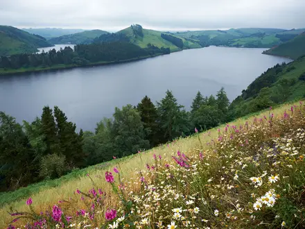
Oeschinensee Panorama Trail
How would you rate Oeschinensee Panorama Trail?
Tap a star to share your experience and help other hikers.
Oeschinensee Panorama Trail: Lake Oeschinen Balcony Hike
HikeList Score
Oeschinensee Panorama Trail scored 83/100 on HikeList's trail-quality metrics.
See score breakdownHide breakdown
- Ideal length 55
- Balanced challenge 100
- Scenery & wildness 85
- Varied terrain 83
- Accommodation 83
- Food & support 88
- Path quality 98
- Season flexibility 76
Computed from length, challenge, scenery & wildness, terrain variety, accommodation, food & support, path quality and season flexibility.
The Oeschinensee Panorama Trail is an 8.5 km circular day hike above Lake Oeschinen near Kandersteg in the Bernese Oberland, Switzerland. It takes about 3–3.5 hours from the Oeschinensee gondola top station, with roughly 503 m of ascent and descent. The route is moderate, signed as a Swiss T2 mountain trail: suitable for fit hikers, but not for anyone uncomfortable with narrow, exposed dirt paths and steep drops above the lake.
Route Overview
Start and finish at the Oeschinensee gondola top station above Kandersteg. The usual loop climbs through the Läger/forest to the Heuberg viewpoint, then follows the high panorama balcony above Lake Oeschinen with the Blüemlisalp massif ahead. From there it descends past Oberbärgli and Unterbärgli alpine farmsteads/mountain inns to the Oeschinensee shore, before returning on the lakeside path and service track to the gondola. This is a signed SwitzerlandMobility/SchweizMobil-style day route, not a hut-to-hut trek; for longer Swiss itineraries, compare the Alpine Pass Route, Aletsch Glacier Panorama Trail or Davos to Arosa Panorama Trail.
How Lake Oeschinen Was Formed
Oeschinensee is a landslide-dammed lake. Rock avalanches from the Doldenhorn and Fründenhorn flanks shed well over 100 million cubic metres of debris, blocking the valley and helping the lake take its present form roughly 3,200 years ago, after earlier rockfalls around 8,000 years ago. The surrounding high pastures have long been used for summer alpine grazing, and the area later became an accessible alpine tourism destination with the Kandersteg-Oeschinensee gondola.
Notable highlights
- Lake Oeschinen / Oeschinensee (1,578 m): A turquoise mountain lake beneath the Blüemlisalp, about 1.115 km² and up to 56 m deep. Rowing boats operate May to October, and hardy swimmers use the cold water in summer.
- Heuberg viewpoint (~1,987 m): The high point of the loop and the classic photo angle looking down onto the lake. This is also where the exposure feels most obvious.
- Blüemlisalp massif: A serrated, glaciated wall rising to the Blüemlisalphorn at 3,661 m. It dominates much of the balcony traverse.
- Doldenhorn and Fründenhorn: These peaks enclose the basin, with the Doldenhorn at 3,638 m and Fründenhorn at 3,368 m. Rock avalanches from their flanks helped dam the valley and form the lake.
- Oberbärgli and Unterbärgli: Working alpine farmsteads with simple mountain inns on the descent. They are useful summer stops for drinks or a light meal, but can close in shoulder season or midweek.
- UNESCO World Heritage landscape: Since the 2007 western extension, the lake and its surroundings have been part of the Swiss Alps Jungfrau-Aletsch UNESCO World Heritage Site.
Challenges to expect
Expect a narrow dirt mountain path on the Heuberg balcony, with loose rock, uneven footing and exposed, unrailed drops towards the lake. A head for heights helps. Navigation is straightforward in clear weather thanks to Swiss yellow/red-white waymarking, but snow can linger outside high summer. Food options at Oberbärgli, Unterbärgli and the lake are seasonal, so carry water and snacks.
HikeList Score
Oeschinensee Panorama Trail scored 83/100 on HikeList's trail-quality metrics.
See score breakdownHide breakdown
- Ideal length 55
- Balanced challenge 100
- Scenery & wildness 85
- Varied terrain 83
- Accommodation 83
- Food & support 88
- Path quality 98
- Season flexibility 76
Computed from length, challenge, scenery & wildness, terrain variety, accommodation, food & support, path quality and season flexibility.
 Switzerland
Show more data Show less
- Mountainous
- Forest
- Alpine Meadow
- Dirt
- Rocky
- Gravel
- Hotels
- Guesthouses
- Mountain Inns
- Family Friendly
- Pet Friendly
- Restrooms
- Water Sources
- Campsites
- Picnic Areas
Photos from hikers
Taken on the trail by people who've reviewed Oeschinensee Panorama Trail.
Reviews
How would you rate Oeschinensee Panorama Trail?
Tap a star to start your review — you could be the first.