NS Veluwe Walking Trails
How would you rate NS Veluwe Walking Trails?
Tap a star to share your experience and help other hikers.
NS Veluwe Walking Trails: Train-to-Train Day Walks on the Veluwe
HikeList Score
NS Veluwe Walking Trails scored 86/100 on HikeList's trail-quality metrics.
See score breakdownHide breakdown
- Ideal length 55
- Balanced challenge 100
- Scenery & wildness 98
- Varied terrain 83
- Accommodation 83
- Food & support 88
- Path quality 98
- Season flexibility 89
Computed from length, challenge, scenery & wildness, terrain variety, accommodation, food & support, path quality and season flexibility.
The NS Veluwe Walking Trails are station-to-station day walks in the Netherlands, created by Wandelnet with Nederlandse Spoorwegen. The headline route is NS-wandeling Veluwezoom: 16 km from Dieren to Velp, or 11 km to Rheden, through Nationaal Park Veluwezoom. Expect a moderate walk, not a flat stroll: the route climbs and descends the Veluwezoom stuwwal through forest, heath and sandy ridge paths. It suits fit day hikers who want a car-free Veluwe walk with train access, waymarking and downloadable GPX.
Route Overview
The main Veluwe route starts at NS-station Dieren and runs point-to-point to NS-station Rheden for the 11 km option, or on to NS-station Velp for the 15.6 km variant. It passes Landgoed Hof te Dieren, Carolinaberg, Hagenau and the Onzalige Bossen before reaching the Posbank heath viewpoint and the southern-edge towns of Rheden or Velp. Trains connect via Arnhem, Nijmegen, Zutphen, Deventer and Zwolle. The Veluwezoom walk follows the white-red Maarten van Rossumpad; the shorter Rheden option uses yellow-red Veluwe Zwerfpad markings. For longer Dutch walking ideas, compare the Drenthepad or the Achterhoekpad.
Royal Hunting Roads and the NS Walking Programme
NS-wandelingen were developed by Wandelnet with Nederlandse Spoorwegen to make countryside walking reachable by train. Each walk links stations and follows an existing LAW long-distance path or Streekpad. On the Veluwezoom route, several dead-straight koningswegen, or royal hunting roads, date from the 17th century, when stadtholder-king Willem III had them laid out to connect hunting lodges. Around Carolinaberg, those geometric lanes still shape the walking experience.
Notable highlights
- Nationaal Park Veluwezoom: The Netherlands’ oldest national park, established in 1930, with forest, heath and drift sand managed by Natuurmonumenten. It gives this NS walk its unusually hilly Dutch terrain.
- Posbank viewpoint: A well-known heathland outlook on the Veluwezoom, with a 1918 stone bench honouring ANWB pioneer G.A. Pos. In late summer the heather is the main draw.
- Veluwezoom stuwwal: This ice-pushed ridge creates the route’s real climbing and descending, especially through the Onzalige Bossen. It is the reason the walk is graded moderate.
- Carolinaberg and koningswegen: Fourteen forest lanes meet at this low wooded hill, part of the historic geometric hunting-road landscape. It is one of the route’s clearest landscape-history features.
- Wildlife: Red deer, roe deer, wild boar and Scottish Highland cattle are present in the park’s woods and heath. Keep distance from livestock and avoid approaching wild animals.
- Station-to-station logistics: The walk starts and ends at train stations, with free route description, map and GPX available. If you like car-free national park walks, also see the De Meinweg National Park Trail.
Challenges to expect
Do not treat Veluwezoom as an easy flat Dutch walk. The Onzalige Bossen section has sustained climbing and descending, with sandy, loose and rooty paths that can be tiring. Unpaved tracks become muddy after rain, and two white-red routes cross in the area, so carry the written description or GPX. Refreshment stops are mainly Carolinahoeve and Paviljoen De Posbank; there are no huts.
HikeList Score
NS Veluwe Walking Trails scored 86/100 on HikeList's trail-quality metrics.
See score breakdownHide breakdown
- Ideal length 55
- Balanced challenge 100
- Scenery & wildness 98
- Varied terrain 83
- Accommodation 83
- Food & support 88
- Path quality 98
- Season flexibility 89
Computed from length, challenge, scenery & wildness, terrain variety, accommodation, food & support, path quality and season flexibility.
 Netherlands
Show more data Show less
- Forest
- Hills
- Heath
- Dirt
- Sand
- Gravel
- Hotels
- Guesthouses
- Campsites
- Family Friendly
- Pet Friendly
- Restrooms
- Water Sources
- Campsites
- Picnic Areas
Download Our Full Guide to NS Veluwe Walking Trails FREE!
Get our comprehensive guide to this hike for free. Save it for later reading or print out at home.
Photos from hikers
Taken on the trail by people who've reviewed NS Veluwe Walking Trails.
NS Veluwe Walking Trails: The Complete Guide
 i
Image by julia700702
i
Image by julia700702 The NS Veluwe Walking Trails are not a single thru-hike, but a set of train-to-train day walks across one of the Netherlands’ best walking regions. The headline route is NS-wandeling Veluwezoom, a 15.6 km walk from NS-station Dieren to NS-station Velp, with a shorter 11 km finish at Rheden.
This is Dutch walking with more shape than most: sandy forest tracks, heathland, rooty paths and the low but definite climbs of the Veluwezoom stuwwal. The route crosses Nationaal Park Veluwezoom (Veluwezoom National Park), passing Hof te Dieren, Carolinaberg, the Onzalige Bossen and the Posbank viewpoint.
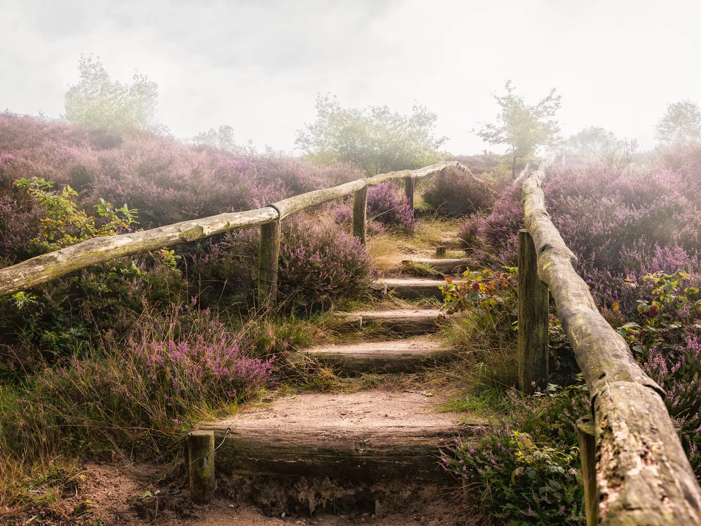
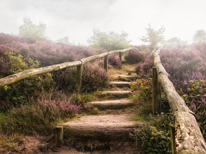
Late summer brings the classic Veluwezoom scene: purple heide (heath) rolling over low moraine hills, with beech, oak and pine woodland on the ridges. Autumn is also strong, especially on the forest lanes and estate paths.
The logistics are deliberately simple. Every NS-wandeling starts and ends at a railway station, so this is ideal for car-free day hikers, families on easier Veluwe routes, and fitter walkers wanting the more demanding Dieren to Velp option.
Do not underestimate the flagship Veluwezoom walk just because the high point is only 110 m. Around 250 m of accumulated ascent, loose sand and rooty climbs through the Onzalige Bossen make it moderate by Dutch standards.
This guide covers route choices, stages, days, accommodation, food, transport, terrain and the common mistakes to avoid.
Stage-by-Stage Guide
The NS-wandeling Veluwezoom is best planned as a single day walk with two finish options. Both start at NS-station Dieren and cross the same hilly Veluwezoom landscape before the route either finishes at NS-station Rheden or continues to NS-station Velp.
Stage 1: NS-station Dieren to NS-station Rheden — short option
| Detail | Practical notes |
|---|---|
| Distance | About 11 km |
| Walking time | About 2.5–3 hours |
| Start / finish | NS-station Dieren to NS-station Rheden |
| Character | Forest, estate tracks, heathland and sandy moraine paths |
| Difficulty | Moderate for the Netherlands because of repeated low climbs and descents |
This shorter Veluwezoom option gives the essential character of the walk without the final continuation to Velp. From Dieren the route heads into the estate and forest landscape around Landgoed Hof te Dieren, then works through the wooded ridges and heathland of Nationaal Park Veluwezoom.
The walking is mostly on dirt, sand and gravel tracks, but the terrain is more demanding than many Dutch station walks. Through the Onzalige Bossen the path uses sandy, rooty climbs and descents on the Veluwezoom stuwwal, the ice-pushed ridge that makes this route feel unusually hilly for the Netherlands.
Key landmarks on this option include Landgoed Hof te Dieren, Carolinaberg, Hagenau, the Onzalige Bossen and the heathland around Posbank and Zijpenberg. Carolinaberg is notable for its star-shaped meeting of straight forest lanes, part of the old koningswegen (royal hunting roads) linked to the former Orange hunting landscape.
The main view comes around Posbank, a well-known viewpoint at about 90 m. In late summer the surrounding heide (heath) is the route’s visual highlight, with broad purple slopes across the low Veluwezoom ridges.
Food and drink should not be left to chance. The known refreshment stops on the Veluwezoom route are Carolinahoeve and Paviljoen De Posbank, but opening times can vary by season and day of week, so carry enough water and snacks for the full walk and check current opening before travelling.
Rheden is the practical finish for the short option. It has an NS-station on the Arnhem–Zutphen line, making the route straightforward as a car-free day walk; onward rail connections run via Arnhem, Nijmegen, Zutphen, Deventer and Zwolle.
Accommodation is not normally needed for this stage, as it is designed as a day walk. If staying locally, Rheden, Dieren, Velp and Arnhem are the most relevant bases, with hotels, pensions, B&Bs and campsites in the wider Veluwe/Arnhem area.
Navigation is based on existing waymarked long-distance paths, with the flagship Veluwezoom route following the white-red Maarten van Rossumpad (LAW 4). Download the current route description and GPX from NS or Wandelnet before setting off, and check for diversions before travelling.
The main hazards are underfoot rather than alpine: loose sand, exposed roots, short steep slopes and mud after rain. Keep distance from Scottish Highland cattle and from wildlife such as edelhert (red deer), ree (roe deer) and wild zwijn (wild boar). There is no significant exposure, but the climbs can feel sharper than expected on a lowland Dutch walk.
Stage 2: NS-station Dieren to NS-station Velp — full flagship route
| Detail | Practical notes |
|---|---|
| Distance | About 15.6 km |
| Walking time | About 3–4 hours |
| Start / finish | NS-station Dieren to NS-station Velp |
| Character | Full Veluwezoom crossing with forest, heath, ridge paths and the Beekhuizense Beek valley |
| Difficulty | Moderate; roughly 250 m accumulated ascent |
The full Dieren to Velp option continues beyond the shorter Rheden finish and is the route that matches the rounded 16 km figure often used for the NS-wandeling Veluwezoom. It includes the same estate, forest and Posbank sections, then extends towards Velp via the Beekhuizense Beek valley.
The first part follows the same hilly Veluwezoom terrain from Dieren: Landgoed Hof te Dieren, Carolinaberg, Hagenau, the Onzalige Bossen and the open heath around Posbank and Zijpenberg. Expect a mix of broad forest lanes, narrower sandy paths, gravel tracks and rooty woodland sections.
The accumulated ascent is modest in absolute terms, but the route repeatedly climbs and descends the stuwwal. The high ground is low by mountain standards — Nationaal Park Veluwezoom reaches 110 m — yet the combination of sand, roots and rolling ridges makes pacing more important than on flatter Dutch NS walks.
The longer continuation adds more variety after the Posbank area, especially around the Beekhuizense Beek valley before the approach to Velp. This makes the full route the better choice for walkers wanting the most complete Veluwezoom day rather than the quickest station-to-station option.
Views are strongest on and around the heathland ridges near Posbank, particularly from mid-August to mid-September when the heide is usually in bloom. In autumn, the beech and oak lanes give the forest sections their best colour.
Food and water planning is the same as for the short option: Carolinahoeve and Paviljoen De Posbank are the named refreshment stops, but do not rely on them without checking current opening. Carry enough water for 15.6 km, especially in warm late-summer weather when the heathland sections can feel exposed to sun.
Velp is the end point for the full route and has an NS-station on the Arnhem–Zutphen line. This keeps the walk simple logistically: arrive by train at Dieren, walk west through the national park, and return by train from Velp.
For an overnight base, Velp and nearby Arnhem are the most practical choices at the end of the full walk. Rheden, Dieren, Apeldoorn and Ede are also useful Veluwe-area bases depending on onward plans and which NS-wandeling is being linked with the trip.
Navigation should be treated as waymarking plus backup, not waymarking alone. Follow the current NS/Wandelnet route description and GPX, and use the white-red Maarten van Rossumpad (LAW 4) markings where the route follows them. Any alternative markings or local diversions should be checked against the official route file before starting.
After rain, unpaved paths can be muddy and the sandy climbs can become slippery on descents. In dry spells, loose sand slows progress and can make the short climbs feel harder than their height suggests. Keep clear of large grazing animals, do not approach wild boar, and allow extra time if walking during the late-summer heather season when the Posbank area is at its busiest.
Recommended Itinerary
These walks are planned as train-in, train-out day hikes, not as a continuous long-distance route. For the flagship NS-wandeling Veluwezoom, the practical choice is between the full Dieren to Velp route and the shorter Dieren to Rheden finish.
Standard itinerary: full Veluwezoom route
Best for reasonably fit day walkers who want the complete flagship route, including the hilly Veluwezoom section and the longer finish towards Velp.
| Day | From | To | Approx. distance | Why this stage makes sense | Services/accommodation notes |
|---|---|---|---|---|---|
| 1 | NS-station Dieren | NS-station Velp | ~15.6 km | This is the full NS-wandeling Veluwezoom and matches the rounded 16 km version of the route. It gives a complete crossing from Hof te Dieren through Carolinaberg, the Onzalige Bossen, Posbank and onwards towards Velp, with roughly 3–4 hours of walking. | Start and finish are railway stations, so no transfer back to the start is needed. Refreshment options on the route include Carolinahoeve and Paviljoen De Posbank, but opening times should be checked before travelling. No overnight stop is required; if staying locally, use towns such as Arnhem, Velp, Rheden, Dieren, Apeldoorn or Ede as a base. |
Slower / easier variant: short Veluwezoom finish at Rheden
Best for families, casual walkers, late starts, hot weather, or anyone wanting the Veluwezoom hills without committing to the full Velp finish.
| Day | From | To | Approx. distance | Why this stage makes sense | Services/accommodation notes |
|---|---|---|---|---|---|
| 1 | NS-station Dieren | NS-station Rheden | ~11 km | This uses the shorter official finish and keeps the day to about 2.5–3 hours of walking. It still covers the key Veluwezoom terrain, including the sandy, rooty climbs and descents that make this walk more demanding than many Dutch lowland routes. | Rheden is on the Arnhem–Zutphen rail line, so it is an easy exit point by train. Carry food and water rather than relying entirely on cafés, especially outside peak season or on weekdays. |
Faster / time-limited option
There is no meaningful multi-day acceleration here: the route is already a single day walk. For a short travel window, the practical faster option is to walk only to Rheden; for a full but efficient day, take an early train to Dieren and continue to Velp.
| Day | From | To | Approx. distance | Why this stage makes sense | Services/accommodation notes |
|---|---|---|---|---|---|
| 1 | NS-station Dieren | NS-station Rheden or Velp | ~11 km or ~15.6 km | Choose Rheden if train connections, daylight or weather make the longer finish unattractive. Choose Velp if there is enough time for the full 3–4 hours of walking plus breaks. | Check current NS train times before travelling and download the latest route description or GPX from NS or Wandelnet. Route diversions and station stopping patterns can change. |
Building a multi-day Veluwe walking break
If planning more than one day, treat the Veluwe NS walks as separate day walks from a rail-connected base, not as connected stages. Arnhem and Ede are practical bases because they give access to several Veluwe-area walks by train, while Dieren, Rheden and Velp work well for the Veluwezoom route itself.
| Day | From | To | Approx. distance | Why this stage makes sense | Services/accommodation notes |
|---|---|---|---|---|---|
| 1 | Dieren | Rheden or Velp | ~11 km or ~15.6 km | The flagship Veluwezoom walk is the best first choice for the hilliest, most distinctive Veluwe NS day. | Stay off-route in a rail-served town rather than trying to backpack the route. |
| 2 | Arnhem | Oosterbeek or Wolfheze | 11–19.8 km | NS-wandeling Warnsborn gives a second Veluwe-area station-to-station day without needing a car. | Check the official NS/Wandelnet description for the current finish option before booking onward travel. |
| 3 | Oosterbeek | Arnhem | 7–15.1 km | NS-wandeling Hemelse Berg is a shorter, flexible day that pairs well with a base in Arnhem or nearby. | Suitable as a lighter day between longer walks. Train times and route files should be checked before travelling. |
| 4 | Nunspeet | Harderwijk | 10–20.9 km | NS-wandeling Hierdense Poort extends the trip to another Veluwe station-to-station landscape. | This is a separate walk, not a continuation of Veluwezoom. Arrange rail travel independently for the day. |
| 5 | Ede | Ede | 10 or 16 km | NS-wandeling Belmonte gives another flexible Veluwe option from Ede. | Ede also gives access by bus 108 to De Hoge Veluwe National Park, which is a separate walking area and not on the Veluwezoom route. |
Planning the Route
Treat it as a set of day walks, not a thru-hike
The NS Veluwe Walking Trails are best planned as individual station-to-station day walks. Each route starts and ends at an NS-station, so the practical unit is one walk per day rather than a continuous multi-day itinerary.
For the flagship NS-wandeling Veluwezoom, most walkers should allow a single day: roughly 2.5–3 hours for the Dieren to Rheden option, or 3–4 hours for the full Dieren to Velp route. Add time for stops at Posbank, the Onzalige Bossen, viewpoints, photographs and any café breaks.
There is little advantage in rushing this route. The distances are modest, but the Veluwezoom walk is more enjoyable with time in hand for the sandy climbs, rooty descents and open heide around Posbank, especially in late summer when the heather is in flower.
Choosing the right Veluwezoom option
The main planning decision on the flagship route is whether to finish at Rheden or continue to Velp. Both options keep the station-to-station logic intact.
| Option | Route | Best for |
|---|---|---|
| Short option | Dieren → Rheden, about 11 km | A shorter Veluwezoom walk, limited daylight, families or walkers wanting the hills without the full finish to Velp |
| Full option | Dieren → Velp, about 15.6 km | The complete flagship walk, including the longer continuation towards the Beekhuizense Beek valley and Velp |
The shorter finish at Rheden is the cleanest way to cut the day short without needing taxis or road walking. If energy, weather or daylight are uncertain, plan around the Rheden finish and continue only if conditions are comfortable.
Extending the trip
To make a longer Veluwe walking break, link several NS-wandelingen as separate day walks rather than forcing them into one continuous route. Relevant Veluwe-area NS walks include Veluwezoom, Warnsborn, Hemelse Berg, Hierdense Poort and Belmonte, with starts or finishes at stations such as Dieren, Velp, Rheden, Arnhem, Oosterbeek, Nunspeet, Harderwijk and Ede-Wageningen.
A practical approach is to base yourself in a town with good rail links, then travel out each day to a different NS walk. Arnhem, Velp, Rheden, Dieren, Apeldoorn and Ede offer the widest choice of nearby accommodation in the wider region.
Nationaal Park De Hoge Veluwe and the Kröller-Müller Museum are a separate Veluwe walking area, not part of the Veluwezoom route. They can be combined with a walking trip in the region, but they require separate planning and are reached by bus 108 from Ede-Wageningen or Apeldoorn stations.
Accommodation planning
Accommodation is not normally needed on the route itself. These are day walks designed for walkers arriving and leaving by train, so most people return home or to a regional base at the end of the day.
For a multi-day Veluwe break, book accommodation in a rail-connected town rather than trying to sleep between stages. Hotels, pensions, B&Bs and campsites are available in the Veluwe and Arnhem region, with the best practical choice in larger towns such as Arnhem, Velp, Rheden, Dieren, Apeldoorn and Ede.
Because the walks are not arranged as a linear backpacking trail, daily stages are dictated by railway stations rather than accommodation stops. This makes the logistics simple, but it also means each day should be planned around train times, daylight and the specific NS route description.
Transport is the key booking task
Train access is the central planning feature. For the Veluwezoom walk, Dieren, Rheden and Velp are on the Arnhem–Zutphen line, with onward connections via Arnhem, Nijmegen, Zutphen, Deventer and Zwolle.
Check current NS train times before travelling, especially if starting early, walking on a weekend or relying on a specific return connection. Station stops, engineering works and replacement buses can affect what looks like a simple day walk.
Other Veluwe NS walks use stations including Arnhem, Oosterbeek, Nunspeet, Harderwijk and Ede-Wageningen. When combining several walks, plan each day separately rather than assuming all routes share the same rail pattern.
Navigation and route updates
Download the current route description and GPX from NS or Wandelnet before setting out. The Veluwezoom route follows the white-red Maarten van Rossumpad (LAW 4) markings, but a phone map or GPX track is still useful at forest junctions, sandy tracks and estate paths.
Do not rely only on memory or a simplified overview map. NS-wandelingen use existing waymarked routes, and diversions can occur because of forestry work, conservation management or path closures. Current route notes should be checked before travelling.
Food, water and stops
Carry enough water and snacks for the full walk, even though the route is not remote. The landscape between stations is mainly forest, heath and sandy ridge paths, so services are limited once away from the towns.
On the Veluwezoom route, Carolinahoeve and Paviljoen De Posbank are the known refreshment stops. Opening times can change by season, weekday and weather, so they should not be treated as guaranteed food or water sources without checking before departure.
There are no mountain huts or backpacking facilities on this walk. Plan it like a self-sufficient countryside day walk: start with what is needed, use cafés as a bonus, and finish at the station with onward travel already understood.
Weather, daylight and underfoot conditions
The Veluwe is low, but the Veluwezoom route feels more strenuous than many Dutch walks because it climbs and descends the stuwwal through the Onzalige Bossen. Sandy and rooty paths can slow progress, particularly after rain or when walking with children.
Unpaved paths can become muddy after wet weather, while sandy sections can be tiring in dry conditions. Lightweight walking shoes or boots with good grip are more useful than smooth-soled trainers on the full Dieren to Velp option.
Late summer, roughly mid-August to mid-September, is the classic period for purple heide around Veluwezoom and Posbank. Autumn is also strong for woodland colour, but daylight is shorter, so the full route should be started with enough margin for the finish at Velp or the shorter exit at Rheden.
What matters most
For this route, the main planning priorities are transport, current route files, footwear and carrying enough food and water for a self-contained day. Accommodation and permits are not the main constraints unless turning the Veluwe walks into a broader regional trip.
The simplest successful plan is: choose one NS-wandeling, download the latest route description and GPX, check trains to the start and from the finish, carry enough supplies for the day, and decide in advance whether the Rheden or Velp finish is the right target for the Veluwezoom walk.
Towns, Villages and Overnight Stops
These NS Veluwe walks are designed as train-in, train-out day walks, not as a backpacking route with fixed overnight stages. Most walkers do not sleep on the route itself; accommodation is mainly relevant if you want a weekend base for several NS-wandelingen or an early start on the Veluwezoom route.
For the flagship NS-wandeling Veluwezoom, the practical overnight places are the railway towns at either end: Dieren, Rheden and Velp, with Arnhem offering the broadest nearby urban base. Accommodation details, opening days and prices change seasonally, so this should be checked before travelling.
Dieren — start of the flagship Veluwezoom walk
Dieren is the starting point for the flagship NS-wandeling Veluwezoom. The walk begins at NS-station Dieren, making it the most practical place to stay if an early start matters or if train connections on the day are awkward.
Dieren has train access on the Arnhem–Zutphen line, with onward connections via Arnhem, Zutphen and the wider Dutch rail network. This is the key logistical advantage: you can step off the train and begin walking without a transfer.
For overnight planning, Dieren is a sensible but not essential base. The wider Veluwe and Arnhem region has hotels, pensions, B&Bs and campsites, and Dieren is one of the route towns where walkers may find accommodation and food options. Availability should be checked before booking, especially in the late-summer heather season.
Landgoed Hof te Dieren — early-route estate section
Landgoed Hof te Dieren (Hof te Dieren estate) comes soon after leaving Dieren on the flagship route. It is not an overnight stop; treat it as a landscape transition from the station town into the historic estate and woodland country that characterises the walk.
There are no hiker services to rely on here. Carry water and food from Dieren if needed, particularly outside normal café hours or if walking the shorter 11 km option without a long stop.
Carolinaberg and Carolinahoeve
Carolinaberg is a wooded hill and junction area where straight forest lanes meet in a star pattern, linked to the historic koningswegen (royal hunting roads). It is an important navigation and route-interest point rather than a village.
Carolinahoeve is one of the named refreshment stops on the official Veluwezoom route. Opening times can vary, so it should be checked before travelling rather than treated as guaranteed food and drink.
This is not a good overnight location. Use it as a mid-walk break point, but still carry enough water and snacks to complete the walk if the café is closed.
Hagenau
Hagenau sits on the woodland section between the estate country and the hillier Veluwezoom terrain. For walkers, it functions as a route waypoint rather than a service village.
Do not plan accommodation, shops or transport around Hagenau. It is useful mainly for orientation within the forested middle part of the walk.
Onzalige Bossen
The Onzalige Bossen (Onzalige woods) are one of the reasons the Veluwezoom route feels more demanding than many Dutch day walks. The path climbs and descends the stuwwal (ice-pushed ridge) on sandy, rooty tracks, so pace is usually slower here than on flat gravel or forest lanes.
There are no town services in this section. It is not an overnight stop and should be treated as a self-sufficient woodland crossing: carry water, food, a charged phone and the current route description or GPX.
Posbank
Posbank is the best-known viewpoint on the Veluwezoom route, standing at about 90 m above sea level. It is especially popular in late summer when the heide (heath) is in purple bloom.
Paviljoen De Posbank is a named refreshment stop on the route. Opening hours and busy-period arrangements should be checked before travelling, particularly at weekends and during the heather season.
Posbank is not a logical overnight stop for this walk. It is better treated as a rest and viewpoint stop before continuing towards Rheden or Velp.
Zijpenberg
Zijpenberg lies on the higher heath-and-ridge section after Posbank. It is a scenic route point rather than a settlement with services.
There is no accommodation or transport link to plan around here. Keep moving if weather turns poor or if daylight is short; the practical exits remain the stations at Rheden or Velp.
Beekhuizense Beek valley — on the longer Velp option
The Beekhuizense Beek valley is part of the longer Dieren to Velp option. Walkers finishing at Rheden on the 11 km route will not use the full Velp continuation.
This is a route section rather than a service stop. It is useful to recognise because it marks that you are committed to the longer finish at Velp rather than the shorter Rheden exit.
Rheden — shorter-route finish
Rheden is the finish for the shorter Veluwezoom option, about 11 km from Dieren. It is the right choice if the weather is poor, legs are tiring, time is limited or the hilly sandy ground has taken longer than expected.
NS-station Rheden is on the Arnhem–Zutphen line, so it gives a straightforward rail exit from the walk. Connections can be made via Arnhem, Zutphen and other regional rail hubs.
Rheden can work as an overnight base, though most walkers will simply take the train out. As one of the route towns, it may have accommodation and food options, but availability and opening times should be checked before travelling.
Velp — full-route finish
Velp is the finish for the full flagship route from Dieren, about 15.6 km in total. This is the option that matches the rounded 16 km version of the walk.
NS-station Velp is also on the Arnhem–Zutphen line, making the end of the walk simple: no taxi or bus transfer is normally needed. This is one of the main strengths of the NS-wandeling format.
Velp is a practical overnight stop if you want to stay close to the finish or combine the walk with time in the Arnhem area. The town is listed among the places with a wider choice of accommodation in the region, but current availability should be checked before booking.
Arnhem — best nearby urban base
Arnhem is not the start or finish of the flagship Dieren to Velp walk, but it is the most useful nearby city base. It gives strong rail connections and sits close to the Veluwezoom station line via Dieren, Rheden and Velp.
For walkers planning more than one NS Veluwe day walk, Arnhem is often more convenient than changing overnight stops. Other NS walks in the Veluwe cluster also use Arnhem or nearby Oosterbeek as station points.
Arnhem has the widest practical appeal for accommodation, evening food and rail flexibility. It is the best choice if the priority is logistics rather than sleeping directly beside the trail.
Oosterbeek, Nunspeet, Harderwijk and Ede-Wageningen — bases for other Veluwe NS walks
The wider NS Veluwe walking network is not one continuous route, so overnight planning depends on which day walk is chosen. Other Veluwe NS walks use stations including Oosterbeek, Nunspeet, Harderwijk and Ede-Wageningen.
These places are relevant if combining the Veluwezoom walk with routes such as Warnsborn, Hemelse Berg, Hierdense Poort or Belmonte. In that case, choose accommodation based on rail convenience rather than trying to link the walks on foot.
Ede is also one of the wider Veluwe towns with accommodation options, and Ede-Wageningen station is a transport gateway for the separate De Hoge Veluwe National Park area by bus. De Hoge Veluwe is not on the flagship Veluwezoom route.
Apeldoorn — wider Veluwe base, not on the flagship route
Apeldoorn is useful as a broader Veluwe accommodation and transport base, but it is not on the Dieren to Rheden or Dieren to Velp walk. It may suit walkers combining NS-wandelingen with other Veluwe plans.
For De Hoge Veluwe National Park, bus 108 runs from Apeldoorn as well as from Ede-Wageningen. This is a separate walking area from Nationaal Park Veluwezoom and should not be confused with the flagship NS-wandeling Veluwezoom.
Getting to the Start
The NS Veluwe walks are built around rail access, so the “start” depends on the individual NS-wandeling chosen. For the flagship NS-wandeling Veluwezoom, start at NS-station Dieren; the route then finishes at NS-station Rheden for the shorter option or NS-station Velp for the full route.
By train
Train is the standard and most practical way to reach the start. For the Veluwezoom walk, travel to NS-station Dieren, which lies on the Arnhem–Zutphen line. Connections are available via Arnhem, Nijmegen, Zutphen, Deventer and Zwolle.
This point-to-point set-up is the main advantage of the route: after walking from Dieren to Rheden or Velp, return by train from the finish station rather than retracing the route. Current NS train times, platform changes and any rail works should be checked before travelling.
Other Veluwe NS walks start from stations including Arnhem, Oosterbeek, Nunspeet and Ede. The wider Veluwe NS cluster also uses stations such as Harderwijk and Ede-Wageningen, so choose the walk first, then plan rail travel to the correct start station.
Download the latest route description and GPX from NS or Wandelnet before setting off. NS-wandelingen can be rerouted for forestry work, path closures or local diversions, and this should be checked before travelling.
By bus
A bus is not normally needed for the flagship Veluwezoom walk because both the start and finish are railway stations. The cleanest plan is train to Dieren, walk to Rheden or Velp, then train onwards.
Bus access is more relevant if combining the trip with a separate Veluwe walking area. Nationaal Park De Hoge Veluwe is not on the Veluwezoom route and is reached by bus 108 from Ede-Wageningen or Apeldoorn stations. Current bus times and stop locations should be checked before travelling.
By car
Driving is possible but less efficient than using the train, because the walks are point-to-point rather than circular. If arriving by car for the Veluwezoom route, the simplest arrangement is usually to leave the car near the start at Dieren and return by train from Rheden or Velp after the walk.
Do not assume long-stay parking is available or suitable at every station. Parking rules, charges, overnight restrictions and capacity at Dieren, Rheden and Velp should be checked before travelling.
A taxi can be a fallback if trains are disrupted or if a late finish makes connections awkward. Local taxi availability should not be relied on without checking in advance, especially outside busy times.
From the nearest airport
There is no airport-specific trailhead transfer for these walks. International arrivals should connect into the Dutch rail network and route towards Dieren for the Veluwezoom walk, usually via one of the regional rail hubs serving the Arnhem–Zutphen line.
For other Veluwe NS walks, travel by train to the relevant start station, such as Arnhem, Oosterbeek, Nunspeet or Ede. Airport-to-rail connections, ticketing and final train times should be checked before travelling.
Where to stay before starting
Most walkers do these as day walks and return home by train, so overnight accommodation is not required on the route itself. If staying locally, Arnhem gives the widest practical base for the Veluwezoom walk because it has strong rail connections and lies close to the Dieren–Rheden–Velp corridor.
Dieren is the most convenient overnight choice for an early start on the flagship route. Rheden and Velp work well if staying near the finish, while Apeldoorn and Ede are useful bases for other Veluwe walks.
Accommodation in the region includes hotels, pensions, B&Bs and campsites. Availability can tighten in late summer during the heather season around the Veluwezoom and Posbank, so accommodation and transport should be booked or checked in advance.
Getting Home from the Finish
By train
Every NS-wandeling is designed to finish at a railway station, so getting home is normally straightforward: walk to the platform and take the train rather than arranging a lift or retracing the route on foot.
For the flagship NS-wandeling Veluwezoom, there are two finish choices:
| Finish option | Station | Use this if… |
|---|---|---|
| Short route | NS-station Rheden | You are ending after the 11 km option from Dieren |
| Full route | NS-station Velp | You are completing the full Dieren to Velp route of about 15.6 km |
Dieren, Rheden and Velp are all on the Arnhem–Zutphen railway line. From the finish, onward connections run via Arnhem, Nijmegen, Zutphen, Deventer and Zwolle, depending on where you are heading next.
If travelling back to the start, take the train from Rheden or Velp towards Dieren. This is the simplest option if a car has been left at the start, though the whole route works best as a train-in, train-out day walk.
Check the current NS timetable before setting off, especially for an evening finish, engineering works or public-holiday service changes. If finishing late, go directly to the station rather than assuming there will be convenient food, bus or taxi options nearby.
Other Veluwe NS walks use stations such as Arnhem, Oosterbeek, Nunspeet, Harderwijk and Ede-Wageningen. The same principle applies: finish at the named station, then continue by NS train using the current timetable.
By bus
A bus is not normally needed at the end of an NS Veluwe walk because the routes are specifically planned around railway stations. For the Veluwezoom route, Rheden and Velp are rail finishes, so train is the default onward transport.
Bus options can be useful only if you are diverting, abandoning the walk away from the station, or linking the day with a separate visit elsewhere in the Veluwe. Bus routes and evening service levels are timetable-dependent and should be checked before travelling.
De Hoge Veluwe National Park is a separate Veluwe walking area, not on the Dieren–Rheden/Velp Veluwezoom route. It is reached by bus 108 from Ede-Wageningen or Apeldoorn stations.
By car/taxi
Driving is possible, but it removes much of the benefit of an NS-wandeling. If parking at the start in Dieren for the Veluwezoom walk, the practical return is to take the train back from Rheden or Velp to Dieren.
A taxi can be a fallback if trains are disrupted or if someone cannot complete the walk, but availability should not be assumed at smaller stations. Book ahead where possible, and check local taxi options before relying on one, particularly in the evening.
From the nearest airport
Airport transfers are best handled by rail rather than by road. From the Veluwezoom finish at Rheden or Velp, travel first by train via the regional rail network, commonly connecting through Arnhem or Zutphen depending on the final airport route.
Specific airport journey times and connections vary by date, time and engineering works. This should be checked before travelling.
Where to stay at the finish
Most walkers do not need accommodation at the finish because these are single-day walks with station access at both ends. If staying locally, Velp and Rheden are convenient for the Veluwezoom finish, while Arnhem, Dieren, Apeldoorn and Ede offer wider accommodation choice in the wider Veluwe/Arnhem area.
Options in the region include hotels, pensions, B&Bs and campsites. Book ahead in busy periods, especially around the late-summer heather season on the Veluwezoom.
Which Direction Should You Walk?
Standard direction: Dieren → Rheden or Velp
For the flagship NS-wandeling Veluwezoom, the standard direction is NS-station Dieren to NS-station Rheden for the shorter option, or NS-station Dieren to NS-station Velp for the full route. This is the direction used for the walk’s normal station-to-station flow and is the simplest choice for most hikers.
Transport is straightforward either way because Dieren, Rheden and Velp are all railway stations on the Arnhem–Zutphen line. The direction therefore does not create a major public-transport advantage; the main reason to walk from Dieren is that the route description and day-walk logic are built around that direction.
The scenery also works well from Dieren. The walk starts through the historic estate landscape around Landgoed Hof te Dieren, then moves towards Carolinaberg, Hagenau, the Onzalige Bossen and the heath and viewpoint area around Posbank. On the full Velp option, the route continues beyond the Rheden finish towards the Beekhuizense Beek valley before ending at Velp.
Reverse direction: Velp or Rheden → Dieren
Walking in reverse is practical in transport terms, as both ends are still railway stations. It can suit hikers staying nearer Arnhem, Velp or Rheden who prefer to begin there and finish at Dieren.
The main drawback is navigation. NS-wandelingen are designed as described station-to-station walks, so anyone reversing the route should use the current official route description or GPX and check for diversions before travelling. Do not rely on memory or on assuming every instruction works cleanly backwards.
Reversing the full route means reaching the Posbank and Veluwezoom heathland earlier, then finishing through the woods and estate approach towards Dieren. That gives a strong scenic opening, but a less obvious psychological finish than arriving at Velp after completing the full 15.6 km route.
Are the climbs easier one way?
There is no clear climbing advantage in either direction. The Veluwezoom route crosses the same ice-pushed ridge whichever way it is walked, with roughly 250 m of accumulated ascent on sandy, rooty paths through the Onzalige Bossen and around the Posbank area.
For Dutch walking, these hills are noticeable, but they are not mountains. Direction choice should be based more on navigation, train plans and preferred finish than on gradient.
Weather, wind and accommodation flow
Prevailing wind is not a major direction factor here. Much of the route is in forest, with more open heath around Posbank, so weather matters for clothing and footing rather than for choosing which way to walk.
Accommodation flow is also mostly irrelevant because these are day walks, not a multi-day trail. If staying locally in Arnhem, Velp, Rheden, Dieren, Apeldoorn or Ede, choose the direction that gives the easiest train connection back to the overnight base.
Recommendation
Walk the flagship Veluwezoom route in the standard direction: Dieren → Rheden for the 11 km option, or Dieren → Velp for the full 15.6 km walk. It matches the intended NS-wandeling format, gives a natural build from estate and forest into the hillier Veluwezoom landscape, and keeps navigation simplest.
Reverse the route only if it clearly improves your train or accommodation logistics, and use the latest official route description or GPX when doing so.
Accommodation Along the Route
The NS Veluwe Walking Trails are not designed as a hut-to-hut or inn-to-inn route. They are station-to-station day walks, so most walkers travel in by train, carry a daypack, finish at another station and return home or to a fixed base the same day.
For overnight planning, the best approach is to choose one base with good rail access rather than trying to sleep at each finish point. Arnhem is the most practical hub for the flagship NS-wandeling Veluwezoom because Dieren, Rheden and Velp are all on the Arnhem–Zutphen line. Dieren, Rheden and Velp can also work if you want to stay close to the start or finish.
The Veluwe/Arnhem region has hotels, pensions, B&Bs and campsites. The strongest choice is in Arnhem, Velp, Rheden, Dieren, Apeldoorn and Ede. Inside the walking sections of Nationaal Park Veluwezoom (Veluwezoom National Park), do not plan on finding hiker accommodation or huts on the route itself.
Best places to stay
| Place | Accommodation level | Best for | Notes |
|---|---|---|---|
| Arnhem | good | Main base for the Veluwezoom walk and other Veluwe NS walks | Strongest practical hub, with rail links towards Dieren, Rheden and Velp. Also useful for walkers combining several NS-wandelingen. |
| Dieren | good | Starting the flagship NS-wandeling Veluwezoom early | Convenient for the Dieren start. Useful if you want a quiet overnight before walking to Rheden or Velp. |
| Rheden | good | Short Veluwezoom option finish | Works for the 11 km Dieren–Rheden version. Also sensible if you want to stay close to Nationaal Park Veluwezoom after the walk. |
| Velp | good | Full Veluwezoom route finish | Best placed for the full Dieren–Velp option of about 15.6 km. Rail access makes returning to Arnhem or onward travel straightforward. |
| Ede | good | Other Veluwe NS walks and De Hoge Veluwe access | Useful for the Ede-based NS walks and for reaching Nationaal Park De Hoge Veluwe by bus 108 from Ede-Wageningen station. De Hoge Veluwe is a separate walking area, not on the Veluwezoom route. |
| Apeldoorn | good | Wider Veluwe base | A practical base for the broader Veluwe region and another access point for bus 108 to De Hoge Veluwe. Check current bus times before travelling. |
| On-route countryside in Veluwezoom | none | Day walking only | Hof te Dieren, Carolinaberg, Hagenau, Onzalige Bossen, Posbank, Zijpenberg and the Beekhuizense Beek valley are walking waypoints, not overnight stops to rely on. There are no huts on the NS-wandeling Veluwezoom. |
Booking strategy
For a single NS walk, accommodation is usually optional: the railway-based format makes day-return walking straightforward. If staying overnight, book a room in Arnhem, Dieren, Rheden or Velp and use the train to position yourself at the start and return from the finish.
Booking ahead is sensible for late summer, especially roughly mid-August to mid-September when the Veluwezoom heide (heath) is at its purple peak around Posbank. Autumn weekends can also be busy in the Veluwe woods. Campsites, B&Bs and smaller pensions should be booked in advance rather than treated as walk-up options.
Luggage, taxis and inn-to-inn walking
Luggage transfer is not normally needed on these walks. The cleanest plan is to leave overnight kit at your base accommodation and carry only food, water, waterproofs and day-walking essentials.
Taxi transfers are rarely necessary because every NS-wandeling starts and finishes at a railway station. If you intend to use taxis for an early start, late finish or accommodation away from a station, availability and prices should be checked before travelling.
The network does not work as a natural inn-to-inn trail in the way a continuous long-distance route does. It can be turned into a self-designed multi-day walking break by staying in one or two rail-linked towns and completing a different NS-wandeling each day, but the logistics are based on trains rather than overnight stages along a single line.
Camping and Wild Camping
The NS Veluwe Walking Trails are not designed as camping or backpacking routes. They are individual station-to-station day walks, with the flagship NS-wandeling Veluwezoom taking roughly 3–4 hours from Dieren to Velp, or 2.5–3 hours to Rheden on the shorter option.
For most walkers, camping only makes sense as a base-camp arrangement: stay at a campsite in the wider Veluwe/Arnhem region, travel to the start station by train, walk the route, then return by train. There are no mountain huts, trail shelters or official overnight stages on the Veluwezoom walk itself.
Campsites and overnight bases
The Veluwe/Arnhem region has campsites as well as hotels, pensions and B&Bs. The most practical bases are towns with rail access, because every NS-wandeling starts and ends at a station.
| Base area | Useful for | Practical notes |
|---|---|---|
| Arnhem | Veluwezoom and other Veluwe/Arnhem NS walks | Largest nearby city base with strong rail connections. |
| Velp, Rheden or Dieren | Flagship NS-wandeling Veluwezoom | Closest station towns to the Dieren–Rheden/Velp route. |
| Ede / Ede-Wageningen | Belmonte and access towards De Hoge Veluwe area | Useful for walkers combining NS walks with other Veluwe walking areas. |
| Nunspeet or Harderwijk | Hierdense Poort | Practical for the north-western Veluwe NS walk. |
| Apeldoorn | Wider Veluwe base | Also useful for onward bus access towards De Hoge Veluwe National Park. |
Specific campsite locations, opening dates and public-transport links should be checked before booking. Many campsites in the Netherlands are seasonal, and late summer can be busy, especially during the heather bloom around Veluwezoom and Posbank.
Wild camping
Wild camping should not be planned for the NS Veluwe walks. The flagship route crosses Nationaal Park Veluwezoom (Veluwezoom National Park), a protected landscape of forest, heath and drifting sand owned by Natuurmonumenten, with red deer, roe deer, wild boar and free-roaming Scottish Highland cattle.
Do not pitch a tent in the national park, on heathland, in forest, on private estate land such as around Landgoed Hof te Dieren, or beside the trail unless overnight camping is explicitly permitted by the land manager or local authority. Rules for any designated nature-camping areas or campsites must be checked locally before travelling.
Water and cooking
Carry enough water for the whole day. The Veluwezoom route is short, but sandy climbs through the Onzalige Bossen and exposed heath around Posbank can feel hotter and drier than the distance suggests.
The official Veluwezoom walk has refreshment stops at Carolinahoeve and Paviljoen De Posbank, but opening hours can change. Do not rely on streams such as the Beekhuizense Beek valley as a drinking-water source.
Open fires are not appropriate on these walks. In forest, heath and sandy nature areas, use only established campsite facilities and follow the rules of the site or land manager. Stoves should only be used where explicitly allowed.
Leave No Trace on the Veluwe
Stay on marked paths, especially across heide (heath), stuifzand (drifting sand) and sensitive forest tracks. These areas are easily damaged by shortcutting, and disturbance matters more during busy heather season.
Keep well clear of wild zwijn (wild boar), edelhert (red deer), roe deer and Scottish Highland cattle. Pack out all litter, avoid loud overnight use of picnic areas, and do not treat viewpoints such as Posbank as informal camping spots.
For this route network, the cleanest camping plan is simple: book a legal campsite near a station, walk with a light day pack, and use the train at the end of the day.
Food, Water and Resupply
These are station-to-station day walks, not a backpacking route, so “resupply” usually means buying food before setting off, using a café on the route if open, then eating again after finishing by train. For the flagship NS-wandeling Veluwezoom, do not plan the day around guaranteed shops once you leave Dieren: carry enough food and water to complete either the 11 km Rheden option or the full 15.6 km Velp option independently.
The known refreshment stops on the Veluwezoom route are Carolinahoeve and Paviljoen De Posbank. Opening hours can be seasonal, weather-dependent or affected by busy holiday periods, so this should be checked before travelling. Treat them as useful stops, not essential resupply points.
What to carry
For the Veluwezoom walk, most hikers should start with:
- Lunch or substantial snacks for a 3–4 hour walk, especially if walking the full Dieren to Velp route.
- At least 1–1.5 litres of water per person in normal conditions.
- More water in warm late-summer weather, particularly during the heather season when exposed sandy and heathland sections can feel hotter than expected.
- A small emergency snack, as café opening hours should not be relied on.
The route is low in altitude, but the sandy, rooty climbs through the Onzalige Bossen and the Veluwezoom stuwwal make the flagship walk more physically demanding than a flat Dutch path of the same length.
Water
There are no dependable potable water points listed for the route, so start with the water needed for the whole walk. Cafés may be able to provide drinks when open, but this should not replace carrying enough water from the start.
Do not rely on natural water. The longer Velp option passes the Beekhuizense Beek valley, but stream water should only be used in an emergency and would need proper treatment or filtering. Carrying tap water is the simpler and safer plan.
Food and water by section
| Section | Food availability | Water availability | Notes |
|---|---|---|---|
| NS-station Dieren and the start of the walk | Best place to begin already supplied; use town/station services before leaving if needed. | Fill bottles before starting; do not assume a refill immediately on the trail. | The route quickly becomes a countryside and woodland walk through Landgoed Hof te Dieren and towards Carolinaberg. |
| Dieren to the Carolinaberg / Hagenau area | Limited once away from town. | Carry your own. | Forest and estate walking; not a section to depend on shops or cafés. |
| Around Carolinahoeve | Refreshments may be available at Carolinahoeve. | Drinks may be available if open. | Opening hours should be checked before travelling. Do not plan to arrive without food or water. |
| Onzalige Bossen to Posbank | Limited on the trail until the Posbank area. | Carry your own. | This is one of the hillier, sandier parts of the route, so water is more important than the modest altitude suggests. |
| Around Paviljoen De Posbank | Refreshments may be available at Paviljoen De Posbank. | Drinks may be available if open. | A useful break point on the route, especially in late-summer heather season, but hours can vary. |
| Posbank to NS-station Rheden, 11 km finish | Limited after leaving the Posbank area. | Carry enough to finish. | The shorter option ends at Rheden station. Plan food and drink as a half-day walk rather than relying on mid-route services. |
| Posbank / Zijpenberg to NS-station Velp, full 15.6 km option | Limited on the final stretch. | Carry enough to finish; do not rely on the Beekhuizense Beek as a drinking source. | The longer option continues via the Beekhuizense Beek valley towards Velp. Have spare water for this final section, particularly in warm weather. |
| Other NS Veluwe walks | Varies by route and station town. | Varies by route. | Check the current NS or Wandelnet route description for the specific walk, especially for Sunday openings, seasonal cafés and any diversions. |
Sundays, holidays and seasonal hours
Rural cafés and pavilion-style stops can have shorter hours, seasonal closures or busy-period changes. Sundays and public holidays are worth checking carefully, especially if the walk is being planned around a lunch stop rather than packed food.
For a low-risk day, buy food before travelling or at the start town, carry enough water from the beginning, and treat Carolinahoeve and Paviljoen De Posbank as welcome extras rather than necessities.
Terrain, Conditions and Difficulty in Practice
Overall feel of the Veluwe NS walks
Most Veluwe NS-wandelingen are straightforward day walks on good lowland paths: forest tracks, sandy heathland paths, gravel lanes and occasional drifting-sand (stuifzand) patches. They are designed as station-to-station walks, so the challenge is usually distance, weather and navigation rather than technical terrain.
The flagship NS-wandeling Veluwezoom is tougher than the average Dutch day walk. It crosses the Veluwezoom stuwwal, an ice-pushed ridge, so the route has repeated short climbs and descents rather than one long ascent. The figures are modest by mountain standards — the high point of Nationaal Park Veluwezoom is 110 m and Posbank is about 90 m — but the accumulated ascent of roughly 250 m on the full Dieren to Velp route is noticeable in the Netherlands.
Path surfaces underfoot
Expect a mostly unpaved walk: dirt, sand and gravel tracks through forest and heath. On the Veluwezoom route, the sections through the Onzalige Bossen are the roughest in practice, with loose sandy climbs, exposed roots and short descents that can be awkward when wet or when the sand is dry and shifting.
There is no rocky or technical mountain terrain, and no scrambling. The main underfoot hazards are roots, soft sand, mud after rain and leaf cover in autumn, which can hide uneven ground on forest paths.
Sandy ground drains better than clay, but it also costs energy. On warm days, soft sand on open heath and drifting-sand patches can make the pace slower than the distance suggests, especially on the longer Velp option.
Climbs, descents and pacing
The Dieren to Rheden short option is about 11 km and usually feels like a compact half-day walk for fit walkers. The full Dieren to Velp option, at about 15.6 km, adds time on the feet and more sustained effort, especially after the hillier middle section.
The climbs are not long, but they come often enough to break the rhythm. The steeper sandy and rooty sections through the Onzalige Bossen are where the moderate grade is most justified. Walking poles are not essential, but can help on loose descents if knees or balance are a concern.
Allow extra time if walking during the late-summer heather bloom around Posbank. Paths can be busier, and the open heathland sections encourage stops, photos and slower progress.
Mud, rain and seasonal conditions
Unpaved paths can turn muddy after rain, particularly in forest where shade keeps the ground damp. Waterproof walking shoes or light boots are sensible outside dry summer spells; trainers are workable in good conditions but may be poor on muddy, rooty descents.
Spring usually means firmer temperatures and fresh forest growth, but paths can still be wet. Summer brings the easiest underfoot conditions, though dry sand can become tiring and open heath can feel exposed in sun.
Late summer, roughly mid-August to mid-September, is the classic heide (heath) season on the Veluwezoom and around Posbank. Autumn is good walking weather for beech and oak colour, but fallen leaves can make roots and shallow ruts harder to see.
Exposure, shelter and weather
This is a lowland route, not an exposed upland ridge walk. Forest gives plenty of shelter in places, while heathland around Posbank and the open sandy areas are more exposed to wind, sun and rain.
Because the route is short enough for a day walk, conditions can usually be managed with normal hiking layers rather than specialist mountain kit. A waterproof jacket, water, sun protection in summer and footwear with grip are the practical essentials.
Livestock, wildlife and route behaviour
Nationaal Park Veluwezoom has red deer (edelhert), roe deer (ree), wild boar (wild zwijn) and free-roaming Scottish Highland cattle. They are part of the walking environment, not attractions to approach. Keep distance, give cattle room on paths and never try to feed or photograph animals at close range.
Details of gates, fenced areas and temporary diversions can change with land management in the national park and estates. This should be checked before travelling, alongside the current NS/Wandelnet route description and GPX.
What makes it easier or harder in real life
The Veluwe NS walks are easier than their distances might imply because they start and finish at railway stations, use established waymarked routes and avoid remote mountain terrain. There is no need to carry camping gear, and the walking day can be shortened on the Veluwezoom route by finishing at Rheden instead of Velp.
They become harder when the ground is wet, when sand is loose and dry, or when the full Veluwezoom route is treated as a flat 16 km stroll. The landscape is low, but the combination of sandy paths, roots, short climbs and repeated descents makes the Dieren to Velp walk a genuine moderate day hike by Dutch standards.
Weather and Best Time to Walk
Best months
The NS Veluwe walks are best treated as spring, summer and autumn day walks. The paths are low-level and station-to-station, so there is no mountain season to plan around, but the quality of the walk changes noticeably with the heath, forest and sandy tracks.
For the flagship NS-wandeling Veluwezoom, the standout period is late summer, roughly mid-August to mid-September, when the heide (heath) around the Veluwezoom and Posbank is in purple bloom. This is also likely to be one of the busier times on the Posbank section, so start early if using the full Dieren to Velp option.
Autumn is another strong choice, especially for the beech and oak lanes and the wooded sections through the Onzalige Bossen. Underfoot conditions are usually more variable after rain, so expect mud on unpaved paths and slippery roots on the steeper forest sections.
Seasonal conditions underfoot
Most Veluwe NS walks use dirt, sand and gravel tracks across forest, heath and sandy Veluwe terrain. In dry weather the sandy paths can feel loose underfoot, particularly on the climbs and descents of the Veluwezoom stuwwal.
After rain, unpaved paths can turn muddy. On the Veluwezoom route this matters most in the Onzalige Bossen, where the route is hillier than most Dutch walks and uses rooty, sandy paths with repeated short climbs and descents.
The route does not require specialist mountain equipment, but footwear still matters. Lightweight walking shoes or boots with decent grip are more useful than smooth-soled trainers, especially outside dry summer conditions.
Summer heat, storms and exposed heath
Summer is a good time to walk, but the open heath sections can feel exposed in warm weather. Carry water from the start rather than relying only on refreshment stops, and remember that the full Veluwezoom option is around 15.6 km with roughly 250 m of accumulated ascent.
In stormy or very windy weather, the forested sections deserve caution. The Veluwezoom route passes through substantial woodland as well as heath, so postponing the walk is sensible if strong winds or thunderstorms are forecast.
Winter realism
These are lowland day walks, not a winter mountain undertaking, and the train-based format makes them relatively easy to shorten or abandon compared with a remote route. The 11 km Dieren to Rheden option is the more conservative choice on short winter days.
Winter walking is realistic in settled conditions, but it is less attractive after prolonged rain, when unpaved paths become muddy and the rooty descents can be slippery. Snow and ice are not central planning factors for this low Veluwe landscape, but any forecast wintry conditions should be taken seriously because the Veluwezoom route has more climbing and descending than many Dutch walks.
Daylight and timing
The flagship Veluwezoom walk takes roughly 3–4 hours to Velp, or 2.5–3 hours to Rheden on the shorter option. In summer this leaves a comfortable margin for pauses at Posbank and in the forest; in winter, start early enough to finish before dusk.
Because every NS-wandeling starts and ends at a railway station, it is straightforward to choose a route length that fits the day. Always check current NS train times, the route description or GPX, and any diversions before travelling.
Accommodation and busy periods
Accommodation is not usually a limiting factor because these are day walks and most walkers return by train. If staying nearby, Arnhem, Velp, Rheden, Dieren, Apeldoorn and Ede offer the widest choice of hotels, guesthouses, B&Bs and campsites.
Late-summer heather season is the period most likely to attract extra visitors to the Veluwezoom and Posbank area. If planning a weekend base in the Veluwe/Arnhem region at that time, book ahead and confirm current availability before travelling.
Safety Notes
Emergency help
The emergency number in the Netherlands is 112. If calling for help, give the route name, nearest NS-station or known waypoint, and whether you are on the Dieren–Rheden or Dieren–Velp option.
Mobile reception should not be treated as guaranteed in the forested parts of Nationaal Park Veluwezoom. Download the current route description and GPX before setting off, and keep enough battery to navigate back to a station if needed.
Terrain and navigation
The Veluwe NS walks are lowland day walks, but the flagship Veluwezoom route is more demanding than many Dutch station walks. The climbs and descents over the Veluwezoom stuwwal, especially through the Onzalige Bossen, use sandy and rooty paths that can be slippery or tiring after rain.
Most of the walking is on dirt, sand and gravel tracks. Unpaved paths can become muddy after wet weather, so grippy walking shoes are more useful than smooth-soled trainers.
NS-wandelingen follow existing waymarked routes, but markings can be missed at junctions, estates and forest tracks. Carry the current NS/Wandelnet route description or GPX, and check any diversions before travelling.
Weather and exposure
The route is not mountainous, but open heide (heath) around places such as Posbank can feel exposed in strong sun, wind or rain. In summer, carry enough water and sun protection; sandy paths and open heathland can feel hotter than the distance suggests.
In cooler months, the walk can still become uncomfortable if rain and wind combine with a slower pace on muddy tracks. A light waterproof layer is sensible even on a short day walk.
Wildlife and livestock
Red deer, roe deer, wild boar and free-roaming Scottish Highland cattle live in the Veluwezoom area. Keep a respectful distance, do not feed animals, and give cattle and wild boar plenty of space, especially if young animals are nearby.
Dogs, if taken, should be kept under close control and in line with local access rules. This should be checked before travelling.
Roads, stations and escape options
These walks begin and end at NS-stations, so the main road risks are likely to be around station towns, road crossings and short built-up sections rather than long road-walking stretches. Stay alert when leaving or entering Dieren, Rheden, Velp and other station towns on the Veluwe NS routes.
The Veluwezoom route has a useful shorter finish at NS-station Rheden after about 11 km, before the full route continues to NS-station Velp at about 15.6 km. If weather, fatigue or daylight becomes an issue, use the shorter station finish rather than pressing on unnecessarily.
Water and refreshment planning
There are no mountain huts or safety shelters on these day walks. Refreshment stops on the Veluwezoom route include Carolinahoeve and Paviljoen De Posbank, but opening times can change, so carry enough water and food to finish the walk without relying on them.
Water hazards are not a major feature of this route. The longer Velp option passes the Beekhuizense Beek valley, but this is not a route defined by river crossings, tides or fords.
Before setting off
Check the following on the morning of the walk:
- current NS train times to the start station and from the intended finish station;
- whether finishing at Rheden or Velp best matches the weather, daylight and fitness of the group;
- the latest NS/Wandelnet route description, GPX and any diversions;
- weather forecast, especially heat, heavy rain or strong wind on open heathland;
- phone battery, offline map access and emergency contact details;
- enough water, snacks and basic waterproof clothing for a self-sufficient day walk.
Gear Recommendations
These are train-to-train day walks, not backpacking routes. Pack for a self-sufficient day on forest, heath and sandy ridge paths, with enough flexibility for wet ground, exposed heathland and a delayed train home.
Footwear
For most NS Veluwe walks, lightweight walking shoes or trail shoes with good tread are ideal. The ground is mostly dirt, sand and gravel, but unpaved paths can turn muddy after rain.
For the flagship NS-wandeling Veluwezoom, choose footwear with reliable grip and a secure fit. The climbs and descents through the Onzalige Bossen are sandy, rooty and steeper than many Dutch walkers expect, so smooth-soled trainers are a poor choice in wet conditions.
Heavy mountain boots are usually unnecessary unless carrying a larger pack, walking in prolonged rain or preferring extra ankle support. Gaiters are optional, but can be useful after rain or on sandy sections.
Waterproofs and Layers
Carry a waterproof jacket even on a short forecast window. The route has long sections through forest and heath, and once away from the stations there is no guaranteed indoor shelter until a refreshment stop or finish station.
A light warm layer is sensible outside high summer. The Veluwezoom is low, with Posbank around 90 m and the national park high point 110 m, but open heath and forest edges can feel cool in wind or after rain.
In autumn, add a slightly warmer mid-layer and expect damp, leaf-covered paths. In late summer, when the heide (heath) is at its best, sun protection is often more important than insulation.
Navigation
Do not rely only on spotting waymarks. The NS-wandelingen follow existing LAW or Streekpad routes, and the flagship Veluwezoom route follows the white-red Maarten van Rossumpad (LAW 4), but junctions through forest estates and heathland can still be missed.
Before travelling, download the current free route description and GPX from NS or Wandelnet. Routes, diversions and station arrangements can change, so this should be checked before travelling.
A phone with offline map access is normally sufficient for these day walks. Carry a small power bank if using GPX navigation, taking photos, or depending on the phone for train times at the finish.
Water and Food
Carry enough water for the full walk, not just to the next café. For the 11 km Dieren–Rheden option, most walkers should be comfortable with around 1 litre in mild weather; for the full Dieren–Velp route, hot days or faster walkers may want 1.5 litres or more.
There are refreshment stops associated with the Veluwezoom route, including Carolinahoeve and Paviljoen De Posbank, but opening times can vary. Do not make the walk dependent on them being open; carry snacks or lunch.
There are no mountain huts or bothies on the route. The practical pattern is to eat on the trail, then use the train stations and town services at the start or finish.
Trekking Poles
Poles are optional for most Veluwe NS walks. The terrain is generally lowland and well tracked.
They are more useful on the Veluwezoom route, especially on the sandy climbs and descents over the stuwwal through the Onzalige Bossen. A single pole or lightweight pair can help with balance on loose sand, roots and wet slopes, but they are not essential for a fit day walker with a light pack.
Sun, Heat and Insect Protection
Open heathland around the Veluwezoom and Posbank can feel exposed in sunny weather. Carry sunscreen, sunglasses and a cap or brimmed hat in spring and summer, especially during the late-summer heather season.
In warm months, insect repellent is worth packing for forest edges, still woodland sections and breaks on the heath. Long socks or trousers also help when walking through vegetation beside narrow paths.
Pack Size
A 15–25 litre daypack is enough for the flagship Veluwezoom walk and the other NS Veluwe day walks. It should fit waterproofs, a warm layer, water, food, phone, power bank and any personal essentials.
Because every walk starts and ends at an NS-station, avoid overpacking. The main comfort issue is not wilderness remoteness, but having the right footwear, rain protection and enough food and water between stations.
Camping Gear
Camping gear is not needed on the NS Veluwe Walking Trails. These are single-day station-to-station walks, and carrying a tent or full backpacking load will only make the sandy and rooty sections less enjoyable.
If staying at a campsite in the Veluwe or Arnhem region, treat it as a base and walk with a daypack. Nearby towns such as Arnhem, Velp, Rheden, Dieren, Apeldoorn and Ede offer the widest choice for overnight bases, but accommodation should be booked and checked separately.
For Inn-to-Inn or Base Walkers
These routes work best from a fixed base rather than as a continuous inn-to-inn trek. Stay near a station such as Arnhem, Velp, Rheden, Dieren, Apeldoorn or Ede, then use the train to reach individual NS-wandelingen.
Pack lightly each day and leave overnight luggage at accommodation where possible. If moving between hotels by train, use a small overnight bag plus a separate daypack rather than walking the route with all luggage.
For Campers
Campers should plan around a campsite base, not a wild or linear camping itinerary. Carry only day-walk gear on the trail and return by train to the campsite or onward base.
A waterproof pack cover or dry bags are useful if travelling to and from the campsite in wet weather. Keep camp shoes, stove and sleeping kit off the walking route unless absolutely necessary.
For Fast and Section Hikers
Fast walkers can use a small running vest or compact daypack, but should still carry waterproof protection, water, food and phone navigation. The Veluwezoom’s modest height should not be mistaken for flat urban walking: the accumulated climbing, loose sand and roots can slow the pace.
The Dieren–Rheden option is a useful shorter finish, while the full route continues to Velp. Check train times before starting, especially if planning a late afternoon or evening walk.
Budget and Costs
The NS Veluwe walks are among the cheaper ways to hike in the Netherlands because they are designed as train-in, train-out day walks. There is no need to pay for luggage transfer, trail accommodation or a multi-day package unless you deliberately turn several NS-wandelingen into a short Veluwe walking break.
Prices in the Netherlands are in euros (€). Rail fares, hotel rates and café prices change, so check current prices before booking or travelling.
Main cost items
| Cost item | What to budget for |
|---|---|
| Route description and GPX | The NS/Wandelnet route information and GPX downloads are free. Download them before travelling. |
| Train travel | Usually the main unavoidable cost. The flagship Veluwezoom walk starts at NS-station Dieren and finishes at Rheden or Velp, so budget for a return rail journey using different stations. Check current NS fares and train times before travelling. |
| Food and drink | Cheapest if you carry lunch and snacks. Budget more if using refreshment stops such as Carolinahoeve or Paviljoen De Posbank on the Veluwezoom route. Opening times should be checked before travelling. |
| Accommodation | Not normally needed for a single NS walk. If staying locally, compare current rates in Arnhem, Velp, Rheden, Dieren, Apeldoorn or Ede. Hotels, guesthouses, B&Bs and campsites are all possible in the wider region. |
| Local taxis | Usually unnecessary because each NS-wandeling starts and ends at a railway station. A taxi is only a contingency cost if plans change, weather deteriorates or someone cannot finish the walk. |
| Luggage transfer | Not relevant for the normal day-walk format. Carry a daypack only. |
| Guided or self-guided packages | Not needed for the standard NS-wandelingen, which are waymarked and supported by free route notes and GPX. Any commercial walking break should be compared against the simple cost of booking trains and accommodation independently. |
Budget approach
The cheapest way to walk the Veluwezoom route is to travel by train to Dieren, finish at Rheden or Velp, and return by train the same day. Carry water, lunch and snacks, and use the free NS/Wandelnet route description and GPX.
This keeps the day’s spending to rail tickets plus basic food. It also avoids the cost of overnight accommodation, taxis and luggage services.
Mid-range approach
A mid-range day out adds a café or restaurant stop to the basic train-and-walk plan. On the flagship Veluwezoom route, Carolinahoeve and Paviljoen De Posbank are the relevant refreshment stops, but opening times and current prices should be checked before relying on them.
Walkers linking several Veluwe NS walks over two or three days may want a base in Arnhem, Velp, Rheden, Dieren, Apeldoorn or Ede. This adds accommodation and meals out, but keeps logistics simple because the walks are built around railway stations.
Comfortable approach
A more comfortable version is to stay in a hotel or B&B in one of the larger nearby towns, take trains to each day’s starting station, and eat out after the walk. Arnhem, Apeldoorn and Ede generally make practical bases because they connect well with Veluwe walking areas, while Velp, Rheden and Dieren are convenient for the Veluwezoom route itself.
A taxi budget is only worth considering as a fallback, not as a normal part of the route plan. The NS-wandelingen are specifically designed to avoid car transfers.
Costs to avoid overestimating
Do not budget for mountain huts, permits, baggage vans or staged accommodation on the Veluwezoom walk. It is a single-day station-to-station route, not a backpacking trail.
If adding Nationaal Park De Hoge Veluwe and the Kröller-Müller Museum as a separate trip, treat that as a different day out with separate transport planning. De Hoge Veluwe is reached by bus 108 from Ede-Wageningen or Apeldoorn stations; current bus fares, park costs and museum costs should be checked before travelling.
Luggage Transfer, Guided Tours and Support Services
Luggage transfer
Luggage transfer is rarely relevant on the NS Veluwe Walking Trails. These are individual station-to-station day walks, not a continuous multi-day trek, so most walkers carry only a day pack and return home or to a nearby base by train.
For the flagship NS-wandeling Veluwezoom, the practical approach is simple: start at NS-station Dieren with the day’s food, water, waterproofs and navigation, then leave by train from Rheden or Velp. There is no need to move a main bag along the route.
Walkers staying in the region for several days usually base themselves in towns such as Arnhem, Velp, Rheden, Dieren, Apeldoorn or Ede and travel out to each walk by train. If changing accommodation between towns, ask the accommodation directly whether they can hold or forward luggage, or arrange a local taxi in advance. This should be checked before travelling.
| Service | How useful is it here? | Practical note |
|---|---|---|
| Dedicated luggage courier | Usually unnecessary | The walks are short day routes ending at stations. |
| Hotel luggage storage | Useful if basing nearby | Arrange directly with the hotel, guesthouse, B&B or campsite. |
| Taxi carrying bags between lodgings | Occasionally useful | Best arranged ahead in Arnhem, Dieren, Rheden, Velp, Apeldoorn or Ede. |
Self-guided walking packages
A formal self-guided walking holiday is not essential for these routes. The NS-wandelingen are designed for independent walkers using public transport, with free route information and GPX files available through NS and Wandelnet.
A packaged trip may still suit visitors who want accommodation arranged for several Veluwe day walks, especially if combining Veluwezoom with other NS walks starting from Arnhem, Oosterbeek, Nunspeet or Ede. A typical package would usually cover accommodation planning and route notes, but current availability, inclusions and prices should be checked before booking.
For most confident walkers, booking accommodation independently and using the NS/Wandelnet route description is the more straightforward option.
Guided walking
Guiding is optional rather than necessary. The routes follow waymarked paths, and the Veluwezoom walk follows the white-red Maarten van Rossumpad (LAW 4) for the flagship Dieren to Rheden/Velp route.
A guide can be worthwhile for walkers who want interpretation of Nationaal Park Veluwezoom, the Veluwezoom stuwwal, the heide, wildlife and historic features such as Carolinaberg and the koningswegen. Private guiding should be booked ahead, with the meeting point, language, route length, group size and bad-weather arrangements agreed clearly.
Guided availability varies by season and operator. This should be checked before travelling, especially during the late-summer heather season when the Posbank area is busiest.
Taxi transfers and bail-out options
The main support service is the train. Every NS-wandeling starts and finishes at an NS-station, and the Veluwezoom route gives a shorter finish at Rheden or the full finish at Velp.
Taxis are best treated as a backup rather than part of the normal plan. If a taxi is needed because of injury, bad weather or a missed connection, arrange it from a station town such as Dieren, Rheden, Velp or Arnhem rather than assuming one will be available on demand near the forest paths.
For De Hoge Veluwe National Park, which is a separate walking area from the Veluwezoom route, access is by bus 108 from Ede-Wageningen or Apeldoorn stations. Current timetables should be checked before travelling.
On-route support
There are no mountain huts or trekking support points on the NS-wandeling Veluwezoom. The route is a lowland day walk, but the sandy and rooty climbs through the Onzalige Bossen can still feel demanding in warm weather.
Refreshment stops on the Veluwezoom route include Carolinahoeve and Paviljoen De Posbank. Opening hours can change, so carry enough food and water to complete the walk without relying on them.
Shorter Hikes and Best Sections
The NS Veluwe Walking Trails are already built as short, station-to-station day walks rather than one continuous long-distance route. The practical choice is therefore not where to “cut” a thru-hike, but which NS-wandeling to pick for the time, fitness and scenery wanted.
Always download the current route description and GPX from NS or Wandelnet before setting off, and check train times and any diversions before travelling.
Best options at a glance
| Best for | Start → end | Approx. distance | Why choose it | Transport notes |
|---|---|---|---|---|
| Best single day walk | NS-station Dieren → NS-station Velp | ~15.6 km | The full flagship NS-wandeling Veluwezoom: Hof te Dieren, Carolinaberg, Onzalige Bossen, Posbank and the Beekhuizense Beek valley, with the most varied terrain in the Veluwezoom. | Dieren and Velp are both on the Arnhem–Zutphen line. Travel out and back by train. |
| Best shorter Veluwezoom option | NS-station Dieren → NS-station Rheden | ~11 km | Keeps the main Veluwezoom experience while avoiding the longer finish to Velp. A good choice if time is limited or the sandy, rooty climbs feel harder than expected. | Start at Dieren and leave by train from Rheden, also on the Arnhem–Zutphen line. |
| Best for scenery | NS-station Dieren → NS-station Velp | ~15.6 km | The strongest scenic mix: wooded estate, star-shaped forest lanes at Carolinaberg, hilly Onzalige Bossen, heath around Posbank and the longer descent towards Velp. Late summer is the prime heather season. | Simple train-in, train-out logistics via Dieren and Velp. |
| Best for beginners | NS-wandeling Hemelse Berg: Oosterbeek → Arnhem | 7–15.1 km | The most flexible short-distance choice in the Veluwe cluster. It suits walkers who want a station-based NS walk without committing to the full Veluwezoom distance and climbs. | Uses Oosterbeek and Arnhem stations. Check the current route variant before travelling. |
| Best for public transport | NS-wandeling Veluwezoom: Dieren → Rheden or Velp | ~11 km or ~15.6 km | The route is designed around rail access, with a clear shorter finish at Rheden and full finish at Velp. This makes it easy to adjust the day without needing a car. | Dieren, Rheden and Velp are on the Arnhem–Zutphen line. |
| Best weekend plan | Veluwezoom plus an Arnhem/Oosterbeek NS walk | Two separate day walks: ~11–15.6 km plus 7–19.8 km depending on route choice | Treat the weekend as two independent NS day walks rather than a continuous trail. Pair the flagship Veluwezoom with either Hemelse Berg or Warnsborn for a strong car-free walking weekend based around Arnhem/Oosterbeek and the Veluwezoom. | Base yourself near Arnhem, Velp, Rheden or Dieren and use trains to reach each start and finish. |
| Best 3–5 day approach | Choose several NS-wandelingen from the Veluwe cluster | Typically 7–21 km per day | There is no official 3–5 day Veluwe thru-route here. A practical multi-day version means staying in one or two bases and walking separate NS routes such as Veluwezoom, Warnsborn, Hemelse Berg, Hierdense Poort and Belmonte. | Use the rail network between Arnhem, Oosterbeek, Nunspeet, Harderwijk, Ede-Wageningen, Dieren, Rheden and Velp as appropriate. Exact connections should be checked before travelling. |
| Best for villages and accommodation | Arnhem/Oosterbeek routes or Veluwezoom ending at Rheden/Velp | Varies by walk | Arnhem, Velp, Rheden, Dieren, Apeldoorn and Ede offer the widest choice of hotels, guesthouses, B&Bs and campsites in the wider region. | Choose accommodation first, then pick nearby NS walks with convenient station access. |
| Camping | Not a route-based camping hike | Not applicable | These are day walks, not a backpacking route with trail stages. Campsites exist in the Veluwe/Arnhem region, but camping is best treated as a base for day walks rather than part of a linear itinerary. | Campsite location, access and seasonal opening should be checked before booking. |
The flagship short option: Dieren to Rheden
The 11 km Dieren to Rheden version is the cleanest way to experience the Veluwezoom without committing to the full walk to Velp. It still gives the route’s essential character: the wooded approach from Dieren, the Veluwezoom stuwwal, sandy and rooty paths, and the climb-and-descent profile that makes this walk moderate by Dutch standards.
This is the better choice in poor weather, with children used to walking, or when starting later in the day. Finish at NS-station Rheden and return by train; do not assume refreshment stops or route details are unchanged without checking the current NS/Wandelnet route description.
The full best day: Dieren to Velp
For most fit day walkers, the full ~15.6 km Dieren to Velp route is the best expression of the NS Veluwe walks. It adds the longer continuation towards Velp and includes more of the varied Veluwezoom landscape, including the Beekhuizense Beek valley on the longer option.
The distance is modest, but the accumulated ascent of roughly 250 m, loose sand and rooty climbs through the Onzalige Bossen make it slower than a flat Dutch canal or polder walk. Allow enough daylight, especially outside summer, and expect unpaved sections to be muddy after rain.
Building a weekend or longer trip
A weekend works best as two separate station walks, not as a stitched-together thru-hike. A strong plan is one day on the Veluwezoom route and one day on an Arnhem/Oosterbeek NS walk such as Hemelse Berg or Warnsborn, choosing the shorter or longer variant to match energy and weather.
For three to five walking days, stay in a rail-connected base such as Arnhem, Velp, Rheden, Dieren or Ede and select a different NS-wandeling each day. The Veluwe cluster includes Veluwezoom, Warnsborn, Hemelse Berg, Hierdense Poort and Belmonte, with distances ranging from short half-day options to walks of around 20 km. This approach keeps the logistics simple and avoids inventing a continuous route where none exists.
Highlights and Points of Interest
Most of the stand-out sights are on the flagship NS-wandeling Veluwezoom from NS-station Dieren to NS-station Rheden or Velp. De Hoge Veluwe and the Kröller-Müller Museum are worthwhile nearby additions, but they are a separate Veluwe walking area and are not on the Veluwezoom route.
Main highlights on the Veluwezoom route
| Highlight | Why it matters | Where to spend extra time |
|---|---|---|
| Nationaal Park Veluwezoom (Veluwezoom National Park) | The Netherlands’ oldest national park, designated on 25 January 1930 and owned by Natuurmonumenten. Its mix of forest, heide (heath) and stuifzand (drifting sand) gives this NS walk a wilder feel than many Dutch day walks. | Allow time for the hillier central section rather than treating the route as a flat stroll. |
| Landgoed Hof te Dieren (Hof te Dieren estate) | A historic country estate near the start from Dieren, linked to the former Orange hunting domains that shaped this part of the Veluwe. | A good early place to slow down before the route becomes more wooded and hilly. |
| Carolinaberg and the koningswegen | A low wooded hill where fourteen straight forest lanes meet in a star pattern. The koningswegen (royal hunting roads) were laid out under stadtholder-king Willem III, Prince William III of Orange, between 1679 and 1684 to link Veluwe hunting lodges. | Worth pausing to look at the geometry of the lanes; it is one of the clearest cultural-historic features on the walk. |
| Onzalige Bossen (Onzalige woods) | The most physically distinctive part of the flagship route. Sandy, rooty paths climb and descend the Veluwezoom stuwwal, the ice-pushed ridge that makes this walk unusually hilly for the Netherlands. | Do not rush this section. The accumulated ascent is modest, but the terrain is more tiring than level gravel tracks. |
| Posbank | The best-known viewpoint on the route, about 90 m high, with broad views over rolling heath. It is especially popular in late summer when the heather turns purple. | If choosing one place to linger, make it here — particularly from mid-August to mid-September. |
| Zijpenberg area | A named point on the route through the high Veluwezoom landscape, close to the heath-and-ridge character that defines the walk. | Useful as part of the broader Posbank/heathland section rather than a separate destination. |
| Beekhuizense Beek valley | On the longer Dieren–Velp option, this valley adds variety after the main Veluwezoom hills. | Choose the Velp finish rather than the shorter Rheden finish if time and legs allow. |
Posbank and the late-summer heather
Posbank is the classic Veluwezoom viewpoint and the most memorable scenic stop on the flagship walk. At roughly 90 m it is not high in mountain terms, but in the low Dutch landscape it gives unusually open views across the heath and wooded ridges.
The heide (heath) is at its best in late summer, roughly mid-August to mid-September. This is also when the area can be busiest, so allow extra time around the viewpoint and avoid planning a tight train connection immediately after the walk.
The Veluwezoom stuwwal: why the route feels hillier than expected
The Veluwezoom’s hills are part of a stuwwal, an ice-pushed moraine formed during the Saalian glaciation. The park’s highest point is only 110 m, but the repeated climbs and descents create about 250 m of accumulated ascent on the full Dieren–Velp route.
This is the main reason the Veluwezoom NS walk is more than an easy lowland stroll. The Onzalige Bossen section in particular has loose sand, roots and short climbs that require more attention than the flatter Veluwe forest tracks found on other NS walks.
Wildlife to look for
Nationaal Park Veluwezoom supports edelhert (red deer), ree (roe deer), wild zwijn (wild boar) and free-roaming Scottish Highland cattle. Sightings are never guaranteed, but quiet walking through the forest and heath gives the best chance.
Keep a sensible distance from all animals, especially cattle and wild boar. Do not try to approach, feed or photograph them at close range.
Historic landscape: Orange hunting domains
The area around Hof te Dieren and Carolinaberg is more than a natural landscape. The straight koningswegen and former hunting-domain structure show how the Veluwe was shaped by royal and aristocratic land use as well as by geology.
Carolinaberg is the clearest place to notice this on foot. The star pattern of lanes is practical for navigation and also one of the route’s most distinctive historic features.
Longer option: Beekhuizense Beek valley to Velp
The shorter Veluwezoom option ends at NS-station Rheden after about 11 km. Continuing to NS-station Velp extends the walk to about 15.6 km and includes the Beekhuizense Beek valley.
For walkers deciding between the two finishes, the Velp option is the better choice when there is enough daylight and energy. It gives a fuller day out and adds a different landscape note after the main heath and ridge sections.
Nearby but separate: De Hoge Veluwe and Kröller-Müller Museum
Nationaal Park De Hoge Veluwe is a separate Veluwe walking area, not part of the Dieren–Rheden/Velp NS-wandeling Veluwezoom. It is one of the Netherlands’ largest continuous nature reserves, about 55 km², with heath, shifting sand, red deer and wild boar.
The Kröller-Müller Museum, within that separate area, holds the world’s largest private Van Gogh collection. It can make an excellent extra day for hikers basing themselves in the Veluwe or Arnhem region, reached by bus 108 from Ede-Wageningen or Apeldoorn stations. Opening times, access arrangements and transport times should be checked before travelling.
Common Mistakes and Planning Tips
The NS Veluwe walks are straightforward to organise, but a few assumptions cause problems: treating the network as one trail, underestimating the Veluwezoom hills, and relying too heavily on services en route. Plan it as a train-accessed day walk, not as a backpacking route.
| Common mistake | Practical fix |
|---|---|
| Treating the NS Veluwe walks as one continuous long-distance trail | Choose a specific NS-wandeling before booking travel. The flagship Veluwezoom route is Dieren to Velp at about 15.6 km, with a shorter Dieren to Rheden option of about 11 km. Other Veluwe NS walks start from stations such as Arnhem, Oosterbeek, Nunspeet and Ede, but they are separate day walks, not stages of one signed thru-route. |
| Assuming the Veluwezoom route will feel flat because it is in the Netherlands | Allow for real climbing and descending on the Veluwezoom stuwwal, especially through the Onzalige Bossen. The high point is only 110 m and Posbank is about 90 m, but the full Dieren to Velp route still has roughly 250 m of accumulated ascent on sandy, rooty paths. |
| Starting without deciding between Rheden and Velp | Decide in advance whether the 11 km Rheden finish or the full 15.6 km Velp finish suits the day’s time, fitness and weather. Rheden is the sensible shorter exit; Velp is the full flagship option and continues beyond the shorter finish. |
| Not checking train times because the route starts and ends at stations | Check current NS train times before travelling, including any engineering works or altered stopping patterns. Dieren, Rheden and Velp are on the Arnhem–Zutphen line, with wider connections via Arnhem, Nijmegen, Zutphen, Deventer and Zwolle, but schedules can change. |
| Using an old route description or relying only on waymarks | Download the current free route description and GPX from NS or Wandelnet before setting off, and check for diversions. The Veluwezoom walk follows the white-red Maarten van Rossumpad (LAW 4), but signage alone is not a substitute for having the current route on a phone or GPS. |
| Confusing Nationaal Park Veluwezoom with De Hoge Veluwe National Park | Keep these as separate plans. The Dieren–Rheden/Velp flagship walk crosses Nationaal Park Veluwezoom; De Hoge Veluwe and the Kröller-Müller Museum are a different Veluwe walking area reached by bus 108 from Ede-Wageningen or Apeldoorn stations. |
| Expecting regular shops and facilities along the route | Carry enough water and food for the day. The named refreshment options on the Veluwezoom route are Carolinahoeve and Paviljoen De Posbank, but opening times should be checked before travelling; there are no mountain huts or guaranteed resupply points. |
| Wearing city shoes on sandy or wet paths | Use comfortable walking shoes or trail shoes with decent grip. Much of the route is on dirt, sand and gravel, and the Veluwezoom adds loose sandy climbs, roots and descents; unpaved sections can turn muddy after rain. |
| Underestimating the short option | The 11 km Dieren to Rheden route is shorter, not flat pavement. It still crosses the hilly Veluwezoom landscape, so allow about 2.5–3 hours of walking and keep some buffer for breaks, photos and navigation. |
| Planning too tightly around the heather bloom | Late summer, roughly mid-August to mid-September, is the classic period for purple heide around Posbank and Veluwezoom, but it is still a normal day walk with railway logistics. Check the route, train times and weather first; the bloom is a bonus, not a reason to ignore practical planning. |
| Approaching wildlife or free-roaming cattle | Keep a respectful distance from edelhert (red deer), ree (roe deer), wild zwijn (wild boar) and Scottish Highland cattle. They are part of the Veluwezoom landscape, not a photo opportunity at close range. |
| Booking accommodation as though it is required on the walk | Most walkers do not need accommodation because each NS-wandeling is a single-day, station-to-station route. If staying nearby, base the trip around rail access; Arnhem, Velp, Rheden, Dieren, Apeldoorn and Ede have the widest choice of hotels, guesthouses, B&Bs and campsites. |
Final Advice
The NS Veluwe walks are best treated as what they are designed to be: car-free, station-to-station day walks rather than a continuous thru-hike. They suit walkers who want a straightforward rail-based outing, with enough route choice to match the day’s fitness, weather and available time.
For the flagship NS-wandeling Veluwezoom, the key decision is whether to finish at Rheden after about 11 km or continue to Velp for the full 15.6 km. The longer option is the better choice if there is time and energy for the complete route, but the Rheden finish is a useful exit if the sandy climbs, heat, rain or train timings make a shorter day more sensible.
The most rewarding section is the hilly Veluwezoom landscape around the Onzalige Bossen, Posbank and the surrounding heide, especially in late summer when the heath is in bloom. Do not underestimate it simply because the high point is only 110 m: the repeated sandy, rooty climbs and descents make this one of the more physically satisfying Dutch day walks.
Before setting out, download the current route description and GPX from NS or Wandelnet, check train times for Dieren, Rheden and Velp, and look for any route diversions. Refreshment stops such as Carolinahoeve and Paviljoen De Posbank are useful, but opening times should be checked before travelling.
The final recommendation is simple: choose a clear-weather day, start by train, carry enough water and snacks for an independent day walk, and allow more time than the distance alone suggests. For hikers wanting the Veluwe at its most varied — forest, heath, sandy ridges, low moraine hills and easy rail logistics — Veluwezoom is the standout NS option.
Start at NS-station Dieren and walk through Landgoed Hof te Dieren, Carolinaberg, Hagenau, the Onzalige Bossen and the Posbank area before finishing at NS-station Velp. A shorter 11 km finish is possible at NS-station Rheden.
Reviews
How would you rate NS Veluwe Walking Trails?
Tap a star to start your review — you could be the first.