Navarre Camino Route
How would you rate Navarre Camino Route?
Tap a star to share your experience and help other hikers.
Navarre Camino Route: A 7-day Camino Francés guide
HikeList Score
Navarre Camino Route scored 86/100 on HikeList's trail-quality metrics.
See score breakdownHide breakdown
- Ideal length 100
- Balanced challenge 100
- Scenery & wildness 72
- Varied terrain 100
- Accommodation 92
- Food & support 54
- Path quality 84
- Season flexibility 89
Computed from length, challenge, scenery & wildness, terrain variety, accommodation, food & support, path quality and season flexibility.
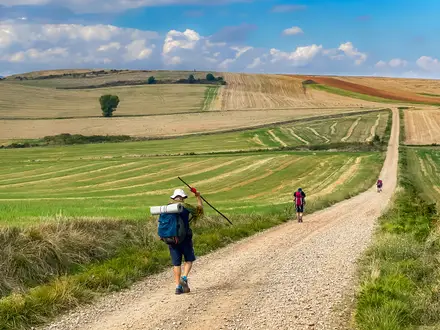
The Navarre Camino Route is the Navarre section of the Camino Francés in Spain, running about 155 km from Roncesvalles to Logroño. It is usually walked in 6–7 days; this guide uses a 7-day itinerary with roughly 20–25 km per day. Difficulty is moderate: the route is non-technical, well waymarked with yellow arrows and scallop shells, and has strong pilgrim infrastructure. It suits hikers wanting a classic Camino experience with towns, albergues, churches, vineyards and manageable daily distances.
Route Overview
This is a point-to-point walk west across Navarre, starting at Roncesvalles just below the Puerto de Ibañeta and ending in Logroño, capital of La Rioja. The route passes Burguete, Zubiri, Pamplona, Alto del Perdón, Puente la Reina, Estella, Los Arcos, Viana and Logroño. At Puente la Reina the Camino Francés meets the Camino Aragonés; after Logroño the onward route continues as the Camino Francés Rioja Segment. Services are frequent overall, but the Estella–Los Arcos and Los Arcos–Viana stages have fewer intermediate options, so carry food and water.
A historic Camino gateway through Navarre
This is part of the Camino Francés, the great medieval pilgrim road to the shrine of St James in Santiago de Compostela and a UNESCO World Heritage itinerary. Navarre was one of the early centres of the pilgrimage: its kings fostered the route, founded towns such as Estella and supported pilgrim infrastructure including the bridge at Puente la Reina. Roncesvalles carries the legend of the 778 Battle of Roncevaux and Roland, while sections near Cirauqui follow preserved Roman road.
Notable highlights
- Roncesvalles (Roncevaux): The traditional Spanish gateway of the Camino, just below the Ibañeta pass. Its Collegiate church and pilgrim hostel make it a natural starting point for walkers entering Spain.
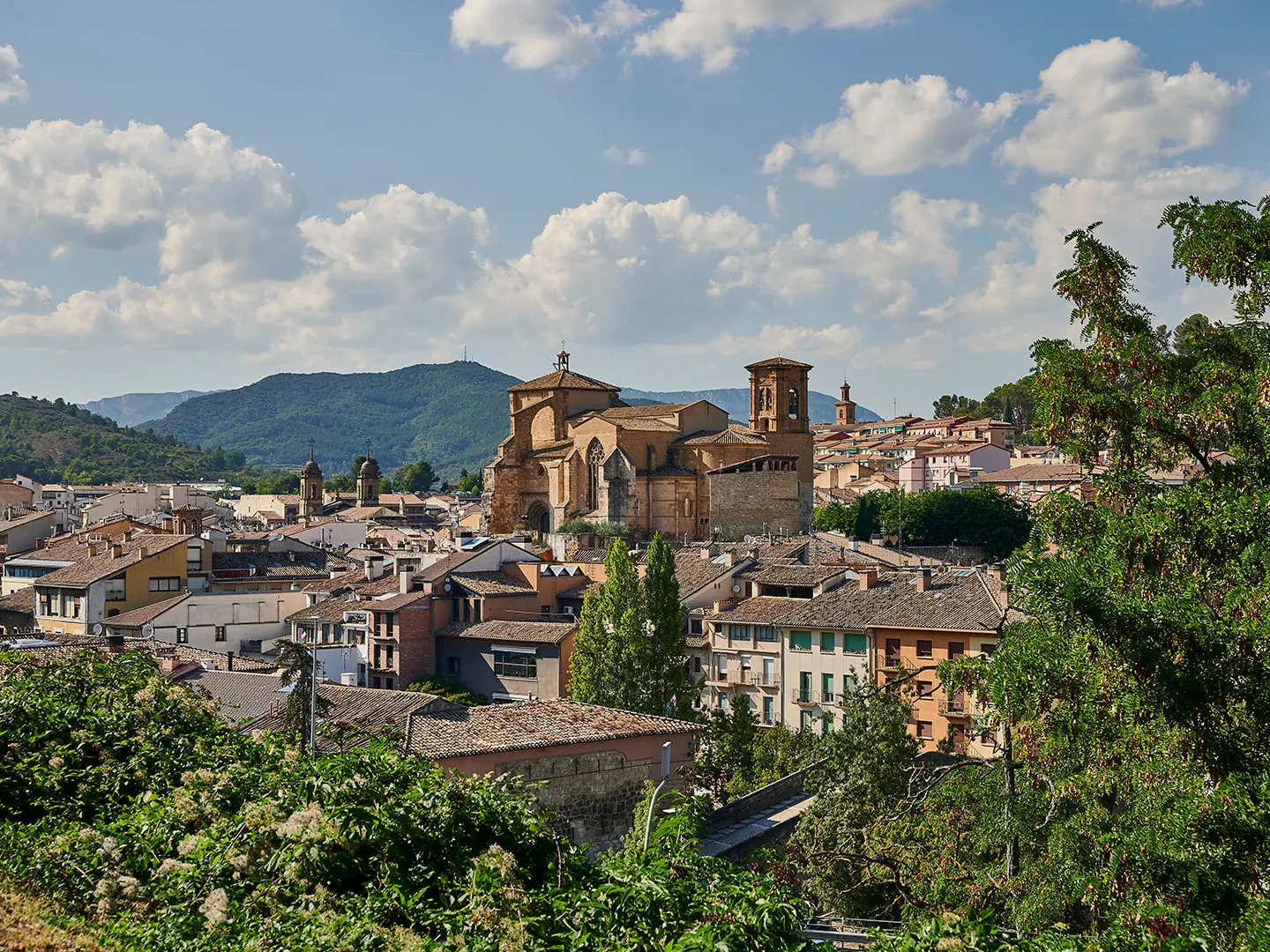
- Pamplona (Iruña): Navarre’s capital and the first major city on this section. The Camino passes a lively old town known for San Fermín, fortified walls and its Gothic cathedral.
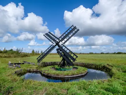
- Alto del Perdón: A ridge above Pamplona at about 770 m, with a wind farm and Vicente Galbete’s cut-steel pilgrim sculpture. It is one of the main climbs and viewpoint moments of the route.
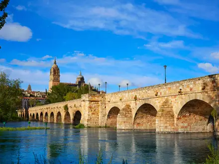
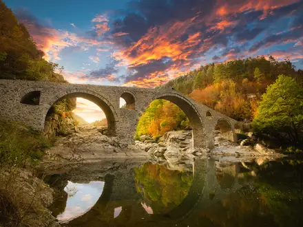
- Puente la Reina (Gares): The junction where the Camino Francés meets the Camino Aragonés. Its historic pilgrim bridge over the Arga is one of the route’s defining Camino landmarks.
- Monastery of Irache and wine fountain: Near Estella, this Benedictine monastery and adjoining Bodegas Irache wine fountain are a classic Camino stop.
- Cirauqui’s Roman road: Between Puente la Reina and Estella, the trail follows a preserved stretch of Roman road and a Roman-era bridge below the hilltop village.
Challenges to expect
Navigation is easy by Camino standards, but the walking is not flat. Expect a steep, rocky descent on day one into Zubiri and a climb and descent over Alto del Perdón after Pamplona. Summer heat can be tiring on exposed open sections, while spring and autumn may bring wet, muddy paths. Some rural stretches, especially Estella–Los Arcos and Los Arcos–Viana, have limited services.
HikeList Score
Navarre Camino Route scored 86/100 on HikeList's trail-quality metrics.
See score breakdownHide breakdown
- Ideal length 100
- Balanced challenge 100
- Scenery & wildness 72
- Varied terrain 100
- Accommodation 92
- Food & support 54
- Path quality 84
- Season flexibility 89
Computed from length, challenge, scenery & wildness, terrain variety, accommodation, food & support, path quality and season flexibility.
Show more data Show less
- Mountainous
- Forest
- Farmland
- Vineyards
- River Valley
- Urban
- Rocky
- Dirt
- Gravel
- Paved
- Albergues
- Guesthouses
- Pensions
- Hotels
- Family Friendly
- Pet Friendly
Download Our Full Guide to Navarre Camino Route FREE!
Get our comprehensive guide to this hike for free. Save it for later reading or print out at home.
Articles related to this hike
In these collections
Photos from hikers
Taken on the trail by people who've reviewed Navarre Camino Route.
Navarre Camino Route: The Complete Guide
 i
Image by Juanma
i
Image by Juanma The Navarre Camino Route is the Spanish gateway section of the Camino Francés, walking west from Roncesvalles (Orreaga) in the Pyrenean foothills to Logroño on the La Rioja border. It suits first-time Camino walkers who want strong waymarking, regular pilgrim services and a route with real historical weight rather than remote wilderness.
The first days move through beech and oak woods, river valleys and old pilgrim villages before reaching Pamplona (Iruña). Beyond the city, the path climbs to the wind-scoured Alto del Perdón, then drops towards Puente la Reina (Gares), where the Camino Aragonés joins the French Way.
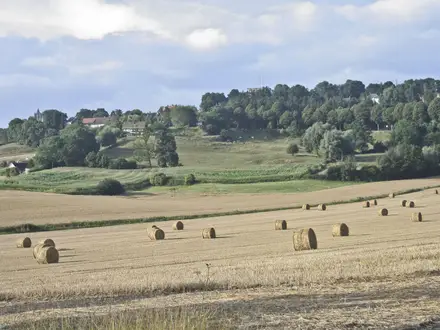
Further west, the walking becomes broader and drier, passing Roman road remains near Cirauqui (Zirauki), the historic Camino town of Estella (Lizarra), the Monasterio de Irache and the vineyard country around Los Arcos, Viana and Logroño. The route is sociable and well supported, but still feels like a proper point-to-point journey across Navarra.
This is a moderate, non-technical walk, not a flat stroll. The steep rocky descent into Zubiri, the climb and descent over Alto del Perdón, muddy tracks after rain and exposed summer heat all require sensible pacing, footwear and water planning.
This guide covers stages, daily planning, accommodation, food and water, transport, terrain and the common mistakes to avoid.
Stage-by-Stage Guide
Stage 1: Roncesvalles (Orreaga) to Zubiri — approx. 22 km
The first stage starts high, just below the Puerto de Ibañeta, so the day feels more like a long descent through the Pyrenean foothills than a mountain climb. From the Real Colegiata de Santa María in Roncesvalles (Orreaga), the Camino heads west through Burguete (Auritz) and Espinal (Aurizberri), then crosses the Alto de Mezkiritz and Alto de Erro before dropping to Zubiri.
The terrain is a mix of woodland tracks, village lanes and rougher stony paths. The descent towards Zubiri is the key difficulty of the day: it is steep and rocky in places, and can be awkward with a full pack, especially after rain.
Burguete (Auritz) is the first useful village after Roncesvalles and marks the shift from the historic gateway of the Camino into quieter forest and foothill walking. The main views are between the trees and over the rolling Navarrese hills rather than big open panoramas.
Food and water: Start with enough water and snacks for the day rather than relying on every small village having open services. Burguete (Auritz), Espinal (Aurizberri) and Zubiri are the main practical stops, but opening hours can vary by season.
Accommodation: Zubiri is a standard Camino stage stop with pilgrim accommodation. In busy periods, especially high summer, booking ahead is sensible.
Transport and access: Roncesvalles (Orreaga) has no railway; access is normally via the limited Pamplona–Roncesvalles bus service, with fewer services out of season. Timetables should be checked before travelling. For Zubiri onward transport or road access, local options should also be checked before relying on them.
Navigation notes: Waymarking is generally strong, with yellow arrows, scallop-shell markers and the GR 65 alignment. Pay attention on the rougher descent into Zubiri, where the line is clear but footing matters more than navigation.
Warnings: This is the stage where footwear matters most. The rocky final descent can punish tired legs, and wet weather can make the path slippery or muddy.
Stage 2: Zubiri to Pamplona (Iruña) — approx. 21 km
This stage follows the Camino out of the foothills and into the Arga river corridor, gradually becoming more urban as it approaches Pamplona (Iruña). The route passes Larrasoaña, Trinidad de Arre, Villava (Atarrabia) and Burlada (Burlata) before entering Navarre’s capital.
Underfoot, expect a varied day of riverside paths, tracks, village sections and paved approaches into the city. It is less physically severe than Stage 1, but the final urban kilometres can feel long at the end of the day.
Trinidad de Arre is an important marker before the route threads through the outer towns of Villava (Atarrabia) and Burlada (Burlata). Pamplona (Iruña) is the main highlight, with its fortified walls, old town and Gothic cathedral.
Food and water: This is one of the easier stages for services, with several settlements before Pamplona. Even so, do not assume every café or shop will be open outside the main season or at siesta time.
Accommodation: Pamplona (Iruña) has the widest range of accommodation on the Navarre section, from albergues to pensiones and hotels. Beds can be under heavy pressure during San Fermín in early July and in high summer, so reservations are strongly advised then.
Transport and access: Pamplona (Iruña) is the first major transport hub on the route, with a mainline railway station, bus connections and an airport. It is the easiest place on this section to pause, start or leave the Camino.
Navigation notes: The waymarking remains good, but urban approaches require more attention than open trail. Watch for arrows and shell markers through Villava (Atarrabia), Burlada (Burlata) and into Pamplona’s old town rather than simply following the most obvious road.
Warnings: The main challenge is the paved urban finish, which can be tiring on feet after mixed trail surfaces. In hot weather, plan water stops before the city outskirts.
Stage 3: Pamplona (Iruña) to Puente la Reina (Gares) — approx. 24 km
This is one of the signature stages of the Navarre Camino Route. After leaving Pamplona (Iruña), the trail passes Cizur Menor and Zariquiegui, then climbs to the Alto del Perdón before descending through Uterga, Muruzábal and Obanos to Puente la Reina (Gares).
The climb to the Alto del Perdón is steady rather than technical, but it is exposed and can feel hard in heat or wind. The ridge is crowned by a wind farm and Vicente Galbete’s cut-steel pilgrim figures, with views back towards the Pyrenees and ahead across the route west.
The descent from the ridge needs care, particularly if the surface is loose or wet. After the ridge, the walking becomes more rolling, moving through farmland and Camino villages before reaching Puente la Reina (Gares), where the Camino Aragonés joins the Camino Francés.
Food and water: Cizur Menor and Zariquiegui are the key settlements before the climb. Carry enough water before tackling the exposed ridge, especially in summer. Uterga, Muruzábal, Obanos and Puente la Reina (Gares) provide later-stage stopping points, subject to seasonal opening.
Accommodation: Puente la Reina (Gares) is a major Camino stop with pilgrim accommodation and other services. It is also a natural place to book ahead because two Camino branches meet here.
Transport and access: Pamplona (Iruña) is the reliable transport hub at the start of the stage. For intermediate villages and Puente la Reina (Gares), local public transport details should be checked before travelling.
Navigation notes: The route is well signed out of Pamplona and over the Alto del Perdón. In the city-edge section, stay alert for Camino markers through streets and junctions before the route opens out beyond Cizur Menor.
Warnings: This stage is exposed on the Alto del Perdón. Wind, sun and heat can all be more noticeable on the ridge than in the lower villages, and there is a meaningful descent afterwards.
Stage 4: Puente la Reina (Gares) to Estella (Lizarra) — approx. 22 km
This stage begins at one of the classic Camino landmarks: the medieval pilgrim bridge over the río Arga at Puente la Reina (Gares). From there, the route continues through Mañeru, Cirauqui (Zirauki), Lorca and Villatuerta before reaching Estella (Lizarra).
The walking is varied and typically Camino in character: rolling farmland, village approaches, dirt and gravel tracks, and paved sections in and out of settlements. Around Cirauqui (Zirauki), the route includes preserved Roman road and a Roman-era bridge, making this one of the more historically distinctive walking days.
Cirauqui (Zirauki) is the main mid-stage highlight, a hilltop medieval village with a memorable approach and departure. Estella (Lizarra) gives the day a strong finish, with its Romanesque churches and the Palace of the Kings of Navarre.
Food and water: There are several villages along the stage, making this more forgiving than the sparser days after Estella. Still, opening hours can be irregular, so carry water and enough food to bridge closures.
Accommodation: Estella (Lizarra) is one of the larger towns on the Navarre section, with albergues, guesthouses, pensiones and hotel options. It is a good resupply and laundry stop before the more open stages ahead.
Transport and access: Puente la Reina (Gares), the intermediate villages and Estella (Lizarra) have road access, but public transport frequency should not be assumed. This should be checked before travelling if using the route as a section walk.
Navigation notes: Waymarking is normally straightforward, but the route through hilltop villages and paved junctions still requires attention. Follow Camino markers rather than shortcuts out of towns.
Warnings: After rain, dirt tracks and older stone surfaces can be slippery or muddy. The repeated village climbs and descents can add up even though the stage is not technically difficult.
Stage 5: Estella (Lizarra) to Los Arcos — approx. 21 km
The day leaves Estella (Lizarra) through Ayegui, passing the Monasterio de Irache and the adjoining Bodegas Irache wine fountain before continuing towards Villamayor de Monjardín and Los Arcos. This is where the route begins to feel more open, with rolling farmland, vineyards, cereal fields and fewer substantial settlements.
The terrain is mostly tracks and rural paths with some paved village approaches. The walking is not technical, but the combination of exposure and longer gaps between services can make it demanding in hot weather.
The Monasterio de Irache is the key early landmark, and the wine fountain is a well-known Camino curiosity. Its hours can change, so they should be checked before relying on it as part of the day.
Food and water: This is one of the stages where carrying food and water matters. Ayegui and Villamayor de Monjardín are the main named places before Los Arcos, but there are sparser intervals than on the approach to Pamplona or Estella.
Accommodation: Los Arcos is a regular Camino stopping point with pilgrim accommodation. Seasonal closures and bed availability should be checked before travelling, particularly outside the main walking season or in high summer.
Transport and access: Estella (Lizarra) is the main town at the start. For Los Arcos and the smaller places en route, public transport options should be checked before building a plan around them.
Navigation notes: The waymarking is generally reliable, but the openness of the landscape means there can be fewer obvious village-to-village visual cues. In poor visibility or heat haze, stay disciplined about following yellow arrows and shell markers.
Warnings: Heat and exposure are the main issues. Leave early in summer, carry more water than on the village-dense stages, and avoid assuming there will be frequent shade.
Stage 6: Los Arcos to Viana — approx. 18 km
This shorter stage continues west through open Navarrese country, passing Sansol and Torres del Río before reaching Viana, the last walled town in Navarre before La Rioja. It is often combined with the final leg to Logroño by stronger walkers, but splitting at Viana makes the end of the route more manageable.
The terrain is again a mix of dirt tracks, gravel, field paths and paved village sections. The walking is not technical, but it remains exposed in places, and the day can feel harder than the distance suggests in strong sun.
Torres del Río is the standout mid-stage stop, known for the octagonal 12th-century Romanesque church of Santo Sepulcro. Viana is a substantial and historic finish, with the Iglesia de Santa María, its Renaissance façade and the tomb of Cesare Borgia at its base.
Food and water: Carry enough water and food from Los Arcos, as this is another sparser interval compared with the earlier stages. Sansol, Torres del Río and Viana are the key places on the day, but seasonal opening should not be taken for granted.
Accommodation: Viana has pilgrim accommodation and is a practical overnight stop before Logroño. Booking ahead is sensible in busy periods because many pilgrims continue to Logroño while others stop here to split the long Los Arcos–Logroño section.
Transport and access: Los Arcos, Torres del Río and Viana have road access, but local public transport arrangements should be checked before travelling. Do not rely on frequent services without checking current timetables.
Navigation notes: The route is well marked, with straightforward Camino signage through villages and open farmland. Pay attention when leaving towns, where paved streets and minor roads can create more junctions than the rural sections.
Warnings: The main risk is underestimating exposure. Even at 18 km, this stage needs proper water planning in summer.
Stage 7: Viana to Logroño — approx. 14 km
The final stage is short and practical, taking the Camino out of Viana, across the Navarre–La Rioja border area and into Logroño. The route enters the La Rioja capital across the Puente de Piedra over the Ebro, giving a clear and satisfying finish to the Navarre section.
The walking is a mix of rural approach and increasingly urban surfaces as Logroño draws closer. Compared with the previous days, the physical demands are modest, but the paved city approach can still be tiring on feet.
The main landmark is the entry into Logroño itself over the Puente de Piedra. Once in the city, the Camino reaches a major service centre, with the old town, Calle Laurel and Rioja wine culture close at hand.
Food and water: Viana and Logroño make this the easiest stage for services. Still, start with water, as the short distance should not lead to complacency in hot weather.
Accommodation: Logroño has a wide choice of albergues, guesthouses, pensiones and hotels. It is a sensible place to book in advance if finishing the route on a weekend, in high summer or during busy travel periods.
Transport and access: Logroño has both a railway station and a bus station, with onward connections including Zaragoza, Bilbao and beyond. This makes it the simplest end point for leaving the route.
Navigation notes: Waymarking continues into the city, but urban walking always needs concentration at junctions and busy streets. Follow the Camino markers to the Puente de Piedra and into Logroño rather than navigating only by the city skyline.
Warnings: The final day is short, but heat and hard surfaces still matter. If continuing beyond Logroño on the Camino Francés, use the city as a proper resupply and rest point before the next section.
Recommended Itinerary
Standard 7-day itinerary
This is the most balanced way to walk the Navarre Camino Route from Roncesvalles (Orreaga) to Logroño: daily stages are mostly around 18–24 km, with the exposed Los Arcos–Logroño stretch split at Viana. It suits most first-time Camino walkers, especially anyone who wants manageable days rather than pushing a long final stage.
| Day | From | To | Approx. distance | Why this stage makes sense | Services/accommodation notes |
|---|---|---|---|---|---|
| 1 | Roncesvalles / Orreaga | Zubiri | 22 km | A full first day across the early Pyrenean foothills, passing Burguete / Auritz and Espinal / Aurizberri before the Alto de Mezkiritz and Alto de Erro. The steep, rocky descent into Zubiri makes this a proper opening stage, even though the route is non-technical. | Roncesvalles has pilgrim infrastructure but no railway, so arrival logistics need planning. Zubiri is a standard Camino halt; book ahead in busy periods if relying on a specific bed. |
| 2 | Zubiri | Pamplona / Iruña | 21 km | A logical descent through the Arga valley corridor into Navarre’s capital, passing Larrasoaña, Trinidad de Arre, Villava / Atarrabia and Burlada / Burlata. Finishing in Pamplona gives access to the route’s first major city services. | Pamplona has the widest choice so far: albergues, guesthouses, pensiones, hotels, shops, food and onward transport. Accommodation pressure is high around San Fermín in early July, so book well ahead then. |
| 3 | Pamplona / Iruña | Puente la Reina / Gares | 24 km | One of the key stages of the route: after Cizur Menor and Zariquiegui the Camino climbs to the Alto del Perdón, then descends towards Uterga, Muruzábal and Obanos. Puente la Reina is a natural overnight stop where the Camino Aragonés joins the Camino Francés. | Start early in warm weather: the Perdón ridge is exposed and the descent can be tiring. Puente la Reina has established pilgrim accommodation and services. |
| 4 | Puente la Reina / Gares | Estella / Lizarra | 22 km | A well-shaped stage through Mañeru, Cirauqui / Zirauki, Lorca and Villatuerta, with historic Camino villages and the preserved Roman road section beyond Cirauqui. Estella is the next major town and a strong place to finish the day. | Estella has a good range of pilgrim and town accommodation, plus shops and food options. It is one of the better places on the route to reset, replace small items or choose a private room. |
| 5 | Estella / Lizarra | Los Arcos | 21 km | A classic Camino stage leaving Estella via Ayegui and the Monasterio de Irache before moving into more open farmland and vineyard country towards Villamayor de Monjardín and Los Arcos. | Check current opening details for the Irache wine fountain if it is a priority. Carry enough water and food for the more open sections between Estella and Los Arcos, especially in summer. |
| 6 | Los Arcos | Viana | 18 km | A shorter but useful stage across sparser country via Sansol and Torres del Río, avoiding the need to push all the way to Logroño in one long day. Torres del Río’s Santo Sepulcro church and Viana’s walled old town make this a worthwhile split. | Services are less continuous than around Pamplona or Estella, so do not leave Los Arcos under-supplied. Viana is the last major Navarre stop before La Rioja. |
| 7 | Viana | Logroño | 14 km | A short final day into La Rioja, giving an easier finish after six consecutive walking days. The route leaves Navarre, crosses the Ebro and enters Logroño over the Puente de Piedra. | Logroño has extensive accommodation, food and onward transport, including railway and bus stations. It is the easiest place on this itinerary to finish, rest or continue west on the Camino Francés. |
Slower variant
A slower schedule suits walkers arriving late into Roncesvalles, anyone carrying a heavier pack, or anyone who wants more time in Pamplona or Estella. The simplest slower plan is to keep the same walking stages but add a rest or half-rest day in Pamplona / Iruña and/or Estella / Lizarra, both of which have the services to support a pause.
Another slower approach is to split one of the longer days using intermediate Camino villages such as Larrasoaña, Cizur Menor, Zariquiegui, Uterga, Muruzábal, Obanos, Mañeru, Cirauqui / Zirauki, Lorca, Villatuerta, Sansol or Torres del Río. Exact distances and current accommodation availability for these shorter-stage options should be checked before booking.
This variant is best for hot weather, first Camino walkers who prefer margin in the day, or anyone concerned about the day-one descent into Zubiri or the Alto del Perdón stage after Pamplona.
Faster variant
A common 6-day version keeps the first five stages the same, then combines Los Arcos to Logroño into one longer final day instead of stopping in Viana. Using this guide’s stage split, that means joining the 18 km Los Arcos–Viana stage with the 14 km Viana–Logroño stage; check official mapping before booking, as published Camino distances vary slightly.
| Day | From | To | Approx. distance | Why this stage makes sense | Services/accommodation notes |
|---|---|---|---|---|---|
| 1 | Roncesvalles / Orreaga | Zubiri | 22 km | Standard opening stage over the early passes and down the rocky descent into Zubiri. | Book ahead in busy periods. |
| 2 | Zubiri | Pamplona / Iruña | 21 km | Keeps the natural valley approach into Pamplona. | Strong city services and accommodation. |
| 3 | Pamplona / Iruña | Puente la Reina / Gares | 24 km | Crosses the Alto del Perdón and reaches the next major Camino hub. | Start early in heat; Puente la Reina has pilgrim services. |
| 4 | Puente la Reina / Gares | Estella / Lizarra | 22 km | A manageable historic stage via Cirauqui / Zirauki and the Roman road section. | Estella is a good resupply point. |
| 5 | Estella / Lizarra | Los Arcos | 21 km | Leaves Estella via Irache and continues through more open country. | Carry food and water for the sparser intervals. |
| 6 | Los Arcos | Logroño | Long final stage; check official mapping before booking | Saves a day by walking through Viana and continuing into Logroño. This is only sensible for fit walkers who are comfortable with a longer, more exposed day. | Start early, especially in summer, and leave Los Arcos properly supplied. Viana is the key intermediate town before the final approach to Logroño. |
Planning the Route
How many days to allow
The most practical plan for the Navarre Camino Route is 7 walking days. That keeps each day within a manageable range, gives useful recovery after the first descent into Zubiri and the Alto del Perdón crossing, and avoids making the final approach to Logroño unnecessarily long.
A 6-day plan is common for fitter walkers by combining Los Arcos to Logroño into one longer stage rather than stopping in Viana. That is efficient, but it removes the easiest short day of the route and can feel exposed in hot weather.
A slower pace is easy to justify if you want more time in Pamplona (Iruña), Estella (Lizarra) or Logroño, or if walking in summer when early starts and longer midday breaks make sense. The route is not technically difficult, but it is not a flat stroll; planning should account for heat, hard surfaces into towns, and the rocky descent into Zubiri on day one.
Natural stage planning
Daily stages are strongly shaped by the Camino infrastructure. The usual stopping places are not arbitrary: they are the towns with the best spread of albergues, guesthouses, food and transport options.
| Stage | Practical planning note |
|---|---|
| Roncesvalles (Orreaga) to Zubiri | Start with a full walking day and expect the rough descent towards Zubiri to take more out of legs than the distance suggests. |
| Zubiri to Pamplona (Iruña) | A useful city stage with more accommodation choice at the end. Good point for a rest night if needed. |
| Pamplona (Iruña) to Puente la Reina (Gares) | The Alto del Perdón is the main planning feature: exposed, windy and hot in summer, with a descent afterwards. |
| Puente la Reina (Gares) to Estella (Lizarra) | A well-established Camino stage through Mañeru, Cirauqui (Zirauki), Lorca and Villatuerta. |
| Estella (Lizarra) to Los Arcos | Carry enough food and water for a sparser stretch, especially in warm conditions. Check the Irache wine-fountain hours if planning around that stop. |
| Los Arcos to Viana | Another section where food and water planning matters more than navigation. |
| Viana to Logroño | A short final stage into La Rioja, entering Logroño over the Puente de Piedra. |
Walking it quickly or slowly
Seven days is the best default for most independent walkers because it balances progress with resilience. It leaves room for slower starts, café stops, laundry, foot care and booking complications without turning the route into a forced march.
Six days suits walkers who are already comfortable with repeated 20 km-plus Camino days and are happy to finish with the combined Los Arcos to Logroño stage. In summer, that longer final push should be started early, as the more open farmland and vineyard sections can be hot and exposed.
Adding a rest or half-day is most useful in Pamplona (Iruña), Estella (Lizarra) or Logroño, where services are strongest. Smaller villages can be excellent overnight stops, but do not assume there will be the same choice of beds, shops or evening food without checking ahead.
Shortening, extending and section hiking
Shortening the route is simplest by starting or finishing in one of the larger towns, especially Pamplona (Iruña), Estella (Lizarra), Viana or Logroño. Smaller intermediate starts and exits may be possible, but onward transport from villages should be checked before travelling.
Section hiking is practical, but it works best when planned around the reliable transport nodes at the ends. Roncesvalles (Orreaga) has no railway; the usual approach is via Pamplona by the ALSA / Autocares Artieda bus service, which has limited frequency and fewer runs out of season. Logroño is much easier for onward travel, with both railway and bus stations.
Extending east from Roncesvalles towards Saint-Jean-Pied-de-Port is a different undertaking and changes the mountain and border-crossing logistics. Extending west beyond Logroño follows the wider Camino Francés, but stages beyond this Navarre section need separate planning.
What to plan before booking
Accommodation is the main planning task. The route has a dense pilgrim network of municipal and private albergues, plus guesthouses, pensiones and hotels in larger towns such as Pamplona (Iruña), Estella (Lizarra) and Logroño. Beds are usually straightforward in normal seasons, but high summer and San Fermín in early July can create heavy pressure, so book ahead then.
Seasonal albergue closures can affect flexibility outside the busiest months. This should be checked before travelling, especially if relying on a specific small-town stop.
Food and water are generally easy to manage because the Camino passes through regular villages and towns. The exceptions to treat more carefully are Estella (Lizarra) to Los Arcos and Los Arcos to Viana, where the spacing feels sparser and carrying extra water and snacks is sensible.
Navigation is one of the easier parts of planning. The route is very well waymarked with yellow arrows and scallop-shell markers and also coincides with the GR 65. Even so, keep an offline map or GPX track for town exits, road crossings and days with poor visibility.
Transport should be arranged before committing to the first night. Pamplona (Iruña) is the practical gateway, with rail, bus and airport options, followed by the limited bus onward to Roncesvalles (Orreaga). Current Pamplona–Roncesvalles bus times should be checked before travelling.
Weather planning matters more than mountain navigation. The highest ground is effectively at the start around the Puerto de Ibañeta / Roncesvalles area, and later high points are lower, but the Alto del Perdón and the open farmland after Estella can be exposed. In summer, early starts, sun protection and enough water are more important than carrying heavy mountain kit.
The path can be muddy after rain and includes rocky tracks, gravel, field paths, paved town approaches and a steep descent into Zubiri. Proper walking shoes or boots with good grip are worth using even though the route is non-technical.
Budget and payments should be planned in euros. If using baggage transfer or booking private accommodation, confirm current prices, collection arrangements and cancellation terms before committing.
Towns, Villages and Overnight Stops
Accommodation on this section is one of the route’s strengths: the Camino Francés through Navarra has a dense pilgrim network, with municipal and private albergues, plus pensiones, guesthouses and hotels in the larger towns. In normal spring and autumn conditions, most walkers can plan around the standard stage towns, but beds can fill quickly in high summer and especially around San Fermín in Pamplona in early July.
Seasonal closures are possible, particularly in smaller places, so do not build a tight itinerary around a single albergue without checking it is open. Food and water are generally straightforward in the main stage towns, but the Estella to Los Arcos and Los Arcos to Viana intervals are the sections where carrying extra supplies is most important.
| Usual overnight stop | Route role | Practical notes |
|---|---|---|
| Roncesvalles (Orreaga) | Start | Small mountain gateway below the Puerto de Ibañeta; arrive with onward walking food and a bed plan. |
| Zubiri | End of Day 1 | Good first overnight after the descent from the Alto de Erro; useful recovery stop before the Arga valley approach to Pamplona. |
| Pamplona (Iruña) | End of Day 2 | Major city stop with the widest choice of accommodation and services; book ahead around San Fermín. |
| Puente la Reina (Gares) | End of Day 3 | Classic Camino stage town where the Camino Aragonés joins; strong overnight choice after the Alto del Perdón. |
| Estella (Lizarra) | End of Day 4 | Large historic Camino town with broad services before the sparser run towards Los Arcos. |
| Los Arcos | End of Day 5 | Important overnight base between Estella and Viana; stock up before the next exposed rural stage. |
| Viana | End of Day 6 | Last Navarrese town before La Rioja; useful split if not walking Los Arcos to Logroño in one day. |
| Logroño | Finish | Large city with rail and bus onward travel, plus many accommodation and food options. |
Roncesvalles (Orreaga)
Roncesvalles is the traditional Spanish starting point for this guide, just below the Puerto de Ibañeta and beside the Real Colegiata de Santa María. It is a small mountain settlement rather than a service town, so it is best treated as a start-point overnight rather than a place for extensive resupply.
Accommodation is pilgrim-focused, with the historic hospice tradition still central to the village. Beds should be booked or checked ahead in busy periods, and anyone arriving late from Pamplona should not assume last-minute availability.
There is no railway at the start. Access is normally by bus from Pamplona, operated by ALSA / Autocares Artieda, with limited frequency and fewer services out of season; this should be checked before travelling.
Burguete (Auritz)
Burguete comes shortly after Roncesvalles on the first day, as the route begins its westward line through the Pyrenean foothills. It is a useful early service point, but for most walkers it is too close to the start to be a logical first overnight on a standard itinerary.
It can be useful if starting late from Roncesvalles or if deliberately keeping the first day very short. Availability of pilgrim beds, food and shops should be checked before relying on it, especially outside the main walking season.
Espinal (Aurizberri)
Espinal is another early on-route village before the route continues towards the Alto de Mezkiritz and Alto de Erro. It is more useful as a rest, food or water point than as a standard overnight stop on the 7-day itinerary.
Walkers using shorter stages may consider it, but accommodation and food opening patterns can be seasonal. This should be checked before travelling.
Zubiri
Zubiri is the usual first overnight stop from Roncesvalles, reached after the higher ground of the first day and the steep, rocky descent towards the Arga valley. It is a sensible place to stop because many walkers arrive with tired legs and need time to recover before continuing towards Pamplona.
Expect Camino accommodation rather than big-city choice: albergues and small-scale pilgrim lodging are the main planning assumption. Book ahead in peak periods, and check seasonal opening before fixing a non-refundable itinerary.
Food and basic pilgrim services are part of its role as a stage town, but carrying snacks from the start is still sensible because the first day is physically the roughest underfoot. Public transport details for Zubiri should not be assumed; this should be checked before travelling.
Larrasoaña
Larrasoaña lies between Zubiri and Pamplona on the Arga valley stage. It is most useful for walkers who want to adjust the first two days, either by stopping short of Pamplona or by breaking the valley section differently.
Accommodation may suit flexible Camino itineraries, but it is not one of the main stage stops used in this guide. Check current albergue opening, food availability and any transport options before committing to it as an overnight.
Trinidad de Arre
Trinidad de Arre is on the approach to Pamplona, before the route passes through Villava and Burlada. It marks the transition from the river-valley walking into the urban fringe of the capital.
Most walkers continue into Pamplona for the wider accommodation and food choice. It can still be useful as a pause before the city, but it should not be treated as a guaranteed overnight base without checking current pilgrim accommodation.
Villava (Atarrabia)
Villava is part of the built-up approach into Pamplona. By this point the walking feels increasingly urban, and the practical decision is whether to stop before the capital or continue to the old town.
For most hikers, Pamplona is the stronger overnight choice because of its broad accommodation range and transport links. If considering Villava for a shorter day, check current accommodation and food options before travelling.
Burlada (Burlata)
Burlada sits immediately before Pamplona on the route’s urban approach. It is useful mainly as a waypoint and service area before entering the city.
It is not the natural overnight target for the standard itinerary. Pamplona has the better choice of beds, shops, restaurants and onward transport, so Burlada is mainly relevant if accommodation in the city is full or if a shorter walking day is required.
Pamplona (Iruña)
Pamplona is the first major city on this section and the normal second overnight stop. It is the best place so far for restocking, laundry, footwear or gear replacement, and taking a more comfortable private room if needed.
Accommodation ranges from pilgrim albergues to pensiones, guesthouses and hotels. Demand rises sharply around San Fermín in early July, when booking ahead is strongly advised and prices can change quickly.
Pamplona is also the main access point for the start of the route, with a mainline railway station, bus services and an airport. Walkers joining or leaving the Camino here have far more transport flexibility than in the smaller stage towns.
Cizur Menor
Cizur Menor is the first village beyond Pamplona on the way towards the Alto del Perdón. It is useful if leaving the city late or if deliberately making a very short day out of Pamplona.
For the standard itinerary it is usually passed early, with Puente la Reina as the day’s target. Check current beds and food before planning to stop here, particularly outside the main season.
Zariquiegui
Zariquiegui sits below the climb to the Alto del Perdón, making it a useful last village before the exposed ridge section. It is a practical place to pause, adjust layers and make sure water is topped up before the climb and descent.
It is not normally the overnight target for this stage. Anyone considering a stop here should check accommodation and food availability before travelling.
Alto del Perdón
The Alto del Perdón is a ridge and viewpoint, not an overnight stop. It is one of the key physical and navigational points between Pamplona and Puente la Reina, with the route climbing to the wind farm and the line of steel pilgrim figures before descending west.
There are no planning assumptions to make here for accommodation or resupply. Carry what is needed from Pamplona, Cizur Menor or Zariquiegui, particularly in hot weather.
Uterga
Uterga is the first village after the descent from the Alto del Perdón. It is useful because walkers often arrive after the most exposed and strenuous part of the stage from Pamplona.
It can work as a rest or refreshment stop before continuing towards Muruzábal, Obanos and Puente la Reina. Overnight plans here should be checked carefully, as the standard stage continues to Puente la Reina.
Muruzábal
Muruzábal lies between Uterga and Obanos on the descent-side approach to Puente la Reina. It is a minor route village rather than a principal stage town.
For most walkers it is a passing stop. Check any accommodation, food or shop opening before relying on it, especially in quieter months.
Obanos
Obanos is the final village before Puente la Reina, close to the point where the route reaches one of the Camino’s most important junction towns. It is useful if you want to avoid staying in Puente la Reina or if beds there are under pressure.
The standard itinerary continues to Puente la Reina because that town has a stronger pilgrim role and more obvious stage-stop logic. Accommodation and food in Obanos should be checked before travelling.
Puente la Reina (Gares)
Puente la Reina is one of the best overnight stops on the Navarre section. The Camino Aragonés joins the Camino Francés here, and the medieval bridge over the río Arga makes it a natural place to pause at the end of the day from Pamplona.
Accommodation is pilgrim-oriented, with albergues and other lodging options appropriate to a major Camino stage town. Beds can still fill in busy periods, so book ahead if walking in high summer or on a fixed schedule.
Food and basic resupply are easier here than in the smaller villages on either side. Public transport should not be assumed without checking current services.
Mañeru
Mañeru is the first village after Puente la Reina on the way towards Cirauqui and Estella. It is usually reached early in the stage, so it is more useful for a morning pause than as an overnight target.
If starting late from Puente la Reina or recovering from fatigue, it may have value as a short-stage stop. Accommodation and food availability should be checked before travelling.
Cirauqui (Zirauki)
Cirauqui is a hilltop medieval village and one of the more distinctive intermediate stops between Puente la Reina and Estella. Beyond it, the route follows a preserved stretch of Roman road and a Roman-era bridge, so it is worth allowing time rather than rushing through.
It can be considered for a non-standard overnight, but Estella remains the main stage target. Check beds, shops and food opening before relying on Cirauqui as a stop.
Lorca
Lorca lies on the route between Cirauqui and Villatuerta. It is a practical intermediate village on the way to Estella, mainly useful for breaking the stage and managing food or water.
Most walkers on the 7-day itinerary continue to Estella. If planning to stop in Lorca, check current accommodation and services before travelling.
Villatuerta
Villatuerta is the last listed village before Estella on this stage. It is useful as a final pause before reaching the larger town and its broader services.
It is generally a passing point rather than the natural overnight target. Accommodation, food and transport options should be checked before relying on them.
Estella (Lizarra)
Estella is a major Camino town and the standard overnight after Puente la Reina. It has the scale and service range to make it one of the better places for laundry, resupply, a more comfortable bed and a proper meal.
Accommodation includes the route’s usual pilgrim albergue network, with guesthouses, pensiones and hotels more likely here than in the rural villages. Book ahead in peak season, and use Estella to prepare for the sparser country towards Los Arcos.
The Monasterio de Irache and the Bodegas Irache wine fountain are just beyond Estella at Ayegui. Check the wine fountain’s current hours before planning around it.
Ayegui and the Monasterio de Irache
Ayegui is immediately beyond Estella and is chiefly important to walkers because of the Monasterio de Irache and the adjoining Bodegas Irache wine fountain. It is normally encountered early on the stage to Los Arcos.
For most walkers it is a short visit rather than an overnight stop, as Estella has the stronger accommodation and resupply base. The wine fountain should be treated as a brief Camino tradition, not a water or food-planning resource; current opening times should be checked before travelling.
Villamayor de Monjardín
Villamayor de Monjardín is the main named village between Ayegui and Los Arcos. It is an important planning point because the Estella to Los Arcos day has fewer substantial service stops than the earlier urban and village-heavy stages.
It can be used to shorten the stage or to pause before the more open farmland. Check accommodation, food and water availability before relying on it, and leave Estella with enough supplies to be self-sufficient if services are closed.
Los Arcos
Los Arcos is the standard overnight after Estella and a key stop before the final Navarre stages. It is especially useful because the walking on either side is more open and exposed, with fewer large settlements than earlier in the route.
Accommodation is pilgrim-focused, and demand can be high when many walkers use the 6-day version by continuing all the way to Logroño the next day. If following the 7-day itinerary, Los Arcos to Viana gives a more manageable day and avoids arriving in Logroño late.
Stock up here before leaving. The Los Arcos to Viana section is one of the intervals where carrying food and water matters, particularly in summer heat.
Sansol
Sansol comes after Los Arcos on the way to Torres del Río and Viana. It is a useful intermediate point on an otherwise more open stage.
It may suit walkers who want to break the Los Arcos to Viana day differently, but it is not the standard overnight in this guide. Check current albergue, food and shop availability before relying on it.
Torres del Río
Torres del Río is a small village best known on the route for the octagonal 12th-century Romanesque church of Santo Sepulcro. Practically, it is a useful stop between Los Arcos and Viana.
It can work as an alternative overnight if Viana is too far or if planning a slower itinerary. Because it is a small village, check beds and food before travelling rather than assuming full services.
Viana
Viana is the last walled town in Navarra before La Rioja and the usual Day 6 overnight on the 7-day itinerary. It makes the final approach to Logroño short and controlled, which is useful if arranging onward rail or bus travel the next day.
Accommodation should be planned ahead in busy periods, but Viana is a stronger overnight base than the smaller villages between Los Arcos and Logroño. Food and resupply are also more dependable here than on the rural stretch before it, though exact opening hours still matter on Sundays, holidays and out of season.
Viana is also the last Navarrese town on this guide, with the Iglesia de Santa María and the tomb of Cesare Borgia at its base. Most walkers should leave with water for the crossing into La Rioja and the urban approach to Logroño.
Logroño
Logroño is the finish of this Navarre Camino section, entered after crossing the Ebro over the Puente de Piedra. As the capital of La Rioja, it has the broadest end-of-route choice for hotels, pensiones, albergues, food and onward travel.
The city has its own railway station, with connections including Zaragoza, Bilbao and beyond, plus a bus station. This makes Logroño the easiest place on the route to leave the trail or pause before continuing west on the Camino Francés.
For food, Calle Laurel is the well-known area for tapas bars and Rioja wine. If arriving at the end of a long hot day, it is still worth booking accommodation before entering the city rather than assuming the best-value beds will remain available.
Getting to the Start
The Navarre Camino Route starts in Roncesvalles (Orreaga), just below the Puerto de Ibañeta, with the Camino waymarks leading west from beside the Real Colegiata de Santa María. There is no railway at the trailhead, so most walkers reach the start via Pamplona (Iruña).
By train
The practical railhead for Roncesvalles (Orreaga) is Pamplona (Iruña), which has a mainline railway station. From there, continue to Roncesvalles by bus or pre-arranged taxi/private transfer.
Allow enough time between the train arrival and the onward connection to Roncesvalles. The Pamplona–Roncesvalles bus has limited frequency and fewer runs out of season, so same-day connections are not always straightforward. This should be checked before travelling.
By bus
The standard public-transport approach is to travel first to Pamplona (Iruña), then take the ALSA / Autocares Artieda bus service towards Roncesvalles (Orreaga). This is the key connection for walkers starting at the traditional Spanish gateway of the Camino Francés.
Frequency is limited, especially outside the main walking season. Check current timetables before booking a train, flight or first night’s accommodation, and be prepared to stay overnight in Pamplona if the onward bus does not fit your arrival time. This should be checked before travelling.
If the bus timetable is impractical, a taxi or private transfer from Pamplona is the usual fallback. Fares, availability and pick-up arrangements should be confirmed in advance, particularly for late arrivals or travel outside the main season.
By car
Driving directly to Roncesvalles (Orreaga) is possible, but it is rarely the neatest option for a point-to-point Camino stage ending in Logroño. Unless someone is dropping you at the start, you will need a plan for returning to the vehicle after the walk.
Long-stay parking arrangements at or near Roncesvalles should be checked before travelling. For most independent walkers, it is simpler to use public transport to reach Pamplona, continue by bus or taxi to Roncesvalles, and leave the route from Logroño by rail or bus at the end.
From the nearest airport
Pamplona (Iruña) has an airport and is the most relevant gateway for the start of this route. From the airport, continue into Pamplona for onward transport to Roncesvalles (Orreaga) by bus or taxi/private transfer.
Do not assume an airport arrival will connect neatly with the Roncesvalles bus. The onward service is limited, and reduced out of season, so flight arrival times should be matched against the bus timetable before booking. This should be checked before travelling.
Where to stay before starting
Staying in Roncesvalles (Orreaga) the night before walking is the simplest option if you want to start Day 1 early and unhurried. The first stage to Zubiri is around 22 km and includes the rocky descent after the Alto de Erro, so beginning rested is worthwhile.
Pamplona (Iruña) has a wider choice of hotels, guesthouses and pilgrim accommodation, but it puts the transport connection to Roncesvalles on the morning of departure. Only choose this if the bus or taxi timing allows enough daylight for the first stage.
Book ahead in busy periods, especially high summer and around San Fermín in early July, when beds in Pamplona and on the Camino corridor can fill quickly. Seasonal albergue opening dates and current availability should be checked before travelling.
Getting Home from the Finish
The Navarre section finishes in Logroño, after the Camino crosses the Ebro into the city over the Puente de Piedra. This is a straightforward place to leave the route: Logroño is a regional capital with both a railway station and a bus station, so most walkers should plan onward travel from the city rather than trying to arrange a private transfer from the trail.
If finishing late in the day, staying overnight in Logroño is usually the simplest option. It avoids rushing the final walk from Viana, gives time to collect laundry or luggage if needed, and makes morning train or bus departures much easier.
By train
Logroño has its own railway station, making train travel the simplest onward option for many walkers. Services connect Logroño with cities including Zaragoza and Bilbao, with onward connections beyond those hubs.
Train times and routings vary by day and season, so do not assume there will be a convenient late departure after walking in from Viana. This should be checked before travelling, especially if booking an international flight or a long-distance connection the same day.
For a low-stress finish, allow time to walk into Logroño, reach accommodation or the station, and deal with any delays on the final stage. If the only suitable train is early the next morning, book a bed in Logroño and travel after breakfast.
By bus
Logroño also has a bus station, giving another practical way to leave the finish. Buses are useful if the train timetable does not suit, or if travelling to a destination better served by road than rail.
Exact routes, operators and departure times should be checked before travelling. This is particularly important on Sundays, public holidays and outside the main walking season, when services can be less convenient.
If connecting onward from Logroño by bus, leave a sensible gap between the expected walking finish and the bus departure. The final approach into a city can take longer than expected once navigation, accommodation check-in and tired legs are factored in.
By car/taxi
Logroño is a practical place for pickup by car because the route ends in a major city rather than a remote village. If being collected, arrange a clear meeting point in the city rather than on the Camino itself, as the trail enters across the Puente de Piedra and then continues into the urban area.
Taxis are best treated as a local solution for reaching a hotel, station or bus station after finishing. A long taxi transfer back towards Roncesvalles or Pamplona is likely to be costly and should be pre-arranged rather than left until arrival.
For walkers who have left a car elsewhere, returning to it by public transport will usually be more sensible than trying to organise a same-day taxi across the full route. Timetables should be checked before travelling.
From the nearest airport
For flights, the practical approach is to use Logroño’s train or bus links to reach a city with suitable air connections. The route’s known onward rail links include Zaragoza and Bilbao, and wider connections can be made from there.
Do not plan a tight same-day flight connection unless the train or bus timetable gives a generous margin. Final-day walking, station transfers and service delays can easily make a short connection unrealistic. This should be checked before travelling.
Where to stay at the finish
Logroño has a good range of pilgrim and city accommodation, including albergues, guesthouses, pensiones and hotels. It is one of the easiest places on this section to spend a final night before travelling home.
Booking ahead is sensible in busy periods, especially in high summer. Staying overnight also gives time to enjoy the finish properly, sort onward tickets, and avoid turning the final stage into a race for a train or bus.
Which Direction Should You Walk?
Standard direction: Roncesvalles to Logroño
The Navarre Camino Route is best walked westbound, from Roncesvalles (Orreaga) to Logroño. This is the traditional and overwhelmingly most common direction on the Camino Francés, with the yellow arrows and scallop-shell waymarks leading west from beside the Real Colegiata de Santa María.
Walking this way fits the natural pilgrim flow. Accommodation, daily stage patterns and the social rhythm of the route all work most smoothly when you move from Roncesvalles to Zubiri, Pamplona, Puente la Reina, Estella, Los Arcos, Viana and finally Logroño.
Transport also favours the westbound direction. Roncesvalles has no railway, so most walkers reach the start by bus from Pamplona, where there are rail, bus and airport connections. That bus has limited frequency and fewer runs out of season, so times should be checked before travelling.
Finishing in Logroño is much simpler. The city has its own railway station and bus station, making onward travel easier than ending in Roncesvalles and needing to time the limited bus back to Pamplona.
What changes if you walk eastbound?
Walking from Logroño to Roncesvalles is possible, but it is less practical. You would be moving against the main Camino flow and against the primary direction of the waymarking, so more attention is needed at junctions and through towns.
The transport pattern is also less convenient. Logroño is easy to reach at the start, but finishing in Roncesvalles leaves you dependent on the limited bus service to Pamplona. This is especially awkward out of season or if arrival time is uncertain.
The gradients are not transformed by reversing the route. The rocky descent into Zubiri on the standard first day becomes a climb if walked eastbound, while the Alto del Perdón remains a meaningful crossing whichever way you tackle it. Westbound walkers do, however, get the classic Camino sequence: Pyrenean foothills and forest first, then Pamplona, the open Perdón ridge, Navarrese farmland, vineyards and the Ebro crossing into Logroño.
Scenery, weather and the feel of the finish
Westbound gives the route a clear sense of progression. You start in the historic Camino gateway of Roncesvalles, pass through Pamplona and the central Navarre stages, then finish by crossing the Puente de Piedra into Logroño, the La Rioja capital.
No route-specific prevailing wind should decide the direction. Heat is the more important seasonal factor on the exposed open sections, especially in summer, and affects both directions. Early starts are sensible on hotter days, particularly on the sparser stretches after Estella and Los Arcos.
Recommendation
Walk westbound from Roncesvalles to Logroño. It is the traditional direction, the waymarking is set up for it, the accommodation flow is easier, the transport works better, and Logroño makes a much more practical finish than Roncesvalles.
Accommodation Along the Route
What to expect
Accommodation is one of the strengths of the Navarre Camino Route. The route has a dense pilgrim network of municipal and private albergues, with guesthouses, pensiones and hotels adding more choice in the larger towns.
For most walkers, the easiest planning pattern is to use the main overnight stops: Roncesvalles (Orreaga), Zubiri, Pamplona (Iruña), Puente la Reina (Gares), Estella (Lizarra), Los Arcos, Viana and Logroño. These stops fit the 7-day itinerary and avoid forcing a long day into Logroño from Los Arcos.
Pamplona, Estella and Logroño have the strongest private-room choice. Smaller Camino villages can be very useful for shortening or reshaping stages, but accommodation there is more limited and should not be treated as guaranteed without booking.
Booking ahead
In normal seasons, beds are generally easy to find on this section, especially for walkers using albergues and keeping some flexibility. The main exception is high summer, when the Camino is busier and exposed walking also makes early starts more important.
Pamplona needs particular care around San Fermín in early July, when accommodation pressure is high. Book ahead for Pamplona and consider booking the nights either side as well, especially if walking with a fixed itinerary or wanting a private room.
Weekend pressure is most relevant in small villages with only limited stock. If a stage depends on sleeping in a smaller place such as Zariquiegui, Uterga, Cirauqui (Zirauki), Villamayor de Monjardín, Sansol or Torres del Río, availability should be checked before travelling.
Seasonal albergue closures can affect the smaller stops. This should be checked before travelling, particularly outside the main spring-to-autumn walking period.
Accommodation by place
Accommodation level below is relative to Camino planning: good means a practical overnight stop with a stronger chance of finding a bed; limited means possible but with fewer choices; none means not a sensible overnight point on the route.
| Place | Accommodation level | Best for | Notes |
|---|---|---|---|
| Roncesvalles (Orreaga) | Limited | Starting night | Traditional Spanish gateway of the Camino Francés. Plan ahead if arriving late from Pamplona or starting in a busy period. |
| Burguete (Auritz) and Espinal (Aurizberri) | Limited | Alternative early stops | Useful if adjusting the start or making a very short first walking day. Availability should be checked before travelling. |
| Zubiri | Good | Standard first-stage finish | A practical overnight after the descent from Alto de Erro. Book ahead in peak periods, as many pilgrims use it as the natural first stop from Roncesvalles. |
| Larrasoaña, Trinidad de Arre, Villava (Atarrabia) and Burlada (Burlata) | Limited | Breaking the Zubiri–Pamplona section | Useful for shortening day two or avoiding a late arrival in Pamplona. Smaller choice than the city. |
| Pamplona (Iruña) | Good | Strongest choice in Navarre; rest night | Best range of albergues, pensiones, guesthouses and hotels on the Navarre section. Book well ahead around San Fermín in early July. |
| Cizur Menor and Zariquiegui | Limited | Shortening the climb towards Alto del Perdón | Sensible options if leaving Pamplona late or wanting a shorter day before the ridge. Check current availability before relying on them. |
| Alto del Perdón | None | Not an overnight stop | Treat the ridge as an exposed crossing, not a place to sleep. Plan accommodation either before the climb or after the descent. |
| Uterga, Muruzábal and Obanos | Limited | Alternatives before Puente la Reina | Useful if splitting the Pamplona–Puente la Reina stage. Smaller villages mean fewer beds and less flexibility. |
| Puente la Reina (Gares) | Good | Standard stage stop | A strong Camino stop where the Camino Aragonés joins the Camino Francés. Sensible place to book if walking to a fixed schedule. |
| Mañeru, Cirauqui (Zirauki), Lorca and Villatuerta | Limited | Short stages between Puente la Reina and Estella | Good for reshaping the day, but not places to assume late walk-in availability. Check before committing to a short-stage plan. |
| Estella (Lizarra) | Good | Major town stop; private-room choice | One of the best accommodation points between Pamplona and Logroño, with more choice than the surrounding villages. |
| Ayegui and Villamayor de Monjardín | Limited | Shortening the Estella–Los Arcos stage | Useful if not walking the full stage to Los Arcos. This section becomes sparser, so book and carry food and water. |
| Los Arcos | Good | Key overnight before Viana or Logroño | The natural stop after Estella on the 7-day itinerary. Also important for walkers deciding whether to split or combine the final approach to Logroño. |
| Sansol and Torres del Río | Limited | Splitting Los Arcos–Viana | Useful smaller stops if avoiding a longer day. Availability should be checked before travelling. |
| Viana | Good | Final Navarre overnight | Best stop for the 7-day itinerary before the short final walk into Logroño. Book in busy periods. |
| Logroño | Good | Finish night and onward travel | Strong city choice of accommodation after entering La Rioja over the Ebro. A good place for an extra night before travelling on. |
Albergues versus private rooms
Albergues are the standard Camino option and suit walkers who are happy with shared accommodation and a sociable route. Policies, opening dates and booking rules vary between municipal and private albergues, so do not assume every place works the same way.
Private rooms are easiest to arrange in Pamplona, Estella and Logroño, and generally more constrained in the smaller villages. Inn-to-inn walkers can complete this route comfortably, but should book the full sequence ahead in high summer, around San Fermín, or whenever a private room is essential.
Using transfers if accommodation is full
The daily stages on this itinerary are manageable and there are enough on-route settlements that accommodation gaps are not usually a route-breaking problem. The awkward points are more likely to be bed pressure in popular stops or limited choice in small villages.
Taxi transfers or luggage transfer may help if the preferred overnight stop is full or if a walker wants to sleep off-route and return to the same point next morning. Operators, coverage and prices change, so this should be checked before travelling and confirmed before booking accommodation.
If using transfers, keep the walking route continuous: arrange to be dropped back at the same village or trail point where the previous day ended. This avoids unintentionally skipping part of the Camino.
Camping and Wild Camping
Camping is not the natural way to walk the Navarre Camino Route. This section of the Camino Francés is built around pilgrim accommodation: municipal and private albergues, guesthouses, pensiones and hotels in towns such as Pamplona, Puente la Reina (Gares), Estella (Lizarra), Viana and Logroño, with smaller pilgrim stops between them.
For most walkers, carrying a tent adds weight without solving a major logistical problem. Beds are generally plentiful in normal seasons, although they can fill quickly in high summer and around San Fermín in Pamplona in early July, when booking ahead is sensible.
Campsites
No specific on-route campsite network is covered by this guide. If planning to camp formally, check current campsite locations, opening dates and whether they accept walkers for one-night stays before building an itinerary around them. This should be checked before travelling.
Because the route passes frequently through villages and towns, a camping-based itinerary may still need to use albergues or guesthouses on some nights. This is especially likely if campsites are seasonal, outside the village centre, or not close enough to the waymarked Camino to be practical after a full walking day.
Wild camping
Do not assume wild camping is permitted in Navarra or La Rioja. The Camino crosses a mix of municipal land, private farmland, vineyards, woodland, river valleys and approaches to towns, and local rules can vary. Wild-camping legality and enforcement should be checked locally before relying on it.
In practical terms, this is also a poor route for discreet wild camping. The waymarked Camino passes through settled areas, cultivated land and popular pilgrim corridors, rather than remote upland country. Open sections around the Alto del Perdón, the farmland beyond Estella (Lizarra), and the vineyard approaches towards Viana and Logroño are exposed and often privately worked.
If a local authority, landowner or accommodation provider explicitly allows camping, keep it low-impact: arrive late, leave early, pitch only where permitted, use a stove only if allowed, and leave no trace. Never camp in crop fields, vineyards, church grounds, historic sites, on the Camino path itself, or beside village infrastructure without permission.
Water and resupply if carrying camping gear
Water and food are usually straightforward because the route regularly passes through villages. The sections where planning matters most are the sparser stretches from Estella (Lizarra) to Los Arcos and from Los Arcos to Viana, where walkers should start with enough water and food rather than assuming frequent services.
In summer, heat and exposure are a bigger issue than distance. A camping load makes the open sections harder, particularly after Pamplona over the Alto del Perdón and across the rolling farmland and vineyards further west. Start early, carry sufficient water, and avoid relying on late-day resupply in small villages without checking what is open.
Fire, waste and Leave No Trace
Open fires are inappropriate on this route and may be restricted, especially in dry summer conditions. Use only permitted cooking methods, follow local fire rules, and avoid any flame in woodland, farmland, dry grass or vineyard areas.
All waste must be carried to a proper bin in the next town or village. Human waste should never be left near the path, water sources, farmland, vineyards, churches or settlement edges. The Camino is a busy walking corridor, so poor camping practice has an immediate impact on local communities and other pilgrims.
Best approach
For this route, the most reliable plan is to sleep in albergues or other accommodation and reserve ahead during busy periods. Camping can work only as a carefully checked alternative where a legal campsite or explicit permission is available; it should not be treated as the default accommodation strategy for the Navarre Camino Route.
Food, Water and Resupply
The Navarre Camino Route is one of the easier long-distance walks in Spain to organise for food, because it passes through regular Camino villages and several substantial towns. Pamplona (Iruña), Estella (Lizarra) and Logroño are the main resupply points, with the best choice for supermarkets, bakeries, cafés, bars and evening meals.
Between those towns, services are more variable. Small villages may have an albergue, bar or small shop aimed at pilgrims, but opening hours can be limited, seasonal or affected by Sundays and public holidays. This should be checked before travelling, especially if walking early, late in the season, or planning to arrive somewhere between lunch and dinner service.
Practical food planning
Carry breakfast or an early snack if leaving before cafés open. On most stages there are villages on the route, but it is still sensible to start the day with food for several hours rather than relying on the first bar being open.
The two stages that deserve the most caution are Estella (Lizarra) to Los Arcos and Los Arcos to Viana. The brief for this route specifically flags these intervals as sparser, so leave with lunch or substantial snacks and enough water for the full exposed section if needed.
Pamplona is the best place for a larger shop before the Alto del Perdón stage. Estella is the key resupply point before the run towards Los Arcos, and Logroño has full city services at the end of the route.
The Bodegas Irache wine fountain near Ayegui is a Camino landmark, not a hydration strategy. It pours free red wine for pilgrims when operating, but its hours should be checked before travelling, and it should not replace carrying water.
Water and hydration
Refill at accommodation before leaving each morning, then top up in towns, bars and cafés during the day. Do not assume every small village will have an open service at the time you pass through.
Natural water sources should not be relied on for drinking. The route follows valleys, farmland and villages rather than remote wilderness, so the practical approach is to use treated tap water and established services. If water is taken from any untreated source, it should be filtered or purified.
Heat is the main water-management issue. The open farmland and the exposed Alto del Perdón ridge can feel much harder in summer than the distance suggests, so carry more water than usual on hot days and leave early where possible.
| Section | Food availability | Water availability | Notes |
|---|---|---|---|
| Roncesvalles (Orreaga) to Zubiri | Moderate. Burguete (Auritz) and Espinal (Aurizberri) are on the route before Zubiri, but do not rely on every service being open. | Refill before leaving Roncesvalles and use village services where open. | Start with snacks and water for the morning. The steep rocky descent into Zubiri is not a place to be dehydrated or underfed. |
| Zubiri to Pamplona (Iruña) | Generally good by Camino standards, with Larrasoaña, Trinidad de Arre, Villava (Atarrabia) and Burlada (Burlata) before the city. | Good at accommodation and open village/city services. | Pamplona has the best choice since the start, so use it for a proper resupply. |
| Pamplona (Iruña) to Puente la Reina (Gares) | Good at the start and finish, more limited across the Alto del Perdón section. Cizur Menor, Zariquiegui, Uterga, Muruzábal and Obanos are on the route. | Fill up before leaving Pamplona; top up where services are open. | Carry enough water for the climb, ridge and descent over Alto del Perdón, especially in summer. |
| Puente la Reina (Gares) to Estella (Lizarra) | Reasonable, with Mañeru, Cirauqui (Zirauki), Lorca and Villatuerta before Estella. | Refill in Puente la Reina and use village services as available. | Estella is a major resupply point and a good place to buy food for the next stage. |
| Estella (Lizarra) to Los Arcos | Limited after Estella/Ayegui and Villamayor de Monjardín. | Carry enough water from Estella or Ayegui for a longer, sparser interval. | This is one of the key sections for carrying food and water. The Irache wine fountain is not a water stop. |
| Los Arcos to Viana | Limited to moderate. Sansol and Torres del Río are on the route, but services can be variable. | Leave Los Arcos with a full supply and top up only where services are open. | Another section specifically worth treating as sparse; carry lunch/snacks and adequate water. |
| Viana to Logroño | Easy at the start and finish, with full services in Logroño. | Fill up in Viana; Logroño has city services. | Shorter than the other stages, but still exposed enough in heat to justify carrying water from the start. |
How much to carry
For normal spring or autumn conditions, most walkers should leave each morning with water for several hours plus snacks, even on stages with villages. In hot weather, carry a larger water capacity and do not wait until the bottle is nearly empty before looking for the next refill.
For Estella to Los Arcos and Los Arcos to Viana, carry enough food to complete the stage without buying lunch en route. For early starts, Sundays, public holidays and out-of-season walking, apply the same rule more widely: buy the night before in Pamplona, Estella, Los Arcos or Viana rather than assuming rural services will be open in the morning.
Terrain, Conditions and Difficulty in Practice
The Navarre Camino Route is a moderate walk in practical terms: easy to follow, non-technical and well supported, but with enough hard ground, short steep sections and summer exposure to punish poor footwear or an over-heavy pack. Most walkers find the navigation straightforward because the route is marked by yellow arrows, scallop shells and GR 65 waymarking; the difficulty comes less from route-finding and more from repeated daily mileage on mixed surfaces.
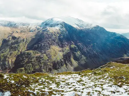
The trail starts high in the Pyrenean foothills, near Roncesvalles (Orreaga) and the Puerto de Ibañeta area, then generally works west through forest, river valley, open ridge country and rolling farmland. The page high point of around 1,050 m refers to the Ibañeta/Roncesvalles start area rather than a major climb later in the walk. The later named tops are lower: Alto de Mezkiritz, Alto de Erro and, after Pamplona, Alto del Perdón.
Surfaces underfoot
Expect a varied but mostly straightforward Camino surface mix:
| Terrain type | Where it matters | Practical effect |
|---|---|---|
| Woodland and mountain tracks | Roncesvalles (Orreaga) to Zubiri, through the Pyrenean foothills | Can be rocky, rooty and muddy after rain; the descent into Zubiri is the first real test. |
| Dirt and gravel tracks | Common across the route, especially between villages and across farmland | Usually fast walking, but hard on feet over several consecutive days. |
| Paved town approaches | Around larger settlements such as Pamplona (Iruña), Estella (Lizarra) and Logroño | Easy navigation but tiring on soles and knees, especially late in the day. |
| Open farm tracks | West of Pamplona and across the Navarrese/Riojan transition | Little shade in warm weather; heat can matter more than gradient. |
| Preserved Roman road and old stonework | Near Cirauqui (Zirauki) | Historic but uneven underfoot; take care on worn stone if wet. |
There is no scrambling, no technical mountain terrain and no need for specialist equipment beyond normal hiking kit. Trail shoes or lightweight boots with good grip are more useful than heavy mountain boots for most walkers, though the rocky descent to Zubiri and wet-weather mud argue against flimsy footwear.
The main climbs and descents
Day one is often more demanding than the distance suggests. The route leaves the Roncesvalles area through Pyrenean woodland and crosses the Alto de Mezkiritz and Alto de Erro before dropping steeply and rockily into Zubiri. This descent is the section most likely to trouble knees, ankles and overloaded packs early in the hike.
The other defining effort is the crossing of Alto del Perdón after Pamplona (Iruña). The climb from the Pamplona basin towards the ridge is sustained rather than technical, and the ridge itself is exposed, with a wind farm and broad views. The descent towards Uterga, Muruzábal, Obanos and Puente la Reina (Gares) needs care in poor weather or on tired legs.
After Puente la Reina, the walking becomes more rolling than mountainous. There are still frequent rises and falls through villages such as Mañeru, Cirauqui (Zirauki), Lorca and Villatuerta, but the challenge is usually cumulative distance, heat and hard surfaces rather than a single major climb.
Stage-by-stage difficulty in practice
| Stage | Practical terrain notes | Difficulty feel |
|---|---|---|
| Roncesvalles (Orreaga) to Zubiri | Forest, tracks, the Alto de Mezkiritz and Alto de Erro, then the steep rocky descent into Zubiri. | One of the toughest stages despite being early; protect knees and do not rush the descent. |
| Zubiri to Pamplona (Iruña) | Arga valley walking, then increasingly built-up approaches through Trinidad de Arre, Villava (Atarrabia) and Burlada (Burlata). | Physically easier than day one, but paved and urban sections can be tiring. |
| Pamplona (Iruña) to Puente la Reina (Gares) | Open climb to Alto del Perdón, exposed ridge, then descent towards the villages west of the ridge. | The route’s main mid-walk effort; wind, sun and heat can make it feel harder. |
| Puente la Reina (Gares) to Estella (Lizarra) | Rolling tracks and village-to-village walking, including the old road and Roman-road section near Cirauqui (Zirauki). | Moderate; uneven stone and repeated small climbs are the main factors. |
| Estella (Lizarra) to Los Arcos | Farmland, vineyards and more open country after Ayegui and the Monasterio de Irache area. | Not technically hard, but more exposed and sparser in feel; heat and water planning matter. |
| Los Arcos to Viana | Rolling open terrain via Sansol and Torres del Río towards the last Navarrese walled town. | Manageable distance, but shade can be limited and the day can feel long in summer. |
| Viana to Logroño | Shorter final stage, entering La Rioja and Logroño across the Ebro via the Puente de Piedra. | Easiest stage on paper; urban approach and hard surfaces still affect tired feet. |
Mud, heat and seasonal conditions
After rain, the woodland tracks near the start and dirt paths across farmland can become muddy. The route is not known for boggy wilderness conditions, but wet clay, rutted farm tracks and slick stone around old road sections can slow progress. Poles can be useful on the Zubiri descent, the Alto del Perdón descent and wet uneven stone.
In summer, heat is often the bigger difficulty than gradient. The open sections after Pamplona, across Alto del Perdón, and through the farmland and vineyard country towards Los Arcos, Viana and Logroño can feel very exposed. Early starts, sun protection and enough water are important, especially on the sparser Estella–Los Arcos and Los Arcos–Viana intervals.
Spring and autumn are generally more forgiving for walking temperature, though rain can make the rockier or older stone sections slippery. Out-of-season walking may also affect services and accommodation availability, so seasonal closures should be checked before travelling.
Road walking, towns and built-up sections
This is not a remote mountain traverse. The Camino repeatedly passes through villages and towns, and the approaches into Pamplona (Iruña), Estella (Lizarra), Viana and Logroño include paved and built-up walking. These sections are simple to navigate but can be harder on the body than dirt tracks, particularly with a full pack.
The paved sections also make footwear choice important. Blisters are a more common practical problem on this kind of route than technical terrain accidents: alternating gravel, stone, tarmac and hard town paving creates constant friction over 6–7 walking days.
Gates, fences and livestock
This is primarily a waymarked pilgrim route on tracks, paths, lanes and village approaches, not a British-style field path with frequent stiles. Gates, fences and livestock management are not a defining difficulty of this section. Normal care is still needed in rural areas: keep to the marked Camino, close any gates that are encountered, and avoid disturbing animals or cultivated land.
What makes the route easier — and what catches walkers out
The route is easier than many long-distance hikes because it is very well waymarked, regularly passes settlements and has strong pilgrim infrastructure. Daily stages in the 7-day version are manageable, and there is no technical navigation or exposed scrambling.
What catches walkers out is the combination of hard surfaces, repeated daily mileage and early physical stress. The first day’s descent into Zubiri comes before the body has settled into the rhythm of the Camino, and Alto del Perdón arrives after the urban walking out of Pamplona. In hot weather, the open farm and vineyard sections can turn otherwise moderate stages into slow, draining days.
Weather and Best Time to Walk
Best season
Spring and autumn are the most practical seasons for the Navarre Camino Route. They give the best balance of walkable temperatures, usable daylight and active pilgrim services, without the strongest summer heat on the open farmland and ridge sections.
Summer is entirely possible, but heat becomes one of the main difficulties of the route. The exposed stretches after Pamplona, over the Alto del Perdón, and across the more open country between Estella, Los Arcos, Viana and Logroño can feel much harder than their distances suggest.
High summer also brings more pressure on beds, especially in popular pilgrim towns and around San Fermín in Pamplona in early July. If walking then, book accommodation ahead rather than relying on turning up late in the day.
Weather issues by terrain
The route starts high, around Roncesvalles (Orreaga) below the Puerto de Ibañeta, so the first morning can feel noticeably cooler than the lower stages further west. Day one also crosses the Alto de Mezkiritz and Alto de Erro before the descent to Zubiri, so cold wind, wet ground or poor visibility matter more here than on the gentler valley stages.
The descent into Zubiri is rocky and steep enough to require care in wet weather. After rain, woodland paths, field tracks and dirt sections can become muddy, and the preserved Roman-road stretches near Cirauqui (Zirauki) can be awkward underfoot if wet.
The Alto del Perdón is the key exposed point after Pamplona. It is a windswept ridge with little shelter, so strong wind, heavy rain or thunderstorms make this stage feel more serious than the modest altitude suggests.
Further west, the route becomes more open through farmland, olive groves and vineyards. In hot weather these stages are less about technical difficulty and more about shade, water, pacing and early starts.
Summer heat
In summer, plan to leave early, carry enough water and avoid treating the longer open stages as casual town-to-town strolls. The sections from Estella (Lizarra) to Los Arcos and from Los Arcos to Viana are specifically worth planning for food and water, as services are sparser than around Pamplona or Estella.
A hat, sunglasses, sun cream and a light long-sleeved layer are more useful here than heavy mountain kit in the hottest part of the season. Footwear still needs to be supportive: heat does not remove the rocky descent into Zubiri, gravel tracks or paved approaches into towns.
Rain, mud and cold
Rain is most relevant for traction rather than navigation, as the Camino is very well waymarked with yellow arrows and scallop shells. Mud after rain can slow progress on woodland and field paths, and paved town approaches can become tiring when wet.
A waterproof jacket is worth carrying outside the hottest settled spells, especially because the start is near the Pyrenean foothills and the Alto del Perdón has little shelter. Lightweight waterproof trousers are optional for many walkers, but useful if the forecast is persistently wet.
Cold is most likely to matter at the higher start near Roncesvalles (Orreaga) and on exposed ridges. Pack at least one warm layer even when the lower towns feel mild.
Winter practicality
Winter is not the normal recommended season for this section. The route is not technically difficult, but shorter daylight, colder weather, possible wintry conditions on higher ground near Roncesvalles (Orreaga), and reduced pilgrim services make it a more demanding undertaking.
If walking outside the main spring-to-autumn season, check accommodation openings, the Pamplona–Roncesvalles bus timetable and current weather before travelling. Some services operate with reduced frequency or seasonal closures, so winter planning should not rely on the same flexibility as a spring or autumn Camino.
Accommodation and timing
Accommodation is plentiful in normal Camino seasons, with municipal and private albergues plus guesthouses, pensiones and hotels in larger towns such as Pamplona, Estella (Lizarra) and Logroño. In high summer, and especially around San Fermín in early July, beds can fill quickly.
Starting early is useful in every season: it gives cooler walking in summer, more margin for mud or rain in spring and autumn, and better choice of beds where albergues operate on a first-come basis. In winter or shoulder periods, current opening dates should be checked before building an itinerary around smaller villages.
Safety Notes
The Navarre Camino Route is a well-waymarked, well-used walk with frequent settlements, so the overall safety profile is manageable for independent hikers. The main risks are ordinary hiking risks: heat, dehydration, slips on rough descents, fatigue, muddy ground after rain and exposure on open ridges.
In an emergency in Spain, call 112. This connects to emergency services and is the number to use for medical incidents, accidents, fire or police assistance.
Terrain and slip hazards
The first day from Roncesvalles (Orreaga) to Zubiri includes the route’s most notable underfoot hazard: the steep, rocky descent towards Zubiri after the Alto de Erro area. Take it steadily, especially with a full pack, tired legs or wet ground.
The route can be muddy after rain, particularly on woodland and field paths. Walking poles and shoes with reliable grip are more useful than heavy mountain boots for most walkers, but smooth-soled trainers are a poor choice.
The crossing of the Alto del Perdón after Pamplona (Iruña) is another section where care is needed. The ridge is exposed and can be windy, and the descent towards Uterga and Puente la Reina (Gares) should not be rushed.
Heat, sun and exposure
Summer heat is one of the biggest practical hazards on this route. The open farmland and vineyard sections west of Pamplona, especially around Estella (Lizarra), Los Arcos, Viana and the approach to Logroño, can feel much harder than the distance suggests.
Start early in hot weather, carry more water than usual and avoid relying on every small village for supplies. The sparser intervals from Estella to Los Arcos and Los Arcos to Viana need particular attention for water and food planning.
Use sun protection: hat, sunglasses, high-factor sunscreen and light breathable clothing. Heat illness can develop quickly on exposed tracks, especially when walking long stages with a pack.
Cold, rain and wind
Although this is not a high mountain trek, the start around Roncesvalles (Orreaga), just below the Puerto de Ibañeta, is the highest part of the route and can feel noticeably cooler than the lower valleys. Spring and autumn walkers should carry a waterproof layer and a warm layer.
The Alto del Perdón is exposed to wind and weather. Check the forecast before leaving Pamplona, and do not treat it as a sheltered lowland stroll if poor weather is due.
Water and rivers
The route follows and crosses rivers including the río Arga and later reaches Logroño across the Ebro by the Puente de Piedra. There are no special tidal or ferry issues on this inland route, and the Camino uses bridges rather than requiring river crossings on foot.
Do not enter rivers to cool off when levels are high or currents are strong. After heavy rain, stay on the marked route and use the proper bridges and paved approaches.
Roads, towns and traffic
The Camino has paved approaches into towns and cities, including Pamplona (Iruña), Puente la Reina (Gares), Estella (Lizarra), Viana and Logroño. Expect traffic, junctions and mixed pedestrian areas as you enter and leave larger places.
Follow waymarks, but also watch for road crossings and avoid walking in the carriageway where there is a verge or pavement. Early starts can mean walking in low light, so a small light or reflective detail is useful.
Mobile signal and navigation
Waymarking is generally strong, with yellow arrows, scallop-shell markers and GR 65 markings, but a phone should not be the only navigation tool. Download offline maps before starting, keep a power bank available and carry the address of the night’s accommodation.
Mobile coverage is generally more reassuring on a Camino than on a remote mountain route because settlements are frequent, but gaps can still occur in woodland, dips and rural stretches. Do not rely on being able to solve every problem by calling from the trail.
Solo hiking
This is a suitable route for solo walkers because it is popular, social and well served by pilgrim infrastructure. Standard precautions still apply: tell someone the day’s destination, avoid pushing on late when tired, and book ahead in busy periods rather than arriving exhausted with no bed arranged.
If walking alone through quieter open sections, keep enough water, food and battery power to manage delays. The route is not remote in a wilderness sense, but some intervals between villages can still feel exposed in heat or bad weather.
What to check each morning
Before setting off each day, check:
- The weather forecast, especially heat, thunderstorms, heavy rain or strong wind on the Alto del Perdón.
- Water and food availability for the day, particularly Estella–Los Arcos and Los Arcos–Viana.
- The distance to the next confirmed accommodation and whether a bed is booked in busy periods.
- Foot condition: treat hot spots before they become blisters.
- Phone battery, offline map access and the location of the next major town or village.
- Any seasonal albergue closures or changed opening times. This should be checked before travelling and again locally where plans depend on a specific stop.
Gear Recommendations
Pack for a supported Camino rather than a remote mountain trek. The Navarre Camino Route has frequent pilgrim accommodation and towns, but the first day includes rougher Pyrenean tracks and a steep rocky descent into Zubiri, while the Alto del Perdón and the open farmland towards Los Arcos and Viana can feel exposed in wind, rain or heat.
A light, disciplined pack is more useful than expedition-level equipment. For most inn-to-inn walkers, the aim should be comfortable daily walking over 14–24 km stages, with enough spare capacity for water and food on the quieter sections.
Footwear
Choose footwear for hard-packed tracks, gravel, woodland paths, paved town approaches and occasional muddy stretches after rain. Lightweight walking shoes or trail shoes suit many pilgrims, provided they have good grip and enough cushioning for repeated days on mixed surfaces.
Boots are not mandatory, but they may be preferable if extra ankle support is needed, especially for the rocky descent into Zubiri on day one and the descent from the Alto del Perdón after Pamplona. Whatever the choice, footwear should be worn in before arrival; this is not a route for testing new shoes.
Carry spare walking socks and a small blister kit. Long paved approaches into places such as Pamplona and Logroño can be as hard on feet as the rougher tracks.
Waterproofs and Warm Layers
Even in the main walking seasons, carry a proper waterproof jacket. The route starts high in the Roncesvalles / Puerto de Ibañeta area and crosses forested and upland ground early on, where weather can feel cooler and wetter than lower Navarra.
A lightweight fleece or insulated layer is sensible in spring and autumn, and useful for early starts from albergues. The Alto del Perdón is a windswept ridge with a wind farm, so an extra layer is valuable even if the day begins warm in Pamplona.
Waterproof trousers are optional for many summer walkers, but more useful in spring and autumn or if the forecast is unsettled. After rain, expect some muddy paths as well as wet grass and dirt tracks.
Sun, Heat and Exposure
Heat is one of the main challenges on this section in summer. The open stretches through farmland, vineyards and cereal fields after Pamplona, Estella and Los Arcos have less shade than the early Pyrenean woodland.
Carry a sun hat, sunglasses and high-factor sun cream. A light long-sleeved layer can be more comfortable than exposed skin on hot days.
Start early in hot weather, particularly on the longer Pamplona to Puente la Reina stage and the more open Estella to Los Arcos and Los Arcos to Viana sections. Do not rely on finding shade whenever needed.
Water Capacity and Food Carry
Most walkers should have capacity for at least 1.5–2 litres of water, with more in hot weather. This is especially important on the sparser Estella–Los Arcos and Los Arcos–Viana intervals, where food and water should be planned before setting out.
Do not assume every village bar or shop will be open when needed. Carry a simple lunch or substantial snacks on the quieter stages, even though the overall route has strong pilgrim infrastructure.
A small electrolyte supply can be useful in summer, particularly for walkers covering the route in six days by combining Los Arcos to Logroño into one longer stage.
Navigation and Electronics
The Camino Francés through Navarra is very well waymarked with yellow arrows and scallop-shell markers, and it also coincides with the GR 65. A dedicated GPS device is not necessary for most walkers.
A phone with an offline map is still recommended for checking accommodation locations, town exits and any confusing urban sections through places such as Pamplona and Logroño. Carry a small power bank if relying on a phone for navigation, bookings or transport details.
Keep charger cables accessible in albergues and guesthouses. Plug access can be limited when accommodation is busy, especially in high summer and around San Fermín in early July.
Trekking Poles
Trekking poles are useful but not essential. They are most helpful on the first day’s descent into Zubiri, on the climb and descent over the Alto del Perdón, and for reducing knee strain over consecutive walking days.
If using poles, make sure they can be packed or handled easily on buses and in accommodation. Rubber tips are considerate on paved sections through towns and villages.
Sleeping and Albergue Gear
For inn-to-inn or albergue walkers, a lightweight sleeping liner is often more practical than a full sleeping bag in warmer months. In cooler spring or autumn conditions, a compact sleeping bag or warmer liner may be preferable, depending on the accommodation booked.
A small towel, earplugs and a head torch or small light are useful in shared pilgrim accommodation. Check what bedding and towels are provided before booking private rooms or albergues, as this can vary.
Keep valuables, passport, payment cards and phone in a small pouch that can stay with you in accommodation and cafés.
Camping Gear
This route is best planned as an albergue, guesthouse or hotel walk. The established pilgrim accommodation network makes camping gear unnecessary for most hikers and carrying it will add avoidable weight.
Anyone intending to camp should plan sites in advance and check the current legal and practical options before travelling. Do not assume that camping is possible at stage ends or beside the Camino.
Advice by Hiker Type
Inn-to-inn pilgrims: prioritise light footwear, a compact clothing system, a sleeping liner, towel, blister care, sun protection and enough water capacity for exposed stages. Avoid overpacking; the route’s towns and pilgrim services reduce the need for heavy reserves.
Campers: only carry camping equipment if specific overnight arrangements have been checked before travelling. A tent, mat and cooking kit are a major weight penalty on a Camino section where accommodation is normally the more practical option.
Fast or section hikers: use a smaller pack, but do not strip out weather protection, sun protection, water capacity or blister care. The route is well signed, but long paved and gravel sections can quickly punish poor footwear or an overloaded daypack.
Budget and Costs
All costs on this route should be planned in euros (€). Prices vary by season, town, room type and how far ahead beds are booked, so the ranges below are planning estimates rather than fixed tariffs. Confirm current prices before booking, especially for Pamplona (Iruña) in early July during San Fermín and in high summer generally.
Daily budget ranges
| Travel style | Likely daily spend | What it usually means |
|---|---|---|
| Budget pilgrim | €35–€55 per day | Albergue beds, simple breakfasts, supermarket food, basic pilgrim meals, little or no paid luggage transfer |
| Mid-range | €70–€110 per day | A mix of private albergues, pensiones or simple guesthouses, café stops, restaurant meals, occasional luggage help or taxi use |
| Comfortable | €120–€180+ per day | Private rooms or hotels where available, more restaurant meals, luggage transfer, taxis or extra nights in Pamplona (Iruña) or Logroño |
For a 7-day crossing from Roncesvalles (Orreaga) to Logroño, this gives a rough on-trail spend of about €245–€385 at budget level, €490–€770 mid-range, or €840+ for a more comfortable trip. Add transport to Pamplona, the bus or taxi to Roncesvalles, onward travel from Logroño, and any extra nights before or after the walk.
Accommodation costs
The cheapest realistic approach is to use the Camino albergue network. Municipal and private albergues are the core budget option on this section, with guesthouses, pensiones and hotels more common in larger places such as Pamplona (Iruña), Estella (Lizarra) and Logroño.
As a broad guide, albergue beds are the low-cost baseline, while private rooms can quickly double or triple the nightly spend. Prices and availability tighten in high summer and around San Fermín in Pamplona (Iruña), when booking ahead is sensible rather than relying on walk-up beds.
Camping is not the normal budgeting model for this route. The practical low-cost infrastructure is albergues, not campsites. If planning to camp, site availability and local rules should be checked before travelling.
Food and drink
Food costs are easy to control because the route passes regular villages and towns, but the sparser stretches from Estella (Lizarra) to Los Arcos and from Los Arcos to Viana need a little more planning. Carry food and water for those intervals rather than assuming constant cafés or shops.
A budget walker using supermarkets, simple breakfasts and basic meals can often keep food and drink to around €15–€25 per day. A mid-range allowance of €25–€45 per day is more realistic if using cafés, pilgrim menus and bars. Eating out more often in Pamplona (Iruña), Estella (Lizarra) or Logroño, especially around Logroño’s tapas bars on Calle Laurel, will push this higher.
Transport to and from the route
The start is not on the railway. Most walkers reach Roncesvalles (Orreaga) via Pamplona (Iruña), then use the Pamplona–Roncesvalles bus operated by ALSA / Autocares Artieda. Frequency is limited and reduced out of season, so times and fares should be checked before travelling.
Pamplona (Iruña) has train, bus and airport access, while Logroño has both railway and bus stations for leaving the route. Long-distance fares vary too much by booking date and origin to budget precisely here, so treat them as a separate line item rather than part of the daily walking spend.
Taxis, luggage transfer and contingencies
Local taxis can be useful if injury, heat or accommodation pressure forces a change of plan, but they are poor value as a routine solo option. Sharing with other walkers can reduce the cost, but availability and fares should be checked locally.
Luggage transfer is relevant on the Camino Francés and may be available between regular stage towns, but operators, coverage and prices change by season. If using it every day over seven stages, it becomes a meaningful extra cost rather than a minor add-on. Confirm current prices, bag limits and collection times before booking accommodation around it.
A sensible contingency fund is worth carrying for this route. Heat on exposed sections, a full albergue, a blister, or a missed Pamplona–Roncesvalles bus can all turn into an extra taxi, private room or unplanned meal.
Independent versus package costs
Independent walking is normally the cheapest way to complete the Navarre Camino Route because the waymarking is strong and the pilgrim infrastructure is dense. Budget control comes from choosing albergues, buying some food from shops and avoiding unnecessary transfers.
Self-guided Camino packages are more expensive but can simplify accommodation booking, luggage transfer and documentation. They suit walkers who want fixed reservations and less day-to-day admin, especially in busier periods. Compare what is included carefully: accommodation standard, luggage transfer, meals, emergency support and any transport to Roncesvalles (Orreaga) or from Logroño can vary significantly.
Luggage Transfer, Guided Tours and Support Services
The Navarre Camino Route is one of the easier long-distance walks in Spain to support logistically. The Camino Francés has a mature pilgrim network, frequent overnight stops and plenty of services in larger towns such as Pamplona (Iruña), Estella (Lizarra) and Logroño, so most walkers do not need a fully guided trip unless they want the reassurance of pre-booked arrangements.
Luggage transfer
Daily luggage transfer is widely used on the Camino Francés and is well suited to this section because the standard stage towns are clear: Roncesvalles (Orreaga), Zubiri, Pamplona (Iruña), Puente la Reina (Gares), Estella (Lizarra), Los Arcos, Viana and Logroño. It lets you walk with a daypack while a main bag is moved to the next accommodation.
This is most useful if you are walking in summer heat, managing the rocky descent into Zubiri, crossing the Alto del Perdón with less weight, or staying in hotels and guesthouses rather than carrying everything between albergues. It is less necessary for experienced Camino walkers using a light pack and staying flexibly in pilgrim accommodation.
Before relying on bag transfer, check three things with your accommodation or courier:
- whether luggage can be collected from Roncesvalles (Orreaga) and delivered to your exact overnight stop;
- whether the next accommodation accepts unattended bags;
- the latest booking time, collection procedure and current price.
Prices, operating dates and booking cut-offs vary by operator and season, so confirm current details when booking. In busy periods, especially high summer and around San Fermín in early July, book both accommodation and luggage transfer ahead rather than arranging everything on arrival.
Carry essentials with you even when using luggage transfer: water, food for sparser stretches, waterproofs or sun protection, medication, valuables, passport or ID, pilgrim credential and a phone. Your transferred bag may not be available until later in the day.
Self-guided walking packages
Self-guided Camino packages suit walkers who want the independence of walking alone but do not want to organise every bed, bag transfer and daily plan. Companies such as CaminoWays offer Camino Francés walking packages; check that the itinerary specifically covers the Roncesvalles (Orreaga) to Logroño section, or that it can be tailored to this 6–7 day Navarre route.
A typical self-guided package may include pre-booked accommodation, luggage transfer, route notes and local support contact details. Some packages use hotels and guesthouses rather than municipal pilgrim albergues, which can be a good fit for walkers who want private rooms, earlier reservations and less uncertainty during peak season.
This option is particularly useful if your dates are fixed, if you are travelling during San Fermín or high summer, or if you prefer not to manage Spanish-language booking calls in smaller villages. It is less cost-effective if you are comfortable using albergues, carrying your own pack and booking each night independently.
Guided tours
A guided tour is not essential on this route. The Camino is well waymarked with yellow arrows and scallop shells, the daily distances are manageable, and the pilgrim infrastructure is strong enough for independent walkers.
A guided option may still suit first-time long-distance walkers, groups, or anyone who wants a fixed schedule, arranged accommodation, baggage handling and additional context at places such as Pamplona (Iruña), Puente la Reina (Gares), Estella (Lizarra), the Monasterio de Irache and Viana. Check group size, accommodation standard, included meals, baggage allowance and what happens if you need to skip a stage.
Taxis and local transfers
Taxis are useful as a safety net rather than a daily necessity. They can help with missed buses, injury, heat exhaustion, or shortening a stage such as Los Arcos to Logroño if you decide not to split it at Viana.
Availability is easier in larger towns such as Pamplona (Iruña), Estella (Lizarra) and Logroño. In smaller villages, do not assume a taxi will be waiting; ask your accommodation, a bar or the local tourist office to arrange one. This should be checked before travelling if you plan to depend on a taxi for a fixed connection.
For the start, remember that Roncesvalles (Orreaga) has no railway station. Most walkers reach it via Pamplona (Iruña), with the Pamplona–Roncesvalles bus having limited frequency and fewer runs out of season, so a private transfer or taxi may be worth considering if your arrival time does not match the bus timetable. Current bus times and transfer costs should be checked before booking travel.
Shorter Hikes and Best Sections
The Navarre Camino Route is easy to shorten because the full route is already broken by regular Camino towns. The main limitation is transport: Pamplona and Logroño are straightforward access points, while smaller stage towns require current bus or taxi checks before committing to a short itinerary.
| Best for | Start → end | Approx. distance | Why choose it | Transport notes |
|---|---|---|---|---|
| Best day walk | Pamplona (Iruña) → Puente la Reina (Gares) | ~24 km | The signature Navarre day: the climb over Alto del Perdón, the cut-steel pilgrim figures, broad views back towards the Pyrenees and the descent to Puente la Reina’s medieval bridge over the río Arga. | Pamplona has rail, bus and airport access. Transport back from Puente la Reina should be checked before travelling. |
| Easier short day | Viana → Logroño | ~14 km | A shorter final approach into La Rioja, finishing by crossing the Ebro into Logroño over the Puente de Piedra. Good if time or fitness is limited. | Logroño has a railway station and bus station. Access to Viana should be checked before travelling. |
| Best weekend section | Pamplona (Iruña) → Estella (Lizarra), overnight in Puente la Reina (Gares) | ~46 km over 2 days | A strong two-day Camino sample: Alto del Perdón, Puente la Reina, Mañeru, Cirauqui (Zirauki), the preserved Roman-road stretch and the historic Camino town of Estella. | Start in Pamplona for the easiest access. Onward transport from Estella should be checked before travelling. |
| Best 3-day section | Roncesvalles (Orreaga) → Puente la Reina (Gares) | ~67 km over 3 days | The classic opening Spanish section: Pyrenean forest, the descent to Zubiri, the Arga valley into Pamplona, then the exposed crossing of Alto del Perdón. | Reach Roncesvalles by bus from Pamplona; frequency is limited and reduced out of season. Transport from Puente la Reina should be checked before travelling. |
| Best 5-day section / best public-transport option | Pamplona (Iruña) → Logroño | ~99 km over 5 days | Skips the more awkward Roncesvalles access while keeping many of the route’s best features: Alto del Perdón, Puente la Reina, Estella, Irache, Los Arcos, Torres del Río, Viana and the finish into Logroño. | Strongest end-to-end logistics: Pamplona has mainline rail, bus and airport access; Logroño has rail and bus connections. |
| Best for scenery | Pamplona (Iruña) → Puente la Reina (Gares) | ~24 km | The open ridge of Alto del Perdón is the route’s most recognisable viewpoint, with wind turbines, pilgrim sculptures and a wide descent towards the western Camino. | As above: easy start in Pamplona; return/onward transport from Puente la Reina should be checked. |
| Best for forest and mountain feel | Roncesvalles (Orreaga) → Zubiri | ~22 km | The most upland-feeling day, with Pyrenean beech-and-oak woodland, the Alto de Mezkiritz, Alto de Erro and the steep rocky descent into Zubiri. | Roncesvalles access depends on the limited Pamplona bus. Transport out of Zubiri should be checked before travelling. |
| Best for beginners | Viana → Logroño | ~14 km | The shortest stage in this itinerary, with a clear destination and the easiest finish logistics. It still gives a proper point-to-point Camino feel without committing to a long day. | Finish logistics are simple in Logroño. Check current access to Viana before booking. |
| Best for villages and accommodation | Puente la Reina (Gares) → Estella (Lizarra) | ~22 km | A well-paced village stage through Mañeru, Cirauqui (Zirauki), Lorca and Villatuerta before reaching Estella, with classic Camino infrastructure and historic stops. | Accommodation is available in the main Camino towns, but beds can fill in high summer. Transport at both ends should be checked before travelling. |
Camping and very low-budget options
This is primarily an albergue, guesthouse and hotel route, not a camping-led trail. The practical low-budget approach is to use pilgrim albergues and book ahead in busy periods, especially high summer and around San Fermín in early July.
No specific camping section can be recommended without current campsite and local camping-rule checks. If carrying a tent, confirm legal overnight options before travelling rather than assuming camping will be possible between Camino towns.
Highlights and Points of Interest
The Navarre Camino Route is rich in historic Camino landmarks, but the best stops are not evenly spaced. Pamplona, Puente la Reina, Estella, Viana and Logroño are the obvious places to allow extra time, while Alto del Perdón and Irache are short but memorable on-trail moments rather than overnight sightseeing stops.
Roncesvalles / Orreaga
Roncesvalles is the traditional Spanish gateway of the Camino Francés, set just below the Puerto de Ibañeta at the high eastern end of this route. The key sight is the 12th-13th-century Real Colegiata de Santa María, part of the historic pilgrim complex that has welcomed walkers for centuries.
It is worth arriving early enough to look around before starting west, especially if travelling in from Pamplona on the same day. The village is also tied to the legend of the 778 Battle of Roncevaux and Roland, giving the start of the route a strong historical and literary setting.
Burguete / Auritz and the Pyrenean foothills
Soon after Roncesvalles, the route passes through Burguete, a handsome Pyrenean village associated with Ernest Hemingway. This early section is one of the route’s most wooded, with beech-and-oak country and mountain tracks before the Camino begins to drop towards Zubiri.
The first day is not just scenic; it is also one of the more physically demanding parts of the week. The descent into Zubiri is steep and rocky, so the landscape is best enjoyed with enough time in hand and suitable footwear rather than as a rushed first stage.
The Arga valley into Pamplona / Iruña
Between Zubiri and Pamplona, the Camino follows the broader Arga river corridor through villages including Larrasoaña, Trinidad de Arre, Villava / Atarrabia and Burlada / Burlata. It is a gentler transition from rural Navarra into the first major city of the route.
Pamplona is one of the best places on the route to pause for a longer stop. Its Gothic cathedral, fortified walls and old town make it more than a simple resupply point, and it has the widest range of services before Logroño. Around San Fermín in early July, accommodation pressure is high, so extra nights should be booked ahead.
Alto del Perdón
The climb west of Pamplona leads to the Alto del Perdón, the signature viewpoint of the Navarre section. At around 770 m, the ridge is exposed and wind-swept, with a wind farm and Vicente Galbete’s 1996 cut-steel line of pilgrim figures marking the crest.
This is the place to stop for the classic wide view: the Pyrenees behind and the route dropping ahead towards Puente la Reina. In hot or windy weather it can feel harsher than its elevation suggests, so treat it as a proper hill crossing rather than a casual city-edge walk.
Puente la Reina / Gares
Puente la Reina is one of the defining Camino towns on this route. It is where the Camino Aragonés joins the Camino Francés, giving the town particular significance in the wider Santiago network.
The main landmark is the elegant medieval pilgrim bridge over the río Arga. If time is limited, this is still a place worth slowing down for: the bridge is one of the clearest visual reminders that this is an old pilgrimage road, not just a modern long-distance trail.
Cirauqui / Zirauki and the Roman road
Beyond Puente la Reina, Cirauqui is a hilltop medieval village with a strong old-town feel. The Camino then follows a preserved stretch of Roman road and crosses a Roman-era bridge on the way towards Estella.
This section is especially rewarding for walkers interested in the layers of route history underfoot. It is also a good reminder that some of the trail surface here is old, uneven and exposed, rather than a uniformly smooth path.
Estella / Lizarra
Estella is another natural place to spend extra time. Founded to serve pilgrims, it remains one of the main historic Camino towns in Navarra, with Romanesque churches and the Palace of the Kings of Navarre.
It is also a practical overnight stop before the more open farmland west towards Los Arcos. Walkers who prefer a less rushed cultural stop should consider protecting time here rather than treating it only as the end of a stage.
Monasterio de Irache and the wine fountain
Just beyond Estella at Ayegui, the route passes the Benedictine Monasterio de Irache. Beside it is the Bodegas Irache wine fountain, a well-known Camino stop where a wall tap has poured free red wine for pilgrims since 1991.
This is a brief stop rather than a full sightseeing detour, but it is one of the most distinctive cultural moments on the route. The wine-fountain hours should be checked before travelling if relying on it being available.
Villamayor de Monjardín to Los Arcos
West of Irache and Villamayor de Monjardín, the character of the walk opens out into rolling Navarrese farmland. Cereal fields, olive groves and vineyards become more prominent, and the route feels more exposed than the wooded first stages.
This is not a single landmark highlight so much as an important change in landscape. It is also a section where food and water planning matters more, particularly in summer, as the intervals between services are sparser than around Pamplona or Estella.
Torres del Río
Torres del Río is a small village, but it contains one of the route’s most notable churches: the octagonal 12th-century Romanesque church of Santo Sepulcro. It is a compact stop and easy to miss if walking quickly between Los Arcos and Viana.
For walkers interested in Camino architecture, this is worth building into the day’s rhythm. It is not a large service centre, so do not rely on it as the main logistical stop without checking current facilities.
Viana
Viana is the last walled town in Navarra before the route crosses into La Rioja. Its Iglesia de Santa María has a fine Renaissance façade, and at its base is the tomb of Cesare Borgia, killed nearby in 1507.
The town makes a useful and attractive overnight split between Los Arcos and Logroño. Staying here keeps the final day into Logroño short, which is useful for onward travel or for enjoying the city at the end of the Navarre section.
Logroño
The route enters Logroño over the Puente de Piedra, crossing the Ebro into the capital of La Rioja. As the end of this Navarre section, it is both a clear geographical finish and a practical transport hub.
Logroño is a good place to allow an extra night if onward trains or buses do not line up, or if finishing with time for the city rather than immediately leaving. Calle Laurel is well known for tapas bars, and Rioja wine is part of the local identity, making it the most urban and sociable finish on the route.
Common Mistakes and Planning Tips
Assuming Roncesvalles is simple to reach
Mistake: Treating Roncesvalles (Orreaga) like a rail-connected trailhead. There is no railway at the start, and the Pamplona–Roncesvalles bus has limited frequency, with fewer services out of season.
Fix: Plan the approach through Pamplona, then check the current ALSA / Autocares Artieda timetable before booking accommodation in Roncesvalles. If arriving late in Pamplona, allow for the possibility that the onward bus may not run at a convenient time. This should be checked before travelling.
Leaving accommodation too late in busy periods
Mistake: Relying on the Camino’s strong pilgrim infrastructure without considering peak demand. Beds are generally plentiful on this section, but they can fill fast in high summer and around San Fermín in Pamplona in early July.
Fix: Book ahead for Roncesvalles, Pamplona, Puente la Reina (Gares), Estella (Lizarra), Los Arcos, Viana and Logroño if walking in busy periods. If using albergues, also check whether seasonal closures affect the exact dates of travel.
Underestimating the first day to Zubiri
Mistake: Thinking day one is easy because the high ground is near the start. The route begins high around Roncesvalles / Puerto de Ibañeta, but the walk to Zubiri still includes Alto de Mezkiritz, Alto de Erro and a steep, rocky descent into Zubiri.
Fix: Start with conservative expectations, especially if this is a first Camino. Wear proper walking footwear, avoid overpacking, and take the descent steadily rather than treating the first stage as a warm-up road walk.
Misreading the 1,050 m high point
Mistake: Assuming the route climbs to 1,050 m later in the week. On this itinerary, that figure reflects the Roncesvalles / Ibañeta area at the start of the route, not a major mid-route summit.
Fix: Plan effort around the real physical pinch points: day one’s descent into Zubiri and day three’s crossing of the Alto del Perdón after Pamplona. The route is non-technical, but it is not completely flat.
Planning an over-ambitious six-day schedule
Mistake: Compressing the walk into six days without noticing what that does to the end of the route. Many pilgrims walk Los Arcos to Logroño in one stage, but that creates a long final day compared with the seven-day itinerary that splits at Viana.
Fix: Use the seven-day structure if you want steadier daily distances, especially in summer heat. The Viana split makes the final approach to Logroño shorter and gives more margin for delays, accommodation pressure or tired feet.
Not carrying enough food and water on the sparser western stages
Mistake: Assuming every village has a shop, café or open bar exactly when needed. The Camino infrastructure is good, but the Estella–Los Arcos and Los Arcos–Viana intervals are specifically worth treating as sparser for food and water.
Fix: Leave Estella (Lizarra), Los Arcos and Viana with enough water and snacks for the next section, rather than depending on a mid-stage stop. In hot weather, carry more than the minimum and refill whenever a reliable opportunity appears.
Underestimating heat and exposure
Mistake: Focusing only on distance and ignoring summer conditions. The open sections across the Alto del Perdón ridge and the rolling farmland and vineyards west of Estella can feel much harder in heat than the kilometre figures suggest.
Fix: Start early in summer, cover exposed ground before the hottest part of the day, and keep sun protection and water accessible. Check the forecast before the Perdón crossing and the longer open stages beyond Estella.
Treating the waymarking as a substitute for all navigation
Mistake: Assuming the yellow arrows and scallop shells remove the need for any route awareness. The Camino Francés through Navarra is very well waymarked and also coincides with the GR 65, but urban approaches and exits through places such as Pamplona, Villava (Atarrabia), Burlada (Burlata) and Logroño still require attention.
Fix: Carry an offline map or reliable route app as a backup, especially for town exits and accommodation detours. Use the current waymarks on the ground as the primary guide, but know the next village in sequence so wrong turns are noticed quickly.
Forgetting that place names are bilingual
Mistake: Thinking a sign, booking listing or map is for a different place because it uses the Spanish or Basque name. This is common around Roncesvalles (Orreaga), Pamplona (Iruña), Puente la Reina (Gares), Estella (Lizarra) and Cirauqui (Zirauki).
Fix: Note both forms of the main overnight stops before travelling. This helps with bus information, accommodation addresses, waymarking and local signage.
Relying on the Irache wine fountain without checking details
Mistake: Planning around the Bodegas Irache wine fountain as if it is always available. It is a memorable stop near Ayegui after Estella, but its hours can matter.
Fix: Treat the Monasterio de Irache and wine fountain as a bonus rather than a guaranteed resupply point. Check current opening arrangements before relying on the stop for timing.
Ignoring mud after rain
Mistake: Packing as if the whole route is dry gravel and pavement. The surface mix includes woodland and field paths, dirt and gravel tracks, preserved Roman road near Cirauqui, and paved town approaches; it can be muddy after rain.
Fix: Choose footwear that copes with both hard surfaces and muddy tracks. Keep spare socks accessible, and avoid starting the week with new or untested shoes.
Overpacking for a well-serviced Camino
Mistake: Carrying expedition-style kit for a route with frequent towns, albergues, guesthouses, pensiones and hotels. Extra weight is especially punishing on the rocky descent into Zubiri and the climb and descent over Alto del Perdón.
Fix: Pack for a supported point-to-point Camino, not a remote mountain traverse. Keep the load light, but do not cut essentials such as rain protection, sun protection, water capacity and footwear suitable for rough descents.
Assuming the finish needs complex logistics
Mistake: Spending all the planning effort on the start and forgetting onward travel from Logroño until arrival. Logroño has both a railway station and a bus station, but onward services still need matching to the final walking day.
Fix: Decide whether to leave Logroño the same day or stay overnight. If travelling onwards by train or bus, check current times and book where necessary before committing to a tight final-day schedule.
Final Advice
The Navarre Camino Route is best suited to walkers who want a well-waymarked, sociable long-distance trail with regular villages and strong pilgrim infrastructure, rather than a remote mountain trek. It is a good first Camino, provided the daily distances are taken seriously and footwear is suitable for rocky descents, gravel tracks, paved town approaches and muddy sections after rain.
The main planning priority is not navigation, but logistics. Book beds ahead in high summer and around San Fermín in early July, check the limited Pamplona–Roncesvalles bus before travelling, and do not assume every small village will have the services needed at the exact time of day you arrive. Seasonal albergue closures, current transport times and the Irache wine-fountain hours should be checked before travelling.
The two stages that deserve the most respect are Roncesvalles (Orreaga) to Zubiri, because of the steep rocky descent, and Pamplona (Iruña) to Puente la Reina (Gares), because of the climb and descent over the Alto del Perdón. In hot weather, the more open farmland and vineyard sections beyond Estella (Lizarra) can be harder than their profile suggests, so start early and carry enough water and food, especially on the Estella–Los Arcos and Los Arcos–Viana intervals.
The most rewarding part of the route is the sense of progression: forest and Pyrenean foothills at the start, the city break in Pamplona, the exposed Alto del Perdón ridge, the bridge at Puente la Reina, the historic Camino towns of Estella and Viana, and the final crossing into Logroño over the Ebro. It works very well as a full week-long walk, with the seven-day split giving a manageable finish via Viana rather than a long Los Arcos–Logroño day.
As a section hike, it is also straightforward: Pamplona, Estella and Logroño make practical access points, while the dense Camino accommodation network allows shorter or longer days if beds are available. For most independent walkers, the best approach is to keep the pack light, reserve key nights in busy periods, treat the waymarking as excellent but not a substitute for basic route awareness, and give the exposed summer sections the same respect as the named climbs.
Forest walking from the Pyrenean foothills, followed by a steep, rocky descent that can be hard on the knees.
A gentler stage along the Arga river into Pamplona, the first major city on the Navarre section.
Leaves Pamplona and crosses the Alto del Perdón ridge before descending through Uterga, Muruzábal and Obanos to Puente la Reina.
Rolling countryside, vineyards and the hilltop village of Cirauqui, including a preserved Roman road section before Estella.
Passes Irache and its wine fountain, then crosses more open country with fewer intermediate villages and services.
Open fields and village walking via Sansol and Torres del Río, with another relatively sparse service interval.
A shorter final stage crossing out of Navarre into La Rioja and finishing in Logroño.
Reviews
How would you rate Navarre Camino Route?
Tap a star to start your review — you could be the first.