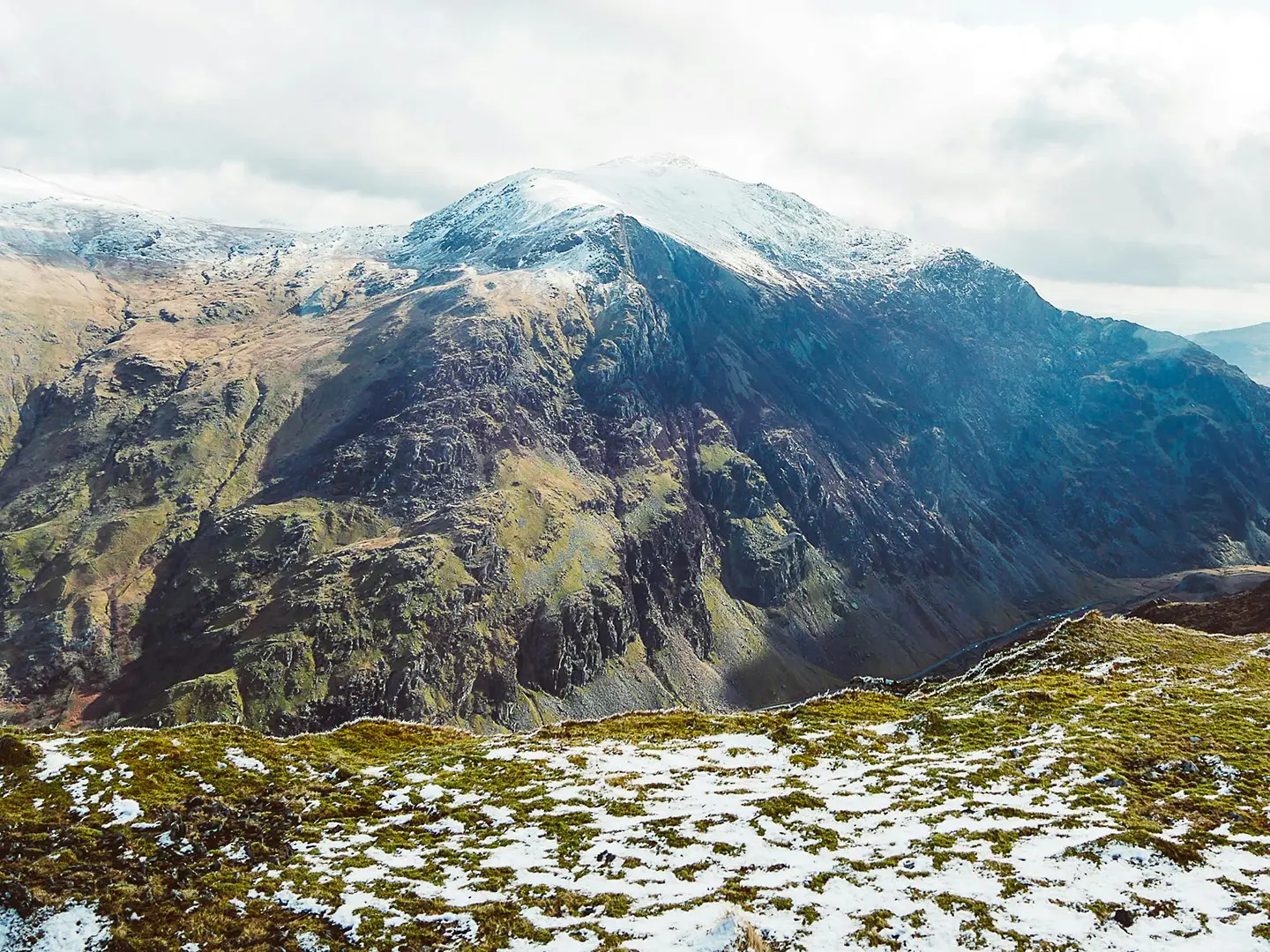
Snowdonia Way
How would you rate Snowdonia Way?
Tap a star to share your experience and help other hikers.
Snowdonia Way: A Complete Hiking Guide
HikeList Score
Snowdonia Way scored 90/100 on HikeList's trail-quality metrics.
See score breakdownHide breakdown
- Ideal length 100
- Balanced challenge 100
- Scenery & wildness 58
- Varied terrain 100
- Accommodation 100
- Food & support 94
- Path quality 92
- Season flexibility 89
Computed from length, challenge, scenery & wildness, terrain variety, accommodation, food & support, path quality and season flexibility.
The Snowdonia Way is a 156 km point-to-point walk through Eryri (Snowdonia) National Park in Wales, usually walked in 6–8 days. It runs south to north from Machynlleth to Conwy and is a moderate low-level traverse, though the days are long and the route is not waymarked. It suits experienced walkers who are comfortable using maps or the Cicerone guidebook, with an optional, much harder mountain variant for those wanting summits and rougher upland terrain.
Route Overview
The main Snowdonia Way starts in Machynlleth, Powys, and finishes in Conwy on the north coast; both ends have railway stations, making it a practical linear walk. Travelling south to north, the route links Dolgellau below Cadair Idris, Trawsfynydd, Penrhyndeudraeth, Beddgelert, Dolwyddelan, Bethesda and the Ogwen Valley, then Llanfairfechan before Conwy. It follows existing rights of way rather than a purpose-built trail: valley tracks, hillside paths, forested slopes, open moorland, riverside sections and some Roman roads. Near the northern end it passes close to Aber Falls — see the shorter Aber Falls Walk for a day-hike alternative. Finishing on the north coast, it pairs naturally with the nearby Anglesey Coastal Path, or with the Beacons Way if you want to traverse Wales's other great national park.
History of the Snowdonia Way
The Snowdonia Way was created by international mountain leader Alex Kendall, who grew up walking in Eryri, and was published by Cicerone in 2017. It is not an officially waymarked national trail; it links long-standing rights of way into a continuous south-to-north traverse of the national park. The route crosses a landscape shaped by Welsh history and folklore, including Roman roads, stories of King Arthur and associations with the Welsh princes.
Notable highlights
- Pass of Aberglaslyn: A wooded river gorge near Beddgelert where the path runs tight beside the Afon Glaslyn. This is the only stretch fitted with handrails and needs care in wet weather.
- Aber Falls (Rhaeadr Fawr): A roughly 37 m waterfall in the Carneddau, reached near the northern end of the low-level route before the descent towards the coast.
- Ogwen Valley: A glacier-carved valley framed by Tryfan and the Glyderau, with views towards Carnedd Llywelyn. It gives the low-level route a classic Eryri mountain setting without committing to the mountain variant.
- Yr Wyddfa (Snowdon): The highest mountain in Wales at 1,085 m. The low route passes beneath it at Beddgelert, while the optional mountain route climbs to the summit.
- Cadair Idris: A prominent mountain above Dolgellau, known for its cliffs, glacial lakes and Welsh legend. It is a summit option on the mountain route early in the walk.
Challenges to expect
The main route is moderate, but not easy: expect long 6–8 hour walking days, some steep ascents and descents, wet ground and changeable Eryri weather. It is not waymarked, so navigation depends on maps or the guidebook, especially on unsigned sections. The mountain variant is a different undertaking: rocky ridges, pathless upland and, in winter, full mountaineering skills and equipment.
HikeList Score
Snowdonia Way scored 90/100 on HikeList's trail-quality metrics.
See score breakdownHide breakdown
- Ideal length 100
- Balanced challenge 100
- Scenery & wildness 58
- Varied terrain 100
- Accommodation 100
- Food & support 94
- Path quality 92
- Season flexibility 89
Computed from length, challenge, scenery & wildness, terrain variety, accommodation, food & support, path quality and season flexibility.
 United Kingdom
 Wales
WalesShow more data Show less
- Valley Tracks
- Hillside Paths
- Open Moorland
- Wooded Valleys
- Forested Slopes
- Riverside Sections
- Paths
- Tracks
- Unsigned Sections
- Off Trail Sections
- B&Bs
- Guesthouses
- Hostels
- Wild Camping
- Family Friendly
- Dog Friendly On Leash
- Restrooms
- Potable Water Sources
- Established Campsites
- Shelters
- Picnic Areas
- Public Transport Access Points
Download Our Full Guide to Snowdonia Way FREE!
Get our comprehensive guide to this hike for free. Save it for later reading or print out at home.
In these collections
Photos from hikers
Taken on the trail by people who've reviewed Snowdonia Way.
Snowdonia Way: The Complete Guide
 i
Image by Adrian Dorobantu
i
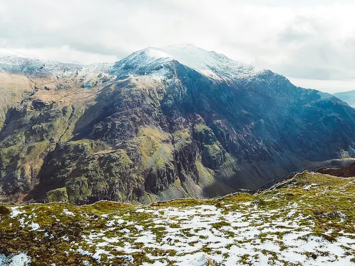
Image by Adrian Dorobantu The Snowdonia Way is a south-to-north traverse of Eryri (Snowdonia), linking Machynlleth in mid-Wales with the walled coastal town of Conwy. The standard route is not a summit-bagging line, but a long, scenic low-level journey through valleys, passes, forests, moorland and old tracks beneath the highest mountains in Wales.
It suits experienced independent walkers who want the feel of a mountain crossing without committing to exposed ridges every day. Dolgellau, Trawsfynydd, Beddgelert, Dolwyddelan, Bethesda, Llanfairfechan and Conwy give the walk useful places to sleep, resupply and break the journey.
The route’s character comes from what it passes under as much as what it climbs: Cadair Idris above Dolgellau, Yr Wyddfa (Snowdon) above Beddgelert, and the Glyderau and Carneddau around Dyffryn Ogwen (Ogwen Valley). Highlights include Bwlch Aberglaslyn (Pass of Aberglaslyn), Rhaeadr Fawr (Aber Falls) and the final approach to Conwy Castle.
Do not mistake “low-level” for easy. The main route is 156 km / 97 miles, unwaymarked throughout, with long days, wet ground, steep climbs and descents, and changeable mountain weather; the separate mountain route is a much harder undertaking over major summits including Yr Wyddfa (Snowdon).
This guide covers stages, day choices, accommodation, food, transport, terrain and the common mistakes to avoid.
Stage-by-Stage Guide
The stage notes below follow the standard 6-stage low-level Snowdonia Way. This is the 156 km / 97 mile main route, not the harder mountain variant. Distances are approximate, and the route is not waymarked, so each day needs the Cicerone guidebook, GPX and OS mapping rather than reliance on signs on the ground.
Stage 1: Machynlleth to Dolgellau — 25 km
The opening stage leaves Machynlleth, a well-connected mid-Wales market town on the Cambrian Line, and heads north into the southern part of Eryri (Snowdonia). It is a substantial first day rather than a gentle warm-up: expect a full walking day on mixed low-level terrain, with valley tracks, hillside paths and rougher sections underfoot.
The stage gives an early sense of the route’s character. The Snowdonia Way is not a signed National Trail, and even on this first leg navigation matters; use map, compass and GPX from the start rather than expecting waymarks to carry you through junctions and rights-of-way changes.
Dolgellau is the clear stage-end and the main service hub for this part of the route. It is a good place for accommodation, food and resupply before the next stage, with a wider choice than many of the smaller settlements further north. Book ahead in the main walking season, as stage-end towns in Eryri can fill quickly.
The major landscape presence at the end of the day is Cadair Idris, which rises above Dolgellau. The low route passes beneath the mountain rather than climbing it; walkers wanting the summit are looking at the separate mountain-route variant, not the standard Snowdonia Way.
Food and water planning is straightforward at the two ends but should not be casual in between. Start with enough food and drink for the full day unless current facilities along the line of travel have been checked before setting out.
Public transport access is strongest at Machynlleth because of its railway station. Dolgellau has road access and is an important local centre, but onward bus options and current timetables should be checked before travelling.
Stage 2: Dolgellau to Trawsfynydd — 23 km
This stage continues north from Dolgellau through the southern valleys of Eryri, passing Llanelltyd and moving towards the Trawsfynydd area. It remains a low-level traverse, but “low-level” should not be read as easy: the day still includes sustained distance, ascent and descent, and the ground can be wet or rough away from the best tracks.
The route uses a mixture of existing rights of way, with forest and hillside paths, moorland sections and valley tracks all possible across this part of the walk. In poor visibility, the unsigned nature of the Snowdonia Way is especially important; keep close track of position rather than waiting for confirmation from trail furniture.
Trawsfynydd is a smaller stage-end than Dolgellau. Accommodation and evening food should be arranged in advance, particularly in summer or if walking to a fixed schedule. If no suitable bed is available directly on the route, a short local bus or other transfer may be needed; this should be checked before travelling.
Llyn Trawsfynydd is the key feature around this stage. The route passes near the large reservoir, but walkers should be aware that the historic footbridge across its narrowest point has been closed since around 2022. A short A470 / southern-lake diversion is needed; check the current route update before setting out from Dolgellau or Trawsfynydd.
Food and water are best treated as end-of-day logistics rather than something to rely on throughout the stage. Carry enough for the full day and use Dolgellau to stock up before leaving.
Road access is available around the Trawsfynydd area, and local buses may help with section-walking or accommodation transfers. Current services should be checked before travelling.
Stage 3: Trawsfynydd to Beddgelert — 30 km
This is one of the longest and most varied days on the standard 6-stage itinerary. From Trawsfynydd the route heads north via Maentwrog and Penrhyndeudraeth before reaching the Afon Glaslyn corridor and Beddgelert. Many walkers shorten the day by splitting it at Penrhyndeudraeth, creating a more manageable 8-day itinerary.
The terrain is mixed, with valley walking, hillside paths, woodland and riverside sections. Expect changes in underfoot conditions: some stretches are on good tracks, while others can be muddy, wet or slow after rain.
The major highlight is Bwlch Aberglaslyn (Pass of Aberglaslyn), the narrow wooded gorge where the path runs close beside the Afon Glaslyn. This section has fixed handrails and needs care when wet. It is not technically a mountain section, but a slip here would be more serious than on an ordinary valley path, so poles, wet rock and heavy packs should be managed carefully.
Beddgelert is an important overnight stop and one of the best-known villages on the route, sitting below the mountains around Yr Wyddfa (Snowdon). The standard low route passes through the valley here; it does not climb Yr Wyddfa. The Snowdon ascent belongs to the separate mountain route and changes the difficulty completely.
Maentwrog, Penrhyndeudraeth and Beddgelert are the main places to plan around for food, water and services, but opening times should be checked before relying on them. Carry enough food for the full stage if walking it in one day.
Beddgelert has road access and is within the area served by local Eryri transport, including Sherpa’r Wyddfa and other local buses. These services can be useful for section walkers or for reaching accommodation away from the route, but current timetables should be checked before travelling.
Stage 4: Beddgelert to Dolwyddelan — 21 km
This is a shorter day by Snowdonia Way standards, but it still crosses serious upland country in terms of weather and navigation. The route leaves Beddgelert beneath the high mountains and continues north-east towards Dolwyddelan in the Lledr valley.
The walking remains on the low-level line, using valley and hillside routes rather than the summits. This distinction matters here: the landscape is dominated by Yr Wyddfa (Snowdon), but the standard Snowdonia Way deliberately avoids the mountain top.
Underfoot, expect a continuation of the route’s usual mix: tracks, field and hillside paths, rougher wet sections and occasional steeper ups and downs. After rain, the slower ground can make the stage feel longer than the distance suggests.
Dolwyddelan is a small village stage-end, known for the ruined keep of Dolwyddelan Castle, associated with the medieval Welsh princes of Gwynedd. Accommodation here and nearby should be booked ahead, as the choice is more limited than in Dolgellau, Beddgelert or Conwy.
Food and water are best secured before leaving Beddgelert, with Dolwyddelan as the next planned service point. Do not assume that small-village facilities will be open late or every day; this should be checked before travelling.
Navigation is usually less complex than on the mountain variant, but there is still no waymarking for the Snowdonia Way itself. Keep GPX and OS mapping accessible rather than buried in the pack.
Stage 5: Dolwyddelan to Bethesda — 25 km
This stage carries the route from the Lledr valley towards the northern mountains and Bethesda. It is one of the most mountain-feeling days on the low route, with the landscape tightening into the classic scenery of Dyffryn Ogwen (Ogwen Valley).
The route gives views into a dramatic glacier-carved valley framed by Tryfan and the Glyderau, with views towards Carnedd Llywelyn. The standard Snowdonia Way still avoids the high ridges and summits, but the terrain and weather can feel properly upland.
Expect rougher ground, wet paths and some steep ascent and descent. A benign forecast at valley level can still mean wind, rain and poor visibility higher on the route, so waterproofs, warm layers and confident navigation remain essential.
Bethesda is the stage-end and a practical place to break the route before the long final day to Conwy. Accommodation should still be arranged ahead, particularly if arriving at the same time as other walkers or during busy holiday periods.
Food and water should be planned carefully. Dolwyddelan is a small start point, and there may be long gaps between reliable facilities, so carry enough for the day rather than depending on finding refreshments en route.
Transport options in this part of Eryri include Sherpa’r Wyddfa and local bus services around the mountain valleys. These can help with section walking or with reaching off-route accommodation, but current routes and times should be checked before travelling.
Stage 6: Bethesda to Conwy — 34 km
The final standard stage is the longest of the 6-day itinerary and should not be treated as a simple run-in to the coast. At around 34 km, it is a demanding day after five previous stages, especially with rough or wet ground underfoot. Many walkers split it at Llanfairfechan, making an 8-day itinerary with a more reasonable final approach to Conwy.
From Bethesda the route crosses the northern part of Eryri towards Abergwyngregyn, Rhaeadr Fawr (Aber Falls), Llanfairfechan and finally Conwy. The walking combines upland foothill terrain with the gradual transition towards the north coast.
Rhaeadr Fawr is the major natural landmark of the stage: a roughly 37 m waterfall where the Afon Goch drops over an igneous sill in the Carneddau foothills. It is a strong highlight near the northern end of the route, but the day still has significant distance left if continuing all the way to Conwy.
Llanfairfechan is the practical split point used in the 8-day version of the walk. Breaking the stage here changes the final two days to roughly 21 km and 16.5 km, which is often more realistic than tackling the full Bethesda-to-Conwy leg in one push.
Conwy is the official finish, a medieval walled town beside Conwy Castle. It has accommodation and onward transport, though Conwy station is a small request stop; many travellers use Llandudno Junction, a short distance away, for wider rail connections to Chester, Crewe, Manchester and Llandudno.
Food and water planning matters on this stage because of the distance. Use Bethesda to stock up, check what is available around Llanfairfechan if splitting the stage, and avoid assuming that every intermediate service will be open when needed.
Navigation remains important right to the finish. The route is still unsigned as a continuous trail, and fatigue on the longest day can make missed junctions more likely. Keep the map or GPX active until Conwy, rather than mentally finishing the walk at the first sight of the coast.
Recommended Itinerary
Distances on the Snowdonia Way are approximate and should be checked against the Cicerone guidebook, GPX and OS mapping before booking accommodation. This is especially important because the route is not waymarked, several stage-ends are small, and the Llyn Trawsfynydd footbridge closure requires a diversion via the A470 / southern side of the lake.
Standard itinerary: 7 days
This is the most practical balance for many independent walkers: it keeps the main guidebook stages largely intact, but avoids finishing with the very long Bethesda to Conwy day. It suits walkers comfortable with 20–30 km days on unsigned ground, but who want a more manageable final approach to the coast.
| Day | From | To | Approx. distance | Why this stage makes sense | Services/accommodation notes |
|---|---|---|---|---|---|
| 1 | Machynlleth | Dolgellau | 25 km | A strong opening day between two proper towns, using the southern approach into Eryri before finishing below Cadair Idris. | Machynlleth and Dolgellau are among the easier places on the route for accommodation and transport. Book Dolgellau ahead in busy periods. |
| 2 | Dolgellau | Trawsfynydd | 23 km | A full but manageable day north from Dolgellau, setting up the traverse towards Llyn Trawsfynydd. | Trawsfynydd is smaller than Dolgellau, so accommodation should be arranged before starting the walk. Check the current Llyn Trawsfynydd diversion before travel. |
| 3 | Trawsfynydd | Beddgelert | 30 km | One of the longer standard days, but it gets you through to a key village beneath Yr Wyddfa (Snowdon) and avoids adding an extra overnight in the middle. | Beddgelert is a popular overnight stop, so advance booking is sensible, particularly in summer and at weekends. The Bwlch Aberglaslyn (Pass of Aberglaslyn) section needs care when wet. |
| 4 | Beddgelert | Dolwyddelan | 21 km | A shorter day after the long Trawsfynydd–Beddgelert leg, continuing through classic valley country rather than committing to the high mountain variant. | Dolwyddelan is a small stage-end. Arrange accommodation early or be prepared to use local transport to reach a bed; this should be checked before travelling. |
| 5 | Dolwyddelan | Bethesda | 25 km | A substantial crossing towards Dyffryn Ogwen (Ogwen Valley), with mountain scenery but still on the low-level Snowdonia Way rather than the summit route. | Bethesda has more practical end-of-day options than some of the smaller villages, but beds can still fill in peak season. |
| 6 | Bethesda | Llanfairfechan | 21 km | Splits the long final guidebook stage and gives time for the northern hills and the approach past Rhaeadr Fawr (Aber Falls). | Llanfairfechan makes a useful coastal-side overnight before the final walk into Conwy. Check accommodation and transport before committing to this split. |
| 7 | Llanfairfechan | Conwy | 16.5 km | A shorter final day into Conwy, leaving time for onward rail connections from Conwy or nearby Llandudno Junction. | Conwy has more visitor accommodation than the smaller stage-ends, but it is still worth booking ahead in season. Conwy station is a small request stop; many travellers use Llandudno Junction for wider connections. |
Slower itinerary: 8 days
The 8-day version is the better choice if accommodation availability, shorter walking days or recovery time matter more than speed. It splits both the long Trawsfynydd to Beddgelert stage and the long Bethesda to Conwy finish, using Penrhyndeudraeth and Llanfairfechan as practical intermediate overnights.
| Day | From | To | Approx. distance | Why this stage makes sense | Services/accommodation notes |
|---|---|---|---|---|---|
| 1 | Machynlleth | Dolgellau | 24.6 km | A full first day between substantial towns, without needing a remote first-night stop. | Good place to start with a pre-booked night in Dolgellau. Machynlleth has rail access on the Cambrian Line. |
| 2 | Dolgellau | Trawsfynydd | 22.2 km | Keeps the second day moderate before the route reaches the Trawsfynydd area. | Trawsfynydd is a small overnight stop; book before travelling. Check the Llyn Trawsfynydd footbridge closure and diversion. |
| 3 | Trawsfynydd | Penrhyndeudraeth | 15.8 km | A shorter stage that breaks up the otherwise long haul from Trawsfynydd to Beddgelert. | Penrhyndeudraeth is used as a practical accommodation hub on slower schedules. Availability should be checked before booking the full itinerary. |
| 4 | Penrhyndeudraeth | Beddgelert | 14.9 km | Keeps mileage low through the Bwlch Aberglaslyn (Pass of Aberglaslyn) area, where wet rock and fixed handrails require concentration. | Beddgelert is popular and should be booked ahead. Allow time for careful progress through the gorge in poor weather. |
| 5 | Beddgelert | Dolwyddelan | 20.1 km | A steady mid-route stage after two shorter days, staying on the low-level line beneath the high mountains. | Dolwyddelan is small; if accommodation is full, a short local transport link may be needed. This should be checked before travelling. |
| 6 | Dolwyddelan | Bethesda | 25 km | The longest day on this slower schedule, but still shorter than the longest stages of the 6-day version. | Bethesda is a sensible overnight before the northern section towards Rhaeadr Fawr and the coast. |
| 7 | Bethesda | Llanfairfechan | 21 km | Breaks the final section and avoids arriving in Conwy at the end of a 30 km-plus day. | Llanfairfechan gives a useful final overnight. Check accommodation and any local bus options before fixing dates. |
| 8 | Llanfairfechan | Conwy | 16.5 km | A short final walk into Conwy, practical for onward travel the same day. | Conwy has a small request-stop station; Llandudno Junction is the main nearby interchange for longer rail journeys. |
Faster itinerary: 6 days
The 6-day itinerary follows the main guidebook stage pattern. It is best reserved for fit, efficient walkers who are comfortable with long 6–8 hour days, wet or rough ground, and independent navigation on an unsigned route. The final Bethesda to Conwy day is the key test; if accommodation allows, many walkers will prefer to split it at Llanfairfechan.
| Day | From | To | Approx. distance | Why this stage makes sense | Services/accommodation notes |
|---|---|---|---|---|---|
| 1 | Machynlleth | Dolgellau | 25 km | A direct start from the rail-served trailhead to the main southern hub of the route. | Dolgellau is a practical first overnight, but still worth booking ahead. |
| 2 | Dolgellau | Trawsfynydd | 23 km | Maintains momentum northwards while keeping the day below the longest stages. | Confirm accommodation in Trawsfynydd before starting. Check the Llyn Trawsfynydd diversion before travel. |
| 3 | Trawsfynydd | Beddgelert | 30 km | A long but logical push through to Beddgelert, avoiding an extra stop between the lake country and the Glaslyn valley. | Beddgelert is a key overnight village. The Bwlch Aberglaslyn section can be slow in wet conditions. |
| 4 | Beddgelert | Dolwyddelan | 21 km | A shorter recovery stage after the long previous day. | Dolwyddelan has limited accommodation compared with the larger towns. Book early or check local transport alternatives. |
| 5 | Dolwyddelan | Bethesda | 25 km | Positions you for the final northern crossing and the approach to the coast. | Bethesda is the last major overnight before the long finish. |
| 6 | Bethesda | Conwy | 34 km | The longest day of the low-level itinerary, completing the northern section past Rhaeadr Fawr and onward to Conwy. | Only suitable if fitness, daylight and weather are in your favour. If in doubt, split this stage at Llanfairfechan. |
Planning the Route
The Snowdonia Way needs more planning than a waymarked National Trail. The walking is mostly low-level on the main route, but the line is unsigned, accommodation is unevenly spaced, and several days are long enough that poor weather or slow navigation can quickly affect the schedule.
Most walkers should plan around 7–8 days rather than forcing the full low-level route into the six guidebook stages. The six-day itinerary is achievable for strong walkers happy with repeated 21–34 km days, but the longer stages leave little margin for wet ground, navigation errors, late starts or short winter daylight.
Choosing a 6-day or 8-day schedule
The standard low-level route divides naturally into six stages, using the main settlements across Eryri. This is the cleanest itinerary on paper, but it includes a long final day from Bethesda to Conwy and a substantial Trawsfynydd to Beddgelert stage.
| Schedule | Best for | Main planning issue |
|---|---|---|
| 6 days | Fit, experienced walkers wanting long days | Repeated full days of 6–8 hours or more, with less room for delays |
| 7–8 days | Most independent walkers | More accommodation bookings, but a more manageable pace |
| 9 days+ | Slower walkers, poor-weather margin, or mixed low/mountain-route plans | Needs careful linking of smaller overnight stops and transport |
A practical 8-day version splits the two longest sections by using Penrhyndeudraeth between Trawsfynydd and Beddgelert, and Llanfairfechan between Bethesda and Conwy. This gives a better balance of daily distances and is usually the more sensible plan for walkers carrying full kit.
| Day | From | To | Approx. distance |
|---|---|---|---|
| 1 | Machynlleth | Dolgellau | 24.6 km |
| 2 | Dolgellau | Trawsfynydd | 22.2 km |
| 3 | Trawsfynydd | Penrhyndeudraeth | 15.8 km |
| 4 | Penrhyndeudraeth | Beddgelert | 14.9 km |
| 5 | Beddgelert | Dolwyddelan | 20.1 km |
| 6 | Dolwyddelan | Bethesda | 25 km |
| 7 | Bethesda | Llanfairfechan | 21 km |
| 8 | Llanfairfechan | Conwy | 16.5 km |
Let accommodation dictate the itinerary
The route is strongly shaped by where beds are available. Machynlleth, Dolgellau and Conwy have broader accommodation options, while smaller stage-ends such as Trawsfynydd, Dolwyddelan and Bethesda need earlier booking, especially in summer.
Do not assume that every stage-end will have spare rooms, evening food and a shop available at short notice. Some walkers may need to use a short local bus to reach accommodation off the line of the walk, then return to the same point the next morning. This should be checked before travelling.
If booking late, build the itinerary around confirmed beds first, then adjust daily distances around those bookings. This is usually easier than fixing a day-by-day schedule and trying to find accommodation afterwards.
Navigation planning is essential
The Snowdonia Way is not waymarked on the ground. There is no trail acorn or continuous set of signs to follow, so navigation should be planned before leaving Machynlleth.
Carry the Cicerone guidebook route description, GPX files and proper mapping. Relevant OS mapping includes Explorer OL17, OL18 and OL23, plus 215 and 263; Landranger 115, 124 and 135 also cover the corridor. A phone-only approach is not enough unless it is backed up with offline maps, spare power and a paper-map fallback.
The low-level route follows a mix of valley tracks, hillside paths, forest, moorland and old Roman roads. Some sections can be rough, wet or indistinct, so time estimates should allow for slower progress than on a surfaced path.
Low route or mountain route?
Decide early whether the plan is the low-level Snowdonia Way or the mountain-route variant. They are not the same undertaking.
The standard route deliberately passes below the major summits and reaches a high point of 407 m. It still has substantial ascent over the full journey, but it is a valley-and-pass traverse rather than a summit walk.
The mountain route is around 196 km / 122 miles over nine stages and climbs major peaks including Cadair Idris, Yr Wyddfa (Snowdon) and the Glyderau. In winter conditions it requires full winter mountaineering skills and equipment. It should not be treated as a simple extension to the low route.
Key route checks before setting off
Two checks matter particularly when finalising the itinerary.
First, the footbridge across the narrowest part of Llyn Trawsfynydd has been closed since around 2022, requiring a short diversion via the A470 / southern side of the lake. Check the latest Cicerone updates and LDWA alerts before travelling.
Second, check food and refreshment options on each day rather than relying on cafés being open. The café at Croesor closed permanently in March 2025, and opening hours in smaller villages can be limited or seasonal.
The Bwlch Aberglaslyn (Pass of Aberglaslyn) section near Beddgelert also deserves attention in poor weather. The path runs tightly through the wooded gorge beside the Afon Glaslyn, with fixed handrails, and needs care when wet.
Food, water and resupply
Plan to carry a full day’s food between overnight stops unless current services are known to be open. Larger settlements such as Machynlleth, Dolgellau and Conwy are easier for resupply; smaller villages should be treated more cautiously.
Water planning is straightforward in the sense that this is not a dry upland desert route, but safe drinking water is still a logistics issue. Carry enough for the day, refill at accommodation or reliable services, and do not depend on untreated streams without a suitable treatment method.
Weather and timing
Spring to autumn is the normal planning window for the low-level route. Even then, Eryri weather can be wet, windy and changeable, and low cloud can make unsigned moorland sections significantly harder to navigate.
Longer itineraries are more resilient. An 8-day plan gives more room to wait out bad weather, arrive before dark, or slow down on rough ground without immediately compromising the next accommodation booking.
Section hiking and transport
Section hiking is practical because both ends are on the rail network and local buses help with intermediate access. Machynlleth has a station on the Cambrian Line, while Conwy has a small request-stop station on the North Wales Coast Line; many travellers use nearby Llandudno Junction for wider connections.
Within Eryri, Sherpa’r Wyddfa and local TrawsCymru buses can help link sections or reach accommodation away from the route. Timetables, operating days and last buses should be checked before travelling, particularly outside the main season.
For a first section-hike plan, the most natural breaks are the established overnight settlements: Dolgellau, Trawsfynydd, Penrhyndeudraeth, Beddgelert, Dolwyddelan, Bethesda and Llanfairfechan. Build each section around reliable transport first, then check whether the walking distance is realistic for the available daylight.
Towns, Villages and Overnight Stops
Accommodation on the Snowdonia Way is unevenly spaced. The main six-day low-level itinerary uses Machynlleth, Dolgellau, Trawsfynydd, Beddgelert, Dolwyddelan, Bethesda and Conwy as the practical overnight chain, while many walkers make the route easier by adding Penrhyndeudraeth and Llanfairfechan.
Book ahead, especially in summer. Machynlleth, Dolgellau and Conwy have the broadest choice, while smaller stage-ends can be tight for rooms and evening food. In the smaller villages, do not assume there will be late-opening shops, cafés or pub meals unless these have been checked before travelling.
| Place | Best use for walkers | Practical note |
|---|---|---|
| Machynlleth | Start-night stop | Rail access on the Cambrian Line; good place to arrive the day before walking. |
| Dolgellau | Standard night 1 | Larger southern Eryri hub below Cadair Idris. |
| Trawsfynydd | Standard night 2 | Small stage-end; book accommodation and food in advance. |
| Penrhyndeudraeth | Useful 8-day stop | Splits the long Trawsfynydd to Beddgelert stage. |
| Beddgelert | Standard night 3 / 4 | Key village stop before the Lledr valley section. |
| Dolwyddelan | Standard night 4 / 5 | Small village stage-end; limited accommodation should be planned early. |
| Bethesda | Standard night 5 / 6 | Practical stop before the long final stage or before splitting via Llanfairfechan. |
| Llanfairfechan | Useful 8-day stop | Breaks the long Bethesda to Conwy stage. |
| Conwy | Finish-night stop | Rail access via Conwy or nearby Llandudno Junction; good end-of-walk base. |
Machynlleth
Machynlleth is the southern start of the Snowdonia Way and the best place to position yourself before setting off. It is a mid-Wales market town with its own railway station on the Cambrian Line, with direct trains from Shrewsbury, Birmingham and onward to or from Wolverhampton and Aberystwyth.
As one of the larger towns on the route, Machynlleth is a sensible place to arrange a first-night hotel, guesthouse or B&B and to sort food before the first full walking day. The trail is not waymarked from the outset, so this is also the point to make sure the Cicerone guidebook, GPX files and OS mapping are ready rather than relying on signs on the ground.
Dolgellau
Dolgellau is the standard first overnight stop on the low-level route, reached from Machynlleth after a long opening stage. It is a handsome dark-stone market town below Cadair Idris and acts as a hub for the southern part of Eryri.
This is one of the better places on the route for accommodation, with the broader choice expected of a larger town. It is a strong overnight stop for most itineraries: there is little advantage in pushing beyond it unless accommodation has already been arranged elsewhere.
Food and resupply are easier here than in the smaller settlements that follow, but opening times should still be checked before travelling. The next stage to Trawsfynydd is another substantial day, so Dolgellau is a practical place to leave with food already sorted.
Llanelltyd
Llanelltyd is passed after Dolgellau on the way north and is more useful as a route waypoint than as a primary overnight base. Walkers using the standard six-day schedule normally continue to Trawsfynydd rather than stopping here.
Treat accommodation, food and public transport options here as limited unless arranged in advance. If planning a shorter custom stage around Dolgellau or Llanelltyd, all services should be checked before travelling.
Trawsfynydd
Trawsfynydd is the standard second overnight stop on the low-level Snowdonia Way. It sits near Llyn Trawsfynydd, a major landmark on this part of the route.
This is a small stage-end, so accommodation should be booked early. Do not leave food planning until arrival without checking what is open, particularly outside the main holiday season or if arriving late after a long day from Dolgellau.
A key route note applies around Llyn Trawsfynydd: the historic footbridge across the narrowest point of the lake has been closed since around 2022, requiring a short A470 / southern-lake diversion. Current route updates should be checked before travelling.
Maentwrog
Maentwrog sits between Trawsfynydd and the Beddgelert/Penrhyndeudraeth section and can be relevant for walkers breaking the central part of the route differently from the guidebook stages. It is not one of the main standard stage-ends.
Use Maentwrog only as an overnight or food stop if accommodation and meals have been arranged in advance. For most walkers, it is better treated as a passing village rather than a guaranteed resupply point.
Penrhyndeudraeth
Penrhyndeudraeth is the most useful additional overnight stop for walkers taking an easier eight-day schedule. It breaks the long Trawsfynydd to Beddgelert stage into two much more manageable days.
This makes Penrhyndeudraeth one of the most practical non-guidebook-stage stops on the whole route. It is especially useful for walkers who do not want a 30 km day before reaching Beddgelert.
Accommodation and evening food should still be booked or checked ahead. Local buses in Eryri can help with intermediate access, but exact services and times should be checked before travelling.
Bwlch Aberglaslyn (Pass of Aberglaslyn)
Bwlch Aberglaslyn (Pass of Aberglaslyn) is a route feature rather than an overnight base. The path runs through a narrow wooded gorge beside the Afon Glaslyn near Beddgelert, with fixed handrails on the tightest section.
It is one of the places where timing and conditions matter more than services. Take care in wet weather, as the gorge path can feel confined and slippery, and do not plan on using the pass itself for food, accommodation or transport logistics.
Beddgelert
Beddgelert is a major village stop on the route and the standard overnight after the long stage from Trawsfynydd on the six-day itinerary. On the eight-day version, it follows the shorter day from Penrhyndeudraeth.
The village is a key walking base at the foot of Yr Wyddfa (Snowdon), though the low-level Snowdonia Way passes beneath the mountain rather than climbing it. Accommodation is usually planned here well in advance, particularly in busy walking months.
Beddgelert is also the practical place to reset before the next stage to Dolwyddelan. Food and café or pub opening times should be checked before travelling, especially if arriving late or walking outside peak season.
Dolwyddelan
Dolwyddelan is the standard overnight stop between Beddgelert and Bethesda on the low-level route. It sits in the Lledr valley and is associated with the ruined keep of Dolwyddelan Castle.
This is a small village stage-end, so it needs early accommodation planning. If no suitable bed is available, a short local bus or a reworked stage plan may be needed; this should be arranged before starting the route rather than left until the day.
Food availability should not be assumed. Carry enough to be self-sufficient for the evening or breakfast unless meals have been booked or opening times checked.
Capel Curig
Capel Curig is relevant mainly for walkers using or connecting with the mountain-route variant, and sits on or near that higher line rather than being a core low-level stage-end. It is also useful to know as a mountain-area settlement near the central Eryri road network.
Low-route walkers should not assume that Capel Curig naturally fits their itinerary unless deliberately adjusting the route or using transport. Accommodation, food and onward transport should be checked before travelling.
Bethesda
Bethesda is the standard penultimate overnight stop on the six-day low-level route, reached from Dolwyddelan before the final long day to Conwy. It is also the overnight before a shorter final two-day finish if using Llanfairfechan as an extra stop.
This is an important planning point because the direct Bethesda to Conwy stage is long. Walkers who prefer shorter days should strongly consider splitting the finish at Llanfairfechan.
Accommodation and food should be arranged ahead, as demand around the northern Eryri valleys can be high. The Sherpa’r Wyddfa and local TrawsCymru bus networks can help with intermediate access in Eryri, but exact routes and timetables should be checked before travelling.
Dyffryn Ogwen (Ogwen Valley)
Dyffryn Ogwen (Ogwen Valley) gives the low-level route one of its strongest mountain settings, framed by Tryfan and the Glyderau, with views towards Carnedd Llywelyn. It is a landscape section rather than a dependable overnight stop.
Do not rely on the valley itself for accommodation, shops or meals unless something specific has been booked. It is better treated as a committing walking section between established stops, with sufficient food, waterproofs and navigation already in place.
Abergwyngregyn and Rhaeadr Fawr (Aber Falls)
Abergwyngregyn and Rhaeadr Fawr (Aber Falls) come into play towards the northern end of the route before the descent towards the coast. Rhaeadr Fawr is the notable landmark here, where the Afon Goch drops through the Carneddau foothills.
This area is more useful as a route highlight and possible break point than as a main overnight base. If planning to stop locally, accommodation, food and transport should be checked before travelling.
Llanfairfechan
Llanfairfechan is the key extra overnight stop for walkers splitting the final Bethesda to Conwy stage. On the eight-day version, it turns a very long final day into two shorter walking days.
This is the most practical way to reduce pressure at the end of the route, especially after several consecutive long days through Eryri. It also gives more flexibility if the weather is poor over the northern section.
Accommodation should be booked ahead, and evening food should be checked rather than assumed. Walkers finishing or joining here should also check current local transport options before travelling.
Conwy
Conwy is the northern finish of the Snowdonia Way, a walled medieval town beside Conwy Castle on the north coast. It is one of the best places on the route to stay after completing the walk.
Conwy has a small request-stop station on the North Wales Coast Line. Many travellers use nearby Llandudno Junction as the main interchange for connections to Chester, Crewe, Manchester and Llandudno.
As a larger end-point town, Conwy is a practical place for hotels and post-walk food, but booking ahead is still sensible in busy periods. If travelling onward by train from Conwy itself, remember that it is a request stop and check the stopping pattern before travelling.
Getting to the Start
By train
Machynlleth is the natural starting point for the Snowdonia Way and has its own railway station on the Cambrian Line. This makes the route unusually straightforward for a linear walk: arrive by train, walk north through Eryri (Snowdonia), then leave from Conwy or nearby Llandudno Junction at the finish.
Machynlleth has direct train links from Shrewsbury and Birmingham, with onward connections to and from Wolverhampton and Aberystwyth. For most walkers coming from elsewhere in the UK, Shrewsbury or Birmingham will be the main rail gateways.
Allow enough time on arrival to sort food, accommodation and navigation before starting. The Snowdonia Way is not waymarked from Machynlleth, so the Cicerone guidebook, GPX files and OS maps should be ready before leaving town rather than worked out on the first hillside.
Rail times and engineering works can materially affect this journey, especially if travelling on a Sunday or arriving late in the day. This should be checked before travelling.
By bus
Bus travel can help with intermediate access within Eryri, particularly using local TrawsCymru services and the Sherpa’r Wyddfa (Snowdon Sherpa) network further north, but rail is usually the simplest way to reach the official start at Machynlleth.
If using buses to reach Machynlleth from another Welsh town, plan the journey carefully and avoid building a tight connection into the first walking day. Rural services may be infrequent, seasonal or reduced on Sundays and public holidays. This should be checked before travelling.
For late arrivals, poor connections or a missed bus, a local taxi may be the practical fallback. Pre-booking is sensible, as rural taxi availability should not be assumed at short notice.
By car
Driving to Machynlleth is possible, but the Snowdonia Way is a point-to-point walk ending in Conwy, not a circular route. Anyone leaving a car at the start needs a clear plan for returning from the north coast after the walk.
The rail network makes this manageable in principle: Conwy has a small request-stop station on the North Wales Coast Line, and the main interchange is a short distance away at Llandudno Junction. From there, connections run towards Chester, Crewe, Manchester and Llandudno, with onward travel needed to return towards mid-Wales.
Do not assume that convenient long-stay parking is available in Machynlleth without arranging it in advance. If staying locally before the walk, ask the accommodation whether parking for the full hike is possible; otherwise check current local car park rules before leaving a vehicle for several days. This should be checked before travelling.
For many walkers, the cleanest car-based plan is to travel to Machynlleth by public transport, complete the route, then return home from Conwy or Llandudno Junction rather than retrieving a vehicle from the start.
From the nearest airport
There is no airport access that removes the need for a substantial onward rail journey to Machynlleth. For fly-in walkers, the practical approach is to choose an airport with good rail links into Birmingham, Wolverhampton or Shrewsbury, then continue by train on the Cambrian Line to Machynlleth.
Build in a buffer if flying and starting the walk the next day. A delayed flight or missed rail connection can easily compromise the first stage to Dolgellau, which is a full walking day rather than a short warm-up.
Airport-to-rail connections and through-ticket options change over time. This should be checked before travelling.
Where to stay before starting
Machynlleth is the best place to stay before beginning the Snowdonia Way. It is a proper market town, has its own railway station, and avoids the need for a same-day transfer before tackling the first stage to Dolgellau.
Staying the night before is strongly recommended if arriving from outside Wales or by a multi-leg public transport journey. It gives time to check the forecast, charge devices, load GPX files, organise OS mapping and make sure the first day’s navigation is ready.
Accommodation in Machynlleth includes the kind of town-based options expected at the larger settlements on this route, such as hotels, B&Bs and guesthouses. Book ahead in busy spring, summer and autumn periods, particularly if the itinerary depends on fixed overnight stops later in Eryri.
Getting Home from the Finish
The Snowdonia Way finishes in Conwy, the medieval walled town on the north coast. This is a practical end point for a linear walk because Conwy is on the North Wales Coast Line, with the larger interchange at Llandudno Junction a short distance away.
By train
Conwy has a small request-stop station on the North Wales Coast Line between Chester and Holyhead. It is convenient if a suitable train is calling there, but do not assume every service stops: check the timetable carefully and allow time to use the request-stop procedure.
For most onward journeys, Llandudno Junction is the more useful railhead. It is the main nearby interchange, with connections towards Chester, Crewe, Manchester and Llandudno, and is generally the safer option if making a longer connection or travelling with a fixed onward booking.
If finishing late after the long Bethesda to Conwy stage, build in a margin rather than aiming for the last possible train. A delayed final day, wet conditions, tired legs or a slow approach into Conwy can make a same-evening connection risky. Timetables should be checked before travelling.
By bus
Local buses can be useful for short hops around the Conwy and Llandudno Junction area, or for reaching accommodation if the best rail connection is from Llandudno Junction rather than Conwy itself. Services and evening coverage vary, so bus times should be checked before travelling.
Within Eryri, the Sherpa’r Wyddfa and local TrawsCymru buses are more relevant to intermediate access and bail-out points than to leaving the final finish. They can still be useful if plans change before reaching Conwy, especially around mountain villages and road corridors.
By car/taxi
For a point-to-point walk, public transport is usually simpler than leaving a car at one end. Both Machynlleth and Conwy are on the rail network, so returning towards the start by train is a practical option, normally using Llandudno Junction for the strongest onward connections.
A taxi is the simplest backup between Conwy and Llandudno Junction if train times from the small Conwy request-stop station do not work. Availability late in the evening should not be assumed; book ahead where possible, especially at weekends and in the main walking season.
If a car has been left in or near Conwy, check parking arrangements before committing to a multi-day stay. Do not rely on informal long-stay parking in a busy tourist town without confirming restrictions and charges.
From the nearest airport
For air travel after the hike, plan around rail connections from Llandudno Junction towards larger transport hubs such as Chester, Crewe and Manchester. Exact airport routing, journey times and late-evening connections are timetable-dependent and should be checked before travelling.
If flying the same day, leave a conservative buffer. The final approach to Conwy may follow a long walking day, and a missed rail connection can quickly become expensive when tied to a flight.
Where to stay at the finish
Staying overnight in Conwy is often the most relaxed option, especially after the full Bethesda to Conwy stage or if arriving late. Conwy is one of the larger settlements on the route, with hotels, B&Bs and guesthouses, but it is a popular visitor destination and should be booked ahead in summer.
An overnight stop also makes rail travel easier the next morning, when there is more choice from Llandudno Junction and less pressure around request-stop services at Conwy. If accommodation in Conwy is full, look for options within easy reach of Llandudno Junction or nearby local transport, but confirm the connection before booking.
Which Direction Should You Walk?
The Snowdonia Way is normally planned south to north, from Machynlleth to Conwy. That is the direction used by the standard stage sequence: Machynlleth → Dolgellau → Trawsfynydd → Beddgelert → Dolwyddelan → Bethesda → Conwy.
Walking it in reverse is entirely possible, but it is less neat for most walkers. The route is unwaymarked, so the practical issue is not trail signage but how easily your guidebook notes, GPX files and stage planning work in the direction you choose.
South to north: Machynlleth to Conwy
This is the recommended direction for most walkers. Machynlleth is a practical start point, with its own railway station on the Cambrian Line, and the route then works progressively north through Eryri (Snowdonia) towards the coast.
The scenery also builds well in this direction. The walk begins in mid-Wales, reaches Dolgellau below Cadair Idris, continues past Trawsfynydd and Beddgelert beneath the higher mountains, then crosses towards Dyffryn Ogwen (Ogwen Valley), Rhaeadr Fawr (Aber Falls) and the north coast.
The finish at Conwy is one of the strongest arguments for walking south to north. Ending beside the medieval walls and Conwy Castle gives the route a clear psychological endpoint, with onward rail connections available from Conwy or nearby Llandudno Junction.
There is no major transport disadvantage to this direction. Machynlleth is straightforward for a rail start, while Conwy is on the North Wales Coast Line, though it is a small request-stop station and many travellers use Llandudno Junction for wider connections.
The only caution is stage length near the end. On the 6-stage version, Bethesda to Conwy is a long final day of about 34 km, so many walkers split it by staying at Llanfairfechan and finishing with a shorter final walk into Conwy.
North to south: Conwy to Machynlleth
The reverse direction can work if accommodation, rail fares or personal scheduling make it more convenient. Starting via Conwy or Llandudno Junction is practical, and finishing in Machynlleth still leaves you on the rail network.
The main drawback is that the route loses the natural “journey to the coast” feel. Conwy Castle makes a memorable finish, but as a starting point it is harder to match psychologically; the walk then ends inland at Machynlleth rather than with a coastal arrival.
Reverse walkers also need to be more careful with navigation. Because the Snowdonia Way is not waymarked on the ground, you must be comfortable following GPX, OS maps and written route descriptions in reverse where necessary.
Stage flow can also feel tougher at the start if using the 6-stage structure, as Conwy to Bethesda reverses the long 34 km final stage. Splitting via Llanfairfechan is the sensible fix, just as it is for south-to-north walkers who want an easier finish.
Does one direction make the walking easier?
There is no clear evidence that one direction is significantly easier overall. The total ascent and descent are effectively the same whichever way you walk, and the low-level route still includes long days, steep ups and downs, wet ground and rough moorland in both directions.
Weather should not be used as a fixed reason to choose a direction. Eryri has changeable mountain weather, and wind, rain and visibility can matter more on the day than any broad directional assumption. Check the forecast before each stage and be ready to adjust plans.
Recommendation
For most walkers, choose Machynlleth to Conwy. It is the standard direction, has clean rail access at both ends, gives the best sense of progression through Eryri, and finishes strongly at Conwy on the north coast.
Walk north to south only if it solves a specific logistical problem, such as accommodation availability or travel connections. If doing so, reverse the navigation materials carefully and consider splitting the Conwy–Bethesda section via Llanfairfechan rather than opening with a very long day.
Accommodation Along the Route
The Snowdonia Way works well as an inn-to-inn walk, but it needs more forward planning than a heavily waymarked National Trail. The larger towns at each end and in the south have a decent choice of beds, while several mid-route stops are small villages where options can be limited.
Book accommodation before setting out, especially for summer, school-holiday periods and weekends. Because the route is unwaymarked, finishing tired and then adding an improvised detour to find a bed is a poor plan; the overnight stops should be fixed around your navigation, food and transport arrangements.
Best overnight pattern
The standard 6-stage low-level route uses these main overnight stops:
- Machynlleth
- Dolgellau
- Trawsfynydd
- Beddgelert
- Dolwyddelan
- Bethesda
- Conwy
This is efficient, but it includes long days, especially Trawsfynydd to Beddgelert and Bethesda to Conwy. It also relies on finding beds in smaller places such as Trawsfynydd and Dolwyddelan.
Many walkers make the route easier to book and more comfortable by using an 8-day pattern. This commonly adds Penrhyndeudraeth between Trawsfynydd and Beddgelert, and Llanfairfechan between Bethesda and Conwy, reducing the longest days and adding more practical overnight points.
Accommodation by place
| Place | Accommodation level | Best for | Notes |
|---|---|---|---|
| Machynlleth | Good | Start night | A sensible place to stay before day one, with the benefit of its Cambrian Line railway station. Starting rested is worthwhile before the long first stage to Dolgellau. |
| Dolgellau | Good | Night 1 / southern Eryri hub | One of the strongest accommodation stops on the route, with a broader choice than the smaller villages that follow. Useful if adjusting the first two days. |
| Llanelltyd | Limited | Overflow near Dolgellau | Not a primary stage-end for most itineraries, but may work if accommodation around Dolgellau is tight. Check exact location against the route before booking. |
| Trawsfynydd | Limited | Night 2 | A key stage-end on the 6-day route, but not a large accommodation hub. Book early rather than assuming a same-day bed will be available. |
| Maentwrog | Limited | Flexible split / transfer point | Potentially useful when reshaping the Trawsfynydd–Beddgelert section, but should not be treated as a guaranteed overnight solution without a booking. |
| Penrhyndeudraeth | Limited | 8-day itinerary | A practical additional stop between Trawsfynydd and Beddgelert, helping split one of the longer sections of the standard schedule. |
| Bwlch Aberglaslyn (Pass of Aberglaslyn) | None | Passage only | This is a gorge section, not an overnight base. Plan to continue to Beddgelert or use a pre-arranged transfer if not staying on the route. |
| Beddgelert | Good | Night 3 or 4 | One of the most useful mid-route villages for accommodation. It is popular and should be booked ahead in the main walking season. |
| Dolwyddelan | Limited | Night 4 or 5 | A small but important stage-end in the Lledr valley. Secure accommodation here before committing to the surrounding days. |
| Capel Curig | Limited | Mountain-route logistics / transfer option | More relevant to mountain-route planning or bespoke itineraries than to the standard low-level schedule. Use only where it fits the chosen route and transport plan. |
| Bethesda | Limited | Night 5 or 6 | The usual overnight stop before the northern section towards Conwy. Check bed availability early, particularly if walking the 6-day itinerary. |
| Dyffryn Ogwen (Ogwen Valley) | Limited | Pre-booked specialist stop / transfer point | Do not rely on finding accommodation casually in the valley. It is better treated as a scenic section or a pre-arranged overnight/transfer point. |
| Abergwyngregyn / Rhaeadr Fawr (Aber Falls) | Limited | Flexible northern split | Useful only for walkers deliberately breaking the Bethesda–Conwy section differently. Check accommodation and onward transport before building an itinerary around it. |
| Llanfairfechan | Limited | 8-day itinerary | The most useful split between Bethesda and Conwy on the 8-day version, reducing the final push to the coast. Book ahead. |
| Conwy | Good | Finish night | A strong finishing base with more accommodation choice than most villages on the route. Conwy has a small request-stop station, with Llandudno Junction nearby for wider rail connections. |
Booking strategy
For a 6-day itinerary, book Trawsfynydd, Dolwyddelan and Bethesda first, because these are the stops most likely to constrain the whole plan. Machynlleth, Dolgellau and Conwy are generally more flexible, but should still be reserved in busy periods.
For a 7- or 8-day itinerary, prioritise Penrhyndeudraeth and Llanfairfechan early. These stops make the walking days more manageable and can remove the pressure from the longest stages, but they are not places to leave until the last minute.
If one stage-end has no suitable bed, a short taxi or local bus connection can make the route workable. Sherpa’r Wyddfa, TrawsCymru and local buses can help with intermediate access in Eryri, but timetables, operating days and seasonal services change. This should be checked before travelling.
Luggage transfer, taxis and self-guided options
The Snowdonia Way is suitable for luggage-transfer or self-guided inn-to-inn walking, provided the itinerary is built around realistic accommodation stops. Walking-holiday operators use the main hubs and the 8-day pattern to smooth out the harder booking gaps.
Independent walkers can also use taxi transfers to stay slightly off-route where beds are scarce. This is most useful around the smaller mid-route villages, but it must be arranged in advance; do not assume taxis will be available at short notice at the end of a long day.
Carrying all kit gives more flexibility, especially if using hostels, bunkhouses or wild camping in the hills. That flexibility comes with extra weight and more responsibility: plan food, water, bad-weather shelter and legal overnight arrangements carefully. This should be checked before travelling.
Camping and Wild Camping
Camping can work well on the Snowdonia Way, but it needs more planning than on a signed National Trail. The route is unwaymarked, crosses a mix of valleys, hillside paths, forest, moorland and wet ground, and several days are long even without camping kit. A heavier pack will make the 6-day schedule noticeably harder, so many campers will find the 7–8 day split more realistic.
Campsites and formal camping
No single chain of guaranteed campsites is built into the route. The practical approach is to check current camping options around the main overnight hubs — Machynlleth, Dolgellau, Trawsfynydd, Penrhyndeudraeth, Beddgelert, Dolwyddelan, Bethesda, Llanfairfechan and Conwy — before fixing daily mileage.
Some stage-ends are small, and accommodation in general can be thin in summer. Campsites, bunkhouses and hostels should be booked or checked in advance rather than assumed, especially if walking the standard 6-stage itinerary with long days into specific settlements. This should be checked before travelling.
If no formal campsite fits a stage, a short local bus ride may be needed in the same way it can be for beds and guesthouses. That is often better than pushing on late with a heavy pack or camping without permission.
Wild camping legality in Eryri
Wild camping in Wales is not a general legal right. In Eryri (Snowdonia), camping on private land normally requires the landowner’s permission, and much of the valley land, woodland edge, farmland and enclosed grazing crossed by the Snowdonia Way should be treated as private land unless permission has been given.
The practical reality is that discreet high-level or remote camping is sometimes part of Welsh hillwalking culture, but it must not be treated as an entitlement. Camp only where it is lawful and appropriate, avoid enclosed fields and livestock areas, and ask locally where there is any doubt. Local restrictions and landowner requirements should be checked before travelling.
The low-level route has a high point of only 407 m and deliberately stays below the major summits. It is therefore not a route where every day naturally ends on remote upland ground; many logical stopping points are villages, valleys or farmland edges where formal accommodation or permission-based camping is the right plan.
Where camping is most and least practical
Camping is most practical when the itinerary is built around known campsites or permission-based pitches near the established stage towns and villages. The 8-day version, using shorter days via Penrhyndeudraeth and Llanfairfechan, is generally easier to adapt to camping than the compressed 6-day schedule.
Wild or informal camping is least suitable in built-up areas, enclosed farmland, close to houses, beside roads, in forest margins where access is unclear, and on narrow or hazardous sections. Bwlch Aberglaslyn (Pass of Aberglaslyn), where the path runs tight through the gorge beside the Afon Glaslyn with fixed handrails, is a place to pass through carefully, not a camping objective.
The Llyn Trawsfynydd area also needs route checking because the historic footbridge across the narrowest part of the lake has been closed since around 2022, requiring a diversion using the A470 / southern-lake option. Do not plan a camping night around an assumed crossing or access line there without checking the latest route update.
Water and cooking
The Snowdonia Way crosses a wet mountain region with riverside sections and valley streams, but water should still be planned carefully. Natural water must be treated, and lower-level water near farms, roads, villages or grazing land should be avoided where possible.
Carry enough capacity for dry stretches between reliable sources, particularly on long days such as Trawsfynydd to Beddgelert, Dolwyddelan to Bethesda, and Bethesda to Conwy if walking the 6-day schedule. Do not assume every small village, café or accommodation stop will provide late-day food and water without checking opening times.
Use a stove rather than lighting fires. Open fires are inappropriate on this route because of private land, vegetation, forestry, peat and dry-weather fire risk. In poor weather, a stable stove position and the ability to cook under shelter without damaging ground or vegetation are important.
Leave No Trace expectations
Any camp must be small, late, early and invisible after departure. Use a muted tent, pitch on durable ground, keep well away from buildings, roads and livestock, and leave no flattened vegetation, litter, food waste or toilet paper.
Human waste should be dealt with responsibly, well away from watercourses, paths, buildings and grazing animals. Pack out all sanitary items and rubbish. Do not wash cookware, soap or food scraps into streams, lakes or rivers.
Dogs, if taken, add extra complications around livestock and campsites. They must be kept under proper control, and campsite rules or landowner permission should be checked in advance.
Seasonal considerations
Spring to autumn is the sensible camping season for the low-level Snowdonia Way, but Eryri weather can still be cold, wet and windy at any time. A tent, sleep system and waterproofing should be suitable for sustained rain and exposed valley or moorland pitches, not just fair-weather summer camping.
The mountain-route variant is a different proposition. It climbs major summits including Yr Wyddfa (Snowdon), Cadair Idris and the Glyderau, and in winter conditions requires winter mountaineering skills and equipment. Camping on that variant should only be considered by hillwalkers with the skills to manage exposed upland weather, navigation and emergency self-reliance.
Food, Water and Resupply
Food planning on the Snowdonia Way is straightforward at the larger towns, but less reliable between them. Machynlleth, Dolgellau and Conwy are the easiest places to start or finish with supplies; the smaller overnight stops such as Trawsfynydd, Beddgelert, Dolwyddelan, Bethesda and Llanfairfechan should be treated as rural resupply points where opening hours, evening food and Sunday trading can vary.
Do not plan the walk around guaranteed daytime cafés. The route is unwaymarked, often away from main roads, and several stages are long enough that a missed lunch stop can become a real problem. Carry lunch, snacks and a spare meal or emergency food each day, especially on the 30 km Trawsfynydd–Beddgelert stage and the 34 km Bethesda–Conwy stage if walking the 6-day itinerary.
Water is generally easier to find than food because the route follows valleys, riverside sections and wet upland ground, but natural water should not be assumed safe untreated. Carry enough water to complete each stage in warm weather, and use a filter, purifier or other treatment for streams, lakes and hillside sources. Refill from accommodation and village facilities whenever available rather than relying on late-stage natural sources.
Practical resupply strategy
Start from Machynlleth with enough food for the first full day to Dolgellau. From there, buy or arrange food for the next stage before leaving each overnight stop, rather than expecting reliable shops or cafés en route.
For a 6-day schedule, the longest food carries are usually:
- Trawsfynydd to Beddgelert — a long day with limited dependable resupply between stage ends; carry a full lunch and spare snacks.
- Bethesda to Conwy — the longest low-route stage; many walkers split it at Llanfairfechan to reduce distance and make food and water management easier.
- Any Sunday or bank-holiday stage — rural shops and cafés may have reduced hours or be closed. This should be checked before travelling.
The 8-day version is easier for resupply because it breaks the long Trawsfynydd–Beddgelert and Bethesda–Conwy stages at Penrhyndeudraeth and Llanfairfechan. Even then, opening hours should be checked before committing to a minimal food carry.
Do not rely on Croesor as a food stop: the café there closed permanently in March 2025.
| Section | Food availability | Water availability | Notes |
|---|---|---|---|
| Machynlleth to Dolgellau | Best arranged in Machynlleth before setting off; Dolgellau is a larger end-of-stage resupply point. | Refill before leaving Machynlleth. Natural water may be encountered on valley and hillside ground, but should be treated. | Carry a full day’s food from the start. Do not assume reliable food stops during the stage. |
| Dolgellau to Trawsfynydd | Dolgellau is the practical place to buy food before departure. Trawsfynydd is a smaller stage-end, so check evening food and next-day supplies. | Refill in Dolgellau and at accommodation. Streams and wet ground may provide backup water if filtered or treated. | Plan to arrive with enough food if shops or food service in Trawsfynydd are closed. |
| Trawsfynydd to Beddgelert | Limited dependable resupply between stage ends. If using the 8-day itinerary, Penrhyndeudraeth provides a useful intermediate overnight/resupply stop. | Carry enough water for a long day. Natural water should be filtered or treated. | This is one of the key food-planning stages on the 6-day route. The Llyn Trawsfynydd diversion may affect timing, so do not cut food or water margins too fine. |
| Beddgelert to Dolwyddelan | Beddgelert is the place to leave with food for the day. Dolwyddelan is a smaller village stop, so evening food and breakfast/lunch supplies should be checked. | Refill before leaving Beddgelert. The route passes through wet mountain-valley country, but natural sources still need treatment. | The Bwlch Aberglaslyn (Pass of Aberglaslyn) section needs care in wet conditions; keep snacks and water accessible rather than buried in the pack. |
| Dolwyddelan to Bethesda | Food should be carried from Dolwyddelan unless supplies have been arranged. Bethesda is the next main end-of-stage resupply point. | Start with a full carry from Dolwyddelan. Treat any stream or upland water used en route. | A long, rougher-feeling day for many walkers; carry more food than a short village-to-village stage would suggest. |
| Bethesda to Conwy | Bethesda is the last major pre-stage resupply point on the 6-day schedule. The 8-day itinerary splits this at Llanfairfechan, making food logistics easier. | Carry enough water for the full distance or refill at reliable accommodation/facilities if splitting at Llanfairfechan. Natural water should be treated. | At 34 km on the 6-day route, this is not a stage to start with only café plans. Carry lunch, high-energy snacks and a reserve. |
How much to carry
For most walkers, each day should begin with:
- food for the full walking day, not just breakfast and dinner;
- high-energy snacks that can be eaten while navigating or in poor weather;
- a small emergency reserve in case accommodation food, shops or transport plans fail;
- enough water for several hours of walking before the next certain refill.
On hot days, exposed moorland and long valley stages can increase water needs quickly. In wet or cold weather, dehydration is still common because walkers stop less often; keep a bottle accessible and refill whenever a reliable tap or treated source is available.
Rural opening hours
Food availability in Eryri’s smaller villages can change with season, day of week and staffing. Evening meals, packed lunches and breakfast times should be arranged with accommodation when booking, particularly at Trawsfynydd, Dolwyddelan and any split-stage stop.
If walking outside the main spring-to-autumn season, assume fewer cafés, shorter shop hours and less predictable service. Current opening times should be checked before travelling.
Terrain, Conditions and Difficulty in Practice
The low-level Snowdonia Way is not technically hard in the way a mountain ridge walk is hard, but it is a serious long-distance route. Its difficulty comes from long days, repeated climbing and descending, wet upland ground, changeable Eryri (Snowdonia) weather and the fact that the route is not waymarked.
The standard route deliberately stays below the summits, with a high point of 407 m, but that can be misleading. Over the full route there is around 5,410 m of ascent, so the walking feels cumulative: short climbs, valley drops and rough sections add up, especially on a six-day schedule.
Underfoot: tracks, paths, moorland and gorge walking
Expect a varied mix of valley tracks, hillside paths, forest paths, riverside sections, open moorland and old Roman roads. Some stretches are straightforward underfoot, especially on good tracks, but the route also includes rough, wet and sometimes pathless moorland where progress is slower than the map distance suggests.
After rain, muddy trods, greasy grass, wet rock and boggy ground can make the low route feel much harder than its altitude implies. Waterproof footwear, good grip and walking poles are useful, particularly if carrying a multi-day pack.
The most obvious place where extra care is needed is Bwlch Aberglaslyn (Pass of Aberglaslyn), where the path runs through the narrow gorge beside the Afon Glaslyn. Fixed handrails help, but the section should still be treated carefully in wet conditions.
Navigation is part of the difficulty
This is an unsigned route linking existing rights of way, not a waymarked National Trail. There is no trail symbol to follow from Machynlleth, so the Cicerone guidebook, GPX files and OS maps are not optional extras.
Navigation is usually manageable in clear weather, but open moorland, forestry, indistinct paths and mist can make route-finding slower. The lack of waymarking also means junctions, field exits and pathless sections need active attention rather than passive following.
Climbs, descents and daily effort
The low route avoids Cadair Idris, Yr Wyddfa (Snowdon) and the Glyderau summits, but it still crosses hilly country throughout. There are some steep ups and downs, and the work is spread across the whole traverse rather than concentrated in one big mountain day.
The six-stage version has long walking days of about 21–34 km. The 30 km Trawsfynydd to Beddgelert stage and the 34 km Bethesda to Conwy stage are the obvious endurance tests, especially if conditions are wet or visibility is poor. Many walkers will find the 7–8 day version more realistic and more enjoyable.
Road walking, diversions and enclosed country
Road walking is not the defining character of the Snowdonia Way, but short road or lane links should be expected on a route that connects valleys, villages and rights of way. The key practical issue is the Llyn Trawsfynydd footbridge closure, which has required a short A470 / southern-lake diversion. This should be checked before travelling.
Because the route uses rural rights of way, expect gates, stiles, field boundaries and occasional slower progress through enclosed valley country. Where livestock are present, normal countryside practice applies: close gates, give animals space and keep dogs under close control.
Stage-by-stage terrain notes
| Section | Practical terrain character |
|---|---|
| Machynlleth to Dolgellau | A long opening day that quickly establishes the rhythm of the route: tracks, hillside paths and wetter upland ground rather than a gentle valley stroll. |
| Dolgellau to Trawsfynydd | Mixed hill and valley walking with rougher sections underfoot. Conditions can feel much harder after rain. |
| Trawsfynydd to Beddgelert | One of the bigger days on the six-stage itinerary. Includes the Llyn Trawsfynydd diversion issue and the careful gorge walking of Bwlch Aberglaslyn near Beddgelert. |
| Beddgelert to Dolwyddelan | Low-level valley and mountain-foot terrain beneath the high tops. It avoids Yr Wyddfa, but weather and navigation still matter. |
| Dolwyddelan to Bethesda | Continued hill-country walking through the heart of Eryri, with the low route staying below the more technical ground of the mountain variant. |
| Bethesda to Conwy | The longest standard stage if walked in one day. The route passes towards Abergwyngregyn / Rhaeadr Fawr (Aber Falls), Llanfairfechan and finally Conwy, so fatigue and time management are the main issues. |
Seasonal conditions
Spring to autumn is the sensible season window for the low route. Spring can mean wet ground and unsettled weather; summer gives longer daylight but popular accommodation points can book up; autumn can be excellent, but shorter days make the long stages less forgiving.
Even on the low route, Eryri weather can change quickly. Rain, wind and low cloud can turn otherwise moderate terrain into slow, navigation-heavy walking. A low high point does not remove the need for full waterproofs, warm layers and a reliable navigation setup.
Winter changes the character of the walk. The low route may still be below the summits, but cold weather, short daylight and poor visibility increase the seriousness. The separate mountain route is a far harder proposition and, in winter conditions, needs proper winter mountaineering skills and equipment.
Low route versus mountain route
The standard Snowdonia Way is a long, mostly low-level traverse. It is suitable for experienced independent walkers who are comfortable navigating unsigned ground and managing full hill days.
The mountain route is not just a scenic alternative. It is a much harder undertaking, around 196 km / 122 miles over roughly nine stages, and climbs major summits including Cadair Idris, Yr Wyddfa and the Glyderau. It adds rocky ridges, scrambly summit terrain and greater exposure, so it should be planned as a mountain journey rather than a simple extension of the low route.
Weather and Best Time to Walk
Best season
The Snowdonia Way is best planned for spring, summer or autumn. The low-level main route deliberately avoids the summits, but it is still a long traverse through Eryri (Snowdonia), with wet ground, exposed moorland, steep ups and downs and changeable mountain weather.
Summer gives the longest daylight window for the 6–8 hour walking days, especially on the longer stages such as Trawsfynydd to Beddgelert and Bethesda to Conwy. It is also the busiest period for accommodation, so book ahead in small stage-end villages and be prepared to use a local bus if beds are limited.
Spring and autumn can be excellent for quieter walking, but they demand more conservative planning. Shorter daylight, wetter ground and poorer visibility can make the unwaymarked sections slower than the map distance suggests.
Rain, wind and visibility
Expect rain at any time of year. The route includes riverside paths, forest tracks, hillside paths and rough moorland, and wet conditions can quickly make the slower sections heavier underfoot.
Low cloud, hill fog and driving rain matter more here than on a waymarked trail because the Snowdonia Way is not signed on the ground. Carry OS maps, GPX and the Cicerone guidebook, and do not rely on being able to follow obvious waymarks in poor visibility.
The Bwlch Aberglaslyn (Pass of Aberglaslyn) gorge section needs particular care when wet. The path runs close beside the Afon Glaslyn and has fixed handrails, but slippery rock and rain-swollen conditions can make this a place to slow down rather than push for time.
Winter conditions
The low-level route is not primarily a winter trail. Its high point is only 407 m, but that does not remove the problems of short days, cold rain, wind, mud, poor visibility and possible snow or ice on higher passes and exposed ground.
The optional mountain route is a completely different proposition in winter. It climbs Yr Wyddfa (Snowdon), Cadair Idris and the Glyderau, and winter conditions require full winter mountaineering skills and equipment.
For most walkers, a winter end-to-end of the low route is realistic only with strong navigation, flexible plans and the ability to shorten or abandon days if conditions deteriorate. The mountain variant should not be treated as a standard hillwalking itinerary in winter.
Daylight and stage planning
The standard low route is often walked in 6 days, with stages of roughly 21–34 km. In poor weather or short daylight, those distances can feel substantially harder than the elevation profile suggests.
An 8-day schedule gives more margin, especially by splitting the longer Trawsfynydd to Beddgelert and Bethesda to Conwy sections with overnight stops such as Penrhyndeudraeth and Llanfairfechan. This is the safer choice if walking outside high summer, carrying camping kit, or expecting mixed weather.
Start early on long days and keep a clear bad-weather exit plan. Local buses within Eryri can help with intermediate access, but services and timings should be checked before travelling.
Ground conditions by season
Wet ground is a normal part of the Snowdonia Way rather than an exceptional hazard. Waterproof boots or shoes with reliable grip are more important than speed-focused footwear, especially on rough moorland, forest paths and slick riverside sections.
After prolonged rain, allow extra time for pathless or indistinct moorland and any steep grassy descents. The route’s unsigned nature means slow, careful navigation is often the right response to poor conditions.
Accommodation and seasonal pressure
Accommodation is mixed across the route, with B&Bs, guesthouses, hotels, hostels, bunkhouses and possible wild camping in the hills. Summer is the period when advance booking matters most, particularly at smaller stage-ends.
Outside the main season, some services may be quieter or operate reduced availability. Accommodation, food stops and local transport should be checked before travelling, especially if using a 7–8 day itinerary with smaller overnight stops.
Safety Notes
The Snowdonia Way is not a waymarked National Trail. The main safety issue on the low-level route is therefore not technical climbing, but staying found, managing long days, and making sound decisions in changeable Eryri (Snowdonia) weather.
For any serious emergency in the UK, call 999 or 112. In the hills, ask for Police, then Mountain Rescue. If mobile signal is weak, move carefully to higher or more open ground if it is safe to do so, but do not make a situation worse by climbing into exposed terrain in poor weather.
Navigation and remoteness
Carry the Cicerone guidebook, GPX files and the relevant OS mapping, and know how to use them. The route links existing rights of way, tracks, hillside paths, forest paths, moorland and old Roman roads, but there is no consistent trail signage to follow.
Some sections cross open, wet or rough ground where paths can be faint. Poor visibility can make valley-side and moorland navigation much harder, particularly late in the day when fatigue sets in.
Do not rely on mobile coverage being continuous. Keep offline maps available, carry a power bank, and make sure someone knows the day’s intended stage and overnight stop, especially if walking solo.
Weather exposure
The low route deliberately avoids the main summits, but it is still a long traverse through mountain country. Wind, rain, low cloud and sudden temperature drops can affect even the valley and pass sections.
Waterproofs, warm layers, gloves or a hat in cooler conditions, and a spare insulating layer are sensible even in spring and summer. In hot weather, the long stages can become draining, particularly where there is limited shade or resupply between villages.
The optional mountain route is a different level of commitment. It climbs Yr Wyddfa (Snowdon), Cadair Idris and the Glyderau, with rocky ridges, summits and exposed upland; in winter conditions it requires full winter mountaineering skills and equipment.
Long days and fatigue
The six-stage low route includes several 21–34 km days, with roughly 5,410 m of total ascent across the traverse. Tired walkers make poorer navigation decisions, so start early enough to finish in daylight and build in time for slow ground, weather delays and route-finding.
Many walkers split the longer stages into a 7–8 day itinerary. This is often the safer and more enjoyable option if carrying a full pack, walking in unsettled weather, or using accommodation in smaller villages where services are limited.
Specific route hazards
Take particular care in Bwlch Aberglaslyn (Pass of Aberglaslyn), where the path runs tightly beside the Afon Glaslyn through the gorge. Fixed handrails help, but wet rock and narrow footing require attention.
Around Llyn Trawsfynydd, the historic footbridge across the narrowest point has been closed since around 2022. A short A470 / southern-lake diversion has been needed; check the current route status before setting off.
Any road walking or road-side diversion should be treated conservatively. Walk facing traffic where appropriate, use verges or pavements where available, and take extra care in poor visibility, heavy rain or at dusk.
Water, rivers and wet ground
The route includes riverside sections and wet moorland. Avoid stepping onto slippery rocks beside rivers, and do not enter fast or swollen water after heavy rain.
Streams and rivers should not be treated as automatically safe drinking water. Carry enough for the day, refill in settlements where possible, and use appropriate treatment if taking water from natural sources.
Livestock and countryside hazards
The route passes through working rural landscapes as well as open hill country. Give livestock plenty of space, keep gates as found, and avoid getting between cows and calves or approaching sheep closely.
Dogs should be kept under close control wherever livestock may be present. This should be checked before travelling if planning to walk with a dog, as access rules and restrictions can vary locally.
Solo hiking
Solo walkers should be realistic about daily distance, pack weight and navigation ability. A missed turning on an unwaymarked route can add significant time, particularly on the longer Dolwyddelan–Bethesda and Bethesda–Conwy stages.
Share a simple plan with someone off-route: start point, intended finish, accommodation, and a latest check-in time. If plans change, update that contact before heading into areas with weaker signal.
Daily checks before setting off
Before each stage, check:
- the latest mountain weather forecast for Eryri (Snowdonia);
- the day’s route on OS map and GPX, including any escape options;
- daylight hours and a realistic finish time;
- food and water for the full stage, not just to the next village;
- phone battery, power bank and offline mapping;
- waterproofs and warm layers, even if starting in good weather;
- current route issues, especially the Llyn Trawsfynydd footbridge diversion;
- accommodation check-in arrangements or onward transport if staying off-route.
The low-level Snowdonia Way is well within the ability of experienced independent walkers, but it should be treated as a proper mountain-area journey: unsigned, sometimes remote, often wet underfoot, and exposed to fast-changing Welsh weather.
Gear Recommendations
The Snowdonia Way is not a high-altitude trek on the low-level main route, but it is still a serious multi-day walk through Eryri (Snowdonia). Gear choices should reflect long days, wet ground, unsigned navigation and fast-changing mountain weather rather than the route’s relatively modest 407 m high point.
The optional mountain route is a different undertaking. It climbs major summits including Yr Wyddfa (Snowdon), Cadair Idris and the Glyderau, so it needs full hillwalking equipment in normal conditions and winter mountaineering skills and kit when snow or ice is present.
Footwear
Waterproof walking boots or robust trail shoes are both viable on the low route, but choose for wet Welsh ground rather than smooth paths. The route uses valley tracks, hillside paths, forest paths, open moorland, riverside sections and some rough or pathless ground, so grip and underfoot protection matter.
Boots are the safer choice for most walkers carrying a multi-day pack, especially after rain or on the rougher moorland sections. Trail shoes suit experienced lightweight walkers who are comfortable with wet feet and have enough ankle strength for uneven ground.
Gaiters are worth considering in spring and autumn, or after prolonged wet weather, particularly for moorland and boggier sections. They are not essential for every walker, but they help keep mud and water out of footwear over several consecutive days.
Waterproofs and Warm Layers
A proper waterproof jacket is essential, not optional. The low route avoids the main summits but still crosses exposed valleys, passes and moorland where wind and rain can make a moderate day feel much more serious.
Waterproof trousers are strongly recommended for a full traverse. Long wet days are common enough in Eryri that relying only on quick-drying legwear can be uncomfortable, especially when walking 6–8 hour stages.
Carry a warm mid-layer even in summer. A fleece, synthetic jacket or similar insulated layer gives a margin of safety during stops, delays, navigation checks or sudden weather changes.
For the mountain route, add gloves, warm hat, more substantial insulation and mountain-grade waterproofs. In winter conditions, the mountain route requires appropriate winter equipment and the skills to use it.
Navigation Equipment
Navigation is one of the most important gear decisions on this route. The Snowdonia Way is unwaymarked and is not an officially signed National Trail, so there is no trail acorn or continuous waymarking to follow from Machynlleth to Conwy.
Carry more than one navigation method:
- Cicerone guidebook for route description and stage planning
- GPX files on a phone or GPS device
- OS mapping, either paper, digital or preferably both
- Compass, and the ability to use it if visibility drops
Relevant OS mapping includes Explorer OL17, OL18, OL23, plus 215 and 263; Landranger 115, 124 and 135 also cover the route. Check map coverage before setting off, especially if using paper maps and splitting the walk into sections.
A phone alone is a weak plan unless it is protected from rain, backed up with offline mapping and supported by a power bank. Long stages, poor weather and navigation-heavy terrain make battery management a real planning issue.
Water and Food Carry
Do not assume there will be regular facilities between stage-ends. The route links towns and villages such as Machynlleth, Dolgellau, Trawsfynydd, Beddgelert, Dolwyddelan, Bethesda, Llanfairfechan and Conwy, but some daily sections are long and services are not continuous.
Carry enough water for a full day’s walking, with extra capacity in warm weather. The longest standard stage is around 34 km from Bethesda to Conwy, and the 30 km Trawsfynydd to Beddgelert stage is also a substantial day.
Food should be planned stage by stage. For inn-to-inn walkers, packed lunches and emergency snacks are usually more important than a large food carry; for campers, evening meals and breakfast need more careful planning because resupply opportunities can be spaced out.
The café at Croesor has closed permanently, so do not build a day’s food plan around it. Current services and opening times should be checked before travelling.
Trekking Poles
Trekking poles are useful rather than essential on the low route. They help with repeated climbs and descents, wet tracks, rough moorland and fatigue over consecutive long days.
Poles are particularly worthwhile for walkers carrying camping gear or anyone with knee issues on descents. They should be collapsible or easily stowed for sections where hand use is helpful, such as the fixed-handrail path through Bwlch Aberglaslyn (Pass of Aberglaslyn), which needs care in the wet.
Camping Gear
Camping is relevant on the Snowdonia Way, but it changes the character of the walk. A lightweight, weather-capable tent or shelter, warm sleeping system and reliable stove setup are needed if camping in the hills, as conditions can be wet and windy even outside winter.
Keep pack weight disciplined. The low route already involves about 5,410 m of ascent across the full traverse, and heavy camping loads make the longer 25–34 km stages significantly harder.
A pack liner or dry bags are strongly recommended for sleeping gear and spare clothing. Wet kit over several days in Eryri can quickly become more than an inconvenience.
Wild camping should be planned discreetly and responsibly, with no assumption that every stage-end will offer an obvious place to pitch. Any local restrictions, landowner expectations and current access guidance should be checked before travelling.
Power, Phone and Weather Protection
A power bank is strongly recommended because the route is navigation-dependent. It is especially important for anyone using a phone for GPX navigation, accommodation details, transport information or emergency contact.
Use offline maps rather than relying on mobile signal. Keep the phone in a waterproof case or dry bag, and consider carrying a separate GPS device if walking solo or tackling the mountain route.
A small headtorch belongs in the pack even for inn-to-inn walkers. Stages can be long, delays happen, and poor weather or navigation errors can push an arrival later than planned.
Sun, Insects and Seasonal Extras
Sun protection still matters in Eryri. Carry sunglasses, sunscreen and a brimmed cap or hat in settled weather, particularly on open moorland and exposed valley sections.
Insect repellent is useful in warmer months, especially around damp ground, woodland edges and still evenings. It is not the main challenge of the route, but it is a small item that can make camp and rest stops much more comfortable.
In spring and autumn, add warmer gloves, hat and a slightly more robust insulation layer. Daylight is shorter and weather windows can be less forgiving, so a headtorch, spare batteries or adequate power reserve become more important.
Gear Priorities by Walking Style
Inn-to-Inn Walkers
Inn-to-inn walkers can keep loads moderate, but should not treat the route like a waymarked lowland trail. The essentials are reliable waterproofs, comfortable footwear, warm layers, full navigation backup and enough food and water for each day.
A 30–40 litre pack is usually enough for spare clothing, waterproofs, lunch, water, maps, electronics and basic emergency items. If using baggage transfer, still carry everything needed to complete the day safely in bad weather.
Campers
Campers need to prioritise weight, waterproof packing and a shelter that can cope with exposed, wet conditions. A heavy pack will make the long stages from Machynlleth to Dolgellau, Trawsfynydd to Beddgelert and Bethesda to Conwy much more demanding.
Use dry bags or a pack liner for sleeping kit, and keep navigation tools accessible rather than buried inside the pack. Food planning matters more for campers because not every overnight plan will place you directly beside shops or evening meals.
Fast and Section Hikers
Fast walkers and section hikers should avoid stripping kit too far back. The route is unsigned, the weather is changeable and some sections cross rough or wet ground where a light pack does not remove the need for waterproofs, insulation and reliable navigation.
For single-day sections, a compact daypack should still include waterproof jacket, warm layer, map or offline mapping, power reserve, food, water and headtorch. The same applies when using local buses to reach or leave intermediate points; late finishes and missed connections are easier to manage with proper hill kit.
Budget and Costs
The Snowdonia Way can be walked cheaply with camping and self-catering, or much more comfortably with B&Bs, hotels and pre-arranged luggage support. Exact prices vary by season, availability and how far ahead you book, so check current prices before committing to an itinerary.
The main cost pressure is accommodation. Several stage-ends are small, and beds can be limited in summer, especially if following the 6-day schedule through Dolgellau, Trawsfynydd, Beddgelert, Dolwyddelan, Bethesda and Conwy. Splitting the route over 7–8 days can make walking days easier, but it also adds extra nights.
Main cost items
| Cost item | What to budget for |
|---|---|
| Accommodation | Campsites and wild camping are the lowest-cost approach where appropriate. Hostels and bunkhouses keep costs down where available. B&Bs, guesthouses and hotels in Machynlleth, Dolgellau, Beddgelert, Bethesda, Llanfairfechan and Conwy will usually form the mid-range and comfortable budgets. |
| Food | Self-catering from village shops and carrying lunches is cheapest. Pub meals, cafés and hotel breakfasts increase costs. Do not rely on every small village having late-opening food options. |
| Transport to/from trail | Machynlleth has a railway station on the Cambrian Line. Conwy has a small request-stop station, with Llandudno Junction nearby as the main interchange. Rail fares vary heavily by ticket type and booking time. |
| Local transport | Sherpa’r Wyddfa and local TrawsCymru buses can help with access to intermediate points, section hiking and reaching off-route accommodation. Timetables and fares should be checked before travelling. |
| Taxis | Useful as a contingency if accommodation is off-route or buses do not line up with the day’s finish. This can become expensive in rural Eryri, especially for short-notice evening journeys. |
| Navigation | The route is not waymarked, so budget for the Cicerone guidebook, GPX preparation and suitable OS mapping rather than treating navigation as optional. |
| Luggage transfer | If using baggage support, check current availability and prices before booking. This is most relevant for walkers using B&Bs, hotels or a self-guided package. |
| Self-guided packages | Companies such as Alpine Exploratory offer Snowdonia Way walking holidays. These typically cost more than arranging the route independently, but may include accommodation booking and luggage logistics. Check current inclusions carefully. |
Budget approach
A low-cost trip means keeping paid accommodation to a minimum, carrying more food and using public transport rather than taxis. This suits walkers happy with a heavier pack and simpler evenings.
The practical budget model is:
- camp or use basic hostels/bunkhouses where available;
- self-cater breakfasts and lunches;
- book trains in advance where possible;
- use buses for any intermediate access rather than taxis;
- keep the itinerary flexible enough to cope with limited food and accommodation options.
Wild camping can reduce costs, but it must be planned responsibly and is not a substitute for checking where camping is permitted or appropriate. Campsites and formal accommodation should be used where available, especially near villages.
Mid-range approach
Most independent walkers will fall into a mid-range budget: B&Bs, guesthouses, occasional hotels, packed lunches and some pub or café meals. This is the most realistic approach for a 6–8 day traverse if you want to keep pack weight moderate.
Book accommodation early for small stage-ends such as Trawsfynydd, Beddgelert and Dolwyddelan. If nothing is available at the end of a stage, a short bus or taxi to a nearby bed may be needed, so leave room in the budget for local transfers.
Comfortable approach
A comfortable trip means booking private rooms where possible, eating out more often and using luggage transfer or a self-guided operator if available. This reduces daily friction but increases reliance on fixed accommodation and pre-booked logistics.
This approach works best with the 7–8 day version, using places such as Penrhyndeudraeth and Llanfairfechan to split the longer stages. It also gives more margin if poor weather slows progress.
Costs specific to this route
The Snowdonia Way has no permit fee and is not a paid National Trail. The main unavoidable costs are accommodation, food, transport and navigation.
Because the route is unwaymarked, do not cut the budget by skipping maps or guidebook materials. GPX files, OS maps and the Cicerone guidebook are part of the core planning cost, not optional extras.
Allow a contingency for the Llyn Trawsfynydd footbridge closure and the current diversion, accommodation gaps, poor-weather schedule changes and local transport. In Eryri, the expensive part is often not the walking itself, but solving a missed connection or a fully booked village at short notice.
Luggage Transfer, Guided Tours and Support Services
The Snowdonia Way is practical as an independent backpacking route, but support services can make a big difference because the trail is long, unwaymarked and passes through several small overnight stops. The main decisions are whether to carry everything, book a self-guided package with luggage transfer, or arrange ad hoc taxis and extra nights around the longer stages.
Luggage transfer
Dedicated luggage transfer is most useful if walking the 6-stage low-level route, where days can be long and some stages involve wet moorland, forest tracks and sustained climbing. Walking with a daypack leaves more energy for navigation and bad-weather decision-making, especially on the longer Trawsfynydd to Beddgelert and Bethesda to Conwy sections.
There is no single National Trail-style baggage system attached to the Snowdonia Way. If luggage transfer is required, the simplest approach is usually to book through a self-guided walking-holiday company or to ask accommodation providers whether they can recommend a local taxi or courier for the next move. This should be checked before travelling, particularly for smaller places such as Trawsfynydd, Dolwyddelan and Llanfairfechan.
If arranging luggage moves independently, keep the plan simple:
- book all accommodation before arranging transfers;
- give each accommodation the walking date, guest name and bag count;
- keep bags to a manageable size and weight;
- carry waterproofs, insulation, food, water, navigation, first aid and any medication with you, not in the transferred bag;
- have a fallback plan if a taxi cannot cover a particular stage-end.
Luggage transfer is less necessary for experienced walkers using hostels, bunkhouses or wild camping, but the route’s lack of waymarking means a lighter pack is still a real advantage. On the mountain-route variant, support logistics are more complex because the days are harder, higher and more weather-dependent.
Self-guided walking holidays
Companies such as Alpine Exploratory offer self-guided Snowdonia Way packages. These typically suit walkers who want the independence of walking alone or in their own group, but prefer accommodation booking, itinerary structure and luggage logistics to be handled for them.
A self-guided package is particularly useful on this route because accommodation is unevenly spaced. The standard 6-stage route includes some long days, while an 8-day version commonly splits the walk with overnight stops at Penrhyndeudraeth and Llanfairfechan, making the itinerary more manageable for many walkers.
Expect package inclusions and prices to vary by date, accommodation grade, group size and whether luggage transfer is included. Confirm current prices, baggage limits, cancellation terms and any route notes before booking.
Guided options
The low-level Snowdonia Way does not need a guide for competent hillwalkers who can navigate with OS maps, GPX and the Cicerone guidebook. It is not waymarked, however, so a guide can be worthwhile for groups that are unsure about navigation, poor-weather route-finding or the logistics of a point-to-point traverse.
Guided support becomes more relevant on the mountain-route variant. That version is a harder undertaking over major summits including Cadair Idris, Yr Wyddfa (Snowdon) and the Glyderau, and winter conditions require full winter mountaineering skills and equipment. Anyone considering guided days on the mountain route should check the guide’s qualifications, insurance, proposed itinerary and poor-weather alternatives before committing.
Scheduled guided departures are not as central to the Snowdonia Way as self-guided walking holidays. Private guiding or guided day support may be possible through local mountain professionals, but availability, cost and exact coverage should be checked before travelling.
Taxi transfers and local support
Taxis are most useful for three purposes: reaching off-route accommodation, shortening a stage in bad weather, or returning to a transport hub after leaving the trail. They can also help if a small stage-end is fully booked and the nearest bed requires a short transfer.
Do not assume taxis will be immediately available in every village. Book ahead for early starts, evening pick-ups and luggage moves, especially outside the larger towns such as Machynlleth, Dolgellau and Conwy.
Local buses can also help with intermediate access in Eryri, including Sherpa’r Wyddfa and TrawsCymru services. These are useful for section-hiking, rest days or contingency plans, but timetables should be checked before travelling.
What to book ahead
For a supported Snowdonia Way trip, the key bookings are accommodation first, then luggage transfer or taxis. Summer weekends and small stage-ends can fill quickly, so avoid leaving the Trawsfynydd, Beddgelert, Dolwyddelan, Bethesda and Llanfairfechan nights until late.
Before setting off, check:
- accommodation for every night of the itinerary;
- whether luggage transfer is included or needs arranging separately;
- taxi availability for any off-route beds or planned shortcuts;
- current bus timetables for contingency plans;
- route updates, especially the Llyn Trawsfynydd footbridge closure and diversion;
- weather forecasts for Eryri, particularly if using any mountain-route sections.
The most robust plan is one that does not depend on last-minute transport in small villages. Even with support, the Snowdonia Way should be treated as an independent hillwalking route requiring proper navigation, weather judgement and the ability to continue safely if a lift or baggage move is delayed.
Shorter Hikes and Best Sections
The Snowdonia Way works well as a section hike because the 6-day low-level route can be broken into shorter legs using the 8-day itinerary through Penrhyndeudraeth and Llanfairfechan. Even on a short section, treat it as an unwaymarked route: take the Cicerone guidebook, GPX files and the relevant OS mapping, and do not rely on signage on the ground.
Distances below use the low-level main route, not the harder mountain route.
| Best for | Start → end | Approx. distance | Why choose it | Transport notes |
|---|---|---|---|---|
| Best day walk | Penrhyndeudraeth → Beddgelert | 14.9 km | A manageable linear day that takes in one of the route’s standout low-level landscapes: Bwlch Aberglaslyn (Pass of Aberglaslyn), where the path runs tight beside the Afon Glaslyn. The fixed handrails are useful, but this section needs care in wet conditions. | Best planned with local buses or a lift at one end. Sherpa’r Wyddfa and local/TrawsCymru buses may help with access in this part of Eryri, but times should be checked before travelling. |
| Best weekend section | Trawsfynydd → Beddgelert, split at Penrhyndeudraeth | 30.7 km over 2 days | A strong two-day sample of the central route: Llyn Trawsfynydd, the approach through Maentwrog/Penrhyndeudraeth, then Bwlch Aberglaslyn into Beddgelert. The daily distances are much kinder than the 30 km guidebook stage. | Check current access around Llyn Trawsfynydd before setting off: the historic footbridge has been closed since around 2022, with a short A470/southern-lake diversion needed. Local bus links should be checked before travelling. |
| Best 3–5 day section | Beddgelert → Conwy, via Dolwyddelan, Bethesda and Llanfairfechan | 82.6 km over 4 days | The best compact version of the northern half of the route. It starts beneath Yr Wyddfa (Snowdon), crosses the Lledr valley to Dolwyddelan, reaches the mountain setting of Dyffryn Ogwen (Ogwen Valley), passes Rhaeadr Fawr (Aber Falls) near Abergwyngregyn, then finishes at Conwy Castle and the north coast. | Reach Beddgelert by local bus/Sherpa’r Wyddfa where services fit. Conwy has a small request-stop station, while Llandudno Junction is the main rail interchange nearby. |
| Best mountain scenery without taking the mountain route | Dolwyddelan → Bethesda | 25 km | A full, serious day that gives a classic Eryri mountain setting while staying on the low-level route. Expect valley and hillside walking, with the drama of Dyffryn Ogwen, Tryfan and the Glyderau nearby rather than a summit traverse. | This is a long linear day, so transport at both ends needs planning. Local buses may be useful, but this should be checked before travelling. |
| Best first section for less experienced long-distance walkers | Llanfairfechan → Conwy | 16.5 km | One of the shortest practical Snowdonia Way sections and a good way to test navigation, pacing and kit without committing to a remote multi-day traverse. The finish at Conwy gives a clear objective and straightforward onward travel. | Finish at Conwy station, or use Llandudno Junction for wider rail connections. Access to Llanfairfechan by local services should be checked before travelling. |
| Best for public transport | Bethesda → Conwy, split at Llanfairfechan | 37.5 km over 2 days | A practical northern sampler with a rail finish. It includes the approach past Rhaeadr Fawr (Aber Falls) and the final descent to the coast, without needing to walk the whole route. | Conwy is on the North Wales Coast Line, with Llandudno Junction nearby for major connections. For Bethesda and Llanfairfechan, use local bus planning and check current timetables before travelling. |
| Best for villages and accommodation | Dolgellau → Beddgelert, via Trawsfynydd and Penrhyndeudraeth | About 53 km over 3 days | A good choice if beds, food and village stops matter more than remote mileage. Dolgellau is a major southern Eryri hub, and the route then links Trawsfynydd, Penrhyndeudraeth and Beddgelert in shorter stages. | Accommodation in smaller stage-ends can be limited, especially in summer, so book ahead. Local bus options may be needed to reach a bed if the immediate stage-end is full. |
| Best for camping-style itineraries | Trawsfynydd → Beddgelert, split at Penrhyndeudraeth | 30.7 km over 2 days | This is a sensible short test for carrying camping kit: not too long, but still varied underfoot, with lake, valley and gorge walking. It also keeps you close enough to villages to manage food and weather changes. | Do not assume there will be a legal or suitable wild-camping spot exactly where needed. Plan around established places to stay or landowner permission, and check local options before travelling. |
Highlights and Points of Interest
The Snowdonia Way is strongest as a valley-and-pass journey through Eryri (Snowdonia), with the low-level route giving repeated views of the high mountains without requiring summit days. Several of the best places to slow down are also practical overnight hubs, especially Dolgellau, Beddgelert, Bethesda, Llanfairfechan and Conwy.
Machynlleth
Machynlleth is more than a convenient rail-served start point. This mid-Wales market town is historically associated with Owain Glyndŵr, who held a parliament here in 1404, making it a worthwhile place to arrive early rather than stepping straight onto the trail.
It is also the last sizeable town before the route commits north into quieter country. Use it for any final food, maps or kit checks, as the Snowdonia Way is not waymarked from the outset.
Dolgellau and Cadair Idris
Dolgellau is one of the most rewarding early stops: a dark-stone market town set below the Cadair Idris massif. It is a natural place to spend extra time if the first long stage from Machynlleth has been hard, or if poor weather makes a slower start sensible.
Cadair Idris is a major presence above the town, steeped in Welsh legend and forming one of the great mountain backdrops of southern Eryri. The standard low route passes below it rather than climbing to the summit; the separate mountain-route variant tackles Cadair Idris and should not be confused with the main traverse.
Llyn Trawsfynydd
The route passes the large reservoir of Llyn Trawsfynydd near Trawsfynydd, giving a very different landscape from the southern hills around Dolgellau. This is also a section where current route information matters: the historic footbridge across the narrowest point of the lake has been closed since around 2022, requiring a short A470 / southern-lake diversion.
Check the current route update before travelling, particularly if using older GPX files or guidebook notes. The diversion affects walking logistics more than sightseeing, but it is important for timing and navigation.
Maentwrog, Penrhyndeudraeth and the approach to Beddgelert
The stretch through Maentwrog and Penrhyndeudraeth is useful for walkers splitting the long Trawsfynydd to Beddgelert stage into a more manageable schedule. It also marks the transition into the central part of the route, where the landscape tightens towards river valleys, wooded sections and the mountains around Beddgelert.
Penrhyndeudraeth is a practical overnight stop on common 8-day itineraries. It is worth considering if the full Trawsfynydd to Beddgelert day feels too long, especially in wet weather or with a heavier pack.
Bwlch Aberglaslyn (Pass of Aberglaslyn)
Bwlch Aberglaslyn (Pass of Aberglaslyn) is one of the most memorable natural features on the low route. The path runs close beside the Afon Glaslyn through a narrow wooded gorge, with fixed handrails on the tighter sections.
This is not technically high mountain terrain, but it does require care when wet. Take time through the gorge rather than treating it as a fast valley path, particularly if carrying a large rucksack.
Beddgelert
Beddgelert is one of the key villages on the Snowdonia Way and a strong candidate for an extra night. It sits at the foot of Yr Wyddfa (Snowdon), in a classic Eryri valley setting, and is associated with the legend of Gelert, the faithful hound.
For low-route walkers, Beddgelert gives the closest sense of being beneath the highest mountain in Wales without committing to the summit. The standard route does not climb Yr Wyddfa; that belongs to the harder mountain-route variant.
Yr Wyddfa (Snowdon)
Yr Wyddfa (Snowdon), at 1,085 m, is the highest mountain in Wales and the most famous landmark encountered by the Snowdonia Way. On the low-level main route it is a backdrop and orientation point rather than a summit objective.
Anyone planning to add an ascent needs to treat it as a separate mountain day with appropriate timing, weather judgement and equipment. The official mountain-route variant includes Yr Wyddfa, but it is a substantially harder undertaking than the low route.
Dolwyddelan and the Lledr valley
Dolwyddelan is a quieter but worthwhile stop in the Lledr valley. Its ruined castle keep, associated with the medieval Welsh princes of Gwynedd, gives the village a clear historic focus.
This is a useful place to pause between the Beddgelert and Bethesda sections, particularly for walkers following the standard 6-stage schedule. It also breaks up the shift from central Eryri towards the northern valleys.
Dyffryn Ogwen (Ogwen Valley)
Dyffryn Ogwen (Ogwen Valley) provides one of the most dramatic mountain settings on the low route. The valley is framed by Tryfan and the Glyderau, with views towards Carnedd Llywelyn, giving a strong sense of the high mountains while the main route stays below the tops.
This is a good section to allow extra time for stops and weather windows, even if not taking the mountain variant. Conditions can change quickly in this part of Eryri, and views are a major part of the reward.
Bethesda
Bethesda is an important northern-route stop and a practical base before the long final push towards Conwy, or before splitting the route at Llanfairfechan. Its position near Dyffryn Ogwen makes it a useful place to pause after the mountain scenery of the central-northern section.
Walkers following a 6-day schedule face a long final stage from Bethesda to Conwy. Those wanting more time for the northern highlights usually benefit from breaking the journey at Llanfairfechan.
Rhaeadr Fawr (Aber Falls)
Rhaeadr Fawr (Aber Falls) is one of the standout natural features near the northern end of the route. The Afon Goch drops roughly 37 m over an igneous sill in the Carneddau foothills near Abergwyngregyn.
It is a worthwhile place to linger before the route descends towards the coast. In a longer itinerary, this northern section is better enjoyed with an overnight at Llanfairfechan rather than rushing all the way from Bethesda to Conwy in one long day.
Llanfairfechan
Llanfairfechan is a useful coastal-side staging point on the 8-day version of the walk. It turns the long Bethesda to Conwy finish into two more manageable days and gives extra time for Rhaeadr Fawr (Aber Falls) and the northern approach to Conwy.
This is especially sensible for walkers who want to finish with energy left for Conwy itself, rather than arriving late after the full 34 km final stage.
Conwy and Conwy Castle
Conwy gives the Snowdonia Way a strong historic finish. The medieval walled town stands beside Conwy Castle, Edward I’s 13th-century fortress and part of a UNESCO World Heritage Site.
It is worth allowing time after the walk rather than treating Conwy only as a transport exit. The station in Conwy is a small request stop, with Llandudno Junction nearby for wider rail connections, so onward travel plans should be checked in advance.
Best places to spend extra time
| Place | Why linger |
|---|---|
| Machynlleth | Historic start town associated with Owain Glyndŵr; practical final-preparation stop before the unwaymarked route begins. |
| Dolgellau | Attractive market town below Cadair Idris; good recovery point after the first stage. |
| Penrhyndeudraeth | Useful split point between Trawsfynydd and Beddgelert on an 8-day itinerary. |
| Beddgelert | Scenic village beneath Yr Wyddfa (Snowdon), with strong local legend and good access to the Pass of Aberglaslyn area. |
| Dolwyddelan | Quiet valley stop with Dolwyddelan Castle and a useful break between Beddgelert and Bethesda. |
| Bethesda / Dyffryn Ogwen | Best low-route access to the dramatic Ogwen Valley mountain scenery without taking the high summits. |
| Llanfairfechan | Practical overnight to split the long final stage and leave time for Rhaeadr Fawr (Aber Falls). |
| Conwy | Historic walled finish town with Conwy Castle; worth a post-walk night if transport timing allows. |
Common Mistakes and Planning Tips
Treating the Snowdonia Way as a waymarked trail
The Snowdonia Way is not waymarked on the ground and is not a signed National Trail. There is no trail acorn to follow out of Machynlleth, and the route links existing rights of way across valleys, hillside paths, forest, moorland and old roads.
Fix: carry the Cicerone guidebook, current GPX files and the relevant OS mapping, and know how to use them. A phone-only setup is risky unless it is backed up with offline mapping, spare power and a paper-map fallback.
Confusing the low route with the mountain route
The standard Snowdonia Way is the 156 km / 97 mile low-level route from Machynlleth to Conwy. It passes beneath the high tops; its high point is 407 m and it does not summit Yr Wyddfa (Snowdon), Cadair Idris or the Glyderau.
The mountain route is a separate, harder variant of roughly 196 km / 122 miles over 9 stages. It climbs major summits including Yr Wyddfa, Cadair Idris and the Glyderau, and is a much more serious undertaking, especially in winter.
Fix: decide before booking whether the itinerary is the low route or the mountain route. Do not mix mountain-route GPX files, stage notes or accommodation plans into a low-route itinerary unless that is a deliberate and properly equipped choice.
Trying to force the low route into six hard days without checking the stage lengths
The guidebook low route is commonly split into six stages, but several are long walking days. Trawsfynydd to Beddgelert is about 30 km, and Bethesda to Conwy is about 34 km; both can feel much harder in poor weather, on wet ground or with a heavy pack.
Fix: many walkers are better served by a 7–8 day plan. The practical 8-day split uses Penrhyndeudraeth between Trawsfynydd and Beddgelert, and Llanfairfechan between Bethesda and Conwy, reducing the longest final-day pressure.
| Problem stage | Common issue | Practical fix |
|---|---|---|
| Trawsfynydd to Beddgelert | Long day at roughly 30 km | Split via Penrhyndeudraeth if time and accommodation allow |
| Bethesda to Conwy | Long final stage at roughly 34 km | Split via Llanfairfechan to make the finish more manageable |
| Any wet moorland section | Pace drops sharply compared with track walking | Plan by time and terrain, not distance alone |
Leaving accommodation too late
Accommodation is mixed along the route, with more choice in towns such as Machynlleth, Dolgellau and Conwy, and thinner options at smaller stage-ends. In summer, beds in villages and bunkhouses can go quickly, and a walking itinerary can be distorted by one unavailable night.
Fix: book the whole chain of overnight stops before committing to travel dates. Where a stage-end has limited beds, be ready to use a nearby overnight base reached by local bus; this should be checked before travelling.
Assuming every village will have reliable food and supplies
The route passes through real villages and towns, but services are not evenly spaced and small places may have limited opening hours. A closed café or shop can make a long stage uncomfortable, particularly on the longer sections into Beddgelert or Conwy.
Fix: check food options for each stage before setting off each morning, and carry enough lunch, snacks and water capacity for a full day without relying on an intermediate stop. The café at Croesor has closed permanently, so do not build a day’s food plan around it.
Not checking the Llyn Trawsfynydd footbridge situation
The historic footbridge across the narrowest point of Llyn Trawsfynydd has been closed since around 2022. Walkers need to use the short A470 / southern-lake diversion instead of assuming the older line is open.
Fix: check current route updates before travel, especially if using older guidebook notes, printed maps or GPX files. The Cicerone updates page and LDWA alerts are useful pre-walk checks.
Underestimating the navigation in poor visibility
The low route avoids the highest summits, but that does not make it navigationally simple. Open moorland, forest tracks, unsigned junctions and hillside paths can all become confusing in mist, heavy rain or fading light.
Fix: load the route offline, mark stage-end escape points and carry the appropriate OS maps. If navigation confidence is limited, build shorter days into the itinerary rather than relying on perfect weather and fast progress.
Treating “low-level” as “easy”
The low route still involves about 5,410 m of total ascent, long 6–8 hour days, wet ground and some steep ups and downs. The 407 m high point only describes the highest point reached on the main route; it does not reflect the cumulative effort.
Fix: train for repeated day-after-day climbing and descending, not just single-day distance. Pack light, use footwear that copes with wet paths and moorland, and allow enough time for slower ground.
Ignoring mountain weather because the route stays below the summits
Eryri weather can change quickly even in the valleys and passes. Rain, wind, low cloud and cold conditions can make unsigned ground and wet descents significantly harder.
Fix: check the mountain forecast daily, not just a town forecast. Carry waterproofs, warm layers and a navigation system that still works when visibility drops.
Rushing the Bwlch Aberglaslyn section in wet conditions
Bwlch Aberglaslyn (Pass of Aberglaslyn) is one of the most memorable parts of the route, but the path runs close beside the Afon Glaslyn and includes fixed handrails. It needs particular care when wet.
Fix: slow down through the gorge, keep poles stowed if they get in the way of using the handrails, and avoid planning this section so late in the day that tiredness becomes the main hazard.
Mis-planning transport at the Conwy finish
Conwy is on the North Wales Coast Line, but its station is a small request stop. Many onward journeys are simpler from Llandudno Junction, the main interchange a short distance away.
Fix: check the exact return journey before starting the walk. If using Conwy station, understand the request-stop arrangements; otherwise plan connections through Llandudno Junction for services towards Chester, Crewe, Manchester and Llandudno.
Forgetting that buses can solve itinerary problems — but only if checked
Local buses, including Sherpa’r Wyddfa and TrawsCymru services, can help with intermediate access and accommodation workarounds. They are useful on a linear route where one missing bed can otherwise break the schedule.
Fix: use buses as a planned tool, not an emergency assumption. Timetables, operating days and seasonal patterns should be checked before travelling.
Using old route files without checking changes
Older GPX files and notes may not reflect current diversions, closures or service changes. On an unsigned route, a small mismatch between map, guidebook and ground can waste time and create avoidable stress.
Fix: update GPX files shortly before departure, check the Cicerone updates and LDWA alerts, and compare the route with current OS mapping. Pay particular attention around Llyn Trawsfynydd and any accommodation-dependent detours.
Final Advice
The Snowdonia Way is best suited to experienced independent walkers who want a continuous traverse of Eryri (Snowdonia) without committing to the major summits every day. The low-level route is not technically extreme, but it is long, unsigned and often rough underfoot, so it rewards good judgement more than speed.
The main planning priority is navigation. Do not treat this as a waymarked National Trail: use the Cicerone guidebook, GPX files and the relevant OS maps, and be ready to navigate in poor visibility on moorland, forest tracks and quiet rights of way. Check current route updates before travelling, especially around Llyn Trawsfynydd, where the closed footbridge has required a diversion.
Accommodation is the other detail to settle early. Dolgellau, Beddgelert and Conwy are straightforward hubs, but some smaller stage-ends have thinner options, and the 6-day schedule leaves several long days. Many walkers will have a better trip by using a 7- or 8-day itinerary, particularly by splitting the Trawsfynydd to Beddgelert and Bethesda to Conwy sections.
The route is most rewarding as a full south-to-north thru-hike, because the character of Eryri changes steadily from the southern valleys below Cadair Idris to Bwlch Aberglaslyn (Pass of Aberglaslyn), Beddgelert, Dyffryn Ogwen (Ogwen Valley), Rhaeadr Fawr (Aber Falls) and finally Conwy. It also works as a section hike, helped by rail at both ends and buses within the National Park, but intermediate transport should be checked before travelling.
Keep the low route and the mountain route clearly separate when planning. The standard Snowdonia Way does not summit Yr Wyddfa (Snowdon); it stays mostly in valleys and passes, with a low-route high point of 407 m. The mountain variant is a much harder undertaking over Cadair Idris, Yr Wyddfa and the Glyderau, and in winter it requires proper mountaineering skills and equipment.
For most walkers, the best recommendation is to walk the low route in spring, summer or autumn over 7–8 days, book beds ahead, carry full waterproofs and navigation tools, and leave enough flexibility for Welsh mountain weather. Done that way, the Snowdonia Way is a demanding but highly practical way to cross the heart of Eryri on foot.
The Snowdonia Way begins in Machynlleth, following the Dovey valley and gentle lowland paths northward. The route traverses farmland and woodland, passing through quiet hamlets and offering scenic views of the Dyfi river. Gradually, the way ascends into the foothills and woodlands before arriving in the historic market town of Dolgellau, famous for its charming stone buildings and proximity to Cadair Idris.
Departing Dolgellau, the trail heads north through farmland and valleys, skirting east of the Rhinogydd mountains and passing via Llanelltyd. Walkers follow riverside and woodland tracks, with distant views of lakes and high peaks, until reaching Trawsfynydd. The path then continues to the small village of Tanygrisiau, near Blaenau Ffestiniog, renowned for its slate mining heritage.
Leaving Tanygrisiau, the route follows scenic paths through forested valleys and past Llyn Mair, ascending gradually before descending towards the village of Maentwrog. From here, wooded tracks and riverside trails lead north alongside the River Glaslyn, culminating in the picturesque village of Beddgelert at the foot of Snowdon.
The trail sets out from Beddgelert, following the valley northwards through woodlands and past lakes such as Llyn Gwynant. Travelers skirt the lower slopes of Snowdon, traverse open moorland, and gradually turn northeast toward the Ogwen Valley. The section finishes in the lively village of Bethesda, near the Carneddau mountains.
On the final leg, the path leaves Bethesda and crosses into the northern foothills, passing remote farms, bridleways, and heather moorland with impressive views back into the mountains. As the scenery transitions to rolling hills, the route descends towards the medieval walled town of Conwy, ending near its famous castle and the North Wales coast.
Useful Links
Hand-picked external resources for planning and researching the Snowdonia Way — official trail sites, maps and GPX downloads, baggage transfer and local information. Each link opens in a new tab.
Official & reference
-
 The Snowdonia Way (official site) snowdoniaway.com
The trail's own website from route creator Alex Kendall, with an overview of the six low-level stages, accommodation suggestions, how to reach the trailheads by public transport and notes on local attractions. A good first stop for planning the unwaymarked route.
-
 Snowdonia Way - Wikipedia en.wikipedia.org
Concise factual overview of the 156 km (97 mile) Machynlleth-to-Conwy path: the low-level main route versus the high mountain variant, towns passed, elevation and the 2017 origin.
-
 The Snowdonia Way guidebook - Cicerone Press cicerone.co.uk
The publisher's page for Alex Kendall's definitive guidebook, covering both the low-level and mountain routes stage by stage. Includes free downloadable GPX files and an Updates section flagging recent path changes (such as the Trawsfynydd bridge closure).
Maps & GPX
-
 Snowdonia Way - LDWA Long Distance Paths ldwa.org.uk
The Long Distance Walkers Association entry with an interactive map, OS Landranger/Explorer sheet references, accommodation listings and downloadable GPX/MemoryMap files. It also carries current route alerts, including the closed Llyn Trawsfynydd footbridge.
-
 Snowdonia Way Mountain Route - komoot collection komoot.com
A nine-stage komoot collection mapping the harder mountain variant over Cadair Idris, Snowdon and the Glyderau, with per-stage distances, elevation profiles and interactive maps you can send to your phone or export as GPX.
Planning & logistics
-
 Snowdonia Way self-guided holiday - Alpine Exploratory alpineexploratory.com
A reputable operator offering a self-guided package on the Snowdonia Way with booked accommodation and, usefully on a linear walk, baggage transfer to each night's stop (or a single Machynlleth-to-Conwy luggage move). Detailed stage breakdowns make it handy even for independent planners.
Local area & national parks
-
 Eryri (Snowdonia) National Park - plan your visit eryri.gov.wales
The official National Park Authority site for the area the trail crosses: getting around by train and Sherpa'r Wyddfa bus, the Countryside Code, mountain-safety advice and seasonal visitor information for Eryri.
External links are provided for convenience and are not affiliated with HikeList. Always check official sources for the latest trail conditions before you set out.
Reviews
How would you rate Snowdonia Way?
Tap a star to start your review — you could be the first.