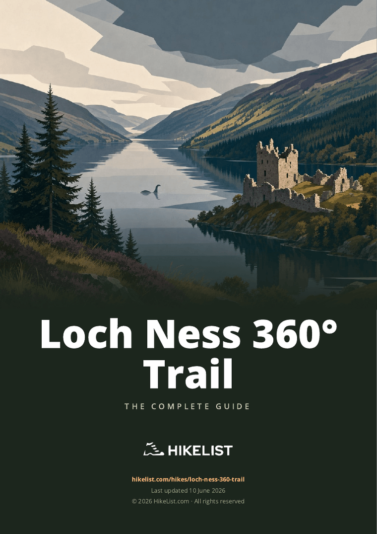
Loch Ness 360° Trail
How would you rate Loch Ness 360° Trail?
Tap a star to share your experience and help other hikers.
Loch Ness 360° Trail: A Complete Hiking Guide
HikeList Score
Loch Ness 360° Trail scored 90/100 on HikeList's trail-quality metrics.
See score breakdownHide breakdown
- Ideal length 93
- Balanced challenge 84
- Scenery & wildness 98
- Varied terrain 83
- Accommodation 92
- Food & support 81
- Path quality 98
- Season flexibility 89
Computed from length, challenge, scenery & wildness, terrain variety, accommodation, food & support, path quality and season flexibility.
The Loch Ness 360° Trail is a 129 km / 80 mile loop around Loch Ness in the Scottish Highlands, starting and finishing at Inverness Castle. The official recommendation is 6 days, with one section per day, and the route is rated hard: expect remote stretches, around 3,000 m of ascent and some rugged or boggy ground. It suits fit walkers with hillwalking experience who want a full circuit of Loch Ness using the Great Glen Way and South Loch Ness Trail. See more long-distance routes in Scotland.
Route Overview
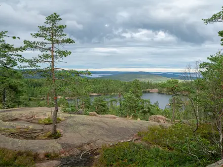
This circular trail starts and ends at Inverness Castle. Sections 1–3 follow the Great Glen Way along the north/west side of Loch Ness via Abriachan, Drumnadrochit, Urquhart Castle and Invermoriston to Fort Augustus. Sections 4–6 return on the quieter south/east side via the South Loch Ness Trail, passing Loch Tarff, the Suidhe Viewpoint, Whitebridge, Foyers, Inverfarigaig and Dores before the final return to Inverness. Waymarking changes from blue thistles on the Great Glen Way to blue red-squirrel markers on the South Loch Ness Trail. For other Scottish routes, compare the island-based Arran Coastal Way or the shorter Highland mountain route at Beinn Eighe Mountain Trail.
How the Loch Ness 360° Trail was created
The Loch Ness 360° Trail was created in August 2018 by Visit Inverness Loch Ness. It joined two existing long-distance routes: the Great Glen Way, opened in 2002, and the South Loch Ness Trail, opened in 2011. A final missing link of path completed the circuit, turning the separate north-side and south-side routes into a continuous loop around the whole of Loch Ness.
Notable highlights
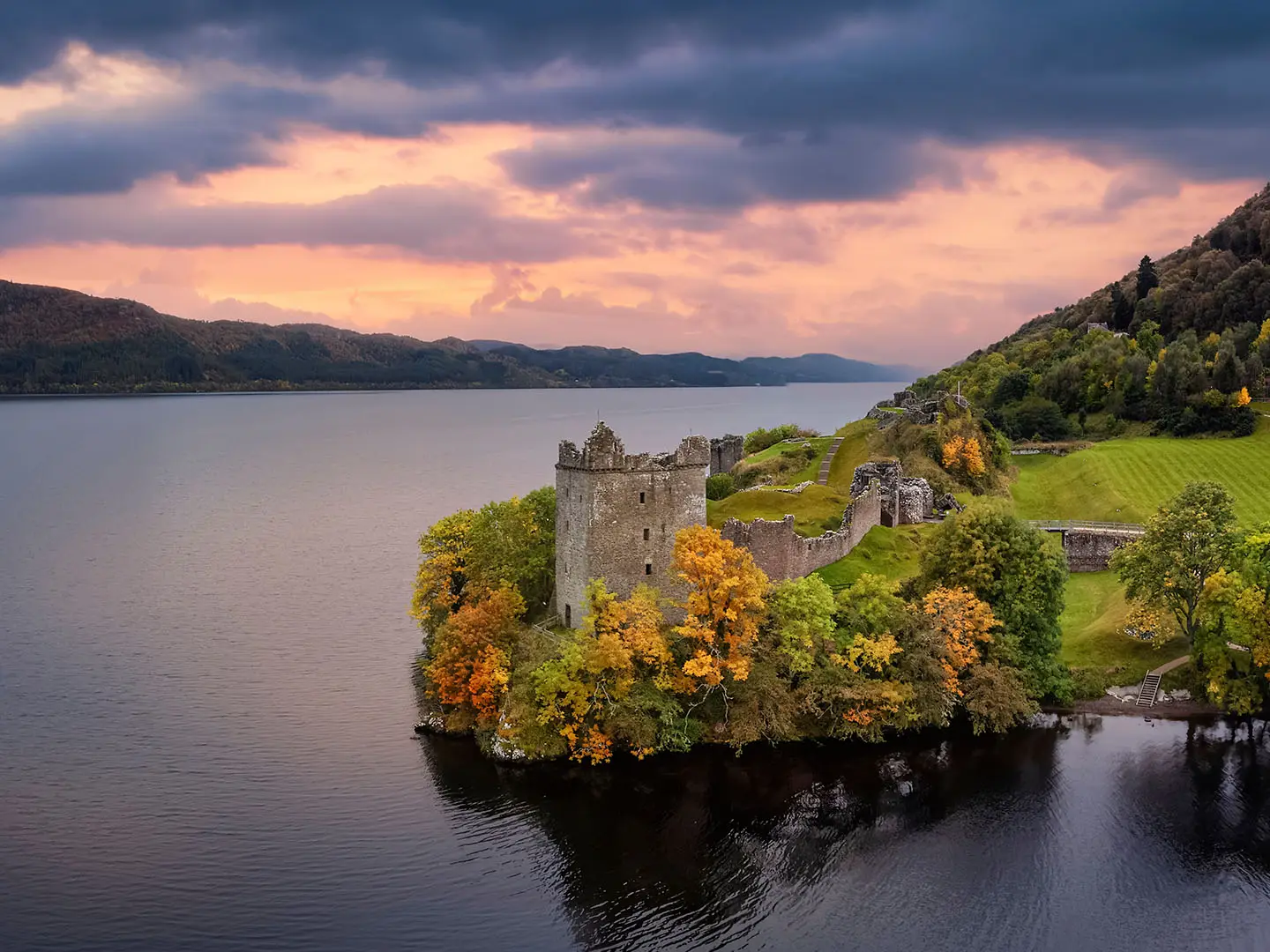
- Urquhart Castle: A ruined medieval castle on a headland near Drumnadrochit, with classic views over Loch Ness from the north/west shore.
- Fort Augustus & the Caledonian Canal: The village sits at the south-western tip of Loch Ness, where Thomas Telford’s Caledonian Canal climbs through a flight of locks.
- Suidhe Viewpoint above Loch Tarff: A high point on the South Loch Ness Trail near Carn an t-Suidhe, giving broad views over Loch Ness and the surrounding hills.
- Falls of Foyers: A wooded gorge waterfall above Foyers, long known as a Highland beauty spot and associated with Robert Burns.
- Dores Beach: A long shingle beach at the north-east end of Loch Ness, useful as a final loch-side stop before returning to Inverness.
- Inverness Castle: The red-sandstone castle above the River Ness marks the official start and finish of the route.
Challenges to expect
This is a hard 6-day walk, not just a lochside stroll. Expect forest tracks, purpose-built path, minor roads, rocky ground and occasional boggy sections, with around 3,000 m of total ascent. Visit Inverness Loch Ness advises a good level of fitness and some hillwalking experience. Mobile signal can be unreliable on remote sections, so carry a map and know how to use it. Coastal walkers might find the logistics different from routes such as the Ayrshire Coastal Path or Assynt Coastal Path.
HikeList Score
Loch Ness 360° Trail scored 90/100 on HikeList's trail-quality metrics.
See score breakdownHide breakdown
- Ideal length 93
- Balanced challenge 84
- Scenery & wildness 98
- Varied terrain 83
- Accommodation 92
- Food & support 81
- Path quality 98
- Season flexibility 89
Computed from length, challenge, scenery & wildness, terrain variety, accommodation, food & support, path quality and season flexibility.
Show more data Show less
- Forest
- Mountainous
- Moorland
- Gravel
- Dirt
- Rocky
- Hotels
- Hostels
- Campsites
- Wild Camping Spots
- Family Friendly
- Pet Friendly
- Restrooms
- Water Sources
- Campsites
Download Our Full Guide to Loch Ness 360° Trail FREE!
Get our comprehensive guide to this hike for free. Save it for later reading or print out at home.
Photos from hikers
Taken on the trail by people who've reviewed Loch Ness 360° Trail.
Loch Ness 360° Trail: The Complete Guide
 i
Image by moofushi
i
Image by moofushi The Loch Ness 360° Trail is a full circuit of Scotland’s most famous loch, starting and finishing at Inverness Castle above the River Ness. It links the Great Glen Way on the north/west shore with the South Loch Ness Trail on the quieter south/east side, creating an 80-mile Highland loop with a clear sense of journey.
The first half is generally the more established walking: forest tracks, purpose-built path, loch views and villages such as Drumnadrochit, Invermoriston and Fort Augustus. Urquhart Castle, the old Telford bridge at Invermoriston and the Caledonian Canal locks give this side plenty of structure between the climbs.
The return leg feels wilder and more committing. From Fort Augustus the trail climbs towards Loch Tarff and Carn an t-Suidhe, then continues through Whitebridge, Foyers, Inverfarigaig and Dores before returning to Inverness along the south-east side of Loch Ness.
This is not a gentle lochside stroll. The route is fully waymarked and has no scrambling, but the cumulative ascent, exposed high ground, rougher South Loch Ness sections, patchy mobile signal and limited south-side services mean it suits fit walkers with some hill-walking experience.
This guide covers the stages, day planning, accommodation, food, transport, terrain and common mistakes that matter when turning the Loch Ness 360° Trail into a workable hike.
Stage-by-Stage Guide
Stage 1: Inverness to Drumnadrochit — approx. 29 km
The opening stage leaves Inverness Castle above the River Ness and follows the Great Glen Way north-west of the city, using blue thistle waymarkers. It is a long first day, so it is worth starting early rather than treating the Inverness exit as a gentle warm-up.
The main work of the day comes on the climb over the hills above Abriachan. Expect a mix of path, forestry track and gravel estate-road walking, with the first big views down Loch Ness appearing as the route gains height.
Abriachan is the key mid-stage landmark, but Drumnadrochit is the practical target for the day. Urquhart Castle sits near Drumnadrochit on Strone Point above Loch Ness and is one of the classic north-shore viewpoints, although visiting it properly adds time and needs to fit around opening arrangements.
Carry enough food and water from Inverness for the full stage unless intermediate services have been checked before travelling. Drumnadrochit is one of the better-served overnight stops on the route, with a wider choice of accommodation than the quieter south side, but summer beds should still be booked ahead.
Stagecoach Highland buses serve Drumnadrochit, giving a useful bail-out or section-walking option. Timetables should be checked before travelling, especially if relying on an evening connection.
Navigation is straightforward in normal conditions if the Great Glen Way waymarks are followed, but do not rely on waymarks alone. Forestry sections and estate tracks can create junctions where a map or GPX track prevents unnecessary mistakes.
The main warnings on this stage are length, cumulative ascent and changeable weather once above the loch. Wet ground and forestry operations can also affect path conditions, so check for live trail diversions before setting out.
Stage 2: Drumnadrochit to Invermoriston — approx. 23 km
This stage continues along the Great Glen Way on the north-west side of Loch Ness. It is generally better graded than the South Loch Ness Trail half of the circuit, but it is still a proper Highland walking day rather than a flat lochside stroll.
The route uses a mixture of forest tracks, purpose-built path, gravel tracks and quieter lanes. Loch views are a regular feature, though the path often sits above the shore rather than directly beside the water.
Urquhart Castle and the Drumnadrochit area mark the start of the day, while Invermoriston is the clear endpoint. In the village, the route crosses the River Moriston by Thomas Telford’s early-19th-century stone bridge, one of the strongest built-landscape features on this side of the loch.
Stock up in Drumnadrochit before leaving. Do not assume reliable food or water between the two villages unless current options have been checked before travelling.
Invermoriston is smaller than Drumnadrochit and Fort Augustus, so accommodation should be arranged in advance. Stagecoach Highland buses serve Invermoriston, but services are not frequent enough to rely on without checking the current timetable.
Follow the Great Glen Way blue thistle waymarkers, with a map or downloaded route line as backup. Mobile signal can be patchy in the glen and forested ground can make it harder to relocate quickly after a missed junction.
The main planning issue is the distance combined with limited intermediate facilities. In poor weather, exposed higher sections and long forestry stretches can feel committing, so carry full waterproofs even when starting in good conditions.
Stage 3: Invermoriston to Fort Augustus — approx. 13 km
This is the shortest of the official six stages and is often the easiest day to use for recovery, laundry or resupply. It remains part of the Great Glen Way and continues to use blue thistle waymarkers.
The walking is typically on well-defined Highland paths, forestry tracks and gravel surfaces rather than technical ground. It is still undulating, but the day is more manageable than the long first stage or the high crossing after Fort Augustus.
Fort Augustus is the main highlight and the practical centrepiece of the day. At the south-western tip of Loch Ness, the Caledonian Canal drops to the loch through its famous flight of five staircase locks in the village centre.
Carry food and water from Invermoriston, but Fort Augustus is one of the best places on the trail for services and onward accommodation. It is a sensible place to restock before the quieter South Loch Ness Trail stages.
Stagecoach Highland buses serve Fort Augustus, making it a useful access point for shorter itineraries or emergency changes of plan. As always on this route, current times should be checked before travelling.
Navigation is generally simple, with established Great Glen Way signing into Fort Augustus. Avoid becoming complacent on the shorter day: forestry tracks and village approaches still need attention, especially if following a GPS file that differs slightly from current waymarking.
The key warning is not the stage itself but what follows. Fort Augustus is the last well-served stop before the more remote south/east side, so use this stage to sort food, cash, accommodation details and weather checks for the high ground ahead.
Stage 4: Fort Augustus to Foyers — approx. 26 km
This is the biggest shift in character on the Loch Ness 360° Trail. The route leaves the Great Glen Way half of the circuit and takes to the South Loch Ness Trail, marked by blue squirrel waymarkers, with rougher and more remote ground than the north-west shore.
The stage climbs from near loch level at Fort Augustus to the high ground above Loch Tarff near Carn an t-Suidhe and the Suidhe Viewpoint. The waymarked trail reaches around 433–434 m here, giving a broad panorama over Loch Ness, Loch Tarff and the surrounding Highland hills.
The terrain is varied and can include open moorland, rougher path, gravel estate road, forestry track and wetter or boggier sections. In poor weather this is one of the most exposed parts of the whole circuit, so it should be treated as a hill day rather than a village-to-village ramble.
Whitebridge is the key intermediate settlement and lies on the line of the 18th-century General Wade military road. It is a useful staging point in route terms, but do not rely on food, water or accommodation there without booking or checking in advance.
Leave Fort Augustus with enough food and water for a long and exposed day. Foyers has some accommodation, but the south/east side of Loch Ness has far fewer beds than Inverness, Drumnadrochit and Fort Augustus, so this night should be booked well ahead.
Stagecoach Highland buses serve Fort Augustus and Foyers, but south-side services are limited. This should be checked before travelling if using buses to shorten, skip or leave this stage.
Navigation needs more care than on the Great Glen Way half. Follow the blue squirrel waymarkers, but carry a map and a charged offline route line because mobile signal can be unreliable and visibility can deteriorate quickly on the high ground.
The main warnings are exposure, wind, rain, boggy going and the lack of easy escape options once committed to the upland section. In summer, midges can also be a nuisance around still, sheltered and wooded places, especially at the start and end of the day.
Stage 5: Foyers to Dores — approx. 23 km
This stage continues along the wilder south-east side of Loch Ness on the South Loch Ness Trail. It is shorter than the previous day but remains demanding because the ground is rougher than much of the Great Glen Way side.
The Falls of Foyers are the obvious highlight at the start of the stage. The wooded gorge and lower fall, about 30 m high, are worth allowing time for, especially if staying in or near Foyers the night before.
Beyond Foyers, the route continues through a mix of forest, rougher path, quiet minor road and hillier ground. Inverfarigaig is the next major named place, followed by the steep zig-zag Corkscrew road climb and the Fair-Haired Lad’s Pass, one of the more distinctive upland features of the south-east shore.
Food and water planning should be conservative. Foyers and Dores are both quieter stops with sparse accommodation and limited services compared with the north-west side, so carry what is needed for the day and check any planned resupply before setting out.
Accommodation in Dores is limited and should be booked early. Some walkers may choose to finish the day by continuing transport-wise to Inverness, but any bus plan from Dores depends on the current Stagecoach Highland timetable and should be checked before travelling.
Navigation remains on blue squirrel waymarkers. Pay particular attention at road sections, forest junctions and around the climb above Inverfarigaig, where the route changes character and tired walkers are more likely to miss a turn.
The main warnings are the steep Corkscrew climb, potentially wet or boggy sections, rougher footing and the limited public transport on this side of the loch. The stage is not technical, but it can be slow in bad weather.
Stage 6: Dores to Inverness — approx. 15 km
The final stage is shorter and returns from Dores to Inverness, completing the loop at Inverness Castle. It is still part of the South Loch Ness Trail side of the circuit, so continue to follow the blue squirrel waymarkers until the route brings you back into the city.
Dores Beach is the key opening landmark, with the classic full-length view down Loch Ness. Aldourie Castle lies just along the shore, and the day then becomes a return walk towards the Highland capital rather than a remote upland crossing.
Expect a mixture of established path, riverside or lochside approaches where the route provides them, and some quieter minor-road walking. Underfoot conditions are generally less committing than the high ground above Loch Tarff or the rougher sections around Inverfarigaig, but wet weather can still make paths muddy.
Carry food and water from Dores unless specific services have been checked before travelling. Inverness has the strongest choice of shops, food, accommodation and onward transport on the whole circuit.
Dores is served by Stagecoach Highland buses, though services are limited. Inverness has the mainline railway station, access to the Caledonian Sleeper and Inverness Airport connections, making the finish straightforward once back in the city.
Navigation into Inverness should not be difficult in clear conditions, but urban edges can be surprisingly easy places to lose a trail line. Keep following the waymarks and use a map or GPX track until the finish at Inverness Castle above the River Ness.
The final day’s main risk is underestimating it because the distance is shorter. Leave enough time for the walk into Inverness, especially if connecting with a train, sleeper service, airport transfer or pre-booked accommodation.
Recommended Itinerary
Standard 6-day itinerary
The official six-section itinerary is the best default for most walkers. It follows the loop anticlockwise from Inverness, taking the Great Glen Way first on the north/west side of Loch Ness, then returning by the rougher South Loch Ness Trail on the south/east side.
| Day | From | To | Approx. distance | Why this stage makes sense | Services/accommodation notes | |---|---|---:|---|---| | 1 | Inverness | Drumnadrochit | 29 km | A long opening day, but it gets the main climb out of Inverness and the Abriachan section done early, with the first major views over Loch Ness. Ending in Drumnadrochit makes practical sense because it is one of the better-served villages on the route. | Inverness is the easiest place for travel, supplies and pre-walk accommodation. Drumnadrochit has a stronger accommodation base than many later stops, but summer beds should still be booked ahead. | | 2 | Drumnadrochit | Invermoriston | 23 km | A full but more balanced day along the Great Glen Way side of the loch. Invermoriston is a logical overnight stop before the shorter approach to Fort Augustus. | Stagecoach Highland buses serve Drumnadrochit and Invermoriston, but timetables should be checked before travelling. Accommodation should be arranged in advance rather than left to arrival. | | 3 | Invermoriston | Fort Augustus | 13 km | The shortest day on the standard schedule, useful after two longer stages and before the high, more exposed crossing on Day 4. It also leaves time in Fort Augustus around the Caledonian Canal locks. | Fort Augustus is one of the main service points on the trail and a sensible place to restock or recover. It gets busy in the main walking season, so book ahead. | | 4 | Fort Augustus | Foyers | 26 km | This is the key mountain-style day of the circuit, climbing from Fort Augustus towards Loch Tarff and the high ground near Carn an t-Suidhe / the Suidhe Viewpoint. It is the day most affected by wind, rain, low cloud and slower going underfoot. | Foyers is on the quieter south/east side, where beds are much sparser than in Inverness, Drumnadrochit or Fort Augustus. Do not start this stage without a confirmed overnight plan. | | 5 | Foyers | Dores | 23 km | A rugged south-side stage with rougher ground, the Falls of Foyers area, Inverfarigaig, the steep Corkscrew road climb and the Fair-Haired Lad’s Pass. It keeps the final day short rather than forcing a very long push back to Inverness. | Dores is a small final-stage stop, so accommodation and onward transport need planning. South-side bus services are limited; check current Stagecoach Highland times before relying on them. | | 6 | Dores | Inverness | 15 km | A shorter final day from the north-east end of Loch Ness back to Inverness Castle. This gives a practical finish with onward rail, airport and city accommodation options. | Inverness has the strongest transport links on the route, including the mainline railway station and access to Inverness Airport. Booking an extra night in the city can make the finish less rushed. |
Slower variant: 7 days
A seven-day plan suits walkers who want more margin for weather, shorter daily effort, or time around Fort Augustus, Foyers and Dores. It is also sensible for anyone unsure about carrying a heavier pack over the higher South Loch Ness Trail sections.
The main constraint is not distance but accommodation. A true seven-walking-day split normally requires using smaller places on or near the route, arranging transfers, or building in a rest/short day at one of the better-served stops. Do not assume there will be convenient beds between the official stage ends; check official mapping and accommodation availability before booking.
The most practical slower approach is often:
- book an extra night in Inverness before starting, especially if arriving by late train, sleeper or flight;
- consider a lighter day or rest time at Fort Augustus before the high Fort Augustus–Foyers stage;
- avoid leaving Foyers, Dores or south-side accommodation to chance, as this side of the loch is the hardest part of the itinerary to adjust at short notice.
Faster variant: 5 days
A five-day itinerary is realistic only for fit, experienced walkers who are comfortable with long Highland days, variable weather and limited escape options on the south/east side. It reduces accommodation pressure by removing one overnight stop, but it also creates at least one very long day.
The two most obvious compressions are:
- Combine Days 2 and 3: Drumnadrochit to Fort Augustus via Invermoriston, approximately 36 km. This keeps the tougher south-side stages in the standard order and ends at the well-served Fort Augustus stop.
- Combine Days 5 and 6: Foyers to Inverness via Dores, approximately 38 km. This avoids an overnight in Dores, but it makes the final south-side and return section a long day after already crossing rougher ground.
A four-day crossing is best treated as a specialist fastpacking-style schedule rather than the normal walking itinerary. Daily distances become demanding, accommodation choices narrow sharply, and current mapping, weather and transport options should be checked before committing.
Planning the Route
How many days to allow
Most walkers should treat the official six-day schedule as the default plan. It follows the natural line of settlements around the loch and keeps the harder south/east side manageable without needing very long days on rougher ground.
A five-day itinerary is possible for fit walkers, but it usually means combining stages or accepting longer days where accommodation and public transport are thinner. Four days is a fast-hiking schedule rather than a standard walking itinerary. A seven-day plan is often the better choice if you want shorter days, time at Urquhart Castle, Fort Augustus or the Falls of Foyers, or more margin for poor Highland weather.
| Itinerary | Best for | Planning implications |
|---|---|---|
| 4 days | Very fit walkers moving quickly | Long days; less flexibility if weather is poor; accommodation spacing becomes more awkward |
| 5 days | Strong walkers with light packs | Requires careful stage splitting and early accommodation booking |
| 6 days | Most independent walkers | Matches the official six sections and the main overnight stops |
| 7 days | More relaxed hikers or those wanting extra time | Easier pacing, but still dependent on available beds, especially on the south/east side |
Direction and stage structure
The official six-section route is normally planned anticlockwise from Inverness Castle: Inverness to Drumnadrochit, then Invermoriston, Fort Augustus, Foyers, Dores and back to Inverness. This takes the Great Glen Way first on the north/west side, followed by the wilder South Loch Ness Trail on the south/east side.
Some organised itineraries run the loop clockwise, starting with Inverness to Dores and Foyers. Either direction works, but accommodation, baggage transfer and bus options should be checked before fixing the direction. The anticlockwise schedule has the advantage of following the official section order and leaving the rougher, more exposed south-side stages until after several days of walking.
The route is not a continuous lochside promenade. Several stages climb well above Loch Ness, especially around Abriachan and on the crossing from Fort Augustus towards Foyers via the high ground near Loch Tarff and Carn an t-Suidhe / the Suidhe Viewpoint.
Accommodation drives the itinerary
Accommodation is the main constraint on the Loch Ness 360° Trail. Inverness, Drumnadrochit and Fort Augustus have the strongest choice of hotels, guesthouses, B&Bs, hostels, bunkhouses and campsites, while Whitebridge, Foyers and Dores are much more limited.
For most walkers, the overnight stops are therefore not arbitrary. They are dictated by the villages where beds exist, by the spacing of the official sections, and by whether there is any realistic fallback transport if a plan changes.
Book the south/east side early, especially Foyers and Dores. Summer demand around Inverness and Loch Ness can be high, and a missed booking on the quieter side can force an awkward taxi or bus workaround.
Responsible wild camping is legal in Scotland, but it should not be treated as a way to avoid all planning. The south side has rougher ground, forestry, moorland and more exposed sections, so a camping itinerary still needs careful thought about water, weather, food carry and where it is appropriate to pitch under the Scottish Outdoor Access Code.
Food and water planning
Do not assume that every overnight stop has the same level of services. Inverness, Drumnadrochit and Fort Augustus are the safest places to build resupply and meal planning around; smaller places such as Whitebridge, Foyers and Dores need more caution.
Carry enough food for each day and a reserve for the quieter stages. If relying on cafés, pubs, accommodation meals or packed lunches, arrange this in advance rather than assuming availability on arrival.
Water should be planned day by day. Refill where possible at accommodation or other reliable serviced stops, and carry enough for the longer upland sections. Natural water may be present in the landscape, but it should be treated if used.
Navigation and mapping
The trail is waymarked, with Great Glen Way blue thistle markers on the north/west shore and South Loch Ness Trail blue squirrel markers on the south/east shore. Waymarking makes the route straightforward in normal conditions, but it is still a Highland long-distance walk, not a city-edge path.
Carry a map and know how to use it, particularly for the South Loch Ness Trail and the high ground near Loch Tarff and Carn an t-Suidhe. Mobile signal can be patchy, and forestry work or local diversions can affect the line of the path.
Useful OS map coverage includes Landranger 26, 34 and 35, and Explorer 55, 400, 416, 417 and 431. Current route notes, interactive mapping and any live trail diversions should be checked before travelling.
Transport and section hiking
The loop format makes overall logistics simple: start and finish at Inverness Castle, with Inverness railway station and wider onward travel close to the city centre. Inverness Airport is about 7 miles east of the city, with its own station around 10 minutes’ walk from the terminal and Stagecoach buses 11 and 27 serving the airport area.
Section hiking is practical in principle because Stagecoach Highland buses serve Drumnadrochit, Invermoriston, Fort Augustus, Foyers and Dores. In practice, the south-side services are limited, so single-day sections and bailout plans need careful timetable checks.
Do not build a tight itinerary around the assumption that a late bus will solve a missed stage. Bus times, seasonal service levels and Sunday or evening options should be checked before travelling.
Weather, exposure and timing
Spring, summer and autumn are the normal walking seasons, but conditions can still be wet, windy and cold on the higher ground. The crossing from Fort Augustus towards Foyers is the key weather-sensitive section because the route climbs from near loch level to the high ground around Loch Tarff and the Suidhe Viewpoint.
Full waterproofs, warm layers and enough spare food are sensible even in summer. The South Loch Ness Trail is rougher and can be boggy in places, so footwear should be chosen for wet Highland ground rather than only for forestry tracks.
Midges can be a nuisance from late spring to early autumn, especially in still, damp conditions. Repellent and a head net are lightweight additions that can make campsites, rest stops and evening arrivals much more comfortable.
Where flexibility is limited
The easiest places to alter plans are the larger stops: Inverness, Drumnadrochit and Fort Augustus. These have better accommodation and transport options than the smaller settlements.
Flexibility reduces sharply on the south/east side. Once committed to the Fort Augustus to Foyers and Foyers to Dores sections, walkers should have accommodation, food, water and weather plans already in place.
The route can be shortened only by leaving the loop and using transport from a served village, not by taking simple lochside shortcuts. Any plan to miss a section, split a stage differently or walk the trail over multiple weekends should be built around current Stagecoach Highland timetables and available accommodation.
Towns, Villages and Overnight Stops
Accommodation planning is straightforward on the north/west side of Loch Ness and much tighter on the south/east side. Inverness, Drumnadrochit and Fort Augustus are the best-served stops, while Whitebridge, Foyers and Dores have far fewer beds and should be booked well ahead, especially in summer.
For a six-day itinerary, the usual overnight stops are Drumnadrochit, Invermoriston, Fort Augustus, Foyers and Dores, with Inverness before and after the walk. Fit walkers compressing the trail into fewer days should check carefully that the longer stages still finish somewhere with accommodation, food and transport options.
Inverness
Inverness is the official start and finish of the Loch Ness 360° Trail, with the route beginning at Inverness Castle above the River Ness. It is the best place to spend the night before starting and after finishing, particularly if arriving by public transport or needing to buy food, gas, maps or replacement kit.
Accommodation availability is strongest here compared with the smaller lochside villages, but Inverness is busy in the main walking season. Booking ahead is still sensible, especially if the first walking day to Drumnadrochit is being kept to the official six-day schedule rather than starting late.
Transport is strongest here. Inverness has a mainline railway station with ScotRail and LNER services from Edinburgh, Glasgow, Aberdeen, Perth and direct from London, plus the Caledonian Sleeper from London. Inverness Airport is about 7 miles east; its station is around 10 minutes on foot from the terminal, and Stagecoach buses 11 and 27 also serve the airport.
Abriachan
Abriachan sits on the first section between Inverness and Drumnadrochit, after the climb out of Inverness on the Great Glen Way side of the circuit. It is useful as a landmark on the first long day rather than as a normal overnight stop.
Do not plan around Abriachan unless accommodation, food and transport have been arranged in advance. The first stage is around 29 km, so most walkers using the official itinerary continue to Drumnadrochit for the night.
The practical reason to note Abriachan is the change from city-edge walking into hillier, forested ground above Loch Ness. Carry enough food and water for the full Inverness to Drumnadrochit stage unless current services have been checked before setting off.
Drumnadrochit
Drumnadrochit is the usual first overnight stop on the official anticlockwise itinerary, reached from Inverness after roughly 29 km. It is one of the better-served villages on the trail and a key place to book accommodation on the north/west shore.
The village is also the practical base for Urquhart Castle, which sits nearby on Strone Point above Loch Ness. Walkers may want to allow time here if visiting the castle, but the next day to Invermoriston is still a full stage of around 23 km.
Stagecoach Highland buses serve Drumnadrochit, making it one of the more useful access and exit points if section-walking or needing to shorten the route. Timetables should still be checked before travelling, as rural services can change.
Invermoriston
Invermoriston is the official second overnight stop, between Drumnadrochit and Fort Augustus. The trail crosses the River Moriston here by Thomas Telford’s old stone bridge, making the village a clear staging point on the Great Glen Way half of the circuit.
Accommodation is more limited than in Inverness, Drumnadrochit or Fort Augustus, so booking ahead is important. Do not assume late availability in the main season.
Stagecoach Highland buses serve Invermoriston, which helps for section-hiking and itinerary changes. Food and opening hours should be checked before relying on them, particularly outside the busiest months.
Fort Augustus
Fort Augustus is the main service stop at the south-western end of Loch Ness and the official overnight after the shorter Invermoriston to Fort Augustus stage of around 13 km. It is one of the strongest places on the route for accommodation and resupply.
The village is also the transition point between the Great Glen Way and the South Loch Ness Trail side of the circuit. The next stage to Foyers is around 26 km and includes the high ground near Carn an t-Suidhe and the Suidhe Viewpoint, so Fort Augustus is the place to start that day properly supplied and with a full weather forecast.
The Caledonian Canal locks sit in the village centre and make Fort Augustus a natural rest point if building a slower seven-day itinerary. Stagecoach Highland buses serve Fort Augustus, but current times should be checked before making transport-dependent plans.
Whitebridge
Whitebridge is a small south-side settlement on the line of the old General Wade military road. It lies between Fort Augustus and Foyers on the quieter South Loch Ness Trail side of the loop.
It is useful as a staging landmark on the long Fort Augustus to Foyers day, but accommodation and food options are sparse compared with the north/west shore. Anyone planning to stop overnight at or near Whitebridge should arrange this well ahead and confirm exactly what is available.
Do not rely on Whitebridge as an unplanned resupply point. The south/east side of Loch Ness is the part of the trail where careful booking, carrying food and checking onward options matter most.
Foyers
Foyers is the usual fourth overnight stop on the six-day itinerary, after the demanding Fort Augustus to Foyers stage. It is one of the key accommodation points on the South Loch Ness Trail, but beds are limited and should be booked early.
The village is the practical base for the Falls of Foyers, a wooded gorge waterfall above the settlement. This is worth allowing time for, but the following stage to Dores is still around 23 km and includes rougher, wilder south/east shore walking.
Stagecoach Highland buses serve Foyers, though south-side services are limited. Timetables should be checked before travelling, especially if using Foyers as a start or finish point for a section walk.
Inverfarigaig
Inverfarigaig is a route point between Foyers and Dores on the south-east shore. It is associated with the steep zig-zag Corkscrew road climb and the Fair-Haired Lad’s Pass, so it is important for judging effort on this stage.
It is not one of the standard overnight stops in the official six-day itinerary. Accommodation, food and transport should not be assumed here; this should be checked before travelling.
For most walkers, Inverfarigaig is a place to pass through with enough food, water and daylight to complete the stage to Dores. The ground on this side is more remote and can feel much less serviced than the Great Glen Way half of the route.
Dores
Dores is the final overnight stop on the official six-day itinerary before the return to Inverness. It sits near the north-east end of Loch Ness and is known for Dores Beach, which gives the long view down the loch.
Accommodation is sparse compared with Inverness and the larger west-side villages, so this is one of the nights that needs early booking. If no suitable bed is available in Dores, do not assume that a late alternative nearby will be easy to arrange.
Stagecoach Highland buses serve Dores, but services on the south side are limited and should be checked before relying on them. The final stage from Dores to Inverness is around 15 km, so some walkers may choose to continue into Inverness if timing, daylight and fitness allow.
Inverness finish
The loop finishes back at Inverness Castle, returning from Dores along the final section of the South Loch Ness Trail. Finishing in Inverness makes onward travel much simpler than on point-to-point Highland routes, as rail, coach, airport and accommodation options are concentrated in the city.
For travel planning, allow enough time between reaching the castle and any booked train or flight. The final day is shorter than several earlier stages, but weather, fatigue, photography stops at Dores Beach and the normal delays of a long-distance finish can still make a tight connection stressful.
Getting to the Start
The Loch Ness 360° Trail starts at Inverness Castle, the red-sandstone castle above the River Ness. Because the route is a loop and finishes back at the same point, Inverness is the natural base for both arrival and departure logistics.
By train
Inverness has a mainline railway station and is the simplest public-transport gateway for the trail. ScotRail and LNER services connect Inverness with Edinburgh, Glasgow, Aberdeen, Perth and London, and the Caledonian Sleeper runs overnight from London.
From the station, continue to Inverness Castle in the city centre to begin the trail. The route leaves the city using Great Glen Way and South Loch Ness Trail waymarking, so allow a little time at the start to orientate rather than assuming the first waymark will be immediately obvious from the platform.
Train times, sleeper berths and any engineering works should be checked before travelling, especially if planning to start walking the same day.
By bus
Inverness is also the main bus hub for the Loch Ness area. Stagecoach Highland buses serve places on or near the route, including Drumnadrochit, Invermoriston, Fort Augustus, Foyers and Dores, which can be useful for section walking or for shortening an itinerary.
For reaching the start, aim for Inverness first, then make your way to Inverness Castle. Do not rely on a late or infrequent bus to reposition onto the south/east side of the loch without checking the timetable: services there are limited. This should be checked before travelling.
By car
Driving to Inverness is straightforward in logistical terms because the walk starts and finishes in the same city. That makes the Loch Ness 360° Trail easier to manage than an end-to-end route: there is no need to arrange a return transfer from a distant finish.
The main planning issue is parking. The brief does not identify a specific long-stay car park for the trail, so walkers should check current Inverness city-centre and long-stay parking options before committing to leaving a vehicle for several days. Avoid relying on short-stay, residential or hotel parking unless overnight permission is clear.
If staying in Inverness before the walk, ask the accommodation about parking before booking. Some places may be convenient for the castle and station but unsuitable for leaving a car during a six-day circuit.
From the nearest airport
Inverness Airport is about 7 miles east of the city and is the nearest airport for the Loch Ness 360° Trail. The airport has its own railway station around 10 minutes’ walk from the terminal, and Stagecoach buses 11 and 27 also serve the airport area.
On arrival, travel into Inverness and start from Inverness Castle. If arriving late in the day, it is usually more practical to stay overnight in Inverness rather than trying to begin the first stage immediately, as the standard first day to Drumnadrochit is a long stage.
Flight times, airport bus times and train connections should be checked before travelling.
Where to stay before starting
Inverness is the best place to stay before starting the trail. It has the strongest transport links on the circuit and gives the simplest access to Inverness Castle for an early start.
Accommodation in Inverness gets busy in summer, and the same applies to the loch villages once the walk is underway. Book the first night in Inverness early if travelling in the main walking season, particularly if arriving by evening train, sleeper or flight.
For the smoothest first day, choose somewhere that allows an early breakfast or a simple departure. The first official section runs from Inverness to Drumnadrochit and is one of the longer days on the route, so starting promptly is useful.
Getting Home from the Finish
The Loch Ness 360° Trail finishes where it starts: at Inverness Castle above the River Ness. This makes onward travel much simpler than on a point-to-point trail, because Inverness has the strongest transport links on the route.
By train
The nearest rail hub is Inverness railway station. From Inverness there are rail services operated by ScotRail and LNER to major Scottish cities including Edinburgh, Glasgow, Aberdeen and Perth, plus direct services to London. The Caledonian Sleeper also provides an overnight rail option to London.
If finishing late in the day, do not assume there will be a convenient same-evening train connection. Long-distance rail timings, seat reservations and sleeper berths should be checked before travelling, especially in summer and around weekends.
By bus
Inverness is the best place on the trail for bus connections, but specific onward routes and evening services are timetable-dependent. This should be checked before travelling.
Stagecoach Highland buses also serve several places around the Loch Ness 360° Trail, including Drumnadrochit, Invermoriston, Fort Augustus, Foyers and Dores. This can be useful if plans change, if a vehicle has been left elsewhere on the route, or if accommodation logistics require a return to one of the loch villages. Services on the south side of Loch Ness are limited, so do not rely on turning up without checking current times.
By car/taxi
Because the route is a loop, walkers who have left a car in Inverness return to the same city at the end of the final stage. Long-stay parking arrangements are not covered by the trail itself, so parking location, cost, restrictions and overnight permissions should be checked before leaving a vehicle.
Taxis are the simplest fallback for reaching accommodation, the railway station or Inverness Airport after finishing, particularly if the final day from Dores to Inverness runs late. Taxi availability and fares should be checked in advance during busy periods.
From the nearest airport
The nearest airport is Inverness Airport, about 7 miles east of Inverness. The airport has its own rail station, around 10 minutes’ walk from the terminal, and is also served by Stagecoach buses 11 and 27.
Flight times, airport bus times and rail connections should be checked before booking an onward journey. If finishing late, staying in Inverness and travelling to the airport the following morning is often the lower-risk option.
Where to stay at the finish
Inverness is the most practical place to stay after completing the Loch Ness 360° Trail. It has a much wider choice of hotels, guesthouses, B&Bs, hostels and other services than the smaller lochside villages.
Booking ahead is still important. Inverness and the Loch Ness area get very busy in summer, and late arrivals after the final stage are easier to manage with accommodation already reserved.
Which Direction Should You Walk?
The standard and most logical direction for the Loch Ness 360° Trail is anticlockwise from Inverness Castle, following the Great Glen Way first through Abriachan, Drumnadrochit, Invermoriston and Fort Augustus, then returning on the South Loch Ness Trail via Foyers, Dores and back to Inverness.
This is the official six-section order and the one that gives the cleanest progression for most walkers: the better-graded Great Glen Way comes first, the wilder south/east side comes after Fort Augustus, and the final day from Dores to Inverness is comparatively short.
Standard anticlockwise direction
Anticlockwise is the better default for independent walkers. It starts with the Great Glen Way half of the circuit, which is generally more established and better graded than the South Loch Ness Trail. That makes it a more forgiving way to settle into the route before the rougher, remoter and sometimes boggier south/east shore.
The scenery also builds well in this direction. The first day climbs out of Inverness towards Abriachan and opens up the first major Loch Ness views, the route then works south-west through Drumnadrochit and Invermoriston, and Fort Augustus makes a natural mid-route landmark with the Caledonian Canal locks at the head of the loch.
The hardest-feeling section for many walkers is likely to be the Fort Augustus to Foyers stage, which crosses the high ground near Loch Tarff and Carn an t-Suidhe / the Suidhe Viewpoint. In the standard direction this comes after the shorter Invermoriston to Fort Augustus day, which gives a useful lighter day before the biggest hill stage.
Accommodation flow is also a point in favour of the standard direction. Inverness, Drumnadrochit and Fort Augustus are the better-served stops, while beds are much thinner on the south/east side around Foyers and Dores. Those south-side nights still need to be booked well ahead, but walking anticlockwise means the route’s sparser accommodation comes after the more straightforward first half.
The finish is psychologically tidy too. Dores to Inverness is the final official section and is shorter than several earlier days, giving a manageable last push back to Inverness Castle rather than ending with the long Drumnadrochit to Inverness stage.
Walking clockwise
Clockwise is perfectly possible, and some itineraries use it, but it is usually the less convenient choice. It sends walkers onto the quieter South Loch Ness Trail first, with Dores and Foyers early in the trip, then crosses the high ground to Fort Augustus before finishing along the Great Glen Way.
The main advantage is that the route feels wilder sooner. You reach Dores Beach early, then move into the more remote south/east shore before joining the better-served Great Glen Way settlements later in the walk.
The trade-off is the finish. In a six-day clockwise itinerary, the final stage is the long Drumnadrochit to Inverness section over the Abriachan side, rather than the shorter Dores to Inverness day. For most walkers, that makes the end of the trail feel harder rather than smoother.
Clockwise also changes the climbing rhythm rather than removing the climbs. The high crossing near Carn an t-Suidhe, the South Loch Ness Trail’s rougher ground, the Fair-Haired Lad’s Pass and the steep Corkscrew road section around Inverfarigaig still have to be tackled; they simply come in the opposite order.
Transport, weather and practicalities
Because the Loch Ness 360° Trail is a loop from Inverness Castle, overall access is equally simple in either direction: start and finish transport is based around Inverness. Direction matters more if you need to bail out, section-walk or rely on buses between villages. Stagecoach Highland buses serve places including Drumnadrochit, Invermoriston, Fort Augustus, Foyers and Dores, but south-side services are limited, so current timetables should be checked before travelling.
Weather does not give either direction a reliable advantage. The exposed high ground above Loch Tarff and the open south-side sections can be wet, windy and cold in either direction. Plan the high crossing around the forecast where possible rather than choosing a direction based on assumed wind.
Recommendation
Walk the Loch Ness 360° Trail anticlockwise unless there is a specific accommodation or itinerary reason to do otherwise. It matches the official six-section order, starts with the more straightforward Great Glen Way, places the wildest south/east shore after a few days of walking, and gives a shorter final stage back into Inverness.
Accommodation Along the Route
The Loch Ness 360° Trail works well as an inn-to-inn walk, but only if accommodation is booked in the right places. Inverness, Drumnadrochit and Fort Augustus have the strongest choice, while the south/east side of Loch Ness is much thinner, especially around Whitebridge, Foyers and Dores.
The standard six-day itinerary uses Drumnadrochit, Invermoriston, Fort Augustus, Foyers and Dores as overnight stops between Inverness start and finish. Those stops are logical for the waymarked sections, but they are not equal in accommodation capacity: the final two nights are the ones most likely to dictate the whole itinerary.
Summer and weekends can be busy around Inverness and the loch villages. Book well ahead if walking in peak season, and do not leave Foyers or Dores to chance.
| Place | Accommodation level | Best for | Notes |
|---|---|---|---|
| Inverness | Good | Start/finish nights, spare kit, late arrivals, rest days | The easiest place on the circuit for hotels, guesthouses, B&Bs, hostels and onward transport. A night before starting is sensible if arriving by train, sleeper, bus or flight. |
| Abriachan | Limited | Possible break in the long first stage | Not a standard overnight stop for most six-day itineraries. Arrange accommodation in advance if planning to stop here rather than continuing to Drumnadrochit. |
| Drumnadrochit | Good | End of Section 1; Urquhart Castle area | One of the better-served trail villages and a practical first overnight stop after the long opening day from Inverness. Still worth booking early in summer. |
| Invermoriston | Limited | End of Section 2 | A useful official-stage overnight, but with less choice than Drumnadrochit or Fort Augustus. Book before committing to the rest of the itinerary. |
| Fort Augustus | Good | End of Section 3; resupply and recovery before the south-side crossing | A strong accommodation stop at the south-western end of Loch Ness, with a better spread of walker-friendly options than the quieter east side. Good place to reset before the longer Fort Augustus to Foyers stage. |
| Whitebridge | Limited | Possible staging point on the south side | Accommodation is sparse. It can help break up the quieter side of the loop only if a bed has been arranged in advance. |
| Foyers | Limited | End of Section 4; Falls of Foyers area | A key overnight on the official six-day route, but beds are limited. This is one of the main places to secure before booking transport or baggage arrangements. |
| Inverfarigaig | Limited | Route passage point rather than a main overnight base | Do not rely on it as an overnight solution unless accommodation has been booked specifically. The surrounding South Loch Ness Trail section is quieter and more committing. |
| Dores | Limited | End of Section 5; final night before returning to Inverness | Sparse accommodation. If nothing suitable is available, a pre-arranged transfer to Inverness and back to Dores may be the most practical workaround, but this should be checked before travelling. |
Booking strategy
Plan the accommodation from the south/east side first, not from Inverness. Secure Foyers and Dores before assuming the standard six-day schedule will work, then fit Drumnadrochit, Invermoriston and Fort Augustus around those dates.
Inverness is the easiest place to add flexibility. If travel times are awkward, book a pre-walk night in the city and start early from Inverness Castle the next morning. A post-walk night also removes pressure from the final Dores to Inverness stage.
For the north/west shore, Drumnadrochit and Fort Augustus are the most forgiving bases. Invermoriston is a smaller overnight stop, so it should still be reserved early, particularly if walking during school holidays or at weekends.
Campsites and wild camping
The route can also be planned with a mix of campsites and responsible wild camping. Scotland’s access rights make responsible wild camping possible, but it should not be treated as a substitute for poor planning: choose discreet pitches, arrive late, leave early, carry out all rubbish and avoid camping close to houses, livestock, roads or busy visitor spots.
Camping does not remove all logistical pressure. Food, showers, drying rooms and charging points are still concentrated in the larger settlements, and the South Loch Ness Trail has quieter, more exposed and sometimes boggy ground. Anyone camping should still know where the next reliable services are before leaving Fort Augustus or Foyers.
Using transfers to solve awkward gaps
Taxi or bus transfers can help if Dores, Foyers or another small stop has no suitable accommodation, but they should be arranged in advance. Stagecoach Highland buses serve Drumnadrochit, Invermoriston, Fort Augustus, Foyers and Dores, but south-side services are limited and should not be relied on without checking current timetables.
A common planning pattern is to sleep in Inverness for one of the final nights if no bed is available on the lochside, then return to the trailhead point the next morning. This only works if the transfer is dependable at the time of walking; this should be checked before travelling.
Luggage transfer can make the circuit more comfortable for inn-to-inn walkers, especially given the ascent and the longer stages. Availability, baggage limits and collection points can change, so confirm the service can cover each overnight stop before booking non-refundable accommodation.
Camping and Wild Camping
Camping is a realistic way to walk the Loch Ness 360° Trail, but it needs more planning than the map might suggest. The route circles a large loch, yet long sections run high above the water, through forestry, moorland, estate tracks and minor roads, with limited services on the south/east side.
Formal campsites and camping-friendly accommodation exist around Loch Ness, but specific availability changes seasonally and should be checked before travelling. Inverness, Drumnadrochit and Fort Augustus are the strongest places to plan around; Whitebridge, Foyers and Dores have much thinner accommodation and service provision, so do not assume a pitch or last-minute bed will be available there.
Wild camping on the route
Responsible wild camping is legal in Scotland, and the Loch Ness 360° Trail can be walked with a lightweight wild-camping setup. It is not, however, a route where every evening naturally ends beside an obvious flat lochside pitch.
The Great Glen Way half is generally more managed and passes through busier settlements, forestry and well-used trail corridors. The South Loch Ness Trail half is wilder and quieter, but also rougher, boggier in places and more exposed, especially between Fort Augustus and Foyers over the high ground near Loch Tarff and the Suidhe Viewpoint.
Wild camping is most practical for walkers who are comfortable carrying a full pack over 23–29 km days and who can be self-sufficient if weather, midges or a poor pitch location make the evening difficult. If using a relaxed seven-day itinerary, camping becomes easier because the longer official stages can be split more sensibly.
Camping practicality by section
| Section | Camping notes |
|---|---|
| Inverness to Drumnadrochit | A long first day from the city through the Abriachan area. Plan the night at Drumnadrochit or arrange a legal, low-impact pitch well away from houses, roads and busy path sections. |
| Drumnadrochit to Invermoriston | Generally more straightforward walking on the Great Glen Way side, with settlement at each end. Check formal camping or accommodation in advance rather than relying on arrival without a booking. |
| Invermoriston to Fort Augustus | The shortest official day, which makes Fort Augustus a useful resupply and overnight planning point before the more remote south/east side. |
| Fort Augustus to Foyers | One of the more committing camping stages. The trail climbs from Fort Augustus towards Loch Tarff and the high ground near Carn an t-Suidhe / the Suidhe Viewpoint, where weather exposure matters. Avoid planning to camp on exposed high ground unless conditions are settled. |
| Foyers to Dores | Quieter South Loch Ness Trail terrain, with rougher and occasionally boggy sections. Services are limited, so carry enough food and water capacity for the full day and have a realistic overnight plan before setting off. |
| Dores to Inverness | A shorter final stage into Inverness. Most walkers will not need to camp here; use Inverness accommodation or onward transport instead of looking for a marginal pitch near the city fringe. |
Water and resupply for campers
Do not treat Loch Ness as a guaranteed drinking-water solution. The route often runs above the shore, and safe access to water is not always convenient from the path.
Carry enough water for exposed or high sections, especially between Fort Augustus and Foyers and across the quieter south/east side. Any water taken from burns, lochs or rivers should be treated before drinking.
Inverness, Drumnadrochit and Fort Augustus are the best places to plan food resupply. On the south/east side, services are much more limited around Whitebridge, Foyers and Dores, so campers should not depend on finding supplies late in the day.
Leave No Trace and local restrictions
Keep wild camps small, discreet and for one night only. Pitch late, leave early, and choose durable ground away from houses, gardens, livestock, roads, forestry operations and obvious visitor sites such as Urquhart Castle, the Falls of Foyers, Dores Beach and the Caledonian Canal locks at Fort Augustus.
Use a stove rather than an open fire. Forestry, moorland and dry grassy ground are poor places for fires, and fire risk can change quickly in warm or windy weather.
Pack out all rubbish, food waste and hygiene products. Human waste should be dealt with well away from watercourses, paths and buildings; in busy or unsuitable areas, carry it out where necessary.
Seasonal midges can be a serious nuisance from late spring to early autumn, particularly in still, damp conditions. A head net, insect repellent and a tent with reliable mesh make camping far more tolerable.
Before relying on a wild-camping plan, check current trail information for forestry work, diversions and local land-management notices. This is particularly important on the South Loch Ness Trail, where accommodation is sparse and changing the plan at short notice can be difficult.
Food, Water and Resupply
Food planning on the Loch Ness 360° Trail is straightforward on the busier north/west side and more restrictive on the quieter south/east side. Inverness and Fort Augustus are the safest places to stock up properly, with Drumnadrochit also a key resupply stop; beyond these, opening hours and availability should be checked before travelling.
Do not plan this route as a café-to-café walk. Several stages are long, and the South Loch Ness Trail side in particular has sparse services through Whitebridge, Foyers, Inverfarigaig and Dores. Carry lunch, snacks and an emergency meal on every stage, especially if walking outside the main summer season or on Sundays.
Food resupply strategy
Start with enough food for the first long day from Inverness to Drumnadrochit. Inverness is the obvious place to buy gas-compatible camping food, trail snacks and any specialist supplies before starting the loop.
On a standard six-day itinerary, the practical resupply points are the overnight stops rather than the trail between them. Fort Augustus is the most important midpoint resupply before the wilder south/east shore, where food options are much thinner and rural hours can be short or seasonal.
Accommodation with meals can make the route much easier, but do not assume every overnight stop has evening food available. Where staying in smaller places such as Whitebridge, Foyers or Dores, book meals ahead or carry a backup dinner.
Water planning
Potable water should be taken from accommodation, cafés, pubs or other established services where available. There are no guaranteed public taps listed for the route, so each stage should be started with enough water to complete it comfortably.
As a working minimum, most walkers should leave each morning with at least 1.5–2 litres, more in warm weather, if camping, or on the exposed Fort Augustus to Foyers stage over the high ground near Carn an t-Suidhe / the Suidhe Viewpoint. The long Inverness to Drumnadrochit and Fort Augustus to Foyers days are the stages where running short would be most inconvenient.
Natural water is present in the landscape — the route follows Loch Ness, crosses rivers such as the River Ness and River Moriston, and passes upland lochs around Loch Tarff — but it should not be treated as automatically safe to drink. If relying on natural sources, carry a proper filter, purification tablets or another reliable treatment method, and avoid water close to settlements, roads, livestock or forestry operations.
Section-by-section food and water notes
| Section | Food availability | Water availability | Notes |
|---|---|---|---|
| Inverness to Drumnadrochit | Best stocked at Inverness before leaving; Drumnadrochit is the next key stop. Do not rely on intermediate food. | Fill up in Inverness and refill at accommodation or open services in Drumnadrochit. | Long first day, so carry lunch and snacks from the start. Check opening hours in Drumnadrochit if arriving late. |
| Drumnadrochit to Invermoriston | Food is mainly at the start and end of the stage. | Start with a full day’s water; refill only where services are open in Invermoriston. | Carry lunch from Drumnadrochit. Treat this as a self-sufficient walking day between villages. |
| Invermoriston to Fort Augustus | Shorter stage, with food planning centred on Invermoriston and Fort Augustus. | Fill before leaving Invermoriston; Fort Augustus is the next reliable place to refill. | Fort Augustus is a major resupply point before the quieter south/east side of Loch Ness. |
| Fort Augustus to Foyers | Stock up in Fort Augustus. Food beyond this is limited; Whitebridge is a small settlement and availability should be checked before travelling. | Carry enough water for the high, exposed crossing above Loch Tarff. Natural sources may be present but should be filtered or treated. | One of the most important self-sufficiency days on the trail. Carry lunch, high-energy snacks and a backup meal if overnight arrangements are uncertain. |
| Foyers to Dores | Limited rural availability through Foyers, Inverfarigaig and Dores; check meals and opening times in advance. | Start full from Foyers. Refill opportunities depend on open services; natural water should be treated. | Do not assume food will be available during the day. Sundays and shoulder-season dates need particular care. |
| Dores to Inverness | Limited before returning to Inverness. Inverness has the widest choice at the end of the loop. | Fill in Dores before leaving; Inverness is the next obvious refill point. | Shorter final day, but still carry enough food and water to reach the city without relying on intermediate services. |
Practical tips
- Carry the next day’s lunch before leaving each overnight stop unless a specific open food stop has been arranged.
- Check rural opening hours before travelling, especially on Sundays, public holidays and outside summer.
- If camping, carry an extra evening meal and breakfast through the south/east side, where shops and evening food are less dependable.
- Keep a reserve snack supply separate from the day’s lunch; the route has long climbs, exposed ground and patchy mobile signal in places.
- Refill water whenever a safe opportunity appears, but avoid overloading unnecessarily on the shorter Invermoriston to Fort Augustus and Dores to Inverness stages.
Terrain, Conditions and Difficulty in Practice
The Loch Ness 360° Trail is hard because of cumulative effort, Highland weather and the rougher south-side terrain, not because it is technically difficult. There is no scrambling and the route is waymarked throughout, but it is still a long circuit with around 3,000-3,400 m of ascent and several remote-feeling sections where wet ground, wind and limited phone signal can make a straightforward day feel much tougher.
Underfoot, expect a mix of forest tracks, purpose-built path, gravel estate roads, open moorland, riverside path and stretches of quiet minor road. The Great Glen Way half from Inverness to Fort Augustus is generally the more graded and predictable side of the loop; the South Loch Ness Trail from Fort Augustus back towards Inverness is wilder, rougher and more exposed in places.
North/west shore: Great Glen Way terrain
The Inverness to Fort Augustus half uses the Great Glen Way, marked with blue thistle waymarkers. This side is usually the easier half to move efficiently on, with more well-formed track and path, although it still has meaningful climbing rather than being a flat lochside walk.
The first day out of Inverness includes the climb over the hills above Abriachan, which is one of the early reminders that this route sits above Loch Ness as much as beside it. Expect forested ground, tracks and higher-level views rather than continuous shoreline walking.
Between Drumnadrochit, Invermoriston and Fort Augustus the walking remains non-technical, but the repeated rises and descents add up. The shorter Invermoriston to Fort Augustus stage can feel easier on paper, but it should not be treated as a rest-day stroll if weather is poor or carrying a full pack.
South/east shore: rougher and more committing
The South Loch Ness Trail half, marked with blue squirrel waymarkers, is the more rugged side of the circuit. It includes rougher, rockier and occasionally boggy sections, plus more open ground where wind, rain and low cloud have a bigger effect on pace and comfort.
The Fort Augustus to Foyers section is usually the most committing day in terrain terms. The route climbs from near loch level towards the high ground around Loch Tarff and Carn an t-Suidhe / the Suidhe Viewpoint, reaching roughly 433-434 m on the waymarked trail. This is not a mountain traverse, but it is high enough to feel exposed in bad weather.
Beyond Foyers, the south-east shore continues to demand attention. The section through Inverfarigaig includes the steep Corkscrew road climb and the Fair-Haired Lad's Pass, so even where the surface is road or track, the gradient can be the main difficulty.
Surfaces and road walking
This is not a single-surface trail. Footwear needs to cope with firm gravel, forest track, wet path, rocky ground and sections of tarmac.
The quiet minor-road sections are part of the character of the route rather than an occasional interruption. They can make navigation and pace easier, but they also add hard-surface impact over a multi-day itinerary, especially on longer stages such as Inverness to Drumnadrochit and Fort Augustus to Foyers.
Boggy ground is most relevant on the South Loch Ness Trail side and after rain. Waterproof footwear and gaiters can be useful, but the more important point is to allow slower timings rather than planning every day from map distance alone.
Climbs, descents and exposure
The overall ascent is substantial for a loch circuit. Treat the route as a Highland hill-walking journey broken into long-distance stages, not as a low-level lakeside path.
The biggest height gain is on the Fort Augustus to Foyers section, climbing towards the high point near Carn an t-Suidhe / Suidhe Viewpoint. In clear conditions this section gives some of the widest views of the route; in poor conditions it is also where navigation, warmth and waterproofing matter most.
Steepness is not confined to the high point. The climb above Abriachan and the Corkscrew road climb above Inverfarigaig both affect the feel of their respective days, particularly with a heavy pack.
How conditions change by season
Spring, summer and autumn are the normal walking seasons for this trail. In all three, full waterproofs are essential: the route crosses exposed Highland ground and wet weather can arrive quickly, especially away from the villages.
After sustained rain, expect mud and wetter going on rougher south-side sections. This can slow progress more than the gradient suggests and makes poles useful for balance on slippery descents or uneven ground.
Summer brings the longest daylight and the busiest accommodation period, but also the main midge season, roughly late spring to early autumn. Midges are not a terrain problem, but they can make breaks and camping uncomfortable in still, damp conditions.
Autumn can be an excellent walking season, but shorter daylight makes the longer stages less forgiving. Any live forestry work or trail diversions should be checked before travelling, as diversions can change both distance and underfoot conditions.
Difficulty in practice
Fit walkers with some hill-walking experience should find the Loch Ness 360° Trail very achievable. The waymarking and village-to-village structure make it more accessible than many remote Highland routes.
The difficulty rises quickly if combining long stages with a full camping load, poor weather or limited accommodation choices on the south/east side. The route also becomes harder if compressed into four or five days, because the ascent and rougher ground leave less margin for slow sections.
The main hazards are fatigue, wet and boggy going, exposed high ground, road-walking impact and over-reliance on phone navigation where signal is patchy. Carry a map, keep waterproof layers accessible, and plan daily timings around terrain and weather rather than distance alone.
Weather and Best Time to Walk
The Loch Ness 360° Trail is best planned for spring, summer or autumn. It is a Highland route rather than a low-level lochside promenade: weather can affect pace, navigation, comfort and safety, especially on the South Loch Ness Trail and the high ground near Carn an t-Suidhe / the Suidhe Viewpoint.
Late spring and early autumn often give the best balance for fit walkers: generally more usable daylight than winter, less pressure on accommodation than high summer, and fewer issues with heat and midges than the warmest part of the season. Summer remains popular, but Inverness and the loch villages get very busy, so accommodation should be booked well ahead.
Seasonal considerations
| Season | What to expect | Planning advice |
|---|---|---|
| Spring | A good walking season, but the route can still be wet underfoot and exposed sections may feel cold in wind and rain. | Carry full waterproofs and warm layers. Do not assume waymarking removes the need for a map, particularly in poor visibility. |
| Summer | Longest and busiest walking season, with high demand for beds in Inverness, Drumnadrochit, Fort Augustus and the smaller south-side stops. Midges are a practical issue from roughly late spring to early autumn. | Book accommodation early, especially at Whitebridge, Foyers and Dores where options are sparse. Carry midge repellent or a head net if sensitive to bites. |
| Autumn | Often a strong choice for experienced walkers, but days shorten and wet ground can slow progress, particularly on rougher south/east-side sections. | Start early on longer stages such as Inverness to Drumnadrochit and Fort Augustus to Foyers. Build in enough daylight for navigation, breaks and delays. |
| Winter | Outside the normal recommended walking season for this route. Short daylight, cold conditions, high wind, snow or ice on higher ground, and poor visibility can turn a waymarked trail into a much more serious undertaking. | Only suitable for walkers with winter hill-walking judgement and appropriate equipment. Transport, accommodation and any route diversions should be checked before travelling. |
Weather exposure on the route
The north/west side on the Great Glen Way is generally better graded, but it still climbs away from Inverness through Abriachan and remains exposed enough for wind and rain to matter. Waterproofs should be carried even when the forecast looks settled.
The south/east side is the more committing half of the circuit. Between Fort Augustus, Whitebridge, Foyers, Inverfarigaig and Dores there are rougher, rockier and occasionally boggy sections, plus more remote ground with patchy mobile signal. Wet weather can make this half slower than the map distance suggests.
The most weather-sensitive section is the crossing from Fort Augustus towards Foyers, where the trail rises from near loch level to the high ground above Loch Tarff near Carn an t-Suidhe / the Suidhe Viewpoint. In low cloud, strong wind or heavy rain, this exposed section needs extra care and enough time in hand.
Ground conditions and kit
Expect a mix of forest track, purpose-built path, gravel estate road, riverside path, minor road, open moorland and boggier Highland ground. After prolonged rain, the South Loch Ness Trail can be wet underfoot, so waterproof boots or robust trail shoes with good grip are more appropriate than lightweight urban footwear.
Essential weather kit includes full waterproofs, warm layers, gloves or a hat in cooler conditions, a map, and a way to navigate if visibility deteriorates. Waymarking is helpful, but it should not be the only navigation plan on the higher and more remote sections.
Accommodation and seasonal pressure
Summer is the hardest period for last-minute accommodation. Inverness, Drumnadrochit and Fort Augustus have more options, but the south/east side is much thinner, particularly around Whitebridge, Foyers and Dores.
For a six-day itinerary, those south-side nights should be arranged before committing to travel dates. If walking in the shoulder seasons, check that accommodation, food options, buses and any luggage-transfer arrangements are operating on the dates needed.
Safety Notes
The Loch Ness 360° Trail is waymarked and non-technical, but it is still a Highland long-distance route with remote ground, long days and significant ascent. Treat it as a hill-walking route rather than a simple lochside path, especially on the South Loch Ness Trail between Fort Augustus, Foyers, Inverfarigaig and Dores.
Emergency help and mobile signal
In an emergency in the UK, call 999 or 112 and ask for Police, then Mountain Rescue if the incident is on the hill or a remote section of trail. Give the clearest location possible: nearby village, trail section, grid reference, landmark or last waymarker passed.
Mobile signal can be patchy on remote and higher sections, particularly away from the main villages and on the south/east side of Loch Ness. Do not rely on a phone alone for navigation or emergency communication. Carry a charged phone, power bank, offline mapping and a paper map; the LDWA lists OS Landranger 26, 34 and 35, and OS Explorer 55, 400, 416, 417 and 431 for the route.
Weather and exposure
Weather can change quickly around Loch Ness and on the higher ground. The crossing from Fort Augustus towards Foyers climbs from near loch level to the trail’s high point around Carn an t-Suidhe / the Suidhe Viewpoint above Loch Tarff, where wind, rain and poor visibility can make progress slower and colder than expected.
Carry full waterproofs, warm layers, gloves or a hat outside the warmest months, and enough food to keep moving if a stage takes longer than planned. Even in summer, wet clothing and wind on exposed ground can lead to rapid cooling. In hot spells, the long climbs and open sections can also be demanding, so start early, carry enough water and manage pace carefully.
Navigation and waymarking
The route uses Great Glen Way blue thistle waymarkers on the north/west shore and South Loch Ness Trail blue squirrel waymarkers on the south/east shore. Waymarking is helpful, but it should not replace map-and-compass competence or offline navigation.
Forestry operations, fallen trees, path repairs or temporary diversions can affect Highland trails. Check the official Loch Ness 360° Trail information, the Great Glen Way information and any local diversion notices before setting off each day. This should be checked before travelling.
Remote sections and daily planning
The most committing walking is generally on the quieter south/east side, where services, accommodation and public transport are thinner than around Inverness, Drumnadrochit and Fort Augustus. The Fort Augustus to Foyers and Foyers to Dores stages should be planned carefully, with confirmed accommodation, realistic timings and enough food and water for the day.
Stagecoach Highland buses serve places including Drumnadrochit, Invermoriston, Fort Augustus, Foyers and Dores, but south-side services are limited. Do not assume there will be a convenient bail-out option late in the day. Current timetables should be checked before travelling.
Road walking and traffic
The trail includes stretches of quiet minor road, including the steep Corkscrew road climb above Inverfarigaig and road sections around the smaller south-side settlements. Walk facing oncoming traffic where there is no pavement, take extra care on bends and crests, and use high-visibility clothing or a light in poor visibility.
Road sections can feel low-risk after rougher hill ground, but tired walkers are more likely to make mistakes. Keep to the verge where possible and avoid walking two abreast on narrow lanes.
Wet, rough and boggy ground
The Great Glen Way half is generally better graded, while the South Loch Ness Trail is wilder, with rougher, rockier and occasionally boggy sections. Waterproof footwear with good grip is strongly recommended, and trekking poles can help on slippery ground or long descents.
After heavy rain, boggy sections and forest tracks may be slower than the map distance suggests. Build spare time into the day rather than planning tight onward transport or late check-ins.
Water, rivers, loch edges and waterfalls
The route passes Loch Ness, the River Ness, the River Moriston, the Caledonian Canal and the Falls of Foyers area. Take care on wet rocks, steep banks, bridge approaches and viewpoints, especially after rain or in icy conditions.
Do not rely on untreated surface water unless carrying a suitable filter or purification method. Villages and accommodation stops are the safer places to refill, but availability can vary, so leave each morning with enough water for the full stage.
Livestock, dogs and rural access
The trail passes through rural Highland ground, estate tracks and open country where livestock may be encountered. Keep dogs under close control, give animals space and follow any local signage around fields, gates and working land.
Leave gates as found and avoid disturbing farm or estate operations. During the warmer months, midges can be a significant nuisance, particularly in still, damp conditions, so carry repellent and consider a head net if camping or stopping for long breaks.
Solo hiking
Solo walkers should leave a simple route plan with someone reliable, including the day’s start, intended finish and accommodation. Check in at the end of each stage where signal allows.
Because the route is a loop with some remote sections, turning back can be as hard as continuing once committed to the high or south-side ground. If weather, injury or timing is deteriorating, make the decision early while there are still practical options.
Before setting off each day
Check the following before leaving accommodation or camp:
- Weather forecast for Loch Ness, Fort Augustus, Foyers and the higher ground around Carn an t-Suidhe / Loch Tarff where relevant.
- Any live trail diversions, forestry notices or path closures.
- Distance, ascent and expected time for the day’s stage.
- Food and water carried for the whole day, not just to the next village.
- Phone charge, power bank, offline maps and paper map access.
- Accommodation check-in arrangements and any transport fallback.
- Waterproofs, warm layers and visibility gear for road sections.
- Midge protection in late spring, summer and early autumn.
Gear Recommendations
The Loch Ness 360° Trail is not a technical mountain route, but it is a six-day Highland circuit with long stages, repeated ascent, wet ground and exposed sections. Gear should be chosen for reliable all-day walking rather than for a short lochside path.
Footwear
Sturdy walking footwear is strongly recommended. The Great Glen Way half is generally well-graded, but the South Loch Ness Trail has rougher, rockier and occasionally boggy ground, especially on the quieter south/east side of the loch.
Waterproof walking boots are the safest choice for most walkers, particularly in spring and autumn or after wet weather. Lightweight trail shoes can work for experienced hikers in settled conditions, but they need good grip and enough support for long days with a pack.
Gaiters are worth considering if the forecast is wet or if walking the South Loch Ness Trail after prolonged rain. They are most useful on the boggier and rougher sections rather than on the better-made tracks north of the loch.
Waterproofs and warm layers
Carry full waterproofs: jacket and trousers. The trail climbs to exposed high ground near Carn an t-Suidhe / the Suidhe Viewpoint above Loch Tarff, and the weather can feel very different there from Inverness, Drumnadrochit or Fort Augustus.
A warm mid-layer should be packed even in summer. A lightweight hat and gloves are sensible for the high sections, early starts and windy weather, especially on the Fort Augustus to Foyers stage.
Avoid relying on a single softshell or showerproof jacket. The route has enough remote ground and patchy mobile signal that getting wet and cold can become a real problem.
Navigation and power
The Loch Ness 360° Trail is waymarked, using Great Glen Way blue thistle waymarkers on the north/west shore and South Loch Ness Trail blue squirrel waymarkers on the south/east shore. Waymarking reduces navigation difficulty, but it should not be the only system carried.
Carry a paper map and know how to use it. The LDWA lists OS Landranger 26, 34 and 35, and OS Explorer 55, 400, 416, 417 and 431 for the route. A compass is also sensible, particularly for the higher and more open sections.
Download offline mapping before leaving Inverness, as mobile signal can be patchy on remote high ground. A power bank is strongly recommended if using a phone for mapping, accommodation details, bus times or emergency contact.
Water and food carry
Do not plan this walk as if there will be regular services throughout the day. Inverness, Drumnadrochit and Fort Augustus are the best-served places, while the south/east side through Whitebridge, Foyers, Inverfarigaig and Dores is quieter and needs more careful planning.
Carry enough water for a full day between reliable stops, especially on the Fort Augustus to Foyers and Foyers to Dores stages. In warm weather, or if walking with a heavier pack, take more than usual.
Food should be planned stage by stage. Packed lunches and emergency snacks are important on the longer days, particularly Inverness to Drumnadrochit, Fort Augustus to Foyers and Foyers to Dores. Opening times and food availability should be checked before travelling.
Trekking poles
Trekking poles are useful on this route rather than essential. They help with the cumulative ascent, long descents and rougher ground on the South Loch Ness Trail.
They are especially useful for the high-level ground above Loch Tarff, the steep Corkscrew road climb above Inverfarigaig and the Fair-Haired Lad's Pass. Poles also help reduce strain over a six-day itinerary when carrying accommodation-to-accommodation luggage or camping gear.
Insect and sun protection
Midges can be a problem from roughly late spring to early autumn. Pack repellent, and consider a head net if camping, walking in still damp conditions or spending time around woodland and lochside areas.
Sun protection still matters in the Highlands. The trail includes exposed forestry tracks, open moorland and high ground, so sunglasses, sunscreen and a cap or brimmed hat are sensible in settled weather.
Camping gear
Camping is relevant on this route, with campsites and responsible wild camping available in Scotland. Campers should keep kit robust enough for wet, windy Highland conditions rather than choosing the lightest possible fair-weather setup.
A waterproof tent, warm sleeping system and reliable stove setup are important if staying away from village services. Water treatment is sensible for wild camping, along with bags for carrying out rubbish and any supplies needed between resupply points.
Campers should be particularly careful with pack weight. The ascent is sustained across the full circuit, and the rougher south/east side feels harder with a heavy load.
Gear by walking style
| Walking style | Route-specific gear priorities |
|---|---|
| Inn-to-inn hikers | Comfortable waterproof footwear, full waterproofs, warm layer, offline mapping, paper map, power bank, full-day food and water carry on quieter stages. |
| Campers | All inn-to-inn essentials plus wet-weather tent, warm sleeping kit, stove, water treatment, midge protection and careful food planning for the sparse south/east side. |
| Fast or section hikers | Lightweight waterproofs, grippy footwear, offline navigation, power bank, compact warm layer and enough food/water to avoid depending on limited mid-stage services. Check bus times before relying on transport back to Inverness or between villages. |
Budget and Costs
The Loch Ness 360° Trail is not an expensive route in terms of logistics: it starts and finishes in Inverness, so there is no end-to-end transfer to arrange. The main costs are accommodation, food, travel to Inverness, and any taxis or baggage support used to make the quieter south/east side work.
Prices around Inverness, Drumnadrochit and Fort Augustus can rise sharply in summer, and accommodation is sparse around Whitebridge, Foyers and Dores. Treat the figures below as planning allowances only and check current prices before booking.
Typical six-day budget
Indicative costs below exclude travel to and from Inverness.
| Style | What it usually means on this trail | Indicative total for 6 days |
|---|---|---|
| Budget | Responsible wild camping and/or campsites where available, supermarket food, minimal taxis, carrying your own kit | £250–£500 |
| Mid-range | Hostels, bunkhouses, B&Bs or modest guesthouses where available, café/pub meals mixed with packed lunches, occasional local transport | £650–£1,100 |
| Comfortable | Private rooms throughout, more pub/restaurant meals, baggage transfer where available, taxi back-up for awkward accommodation gaps | £1,100–£1,800+ |
The lower end becomes harder if you need indoor accommodation every night, especially on the south/east side of Loch Ness. The upper end can rise quickly if late booking leaves only higher-priced rooms or if taxis are needed to reach off-route accommodation.
Accommodation
Inverness, Drumnadrochit and Fort Augustus have the best range of accommodation, including hotels, guesthouses, B&Bs, hostels and bunkhouses. These are also busy visitor centres, so summer prices and availability should be checked well in advance.
Whitebridge, Foyers and Dores have fewer beds. These nights are the ones most likely to shape the budget, because limited availability can force a more expensive room, a taxi transfer, or a change to the itinerary.
Camping keeps costs down, and responsible wild camping is legal in Scotland when done properly. Campsite opening dates, facilities and prices vary, so check current details before relying on them, especially outside the main season.
Food and drink
A practical food budget is roughly:
| Food style | Indicative daily allowance |
|---|---|
| Mostly self-catered, packed lunches and simple evening meals | £15–£30 per day |
| Mix of shops, cafés and pub meals | £30–£60 per day |
| Regular restaurant/pub meals and drinks | £60+ per day |
Do not assume there will be frequent shops or cafés between stage ends. Inverness, Drumnadrochit and Fort Augustus are the strongest resupply points; the south/east side is quieter, so carry lunch, snacks and enough water for the day.
Transport to and from Inverness
The loop format is a major cost advantage: you start and finish at Inverness Castle, so there is no need to pay for transport back to the start. Inverness has mainline rail services, including ScotRail and LNER connections from Edinburgh, Glasgow, Aberdeen, Perth and London, plus the Caledonian Sleeper from London.
Inverness Airport is about 7 miles east of the city, with its own station about 10 minutes’ walk from the terminal and Stagecoach buses 11 and 27 serving the airport. Rail, sleeper and flight prices vary heavily by date and advance booking, so check current fares before committing to accommodation.
Local buses and taxis
Stagecoach Highland buses serve places including Drumnadrochit, Invermoriston, Fort Augustus, Foyers and Dores, but services on the south side are limited. Use buses for planned access, rest days or bail-out options only after checking the current timetable.
Taxis can be useful if accommodation is away from the trail, if a bus connection does not work, or if weather or injury forces a shorter day. On the quieter south/east side, taxis may need to come from larger settlements, so agree the fare in advance and do not assume short-notice availability.
Baggage transfer and packages
Baggage transfer can make the 129 km circuit easier, particularly because the route includes around 3,000–3,400 m of ascent and rougher South Loch Ness Trail sections. Availability, coverage and current prices should be checked before booking, especially for nights around Whitebridge, Foyers and Dores.
Self-guided or guided walking packages may suit hikers who want accommodation and luggage logistics arranged together. Compare what is included carefully: number of nights, meals, baggage transfer, route notes, emergency support and any transport to off-route accommodation can make a large difference to the final cost.
Extra costs to allow for
Allow a contingency for paid attractions, laundry, drying wet kit, replacement food, café stops and short taxi journeys. If visiting Urquhart Castle near Drumnadrochit, add the current Historic Environment Scotland admission price.
A sensible reserve is particularly useful on this route because accommodation gaps, limited south-side buses and Highland weather can turn a cheap plan into a more expensive one at short notice.
Luggage Transfer, Guided Tours and Support Services
Luggage transfer
Luggage transfer is useful on the Loch Ness 360° Trail because several stages are long, hilly and exposed, and the south/east side of the loch is quieter than the Great Glen Way half. Walking with only a daypack is especially helpful on the Fort Augustus to Foyers section, which climbs onto high ground near Carn an t-Suidhe / the Suidhe Viewpoint, and on the rougher South Loch Ness Trail sections between Foyers, Inverfarigaig and Dores.
Do not assume door-to-door baggage transfer is available at every overnight stop without checking first. Inverness, Drumnadrochit and Fort Augustus are well served, but accommodation is sparser around Whitebridge, Foyers and Dores, so luggage logistics should be agreed before committing to a booking.
If using luggage transfer, confirm:
- whether the service covers every overnight stop on the chosen itinerary;
- the maximum bag weight and number of bags allowed;
- whether hostels, bunkhouses, campsites or remote B&Bs can receive bags;
- the daily collection and delivery times;
- what happens if a property is not staffed during the day;
- whether clockwise and anticlockwise itineraries are both supported.
Prices and seasonal availability vary, so current costs should be checked when booking. Summer dates can be busy around Inverness, Drumnadrochit, Fort Augustus and the loch villages, so baggage transfer is best arranged at the same time as accommodation rather than added later.
Self-guided walking packages
Self-guided packages suit walkers who want the route, accommodation and luggage transfers organised, but still want to walk independently each day. These packages typically bundle overnight stays, route notes or GPX files, baggage movement and local support contact details, though the exact inclusions vary by company.
They are most useful for hikers who do not want to spend time coordinating the thinner south-side logistics. The key points to check are whether the itinerary follows the official six-section version, compresses the trail into fewer days, or adds rest days or shorter splits.
A six-day itinerary matches the official sectioning, but fit walkers sometimes use five days and some guided or packaged itineraries compress the route further. Shorter itineraries reduce accommodation nights, but they also create longer walking days on ground that can be wet, rough or exposed.
Guided walking options
A fully guided walk is not essential for navigation on the Loch Ness 360° Trail because the route is waymarked, using Great Glen Way blue thistle waymarkers on the north/west shore and South Loch Ness Trail blue squirrel waymarkers on the south/east shore. However, a guide can be useful for groups, first-time Highland walkers, or anyone who wants support with pacing, poor-weather decisions and the more remote south-side sections.
Guided options may use different itineraries from the official six-day schedule, including faster versions for strong walkers. Before booking, check the daily distances, the level of vehicle support, whether luggage is included, and whether the guide walks every stage or only provides transfer and logistical support.
Taxi transfers and local support
Taxi transfers can be useful as a backup on this trail, but they should be arranged in advance where possible. Public transport exists along the route, with Stagecoach Highland buses serving places including Drumnadrochit, Invermoriston, Fort Augustus, Foyers and Dores, but services on the south side are limited.
A taxi can help with missed buses, bad-weather shortening, reaching accommodation slightly off the trail, or returning to Inverness if a stage has to be abandoned. This is particularly relevant around Whitebridge, Foyers and Dores, where services and accommodation are less frequent than on the Inverness, Drumnadrochit and Fort Augustus side of the route.
Do not rely on being able to arrange a same-day taxi from a remote section with weak mobile signal. Keep accommodation phone numbers, taxi contacts and bus timetable information available offline, and agree any planned transfers before setting out for the day.
When support may be unnecessary
Experienced long-distance walkers carrying their own kit may not need paid support, especially because the route starts and finishes in Inverness. The loop format removes the need for an end-to-end return transfer, and Inverness has strong rail, airport and bus connections.
Support becomes more valuable if walking in peak season, using fixed accommodation rather than camping, or travelling with a group. The main constraint is not the waymarking, but the combination of long stages, limited south-side beds, changeable Highland weather and patchy mobile signal on higher or more remote ground.
Shorter Hikes and Best Sections
The Loch Ness 360° Trail works well as a section hike because its official day stages link named villages around the loch. The simplest shorter trips use the north/west shore between Inverness, Drumnadrochit, Invermoriston and Fort Augustus, where accommodation and public transport are generally stronger than on the quieter south/east side.
For any linear section, check current Stagecoach Highland bus times before committing to a plan. Services serve Drumnadrochit, Invermoriston, Fort Augustus, Foyers and Dores, but south-side buses are limited and should not be treated as a flexible fallback.
| Best for | Start to finish | Approx distance | Why choose it | Transport and logistics |
|---|---|---|---|---|
| Best day walk | Invermoriston to Fort Augustus | 13 km | The shortest official stage, with a clear village-to-village line, the River Moriston and old Telford bridge at Invermoriston, and a strong finish at the Caledonian Canal locks in Fort Augustus. | Both villages are served by Stagecoach Highland buses. Check current timetables before travelling, especially if walking one-way. |
| Best weekend section | Drumnadrochit to Fort Augustus, via Invermoriston | 36 km over 2 days | A practical two-day section on the Great Glen Way side of the trail, with manageable daily distances and good Highland village stops. It gives a strong sample of the north/west shore without committing to the full circuit. | Drumnadrochit, Invermoriston and Fort Augustus are all bus-served. Book accommodation ahead, particularly in summer. |
| Best 3-day section | Inverness to Fort Augustus | 65 km over 3 days | This follows the first three official stages: the climb out of Inverness via Abriachan, the Drumnadrochit area, Invermoriston and the finish at Fort Augustus. It is the most straightforward multi-day option for walkers who want a substantial hike with better logistics. | Inverness has the strongest rail, air and bus access on the route. Fort Augustus has bus connections, but onward travel should be checked before booking. |
| Best section for big scenery | Fort Augustus to Foyers | 26 km | This is the high-level South Loch Ness Trail stage, climbing above Loch Tarff towards Carn an t-Suidhe / the Suidhe Viewpoint, the trail’s high point at around 433–434 m. It has some of the widest views on the whole circuit. | This is a harder day with exposed high ground and fewer easy exits. Foyers is bus-served, but services are limited; check times and accommodation before travelling. |
| Best for beginners | Invermoriston to Fort Augustus | 13 km | The distance is much more manageable than the longer 23–29 km stages, and both ends are proper trail villages. It is still a Highland walk, so waterproofs, food, water and navigation backup are needed. | A good section for walkers testing the route as a day hike. Check bus times in both directions before setting off. |
| Best for public transport | Inverness to Fort Augustus, in shorter stages | Up to 65 km | The north/west half gives the most practical section-hiking pattern because Inverness, Drumnadrochit, Invermoriston and Fort Augustus are all served by public transport. | Timetables vary, and buses are not a substitute for planning each day carefully. Inverness is the best base for arrivals and departures. |
| Best for villages and accommodation | Inverness to Fort Augustus | 65 km over 3 days | This half has the best spread of services, with Inverness, Drumnadrochit and Fort Augustus especially useful for beds, food and onward transport. | Book ahead in Inverness, Drumnadrochit and Fort Augustus during busy periods. Invermoriston also needs advance planning because choices are more limited. |
| Best for camping and a wilder feel | Fort Augustus to Inverness via Foyers and Dores | 64 km over 3 days | The south/east side is quieter and rougher, with more remote ground, the high crossing near Loch Tarff, Foyers, Inverfarigaig, the Fair-Haired Lad’s Pass and Dores Beach. Camping gives flexibility where beds are sparse. | Responsible wild camping is legal in Scotland, but it must be done carefully and discreetly. Check current campsites, local restrictions, water availability, bus times and any trail diversions before travelling. |
Practical section-hiking advice
The official stages are the safest building blocks for shorter trips. They finish at recognised settlements and avoid creating awkward mid-stage pickups on minor roads or remote ground.
Avoid underestimating the south/east side. The South Loch Ness Trail is wilder than the Great Glen Way half, with rougher, rockier or boggier sections, the steep Corkscrew climb above Inverfarigaig and more limited services.
If public transport is central to the plan, favour the Inverness–Drumnadrochit–Invermoriston–Fort Augustus side. For the Foyers and Dores sections, treat the bus timetable as a fixed constraint rather than a flexible backup.
Highlights and Points of Interest
The Loch Ness 360° Trail has two distinct characters: the more established Great Glen Way side, with major village stops and historic sites, and the quieter South Loch Ness Trail side, where the best memories are often the high viewpoints, wooded gorges and lonelier stretches above the loch. If you have time to build in a slower day or an extra night, Drumnadrochit, Fort Augustus, Foyers and Dores are the places most likely to reward it.
Inverness Castle and the River Ness
Inverness Castle is the official start and finish of the loop, standing above the River Ness in the centre of Inverness. It is a practical landmark as much as a symbolic one: accommodation, rail connections, food shops and last-minute supplies are all easiest here before setting out.
The opening and closing miles also give the route a clear sense of completion, leaving and returning to the city via the River Ness and the waymarked trails. If travelling to Inverness the day before the walk, staying close to the city centre keeps the start simple.
Abriachan and the first Loch Ness views
The climb out of Inverness towards Abriachan is one of the first proper tests of the trail. Forest tracks and higher ground replace the city approach, and the reward is the first broad look down towards Loch Ness.
This section is worth taking steadily rather than treating it as a long transfer to Drumnadrochit. It sets the tone for the route: well waymarked, but hillier and more physical than a low-level lochside path.
Urquhart Castle and Drumnadrochit
Urquhart Castle, on Strone Point above Loch Ness near Drumnadrochit, is one of the route’s headline historic sites. The ruined medieval castle is one of Scotland’s largest and most visited castles, and its position gives classic views over the loch from the north/west shore.
Drumnadrochit is the natural place to allow extra time if visiting the castle rather than simply passing through the area at the end of a long first day. It is also one of the better-served overnight stops on the route, so it works well as a practical base for a less rushed first section.
Invermoriston and the old Telford bridge
Invermoriston is a smaller, quieter stop between Drumnadrochit and Fort Augustus, but it has one of the most attractive built landmarks on the Great Glen Way half of the circuit. The route crosses the River Moriston by Thomas Telford’s early-19th-century stone bridge.
It is a good place to pause rather than push straight through, particularly because the village marks a natural break before the shorter stage onwards to Fort Augustus. The bridge and river setting add variety after the long loch-and-forest miles.
Fort Augustus and the Caledonian Canal locks
Fort Augustus, at the south-western end of Loch Ness, is the most obvious place on the trail to spend extra time. The village sits where Thomas Telford’s Caledonian Canal drops to the loch through the famous flight of five staircase locks.
This is one of the best resupply and rest points before the wilder South Loch Ness Trail side. Walkers on a six-day itinerary often reach Fort Augustus after the shortest official stage, which makes it a useful afternoon for food, laundry, kit checks or simply slowing down before the high crossing to Foyers.
Loch Tarff, Carn an t-Suidhe and the Suidhe Viewpoint
The climb from Fort Augustus towards Loch Tarff and Carn an t-Suidhe is the highest and most exposed part of the Loch Ness 360° Trail. The waymarked route reaches roughly 433–442 m in this area, with the Suidhe Viewpoint giving a near-360° panorama over Loch Ness, Loch Tarff and the surrounding Highland hills.
This is a major scenic highlight, but it is also a serious planning point. In poor weather the high ground can feel remote and exposed, so waterproofs, warm layers, navigation backup and an early enough start all matter here more than on the lower village-to-village sections.
Whitebridge and the General Wade military road
Whitebridge is a small south-side settlement on the line of the 18th-century General Wade military road. It is not a large service centre, but it is an important staging point on the quieter half of the circuit.
The interest here is as much in the sense of remoteness as in a single attraction. Accommodation and facilities on this side of Loch Ness are sparse, so any plan to stop in or near Whitebridge should be arranged well ahead.
Falls of Foyers
The Falls of Foyers are the main natural feature on the south/east side of the trail. The waterfall sits in a wooded gorge above Foyers, with the lower fall dropping about 30 m, and has long been a celebrated Highland beauty spot; Robert Burns wrote about it after visiting in 1787.
Foyers is a strong candidate for a slower overnight stop because the falls are best appreciated without rushing at the end of a demanding day from Fort Augustus. Paths in wooded gorge areas can be wet or slippery after rain, so allow time and use care if detouring to viewpoints.
Inverfarigaig, the Corkscrew and the Fair-Haired Lad’s Pass
Beyond Foyers, the south-east shore remains the rougher and more rugged side of the route. Around Inverfarigaig, the trail tackles the steep zig-zag road climb known as the Corkscrew before continuing towards the Fair-Haired Lad’s Pass.
This is one of the most memorable walking sections for its sense of height and wildness, but it is not a place to underestimate fatigue. The gradients and more remote feel make it worth starting the Foyers-to-Dores day with enough food, water and daylight.
Dores Beach and the final view down Loch Ness
Dores Beach, at the north-east end of Loch Ness, gives the classic long view back down the loch and is one of the most satisfying late-route stops. It is also the final lochside village before the trail returns to Inverness.
Aldourie Castle lies just along the shore, adding another landmark to the closing stage. If the weather is clear, Dores is a good place to pause before the final walk back into the city, because it gives one of the best full-length perspectives on the ground already covered.
Common Mistakes and Planning Tips
The Loch Ness 360° Trail is well waymarked and logistically simple at Inverness, but many problems come from treating it as an easy lochside path. The route includes long days, exposed Highland ground, sparse services on the south/east side and limited public transport away from the main settlements.
| Common mistake | Why it matters on this route | Better plan |
|---|---|---|
| Leaving accommodation too late | Inverness, Drumnadrochit and Fort Augustus have the widest choice, but beds are much thinner around Whitebridge, Foyers and Dores. Summer demand around Loch Ness can be high. | Book the south/east side nights first, then build the rest of the itinerary around those confirmed stops. If camping, still plan where food, road access and bad-weather alternatives fit. |
| Assuming six days will feel moderate throughout | The official six-section itinerary includes a long opening day from Inverness to Drumnadrochit, a demanding Fort Augustus to Foyers stage over the high ground near Carn an t-Suidhe, and rougher South Loch Ness Trail walking. | Treat six days as the standard plan for fit walkers, not a soft option. Consider seven days if carrying camping gear, walking in poor weather or wanting shorter stages. |
| Compressing the route to four or five days without checking the terrain | The trail is not technical, but it has roughly 3,000–3,400 m of cumulative ascent, forest tracks, moorland, minor roads and occasional boggy or rugged ground. Long mileage on the south/east side can become slow. | Only shorten the itinerary if long Highland days are normal for you. Check each day’s ascent and available accommodation before committing. |
| Treating the South Loch Ness Trail like the Great Glen Way | The north/west side on the Great Glen Way is generally more established and better graded. The south/east side is quieter, rougher and more remote, with sections such as the high ground above Loch Tarff, the Corkscrew above Inverfarigaig and the Fair-Haired Lad’s Pass. | Save energy for the second half of the circuit. Carry full waterproofs, food and a map, and allow extra time for slower going after Fort Augustus. |
| Not checking the forecast for the high crossing near Carn an t-Suidhe | The route climbs from Fort Augustus to the trail’s high point of around 433–434 m near the Suidhe Viewpoint. In poor weather this section can be exposed, wet and much harder to navigate comfortably. | Check the mountain and local forecast before leaving Fort Augustus. Start early, carry warm layers and waterproofs, and be prepared to adjust timing if conditions are poor. |
| Relying only on waymarks | The route is waymarked with Great Glen Way blue thistle markers on the north/west shore and South Loch Ness Trail blue squirrel markers on the south/east shore, but forestry work, junctions, poor visibility or missed posts can still cause errors. | Carry OS mapping or a reliable offline map as well as following waymarks. The OS map sheets listed for the route are Landranger 26, 34 and 35, and Explorer 55, 400, 416, 417 and 431. |
| Using an old GPX without checking for diversions | Forestry operations and trail diversions can affect Highland routes, especially where tracks pass through managed woodland. | Check the official Loch Ness 360° Trail information, the Great Glen Way updates and current route notes before travelling. Download offline mapping after checking for live changes. |
| Assuming buses make easy bail-outs anywhere | Inverness has strong rail, air and bus links, and Stagecoach Highland buses serve places including Drumnadrochit, Invermoriston, Fort Augustus, Foyers and Dores. Services on the south side are limited. | Check current timetables before relying on buses for section hiking, rest-day moves or escape plans. This is especially important for Foyers, Dores and any Sunday or seasonal travel. |
| Forgetting that a loop does not remove all transport planning | Starting and finishing at Inverness Castle avoids a separate end-to-end transfer, but getting to Inverness, reaching accommodation and leaving the trail mid-route still need planning. | Use Inverness as the transport anchor. Confirm train, sleeper, airport and local bus arrangements before booking non-refundable accommodation. |
| Assuming every overnight stop has full resupply | The route passes well-known villages, but the quieter south/east side is not a chain of large service centres. Food options and opening hours can be limited or seasonal. | Carry enough food for each day before leaving the larger stops. Do not plan around a shop, café or evening meal without checking current opening times. |
| Underestimating water and food carry on long stages | Several days are over 20 km, and the Fort Augustus to Foyers and Foyers to Dores sections cross quieter ground where services are not frequent. | Start each day with sufficient water and food for the full stage, plus a reserve. In warm weather or during midge season, build in more drinking water and avoid long delays around still, sheltered areas. |
| Ignoring midges in the warmer months | Lochside, woodland and damp sheltered ground can be uncomfortable in midge season, roughly late spring to early autumn. | Pack repellent and consider a head net if camping or spending time outside in the evenings. Choose breezier rest spots where possible. |
| Planning accommodation in the wrong order of the circuit | The official six-section walk is usually planned anticlockwise from Inverness: Drumnadrochit, Invermoriston, Fort Augustus, Foyers, Dores, Inverness. Some operators and walkers use the opposite direction. | Make sure every booking matches the intended direction and day sequence. This matters most where beds are scarce, such as Foyers and Dores. |
| Treating the difficulty label as either too alarming or too easy | The trail is hard because of distance, ascent, remoteness and weather exposure, not because it involves scrambling or technical mountain ground. Fit walkers with hill-walking experience should find it achievable with sensible planning. | Train for repeated long days with ascent, carry proper waterproofs and navigation, and avoid making the first attempt at multi-day walking on an over-compressed itinerary. |
Final Advice
The Loch Ness 360° Trail is best suited to fit walkers who want a complete Highland circuit rather than a gentle lochside stroll. It is fully waymarked and non-technical, but the distance, cumulative ascent, rougher South Loch Ness Trail sections, exposed high ground near Carn an t-Suidhe and patchy mobile signal make it a serious multi-day walk.
The main planning priority is accommodation. Inverness, Drumnadrochit and Fort Augustus have the best choice, while beds are much scarcer on the quieter south/east side around Whitebridge, Foyers and Dores. Book those nights early, especially for summer, and do not rely on being able to improvise late in the day.
The most rewarding part of the route is the contrast between the two halves: the well-graded Great Glen Way along the north/west side, then the wilder, quieter return on the South Loch Ness Trail. The high section above Loch Tarff near the Suidhe Viewpoint gives the route its most expansive Highland panorama, while the final approach through Dores gives the classic long view down Loch Ness before the return to Inverness.
As a thru-hike, the trail works very well: the loop starts and finishes at Inverness Castle, transport to Inverness is strong, and the six-day official itinerary gives a sensible balance of distance and recovery. Section hiking is possible, particularly on the better-served north/west side, but buses are limited on the south side and current Stagecoach Highland timetables should be checked before travelling.
Treat the route as hard in planning, even if the walking is never technical. Carry full waterproofs, a map, enough food and water for quieter stretches, and allow for midges from late spring to early autumn. Before setting off, check current accommodation availability, bus times and any live forestry or trail diversions on the official trail information.
Follow the Great Glen Way out from Inverness towards Abriachan and on to Drumnadrochit, the village for Urquhart Castle on the north/west shore of Loch Ness.
Continue on the Great Glen Way along the north/west side of Loch Ness from Drumnadrochit to Invermoriston.
Stay on the Great Glen Way to Fort Augustus, where the route reaches the south-western tip of Loch Ness and the Caledonian Canal locks.
Switch to the South Loch Ness Trail, passing the Loch Tarff and Suidhe Viewpoint area before continuing via Whitebridge towards Foyers.
Continue along the quieter south/east side of Loch Ness, with the Falls of Foyers above the village and the route onward towards Inverfarigaig and Dores.
Leave Dores and its shingle beach for the final section back to Inverness Castle, completing the Loch Ness circuit.
Useful Links
Hand-picked external resources for planning and researching the Loch Ness 360° Trail — official trail sites, maps and GPX downloads, baggage transfer and local information. Each link opens in a new tab.
Official & reference
-
 Loch Ness 360° Trail – Official Website lochness360.com
The official site for the trail (created by Visit Inverness Loch Ness), covering all six sections, what to expect and the highlights around the 129 km / 80-mile loop.
- Loch Ness 360° Trail – Planning FAQs lochness360.com
The official planning FAQ: how many days to allow, best time of year, daily mileages, accommodation booking, wild camping, midges and navigation advice.
Maps & GPX
- Loch Ness 360° – Interactive Trail Map lochness360.com
The official interactive map showing the full route, key waypoints and points of interest (Urquhart Castle, Falls of Foyers, Suidhe Viewpoint) plus section elevation profiles.
-
 Loch Ness 360 – LDWA Long Distance Paths ldwa.org.uk
The Long Distance Walkers Association record for the trail, with Ordnance Survey map references, an elevation profile and downloadable GPX/route files (downloads for LDWA members).
Planning & logistics
-
 Piggyback Baggage Transfers – Loch Ness 360 / Great Glen Way piggybackbaggagetransfers.com
A specialist Highlands baggage-transfer service that moves your bags between accommodation along the Loch Ness 360, running daily from spring to autumn (20 kg per bag).
Local area & national parks
-
 Loch Ness – VisitScotland Destination Guide visitscotland.com
Scotland's national tourism site for the Loch Ness area, with getting-there transport options and visitor info for Inverness, Drumnadrochit and Fort Augustus along the route.
External links are provided for convenience and are not affiliated with HikeList. Always check official sources for the latest trail conditions before you set out.
Reviews
How would you rate Loch Ness 360° Trail?
Tap a star to start your review — you could be the first.