Kláštorská Gorge Trail
How would you rate Kláštorská Gorge Trail?
Tap a star to share your experience and help other hikers.
Kláštorská Gorge Trail: Ladders and Waterfalls in Slovak Paradise
HikeList Score
Kláštorská Gorge Trail scored 73/100 on HikeList's trail-quality metrics.
See score breakdownHide breakdown
- Ideal length 55
- Balanced challenge 84
- Scenery & wildness 98
- Varied terrain 64
- Accommodation 58
- Food & support 52
- Path quality 98
- Season flexibility 89
Computed from length, challenge, scenery & wildness, terrain variety, accommodation, food & support, path quality and season flexibility.
The Kláštorská Gorge Trail is a 10.5 km, 1-day hard loop in Slovenský raj National Park, eastern Slovakia. Starting at Podlesok near Hrabušice, it climbs the one-way Kláštorská roklina on fixed metal ladders, rungs, steps and footbridges past waterfalls, then returns by easier forest paths from the Kláštorisko plateau. It suits confident hikers who are comfortable on exposed, wet rock and ladders; it is not a good choice for anyone afraid of heights.
Route Overview
The standard signed route starts and finishes at the Podlesok tourist centre. From Podlesok, blue waymarks lead to Hrdlo Hornádu, where the route reaches the mouth of the Hornád gorge. The hike then turns onto the green-marked Kláštorská roklina, which is strictly one-way upstream, climbing the gorge to Kláštorisko. From the plateau and monastery ruins, the loop descends via Pod Kláštoriskom and Nad Podleskom, using yellow and red waymarks back to Podlesok. The verified route is a loop, not a point-to-point hike. For longer Slovak mountain routes, compare the Low Tatras Ridge Trail or Muránska Planina Trail.
Kláštorisko and the Carthusian Monastery
Kláštorisko takes its name from a Carthusian monastery established by articles of association dated 12 December 1299 on the Skala útočišťa / Lapis Refugii, the “Rock of Refuge”, where Spiš locals had sheltered during the 13th-century Tatar invasions. Saxon settlers gave the site to the Carthusian order, and monks from Žiče oversaw construction in the early 1300s. The monastery operated for about 250 years, then was plundered and deliberately demolished in 1543. Volunteers have since stabilised and partly restored the ruins.
Notable highlights
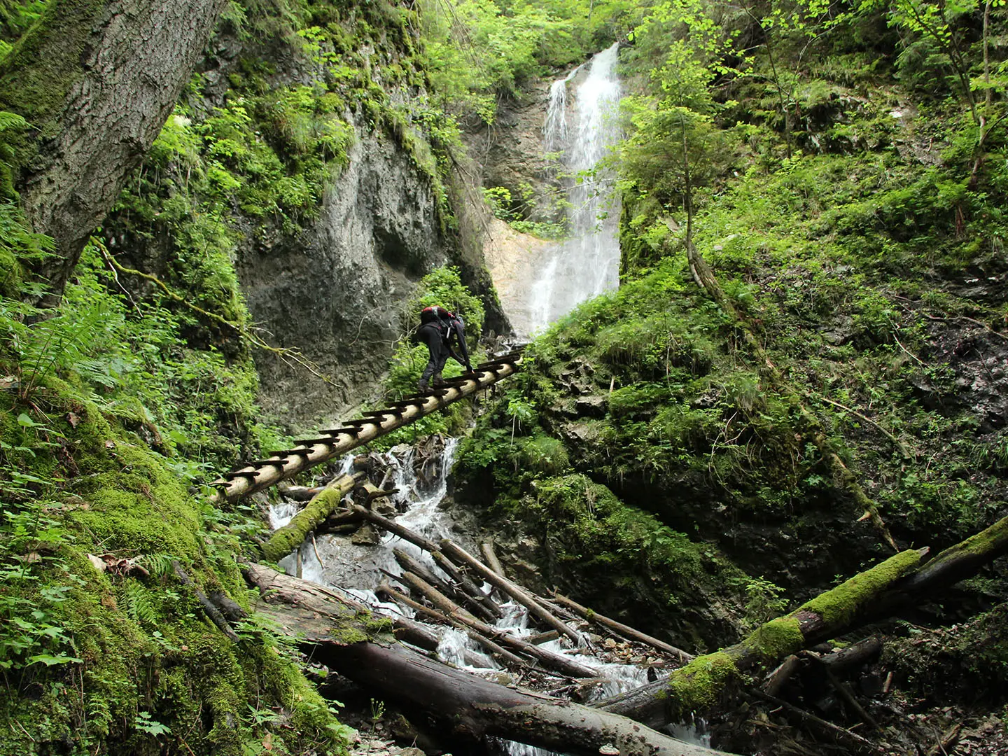
Kláštorská roklina (roughly 1.5 km): The gorge is the core of the hike: a steep, one-way upstream canyon with fixed ladders, rungs and footbridges following the stream bed past waterfalls.
Strakov vodopád (13 m): The tallest waterfall in the gorge, named after Anton Straka. Other cascades on the route include Dúhový, Machový and Objaviteľov falls.
Fixed ladders and footbridges: Vertical metal ladders and bolted rungs are the defining feature of the route. Only one person should be on a ladder at a time, and a steady head for heights is essential.
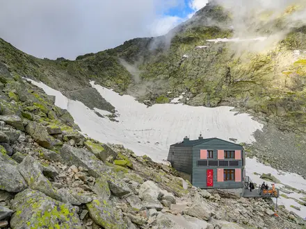
Kláštorisko plateau (~760 m): The grassy ridge plateau at the top of the gorge is a trail hub with a mountain chalet, refreshments and wide views.
Carthusian monastery ruins: The ruined monastery on Kláštorisko is one of the main reasons to pause before the descent, with its history tied to the Rock of Refuge and Slovak Paradise’s name.
Hornád gorge link: The loop touches Hrdlo Hornádu at the start, beside the Prielom Hornádu, the park’s well-known river canyon.
Challenges to expect
Expect wet rock, slippery stream-bed walking, exposed ladders and slow movement through the gorge, especially if other hikers are ahead. The gorge is one-way upstream only, so turning around is not straightforward once committed. High water can close or restrict access, and winter ice makes the ladders serious; crampons are needed in winter conditions. Navigation is generally easy on marked trails. For another hard Slovak day objective, see the Ďumbier Summit Trail.
HikeList Score
Kláštorská Gorge Trail scored 73/100 on HikeList's trail-quality metrics.
See score breakdownHide breakdown
- Ideal length 55
- Balanced challenge 84
- Scenery & wildness 98
- Varied terrain 64
- Accommodation 58
- Food & support 52
- Path quality 98
- Season flexibility 89
Computed from length, challenge, scenery & wildness, terrain variety, accommodation, food & support, path quality and season flexibility.
 Slovakia
Show more data Show less
- Mountainous
- Forest
- Rocky
- Dirt
- Huts
- Campsites
- Family Friendly
- Campsites
- Shelters
Photos from hikers
Taken on the trail by people who've reviewed Kláštorská Gorge Trail.
Reviews
How would you rate Kláštorská Gorge Trail?
Tap a star to start your review — you could be the first.