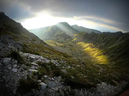
Kjeragbolten
How would you rate Kjeragbolten?
Tap a star to share your experience and help other hikers.
Kjeragbolten: A Strenuous Lysefjord Day Hike
HikeList Score
Kjeragbolten scored 76/100 on HikeList's trail-quality metrics.
See score breakdownHide breakdown
- Ideal length 55
- Balanced challenge 80
- Scenery & wildness 98
- Varied terrain 64
- Accommodation 75
- Food & support 68
- Path quality 98
- Season flexibility 63
Computed from length, challenge, scenery & wildness, terrain variety, accommodation, food & support, path quality and season flexibility.
Kjeragbolten is an 11 km out-and-back day hike on Kjerag mountain above Lysefjord in south-western Norway. Starting at Øygardstøl near Lysebotn, the route climbs about 800 m to the Kjerag plateau and the famous boulder wedged above a 984 m drop. It typically takes 6–10 hours and is strenuous: expect steep smooth granite, exposed terrain and fixed chains. It suits fit, sure-footed hikers comfortable with hands-on scrambling and big exposure.
Route Overview
The hike starts and ends at the Øygardstøl car park, also known as the Eagle’s Nest or Ørnereiret, reached by county road Fv500 from Lysebotn. From the trailhead restaurant and parking area, the marked out-and-back route crosses three steep granite climbs with steel chains or wires, separated by short plateaus and a small marshy dip. Red “T” waymarks lead across open rock where the line can feel sparse in poor visibility. The route passes the Nesatindane viewpoint before continuing onto the Kjerag plateau and Kjeragbolten, the turnaround point. Stavanger is roughly two hours away by road. For another exposed Norwegian classic, compare the Besseggen Ridge, or for a longer plateau journey see the Hardangervidda Traverse.
Kjeragbolten history and geology
Kjeragbolten is a glacial deposit left behind after the last glacial period. As the ice retreated, post-glacial rock rebound is thought to have helped wedge the boulder into its narrow crevice above Lysefjord. The surrounding Kjerag massif is granite and gneiss, with fjord walls shaped by glacial erosion. The boulder became globally recognisable through tourism, viral imagery such as the 2006 “Where the Hell is Matt?” video, and Kjerag’s reputation among BASE jumpers and big-wall climbers.
Notable highlights
Kjeragbolten boulder (~5 cubic metres): The glacial boulder is wedged between two cliff walls above a 984 m drop to Lysefjord. Stepping onto it is optional, exposed and the hike’s most famous photo.
Lysefjord views: The route gives wide views over Lysefjord, a steep-sided fjord framed by granite walls. Clear weather makes the approach and viewpoints much more rewarding.
Nesatindane viewpoint: This high plateau viewpoint comes before Kjeragbolten and looks down towards the fjord. It is a useful landmark on the out-and-back route.
Chained granite climbs: Three steep, smooth granite ascents use fixed steel chains or wires. They are a defining part of the route’s difficulty, especially when wet.
BASE jumping and climbing: Kjerag’s cliffs are known internationally for BASE jumping and big-wall climbing. Hikers may see jumpers or climbers when conditions are suitable.
Challenges to expect
Expect a strenuous mountain day, not a casual viewpoint walk. The three chained granite climbs require pulling up and controlled descending, and the rock becomes slippery in rain. There is little tree cover and the plateau is exposed to wind, weather and poor visibility. Red “T” marks can be sparse on open granite. The seasonal Fv500 access road and lingering snow also affect timing.
HikeList Score
Kjeragbolten scored 76/100 on HikeList's trail-quality metrics.
See score breakdownHide breakdown
- Ideal length 55
- Balanced challenge 80
- Scenery & wildness 98
- Varied terrain 64
- Accommodation 75
- Food & support 68
- Path quality 98
- Season flexibility 63
Computed from length, challenge, scenery & wildness, terrain variety, accommodation, food & support, path quality and season flexibility.
 Norway
Show more data Show less
- Mountainous
- Alpine
- Rocky
- Dirt
- Hotels
- Campsites
- Wild Camping Spots
- Pet Friendly
- Restrooms
- Campsites
Download Our Full Guide to Kjeragbolten FREE!
Get our comprehensive guide to this hike for free. Save it for later reading or print out at home.

Photos from hikers
Taken on the trail by people who've reviewed Kjeragbolten.
Kjeragbolten: The Complete Guide
Kjeragbolten is one of Norway’s most dramatic day hikes: an out-and-back route from Øygardstølen above Lysebotn to the famous boulder wedged high over Lysefjorden. It suits fit, sure-footed hikers who want a demanding mountain day rather than a simple photo stop.
The path crosses open, glacier-smoothed granite on the Kjerag massif, climbing and descending three steep rock sections aided by fixed chains and wires. Between the ridges, the route drops through Litle Storedal and Storedalen before reaching the high plateau and the short spur towards Nesatindane.
The reward is a stark fjord landscape: bare rock, big air and unfenced cliff edges above a near-thousand-metre drop to Lysefjorden. Stepping onto Kjeragbolten itself is optional; the hike stands on its own without taking that risk.
This walk asks for early planning as much as fitness. Access depends on the seasonal Fv500 (Lysevegen) road and, for many travellers, the Lysebotn ferry from Lauvvik or Forsand, while wet granite, wind, cloud and poor visibility can quickly make the route more serious.
This guide covers the stage plan, day timing, accommodation, food and water, transport, terrain and the common mistakes to avoid.
Stage-by-Stage Guide
Stage 1: Øygardstølen [Øygardstøl] car park to Kjeragbolten and back
This is a single demanding out-and-back mountain stage, starting and finishing at Øygardstølen [Øygardstøl] car park beside the Eagle’s Nest restaurant. The route is about 11 km return, with roughly 800 m of total ascent, and most walkers should allow 6–10 hours including breaks, the Nesatindane viewpoint spur and any queue at Kjeragbolten.
The marked path leaves from beside the restaurant and quickly commits to open granite terrain. The route is waymarked with red “T” marks and uses fixed steel chains and wires on the steepest slabs, but it should still be treated as a serious mountain walk rather than a casual viewpoint trail.
Øygardstølen to the first granite ridge
From the car park the path climbs almost immediately onto smooth, glacier-polished rock. This first ascent gives a clear indication of the day’s character: steep granite underfoot, hands-on movement in places, and chains or wires where the slabs are hardest to negotiate.
In dry conditions the rock can be grippy enough for confident walkers, but in rain or after heavy cloud it becomes much more slippery. Good footwear matters here; trainers with poor grip are a poor choice for the polished slabs.
There are no toilets once on the trail. The only facilities are at the trailhead area around Øygardstølen and the Eagle’s Nest restaurant, so sort food, water and toilet needs before setting off.
Over the ridge and down to Litle Storedal
After the first climb the route drops into Litle Storedal, the first valley dip. This descent is part of what makes Kjerag harder than the simple distance suggests: the outward route repeatedly climbs and loses height, and every descent on the way out becomes a climb on the return.
The path remains on exposed mountain terrain above the treeline. There is little shelter from wind, sun, rain or fast-moving cloud, and the red waymarks can be harder to follow if visibility deteriorates.
Take particular care not to rush the downhill slabs. The fixed chains help, but they do not remove the need for balance and sure footing, especially when other hikers are coming the opposite way.
Litle Storedal to Storedalen
The route climbs again out of Litle Storedal and continues across open rock and rougher mountain ground towards Storedalen. Expect more steep granite and a mix of slab, boulder and uneven sections rather than a built footpath.
Storedalen is the main valley crossing on the route and includes a stream that hikers commonly use as a water source. Water availability can never be guaranteed in the same way as a staffed facility, so carry enough from the start and treat or filter natural water if needed.
This middle section is a useful place to reassess conditions. If the weather is closing in, the rock is wet, or progress is much slower than expected, turning back here is often the safer decision than pushing onto the exposed plateau.
Storedalen to the Kjerag plateau
Beyond Storedalen the route makes the long climb towards the Kjerag massif and the high plateau, reaching roughly 1,000–1,084 m above sea level. This is one of the most strenuous parts of the day and includes the last of the three main chain-assisted granite climbs.
The landscape opens out onto a broad, glacier-scoured mountain plateau. The terrain can feel less confined than the earlier ridges, but navigation can become more serious here: in mist or low cloud the open rock offers few obvious handrails, so stay disciplined with the red “T” marks and do not wander towards cliff edges.
The plateau is fully exposed to wind and fast weather changes. A calm start at Øygardstølen does not guarantee benign conditions higher up, and the return still requires all the same steep descents and re-ascents.
Nesatindane / Nesatind viewpoint spur
Around 300 m before Kjeragbolten, a short spur leads to the Nesatindane / Nesatind viewpoint. This gives a dramatic view down over Lysefjorden and is often a worthwhile stop before continuing to the boulder.
The viewpoint sits in serious cliff-edge terrain. There are no fences along the fjord-edge drops, so avoid standing close to the edge, especially in wind, wet conditions or poor visibility.
Nesatindane is also a useful alternative objective if the queue for Kjeragbolten is long, the boulder area feels too crowded, or anyone in the group does not want the exposure of stepping onto the boulder itself.
Kjeragbolten
Kjeragbolten is the turnaround point: a roughly 5 cubic metre glacial boulder wedged in a crevice near the plateau edge, suspended above a 984 m drop to Lysefjorden. Reaching the boulder completes the outward leg, but it is only halfway through the physical effort of the day.
Stepping onto Kjeragbolten is optional. No climbing gear is needed to access it in normal summer conditions, but the exposure is severe and anyone uncomfortable with heights should simply enjoy the view from solid ground.
Queues can build at the boulder in good summer weather. Do not let waiting time compromise the return schedule; the descent includes the same chain-assisted slabs and should not be left until failing light.
Return to Øygardstølen
The return follows exactly the same route back over the plateau, down through Storedalen and Litle Storedal, and across the granite ridges to Øygardstølen. Because of the repeated ups and downs, the return is not a simple downhill walk.
The steep slabs can feel harder in descent than ascent, especially with tired legs. Use the chains carefully, allow faster groups to pass where safe, and avoid bunching on the steepest sections.
Route-finding remains important on the way back. In clear weather the direction of travel is usually straightforward, but in fog the open granite can be confusing; keep locating the red “T” marks rather than cutting across unmarked rock.
Food, water and facilities
There are no huts, cafés, shops or toilets on the trail. Carry all food for the day, plus spare food in case the walk takes longer than planned.
Storedalen has a stream commonly used for refilling water, but it should not be treated as a substitute for starting with adequate supplies. Natural water should be treated or filtered if there is any doubt.
The Eagle’s Nest restaurant at Øygardstølen is the only named facility at the trailhead. Opening times and services are seasonal and should be checked before travelling.
Accommodation and end-of-stage logistics
There is no accommodation on the route itself, and this stage returns to the same trailhead. Most walkers base themselves in Lysebotn, the Stavanger / Sandnes area, or the Sirdal valley, depending on how they are accessing Fv500 (Lysevegen).
Lysebotn has limited seasonal lodging and camping, including Lysebotn Camping and small guesthouses. Availability is limited in the hiking season, so overnight plans should be made before travelling rather than relying on arrival late in the day.
Road access and public transport
The trailhead is at Øygardstølen [Øygardstøl] car park on Fv500 (Lysevegen), above Lysebotn. Access is seasonal and governed by snow conditions; the mountain road is typically open from late May or early June to October or November, but the current road status should be checked before travelling.
From the Stavanger / Sandnes side, access commonly involves the ferry across Lysefjorden to Lysebotn from Lauvvik or Forsand, then the road up the 27 hairpins to Øygardstølen. Ferry timetables and onward arrangements should be checked before travelling, especially if aiming for an early start or a same-day return.
An alternative approach is by road from the Sirdal valley on Fv500. A seasonal Kjerag express bus runs from Stavanger in summer; current operating dates, times and booking requirements should be checked before travelling.
Key warnings for this stage
Do not underestimate the route because it is only about 11 km return. The combination of repeated climbing, chain-assisted slabs, exposed granite, open plateau navigation and the long drive or ferry access makes this a full mountain day.
Avoid the hike in wet, windy or foggy weather. Wet granite is slippery, wind is a serious issue near the fjord-edge cliffs, and poor visibility makes navigation across the plateau harder.
Start early enough to complete the return in daylight. The outward leg to Kjeragbolten is not the endpoint of the day, and the steep descents back to Øygardstølen are not places to be caught tired, cold or in the dark.
Recommended Itinerary
Kjeragbolten is best planned as a single, full mountain day from Øygardstølen [Øygardstøl]. There is no hut, campsite or settlement on the route itself, so the itinerary is not split into overnight stages; the main planning choice is where to stay before and after the hike, and how early you can reach the trailhead.
Standard itinerary
| Day | From | To | Approx. distance | Why this stage makes sense | Services/accommodation notes |
|---|---|---|---|---|---|
| 1 | Øygardstølen [Øygardstøl] car park / Ørnereiret (the Eagle’s Nest) | Kjeragbolten via Litle Storedal, Storedalen, the Kjerag plateau and the Nesatindane / Nesatind spur, then return the same way to Øygardstølen | ~11 km return | This is the normal and only practical walking itinerary: an out-and-back over three steep granite climbs, with the boulder as the turnaround point. Allow 6–10 hours, especially if the rock is damp, cloud lowers, or there is a queue at Kjeragbolten. Start early enough to complete all chain-assisted descents in daylight. | No huts, toilets or staffed services on the trail. Facilities are limited to the car park area and the Eagle’s Nest restaurant at Øygardstølen. Base options are off-trail: limited seasonal lodging and camping in Lysebotn, or hotels, cabins and campsites in the wider Stavanger / Sandnes region or Sirdal valley. Ferry times, the seasonal Kjerag express bus, parking/road access and the Fv500 opening status should be checked before travelling. |
Slower, safer logistics variant
| Day | From | To | Approx. distance | Why this stage makes sense | Services/accommodation notes |
|---|---|---|---|---|---|
| 0 | Stavanger / Sandnes, Sirdal, or Lysebotn | Overnight base before the hike | — | Staying close enough to the trailhead the night before reduces the risk of a rushed start, missed ferry connection or late descent. This suits hikers relying on seasonal transport, anyone driving the Fv500 after a long journey, and walkers who want the full 6–10 hour weather window. | Lysebotn is the closest base but has limited seasonal lodging and camping. Stavanger / Sandnes and Sirdal give more accommodation choice but add access time. This should be checked before travelling. |
| 1 | Øygardstølen [Øygardstøl] car park | Kjeragbolten and back to Øygardstølen | ~11 km return | The walking day remains the same, but with more margin for weather, photo stops and careful movement on the chained granite slabs. | Carry everything needed for the day, including food, water and bad-weather layers. Storedalen has a stream commonly used for water, but treatment and current conditions are the hiker’s responsibility. |
| 1 or 2 | Øygardstølen / Lysebotn area | Overnight base or onward travel | — | A second night nearby avoids having to combine a demanding descent, the hairpin road and onward transport in one late day. | Useful if ferry, bus or road timing is tight. Current timetables and road status should be checked before booking. |
Faster variant
| Day | From | To | Approx. distance | Why this stage makes sense | Services/accommodation notes |
|---|---|---|---|---|---|
| 1 | Øygardstølen [Øygardstøl] car park | Kjeragbolten and back to Øygardstølen | ~11 km return | Fit, sure-footed hikers in dry, clear conditions may complete the route in about 5–6 hours, but the itinerary should still be treated as a full mountain day. The terrain includes repeated steep ascents and descents on smooth granite, so speed should not come at the expense of safe foot placement. | Works best for walkers with private transport or well-timed seasonal transport. Do not plan a tight onward connection immediately after the hike; delays are common if the rock is wet, visibility drops, or the boulder is busy. |
For most independent hikers, the slower logistics variant is the most robust plan: arrive in the area the day before, start from Øygardstølen early, and keep the evening flexible. The faster variant only makes sense in settled summer weather, with the Fv500 (Lysevegen) open and transport already arranged.
Planning the Route
Kjeragbolten is planned as a single, self-contained mountain day rather than a hut-to-hut route. There are no overnight stops, huts or villages on the trail itself, so the key planning decision is where to base yourself before and after the hike, then whether the road, ferry and weather make the day viable.
Most walkers should allow a full day for the outing, even if moving fitness is good. The route is not long on paper, but the repeated granite climbs, chain-assisted sections, exposed plateau and return over the same terrain make it slow in wet rock, wind or cloud. Start early enough to be back at Øygardstølen [Øygardstøl] well before dark.
How to structure the day
The walk starts and finishes at Øygardstølen [Øygardstøl] car park beside Ørnereiret / Ørneredet (the Eagle's Nest). From there the marked path climbs over the first granite ridge, drops into Litle Storedal, continues through Storedalen, then rises onto the Kjerag plateau before the optional Nesatindane / Nesatind spur and Kjeragbolten.
Because this is an out-and-back hike, the halfway decision is simple: if conditions, timing or confidence are not right, turn around and retrace the route. The steepest chained rock has to be descended on the return as well as climbed on the way out, so do not treat reaching the boulder as the end of the hard work.
The boulder itself is optional. Many walkers go to Kjeragbolten for the view and photo, but stepping onto it is not required to complete the hike and should be skipped if the rock is wet, the wind is strong, visibility is poor or the exposure feels uncomfortable.
Pace: fast enough to be safe, slow enough for the terrain
Kjerag is best walked steadily rather than rushed. The smooth granite slabs and chain sections are where time is either won safely or lost badly; forcing the pace here increases the risk of slips, especially on descent.
A realistic plan is to move efficiently across easier plateau sections, then slow down deliberately on the chains, wet slabs, boulders and exposed edges. If cloud builds or the red 'T' waymarks become hard to follow on open rock, navigation and retreat should take priority over reaching the boulder.
Accommodation and base planning
There is no accommodation on the route. The nearest base is Lysebotn below the Fv500 hairpins, where seasonal lodging and camping are limited, including Lysebotn Camping and small guesthouses. These options should be booked ahead in the main hiking season.
Wider accommodation choices are in the Stavanger / Sandnes region or in the Sirdal valley, with hotels, cabins and campsites. Staying farther away gives more choice, but it makes the morning transport plan more important because the trailhead is seasonal and access is constrained by road and ferry timings.
Daily stages are not dictated by accommodation in the way they are on a long-distance trail. The only practical stage is the return hike from Øygardstølen to Kjeragbolten and back.
Transport is the main planning constraint
Access to the trailhead is the make-or-break detail. Øygardstølen is reached by Fv500 (Lysevegen) above Lysebotn, and the mountain road is closed by snow in winter. It is typically open from late May or early June to October or November, but the exact dates vary with conditions. This should be checked before travelling.
From the Stavanger / Sandnes side, the usual approach is via the car/passenger ferry across Lysefjorden to Lysebotn, departing from Lauvvik or Forsand, then continuing up the 27-hairpin Fv500 to Øygardstølen. Ferry timetables, vehicle space and onward transport from Lysebotn should be checked before committing to the hike day.
The other road approach is from the Sirdal valley on Fv500. A seasonal Kjerag express bus also runs from Stavanger in summer. Current running dates, stops, fares and booking requirements should be checked before travelling.
Food, water and facilities
There are no huts, shops or toilets on the trail. Facilities at the start are limited to the Øygardstølen car park and the Eagle's Nest restaurant, so carry the food needed for a full mountain day and do not rely on buying anything once on the route.
Storedalen has a stream used by hikers as a water source, but this should not replace carrying enough water from the start, especially in warm weather or if progress is slow. There is little shelter on the open granite plateau, so food and spare layers need to be packed for wind, cloud and waiting time as well as walking time.
Navigation and weather planning
The route is waymarked with Norwegian Trekking Association red 'T' marks, and fixed chains and wires assist the steepest sections. In clear weather the line is straightforward enough for competent mountain walkers, but the open rock plateau can become confusing in fog or low cloud.
Weather should decide the hike day, not the accommodation booking. Wet granite is very slippery, wind increases the exposure on the plateau and poor visibility makes route-finding harder near unfenced fjord-edge cliffs. If the forecast is wet, windy or foggy, postpone the hike rather than relying on the chains to make it safe.
Shortening, extending and section hiking
This route is easy to shorten only by turning back. There are no useful intermediate exit points, no parallel public transport access on the trail and no natural overnight division.
The Nesatindane / Nesatind viewpoint is a short spur about 300 m before Kjeragbolten and can be included or skipped depending on time and conditions. Beyond that, this is not a route where meaningful extensions or section-hiking plans add much practical value for most walkers.
Costs, bookings and permissions
There is no on-route hut booking to arrange. The practical costs are access-related: ferry, bus or taxi if used, parking at Øygardstølen, food, and accommodation before or after the hike. Current prices should be checked before booking.
No special climbing equipment is needed for the normal summer hiking route, but this is still a demanding mountain walk. Outside the normal summer season, snow closes the road and the route requires winter equipment such as skis or snowshoes, and a guide is strongly preferable.
Towns, Villages and Overnight Stops
Kjeragbolten is a one-day out-and-back hike, not a hut-to-hut route. There is no accommodation on the trail, no mountain hut on the Kjerag plateau, and no toilets once you leave Øygardstølen [Øygardstøl]. Most planning therefore comes down to choosing a practical base before and after the hike, then making the seasonal access work.
Stavanger / Sandnes
Stavanger and Sandnes are the most practical wider bases if you want more choice of hotels, food shops, restaurants and onward public transport. They sit off the route, but they are relevant because access from this side normally involves travelling towards Lauvvik or Forsand for the ferry across Lysefjorden to Lysebotn, or using the seasonal Kjerag express bus from Stavanger in summer.
This is the best option for walkers who want reliable pre-hike supplies and a broader range of accommodation than the small fjord settlements can offer. It does, however, make for a long hiking day unless transport timings line up well, so ferry, bus and onward transfer arrangements should be checked before travelling.
Lauvvik or Forsand
Lauvvik and Forsand are primarily ferry access points for reaching Lysebotn from the Stavanger/Sandnes side. They are not on the walking route itself, but they matter because the Lysefjorden ferry is one of the key links in getting to the Kjerag trailhead.
For most hikers these are transit stops rather than places to base the hike. If an overnight near the ferry is being considered, accommodation and food availability should be checked before travelling, as the briefed route information does not support treating either place as a main hiking base.
The main planning task here is timing: match the ferry to Lysebotn with the onward climb by road to Øygardstølen [Øygardstøl]. The ferry timetable changes seasonally, so it should be checked before booking accommodation or committing to a same-day hike.
Lysebotn
Lysebotn is the fjord village below the Kjerag trailhead, at the foot of the Fv500 (Lysevegen) hairpins. It is the closest practical overnight base to the hike and a strong choice if the aim is to start early without travelling all the way from Stavanger or Sandnes on the morning of the walk.
Accommodation is limited and seasonal, with Lysebotn Camping and small guesthouses noted as options. Because capacity is limited, book well ahead for summer weekends and good-weather periods, and confirm current opening dates before travelling.
Lysebotn is useful because it sits between the ferry arrival point and the road up to Øygardstølen. From here you still need to get up the steep Fv500 hairpin road to the car park by driving, taxi or shuttle; this final road transfer is part of the hike logistics, not a detail to leave until the morning.
Food and services should be treated as limited compared with Stavanger, Sandnes or larger valley bases. Arrive with trail food, spare layers and any essentials already sorted, especially if staying overnight before an early start.
Øygardstølen [Øygardstøl] / Ørnereiret (the Eagle’s Nest)
Øygardstølen [Øygardstøl], also called Ørnereiret / Ørneredet (the Eagle’s Nest), is the actual trailhead and return point. The marked Kjerag path leaves from beside the Eagle’s Nest restaurant, with the car park sitting above Lysebotn on Fv500.
This is not an overnight stop. Facilities are limited to the car park and the Eagle’s Nest restaurant; there are no huts or camping facilities on the route itself. Any parking fees, restaurant opening times and local facilities should be checked before travelling.
Its main value is logistical: starting here puts you directly on the red ‘T’ waymarked route and avoids any additional walking up from the fjord. Because the hike normally takes 6–10 hours return, aim to be at Øygardstølen early enough to complete the route and descend the chain-assisted slabs before dark.
Sirdal valley
The Sirdal valley is the alternative approach side to Kjerag, reached by road via the same Fv500 (Lysevegen). It offers hotels, cabins and campsites in the wider area, making it a practical base for hikers travelling by car who do not need to come through Lysebotn by ferry.
This can simplify access if the Fv500 is open and conditions are suitable, but the same seasonal road closure issue applies. The mountain road is snow-dependent and typically only open from late May or early June to October or November; current road status should always be checked before travelling.
As with Lysebotn, do not assume late-evening food or full trail-supply options close to the trailhead. Buy hiking food and carry all essentials before driving up to Øygardstølen.
On the trail: Litle Storedal, Storedalen, the Kjerag plateau and Kjeragbolten
Litle Storedal, Storedalen, Nesatindane / Nesatind, the Kjerag plateau and Kjeragbolten are route landmarks, not overnight stops. There are no huts, toilets, staffed facilities or formal resupply points beyond the trailhead.
Storedalen has a stream used by hikers as a water source, but water treatment is a personal responsibility and conditions vary. Carry enough water from the start, especially in hot weather or if unsure about refilling.
The plateau is fully exposed, with little shelter from wind, cloud or fast weather changes. Plan the day so there is no temptation to linger late at the boulder or viewpoint; the return involves descending the same steep granite sections and chains used on the outward route.
Getting to the Start
Kjeragbolten starts and finishes at Øygardstølen [Øygardstøl] car park, also called Ørnereiret / Ørneredet (the Eagle’s Nest), above Lysebotn on Fv500 (Lysevegen). Access is the main planning constraint: the mountain road is snow-dependent and normally only usable in the summer season.
The key checks before committing to travel are the current Fv500 road-opening status, the Lysefjorden ferry timetable to Lysebotn, and any seasonal bus operating dates. This should be checked before travelling.
By train
There is no train to Lysebotn, Øygardstølen or the Kjerag trailhead. If arriving in the region by rail, the practical onward transport hub is the Stavanger/Sandnes area, then you must continue by seasonal bus, hire car, ferry plus road transfer, or pre-arranged taxi/shuttle.
Do not plan this hike as a simple train-to-trail day. The final approach involves either the Lysefjorden ferry to Lysebotn and the steep Fv500 road up to Øygardstølen, or the road approach from the Sirdal valley.
By bus
A seasonal Kjerag express bus runs from Stavanger in summer. This is the simplest public-transport option when it is operating, but dates, departure times and whether the timetable gives enough time for a 6–10 hour return hike must be checked before booking.
Outside the main summer season, public transport should not be relied on. If staying in Lysebotn, a taxi or shuttle up the Fv500 hairpins to Øygardstølen may be possible, but availability is limited and should be arranged in advance.
By car
Driving gives the most control over the early start this hike deserves. From the Stavanger/Sandnes side, the usual approach is to take the car/passenger ferry across Lysefjorden from Lauvvik or Forsand to Lysebotn, then drive up Fv500 (Lysevegen) to Øygardstølen.
The road from Lysebotn is a major part of the logistics: Fv500 climbs away from the fjord through 27 hairpins, with the road route rising towards the high mountain plateau before reaching the trailhead area. Allow time for slow mountain driving, ferry loading and the return journey after the hike.
An alternative road approach reaches Øygardstølen from the Sirdal valley on the same Fv500. This can be useful if basing yourself inland rather than around Stavanger/Sandnes or Lysebotn.
Parking is at Øygardstølen beside the Eagle’s Nest restaurant, where the marked red-‘T’ Kjerag path begins. Expect trailhead parking to be a paid facility in NOK; current charges and payment methods should be checked before travelling. This is a day-hike car park rather than a staging point for a multi-day route.
The Fv500 mountain road is closed by snow in winter and is typically open from late May or early June to October or November, depending on conditions. Do not assume access is possible just because the weather is good at fjord level.
From the nearest airport
For flights, the practical gateway is the Stavanger/Sandnes area. From there, continue by seasonal Kjerag express bus, hire car via the Lysefjorden ferry to Lysebotn, or a pre-arranged transfer.
If flying in, avoid same-day plans that depend on tight connections between the flight, ferry, road transfer and a full Kjerag hike. The route itself commonly takes 6–10 hours, and the access chain has several seasonal and weather-dependent links.
Where to stay before starting
Lysebotn is the closest base, sitting below the Fv500 hairpins at the head of Lysefjorden. It has limited seasonal lodging and camping, including Lysebotn Camping and small guesthouses, and is the most convenient option if a local transfer up to Øygardstølen is arranged.
The wider Stavanger/Sandnes area offers more accommodation and transport options, but the journey to the trailhead is longer and more dependent on ferry, bus or road timings. It suits walkers using the seasonal bus or those with a car who are prepared for an early start.
The Sirdal valley is another practical base for drivers approaching Øygardstølen from inland on Fv500. Hotels, cabins and campsites are available in the wider area, but exact opening periods and availability should be checked before travelling.
Facilities at the trailhead are limited to the Øygardstølen car park and the Eagle’s Nest restaurant. There are no huts or toilets on the trail itself, so arrive prepared before leaving the car park.
Getting Home from the Finish
Kjeragbolten is an out-and-back hike, so the finish is the same as the start: Øygardstølen [Øygardstøl] car park beside Ørnereiret / Ørneredet, above Lysebotn. Leaving the finish is mainly a question of whether you have a car at the trailhead, a booked seasonal bus, or a pre-arranged lift/taxi down the Fv500 (Lysevegen).
Late finishes can be awkward. The hike commonly takes 6–10 hours, the road is seasonal, and ferry/bus options are timetable-dependent, so do not assume there will be onward transport waiting if you reach the car park near evening.
By train
There is no train service to Øygardstølen, Lysebotn or the Kjerag trailhead. Rail travel only becomes relevant once you have returned to the Stavanger/Sandnes side or another larger transport hub.
If planning to continue by train after the hike, arrange the road/ferry or bus leg first, then build the rail journey around that. Station choices, connections and late-day departures should be checked before travelling.
By bus
A seasonal Kjerag express bus runs from Stavanger in summer and is the main public-transport-style option for hikers without a car. Use it only with the return departure time clearly planned, as Kjerag is a long and strenuous day and the final descent over the chained granite slabs can take longer than expected in wet or busy conditions.
Do not rely on frequent local buses from the trailhead. Services are seasonal and limited, and current timetables should be checked before travelling.
By car/taxi
With a car at Øygardstølen, the simplest exit is to drive back down the Fv500 (Lysevegen) to Lysebotn, then continue by ferry across Lysefjorden towards Lauvvik or Forsand for the Stavanger/Sandnes side. Alternatively, drive out by road towards the Sirdal valley on the same Fv500.
The Lysebotn road is a high, seasonal mountain road with 27 hairpins and is closed by snow in winter, typically opening only from late May or early June until October or November. The road-opening status is the key check before committing to the hike.
Taxi or shuttle travel between Lysebotn and Øygardstølen may be possible in season, but it should be arranged in advance rather than assumed on arrival. If using the ferry via Lysebotn, check the Lauvvik/Forsand–Lysebotn timetable before the hike and allow enough margin for the descent from the plateau and the drive down from the car park.
From the nearest airport
For flights after the hike, plan to exit via the Stavanger/Sandnes side rather than treating Lysebotn or Øygardstølen as a transport hub. The practical chain is: finish at Øygardstølen, reach Lysebotn or Sirdal by road, then continue by ferry/road or bus towards Stavanger/Sandnes for onward airport connections.
Same-day flights after Kjerag are risky unless transport is booked with generous time buffers. Road, ferry and seasonal bus timings should all be checked before travelling.
Where to stay at the finish
There is no accommodation on the trail and no hut at Kjeragbolten. Facilities at Øygardstølen are limited to the car park and the Eagle's Nest restaurant area, with no toilets on the route itself.
If finishing late, staying nearby is often more practical than trying to force a same-day return to Stavanger/Sandnes. Lysebotn has limited seasonal lodging and camping, including Lysebotn Camping and small guesthouses, while the wider Stavanger/Sandnes region and the Sirdal valley offer more choice of hotels, cabins and campsites.
Book accommodation before travelling, especially in the main summer season, and make sure the final transport leg from Øygardstølen is covered. The finish is remote, and missed ferries, closed roads or a late descent can quickly turn into a logistical problem.
Which Direction Should You Walk?
Kjeragbolten is not a route with a meaningful northbound/southbound or clockwise/anticlockwise choice. The standard and practical way to walk it is from Øygardstølen [Øygardstøl] car park beside Ørnereiret / Ørneredet (the Eagle's Nest) restaurant, out to Kjeragbolten, then back by the same marked path.
There is no normal reverse direction because Kjeragbolten is not a trailhead with road access, accommodation or transport. Treat the boulder as the turnaround point, not the end of the hike.
Standard direction: Øygardstølen to Kjeragbolten and back
This is the only realistic direction for independent hikers. The route starts directly from the car park and follows the red ‘T’ waymarks over the granite ridges, through Litle Storedal and Storedalen, then onto the Kjerag plateau before reaching Nesatindane / Nesatind and Kjeragbolten.
The scenery builds well in this direction: the early granite climbs establish the seriousness of the terrain, Storedalen gives a lower, sheltered-feeling middle section, and the plateau then opens out towards the fjord-edge viewpoints and the boulder. The main psychological risk is treating Kjeragbolten as the finish; it is only halfway, with the same chain-assisted granite sections still to descend and reclimb on the return.
Does either direction make the climbing easier?
No. Because this is an out-and-back, every steep section is walked both uphill and downhill. The three smooth granite climbs are ascended and descended in both directions, with fixed chains and wires on the steepest parts.
The return can feel harder than expected because tired legs meet the same polished slabs again. In wet conditions the descents are often the most awkward part of the day, so good conditions matter more than direction.
Transport and accommodation flow
Direction does not affect logistics. All transport planning revolves around getting to and from Øygardstølen via the seasonal Fv500 (Lysevegen), either from Lysebotn or from the Sirdal side, with ferry and road-opening checks made before travelling.
There are no huts, toilets or overnight stops on the trail, so accommodation should be arranged off-route in Lysebotn, the wider Stavanger / Sandnes area, or the Sirdal valley. Whichever base is used, the walking day still begins and ends at Øygardstølen.
Weather and timing
There is no useful wind-based direction choice on this route. The important decision is when to start: go early enough to complete the 6–10 hour return before dark, and avoid setting out in wet, windy or foggy weather.
Poor visibility makes route-finding on the open granite plateau more difficult, and wet slabs make the chained sections significantly more hazardous. If conditions deteriorate before reaching the plateau or boulder, turning back is the safer choice.
Recommendation
Walk the standard out-and-back from Øygardstølen to Kjeragbolten and return the same way. Start early, keep enough energy and daylight for the return, and regard stepping onto the boulder as optional rather than the objective that determines whether the hike is a success.
Accommodation Along the Route
Kjeragbolten is not an inn-to-inn hike. The route is a single out-and-back day walk from Øygardstølen [Øygardstøl], with no huts, campsites, toilets or lodging on the trail itself. Plan accommodation as a base before and/or after the hike, not as part of a staged route.
The most convenient base is Lysebotn, the fjord village below the Fv500 (Lysevegen) hairpins. It keeps the road approach short on the hiking morning, but accommodation is limited and seasonal, including Lysebotn Camping and small guesthouses. Book well ahead for summer dates, especially weekends and settled-weather periods.
Stavanger, Sandnes and the Sirdal valley give a wider choice of hotels, cabins and campsites, but they add more transport planning. From the Stavanger/Sandnes side, the ferry across Lysefjorden to Lysebotn and the onward road or shuttle up to Øygardstølen become part of the day. From Sirdal, the key dependency is the seasonal Fv500 mountain road.
| Place | Accommodation level | Best for | Notes |
|---|---|---|---|
| Lysebotn | Limited | Earliest start with the shortest morning approach to Øygardstølen | Seasonal lodging and camping, including Lysebotn Camping and small guesthouses. Book ahead; choice is small and summer demand can be high. |
| Øygardstølen [Øygardstøl] / Ørnereiret trailhead | None | Starting and finishing the hike | Car park and Eagle’s Nest restaurant only. Do not plan to sleep at the trailhead unless separately arranging something legal and appropriate nearby; this should be checked before travelling. |
| On the Kjerag route and plateau | None | Day hiking only | No huts, no toilets and no staffed facilities on the trail. Carry everything needed for the day and descend to your base afterwards. |
| Stavanger / Sandnes region | Good | Travellers wanting the broadest choice of hotels, cabins and campsites | More accommodation choice than Lysebotn, but access to the hike depends on the seasonal ferry/bus/road combination. Check ferry, bus and road timings before booking a hiking day. |
| Sirdal valley | Good | Drivers approaching Øygardstølen from the inland side | Hotels, cabins and campsites are available in the wider valley area. The Fv500 (Lysevegen) road opening is the critical check, as snow closes it outside the hiking season. |
Booking strategy
For the simplest logistics, stay in Lysebotn the night before the hike and arrange the morning transfer or drive up the Fv500 to Øygardstølen. This reduces the risk of losing time to ferries, buses or a long approach before a demanding 6–10 hour mountain day.
If staying in Stavanger, Sandnes or Sirdal, treat the hike as a full-day excursion and build the transport around an early start. The Fv500 mountain road is normally a summer-season road only, and ferry or bus timetables can determine whether the day is feasible. This should be checked before travelling.
Luggage transfer and taxi transfers
Luggage transfer is generally irrelevant on Kjeragbolten because there are no overnight stops along the route. Leave luggage at your accommodation or in your vehicle where appropriate, and carry only day-hiking gear.
Taxi or shuttle transfers can be useful between Lysebotn and Øygardstølen if staying in the village without a car. They do not solve any on-route accommodation gap, because the walk begins and ends at the same trailhead.
Camping and Wild Camping
Kjeragbolten is best treated as a long day hike from a base, not as a camping route. There are no huts, formal campsites or toilets on the marked path between Øygardstølen [Øygardstøl] and Kjeragbolten, and the open granite plateau offers little shelter from wind, cloud or fast-changing weather.
Practical camping options
| Location | Use for hikers | Notes |
|---|---|---|
| Lysebotn | Best local base for camping close to the route | Lysebotn Camping and limited seasonal lodging sit below the Fv500 hairpins. This is the most practical option if you want to camp before or after the hike. Availability and opening dates should be checked before travelling. |
| Øygardstølen [Øygardstøl] / Ørnereiret | Trailhead only, not a normal camping base | Facilities are limited to the car park and Eagle’s Nest restaurant area. Do not assume overnight camping or sleeping in vehicles is allowed here; this should be checked locally before relying on it. |
| Stavanger / Sandnes / Sirdal area | Wider choice of campsites, cabins and hotels | Useful if Lysebotn is full or if road/ferry logistics make a same-day approach easier from elsewhere. Allow for the seasonal access constraints on Fv500 (Lysevegen). |
Wild camping on or near the route
Wild camping on the Kjerag plateau is not recommended for most walkers. The route crosses exposed, glacier-polished granite with steep slabs, wet sections, boulder and scree, a marshy dip at Storedalen, and unfenced cliff edges near the top. In poor visibility it can be difficult to navigate safely, and a night on the plateau leaves very little margin if wind, rain or cloud arrives.
Norway’s outdoor-access rules and any local restrictions should be checked before pitching anywhere in the Kjerag area. Do not camp in the Øygardstølen car park, beside the restaurant, on private or managed land, or close to the marked path unless camping is clearly permitted.
If a legal wild camp is planned, choose a low-impact spot well away from the cliff edge, the boulder area, the main line of the trail and any wet or fragile ground. Avoid exposed slabs where a tent cannot be anchored securely, and do not rely on finding a sheltered pitch high on the plateau.
Water
Storedalen has a stream used by hikers as a water source, but there are no serviced water points on the trail. Anyone camping should carry enough water from a reliable source and treat natural water if there is any doubt about quality.
Do not wash, cook or dispose of food waste directly in streams. Carry food scraps and packaging out, including anything biodegradable.
Leave No Trace and waste
There are no toilets on the trail, so use facilities before setting off. If camping, carry out all rubbish and toilet paper, and be prepared to manage human waste responsibly in line with local guidance.
Keep noise low, leave no gear caches, and do not move rocks to build windbreaks or tent platforms. The plateau is open and heavily visited in good summer conditions, so even small impacts quickly become visible.
Fires and seasonal conditions
Open-fire rules, stove use and any seasonal fire bans should be checked locally before travelling. In practice, the exposed granite terrain and changeable mountain weather make fires inappropriate; a small camping stove, used only where permitted and sheltered safely from wind, is the practical option.
Camping plans are only realistic in the normal summer hiking season. Outside the snow-free window, Fv500 is closed by snow and the route becomes a winter mountain undertaking requiring specialist equipment and judgement.
Food, Water and Resupply
Kjeragbolten is a self-contained day hike, so resupply on the route is effectively non-existent. Treat Øygardstølen [Øygardstøl] as the last practical services point, and start with all food needed for a demanding 6–10 hour mountain day.
Food
The Eagle's Nest restaurant beside the Øygardstølen car park is the only named food option at the trailhead. Its opening is seasonal and tied to the summer hiking period, so do not rely on it as the sole source of breakfast, packed lunch or post-hike food. This should be checked before travelling.
There are no huts, cafés, shops or vending points on the Kjerag path. Once beyond the car park, you must carry everything needed until returning to Øygardstølen.
Buy trail food before driving up Fv500 (Lysevegen), ideally in the wider Stavanger / Sandnes region, the Sirdal valley, or before committing to the Lysebotn approach. Lysebotn has limited seasonal visitor services, but it should not be treated as a guaranteed resupply stop without checking current opening times.
For the hike itself, carry a proper packed lunch plus high-energy snacks that can be eaten quickly between the granite climbs. The route is short in distance but physically demanding, and queues or waiting time near Kjeragbolten can extend the day.
Water
There is no treated drinking-water point on the trail. Start from Øygardstølen with enough water for several hours of steep, exposed walking.
Storedalen has a stream where hikers commonly refill water. Because this is an untreated natural source, filtering, boiling or using purification tablets is the safest approach, especially later in the season or after heavy use of the route.
The plateau is exposed and can feel cool in wind, but the repeated ascents on bare granite are dehydrating in sun. A practical minimum for most walkers is 2 litres per person, with more in warm weather or if not planning to use the Storedalen stream.
Resupply and opening-hour cautions
This is not a route where food logistics can be solved mid-walk. Rural and seasonal services around Lysebotn and Øygardstølen may keep limited hours, and Sunday opening can be restricted. This should be checked before travelling.
Anyone using the ferry and then travelling up to Øygardstølen should also avoid cutting supplies too fine: transport timings, weather delays and the long return hike can make the day longer than expected.
| Section | Food availability | Water availability | Notes |
|---|---|---|---|
| Lauvvik / Forsand to Lysebotn approach | Buy supplies before setting off; do not rely on last-minute purchases unless opening times are checked | Carry water before the drive/ferry connection | Ferry and road timing can make quick shopping impractical |
| Lysebotn | Limited seasonal services only | Water availability depends on where you are staying or stopping | Useful as a base, but not a guaranteed trail-food resupply point |
| Øygardstølen [Øygardstøl] / Eagle's Nest trailhead | Eagle's Nest restaurant at the car park; seasonal opening | Start with full bottles | Last practical services before the hike; no toilets on the trail |
| Øygardstølen to Storedalen | No food available | Carry from the start | Steep granite sections make early dehydration easy, especially in sun |
| Storedalen | No food available | Stream used by hikers for refilling | Treat or filter natural water before drinking |
| Kjerag plateau, Nesatindane and Kjeragbolten | No food available | No reliable treated source | Exposed, windy plateau; carry enough food and water for delays and the return walk |
| Return to Øygardstølen | No food available until the car park | Refill earlier at Storedalen if needed | The return includes the same steep chain-assisted climbs and descents, so keep food and water back for the way down |
Terrain, Conditions and Difficulty in Practice
Kjeragbolten is short on paper but demanding underfoot. The route is about 11 km return, yet it packs in roughly 800 m of ascent, repeated steep climbs and descents, and long sections of bare, glacier-polished granite where footwear, weather and confidence matter more than distance.
This is not a road walk, a forest trail or a casual viewpoint path. From Øygardstølen [Øygardstøl], the marked path heads straight onto open mountain terrain above the treeline, following red T waymarks across rock slabs, valley dips, boulderier ground and the exposed Kjerag plateau.
What the walking feels like
The defining feature is the sequence of three steep granite ridges between the car park and the plateau. Each is climbed on the way out and descended on the return, so the hardest terrain is not finished once Kjeragbolten has been reached.
Several of the steepest rock sections are aided by fixed steel chains and wires. These are there for balance and security on smooth slabs, not to turn the route into a protected climbing route. In dry conditions they make the steeper sections manageable for fit, sure-footed hikers; in rain they can become slow, awkward and slippery.
Between the ridges the path drops into valley terrain, including Litle Storedal and Storedalen. Storedalen has a marshier dip and a stream crossing, so expect wetter ground here than on the exposed rock slabs. The stream is also a common water source, but conditions and flow vary through the season.
Higher up, the route crosses the Kjerag massif and plateau: open, hard rock, scattered boulders and little natural shelter. Waymarks are essential here because the surface is often broad rock rather than a worn dirt path.
Main terrain challenges
| Terrain feature | Where it matters | Practical impact |
|---|---|---|
| Smooth granite slabs | On the three main climbs and descents | Very slippery when wet; slow on descent; good grip and balance are essential |
| Fixed chains and wires | Steepest granite sections | Useful for stability, but queues and bottlenecks can form; gloves can help in cold or wet weather |
| Repeated ascent and descent | Outbound and return route | The return is still physically demanding because every ridge crossed on the way out must be climbed or descended again |
| Marshy ground and stream crossing | Storedalen | Feet may get wet; pace slows after rain or snowmelt |
| Open plateau rock | Kjerag massif / Kjerag plateau | Route-finding depends on red T marks; navigation becomes difficult in fog or low cloud |
| Fjord-edge exposure | Near the top, Nesatindane and Kjeragbolten area | Unfenced cliffs and a 984 m drop below the boulder; stay well back from edges in wind, cloud or crowds |
Exposure and the boulder
The route has serious exposure near the fjord edge. The cliffs above Lysefjorden are unfenced, and the famous boulder is wedged above a 984 m drop. Stepping onto Kjeragbolten is entirely optional and should never be treated as part of completing the hike.
Anyone with a poor head for heights may find the plateau edge, Nesatindane viewpoint and the boulder area uncomfortable even if the walking itself is within their fitness level. Wind can make these areas feel far more serious, especially when people are waiting for photos.
Weather and surface conditions
Dry, clear weather makes a major difference on Kjerag. The granite slabs are much more secure underfoot, the red waymarks are easier to follow, and the exposed plateau feels more manageable.
Wet weather changes the character of the hike. Smooth granite becomes polished and slippery, the chain sections become slower, and descents require much more care. Wet, windy or foggy weather is a good reason to postpone the walk.
Poor visibility is particularly important on the upper plateau. The terrain is open and rocky, with few obvious linear features, so losing the red T marks in cloud can quickly make navigation difficult. Carry a map/GPS backup and do not rely only on following other walkers.
Seasonal conditions
The normal hiking season is summer, roughly June to September, sometimes extending from late May to October depending on snow and the opening of Fv500 (Lysevegen). The road is snow-dependent and is typically closed in winter, which also makes the walking route unsuitable as a normal hike.
Early in the season, lingering snow, meltwater and wet rock can make the route slower and more serious. Later in summer, dry rock usually gives the best underfoot conditions, though exposed wind and sudden cloud remain common mountain hazards.
Outside the summer walking season, Kjerag should be treated as a winter mountain route requiring winter equipment such as skis or snowshoes, and ideally a guide. The road status should always be checked before travelling.
Difficulty in practice
The official difficulty is best understood as strenuous mountain hiking rather than technical climbing. There is no roped climbing on the standard route, but the combination of steep slabs, hands-on chain sections, repeated height gain, exposure and fast-changing weather makes it unsuitable for casual walkers.
Fitness alone is not enough. The route suits hikers who are comfortable placing feet carefully on rock, using hands for balance, descending steep slabs under control and turning back if visibility or surface conditions deteriorate.
Young children, nervous walkers and anyone uncomfortable with heights are likely to struggle. The usual guidance is that it is not recommended for young children, typically under about age 8, and even older children need close supervision on the chains and near the cliffs.
Weather and Best Time to Walk
Kjeragbolten is a summer mountain hike, not a year-round walk. The practical season is roughly June to September, with late May or October possible only when snow conditions and the Fv500 (Lysevegen) road allow access to Øygardstølen [Øygardstøl].
The key pre-trip check is the Fv500 road status. This mountain road is closed by snow in winter and typically opens in late May or early June, then closes again in October or November. This should be checked before travelling.
Best months
| Period | What to expect | Planning advice |
|---|---|---|
| Late May to early June | Possible opening period, but access and snow cover are variable. | Only plan around these dates if the Fv500 is open and the route is suitable for normal hiking. This should be checked before travelling. |
| June to September | Main hiking season, with the best chance of road access and a usable summer trail. | The most realistic window for independent hikers. Still plan for cold wind, rain, fog and wet rock. |
| October | Sometimes possible, but increasingly uncertain as snow and poor weather return. | Treat as late-season mountain hiking. Start early, check road conditions, and avoid marginal weather. |
| November to May | Winter conditions; Fv500 is normally closed by snow for much of this period. | Not realistic as a normal hike. Any attempt requires winter equipment such as skis or snowshoes and is best done with a guide. |
Weather risks on the route
The trail crosses open, glacier-scoured granite above the treeline, with little shelter from wind or sudden weather changes. Conditions at Øygardstølen can feel manageable while the Kjerag plateau is colder, windier and in cloud.
Wet weather is a major safety factor. The route has three steep granite ascents and descents, several aided by fixed chains and wires, and the same sections must be descended on the return. Smooth rock becomes very slippery when wet, so rain can turn a demanding hike into a serious one.
Fog and low cloud are also significant. The route is marked with red “T” waymarks, but route-finding across open rock is harder in poor visibility, and the plateau has unfenced cliff edges above Lysefjorden. Do not rely on clear views for navigation or safety margins.
Strong wind matters more here than on a sheltered valley path. The exposed plateau, chain sections and cliff-edge viewpoints make windy conditions a reason to delay the hike, especially if combined with rain or poor visibility.
Daylight and start times
Although summer gives long daylight, this is still a 6–10 hour return hike for many walkers. Start early enough to complete the full out-and-back route and descend the chain-assisted granite sections before dark.
Late in the season, daylight becomes a more important constraint. If travelling in September or October, build in a wider margin and avoid starting after transport delays, poor weather or long queues at the boulder.
Trail surface by season
In the normal summer season, expect bare granite slabs, boulder and scree, a marshy dip, and a stream crossing in Storedalen. Footwear needs to grip well on smooth rock and remain secure when the surface is wet.
Early or late in the season, lingering snow or ice can change the character of the route. The hike should not be treated as a standard summer walk unless the road is open and the trail is clear enough for normal mountain hiking. This should be checked before travelling.
Accommodation and services by season
Lysebotn has limited seasonal lodging and camping, while wider options are found in the Stavanger, Sandnes and Sirdal areas. Because access, ferry services and local accommodation are seasonal, availability should be checked before booking travel.
There are no huts, toilets or shelters on the trail itself. Weather planning therefore needs to include enough clothing, food and time to complete the whole route back to Øygardstølen without relying on services beyond the car park and the Eagle’s Nest restaurant.
Safety Notes
Emergency help and communications
Save the relevant Norwegian emergency numbers before setting out, along with the names Øygardstølen [Øygardstøl], Kjerag, Kjeragbolten and Lysebotn for describing your location. This should be checked before travelling.
Do not rely on being able to solve problems by phone from the plateau. Carry an offline map or GPS track, keep enough battery in reserve for the return, and make sure someone off the hill knows your intended start time and expected return time.
Weather, visibility and exposure
Kjerag is an exposed mountain route above the treeline, with little shelter once away from the Øygardstølen car park. Wind, cloud and fast weather changes are serious factors on the open granite plateau.
Avoid the hike in wet, windy or foggy conditions. Wet granite is very slippery, the chain-assisted sections become much harder, and route-finding across open rock is difficult when the red T marks are hard to see.
The route reaches roughly 1,084 m, so summer conditions can still feel cold on the plateau, especially in wind or cloud. Carry warm layers and waterproofs even if Lysebotn or the fjord is mild.
Steep granite, chains and the return descent
The route has three steep granite ascents and descents, several aided by fixed steel chains and wires. These are not roped climbing sections, but they require steady footwork, hand use and confidence on smooth rock.
The descents can be as demanding as the climbs, particularly when tired. Keep time and energy for the full return: Kjeragbolten is only the turnaround point, not the end of the hard walking.
If the slabs are wet, icy, or crowded, slow down and give other walkers space on the chains. Do not pull past people on exposed or polished rock.
Cliffs, the boulder and photo stops
The plateau has unfenced fjord-edge cliffs, and Kjeragbolten is wedged above a 984 m drop to Lysefjorden. Stay well back from cliff edges, especially in wind, poor visibility or when taking photos.
Stepping onto Kjeragbolten is entirely optional. Anyone unsure about heights, balance, footwear grip or weather conditions should skip it; the safer choice is to enjoy the viewpoint without standing on the boulder.
Queues and photo pressure can lead to rushed decisions. Take turns calmly, keep packs and loose items secure, and do not step onto the boulder if conditions or confidence are not right.
Water, toilets and supplies
There are no toilets or huts on the trail. Facilities are limited to the Øygardstølen car park and the Eagle’s Nest restaurant area, so plan accordingly before leaving the trailhead.
Storedalen has a stream used by hikers as a water source, but do not depend on it as the only supply. Carry enough water for a 6–10 hour mountain day, and treat or filter stream water if unsure about local guidance.
Solo hiking and group judgement
Solo walkers should be realistic about the route’s exposure, chains and navigation demands. In poor weather, or if confidence with heights is marginal, this is a poor route to tackle alone.
Groups should move at the pace of the least confident person and be prepared to turn back before the plateau if conditions deteriorate. Children, inexperienced walkers and anyone with a poor head for heights need particular caution; the route is not a casual viewpoint walk.
Access and end-of-day safety checks
The Fv500 (Lysevegen) mountain road is snow-dependent and normally only open in the summer season. Check the current road status before travelling, as access to Øygardstølen depends on it.
If travelling via Lysebotn, check the current Lauvvik/Forsand–Lysebotn ferry timetable and onward transport before setting off. Missing the last transport connection can turn a hard day hike into a logistical problem.
Before leaving the car park, check:
- current mountain weather, especially wind, rain, fog and temperature;
- daylight available for a 6–10 hour return hike;
- Fv500 road status and any return transport times;
- footwear grip on wet or polished granite;
- enough food, water, warm layers and waterproofs;
- offline navigation and battery level;
- whether every person in the group is comfortable with chains, steep slabs and exposed viewpoints.
Gear Recommendations
Kjeragbolten is a short-distance hike by map distance, but the kit should be chosen for a full mountain day: steep polished granite, fixed chains, open plateau, little shelter and fast weather changes. Pack for 6–10 hours outside, not for a quick viewpoint walk.
Footwear
Wear supportive hiking shoes or boots with a stiff, grippy sole. The three granite ascents and descents are the main reason: smooth rock becomes very slippery when wet, and soft casual trainers give little security on the chain-assisted slabs.
Ankle support is useful if carrying a heavier day pack, especially on the boulder and scree sections and when descending tired. Lightweight trail shoes can work for experienced, sure-footed hikers in dry conditions, but they need excellent wet-rock grip.
Avoid new footwear. The out-and-back format means the same steep rock sections have to be descended late in the day, when slips are more likely.
Clothing and Weather Protection
Carry full waterproofs, even if the forecast looks settled. The Kjerag plateau is above the treeline, exposed to wind and cloud, and poor visibility makes route-finding across open rock much harder.
A warm mid-layer is essential. The trailhead starts high above Lysebotn and the route reaches the Kjerag plateau, so conditions can feel much colder than down by Lysefjorden.
Gloves are useful for the fixed chains and wires, particularly in cold or wet weather. They also protect hands on rough granite during the steeper hands-on sections.
A hat or buff is worth carrying for wind on the plateau. In warm, clear weather, also take sun protection: there is little shade once above the car park.
Navigation
Do not rely only on following other hikers. The path is marked with red “T” waymarks, but the route crosses open glacier-scoured rock where mist, rain or low cloud can make the next mark difficult to pick out.
Carry an offline map on a charged phone, plus a backup power source. A paper map or separate GPS device is sensible if walking in marginal weather or outside peak summer.
Turn back if visibility deteriorates to the point where the red marks are hard to follow. The route passes close to unfenced fjord-edge cliffs near the top, and navigation mistakes here have serious consequences.
Water and Food
Carry enough water for a long, strenuous day. There are no huts, shops or toilets on the trail, and the Eagle’s Nest facilities are only at the trailhead.
Storedalen has a stream used by hikers as a water source, but availability and water quality can vary with conditions. Treat or filter water if there is any doubt.
Pack proper food, not just snacks. The hike involves repeated steep climbs on the way out and again on the return, so plan for a full lunch plus high-energy food that can be eaten without a long stop in bad weather.
Trekking Poles
Trekking poles can help on the long descents and in the marshy dip around Storedalen. They reduce load on knees and improve balance on uneven ground.
They are awkward on the chained granite sections, where hands are needed on the fixed wires and rock. Use poles that fold or collapse securely and can be stowed on the pack before the steeper slabs.
Day Pack and Safety Essentials
Use a stable day pack that leaves hands free. Loose shoulder bags or handheld items are a poor choice because the route includes hands-on chain sections and exposed rock.
Useful route-specific items include:
- head torch, especially if starting late or walking outside midsummer’s long daylight
- small first-aid kit, including blister care
- emergency warm layer or survival bag
- phone in a waterproof case or dry bag
- power bank for navigation and emergency calls
- gloves for chains and cold rock
- spare dry layer for the plateau
Stepping onto Kjeragbolten itself is optional and should not affect the gear list. No climbing equipment is used for the normal hiking route, but balance, dry conditions and a clear head for exposure matter more than equipment at the boulder.
Camping Gear
There are no huts or campsites on the hiking route itself, and Kjeragbolten is normally done as a one-day out-and-back from Øygardstølen [Øygardstøl]. Do not carry overnight camping gear unless it is part of a separate off-trail plan.
Campers staying in Lysebotn or elsewhere before the hike should leave tents, sleeping bags and cooking equipment at base. Carrying a heavy overnight pack over the chained granite slabs makes the route significantly harder and less safe.
Advice by Hiking Style
Base-lodging hikers staying in Lysebotn, Stavanger/Sandnes or Sirdal should pack as self-sufficient day hikers. There is no inn-to-inn element on this route and no resupply once on the trail.
Campers should treat the hike as a light day outing from camp. Keep the pack small and stable, but do not strip out weather protection: the plateau exposure is the main hazard, not the distance.
Fast hikers and section hikers should still carry waterproofs, insulation, navigation and emergency basics. The route can take fit walkers around 5–6 hours in good conditions, but delays from wet rock, queues at the boulder, mist or tired descents are common enough that an ultra-minimal kit is a poor choice.
Seasonal Extras
The normal hiking season is summer, governed by snow conditions and the opening of Fv500 (Lysevegen). Early or late in the season, expect colder rock, lingering snow patches and a higher chance of wind and cloud; add warmer gloves, an extra insulating layer and more conservative footwear.
Outside the summer hiking window, the road and route are snow-affected and any attempt requires winter equipment such as skis or snowshoes and, ideally, a guide. This should be checked before travelling.
Budget and Costs
Kjeragbolten is a one-day hike, but it is not a zero-cost day out. The main expenses are getting to Øygardstølen [Øygardstøl], parking or onward transport from Lysebotn, and staying close enough to start early.
Budget in NOK (kr). Current prices for ferries, buses, taxis, parking, campsites and lodging should be checked before booking, especially because access is seasonal and tied to the Fv500 (Lysevegen) road opening.
Main costs to allow for
| Cost | What to budget for |
|---|---|
| Accommodation | No huts or lodging on the trail. Use Lysebotn for the closest base, or stay in the wider Stavanger / Sandnes region or the Sirdal valley. Lysebotn has limited seasonal lodging and camping, including Lysebotn Camping and small guesthouses. |
| Transport to the trailhead | From the Stavanger / Sandnes side, budget for the Lauvvik or Forsand to Lysebotn ferry, then the road transfer up Fv500 to Øygardstølen. From Sirdal, budget for road access on Fv500. A seasonal Kjerag express bus from Stavanger may be the simpler option when running. |
| Local taxi or shuttle | If arriving in Lysebotn without a car, allow for a taxi or shuttle up the 27-hairpin Fv500 road to Øygardstølen. This should be booked in advance where possible, with a clear return plan after the hike. |
| Parking / access | Øygardstølen is a fee-bearing trailhead car park. The current parking fee should be checked before travelling. |
| Food and drink | There are no shops, huts or cafés on the trail. Bring hill food before leaving your base, and allow extra NOK if using the Eagle’s Nest restaurant at the trailhead when open. |
| Gear | Most summer hikers need normal mountain day-hike kit rather than specialist climbing equipment. Outside the normal summer season, winter equipment and ideally a guide add significant cost. |
Budget approach
The lowest-cost approach is to camp or use simple seasonal accommodation, self-cater, and avoid private taxis where possible. If the seasonal Kjerag express bus works with your dates, it can reduce the need for a hire car, ferry logistics and parking.
This approach needs careful timing. If the bus is not running, or if ferry and shuttle connections do not line up, a taxi from Lysebotn to Øygardstølen can quickly become one of the biggest costs of the trip.
Mid-range approach
A practical mid-range plan is to stay in Lysebotn, Sirdal, Stavanger or Sandnes, use a car or pre-arranged transport to reach the trailhead, and carry all food for the day. Staying closer to the start makes it easier to begin early and finish before dark, but accommodation near Lysebotn is limited and seasonal.
Drivers coming via Lysefjorden should include ferry fares, fuel and the Øygardstølen parking fee. Drivers approaching from Sirdal avoid the ferry but still need to check Fv500 road conditions and opening dates.
Comfortable approach
A more comfortable plan is to base in a hotel in Stavanger / Sandnes or a cabin or hotel in the Sirdal area, use organised transport where available, and keep meals simple by eating before and after the hike rather than relying on trailhead facilities. This costs more but reduces the risk of missed connections and late starts.
For hikers attempting Kjerag outside the normal summer walking season, budget for winter equipment and a guide. Snow closes the road and changes the character of the route completely, so this is not comparable with the normal summer day hike.
Costs that are not relevant here
There is no luggage transfer to budget for because Kjeragbolten is an out-and-back day hike from Øygardstølen. There are also no on-route hut fees, staged accommodation costs or resupply costs.
Do not assume that saving money by staying far away will work unless the first transport of the day gets you to Øygardstølen early enough. For this route, paying more for reliable access can be the difference between a safe full-day hike and a rushed start on exposed granite.
Luggage Transfer, Guided Tours and Support Services
Kjeragbolten is a single-day out-and-back hike, so support services are mainly about getting to Øygardstølen [Øygardstøl] and managing weather, timing and safety. There is no on-route accommodation, no hut-to-hut structure and no practical need for luggage transfer on the trail itself.
Luggage transfer
Luggage transfer is generally unnecessary for Kjerag. The route starts and finishes at the same car park above Lysebotn, so most walkers leave overnight bags at accommodation in Lysebotn, Stavanger/Sandnes, Sirdal or in a vehicle at the trailhead.
Carry only a mountain daypack with waterproofs, warm layers, food, water, map/navigation, phone power and emergency essentials. There are no huts, shops or toilets on the trail, and once you leave Øygardstølen the route is fully exposed until you return.
If travelling without a car and moving accommodation before or after the hike, ask your lodging in Lysebotn or your transport operator about bag storage before the day. This should be checked before travelling.
Guided hikes
A guided hike can be worthwhile on Kjerag if you are unsure about the chained granite sections, exposure near the fjord edge, navigation across open rock, or the fast-changing weather on the plateau. The route is waymarked with red “T” marks, but cloud, rain and wind can make the smooth granite slabs much more serious than the distance suggests.
Guided options are most useful for:
- hikers without experience on steep, chain-assisted rock;
- solo walkers who want additional safety on an exposed route;
- visitors with limited flexibility who need help judging whether conditions are suitable;
- anyone attempting the area outside the normal summer window, when snow and winter conditions change the character of the route.
Outside the summer season, the Fv500 (Lysevegen) road and the route are governed by snow conditions. Any winter or late/early-season attempt needs appropriate winter equipment, and a guide is strongly advisable.
Book guided support ahead in the main season, especially if travelling from Stavanger or combining the hike with ferry or shuttle connections. Prices, dates and cancellation policies vary, so confirm current details before booking.
Self-guided packages
A self-guided walking-holiday package is not usually needed for Kjeragbolten alone. The hike does not involve multiple stages, baggage moves or accommodation changes along the trail.
A package may make sense if Kjerag is part of a wider Lysefjorden, Ryfylke, Stavanger/Sandnes or Sirdal itinerary. In that case, the useful inclusions are likely to be accommodation, local transport planning and backup if weather or road access disrupts the hiking day, rather than any trail-specific luggage service.
Taxi, shuttle and bus support
Transport support is often the most important service for this hike. The trailhead at Øygardstølen is reached by the seasonal Fv500 (Lysevegen) mountain road above Lysebotn, and access depends on the road being open.
If arriving via Lysefjorden, plan the whole chain carefully: ferry to Lysebotn from Lauvvik or Forsand, then road transport up the hairpins to Øygardstølen. Without a car, arrange a taxi or shuttle from Lysebotn to the trailhead in advance; availability is seasonal and should not be assumed on arrival.
A seasonal Kjerag express bus runs from Stavanger in summer. Timetables, operating dates and booking requirements change, so check current details before travelling.
Key support bookings and checks:
| Service | When it matters | What to check |
|---|---|---|
| Fv500 (Lysevegen) road access | Essential for reaching Øygardstølen | Current snow closure/opening status |
| Ferry to Lysebotn | If approaching from Lauvvik or Forsand | Timetable, capacity and onward connection time |
| Taxi or shuttle from Lysebotn | If travelling without a car | Availability, pickup time and return plan |
| Seasonal Kjerag express bus | If travelling from Stavanger | Operating dates, timetable and booking rules |
| Guided hike | If unsure about exposure, chains or navigation | Group size, start time, weather policy and equipment requirements |
For independent hikers, the main rule is simple: sort out the return transport before starting. The hike commonly takes 6–10 hours, and missing the last bus, ferry connection or arranged pickup can create a serious logistical problem in a remote mountain setting.
Shorter Hikes and Best Sections
Kjeragbolten has very limited section-hiking potential. The marked route is an exposed out-and-back from Øygardstølen [Øygardstøl], with no huts, no village midway and no alternative finish, so any shorter version means turning round on the same path.
A shortened Kjerag walk does not necessarily make the hike easy. The route starts with steep, smooth granite and chain-assisted ground, so even a partial walk can feel serious in wet, windy or foggy conditions.
Best Options at a Glance
| Best for | Start and end | Approximate distance | Why it is worth doing | Transport notes |
|---|---|---|---|---|
| Best day walk / classic Kjeragbolten route | Øygardstølen [Øygardstøl] car park → Kjeragbolten, via Storedalen and the Kjerag plateau → return to Øygardstølen | ~11 km return | The full experience: the three chained granite climbs, Storedalen, the high plateau, Nesatindane / Nesatind and Kjeragbolten itself. | Same-day access depends on the summer opening of Fv500 (Lysevegen). Arrive by road from Sirdal, by ferry to Lysebotn from Lauvvik or Forsand then up the hairpin road, or by the seasonal Kjerag express bus from Stavanger. Road status, ferry times and bus times should be checked before travelling. |
| Best scenery without stepping onto the boulder | Øygardstølen → Nesatindane / Nesatind viewpoint → return to Øygardstølen | Roughly 10–11 km return; the viewpoint is about 300 m before Kjeragbolten | Good choice if the boulder queue is long, conditions feel exposed, or stepping onto Kjeragbolten is not appealing. You still get the plateau and Lysefjorden views, but this is not a much easier walk. | Use the same Øygardstølen trailhead arrangements as the full hike. Allow almost the same time as the complete route, as most of the climbing and difficult terrain is already behind you by this point. |
| Shorter mountain taster | Øygardstølen → first granite ridge or Litle Storedal → return to Øygardstølen | Variable; shorter than the full route | A practical turn-back option if weather deteriorates, the granite is slippery, or the group finds the chains and exposure too demanding. It gives a clear feel for the terrain without committing to the full plateau crossing. | There is still only one trailhead, so transport is the same as for the full hike. Do not treat this as a casual viewpoint stroll; the early slabs can still be awkward and slippery. |
| Best for public transport | Øygardstølen → Kjeragbolten or Nesatindane → return to Øygardstølen, using the seasonal Kjerag express bus where available | Up to ~11 km return | The simplest non-car version is to walk the standard out-and-back route from the bus-accessible trailhead. | The seasonal bus must leave enough time for a 6–10 hour hike and for delays on the descent. Current operating dates and times should be checked before travelling. |
| Best weekend plan | Base in Lysebotn, Sirdal or the Stavanger / Sandnes area; hike from Øygardstølen and return to the same base | Hiking component up to ~11 km return | A weekend works best as a weather-and-access buffer rather than as a section hike. Use the best weather window for Kjerag, especially because wet granite and poor visibility change the difficulty sharply. | Lysebotn is the closest village base but has limited seasonal lodging and camping. Stavanger / Sandnes and Sirdal give more base options but require a longer approach to the trailhead. |
| Best for villages and accommodation | Øygardstølen → Kjeragbolten or a shorter turnaround point → Øygardstølen, with overnight base off-trail | Up to ~11 km return | There is no accommodation on the route, so the practical choice is to sleep off-trail and carry only day-hiking kit. | Lysebotn sits below the Fv500 hairpins and is the nearest base. The wider Stavanger / Sandnes region and Sirdal valley also have hotels, cabins and campsites. |
| Best for camping | Camp off-route, especially around Lysebotn, then do Kjerag as a day hike from Øygardstølen | Up to ~11 km return | Camping is most useful as a base arrangement, not as an on-route strategy. Keeping overnight gear off the steep granite sections makes the hike safer and more manageable. | Lysebotn Camping is a practical base option. There are no huts or toilets on the trail itself, and the plateau is exposed to wind, cloud and fast weather changes. |
| Best 3–5 day section | Not applicable as a Kjerag-only itinerary | Not applicable | Kjeragbolten is a one-day out-and-back hike, not a multi-day trail. Extra days are better used as weather buffers or for wider Lysefjorden travel plans. | Any wider multi-day plan around Lysefjorden is separate from the Kjerag route and should be checked before travelling. |
Best Shorter Choice if Conditions Are Marginal
If the granite is wet, the cloud is low or wind is building, the safest shorter plan is an early out-and-back from Øygardstølen to the first ridge or down towards Litle Storedal. This still includes steep rock, but it avoids committing to the more exposed upper plateau and the long return over multiple chained sections.
Turn round while descent still feels straightforward. On Kjerag, the return is not a simple walk-out: the same smooth granite climbs and descents must be negotiated again on tired legs.
Best Section for Scenery
For scenery, the strongest shorter target is Nesatindane / Nesatind. It lies about 300 m before Kjeragbolten and gives a quieter viewpoint over Lysefjorden without needing to step onto the wedged boulder.
This option should still be treated as nearly the full hike. Most of the ascent, the chain-assisted sections and the exposed plateau terrain have already been completed before reaching Nesatindane.
Best Option for Beginners
There is no genuinely beginner-friendly Kjeragbolten section. The route is demanding from the lower slopes, and the combination of smooth slabs, chains, exposure and fast-changing mountain weather makes it unsuitable as a first serious mountain hike.
Less experienced walkers should only attempt a short out-and-back in dry, settled weather and be ready to turn round early. Anyone with a poor head for heights should avoid pushing on towards the plateau edge; stepping onto Kjeragbolten is entirely optional even for those who complete the full route.
Public Transport Considerations
The seasonal Kjerag express bus from Stavanger is the key public-transport option for walkers who do not want to drive. It still requires careful timing because the normal walking window is 6–10 hours return, and the descent should be completed before dark.
Another access pattern is ferry travel to Lysebotn from Lauvvik or Forsand, followed by a road transfer up Fv500 to Øygardstølen. Ferry timetables, road opening dates and any taxi or shuttle arrangements should be checked before travelling, as Fv500 is snow-dependent and normally only open in the summer season.
Highlights and Points of Interest
Kjeragbolten
Kjeragbolten is the route’s defining landmark: a glacial erratic of roughly 5 cubic metres wedged in a crevice near the edge of the Kjerag plateau. Its fame comes from the apparent exposure beneath it — a sheer drop of about 984 m to Lysefjorden (Lysefjord) far below.
Stepping onto the boulder is optional. It requires no climbing gear, but it is exposed and should only be considered in dry, calm conditions by hikers comfortable with heights. In busy summer periods, allow extra time here for the photo queue and avoid letting the boulder become the reason for rushing the return walk.
The Kjerag plateau and fjord-edge views
The open Kjerag plateau is a stark, glacier-polished granite landscape above the treeline, with broad slabs, boulders and exposed cliff edges. The most dramatic views are where the rock drops almost vertically towards Lysefjorden, giving long aerial perspectives along the narrow fjord.
This is also where weather matters most. Cloud can remove the views and make route-finding on the open rock much harder, while wind near the fjord edge can be serious. Spend time at the viewpoints only when visibility and footing are good, and keep well back from unfenced drops.
Nesatindane / Nesatind viewpoint
Nesatindane is a short spur reached about 300 m before Kjeragbolten and is worth building into the outward leg before joining any queue at the boulder. It gives a high, open view down over Lysefjorden and is often the better place to pause if the boulder area feels crowded.
For hikers who do not want to step onto Kjeragbolten, Nesatindane is the key alternative viewpoint. It delivers the fjord drama without requiring the exposed boulder photo.
The three chained granite climbs
The three steep granite climbs are not just obstacles; they are a major part of the Kjerag experience. Fixed steel chains and wires assist on the smoothest and steepest sections, and the same ground must be descended on the return.
These sections are best tackled slowly, with spacing between hikers and both hands free where chains are needed. In wet conditions the polished granite becomes very slippery, so these climbs should not be treated as a casual scramble or a place to stop for photographs.
Litle Storedal and Storedalen
Between the ridge climbs, the route drops into valley terrain at Litle Storedal and Storedalen before rising again towards the plateau. Storedalen is the main softer, lower section of the walk, with marshy ground and a stream crossing beneath the steep granite of the Kjerag massif.
The stream in Storedalen is a known water-refill point for hikers, but water treatment is a sensible precaution. It is also a practical place to pause before the next climb, especially on the outward leg when the hardest upper ground is still ahead.
Lysefjorden from above
Lysefjorden is the constant geographical focus of the hike, even when it is hidden behind ridges or cloud. The best views come from the plateau and viewpoints near Kjeragbolten, where the fjord lies almost a kilometre below the cliff line.
Allow time for photographs only if the weather is settled. The cliff edge is unfenced, and the safest viewpoints are those reached without stepping close to the drop.
Kjerag’s BASE-jumping and big-wall history
Kjerag’s near-1,000 m walls are internationally known for BASE jumping and big-wall climbing. The first BASE jump here took place in 1994, and the area also has a climbing history dating back to major big-wall ascents in the 1980s.
In suitable conditions, hikers may see BASE jumpers or climbers around the cliffs. Watch from safe ground only; the plateau edge is exposed and should never be approached for a better view.
Øygardstølen and the Lysevegen approach
The hike starts at Øygardstølen [Øygardstøl], also known as Ørnereiret / Ørneredet (the Eagle’s Nest), high above Lysebotn. The trail begins beside the Eagle’s Nest restaurant, making this the last practical place for facilities before the route; there are no toilets or huts on the trail.
The approach itself is part of the day’s logistics and scenery. Fv500 (Lysevegen) climbs from Lysebotn by a long sequence of hairpins before reaching the trailhead, and the road is seasonal and snow-dependent. Its current opening status should be checked before travelling.
Common Mistakes and Planning Tips
Kjeragbolten is easy to underestimate because the return distance is only about 11 km. The real difficulty is the combination of 800 m of ascent, three steep chain-assisted granite climbs, exposed plateau terrain and access that depends on seasonal roads, ferries or buses.
| Common mistake | Better plan |
|---|---|
| Treating it as a short viewpoint walk | Plan it as a strenuous mountain day of 6–10 hours, not a quick photo stop. Start early enough to be back at Øygardstølen before dark. |
| Forgetting that the route is out-and-back | The same steep granite sections must be descended on the return. Save time, energy and concentration for the way back; the hardest moments are often on tired legs. |
| Arriving without checking Fv500 (Lysevegen) | The mountain road is snow-dependent and usually only open from late May/early June to October/November. Check the current road-opening status before travelling. |
| Assuming transport will be simple on the day | If travelling via Lysebotn, the Lauvvik/Forsand–Lysebotn ferry and onward road transfer up the 27 hairpins need planning. Seasonal buses and ferries should be checked before travelling. |
| Booking Lysebotn accommodation too late | Lysebotn has limited seasonal lodging and camping. Book early in summer, or base yourself in the wider Stavanger, Sandnes or Sirdal area and allow for the longer access journey. |
| Starting in poor weather because the distance looks manageable | Wet granite is extremely slippery, the chains become more demanding, and mist makes route-finding across open rock harder. Choose a clear, settled forecast and avoid wet, windy or foggy days. |
| Relying only on the red “T” waymarks | The route is marked, but visibility can drop quickly on the exposed plateau. Carry a map or offline navigation and know that wayfinding is harder on open granite than on a built path. |
| Wearing light city shoes or smooth-soled trainers | Use hiking shoes or boots with reliable grip on wet rock. The route involves smooth slabs, boulder and scree, marshy ground and repeated chain-assisted climbs. |
| Under-carrying food and water | There are no huts, shops or toilets on the trail. Carry enough food and water for a long mountain day; Storedalen has a stream used by hikers, but do not make the whole day depend on one refill point. |
| Planning to “just step onto the boulder” | Kjeragbolten is optional and exposed above a 984 m drop to Lysefjorden. Skip it if conditions, queues, nerves or judgement say no; the plateau and Nesatindane viewpoint still make the hike worthwhile. |
| Taking young children or nervous hikers too far | This is not recommended for young children or anyone with a poor head for heights. Turn back early if the first chain-assisted granite climb feels beyond the group’s comfort level. |
| Confusing the numbers | The trail high point is about 1,084 m, the Kjerag massif summit is 1,132 m, and the famous 984 m figure is the drop below the boulder, not the boulder’s altitude. This matters when judging exposure and weather. |
Key planning checks before setting off
- Check whether Fv500 (Lysevegen) is open and clear of snow.
- Check the Lauvvik/Forsand–Lysebotn ferry timetable if approaching via Lysefjorden.
- Check any seasonal Kjerag express bus details if not driving. This should be checked before travelling.
- Check the mountain forecast, especially wind, rain, cloud base and visibility.
- Confirm current parking, ferry, food and accommodation costs before booking or travelling.
- Pack for a full exposed mountain day: waterproof layers, warm clothing, food, water, navigation and footwear with good grip.
A simple rule for the day
If the rock is wet, the cloud is down or the group is already struggling before Storedalen, turn around. Kjeragbolten is an out-and-back hike with no easy escape route, and every steep section on the way out has to be repeated in reverse.
Final Advice
Kjeragbolten is best for fit, sure-footed hikers who are comfortable on steep granite, fixed chains and exposed mountain terrain. It is not a casual viewpoint walk, and it is a poor choice for anyone with a weak head for heights, limited scrambling confidence, or an inflexible schedule during unsettled weather.
The main planning priority is access. The Fv500 (Lysevegen) road to Øygardstølen is snow-dependent and seasonal, and ferry, bus, taxi or driving arrangements via Lysebotn need checking before travelling. Start early, allow the full 6–10 hour window, and do not rely on there being shelter, toilets or facilities once on the trail.
The reward is the full mountain setting: the chained granite ridges, the open Kjerag plateau, the views down Lysefjorden and, for those who choose it, the famous boulder itself. Stepping onto Kjeragbolten is optional; the hike is still worthwhile without taking that risk or joining a photo queue.
This is not a thru-hike or a route that benefits from section hiking. It works as a single demanding out-and-back day from Øygardstølen, with the option to turn around before the plateau or before the boulder if weather, time or confidence deteriorates.
The key final rule is simple: avoid the route in wet, windy or foggy conditions. Smooth granite, chains, open rock and unfenced fjord-edge cliffs leave little margin for error, and poor visibility makes wayfinding harder on the plateau. In good summer conditions, with an early start and realistic expectations, Kjerag is one of Norway’s most memorable short mountain hikes.
Reviews
How would you rate Kjeragbolten?
Tap a star to start your review — you could be the first.