Kamniška Bistrica Valley Trail
How would you rate Kamniška Bistrica Valley Trail?
Tap a star to share your experience and help other hikers.
Kamniška Bistrica Valley Trail: Easy Alpine Valley Walk
HikeList Score
Kamniška Bistrica Valley Trail scored 78/100 on HikeList's trail-quality metrics.
See score breakdownHide breakdown
- Ideal length 55
- Balanced challenge 64
- Scenery & wildness 74
- Varied terrain 100
- Accommodation 92
- Food & support 88
- Path quality 98
- Season flexibility 89
Computed from length, challenge, scenery & wildness, terrain variety, accommodation, food & support, path quality and season flexibility.
The Kamniška Bistrica Valley Trail, also known as the Koželj Trail or Koželjeva pot, is an easy waymarked walk in northern Slovenia. It runs about 10 km one way through the glacial Kamniška Bistrica valley, from Stahovica/Zgornje Stranje near Kamnik to the river source beside Dom v Kamniški Bistrici. Allow one day: roughly 2.5–3 hours walking one way. It suits families, older walkers and hikers wanting Kamnik-Savinja Alps scenery without a high-mountain route.
Route Overview
The recognised route is point-to-point, heading upstream from Stahovica or Zgornje Stranje at the valley mouth to Dom v Kamniški Bistrici and the Kamniška Bistrica source at about 600 m. The trail stays mostly on dirt and gravel forest paths above the river, with short rocky and wooden-step sections around Veliki Predaselj and Mali Predaselj gorges. A short side path leads to the Orglene/Orglice waterfall. The upper end is also a common base for higher Kamnik-Savinja Alps hikes and is around a 45-minute drive from Ljubljana. For similar Slovenian valley walking, compare the Logar Valley Panoramic Trail; for higher objectives, see the Bohinj to Triglav Trail or Mount Vogel Loop.
Kamniška Bistrica Valley History
Kamniška Bistrica is a glacial valley linking the Kamnik lowlands of Upper Carniola with the high Kamnik-Savinja Alps. The river supported traditional forestry and milling, while the valley became an important mountaineering base in the early 20th century. A tourist hut opened here in 1909, with Dom v Kamniški Bistrici taking its present form in 1929. The valley also contains a royal hunting lodge designed by Slovenian architect Jože Plečnik for King Alexander I of Yugoslavia in 1932–1934.
Notable highlights
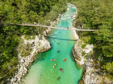
- Kamniška Bistrica source: A powerful karstic spring rises beneath a rocky wall into a vivid green pool beside Dom v Kamniški Bistrici. Three springs form the riverhead of the Kamniška Bistrica.
- Veliki and Mali Predaselj gorges: Narrow limestone gorges where the river has cut deep pools, with Veliki Predaselj reaching about 35 m deep. Mali Predaselj has a natural rock bridge formed by a wedged boulder and wooden steps down to the gorge floor.
- Orglene/Orglice waterfall: The largest waterfall in the area, about 30 m high, reached on a short side path. Its name comes from the organ-pipe shape of the water streams.
- Dom v Kamniški Bistrici: A mountain hut at about 600 m beside the source, offering food, refreshments and around 36 beds in season. It is also a gateway to higher Kamnik-Savinja Alps routes.
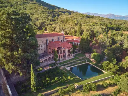
- Plečnik’s royal hunting lodge: A notable architectural and royal heritage site in the valley, designed by Jože Plečnik and built for King Alexander I of Yugoslavia.
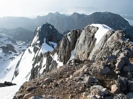
- Kamnik-Savinja Alps peaks: The valley is ringed by major summits including Grintovec, Skuta, Jezerska Kočna, Planjava, Ojstrica and Brana.
Challenges to expect
This is an easy valley walk, but expect wet or slippery surfaces after rain, especially on dirt, gravel, rock and wooden steps. The Predaselj gorge edges and short descents need care, particularly with children. Winter can bring snow and ice. Dom v Kamniški Bistrici is seasonal, typically operating from April to the end of September, so do not rely on hut services outside that period.
HikeList Score
Kamniška Bistrica Valley Trail scored 78/100 on HikeList's trail-quality metrics.
See score breakdownHide breakdown
- Ideal length 55
- Balanced challenge 64
- Scenery & wildness 74
- Varied terrain 100
- Accommodation 92
- Food & support 88
- Path quality 98
- Season flexibility 89
Computed from length, challenge, scenery & wildness, terrain variety, accommodation, food & support, path quality and season flexibility.
 Slovenia
Show more data Show less
- Glacial Valley
- Forest
- Limestone Gorges
- Riverside Meadows
- Alpine
- Dirt
- Gravel
- Rocky
- Wooden Steps
- Huts
- Hotels
- Guesthouses
- Campsites
- Family Friendly
- Pet Friendly
- Restrooms
- Water Sources
- Campsites
- Picnic Areas
Photos from hikers
Taken on the trail by people who've reviewed Kamniška Bistrica Valley Trail.
Follow the waymarked Koželj Trail upstream through the Kamniška Bistrica valley. The route passes forest trail, riverside meadows, Veliki Predaselj and Mali Predaselj gorges, and a short side path to Orglene/Orglice waterfall before reaching the river source and Dom v Kamniški Bistrici.
Reviews
How would you rate Kamniška Bistrica Valley Trail?
Tap a star to start your review — you could be the first.