Iroise Marine Park Circuit
How would you rate Iroise Marine Park Circuit?
Tap a star to share your experience and help other hikers.
Iroise Marine Park Circuit: Pointe Saint-Mathieu Day Loop
HikeList Score
Iroise Marine Park Circuit scored 79/100 on HikeList's trail-quality metrics.
See score breakdownHide breakdown
- Ideal length 55
- Balanced challenge 100
- Scenery & wildness 98
- Varied terrain 59
- Accommodation 66
- Food & support 88
- Path quality 80
- Season flexibility 89
Computed from length, challenge, scenery & wildness, terrain variety, accommodation, food & support, path quality and season flexibility.
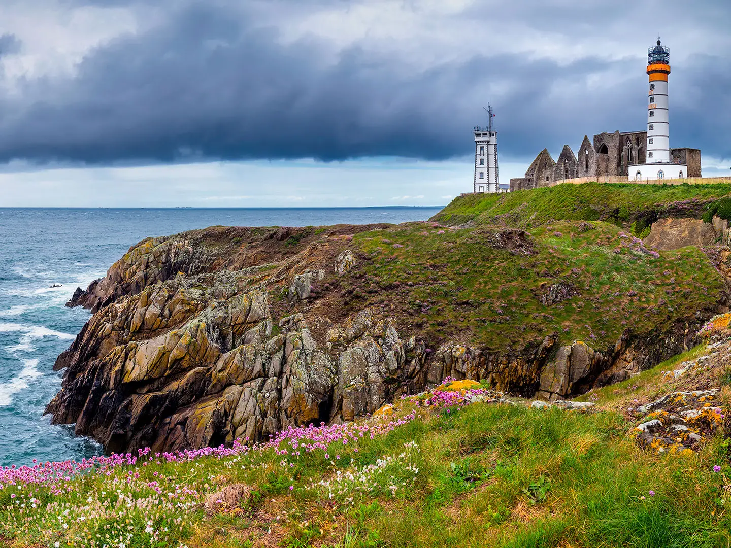
The Iroise Marine Park Circuit is a 12.5 km moderate coastal day loop around Pointe Saint-Mathieu near Plougonvelin, at the far western tip of Finistère in Brittany, France. The route is officially the Circuit de Saint-Mathieu, with a GR34 clifftop section and a yellow-blazed inland return. It suits hikers wanting a half-day to full-day walk with Atlantic sea views, abbey ruins, a working lighthouse, WWII bunkers and exposed but non-technical coastal terrain.
Route Overview
The loop begins and ends at Plougonvelin, commonly from the Trez-Hir or Pointe Saint-Mathieu car park, and can be walked in either direction. The coastal half follows the GR34, the Sentier des Douaniers, around Pointe Saint-Mathieu past the lighthouse, abbey ruins, sailors’ memorial, Blockhaus de la Casquette, Mémoires 39-45, Jardin du Vaéré and Keryunan coastal path. The return uses a yellow-marked PR through the rural/inland side of the headland. A longer documented variant continues east to Les Rospects viewpoint and Fort de Bertheaume. Public-transport details are not verified in the brief, so plan local access separately. For other French coastal routes, compare the D-Day Beaches Circuit or the Bordeaux to Arcachon Trail.
Pointe Saint-Mathieu: abbey, lighthouse and fortified coast
Pointe Saint-Mathieu has long been a landmark for Breton seafarers. A Benedictine abbey was established here from the 11th century and later fell into ruin; the present lighthouse was built among its remains in 1835. The sailors’ memorial recalls those lost on the dangerous Iroise Sea, while nearby defences range from Vauban-era works at Fort de Bertheaume to German WWII bunkers. Since 2007 the surrounding waters have formed the Parc naturel marin d’Iroise.
Notable highlights
- Pointe Saint-Mathieu (abbey ruins and lighthouse): The headland is the main landmark of the walk, with ruined Benedictine abbey walls beside a working lighthouse. It gives wide views across the Iroise Sea towards Ouessant.
- Sailors’ Memorial / Cénotaphe (1927 monument): This monument by Breton sculptor René Quillivic honours sailors and fishermen lost at sea. It is a sombre stop beside the abbey and lighthouse.
- Blockhaus de la Casquette & Mémoires 39-45 (WWII coast defences): The route passes wartime bunkers on the cap, including the distinctive cap-topped bunker. The museum occupies a former German command post.
- Jardin du Vaéré (coastal garden): Passed at roughly the sixth kilometre, this garden offers a greener, calmer break from the exposed Atlantic headland.
- Keryunan coastal path (GR34 clifftop section): This is one of the most scenic parts of the loop, with rocky footpath, coves and open views over the marine park’s waters.
- Fort de Bertheaume (longer eastern variant): The longer option adds this Vauban-era sea fort on a tidal islet linked by footbridge, now a heritage site with a separately ticketed zip-line.
Challenges to expect
Expect exposure rather than technical difficulty. The clifftop GR34 is uneven in places, with dirt and rocky sections, steep coastal drops and modest ups and downs around coves. Atlantic wind, rain and sea mist can arrive quickly, even outside winter. Navigation is straightforward if you follow the red-and-white GR34 on the coast and yellow PR waymarks inland, but summer paths and car parks can be busy.
HikeList Score
Iroise Marine Park Circuit scored 79/100 on HikeList's trail-quality metrics.
See score breakdownHide breakdown
- Ideal length 55
- Balanced challenge 100
- Scenery & wildness 98
- Varied terrain 59
- Accommodation 66
- Food & support 88
- Path quality 80
- Season flexibility 89
Computed from length, challenge, scenery & wildness, terrain variety, accommodation, food & support, path quality and season flexibility.
 France
Show more data Show less
- Coastal
- Dirt
- Rocky
- Paved
- Hotels
- Campsites
- Family Friendly
- Pet Friendly
- Restrooms
- Water Sources
- Campsites
- Picnic Areas
Photos from hikers
Taken on the trail by people who've reviewed Iroise Marine Park Circuit.
Reviews
How would you rate Iroise Marine Park Circuit?
Tap a star to start your review — you could be the first.