Hurrungane Circuit
How would you rate Hurrungane Circuit?
Tap a star to share your experience and help other hikers.
Hurrungane Circuit: Hut-to-Hut Hiking in Jotunheimen
HikeList Score
Hurrungane Circuit scored 77/100 on HikeList's trail-quality metrics.
See score breakdownHide breakdown
- Ideal length 66
- Balanced challenge 52
- Scenery & wildness 98
- Varied terrain 94
- Accommodation 66
- Food & support 81
- Path quality 98
- Season flexibility 76
Computed from length, challenge, scenery & wildness, terrain variety, accommodation, food & support, path quality and season flexibility.
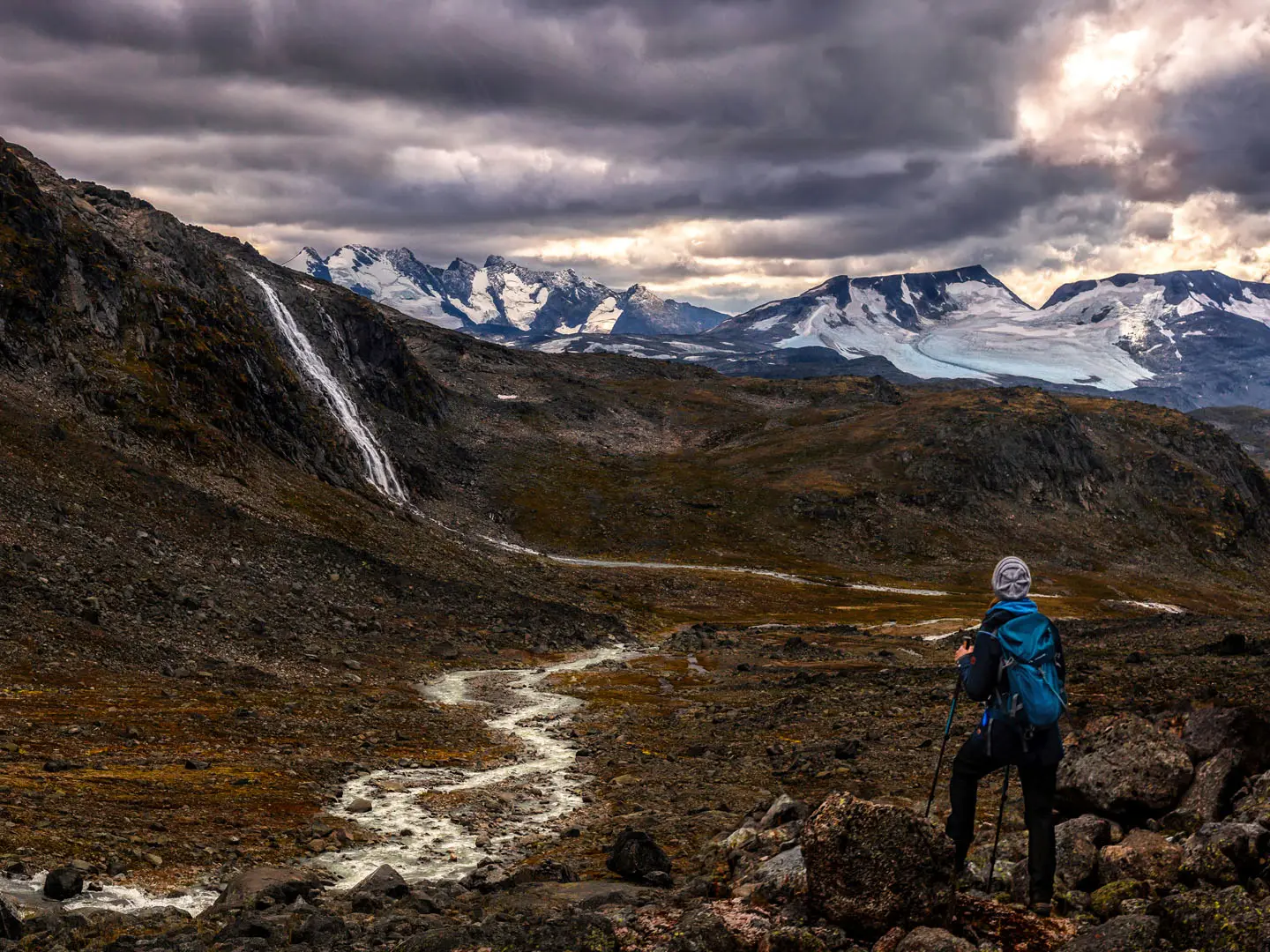
The Hurrungane Circuit is a 34 km hut-to-hut loop through the jagged Hurrungane massif in western Jotunheimen, Norway. Starting and finishing at Turtagro on the Sognefjellsvegen, it usually takes 2-3 days and is best treated as a strenuous mountain walk. The standard DNT-marked line goes via Fannaraken/Fannarakhytta and Skogadalsboen, with rough stony paths, scree and exposed high ground, but no glacier travel or technical scrambling on the Turtagro variant.
Route Overview
The classic loop starts at Turtagro, an old climbers' base at 884 m on Rv55 between Fortun and Lom. Walk through Helgedalen to the summit of Fannaraken and Fannarakhytta at 2,068 m, then continue down via Gjertvassdalen to Skogadalsboen DNT lodge in upper Utladalen. The final leg returns to Turtagro over Keisarpasset. It is a true loop on DNT-marked trails, normally split across two hut nights. If you are comparing Jotunheimen options, see the Galdhøpiggen Summit Trail, Glittertind Ascent and Besseggen Ridge.
Hurrungane and the birth of Norwegian mountaineering
Hurrungane has a central place in Norwegian climbing history. British climber William Cecil Slingsby made the first ascent of Store Skagastolstind, known as Storen, on 21 July 1876 with Emanuel Mohn and Knut Lykken, though only Slingsby reached the top. He is widely described as the father of Norwegian mountain sport. Turtagro has been a mountaineering hub for the massif since the late 1800s.
Notable highlights
- Fannaraken and Fannarakhytta (2,068 m): The summit is the high point of the walking loop. Fannarakhytta stands on top and is the highest staffed DNT mountain hut in Norway.
- Store Skagastolstind / Storen (2,405 m): The highest peak in Hurrungane and Norway's third-highest mountain dominates the skyline. It is a technical climb, not part of this circuit.
- Utladalen: The route descends into Norway's deepest valley around Skogadalsboen. The valley is protected as part of the Utladalen Landscape Protection Area, with Vettisfossen farther downvalley.
- Turtagro: This historic alpine base on the Sognefjellsvegen is the classic start and finish for Hurrungane routes.
- Keisarpasset: The pass on the Skogadalsboen-Turtagro leg marks the transition between upper Utladalen and the Helgedalen side.
- Visible glaciers: Skagastolsbreen, Maradalsbreen and Fannarakbreen can be seen from the route, although the standard circuit does not cross them.
Challenges to expect
Expect strenuous walking rather than technical climbing. The route is DNT-marked, but sections are steep, rough and stony, with stable scree, exposed high ground on Fannaraken and lower birch woods in the valleys. Snow can linger into early summer. The 2-day version is possible but makes the Fannaraken-Skogadalsboen-Turtagro day long; 3 days is the more comfortable hut-to-hut pace.
HikeList Score
Hurrungane Circuit scored 77/100 on HikeList's trail-quality metrics.
See score breakdownHide breakdown
- Ideal length 66
- Balanced challenge 52
- Scenery & wildness 98
- Varied terrain 94
- Accommodation 66
- Food & support 81
- Path quality 98
- Season flexibility 76
Computed from length, challenge, scenery & wildness, terrain variety, accommodation, food & support, path quality and season flexibility.
 Norway
Show more data Show less
- Alpine
- Mountainous
- Valley
- Forest
- Rocky
- Dirt
- Gravel
- Huts
- Hotels
- Pet Friendly
- Water Sources
- Campsites
- Shelters
In these collections
Photos from hikers
Taken on the trail by people who've reviewed Hurrungane Circuit.
Climb from Turtagro through Helgedalen to Fannaraken and Fannarakhytta on the 2,068 m summit. This leg gains roughly 1,170 m and is the high, exposed start to the circuit.
Leave the summit area and continue on DNT-marked trails towards Skogadalsboen, passing the Gjertvassdalen side of the massif and descending towards upper Utladalen.
Return from Skogadalsboen to Turtagro on the Hu.4 route via Keisarpasset. This documented leg has about 650 m ascent, 730 m descent and is listed at around 6 hours.
Reviews
How would you rate Hurrungane Circuit?
Tap a star to start your review — you could be the first.