Hel Peninsula Trail
How would you rate Hel Peninsula Trail?
Tap a star to share your experience and help other hikers.
Hel Peninsula Trail: Coastal Walk on Poland’s Baltic Spit
HikeList Score
Hel Peninsula Trail scored 74/100 on HikeList's trail-quality metrics.
See score breakdownHide breakdown
- Ideal length 59
- Balanced challenge 50
- Scenery & wildness 78
- Varied terrain 94
- Accommodation 83
- Food & support 88
- Path quality 80
- Season flexibility 89
Computed from length, challenge, scenery & wildness, terrain variety, accommodation, food & support, path quality and season flexibility.
The Hel Peninsula Trail is a 35 km, easy, point-to-point coastal walk in Pomerania, northern Poland, from Władysławowo to Hel. It suits walkers who want flat Baltic beaches, seaside towns and simple public transport rather than a remote wilderness hike. The key caveat: this is not a dedicated waymarked long-distance hiking trail. The practical through-route follows the R10 / EuroVelo 10 cycle path, shared with cyclists, though you can also walk parallel sections on the beach. Allow one long day or split it over two.
Route Overview
Start at Władysławowo, the mainland base of the Hel Peninsula, and walk east along the sand spit towards Hel at the tip. The route passes Chałupy, Kuźnica, Jastarnia and Jurata, with the Bay of Puck on one side and the open Baltic Sea on the other. The line is simple: follow the separated R10 cycle/foot path, using the beach where you prefer sand to paving. A railway line, road and bus 669 run along the spit, so one-way walks and shorter sections are easy. If you want a more conventional coastal thru-hike, compare the Baltic Coastal Trail; for a larger Polish cycling route, see the Green Velo Trail, or follow the historic Amber Trail inland.
Sand, storms and coastal defences
The Hel Peninsula is formed entirely of sand and was a chain of islands until the 17th century; winter storms can still cut across the spit. In the Second World War it became a fortified Polish naval garrison of around 3,000. During the Battle of Hel in 1939, Polish forces held out, and at one point dynamited the spit to turn it back into an island. German occupiers later built heavy coastal batteries here. Today the former fishing villages are seaside resorts within Nadmorski Landscape Park.
Notable highlights
Hel Lighthouse (41.5 m): A dark-red brick octagonal tower at the tip of the peninsula, built in 1942 and still operational. The climb gives a rare overview of the narrow spit, the Bay of Puck and the Baltic.
Seal Sanctuary, Fokarium: A grey-seal rescue and research centre on Hel’s waterfront, run by the University of Gdańsk’s oceanography institute. It is an easy add-on at the end of the walk.
Hel Fortified Area / Museum of Coastal Defence: Preserved bunkers, gun batteries and fire-control towers reflect the peninsula’s wartime role. The separate waymarked Fortifications Trail is about 10 km around the tip.
Cypel Helski: The very end of the spit, with water on three sides. It is the natural finish point for walkers continuing beyond the town of Hel.
Chałupy and the Bay of Puck: The shallow bay-side waters around Chałupy and Jastarnia are a major kitesurfing and windsurfing area. This is where the peninsula feels especially narrow, with sea and bay close together.
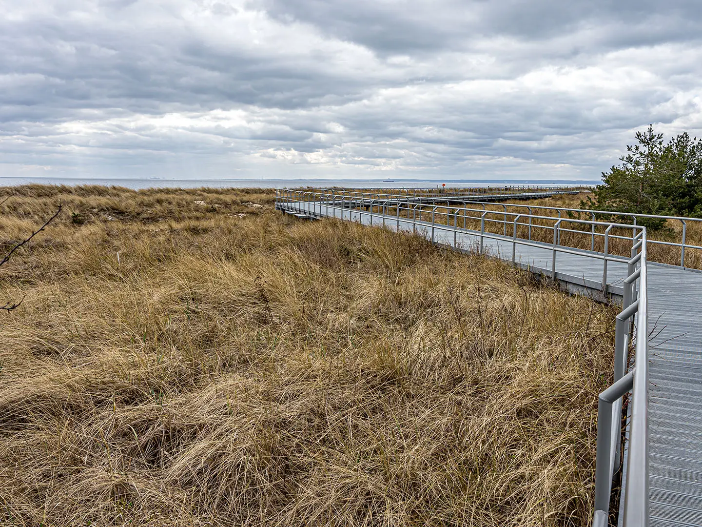
Baltic beaches: The seaward side has a near-continuous white-sand beach for much of the route. It is slower than the paved path but gives the most direct coastal walking experience.
Challenges to expect
The route is physically easy: flat, low and with negligible ascent. The main issues are practical rather than technical. The R10 path is shared with cyclists, especially busy in summer, and open sections can be windy, sunny and exposed with limited shade. Beach walking is softer and slower than the paved route. Navigation is straightforward, and towns, trains and bus 669 make resupply and bail-out simple.
HikeList Score
Hel Peninsula Trail scored 74/100 on HikeList's trail-quality metrics.
See score breakdownHide breakdown
- Ideal length 59
- Balanced challenge 50
- Scenery & wildness 78
- Varied terrain 94
- Accommodation 83
- Food & support 88
- Path quality 80
- Season flexibility 89
Computed from length, challenge, scenery & wildness, terrain variety, accommodation, food & support, path quality and season flexibility.
Show more data Show less
- Coastal
- Beach
- Dunes
- Forest
- Paved
- Concrete Block
- Sand
- Hotels
- Guesthouses
- Campsites
- Family Friendly
- Pet Friendly
- Restrooms
- Water Sources
- Campsites
- Picnic Areas
In these collections
Photos from hikers
Taken on the trail by people who've reviewed Hel Peninsula Trail.
Walk the full peninsula from the mainland base at Władysławowo to Hel at the tip, following the R10 / EuroVelo 10 cycle path via Chałupy, Kuźnica, Jastarnia and Jurata. Fit walkers can do this in one long day; many split it over two days with an overnight in Jastarnia or Jurata.
Reviews
How would you rate Hel Peninsula Trail?
Tap a star to start your review — you could be the first.