Hajla Peak Trail
How would you rate Hajla Peak Trail?
Tap a star to share your experience and help other hikers.
Hajla Peak Trail: Montenegro–Kosovo Border Summit
HikeList Score
Hajla Peak Trail scored 79/100 on HikeList's trail-quality metrics.
See score breakdownHide breakdown
- Ideal length 55
- Balanced challenge 94
- Scenery & wildness 98
- Varied terrain 64
- Accommodation 66
- Food & support 81
- Path quality 98
- Season flexibility 89
Computed from length, challenge, scenery & wildness, terrain variety, accommodation, food & support, path quality and season flexibility.
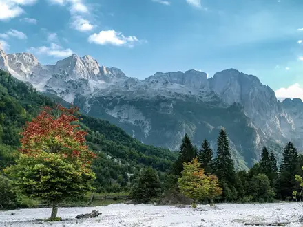
The Hajla Peak Trail is a 14 km out-and-back day climb from the Rozaje side of north-east Montenegro to Hajla summit, 2,403 m, on the Montenegro-Kosovo border. It is rated moderate, but sits at the tougher end: expect about 1,250 m of ascent, a long 7–9 hour day, and an exposed rocky summit ridge. It suits fit hikers who want a non-technical Prokletije / Accursed Mountains peak with forest, high pasture, limestone ridge and major border-mountain views.
Route Overview
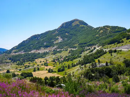
The standard Montenegrin route starts in Rozaje, around 1,005 m, and climbs via Donji/Gornji Bukelj and the Bandzov katun area to Hajla summit, returning the same way. A common higher start is Gornji Bukelj / Bandzov katun, reached by a 10–12 km non-paved forest road from Rozaje; from there the summit is roughly 2.5–3 hours away. Key waypoints are Gornji Bukelj, Hajla pass / Pas Hajle, Mala Gora pass and the 2,403 m summit. This page covers the Rozaje/Bandzov/Bukelj approach only; Kosovo-side routes from Reke e Allages, Pepaj and Drelaj also exist. For other Montenegro mountain days, compare Grbaja Valley to Karanfili or Hrid Lake Trail.
Hajla, the Ibar Source and a Cross-Border Mountain
Hajla is the high point of the northern Prokletije, the Accursed Mountains, a name tied to the region’s harsh mountain life. Pleistocene glaciation shaped the cirques and upper slopes, while the limestone tops feed the source of the Ibar river on the Montenegrin side. The high pastures have long supported seasonal shepherding in katuns such as Bandzov. The area also saw fighting during the 1999 Kosovo War near Greater Shtupec, and later became part of the Peaks of the Balkans, a reconciliation trail linking Montenegro, Kosovo and Albania.
Notable highlights
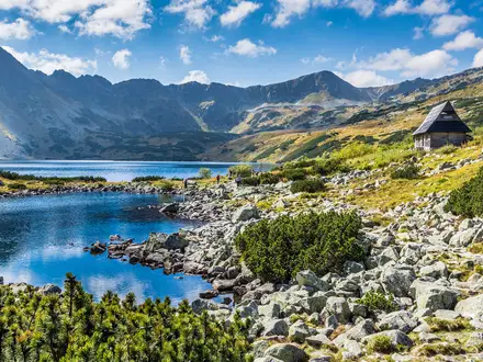
Hajla summit (2,403 m): The highest peak of the northern Accursed Mountains and the literal Montenegro-Kosovo border. On clear days the panorama reaches towards Gjeravica, the Komovi and the Albanian Alps.
Summit ridge and limestone cliff: The final crest is rocky and exposed, narrowing to roughly a metre in places. A sheer limestone wall drops below the summit, making this the most serious-feeling section of the hike.
Bandzov katun: A traditional highland shepherds’ settlement below Hajla’s north face at about 1,460 m. It is also a practical higher trailhead for hikers approaching from Rozaje by the forest road.
Source of the Ibar — Vrelo Ibra: The Ibar rises in the forests of Hajla below Maja Dramadol. It adds a strong geographical marker to a route better known for its ridge and border summit.
Peaks of the Balkans / Via Dinarica: Hajla lies on these international long-distance routes. The Peaks of the Balkans is especially notable as a cross-border trail connecting Montenegro, Kosovo and Albania.
Challenges to expect
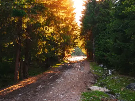
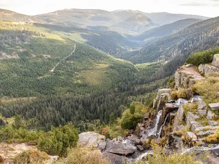
This is not technical climbing, but it is a big mountain day: around 1,250 m of ascent from Rozaje and a 7–9 hour out-and-back. The lower route uses forest road and wild forest trail, then open grass and rock before the exposed limestone summit ridge. Snow can linger or fall on the tops outside settled summer weather. The summit ridge is the key hazard: narrow, rocky and border-exposed, so avoid it in poor visibility or storms. For another demanding summit day, see Bobotov Kuk Summit Trail.
HikeList Score
Hajla Peak Trail scored 79/100 on HikeList's trail-quality metrics.
See score breakdownHide breakdown
- Ideal length 55
- Balanced challenge 94
- Scenery & wildness 98
- Varied terrain 64
- Accommodation 66
- Food & support 81
- Path quality 98
- Season flexibility 89
Computed from length, challenge, scenery & wildness, terrain variety, accommodation, food & support, path quality and season flexibility.
 Montenegro
Show more data Show less
- Mountainous
- Forest
- Dirt
- Rocky
- Huts
- Guesthouses
- Pet Friendly
- Water Sources
- Campsites
- Shelters
Photos from hikers
Taken on the trail by people who've reviewed Hajla Peak Trail.
Climb from Rozaje, around 1,005 m, via Gornji Bukelj, Hajla pass / Pas Hajle and Mala Gora pass to Hajla summit, 2,403 m, then return by the same route. The Rozaje out-and-back gains about 1,250 m and typically makes a full 7–9 hour day. Starting higher at Gornji Bukelj / Bandzov katun shortens the summit push, but the route remains steep and exposed near the top.
Reviews
How would you rate Hajla Peak Trail?
Tap a star to start your review — you could be the first.