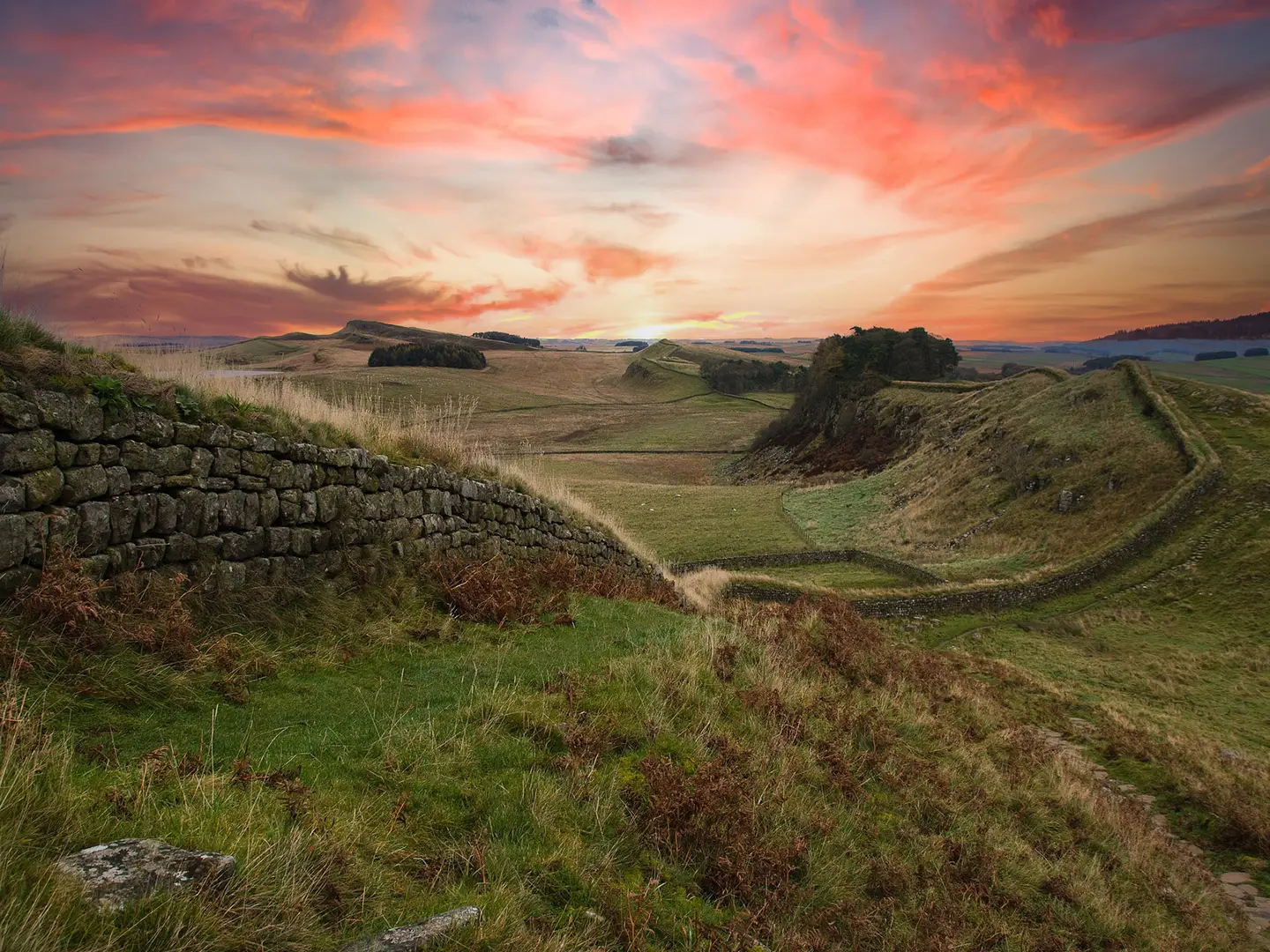
Hadrian's Wall Path
How would you rate Hadrian's Wall Path?
Tap a star to share your experience and help other hikers.
Hadrian's Wall Path: A Coast-to-Coast Roman Frontier Walk
HikeList Score
Hadrian's Wall Path scored 79/100 on HikeList's trail-quality metrics.
See score breakdownHide breakdown
- Ideal length 96
- Balanced challenge 100
- Scenery & wildness 39
- Varied terrain 71
- Accommodation 83
- Food & support 88
- Path quality 80
- Season flexibility 89
Computed from length, challenge, scenery & wildness, terrain variety, accommodation, food & support, path quality and season flexibility.
Hadrian's Wall Path is a 135 km waymarked National Trail across northern England, following the Roman frontier from the River Tyne to the Solway Firth. Most walkers take 6-7 days. It is a moderate point-to-point walk: manageable for reasonably fit hikers, but with repeated short climbs on the central Whin Sill crags. Expect a mix of city paths, farmland, moorland, grass and dirt trail, with major Roman sites throughout. For trip comparisons, see Annandale Way, Anglesey Coastal Path and Ayrshire Coastal Path.
Route Overview
The trail runs coast to coast from Segedunum Roman Fort at Wallsend, Newcastle upon Tyne, to Bowness-on-Solway on the Solway Firth. It is conventionally walked west-bound, so the urban Tyneside section comes first and the finish is on the quieter Solway coast; the prevailing wind is from the west. Key places include Heddon-on-the-Wall, Chollerford and Chesters Roman Fort, Brocolitia, Steel Rigg, Housesteads Roman Fort, Sycamore Gap, Once Brewed/Twice Brewed, Gilsland, Birdoswald Roman Fort, Walton and Carlisle. As a point-to-point route, plan end-to-end logistics rather than a loop.
Hadrian's Wall: Roman Britain’s Northern Frontier
Hadrian's Wall was begun in AD 122 on the orders of Emperor Hadrian to mark and defend the north-west frontier of Roman Britain. The barrier ran about 73 miles across the island from Wallsend on the Tyne to Bowness-on-Solway, guarded by forts, milecastles and turrets. It remained an imperial frontier for nearly 300 years. The Wall became part of the Frontiers of the Roman Empire UNESCO World Heritage Site in 1987, and the modern National Trail opened in 2003.
Notable highlights
- Segedunum Roman Fort, Wallsend: The eastern trailhead and a major excavated fort on the Wall, with a museum and viewing tower. It is also the first or last Hadrian's Wall Path Passport stamping station.
- Housesteads Roman Fort: Set high on the Whin Sill crags, this is the most complete Roman fort surviving in Britain and once held a regiment of around 800 soldiers. It is one of the standout stops on the central section.
- Sycamore Gap: A well-known dip in the crags between Milecastle 39 and Crag Lough. The famous lone tree was illegally felled in 2023, but the site remains a key landmark on the central section.
- Steel Rigg and Crag Lough: One of the most dramatic walking sections, where the Wall follows the dolerite Whin Sill above Crag Lough. This is classic Hadrian's Wall Path terrain: exposed grass, crags and repeated climbs.
- Vindolanda: A Roman fort and settlement reached by a short detour south of the main route. It is especially known for the Vindolanda writing tablets, the oldest surviving handwritten documents in Britain.
- Birdoswald Roman Fort: A western highlight beside the longest continuous visible stretch of Hadrian's Wall, and the only Roman auxiliary fort known to retain a drill hall.
Challenges to expect
The hardest walking is the 37 km central section between Chollerford and Birdoswald, where the Whin Sill brings many short, sharp climbs and descents. Most ascent is concentrated here, with the high point at Winshields Crags. The route is well waymarked with the acorn National Trail symbol, but mud can be an issue in wet conditions. Winter walking is discouraged because soft turf and buried archaeology are easily damaged.
HikeList Score
Hadrian's Wall Path scored 79/100 on HikeList's trail-quality metrics.
See score breakdownHide breakdown
- Ideal length 96
- Balanced challenge 100
- Scenery & wildness 39
- Varied terrain 71
- Accommodation 83
- Food & support 88
- Path quality 80
- Season flexibility 89
Computed from length, challenge, scenery & wildness, terrain variety, accommodation, food & support, path quality and season flexibility.
 United Kingdom
 England
Show more data Show less
- Grassland
- Urban
- Paved
- Gravel
- Dirt
- Hotels
- Hostels
- Campsites
- Family Friendly
- Dog Friendly On Leash
- Restrooms
- Established Campsites
- Visitor Center
- Public Transport Access Points
Download Our Full Guide to Hadrian's Wall Path FREE!
Get our comprehensive guide to this hike for free. Save it for later reading or print out at home.
Articles related to this hike
Photos from hikers
Taken on the trail by people who've reviewed Hadrian's Wall Path.
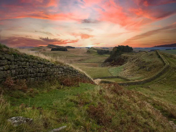
Hadrian's Wall Path: The Complete Guide
 i
Image by Sweetaholic
i
Image by Sweetaholic Hadrian’s Wall Path is one of England’s most practical and rewarding long-distance walks: a 135 km coast-to-coast National Trail following the line of the Roman frontier from Segedunum at Wallsend to Bowness-on-Solway. It suits reasonably fit walkers who want strong history, clear waymarking and a route that can be tackled without technical mountain skills.
The walk changes character several times. It starts with urban and riverside paths along the Tyne, crosses farmland and the Military Road corridor, then rises onto the exposed Whin Sill crags where the Wall is at its most dramatic.
The central section between Chollerford and Birdoswald is the crux, with repeated short climbs and descents over grass and rock, including the high point at Winshields Crags. Beyond it, the route eases through Cumbrian pasture, Carlisle and the flat Solway estuary to a quiet finish near the shore.
This is a moderate trail rather than a hard expedition, but it still needs proper planning. Accommodation is limited and popular around Housesteads, Once Brewed and Gilsland, the central turf can be muddy and fragile in wet weather, and transport from the small finish village must be arranged carefully.
This guide covers stages, daily planning, accommodation, food, transport, terrain and the common mistakes to avoid.
Stage-by-Stage Guide
Stage 1: Wallsend (Segedunum) to Heddon-on-the-Wall — 22 km
This opening stage is the easiest underfoot but one of the longest-feeling, because much of it is on hard urban and suburban surfaces. The route starts at Segedunum Roman Fort in Wallsend, then follows National Trail acorn waymarks west along the River Tyne through Newcastle upon Tyne and out towards Newburn before reaching Heddon-on-the-Wall.
Expect paved riverside paths, urban junctions and later more open ground as the trail leaves Tyneside. Navigation is generally straightforward, but waymarks can be easier to miss in built-up areas than on open country, so pay attention at path junctions, bridges and road crossings.
Segedunum is the key Roman landmark at the start and is also a Hadrian’s Wall Path Passport stamping station. Newcastle gives the best early-stage access to shops, cafés, rail services and accommodation; once beyond the city, do not rely on frequent services without checking in advance.
Food and water are easiest to organise before leaving Wallsend or Newcastle. Carry enough for the full day after the urban section, particularly if arriving late or walking outside the main season.
Heddon-on-the-Wall is a practical first overnight stop, but accommodation is much thinner than in Newcastle. Book ahead, or be prepared to use nearby accommodation and arrange transport in advance.
Transport is strongest at the start: Newcastle is on the East Coast Main Line and the Tyne and Wear Metro runs to Wallsend, a short walk from Segedunum. Road access is reasonable around the urban and suburban sections, but any onward bus or taxi plan from Heddon-on-the-Wall should be checked before travelling.
Main cautions are hard surfaces, urban navigation and the temptation to underestimate the day because it is not hilly. Good footwear still matters, especially if continuing straight into a multi-day schedule.
Stage 2: Heddon-on-the-Wall to Chollerford — 24 km
This stage leaves the Tyneside edge behind and moves into the more open farmland and Military Road corridor of Northumberland. It is not as dramatic as the central crags, but it is a proper rural walking day with long gaps between reliable services.
The route passes through or near Harlow Hill and Halton before reaching Chollerford, beside Chesters Roman Fort. Underfoot is a mix of field paths, grass, dirt trail and tracks, with conditions becoming muddy after wet weather.
Chesters Roman Fort is the main highlight at the end of the day. It is one of the best-preserved Roman cavalry forts in Britain and sits right beside the trail, making Chollerford a particularly good overnight stop for walkers allowing time for the archaeology.
Carry lunch and enough water from the start unless specific mid-stage stops have been checked before travelling. Rural services along this section should not be assumed.
Accommodation at Chollerford and nearby villages should be booked ahead in the walking season. This is the approach to the central Wall country, where beds become more limited and demand rises.
The Tyne Valley railway line parallels much of the wider route, with stations including Corbridge and Hexham in this part of the corridor. Exact links between the trail and stations, bus stops or accommodation pick-ups should be checked before travelling.
Navigation remains well waymarked with National Trail acorns, but field crossings require more attention than the riverside start. Stay on the signed line, close gates, and keep off the Wall and any fragile archaeology.
Stage 3: Chollerford to Once Brewed / Steel Rigg — 20 km
This is where the walk changes character. After Chollerford and Chesters, the trail heads into the central Wall landscape, where the Whin Sill escarpment begins to dominate and the walking becomes more strenuous.
The stage includes Brocolitia / Carrawburgh and the Temple of Mithras, a small but memorable Roman site just off the path in the fields. Housesteads Roman Fort is another major highlight, set high on the crags and one of the most important Roman sites on the whole route.
Terrain becomes rougher, grassier and more exposed than on the first two days. The climbs are not long mountain ascents, but they come repeatedly and can feel hard with a full pack, especially in wet or windy weather.
This section is part of the most fragile and most demanding stretch of the National Trail. National Trails discourages walking the central section in winter or wet conditions because the turf is easily damaged and erosion can affect buried archaeology. Stay on the signed path and do not walk on the Wall itself.
Food and water options are limited between the main trail hubs, so start the day supplied. Once Brewed / Twice Brewed is an important overnight area, but do not arrive assuming space will be available.
Accommodation near Once Brewed includes The Sill / YHA and independent hostels near Once Brewed, alongside other local options in the Military Road corridor. This is one of the highest-demand areas on the trail and should be booked well ahead.
The seasonal AD122 Hadrian’s Wall Country Bus links trailhead villages along the central section, making this one of the easier parts of the route to split, shorten or use for access. Current bus times and operating dates should be checked before relying on it.
Vindolanda is a worthwhile optional detour near Once Brewed, about 1.5 km south of the path. It is not on the National Trail itself, so allow extra time and energy if visiting.
Stage 4: Once Brewed / Steel Rigg to Gilsland — 14 km
This is a shorter stage by distance, but it covers some of the most memorable and physically uneven walking on Hadrian’s Wall Path. The Wall rides the Whin Sill in a sequence of short, steep climbs and descents, with exposed grass, rock and open views.
Depending on where the previous day ended, this stage may include the classic Steel Rigg and Crag Lough area, Sycamore Gap, Winshields Crags and Cawfields. Winshields Crags, at 345 m, is the high point of both the Wall and the National Trail.
Sycamore Gap remains a key landmark even though the famous tree was illegally felled in 2023. The dip in the crags between Milecastle 39 and Crag Lough is still one of the most recognisable places on the route.
The path is well signed but demands care underfoot. Wet grass, mud and polished rock can make the short descents slippery, and the exposed escarpment can feel much harder in strong wind.
Carry food and water unless specific stops have been checked in advance. The day is short enough to allow time for Roman sites, but not so short that it can be treated as a rest day in poor conditions.
Accommodation is available in the wider Once Brewed, Twice Brewed, Greenhead and Gilsland area, but capacity is limited compared with Newcastle or Carlisle. Book early, especially for spring, summer and early autumn weekends.
The AD122 bus is useful for central-section access, and road access is available at several trailhead points in the Wall corridor. Timetables, stopping points and seasonal operation should be checked before travelling.
The main warning is conservation as much as personal safety: this is the most erosion-prone part of the trail. Avoid walking it in persistently wet conditions where possible, keep to the marked line and stay off the Wall.
Stage 5: Gilsland to Walton — 12 km
This is a gentler transition stage from the central crags towards the quieter Cumbrian countryside. It is shorter than most days on the standard schedule, which gives time for Birdoswald Roman Fort without rushing.
Birdoswald is the main highlight, standing beside the longest continuous visible stretch of Hadrian’s Wall. The route then continues through more pastoral country, passing Banks before reaching Walton.
The terrain is mostly grass, field paths, tracks and rural walking rather than sustained escarpment. It can still be muddy, especially after rain, and field sections require careful attention to gates, waymarks and livestock.
Food and water should be carried from Gilsland unless specific services have been checked before travelling. Do not assume regular mid-stage shops or cafés on this quieter section.
Walton is a small overnight stop, so accommodation at or near the village needs advance planning. If staying away from the trail, arrange any pick-up or transfer with the accommodation before setting out.
The Tyne Valley railway line continues to parallel the broader route, with Brampton one of the named stations in this western-central area. Exact access between Walton, the trail and any station or bus connection should be checked before travelling.
Navigation is simpler than on the crags but less visually obvious than the Wall-top sections. Follow the acorn waymarks through fields and do not shortcut across farmland.
Stage 6: Walton to Carlisle — 18 km
This stage continues through gentle Cumbrian pasture before entering Carlisle along the River Eden. After the exposed central section, the walking is lower, flatter and less physically intense, though it still needs a full day’s supplies.
The route passes Crosby-on-Eden before following the River Eden into Carlisle. The main appeal is the change in landscape: quieter farmland gives way to riverside walking and then the services of a city.
Underfoot, expect field paths, grass, dirt trail and riverside sections. Mud is the main condition issue after rain, rather than steepness or technical difficulty.
Carry enough food and water to reach Carlisle unless definite stops have been checked in advance. Carlisle has plentiful accommodation, food, shops and onward transport, making it the easiest resupply and recovery point since Newcastle.
Carlisle is on the West Coast Main Line, so this is the best place on the western half of the trail to join, leave or pause the walk. It is also the practical base for anyone needing a shorter final stage plan or onward travel after finishing at Bowness-on-Solway.
Navigation becomes more mixed as the route approaches the city: field waymarks, riverside paths and urban edges all require attention. Check current National Trail diversions before setting out, particularly after periods of poor weather.
The main warning is complacency. The stage is not difficult, but wet fields, tired legs and urban-path junctions can still slow progress late in a multi-day walk.
Stage 7: Carlisle to Bowness-on-Solway — 24 km
The final stage is long but mostly flat, following the western approach from Carlisle through Beaumont, Burgh by Sands and Drumburgh to Bowness-on-Solway. The character is very different from the Whin Sill: open Cumbrian pasture, the River Eden, salt-marsh edges and wide Solway Firth skies.
This is not a mountain day, but it is a full-distance walking day with limited services once outside Carlisle. Start with enough food and water to finish unless specific stops have been checked before travelling.
The terrain is generally gentle, with flat estuary-side walking near the end. It can feel exposed in poor weather, and the openness of the Solway can make wind more noticeable than the map profile suggests.
Bowness-on-Solway is the official western terminus, marked by the finish sign near the shore on the site of the Roman fort of Maia. It is also a Passport area, with Bowness House Farm and the Kings Arms Inn listed as stamping stations in the operating season.
Accommodation in Bowness-on-Solway is limited compared with Carlisle and should be booked ahead. Many walkers also use Carlisle for onward travel, so the finish-day transport plan needs to be arranged before leaving the city.
The local 93 bus connects Bowness-on-Solway with Carlisle, but times should be checked before travelling, especially at weekends, holidays or outside the main walking season. Carlisle’s West Coast Main Line station is the main onward rail hub.
Navigation is usually straightforward on the signed National Trail, but do not drift away from the waymarked line across estuary-edge farmland and marsh margins. The final day is often mentally easy to underestimate: allow time for the distance, breaks, the finish photo and the onward bus or pick-up.
Recommended Itinerary
The most practical schedule for Hadrian's Wall Path is a 7-day west-bound itinerary from Wallsend to Bowness-on-Solway. It keeps the hardest Whin Sill section in manageable stages, gives enough time for the main Roman sites, and avoids making the exposed central crags into one long, rushed day.
Do not judge the stages by distance alone. The shorter days between Chollerford, Once Brewed / Steel Rigg, Gilsland and Walton are deliberately useful: this is where the repeated climbs, Roman sites and thinner accommodation make planning more important.
Standard 7-day itinerary
| Day | From | To | Approx. distance | Why this stage makes sense | Services/accommodation notes |
|---|---|---|---|---|---|
| 1 | Wallsend (Segedunum) | Heddon-on-the-Wall | 22 km | A full but straightforward opening day, using the signed National Trail from the eastern trailhead and getting the urban Tyneside section behind you. | Newcastle upon Tyne has the widest accommodation and transport choice at the start. Heddon-on-the-Wall has far fewer options than the city, so overnight arrangements should be booked rather than assumed. |
| 2 | Heddon-on-the-Wall | Chollerford | 24 km | A longer rural stage that positions you well for Chesters Roman Fort at Chollerford and for entering the more demanding central section the following day. | Stay in or near Chollerford if visiting Chesters. Accommodation is more limited than in Newcastle or Carlisle, so book ahead in the main walking season. |
| 3 | Chollerford | Once Brewed / Steel Rigg | 20 km | This is where the walk begins to feel more like the classic Wall country. The route passes important Roman remains and leads towards the Whin Sill escarpment, so the day is best kept moderate rather than overextended. | Once Brewed / Twice Brewed and nearby trail accommodation, including hostel and bunkhouse-style options, are in high demand. This is one of the key nights to secure early. |
| 4 | Once Brewed / Steel Rigg | Gilsland | 14 km | A deliberately short day through the most dramatic central terrain, including the Steel Rigg, Crag Lough and Winshields Crags area. The distance is modest, but the repeated short climbs and descents make it slower than it looks. | The central Housesteads–Once Brewed–Gilsland corridor has thinner accommodation than the towns at either end of the trail. Book well ahead and plan meals carefully. |
| 5 | Gilsland | Walton | 12 km | A useful recovery stage after the crags, with time for Birdoswald Roman Fort and the longest continuous visible stretch of Hadrian's Wall. It also prevents the western half from becoming a string of long days. | Walton is a small overnight stop. Check accommodation, evening food and any baggage-transfer arrangements before committing to this stage. |
| 6 | Walton | Carlisle | 18 km | A manageable day through gentler Cumbrian country, finishing in Carlisle with full town services and excellent onward rail options if section-hiking. | Carlisle is the easiest overnight base on the western half, with a much wider choice of accommodation, food and transport than the smaller villages. |
| 7 | Carlisle | Bowness-on-Solway | 24 km | A long but mostly gentle final stage across the flat Solway side of the route. It gives a clear coast-to-coast finish at Bowness-on-Solway without needing another intermediate night. | Bowness-on-Solway is a small finish village, not a transport hub. The 93 bus links Bowness-on-Solway with Carlisle, but current times should be checked before travelling and before booking onward trains. |
Slower 8-10 day itinerary
A slower schedule suits walkers who want more time at Chesters, Housesteads, Birdoswald and the optional Vindolanda detour, or anyone treating Hadrian's Wall Path as a first long-distance walk. It also gives more flexibility if wet weather makes the central turf slow and slippery.
The best places to add time are:
| Adjustment | Why it helps | Planning note |
|---|---|---|
| Add an extra night around Once Brewed / Twice Brewed | Gives time for Housesteads, Steel Rigg, Crag Lough and the optional signed detour south to Vindolanda without rushing the hardest terrain. | Accommodation here is among the most sought-after on the route. Book early. |
| Split one of the longer opening or closing days | Reduces the 22-24 km days at either end, useful for a gentler first day or a less pressured final approach to Bowness-on-Solway. | Exact stopping places depend on available accommodation and transport. Check official mapping before booking. |
| Add a night in Carlisle | Useful if arriving late from Walton, dealing with tired legs, or needing a more reliable transport base before the final Solway stage. | Carlisle has the strongest service base near the western end. |
Faster 6-day itinerary
A 6-day crossing is realistic for fit, experienced walkers who are comfortable with consecutive long days and are not planning extended visits to every Roman site. The simplest faster adjustment is to keep the central crag stages manageable, then combine the gentler western stages.
| Day | From | To | Approx. distance | Why this stage makes sense | Services/accommodation notes |
|---|---|---|---|---|---|
| 1 | Wallsend (Segedunum) | Heddon-on-the-Wall | 22 km | Standard opening stage. | Book Heddon-on-the-Wall accommodation ahead or base logistics from Newcastle where practical. |
| 2 | Heddon-on-the-Wall | Chollerford | 24 km | Standard rural approach to the central Wall. | Chollerford is a logical stop before the harder terrain. |
| 3 | Chollerford | Once Brewed / Steel Rigg | 20 km | Keeps the first central day sensible rather than forcing a very long crag stage. | Once Brewed / Twice Brewed accommodation should be secured early. |
| 4 | Once Brewed / Steel Rigg | Gilsland | 14 km | Protects time and energy for the steepest, most scenic Wall section. | Short on paper, but do not underestimate the repeated climbs and descents. |
| 5 | Gilsland | Carlisle | 30 km | Combines the standard Gilsland–Walton and Walton–Carlisle stages into one long day as the terrain becomes gentler. | Start early, carry enough food, and avoid relying on small-village services without checking them first. Carlisle gives the best recovery and transport options. |
| 6 | Carlisle | Bowness-on-Solway | 24 km | Standard final stage to the Solway finish. | Arrange return transport from Bowness-on-Solway in advance; the 93 bus timetable should be checked before travelling. |
The faster version leaves much less slack for poor weather, site visits and accommodation problems. For most independent walkers, the 7-day plan is the better balance of distance, terrain and logistics.
Planning the Route
How many days to allow
Most walkers should plan Hadrian’s Wall Path as a 7-day walk. That gives a practical spread of stages using the main accommodation hubs, while keeping the hardest central section over the Whin Sill to manageable days.
Experienced walkers can complete the trail in 6–7 days, but a faster schedule leaves less time for Chesters, Housesteads, Birdoswald and other Roman sites directly on or just beside the route. A 7–10 day plan is better if archaeology is a major part of the walk, especially if adding the signed detour to Vindolanda near Once Brewed.
The route is not difficult to follow, but the planning challenge is uneven. The eastern and western ends are relatively straightforward; the central section between Chollerford and Birdoswald needs the most care because accommodation is thinner, the walking is more tiring, and places fill early in the main season.
Fast, standard or slower itineraries
| Plan | Best for | Practical notes |
|---|---|---|
| 6 days | Fit walkers prioritising the walk over site visits | Requires longer days and efficient logistics. Less time for Roman forts, museums and detours. |
| 7 days | Most independent walkers | A strong balance of daily distance, accommodation availability and time to see the main Wall sections. |
| 8 days | Walkers wanting shorter days in the craggy middle section | Useful if staying around Once Brewed / Twice Brewed, Steel Rigg, Gilsland or nearby accommodation. |
| 9–10 days | Walkers treating the trail as a Roman-history journey | Allows time for Chesters, Housesteads, Birdoswald, Brocolitia and the Vindolanda detour without rushing. |
A slower itinerary is not just about easier walking. It can make the route more reliable logistically, because it gives more flexibility around accommodation, weather on the exposed crags, and opening times for Roman sites. This should be checked before travelling.
Direction of travel
Hadrian’s Wall Path is conventionally walked west-bound, from Wallsend / Segedunum to Bowness-on-Solway. This puts the urban Tyneside walking at the start, the dramatic central Wall country in the middle, and the quieter Solway finish at the end.
Walking west does mean you may be walking into the prevailing westerly wind at times, particularly on exposed sections. Even so, the west-bound direction remains the standard choice and fits well with the official start at Segedunum and the finish sign at Bowness-on-Solway.
East-bound walking is possible, but it changes the feel of the route and makes onward transport from the start village less convenient for many walkers. If finishing at Wallsend, the Tyne and Wear Metro and Newcastle rail links make the final exit straightforward.
How daily stages are dictated
The route is not dictated by terrain in the way a mountain traverse is, but it is strongly shaped by where accommodation exists. Newcastle, Carlisle and the larger settlements are easy to plan around; the central Wall corridor requires earlier booking.
The most important pinch point is the Housesteads–Once Brewed–Gilsland area. Accommodation here is in high demand during the walking season, and leaving it late can force awkward stage lengths or transport shuttles.
A standard 7-day structure using the main hubs is:
| Stage | Route | Approx. distance |
|---|---|---|
| 1 | Wallsend / Segedunum to Heddon-on-the-Wall | 22 km |
| 2 | Heddon-on-the-Wall to Chollerford | 24 km |
| 3 | Chollerford to Once Brewed / Steel Rigg | 20 km |
| 4 | Once Brewed / Steel Rigg to Gilsland | 14 km |
| 5 | Gilsland to Walton | 12 km |
| 6 | Walton to Carlisle | 18 km |
| 7 | Carlisle to Bowness-on-Solway | 24 km |
The shorter middle days are deliberate. This is where the trail repeatedly rises and falls over the Whin Sill, passes the most dramatic Wall remains, and gives access to key sites such as Housesteads, Steel Rigg, Crag Lough and Birdoswald.
Shortening or extending the walk
Hadrian’s Wall Path is relatively easy to shorten because public transport parallels much of the route. The Tyne Valley railway serves places including Corbridge, Hexham, Haltwhistle and Brampton, and the seasonal AD122 Hadrian’s Wall Country Bus links trailhead villages along the central section.
That makes it possible to skip a section in poor weather, leave the trail for a pre-booked bed, or return to a missed section later. Current train and AD122 bus times should be checked before travelling, especially outside the main walking season.
Extending the walk is usually done by adding time rather than adding distance. The most worthwhile extra time is around the central Wall: Chesters, Brocolitia / Carrawburgh, Housesteads, Birdoswald and the detour to Vindolanda can easily justify a slower schedule.
Section hiking
Section hiking is practical on this trail. The best-supported sections are those near the Tyne Valley railway and the AD122 bus corridor, where walkers can create linear day walks without needing a car at both ends.
Good section-hike planning should start with transport, not mileage. Check which stations or bus stops work for the chosen section, then plan the walking day around those times. This is particularly important at weekends, outside summer, and around Bowness-on-Solway.
The finish at Bowness-on-Solway needs specific planning because it is a small village. Walkers finishing there usually need onward transport to Carlisle, with the local 93 bus providing the key public transport link. This should be checked before travelling.
Accommodation planning
Book accommodation before committing to a fixed itinerary, especially between Chollerford, Once Brewed / Twice Brewed, Gilsland and Birdoswald. This is the section where a lack of beds can distort the whole route plan.
Available accommodation styles include hotels, inns, guesthouses, B&Bs, hostels, bunkbarns and campsites. Newcastle and Carlisle offer the widest choice, while the central corridor is more limited and more seasonal in feel.
If using luggage transfer or public transport to reach off-trail accommodation, check pick-up points and timings directly with the relevant operator or accommodation provider. Do not assume every village has flexible evening transport.
Food and water
Food planning is straightforward in the larger places but should not be left to chance on the rural middle stages. Carry lunch and enough water for the walking day, particularly across the central crags and the quieter Cumbrian sections.
Opening hours for pubs, cafés, shops and Roman-site facilities can vary by season and day of the week. This should be checked before travelling, especially if relying on a single village for dinner or supplies.
Accommodation providers may offer packed lunches or evening meals, but this should be arranged in advance. The safest approach is to confirm food options at the same time as booking the bed.
Navigation and maps
Navigation is generally uncomplicated because Hadrian’s Wall Path is a waymarked National Trail, using the acorn symbol. Even so, carry proper mapping rather than relying only on waymarks, especially in poor visibility or where diversions are in place.
OS Explorer OL43 covers the core Hadrian’s Wall area, with adjoining sheets needed beyond that coverage. A dedicated guidebook and map booklet, such as the Cicerone guide, is also a practical choice for stage planning.
Check the official National Trail information before setting off for live diversions and route updates. On the ground, stay on the signed path and do not walk on the Wall itself.
Weather, season and ground conditions
The best planning window is spring to autumn, with the main practical walking season roughly May to October. The Passport season runs broadly from Easter to the end of October, with stamping stations including Segedunum, The Robin Hood Inn, The Sill, Walltown Country Park, Bowness House Farm and the Kings Arms Inn.
The central turf is fragile and can be muddy when wet. National Trails discourages walking the fragile central section in winter or wet conditions because of erosion risk and potential damage to buried archaeology.
Weather planning matters most on the exposed Whin Sill section. There is no scrambling, but wind, rain and slippery grass can make the short climbs and descents much slower than the map distance suggests.
Permits, access and site visits
Route planning is more about accommodation, transport and site opening times than permits. If visiting Roman forts, museums or using the Passport scheme, check current opening arrangements, ticketing and seasonal details before booking a tightly timed itinerary.
The conservation rules are simple but important: stay on the signed trail, avoid cutting corners on wet ground, and keep off the Wall. This protects both the turf path and the archaeology that lies beneath and around the visible remains.
Towns, Villages and Overnight Stops
Accommodation is easy at the two city ends, but the middle of Hadrian's Wall Path needs more care. Newcastle upon Tyne and Carlisle have the widest choice of hotels, guesthouses, food shops and transport; the central Housesteads–Once Brewed–Gilsland area is more limited and should be booked well ahead in the main walking season.
Do not assume every small village has a shop, evening meal or taxi available at short notice. For rural stops, book accommodation in advance, ask whether dinner or packed lunches are available, and carry enough food to cover gaps between services.
Wallsend (Segedunum)
Wallsend is the eastern trailhead, beside Segedunum Roman Fort and museum. It is a practical start point rather than a typical overnight stop, because Newcastle upon Tyne has far more accommodation and food choice nearby.
The Tyne and Wear Metro runs to Wallsend, with Segedunum a short walk away. Segedunum is also a Hadrian's Wall Path Passport stamping station during the usual Passport season, which runs roughly Easter to the end of October; current opening arrangements should be checked before travelling.
Newcastle upon Tyne
Newcastle is the main logistics base at the eastern end of the route. It suits walkers arriving the night before starting, anyone needing outdoor supplies, and anyone wanting a simple rail connection before or after the walk.
Accommodation and food options are plentiful compared with anywhere else on the trail. Newcastle has a mainline station on the East Coast Main Line, and the Metro connection to Wallsend makes it straightforward to reach the official start at Segedunum.
Newburn
Newburn sits on the early, largely riverside section west of Newcastle. It is more useful as a break point or short-stage option than as a primary overnight target.
Because this is still within the wider Tyneside fringe, services are less isolated than farther west, but overnight walkers should still check accommodation and food arrangements before building an itinerary around it. It can work for walkers wanting to shorten the first day to Heddon-on-the-Wall.
Heddon-on-the-Wall
Heddon-on-the-Wall is a common first-night stop on a west-bound itinerary from Wallsend. It marks the move from urban and suburban walking into more open countryside and the Military Road corridor.
Accommodation is more limited than in Newcastle, so booking ahead is sensible. Treat food and breakfast arrangements as part of the accommodation booking rather than assuming late-opening village services will be available.
Harlow Hill
Harlow Hill is a small rural waypoint on the Northumberland section rather than a major service centre. It may suit walkers using nearby accommodation on the Military Road corridor, but it is not a place to rely on for full resupply.
Check in advance if accommodation, meals or pick-ups are being arranged here. Walkers passing through should carry food and water for the day rather than planning around village shops.
Halton
Halton is another small settlement on the route between Heddon-on-the-Wall and Chollerford. It is best treated as a quiet intermediate point rather than a guaranteed overnight hub.
Accommodation may be available in the wider corridor, but options are not comparable with the larger towns. If using Halton or nearby rural accommodation, confirm arrival time, evening meal options and any baggage-transfer access before booking the stage.
Chollerford (Chesters Roman Fort)
Chollerford is one of the most useful overnight stops before the tougher central section. It sits by Chesters Roman Fort, one of the major Roman sites on the route, and is a logical stop before the path climbs towards the Whin Sill country.
Accommodation and meals should be booked ahead, especially in the walking season. For public transport, the Tyne Valley railway stations at Corbridge and Hexham are the relevant wider-area rail access points, while central-section bus arrangements should be checked before travelling.
Brocolitia (Carrawburgh)
Brocolitia, also known as Carrawburgh, is an archaeological stop rather than an overnight village. The Temple of Mithras lies just off the path in the fields and is a worthwhile short pause on the way towards the central crags.
Do not plan on food, shops or accommodation here. It is a place to visit in passing between booked stops such as Chollerford and Once Brewed / Steel Rigg.
Steel Rigg
Steel Rigg is a key access point for the most dramatic part of the trail, where the Wall rides the Whin Sill above Crag Lough and continues towards Winshields Crags. It is important for route planning because many walkers either finish or start a central-stage day around here.
Accommodation is not the point of Steel Rigg itself; most walkers use nearby Once Brewed / Twice Brewed, The Sill / YHA, independent hostels or other booked accommodation in the area. This is one of the highest-demand parts of the route, so reservations should be made early.
Once Brewed / Twice Brewed
Once Brewed / Twice Brewed is the main practical base for the central Hadrian's Wall section. It is well placed for Steel Rigg, Housesteads, Sycamore Gap, Crag Lough and the optional signed detour south to Vindolanda, about 1.5 km off the path.
Accommodation includes The Sill / YHA and independent hostel-style options nearby, with other rural accommodation in the area. The seasonal AD122 Hadrian's Wall Country Bus serves the central section, but current timetables should be checked before relying on it.
This is one of the places where stopping an extra night can make sense if Roman-site visits are a priority. Book meals, packed lunches and beds well ahead, as availability is thin relative to demand.
Housesteads
Housesteads is a major Roman fort on the Whin Sill, not a village stop in the usual sense. It is a highlight of the central section and often visited while walking between Once Brewed / Steel Rigg and Gilsland or nearby accommodation.
Do not treat Housesteads as a resupply point unless specific visitor facilities are checked in advance. The practical overnight bases are nearby rural accommodation hubs rather than the fort itself.
Cawfields
Cawfields is a useful central-route landmark between the high crags and the western side of the Whin Sill section. It can form part of a shorter day if using nearby accommodation or transport links.
Food and accommodation should not be assumed at the trail itself. Walltown Country Park, in this wider central area, is one of the Hadrian's Wall Path Passport stamping locations during the usual season; current stamping arrangements should be checked before travelling.
Greenhead
Greenhead is a practical village stop near the western edge of the central crag section. It can work as an overnight alternative or staging point for walkers who do not want to continue as far as Gilsland.
Accommodation and meals should be arranged before arrival. For public transport planning, Haltwhistle is one of the Tyne Valley railway stations serving the wider central area, and the AD122 bus may be relevant in season; timetables should be checked before travelling.
Gilsland
Gilsland is a common overnight target after the high central Wall section. It works well at the end of a shorter but demanding day from Once Brewed / Steel Rigg, allowing time for Housesteads, Sycamore Gap, Crag Lough and the repeated climbs of the Whin Sill.
Accommodation is more limited than in the cities, so book ahead and confirm meals. It is a useful place to pause before the route begins to ease westwards towards Birdoswald, Banks and Walton.
Birdoswald
Birdoswald is another major Roman fort and a key stop on the western side of the central section. It stands beside the longest continuous visible stretch of Hadrian's Wall and is a strong reason to allow time in the itinerary rather than rushing through.
It is primarily a heritage stop, not a full-service village. If planning to finish a day nearby, accommodation, evening food and onward transport should be arranged in advance.
Banks
Banks is a small village west of Birdoswald. It is best viewed as a quiet rural waypoint on the transition from the central Wall country towards the gentler Cumbrian stages.
Do not rely on shops or regular food availability without checking first. It can be useful for shorter-stage itineraries if suitable accommodation is booked nearby.
Walton
Walton is a common overnight stop between Gilsland and Carlisle on a seven-day west-bound schedule. It gives a shorter day out of the central section and breaks the approach to Carlisle into manageable stages.
Accommodation and food options are limited compared with Carlisle, so bookings should be made ahead and meal arrangements confirmed. It is a sensible stop for walkers who prefer not to combine the Gilsland-to-Carlisle stretch into one longer day.
Crosby-on-Eden
Crosby-on-Eden lies on the approach to Carlisle. It is more of an intermediate point than a principal overnight hub, although it may suit walkers using nearby rural accommodation.
Because Carlisle is close ahead on the standard route, many walkers continue into the city for the night. If stopping before Carlisle, check accommodation, food and baggage-transfer access before committing to the stage.
Carlisle
Carlisle is the main western-side service centre and one of the most useful overnight stops on the whole route. It has plentiful accommodation, food shops, places to eat and onward transport, making it the natural base before the final day to Bowness-on-Solway.
Carlisle is on the West Coast Main Line and is also the rail hub for the Tyne Valley line to Newcastle. It is the best place near the finish for restocking, replacing gear, or building in a bad-weather or rest day.
Beaumont
Beaumont is a small village on the final stage west of Carlisle. It is a waypoint on the route towards the Solway rather than a major service stop.
Carry food and water from Carlisle unless accommodation or services have been specifically arranged. The final day crosses quieter country, so do not expect the same level of facilities as in the city.
Burgh by Sands
Burgh by Sands is one of the key villages on the final approach to the Solway. It can be used to shorten the last day if accommodation is available, but many walkers continue to Bowness-on-Solway in one stage from Carlisle.
As with other small Cumbrian villages, confirm food, opening times and overnight arrangements before relying on them. This is a good place to reassess pace and daylight before the exposed, flat estuary finish.
Drumburgh
Drumburgh is a small settlement between Burgh by Sands and Bowness-on-Solway. It is mainly a passing point on the final day.
Do not plan on resupply here unless this has been checked in advance. Walkers should leave Carlisle or their previous accommodation with enough food and water for the full final stage.
Bowness-on-Solway
Bowness-on-Solway is the western terminus of Hadrian's Wall Path, marked by the official finish sign near the shore. It is a small finish village, so onward transport and any overnight stay should be planned before arrival.
The local 93 bus connects Bowness-on-Solway with Carlisle, but times should be checked before travelling, especially if finishing late in the day. Bowness House Farm and the Kings Arms Inn are Passport stamping locations during the usual season, with current arrangements best checked in advance.
Staying in Bowness can make for a relaxed finish, but accommodation is limited compared with Carlisle. Many walkers either book ahead in the village or return to Carlisle for wider accommodation, food and rail options.
Getting to the Start
Hadrian’s Wall Path starts at Segedunum Roman Fort in Wallsend, east of Newcastle upon Tyne. The National Trail acorn waymarks lead west from the trailhead along the Tyne, and Segedunum is also a Hadrian’s Wall Path Passport stamping station.
By train
The simplest rail approach is to travel to Newcastle upon Tyne, which is on the East Coast Main Line. From Newcastle, take the Tyne and Wear Metro to Wallsend; the Metro station is a short walk from Segedunum Roman Fort.
Allow time at the start if collecting a Passport stamp or visiting the fort and museum before walking. Opening times and Passport season details can change, so this should be checked before travelling.
If arriving by rail on the morning of Day 1, remember that the usual first stage to Heddon-on-the-Wall is a full day’s walk from Wallsend. A late arrival in Newcastle can make the first day unnecessarily rushed.
By bus
For most walkers, the Metro is the easiest public transport link between Newcastle and Wallsend. Local bus options may also be available across Tyneside, but routes and frequencies should be checked before travelling.
The AD122 Hadrian’s Wall Country Bus is useful for the central section of the route, not for reaching the eastern trailhead. Do not rely on it for the start at Wallsend.
By car
Driving to the start is straightforward in principle because Wallsend is within the Newcastle upon Tyne urban area, but this is a point-to-point coast-to-coast walk and the finish is at Bowness-on-Solway, a small village on the Solway Firth. Leaving a car at the start creates an awkward return journey at the end.
If driving, the usual practical options are:
- arrange a lift or taxi drop-off at Segedunum;
- park in or near Newcastle and return there after finishing;
- use public transport back from the west, usually via Carlisle.
Long-stay parking arrangements should be checked before travelling. Do not assume that parking at or near the trailhead is suitable for a week-long walk unless this has been checked in advance.
From the nearest airport
For international or domestic flights, the practical approach is to fly into the Newcastle area, then continue to Newcastle city centre and onward to Wallsend by public transport or taxi. Airport-to-city transport details and late-evening connections should be checked before travelling.
If arriving by air the same day as starting, build in a buffer. A delayed flight or missed connection can turn the first stage to Heddon-on-the-Wall into a late finish.
Where to stay before starting
Newcastle upon Tyne is the most convenient place to stay before starting, with plentiful accommodation and easy Metro access to Wallsend in the morning. It also makes sense if arriving by mainline train the previous evening.
Staying close to Wallsend can reduce the morning transfer, but accommodation choice is more limited than in central Newcastle. This should be checked before booking.
For an efficient first day, aim to reach Segedunum early, stamp the Passport if using one, and begin walking west without losing too much of the morning in city transport.
Getting Home from the Finish
Hadrian’s Wall Path finishes in Bowness-on-Solway, a small village on the Solway Firth, not at a railway station. Most walkers leave by taking the local bus or a pre-booked taxi to Carlisle, then continue by rail.
If finishing late in the day, do not assume there will be a convenient same-day connection from Bowness-on-Solway. Check the current bus timetable before committing to onward trains, and consider booking a taxi or staying locally if your final walking day is likely to run long.
By train
The nearest major rail hub for the finish is Carlisle. Carlisle is on the West Coast Main Line, making it the main gateway for onward journeys after completing the trail.
Carlisle also links with Newcastle upon Tyne by the Tyne Valley railway line, which is useful if returning to the eastern end of the route or to accommodation left in Newcastle. Timetables and connections should be checked before travelling, especially if relying on an evening train after walking the final stage from Carlisle to Bowness-on-Solway.
By bus
Local bus 93 connects Bowness-on-Solway with Carlisle. This is the key public-transport link from the western terminus.
Services from a small finish village can be limited, and timings are timetable-dependent. Check the current 93 bus times before setting out on the final day, and build in a buffer for delays, tired legs and time at the finish sign.
By car/taxi
A taxi from Bowness-on-Solway to Carlisle is the most flexible option if bus times do not match your finish, if you are walking in a group, or if you need to catch a specific train. It should be booked in advance rather than arranged on arrival.
Drivers collecting walkers should agree a clear pick-up point in Bowness-on-Solway, as the finish is in a small village rather than a transport interchange. If leaving a car for the end of the walk, parking arrangements in Bowness-on-Solway should be checked before travelling.
From the nearest airport
Bowness-on-Solway has no airport connection. The practical first step is to get from Bowness-on-Solway to Carlisle by bus or taxi, then continue by rail towards the most suitable airport for your onward journey.
The nearest airport choice and the best rail connection from Carlisle are itinerary-dependent. This should be checked before travelling.
Where to stay at the finish
Bowness-on-Solway is a quiet finish village, so accommodation should be booked ahead if planning to stay at the western terminus. This is the best option if you want an unhurried final evening on the Solway rather than rushing for the last bus or a pre-booked taxi.
Carlisle has a much wider choice of accommodation and is usually the more practical overnight stop for rail travel the next morning. If your final day is the full Carlisle to Bowness-on-Solway stage, decide in advance whether the day ends in Bowness-on-Solway or whether onward transport back to Carlisle is part of the plan.
Which Direction Should You Walk?
The standard and most satisfying way to walk Hadrian’s Wall Path is west-bound, from Wallsend to Bowness-on-Solway. This is the conventional direction, matches the usual east-to-west storytelling of the Wall, and gives the walk a strong sense of progression: urban Tyneside first, then the open Northumberland Wall country, then the quiet Solway finish.
The reverse direction is entirely practical, but it changes the feel of the route. It gives easier onward transport at the end, but the final approach into Newcastle upon Tyne is less appealing than finishing beside the Solway Firth.
| Direction | Main advantages | Main drawbacks |
|---|---|---|
| West-bound: Wallsend → Bowness-on-Solway | Traditional direction; easy start via Newcastle and Wallsend Metro; urban section completed first; best psychological finish on the Solway coast | More likely to face prevailing westerly wind; onward transport from Bowness-on-Solway needs planning via the local bus to Carlisle |
| East-bound: Bowness-on-Solway → Wallsend | Easier finish logistics, with Newcastle’s mainline rail and Metro links; more likely to have the prevailing wind behind you | Starts with the quiet estuary section and finishes in the urban Tyne corridor; less natural scenery progression |
Transport logistics
For most walkers, Wallsend is the simpler starting point. Newcastle upon Tyne is on the East Coast Main Line, and the Tyne and Wear Metro runs to Wallsend, a short walk from Segedunum Roman Fort and the eastern trailhead.
Bowness-on-Solway is a small finish village, so west-bound walkers need to arrange onward travel. The local 93 bus connects Bowness-on-Solway with Carlisle, where there are rail connections on the West Coast Main Line. Current bus times should be checked before travelling, especially if finishing late in the day.
East-bound walkers reverse that issue: the start requires getting out to Bowness-on-Solway first, but the finish is much easier, with Newcastle’s rail and Metro network close at hand.
Scenery and route progression
West-bound has the better natural build-up. The first day clears the urban and suburban riverside walking along the Tyne, then the route opens into farmland and the Military Road corridor before reaching the best-preserved and most dramatic Wall country over the Whin Sill.
After the central crags, the route softens into Cumbrian pasture, Carlisle, and finally the flat Solway estuary. Ending at Bowness-on-Solway gives a clear coast-to-coast finish and feels more conclusive than arriving in Wallsend through the eastern urban approach.
East-bound gives a quieter start and saves the transport convenience for the end. It can suit walkers who dislike finishing in a small village, but the scenery sequence is generally less satisfying.
Climbs, weather and walking difficulty
The hardest walking is concentrated in the central section between Chollerford and Birdoswald, where the path repeatedly rises and falls over the Whin Sill escarpment. Direction does not make a major difference here: the climbs are short and sharp either way, and there is no technical ground.
Weather can matter more than gradient. The prevailing wind is generally westerly, so west-bound walkers may be walking into it on exposed sections, particularly across the open central crags and the Solway approach. East-bound walkers are more likely to have wind assistance, though this should not be the deciding factor unless a forecast shows strong conditions.
Accommodation flow
Accommodation is plentiful at the Newcastle and Carlisle ends, but thinner and in high demand around the central Housesteads–Once Brewed–Gilsland section. This applies in both directions, so the key decision is not which way to walk, but booking the central nights well ahead in the walking season.
A west-bound itinerary fits the most common staging pattern: Wallsend, Heddon-on-the-Wall, Chollerford, Once Brewed or Steel Rigg, Gilsland, Walton, Carlisle and Bowness-on-Solway. Reverse itineraries work just as well, but require the same care around the central accommodation pinch-points.
Recommendation
For most walkers, walk Hadrian’s Wall Path west-bound from Wallsend to Bowness-on-Solway. It is the traditional direction, starts with the easiest access, puts the urban walking behind you early, and gives the strongest finish on the Solway Firth.
Choose east-bound only if finishing with the easiest possible transport is more important than the classic route progression, or if the weather forecast makes a strong westerly wind a major consideration.
Accommodation Along the Route
Hadrian’s Wall Path works well as an inn-to-inn walk, but only if accommodation is booked before travel. The easy sections near Newcastle upon Tyne and Carlisle have the strongest choice; the pressure point is the central Wall country around Housesteads, Steel Rigg, Once Brewed/Twice Brewed, Greenhead and Gilsland, where beds are fewer and walkers tend to arrive on the same stage pattern.
The route has a mix of hotels, inns, guesthouses, B&Bs, hostels, bunkbarns and campsites. Hostels and bunkbarns, including The Sill / YHA and independent hostels near Once Brewed, are particularly useful in the central section, where traditional village accommodation is more limited.
Best overnight stops
For a standard 6–8 day itinerary, the most practical overnight stops are usually Newcastle upon Tyne or Wallsend before the start, then Heddon-on-the-Wall, Chollerford, Once Brewed / Steel Rigg, Gilsland, Walton or nearby, Carlisle, and either Bowness-on-Solway or Carlisle after finishing.
Newcastle upon Tyne and Carlisle are the easiest places to find a bed and are good buffer stops at either end of the walk. Carlisle is especially useful after the finish because Bowness-on-Solway is a small village and onward transport has to be planned; the local 93 bus links Bowness-on-Solway with Carlisle, but current times should be checked before travelling.
The central section needs the most care. Once Brewed / Twice Brewed is the key accommodation area for Steel Rigg, Housesteads, The Sill and the Vindolanda detour, but demand is high in the walking season. Gilsland and Greenhead are useful western-central stops before or after Birdoswald, but choice is still much thinner than in the cities.
Accommodation by place
| Place | Accommodation level | Best for | Notes |
|---|---|---|---|
| Wallsend / Newcastle upon Tyne | Good | Night before starting; easy transport access | Newcastle has the broadest choice at the eastern end. Wallsend is practical for Segedunum and the Metro, but many walkers stay in Newcastle and travel to the trailhead. |
| Newburn | Limited | Short first day or adjusted itinerary | Useful only if splitting the Tyneside section differently. Do not assume the same choice as Newcastle. |
| Heddon-on-the-Wall | Limited | Standard first overnight westbound | A common first-stage stop after Wallsend. Book ahead, especially at weekends and during the main walking season. |
| Harlow Hill / Halton | Limited | Adjusting the Heddon–Chollerford stage | Small places on or near the route; useful for custom itineraries, but not a reliable fallback without a booking. |
| Chollerford | Limited | Overnight before the central crags; Chesters Roman Fort | A key staging point before the harder Chollerford–Birdoswald section. Beds should be reserved in advance. |
| Brocolitia / Carrawburgh | None | Roman site visit only | Not an overnight base. Continue to accommodation around Chollerford, Once Brewed / Twice Brewed or other nearby booked stops. |
| Steel Rigg / Housesteads / Cawfields | Limited | Central Wall scenery and short-stage itineraries | These are route landmarks rather than full accommodation hubs. Use booked accommodation around Once Brewed / Twice Brewed, The Sill / YHA, nearby hostels, bunkbarns or campsites. |
| Once Brewed / Twice Brewed | Limited | Main central Wall base; Housesteads, Steel Rigg, The Sill and Vindolanda detour | One of the most important overnight areas on the whole route. Book well ahead from spring to autumn. |
| Greenhead | Limited | Western side of the crags; access towards Gilsland and Birdoswald | Useful for splitting the central section, particularly if not walking all the way from Once Brewed / Steel Rigg to Gilsland. |
| Gilsland | Limited | Overnight after the main crags; access to Birdoswald | A practical westbound stop after Once Brewed / Steel Rigg. Availability can be tight because many itineraries converge here. |
| Birdoswald / Banks | Limited | Roman fort visit; shorter stage planning | Accommodation choice is not extensive. Treat this area as a pre-booked stop or use it as a point between Gilsland and Walton. |
| Walton | Limited | Quiet rural stop before Carlisle | A useful stage end on a 7-day schedule. Book ahead, as there is not the same depth of choice as Carlisle. |
| Crosby-on-Eden | Limited | Shortening the approach to Carlisle | Useful for itinerary adjustments, but Carlisle is the stronger accommodation base. |
| Carlisle | Good | Major resupply and overnight hub; end-of-walk base if not staying in Bowness-on-Solway | The best western accommodation base, with mainline rail connections and more choice than the Solway villages. |
| Burgh by Sands / Drumburgh | Limited | Splitting the Carlisle–Bowness-on-Solway stage | Small settlements on the final section. Only plan to stop here with a confirmed booking. |
| Bowness-on-Solway | Limited | Official finish; final night if available | A quiet small finish village, not a large resort. If beds are full, arrange onward travel to Carlisle. |
Booking strategy
Book the central nights first, then build the rest of the itinerary around them. The most awkward beds to secure are usually around Once Brewed / Twice Brewed, Steel Rigg, Housesteads, Greenhead and Gilsland, because this is both the most scenic section and the hardest to bypass on foot.
Spring, summer and early autumn bring the main walking traffic, with extra pressure at weekends and around holiday periods. Passport season runs roughly from Easter to the end of October, which broadly overlaps with the busiest walking months; exact opening arrangements for services and stamping points should be checked before travelling.
If walking in a larger group, book earlier than a solo walker or pair. Small inns, B&Bs, bunkbarns and hostels can fill quickly, and splitting a group between several places may be necessary in the central section.
Luggage transfer, taxis and awkward gaps
Luggage transfer can make the route much easier for inn-to-inn walkers, especially over the repeated climbs and descents of the Whin Sill section. Availability, baggage limits and pick-up rules should be checked before booking accommodation, because not every small property or campsite will necessarily handle bags in the same way.
Taxi transfers can help where accommodation is slightly off the line or where the preferred stage-end is full. They are most useful in the thin central belt and around the smaller Cumbrian villages, but they should be arranged in advance rather than left until the end of a walking day.
The seasonal AD122 Hadrian’s Wall Country Bus links trailhead villages along the central section, and the Tyne Valley railway line has stations at Corbridge, Hexham, Haltwhistle and Brampton. These can help with section-walking or recovering from a missed booking, but timetables change and should be checked before travelling.
Camping and hostels
Camping is possible at campsites along the route, but it still needs planning. The central trail is exposed, and accommodation is spread unevenly, so do not assume a campsite will appear at the right point for an unplanned stop.
Hostels and bunkbarns are valuable on this route because they add capacity where hotel and B&B beds are limited. The Sill / YHA and independent hostels near Once Brewed are particularly useful for walkers wanting affordable accommodation close to the central Wall, Housesteads and Steel Rigg.
Camping and Wild Camping
Camping is possible on Hadrian’s Wall Path, but it needs more planning than a B&B-based itinerary. The route has a mix of campsites and other low-cost accommodation, with services more plentiful around Newcastle and Carlisle and thinner through the central Housesteads–Once Brewed–Gilsland section, where demand is high in the walking season.
Do not assume a campsite will be available at each natural stage end. The practical approach is to plan each night in advance, then use the Tyne Valley railway stations, the seasonal AD122 Hadrian’s Wall Country Bus or local taxis to bridge awkward gaps where necessary. Current campsite opening dates, pitches, prices and booking rules should be checked before travelling.
Is Hadrian’s Wall Path suitable for camping?
Yes, for walkers used to carrying a full pack, but it is not the easiest National Trail for a first camping trip. The path is only moderate overall, yet the central Chollerford–Birdoswald section over the Whin Sill has repeated short climbs, exposed ground and muddy turf in wet weather. A heavy camping pack makes this section noticeably harder.
Camping works best if daily distances are kept flexible rather than forced into the standard walking stages. The short stages around Once Brewed / Steel Rigg, Gilsland and Walton can be useful when carrying extra weight, while the flatter approaches through Tyneside, the River Eden corridor and the Solway end are generally less demanding underfoot.
Campsites and booking strategy
Campsites exist on or near the route, but they are not as evenly spaced as the villages. Newcastle and Carlisle have the widest overall accommodation choice, while the central Wall corridor around Once Brewed / Twice Brewed, Steel Rigg, Housesteads, Cawfields, Greenhead and Gilsland is the section where camping and hostel-style beds need to be booked furthest ahead.
When planning, check three things for each night:
- whether the site accepts backpacking walkers rather than only caravans or pre-booked units;
- whether it is actually on the trail or requires a road walk or transfer;
- whether food, a pub, shop or breakfast option is available nearby.
The central section is the most important to secure first. It is also the stretch with the Roman sites, the best Wall scenery and the hardest walking, so many walkers deliberately split it into shorter days rather than trying to force long distances with a tent.
Wild camping: legality and reality
Hadrian’s Wall Path is in England, where there is no general right to wild camp without the landowner’s permission. Much of the route crosses working farmland, grazed pasture and land with sensitive buried archaeology connected to the World Heritage Site. Wild camping without permission should not be treated as a normal option on this trail.
The central Wall section is particularly unsuitable for informal camping. The turf is fragile, erosion is a serious concern, and walkers should stay on the signed path and off the Wall itself. National Trails also discourages walking the fragile central section in winter or wet conditions, when damage to the ground and buried archaeology is more likely.
If a farmer, accommodation owner or land manager gives explicit permission to camp, keep the pitch discreet, use a small tent, arrive late, leave early and leave no trace. If permission has not been granted, use a campsite, hostel, bunkbarn, inn or transport link instead.
Water and supplies for campers
Do not rely on natural water along the trail. The route follows rivers and passes open country, but safe drinking water should be planned around accommodation, campsites, cafés, pubs and villages. Carry enough for each day, especially across the exposed central Whin Sill section and the quieter western stages beyond Carlisle towards Bowness-on-Solway.
Food planning matters more for campers than for B&B walkers. Newcastle and Carlisle are the easiest places to stock up, while smaller places such as Chollerford, Once Brewed / Twice Brewed, Greenhead, Gilsland, Walton, Burgh by Sands, Drumburgh and Bowness-on-Solway should not be assumed to have full resupply. Opening times and food availability should be checked before travelling.
Fires, stoves and low-impact camping
Open fires are inappropriate on this route. The path crosses farmland, dry grassland in summer and archaeologically sensitive ground, and fire scars would be unacceptable near the Wall corridor. Use a small camping stove only where permitted by the campsite or landowner, and keep it well away from long grass, walls, banks and livestock.
Follow strict low-impact practice throughout:
- camp only where permitted;
- never pitch on or beside the Wall, milecastles, forts or earthworks;
- stay on the signed National Trail and avoid widening muddy sections;
- pack out all litter, food waste and hygiene products;
- keep gates as found and give livestock plenty of space;
- avoid washing or toileting near watercourses;
- leave no trace of the pitch.
Seasonal considerations
The practical camping season broadly matches the main walking season: spring, summer and autumn, with May to October usually the most sensible window for drier ground and operating services. Easter to the end of October also broadly aligns with the Hadrian’s Wall Path Passport season, although current details should be checked before relying on any stamping point.
Wet weather makes the central turf muddy and more vulnerable to damage. In poor conditions, a camping itinerary should be adjusted rather than pushing on over eroded ground with a heavy pack. Booking flexible accommodation or using the AD122 bus and Tyne Valley railway as backup can make a camping trip much easier to manage.
Food, Water and Resupply
Hadrian’s Wall Path is not a wilderness route, but food and water planning still matters. The easiest resupply is at the urban ends around Newcastle upon Tyne and Carlisle; the central Whin Sill and the quieter Cumbrian villages have fewer options, shorter opening hours and higher seasonal pressure.
Do not assume every village has an open shop, café or pub when you arrive. Rural services may close on certain weekdays, run reduced Sunday hours, or operate seasonally, especially away from Newcastle and Carlisle. This should be checked before travelling, and evening meals should be booked ahead where accommodation is in a small village or isolated trail hub.
How much to carry
For most stages, carry lunch, snacks and enough water to finish the day without relying on an unplanned stop. This is especially important between Heddon-on-the-Wall and Chollerford, across the Chollerford–Birdoswald central section, and on the final run from Carlisle to Bowness-on-Solway.
A practical approach is to buy the next day’s food the evening before whenever staying in Newcastle, Carlisle or a larger service point. In smaller places, ask accommodation in advance about packed lunches, evening meals and whether there is anywhere nearby to buy supplies.
On warm days or during the exposed central crags, start with a full water carry. There is little shade on parts of the Whin Sill and Solway sections, and the repeated short climbs between Chollerford, Steel Rigg, Cawfields and Birdoswald make dehydration more likely than the modest height of the trail suggests.
Water
Reliable drinking water is best treated as something obtained from accommodation, cafés, pubs and visitor facilities, not from the landscape. The route passes the River Tyne, the River Eden, Crag Lough and the Solway estuary, but these should not be treated as normal drinking-water sources.
If water is taken from any natural source in an emergency, it should be filtered and/or treated. Farmland, livestock, urban runoff and standing water all make untreated water a poor choice on this route.
Food and water by section
| Section | Food availability | Water availability | Notes |
|---|---|---|---|
| Wallsend / Segedunum to Heddon-on-the-Wall | Best supplied at the start around Wallsend and Newcastle upon Tyne. Food options become more scattered as the route leaves the urban Tyne corridor. | Easy to start with full bottles in Wallsend or Newcastle. Refill at cafés, accommodation or other staffed services where available. | Do the first proper food shop before leaving the city if staying beyond Heddon-on-the-Wall. |
| Heddon-on-the-Wall to Chollerford | More limited rural walking through the Military Road corridor and farmland. Do not rely on casual resupply en route. | Start full from Heddon-on-the-Wall. Refill opportunities depend on open services and accommodation. | Carry lunch and snacks for the day. Check pub/café/shop availability before committing to an evening stop. |
| Chollerford to Once Brewed / Steel Rigg | Limited but strategically important services around the main trail hubs and Roman sites. Chesters, Brocolitia/Carrawburgh, Housesteads, Steel Rigg and Once Brewed/Twice Brewed sit in the busiest central corridor, but opening times vary. | Fill up before leaving Chollerford and again wherever staffed facilities allow. | This is the start of the hardest walking. Carry enough food and water to cross the crags without depending on a mid-stage purchase. |
| Once Brewed / Steel Rigg to Gilsland via Cawfields, Greenhead and Birdoswald | Food availability is thinner and more seasonal than in the cities. There may be services around recognised trail hubs and villages, but this should be checked before travelling. | Begin with full bottles. Refill at accommodation, pubs, cafés or visitor facilities where open. | The terrain is exposed and undulating. A packed lunch is strongly recommended, especially if visiting Housesteads, Cawfields or Birdoswald slows the day. |
| Gilsland to Walton | Rural village-to-village walking with limited resupply. | Refill before setting out and at accommodation or open village services. | The stage is shorter in many itineraries, but lack of guaranteed services still makes carrying food sensible. |
| Walton to Carlisle | Food options improve as the route approaches Carlisle. | Start with enough water for the rural stretch, then refill more easily in Carlisle. | Carlisle is the key resupply point before the final stage to Bowness-on-Solway. Buy food for the last day here unless accommodation has arranged a packed lunch. |
| Carlisle to Bowness-on-Solway | Carlisle is the last major resupply point. Food availability becomes limited after leaving the city and should not be assumed in Burgh by Sands, Drumburgh or Bowness-on-Solway. | Fill bottles in Carlisle. Refill options after that depend on open rural services and accommodation. | Treat this as a full-day carry for food and water. The finish village is small, so onward transport and post-walk food plans should be arranged in advance. |
Practical resupply strategy
Plan the walk around two strong resupply anchors: Newcastle upon Tyne at the start and Carlisle near the finish. Between them, rely on pre-booked accommodation meals, packed lunches and known open services rather than assuming frequent shops.
For a 6–8 day itinerary, carry one day’s food at a time where possible, plus emergency snacks. On the central section, carrying extra food is preferable to arriving at a closed rural pub or café after a long, wet day.
Breakfast and evening meals are easiest when accommodation is booked somewhere with on-site food or nearby dining. In smaller places such as Heddon-on-the-Wall, Chollerford, Once Brewed/Twice Brewed, Gilsland, Walton and Bowness-on-Solway, meal arrangements should be made at the same time as the room booking.
Closures and timing
Sunday and Monday closures can affect rural pubs, cafés and shops. Seasonal hours also matter, particularly outside the main walking period from spring to autumn. Confirm current opening times before relying on any single food stop.
Late arrivals are a common problem on the central crags, where Roman sites and short climbs slow progress. If the day includes Chesters, Housesteads, Birdoswald or the Vindolanda detour near Once Brewed, carry lunch rather than planning around a tight café stop.
Terrain, Conditions and Difficulty in Practice
Hadrian’s Wall Path is moderate because the walking is long rather than technical. The National Trail is well waymarked with acorn signs, there is no scrambling, and the high point at Winshields Crags is only 345 m, but the route changes character sharply between the Tyne, the Whin Sill and the Solway.
The main practical challenge is the central 37 km / 23 mile section between Chollerford and Birdoswald. This is where most of the climbing, exposure and rougher underfoot conditions are concentrated; the eastern and western ends are much flatter and generally less physically demanding.
Surfaces underfoot
Expect a mix of paved urban path, riverside walking, farm tracks, grass and dirt trail. The first part out of Wallsend and through Newcastle upon Tyne is the firmest underfoot, with urban and suburban riverside paths along the Tyne.
Through Northumberland the route becomes more rural, crossing open farmland and following the historic Military Road corridor. This is easier navigation than wilderness walking, but the surface is more variable: grass, track and dirt path can all become slower after rain.
The central Whin Sill section is the roughest part of the trail. The path runs over exposed grassy crags, with short rocky sections and turf that can become muddy, slippery and easily damaged in wet conditions. Good walking shoes or boots with reliable grip are strongly recommended here.
West of Birdoswald the ground gradually becomes gentler again. The route passes through Cumbrian pastures, follows the River Eden through Carlisle, then finishes with flat estuary and salt-marsh walking towards Bowness-on-Solway.
Climbs, descents and exposure
The total ascent is best treated as approximate, with different measurements varying, but the important planning point is that it is not evenly spread. Most of the effort comes in repeated short, sharp climbs and descents across the Whin Sill between Chollerford, Steel Rigg, Housesteads, Cawfields, Gilsland and Birdoswald.
These climbs are not high by mountain standards, but they are tiring because they come one after another. A short day over the crags can feel harder than a longer flatter day beside the Tyne or across the Solway plain.
The most exposed walking is around Steel Rigg, Crag Lough, Sycamore Gap, Housesteads and Winshields Crags. In poor weather this section can feel much more serious than the map height suggests, with wind, rain and slippery grass making progress slower.
Mud, erosion and seasonal conditions
The central turf is fragile and vulnerable to erosion. National Trails discourages walking the fragile central section in winter or wet conditions, when damage to the path and buried archaeology is much more likely.
The practical walking season is roughly May to October, with spring, summer and autumn the normal choices. Even then, prolonged rain can make the Whin Sill section muddy and the short descents awkward, so daily distances across the central crags should not be judged only by kilometres.
In dry summer weather the route is far easier underfoot, especially across the grass sections. In wet autumn conditions, the same ground can become slower, muddier and more tiring, particularly between Chollerford and Birdoswald.
Farmland, gates and the Wall itself
Much of the middle and western route crosses working countryside, including farmland and pasture. Progress can be more stop-start than on a continuous track, especially where the path moves between fields and through field boundaries.
Stay on the signed National Trail line and do not walk on Hadrian’s Wall itself. This is both a conservation issue and a practical one: the official path is designed to protect the archaeology while giving walkers a clear, sustainable route.
What makes it easier or harder in practice
The route is easier than many long-distance walks because navigation is straightforward, settlements and transport links are relatively frequent, and there is no technical mountain ground. The Tyne-side start, the approach to Carlisle and the Solway finish are all comparatively gentle walking.
It becomes harder when long daily distances are combined with time spent visiting Roman sites, especially in the central section. Chesters, Housesteads, Birdoswald and the optional detour to Vindolanda can all add time and fatigue even if they do not add much trail distance.
The most common mistake is underestimating the crag section because the highest point is modest. Plan Chollerford to Birdoswald as the key physical section of the whole trail: shorter mileage, earlier starts and flexible breaks make this part much more enjoyable.
Weather and Best Time to Walk
The practical walking season for Hadrian’s Wall Path is roughly May to October. This is when the central turf over the Whin Sill is generally drier, accommodation and walker services are most geared up for through-hikers, and the risk of damaging the fragile archaeology below the path is lower.
The route can be walked in spring, summer and autumn, but the central section between Chollerford and Birdoswald needs the most careful weather judgement. This is the exposed, up-and-down stretch over the crags around Housesteads, Steel Rigg, Crag Lough, Cawfields and Winshields Crags, where wet grass, mud and wind make progress slower than the mileage suggests.
Best months
May, June, September and early October are usually the best months for most walkers. They give a good balance of usable daylight, active trail services and less pressure than the peak summer holiday period, while avoiding the worst of winter ground conditions.
July and August are also very workable, especially for first-time long-distance walkers who want maximum daylight and the widest choice of services. The trade-off is demand: accommodation on the central Housesteads–Once Brewed–Gilsland stretch is limited and should be booked well ahead.
The Hadrian’s Wall Path Passport season runs roughly Easter to the end of October, with stamping stations including Segedunum, The Sill, Walltown Country Park and Bowness-on-Solway. Exact dates and availability should be checked before travelling.
Season-by-season planning
| Season | What to expect | Planning advice |
|---|---|---|
| Spring | Improving conditions, but the central turf may still be wet after prolonged rain. Exposed crags can feel cold and windy. | A good time from May onwards. Build in flexibility if walking after a wet spell, especially between Chollerford and Birdoswald. |
| Summer | Longest daylight and the easiest season for logistics, but the route is busier and accommodation pressure is highest. | Book the central section early. Carry enough water for the more open farmland and crag sections, and do not rely on every small place having services available when you arrive. |
| Autumn | Often a strong choice in September and early October, with fewer crowds than high summer. Ground conditions can deteriorate as rainfall increases. | Start earlier in the day as daylight shortens. Be prepared for mud and slippery grass on the Whin Sill. |
| Winter | Not recommended for the full trail, especially the fragile central section in wet conditions. Short days, cold wind, mud and possible snow or ice make the exposed crags less forgiving. | National Trails discourages walking the fragile central section in winter or wet conditions because of erosion and damage to buried archaeology. A full winter through-walk is only realistic for well-equipped walkers willing to adapt plans. |
Rain, mud and trail surface
Rain matters more here than altitude. The high point at Winshields Crags is only 345 m, but the path repeatedly climbs and drops over exposed grass and rock, and the turf can become muddy and easily eroded when wet.
After sustained rain, the central crag section is the main problem area. Expect slower going, greasy descents and more pressure on the path surface; stay on the signed line and do not walk on the Wall itself.
The eastern and western ends are generally less severe underfoot, with more riverside, farmland and estuary walking. They can still be wet and muddy, but they lack the repeated short, sharp climbs of the Whin Sill.
Wind, fog and exposure
The route is conventionally walked west-bound from Wallsend to Bowness-on-Solway. In westerly weather this can mean headwinds, particularly across the open Northumberland sections and on the exposed crags.
Low cloud or fog can make the central section feel more serious, even though the trail is well waymarked with National Trail acorns. Navigation is not technically difficult, but poor visibility makes it easier to miss turns, lose pace and underestimate the repeated climbs.
Stormy weather should be taken seriously on the exposed Whin Sill. If conditions are very poor, the Tyne Valley railway line and the seasonal AD122 Hadrian’s Wall Country Bus can help with itinerary changes along parts of the route, but current timetables should be checked before relying on them.
Daylight and daily timing
Summer daylight makes long stages such as Wallsend to Heddon-on-the-Wall, Heddon-on-the-Wall to Chollerford and Carlisle to Bowness-on-Solway easier to manage. In autumn, shorter days make early starts more important, particularly if visiting Roman sites such as Chesters, Housesteads or Birdoswald en route.
The central stages may look shorter on paper but should not be rushed. The section around Steel Rigg, Crag Lough and Cawfields is the most demanding part of the trail and is also where many walkers spend the most time stopping for views and archaeology.
Accommodation and seasonal services
Accommodation is plentiful in Newcastle upon Tyne and Carlisle, but thinner on the central corridor around Once Brewed/Twice Brewed, Housesteads, Greenhead and Gilsland. In the main walking season, book this section first and build the rest of the itinerary around it.
Some walker services are seasonal, including the AD122 bus and Passport stamping arrangements. This should be checked before travelling, especially for early spring, late autumn or any itinerary that depends on a bus connection or a specific stamping point.
Safety Notes
Hadrian’s Wall Path is a well-waymarked National Trail with no scrambling or technical mountain terrain, but it still needs proper long-distance walking judgement. The main risks are slips on wet grass and rock, fatigue on the repeated climbs of the central Whin Sill, exposure to wind and rain, road sections and road crossings, livestock, and underestimating the quieter rural stretches.
Emergency help
In the UK, call 999 or 112 for police, ambulance, fire or mountain rescue. If an incident happens away from a road, give the clearest possible location: nearest village or landmark, National Trail position, grid reference or GPS coordinates, and whether the casualty is on the Wall-side crags, farmland, riverside path or estuary section.
Mobile signal should not be relied on everywhere, especially through the rural central section and on the quieter western approach to Bowness-on-Solway. Carry an offline map, keep a phone charged, and make sure at least one person knows the day’s intended finish point.
Weather and exposure
The exposed section between Chollerford and Birdoswald, especially around Steel Rigg, Crag Lough, Housesteads, Cawfields and Winshields Crags, is the part most affected by wind, rain and poor visibility. The climbs are short rather than high, but they come repeatedly and the turf and rock can become slippery in wet weather.
Carry waterproofs and a warm layer even in summer. In hot weather, the open crags, farmland and Solway approach can feel more exposed than the modest height suggests, so carry enough water between services and use sun protection.
National Trails discourages walking the fragile central section in winter or very wet conditions. That is partly a conservation issue, but it is also practical safety advice: saturated turf is harder underfoot, more slippery, and easier to damage.
Roads, farms and livestock
The route includes urban paths, lanes, road crossings and sections near the historic Military Road corridor. Stay alert where the trail meets roads, avoid walking with headphones at crossings, and use the signed line rather than informal shortcuts.
Much of the route crosses working farmland. Keep dogs under close control, give livestock space, close gates behind you, and never put yourself between cows and calves. If a field feels uncomfortable, move calmly and steadily to the exit without running.
Water, rivers and the Solway
The trail follows or passes close to the River Tyne, the River Eden, Crag Lough and the Solway Firth. Treat wet banks, lough edges, marshy ground and estuary margins with caution, particularly after rain.
On the Solway approach, stay on the signed path and do not shortcut across salt-marsh, mud or tidal flats. The finish at Bowness-on-Solway is quiet and exposed, so have onward transport arranged before arrival.
Solo walking
Solo walkers should be comfortable navigating a waymarked path, managing a full day’s food and water, and dealing with delays without immediate help. The trail is popular in the main walking season, but there can still be long quiet spells, particularly away from Newcastle, Carlisle and the busiest Roman sites.
Leave a simple plan with someone else, including the day’s start and finish, accommodation, and any planned detours such as Vindolanda. If plans change, update that person before signal drops.
Check before setting off each day
- Weather forecast, including wind, heavy rain, heat and visibility on the central crags.
- National Trail updates for diversions or path issues.
- Food and water options before committing to rural stages.
- Daylight remaining, especially if visiting Roman sites en route.
- AD122 bus, local bus and Tyne Valley train times if relying on public transport. This should be checked before travelling.
- Phone charge, offline mapping and the location of the next village or road access point.
- Footwear and waterproofs: the central turf and rock can be awkward when wet, even though the route is not technical.
Gear Recommendations
Hadrian’s Wall Path does not need technical mountain kit, but it does need proper long-distance walking gear. The mix of paved Tyneside paths, farm tracks, grass, muddy central turf and exposed Whin Sill crags means footwear, waterproofing and spare warmth matter more than ultralight minimalism.
Footwear
Choose comfortable, broken-in walking shoes or lightweight boots with reliable grip. The eastern and western ends include plenty of flatter walking, but the Chollerford–Birdoswald section has repeated short climbs and descents on grass, rock and often muddy ground.
Waterproof footwear is useful in spring and autumn, and after wet weather on the central turf. Trail runners can work for fit walkers in dry conditions, but they should have good tread and enough support for consecutive long days with a pack.
Gaiters are optional, but useful if the forecast is wet or if walking the grassier Northumberland and Cumbria sections after rain.
Waterproofs and warm layers
Carry a proper waterproof jacket every day, even in settled weather. The Whin Sill section around Steel Rigg, Housesteads, Cawfields and Winshields Crags is exposed, and weather can feel much colder there than on the lower riverside and farmland sections.
Waterproof trousers are strongly recommended outside high summer, and still worth carrying in summer if the forecast is unsettled. A warm mid-layer, hat and gloves are sensible for spring and autumn, especially on the central crags and the open Solway approach to Bowness-on-Solway.
Navigation
The route is a waymarked National Trail, signed with the acorn symbol, so navigation is generally straightforward. Do not rely on waymarks alone: carry offline mapping on a phone and a backup map or guidebook, especially for diversions, poor visibility and finding accommodation off the line of the path.
OS Explorer OL43 covers the main Hadrian’s Wall area, with adjoining sheets needed for the full coast-to-coast route. A dedicated Hadrian’s Wall Path guidebook or map booklet is also practical, particularly if visiting Roman sites such as Chesters, Housesteads, Birdoswald or the signed detour to Vindolanda.
A small power bank is worthwhile for anyone using phone navigation, accommodation details, train times or the AD122 Hadrian’s Wall Country Bus. Keep electronics in a dry bag or waterproof case.
Water and food carry
Carry enough water for the full stage, not just the next village. Services are plentiful in Newcastle upon Tyne and Carlisle, but thinner on the central Housesteads–Once Brewed–Gilsland section and in the quieter western villages.
A packed lunch and high-energy snacks are sensible on the Chollerford to Birdoswald stretch and on the final approach through Burgh by Sands, Drumburgh and Bowness-on-Solway. Opening times for pubs, cafés, shops and accommodation meals should be checked before travelling, particularly outside the main walking season.
Trekking poles
Trekking poles are useful but not essential. They are most helpful on the repeated rises and dips between Chollerford and Birdoswald, where short grassy descents can be slippery in wet conditions.
Use poles carefully around archaeological remains and avoid damaging soft ground. The conservation message on this trail is important: stay on the signed path and do not walk on the Wall itself.
Sun, insects and small essentials
The trail has long open stretches with limited shelter, especially across the central crags and the Solway estuary section. Pack sun cream, sunglasses and a cap or brimmed hat in spring, summer and early autumn.
Insect repellent can be useful in warm, still conditions near grassy fields, riverside sections and the Solway. A small blister kit, basic first-aid items and spare socks are more useful than a large emergency kit on this well-connected trail.
If collecting Hadrian’s Wall Path Passport stamps, keep the Passport dry and easy to reach. Stamping stations operate roughly from Easter to the end of October, but current arrangements should be checked before travelling.
Inn-to-inn hikers
Inn-to-inn walkers can keep kit relatively light, especially if using baggage transfer. A day pack should still contain waterproofs, warm layer, water, lunch, navigation, phone power, first aid and a headtorch or small torch.
Do not send all foul-weather gear in a baggage bag. The exposed middle section is the part of the route where being under-equipped is most noticeable, and there may be long gaps between accommodation once on the Whin Sill.
Campers
Campers need a shelter, sleep system and cooking setup suitable for changeable spring, summer or autumn weather. The central crags and the Solway end can be windy and exposed, so choose a tent that pitches securely and packs small enough for consecutive walking days.
Campsites exist along the route, but accommodation and camping options are thinner and in high demand around the Housesteads–Once Brewed–Gilsland area. Book ahead in the walking season and check what food, water and charging facilities are available before relying on them.
A heavier camping pack makes the short, sharp central climbs feel harder. Keep non-essential items to a minimum and pay particular attention to footwear fit, blister prevention and pack waterproofing.
Fast and section hikers
Fast walkers and section hikers can travel light, but should not treat the route as an urban path throughout. The easiest miles are at the Tyneside and Solway ends; the central 37 km between Chollerford and Birdoswald is the section that demands hill-walking judgement.
For single-day sections, carry the same core safety kit as through-hikers: waterproof shell, warm layer, water, food, offline map, power bank and a small first-aid kit. Train and bus times, including the Tyne Valley railway and seasonal AD122 bus, should be checked before travelling if using public transport to join or leave the trail.
Budget and Costs
Hadrian’s Wall Path is a relatively easy trail to budget for because it passes through established towns, villages and transport corridors, but costs vary sharply by walking style. Accommodation is the main expense, especially on the central Housesteads–Once Brewed–Gilsland section where beds are thinner and demand is high in the walking season.
All costs should be planned in GBP (£). Current accommodation rates, rail fares, bus fares, baggage-transfer prices and attraction entry fees should be checked before booking.
Main cost drivers
| Cost | What affects it on this route |
|---|---|
| Accommodation | Cheapest if camping or using hostels/bunkbarns; higher for B&Bs, inns and hotels. Newcastle upon Tyne and Carlisle have the widest choice; the central Wall section needs early booking. |
| Food | Lower if buying supplies in larger places and carrying lunches; higher if relying on pub meals, cafés and packed lunches from accommodation. |
| Transport | Newcastle and Carlisle are well connected by rail. Wallsend is reached by Tyne and Wear Metro, while Bowness-on-Solway requires onward transport, commonly via the local bus 93 to Carlisle or a taxi. |
| Local buses and taxis | Useful for shortening days, reaching accommodation off the line, or recovering from missed connections. The seasonal AD122 Hadrian’s Wall Country Bus is especially useful around the central section, but timetables should be checked before travelling. |
| Roman sites | Chesters, Housesteads, Birdoswald, Segedunum and the optional Vindolanda detour can add a meaningful amount to the trip budget if visiting several paid sites. Check current entry prices before travelling. |
| Luggage transfer / packages | Optional extras that can make the walk easier but increase the total cost. Coverage, daily limits and prices should be checked before booking. |
Budget approach
A low-cost Hadrian’s Wall Path trip usually means camping where available, using hostels or bunkbarns on the central section, carrying food from larger settlements, and limiting paid Roman-site visits. This works best for walkers who are happy carrying a heavier pack and can be flexible with simple accommodation.
The biggest constraint is not the walking, but availability. Campsites and cheaper beds are not evenly spread along every stage, so the itinerary may need to be shaped around where budget accommodation exists rather than around ideal daily distances.
Transport can be kept lower by using rail to reach Newcastle, the Metro to Wallsend, and public transport from Bowness-on-Solway back towards Carlisle. The 93 bus from Bowness-on-Solway is particularly important to check, as the finish village is small and onward options are limited.
Mid-range approach
Most independent walkers should budget for a mix of B&Bs, inns, guesthouses and the occasional hostel. This is the most practical style for a 6–8 day crossing, especially if walking west-bound from Wallsend to Bowness-on-Solway and staying in the usual stage places such as Heddon-on-the-Wall, Chollerford, Once Brewed / Steel Rigg, Gilsland, Walton and Carlisle.
Food costs are moderate if breakfasts are included, lunches are bought or pre-ordered, and evening meals are taken in pubs or inns where available. Do not assume every overnight stop has multiple evening food options; this should be checked before travelling, particularly away from Newcastle, Carlisle and the larger trail villages.
This approach may also include selective paid entry to major Roman sites such as Chesters, Housesteads and Birdoswald, rather than trying to visit every site along the Wall.
Comfortable approach
A more comfortable budget allows for private rooms throughout, better-located inns or hotels, taxis where accommodation is off-route, and luggage transfer if available for the chosen itinerary. This is the easiest way to reduce pack weight across the central Whin Sill section, where the walking is more strenuous and the terrain can be wet underfoot.
Comfortable itineraries often add time for Roman sites, particularly around Chollerford, Housesteads, Once Brewed and Birdoswald. Adding rest time or shorter days usually increases the total accommodation cost, but it makes the route more enjoyable if archaeology is a major reason for walking the trail.
Transport costs to allow for
Plan for three separate transport elements: getting to Newcastle upon Tyne, reaching Wallsend and Segedunum for the start, and leaving Bowness-on-Solway at the finish. Newcastle is on the East Coast Main Line, and the Tyne and Wear Metro runs to Wallsend, a short walk from the eastern trailhead.
At the western end, Bowness-on-Solway is a small finish village. Walkers need onward transport, commonly by the local 93 bus to Carlisle or by taxi. Carlisle is on the West Coast Main Line, making it the natural rail exit point.
During the walk, the Tyne Valley railway line and the seasonal AD122 Hadrian’s Wall Country Bus can reduce taxi use or help with itinerary adjustments. Current timetables should be checked before travelling, especially outside the main walking season.
Where not to cut costs
Do not save money by leaving the central section to chance in peak season. The Housesteads–Once Brewed–Gilsland corridor has fewer beds and is one of the most popular parts of the trail, so late booking can force expensive taxis, awkward detours or longer days than planned.
Do not rely on buying all food on the path each day. Carry lunch and snacks where services are uncertain, particularly through the more rural Northumberland and Cumbrian stages.
Finally, avoid planning a winter or very wet-weather trip simply because accommodation is cheaper. The National Trail discourages walking the fragile central section in winter or wet conditions because of erosion risk and damage to buried archaeology.
Luggage Transfer, Guided Tours and Support Services
Hadrian’s Wall Path is one of the easier UK National Trails to walk with support, but the level of service varies by season, village and accommodation. The main decision is whether to book everything independently — using trains, buses, taxis and baggage couriers as needed — or to use a self-guided walking-holiday company to package the route.
The central section around Chollerford, Once Brewed/Twice Brewed, Housesteads, Cawfields, Greenhead, Gilsland and Birdoswald is where support matters most. Accommodation is thinner, demand is high in the walking season, and the Whin Sill section is the hardest ground on the trail.
Luggage transfer
Luggage transfer is widely used on Hadrian’s Wall Path and is particularly useful if walking the standard 6–8 day itinerary in B&Bs, inns, hotels or hostels. It allows you to carry only a daypack over the repeated short climbs and descents between Chollerford and Birdoswald, where a heavy pack can make the day noticeably harder.
A typical luggage-transfer arrangement moves one main bag per walker from each night’s accommodation to the next. Exact weight limits, collection times, delivery times and whether campsites or hostels are covered vary by operator, so these details should be checked before booking.
Book luggage transfer at the same time as accommodation, especially for the central Housesteads–Once Brewed–Gilsland corridor. Couriers need a fixed itinerary, and last-minute changes can be awkward where accommodation is spread along the Military Road corridor rather than directly on the path.
Luggage transfer is less necessary if you are travelling light, staying in Newcastle and Carlisle at either end, or section-hiking using the Tyne Valley railway line. It is also less straightforward for wild or flexible camping-style trips, because the courier needs a definite, accessible drop-off point each day.
Self-guided walking packages
Self-guided packages are a practical option on this route. These normally combine pre-booked accommodation, luggage transfer and route information, with the walker following the National Trail independently each day.
This suits walkers who want the logistics handled, overseas visitors unfamiliar with UK transport, and anyone planning to walk in the main season when central accommodation books up early. It is also useful if you want time to visit Roman sites such as Chesters, Housesteads, Birdoswald or the signed detour to Vindolanda without spending evenings rearranging transport and rooms.
A package is not essential for confident independent hikers. The route is well waymarked with National Trail acorn signs, both ends are rail-connected, and the Tyne Valley railway line gives useful access to Corbridge, Hexham, Haltwhistle and Brampton. The seasonal AD122 Hadrian’s Wall Country Bus also helps with central-section logistics, but current timetables should be checked before relying on it.
When comparing packages, check:
| What to check | Why it matters on Hadrian’s Wall Path |
|---|---|
| Overnight stops | Some itineraries use off-route accommodation where trail transfers may be needed. |
| Direction of travel | The route is conventionally walked west-bound from Wallsend to Bowness-on-Solway. |
| Time allowed for Roman sites | A fast 6-day schedule leaves less time for Chesters, Housesteads, Birdoswald and Vindolanda. |
| Luggage rules | Bag limits and collection times vary. |
| Final-day transport | Bowness-on-Solway is a small finish village, so onward travel to Carlisle needs planning. |
| Season dates | Services, buses and Passport stamping arrangements are seasonal; check current details before booking. |
Guided tours
Guided walking options suit hikers who want historical interpretation as much as route support. Hadrian’s Wall Path is rich in Roman archaeology, and a guide can add context at forts, milecastles, temples and the best-preserved Wall sections, particularly around Chesters, Housesteads, Steel Rigg, Sycamore Gap, Cawfields and Birdoswald.
Guided trips are usually less flexible than self-guided packages. Before booking, check the daily distances, whether entry to Roman sites is included, how much time is allowed at major sites, and whether the route follows the full National Trail from Wallsend to Bowness-on-Solway or focuses only on the central Wall country.
A guide is not needed for navigation. The trail is a waymarked National Trail and has no technical ground, so most fit walkers can complete it independently with normal long-distance walking skills, suitable footwear and sensible weather planning.
Taxis, buses and local transfers
Taxis are useful for filling gaps rather than for walking the whole route. They are most relevant where accommodation is off the line of the path, where a central-stage day needs shortening, or at the western finish if the local bus from Bowness-on-Solway to Carlisle does not fit your plans.
Pre-book rural taxis wherever possible, particularly around the central and western sections. Newcastle upon Tyne and Carlisle have far more transport choice; smaller places such as Once Brewed/Twice Brewed, Greenhead, Gilsland, Walton and Bowness-on-Solway require more planning.
Public transport can reduce the need for taxis on some stages. Newcastle is linked to Wallsend by the Tyne and Wear Metro, the Tyne Valley railway line serves several useful towns between Newcastle and Carlisle, and the AD122 bus links key Hadrian’s Wall locations in season. Timetables and operating dates should be checked before travelling.
What should be booked ahead
Accommodation should be the first booking, especially for the central section. Once the overnight stops are fixed, luggage transfer, package support or taxi links can be arranged around them.
For a supported walk, book in this order:
- Decide the itinerary length — 6–8 days is typical, with longer schedules allowing more time at Roman sites.
- Secure accommodation — prioritise Chollerford, Once Brewed/Twice Brewed, Greenhead, Gilsland and nearby central-stage options.
- Arrange luggage transfer — provide the exact overnight list and check bag rules.
- Plan final transport from Bowness-on-Solway — the finish is quiet, and onward travel to Carlisle should not be left vague.
- Check seasonal services — especially the AD122 bus, Passport stamping season and any current trail information from National Trails.
Support services are most valuable on the central crag section and at the small western finish. On the urban Tyneside approach and around Carlisle, transport and accommodation are much easier to arrange independently.
Shorter Hikes and Best Sections
Hadrian’s Wall Path works well as a section walk because the character changes sharply along the route. The central Whin Sill section gives the strongest Wall-and-crag scenery; the Tyneside and Carlisle ends are easier underfoot and simpler for transport; the accommodation pinch-point is around Housesteads, Once Brewed, Gilsland and the Military Road corridor, so short trips there still need early booking.
Distances below use the practical stage distances for the full route. For local bus and train timings, especially the seasonal AD122 Hadrian’s Wall Country Bus, current timetables should be checked before travelling.
Best Day Walk: Once Brewed / Steel Rigg to Gilsland
| Start | End | Approx. distance | Best for | Transport notes |
|---|---|---|---|---|
| Once Brewed / Steel Rigg | Gilsland | 14 km | The most concentrated scenic section: Whin Sill crags, exposed Wall country, Crag Lough, Sycamore Gap area, Winshields Crags nearby, Cawfields and the western run towards Gilsland | The seasonal AD122 bus links trailhead villages along the central section. Haltwhistle is on the Tyne Valley railway line and is the most useful rail access point for this part of the route; onward bus/taxi details should be checked before travelling. |
This is the strongest single-day taste of the trail if the aim is dramatic scenery rather than simply ticking off miles. The walking is not technical, but it includes repeated short climbs and descents on exposed, sometimes muddy turf, so it is a proper hill day rather than a flat heritage stroll.
Avoid this as a casual wet-weather option. National Trails discourages walking the fragile central section in winter or very wet conditions because of erosion and damage to buried archaeology; stay on the signed path and never walk on the Wall itself.
Best Weekend Section: Chollerford to Gilsland
| Start | End | Approx. distance | Best for | Transport notes |
|---|---|---|---|---|
| Chollerford | Gilsland | 34 km over two typical days | The classic central Wall: Chesters, Brocolitia / Carrawburgh and the Temple of Mithras, Housesteads, Steel Rigg, the Whin Sill crags, Cawfields and the approach to Gilsland | Hexham and Haltwhistle are on the Tyne Valley railway line; the AD122 bus serves the central Hadrian’s Wall area in season. Local connections should be checked before booking. |
This is the best two-day version of Hadrian’s Wall Path for walkers who want the archaeology and the scenery without committing to the full coast-to-coast route. A common split is Chollerford to Once Brewed / Steel Rigg, then Once Brewed / Steel Rigg to Gilsland.
Accommodation around Housesteads, Once Brewed, Twice Brewed and Gilsland is in high demand in the walking season. Book beds well ahead, and do not assume a late room will be available simply because the trail is well known.
Best 3–5 Day Section: Chollerford to Walton or Carlisle
| Start | End | Approx. distance | Best for | Transport notes |
|---|---|---|---|---|
| Chollerford | Walton | 46 km over three typical days | A compact version of the trail’s best Roman and upland walking, continuing beyond Birdoswald into quieter country | Use the Tyne Valley railway stations at Hexham, Haltwhistle, Brampton and Carlisle as the main access corridor, with local links to and from the trail. This should be checked before travelling. |
| Chollerford | Carlisle | 64 km over four typical days | A longer section that combines the central crags with the transition into Cumbrian pastures and the River Eden approach to Carlisle | Carlisle is on the West Coast Main Line; Hexham, Haltwhistle and Brampton are on the Tyne Valley railway line. Local transfers may still be needed. |
For a 3–5 day trip, starting at Chollerford makes good sense because it avoids spending limited time on the flatter eastern approach while still including Chesters and the main upland Wall. Continuing to Walton gives a satisfying central traverse; continuing to Carlisle adds an easier final day into a major transport hub.
This section still needs the same care as the full walk: early accommodation booking, proper footwear, and realistic pacing over the Whin Sill. The ascents are short rather than high mountain climbs, but they come repeatedly between Chollerford and Birdoswald.
Best Section for Scenery: Steel Rigg, Crag Lough and Winshields Crags
| Start | End | Approx. distance | Best for | Transport notes |
|---|---|---|---|---|
| Once Brewed / Steel Rigg | Gilsland | 14 km if walked as the full practical stage | The headline landscape of the route: Wall on dolerite crags, Crag Lough, Sycamore Gap area and the high ground around Winshields Crags | Seasonal AD122 bus access is useful for the central section. Haltwhistle rail connections can help with access, but local onward travel should be checked before travelling. |
The most photogenic stretch is around Steel Rigg and Crag Lough, where the Wall follows the Whin Sill escarpment. Winshields Crags, at 345 m, is the highest point of both the Wall and the National Trail.
If only a shorter out-and-back or loop is planned from a road access point, the exact distance depends on the chosen parking or bus stop. This should be checked before travelling.
Best Section for Beginners: Wallsend to Heddon-on-the-Wall
| Start | End | Approx. distance | Best for | Transport notes |
|---|---|---|---|---|
| Wallsend / Segedunum | Heddon-on-the-Wall | 22 km | An easier first stage with urban and riverside walking out of Newcastle, National Trail waymarking and straightforward logistics | Tyne and Wear Metro runs to Wallsend, a short walk from Segedunum. Newcastle upon Tyne is on the East Coast Main Line. Return travel from Heddon-on-the-Wall should be checked before travelling. |
This is the least intimidating way to sample the National Trail as a long day, especially for walkers who want easy access and no exposed crag walking. The route follows urban and suburban riverside paths along the Tyne before the trail begins to feel more rural.
It is not the most dramatic section of Hadrian’s Wall Path, but it is useful for testing footwear, day-pack weight and pace before committing to the central section.
Best Section for Public Transport: Newcastle / Wallsend to Carlisle in Sections
| Section idea | Approx. distance | Why it works | Transport notes |
|---|---|---|---|
| Wallsend / Segedunum to Heddon-on-the-Wall | 22 km | Simple access at the eastern end and an easy introduction to the trail | Metro to Wallsend; mainline rail at Newcastle. Onward travel from Heddon-on-the-Wall should be checked before travelling. |
| Chollerford to Once Brewed / Steel Rigg | 20 km | Strong Roman-site day with Chesters, Brocolitia and access towards Housesteads / the central crags | Tyne Valley railway access via Hexham or Haltwhistle, with seasonal AD122 bus links in the central section. Check current services. |
| Once Brewed / Steel Rigg to Gilsland | 14 km | Best scenic day, with the Whin Sill and crag-top Wall walking | Haltwhistle and Brampton sit on the Tyne Valley railway line; local bus or taxi links may be needed. |
| Walton to Carlisle | 18 km | Easier Cumbrian walking finishing in a major city | Carlisle is on the West Coast Main Line and the Tyne Valley railway. Access to Walton should be checked before travelling. |
The Tyne Valley railway line between Newcastle and Carlisle is the main reason Hadrian’s Wall Path is practical as a section walk. Stations at Corbridge, Hexham, Haltwhistle and Brampton sit close enough to the corridor to support staged walking, though not every trail village has a station on the path itself.
The AD122 bus is especially useful for the central Wall, but it is seasonal. Do not build a tight itinerary around it without checking the current timetable.
Best Section for Villages and Accommodation: Chollerford to Gilsland, with Early Booking
| Start | End | Approx. distance | Best for | Transport notes |
|---|---|---|---|---|
| Chollerford | Gilsland | 34 km | A two-day trip using the main accommodation hubs around Chollerford, Once Brewed / Twice Brewed and Gilsland | Use Tyne Valley rail access and the AD122 bus where available; details should be checked before travelling. |
This is the most rewarding accommodation-based short break, but also the section where beds are thinnest and demand is highest. The Housesteads–Once Brewed–Gilsland area should be booked well ahead in the walking season.
If preferred dates are full, look at shifting the start or finish to Greenhead, Haltwhistle-accessible points, or Carlisle-connected sections. Exact transfers and accommodation availability should be checked before booking.
Best Option for Camping
| Start | End | Approx. distance | Best for | Transport notes |
|---|---|---|---|---|
| Chollerford to Gilsland, or a longer Chollerford to Walton section | 34–46 km depending on finish | A compact camping-style trip through the best central Wall country, provided booked pitches match the stages | Seasonal AD122 bus and Tyne Valley railway access can support a one-way trip, but current services and campsite locations should be checked before travelling. |
Camping is possible on Hadrian’s Wall Path, but it needs more planning than a B&B itinerary because campsite locations, opening dates and pitch availability determine the realistic stages. This is especially important on the central section, where accommodation of all types is in high demand.
Use established campsites and book ahead. The central turf is fragile, and the conservation message is the same for campers as for day walkers: stay on the signed path, avoid wet winter conditions, and keep off the Wall itself.
Highlights and Points of Interest
Hadrian’s Wall Path is not just a line walk beside Roman stonework. The strongest highlights are clustered around the central Northumberland section, where the Wall climbs the Whin Sill, but there are worthwhile stops from the first steps at Wallsend to the Solway finish.
If time is limited, build extra slack into the Chollerford–Once Brewed–Gilsland section. This is where the trail combines the best surviving archaeology, the most dramatic walking and the main optional detour to Vindolanda.
Key highlights, east to west
| Highlight | Where it fits on the walk | Why it matters | Planning note |
|---|---|---|---|
| Segedunum Roman Fort | Wallsend, eastern trailhead | Excavated Roman fort, museum and viewing tower at the start of the National Trail. It guarded the eastern end of the Wall and is also a Hadrian’s Wall Path Passport stamping station. | Worth arriving early enough to look around before setting off, especially if starting the same day from Newcastle upon Tyne. Check current opening times before travelling. |
| River Tyne walking into Newcastle | Wallsend to Newcastle upon Tyne and beyond | The opening section follows urban and suburban riverside paths, giving a very different start from the later farmland and crags. | Fast underfoot compared with the central trail, but still allow time for navigation through the built-up eastern end. |
| Heddon-on-the-Wall | After Newburn, before the open Northumberland sections | One of the early settlements where the route begins to feel less urban and more rural. | A useful first-night stop on a 7-day westbound itinerary. |
| Chesters Roman Fort, Cilurnum | Chollerford | One of the best-preserved Roman cavalry forts in Britain, with the most complete surviving Roman bath-house on the Wall, right beside the trail. | A strong candidate for extra time on the Chollerford stage. Check opening times if planning a visit rather than simply passing. |
| Brocolitia / Carrawburgh and the Temple of Mithras | West of Chollerford, before the central crags | Foundations of a small mithraeum stand just off the path in the fields, a rare surviving frontier temple to Mithras. | A short, worthwhile stop because it adds a different kind of Roman site from the larger forts. |
| Housesteads Roman Fort, Vercovicium | On the Whin Sill crags | The most complete Roman fort surviving in Britain, set high above the surrounding country. It once garrisoned around 800 auxiliary soldiers. | One of the main places to slow down. It sits on the harder central section, so do not underestimate the walking either side. |
| Sycamore Gap | Between Milecastle 39 and Crag Lough | A famous dip in the crags and one of the best-known landmarks on the route. The lone tree was illegally felled in 2023, but the dramatic gap remains a notable point on the central section. | Expect this area to be busy in good weather. Stay on the signed path and off the Wall itself. |
| Steel Rigg and Crag Lough | Central Whin Sill section near Once Brewed / Twice Brewed | The classic view of the Wall riding the dolerite escarpment above the lake. This is the most dramatic walking on the National Trail. | This is also where the path becomes more strenuous, with repeated short, sharp climbs and descents. Wet turf can be slow and easily damaged. |
| Winshields Crags | Just west of Steel Rigg and Cawfields | The high point of both the Wall and the trail at 345 m / 1,132 ft. | Best treated as part of the same central cragland section rather than a quick roadside viewpoint. Conditions feel more exposed here than on the flatter eastern and western ends. |
| Vindolanda | Optional signed detour south of the path near Once Brewed | Major Roman fort and civilian settlement, famous for the Vindolanda writing tablets, among the oldest surviving handwritten documents in Britain. | Not on the National Trail itself. The detour is about 1.5 km / roughly a mile south of the path, so allow extra time and energy. |
| Birdoswald Roman Fort, Banna | West of Gilsland, near the western end of the craggy section | A major western highlight beside the longest continuous visible stretch of Hadrian’s Wall. It is the only Wall fort known to retain evidence of a drill hall. | A good place to pause before the route changes character towards gentler Cumbrian pasture. Check current opening times before relying on a full visit. |
| Carlisle and the River Eden | Late in the walk before the Solway | The route follows the River Eden through Carlisle, giving a green approach into one of the main transport and accommodation hubs on the trail. | Useful for resupply, accommodation and onward rail options if section-walking. |
| Burgh by Sands and Drumburgh | Final approach to Bowness-on-Solway | Quiet Cumbrian settlements on the flat western section, as the route moves towards the Solway Firth. | The walking is less rugged than the central crags, but the final day can still be a long one if starting from Carlisle. |
| Bowness-on-Solway | Western terminus | Quiet finish on the Solway Firth, on the site of the Roman fort of Maia, with wide estuary skies and birdlife across the marshes. | The official finish sign near the shore marks the end of the trail. Onward transport from the small finish village should be planned in advance. |
Best viewpoints and landscape moments
The most memorable views come on the Whin Sill between Steel Rigg, Crag Lough, Sycamore Gap, Housesteads and Winshields Crags. This is where the Wall repeatedly climbs and drops over the dark dolerite escarpment, giving the route its familiar skyline.
Winshields Crags is the high point at 345 m / 1,132 ft, but the best views are not limited to the summit. The repeated rises and dips along the central section give several strong viewpoints, particularly where the Wall runs above Crag Lough.
The contrast with the rest of the walk is part of the appeal. The Tyne riverside gives an urban start, the middle section provides the exposed cragland walking, and the approach to Bowness-on-Solway opens out into flat salt-marsh and estuary country.
Roman sites worth extra time
For walkers who want more than brief photo stops, the main Roman sites to prioritise are Segedunum, Chesters, Housesteads, Birdoswald and the optional detour to Vindolanda. These are the places most likely to justify adjusting the day’s mileage rather than squeezing in a rushed visit.
Chesters, Housesteads and Birdoswald all sit on or beside the line of the trail. Vindolanda is different: it is a signed off-route detour south of the path near Once Brewed, so it needs to be planned into the day rather than treated as a casual pass-by stop.
Opening times and access arrangements for staffed sites can change by season, so these should be checked before travelling. If collecting the Hadrian’s Wall Path Passport, also check the current stamping arrangements before relying on a specific stop.
Conservation note for the central Wall
The central crags are the most spectacular part of the walk, but they are also the most fragile. Stay on the signed National Trail and do not walk on the Wall itself.
National Trails discourages walking the fragile central section in winter or very wet conditions because the turf is easily damaged and erosion can affect buried archaeology. The main walking season, when the ground is generally drier, is the better time to enjoy the Wall at its best.
Common Mistakes and Planning Tips
Hadrian’s Wall Path is straightforward to follow, but it is easy to plan it badly. Most problems come from treating the whole 135 km / 84 mile trail as uniformly easy, when the route changes sharply between urban Tyneside, the exposed Whin Sill crags and the quieter Cumbrian and Solway sections.
| Common mistake | Practical fix |
|---|---|
| Leaving central-section accommodation too late | Book early around Housesteads, Once Brewed / Twice Brewed, Steel Rigg, Greenhead and Gilsland. Accommodation is thinner here than in Newcastle or Carlisle and demand is high in the walking season. |
| Planning the hardest days by distance alone | The Chollerford to Birdoswald stretch is the crux, with repeated short, sharp climbs and descents over the Whin Sill. A shorter mileage day here can feel harder than a longer flat day near the Tyne or Solway. |
| Assuming the trail is all gentle because it is a National Trail | The waymarking is good and there is no scrambling, but the central crags are exposed, muddy in wet weather and tiring underfoot. Wear proper walking footwear and carry waterproofs even in settled periods. |
| Starting in poor winter or wet conditions on the central turf | The National Trail discourages walking the fragile central section in winter or wet conditions because the turf is easily eroded and buried archaeology can be damaged. The main walking season is roughly May to October; stay on the signed path and never walk on the Wall itself. |
| Treating every village as a resupply point | Do not assume each named place has a shop, café or evening meal available when needed. Carry enough food and water between known stops, especially on the central and western rural sections, and check services before travelling. |
| Underestimating the finish logistics at Bowness-on-Solway | Bowness-on-Solway is a small finish village, not a major transport hub. Walkers need to arrange onward travel, typically using the local 93 bus to Carlisle or pre-booked transport; current times should be checked before travelling. |
| Relying on the AD122 bus without checking the season | The AD122 Hadrian’s Wall Country Bus is useful for the central section, but it is seasonal. Check current dates and times before building it into a stage plan or using it as a bail-out option. |
| Forgetting that the Tyne Valley railway is useful for section-hiking | Corbridge, Hexham, Haltwhistle and Brampton on the Newcastle–Carlisle line can help with joining, leaving or shortening the route. Check current train times before relying on a specific connection. |
| Trying to visit every Roman site without adding time | Chesters, Housesteads, Birdoswald and Brocolitia are on or close to the line of the trail, but meaningful visits take time. Vindolanda is an optional signed detour about 1.5 km south of the path near Once Brewed, not a waypoint on the trail itself. Build shorter walking days if Roman sites are a priority. |
| Assuming the Passport is available year-round | Passport stamping stations operate roughly from Easter to the end of October, including Segedunum, The Robin Hood Inn, The Sill, Walltown Country Park, Bowness House Farm and the Kings Arms Inn. Check current Passport details before travelling. |
| Walking west-bound without considering the wind | The conventional direction is Wallsend to Bowness-on-Solway, giving an urban-to-estuary sense of progression and a quieter finish. However, west-bound walking can mean facing the prevailing westerly wind, particularly on exposed sections. Pack layers accordingly. |
| Using only waymarks and no independent navigation | The acorn waymarks are frequent, but a map or reliable offline route file is still sensible for diversions, accommodation access, detours and bad weather. Check live diversions on the official National Trail information before setting off. |
Stage-planning tips that make the route easier
Avoid stacking the hardest terrain into one overlong central day. The section between Chollerford and Birdoswald contains the most demanding walking, including Steel Rigg, Crag Lough, Housesteads, Cawfields and Winshields Crags, the trail high point at 345 m.
A seven-day schedule often works better than a rushed six-day itinerary if you want time for forts and museums. A 7–10 day plan is common when visits to Roman sites are part of the trip rather than brief photo stops.
Do not be misled by the flat opening and closing sections. The walk out of Wallsend and Newcastle follows urban and suburban riverside paths, while the approach to Bowness-on-Solway is flatter estuary walking; neither reflects the effort required on the Whin Sill.
Booking and transport checks before committing
Accommodation, onward transport from Bowness-on-Solway, AD122 bus times, Tyne Valley rail times, Passport availability and any National Trail diversions should all be checked before travelling. These details change seasonally and can affect whether a planned stage is realistic.
If walking in peak season, secure the central accommodation first, then fit the rest of the itinerary around it. Newcastle and Carlisle have far more choice, so they are usually easier to arrange than the smaller places around Once Brewed, Housesteads, Greenhead and Gilsland.
Final Advice
Hadrian’s Wall Path is one of the strongest choices in England for a first long-distance National Trail: clear waymarking, manageable daily distances and regular historical interest make it accessible without making it dull. It still rewards experienced walkers, especially through the Whin Sill section, where the Wall, crags and Roman sites give the route its real character.
The single most important planning task is accommodation on the central section between Chollerford, Once Brewed / Twice Brewed, Greenhead, Gilsland and Birdoswald. Beds are thinner here than in Newcastle upon Tyne or Carlisle, and this is also where the walking is most demanding, so book early and avoid relying on last-minute availability in the main season.
The most rewarding walking is the stretch over the Whin Sill around Steel Rigg, Crag Lough, Housesteads, Sycamore Gap, Cawfields and Winshields Crags. Do not underestimate it: the climbs are short rather than mountainous, but they come repeatedly, and wet turf can make the day slower and harder than the map distance suggests.
A full west-bound thru-hike from Wallsend to Bowness-on-Solway gives the best sense of crossing the country and moving from urban Tyneside to open crags and then the Solway estuary. The route also works very well as a section hike, particularly by using the Tyne Valley railway and, in season, the AD122 bus for the central Wall country; current times should be checked before travelling.
Protecting the archaeology matters on this trail. Stay on the signed path, do not walk on the Wall itself, and avoid the fragile central turf in very wet conditions or winter when erosion risk is highest. For most walkers, the best experience is a May to October trip with accommodation fixed in advance, enough time for Chesters, Housesteads or Birdoswald, and an onward transport plan from the quiet finish at Bowness-on-Solway.
Starting at Segedunum Roman Fort in Wallsend, the trail follows the River Tyne west through the urban bustle of Newcastle. This initial section is mostly paved paths and riverside promenades, passing city landmarks before reaching the outskirts. The walk finishes at Heddon-on-the-Wall, where the first significant remains of Hadrian's Wall appear at the village edge.
Leaving Heddon, the route leads through open country and rolling farmland, largely following the historic Military Road. Walkers encounter longer stretches of visible wall and earthworks, passing near the villages of Harlow Hill and Halton. The day ends at Chollerford, close to the Chesters Roman Fort.
This section marks the transition into the most scenic and rugged part of the trail. The path rises along the Whin Sill ridge, offering panoramic views and well-preserved stretches of wall. Key highlights include Brocolitia fort, the iconic Sycamore Gap, and Housesteads Roman Fort before ending at Once Brewed, a popular base for the central section.
Continuing across scenic ridge tops and open moor, this shorter stretch provides frequent encounters with the wall, turrets, and milecastles. Sites such as Steel Rigg, the dramatic Winshield Crags, and Birdoswald Roman Fort are major highlights before the descent into the border village of Gilsland.
Departing Gilsland, the trail meanders across pastoral landscapes, passing the picturesque Lanercost Priory. The route here features fewer wall remains, but offers tranquility and rural charm as it leads toward Walton, a small Cumbrian village, marking the end of the central upland section.
This section leads through gentle countryside with rolling fields and riverside paths. Walkers cross through the heart of northern Cumbria, encountering remnants of Vallum earthworks and the River Eden before entering the historic city of Carlisle, with its castle and other notable landmarks.
For the final day, the path leaves Carlisle, following the River Eden north and west into flat marshland and wide open estuary views. This last stretch is characterized by changing landscapes, rare wildlife, and expansive skies, before culminating at the village of Bowness-on-Solway at the edge of the Solway Firth, complete with the official Hadrian's Wall Path finish marker.
Reviews
How would you rate Hadrian's Wall Path?
Tap a star to start your review — you could be the first.