Gutâi Mountains Trail
How would you rate Gutâi Mountains Trail?
Tap a star to share your experience and help other hikers.
Gutâi Mountains Trail: Creasta Cocoșului Day Hike
HikeList Score
Gutâi Mountains Trail scored 83/100 on HikeList's trail-quality metrics.
See score breakdownHide breakdown
- Ideal length 55
- Balanced challenge 100
- Scenery & wildness 98
- Varied terrain 76
- Accommodation 74
- Food & support 81
- Path quality 98
- Season flexibility 89
Computed from length, challenge, scenery & wildness, terrain variety, accommodation, food & support, path quality and season flexibility.
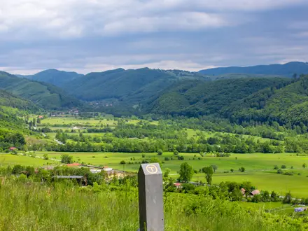
The Gutâi Mountains Trail is a moderate day hike in Maramureș, northern Romania, usually built around Creasta Cocoșului, the sharp volcanic “Rooster’s Crest”. Treat the listed 17 km as route-dependent: the established Pasul Gutâi–Creasta Cocoșului–Pasul Neteda line is roughly 12–13 km, while longer variants add distance. Expect forest tracks, meadows and a short, steeper rocky finish, with about 700 m ascent on a typical Pasul Gutâi day route. It suits fit hikers wanting a compact Carpathian ridge objective rather than a multi-day trek.
Route Overview
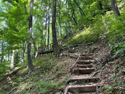
The standard approach starts at Pasul Gutâi, about 987 m, on DN18 between Baia Mare and Sighetu Marmației, near Hanul Pintea Viteazul. Cross the road and follow the red-stripe waymarks through forest and clearings towards Creasta Cocoșului. The final approach to the andesite crest is shorter, steeper and more exposed. From below the crest, the red-cross continuation leads towards Tăurile Chendroaiei and Pasul Neteda, making the route most logical as a point-to-point walk; many hikers simply return the same way to Pasul Gutâi. Alternative trailheads include Breb and Mara. For other Romanian mountain objectives, compare the Curmătura Hut Loop, the Bucegi Plateau Circuit and the Bihor Peak Summit Trail.
Volcanic Origins and Maramureș Lore
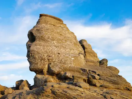
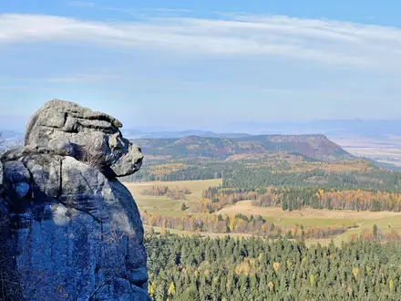
Creasta Cocoșului is a remnant of the Gutâi volcanic massif: the crest is linked to a crater eruption around 9 million years ago, with surrounding andesite dykes dated around 10–11 million years. Long erosion exposed the jagged ridge seen today. The area has been protected as a nature reserve since 1954 and is now also within the Gutâi-Creasta Cocoșului Natura 2000 site. The pass also carries local haiduk associations through the name Hanul Pintea Viteazul.
Notable highlights
- Creasta Cocoșului: A castellated andesitic volcanic ridge about 200 m long and the defining landmark of the hike. It is a protected natural monument and gives broad views across Maramureș in clear weather.
- Vârful Gutâi, 1,443 m: The highest summit in the Gutâi range. It provides the headline altitude for the area and wide panoramas over the Maramureș basin and surrounding Carpathians.
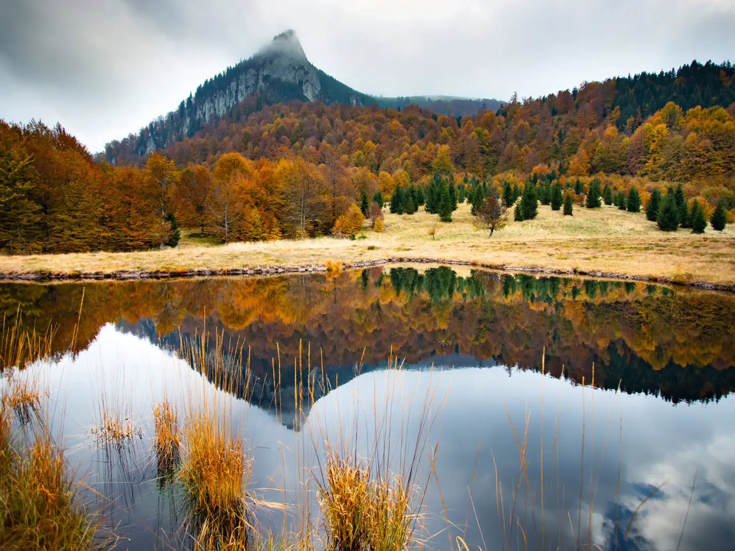
- Tăurile Chendroaiei: Small tarns or ponds reached on the red-cross continuation from the crest area. They sit among peat and meadow below the ridge and are a useful extension if conditions and time allow.
- Pasul Gutâi, about 987 m: The usual gateway on DN18, with road access between Baia Mare and Sighetu Marmației. Hanul Pintea Viteazul marks the pass and is a practical landmark for the start.
- Beech, fir and alpine flora: The reserve and surrounding forests hold rich summer flora. Wildlife in the wider area includes lynx, brown bear and mountain eagles.
Challenges to expect
Navigation is not hard on the marked Pasul Gutâi approach, but route length varies by trailhead and whether you continue to Pasul Neteda or return the same way. The main difficulty is the final steeper, scrambly and exposed section on bare andesite near Creasta Cocoșului. There are no huts on the crest, so carry food, water and weather layers. Winter requires proper equipment.
HikeList Score
Gutâi Mountains Trail scored 83/100 on HikeList's trail-quality metrics.
See score breakdownHide breakdown
- Ideal length 55
- Balanced challenge 100
- Scenery & wildness 98
- Varied terrain 76
- Accommodation 74
- Food & support 81
- Path quality 98
- Season flexibility 89
Computed from length, challenge, scenery & wildness, terrain variety, accommodation, food & support, path quality and season flexibility.
 Romania
Show more data Show less
- Mountainous
- Forest
- Meadow
- Dirt
- Rocky
- Guesthouses
- Inns
- Family Friendly
- Pet Friendly
- Water Sources
- Campsites
- Shelters
Photos from hikers
Taken on the trail by people who've reviewed Gutâi Mountains Trail.
Start at Pasul Gutâi on DN18 near Hanul Pintea Viteazul. Follow the red-stripe route through forest and open clearings to the foot of Creasta Cocoșului, then make the short, steeper ascent onto the volcanic crest. From there, either return to the pass or continue on the red-cross line towards Tăurile Chendroaiei and Pasul Neteda. The established Pasul Gutâi–Pasul Neteda traverse is roughly 12–13 km, so 17 km should be treated as a route-dependent day variant.
Reviews
How would you rate Gutâi Mountains Trail?
Tap a star to start your review — you could be the first.