Greensand Way
How would you rate Greensand Way?
Tap a star to share your experience and help other hikers.
Greensand Way: Surrey and Kent Ridge Walk
HikeList Score
Greensand Way scored 92/100 on HikeList's trail-quality metrics.
See score breakdownHide breakdown
- Ideal length 99
- Balanced challenge 100
- Scenery & wildness 98
- Varied terrain 64
- Accommodation 83
- Food & support 88
- Path quality 98
- Season flexibility 89
Computed from length, challenge, scenery & wildness, terrain variety, accommodation, food & support, path quality and season flexibility.
The Greensand Way is a 174 km waymarked point-to-point trail across England, following the greensand ridge from Haslemere in Surrey to Hamstreet in Kent. Allow 6-9 days. It is a moderate long-distance walk: no mountains, but frequent climbs and descents, woodland mud after rain, and about 3,400 m of total ascent. It suits hikers who want a lowland thru-hike with hills, forests, historic estates, Kent villages and good access from south-east England.
Route Overview
Most walkers go east from Haslemere to Hamstreet, crossing Surrey first, then the Chart Hills and Kent Weald before finishing near the edge of Romney Marsh. Key places include Hindhead and the Devil’s Punch Bowl, Hascombe, Holmbury St Mary, Leith Hill, Dorking, Reigate, Limpsfield, Crockham Hill, Toys Hill, Ide Hill, Knole Park, Yalding, Sutton Valence, Egerton, Pluckley, Hothfield and Hamstreet. The route is waymarked with GW tower discs in Surrey and an oast-house symbol in Kent. Public transport links around towns and larger villages make section walking practical. For different UK trail styles, compare the hillier Beacons Way or the coastal Anglesey Coastal Path.
How the Greensand Way was created
The idea of a ridge path along the greensand appears in Patrick Abercrombie’s 1944 Greater London Plan. The modern Greensand Way was created by the Ramblers and local councils in stages during the 1980s: the first 12-mile section opened in June 1980, the Surrey route was completed by May 1982, the western Kent section followed in April 1986, and the final section to Hamstreet opened on 15 April 1989. It now links the Surrey Hills and Kent Downs National Landscapes.
Notable highlights
- Leith Hill and Leith Hill Tower (294 m): The highest point on the Greensand Way and in south-east England. The 18th-century Gothic tower gives wide views towards the South Downs and, in clear weather, towards London.
- Devil’s Punch Bowl, Hindhead: A large natural heathland amphitheatre managed by the National Trust. The trail passes beneath Gibbet Hill early in the Surrey section, with broad views over wooded greensand country.
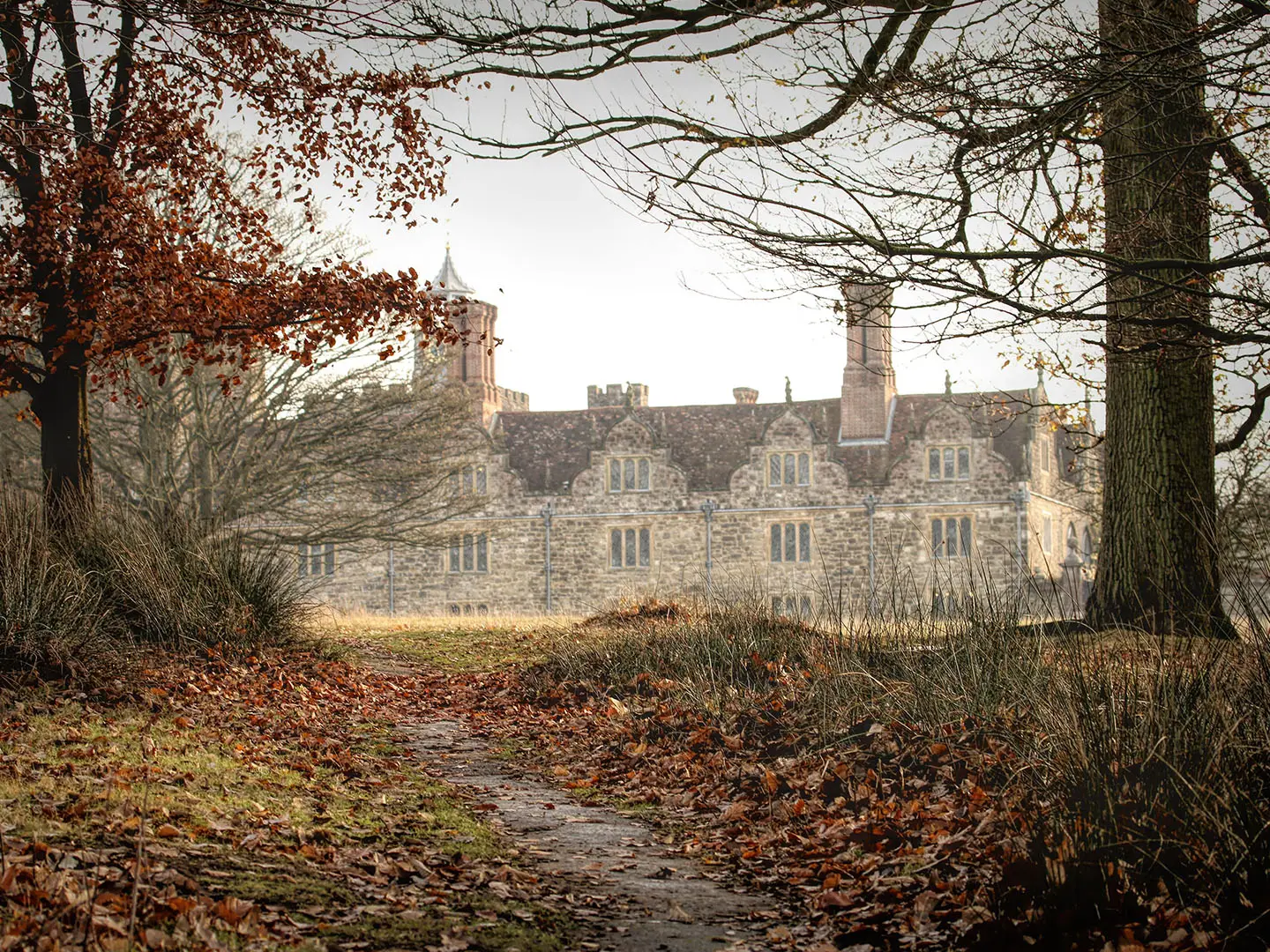
- Knole and Knole Park, Sevenoaks: The Way drops through Knole’s medieval deer park, a National Trust landscape of ancient oaks and fallow deer around one of England’s major historic houses.
- Toys Hill, Ide Hill and Ightham Mote: The Kent section crosses wooded high points near Ightham Mote, a moated medieval manor house set in its own valley.
- Yalding and the River Medway: The route crosses the Medway at Twyford Bridge in a low gap between greensand hills, with orchards and former hop gardens nearby.
- Hamstreet Woods National Nature Reserve: Near the finish, the trail reaches ancient oak-and-hornbeam woodland on the edge of Romney Marsh.
Challenges to expect
Expect steady cumulative effort rather than altitude: the Way has about 3,400 m of ascent over repeated short hills, including Hascombe, Pitch Hill, Holmbury Hill and Leith Hill. Woodland tracks, clay and field paths can be muddy and slippery after rain. Waymarking is good, but carry OS mapping for junctions and diversions. Accommodation in towns and larger villages can book up at weekends.
HikeList Score
Greensand Way scored 92/100 on HikeList's trail-quality metrics.
See score breakdownHide breakdown
- Ideal length 99
- Balanced challenge 100
- Scenery & wildness 98
- Varied terrain 64
- Accommodation 83
- Food & support 88
- Path quality 98
- Season flexibility 89
Computed from length, challenge, scenery & wildness, terrain variety, accommodation, food & support, path quality and season flexibility.
 United Kingdom
 England
Show more data Show less
- Hills
- Forest
- Dirt
- Gravel
- Hotels
- Guesthouses
- Campsites
- Family Friendly
- Pet Friendly
- Restrooms
- Water Sources
- Campsites
- Picnic Areas
Download Our Full Guide to Greensand Way FREE!
Get our comprehensive guide to this hike for free. Save it for later reading or print out at home.

In these collections
Photos from hikers
Taken on the trail by people who've reviewed Greensand Way.
Greensand Way: The Complete Guide
 i
Image by Jim Driscoll
i
Image by Jim Driscoll The Greensand Way is a substantial lowland traverse from Haslemere in Surrey to Hamstreet in Kent, following the greensand ridge through the Surrey Hills and Kent Downs National Landscapes. It suits walkers who want a proper point-to-point journey with hills, woodland, heath and historic parkland, but without mountain terrain.
The route has a quietly varied character: sandy heath around Hindhead and the Devil’s Punch Bowl, wooded ridge tops over Hascombe Hill, Pitch Hill, Holmbury Hill and Leith Hill, then gentler Kent country of orchards, former hop gardens and lower ridges. Knole Park, the River Medway at Yalding and Hamstreet Woods give the walk a clear eastward progression towards the edge of Romney Marsh.
This is not a route to underestimate. The high point is only Leith Hill at 294 m, but the repeated climbs and descents add up to about 3,400 m of ascent across 174 km, with typical long-distance days of roughly 24–32 km.
Underfoot, expect woodland tracks, clay field paths, gravel, quiet lanes and sandy sections. After rain, mud and slippery clay can slow progress, and the waymarks are not enough on their own, so an OS map or reliable route mapping is part of the kit.
This guide covers stages, days, accommodation, food, transport, terrain, navigation, gear and common mistakes.
Stage-by-Stage Guide
This is a practical seven-day split, not an official set of stages. The official Surrey and Kent route guides divide the Greensand Way into shorter sections, so the days below are best treated as a thru-hiking itinerary that can be shortened using the railway stations and nearby towns.
Waymarking changes as the route crosses counties: Surrey uses a ‘GW’ tower disc, while Kent uses an oast-house symbol. Do not rely on waymarks alone. The route crosses many woods, estates, field edges and lanes, so carry OS mapping or a reliable GPX as well as the official route notes.
Stage 1: Haslemere to Shamley Green — about 27 km
The opening day is a full lowland hill stage, starting in Haslemere town centre and climbing quickly towards Hindhead Commons. It is one of the more varied Surrey days, with sandy heathland tracks, woodland paths, farmland and village lanes before the finish at Shamley Green.
The main early feature is Hindhead, including Gibbet Hill and the Devil’s Punch Bowl. Gibbet Hill is the second-highest point in Surrey and is marked by a stone cross, with wide views across the Weald. The Devil’s Punch Bowl is a steep-sided heathland amphitheatre managed by the National Trust; Exmoor ponies and Highland cattle graze the area, so give livestock plenty of room and keep dogs under close control.
After the Punch Bowl the route drops through Thursley and continues by Wormley, Witley, Hambledon and Hascombe. Hascombe is a useful place to pause, with the White Horse pub, a village pond and a notable Victorian church. Shamley Green is an attractive village around a green, but it is not a large service centre.
Underfoot, expect sandy heathland around Hindhead, then woodland and clay field paths later in the day. Valley bottoms and shaded woodland sections can be muddy after rain, and the Hindhead section has some steeper ground by Greensand Way standards.
Food and water are limited between the main villages. The White Horse at Hascombe is the clearest on-route stop, but opening times should be checked before relying on it. Carry enough water for the heathland section, especially in warm weather.
Accommodation at Shamley Green is limited, with some B&B options in or near the village. Cranleigh, about 3 km south, gives more choice if Shamley Green is full, but that adds a transfer or extra walking. Book this night early because there is less flexibility than in Dorking or Sevenoaks.
Haslemere station is a convenient starting point, with direct trains from London Waterloo. Witley station, on the Guildford–Portsmouth line, gives a useful shorter-day option if the full Haslemere to Shamley Green stage is too long.
Navigation is generally straightforward on the bigger heathland tracks, but the day has several changes of character and many minor paths. Take care leaving the open commons and again through farmland after Witley and Hascombe, where missed field-edge turns can add time.
Stage 2: Shamley Green to Dorking — about 24 km
This is the classic Surrey ridge day and one of the hardest stages despite the moderate distance. The route crosses a sequence of greensand tops and woodland ridges, including Hascombe Hill, Winterfold Hill, Pitch Hill, Holmbury Hill and Leith Hill.
Much of the day is on woodland tracks through areas such as Hurt Wood, with oak, birch and pine, mixed with sandy and clay paths. The climbs are not mountainous, but they come repeatedly, and several descents can be slippery in wet conditions. In a wet spell this stage can feel much slower than the mileage suggests.
Pitch Hill and Holmbury Hill give the day its rhythm before the route reaches Leith Hill, the high point of the entire Greensand Way at 294 m. Leith Hill Tower was built in 1765 by Richard Hull; from the roof platform the height is 1,029 ft / 314 m. In clear weather there are views to the South Downs, the London skyline and, on the clearest days, towards the sea.
There is a seasonal kiosk at the base of Leith Hill Tower, but it should not be treated as guaranteed food or water. Nearby options include The Plough Inn at Coldharbour and the Stephan Langton pub near Friday Street, depending on the exact line walked and opening hours. Holmbury St Mary also has accommodation on or close to the route, including Bulmer Farm B&B, with pubs nearby.
The stage descends through Wotton and Westcott into Dorking. Dorking is one of the strongest overnight stops on the whole trail, with hotels, B&Bs, pubs, restaurants and supermarkets.
Dorking also has excellent rail access, including Dorking Deepdene, Dorking Town and Dorking West stations, with London connections. This makes Stage 2 easy to split or use as a weekend section.
Navigation needs attention in the woods, where forestry tracks, bike trails and footpaths can be confusing. Keep checking the map at junctions on Hurt Wood, Pitch Hill, Holmbury Hill and Leith Hill rather than assuming the broadest track is the Greensand Way.
Stage 3: Dorking to Godstone — about 24 km
This stage is less dramatic than the Leith Hill day but still varied, moving through the Mole Valley and a chain of Surrey towns and villages. The route runs broadly east from Dorking, south of the A25 corridor, using farmland paths, red-sand and clay tracks, lanes and woodland sections.
From Dorking the Greensand Way passes towards Brockham, an attractive village with a large green and pubs, then through the Betchworth area. There are more gates, field edges and stiles on this stage than on the wooded ridge day before it, so expect slower progress in wet or muddy conditions.
Reigate is the main service point. The route passes Reigate Heath, with its windmill, and skirts Reigate Priory Park. Reigate town has accommodation, pubs, cafés, shops and rail access, so it is the obvious place to shorten the stage if needed.
There is also local historic interest around Reigate, including the Reigate Caves and the historic sand mines beneath the town. These are a separate visit rather than a walking essential, and opening arrangements should be checked before planning time around them.
After Reigate the route continues by South Nutfield and Bletchingley, where there are castle remains, before reaching Godstone. The walking is moderate, with fewer big climbs than Stage 2, but the clay can be sticky and the field sections can be tiring after rain.
Food and water are most reliable in Dorking and Reigate, with pubs also in villages such as Brockham. Do not assume every smaller village has all-day food. Carry snacks and enough water to avoid being dependent on one pub stop.
Godstone is a pleasant village-end point with a green and pubs, but accommodation is limited. Oxted, about 5 km away, usually gives more practical overnight options; Redhill and Reigate are also useful if using trains or taxis.
Rail access is good for this stage. Dorking is well connected at the start, Reigate station offers trains to London Victoria, and Earlswood station near the Redhill area is close enough to be useful as a bail-out or start point. For Godstone, Oxted is the main rail hub.
Navigation is generally easier than in the dense Surrey woods, but take care at field exits, lane crossings and around the built-up edges of Reigate. Livestock fields are a normal part of the stage, so close gates and keep dogs controlled.
Stage 4: Godstone to Ide Hill — about 21 km
This is a shorter but still hilly stage, useful as a positioning day before the longer walk to Yalding. It links the eastern Surrey villages with the western Kent ridge, passing Tandridge, Limpsfield, Crockham Hill and Toys Hill before reaching Ide Hill.
The route passes through Limpsfield and the woodland of Limpsfield Chart, with Oxted acting as the main nearby transport and accommodation hub. The stage then continues into more rural country around Crockham Hill and Toys Hill.
Toys Hill is a key feature of the day and one of the highest points in Kent. The National Trust woodland here was badly affected by the Great Storm of 1987; the landscape has regenerated, but the area still has a distinctive wooded, uneven character.
This is also the stage where the route crosses from Surrey into Kent. The waymarking changes from the Surrey ‘GW’ tower disc to the Kent oast-house symbol, which is useful reassurance but not a substitute for mapping.
Terrain is mixed woodland, field paths and lanes, with some steeper sections around the hill villages. In wet weather, shaded woodland paths can be slippery and slow. There is less urban walking than on Stage 3, so navigation can feel less obvious.
Food and water are available in some villages, including pubs around the route, but opening times should be checked. Ide Hill has a pub, but it is a small village rather than a full-service town.
Accommodation directly at Ide Hill is very limited, so most walkers need a plan before reaching the stage end. Sevenoaks, about 7 km north, has more accommodation; Oxted is another practical option if using road transfer or public transport.
Oxted station is the main rail access for the western end of the stage, with trains to London Bridge and Victoria. Sevenoaks station can be reached from the wider Ide Hill / Knole Park area by link path or taxi, depending on the day’s arrangement. This should be checked before travelling.
The main warning for this stage is navigation rather than exposure or remoteness. Keep the map handy through Limpsfield Chart, Toys Hill and the smaller Kent paths, where woodland junctions and field exits can be missed.
Stage 5: Ide Hill to Yalding — about 27 km
This is one of the longer days and deserves an early start, especially if visiting Knole House or making a detour to Ightham Mote. The route moves from the high ground around Ide Hill through Sevenoaks Weald and Knole Park, then east through Shipbourne, Dunk’s Green, West Peckham and Nettlestead Green before dropping to Yalding and the River Medway.
Knole Park is the major landmark. The Greensand Way passes through or around this National Trust medieval deer park, with ancient oaks, free-roaming fallow deer and Knole House at its centre. Keep a respectful distance from deer and follow any local access signs within the park.
A link path from Knole Park reaches Sevenoaks station, which is very useful for section walkers. This also makes Sevenoaks a practical alternative overnight base if Ide Hill accommodation is unavailable.
The route also passes close to Ightham Mote, a National Trust moated medieval manor house in a wooded valley. It is a slight detour rather than a mandatory part of the stage, so allow extra time if planning to visit.
Beyond Sevenoaks Weald the character becomes more Kentish: undulating farmland, orchards, old hop-growing country, village lanes and parkland. Shipbourne has The Chaser pub near the old church and Shipbourne Common, while West Peckham has The Swan on the Green. Pub opening times should be checked before relying on either for a main meal.
The approach to Yalding brings the Medway landscape, with waterways, meadows and old bridges. The route crosses the River Medway at Yalding via Twyford Bridge, the medieval ‘Bridge of the Two Fords’. Hampstead Lock is nearby on the Medway Navigation.
Yalding is a good overnight stop, with village B&Bs, a pub and a station on the Medway Valley line. It is also a sensible place to resupply before the next long stage.
The walking is gentler than the Surrey ridge stages, but the distance is still significant and there can be some road walking through and between villages. Field paths and river meadows may be wet or muddy after rain.
Navigation requires attention in Knole Park, where paths can feel broad and informal, and again across farmland east of Shipbourne and West Peckham. Do not rush the final approach to the Medway; bridges, waterways and field paths make accurate map-reading important.
Stage 6: Yalding to Pluckley — about 27 km
This stage begins the eastern Kent section and quickly climbs back towards the Greensand ridge. It is a long rural day through Linton, Sutton Valence and Egerton, with broad views over the Weald and a landscape of farmland, orchards, woodland and former hop fields.
The climb out of the Medway area is a noticeable change after the flatter approach into Yalding. Linton gives elevated views, and Sutton Valence is a memorable hilltop village with the remains of a 12th-century castle and good outlooks across the surrounding country.
Egerton is the main later village on the stage, with a pub. After that, the route continues through more open countryside towards Pluckley, with links near Pluckley to the Stour Valley Walk.
Underfoot, expect greensand ridge paths, orchard edges, farmland tracks and clay sections. The gradients are generally gentler than the Surrey hills, but the distance and sticky mud can make the day tiring in wet conditions.
Food and water should be planned carefully. Yalding is the best place to start stocked up, with possible village pub stops later, including Egerton. Opening times and food service should be checked before travelling.
Pluckley is a small and well-known village, often associated with ghost stories and as a filming location for The Darling Buds of May. The Black Horse is a 15th-century pub and real-ale stop, but it does not provide accommodation.
Accommodation at Pluckley is very limited. Ashford, about 10 km south, has a much wider choice and is often the practical overnight base if nothing is available in the village.
Pluckley station is on the Ashford–Maidstone East line, making this stage workable for section walkers. Yalding station at the start is on the Medway Valley line, with trains towards Maidstone and Paddock Wood.
Navigation is mainly across farmland and village paths rather than complex upland terrain. Pay close attention to field-edge turns, orchard tracks and rights of way leaving villages, where the walked line may not be obvious from the ground.
Stage 7: Pluckley to Hamstreet — about 24 km
The final stage continues through Kent farmland and villages before reaching heathland, ancient woodland and the edge of Romney Marsh. It passes Little Chart, Hothfield and Kingsnorth before finishing at Hamstreet.
Little Chart is the first notable village section. The route then reaches Hothfield Common (Hothfield Heathlands), a Kent Wildlife Trust-managed heathland and valley-bog nature reserve that protects some of Kent’s last surviving valley bogs. The Greensand Way runs across the western side of this rare peatland and heathland habitat, where the ground can be damp and sensitive; keep to the path.
Hothfield is also listed as a Local Nature Reserve, adding to the conservation interest of the final day. From there the route continues towards Kingsnorth and the approach to Hamstreet.
Hamstreet Woods National Nature Reserve is the final major natural landmark. This ancient oak-and-hornbeam woodland is a remnant of the old Wealden forest and gives a strong finish before the route reaches Hamstreet village.
The landscape transition is important on this stage. The route leaves the greensand country and descends towards the now-landlocked levels of Romney Marsh, with the walking becoming less hilly overall as the finish approaches.
Terrain is a mix of farmland, orchards, heathland, woodland and flatter approaches near the marsh edge. It is generally less demanding than the central Surrey stages, but 24 km remains a full day, and wet ground around heathland, boggy areas and woodland can slow progress.
Food and water options are limited compared with the larger towns earlier on the route. Start from Pluckley prepared, and do not rely on finding frequent shops or cafés in the smaller villages. Pub and shop availability should be checked before travelling.
Hamstreet has some accommodation, with Ashford the wider fallback for hotels and transport links. If finishing the trail and leaving the same day, build in time for the final woodland and village navigation rather than assuming an easy stroll to the station.
Hamstreet station is on the Ashford–Hastings line, with onward rail and bus links towards Ashford. Pluckley station at the start of the day also makes the final stage straightforward as a train-based section.
Navigation is mostly moderate, but the final day still crosses rural paths, reserves and woodland where waymarks can be missed. Take particular care through Hothfield Common and Hamstreet Woods, where informal paths can be distracting and staying on the right line matters for both navigation and habitat protection.
Recommended Itinerary
The 7-day schedule below is the most practical continuous thru-hike split for the Greensand Way. It keeps most days in the 21–27 km range, uses towns or larger villages where possible, and avoids relying on accommodation in the quietest parts of the ridge.
Distances are approximate. Check official mapping before booking accommodation, especially if staying off-route or using taxis at the end of a day.
Standard 7-day itinerary
| Day | From | To | Approx. distance | Why this stage makes sense | Services/accommodation notes |
|---|---|---|---|---|---|
| 1 | Haslemere | Shamley Green | 27 km / 17 miles | A strong opening day through Hindhead, the Devil’s Punch Bowl, Thursley and Hascombe, finishing before the main Surrey hill sequence. | Shamley Green is small, with limited accommodation and services. Book ahead and carry enough food from the start. |
| 2 | Shamley Green | Dorking | 24 km / 15 miles | This is the classic Surrey ridge day over Pitch Hill, Holmbury Hill and Leith Hill, the high point of the route. Dorking makes a practical town finish after a hilly section. | Dorking has the best service range on the western half of the route, with hotels, inns, B&Bs, shops and rail access. |
| 3 | Dorking | Godstone | 24 km / 15 miles | A workable linking day through Brockham, Betchworth, Reigate and Bletchingley, keeping the next Kent approach day manageable. | Godstone has pubs and limited accommodation. Reigate can be used as an alternative stop with fuller town services, while Oxted is close to the route and has a station. |
| 4 | Godstone | Ide Hill | 21 km / 13 miles | The shortest standard day, but still useful: it crosses from Surrey into Kent via Limpsfield, Crockham Hill and Toys Hill, with repeated climbs and descents. | Ide Hill is a very small village and accommodation is limited. Many walkers need to arrange a stay in Sevenoaks, Sevenoaks Weald or Westerham, or use a taxi transfer. This should be checked before travelling. |
| 5 | Ide Hill | Yalding | 27 km / 17 miles | A long but coherent Kent stage through Sevenoaks Weald, Knole Park, Shipbourne and West Peckham, ending after the River Medway crossing at Yalding. | Yalding is a small village with some B&B and pub accommodation. Nettlestead Green may also be useful for nearby stays. Book ahead. |
| 6 | Yalding | Pluckley | 27 km / 17 miles | Another longer day through Linton, Sutton Valence and Egerton, crossing a quieter agricultural section before reaching Pluckley. | Pluckley has limited village services, pub options and B&B accommodation. Accommodation around Pluckley and Egerton should be reserved early. |
| 7 | Pluckley | Hamstreet | 24 km / 15 miles | A solid final day through Little Chart, Hothfield and Kingsnorth, finishing at Hamstreet near the edge of Romney Marsh. Start early, as this is not a short stroll-out stage. | Hamstreet is small and accommodation is limited. Ashford, about 5 miles away, has a wider range of accommodation and rail connections. |
Slower 9-day option
A 9-day walk suits hikers who want shorter days, more time in the Surrey Hills and Kent Downs, or a less pressured schedule in muddy conditions. It is also a better fit if accommodation availability forces overnight stops away from the neat 7-day split.
One sensible slower pattern is:
| Day | Suggested stage | Approx. distance / note |
|---|---|---|
| 1 | Haslemere to Hindhead or Thursley | Around 13 km |
| 2 | Hindhead/Thursley to Shamley Green or Holmbury St Mary | Around 21 km |
| 3 | Holmbury St Mary to Dorking, via Leith Hill | Around 18 km |
| 4 | Dorking to Godstone | Around 24 km |
| 5 | Godstone to the Sevenoaks area, via Ide Hill and Knole Park | Around 24 km |
| 6 | Sevenoaks area to Yalding | Around 22 km |
| 7 | Yalding to Sutton Valence | Around 14 km |
| 8 | Sutton Valence to Pluckley | Around 18 km |
| 9 | Pluckley to Hamstreet | Around 24 km |
This version depends heavily on where beds are available. Thursley, Holmbury St Mary, Ide Hill, Sutton Valence and the smaller Kent villages have limited accommodation, so the overnight plan may need short transfers to nearby towns.
Faster 5-day option
A 5-day traverse is only for strong, efficient walkers who are comfortable with long lowland days, repeated short climbs and potentially slow going on muddy woodland and clay paths. It leaves little margin for bad weather, navigation delays or late starts.
A practical faster outline is:
| Day | Suggested stage | Approx. distance / note |
|---|---|---|
| 1 | Haslemere to Holmbury St Mary area | Around 20 miles; check official mapping before booking |
| 2 | Holmbury St Mary area to Godstone | Around 20 miles, including the Leith Hill section |
| 3 | Godstone to Sevenoaks area | Around 20 miles |
| 4 | Sevenoaks area to Pluckley | Around 24 miles; the longest day in this version |
| 5 | Pluckley to Hamstreet | Around 15 miles |
This faster split works best for walkers travelling light and using pre-booked accommodation close to the trail. There is no reason to force a 5-day schedule if the weather is wet: the Greensand Way’s repeated climbs, woodland tracks and field paths can be slower than the map distance suggests.
Planning the Route
How many days to allow
Most walkers should plan the Greensand Way as a 7-day walk. That gives a steady but realistic schedule of about 21–27 km per day, with enough time for the repeated climbs over the Surrey and Kent greensand hills without turning the route into a forced march.
A 6-day itinerary is possible for fit walkers comfortable with long lowland days and limited recovery time. It will usually mean several days at or above 30 km, plus careful accommodation planning where the path does not finish neatly in a large town.
An 8- or 9-day itinerary is often more comfortable if you want shorter days, time at places such as Leith Hill, Knole Park or Yalding, or if winter mud is likely to slow progress. Slowing the route down also helps with the awkward accommodation pattern, especially around Shamley Green, Ide Hill and Yalding.
A practical 7-day structure
The route does not have official long-distance stages in the way some National Trails do. The Surrey and Kent councils break it into shorter day-walk sections, so a thru-hike needs to be built around accommodation, rail access and how far you are prepared to walk each day.
A common 7-day split is:
| Day | Section | Approx. distance | Planning note |
|---|---|---|---|
| 1 | Haslemere to Shamley Green | 27 km | Accommodation near Shamley Green is limited; some walkers use a nearby town as a base. |
| 2 | Shamley Green to Dorking | 24 km | The hilliest Surrey day, crossing Pitch Hill, Holmbury Hill and Leith Hill. Dorking is a useful overnight stop. |
| 3 | Dorking to Godstone | 24 km | Reigate is a strong intermediate accommodation and transport point if you want to shorten the day. |
| 4 | Godstone to Ide Hill | 21 km | Shorter on paper, but accommodation around Ide Hill is limited; Sevenoaks may be more practical via the Knole Park link. |
| 5 | Ide Hill to Yalding | 27 km | A longer Kent day through Knole Park, Shipbourne and West Peckham, finishing by the River Medway. |
| 6 | Yalding to Pluckley | 27 km | Rural mid-Kent has longer gaps between services; carry enough food and water. |
| 7 | Pluckley to Hamstreet | 24 km | The finish is rail-accessible, but accommodation at Hamstreet is limited; Ashford is the more flexible nearby base. |
This split is a planning framework, not a fixed itinerary. In practice, overnight stops are often adjusted to suit available rooms, rail connections or a shorter first or final day.
Accommodation drives the itinerary
The main planning constraint is not the walking difficulty, but where you can sleep. The route passes many villages, but accommodation directly on or near the ridge is unevenly spread.
The easiest overnight bases are the larger towns and transport hubs: Haslemere, Dorking, Reigate, the Oxted/Limpsfield area, Sevenoaks, Yalding/Maidstone area, Pluckley, Ashford and Hamstreet. Smaller places such as Shamley Green, Ide Hill and Yalding can work, but choice is limited and booking ahead matters.
Budget walkers have one particularly useful option in the Surrey Hills: YHA Holmbury St Mary, about 1 km off the route. It is the most convenient hostel-style stop close to the Way and should be booked well ahead in peak periods. Tanners Hatch YHA, near Dorking, is another option but is around 3 km from the path and is more remote, with a water source but no mains electricity.
Weekend accommodation in the Surrey Hills and around Sevenoaks can fill quickly, especially in spring and summer. If walking end-to-end, secure the awkward nights first, then build the daily distances around them.
A dedicated Greensand Way baggage-transfer package is not a standard feature of the route. Most walkers either carry their own kit, use rail-based section walks, or arrange local taxis where necessary. Any luggage-transfer or taxi plan should be checked before travelling.
Section walking is very practical
The Greensand Way is one of the easier long-distance routes in southern England to walk in sections. Rail access is especially useful in Surrey, where Haslemere, Witley, Dorking, Earlswood and Oxted are on or close to the route.
Kent is still workable by train, but the spacing is less even. A link through Knole Park reaches Sevenoaks station, the route crosses the Medway Valley line at Yalding, and Pluckley, Ashford and Hamstreet provide useful access in the eastern section. The least convenient stretch for rail-based day walking is the more rural mid-Kent section between Sevenoaks/Yalding and Pluckley.
For London-based walkers, the route is well suited to a series of day walks or weekend blocks. Haslemere, Dorking, Oxted and Sevenoaks are particularly useful access points, while Hamstreet gives a straightforward rail finish at the eastern end. Train times, engineering works and fares should be checked before travelling.
Food and water planning
There are no major waterless wilderness sections, but the route should not be treated as a continuous chain of shops. Carry enough water for each day, and more in the rural Kent stages where services are less frequent.
The Surrey section has regular villages and pubs, with useful stops around places such as Shamley Green, Holmbury St Mary, Dorking, Brockham and Betchworth. Around Dorking and the Surrey Hills there are also more cafés and tearooms than on the quieter ridge sections.
In Kent, services are more spread out. Yalding, Linton, Sutton Valence, Egerton and Pluckley are important planning points for pubs or resupply, but opening days and hours vary. Do not rely on a pub lunch without checking ahead, especially midweek.
Navigation and maps
The Greensand Way is waymarked, but the waymarking should not be the only navigation method. In Surrey, look for the GW tower disc; in Kent, look for the oast-house symbol. The route also passes through places with dense path networks and urban edges, where it is easy to take the wrong branch.
Navigation needs particular care around busier or more complicated areas such as Reigate, Oxted and Hurst Green. Field edges, woodland junctions and estate paths can also be confusing after vegetation growth or where signs are partly hidden.
Use the free route PDFs and section maps from Surrey County Council and Explore Kent as the main current planning resources. Many walkers supplement these with OS Explorer mapping or a GPX track. The route spans several OS Explorer sheets, so confirm the exact map set before buying paper maps for the full trail.
The older guidebook, Along and Around the Greensand Way by Bea Cowan, is out of print. For current route-following, the council PDFs and up-to-date mapping are more important.
Weather, ground conditions and timing
The best seasons are spring, summer and autumn. April and May bring woodland flowers but can still be wet underfoot; September and October often give the best balance of daylight, cooler temperatures and firmer paths.
Mud is the main seasonal complication. Clay paths, field edges and woodland tracks can become slow and slippery after rain, and the repeated short climbs feel much harder when the ground is wet. Waterproof walking boots are a sensible default even outside winter.
Summer gives long walking days, but some field and woodland sections can be overgrown. Winter is possible, but expect heavy mud, shorter daylight and slower progress; an 8- or 9-day schedule is more realistic than an aggressive fast itinerary in poor conditions.
What to plan first
Prioritise the route in this order:
- Accommodation — book the limited stops first, especially Shamley Green/Surrey Hills, Ide Hill/Sevenoaks and Yalding.
- Daily stage length — adjust the 7-day structure to match where rooms are available.
- Transport links — decide whether to walk end-to-end, use rail-based day sections, or mix both.
- Navigation — download the Surrey and Kent route PDFs, carry mapping, and keep an offline GPX or map app available.
- Food and water — check pub and shop opening times, particularly in rural Kent.
- Ground conditions — allow extra time after rain and choose footwear for mud rather than dry park paths.
Permits are not a significant planning issue for this walk. Accommodation, transport and navigation are the factors most likely to affect whether the itinerary works smoothly.
Towns, Villages and Overnight Stops
Accommodation on the Greensand Way is unevenly spaced. Haslemere, Dorking, Reigate, Sevenoaks, Yalding, Pluckley and Hamstreet are the most useful planning anchors, while several attractive villages on the ridge have a pub but little or no dedicated walker accommodation.
The Surrey section is generally easier to organise, with good rail access and stronger town services. The Kent section needs more care, especially around Ide Hill, Toys Hill and Crockham Hill, where walkers often need to detour or book well ahead.
| Area | Best use for walkers | Accommodation position |
|---|---|---|
| Haslemere | Start town, night-before stop, full resupply | Good choice in and near town |
| Hindhead / Devil's Punch Bowl | Short first-day break or emergency early stop | Limited; hotel beside the National Trust area |
| Shamley Green | Possible first night on a 7-day itinerary | Limited; check nearby Bramley or Cranleigh |
| Holmbury St Mary | Excellent shorter-stage stop in the Surrey Hills | YHA and village pub |
| Dorking | Major overnight and resupply hub | Strong choice of hotels, inns and B&Bs |
| Reigate | Overnight, lunch stop or bail-out point | Good town accommodation and rail access |
| Godstone | Possible stage end, but thin for beds | Limited; Oxted is often more practical |
| Oxted / Limpsfield | Practical base for the Limpsfield area | Better choice in Oxted than on-route Limpsfield |
| Ide Hill / Toys Hill | Scenic but awkward overnight area | Very limited; consider Westerham or Edenbridge |
| Sevenoaks | Strong Kent-side overnight with rail access | Good town choice, reached via Knole Park link |
| Yalding | Logical overnight near the Medway crossing | Limited village accommodation; Maidstone has more |
| Egerton / Pluckley | Useful final Kent overnight area | Good trail-side and village options |
| Hamstreet | Finish village | Limited, but practical for a late finish |
Haslemere
Haslemere is the usual start town and the easiest place to arrive the night before. The Greensand Way begins in the town centre at an alley beside 43 High Street, so accommodation in the centre keeps the first morning simple.
The town has the best start-of-walk services on the western end of the route: Waitrose, M&S Food, Tesco, independent High Street shops, pubs and restaurants. Useful pubs and food stops include The White Horse Hotel, The Swan Inn and Harper's at Haslemere.
Accommodation options include The Georgian Hotel, Harper's at Haslemere and voco Lythe Hill Hotel & Spa, which is about 1 mile out of town. Airbnb-style accommodation is also available, but availability should be checked before travelling.
Haslemere station is on the London Waterloo–Portsmouth line, with journeys to London taking about 55 minutes. This makes it a straightforward start for both thru-hikers and section walkers.
Hindhead and the Devil's Punch Bowl
Hindhead comes early on the first day and is more useful as a break point than as a planned overnight stop. The Greensand Way passes the Devil's Punch Bowl and Gibbet Hill area, with National Trust visitor facilities at the Punch Bowl car park.
The National Trust café normally provides hot and cold drinks, sandwiches and cakes in season, with an ice-cream kiosk at weekends and during school holidays. Toilets are available at the visitor centre.
There are no general shops beyond the visitor facilities. Overnight parking at the National Trust car park is not permitted.
The Devil's Punchbowl Hotel sits beside the National Trust area and can be useful if splitting the first day short or arranging a taxi-based start. It offers rooms, food and free parking.
Shamley Green
Shamley Green is a common first-night target on a 7-day west-to-east itinerary, reached after the Haslemere to Hindhead, Thursley and Hascombe section. It is a small commuter village rather than a full service hub.
The Red Lion is the main village pub and the key local facility for walkers. There is no supermarket in the village itself, so food and next-day supplies are better bought in Haslemere or arranged ahead.
Accommodation is limited. Check village-based B&Bs early, and consider nearby Bramley or Cranleigh, both around 3–4 miles off route, if nothing is available directly in Shamley Green.
Holmbury St Mary
Holmbury St Mary sits between Pitch Hill and Holmbury Hill and is one of the most useful smaller stops in the Surrey Hills. It works particularly well for walkers taking shorter stages rather than pushing from Shamley Green to Dorking in one day.
YHA Holmbury St Mary Surrey Hills is a strong option for walkers, set in woodland directly on or very near the Greensand Way. It offers dormitory beds, private rooms, a licensed bar, meals, camping and glamping bell tents.
The Royal Oak pub is in the village. Gomshall station is about 2.5 miles away on the Guildford–Redhill line, which gives this area some flexibility for section walking or joining the route.
Dorking
Dorking is the main service hub of the Surrey section and one of the best overnight towns on the whole route. It is a practical end to the second day on a 7-day itinerary after crossing Pitch Hill, Holmbury Hill and Leith Hill.
Accommodation is strong by Greensand Way standards. Options include The White Horse, a historic coaching inn in the town centre with 56 en-suite rooms, bar and restaurant; Premier Inn; local B&Bs; The Plough Inn at Coldharbour about 2 miles south; and Bulmer Farm B&B.
For resupply, Dorking has Waitrose, M&S, Sainsbury's, Boots, independent shops and St Martin's Walk shopping centre. There are also multiple pubs and restaurants, making it one of the easiest places to sort food, snacks and any minor kit needs.
Dorking station has services to London Victoria or London Bridge via Redhill, with journeys taking about 50 minutes, and is also served by Thameslink. It is a very useful rail access point for section walkers.
Reigate
Reigate comes after Brockham and Betchworth on the Dorking to Godstone section. The route passes Reigate Heath and briefly through the town, making it a useful lunch, resupply or overnight stop.
The town has a good accommodation range, including Reigate Manor Hotel, B&Bs and cheaper chain hotels nearby. It is a better serviced option than many of the smaller villages either side.
Food and supplies are easy to find in the town centre, with supermarkets including Sainsbury's and Marks & Spencer Food, plus pubs and restaurants. Pubs include The White Horse and The Black Horse.
Reigate station has services to London Victoria and London Bridge, with journey times of about 40 minutes. This is one of the most convenient exit points in the middle of the route.
Godstone
Godstone is a logical stage end on some itineraries and sits where both the North Downs Way and Greensand Way pass through the area. It is often treated as part of the halfway section of the route.
The village is smaller and less useful as an accommodation hub than Dorking, Reigate or Oxted. The Bell on the village green is the main pub option.
Dedicated walker accommodation is limited, so beds should be arranged before committing to a Godstone finish. Oxted, about 3 miles east and with a railway station, is often the more practical base.
Oxted and Limpsfield
Limpsfield is on the route, while Oxted is the nearby town most walkers use for services. This is an important distinction when booking: Limpsfield has limited accommodation, but Oxted has a better range of hotels, B&Bs, restaurants and rail access.
Oxted station has services to London Bridge and Victoria. Most walkers needing an overnight in this area detour 1–2 miles to Oxted rather than relying on beds directly in Limpsfield.
Limpsfield Chart is the approximate halfway point of the Greensand Way. If using this area as a stage break, check both accommodation and the route back to the trail before booking.
Crockham Hill, Toys Hill and Ide Hill
This Kent Downs section is one of the more awkward overnight stretches. The villages are attractive and well placed on the ridge, but accommodation directly on the route is very limited.
Ide Hill has The Cock Inn, which is useful for food and drink if it fits the day's timing. Do not assume there will be a choice of beds in Ide Hill, Crockham Hill or Toys Hill.
Westerham, about 2–3 miles away, and Edenbridge, about 4 miles away, have more options than the villages on the route. For this stretch, accommodation should be booked well in advance, and any taxi or public-transport links should be checked before travelling.
Sevenoaks and Knole Park
After Ide Hill and Sevenoaks Weald, the route passes through or near Knole Park, with a link path to Sevenoaks town. Sevenoaks is about 1 mile from Knole Park and is one of the most useful overnight bases on the Kent half of the walk.
The town has hotels, B&Bs, restaurants and pubs, including Premier Inn and Moorings at Sevenoaks. Knole B&B overlooks Knole Park and is well placed for walkers using the Knole Park link; The White Hart is nearby.
Sevenoaks town centre has Waitrose, M&S Food, restaurants and pubs. It is a sensible place to resupply before the more rural stages towards Yalding, Egerton and Pluckley.
Sevenoaks station has frequent direct trains to London (including London Bridge, Charing Cross and Cannon Street, plus St Pancras via Thameslink), with the fastest journeys to London Bridge well under 30 minutes. Exact services and times should be checked before travelling. This makes it an excellent railhead for section walkers and for anyone needing to adjust an itinerary mid-walk.
Yalding
Yalding is a logical overnight after the long section from Ide Hill via Knole Park, Shipbourne and West Peckham. The village sits on the River Medway, and the Greensand Way crosses at Twyford Bridge, one of the key landmarks of the Kent section.
The village has several pubs and food options, including The Woolpack Inn at Benover, The Chequers, The Walnut Tree and The Boathouse slightly to the north near Maidstone. Opening days and food service should be checked before travelling.
Accommodation directly in Yalding is limited, so book early if using it as a stage end. Maidstone, about 6 miles north-east, has a wider hotel range if village accommodation is unavailable.
Yalding station is on the Medway Valley line between Paddock Wood and Strood/Maidstone. This gives useful rail access for section walking or for shortening the route.
Sutton Valence
Sutton Valence is a hilltop village on the Greensand Ridge between Yalding and Egerton. It is more useful as a lunch or rest stop than as a major overnight base.
The village has three working pubs including The Swan, plus a post office, small shops and a garage. The Pepper Box Inn, on the Greensand Way, is noted as walker-friendly and has outdoor seating.
Because the day from Yalding to Pluckley is a long rural stage, Sutton Valence is a useful place to plan food and drink around. Do not rely on it as the only resupply point without checking current opening times.
Egerton and Elvey Farm
Egerton is a small village on the approach to Pluckley. The George / Barrow House is the main gastro-pub option in the village.
Elvey Farm B&B, between Pluckley and Egerton, is one of the strongest trail-side accommodation options on the Greensand Way. It sits directly on the route and offers five en-suite suites with continental breakfast provided in the suite.
The location is particularly convenient because Pluckley is about 20 minutes' walk away and Egerton about 30 minutes' walk along the trail. For walkers wanting to avoid a longer detour in this rural part of Kent, it is a very practical booking.
Pluckley
Pluckley is a good final overnight before the last day to Hamstreet. It is a small Kent village on the Greensand Way, with rail access and enough local facilities to make it one of the better eastern stops.
Pubs include The Black Horse, The Rose and Crown, and The Dering Arms, which is a pub and fish restaurant. The village also has three shops.
Accommodation options include Elvey Farm between Egerton and Pluckley, Stone Lodge B&B in the village and Arden B&B. Availability can be limited, so book ahead rather than leaving this stop to chance.
Pluckley station is on the Ashford line, making it a useful exit or entry point for section walkers. It also gives a practical alternative if the final day to Hamstreet needs to be postponed.
Hamstreet
Hamstreet is the finish village on the edge of Romney Marsh. It is small, but it has enough facilities to make finishing here straightforward.
There are two pubs, The Duke's Head and The Woolpack Inn, plus small shops, a doctor's surgery and a café at the garden centre. The Woolpack Inn offers accommodation, which can be useful for walkers finishing late or avoiding immediate onward travel.
Hamstreet station is on the Ashford–Folkestone/Hastings line, with trains to Ashford taking about 10 minutes for onward connections. Hamstreet Woods National Nature Reserve lies just north of the village and is the final woodland landmark near the end of the walk.
Getting to the Start
The Greensand Way starts in Haslemere, Surrey, at the Old Town Hall on the High Street. The official start is also marked by a green metal Greensand Way sign in an alley to the left of 43 High Street; from there the route heads between buildings towards Church Lane.
By train
Train is the simplest and most reliable way to reach the start. Haslemere station is on the Portsmouth Direct Line and is served by South Western Railway, with direct trains from London Waterloo.
From London Waterloo, trains to Haslemere are frequent: typically around two per hour off-peak, with more at peak times. The fastest journeys take about 49 minutes, with many services taking roughly 52–59 minutes. Timetables should be checked before travelling, especially for weekends, engineering works and early starts.
Haslemere station is about a 10-minute walk from the trail start. Exit the station, turn left and follow Lower Street towards the town centre; this brings you to the High Street close to the Old Town Hall. No onward taxi or bus is needed unless mobility or heavy luggage makes the short walk impractical.
The station has three platforms, step-free access via lifts, toilets, ticket machines, Wi-Fi, a heated waiting room on platforms 2/3 and a taxi rank. Accessible taxis are not normally available from the station rank, so accessible passengers should pre-book.
For section walkers, Haslemere is also a strong starting point because the wider route is well connected by rail. Stations on or close to the Way include Witley, Dorking, Earlswood and Oxted in Surrey, with further rail access later at Sevenoaks, Yalding, Pluckley, Ashford and Hamstreet.
By bus
Buses serve Haslemere, but they are less useful than the train for most walkers. Services are rural and can be infrequent, particularly outside weekday daytime hours.
Stagecoach routes in the area include:
| Route | Main places served |
|---|---|
| 70 | Guildford – Godalming – Haslemere – Midhurst |
| 19 | Aldershot – Farnham – Haslemere |
| 23 | Haslemere – Liphook |
| 71 / 72 | Guildford – Woolmer Hill / Aaron's Hill |
Bus timetables should be checked before travelling through Surrey County Council or Stagecoach. For a punctual first day on the trail, the train is usually the better option.
By car
Haslemere is straightforward to use as a driving start point, especially if the car will be collected by train after finishing at Hamstreet. Haslemere station car park is the most practical long-stay option for many walkers.
Haslemere station car park has 358 spaces, including accessible spaces. Published parking charges include hourly, daily, weekend, weekly and monthly options, with payment available via RingGo using location code 77483. Prices change, so current charges and long-stay conditions should be checked before leaving a vehicle for several days.
For thru-hikers, a weekly or monthly parking ticket is usually more practical than paying daily. The end of the route at Hamstreet has rail access on the Ashford line, so returning by train to collect a car at Haslemere is a workable plan.
There is a taxi rank at Haslemere station. Local taxi firms include A3 Cars and Haslemere Independent Taxis, which also advertise airport transfers. Pre-booking is sensible for early, late or accessible journeys.
From the nearest airport
Gatwick is the nearest major airport to Haslemere. The usual rail journey is from Gatwick Airport station with a change at Guildford, then onward by South Western Railway to Haslemere. The fastest connections take about 1 hour 11 minutes, with many journeys around 1 hour 17 minutes; this should be checked before travelling.
From Heathrow, there is no direct train to Haslemere. The practical route is to reach London Waterloo, then take a South Western Railway service to Haslemere. Depending on the connection across London, total journey time is typically around 1 hour 28 minutes to 1 hour 45 minutes.
From London City, Luton or Stansted, travel into London and connect to Waterloo for the direct train to Haslemere. For these airports, the cross-London transfer is usually the part most likely to affect timing, so allow a generous connection if starting the walk the same day.
Airport taxis and pre-booked transfers are available, but costs vary. Gatwick to Haslemere by car or taxi is roughly 50 minutes in normal conditions; Heathrow is also within taxi range, but train may be more predictable at busy times.
Where to stay before starting
Haslemere is a good place to stay the night before starting, with hotels, inns, guesthouses and B&Bs in and around the town. Staying locally avoids relying on an early train and makes the first full walking day easier to manage.
Options in Haslemere include The Crown Inn, Harper's Steakhouse with Rooms and The Wackery. Typical B&B or guesthouse prices are broadly in the £50–£150 range, though hotel rates vary by date and availability; current prices should be checked before booking.
The Haslemere Visitor & Local Information Centre is at Haslemere Museum, 78 High Street, Haslemere GU27 2LA, and can be useful for local accommodation and town information.
Getting Home from the Finish
The Greensand Way finishes in Hamstreet, Kent, on the edge of Romney Marsh. The practical advantage is that Ham Street railway station is effectively at the finish: the trail is described either as ending at the village crossroads or on the station platform itself, so there is no long transfer at the end of the walk.
Hamstreet is a village rather than a large town, but it is not isolated. There are local shops and eateries, and Ashford is only a short train or taxi ride away.
By train
Ham Street station (HMT) is the key onward connection. It is on the Marshlink line between Ashford and Hastings/Eastbourne, with trains towards Ashford International from Platform 1 and towards Eastbourne from Platform 2.
Trains to Ashford International run approximately hourly and take about 8 minutes. Timetables should be checked before travelling, especially if finishing late in the day or walking on a Sunday.
From Ashford International, Southeastern Highspeed services run to London St Pancras International in about 35–38 minutes, with services up to three times per hour. Slower services also run towards London Charing Cross, taking around 1 hour 24 minutes. As a whole journey, Ham Street to London St Pancras is roughly one hour with the change at Ashford, making this one of the easier long-distance walk finishes in southern England.
Ashford International no longer has Eurostar services. For international rail connections, continue to London St Pancras.
Ham Street station has step-free access to all platforms, shelters, passenger information screens, toilets, help points and a small car park. The ticket office is open Monday to Saturday in the morning only and is closed on Sundays; ticket machines are available, but buying tickets in advance is sensible if travelling outside staffed hours.
If finishing late, check the last train from Ham Street to Ashford before committing to a final-day schedule. A taxi to Ashford is a practical fallback if the last train is missed.
By bus
Stagecoach South East bus services connect Hamstreet with Ashford, including routes 11, 11A, 11B and 511 variants. The journey to Ashford is usually around 14–16 minutes.
Bus services are more timetable-dependent than the train and may not run every day of the week. Sunday services in particular should be checked before relying on the bus as a finish-day exit.
For most walkers heading to London or further afield, the train from Ham Street to Ashford is the simpler and faster option.
By car/taxi
Hamstreet is on the B2067, with the A2070 bypassing the village centre, so road access is straightforward. If being collected, agree a clear meeting point in the village or at Ham Street station.
Taxis from the Ashford area serve Hamstreet, with operators including United Taxis, Ashford Taxis Kent, Rakin Taxi, A2B Taxi and Royal Cars Private Hire. The drive between Hamstreet and Ashford is short, typically around 10–12 minutes.
A taxi is useful if finishing after the last train, if returning to a parked car in Ashford, or if carrying luggage that has been transferred to the finish. If using baggage transfer, arrange the exact drop-off point in advance, either in Hamstreet village or at accommodation in Ashford.
From the nearest airport
Lydd London Ashford Airport is the closest airport geographically, but it has very limited commercial services and is not a practical option for most walkers.
London Gatwick is generally the most useful major airport for onward flights. It is around 47 miles west of Ashford and can be reached by car in about an hour, or by train via London in around 1 hour 15 minutes, depending on connections.
London Heathrow is farther away, around 75 miles from Ashford. The usual public-transport route is via London St Pancras, then onward across London by Underground or the Elizabeth line. Allow extra time for the London transfer, especially with a rucksack.
Where to stay at the finish
Hamstreet itself has limited accommodation, with local self-catering and Airbnb-style options rather than a wide choice of walker-focused places to stay. Book early if intending to sleep in the village at the end of the route.
Ashford is the more practical overnight base. It is only about 8 minutes away by train and has a much wider range of hotels and B&Bs, including options close to Ashford International station.
Staying in Ashford on the final night is the sensible choice if finishing late, travelling on a Sunday, or wanting an easy morning departure to London. If the final Pluckley to Hamstreet stage is completed early, many walkers can continue home the same afternoon.
Which Direction Should You Walk?
The Greensand Way is best walked west to east, from Haslemere to Hamstreet. This is the traditional direction used by the main route descriptions, and it fits the way the trail is waymarked and usually planned.
Walking east to west is perfectly possible, but it is a slightly less natural fit for transport, navigation and the overall shape of the journey.
Standard direction: Haslemere to Hamstreet
Starting in Haslemere is straightforward. Haslemere station is on the South Western Railway Portsmouth Direct Line, with frequent direct trains from London Waterloo, making it one of the easiest points on the route to reach without a car.
The scenery also works well in this direction. The first two days take in some of the strongest Surrey ridge walking: Hindhead and the Devil’s Punch Bowl, Hascombe Hill, Pitch Hill, Holmbury Hill and Leith Hill, the highest point of the route at 294 m.
After Dorking and Reigate, the route becomes more varied and lower-key before crossing into Kent. The later stages bring Knole Park, orchards, former hop country, the River Medway at Yalding and, finally, the approach to Hamstreet Woods and the edge of Romney Marsh.
That finish is a genuine strength of the west-to-east walk. After days of woodland, ridge and farmland, arriving at the marsh-edge landscape gives the route a clear sense of ending rather than simply stopping in another town.
Reverse direction: Hamstreet to Haslemere
Starting at Hamstreet is workable but less convenient. Ham Street station is on the Marshlink line between Ashford International and Hastings, with roughly hourly services, so journey planning matters more than at Haslemere. Connections via Ashford make it usable, but it is not as simple a starting point as Haslemere for many walkers coming from London or the south-east.
The reverse direction gives a slower scenic build. The Kentish lowlands, orchards and quieter countryside come first, while the more dramatic Surrey ridge and Leith Hill arrive very late in the walk. Some walkers may like the idea of saving the highest ground for the end, but others may find the early stages less motivating.
Finishing at Haslemere is very convenient by rail, so the reverse direction does have one clear practical advantage: the journey home is usually easy.
Are the climbs easier one way?
There is no strong gradient reason to choose either direction. The Greensand Way’s difficulty comes from repeated short climbs and descents along the greensand ridge rather than one major ascent.
The Surrey hills are undulating whichever way they are walked. Leith Hill is the high point, but the route does not have a single dominant climb that is clearly easier or harder in one direction.
Wind and weather
The UK’s prevailing wind is generally from the south-west, so walking west to east can give a slight tailwind or side-tailwind advantage. On this route, that is only a minor factor.
Much of the Greensand Way passes through woodland, parkland, lanes and sheltered field paths, so wind direction rarely decides the day. Underfoot conditions are usually more important: clay, woodland tracks and field paths can be muddy and slippery after rain.
Accommodation and planning flow
Accommodation planning is simpler in the standard direction because the common overnight sequence runs naturally from Haslemere through places such as Dorking, Reigate or the Oxted/Limpsfield area, Sevenoaks, Yalding, Pluckley and Hamstreet.
The route can still be booked in reverse, but published route notes, stage descriptions and most planning resources are arranged west to east. That makes the standard direction easier for checking distances, transport links and daily logistics.
Recommendation
Walk the Greensand Way west to east: Haslemere to Hamstreet.
This direction gives the easiest start by public transport, follows the established route descriptions and waymarking, reaches the Surrey high ground early, and saves the distinctive Romney Marsh edge for the finish. Reverse walking is viable, especially if finishing at Haslemere suits onward travel, but for most hikers the standard direction is the better choice.
Accommodation Along the Route
Accommodation on the Greensand Way is workable for a continuous end-to-end walk, but it needs more planning than the better-known National Trails. The route passes close to several substantial towns, yet long sections of the ridge and Low Weald have only scattered B&Bs, pubs, holiday cottages and campsites.
Book ahead, especially for Friday and Saturday nights. Much of the route lies within easy reach of London, so popular villages, country inns and Surrey Hills accommodation can fill with weekend walkers, cyclists and short-break visitors.
Best overnight stops
The easiest places to build an inn-to-inn itinerary are Haslemere, Holmbury St Mary, Dorking, Reigate, the Oxted/Limpsfield area, Sevenoaks, Yalding, Pluckley and Ashford. These give the best balance of accommodation choice, food options and public transport.
The awkward stretches are between Oxted and Sevenoaks, and between Sevenoaks and Yalding. These are rural, wooded and village-based sections where accommodation is thinner, so walkers often use Sevenoaks, Yalding or nearby rail-linked towns rather than trying to sleep exactly on the line of the path.
| Place | Accommodation level | Best for | Notes |
|---|---|---|---|
| Haslemere | Good | Start night, late arrival by train, first night before walking | A practical starting base with hotels, guesthouses and B&Bs. The White Horse Hotel is a historic high-street coaching inn; Travelodge Haslemere gives a budget option. |
| Hindhead / Thursley | Limited | Passing through, not a main overnight stop | Very little directly on the route around the Devil’s Punch Bowl and Thursley. Most walkers stay in Haslemere before this section or continue further east. |
| Shamley Green / Hascombe | Limited | Shorter first-day schedules, rural B&B or self-catering if available | Small-village accommodation only. Holmbury St Mary is usually a stronger option for walkers splitting the Surrey Hills section. |
| Holmbury St Mary | Good | Budget stop, walker-friendly stop between Shamley Green and Dorking | YHA Holmbury St Mary is directly on the Greensand Way, with rooms, camping pods, a small camping area, meals and a bar; pre-booking is essential. Bulmer Farm B&B is also directly on the route and suits walkers wanting a private-room stay. |
| Dorking | Good | End of Day 2 or start of Day 3, restocking, rail-based alternatives | A sizeable Surrey town with several hotels and guesthouses, plus rail access. Useful if nearby village accommodation is full. |
| Reigate / Redhill area | Good | Comfortable town stop on the Dorking–Godstone section | Reigate has hotels, inns, B&Bs and guesthouses; Reigate Manor is one established hotel option. Redhill broadens the choice nearby. |
| South Nutfield / Bletchingley / Godstone | Limited | Rural stop if already booked, shorter stages | Godstone and nearby villages have fewer choices than Reigate or Oxted. If nothing suitable is available, adjust the stage or use public transport/taxi links to a larger town. |
| Oxted / Limpsfield / Hurst Green | Good | Practical base before the Kent ridge section | Oxted has a train station and a better spread of B&Bs and guesthouses than the surrounding villages. Hurst Green is close to the route. |
| Crockham Hill / Toys Hill / Ide Hill | Limited | On-ridge overnight only if booked well ahead | One of the thinnest accommodation stretches. Ide Hill has some B&B/self-catering options and the Cock Inn is on the route, but many walkers stay in Sevenoaks and return to the trail. |
| Sevenoaks | Good | Main Kent base, town accommodation, rail access | A strong option when ridge accommodation is full. A link through Knole Park reaches Sevenoaks station, making it useful for both through-walkers and section walkers. The Patch B&B is one local walker-friendly option. |
| Sevenoaks Weald / Shipbourne / Dunk’s Green | Limited | Rural B&B or group cottage if booked well ahead | Small settlements with sparse choice. The Retreat Space at Sevenoaks Weald and The Old Cart Shed at Shipbourne are examples of rural options, but availability should be secured early. |
| Yalding | Good | End of the long Sevenoaks–Yalding stage, Medway Valley rail access | Better supplied than the preceding rural stretch, with B&Bs and access to wider accommodation around Maidstone if needed. The Hop Farm Camping and Touring Park near Paddock Wood is a camping option east of Yalding. |
| Linton | None | Passing through | A tiny hamlet rather than an overnight base. Plan to continue to Sutton Valence, Yalding, Egerton or another booked stop. |
| Sutton Valence | Limited | Mid-stage stop between Yalding and Pluckley | Some B&B accommodation exists in and around the village. Blackberry Cottage on Forsham Lane is on the Greensand Way. |
| Egerton / Pluckley | Good | Key rural overnight before the final day | One of the better rural clusters. Elvey Farm sits between Pluckley and Egerton; Arden Bed and Breakfast is adjacent to the Greensand Way; The Dering Arms is close to Pluckley station and takes bookings by phone. |
| Hamstreet | Limited | Finish night only if pre-booked locally | Hamstreet is a small finish village with limited local accommodation. Many walkers finish and travel on to Ashford by train. |
| Ashford | Good | Post-walk night, backup if Hamstreet is full | A practical town-level accommodation base near the finish, with chain hotels and B&Bs. Broadhembury Holiday Park near Kingsnorth is a camping, touring and glamping option close to the final approach. |
Campsites and budget options
Camping is possible, but the Greensand Way is not a simple campsite-every-night trail. Campsites are unevenly spaced, and several are off the exact line of the route, so daily distances and transport need checking before committing to a camping itinerary.
Useful camping options include YHA Holmbury St Mary on the Surrey section, Etherley Farm near Dorking, The Hop Farm Camping and Touring Park near Yalding, Frittenden Orchard in Kent, Westover Smarden near Ashford, and Broadhembury Holiday Park near Kingsnorth and Hamstreet. Availability, opening dates and pitch rules should be checked before travelling.
YHA Holmbury St Mary is the standout budget accommodation on the route. It is directly on the Greensand Way, has rooms as well as camping pods and a small camping area, and is popular with walking groups, so it should be booked well ahead for summer weekends.
Inn-to-inn walking and awkward gaps
The Greensand Way can be walked inn-to-inn, but not on a turn-up-and-find-a-room basis. A continuous 6–9 day itinerary works best if accommodation is booked first, then the daily distances are adjusted around the available beds.
The Surrey section is easiest to plan around Haslemere, Holmbury St Mary, Dorking, Reigate and Oxted. The Kent section needs more care, particularly around Ide Hill, Sevenoaks Weald and Shipbourne, where village accommodation is limited and can be full at weekends.
There is no widely advertised dedicated Greensand Way baggage-transfer package, so assume that luggage will need to be carried unless a private arrangement is made. Taxis can help bridge awkward gaps between the trail and accommodation, and the railway network is a major advantage: Haslemere, Dorking, Reigate, Oxted/Hurst Green, Sevenoaks, Yalding, Pluckley, Ashford and Hamstreet all make it possible to sleep off-route and return to the path.
Booking advice
For a full thru-hike, reserve accommodation before fixing the itinerary. The most constrained nights are likely to be Holmbury St Mary, Ide Hill or the Sevenoaks ridge area, the Sevenoaks–Yalding rural stretch, and Pluckley if relying on one specific inn or B&B.
Check current prices before booking. Rates given by small B&Bs and inns can change, and some places use phone or email bookings rather than live online availability. The Dering Arms at Pluckley, for example, takes phone bookings; Arden Bed and Breakfast asks walkers to make contact before payment.
If the preferred overnight stop is full, the best solution is usually to use the railway or a short taxi transfer rather than forcing an overlong day. This is one of the strengths of the Greensand Way: accommodation is not always exactly where the walker wants it, but public transport gives enough flexibility to keep the route practical.
Camping and Wild Camping
Camping the Greensand Way is possible, but it is not as straightforward as on routes with regular walker-focused campsites. Legal sites are patchy, especially directly on the ridge, so most end-to-end walkers either use a mix of B&Bs, inns and occasional campsites, or plan short detours to camping options near towns and villages.
A fully camping-based itinerary needs careful booking. Do not assume there will be a campsite at the end of each 24–27 km stage, and check opening dates, tent pitch availability and whether one-night backpacking stays are accepted before travelling.
Wild camping legality
Wild camping is not legal in England without explicit landowner permission. This applies throughout Surrey and Kent, including the Surrey Hills and Kent Downs National Landscapes; those designations protect the landscape but do not give any right to camp.
Permission may occasionally be granted by a landowner, but it must be arranged locally and cannot be relied on as a normal planning method. Camping discreetly in woods, on commons, in fields or in parkland without permission is not lawful and risks damaging access relationships on a heavily used lowland route.
Knole Park is a National Trust deer park with public access and a right of way through it, but camping is not permitted. Thursley Common National Nature Reserve also has no camping, fires or BBQs.
Campsites and camping areas along the route
The best-positioned camping stop on the Surrey section is YHA Holmbury St Mary, on or very close to the Greensand Way between Holmbury Hill and Leith Hill. It has a small camping area in woodland, as well as dorm accommodation, a self-catering kitchen and meals. It works particularly well for walkers splitting the western Surrey hills section over Days 1–2, but current availability should be checked with YHA before booking a stage around it.
Elsewhere, campsites tend to be near rather than directly on the trail. In Surrey, farm-based and woodland camping or glamping options are most relevant around the Holmbury, Dorking and Reigate corridor; listings on Hipcamp, Pitchup.com and Campsites.co.uk can be useful, but distances from the actual line of the Way vary.
In Kent, the most useful camping areas are around Yalding and the River Medway, Pluckley and the Kent Weald, and, more generally, Ashford and nearby villages before or after the finish at Hamstreet. Around Pluckley there are farm campsites, adult-only rural sites and orchard-based pitching options, but many wider Kent Weald listings are aimed more at car campers than walkers, so check access, arrival times and whether a single small tent is welcomed.
| Route section | Camping practicality |
|---|---|
| Haslemere to Shamley Green | Limited direct camping. Plan accommodation carefully or use nearby towns/villages. |
| Shamley Green to Dorking | Best camping fit on the route because YHA Holmbury St Mary is close to the Way between Holmbury Hill and Leith Hill. |
| Dorking to Godstone | Some camping options exist in the wider Dorking/Reigate area, usually with a detour. Check locations against the route before committing. |
| Godstone to Ide Hill | Campsites are less convenient; many walkers use indoor accommodation or public transport access around Oxted/Limpsfield. |
| Ide Hill to Yalding | Yalding and the Medway area are the most practical camping focus for this part of Kent. |
| Yalding to Pluckley | Farm and orchard-based sites in the Weald can work, but may sit off-route. Check walker suitability. |
| Pluckley to Hamstreet | Camping becomes more limited near the Hamstreet finish; Ashford and surrounding villages may offer more options. |
Fire rules and heathland risk
Do not light ground fires on the Greensand Way corridor. Much of the route passes through or close to heathland, woodland and protected habitats where fire is a serious risk.
This is especially important around Thursley Common National Nature Reserve, early in the Surrey section near Thursley. The reserve has strict rules: no fires, no BBQs and no smoking. It has suffered major wildfire damage, and any fire on or near heathland can spread rapidly in dry, windy conditions.
Use a stove only where it is safe and permitted, and never use disposable BBQs on commons, in woods, on dry grass, in fields or in National Trust or nature reserve land. Even where a campsite advertises firepits, use only the designated facilities and follow the site’s current rules.
Water and resupply when camping
Do not plan to rely on streams for drinking water along the greensand ridge, especially in summer. The route crosses villages and towns regularly, but long wooded and field sections can still leave you carrying several hours’ water between reliable refills.
Campsites provide the most dependable water supply overnight. During the day, refill in settlements such as Dorking, Reigate, Sevenoaks-area villages, Yalding, Pluckley and Ashford-area services where available. Carry enough to cook an evening meal and start the next morning if the next shop or café is not certain.
Leave No Trace on this route
The Greensand Way crosses private farmland, commons, woodland, National Trust land, deer park, orchards and protected landscapes. Keep camping impact low even on legal sites.
Practical rules for this route:
- Camp only on legal campsites or with clear landowner permission.
- Pack out all rubbish, including food scraps and sanitary waste.
- Do not light fires or BBQs away from designated campsite facilities.
- Keep stoves off dry grass, leaf litter and heathland vegetation.
- Use toilets at campsites, pubs, cafés and towns where possible.
- Keep noise low on farm and woodland sites, especially if arriving late after a long stage.
- Close gates and avoid blocking tracks, field entrances or estate roads.
Is the Greensand Way a good camping route?
The Greensand Way can be camped, but it is better described as a mixed-accommodation trail than a classic backpacking campsite-to-campsite route. The walking days are long enough to make heavy packs noticeable, and the repeated short climbs over the greensand ridge add effort even though there are no mountains.
Camping works best if the itinerary is built around known legal stops, particularly YHA Holmbury St Mary and the more campsite-friendly areas around Yalding and Pluckley. For many walkers, the most practical approach is to camp for selected nights and use B&Bs, inns, hostels or rail-linked towns for the rest.
Food, Water and Resupply
The Greensand Way is not a wilderness route, but it is not a constant village-to-village café walk either. The main resupply points are the larger towns and rail-linked settlements: Haslemere, Dorking, Reigate, Oxted, Sevenoaks, Yalding, Pluckley, Ashford and Hamstreet.
Between these, the route spends long periods on heathland, wooded greensand ridges, fields and quiet lanes. Many smaller villages have a pub but no shop, and some have no reliable facilities at all. Carrying lunch and emergency snacks each day is sensible, even when a pub stop is planned.
There are no dedicated waymarked water points on the trail. Water normally comes from cafés, pubs, village shops, supermarkets, National Trust facilities and accommodation. Streams and rivers should not be treated as drinking water unless filtered or purified.
Practical resupply strategy
Start each day with breakfast sorted and enough food for lunch unless the day’s pub or café stop has definitely been checked. Rural pub hours change, and closures or changes of format are common on this route, especially in smaller villages.
For most stages, carry at least 1.5–2 litres of water. On warmer days, or on the longer Surrey ridge sections with few formal facilities, 2–3 litres is safer. Refill whenever a reliable opportunity appears rather than waiting for the next village.
Dorking and Reigate are the easiest full resupply stops on the Surrey half. Dorking has Waitrose, Sainsbury’s, Tesco Express and Lidl, while Reigate has Morrisons, M&S Simply Food, Co-op and other convenience stores. Oxted is also useful before the route crosses into Kent.
In Kent, services are more village-based. Sevenoaks and Ashford are the major fallback towns, though both may require a detour depending on the exact line walked. Hamstreet has good finish-point facilities, including Morrisons Daily, convenience stores, a pub and station access.
Stage-by-stage food and water availability
| Section | Food availability | Water availability | Notes |
|---|---|---|---|
| Haslemere to Shamley Green | Haslemere is a good starting resupply point, with cafés, pubs, Co-op and convenience shops. The National Trust Punch Bowl Café at Hindhead serves hot drinks, soups, sandwiches, paninis, cakes, baked potatoes and snacks. Thursley, Wormley, Hambledon and Hascombe have limited or no shop facilities. Shamley Green has a pub and limited facilities. | Fill in Haslemere, then again at the Devil’s Punch Bowl if open. After Hindhead, formal water points are sparse until Shamley Green. | Leave the Devil’s Punch Bowl with full bottles. The Dog & Pheasant near Brook is just south of the route but requires a slight detour. |
| Shamley Green to Dorking | Holmbury St Mary is the key mid-stage stop, with the Royal Oak and the King’s Head. Leith Hill has a National Trust kiosk at the base of Leith Hill Tower, but it is not a full café. Dorking has supermarkets, cafés, pubs and restaurants. | Holmbury St Mary and the Leith Hill kiosk are the main refill opportunities. Dorking is the reliable end-of-stage refill and resupply point. | The Leith Hill kiosk has weather-dependent hours. Long woodland sections make it risky to rely on finding water between Holmbury St Mary and Dorking. |
| Dorking to Godstone | Brockham and Betchworth have village pubs, with the Duke’s Head at Betchworth a possible stop if open. Reigate is the main mid-stage resupply point, with Morrisons, M&S Simply Food, Co-op, Londis stores, cafés and pubs. Bletchingley has convenience shops, a newsagent, coffee shop and pubs, though pub numbers have reduced. Godstone has limited village facilities. | Reigate is the best planned refill point. Bletchingley is useful for top-ups. | Stock up well in Dorking before leaving. Pub availability in Bletchingley and Godstone should be checked before travelling. |
| Godstone to Ide Hill | The first part to Limpsfield is quiet. Oxted has cafés, shops and pubs, including options around the station and Station Road East. Crockham Hill is very limited. Toys Hill has no café or shop on site. Ide Hill has the Cock Inn, and nearby Emmetts Garden has National Trust tea rooms when open. | Fill in Godstone if possible, then use Oxted as the reliable refill before the Kent Downs section. | The stretch from Oxted over Crockham Hill and Toys Hill to Ide Hill is roughly 10 km without formal services. Emmetts Garden opening is seasonal and should be checked before travelling. |
| Ide Hill to Yalding | Sevenoaks Weald is limited. Knole House has a National Trust café when open, and a link path reaches Sevenoaks town for Waitrose, M&S, Tesco, cafés and restaurants. Shipbourne has the Chaser Inn and a Thursday morning farmers’ market at St Giles. Dunk’s Green has the Kentish Rifleman, and West Peckham has the Swan on the Green. Yalding has pubs and some shop facilities. | Water is reasonably well spaced if pubs and cafés are open. Shipbourne, Dunk’s Green and West Peckham are useful refill points. | This is one of the better-served Kent stages, but Sevenoaks town is a detour from the route. Do not assume every village has a shop. |
| Yalding to Pluckley | Yalding has village facilities. Linton is very limited. Sutton Valence is the main mid-stage food stop, with pubs including the King’s Head, the Swan and the Clothworkers Arms. The Pepper Box Inn lies on the route in this area. Egerton has a key village pub. Pluckley has the Black Horse, but its current opening and food service should be checked before relying on it. The Rose & Crown at Mundy Bois is an alternative near Pluckley. | Sutton Valence is the most reliable mid-stage refill. Egerton can be useful if the pub is open. | Carry extra snacks into Pluckley. The Egerton and Pluckley pubs change names, format and opening from time to time, so check before travelling. |
| Pluckley to Hamstreet | Little Chart and Hothfield have little to rely on. Kingsnorth, on the suburban edge of Ashford, has some convenience retail. Ashford is the large-town fallback for supermarkets and cafés if a detour is needed. Hamstreet has the Dukes Head, Morrisons Daily, post office, convenience stores, an Indian restaurant and a garden-centre café. | Fill before leaving Pluckley. Do not count on Little Chart or Hothfield for water. Hamstreet is reliable at the finish. | Treat this as a largely self-sufficient final day until Kingsnorth or Hamstreet. Hamstreet’s Morrisons Daily is open until 10pm. |
Long gaps to plan around
The most important food and water gaps are not extreme, but they matter on warm days and when pubs are closed.
- After the Devil’s Punch Bowl, services are sparse across the remaining Day 1 villages and towards the next substantial stops. Carry enough water and food to reach Shamley Green and beyond if needed.
- On Day 2, Holmbury St Mary and the Leith Hill kiosk are the only dependable mid-stage options before Dorking, and the kiosk is weather-dependent.
- On Day 4, the Oxted to Ide Hill stretch over Crockham Hill and Toys Hill has about 10 km with no formal services.
- On Day 7, Pluckley to Hamstreet has few dependable facilities through Little Chart and Hothfield, so start with a full day’s food and water.
Water safety and refilling
Do not drink directly from streams, ponds, the River Medway or other natural water sources. If natural water is used in an emergency, it should be filtered or purified.
Pubs will usually provide tap water on request, and cafés and shops participating in the Refill scheme can be useful in the larger towns and villages. National Trust sites at the Devil’s Punch Bowl and Leith Hill have facilities during opening hours, but neither should be treated as a guaranteed out-of-hours water source.
On a typical cool-weather day, 1.5–2 litres between service points is usually appropriate. In summer, on exposed heath or during the hillier Surrey stages, increase this to 2–3 litres and refill whenever possible.
Sundays, Mondays and seasonal opening
Rural pubs in Surrey and Kent often have reduced Sunday hours and may close on Mondays or Tuesdays. This particularly affects the smaller village stages, where a single pub may be the only food option.
The Leith Hill Tower kiosk is seasonal and weather-dependent. National Trust cafés commonly have shorter winter hours, and some facilities may close or reduce service outside the main walking season.
Pluckley needs particular care: the village pubs can have limited or changeable opening and food service. If finishing a stage there, check ahead, arrange food before arrival, or carry a backup meal.
Terrain, Conditions and Difficulty in Practice
The Greensand Way is a lowland ridge walk, but it should not be underestimated. Its difficulty comes less from altitude or technical ground and more from repeated short climbs, mixed surfaces, mud after rain and the sheer length of multi-day walking.
Underfoot, the route changes constantly: sandy ridge-top paths, woodland tracks, clay field paths, grass margins, parkland turf, orchard tracks, gravel and quiet lanes. In dry weather it can be very good walking; after sustained rain, the lower clay sections can be slow, slippery and tiring.
The character of the ridge
The route follows the Greensand Ridge, where sandstone and some ironstone rise above the surrounding clay vales. This explains much of the walking: the higher ridge tops are often light, sandy and free-draining, while the dips into lower ground can be muddy and sticky.
In Surrey the ridge is at its most defined, with a sequence of hills and cols from Hindhead through Hascombe Hill, Pitch Hill, Holmbury Hill and Leith Hill, then onward through the Reigate and Oxted hills. East of the Medway the ridge becomes gentler and less sharply defined, with more rolling farmland and orchard country before the final approach towards Hamstreet and the edge of Romney Marsh.
Path surfaces underfoot
Expect a varied surface rather than a single consistent trail tread. The Surrey hills give some of the best walking surfaces in dry conditions, especially on sandy heathland paths, packed woodland tracks and gravelly routes through established woodland.
The Hurtwood, Holmbury Hill and Leith Hill areas include many well-used woodland paths and tracks. These are generally straightforward, though steeper sandy slopes can feel loose underfoot, particularly on descents.
Lower sections and field paths are more weather-dependent. Clay paths can become sticky, rutted and slippery after rain, especially where the route drops off the ridge or passes through agricultural land. Deeply rutted farm tracks can hold standing water after wet spells.
Kent brings more field edges, orchards, former hop-garden country and rolling farmland. These sections are easier in gradient than the Surrey hills, but can be slower underfoot when clay is wet or when summer growth narrows field-edge paths.
Near the finish, Hamstreet Woods has typical ancient woodland paths through oak-and-hornbeam woodland. These are not technical, but can be wet and earthen in poor conditions.
Climbs and descents
The route has about 3,400 m of total ascent, which is substantial for a walk with a high point of only 294 m. The climbing comes in repeated bursts rather than one or two major ascents.
The hardest hill-walking is in Surrey. Early on, the route rises around Hindhead and Gibbet Hill, then drops from the Devil’s Punch Bowl area before regaining height. Later, the sequence over Hascombe Hill, Pitch Hill, Holmbury Hill and Leith Hill gives the most sustained hilly section of the whole walk.
Leith Hill is the high point of the route and the highest point in Surrey. The descent from the Leith Hill Tower area is steep in places, and tired legs can make these short drops feel as demanding as the climbs.
After Dorking, the route generally eases, although the Reigate, Bletchingley and Oxted hills still add work. Toys Hill and Ide Hill in Kent provide further climbing before the route drops towards Sevenoaks and the Medway.
Knole Park is a notable change of pace, with easier parkland walking over deer-park turf. After the Medway crossing at Yalding the route climbs again, but east of the Medway the walking becomes more rolling than hilly. The final stages towards Hamstreet are the flattest of the route.
Mud, wet ground and overgrowth
Mud is one of the main practical difficulties on the Greensand Way. The sandy greensand tops often drain well, but the clay-based field paths and valley crossings can be slow after rain.
Winter and early spring are the muddiest times. Woodland paths can be wet and slippery, field edges can be churned, and rutted farm tracks may hold standing water. Moat Woods in Kent is a notably wet woodland section, and the area near Hothfield Common can also be boggy on exit in wet conditions.
In summer, the issue can switch from mud to vegetation. Field-edge paths may become overgrown, especially after warm, wet weather. Long trousers or gaiters can be useful where nettles, long grass or brambles narrow the line.
Road walking and crossings
Road walking is present but not dominant. Most tarmac sections are short stretches on quiet country lanes, often on descents into or out of villages.
There are also brief road crossings and occasional less pleasant road sections. Around Oxted and Tandridge the route uses and crosses busy roads, including the A25 and a tricky crossing of the A22, so care is needed even though these are only a limited part of the walk. The exact road sections should be checked before travelling.
Stiles, gates and field boundaries
Stiles are frequent throughout the route and are a real factor in timing and fatigue. They are especially noticeable across farmland and field-edge sections, including both Surrey and Kent.
For most walkers they are an inconvenience rather than a barrier, but over 174 km they add repeated stop-start effort. They are more significant for anyone with reduced mobility, heavy multi-day packs or large dogs. Gates are also common, but should not be relied on as an alternative to stiles.
Livestock and agricultural land
The route crosses working farmland as well as woodland, parkland and orchards. Fields may contain livestock, including sheep or cattle, so standard countryside practice applies: close gates, keep dogs under close control, and give animals space.
The Kent orchard and former hop-garden sections are generally agricultural rather than livestock-heavy, but they are still working landscapes. Paths can be affected by vehicle tracks, seasonal growth and muddy field margins.
Exposure and technical difficulty
There is no scrambling, rock-climbing or serious technical ground on the Greensand Way. It is a walking route throughout, with no mountain exposure or vertigo-inducing drops.
The more exposed moments are weather-related rather than technical. Open heathland around Hindhead and the Devil’s Punch Bowl can feel bleak in poor weather, and ridge-top sections on Holmbury Hill and Leith Hill can be windy. Waterproofs and a warm layer still matter, even though this is not high mountain country.
Seasonal conditions
| Season | What to expect in practice |
|---|---|
| Spring | Woodland sections can be excellent, with bluebells in places, but early spring clay paths may still be wet and slippery. By May, some field paths may start to grow in. |
| Summer | The sandy ridge tops are usually at their best, and long daylight helps with 24–32 km days. Overgrown field edges can slow progress after a wet summer. |
| Autumn | Often one of the best seasons for the route, with generally firm paths after summer and good woodland colour. Wet spells can still make clay sections slippery. |
| Winter | Feasible with appropriate footwear, but the slowest and muddiest season. Expect low light, wet woodland, slippery field paths and more tiring days. |
What makes the route harder than it looks
The Greensand Way’s moderate grade is accurate, but the effort accumulates. The repeated climbs and descents in Surrey can be tiring by the second or third day, especially on a 7-day schedule with daily stages of roughly 24–32 km.
Mud can change the character of the walk quickly. A dry ridge-top path may be easy going, while the next clay field or woodland hollow may require slow, careful footing. Stiles, rutted tracks and overgrown field margins all add time without appearing dramatic on a map.
Navigation can also slow progress in built-up or enclosed areas. Around Oxted, paths through fenced or similar-looking corridors can be confusing, so a map or GPX track is useful rather than relying only on waymarks.
What makes it manageable
There are no mountains, no technical sections and no sustained high-level exposure. The route repeatedly returns to villages, lanes, stations or nearby towns, which makes escape routes and shorter section walks practical.
In good weather, many of the ridge-top and woodland sections are excellent underfoot. Knole Park gives easy parkland walking, the Kent orchard belt is gentler, and the final approach towards Hamstreet is flatter than the Surrey half of the route.
The main planning decision is therefore not whether the terrain is technical, but whether the daily distances, cumulative ascent and likely ground conditions match the walker’s fitness and footwear.
Weather and Best Time to Walk
The best walking windows for the Greensand Way are late April to May and September to October. These months give enough daylight for long stages, good countryside interest and generally more manageable underfoot conditions than winter.
Early autumn is the strongest all-round choice for a thru-hike. The route has autumn colour through woodland and parkland, fungi in the woods, and the field paths are often drier than they become later in the year. Accommodation in rural villages is also usually easier than on busy summer weekends, though booking ahead is still sensible.
Spring is also excellent, especially late April and May, when bluebells are a major feature in the ancient woodland sections and blossom appears in the Kent orchards. Easter and bank holiday weekends can fill rural B&Bs and inns, so book early if walking then.
Seasonal conditions at a glance
| Season | How it walks | Main planning points |
|---|---|---|
| Spring: April–May | One of the best periods: long daylight, woodland flowers, fresh growth and good walking temperatures. | Ticks become active; field paths can still be muddy after wet spells. Bank holiday accommodation should be booked ahead. |
| Summer: June–August | Longest daylight and useful shade through Surrey and Kent woodland. | Bracken, undergrowth and path-edge vegetation can encroach, especially after wet summers. Thunderstorms are possible, so check the forecast before exposed ridge sections. |
| Early autumn: September–October | Probably the best balance of scenery, daylight and path conditions. | Mornings can be misty in valleys; daylight narrows through October, so start early on 24–32 km days. Tick risk continues into early autumn. |
| Winter: November–March | Feasible as day walks or short sections, but not ideal for the full route. | Clay field paths become muddy and slippery, daylight is short, and cold easterly winds can make the ridge tops feel raw. A winter thru-hike needs shorter stages and careful timing. |
Rain, mud and trail surfaces
South-east England is one of the drier parts of the country, but the Greensand Way has rain in every season and no reliable dry period. The greensand ridge drains better than the surrounding clay lowlands, so sandy woodland tracks and higher ridge paths can recover quickly after rain.
The harder going comes where the route drops off the ridge and crosses clay field paths and vales. Around areas such as Dorking, Godstone and Tandridge, muddy field paths can be thick and slippery from late autumn through early spring, and after prolonged rain at any time of year.
Near the Kent end, take extra care around Hothfield Common / Hothfield Heathlands, where active bog and wet heathland make the ground damp even outside winter; boardwalks cover the wettest areas. Hamstreet Woods, close to the finish, is low-lying and can also be wet underfoot in autumn and winter.
Waterproof boots or shoes with good grip are more useful here than lightweight summer footwear outside the driest months. Trekking poles are helpful on the repeated short climbs and descents when clay is wet.
Wind, fog and storms
The route is low-level by mountain standards, but ridge tops such as Leith Hill, Hascombe Hill, Pitch Hill and Toys Hill catch more wind than the villages below. In winter and early spring, cold easterly winds can make exposed tops feel much colder than expected.
Autumn mornings can bring valley mist and temperature inversions. This can make navigation slower in fields and wooded edges, but it can also leave ridge viewpoints, especially around Leith Hill, above the mist once the morning improves.
Summer thunderstorms are a realistic risk. If storms are forecast, avoid lingering on exposed high points and open farmland, and be prepared to alter timing rather than pushing through a long stage regardless.
Daylight and stage timing
A typical Greensand Way itinerary involves days of roughly 24–32 km / 15–20 miles, so daylight matters more than the route’s modest height suggests.
- June and July: sunrise is around 4:50 am and sunset around 9:15 pm, giving over 16 hours of daylight.
- April and May: roughly 14–15 hours of daylight, usually enough for comfortable long stages.
- September and October: about 12–11 hours, still workable, but October starts should be prompt.
- December and January: only around 8 hours of usable light, making full-length thru-hike stages difficult.
Winter walking is better treated as station-based day sections unless the itinerary is deliberately shortened.
Ticks and insects
Ticks are a genuine consideration on this route. The Greensand Way passes through woodland, heathland, bracken, long grass and deer country, including areas around Hindhead, Thursley and Knole Park.
Ticks are most active from April to October, with higher activity in spring and again in late summer to early autumn. Wear long trousers in bracken and long grass, tuck trousers into socks where vegetation is high, use repellent on exposed skin, and check carefully after walking. Carry a proper tick remover and remove any tick promptly.
Accommodation and seasonal facilities
Accommodation in towns and larger villages along or near the route is available year-round, but rural capacity is limited in places. Book ahead for Easter, spring bank holidays and July–August, especially if relying on small B&Bs or inns rather than staying in larger towns.
No specific seasonal closure affects the trail as a walking route. National Trust and estate facilities along the way are more likely to have fuller opening in spring to autumn; if planning café stops, house visits or paid attractions such as Knole, opening times should be checked before travelling. Knole Park itself is accessible year-round.
Safety Notes
The Greensand Way is a lowland trail, not a mountain route, but it is still a 174 km walk with repeated climbs, muddy ground, road crossings and long days between accommodation stops. Most safety issues are practical: staying upright on wet clay, crossing roads patiently, carrying enough water and not relying on waymarks alone.
Emergency help and mobile signal
In an emergency, call 999 or 112. For injury, road incidents or a missing walker on this route, the relevant services are the police and ambulance service rather than mountain rescue.
Mobile signal is generally reasonable in towns and on the higher ridge sections, but it can drop in wooded valleys, commons and low-lying ground between villages. Expect patchier coverage in woodland-heavy sections such as the Surrey greensand commons and Hamstreet Woods National Nature Reserve.
Download offline mapping before setting off each day and do not assume a live data connection will be available when a path junction is unclear. A charged phone is useful, but it should not be the only navigation tool.
Terrain, mud and slips
The main underfoot hazard is mud. Clay-heavy field paths and woodland tracks can become very slippery after rain, especially on the lower Surrey paths and across the Kent farmland sections from Yalding towards Hamstreet.
Waterproof boots with a good tread are strongly recommended in wet conditions. Lightweight trail shoes may be comfortable in dry summer weather, but they are a poor choice after prolonged rain on clay paths, churned field edges and muddy woodland tracks.
The greensand ridge also has sandy and loose sections, particularly on Surrey heathland and ridge-top paths. Take care on short descents where loose sand, leaf litter or exposed roots can make footing unreliable.
Although the highest point is only Leith Hill at 294 m, the route climbs and drops repeatedly. The cumulative ascent of about 3,400 m is enough to cause fatigue, especially on 24–32 km days, so late-day slips are a realistic risk.
Navigation and waymarking
The route is waymarked, with the GW tower disc in Surrey and the oast-house symbol in Kent, but waymarks alone are not enough for the whole trail. Carry the relevant OS Explorer mapping, or a reliable downloaded GPS track, and know how to use it.
Navigation needs particular care at road junctions, through agricultural land and in the more complex Kent sections. Field edges, former hop garden paths and overgrown summer vegetation can make the onward line less obvious.
Some sections cross golf courses, including the Tandridge Golf Course area. Keep to the signed line, pause if players are taking shots nearby and stay alert for golf balls.
Roads and lane walking
The Greensand Way uses quiet lanes in places and crosses several busier roads. There are no long A-road walking sections, but individual crossings still need care.
The A22 crossing in the Tandridge/Oxted area is a notable hazard, with fast traffic and limited sight lines. Cross only when there is a clear gap, and do not let a schedule pressure the decision. An alternative via Tandridge Road omits about 1 km of the official route for walkers who prefer to avoid that crossing.
The A25 in the Oxted area is another busy rural A-road crossing. Take time, remove headphones and make sure all members of a group are ready before crossing.
On lanes without pavements, walk on the side facing oncoming traffic where safe to do so. Step in well on bends, at narrow verges and when large vehicles pass.
Livestock and farmland
The route crosses farmland throughout Surrey and Kent, including fields with cattle, sheep and horses. Keep dogs on leads near livestock and close gates behind you unless a sign asks otherwise.
Cows with calves are the main livestock hazard. Never walk between a cow and her calf, give the herd space and avoid lingering in the field if animals become unsettled.
If cattle approach or threaten, stay calm, do not run, and move steadily towards the nearest safe exit. If walking with a dog and cattle become aggressive, release the dog rather than trying to hold it close.
Bulls may lawfully be present in fields crossed by public rights of way in some circumstances. Treat any bull with caution, keep well away and leave the field by the safest practical line if concerned.
Weather, heat and exposure
This is a mostly sheltered lowland route, with woods, hedgerows and valleys providing cover on many sections. It is not an exposed mountain walk, but wind and rain can still matter on the open tops.
Leith Hill, Hascombe Hill, Pitch Hill, Holmbury Hill and the Hindhead / Devil’s Punch Bowl area can feel cold and windy in poor weather. The final approach towards Hamstreet and the edge of Romney Marsh is flatter and more open to wind.
In summer, heat can be more serious than cold. Kent’s open farmland, orchards, road sections and field edges can be shadeless for stretches, so carry enough water and avoid underestimating hot, still days.
In spring and autumn, short daylight hours and wet ground are the bigger planning issues. Start early enough to finish in daylight, especially on longer stages into Yalding, Pluckley or Hamstreet.
Water and river crossings
There are no significant ford hazards on the Greensand Way. The River Medway is crossed at Twyford Bridge at Yalding, using an established bridge crossing.
Do not drink from streams or untreated surface water. Villages, pubs and cafés are the realistic water points, but opening hours vary, so carry enough for the full day rather than relying on an unplanned refill.
Gaps between villages can be several kilometres, especially in Kent. On hot days, carry more than usual and check where the next reliable stop is before leaving each settlement.
Solo hiking
The Greensand Way is generally suitable for competent solo walkers. It passes through or near villages frequently enough that it is not a wilderness route, and many sections see day walkers in fair weather.
Some parts can still feel quiet, particularly between the Surrey hilltops and Dorking, and across the Kent farmland in poor weather or outside the main walking season. Solo walkers should leave a daily plan with someone, including the intended finish point and accommodation.
A whistle, small first-aid kit, waterproof layer, warm spare layer and headtorch are sensible even on a lowland trail. A minor ankle injury on a muddy field path can still become awkward if it happens late in the day and mobile signal is weak.
Check before setting off each day
Before leaving each morning, check:
- the weather forecast, including wind, heavy rain and heat;
- daylight hours and whether the planned stage can be completed before dark;
- the day’s road crossings, especially around Tandridge/Oxted;
- the next realistic water and food stops;
- whether pubs, cafés or shops on the line are actually open that day;
- the OS map or downloaded GPS track for any confusing field or woodland sections;
- phone battery, offline maps and power bank;
- accommodation check-in arrangements if finishing away from a larger town;
- footwear choice after rain, especially for clay paths and woodland descents.
Gear Recommendations
The Greensand Way is a lowland route, but it is not a trainers-and-tee-shirt stroll. The main gear demands come from repeated short climbs, clay and woodland mud after rain, changeable south-east England weather, and navigation that cannot be left entirely to waymarks.
Footwear
Choose waterproof walking boots with a grippy, chunky outsole. The route uses woodland tracks, dirt and clay field paths, gravel, quiet lanes, grassy ridge tops and sandy heathland sections, so footwear needs to cope with both wet mud and firmer tracks.
Ankle support is useful because the 3,400 m of ascent comes in many repeated climbs and descents rather than one big hill. Pitch Hill, Holmbury Hill, Leith Hill, Toys Hill and Ide Hill all add to the cumulative strain over several days.
Trail shoes or trail runners can work in a settled dry summer spell, especially for fast day walkers. They are a poor choice for a full end-to-end walk in mixed weather, and especially for the clay farmland stages in Kent between Yalding, Pluckley and Hamstreet after rain.
Low gaiters are worth carrying from October to April, and after any prolonged wet period. They help keep mud, leaf litter and grit out of boots on woodland and field paths; full mountain gaiters are usually unnecessary.
Break boots in before starting. Long daily stages of roughly 24–32 km make blisters one of the easiest ways to turn a moderate route into a difficult one.
Waterproofs and Layers
Carry a waterproof jacket with taped seams and a proper hood on every stage. A light, packable shell is normally enough; the Greensand Way is not a mountain route, but rain and low cloud can still make the Surrey and Kent hills cold and wet.
Waterproof trousers are strongly recommended in spring, autumn and winter. In summer they are optional, but still useful on a very wet day when clay paths quickly become slippery and unpleasant.
Pack a fleece or light insulated layer, even outside winter. Leith Hill, the exposed ridge tops and early starts can be cool, particularly in spring and autumn.
In summer, use a moisture-wicking base layer rather than cotton. Add a sun hat, sunscreen and sunglasses for the more open sections around the Devil’s Punch Bowl, Holmbury Hill, Leith Hill and Toys Hill.
Packs: Inn-to-Inn, Camping and Day Sections
Most accommodation-based walkers only need a 15–25 litre daypack. It should comfortably hold waterproofs, a warm layer, water, food, navigation, a small first-aid kit, headtorch, power bank and any personal medication.
Campers need a full 50–65 litre pack for tent, sleeping bag, mat, stove and food. Wild camping is not legally permitted in England, so camping plans must be built around designated campsites, which are sparse along the route.
Fast section walkers using trains can manage with a light 20 litre daypack in settled weather. Do not strip the kit down so far that there is no waterproof layer, offline navigation or emergency light; woodland delays and missed turns can easily push a day later than planned.
Water and Food Carry
Carry at least 1.5–2 litres of water for each stage. A 2-litre capacity, using bottles, a soft flask or a hydration bladder, is a sensible default for most walkers.
Villages, pubs and cafés occur regularly enough that the route is not a wilderness walk, but gaps still matter. The Surrey ridge sections around Holmbury St Mary, Leith Hill and Wotton, and the more rural Kent farmland stages, should not be started with only a small bottle.
Streams and other natural water sources should not be treated as reliable drinking water. Farmland and livestock run-off make water quality uncertain, so filtering or treating is advisable if natural sources are used.
Carry lunch or substantial snacks each day unless a food stop has been planned carefully. Many stages pass settlements, but opening hours and exact availability can change; this should be checked before travelling.
Navigation
Do not rely on waymarking alone. The route is waymarked, with GW tower discs in Surrey and an oast-house symbol in Kent, but an OS map or downloaded digital mapping is still required.
A phone with offline mapping is highly recommended. OS Maps, Komoot or another reliable navigation app with downloaded map tiles will make the route much easier to follow, especially in woodland, farmland and around field edges where signs can be missed.
A GPX file is available from Walking Englishman and other route resources. Download it before setting off, as mobile signal is generally good across Surrey and Kent but can drop in deeper woodland.
Paper mapping remains a sensible backup. The full route crosses multiple OS Explorer 1:25,000 sheets, and the exact set should be checked before travelling if relying on printed maps.
Trekking Poles
Trekking poles are useful but not essential. They are most valuable for walkers with knee issues, anyone carrying camping gear, or anyone tackling 25–30 km days over several consecutive stages.
The repeated descents off the greensand ridge are where poles earn their place. They also help with balance on slippery clay and wet woodland paths after rain.
Camping Gear
For camping, use a lightweight 3-season tent, a sleeping mat and a sleeping bag suitable for the season. For spring and autumn, a bag with a comfort rating around 0°C to +5°C is a sensible benchmark.
A stove is useful because campsites are not always beside pubs or evening food options. Gas canister or alcohol stoves are both workable, provided they are used safely and in line with campsite rules.
Because campsites are sparse, camping gear should be chosen to keep the pack manageable. Heavy equipment will make the repeated climbs much harder over a 6–9 day itinerary.
Power, First Aid and Small Essentials
A 10,000 mAh power bank is a good size for multi-day walkers using phone navigation. It should normally provide around two full phone charges, depending on the phone and conditions.
Carry a headtorch even when not planning to walk after dark. Short winter days, slow muddy paths, navigation errors or late pub stops can all make the final kilometres slower than expected.
A compact first-aid kit should include blister plasters, pain relief, antiseptic wipes, a small bandage and a tick removal tool. The heathland and woodland sections make tick checks important from spring through autumn.
Sun, Insects and Seasonal Extras
From May to September, carry sunscreen, sunglasses and a sun hat. Open heathland and ridge sections can be exposed, even though much of the route also passes through woodland.
Insect repellent is useful from June to August, particularly in woodland and near water. Long trousers or light gaiters help reduce tick exposure in undergrowth.
| Season | Gear adjustments |
|---|---|
| Spring | Waterproofs, warm layer, tick tool and footwear ready for lingering mud after rain. |
| Summer | Extra water capacity, sun protection, insect repellent and awareness that overgrowth or crops can make waymarks harder to spot. |
| Autumn | Waterproofs, low gaiters, warm layer and a headtorch as daylight shortens. |
| Winter | Warm hat, gloves, extra midlayer, headtorch and gaiters; clay mud is often at its worst and daylight is limited. |
Budget and Costs
The Greensand Way is a relatively economical long-distance walk by south-east England standards if it is self-organised, especially because so many sections can be reached by train. The main cost is accommodation: villages on the ridge can be limited, and prices rise quickly in popular Surrey Hills and Kent Downs locations.
All prices below are planning estimates in GBP. Check current fares, room rates and opening times before booking, especially for rail tickets, campsites and smaller B&Bs.
Typical cost ranges
| Item | Budget range | Notes |
|---|---|---|
| B&Bs / guesthouses | £80–£130 per room/night | Traditional B&Bs can be cheaper in some smaller Kent villages; larger towns such as Dorking, Reigate, Sevenoaks and Ashford have more hotel choice. |
| Budget hotels | £55–£90 per room/night | Usually best booked in advance online; options are stronger in towns than on the ridge. |
| Inns / country hotels | £130–£200+ per room/night | Useful where village accommodation is sparse, but can raise the total trip cost sharply. |
| Campsites | roughly £12–£20 per adult/night on basic sites; around £34+ per tent pitch on some booking platforms | Campsites exist but are not evenly spaced for a neat end-to-end itinerary. Do not assume camping is available at every stage end. |
| Pub main meal | £14–£20 | Rural Surrey and Kent pubs are walker-friendly but not generally cheap. |
| Pint of real ale | £4.50–£6 | Budget more in popular villages and estate areas. |
| Café / National Trust snack lunch | £8–£14 | Useful at places such as Hindhead, Leith Hill Tower and Knole, but hours can be seasonal. |
| Packed lunch from shops | £5–£10 | Cheapest approach, and important on stages with limited open shops. |
| Local taxi / luggage shuttle | roughly £15–£40 per transfer | Depends heavily on distance and operator; agree the fare in advance. |
Transport costs
From London, Haslemere is straightforward by South Western Railway from London Waterloo. Off-peak singles are commonly around £16–£22 if booked sensibly, while peak or anytime singles can be much higher, around £29–£48+. Off-peak returns from London Waterloo are typically around £23–£30.
At the finish, Ham Street station gives access to Ashford International and onward London services. Ham Street to Ashford is a short rail hop, with fares from about £4.20. From Ashford, high-speed services to London St Pancras are faster but usually cost more; classic Southeastern routes to London Victoria or Charing Cross are slower but may be cheaper.
Railcards such as 16–25, 26–30, Senior and Two Together usually give one-third off eligible fares. For a route with rail access at Haslemere, Witley, Dorking, Redhill near Earlswood, Oxted, Sevenoaks, Yalding, Pluckley, Ashford and Ham Street, a Railcard can make section-walking particularly good value.
Food budget
A realistic food budget depends on how often pubs and cafés are used. Some stages pass through villages with limited facilities, so carrying lunch is sensible even on a comfortable budget.
| Style | Daily food budget | What it assumes |
|---|---|---|
| Budget | £20–£30 per day | Breakfast included with accommodation or cooked at camp, packed lunch, one pub meal or simple evening food. |
| Mid-range | £40–£60 per day | Café or pub lunches, pub dinners, snacks and drinks. |
| Comfortable | £60–£90 per day | Three meals out where available, drinks, desserts and fewer supermarket meals. |
Luggage transfer and packages
The Greensand Way is usually arranged independently rather than as a packaged walking holiday. It does not have the same dedicated baggage-transfer and self-guided holiday market as better-known National Trails.
If bags need moving, the practical option is to contact local taxi firms around overnight stops such as Dorking, Reigate, Sevenoaks and Ashford. Expect roughly £15–£40 per transfer depending on distance, but get a firm quote before the walk.
For comparison, similar south-east England self-guided holidays with accommodation and luggage transfer can run to roughly £700–£1,200+ per person for a week or more. That should be treated only as a comparison point, not as a standard Greensand Way package price.
Maps and navigation costs
The free Surrey County Council and Explore Kent route PDFs are useful for keeping costs down. A GPX file plus the official PDFs may be enough for confident navigators, but an OS mapping option is still strongly recommended for diversions, accommodation detours and muddy field-path alternatives.
OS Explorer paper maps cost roughly £9–£14 each, and the full route needs around 7–9 sheets, so buying the full paper set can cost about £65–£120+. A digital OS Maps subscription is usually better value for many walkers, at around £24–£30 per year or £4–£5 for a month.
Example total budgets for a 7-day walk
These estimates assume a typical one-week end-to-end walk and include transport to Haslemere, transport home from Ham Street, food, accommodation, navigation and a small contingency. If only six nights are needed on trail, reduce the accommodation element accordingly; if adding a night before the start or after the finish, increase it.
| Style | Estimated total | Assumptions |
|---|---|---|
| Budget | £360–£400 per person | Camping where possible, simple breakfasts, packed lunches, one pub meal per day, off-peak rail, one month of digital mapping. |
| Mid-range | £1,100–£1,200 per person | B&Bs or modest hotels, café/pub lunches, pub dinners, rail travel and modest contingency. |
| Comfortable | £1,600–£1,800 per person | Inns or hotels, eating out most meals, occasional taxis and more flexible booking choices. |
Solo walkers should pay particular attention to accommodation pricing. Many rooms are priced per room rather than per person, and a single supplement or single-occupancy charge can add roughly £20–£40 per night compared with sharing.
Luggage Transfer, Guided Tours and Support Services
The Greensand Way is best treated as a self-organised long-distance walk rather than a route with a mature baggage-transfer network. Unlike the big National Trails, it does not have a widely advertised, dedicated door-to-door luggage service running the full Haslemere to Hamstreet line.
That is less of a problem here than it would be on a remote trail. The route repeatedly comes close to towns and rail stations, including Haslemere, Witley, Dorking, Reigate, Earlswood, Oxted, Sevenoaks, Yalding and Hamstreet, so many walkers either carry their own kit or break the trail into train-based day walks.
Main support options
| Option | Best for | Practical notes |
|---|---|---|
| Carrying your own pack | Most end-to-end walkers | The route is moderate rather than mountainous, but repeated climbs, mud and long 24–32 km days make a lighter pack worthwhile. |
| Train-based section walking | Walkers living within reach of Surrey, London or Kent rail links | Very practical on this trail because stations sit on or close to many sections. It removes the need for overnight gear and luggage transfer. |
| Local taxis | Filling accommodation gaps, shortening a day, or reaching off-route accommodation | Useful around Dorking, Reigate, Sevenoaks, Maidstone, Ashford and the Pluckley/Hamstreet area. Book ahead where possible, especially for early starts. |
| Self-guided planning services | Walkers who want help arranging accommodation and stages | Self Guided Travel lists the Greensand Way on its website; contact the operator directly through its site for current details. Check exactly what is included before booking. |
| Specialist baggage couriers by enquiry | Walkers who strongly prefer not to carry an overnight pack | Coverage is not standard on the Greensand Way. Operators that mainly serve other southern routes may quote by enquiry, but this should be checked before travelling. |
Luggage transfer
Do not assume that a baggage courier will cover the Greensand Way as standard. Some established walking-luggage companies concentrate on other parts of southern England or on named routes such as the Thames Path, Ridgeway, Coast to Coast or south-west trails, rather than the Surrey and Kent Greensand Way corridor.
If luggage transfer is essential, make direct enquiries before fixing the itinerary. Walking.holiday, for example, focuses on the Thames Path and Ridgeway but invites enquiries for other walks in the south of England; its published walking-baggage rates include figures around £30 for a first bag and £35 for two bags per transfer, plus a booking fee. Current prices, route coverage and willingness to serve each overnight stop should be checked before booking.
For most walkers, a simpler solution is to carry a compact overnight pack and choose accommodation in the larger settlements. Haslemere, Dorking, Reigate, Sevenoaks, Yalding, Pluckley, Ashford and Hamstreet are the most useful planning anchors, with some accommodation also available in smaller villages or nearby towns.
Self-guided walking holidays
The Greensand Way has fewer packaged self-guided holiday options than better-known UK trails. Self Guided Travel lists the Greensand Way and appears to offer route-planning support for self-guided walkers; contact the operator directly for current itineraries, accommodation arrangements, luggage options and prices.
A self-guided package suits walkers who want the route broken into sensible stages and prefer not to manage every accommodation booking independently. Before committing, check whether the service includes accommodation booking, maps or route notes, baggage transfer, emergency support, station transfers and what happens if accommodation directly on the route is unavailable.
Guided walking
Regular group guided departures are not a standard feature of the Greensand Way. Walkers wanting a guide should treat this as a private guiding or bespoke trip arrangement and check availability well in advance.
Guided support is usually unnecessary for navigation on this route, as the trail is waymarked and has official Surrey and Kent route information available. It may still appeal to groups, overseas visitors, or walkers who want local interpretation through areas such as the Devil’s Punch Bowl, Leith Hill, Knole Park, the Kent Downs, Yalding and the approach to Romney Marsh.
Taxi transfers and off-route accommodation
Local taxis are the most useful flexible support service on the Greensand Way. They are particularly helpful when accommodation is not available exactly where a walking day ends, or when a walker wants to stay in a larger town and return to the route the following morning.
Typical examples include using a taxi between Dorking and a nearby start point on the Surrey hills, linking accommodation around Reigate or Oxted/Limpsfield, reaching accommodation away from Ide Hill or Yalding, or managing the finish around Hamstreet and Ashford. Exact availability, fares and waiting times vary, so book ahead rather than relying on finding a taxi at short notice in smaller villages.
What to book ahead
Accommodation is the main item to secure in advance, especially for weekends, spring and summer. The route passes many attractive villages, but beds directly on the ridge are limited, and some walkers need to detour or use a taxi to reach suitable accommodation.
If using any support service, confirm these details before travelling:
- whether the operator will cover every overnight stop on the chosen itinerary;
- latest bag drop-off and delivery times;
- maximum bag weight and labelling requirements;
- access instructions for B&Bs, inns or guesthouses;
- what happens if a property cannot accept luggage before check-in;
- cancellation terms and same-day contact numbers;
- taxi availability for early starts or Sunday travel.
For many hikers, the most efficient support plan is simple: book accommodation in advance, keep luggage light, use trains for access and exits, and reserve taxis only for awkward accommodation gaps.
Shorter Hikes and Best Sections
The Greensand Way is one of the easier long-distance trails in south-east England to split into day walks. Rail access is strong at both ends and at several useful points in between, especially Haslemere, Witley, Dorking, Reigate, Oxted or Hurst Green, Sevenoaks, Yalding, Pluckley, Ashford and Hamstreet.
Surrey County Council breaks the Surrey part into short mapped sections of roughly 3–8 miles, while Explore Kent covers the Kent section. For most walkers, the best shorter versions are station-to-station walks, with the highest-value scenery in the Surrey Hills and around Sevenoaks, Knole Park and the Medway.
| Best for | Suggested section | Approx. distance | Why choose it | Transport notes |
|---|---|---|---|---|
| Best short opener | Haslemere to Gibbet Hill, Hindhead | 3.5 miles | Devil’s Punch Bowl, Gibbet Hill and early greensand heathland | Start at Haslemere station; onward transport from Hindhead should be checked before travelling |
| Best full day in Surrey | Gomshall or Holmbury St Mary to Dorking | about 10–15 miles | Holmbury Hill, Leith Hill, woodland and the strongest Surrey ridge scenery | Gomshall is the nearest railhead to the Holmbury / Leith Hill area; finish at Dorking Main or Dorking Deepdene |
| Best beginner section | Dorking to Reigate | 6 miles, or about 10 miles on longer variants | Gentler terrain, villages and excellent escape options | Rail at Dorking and Reigate |
| Best Kent day walk | Sevenoaks to Yalding | about 12–13 miles | Knole Park, parkland, fields, orchards and the River Medway | Sevenoaks station via the Knole Park link path; finish at Yalding station |
| Best weekend | Gomshall / Holmbury St Mary to Reigate, overnight in Dorking | about 16–25 miles depending on access points and variants | Combines Leith Hill with an easier second day through Brockham and Betchworth | Rail access at Gomshall, Dorking and Reigate |
| Best 3–5 day section | Haslemere to Sevenoaks | about 96 km / 60 miles | The main Surrey Hills sequence plus the crossing towards the Kent Downs and Knole Park | Start at Haslemere; finish at Sevenoaks |
Best short opener: Haslemere to Gibbet Hill, Hindhead
This is the most accessible way to sample the western end of the route without committing to a long day. The Surrey section from Haslemere to Gibbet Hill is about 3.5 miles and normally takes around 1.5 hours, making it a useful half-day walk.
The appeal is immediate: Hindhead and the Devil’s Punch Bowl give a strong introduction to the heathland and greensand country that shapes the early route. The Devil’s Punch Bowl is managed by the National Trust, with the Punch Bowl Café on site.
For a longer station-to-station day, continue from Gibbet Hill to Witley station, adding about 6.5 miles. That makes Haslemere to Witley roughly 10 miles in total and avoids needing to finish at a non-rail point.
Best Surrey day walk: Gomshall or Holmbury St Mary to Dorking
For a single day that captures the Greensand Way at its most distinctive, target the Holmbury Hill and Leith Hill section, finishing in Dorking. This is the best choice for woodland, hilltop views and the route’s highest ground.
The exact distance depends on the access point. Gomshall to Dorking is commonly walked as a roughly 10.6-mile day, while starting nearer Holmbury St Mary or Pitch Hill can make the day shorter or longer depending on the approach.
This section includes the approach to Leith Hill, the high point of the Greensand Way at 294 m and the highest point in Surrey. Leith Hill Tower is managed by the National Trust, and there is a café at the tower; current opening should be checked before travelling.
Gomshall is the nearest useful railway station for the Holmbury / Leith Hill area, while Dorking Main and Dorking Deepdene are practical finish points. The access from station to trail should be checked against the current map before travelling.
Best section for scenery and nature: Holmbury St Mary to Dorking via Leith Hill
If scenery matters more than clean station-to-station logistics, the Holmbury St Mary to Dorking stretch is the standout. It takes in classic Surrey Hills country: ancient woodland, heathland, sandy tracks, oak, birch, Scots pine and repeated views from the greensand ridge.
Holmbury Hill gives views south over the Weald, while Leith Hill gives the route its highest and most celebrated viewpoint. In clear conditions, views extend north towards London and south towards the South Downs.
Accommodation is more limited directly on the ridge than in the towns. YHA Holmbury St Mary is near this area, and Dorking is the most practical town finish for onward travel and overnight stays.
Best beginner section: Dorking to Reigate
Dorking to Reigate is the best first taste of the Greensand Way for walkers who want a manageable day with little logistical risk. The Surrey County Council section from Deepdene to Reigate Priory Park is about 6 miles and is normally a gentler outing than the Holmbury and Leith Hill section.
Longer variants of around 10 miles use the same broad corridor via Brockham and Betchworth. The walking is still varied, with villages, field paths and the River Mole, but the terrain is more forgiving than the ridge-top sections to the west.
Both Dorking and Reigate have rail stations, and Reigate has regular services towards London. This is also a good poor-weather option, as there are more settlements and easier exit points than on the more wooded hills.
Best Kent day walk: Sevenoaks to Yalding
Sevenoaks to Yalding is the strongest single-day option in Kent. It is about 12–13 miles and gives a good cross-section of the eastern half of the route: Knole Park, Wealden fields, villages, orchards and the River Medway at Yalding.
The link path through Knole Park connects Sevenoaks station with the Greensand Way. The route then passes through or near places such as Shipbourne, West Peckham and Nettlestead Green before reaching Yalding.
Knole Park is a major highlight, with ancient oaks and free-roaming deer around the historic house. Autumn is a particularly good time for this section because of the parkland, orchards and wooded colour.
Sevenoaks has mainline rail access, while Yalding station is on the Medway Valley line. Check current train connections before fixing a late finish, as service patterns can affect the practicality of returning the same day.
Best weekend section: Gomshall / Holmbury St Mary to Reigate
A strong two-day version runs from the Holmbury / Leith Hill area to Reigate, with an overnight stop in Dorking. It gives one scenic ridge day followed by a lower, more settled day through the Mole valley villages.
A typical split is:
| Day | Section | Approx. distance | Notes |
|---|---|---|---|
| 1 | Gomshall or Holmbury St Mary to Dorking | about 10–15 miles | Holmbury Hill, Leith Hill, woodland and the route’s high point |
| 2 | Dorking to Reigate | 6 miles, or about 10 miles on longer variants | Brockham, Betchworth and easier terrain |
Dorking and Reigate are the most useful overnight and finish points because both have accommodation and rail access. Starting from Gomshall works well for train-based walkers, but the approach to the Greensand Way should be planned carefully on an OS map or current route PDF.
Best 3–5 day section: Haslemere to Sevenoaks
For walkers who want the most rewarding part of the Greensand Way without completing all 174 km, Haslemere to Sevenoaks is the best longer section. It is about 96 km / 60 miles and can be walked in three long days, four balanced days or five easier days.
This version includes the Devil’s Punch Bowl, the Surrey greensand tops, Leith Hill, the Dorking and Reigate corridor, the crossing into Kent, Toys Hill, Ide Hill and Knole Park. It captures the route’s most distinctive hill country and finishes before the flatter eastern Kent stages.
Haslemere and Sevenoaks are both strong railheads, making this much easier to arrange than a remote point-to-point walk. Accommodation planning is still important, because beds directly on the ridge are limited and many walkers use nearby towns rather than trying to stay exactly on the line of the trail.
Best sections for public transport
The most practical public-transport sections are those with rail at both ends or a short, known link to the route. These are the best choices for day walkers and for anyone building the full trail over several weekends.
| Section | Approx. distance | Why it works |
|---|---|---|
| Haslemere to Witley via Gibbet Hill | about 10 miles | Rail at both ends, with Devil’s Punch Bowl early in the walk |
| Dorking to Reigate | 6 miles, or about 10 miles on longer variants | Easy train access and a gentler section of the route |
| Sevenoaks to Yalding | about 12–13 miles | Strong Kent scenery with stations at both ends, using the Knole Park link at Sevenoaks |
| Pluckley to Hamstreet | about 24 km / 15 miles | A full eastern-stage day with rail access at both ends |
Oxted, Hurst Green, Ashford and other nearby stations can also help with section planning, but the exact links and service patterns should be checked before travelling.
Best for villages and accommodation
Dorking to Reigate is the best short section for walkers who want villages, pubs, cafés and straightforward accommodation rather than a remote-feeling ridge day. Brockham and Betchworth give this stretch a settled, village-based feel, and both end towns are practical places to stay.
For a weekend, the Gomshall / Holmbury St Mary to Reigate plan works particularly well because Dorking sits naturally between the scenic ridge and the easier Reigate day. For a longer 3–5 day trip, Haslemere to Sevenoaks gives the best spread of larger towns and villages, including Haslemere, Dorking, Reigate, the Oxted / Limpsfield area and Sevenoaks.
Accommodation directly on the greensand ridge can be limited, so do not assume every ideal walking stage has beds exactly where needed. It is usually better to plan accommodation first, then adjust the walking days around railheads or short detours.
Camping on shorter sections
The Greensand Way is not the strongest trail for an improvised camping itinerary. There are some campsites along the wider route area, but they are not evenly spaced as a simple end-of-stage network, and accommodation directly on the ridge is limited.
For a camping-based short trip, choose the campsite first and build the walk around nearby transport points such as Haslemere, Dorking, Sevenoaks, Yalding, Pluckley or Hamstreet. Current campsite availability, opening dates and access from the trail should be checked before travelling.
Highlights and Points of Interest
The Greensand Way’s best moments are spread fairly evenly along the route, so it rewards walkers who build in time for viewpoints, National Trust sites and village stops rather than treating it only as a mileage exercise. The highlights below are listed west to east, in the order a Haslemere-to-Hamstreet walk reaches them.
Devil’s Punch Bowl and Gibbet Hill, Hindhead
Early in the Surrey section, the route reaches one of the most distinctive landscapes on the whole trail: the Devil’s Punch Bowl, a large heathland amphitheatre managed by the National Trust. It is an SSSI and part of the Wealden Heaths National Nature Reserve, with open heath, grazing ponies and cattle, and steep paths dropping into the bowl.
Gibbet Hill, at 272 m, is the second-highest point in Surrey and gives broad views across the Weald. In clear weather, the distant London skyline can be visible. The hill takes its name from a notorious 1786 case in which a sailor was robbed and murdered nearby, after which his killers were gibbeted here; the stone Celtic cross now on the summit was placed there much later, and adds a stark historic marker to an already memorable viewpoint. The exact history is worth reading up on before travelling if it is of interest.
This is worth allowing time for, especially if starting from Haslemere with a full first day ahead. The sandstone viewing platform near the visitor centre gives an accessible viewpoint, while walkers with more time can explore the paths around the rim and into the bowl.
The Surrey greensand tops: Hascombe Hill, Pitch Hill, Holmbury Hill and Leith Hill
The sequence of hills between Haslemere, Shamley Green and Dorking is the defining landscape experience of the western half of the route. The climbs are not mountainous, but they come repeatedly and give the Greensand Way its rhythm: wooded ascents, sandy or heathland tops, then views south across the Weald.
Hascombe Hill reaches nearly 200 m and combines ancient woodland, heathland and wide views. Pitch Hill rises to around 257 m and opens out towards the South Downs. Holmbury Hill, at 261 m, is especially worth pausing on: its summit is encircled by the remains of an Iron Age hill fort, with visible ramparts and ditches.
The vegetation here is part of the interest. The acidic sandy soils support heathland plants such as heather and bilberry, with Scots pine, birch, oak and holly, giving a different feel from the chalk landscapes elsewhere in the south-east.
Leith Hill and Leith Hill Tower
Leith Hill is the route’s high point at 294 m and the highest natural point in Surrey (and among the highest in south-east England). The 18th-century Gothic Leith Hill Tower adds another 19.5 m, taking the combined height above the symbolic 1,000-foot mark.
The tower was built in 1765 by Richard Hull of nearby Leith Hill Place, specifically to raise the summit above that threshold. From the top, views extend south towards the South Downs and the English Channel, and north towards London, about 25 miles away.
Leith Hill is one of the best places on the Greensand Way to spend extra time, particularly in clear weather. The tower is National Trust managed and normally has limited opening hours, so this should be checked before travelling if climbing it is a priority. Leith Hill Place, below the summit, was the childhood home of composer Ralph Vaughan Williams and is also associated with the National Trust.
Dorking, Reigate, Bletchingley and other Surrey stops
Dorking is the main town break in the Surrey section and makes a practical place to split stages, resupply or stay overnight. Its historic high street also gives a useful contrast to the wooded ridge walking either side.
Further east, Reigate adds another town stop, with Norman castle earthworks visible from the route. Bletchingley is a smaller but attractive village, notable for its medieval church. These places are not wilderness highlights, but they matter on a long-distance walk because they provide natural pauses between the hillier Surrey and Kent Downs sections.
Toys Hill, Ide Hill and Ightham Mote
Around Toys Hill and Ide Hill the route crosses into Kent and reaches some of the higher ground in the Kent Downs National Landscape. Toys Hill is National Trust managed, with woodland and a viewpoint over the Weald of Kent and Sussex. The main line of the Greensand Way passes through the area rather than directly over the top, so a short diversion is worthwhile for the view.
Ide Hill is an attractive village with a church, green and southward views over the Weald. It is one of the better places on the Kent section to slow down rather than simply pass through.
Ightham Mote lies just off the Greensand Way and is one of the strongest historic detours on the trail. It is a Grade I listed, 14th-century moated manor house of Kentish ragstone and timber framing, with a cobbled courtyard, gardens and a wider estate in the Kent Downs. Allow extra time if visiting, as National Trust opening arrangements should be checked before travelling.
Knole and Knole Park, Sevenoaks
Knole Park is one of the most memorable cultural landscapes on the route. The Greensand Way has a link path through the park to Sevenoaks station, making it especially useful for walkers section-hiking by train or breaking the route around Sevenoaks.
The 1,000-acre medieval deer park contains ancient oaks, some more than 500 years old, and long-established deer herds. Fallow deer have been present for over 500 years, and Sika deer are also found in the park.
Knole House, at the centre of the estate, was formerly an archbishop’s palace and is one of England’s great historic houses. The park itself is free to enter, while the house is ticketed through the National Trust. If time is tight, the parkland and deer alone make this a worthwhile stop.
Yalding and the River Medway crossing
Yalding is a key change in character on the Kent section. The Greensand Way crosses the River Medway at Twyford Bridge, one of the finest medieval bridges in south-east England.
The name Twyford means “twin ford”, reflecting the historic crossing where the Medway meets the Teise and Beult rivers near Yalding. The surrounding landscape of orchards, former hop gardens and oast houses gives this stage a strongly Kentish feel, especially in autumn when the fruit harvest is under way.
Yalding itself is an attractive village and a natural pub stop. The Medway Valley Walk also crosses here, so expect this to feel more like a meeting point of routes than an isolated rural crossing.
West Peckham, Egerton and Pluckley
Between Yalding and Pluckley, the Greensand Way passes through a gentler agricultural Kent landscape, where the interest is often in the villages rather than big viewpoints. West Peckham is a classic English village grouping of church, pub and cricket ground.
Egerton is another useful village pause on the approach to Pluckley. Pluckley itself is an attractive greensand village and is widely known for its reputation as England’s most haunted village. It also makes a practical overnight or transport point on the Ashford line.
Hothfield Common
Near Ashford, Hothfield Common brings a wilder, more open feel back to the route. The Greensand Way crosses the western edge of this heathland and valley-bog Local Nature Reserve, which covers roughly 58 hectares of open heath and bog within a larger area of managed heathland; the exact figures and designations should be checked before travelling.
The common contains Kent’s last four valley bogs and one of the county’s few remaining fragments of open heathland. The bogs are fed by groundwater filtered through the Greensand geology, making this one of the clearest places on the trail to see the link between the route’s name and the underlying landscape.
Hamstreet Woods National Nature Reserve
Close to the finish, Hamstreet Woods National Nature Reserve gives the Greensand Way a strong final natural highlight. It is ancient woodland of oak, sweet chestnut, birch, aspen and coppiced hornbeam, and a remnant of the former Orlestone Forest that once covered the Weald.
The reserve was one of the first National Nature Reserves designated in England and is also an SSSI. Wildlife includes nightingale, hawfinch, white admiral butterfly, dormouse and great crested newt, with primroses, wood anemones and bluebells in spring and abundant fungi in autumn.
Both the Greensand Way and the Saxon Shore Way pass through the woods. Hamstreet station is less than 0.5 km from the reserve, so the walk ends with one of the route’s best woodland sections almost directly before the train home.
Common Mistakes and Planning Tips
Relying on waymarks alone
The Greensand Way is waymarked, but the signs are not enough to navigate the full 174 km without a map or GPX. The Surrey section uses a circular disc with a Leith Hill Tower sketch and “GW”, while Kent uses an oast-house symbol, so the change in signing can make walkers doubt whether they are still on the correct route.
Town and road sections are the usual weak points. Around places such as Oxted and Limpsfield, and through other built-up stretches, waymarks can be easier to miss than on open paths.
Fix: download a current GPX file before setting off and carry proper mapping. OS Explorer sheets for the route span roughly OL33/34, 125, 133, 136, 137, 145, 146, 147 and 148 from Haslemere to Hamstreet; confirm the exact set against the current route before relying on them.
Underestimating the repeated climbs
The route has no mountains, but the total ascent is about 3,400 m. That height gain comes through many short climbs and descents along the greensand ridge, which can be more tiring than the map profile suggests.
The early Surrey stages are especially demanding for a lowland walk. The sequence over Hascombe Hill, Pitch Hill, Holmbury Hill and Leith Hill can punish over-fast pacing, particularly when combined with 24–32 km days.
Fix: treat the first two days as serious hill-walking days, not gentle countryside mileage. Start conservatively, keep breaks efficient, and avoid planning an over-long first stage simply because the highest point is only 294 m.
Booking accommodation too late
Accommodation directly on the ridge is limited. Most walkers need to stay in, or detour to, places such as Haslemere, Dorking, Reigate, the Oxted/Limpsfield area, Sevenoaks, Yalding or the Maidstone area, Pluckley and Ashford.
Smaller villages on or near the route may have little or no realistic accommodation choice. Weekends, bank holidays and good-weather periods in spring and summer can book up quickly because the route is close to London.
Fix: book the whole itinerary before starting, especially Friday and Saturday nights. Do not rely on walk-in availability in the smaller villages.
Assuming village pubs and shops will be open
The Greensand Way passes many attractive villages, but that does not mean reliable daily resupply. Pubs can close, change ownership, reduce food hours or shut on quieter days, and rural Kent has stretches where facilities are sparse.
This matters most on long agricultural stages, especially later in the walk around Yalding, Sutton Valence, Egerton, Pluckley, Little Chart, Hothfield and Kingsnorth. If a planned pub stop is closed, there may not be a convenient alternative nearby.
Fix: check current opening hours before each stage and carry enough food to finish the day without a pub or shop stop. Start each morning with full water bottles rather than depending on uncertain mid-stage refills.
Misjudging mud, clay and summer overgrowth
Wet conditions can make the field and woodland sections slow. Clay paths in the Weald can become heavy, slippery and sticky after rain, while some agricultural approaches in Kent can hold mud long after the weather improves.
The route is not always easier in summer. Damp warm spells can bring nettles and overgrowth on narrower paths, including around the Thursley area and other less-trimmed stretches.
Fix: wear waterproof walking boots with reliable grip and enough ankle support for rutted, slippery ground. Gaiters are useful from autumn to spring, and daily timings should allow for slower progress after prolonged rain.
Planning transport as if every village has a simple escape route
The Greensand Way has strong rail access at key points, including Haslemere, Witley, Dorking, Earlswood, Oxted, Sevenoaks via a link path, Yalding, Pluckley, Ashford and Hamstreet. Between those points, however, some rural stretches are a long way from a station.
Bus links can be patchy, and some intermediate places are poor bail-out points. Sunday services and evening options need particular care.
Fix: download current train and bus times before the trip and build contingency into each stage. Do not assume a bus will be available from a small village at the end of a tiring day; this should be checked before travelling.
Expecting the Kent half to feel like the Surrey Hills
The character of the walk changes after Sevenoaks. The Surrey section has the most concentrated ridge walking, heathland, wooded hills and viewpoints, while the later Kent stages become more agricultural, with orchards, farmland, the Medway valley and the approach towards Ashford and Hamstreet.
That change can feel anticlimactic if expectations are set entirely by Devil’s Punch Bowl, Holmbury Hill, Leith Hill and the Surrey tops. The Kent section has its own interest, but it is flatter and more working countryside in feel.
Fix: plan mentally for two contrasting halves. Enjoy the Surrey Hills for the ridge walking, then treat the Kent section as a quieter lowland journey through villages, orchards, former hop country, the River Medway crossing at Yalding and the woodland finish near Hamstreet.
Setting stages by mileage only
A 24 km day and a 27 km day are not equal on this route. Some days have repeated climbs, awkward town navigation or long gaps between services, while others pass through quieter farming country with fewer reliable places to stop.
The suggested 6–9 day window works best when stages are planned around accommodation, rail access, food and water as well as distance. Long days without dependable facilities are a common planning trap.
Fix: check each day for start and finish transport, accommodation, food stops and water before committing to the itinerary. Carry extra food on the Kent stages where mid-day facilities may be limited.
Using an outdated guidebook or GPX
Older descriptions and GPX files may not match the current line of the route. The classic Bea Cowan guidebook, Along and Around the Greensand Way, is out of print and should not be treated as the sole navigation source.
Fix: use the current Surrey County Council and Explore Kent route information for the Surrey and Kent sections, and download a recent GPX from a current walking route provider. If using an older book or printed description, check it against up-to-date mapping before walking.
Arriving at Leith Hill Tower outside opening hours
Leith Hill is the route’s high point and the highest point in Surrey. The tower is a major reason to time the Surrey stages carefully, but access to the tower itself is restricted.
Tower opening is seasonal and limited, and the pattern changes through the year (it is often open mainly at weekends and on bank holidays, with a winter break), so the current opening times should be checked before travelling. The kiosk at the base of the tower keeps its own separate hours.
Fix: aim to reach Leith Hill during the open window, ideally mid-morning or around lunchtime on the Shamley Green to Dorking stage. If the tower is important to the trip, check the National Trust information before fixing the day’s timings.
Underestimating the Sevenoaks station detour
The Greensand Way does not run straight to Sevenoaks station. Walkers leaving the route for the station use a link through Knole Park and then continue through Sevenoaks town centre.
The walk from the park entrance to the station is about 1.5 miles, which is significant at the end of a long stage. It is not a quick platform-side finish.
Fix: allow at least 30–40 minutes from the route to Sevenoaks station when booking trains or arranging pick-ups. This is especially important if finishing a stage late in the day or walking with tired legs.
Final Advice
The Greensand Way is best for walkers who want a serious lowland journey rather than a mountain route: long days, repeated short climbs, woodland, ridge walking, historic parkland and quiet agricultural country. It particularly suits reasonably fit hikers who enjoy varied terrain and are comfortable navigating across fields, woods and lanes without expecting continuous high-level drama.
The main thing to plan carefully is accommodation. Places to stay are not evenly spaced along the ridge, especially in Surrey, so many walkers need to detour into nearby towns or use rail links to reach overnight stops. Summer weekends should be booked well ahead, and any campsite, inn or B&B opening details should be checked before travelling.
Navigation also deserves proper preparation. The route is waymarked, with a GW tower disc in Surrey and an oast-house symbol in Kent, but waymarks alone are not enough for a 174 km trail with farmland crossings, woodland paths and occasional overgrown sections. Use the official Surrey County Council and Explore Kent route PDFs alongside a GPX file or reliable map app.
For the most rewarding walking, the Surrey ridge sequence from Devil’s Punch Bowl and Hindhead through Hascombe Hill, Holmbury Hill and Leith Hill is the standout section. Leith Hill is the high point of the route and the highest point in Surrey. In Kent, the character changes: Knole Park, the orchards and former hop gardens around Yalding, and Hamstreet Woods give the trail a quieter, more rural finish.
A full thru-hike over about 7–8 days gives the best sense of progression from Surrey heathland and wooded ridges into the Kent Downs, the Medway valley and the edge of Romney Marsh. Section hiking is also very practical, especially from London, thanks to rail access at places such as Haslemere, Witley, Dorking, Earlswood, Oxted, Sevenoaks, Yalding, Pluckley, Ashford and Hamstreet. The Kent section has fewer convenient rail breaks than Surrey, so transport there needs more forward planning.
Do not underestimate the route because it has no mountains. Around 3,400 m of total ascent, muddy clay paths after rain and 24–32 km days make it a proper long-distance walk. In winter, check daylight carefully before committing to long stages; in any season, carry enough food and water between villages and allow time to slow down on the hills rather than treating the trail as a race.
Useful Links
Hand-picked external resources for planning and researching the Greensand Way — official trail sites, maps and GPX downloads, baggage transfer and local information. Each link opens in a new tab.
Official & reference
-
 Greensand Way - Surrey County Council surreycc.gov.uk
The official managing authority for the Surrey half of the trail. Breaks the route into 10 sections with mileage, downloadable maps, transport notes and a fault-reporting link for rights-of-way issues.
-
 Greensand Way - Explore Kent explorekent.org
Kent County Council's official page for the Kent half of the jointly managed trail, with downloadable Surrey/Kent section maps, an info guide and an integrated public-transport journey planner.
-
 Greensand Way - Wikipedia en.wikipedia.org
Encyclopaedic overview of the 174 km route, its history (proposed 1944, built 1980-1989), the places it passes and the protected landscapes it crosses - a good neutral planning reference.
-
 Greensand Way - LDWA Long Distance Paths ldwa.org.uk
The Long Distance Walkers Association directory entry, with an interactive OS map, elevation profile, start/finish grid references, recommended OS sheets, guidebooks and links to connecting trails.
Maps & GPX
-
 Greensand Way - Walking Englishman walkingenglishman.com
Detailed route guide with a downloadable GPX track and Google Earth KMZ file, full statistics (173 km, ~3,442 m ascent), an embedded map, elevation profile and recommended 1:25,000 OS sheets.
-
 Greensand Way OS Map and GPX - GPS Routes gps-routes.co.uk
Free downloadable GPX and Memory Map GPS files for the whole route, shown on switchable Ordnance Survey and OpenStreetMap layers with an elevation profile and highlights along the way.
Local area & national parks
-
 Greensand Way - Surrey Hills National Landscape surreyhills.org
The official Surrey Hills National Landscape (AONB) site for the Surrey stretch, covering the Devil's Punch Bowl, Leith Hill and other highlights, with links to downloadable shorter linear walks.
External links are provided for convenience and are not affiliated with HikeList. Always check official sources for the latest trail conditions before you set out.
Reviews
How would you rate Greensand Way?
Tap a star to start your review — you could be the first.