Great Trossachs Path
How would you rate Great Trossachs Path?
Tap a star to share your experience and help other hikers.
Great Trossachs Path: 48 km across the Trossachs
HikeList Score
Great Trossachs Path scored 88/100 on HikeList's trail-quality metrics.
See score breakdownHide breakdown
- Ideal length 66
- Balanced challenge 100
- Scenery & wildness 85
- Varied terrain 89
- Accommodation 100
- Food & support 94
- Path quality 90
- Season flexibility 89
Computed from length, challenge, scenery & wildness, terrain variety, accommodation, food & support, path quality and season flexibility.
The Great Trossachs Path is a 48 km point-to-point trail in Scotland, crossing Loch Lomond & The Trossachs National Park from Callander to Inversnaid. Usually walked east to west in 2–3 days, it suits hikers wanting a gentle multi-day route: mostly forest and estate tracks, old military road and tarmac lochside road, with modest ascent and only short steep sections. It also links the Rob Roy Way with the West Highland Way.
Route Overview
The normal direction is east to west, starting in Callander, with the route proper beginning just west at Kilmahog, and finishing at Inversnaid on the eastern shore of Loch Lomond. The line follows the south shore of Loch Venachar to Brig o’ Turk, continues by Loch Achray to Trossachs Pier, then runs the north shore of Loch Katrine to Stronachlachar. From there it crosses by Loch Arklet on an old military road, passes Arklet Falls and descends to Inversnaid. A ferry from Inversnaid to Inveruglas connects with the Three Lochs Way and Cowal Way; Loch Katrine walkers may also look at the Loch Katrine Circular Walk.
Rob Roy country, military roads and early tourism
Launched in April 2015, the Great Trossachs Path was created to connect the Rob Roy Way and West Highland Way across the heart of the Trossachs. It runs through the Great Trossachs Forest, a long-term native woodland restoration partnership. The landscape has strong historical associations: Rob Roy MacGregor’s territory around the Trossachs, the 18th-century Inversnaid garrison near Loch Arklet, and Loch Katrine’s literary fame after Sir Walter Scott’s 1810 poem The Lady of the Lake, which helped make the area an early tourist destination.
Notable highlights
- Loch Katrine and the Sir Walter Scott steamship: The path follows the full length of Loch Katrine’s north shore. The Edwardian steamship Sir Walter Scott has sailed the loch since 1900 and offers an optional paid cruise between Trossachs Pier and Stronachlachar.
- Arklet Falls: A waterfall on the descent towards Inversnaid, with the route opening towards Loch Lomond beyond. It has long drawn writers and poets to this part of the Trossachs.
- The Garrison of Inversnaid: The old military road passes the ruins of the 18th-century garrison built to control Rob Roy MacGregor country around Loch Arklet.
- Great Trossachs Forest National Nature Reserve: The trail lies almost entirely within this native woodland restoration area, passing mature oak woods and regenerating forest rich in birdlife.
- Sir Walter Scott literary connection: Scott’s The Lady of the Lake is set on Loch Katrine and helped establish the Trossachs as one of Britain’s early tourist landscapes.
Challenges to expect
The Great Trossachs Path is not technical, but the full 48 km still needs pacing over 2–3 days. Expect mixed surfaces: forest tracks, tarmac, pavement, old military road, boardwalk, steps and some narrow or boggy sections near Inversnaid. Midges are common from June to August, and winter can bring wetter, more exposed conditions. Accommodation is limited between the main settlements, so book ahead or check camping byelaws.
HikeList Score
Great Trossachs Path scored 88/100 on HikeList's trail-quality metrics.
See score breakdownHide breakdown
- Ideal length 66
- Balanced challenge 100
- Scenery & wildness 85
- Varied terrain 89
- Accommodation 100
- Food & support 94
- Path quality 90
- Season flexibility 89
Computed from length, challenge, scenery & wildness, terrain variety, accommodation, food & support, path quality and season flexibility.
 United Kingdom
 Scotland
Show more data Show less
- Forest
- Lochside
- Woodland
- Forest Tracks
- Estate Tracks
- Old Military Road
- Tarmac Road
- Pavement
- Boardwalk
- Narrow Paths
- Hostels
- Bunkhouses
- B&Bs
- Inns
- Eco Lodges
- Wild Camping Permit Zones
- Family Friendly
- Dog Friendly On Leash
- Restrooms
- Potable Water Sources
- Established Campsites
- Picnic Areas
- Public Transport Access Points
Download Our Full Guide to Great Trossachs Path FREE!
Get our comprehensive guide to this hike for free. Save it for later reading or print out at home.
In these collections
Photos from hikers
Taken on the trail by people who've reviewed Great Trossachs Path.
Great Trossachs Path: The Complete Guide
 i
Image by WolfBlur
i
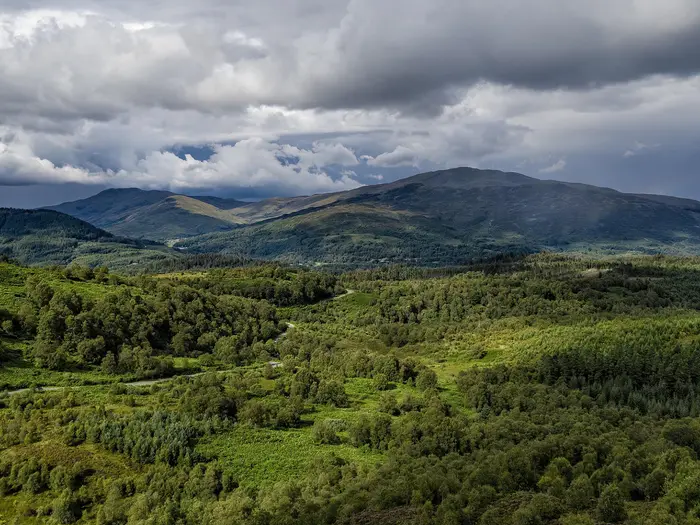
Image by WolfBlur The Great Trossachs Path is a gentle east-to-west crossing of Loch Lomond & The Trossachs National Park, linking Callander with Inversnaid on the shore of Loch Lomond. It suits walkers looking for a first multi-day trail with strong scenery, clear waymarking and no technical ground.
The route keeps close to water for much of its 48 km, passing Loch Venachar, Loch Achray, Loch Katrine and Loch Arklet before dropping by Arklet Falls. Woodland, lochside tracks, quiet lanes and an old military road give it more variety than the modest height gain suggests.
Its best moments are practical as much as scenic: a natural pause at Brig o' Turk, the long north shore of Loch Katrine, and the finish where the trail meets the West Highland Way at Inversnaid. The Steamship Sir Walter Scott also gives an optional way to shorten or reshape the Loch Katrine section.
The walking is straightforward, but the logistics are not casual. Accommodation is sparse away from Callander, the Inversnaid end depends heavily on the seasonal Loch Lomond ferry, and the long stretch around Loch Katrine has limited facilities.
This guide covers stages, days, accommodation, food, transport, terrain and the common mistakes to avoid.
Stage-by-Stage Guide
Stage 1: Callander to Brig o' Turk via Kilmahog — approx. 15 km
This first stage eases you into the route, leaving the full facilities of Callander and picking up the path proper at Kilmahog, just west of town. From there the waymarks lead towards the south shore of Loch Venachar, giving a low-level, lochside start through the eastern Trossachs.
The walking is generally gentle, on a mix of surfaced cycle path, forest or estate tracks and quiet minor-road sections. There is no technical ground, but the day is still long enough to feel like the start of a multi-day walk if carrying overnight kit.
The main landmarks are Callander, Kilmahog, Loch Venachar and the approach into Brig o' Turk. The best views on this stage come from the open lochside sections, with water, woodland and glimpses towards Ben Venue and Ben A'an above the Trossachs forests.
Callander is the last place with a broad choice of shops, cafés and accommodation, so stock up before leaving. Brig o' Turk has limited services, including a long-established tea room and an inn, but opening hours should be checked before travelling, especially outside the main visitor season.
Accommodation at the end of the stage is limited and should be booked ahead. Brig o' Turk is a natural stopping point, but it does not have the flexibility of Callander, so do not assume a bed will be available on arrival.
For transport, Callander is the practical public-transport trailhead, reached by bus from Stirling. Brig o' Turk has road access, but onward public transport is limited and should be checked before travelling if using this as a day-walk or section break.
Navigation is straightforward in normal visibility because the route is waymarked and follows obvious tracks and minor lanes. Carry a proper map or offline mapping regardless: the Harvey Great Trossachs Path map and the relevant OS Explorer sheets cover the route, and they are useful where paths, estate tracks and cycle routes intersect.
The main planning warning for this stage is not the terrain but where you sleep next. Wild camping is allowed in Scotland under the Scottish Outdoor Access Code, but the National Park camping-management zone affects the area between Brig o' Turk and south Loch Achray from March to October, when camping is only permitted in pre-booked designated areas.
Stage 2: Brig o' Turk to Trossachs Pier, Loch Katrine — approx. 10 km
This is the shortest of the three suggested stages and makes a useful half-day between the settled Trossachs around Brig o' Turk and the more committed Loch Katrine section. It passes Loch Achray and finishes at Trossachs Pier, at the eastern end of Loch Katrine.
Expect easy, low-level walking on well-made paths, tracks and quiet road or lane sections, with short rises rather than sustained climbing. Underfoot conditions are usually straightforward, though woodland sections can still be wet or muddy after rain.
The stage links several of the classic Trossachs landscapes: Brig o' Turk, Loch Achray and the approach to Loch Katrine. Views towards Ben Venue and Ben A'an are a key part of the day, especially where the route opens out around the lochs.
Food and drink options are limited once you leave Brig o' Turk, and anything around Trossachs Pier should be treated as seasonal. Carry lunch and enough water for the stage, particularly if walking outside the main visitor months.
Accommodation at or near Trossachs Pier is limited. Loch Katrine has eco-lodges and a few tent pitches, but availability, exact locations and booking conditions should be checked before travelling.
Trossachs Pier has road access and is an important access point for Loch Katrine, including the Steamship Sir Walter Scott. Public transport for walkers should not be assumed; check current options in advance if finishing or starting a section here.
Navigation remains relatively simple, with waymarks and obvious lochside lines. The main decision point for some walkers is whether to continue along the north shore of Loch Katrine on foot, or use a paid sailing on the Steamship Sir Walter Scott between Trossachs Pier and Stronachlachar to shorten the route.
The camping-management rules are especially relevant around this stage. From March to October, camping between Brig o' Turk and south Loch Achray is restricted to pre-booked designated areas, so this is not a place to improvise a late wild camp.
Stage 3: Trossachs Pier to Inversnaid via Loch Katrine, Stronachlachar and Loch Arklet — approx. 23 km
This is the longest and most committing stage of the standard three-day itinerary. It follows the north shore of Loch Katrine to Stronachlachar, then crosses the higher watershed near Loch Arklet before descending past the Garrison of Inversnaid and Arklet Falls to the finish at Inversnaid on Loch Lomond.
The Loch Katrine section is long, scenic and straightforward underfoot, largely following a single-track tarmac private road along the north shore. The walking is not technically difficult, but the distance and lack of facilities make it the stage that most needs a deliberate food, water and timing plan.
After Stronachlachar the route turns towards Loch Arklet and reaches its high point on open ground near the watershed, at about 241 m. This is modest by Scottish hillwalking standards, but it feels more remote than the earlier lochside sections and can be wetter, windier and more exposed in poor weather.
The final approach to Inversnaid follows the old military-road line through Rob Roy MacGregor's country, passing the remains of the 18th-century Garrison of Inversnaid. The descent then leads by Arklet Falls towards Loch Lomond, where the Great Trossachs Path meets the West Highland Way at Inversnaid Pier and the Inversnaid Hotel.
There are very limited places to buy food or drink between Trossachs Pier and Inversnaid. Treat the north shore of Loch Katrine as a long, facility-free stretch and carry enough food, water and bad-weather layers for the full day.
The optional Steamship Sir Walter Scott sailing between Trossachs Pier and Stronachlachar is the main way to reduce this stage. It is a paid, timetable-dependent option and should be checked before travelling; using it changes both the distance and the feel of the day.
Accommodation at the finish is limited to Inversnaid options such as the Inversnaid Hotel and Inversnaid Bunkhouse. Beds should be booked well in advance, particularly because the West Highland Way also passes through Inversnaid.
Transport is the key issue at this end of the route. Inversnaid has no useful road public transport, so the normal public-transport link is the seasonal Loch Lomond Waterbus operated by Cruise Loch Lomond across to Tarbet, where onward train or bus connections can be made; the ferry generally runs April to October, but current timetables must be checked before committing to dates.
Out of season, or if ferry times do not match your walking schedule, onward travel from Inversnaid can become awkward. A taxi or pre-booked Demand Responsive Transport may be needed, and this should be arranged before setting off rather than left until arrival.
Navigation is still helped by waymarking, but this is the stage where a map matters most. The route uses long estate or private-road sections, old military-road ground, lochside tracks and the final descent towards Loch Lomond; mist or heavy rain around Loch Arklet can make the open section feel less obvious.
Near Inversnaid, expect more varied underfoot conditions than on the Loch Katrine tarmac, including boardwalk, steps and a short narrow, muddy section. Midges can be a nuisance from June to August, especially around still, damp woodland and lochside areas, so repellent and a head net are worth carrying in summer.
Recommended Itinerary
The most practical plan for the Great Trossachs Path is usually 3 days, walking east to west from Callander to Inversnaid. The walking is not technically hard, but the itinerary needs to be built around sparse accommodation, limited services and the seasonal Loch Lomond ferry at the Inversnaid end.
Standard itinerary — 3 days
Best for most walkers: steady daily distances, time to enjoy the lochs, and a sensible split before the longer final stage to Inversnaid.
| Day | From | To | Approx. distance | Why this stage makes sense | Services/accommodation notes |
|---|---|---|---|---|---|
| 1 | Callander, via Kilmahog | Brig o' Turk | 15 km | A manageable first day from the main trailhead, leaving Callander’s facilities and following the south shore of Loch Venachar towards the Trossachs. Brig o' Turk is the natural first overnight stop before the route continues towards Loch Achray and Loch Katrine. | Callander has the best choice of shops, food and beds, including Callander Hostel. Brig o' Turk has limited services, including a long-established tea room and an inn, so accommodation should be booked ahead. |
| 2 | Brig o' Turk | Trossachs Pier, Loch Katrine | 10 km | A short positioning day through the heart of the Trossachs, useful because accommodation and camping options are limited and unevenly spaced. It also sets up the long final leg along Loch Katrine and over towards Loch Arklet. | Do not assume a walk-up bed or pitch. Eco-lodges and a few tent pitches are available on Loch Katrine, but these should be arranged in advance. The Brig o' Turk to south Loch Achray area lies within a National Park camping-management zone; from March to October camping is only allowed in pre-booked designated areas. |
| 3 | Trossachs Pier | Inversnaid | 23 km | The longest day, but still on moderate ground: the route follows the north shore of Loch Katrine, passes Stronachlachar, then crosses the higher open ground near Loch Arklet before descending past the Garrison of Inversnaid and Arklet Falls to Loch Lomond. | This is the key facility-free stretch, especially along the north shore of Loch Katrine. Carry enough food and water for the day. Stronachlachar has very limited options, and Inversnaid has limited accommodation at the finish, including Inversnaid Hotel and Inversnaid Bunkhouse. The Loch Lomond Waterbus from Inversnaid is seasonal, generally April to October; this should be checked before travelling. |
Slower variant — 4 days
Best for families, relaxed walkers, or anyone wanting to reduce the long final day. This version only works if accommodation, camping or lodges around Loch Katrine and Stronachlachar can be secured in advance.
| Day | From | To | Approx. distance | Why this stage makes sense | Services/accommodation notes |
|---|---|---|---|---|---|
| 1 | Callander, via Kilmahog | Brig o' Turk | 15 km | Keeps the first day straightforward and uses Brig o' Turk as the first natural stopping point. | Book ahead. Callander has the widest range of facilities; Brig o' Turk is small and options are limited. |
| 2 | Brig o' Turk | Trossachs Pier / Loch Katrine area | 10 km | A short day through Loch Achray country, leaving time for a slower pace or an early stop near Loch Katrine. | Camping restrictions apply between Brig o' Turk and south Loch Achray from March to October. Any pitch or lodge around Loch Katrine should be booked before setting off. |
| 3 | Trossachs Pier / Loch Katrine area | Stronachlachar | Check official mapping before booking | Breaks up the long Loch Katrine north-shore section and avoids combining it with the climb over towards Loch Arklet. | Stronachlachar has very limited accommodation and services. This should be checked before travelling. The Steamship Sir Walter Scott can also be used as a paid option between Trossachs Pier and Stronachlachar if you are happy to skip this walking section. |
| 4 | Stronachlachar | Inversnaid | Check official mapping before booking | Leaves a shorter final day over the watershed near Loch Arklet and down past Arklet Falls to Loch Lomond. | Inversnaid has limited accommodation and no useful road public transport. Arrange the Loch Lomond ferry, taxi or other onward transport before starting the route. |
Faster variant — 2 days
Best for fit walkers who are comfortable with back-to-back long days and have accommodation and onward transport fixed before starting. This is the simplest faster walking schedule without turning the route into a single-day endurance outing.
| Day | From | To | Approx. distance | Why this stage makes sense | Services/accommodation notes |
|---|---|---|---|---|---|
| 1 | Callander, via Kilmahog and Brig o' Turk | Trossachs Pier / Loch Katrine area | 25 km | Combines the first two standard stages, using Brig o' Turk as the main mid-stage service point before continuing to Loch Katrine. | Start with supplies from Callander. Accommodation or camping around Loch Katrine must be arranged ahead; do not rely on finding something on arrival. Camping-management rules apply around Brig o' Turk and south Loch Achray from March to October. |
| 2 | Trossachs Pier | Inversnaid | 23 km | A full but logical second day, following Loch Katrine to Stronachlachar and then crossing towards Loch Arklet before descending to Inversnaid. | Carry food and water for the long Loch Katrine section. Check the Loch Lomond Waterbus timetable and finish logistics before committing to this plan. |
A very fit walker can complete the full 48 km in a long single day, but that is not the best default plan. The point-to-point transport at Inversnaid, the lack of intermediate services and the seasonal ferry make a 2- or 3-day itinerary much more reliable for most hikers.
Planning the Route
The Great Trossachs Path is physically straightforward, but it rewards careful logistics. The walking is mostly on tracks, lanes, cycle path and old road lines; the harder part is fitting the route around sparse accommodation, limited public transport and the seasonal Loch Lomond ferry at Inversnaid.
Most walkers should plan on 2–3 days. A strong walker can cover it faster, but that makes the long Loch Katrine and Loch Arklet sections feel more like a mileage exercise than a relaxed crossing of the Trossachs. Three days gives the best balance for most hikers, especially if using Brig o' Turk and Trossachs Pier as natural breaks.
Choosing a direction
The route is normally walked east to west, from Callander to Inversnaid. This is the most practical direction because Callander has the best start-of-route facilities and is easier to reach by bus from Stirling.
Walking westwards also lets you finish on Loch Lomond, where the route meets the West Highland Way and the Loch Lomond Waterbus connection across to Tarbet/Inveruglas. The important caveat is that the Inversnaid end has no useful road public transport, so ferry times and onward travel must be arranged before starting.
The route can be walked in reverse, but that puts the most awkward transport leg at the beginning. If starting from Inversnaid, the Tarbet–Inversnaid ferry must be running and timed to suit the first walking day; this should be checked before travelling.
How many days to allow
| Plan | Best for | Practical notes |
|---|---|---|
| 2 days | Fit walkers comfortable with longer days | Usually means a long final or first day involving the full Loch Katrine / Loch Arklet / Inversnaid section. Accommodation and transport still need booking carefully. |
| 3 days | Most walkers | The neatest plan, using Callander, Brig o' Turk and Trossachs Pier as the main staging points before the longer final day to Inversnaid. |
| 1 long day | Very fit walkers, usually travelling light | Possible, but transport at Inversnaid becomes the main risk. Missing the ferry or onward connection can be a serious problem. |
The route’s shape is not dictated by terrain so much as by places where it is possible to stop. Callander has the most choice; Brig o' Turk, Stronachlachar and Inversnaid have limited options; the Loch Katrine area has eco-lodges and some tent pitches. Book beds or camping before committing to dates.
Natural stage planning
The common three-day structure works because it matches the main service points rather than because the walking is difficult.
| Stage | Planning focus |
|---|---|
| Callander to Brig o' Turk | Start with food and supplies from Callander. The route proper begins west of town at Kilmahog, then follows Loch Venachar towards Brig o' Turk. Brig o' Turk has limited services, including an inn and long-established tea room, but opening times should be checked before relying on them. |
| Brig o' Turk to Trossachs Pier | A shorter day through the Loch Achray / Trossachs Pier area. This is useful if pacing the route over three days, arranging Loch Katrine accommodation, or positioning for the Steamship Sir Walter Scott. |
| Trossachs Pier to Inversnaid | The longest and most committing stage for many walkers. The north shore of Loch Katrine is a long, quiet stretch with few facilities, followed by the climb towards Loch Arklet and the descent past Arklet Falls to Inversnaid. Carry enough food and drink for the full day. |
If using the Steamship Sir Walter Scott between Trossachs Pier and Stronachlachar, the long north-shore section of Loch Katrine can be shortened. This is a useful option for mixed-ability groups, poor-weather days or walkers who want a less demanding final stage, but sailings and ticket availability should be checked before travelling.
Accommodation strategy
Accommodation is the main constraint on the Great Trossachs Path. Callander has the broadest range, including B&Bs, hotels and Callander Hostel, but choices narrow sharply once on the route.
Brig o' Turk, Stronachlachar and Inversnaid have limited places to stay, and Inversnaid is essentially a finish-point rather than a large service village. Inversnaid Hotel and Inversnaid Bunkhouse are the key named options at the western end, so onward transport should be planned at the same time as booking a bed.
Camping gives more flexibility, but it is not completely unrestricted. Wild camping is allowed under the Scottish Outdoor Access Code, but the section between Brig o' Turk and south Loch Achray lies in a National Park camping-management zone where, from March to October, camping is only permitted in pre-booked designated areas.
Food and water planning
Do not treat this as a route where food can be picked up every few miles. Callander is the practical place to stock up before starting, and the longer western half needs particular care.
The north shore of Loch Katrine and the Loch Arklet approach to Inversnaid are the key stretches where walkers should be self-sufficient for the day. Carry lunch, snacks and enough water; if taking water from lochs or burns, treat it before drinking.
Cafés, inns and visitor facilities in the Trossachs can have seasonal or variable opening hours. This should be checked before travelling, especially outside summer or if walking midweek.
Shortening, extending and section hiking
The easiest built-in shortening option is the Loch Katrine boat between Trossachs Pier and Stronachlachar, which avoids walking the full north shore. It changes the character of the route, but it can make the itinerary more manageable if accommodation or daylight is tight.
Extending the walk is straightforward in principle because the path links the Rob Roy Way at the Callander side with the West Highland Way at Inversnaid. From Inversnaid, the Loch Lomond ferry also links onwards towards routes such as the Three Lochs Way and Cowal Way. Any extension depends heavily on ferry timetables and onward accommodation.
Section hiking is possible, especially on the eastern half around Callander, Kilmahog, Loch Venachar, Brig o' Turk, Loch Achray and Trossachs Pier. It becomes less convenient towards Inversnaid because public transport is limited and the Loch Lomond Waterbus is seasonal.
Navigation and maps
The Great Trossachs Path is waymarked and follows generally clear ground, but a map is still sensible. The official trail map is the Harvey Maps The Great Trossachs Path XT40, and OS Explorer OL46 The Trossachs and OL39 Loch Lomond North cover the area.
Navigation is usually simple on the lochside tracks and lanes, but do not rely only on waymarks or a phone battery. The more open section near Loch Arklet and the final approach to Inversnaid can feel more remote in poor weather, despite the modest altitude.
Transport planning
Transport should be planned before accommodation is finalised. Callander is reached by bus from Stirling, with Stirling linked by train and bus to Edinburgh and Glasgow.
The Inversnaid end is the complication. The usual public-transport solution is the Loch Lomond Waterbus operated by Cruise Loch Lomond across the loch to Tarbet/Inveruglas, with onward connections from the Tarbet/Arrochar side. This generally runs from around April to October, but the current timetable must be checked before booking the walk.
Outside the ferry season, or if times do not work, returning from Inversnaid may require a taxi or pre-booked Demand Responsive Transport. Do not leave this decision until arrival at the finish.
Towns, Villages and Overnight Stops
Accommodation and food are the main planning constraint on the Great Trossachs Path. Callander is the only full-service trail town; after that, overnight options are sparse and concentrated around Brig o' Turk, Loch Katrine / Stronachlachar and Inversnaid. Book beds or pitches before setting off, especially if walking the route over two or three days.
| Place | Role for hikers | Overnight usefulness | Food / supplies | Transport notes |
|---|---|---|---|---|
| Callander | Practical trailhead | Best-served overnight base | All facilities | Bus 59 from Stirling, roughly hourly |
| Kilmahog | Start of the waymarked path proper | Not usually an overnight stop | Do not rely on it for resupply | Reached from Callander on foot |
| Brig o' Turk | Natural first-night stop | Limited; book ahead | Tea room and inn | No railway; onward logistics should be planned |
| Loch Achray / Trossachs Pier | Useful intermediate halt | Limited nearby options; check before booking a stage around it | Do not rely on supplies without checking | Loch Katrine sailings may affect plans |
| Loch Katrine north shore | Long, facility-free section | Eco-lodges and a few tent pitches on Loch Katrine | Carry food and water planning carefully | Steamship Sir Walter Scott can shorten this section |
| Stronachlachar | West end of Loch Katrine | Very limited; book ahead | Limited; do not assume resupply | Linked to Loch Katrine sailings when operating |
| Loch Arklet / Garrison of Inversnaid | Remote high-ground section | Not a service stop | No facilities | Continue to Inversnaid |
| Inversnaid | Finish on Loch Lomond | Limited but important finish accommodation | No trail-town facilities | Seasonal Loch Lomond Waterbus to Tarbet / Inveruglas; no meaningful road public transport |
Callander
Callander is the practical place to begin the route. The waymarked path proper starts just west of town at Kilmahog, but Callander has the accommodation, food and transport that make it the sensible trailhead.
There is plenty of choice here compared with the rest of the route, including B&Bs, hotels and Callander Hostel. For most walkers, staying in Callander the night before the walk is the easiest way to start early and avoid depending on same-day transport connections.
Callander has all facilities, so use it for the main food shop, gas or small essentials before heading into the Trossachs. Resupply becomes much less reliable after leaving town.
Public transport access is by bus from Stirling, with service 59 running roughly hourly. Stirling is the rail and bus gateway from Edinburgh or Glasgow.
Kilmahog
Kilmahog sits just west of Callander and is where the route proper leads off towards the south shore of Loch Venachar. It is more a transition point than a hiking base.
Most walkers will simply pass through or join the waymarks here after starting in Callander. Do not treat Kilmahog as a guaranteed accommodation or resupply point unless specific arrangements have been made in advance.
Loch Venachar South Shore
The south shore of Loch Venachar is part of the first walking day between Callander and Brig o' Turk. It is a scenic lochside stretch rather than a settlement stop.
There are no route-planning reasons to break the journey here unless using pre-arranged accommodation off-route. Carry what is needed from Callander for the day.
Brig o' Turk
Brig o' Turk is the main mid-route village and the most natural first overnight stop on a three-day itinerary. It sits between the Loch Venachar and Loch Achray sections, about 15 km from Callander on the standard staging.
Accommodation is limited, so booking ahead is essential. The village has a long-established tea room and an inn, making it one of the few places after Callander where walkers can plan a proper stop rather than just a roadside pause.
This is also an important camping-planning area. The stretch between Brig o' Turk and south Loch Achray lies in a National Park camping-management zone; from March to October, camping is only permitted in pre-booked designated areas. This should be checked before travelling.
Loch Achray
Loch Achray lies immediately west of Brig o' Turk on the approach to Trossachs Pier. It is useful for route pacing, but it should not be treated as a village with dependable hiker services.
The camping-management zone affecting the Brig o' Turk to south Loch Achray area is the key local issue. If planning to camp here between March and October, arrange the correct designated place before arrival rather than assuming a wild pitch is allowed.
Trossachs Pier
Trossachs Pier, at the east end of Loch Katrine, is a major decision point rather than a major overnight hub. It is the point where walkers either continue along the long north shore of Loch Katrine or use the Steamship Sir Walter Scott as an optional paid sailing towards Stronachlachar.
On a three-day itinerary, Trossachs Pier can work as a stage end only if accommodation or camping has been arranged nearby. Do not assume there will be spare beds or straightforward onward transport on arrival.
The sailing timetable matters if using the boat to shorten the walk. Loch Katrine cruise times and prices change seasonally, so confirm current sailings before building a day plan around them.
Loch Katrine North Shore
The north shore of Loch Katrine is the longest facility-free stretch of the route and needs more care than the gentle terrain suggests. Once committed to this section, food, weather protection and timing matter more than navigation difficulty.
Eco-lodges and a few tent pitches are available on Loch Katrine, but these should be booked ahead. If camping elsewhere, follow the Scottish Outdoor Access Code and check whether any National Park restrictions apply to the exact location and date.
The Steamship Sir Walter Scott is the main practical alternative to walking the whole lochside road. It can be useful for walkers who want a shorter day, are delayed by weather, or are linking accommodation at opposite ends of the loch.
Stronachlachar
Stronachlachar sits at the west end of Loch Katrine and is the last settlement-like stop before the route climbs towards Loch Arklet and drops to Inversnaid. It is a useful staging point, but services and beds are very limited.
Book ahead if planning to stay here. It can also be part of a Loch Katrine boat-assisted itinerary, depending on the Steamship Sir Walter Scott timetable.
There should be no assumption of easy resupply after Stronachlachar. Carry enough food and water planning for the onward section over Loch Arklet to Inversnaid.
Loch Arklet and the Garrison of Inversnaid
The Loch Arklet section is higher, more open and more remote than the earlier lochside walking. The route passes the remains of the 18th-century Garrison of Inversnaid before descending towards Arklet Falls and Loch Lomond.
This is not an overnight or service stop. Treat it as a through-section between Stronachlachar / Loch Katrine and Inversnaid, with no resupply or public transport options on the path.
Inversnaid
Inversnaid is the western finish of the Great Trossachs Path, on the eastern shore of Loch Lomond beside Inversnaid Pier and the Inversnaid Hotel. It is also where the route meets the West Highland Way.
Accommodation at the finish is limited but important: the known options are the Inversnaid Hotel and Inversnaid Bunkhouse. Book ahead, particularly if arriving late in the day or outside the main walking season.
Inversnaid is not a full-service village, so do not plan on a shop-style resupply at the finish. If continuing on the West Highland Way or waiting for transport, carry enough food to cover delays.
Transport is the main issue here. There is no meaningful road public transport from Inversnaid; the usual exit is the seasonal Loch Lomond Waterbus operated by Cruise Loch Lomond across to Tarbet / Inveruglas, with Tarbet linked onwards by train or bus towards Glasgow. The waterbus generally runs April to October, and out-of-season returns may require taxi or pre-booked Demand Responsive Transport. This should be checked before travelling.
Getting to the Start
The practical trailhead is Callander, which has the services and accommodation needed before setting off. The waymarked path proper begins just west of town at Kilmahog, then continues along the south shore of Loch Venachar.
Because the route is linear and finishes at Inversnaid, do not treat getting to Callander as the only transport problem. The Inversnaid end has very limited onward public transport, and the usual exit involves the seasonal Loch Lomond Waterbus across to Tarbet. Plan the finish and return before committing to accommodation or parking.
By train
There is no railway on the Great Trossachs Path itself. Stirling is the practical railhead for Callander, with onward travel by bus.
Stirling is reachable by train from Glasgow and Edinburgh, making it the simplest public-transport gateway for most walkers. From Stirling, continue to Callander by bus; current train and bus connections should be checked before travelling.
By bus
Callander is served by bus from Stirling. The key service is the 59 from Stirling to Callander, running roughly hourly, but times vary by day and season, so this should be checked before travelling.
If arriving late, starting on a Sunday or travelling outside the main season, build in extra time rather than assuming an easy connection. A taxi from Stirling or a pre-booked local taxi can be a useful fallback, but availability and cost should be confirmed in advance.
By car
Driving to Callander is straightforward in principle, but the main issue is what happens after finishing at Inversnaid. The route does not loop back to Callander, and public transport from Inversnaid is awkward, especially outside the Loch Lomond Waterbus season.
If leaving a vehicle in Callander for several days, check current long-stay parking rules before travelling. Many walkers will find it simpler to stay in Callander the night before and ask accommodation providers about suitable parking arrangements, rather than assuming multi-day parking is available in the town centre.
Do not rely on being able to return from Inversnaid to Callander quickly by public transport. In season, the usual exit from Inversnaid is by Loch Lomond Waterbus to Tarbet, with onward train or bus links towards Glasgow; out of season, a taxi or pre-booked Demand Responsive Transport may be needed.
From the nearest airport
For walkers flying in, Glasgow and Edinburgh are the most practical airport gateways because both connect into the central Scotland transport network. From either city, travel on to Stirling, then take the bus to Callander.
Airport-to-Stirling connections, late arrivals and Sunday services should be checked before travelling. If flight times do not align well with the Stirling–Callander bus, staying overnight in Stirling or Callander is usually a safer plan than trying to reach the trailhead late in the day.
Where to stay before starting
Callander is the best place to stay before starting the Great Trossachs Path. It has the broadest choice of accommodation on the route, including B&Bs, hotels and Callander Hostel, plus the facilities needed for last-minute food and supplies.
Booking ahead is sensible, especially if the first day is planned only as far as Brig o' Turk, where accommodation is much more limited. Starting from Callander also avoids having to arrange a separate transfer to Kilmahog; most walkers simply begin in town and follow the route west to the waymarked start of the path proper.
Getting Home from the Finish
Inversnaid is a remote finish point on the eastern shore of Loch Lomond. There is no practical railway or regular road public transport at the trailhead itself, so the onward journey needs planning before you leave Callander.
For most walkers, the key connection is the seasonal Loch Lomond Waterbus operated by Cruise Loch Lomond, linking Inversnaid with Tarbet and Inveruglas on the opposite side of the loch. It generally runs from April to October, but sailing times, operating days and last departures are timetable-dependent and should be checked before travelling.
By train
There is no railway at Inversnaid. The usual public-transport exit is to take the Loch Lomond Waterbus across to Tarbet, then continue by rail from the Tarbet/Arrochar side of Loch Lomond towards Glasgow.
This makes the ferry the critical link in the whole homeward journey. If the last boat has gone, if services are not running, or if the route is being walked outside the main April–October season, a same-day train connection may not be possible without a pre-arranged taxi or other booked transport.
By bus
Inversnaid has no useful road bus service for finishing walkers. Public transport normally starts after crossing Loch Lomond by Waterbus to Tarbet or Inveruglas, where onward bus connections towards Glasgow may be possible.
Because both ferry and bus times can change seasonally, build the day around the published ferry timetable first, then match the onward bus or train connection. Do not assume there will be an evening escape from Inversnaid.
By car/taxi
Leaving a car at Inversnaid is rarely the simplest option because the route is linear and the finish is remote from Callander by road. Most walkers using a car will find it easier to park at or near the start and arrange the return by ferry plus public transport, or pre-book a taxi for the awkward final link.
Out of season, or if finishing late in the day, a taxi or pre-booked Demand Responsive Transport may be the only realistic way out. This should be arranged before starting the hike, not on arrival at Inversnaid.
If meeting a lift at the finish, agree a clear pick-up point around Inversnaid Pier / the Inversnaid Hotel. Mobile signal and waiting facilities should not be relied on as part of the plan.
From the nearest airport
There is no direct airport connection from Inversnaid. The practical route is to get across Loch Lomond by Waterbus to Tarbet or Inveruglas, then continue towards Glasgow by train or bus before making any airport transfer.
Allow generous time between the ferry, onward public transport and any flight. If a same-day flight is involved, the ferry timetable should be treated as the limiting factor, and this should be checked before travelling.
Where to stay at the finish
Staying overnight at Inversnaid is often the most reliable plan if the finish day is long, the ferry timetable is tight, or the weather slows progress over the Loch Arklet and Arklet Falls section. Accommodation at the finish is limited, with the Inversnaid Hotel and Inversnaid Bunkhouse the key options.
Book ahead, especially in the main walking season. There are not enough beds at the finish to treat Inversnaid as a flexible turn-up stop, and missing the last ferry can leave very few onward options.
Which Direction Should You Walk?
The Great Trossachs Path is normally walked east to west, from Callander to Inversnaid. This is also the more intuitive direction for most walkers because Callander is the practical trailhead, has the widest choice of accommodation and is straightforward to reach by bus from Stirling.
The route can be walked in either direction, and the ground is not significantly harder one way than the other. The choice is mainly about transport timing, accommodation and whether you prefer to finish at Loch Lomond or in a town with easier onward travel.
Callander to Inversnaid: the standard direction
Walking from Callander gives the cleanest start. You can arrive by public transport, stay in Callander if needed, then pick up the route west of town at Kilmahog and continue through Loch Venachar, Brig o' Turk, Loch Achray and Loch Katrine.
The scenery also builds well in this direction. The route begins with accessible lochside and woodland walking, then commits to the longer, quieter north shore of Loch Katrine before crossing the higher open ground near Loch Arklet and descending past Arklet Falls to Loch Lomond.
The main drawback is the finish logistics. Inversnaid has no useful road public transport, so most walkers rely on the Loch Lomond Waterbus across to Tarbet, which generally runs April to October. Ferry times, bus 59 to Callander and any onward connections should be checked before travelling, especially if finishing late in the day.
Accommodation also needs attention. Callander is easy; Brig o' Turk, Stronachlachar and Inversnaid have limited options, so a westbound itinerary works best when beds or permitted camping are fixed before setting off.
Inversnaid to Callander: the reverse direction
Starting at Inversnaid can make sense if you want the awkward transport dealt with at the beginning. Once you have reached Inversnaid by ferry, the walk then finishes in Callander, where onward bus travel to Stirling is much simpler.
The reverse direction starts more abruptly, climbing away from Loch Lomond past Arklet Falls towards Loch Arklet and the highest part of the route. The ascent is still modest and non-technical, but it puts one of the more sustained uphill sections early in the walk rather than near the end.
The practical weakness is the first day. Unless staying at Inversnaid the night before, your walking day depends on ferry timings, and you may begin later than ideal before tackling the longest, quietest western section of the route. Out of the ferry season, reaching Inversnaid can be difficult without taxi or pre-booked Demand Responsive Transport; this should be checked before travelling.
Does weather favour one direction?
There is no strong direction advantage for weather on this route. Much of the path is low-level and sheltered by woodland, although the north shore of Loch Katrine and the open ground around Loch Arklet can feel exposed in poor conditions.
Wind direction may affect comfort along Loch Katrine, but it is not a reliable reason to choose one direction when planning months ahead. Transport and accommodation are much more important.
Recommendation
For most walkers, Callander to Inversnaid is the best direction. It follows the usual line of the trail, starts from the easier transport and accommodation hub, gives a satisfying westward progression through the Trossachs, and finishes memorably at Loch Lomond.
Choose the reverse direction only if the Inversnaid access works neatly for your dates, or if finishing in Callander with simpler onward travel is the priority. In either direction, the key planning point is not the terrain but the limited beds and the seasonal ferry connection at Inversnaid.
Accommodation Along the Route
Accommodation is the main constraint on the Great Trossachs Path. The walking is relatively straightforward, but beds and services are sparse once you leave Callander, so this is not a route to improvise on a busy weekend or during the main April–October season.
Callander is the practical place to stay before starting, with the widest choice of B&Bs, hotels and hostel accommodation, including Callander Hostel. After that, options are limited and clustered around Brig o' Turk, Loch Katrine/Stronachlachar and Inversnaid.
| Place | Accommodation level | Best for | Notes |
|---|---|---|---|
| Callander | Good | Pre-walk night; flexible starting point | Best choice on the route, with B&Bs, hotels and hostel accommodation. Useful if arriving by bus from Stirling and starting early the next day. |
| Kilmahog | None / very limited | Trail access only | The path proper begins just west of Callander at Kilmahog, but Callander is the practical accommodation base. |
| Brig o' Turk | Limited | First overnight on a 3-day itinerary | A natural stopping point after the Callander section, with an inn and village services. Book ahead, especially at weekends. |
| Loch Achray / Trossachs Pier | Limited | Short second day; Loch Katrine access | Useful for splitting the route into three easier days. Accommodation around Loch Katrine is limited and may include eco-lodges and tent pitches rather than conventional village beds. This should be checked before travelling. |
| Loch Katrine north shore | None | Self-sufficient passage only | The long north-shore stretch is facility-free for walkers who continue on foot rather than using the Steamship Sir Walter Scott option. Carry food and plan the day carefully. |
| Stronachlachar | Limited | Possible west-end Loch Katrine stop | One of the few possible accommodation points between Loch Katrine and Inversnaid, but options are very limited. Book before committing to this as an overnight stop. |
| Loch Arklet / Garrison of Inversnaid | None | Through-walking only | Open, higher ground between Stronachlachar and Inversnaid. No accommodation should be expected here. |
| Inversnaid | Limited | Finish night; West Highland Way connection | Accommodation includes the Inversnaid Hotel and Inversnaid Bunkhouse. The finish is remote, with onward travel usually dependent on the seasonal Loch Lomond Waterbus or pre-arranged transport. |
Best overnight plans
A comfortable 3-day walking plan usually uses Callander before the start, Brig o' Turk for the first night, then a Loch Katrine/Trossachs Pier or Stronachlachar-area stop before finishing at Inversnaid. This keeps the early days short and leaves the longer, more remote western section for the final day.
A 2-day plan is possible, but it makes accommodation logistics more awkward. Most walkers will need either a long first or second day, and should make sure the chosen overnight stop has confirmed availability before booking transport.
Staying at Inversnaid after finishing can remove pressure from the final day, especially if the Loch Lomond ferry timetable does not line up neatly with walking pace. If not staying there, onward travel from Inversnaid must be planned before setting off.
Camping and restrictions
Wild camping is allowed in Scotland under the Scottish Outdoor Access Code, but this route passes through a National Park camping-management zone between Brig o' Turk and south Loch Achray. From March to October, camping there is only permitted in pre-booked designated areas.
That restriction matters for anyone trying to solve the limited-bed problem with a tent. Outside the managed zone, responsible wild camping may be possible, but the route is largely lochside, wooded and popular in places, so choose discreet sites, arrive late, leave early and follow the Access Code fully.
Eco-lodges and a small number of tent pitches are available on Loch Katrine. Exact locations, opening dates and booking conditions should be checked before travelling.
Booking, seasonality and transfers
Book accommodation before committing to a start date. Callander has the best capacity, but Brig o' Turk, Stronachlachar and Inversnaid have very limited choice, and a single unavailable stop can force a major change to the itinerary.
The practical season is shaped by the Loch Lomond Waterbus, which generally runs April to October. That same period brings more walkers, cyclists, visitors to Loch Katrine and summer weekend pressure, so advance booking is strongly advised.
The route can work for inn-to-inn walkers, but only with careful planning; it is not a classic village-to-village trail with frequent fallback accommodation. Taxi transfers or staying two nights in one base may help if an overnight gap cannot be solved, but local availability and costs should be arranged in advance. This should be checked before travelling.
Camping and Wild Camping
Camping can work well on the Great Trossachs Path, but it needs more planning than the gentle terrain suggests. The route passes through Loch Lomond & The Trossachs National Park and almost wholly through the Great Trossachs Forest National Nature Reserve, so the key issues are camping byelaws, low-impact behaviour and the limited number of formal places to stay.
There is not a continuous chain of campsites along the trail. Accommodation and services are concentrated at Callander, Brig o' Turk, Stronachlachar and Inversnaid, with eco-lodges and a few tent pitches available on Loch Katrine. These should be booked ahead, especially if the route is being walked over a weekend or during the main April–October season.
Wild camping rules
Wild camping is permitted in Scotland under the Scottish Outdoor Access Code when done responsibly. On this route, however, there is an important National Park camping-management zone between Brig o' Turk and south Loch Achray. From March to October, camping in that zone is only allowed in pre-booked designated areas.
That restriction matters because it sits in the middle of the normal early route, between the Loch Venachar / Brig o' Turk area and the approach to Loch Achray and Trossachs Pier. Do not assume it is acceptable to arrive late and pitch discreetly in woodland or by the loch in this area during the byelaw season. Current permit areas, dates and booking rules should be checked before travelling.
Outside the camping-management zone, access rights still come with responsibilities. Camp small, arrive late, leave early, stay no more than one night in one place, and avoid gardens, enclosed fields, buildings, roadsides, livestock areas and busy visitor spots.
Practical camping options by section
| Section | Camping implications |
|---|---|
| Callander to Brig o' Turk | Callander is the practical place to stock up before starting. The route then follows Loch Venachar towards Brig o' Turk, where services are limited and onward camping rules become important. |
| Brig o' Turk to Loch Achray / Trossachs Pier | This is the sensitive section for camping byelaws. From March to October, use only pre-booked designated camping areas within the management zone. This should be checked before travelling. |
| Loch Katrine | Loch Katrine has eco-lodges and a few tent pitches, making this the most practical part of the route for planned camping-style accommodation. The north shore is long and facility-free, so do not rely on finding services once committed to this stretch. |
| Stronachlachar to Loch Arklet and Inversnaid | This is the more remote western end of the walk, with limited services and awkward transport from Inversnaid. Wild camping must be low-impact and carefully chosen, with a firm plan for the ferry, taxi or onward travel the next day. |
Does the route suit camping?
The Great Trossachs Path suits a lightweight camping approach better than a heavy expedition set-up. The walking is moderate, but the full 48 km still involves long days if carrying a tent, sleeping kit, stove and food.
A 2–3 day camping itinerary is realistic for fit walkers, provided the middle-section camping byelaws and Loch Katrine accommodation or pitch availability are dealt with in advance. For many walkers, the simplest plan is to combine one booked camping-style night around Loch Katrine with fixed accommodation at one end of the route.
This is not a good route for improvising every night. The settlements are small, the Loch Katrine north-shore stretch has few facilities, and Inversnaid has very limited onward transport unless the Loch Lomond Waterbus is running.
Water and food for campers
The path follows Loch Venachar, Loch Achray, Loch Katrine and Loch Arklet, so water is often physically nearby. It should not be treated as drinking water without filtering, boiling or chemical treatment.
Carry enough water for the longer facility-free sections, especially around the north shore of Loch Katrine. Do not rely on being able to refill at every settlement or visitor point without checking opening times and facilities first.
Food should be bought before leaving Callander unless definite stops have been planned. Brig o' Turk has limited services, and the western half of the route is too sparse for a camper to assume reliable resupply.
Fires, stoves and impact
Use a stove rather than an open fire. The route passes through regenerating native woodland and protected National Nature Reserve land, where fire damage would be especially harmful.
Do not light fires in woodland, on peaty ground, during dry weather, or anywhere signs prohibit them. If using a stove, choose a stable surface away from vegetation and pack out all gas canisters, food waste and packaging.
Toileting needs particular care beside the lochs. Go well away from water, paths and buildings, bury human waste properly where ground conditions allow, and pack out toilet paper and hygiene products.
Seasonal camping considerations
The practical camping season broadly follows the main walking and ferry season, with April to October being the most workable period for end-to-end logistics. This is also when the National Park camping byelaws apply in the Brig o' Turk–south Loch Achray zone.
Midges are common from June to August, particularly in still, damp woodland and lochside areas. A head net, insect repellent and a tent with a reliable inner are sensible.
Winter camping is possible only for well-equipped walkers, but it is less practical here because transport is very limited, conditions are wetter and more exposed, and services may be reduced. Out-of-season transport from Inversnaid should be arranged before setting off.
Food, Water and Resupply
Food planning is one of the main practical issues on the Great Trossachs Path. Callander is the only place on the route with a full range of facilities, so buy main trail food there before leaving the town or arrive already stocked.
After Callander, services are sparse and opening hours can be rural, seasonal and sometimes unsuitable for early starts or late finishes. Brig o' Turk has a long-established tea room and an inn, making it the most useful mid-route stop, but it should not be treated as guaranteed without checking current opening times before travelling.
The key food gap is the long section from Trossachs Pier along the north shore of Loch Katrine, via Stronachlachar and Loch Arklet, to Inversnaid. This is the stretch where walkers should carry a full day’s food, emergency snacks and enough water capacity to be self-sufficient.
Food and resupply by section
| Section | Food availability | Water availability | Notes |
|---|---|---|---|
| Callander to Brig o' Turk, via Kilmahog and Loch Venachar | Good at Callander before starting; limited once on the trail. Brig o' Turk has a tea room and an inn. | Refill before leaving Callander. Further refills depend on open businesses or accommodation. | Do not leave Callander without lunch or snacks. Brig o' Turk is a sensible overnight or meal stop, but opening times should be checked before travelling. |
| Brig o' Turk to Trossachs Pier, via Loch Achray | Limited. Do not assume food between Brig o' Turk and Trossachs Pier unless current services have been checked. | Start with enough water for the stage. Refills depend on open services. | This is a shorter stage on the common 3-day plan, but still crosses a quiet rural area with limited backup. |
| Trossachs Pier to Inversnaid, via Loch Katrine, Stronachlachar and Loch Arklet | Very limited. The north shore of Loch Katrine is the main facility-free stretch; carry a full day’s food. | Carry enough water or be prepared to treat natural water. Refills should not be assumed unless arranged with accommodation or open services. | This is the longest standard stage, around 23 km, and the one where poor food planning is most likely to cause problems. The Steamship Sir Walter Scott may allow walkers to skip part of Loch Katrine, but the sailing timetable and any onboard or pier facilities should be checked before relying on them. |
| Inversnaid finish | Very limited. Inversnaid has the Inversnaid Hotel and Inversnaid Bunkhouse, but food availability depends on where you are staying and current opening arrangements. | Refill options depend on accommodation or open services at Inversnaid. | If finishing and immediately using the Loch Lomond ferry, carry food and water to cover delays and onward travel. |
How much to carry
For a 2-day itinerary, carry more food than the distance might suggest, because the second half of the walk has few reliable resupply points. A practical plan is to leave Callander with all breakfasts, trail lunches and snacks needed until Inversnaid, then treat any café, inn or hotel meal as a bonus rather than the core plan.
For a 3-day itinerary, Callander to Brig o' Turk is the easiest section for food planning, provided Brig o' Turk services are open or accommodation includes meals. The final day from Trossachs Pier to Inversnaid still needs full self-sufficiency for the day.
Most walkers should start each stage with enough water for several hours of steady walking, increasing this in warm weather or if walking with children. On the Loch Katrine to Inversnaid stage, carry a larger supply or a reliable water-treatment method.
Natural water
The route passes several lochs and watercourses, including Loch Venachar, Loch Achray, Loch Katrine, Loch Arklet and Arklet Falls. These are useful as emergency or treated water sources, but untreated natural water should not be relied on as safe to drink.
Use a filter, purification tablets or another reliable treatment method if taking water from streams, burns or loch edges. Avoid drawing water close to buildings, road runoff, livestock areas or heavily used shore access points.
Opening hours and seasonal cautions
Rural cafés, inns and visitor services can have reduced hours, seasonal closures or days off, especially outside the main walking season. Sunday opening should be checked in advance if it affects your food plan.
The Steamship Sir Walter Scott and the Loch Lomond ferry are useful for wider logistics, but they should not be treated as food or water resupply without checking current timetables and facilities. If transport is delayed or missed, spare food and drink at Inversnaid can make the onward journey much easier.
Terrain, Conditions and Difficulty in Practice
The Great Trossachs Path is moderate because of its length and logistics, not because of technical walking. The route is generally low-level, well-waymarked and non-exposed, with a high point of about 241 m near Loch Arklet and no scrambling or mountain terrain.
Underfoot, expect a practical mix of forest and estate tracks, surfaced cycle path, quiet lanes, an old military road and a long stretch of single-track tarmac private road beside Loch Katrine. The only notably awkward ground is near Inversnaid, where the route includes boardwalk, steps and a short narrow, muddy section.
Surfaces by section
| Section | Typical terrain and conditions | Practical difficulty |
|---|---|---|
| Callander to Kilmahog and Loch Venachar | Trail access from Callander to the waymarked path at Kilmahog, then easier lochside and woodland going along the south side of Loch Venachar | Straightforward walking; the main task is settling into the route and not rushing the first day |
| Loch Venachar to Brig o' Turk | Mixed tracks and quieter lanes through woodland and lochside country | Gentle overall, with only modest climbing; surfaces are generally forgiving |
| Brig o' Turk to Loch Achray and Trossachs Pier | Well-made paths/tracks and surfaced sections through the Trossachs | One of the easier parts of the route, though camping restrictions apply in the Brig o' Turk–south Loch Achray area from March to October |
| Trossachs Pier to Stronachlachar | Long single-track tarmac private road along the north shore of Loch Katrine | Physically easy underfoot but mentally and logistically harder because it is long and facility-free |
| Stronachlachar to Loch Arklet | Old military road and higher, more open ground near the route’s high point | The most upland-feeling part of the walk, though still modest in altitude; expect more exposure to wind and rain than on sheltered lochside sections |
| Loch Arklet to Inversnaid | Descent past the Garrison of Inversnaid and Arklet Falls towards Loch Lomond, with boardwalk, steps and a short narrow muddy section near Inversnaid | The trickiest footing comes late in the route, when legs may already be tired; take care on wet timber, steps and muddy ground |
Climbs, descents and exposure
The total ascent of about 1,165 m is spread across the full 48 km, so the route rarely feels like a sustained hillwalk. Most climbing comes as short pulls between loch basins and over the higher ground near Loch Arklet rather than as one major ascent.
The final approach from Loch Arklet towards Inversnaid includes a definite descent past Arklet Falls. In wet weather, this late section deserves more attention than the map profile might suggest, especially where steps, boardwalk or mud interrupt the otherwise easy track walking.
Exposure is limited compared with higher Highland routes. The open ground near Loch Arklet is the place where wind, rain and poor visibility will be felt most, while the lochside and forest sections are generally more sheltered.
Road walking and hard surfaces
This is not a rough mountain path for most of its length. A significant part of the route uses hard or engineered surfaces, including surfaced cycle path, quiet country lane and the long private road along Loch Katrine.
That makes navigation and footing easier, but it can be tiring on feet over a multi-day walk. Supportive footwear with enough cushioning is often more useful here than heavy boots designed for rough, rocky ground, though waterproof footwear remains sensible in wet Scottish conditions.
The Loch Katrine north-shore road is the key psychological section. It is easy walking, but there are few distractions in terms of services, and once committed to walking the shore rather than taking the Steamship Sir Walter Scott, the day needs to be paced and provisioned properly.
Mud, boardwalk and wet-weather footing
The route is not generally boggy, and there is no major river-crossing issue to plan around. Wet weather mainly affects comfort and grip rather than route feasibility.
Forest tracks can be wet underfoot after rain, and the short narrow muddy section near Inversnaid is the main place where clean, easy progress may slow. Boardwalk and steps can also become slippery, particularly in persistent rain or when shaded by woodland.
Walking poles are not essential, but they can be useful on the descent towards Inversnaid and on wet hard surfaces if carrying a multi-day pack.
Seasonal conditions
Spring, summer and autumn are the practical walking seasons, especially because the Loch Lomond Waterbus to or from Inversnaid generally operates from around April to October. Outside that window, the walking may still be possible, but transport becomes a much bigger problem.
In summer, the ground is usually at its most straightforward, but midges are common from June to August, particularly around still, sheltered woodland and lochside areas. Carry repellent and avoid relying on long stationary breaks in damp, windless spots.
Autumn can be a good season for the route, but shorter daylight makes the long Loch Katrine and Loch Arklet–Inversnaid sections less forgiving. Winter brings wetter, more exposed conditions and very limited transport, so it should be treated as a different logistical undertaking rather than simply a quieter version of the same walk.
What makes it easier — and what makes it harder
The easy parts are clear: the route is waymarked, low-level, mostly on good surfaces and has no technical ground. It is suitable for newer long-distance walkers who are comfortable covering back-to-back days and carrying food, waterproofs and basic safety kit.
The harder parts are less obvious from the terrain alone. Services are sparse, accommodation is limited away from Callander, and the Inversnaid end depends heavily on seasonal ferry logistics. The long facility-free stretch around Loch Katrine also means food, water and timings need to be sorted before setting off.
In practice, most walkers will find the Great Trossachs Path easier underfoot than many Scottish long-distance trails, but less forgiving logistically. Good planning matters more than technical hill skills.
Weather and Best Time to Walk
The practical walking season for the Great Trossachs Path is April to October, mainly because the Loch Lomond Waterbus between Tarbet and Inversnaid generally operates in that period. That ferry is the usual public-transport link at the western end, so outside its season the route becomes much harder to plan without a taxi or pre-booked Demand Responsive Transport. This should be checked before travelling.
For the best balance of conditions, aim for spring or early autumn. Spring brings birdsong in the regenerating woods of the Great Trossachs Forest, while autumn avoids the main midge season and can suit a quieter 2–3 day itinerary. Summer has the longest daylight and the simplest logistics, but June to August is also the main midge period.
Seasonal considerations
| Season | What to expect | Planning notes |
|---|---|---|
| Spring | Often a good time for the route, with woodland birdlife and improving daylight. Rain and cool conditions are still possible. | The Waterbus season usually begins around April, which makes Callander-to-Inversnaid logistics more workable. Check ferry times before booking. |
| Summer | Longest daylight and generally the easiest season for fitting the full 48 km into 2–3 days. Midges are common from June to August, especially around lochs and woodland. | Carry midge repellent and consider a head net if camping or lingering near still, sheltered areas. Accommodation at Brig o' Turk, Stronachlachar and Inversnaid is limited, so book ahead. |
| Autumn | A strong choice once the worst of the midges has passed, but daylight shortens and wet ground becomes more likely. | The Loch Lomond Waterbus generally runs only to October. Late-season walkers should check the final operating dates before committing to a westbound finish at Inversnaid. |
| Winter | Wetter, colder and more exposed, with very limited transport. The route is low-level, but the open ground near Loch Arklet and the descent to Inversnaid can still feel bleak in poor weather. | Realistic only for well-prepared walkers with firm transport plans. Public-transport returns may be awkward or unavailable; this should be checked before travelling. |
Rain, wind and underfoot conditions
This is not a high mountain route, with a high point of about 241 m near Loch Arklet, but it is still a Scottish loch-and-forest trail. Waterproofs, warm layers and a reliable navigation method are sensible in every season.
Wet weather mainly affects comfort rather than technical difficulty. Much of the route uses forest tracks, estate tracks, quiet lanes, surfaced cycle path and the single-track private road along Loch Katrine, but boardwalk, steps and the short narrow muddy section near Inversnaid can become slippery or slower after rain.
The long north-shore section of Loch Katrine and the ground between Stronachlachar, Loch Arklet and Inversnaid have few facilities. In poor weather, carry enough food, water and spare clothing to complete that stretch without relying on a stop en route.
Daylight and itinerary choice
Daylight matters most on the longer final stage from Trossachs Pier to Inversnaid, around 23 km if walked as a three-day itinerary. In spring and autumn, start early enough to reach Inversnaid in daylight, especially if connecting with the Loch Lomond ferry.
A two-day crossing is possible for fit walkers, but it leaves less margin for wet conditions, slower surfaces or ferry timing. In shorter-day months, a three-day plan is the safer and more relaxed option.
Camping and seasonal rules
Wild camping is allowed in Scotland under the Scottish Outdoor Access Code, but part of this route is affected by National Park camping-management rules. Between Brig o' Turk and south Loch Achray, camping from March to October is only permitted in pre-booked designated areas.
This matters particularly in the main walking season, when walkers may be tempted to stay near the lochs. Camping rules, designated areas and availability should be checked before travelling.
Safety Notes
The Great Trossachs Path is a low-level, well-waymarked route with no technical ground, but it still crosses quiet, sparsely serviced country. The main safety issues are distance, weather, limited onward transport at Inversnaid, the long facility-free stretch along Loch Katrine, and sharing the route with other users.
Emergency help
In an emergency in the UK, call 999 or 112. For an accident on the trail, ask for Police, then Mountain Rescue if hill or remote-area assistance is needed.
Do not assume there will be continuous mobile signal, especially in wooded glens, along loch shores and on the quieter western sections towards Loch Arklet and Inversnaid. Carry a paper map or offline mapping, and make sure someone knows the day’s route, planned finish point and expected arrival time.
Remote and facility-free sections
The longest stretch to take seriously is the section from Trossachs Pier along the north shore of Loch Katrine to Stronachlachar, then onward towards Loch Arklet and Inversnaid. It is not difficult walking, but services are sparse and it is a poor place to discover that food, water, battery power or daylight are running short.
Start this section with enough food, drink and spare clothing for the full day. If using the Steamship Sir Walter Scott to shorten the Loch Katrine section, check the sailing timetable before committing to the plan.
At the western end, Inversnaid has no meaningful road public transport. The usual exit is the seasonal Loch Lomond Waterbus across to Tarbet, generally operating from April to October. Ferry times, bus times from Callander and any return transport should be checked before travelling.
Weather and exposure
Most of the route stays low beside Loch Venachar, Loch Achray, Loch Katrine and Loch Arklet, but Scottish weather can still change quickly. The higher, more open ground near Loch Arklet is modest in altitude but more exposed than the wooded lochside sections.
Carry waterproofs, warm layers and a headtorch even on a straightforward summer itinerary. In winter and poor weather, expect wetter ground, colder wind exposure and much more limited transport; this should be planned as a more self-reliant walk.
Heat, cold and midges
In warm weather, the long tarmac and track sections can feel more tiring than the elevation profile suggests. Carry enough water, use sun protection and do not rely on finding regular shops or cafés between the main stopping points.
From June to August, midges can be a real nuisance, particularly in still, damp conditions around woodland and loch shores. Repellent, a head net and long sleeves can make camp stops and evening arrivals much more comfortable.
Roads, cyclists and horse riders
This is a multi-use trail for walkers, cyclists and, on most sections, experienced horse riders. Keep to the left where sightlines are poor, listen for bikes on descents and take particular care on bends, boardwalks, steps and narrower muddy sections near Inversnaid.
The route also uses quiet lanes and a long single-track private road beside Loch Katrine. Walk facing oncoming traffic where appropriate, step in for vehicles on narrow sections, and use lights or reflective items if walking early, late or in poor visibility.
Lochs and water safety
Much of the route runs beside deep open water, including Loch Venachar, Loch Achray, Loch Katrine, Loch Arklet and Loch Lomond at Inversnaid. Take care on wet rock, muddy banks, jetties and lochside edges, especially with children or dogs.
Cold water is a hazard even in mild weather. Do not treat loch access points as casual swimming spots during a walking day unless conditions, ability and exit points are clearly suitable.
Livestock, dogs and access
Livestock is not the defining hazard on this route, but the path crosses rural and estate landscapes where animals may be present. Follow the Scottish Outdoor Access Code: keep dogs under close control, avoid disturbing wildlife and give any animals plenty of space.
Camping is also controlled in part of the National Park. Between Brig o' Turk and south Loch Achray, camping from March to October is only permitted in pre-booked designated areas; this should be checked before travelling if planning to camp.
Solo hiking checks
Solo walkers should be comfortable with the full day’s distance, navigation between waymarks and arranging a firm exit from Inversnaid. The terrain is not severe, but a missed ferry or late finish can quickly become a logistical problem.
Before setting off each day, check:
- the weather forecast and daylight available;
- ferry, bus or onward transport times;
- food and water for the next facility-free stretch;
- phone battery and offline maps;
- accommodation or camping arrangements for that night;
- whether the day includes the long Loch Katrine section or the more open ground near Loch Arklet.
Gear Recommendations
The Great Trossachs Path is not a technical mountain route, so gear should be chosen for steady mileage, wet Scottish weather and limited services rather than difficult ground. The main packing priorities are reliable waterproofs, enough food and water for the long quiet sections, and navigation backup for the forest tracks, lochside roads and open ground near Loch Arklet.
Footwear
Lightweight walking boots or sturdy trail shoes are suitable for most walkers. The route uses well-made forest and estate tracks, surfaced cycle path, quiet lane and a long single-track tarmac private road along the north shore of Loch Katrine, so heavy mountain boots are usually unnecessary unless preferred for ankle support.
Waterproof footwear is useful in wet weather, especially for the boardwalk, steps and the short narrow, muddy section near Inversnaid. If using trail shoes, pair them with good socks and expect wet feet after prolonged rain.
Waterproofs and Warm Layers
Carry a proper waterproof jacket and waterproof trousers in every season. Much of the route stays low beside Loch Venachar, Loch Achray, Loch Katrine and Loch Arklet, but Scottish weather can still turn quickly, and the more open ground between Stronachlachar and Inversnaid is less sheltered.
A warm mid-layer is worth carrying even in summer, particularly if waiting for transport at Inversnaid or taking a ferry connection across Loch Lomond. In spring and autumn, add hat and gloves; in winter, conditions are wetter, colder and transport is far more limited, so a more conservative clothing system is needed.
Navigation
The trail is waymarked and generally straightforward, but do not rely on waymarks alone. Carry an offline map on a phone and a paper backup, especially if walking the long north shore of Loch Katrine or finishing late towards Loch Arklet and Inversnaid.
The official trail map is Harvey Maps The Great Trossachs Path XT40 at 1:40,000. OS Explorer OL46 The Trossachs and OL39 Loch Lomond North cover the area. A power bank is strongly recommended, as phone navigation, photographs and transport checks can drain a battery over two or three days.
Water and Food Carry
Plan for long stretches without shops or easy resupply. The section around the north shore of Loch Katrine is the key one: it is long, quiet and facility-free for practical hiking purposes, unless using services at the ends or taking the Steamship Sir Walter Scott as part of the plan.
Most walkers should leave each overnight stop or major service point with enough food for the full day plus an emergency snack. Carry enough water to cover several hours of walking; exact capacity depends on weather and personal needs, but starting the Loch Katrine and Loch Arklet sections with full bottles is sensible.
Trekking Poles
Trekking poles are optional. They are useful for walkers carrying camping kit, for managing tired legs over the full 48 km, and for the short steeper pulls and descent towards Inversnaid.
On the long tarmac stretch beside Loch Katrine, poles with rubber tips are quieter and less jarring. Fast hikers using a small pack may prefer to leave poles behind unless they normally use them.
For Inn-to-Inn Walkers
Inn-to-inn walkers can keep the pack light, but should not under-pack for weather or delays. Accommodation and services are sparse between Callander, Brig o' Turk, Stronachlachar and Inversnaid, so carry a full day’s food, waterproofs, warm layer, headtorch, first-aid basics and navigation backup.
A small sit mat or extra warm layer is useful if waiting at Trossachs Pier, Stronachlachar or Inversnaid. Because the Inversnaid end depends heavily on seasonal ferry logistics, keep phone battery in reserve for timetable checks and contingency calls.
For Campers
Campers need a compact, weatherproof Scottish three-season setup: tent or shelter, warm sleeping bag, sleeping mat, stove if not relying on settlements, and a robust dry-bag system. The route is low-level, but exposed rain and damp ground can still make poor camping gear miserable.
Wild camping is allowed under the Scottish Outdoor Access Code, but the stretch between Brig o' Turk and south Loch Achray lies in a National Park camping-management zone. From March to October, camping there is only permitted in pre-booked designated areas. This should be checked before travelling.
Keep camping loads disciplined. The walking is moderate, but carrying a heavy pack over 48 km of mixed track, road and path will make the long final stage to Inversnaid feel much harder.
For Fast and Section Hikers
A fit walker can complete the route in a long single day, but the kit still needs to cover bad weather, darkness and awkward transport. Carry a headtorch, waterproofs, warm layer, emergency food, offline mapping and a power bank.
For day sections, avoid assuming that there will be an easy exit at the far end. Public transport is straightforwardest at Callander; the Inversnaid end has no road public transport to speak of, and ferry services across Loch Lomond are seasonal. Return logistics should be planned before choosing a lightweight kit list.
Sun, Midges and Seasonal Extras
In summer, carry insect repellent and consider a midge head net, especially for still, damp evenings near woodland and loch margins. Midges are common from June to August.
Sun protection is still worthwhile on clear days: sunglasses, sun cream and a cap weigh little and are useful on exposed lochside roads and open sections. In spring and autumn, add warmer gloves and a hat; in winter, take more insulation, allow for wet underfoot conditions and check transport carefully before committing to the route.
Budget and Costs
The Great Trossachs Path is free to walk. There are no trail permits or access fees, so the budget is driven by accommodation, food, the Loch Lomond ferry at Inversnaid, and any taxis needed to solve the awkward end-to-end transport.
Prices in the Trossachs and Loch Lomond area vary by season and availability, especially where there are only one or two places to stay. Confirm current prices before booking, particularly for Inversnaid, Brig o' Turk, Stronachlachar, Loch Katrine accommodation and ferry services.
Main cost items
| Cost item | What to budget for |
|---|---|
| Trail access | Free. No walking fee for the Great Trossachs Path. |
| Accommodation | The biggest variable. Callander has the widest choice, including hostel, B&B and hotel options. Brig o' Turk, Stronachlachar and Inversnaid have very limited supply, so prices can be higher and booking ahead matters. |
| Camping | Wild camping is possible under the Scottish Outdoor Access Code, but the Brig o' Turk to south Loch Achray area is within a National Park camping-management zone from March to October, where camping is only allowed in pre-booked designated areas. Loch Katrine also has eco-lodges and a few tent pitches. Check current camping permit and pitch prices before booking. |
| Food and drink | Cheapest if carrying food from Callander. Expect fewer opportunities after leaving Callander, with Brig o' Turk a natural stop and a long facility-free stretch around Loch Katrine. Hotel or inn meals increase the budget. |
| Public transport | Budget for travel to Callander, usually by bus from Stirling, and onward or return travel from Inversnaid using the Loch Lomond Waterbus to Tarbet when running. Check current fares and timetables before travelling. |
| Taxi / Demand Responsive Transport | Potentially important out of season, or if ferry and bus times do not connect. This can become a major cost if used for a long point-to-point transfer. Arrange before setting off. |
| Optional Loch Katrine sailing | The Steamship Sir Walter Scott is a paid optional sailing between Trossachs Pier and Stronachlachar, useful if skipping the long north-shore Loch Katrine section. Check current sailing times and fares. |
| Maps | The Harvey Maps Great Trossachs Path XT40 map is listed at £7.95. OS Explorer OL46 and OL39 also cover the area. |
Budget approach
The lowest-cost plan is to camp legally where permitted, carry most food from Callander, and use public transport rather than taxis. This keeps paid costs to food, camping permits or pitches where required, the ferry from Inversnaid if using it, and travel to and from the route.
This approach needs the most planning. The camping-management zone between Brig o' Turk and south Loch Achray must be dealt with properly from March to October, and the Inversnaid ferry season effectively controls how easy the finish is without a taxi.
Mid-range approach
A typical mid-range plan uses a mix of hostel, B&B, bunkhouse or modest hotel accommodation, with some self-catering food and some meals at inns, cafés or hotels where available. Callander is the easiest place to control costs because it has the broadest choice of accommodation and facilities.
The harder part is the middle and end of the route. Brig o' Turk, Stronachlachar and Inversnaid have limited beds, so booking late can remove cheaper options and force either a more expensive room or a transport workaround.
Comfortable approach
A comfortable itinerary uses hotels or private rooms, meals out where available, and pre-arranged taxi support if public transport timings are awkward. This is the simplest way to remove uncertainty, but it can be disproportionately expensive because the route is short, rural and linear.
Inversnaid is the key pressure point. If staying at the finish or arranging onward travel from Inversnaid, book accommodation and ferry or taxi arrangements before committing to the walking dates.
Costs to avoid overlooking
The Loch Lomond Waterbus between Inversnaid and Tarbet generally runs April to October and is the usual public-transport link at the western end. Outside that season, or if sailings do not fit, a taxi or pre-booked Demand Responsive Transport may be needed; this should be checked before travelling.
The optional Steamship Sir Walter Scott on Loch Katrine can save walking time between Trossachs Pier and Stronachlachar, but it is an extra cost and should not be assumed to run at the time needed. Check the timetable before building a short day around it.
Food planning affects cost as much as comfort. Carry enough for the long Loch Katrine section and do not rely on being able to buy supplies at every overnight stop.
Luggage Transfer, Guided Tours and Support Services
How much support do you need?
The Great Trossachs Path is not a technically difficult trail, so most walkers do not need guiding or specialist mountain support. The main reason to use support services is logistical: sparse accommodation, awkward public transport at Inversnaid, and the need to coordinate buses, ferries or taxis around a linear route.
For a 2–3 day walk, many hikers simply carry their own overnight kit. If using B&Bs, hotels or hostels rather than camping, the amount of gear needed is modest, and carrying it avoids the complications of arranging luggage moves through a route with limited intermediate services.
Luggage transfer
Do not assume luggage transfer will be as straightforward as on busier long-distance trails such as the West Highland Way. If walking with luggage support, arrange it before booking accommodation and make sure the provider can handle the exact overnight stops being used, especially Brig o' Turk, Trossachs Pier, Stronachlachar and Inversnaid.
Key questions to ask before committing:
- Can bags be collected from Callander and delivered to each overnight stop?
- Will the service deliver to Inversnaid at the finish?
- Are there restrictions on bag size, weight or collection times?
- What happens if the Loch Lomond ferry or onward transport from Inversnaid is not running?
- Can the service coordinate with accommodation check-in times?
For walkers staying only in Callander and Inversnaid, luggage transfer may be unnecessary: carrying a light pack for one or two nights is often simpler. For camping itineraries, transfer is less useful unless a bespoke taxi arrangement is made, as legal camping options and designated camping areas need to be planned separately.
Self-guided walking packages
A self-guided package can be useful for walkers who want the accommodation, baggage movement and return logistics arranged together. On this route, that support is often more valuable than route-finding help, because the path is waymarked and generally easy to follow.
Before booking any package, check exactly where each night is spent. Accommodation is limited between Callander and Inversnaid, so itineraries may use Brig o' Turk, Trossachs Pier, Stronachlachar or other nearby options depending on availability. Current prices, inclusions and luggage arrangements should be checked when booking.
Also ask how the package handles the finish at Inversnaid. The usual onward link is the Loch Lomond Waterbus across to Tarbet during its operating season, but outside the main ferry season return travel can be awkward and may require a taxi or pre-booked Demand Responsive Transport. This should be checked before travelling.
Guided options
A fully guided walk is not essential for competent hikers on the Great Trossachs Path. The route is low-level, waymarked and follows forest tracks, lochside roads, estate tracks and an old military road rather than remote mountain terrain.
Guiding may still suit groups, families, first-time multi-day walkers or anyone interested in nature, history and local interpretation through the Great Trossachs Forest, Loch Katrine, the Garrison of Inversnaid and the Rob Roy MacGregor landscape. Private guiding should be booked ahead, particularly if transport support is also required.
Taxi transfers and local transport support
Taxi support is most useful at the beginning or end of the walk, or as a contingency if ferry and bus times do not line up. The Callander end is comparatively straightforward because buses connect with Stirling, but the Inversnaid end needs more planning.
The main practical exit from Inversnaid is the Loch Lomond Waterbus to Tarbet, generally operating from April to October. If finishing outside that period, or if the ferry timetable does not suit the day’s walk, a taxi or pre-booked Demand Responsive Transport may be needed. This should be arranged before setting off, not after reaching Inversnaid.
Taxi transfers may also be useful for shorter section walks, for example to return from Brig o' Turk, Trossachs Pier or Stronachlachar to Callander. Availability, prices and pick-up points vary, so confirm current details directly before booking accommodation or committing to a stage plan.
Shorter Hikes and Best Sections
The Great Trossachs Path is a linear trail, so most shorter walks need a plan for getting back to the start. Callander is the easiest access point by public transport; Inversnaid works well only when the Loch Lomond Waterbus is running, generally April to October. Intermediate exits such as Brig o' Turk, Trossachs Pier and Stronachlachar are useful walking hubs, but onward transport is limited and should be arranged before setting off.
Best sections at a glance
| Best for | Start and end | Approx. distance | Why choose it | Transport notes |
|---|---|---|---|---|
| Best first taste of the trail | Callander to Brig o' Turk, via Kilmahog and Loch Venachar | 15 km | A manageable full-day section from the practical trailhead, with lochside walking, woodland and a village finish. Good for walkers who want the flavour of the route without committing to the remoter west end. | Callander is reached by bus from Stirling on service 59. There is no simple rail access at Brig o' Turk; arrange a lift, taxi, Demand Responsive Transport or an overnight stop. This should be checked before travelling. |
| Best short scenic day | Brig o' Turk to Trossachs Pier | 10 km | The shortest standard stage, passing through classic Trossachs scenery around Loch Achray and towards Loch Katrine, with views towards Ben Venue and Ben A'an above the woods. A good choice for beginners and families comfortable with a linear walk. | Both ends have limited public transport options. Pre-arrange collection, taxi or local transport rather than assuming an easy same-day return. |
| Best weekend section | Callander to Trossachs Pier, overnighting at or near Brig o' Turk | 25 km | Combines the first two stages into a neat two-day walk: enough distance to feel like a journey, but without the long, facility-free Loch Katrine north-shore stretch. Brig o' Turk is the natural overnight stop, with an inn and a long-established tea room. | Start with the Stirling–Callander bus. Return logistics from Trossachs Pier are more awkward and may require taxi, DRT or a pre-arranged lift. Accommodation at Brig o' Turk is limited, so book ahead. |
| Best big scenery section | Trossachs Pier to Inversnaid | 23 km | The most dramatic and committing section: the full length of Loch Katrine’s north shore, the higher ground near Loch Arklet, the Garrison of Inversnaid, Arklet Falls and the descent to Loch Lomond. This is the strongest single-day option for fit walkers. | Inversnaid is normally accessed by the seasonal Loch Lomond Waterbus to or from Tarbet. There is no road public transport to rely on at Inversnaid. The Steamship Sir Walter Scott can be used as a paid option between Trossachs Pier and Stronachlachar to shorten or vary the Loch Katrine section; check sailing times and prices before booking. |
| Best for public transport | Full route in season, or Callander to Brig o' Turk as the easiest short start | 48 km for the full trail; 15 km for Callander–Brig o' Turk | There is no perfect short section with straightforward public transport at both ends. The full east-to-west route has the clearest end-to-end logic when the Inversnaid ferry is operating. For a shorter walk, Callander to Brig o' Turk is the easiest to begin by bus, but the finish still needs planning. | Use bus 59 from Stirling to Callander. At the west end, use the Loch Lomond Waterbus between Inversnaid and Tarbet when running. Out of season, returns can be difficult and may need taxi or DRT. |
| Best for villages and accommodation | Callander to Brig o' Turk | 15 km | This section has the strongest facilities pattern: Callander has the widest choice of places to stay and eat, and Brig o' Turk is the main village stop on the trail. It suits walkers who want a lower-risk overnight section. | Book accommodation ahead, especially at Brig o' Turk where options are limited. If not staying overnight, arrange onward transport in advance. |
| Best camping-based short trip | Brig o' Turk, Loch Achray and Loch Katrine area | 10 km to Trossachs Pier, plus any onward distance to a chosen pitch | A short overnight can be built around Loch Achray and Loch Katrine, where eco-lodges and a few tent pitches are available on Loch Katrine. This works best for walkers who want a compact Trossachs experience rather than the full 48 km crossing. | Camping is not a turn-up-anywhere plan in this area. Between Brig o' Turk and south Loch Achray, the National Park camping-management zone applies from March to October, when camping is only allowed in pre-booked designated areas. Exact pitch locations, availability and onward transport should be checked before travelling. |
If you have 3–5 days
The trail is only 48 km, so there is no need to choose a separate 3–5 day section unless transport or accommodation forces a shorter plan. With three days, most walkers are better served by completing the whole route using the standard Callander–Brig o' Turk, Brig o' Turk–Trossachs Pier and Trossachs Pier–Inversnaid stages.
Four or five days can make sense only as a slower trip with extra time around the lochs, or where accommodation availability dictates shorter walking days. Because beds and transport are sparse between Brig o' Turk, Stronachlachar and Inversnaid, a slower itinerary should be built around confirmed places to sleep rather than distance alone.
Highlights and Points of Interest
The Great Trossachs Path is strongest as a low-level loch-and-woodland route, with its interest spread fairly evenly rather than concentrated in one summit viewpoint. The places below are the main points where it is worth slowing down, planning a longer break, or building extra time into the day.
Loch Venachar and Loch Achray
After leaving Callander and Kilmahog, the route settles into the Trossachs by following the south shore of Loch Venachar before continuing towards Loch Achray. This is one of the gentlest and most accessible parts of the walk, with open water views, woodland edges and occasional glimpses towards Ben Venue and Ben A'an.
For walkers short on time, this eastern section makes a good day-walk area because Callander has the best services on the route. It is also a useful place to ease into the trail before the more remote Loch Katrine and Loch Arklet stages.
Brig o' Turk
Brig o' Turk is the natural mid-trail village stop between Loch Venachar and Loch Achray. It is small, but important for planning: the village has a long-established tea room and an inn, making it one of the few places on the route where a proper break can be built into the day.
Do not assume flexible onward options from here. Accommodation and services are limited along the whole middle of the route, so any overnight stop in or around Brig o' Turk should be arranged ahead.
Great Trossachs Forest National Nature Reserve
Almost the entire route passes through the Great Trossachs Forest National Nature Reserve, a major native-woodland restoration landscape managed by Forestry and Land Scotland, RSPB Scotland and Woodland Trust Scotland. The walking is not wilderness in a high-mountain sense, but it gives a strong sense of moving through a large, recovering forest landscape rather than a series of isolated beauty spots.
Expect oakwoods, regenerating woodland, lochside forest tracks and good birdlife, especially in spring when the woods are at their most active. This is one of the main reasons to take the trail at a steady pace rather than treating it purely as a fast 48 km crossing.
Trossachs Pier and Loch Katrine
Trossachs Pier, at the east end of Loch Katrine, is one of the key decision points on the route. From here the path follows the north shore of Loch Katrine all the way to Stronachlachar, a long and scenic but facility-free stretch.
Loch Katrine is also the cultural centrepiece of the walk. It is the setting of Sir Walter Scott’s 1810 poem The Lady of the Lake, which helped turn the Trossachs into one of Britain’s early tourist landscapes.
The Steamship Sir Walter Scott has cruised Loch Katrine since 1900 and offers an optional paid sailing between Trossachs Pier and Stronachlachar. For some walkers this is a highlight in its own right; for others it is a practical way to shorten the longest, quietest lochside section. Timetables, sailing days and fares should be checked before travelling.
Loch Katrine north shore
For walkers staying on foot, the north shore of Loch Katrine is one of the most memorable parts of the trail. The route runs beside the loch for a sustained distance, with water, wooded slopes and a strong sense of remoteness despite the easy underfoot conditions.
This section rewards unhurried walking, but it needs simple discipline: carry enough food and drink, and do not rely on finding services before Stronachlachar. In poor weather it can also feel longer than the map suggests, because the line is straightforward but committing once you have left Trossachs Pier.
Stronachlachar and the west end of Loch Katrine
Stronachlachar marks the western end of Loch Katrine and the end of the long north-shore traverse. It is an important staging point before the route turns towards Loch Arklet and the final crossing to Inversnaid.
If using the Steamship Sir Walter Scott, Stronachlachar is the usual western landing point on the route. If walking through, it is the obvious place to pause before the higher, more open ground around the Loch Arklet watershed.
Loch Arklet and the old military road
Beyond Loch Katrine the character changes as the route climbs onto more open ground near Loch Arklet. This is where the Great Trossachs Path reaches its high point, around 241 m, so the sense of exposure increases even though the altitude remains modest.
The old military road gives this section historic interest as well as a different walking feel. It is a good place to allow extra time, particularly in unsettled weather, because the final approach to Inversnaid is more remote than the earlier lochside stages around Callander and Brig o' Turk.
The Garrison of Inversnaid
Near Loch Arklet, beside the old military road, stand the remains of the 18th-century Garrison of Inversnaid. It was built to control Rob Roy MacGregor’s country around Loch Lomond and the Trossachs, giving the final part of the trail a clear connection with the area’s turbulent Highland history.
The remains are not a large visitor attraction, so the interest is in the setting: open ground, the military road, and the approach towards Loch Lomond. It is worth knowing the background before reaching it, as there is more to appreciate than the physical ruins alone.
Arklet Falls
Arklet Falls comes on the descent from Loch Arklet towards Inversnaid. It is one of the strongest natural features near the western end of the trail and marks the point where the route begins to open towards Loch Lomond.
The falls have long been associated with the romantic appeal of this corner of the Trossachs, drawing writers and poets to the area. For walkers, it is also a useful psychological marker: the finish at Inversnaid is now close.
Inversnaid and Loch Lomond
The finish at Inversnaid is one of the route’s most satisfying moments, dropping to the wooded eastern shore of Loch Lomond beside the Inversnaid Hotel and Inversnaid Pier. It is also where the Great Trossachs Path meets the West Highland Way, linking this quieter east–west crossing with Scotland’s best-known long-distance trail.
Inversnaid is scenic but logistically tight. The Loch Lomond ferry across to Tarbet or Inveruglas is central to many itineraries and generally operates seasonally, so ferry times should be checked before setting out. Without a working ferry connection, onward travel from Inversnaid can become awkward quickly.
Common Mistakes and Planning Tips
Assuming the easy terrain means easy logistics
The Great Trossachs Path is not technically hard, but it is a poor route for improvising. The walking is gentle; the planning challenge is the sparse accommodation, limited food options and awkward transport at Inversnaid.
Fix: book beds before committing to dates, especially at Brig o' Turk, Stronachlachar and Inversnaid. Treat transport from the finish as part of the booking process, not something to solve after reaching Loch Lomond.
Leaving the Inversnaid exit plan too late
Inversnaid is a remote finish with no useful road public transport. The usual onward link is the Loch Lomond Waterbus across to Tarbet, which generally runs April to October, but timetables and operating days change.
Fix: check the Cruise Loch Lomond Tarbet–Inversnaid timetable before booking the walk. Out of season, or if the boat times do not fit, expect to arrange a taxi or pre-booked Demand Responsive Transport; this should be checked before travelling.
Treating Callander and Inversnaid as equally easy trailheads
Callander is the practical start because it has services and bus links from Stirling. Inversnaid is much harder to reach or leave without aligning ferry, train, bus or taxi times.
Fix: unless there is a specific reason to walk west-to-east, plan the standard Callander to Inversnaid direction and build the final ferry connection into the itinerary. If walking eastbound, make sure the first day’s access to Inversnaid is fully arranged in advance.
Underestimating the Loch Katrine stretch
The north shore of Loch Katrine is long, quiet and largely facility-free. Its tarmac surface can make it look simple on paper, but it still takes time and can feel exposed in poor weather.
Fix: carry the food, water and layers needed for the full Trossachs Pier to Stronachlachar section and beyond towards Loch Arklet. If using the Steamship Sir Walter Scott to shorten the route between Trossachs Pier and Stronachlachar, check sailing times before relying on it.
Assuming every named place has a shop
The route passes small settlements and visitor points, but services are limited and not evenly spaced. Brig o' Turk has a tea room and an inn, but the route should not be planned as if there are regular shops along the way.
Fix: stock up in Callander before leaving. Carry lunch and snacks for each day, especially for the Loch Katrine and Loch Arklet sections, and check current opening times for any planned café or inn stop.
Not booking accommodation early enough
Accommodation is concentrated at the start and finish, with few options in the middle. Callander has a good range, but Brig o' Turk, Stronachlachar and Inversnaid are much more limited.
Fix: secure overnight stops first, then arrange stages around them. For a three-day walk, the practical pattern is Callander to Brig o' Turk, Brig o' Turk to Trossachs Pier, then Trossachs Pier to Inversnaid, but this only works if accommodation and transport line up.
Misunderstanding the camping rules
Wild camping in Scotland is allowed under the Scottish Outdoor Access Code, but this route crosses a National Park camping-management zone between Brig o' Turk and south Loch Achray. From March to October, camping there is only permitted in pre-booked designated areas.
Fix: check the Loch Lomond & The Trossachs National Park camping rules before setting off. Do not assume a lochside pitch is legal simply because the route is rural.
Planning stages by distance alone
The total distance is around 48 km, and the ascent is modest, but the stage balance can still catch walkers out. The final stage from Trossachs Pier to Inversnaid is the longest typical day and includes the higher, more open ground near Loch Arklet before the descent past Arklet Falls.
Fix: match stage length to available accommodation, daylight and transport. If a 23 km final day is too much, look at options around Stronachlachar or consider using the Loch Katrine sailing to reduce walking distance.
Relying only on waymarks
The route is waymarked and generally straightforward, but it uses a mix of forest tracks, estate roads, cycle path, quiet lane, old military road, boardwalk and narrower ground near Inversnaid. Junctions and multi-use tracks still require attention.
Fix: carry a map or reliable offline navigation. The official Harvey Maps Great Trossachs Path XT40 map covers the route, and OS Explorer OL46 and OL39 cover the wider ground.
Ignoring seasonality
The practical walking season is shaped by transport as much as by weather. The Loch Lomond Waterbus generally runs April to October; winter brings wetter conditions, shorter daylight and very limited transport options.
Fix: for a public-transport-based trip, plan within the ferry operating season unless a taxi or other confirmed exit is already arranged. In June to August, also pack midge repellent and consider a head net for still, damp evenings.
Forgetting it is a multi-use trail
The Great Trossachs Path is used by walkers, cyclists and, on most sections, experienced horse riders. Faster users are most likely on good tracks, cycle path sections and the Loch Katrine road.
Fix: keep dogs under close control, avoid blocking the track on bends, and be ready to step aside where visibility is limited. This is particularly important on shared forest and estate tracks.
Being caught by the distance variation
Some listings give the route as about 45 km, while the more practical planning figure is 48 km from Callander to Inversnaid. The difference matters if trying to complete the route in two days or a single very long day.
Fix: plan using 48 km / 30 miles, especially if starting in Callander rather than at Kilmahog. Build in enough margin for stops, navigation pauses and the ferry connection at the finish.
Final Advice
The Great Trossachs Path is best suited to walkers who want a gentle, scenic first multi-day trail but are prepared to organise the logistics properly. The walking itself is rarely difficult: the challenge is the linear route, sparse accommodation, limited food stops and the seasonal ferry connection at Inversnaid.
The single most important planning task is the finish. Inversnaid has no useful onward public transport by road, so the Loch Lomond Waterbus to Tarbet is often the practical link out, and it generally operates only from April to October. Check the ferry timetable, bus 59 to Callander, and any return transport before booking the walk.
Accommodation also needs early attention. Callander is straightforward, but Brig o' Turk, Stronachlachar and Inversnaid have limited options, and camping between Brig o' Turk and south Loch Achray is controlled by National Park camping byelaws from March to October. If using tents, book any required camping area or permit before setting off.
The most rewarding section for many walkers is the long traverse of Loch Katrine and the onward crossing by Loch Arklet towards Inversnaid. It gives the route its real sense of journey, but it is also the stretch with the fewest facilities, so carry enough food, water and bad-weather clothing for a long, self-contained day.
As a full thru-hike, the route works best over 2–3 days, especially for walkers who want time for Loch Katrine, the woods of the Great Trossachs Forest and the descent to Loch Lomond. As a section hike, it is very suitable from the Callander and Trossachs Pier end, but the Inversnaid side is harder to use casually unless the ferry is running and the timetable fits.
For a smooth trip, walk it in the practical ferry season, book beds or camping ahead, and avoid underestimating the Loch Katrine day just because the terrain looks easy on paper. This is not a hard mountain trail, but it rewards walkers who treat the transport and resupply planning as seriously as the walking.
Starting from the bustling centre of Callander, the route follows a well-marked and relatively level path out of the town through woodlands and fields, gradually gaining more remote and scenic surroundings. The route crosses the River Teith as it leaves Callander and soon passes through the small hamlet of Kilmahog, where there is an opportunity for refreshments and supplies. Continuing west along the quiet banks of Loch Venachar, the trail offers open views over the water and surrounding hills before entering stretches of ancient woodland and pockets of pine forest. The path skirts the southern shores of the loch, following surfaced cycle paths and quiet country lanes past the sailing club and towards the wooded foot of Ben Venue. The day’s hike finishes in Brig o’ Turk, a charming village with an inn, tea room, and access to bus services.
Leaving Brig o’ Turk, the route delves into dense forest, following undulating paths through the heart of the Trossachs. Panoramic views emerge as the trail ascends slightly through the woodlands and past the edges of Loch Achray. The route curves northward, offering glimpses of Ben A’an and Ben Venue, two iconic Trossachs hills. Continuing through the wooded glen, the path descends towards the picturesque banks of Loch Katrine, reaching the pier where the historic steamship, the Sir Walter Scott, operates. This stage provides classic Trossachs landscapes—wooded slopes, mirror-like lochs, and dramatic peaks.
From Loch Katrine Pier, the path follows the northern shore of Loch Katrine, passing through open moorland, rich oak woods, and scenic shoreline. The route is mainly on good quality forest roads, with occasional minor ascents, offering expansive views of Loch Katrine and the remote hills beyond. Shortly after the loch’s western end, the route ascends gently through increasingly wild terrain, eventually reaching Inversnaid on the east shore of Loch Lomond. This section feels remote and rewarding, with the surroundings becoming ever more tranquil as the route finishes near the famed Inversnaid Hotel and links up with the West Highland Way.
Reviews
How would you rate Great Trossachs Path?
Tap a star to start your review — you could be the first.