GR70 (Stevenson Trail)
How would you rate GR70 (Stevenson Trail)?
Tap a star to share your experience and help other hikers.
GR70 (Stevenson Trail): Across the Cévennes with Modestine
HikeList Score
GR70 (Stevenson Trail) scored 93/100 on HikeList's trail-quality metrics.
See score breakdownHide breakdown
- Ideal length 91
- Balanced challenge 100
- Scenery & wildness 98
- Varied terrain 71
- Accommodation 100
- Food & support 88
- Path quality 98
- Season flexibility 89
Computed from length, challenge, scenery & wildness, terrain variety, accommodation, food & support, path quality and season flexibility.
The GR70, or Stevenson Trail, is a 272 km waymarked Grande Randonnée across the southern Massif Central in France. Most hikers take about 12 days, walking north to south from the Velay through the Gévaudan/Margeride, Mont Lozère and the Cévennes. It is a moderate point-to-point trek: non-technical, but sustained, with long stages, forest tracks, rocky sections and about 7,800 m of cumulative ascent. It suits walkers who want village-to-village hiking with literary history and upland scenery.
Route Overview
Stevenson’s classic line runs from Le Monastier-sur-Gazeille to Saint-Jean-du-Gard, while the full modern GR70 extends from Le Puy-en-Velay to Alès. The route is usually walked north to south, passing Le Bouchet-Saint-Nicolas, Pradelles, Langogne, La Bastide-Puylaurent, Chasseradès, Le Bleymard, Mont Lozère / Col de Finiels, Le Pont-de-Montvert, Florac and Saint-Germain-de-Calberte. This is a one-way, waymarked trail with red-and-white GR blazes. If you are comparing French long-distance walks, also look at the Chartreuse Trail (GR9 Segment), Ballons des Vosges Park Trails and the Canal du Midi Towpath.
Robert Louis Stevenson and the Cévennes
In autumn 1878, Robert Louis Stevenson walked for twelve days from Le Monastier-sur-Gazeille to Saint-Jean-du-Gard with his donkey, Modestine. His account, Travels with a Donkey in the Cévennes, was published in 1879 and became a classic of travel writing. The GR70 was created to retrace that journey, inaugurated in 1978 for the centenary and formally adopted by the Fédération Française de la Randonnée Pédestre in 1994. The route also crosses Cévennes Huguenot and Camisard history.
Notable highlights
- Le Monastier-sur-Gazeille: The traditional starting village in Haute-Loire, where Stevenson set out in 1878. Its Romanesque abbey church makes it a memorable first stop.
- Pradelles: A hilltop medieval village classed among Les Plus Beaux Villages de France. Expect cobbled streets, an arcaded square and views over the Allier valley.
- Mont Lozère / Col de Finiels: The high point of the GR70 at about 1,699 m. This open granite upland is the toughest and most exposed section of the walk.
- Le Pont-de-Montvert: A granite village below Mont Lozère and a key site in Cévennes Protestant history. The Camisard revolt began here in July 1702 with the killing of the Abbé du Chayla.
- Cévennes National Park: The southern half of the trail passes through protected chestnut groves, ridges and deep valleys in this UNESCO biosphere reserve.
- Saint-Jean-du-Gard: Stevenson’s endpoint. The town has the Maison Rouge museum of Cévennes valley life and a heritage steam railway.
Challenges to expect
The GR70 is moderate rather than technical, but the effort adds up over 272 km and about 7,800 m of ascent. Expect dirt and forest tracks, rocky and gravel sections, minor road stretches and long days between villages. Mont Lozère is the hardest section: higher, more exposed and prone to cold, fog or late spring snow. Resupply is regular but spaced out, so carry food and water for remoter stages. For a very different French mountain setting, compare the Cirque de Gavarnie Trails.
HikeList Score
GR70 (Stevenson Trail) scored 93/100 on HikeList's trail-quality metrics.
See score breakdownHide breakdown
- Ideal length 91
- Balanced challenge 100
- Scenery & wildness 98
- Varied terrain 71
- Accommodation 100
- Food & support 88
- Path quality 98
- Season flexibility 89
Computed from length, challenge, scenery & wildness, terrain variety, accommodation, food & support, path quality and season flexibility.
 France
Show more data Show less
- Mountainous
- Forest
- Dirt
- Rocky
- Gravel
- Hotels
- Lodges
- Huts
- Campsites
- Hostels
- Wild Camping Spots
- Family Friendly
- Pet Friendly
- Restrooms
- Water Sources
- Campsites
- Shelters
- Picnic Areas
Download Our Full Guide to GR70 (Stevenson Trail) FREE!
Get our comprehensive guide to this hike for free. Save it for later reading or print out at home.
In these collections
Photos from hikers
Taken on the trail by people who've reviewed GR70 (Stevenson Trail).
GR70 (Stevenson Trail): The Complete Guide
 i
Image by frederiqc
i
Image by frederiqc The GR70, or Chemin de Stevenson, is a village-to-village crossing of the southern Massif Central shaped by Robert Louis Stevenson’s 1878 journey with the donkey Modestine. It suits walkers who want literary history, rural French villages and varied upland terrain without technical mountaineering.
The classic line runs from Le Monastier-sur-Gazeille to Saint-Jean-du-Gard in about 12 days, while the full modern GR70 adds Le Puy-en-Velay at the start and Alès at the finish. Red-and-white GR waymarks lead through the Velay, the Gévaudan and Margeride, Mont Lozère and the Cévennes.
The landscape changes steadily: volcanic plateaux and open farmland give way to forest, heath and remote Lozère countryside, then the bare granite crossing of Col de Finiels at about 1,699 m. South of Mont Lozère, the route drops into the Cévennes National Park through chestnut groves, ridges and deep valleys towards Saint-Jean-du-Gard.
This is a moderate but sustained walk, not a soft ramble. Stages of roughly 14–29 km, around 7,800 m of cumulative ascent, rocky and gravel sections, minor roads and the exposed Mont Lozère crossing make fitness, pacing and weather planning matter.
Accommodation, baggage transfer and donkey hire make the route practical for independent walkers, but summer beds should be booked ahead and remoter stages need food and water carried between villages. Mont Lozère can be cold, windy or foggy even when the Cévennes valleys are hot.
This guide covers stages, days, accommodation, food and water, transport, terrain, season, gear and common planning mistakes.
Stage-by-Stage Guide
The stages below follow the classic Stevenson line from Le Monastier-sur-Gazeille to Saint-Jean-du-Gard. Distances are approximate, and some operators split or combine days differently, especially around Pradelles, Langogne, Luc and La Bastide-Puylaurent.
Stage 1: Le Monastier-sur-Gazeille to Le Bouchet-Saint-Nicolas
Approx. 24 km | +785 m / -350 m
This is a substantial first day, leaving the Romanesque abbey village of Le Monastier-sur-Gazeille and moving quickly into the volcanic farmland of Haute-Loire. The route crosses the gorge of the Loire at Goudet, then climbs onto a high plateau where black volcanic soils, green Puy lentil fields and rounded volcanic sucs define the landscape.
Underfoot, expect a mix of tracks, rural paths and quiet lanes. The walking is non-technical, but the day is long enough to expose any early pack, boot or pacing problems.
Le Bouchet-Saint-Nicolas is a small, isolated hamlet on the Devès plateau beside a small lake. Services are limited, with gîte and chambres d’hôtes accommodation rather than a broad choice of hotels or shops, so booking ahead is sensible in season.
Carry food from Le Monastier and do not rely on finding supplies late in the day. Streams occur on the route, but the plateau can be exposed and hot in summer, so leave with a proper water reserve.
Navigation is usually straightforward on the red-and-white GR blazes. Take particular care leaving Le Monastier and across the open plateau in fog or poor visibility, where field boundaries and tracks can be less obvious.
There is no useful rail access at Le Bouchet-Saint-Nicolas. Treat it as an overnight walking stop; any taxi, shuttle or baggage-transfer arrangements should be booked in advance and checked before travelling.
Stage 2: Le Bouchet-Saint-Nicolas to Pradelles
Approx. 22 km | +250 m / -315 m
This is a gentler day across the Haute-Loire volcanic plateau, with more undulating walking than sustained climbing. The route continues through open farming country before approaching Pradelles, one of the most rewarding village stops on the northern half of the trail.
Landos is the main intermediate village and makes a useful break stop, with a café. Beyond it, the approach to Pradelles brings broader views over the Allier valley.
The descent before Pradelles can be rough underfoot, so it is worth saving energy for the final kilometres. In wet weather, rocky and gravelly sections need more care than the distance profile suggests.
Pradelles sits at about 1,125 m and is classed among Les Plus Beaux Villages de France. It has cobbled streets, an arcaded square, bars, restaurants, small shops and a better range of accommodation than the previous night, including gîtes, small hotels and chambres d’hôtes.
Food availability is better at the end of the day than at the start, but opening hours in small French villages can still be limited. Carry lunch rather than planning the day around a shop being open.
There is no supplied rail access for Pradelles. It is, however, a practical overnight stop with road access and enough services to reset before the short walk to Langogne.
Stage 3: Pradelles to Langogne
Approx. 14 km
This is the shortest stage in the classic HikeList schedule, and some itineraries combine it with the previous day to make a longer Le Bouchet-Saint-Nicolas to Langogne stage. Kept as a separate day, it gives time to recover and to use Langogne as a major resupply point.
The route leaves the Velay plateau and winds down towards Langogne, beside the Allier and the Naussac reservoir. Paths through fields and woodland make this a more relaxed stage after the exposed plateau walking of the first two days.
Langogne is a key logistics stop. It is the most substantial town in the first section, with a supermarket, boulangeries, pharmacie, hotels, gîtes and other services.
This is the place to stock up carefully. After Langogne there are no shops in Cheylard-l’Évêque or the small hamlets until La Bastide-Puylaurent, so food planning for the next stages matters.
Langogne has an SNCF station, making it the best early mid-route access or bailout point. Rail services connect on the Paris–Nîmes line via Clermont-Ferrand, with services also towards Clermont, Nîmes and Montpellier; current timetables should be checked before travelling.
Navigation is generally straightforward into Langogne. The main planning warning is not terrain but resupply: do not leave town assuming the next evening stop will have a shop.
Stage 4: Langogne to Cheylard-l’Évêque
Approx. 19 km | +460 m / -420 m
This stage leaves Langogne and enters Lozère and the Gévaudan, shifting the walk into quieter forest and remote farming country. There is some tarmac walking after Langogne before the GR returns to shaded forest, undergrowth paths, mossy meadows and small streams.
The day is moderate rather than dramatic, but it feels more isolated than the Velay stages. Small Gévaudan hamlets and forest sections dominate, with fewer obvious escape points and fewer services.
Cheylard-l’Évêque is a tiny hamlet with very limited facilities. Refuge du Moure is the key accommodation option and should be booked well ahead, especially in July and August; staying in nearby Fouzillac may also be possible.
There are no shops in Cheylard-l’Évêque. Carry dinner arrangements as required, plus the next day’s trail food unless your accommodation is providing meals and packed lunch.
No rail access is available at Cheylard-l’Évêque. Any transfer, baggage or taxi arrangements need to be organised in advance rather than left until arrival.
Navigation is usually clear on the GR markings, but the forested nature of the stage makes it important to keep checking blazes at track junctions. Wet forest paths can be muddy or slippery in shaded sections.
Stage 5: Cheylard-l’Évêque to Luc
Approx. 18 km
This stage continues through the deep forested Gévaudan and into wilder, more remote country. It is a quiet day of woods, tracks and small clearings, with the route beginning to feel far removed from the larger towns at either end of the trail.
A notable feature of this section is Notre-Dame-des-Neiges, a Cistercian abbey reached by a short detour. Stevenson stayed here in 1878, and it remains a working Trappist monastery.
HikeList’s stage ends at Luc, a small village with some accommodation and an SNCF station. Train service can be limited, so timetables should be checked before relying on Luc as a start, finish or bailout point.
Some itineraries continue beyond Luc to La Bastide-Puylaurent, making a longer day of about 27 km from Cheylard-l’Évêque. La Bastide-Puylaurent has more facilities than Luc, including gîtes, chambres d’hôtes, a small restaurant, a small shop or épicerie, and SNCF access.
Food planning depends on where the day ends. There are no shops at Cheylard-l’Évêque, so walkers stopping at Luc should carry what they need; those continuing to La Bastide-Puylaurent can resupply there if the shop is open.
Navigation is not technically difficult, but the forested terrain has many tracks. Stay alert at junctions and avoid assuming the most obvious forestry track is the GR.
Stage 6: Luc to Chasseradès
Approx. 18 km
From Luc, the route continues through pine forests and open plateaus, with the first real sense of approaching the Mont Lozère massif. The walking is still non-technical, but the landscape becomes more spacious and remote.
If starting from La Bastide-Puylaurent rather than Luc, this is a shorter day of roughly 12.5–13 km to Chasseradès. That option is common where accommodation or transport has dictated the previous night’s stop.
Chasseradès is a small village in the upper Gévaudan. Accommodation is limited; Hôtel des Sources is a known trail stop, but there are only one or two options, so advance booking is important in season.
Food availability in Chasseradès is limited. Carry lunch and any essential supplies, and check meal arrangements with accommodation before arrival.
Public transport options are better around Luc and La Bastide-Puylaurent than at Chasseradès. Luc and La Bastide-Puylaurent both have SNCF access, but services and practical connections should be checked before travelling.
Navigation is generally on well-marked GR tracks through forest and plateau. In poor weather, the open sections can feel disorientating, so keep to the red-and-white blazes rather than following vehicle tracks across the plateau.
Stage 7: Chasseradès to Le Bleymard
Approx. 16 km | around +610 m / -690 m
This stage crosses pine forest, pastures and the western foothills of Mont Lozère. Stone crosses, scattered hamlets and high-plateau views give the day a transitional feel: the route is building towards the exposed mountain crossing ahead.
The distance is moderate, but the ascent and descent are enough to make it a proper walking day. Paths are mostly tracks and rural paths, with some rougher sections typical of the approach to Mont Lozère.
Le Bleymard is the last village before the Mont Lozère crossing and a vital planning stop. It has accommodation, including gîtes, chambre d’hôtes and a small hotel, along with a restaurant and a small shop.
Stock up here for the next day. There is no food available between Le Bleymard and Le Pont-de-Montvert, and the mountain stage should not be started short of water, layers or food.
No rail access is supplied for Le Bleymard. Road access exists via the village, but walkers relying on shuttles, baggage transfer or taxis should arrange them before arrival.
Navigation is normally straightforward, but this is the point to check the weather for Mont Lozère carefully. If fog, storms or strong wind are forecast, make plans before leaving Le Bleymard rather than deciding high on the mountain.
Stage 8: Le Bleymard to Le Pont-de-Montvert
Approx. 19 km | +820 m / -1,015 m
This is the key mountain day of the GR70 and the most exposed section of the whole route. The trail climbs from Le Bleymard towards the ski-station area, then continues onto the open granite upland of Mont Lozère.
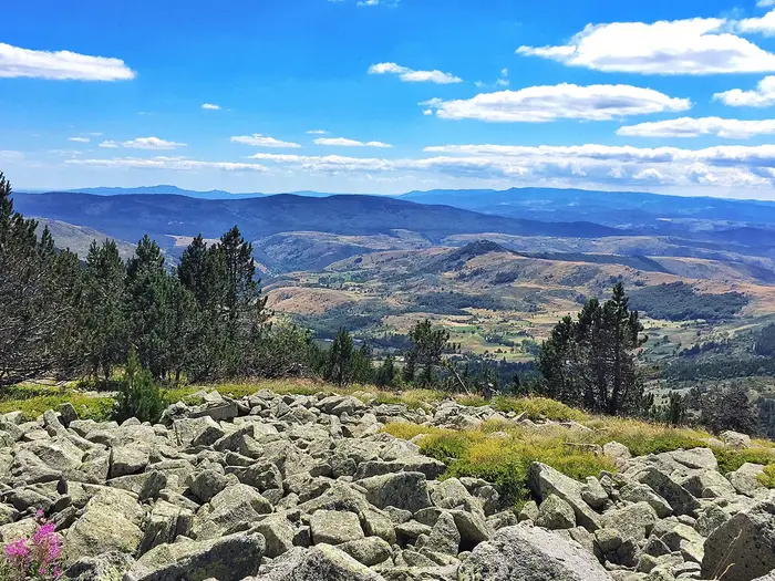
Col de Finiels, at about 1,699 m, is the high point of the trail. The summit plateau is a stark, open landscape of granite boulders, heather and short grass, with no shelter from wind, sun or weather.
Navigation across the plateau relies on granite marker boulders or pillars placed at regular intervals. In clear weather this is manageable; in fog, low cloud or sudden poor visibility it becomes serious, and the ascent is inadvisable in those conditions. A lower-level alternative allows the summit area to be bypassed towards Le Pont-de-Montvert.
The descent to Le Pont-de-Montvert is long, rocky and hard on knees. Around 10 km of boulder-strewn descending follows the high point, and the final 2 km into the village are particularly rough.
Carry full mountain-day kit even in summer: waterproofs, warm layer, sun protection, food and enough water capacity. There are granite springs on Mont Lozère, but no food between Le Bleymard and Le Pont-de-Montvert.
Le Pont-de-Montvert is a granite village on the Tarn, known for its Protestant Cévennes history and as the place where the Camisard revolt began in 1702. It has a small range of gîtes and hotel accommodation, plus a restaurant and small shop; book ahead in peak season.
Thunderstorms can build over the uplands in summer afternoons, so an early start is sensible. Aim to be over the exposed ground before conditions deteriorate.
Stage 9: Le Pont-de-Montvert to Florac
Approx. 28–29 km | +690–775 m / -940 m
This is the longest stage of the classic Stevenson route and should be treated as a hard day. Allow a full walking day of around 7–7.5 hours, with no intermediate food or accommodation between Le Pont-de-Montvert and Florac.
The route climbs out of Le Pont-de-Montvert and traverses the Cham de l’Hermet plateau before entering the Ramponenche state forest. It then climbs to Signal du Bougès, around 1,421 m, a major viewpoint over the Tarn Gorges and the Cévennes.
Further on, the trail passes Col du Sapet at about 1,080 m, crosses the Chaumette reservoir area and passes close to Grizac hamlet. Around 3.4 km of road walking through forest is included, so expect some harder surfaces as well as tracks and paths.
The final descent to Florac is steep and rough in places. The path does not always match the IGN map exactly, so follow the on-ground GR waymarking and take care where the line feels ambiguous.
Carry a full day’s food from Le Pont-de-Montvert. Water planning also matters, especially in hot weather, as this is a long, committing stage.
Florac is the main town of this part of the route, with hotels, gîtes, restaurants, shops, a supermarket and tourist information. It sits where the Tarn meets the Vibron at the foot of the Causse Méjean and is a practical place for a rest day or major resupply.
Florac does not have a train station, but it has bus connections. Current bus times should be checked before using it as a transport point.
Stage 10: Florac to Cassagnas
Approx. 17 km | +340 m / -180 m
Leaving Florac, the route enters the deeper Cévennes, where the landscape changes again. Chestnut groves, schist rock, narrow terrace paths and old mule tracks replace the more open uplands.
The profile is shorter and less severe than the previous day, but the terrain can be tiring. The trail climbs to ridges and drops towards valleys repeatedly, a pattern often described on this route as the Cévenol accordion.
Schist paths can be slippery when wet, and trekking poles are particularly useful here. Take care on polished or angled rock, especially on descents and shaded sections under trees.
Cassagnas is a small Cévenol village with very limited services. There is a gîte or refuge, but capacity is limited and it can fill in season, so booking ahead is important.
There is no shop at Cassagnas. Stock up in Florac for this stage and for onward walking, especially if the next accommodation does not provide a packed lunch.
Public transport options are limited at Cassagnas. It should be planned as an overnight trail stop rather than a flexible transport exit unless a transfer has been arranged in advance.
Stage 11: Cassagnas to Saint-Germain-de-Calberte
Approx. 23 km
This is a proper Cévennes stage, following old mule tracks and terrace paths through deep valleys and chestnut-forested ridges. The walking is not technical, but it is rarely flat for long.
Some itineraries split this section with an overnight at Saint-Étienne-Vallée-Française, a small village with gîte or small hotel accommodation. That can be a useful option for walkers wanting shorter days in the southern Cévennes.
The main terrain issue is the schist underfoot. In dry weather it is manageable; in rain or after storms it can be slick, particularly on descending terrace paths.
Saint-Germain-de-Calberte is a perched Cévenol village with gîtes, chambres d’hôtes and a small restaurant or auberge. It does not have a supermarket, though basic provisions may be available.
Carry food from Florac or from your previous accommodation, depending on what is open and what meals are included. Do not rely on a full resupply at the end of the day.
No rail access is supplied for Saint-Germain-de-Calberte. Pre-book accommodation and any baggage or shuttle arrangements, especially in high season.
Stage 12: Saint-Germain-de-Calberte to Saint-Jean-du-Gard
Approx. 24 km | +660 m / -600–830 m
The final stage of the classic Stevenson route remains a full mountain-and-valley walking day rather than a simple stroll to the finish. It climbs towards the Corniche des Cévennes, a high belvedere ridge with wide views, and passes Signal Saint-Pierre.
The descent then runs through the Gardon valley on schist paths through chestnut and oak forest. Expect sustained descending and uneven ground late in the day, when tired legs are most likely to make mistakes.
The final approach follows the Gardon de Saint-Jean valley into Saint-Jean-du-Gard, Stevenson’s own endpoint. The town has hotels, restaurants, shops, a supermarket, the Maison Rouge museum of Cévennes valley life and the heritage Train à Vapeur des Cévennes to Anduze.
Food and water are less difficult than on the Pont-de-Montvert to Florac stage, but the day is still long and can be hot in the southern Cévennes. Start early in July and August, and carry enough water for dry, exposed sections.
Saint-Jean-du-Gard has no SNCF station. Onward travel is usually arranged by bus towards Alès, which has SNCF services, or by using the heritage railway to Anduze as part of local travel plans; current timetables should be checked before travelling.
Navigation is usually clear on GR markings, but keep concentrating on the long descent. Wet schist can be very slippery, and trekking poles are strongly recommended for the final Cévennes stages.
Recommended Itinerary
The most balanced schedule for the classic Stevenson route is 12 walking days from Le Monastier-sur-Gazeille to Saint-Jean-du-Gard. It keeps most days in the 14–24 km range, with one longer day from Le Pont-de-Montvert to Florac, and uses the main trail villages where accommodation is normally available.
Distances are approximate. Check official mapping before booking, especially if using alternative overnight stops such as La Bastide-Puylaurent, Bédouès-Cocurès or the full GR70 extensions to Le Puy-en-Velay and Alès.
Standard itinerary: classic Stevenson route in 12 days
| Day | From | To | Approx. distance | Why this stage makes sense | Services/accommodation notes |
|---|---|---|---|---|---|
| 1 | Le Monastier-sur-Gazeille | Le Bouchet-Saint-Nicolas | 24 km | A full first day across the Velay plateau, giving an immediate sense of the route’s upland character. The distance is substantial but manageable for a standard schedule. | Le Monastier has gîtes, hotels, cafés/restaurants and some shops. Le Bouchet-Saint-Nicolas is very small, with gîte/chambre d’hôtes accommodation but no shop, so carry food from the start. |
| 2 | Le Bouchet-Saint-Nicolas | Pradelles | 22 km | This keeps the early route steady rather than pushing straight to Langogne. It also allows an overnight in Pradelles, one of the most attractive villages on the northern half. | Pradelles has a hotel, café/restaurant options and limited provisions. Do not rely on late-opening shops without checking locally. |
| 3 | Pradelles | Langogne | 14 km | A short recovery stage and useful resupply day before the quieter Gévaudan sections. It also suits walkers who want time to sort food, cash, laundry or transport. | Langogne is a key service town, with supermarkets, restaurants, accommodation and an SNCF station. It is one of the best resupply points on the route. |
| 4 | Langogne | Cheylard-l’Évêque | 19 km | The route becomes quieter and more remote as it enters Lozère, with forest and moorland replacing the easier access of the previous stages. | Cheylard-l’Évêque is a small hamlet with accommodation but no shop. Carry food from Langogne, including anything needed for the evening if meals are not arranged with the host. |
| 5 | Cheylard-l’Évêque | Luc | 18 km | A moderate stage that avoids making the Cheylard-l’Évêque to La Bastide-Puylaurent/Chasseradès section too long. Luc is also useful because it has rail access. | Luc has accommodation, some services and an SNCF station. It is a practical place to join, leave or shorten the route. |
| 6 | Luc | Chasseradès | 18 km | This stage keeps the pace even before the approach to Mont Lozère. Some walkers use La Bastide-Puylaurent instead, especially for rail access or a different accommodation pattern. | Chasseradès has several accommodation options for its size, including gîtes, chambres d’hôtes, a hotel and municipal camping, but food shopping is limited. La Bastide-Puylaurent has an SNCF station, small groceries and hotels if using that variant. |
| 7 | Chasseradès | Le Bleymard | 16 km | A shorter pre-mountain day through the approaches to Mont Lozère. This is a sensible place to stop before the highest and most exposed stage of the trail. | Le Bleymard has hotel/gîte accommodation and basic provisions. Treat it as the last service point before the Col de Finiels crossing. |
| 8 | Le Bleymard | Le Pont-de-Montvert | 19 km | The key mountain stage of the GR70, crossing Mont Lozère via the Col de Finiels at about 1,699 m. The distance is not extreme, but exposure to wind, fog, cold or strong sun makes it the most serious day. | Le Pont-de-Montvert has accommodation, restaurants, a café and a small épicerie, but opening hours should be checked before relying on it. Carry extra food and water over Mont Lozère. |
| 9 | Le Pont-de-Montvert | Florac | 28 km | The longest day on the classic itinerary. It works for fit walkers on a standard schedule, but it is the obvious stage to split if wanting an easier trip. | Florac is a major resupply town, with supermarkets, restaurants, hotels, a pharmacy and a tourist office. Bédouès-Cocurès can be used to break this stage, with a shorter final leg into Florac. |
| 10 | Florac | Cassagnas | 17 km | A shorter day after the long approach to Florac, moving into the quieter Cévenol valleys and chestnut country. | Cassagnas is very small, with gîte/chambre d’hôtes accommodation but no shop. Carry food from Florac unless meals are arranged. |
| 11 | Cassagnas | Saint-Germain-de-Calberte | 23 km | A solid Cévennes stage on old mule tracks and forested terrain. The distance is steady rather than excessive, but services are limited between overnight stops. | Saint-Germain-de-Calberte has gîtes/chambres d’hôtes, a café/restaurant and limited provisions. Book ahead in busy periods. |
| 12 | Saint-Germain-de-Calberte | Saint-Jean-du-Gard | 24 km | A satisfying final walking day through chestnut valleys and over the Col Saint-Pierre before descending to the Gardon valley. The distance is long enough to feel like a proper finish without needing another overnight stop. | Saint-Jean-du-Gard is a full finish-line town, with hotels, restaurants, shops, tourist services, the Maison Rouge museum and onward bus links towards Alès/Nîmes. Alès has SNCF rail connections. |
Slower variant: 14–15 days
A slower schedule suits first-time long-distance walkers, anyone carrying a full pack, and hikers who want more time in Le Puy-en-Velay, Florac and the Cévennes villages.
The cleanest 14-day version is to walk the full modern GR70 by adding:
| Extra stage | From | To | Approx. distance | Notes | |---|---|---:|---| | Start extension | Le Puy-en-Velay | Le Monastier-sur-Gazeille | 19 km | Le Puy-en-Velay is a useful arrival point with rail access and full city services. This stage links the modern GR70 start to the traditional Stevenson start. | | Finish extension | Saint-Jean-du-Gard | Alès | 20–24 km | Alès has an SNCF station and full city services, making it a practical departure point. Check official mapping before booking this final stage. |
For a 15-day version, also split the longest standard day:
| Split stage | From | To | Approx. distance | Notes | |---|---|---:|---| | 9a | Le Pont-de-Montvert | Bédouès-Cocurès | about 23 km | Reduces the hardest post-Mont Lozère distance and avoids a 28 km day into Florac. Accommodation should be booked ahead. | | 9b | Bédouès-Cocurès | Florac | short final leg | Leaves time for resupply and recovery in Florac. Check official mapping before booking. |
This slower approach is the best choice if accommodation is scarce on the exact standard stages. It also gives more margin for poor weather on Mont Lozère, where fog, wind, cold or fierce sun can slow progress.
Faster variant: about 10 days
A 10-day classic Stevenson itinerary is only sensible for experienced distance hikers who are comfortable with repeated 25–35 km days and can handle limited flexibility in small villages. The main constraint is not just fitness, but accommodation: many overnight stops are small, and missing a booking can force an awkward long day.
The most practical way to shorten the standard itinerary is to combine selected stages rather than trying to walk very long days from the start.
| Change | Approx. distance | Practical effect | Caution |
|---|---|---|---|
| Combine Le Bouchet-Saint-Nicolas to Langogne, skipping the overnight in Pradelles | about 26 km | Saves one night while still ending in Langogne, a strong resupply town with an SNCF station. | Pradelles is worth a stop, and this removes one of the easier pacing breaks early in the route. |
| Combine Florac to Saint-Germain-de-Calberte via Cassagnas | about 40 km | Saves one night on the southern half. | This is strenuous and should only be considered by very fit walkers. Cassagnas has no shop, so food and water planning must be exact. |
Merging the first two days from Le Monastier-sur-Gazeille through Le Bouchet-Saint-Nicolas to Pradelles is around 46 km and is not a sensible default recommendation. It may be possible for ultralight, very fit walkers, but it gives little margin on the opening days and bypasses the more comfortable rhythm of the route.
Section-hiking options
For a shorter trip, the route divides naturally around the rail-served northern and central villages.
| Section | Typical time | Access | What it gives you |
|---|---|---|---|
| Northern half: Le Puy-en-Velay or Le Monastier-sur-Gazeille to Chasseradès | about 7 days | Rail access at Le Puy-en-Velay, plus useful rail options at Langogne, Luc and La Bastide-Puylaurent | Velay plateau, Gévaudan/Margeride forest and the strongest literary-history feel. It misses Mont Lozère and the main Cévennes descent. |
| Southern half: Chasseradès to Saint-Jean-du-Gard or Alès | about 7–8 days | Best joined via La Bastide-Puylaurent or Luc, with onward departure via Saint-Jean-du-Gard to Alès or by continuing to Alès | The Mont Lozère crossing, Le Pont-de-Montvert, Florac and the classic Cévennes valleys. This is the more mountainous and dramatic half. |
Planning the Route
Choose the version before booking anything
The first planning decision is whether to walk the classic Stevenson route or the full modern GR70. They overlap for most of the journey, but they have different start and finish logistics.
| Route version | Start | Finish | Typical time | Best for |
|---|---|---|---|---|
| Classic Stevenson route | Le Monastier-sur-Gazeille | Saint-Jean-du-Gard | About 12 days | The literary line followed by most walkers, ending where Stevenson ended his 1878 journey |
| Full modern GR70 | Le Puy-en-Velay | Alès | About 13–15 days | Walkers wanting the whole waymarked GR route and easier rail access at both ends |
Most walkers go north to south, from Le Puy-en-Velay or Le Monastier-sur-Gazeille towards Saint-Jean-du-Gard or Alès. This is the traditional direction and it also gives the route a clear progression from the Velay and Margeride into Mont Lozère and the Cévennes.
There are no enforced stages. In practice, however, the spacing of villages and available beds strongly shapes each day. This is not a route where it is sensible to assume you can simply stop wherever you feel tired, especially in the smaller Lozère hamlets.
How many days to allow
A 12-day schedule is a realistic standard for the classic Le Monastier-sur-Gazeille to Saint-Jean-du-Gard walk. The daily stages are usually long enough to feel like a proper trekking day, without forcing most fit walkers into repeated very early starts.
For the full Le Puy-en-Velay to Alès GR70, allow 13–15 days. The extra time covers the additional stages at the beginning and end, and gives more room to adjust around transport and accommodation.
A slower itinerary is usually better than a rushed one. The Margeride, Mont Lozère and the southern Cévennes all include sustained terrain, and the Mont Lozère crossing should not be treated as just another short upland day if the weather is poor.
Walkers carrying full camping kit, travelling with a donkey, or wanting shorter days should add time. With a donkey, daily distances are usually kept to about 20 km, and often closer to 15 km in the first days.
Stage planning and accommodation bottlenecks
Accommodation is the main constraint on the GR70. The route has hotels, chambres d'hôtes, gîtes d'étape, refuges, campsites, cabins and occasional monastic hospitality, but some overnight stops are small and have very limited capacity.
For July and August, book every night before setting off. In May, June and September, it is still sensible to book at least 2–4 weeks ahead, particularly if walking as a group or using luggage transfer. Outside the usual Easter-to-Toussaint season, contact accommodation directly before relying on it being open.
Book the constrained stops first, then build the rest of the itinerary around them. The most important bottlenecks are:
| Place / stage area | Why it matters |
|---|---|
| Cheylard-l'Évêque | Very small hamlet with limited gîte capacity and no shop |
| Abbaye Notre-Dame des Neiges | Popular stop on some variants and often booked well ahead |
| Chasseradès | Limited accommodation in a key mid-route position |
| Le Bleymard | Important base before the Mont Lozère crossing |
| Cassagnas | No shop, so food must be planned before arrival |
Check-in is commonly from around 16h00, so long days should be planned with realistic walking time rather than just map distance. If a gîte is full, the next practical bed may be several kilometres further on, which can turn a moderate stage into a much harder day.
Shortening, extending and changing stages
The GR70 is flexible on paper, but less flexible once accommodation is involved. Strong walkers can combine some shorter days, while those wanting an easier pace can split longer stages where accommodation allows.
The classic 12-day schedule includes several days around the 22–24 km mark and one longer day from Le Pont-de-Montvert to Florac. If that feels too tight, add a rest or short day around Mont Lozère or in the Cévennes rather than compressing the route.
South of Langogne, the GR700 offers a shortcut connecting Langogne to Luc without going via Cheylard-l'Évêque. Use this only if it fits the intended route and accommodation plan; it changes the character and continuity of the classic Stevenson line.
Extending to Alès is straightforward for walkers following the full modern GR70. It also gives a rail finish, which can simplify onward travel compared with ending at Saint-Jean-du-Gard.
Section hiking
Section hiking is practical because the route has rail access at both ends and at several mid-route points. The most useful railway points are Le Puy-en-Velay, Langogne, Luc-Lozère, La Bastide-St-Laurent-les-Bains near La Bastide-Puylaurent, and Alès.
Practical section splits include:
| Section | Typical use |
|---|---|
| Le Monastier-sur-Gazeille to Langogne | A northern section of about three walking days, useful for a short first trip |
| Langogne to Florac | A central section of about five walking days, including the higher and more remote terrain |
| Florac to Saint-Jean-du-Gard | A southern Cévennes section of about three to four walking days |
For the traditional start, Le Puy-en-Velay has SNCF rail access, and Haute-Loire Bus Line 46 links Le Puy-en-Velay with Le Monastier-sur-Gazeille on weekdays. This should be checked before travelling, especially for weekend arrivals.
From Saint-Jean-du-Gard, onward travel normally requires a bus to Alès before taking the train. Gard Lines 81 and 72 serve Saint-Jean-du-Gard to Alès, and Line 112 links towards Nîmes; services may be weekday-only or limited, so check timetables before booking return rail tickets. If finishing at a weekend, plan an overnight in Saint-Jean-du-Gard or budget for a taxi to Alès.
Food, water and resupply planning
Food resupply is regular enough for light carrying, but not so frequent that it can be ignored. Langogne, Florac and Saint-Jean-du-Gard have the best services, with Pradelles and Le Pont-de-Montvert also useful for meals and basic supplies.
Plan food carefully for stages ending at Cheylard-l'Évêque and Cassagnas, as neither has a shop. Le Bouchet-Saint-Nicolas and Le Bleymard have more limited services, so do not depend on full supermarket-style resupply there.
Rural opening hours matter on this route. Sunday closures, seasonal hours and reduced autumn services are common in small Lozère and Cévennes settlements. Carry at least one emergency meal and do not assume a bakery or restaurant will be open on arrival.
Water is generally manageable, but the exposed Mont Lozère crossing deserves extra caution. Carry more than usual for that day, especially in July and August or if starting late.
Weather and pacing
The route is best planned between Easter and Toussaint, with May, June and September usually the most comfortable months. July and August bring the highest accommodation pressure and can be very hot in the Cévennes valleys, so early starts and extra water are important.
Mont Lozère is the key weather-sensitive section. The Col de Finiels is high, open and exposed, with possible late-spring snow, fog, cold wind and strong sun. A map or GPX track is especially useful here, even though the GR is waymarked.
Winter is not a sensible default season for this route. Accommodation is largely closed, snow can affect Mont Lozère, and waymarks may be harder to follow.
Navigation, permits and support services
The GR70 is marked with red-and-white GR blazes, and no specialist navigation skills are normally required in clear conditions. Even so, carry a proper route resource: the FFRandonnée GR70 topo-guide, a reliable GPX track, or a digital mapping app such as MonGR.fr. GPX files and mapping are also available through route-planning platforms including gr-infos and komoot.
No permit is required to walk the GR70, and there is no entry permit for the Cévennes National Park. Normal trail conduct still applies, particularly in protected landscapes and near villages, farms and accommodation.
Baggage transfer is widely used and can make the route much easier to manage. Transbagages operates along the GR70 from Le Puy-en-Velay to Saint-Jean-du-Gard, with bags normally ready by 08h00 and a maximum of 15 kg per bag; published prices include around €8 per bag per stage, but current prices should be checked before booking. Other operators include La Malle Postale and Balades Cévenoles.
Donkey hire is a distinctive option on the Stevenson Trail, with operators in the Velay, Margeride and Cévennes. A donkey can carry around 30–35 kg for two to four people, but it limits daily distances and restricts accommodation choice because not every stop accepts donkeys. Hire companies provide approved accommodation lists, so arrange the donkey before finalising overnight bookings.
Towns, Villages and Overnight Stops
The GR70 is a village-to-village walk, but the settlements are unevenly spaced and several are very small. Treat Langogne, La Bastide-Puylaurent, Florac and Saint-Jean-du-Gard as the main resupply anchors, and do not pass open shops assuming the next village will have the same services.
Accommodation is usually in a mix of hotels, gîtes d'étape, chambres d'hôtes, hostels, refuges and campsites. In July and August, popular gîtes and small villages can fill months ahead; book at least 2–3 months in advance for peak summer, and 3–6 weeks ahead for June or September.
Cheylard-l'Évêque and Cassagnas have no shops. Le Bouchet-Saint-Nicolas, Luc, Le Bleymard and Saint-Étienne-Vallée-Française have limited services, so arrive with food rather than relying on last-minute shopping.
Le Puy-en-Velay
Le Puy-en-Velay is the start of the full modern GR70 and the best place to arrive if beginning with the extra stage to Le Monastier-sur-Gazeille. It is a proper small city with full services: hotels, restaurants, supermarkets, outdoor and general shops, banks and pharmacies.
The SNCF station has rail connections towards Lyon and Clermont-Ferrand, making it the most convenient northern access point. It is also the place to resolve any final gear, cash or food issues before moving into smaller plateau villages.
Many walkers stay the night before starting. The old town, cathedral and Chapel on Rocher Saint-Michel are worth time, but from a hiking perspective the main value is practical: reliable accommodation choice, food shopping and transport.
Le Monastier-sur-Gazeille
Le Monastier-sur-Gazeille is the traditional Stevenson start, one stage after Le Puy-en-Velay on the full GR70. It is a small village of around 1,000 people, but it functions well as a walking start point with basic shops and a range of hiker accommodation.
Options include hotel-restaurant accommodation, auberges, gîtes d'étape and chambres d'hôtes. There are enough services for a final meal, breakfast supplies and route preparation before the first classic stage to Le Bouchet-Saint-Nicolas.
There is no train station. Access is normally by taxi or bus from Le Puy-en-Velay, about 20 km away; current bus times should be checked before travelling.
The Romanesque abbey church and the château museum make it worth arriving before the evening, rather than turning up late and leaving immediately the next morning.
Le Bouchet-Saint-Nicolas
Le Bouchet-Saint-Nicolas is the usual first overnight stop on the classic route from Le Monastier-sur-Gazeille. It is a tiny plateau hamlet beside the Lac du Bouchet, an ancient volcanic crater lake.
Services are very limited. Expect gîtes d'étape and chambres d'hôtes rather than a broad choice of hotels or restaurants, and do not count on a supermarket.
Carry food for the evening and the next morning unless your accommodation provides meals. The next better-served stop is Pradelles, so this is a place to arrive prepared rather than a place to resupply properly.
Pradelles
Pradelles is one of the best early overnight stops, both for services and setting. It is a medieval hilltop village classed among Les Plus Beaux Villages de France, with cobbled streets, an arcaded square and views over the Allier valley and Ardèche plateau.
For walkers, the practical draw is that Pradelles has shops, including a general store and pharmacy, plus restaurants, gîtes and chambres d'hôtes. It is a sensible place to restock after the sparse opening stages.
The village is compact, so most accommodation and food options are within easy walking distance. An evening stop here gives time to deal with supplies without losing the feel of a small trail village.
Langogne
Langogne is the first major resupply town after leaving the Le Puy area. It has a supermarket, bakeries, pharmacies, banks, restaurants, hotels and gîtes, making it the most useful service stop between Le Puy-en-Velay and La Bastide-Puylaurent.
The SNCF station sits on the Nîmes–Clermont-Ferrand line, also known as the Cévenol line or La Cévenole. This makes Langogne a strong joining, leaving or rest-day point for section hikers.
The weekly market is on Wednesdays. If your schedule fits, it is a good place to buy fresh food before the quieter Gévaudan/Margeride section.
Transbagages shuttle services stop in Langogne at the Beausejour Hotel. Current shuttle times and prices should be checked before booking, especially outside the main walking season.
Cheylard-l'Évêque
Cheylard-l'Évêque is a tiny hamlet in the Gévaudan and a typical overnight halt between Langogne and Luc. It has gîtes and basic accommodation, but no shops.
This is one of the route's key planning points. Leave Langogne with enough food and water, or book accommodation that provides an evening meal and breakfast.
Do not treat Cheylard-l'Évêque as a resupply stop. It is useful because it breaks the stage pattern, not because it offers services.
Luc
Luc is a small village with limited but useful services. It has a gîte d'étape and basic accommodation, with some food provision, but shopping remains limited and should not be relied on for a full resupply.
Luc has an SNCF station on the Clermont-Ferrand–Nîmes Cévenol line, which is valuable for section hiking or bailing out in poor weather, illness or schedule trouble. Train times should be checked before travelling.
The village is a practical overnight after Cheylard-l'Évêque. Arrive with enough food flexibility, especially if walking outside peak season when small local services may have restricted opening times.
A popular variant in this part of the route is the detour to Abbaye Notre-Dame des Neiges, between Luc and La Bastide-Puylaurent. The monastery offers walker accommodation on a donation basis, with communal dining, and books out months ahead; advance reservation is essential. It is not a general resupply stop.
La Bastide-Puylaurent
La Bastide-Puylaurent is an important mid-route service village and a crossroads for several GR trails. It is a strong overnight and resupply option around the Luc–Chasseradès section, particularly for walkers using stage splits that pass through or stop here.
For its size, services are good: pharmacy, grocery store, butcher, newsagent, post office, petrol station and garage. Accommodation includes hotels and guest-house options, and Camping de l'Allier lies 3 km away with a swimming area and snack bar.
The SNCF station is a major practical asset. It is on the Paris–Marseille line via Clermont-Ferrand, and a separate scenic line connects towards Mende via Chasseradès and Marvejols.
This is one of the best places to reset before the approach to Mont Lozère. If the chosen itinerary does not overnight here, consider whether food and accommodation logistics are stronger by adjusting the stage split.
Chasseradès
Chasseradès is a small village commonly used as an overnight before Le Bleymard. It has accommodation, including hotel and gîte options, and basic shopping through a small épicerie.
The village has an SNCF station on the Marvejols–La Bastide line, which gives it value for section walkers. It is also known for its Romanesque church and railway viaduct, but its main trail role is as a compact, practical overnight.
Services are not extensive, so arrive with essentials already covered. It is a reasonable place for dinner and a bed, not a major resupply town.
Le Bleymard
Le Bleymard is the gateway village for the Mont Lozère crossing and a particularly important overnight. It has gîtes d'étape and chambres d'hôtes, plus limited shops.
This is the place to organise food and water for the route's highest and most exposed day over Col de Finiels. Do not leave Le Bleymard assuming guaranteed supplies on the upland crossing.
Accommodation should be booked ahead in busy periods because many walkers converge here before the same demanding stage. Check the next day's weather before committing to an early start over the open granite plateau.
Mont Lozère / Col de Finiels
Mont Lozère is not an overnight village, but it matters for accommodation and food planning. The GR70 crosses the exposed high ground at Col de Finiels, about 1,699 m, between Le Bleymard and Le Pont-de-Montvert.
There is no normal village resupply on the crossing. Limited shelter may be available around the Mont Lozère refuge / refuge du Bleymard area, but walkers should not depend on food or water there without checking ahead.
Plan this as a self-sufficient mountain day. Carry lunch, water, warm layers, sun protection and enough margin for fog, wind or cold conditions, even in otherwise settled weather.
Le Pont-de-Montvert
Le Pont-de-Montvert is one of the best overnight stops on the GR70, reached after the Mont Lozère crossing. It sits at about 900 m on the Tarn river and has enough services to recover properly after the high stage.
The village has hotels and auberges, cafés and restaurants, shops along the riverfront quay, and a tourist office for local information. Auberge des Cévennes and Hôtel-Restaurant Aux Sources du Tarn are established accommodation options, and the village has a strong hiker focus.
There is no train station. Transbagages shuttle services stop at Temple parking; current shuttle details should be checked before booking.
Historically, Le Pont-de-Montvert is a major Cévennes site: the Camisard revolt began here in July 1702. It is also one of the better places for a slower afternoon if the schedule allows.
Florac
Florac is the best-served town in the Lozère half of the route and a key logistical stop. It has multiple hotels, gîtes, chambres d'hôtes, a campsite, restaurants, a supermarket, pharmacies and banks.
The Cévennes National Park headquarters are located here. For walkers, the more important point is that Florac is the place to do a full resupply before the smaller southern villages.
The weekly market is on Thursdays year-round, with an additional market in July and August. Camping Le Pont du Tarn is a large riverside site with a heated pool, restaurant/bar and mobile homes as well as pitches, usually open from around May to September; current opening dates should be checked before relying on it.
The stage from Le Pont-de-Montvert to Florac is the longest in the classic schedule at about 28 km. Some walkers split it via Cocurès, with Hotel La Lozerette a short detour off-route. Plan water and food carefully for this day.
Transbagages stops at the Florac Tourism Office. Florac is also a sensible rest or half-rest point if legs, laundry or weather require a reset.
Cassagnas
Cassagnas is a very small hamlet used as an overnight after Florac. It has gîtes d'étape and basic accommodation, but no shops.
Stock up thoroughly in Florac before leaving. Cassagnas is not a place for groceries, pharmacy needs or flexible dinner options unless these are arranged through accommodation.
Because services are minimal, booking ahead is strongly advised. Check whether the gîte provides dinner and breakfast, and carry enough food to cover gaps.
Saint-Germain-de-Calberte
Saint-Germain-de-Calberte is a small village in deep Cévennes chestnut country and a useful overnight after Cassagnas. It has more services than the previous hamlet, including a general store / tabac-presse and several hiker accommodation options.
Accommodation includes gîtes d'étape such as Auberge du Recantou, Hôtel et Gîte Le Petit Calbertois and Village vacances Lou Serre de la Can, plus chambres d'hôtes in the surrounding area. Availability can still be tight in peak season, so book ahead rather than turning up late.
There is no train station. The village is quiet, but it has enough practical support for walkers who arrive with sensible expectations.
Saint-Étienne-Vallée-Française
Saint-Étienne-Vallée-Française lies between Saint-Germain-de-Calberte and Saint-Jean-du-Gard in the Vallée Française. It is not always used as a main overnight on a 12-day schedule, but it can help split the final southern stages.
The village has walker-focused gîtes, including Gîte du Pont de Burgen, Le Mas Stevenson, La Ferme de Patience and Gîte Saltebouc. General shopping is limited, so arrange meals through accommodation or carry food.
This is a useful place for walkers who want shorter days in the Cévennes valleys. It should be treated as an accommodation stop rather than a full resupply point.
Saint-Jean-du-Gard
Saint-Jean-du-Gard is Stevenson's own endpoint and the natural finish for the classic route from Le Monastier-sur-Gazeille. It is a pleasant market town in the Gardon valley with hotels, restaurants, shops, a pharmacy and a bank.
The town is large enough for a proper finish meal and practical enough for onward travel planning. The Maison Rouge museum, Pont Vieux, Tour de l'Horloge and Château Saint-Jean provide interest if staying an extra night.
There is no direct SNCF station. The nearest major SNCF access is Alès, about 50 km by road, and bus connections are available; current times should be checked before travelling.
The Train à Vapeur des Cévennes heritage railway runs to Anduze and can be a memorable departure option when operating. Transbagages shuttle services depart Saint-Jean-du-Gard from the post office car park; current timetable and price should be confirmed before booking.
Alès
Alès is the official end of the full modern GR70, one further stage beyond Saint-Jean-du-Gard. Many walkers finishing the classic Stevenson route stop at Saint-Jean-du-Gard, but Alès is the practical choice if completing the full marked route or needing stronger rail connections.
It is a city with full services, including hotels, restaurants, shops and onward transport. The SNCF station has good rail connections towards Nîmes, Montpellier and Lyon.
The extra stage follows the Gardon valley. For walkers with tight travel plans, Alès is often the easiest place to end because it removes the need to arrange onward road transfer from Saint-Jean-du-Gard.
Getting to the Start
The practical gateway for both versions of the GR70 is Le Puy-en-Velay. The full modern GR70 starts there; the classic Stevenson route starts at Le Monastier-sur-Gazeille, about 19–20 km south, which has no railway station.
Most walkers aiming for the classic route travel to Le Puy-en-Velay, stay overnight, then take a bus or taxi to Le Monastier-sur-Gazeille the next morning. If starting the full GR70, no onward transfer is needed.
By train
Gare du Puy-en-Velay is the nearest useful railway station for the start. Trains do not continue to Le Monastier-sur-Gazeille, so classic-route walkers need a bus or taxi for the final transfer.
Le Puy-en-Velay is on the regional SNCF network. TGVs do not run through to Le Puy; from most long-distance routes the usual change is at Saint-Étienne Châteaucreux, then a TER regional train to Le Puy-en-Velay.
| Starting city | Typical rail route | Approximate journey time |
|---|---|---|
| Paris | Paris Gare de Lyon, and sometimes Paris Bercy, to Saint-Étienne Châteaucreux, then TER to Le Puy-en-Velay | 4h 30min–5h 20min |
| Lyon | Lyon Part-Dieu to Saint-Étienne Châteaucreux, then TER to Le Puy-en-Velay | 2h 15min–2h 50min |
| Saint-Étienne | Direct TER to Le Puy-en-Velay | 1h 20min–1h 30min |
| Clermont-Ferrand | TER via Langeac | Around 2h 10min |
| London | Eurostar to Paris, cross Paris to Gare de Lyon/Bercy, then train via Saint-Étienne | Around 6h 30min–7h total |
Paris departures are frequent, with roughly 9–10 services per day to Le Puy-en-Velay using the Saint-Étienne connection. Advance fares combining TGV/Intercités and TER can start from around €31, but prices vary by date and demand.
Tickets can be booked through SNCF Connect or Trainline. TER tickets can usually be bought on the day, but booking ahead is sensible in summer and when connecting with a long-distance train. This should be checked before travelling.
By bus
For the classic start at Le Monastier-sur-Gazeille, use Ligne H46 on the Haute-Loire regional network from Le Puy-en-Velay. It is operated by Cars Région Haute-Loire and links Le Puy with Le Monastier-sur-Gazeille in about 26 minutes.
The key limitation is frequency. The service is mainly a weekday option, with limited or no weekend running, so it is not a dependable plan for Sunday arrivals, bank holidays or late trains.
Check the current H46 timetable at laregionvoustransporte.fr before booking accommodation or onward transfers. This should be checked before travelling.
If the bus does not fit, take a taxi from Le Puy-en-Velay to Le Monastier-sur-Gazeille. The journey is about 20 km and typically costs around €25–€40 depending on operator, time and pick-up point. Pre-booking is advisable, especially on Sundays or for late arrivals.
Local taxi operators serving Le Monastier-sur-Gazeille include Taxi Sébastien Ollier SAS and Sébastien Mialon Taxi. Confirm current availability and prices before relying on a taxi connection.
By car
Le Puy-en-Velay is straightforward to reach by road from the main regional cities:
| Approach | Main road access | Approximate drive |
|---|---|---|
| Lyon | RN88/A47 | 1h 30min / 130 km |
| Clermont-Ferrand | RN102/A75 | 1h 30min / 130 km |
| Saint-Étienne | RN88 | 45min / 75 km |
For long-stay parking, Parking du Saint-Jacques in Aiguilhe, just outside Le Puy-en-Velay, is a secured and monitored option used by hikers and pilgrims. It is a practical choice if leaving a vehicle for the 12–13 days needed to complete the route.
Check current rates, opening arrangements and availability directly with the parking operator at parkingdusaintjacques.com before travelling. This is especially important in peak walking season.
Drivers starting the classic route have two common options. Either park in Le Puy-en-Velay and take the bus or taxi to Le Monastier-sur-Gazeille, or drive to Le Monastier-sur-Gazeille and arrange a later transfer back to the car.
The road transfer from Le Puy-en-Velay to Le Monastier-sur-Gazeille is via the D535 and takes about 25 minutes. For a point-to-point trail, parking logistics at the finish also need planning separately, particularly if ending at Saint-Jean-du-Gard rather than continuing to Alès.
From the nearest airport
The small Le Puy-en-Velay/Loudes Airport (LPY) is about 10 km west of the city centre. Its regular service is very limited, with Twin Jet flights from Paris Orly taking about 1h 10min, so it is mainly useful for domestic connections.
For most international walkers, Lyon Saint-Exupéry (LYS) is the more practical airport. From the airport, take the Rhônexpress tram to Lyon Part-Dieu, then TER trains via Saint-Étienne to Le Puy-en-Velay. Allow around 3 hours for the rail transfer from Lyon airport to Le Puy.
A simpler alternative from Lyon Saint-Exupéry is the Totoom electric minibus shuttle, which runs between Lyon Airport, Saint-Étienne and Le Puy-en-Velay. The Lyon Airport–Le Puy fare is around €65 per seat and the journey takes about 2h 30min, with services timed around airport arrivals and departures.
Totoom should be booked in advance at totoom.fr. Current schedules, fares and luggage arrangements should be checked before travelling.
Other regional airports include Clermont-Ferrand Auvergne (CFE), about 1h 30min by road from Le Puy-en-Velay, and Nîmes Alès Cévennes (FNI), which is closer to the southern end of the trail than the start.
Where to stay before starting
Le Puy-en-Velay is the easiest overnight base before the walk. It has the best transport links, the widest choice of accommodation, and enough services for last-minute food, fuel and trail supplies.
Accommodation includes hotels, gîtes, chambres d’hôtes and pilgrim auberges, particularly around the old town. Book at least one night ahead in July and August, when GR70 walkers overlap with pilgrims and other long-distance walkers.
If starting the classic Stevenson route, Le Monastier-sur-Gazeille is a more atmospheric but less flexible first-night option. It is a small village with gîtes and chambres d’hôtes, so availability is much tighter than in Le Puy-en-Velay.
Known options in Le Monastier-sur-Gazeille include En Si Bon Chemin, Le Repose-Pieds and Auberge Bïn Vendüd Châ Nous. Le Repose-Pieds has quoted rooms from around €55 and triples from around €75, though current rates should be confirmed before booking.
Staying in Le Monastier-sur-Gazeille makes the first walking day simpler, but only if the arrival transfer from Le Puy is secure. For late, Sunday or bank-holiday arrivals, Le Puy-en-Velay is usually the safer overnight plan, followed by a pre-booked taxi or weekday bus to the trailhead.
Getting Home from the Finish
The GR70 has two practical finish points: Saint-Jean-du-Gard, the classic Stevenson endpoint, and Alès, the end of the full modern GR70. The key difference is transport: Saint-Jean-du-Gard has no railway station, while Alès has a central SNCF station with straightforward onward connections.
| Finish point | Best onward option | Planning note |
|---|---|---|
| Saint-Jean-du-Gard | Bus to Nîmes or Alès, or taxi/shuttle | Good town facilities, but no train station |
| Alès | Train from Alès Gare SNCF | Easiest finish for public transport |
By train
There is no train station in Saint-Jean-du-Gard. If finishing the classic route there, you must first reach either Nîmes or Alès by bus, taxi or shuttle before joining the SNCF rail network.
From Alès Gare SNCF, regular TER trains run to Nîmes in about 32 minutes. Nîmes is the main onward hub, with TGV and TER connections towards Paris, Montpellier, Lyon, Marseille and other major cities.
For Paris, the usual rail journey from Alès is via Nîmes, with the fastest connections taking roughly 4 hours overall depending on the connection. There is no direct Alès–Paris train, so allow enough time for the change at Nîmes.
Tickets and live schedules should be checked through SNCF Connect or another rail booking platform before travelling, especially if connecting to a long-distance TGV.
By bus
For most walkers finishing in Saint-Jean-du-Gard, the bus is the simplest low-cost exit.
liO Line 112 runs from Saint-Jean-du-Gard La Poste to Nîmes Gare Routière, next to Nîmes SNCF station. The journey takes about 98 minutes, with around four services per day. It normally runs Monday to Sunday, including bank holidays, except 1 May.
This is often the best DIY option because Nîmes gives the widest range of onward rail connections. First and last bus times are timetable-dependent, with services roughly from early morning to early evening; check current times on the liO Occitanie journey planner or app before fixing train tickets.
There are also buses from Saint-Jean-du-Gard to Alès:
- Line 72 runs via Anduze and takes about 52 minutes to Alès.
- Line 81 also links Saint-Jean-du-Gard with Alès via the local Cévennes villages.
The important catch is that Lines 72 and 81 do not run on Sundays. If finishing in Saint-Jean-du-Gard on a Sunday, use Line 112 to Nîmes, book a taxi/shuttle, or stay overnight and travel on Monday.
By car/taxi
A taxi from Saint-Jean-du-Gard to Alès station takes about 30 minutes by road. Expect a fare in the region of €60–€80, but confirm the price when booking.
Accommodation providers in Saint-Jean-du-Gard can often help arrange a local taxi, which is useful if arriving late, travelling as a group, or carrying heavy luggage. Pre-booking is strongly advised in the hiking season and for Sunday finishes.
Shuttle services also operate along the Chemin de Stevenson. La Malle Postale runs seasonal minibus shuttles between Le Puy-en-Velay, Saint-Jean-du-Gard and Alès, typically from mid-April to mid-October. It runs return shuttles north towards Le Puy-en-Velay, usually a couple of times a day in season with stops at the main trail villages; booking is required and places are limited, and current departure times and fares should be checked before travelling.
La Malle Postale also offers a vehicle transfer service for walkers who need a car moved between ends of the route. This requires advance notice and should be arranged well before starting the hike.
Transbagages provides baggage transfer and passenger transport along the GR70 corridor, including between Le Puy-en-Velay and Saint-Jean-du-Gard. Current operating dates, shuttle availability and prices should be checked before travelling.
From the nearest airport
The closest airport is Nîmes–Alès–Camargue–Cévennes Airport, south of Nîmes. It is a small airport with limited services, useful only if its current flight schedule matches your plans.
For most international travellers, Montpellier–Méditerranée Airport is more practical. From Alès, travel by train via Nîmes towards Montpellier, then continue to the airport by the appropriate local connection. Allow extra time for the transfer from Montpellier city to the airport.
Lyon–Saint-Exupéry Airport is another option for wider European and long-haul connections, but it is less convenient unless planned in advance around rail times from Nîmes or Montpellier.
Flight routes and airport transfer options change regularly, so these should be checked before booking onward travel.
Where to stay at the finish
Saint-Jean-du-Gard is a sensible place to stop if finishing the classic Stevenson route late in the day. It has hotels, gîtes, chambres d’hôtes, restaurants and a small supermarket, so it works well for a final night before travelling out the next morning.
Staying overnight is particularly useful if finishing on a Saturday or Sunday, because the bus options to Alès are weekday-only. Line 112 to Nîmes remains the main Sunday public-transport option, but an overnight stop gives more flexibility and avoids a rushed final stage.
Alès is the better overnight choice for an early train departure. It is a larger town with hotels near the station, supermarkets, restaurants and full urban services, and it removes the need for a morning bus or taxi connection from Saint-Jean-du-Gard.
Which Direction Should You Walk?
For almost everyone, the GR70 is best walked north to south: Le Puy-en-Velay or Le Monastier-sur-Gazeille to Saint-Jean-du-Gard or Alès. This is the traditional direction, the direction Robert Louis Stevenson travelled in 1878, and the direction used by the main guidebooks, accommodation flows and baggage-transfer services.
Walking south to north is possible. The GR is waymarked in both directions, and reverse walkers can use the same trail villages. The trade-off is that transport and services need a little more care, and the route loses some of its natural narrative shape.
Direction comparison
| Direction | Best for | Main drawbacks |
|---|---|---|
| North to south | Following Stevenson’s journey; easiest logistics; best scenery progression; simplest baggage-transfer planning | More walkers moving on the same stage pattern, so beds book up quickly in summer |
| South to north | Avoiding the main walking flow; experienced hikers who want quieter accommodation patterns; following spring northwards in May–June | Less convenient transport at the ends; support services must be arranged explicitly in reverse; tougher Mont Lozère climb from Le Pont-de-Montvert |
Why north to south is the standard choice
The north-to-south direction follows the literary line of Travels with a Donkey in the Cévennes. For many walkers, that is part of the appeal: the walk starts in the Velay, crosses the Margeride and Mont Lozère, then drops into the Cévennes towards Stevenson’s endpoint at Saint-Jean-du-Gard.
It also fits the way the route is organised on the ground. Accommodation providers, baggage-transfer companies and walking-holiday operators are used to walkers moving from north to south, with daily luggage collection in the morning and delivery to the next village later the same day. Reverse transfers may be available, but they should be arranged clearly before booking accommodation.
Transport is simpler in this direction. Le Puy-en-Velay has an SNCF station, with rail access from major hubs including Lyon, Clermont-Ferrand and Paris via connections. From Le Puy-en-Velay, Haute-Loire bus Line 46 serves Le Monastier-sur-Gazeille in around 30 minutes, which makes the traditional start straightforward despite Le Monastier having no station.
At the southern end, Saint-Jean-du-Gard has no SNCF station, but buses link it with Alès, where there are onward trains to Nîmes and wider connections. Gard bus Lines L72 and L81 run between Saint-Jean-du-Gard and Alès Gare SNCF in about an hour, but not on Sundays; Line 112 also links Saint-Jean-du-Gard with Nîmes. If finishing in Saint-Jean-du-Gard on a Sunday, plan either an extra night or a pre-booked taxi. This should be checked before travelling.
Scenery and psychology of the route
North to south gives the route its most satisfying progression. The early Velay stages are open, upland and relatively forgiving, which helps walkers settle into a steady rhythm before the more demanding middle and southern sections.
The route then moves through the Margeride and Gévaudan landscapes before reaching Mont Lozère. The crossing of Col de Finiels, at about 1,699 m, feels like the natural high point of the journey rather than just another pass. After that, the descent towards Le Pont-de-Montvert and onward through Florac and the Cévennes gives a clear sense of entering a different region.
The finish at Saint-Jean-du-Gard works well psychologically. The route has moved from volcanic plateaus and forested uplands into chestnut groves, schist ridges and deep Cévenol valleys, so the endpoint feels distinct from the start rather than arbitrary.
Are the climbs easier one way?
There is no overwhelming terrain reason to reverse the route. The GR70 is not a technically asymmetric mountain route where one direction is clearly safer or easier.
The biggest difference is Mont Lozère. North to south, the approach from Le Bleymard is a long, gradual climb to Col de Finiels, followed by a steeper descent towards Le Pont-de-Montvert. South to north, that same section becomes a more strenuous climb out of Le Pont-de-Montvert before the descent towards Le Bleymard.
For most walkers, the north-to-south version is preferable: the climb is steadier, and the steeper ground is taken downhill. Walkers with sensitive knees may prefer to think carefully about the descent into Le Pont-de-Montvert, but the overall route still works best in the traditional direction.
The southern Cévennes also involve repeated up-and-down ridge walking. Reaching this terrain after a week or more on trail is an advantage for many hikers, as legs, pacing and pack routines are already established.
Weather and exposure by direction
There is no major prevailing-weather advantage on this inland route. The most important weather decisions concern timing, forecast and exposure, especially on Mont Lozère, where cold, fog, wind and strong sun can all matter.
Prevailing winds across the Massif Central are often from the west or northwest, so north-to-south walkers may sometimes have wind behind or across them on exposed upland sections. This is only a minor advantage and should not drive the decision.
Sun angle can work the other way. In afternoon light, north-to-south walkers may spend more time facing into the sun, particularly on open sections. A brimmed hat, sunglasses and enough water matter more than direction.
Accommodation and crowds
Because most people walk north to south, accommodation can fill in a predictable wave along the classic stage villages. In July and August, booking ahead is important, especially if following the common 12-stage pattern from Le Monastier-sur-Gazeille to Saint-Jean-du-Gard.
Reverse walkers may find it easier to stay out of phase with the main flow. This can help in busy periods, although it does not remove the need to book. Smaller places on the route still have limited beds, and campsites, gîtes and hotels can be affected by local holidays and group bookings.
If using baggage transfer, make the direction explicit. Services such as Transbagages and La Malle Postale are part of the route’s normal support network, but the operational default is north to south. Current prices and reverse-direction availability should be checked before booking.
When south to north makes sense
South to north is a valid choice for confident walkers who value quieter trail logistics over the classic Stevenson experience. It can be attractive in spring, when flowering and leaf growth arrive earlier in the southern Cévennes than on the higher northern sections, allowing walkers to follow the season northwards.
It also suits hikers who are less concerned with the literary sequence and more interested in meeting other walkers face-to-face rather than moving with the same group from village to village. Navigation should still be manageable, as the GR70 is blazed in both directions, but attention to junctions is needed because the waymarking and signposting are most naturally read by north-to-south walkers.
The main compromise is travel. Starting from Saint-Jean-du-Gard usually means reaching Alès or Nîmes first, then taking a bus onward. Finishing at Le Monastier-sur-Gazeille means arranging the bus back to Le Puy-en-Velay for rail connections.
Recommendation
Walk the GR70 north to south unless there is a specific reason not to. It follows Stevenson’s original journey, gives the strongest landscape progression, places the Mont Lozère crossing at the right point in the walk, and fits the transport, accommodation and baggage-transfer systems most naturally.
South to north is worth considering for experienced walkers who want to avoid the main flow or who are planning a spring walk around the progression of the season. For most hikers, however, the traditional north-to-south direction is the most practical and rewarding choice.
Accommodation Along the Route
The GR70 works well as an inn-to-inn walk, but it is not a route to leave accommodation to chance. Larger towns such as Le Puy-en-Velay, Langogne, Florac, Saint-Jean-du-Gard and Alès have a genuine range of places to stay, while several stage-end villages have only one or two realistic options.
The most common walker accommodation is the gîte d'étape: simple, practical hiker lodging with dormitory beds, sometimes private rooms, and usually the option of dinner and breakfast. Chambres d'hôtes, small hotels, auberges, farm stays, campsites and a few more unusual stays such as cabins or roulottes are also scattered along the route.
Booking strategy
Book all accommodation before setting out, particularly if walking in July or August, in May/June, or as part of a group. The small-bed villages create the real pressure points: Le Bouchet-Saint-Nicolas, Cheylard-l'Évêque, Chasseradès, Cassagnas and Saint-Germain-de-Calberte can fill months ahead.
For peak-season trips, start planning 6–9 months ahead where possible. Shoulder-season walkers in May, early June or September often get quieter trails and better temperatures, but should still book in advance because many villages have very limited capacity.
Most walker accommodation operates broadly from Easter to Toussaint in early November. Outside that period, contact each place directly before relying on it; this should be checked before travelling.
Typical accommodation costs
Indicative prices on the Stevenson Trail are:
- Gîte d'étape dorm bed: about €18–20 per person, without meals.
- Breakfast: about €8–10.
- Half-board in a gîte d'étape: about €44–50 per person.
- Chambre d'hôte / B&B: commonly about €50–80 per person, or €60–100 per room for two.
- Self-guided packages: higher-cost options bundle accommodation, meals and often luggage transfer; prices vary by operator and comfort level, so current prices should be checked before booking.
Half-board is often the most practical arrangement in the smaller villages. In places such as Cheylard-l'Évêque and Cassagnas, there may be no shop or restaurant beyond the gîte or auberge itself.
Accommodation by place
| Place | Accommodation level | Best for | Notes |
|---|---|---|---|
| Le Puy-en-Velay | Good | All types | Full GR70 start with hotels, gîtes, chambres d'hôtes and camping. A sensible pre-walk night if starting the modern route. |
| Le Monastier-sur-Gazeille | Limited | Budget gîtes, small hotels, camping | Traditional Stevenson start. Modest choice; Camping Estela is on the route. Book early in peak season. |
| Le Bouchet-Saint-Nicolas | Very limited | Gîte or farm auberge | Popular Stage 1 finish after a 24 km day from Le Monastier. Options include La Retirade and Ferme Auberge L'Arrestadou; beds are scarce. |
| Pradelles | Limited–moderate | Gîte, B&Bs, small hotels | More choice than Le Bouchet-Saint-Nicolas, including Gîte Le Stevenson. Still worth booking ahead in July and August. |
| Langogne | Good | Hotels, gîtes, section hikers | One of the best-served towns before Lozère, with hotels, gîtes and chambres d'hôtes. Langogne station makes it useful for joining, leaving or adjusting a section hike. |
| Cheylard-l'Évêque | Very limited | Gîte/refuge | Remote village with Le Refuge du Moure as the key facility. No shops and no restaurant beyond the gîte’s own meals. Book months ahead. |
| Luc | Very limited | Gîte, contingency stop | Small village with a gîte d'étape and an SNCF halt on the Langogne–Mende line. Useful if Cheylard-l'Évêque is full or for a section-hike access point. |
| La Bastide-Puylaurent | Limited | Gîtes, guesthouse, rail access | Accommodation around the village and station area, including L'Étoile Guest House. Also the access point for Abbaye Notre-Dame des Neiges, about 4 km off route. |
| Abbaye Notre-Dame des Neiges | Very limited | Pilgrim/walker overnight | Famous optional abbey stay near La Bastide-Puylaurent. Extremely popular and should be booked as early as possible. |
| Chasseradès | Very limited | Hotel/auberge | Hôtel des Sources is the main option on the GR70; Les Airelles is another property used on some itineraries. Advance booking is important. |
| Le Bleymard | Limited | Gîte d'étape, pre-Mont Lozère night | Last usual overnight before the Mont Lozère crossing. Gîte d'étape L'Escoutal offers rooms and dorms; Hôtel La Remise is another option. |
| Mont Lozère / Col de Finiels | None at the col | Not an overnight stop | No accommodation at Col de Finiels itself. A basic refuge/gîte near Finiels operates seasonally; opening dates should be checked before travelling. Most walkers continue to Le Pont-de-Montvert. |
| Le Pont-de-Montvert | Limited–moderate | Gîte, auberge, food stop | Good choice for its size. Auberge des Cévennes is a historic Stevenson stop and is especially popular. |
| Florac | Good | Hotels, gîtes, camping, restocking | Best accommodation choice on the southern half, with hotels, gîtes, chambres d'hôtes and camping. Also useful for shops, restaurants and pharmacies. |
| Cassagnas | Very limited | Auberge | Espace Stevenson is the key facility. Very small hamlet with no shop, so book early and plan food carefully. |
| Saint-Germain-de-Calberte | Very limited | Gîte or B&B | Small Cévenol village with limited beds. Do not assume last-minute availability. |
| Saint-Étienne-Vallée-Française | Limited | B&B, gîte, more comfortable stop | Optional overnight on some itineraries. Château de Cambiaire is a more comfortable option. |
| Saint-Jean-du-Gard | Moderate–good | Hotels, gîtes, end-of-walk stay | Traditional Stevenson finish with a reasonable choice of hotels, gîtes and chambres d'hôtes, plus restaurants and shops. Bus or taxi connections continue to Alès for trains. |
| Alès | Good | Hotels, onward travel | Full modern GR70 finish with a wide range of hotels and mainline SNCF rail access. |
The main bottlenecks
The hardest places to book are usually not the largest towns but the small stage-end settlements. Cheylard-l'Évêque is the clearest example: Le Refuge du Moure is the main facility, and if it is full the practical choices are to continue towards Luc, return or divert via Langogne, or arrange a transfer.
Le Bouchet-Saint-Nicolas is another early bottleneck because it sits at the end of a long first day from Le Monastier-sur-Gazeille. Cassagnas is also critical on the southern section because Espace Stevenson is the key place to stay and there is no shop.
Le Bleymard should also be treated as a priority booking. It is the normal staging point before Mont Lozère, where the next day crosses the highest and most exposed ground of the route.
Using luggage transfer, shuttles and taxis
Luggage transfer fits the GR70 well, because the route is naturally set up for village-to-village walking. Services such as Transbagages operate along the Stevenson Trail, but your chosen accommodation must be suitable as a drop-off and collection point.
Transfers can also help solve awkward accommodation gaps, especially where a small village is full. This works best when arranged before the trip rather than during the walk, as remoter sections have few fall-back options.
Taxi or shuttle moves should be planned carefully around the actual road access for that day’s stop. Current availability, timings and costs should be checked before travelling.
Camping and self-catering
Camping is possible at or near some route stops, including Le Puy-en-Velay and Le Monastier-sur-Gazeille, and there are campsites or farm-camping options in parts of the route. It is not a guaranteed solution at every stage, so campsite spacing must be checked before committing to a camping itinerary.
Self-catering is straightforward only in the larger towns. On remoter stages, particularly Cheylard-l'Évêque and Cassagnas, there may be no shop, so walkers should carry enough food and rely on booked evening meals where available.
Donkey-friendly accommodation
Donkey walking is part of the Stevenson tradition, but not every gîte or hotel accepts donkeys. Accommodation, grazing or stabling, and luggage arrangements must be planned through donkey-friendly providers in advance, with the Stevenson Association a key contact point for current options.
Camping and Wild Camping
The GR70 suits a camping-based walk, provided you understand the sharp change in rules once the route enters the Cévennes National Park. Many walkers use a mixed approach: campsites and occasional gîtes in villages, with discreet bivouacs on the remoter northern and central stages.
A lightweight hiking tent is strongly preferable. Stage lengths are often 14–29 km, the route has about 7,800 m of ascent, and the national park bivouac rules require a small tent that you cannot stand up inside.
The key rule: camping vs bivouac
In France, a useful distinction is made between camping and bivouac. Camping usually means setting up a more established overnight pitch, often for longer than one night. Bivouac means a lightweight, one-night stop by a walker who arrives late and leaves early.
That distinction matters on the GR70:
- Before the Cévennes National Park — broadly Le Monastier-sur-Gazeille to Le Bleymard / Mont Lozère — normal French land-access rules apply. Private land requires permission, enclosed fields and farm areas should be avoided, and any wild pitch must be discreet, low-impact and for one night only.
- Inside the Cévennes National Park core zone — broadly from the Mont Lozère / Le Pont-de-Montvert section onwards — ordinary camping is prohibited, but bivouac is allowed under strict conditions.
Bivouac rules in the Cévennes National Park
The southern half of the GR70 crosses the Cévennes National Park, where the rules are specific and actively relevant to walkers. Do not treat this section like ordinary wild camping.
In the park core zone, bivouac is permitted only if all of the following apply:
- you are travelling non-motorised;
- you pitch within 50 m of a waymarked GR or GRP trail;
- you use a lightweight tent, not a standing-height camping tent;
- you stay one night only in the same place;
- you pitch no earlier than 19:00 and leave by 09:00.
Open camping with a tent outside these bivouac conditions is prohibited in the core zone, except in limited circumstances close to residential buildings and with the landowner’s consent. In practice, GR70 walkers should plan around the bivouac rule above or use formal accommodation.
There is an important restriction on Mont Lozère: bivouac is prohibited in the Finiels summit area around Col de Finiels / Mont Lozère because of ecological sensitivity. It is also an exposed and poor place to camp in bad weather. Check the current Cévennes National Park map and notices before relying on any high-level pitch.
Fire, stoves and dogs
Fires are strictly prohibited in the Cévennes National Park core zone. This includes campfires and should be treated as a hard rule, not a matter of discretion.
Portable stoves are the practical option for campers, but park rules and local fire-risk orders can change in dry periods. In the national park, stove use is allowed for bivouackers only under specific conditions, including distance from woodland; this should be checked before travelling and again locally in summer.
Even outside the park, avoid open fires. The Cévennes, chestnut groves and pine woods are vulnerable to summer fire risk, and local prefectoral bans may apply from June to September.
Dogs must be kept on a lead in the national park core zone. If walking with a dog or a hired donkey, check each campsite or accommodation stop in advance.
Campsites on or near the GR70
Formal campsites are useful at the start, around Le Bleymard, in Florac and at Saint-Jean-du-Gard. They are less evenly spaced through the Margeride and Gévaudan sections, where walkers often combine gîtes with legal, discreet bivouac.
Book ahead in July and August, especially at the better-positioned sites. Outside the main season, do not assume campsites are open.
| Place / stage area | Camping option | Practical notes |
|---|---|---|
| Le Puy-en-Velay / Aiguilhe | Camping du Puy-en-Velay | Useful for walkers starting the full modern GR70 from Le Puy-en-Velay. Facilities include Wi-Fi and a small grocery provision. This should be checked before travelling. |
| Le Monastier-sur-Gazeille | Camping l’Estela | On the GR70 itself, about 800 m below the village on the Gazeille river. Open 15 April–30 September. Tent pitches, chalets, restaurant, packed lunches, luggage transfer, secure vehicle storage and a meadow for donkeys/horses. Booking is strongly recommended in July–August. |
| Le Bouchet-Saint-Nicolas | Aire Naturelle de Camping du Bouchet-Saint-Nicolas | Small municipal-style camping area on the Devès volcanic plateau, around 1,200 m altitude and 1.5 km from Lac du Bouchet. Around 13 pitches, sanitary facilities, electricity and Wi-Fi. Recent prices have been low, around a few euros per adult plus a tent pitch fee; confirm current prices before booking. |
| Langogne / Cheylard-l’Évêque / La Bastide-Puylaurent / Chasseradès | No campsite to rely on at every stage | This is the section where many camping walkers use gîtes where available or bivouac discreetly outside the national park rules. Do not assume a dedicated campsite at Cheylard-l’Évêque, La Bastide-Puylaurent or Chasseradès without checking current local accommodation. |
| Le Bleymard | Camping Municipal La Gazelle | Close to the GR70 and around 200 m from the village, on the edge of the Lot river. A useful formal camping stop before the Mont Lozère crossing. This should be checked before travelling. |
| Le Pont-de-Montvert | No campsite to assume in the village | Better planned as a gîte/hotel stop or a legal park-rule bivouac away from the village where permitted. Wild camping is not a good default here because the route is within the national park context. |
| Bédouès / south of Le Pont-de-Montvert | Camping Chantemerle à Bédouès | Used by some walkers as an onward camping option south of Le Pont-de-Montvert. Check location, route fit and opening dates before relying on it. |
| Florac | Camping Le Pont du Tarn | 3-star campsite at D998, Route du Pont de Montvert, Florac Trois Rivières. Large site with river access, heated pool, mobile homes and shared accommodation for hikers. Published 2026 season: 1 May–26 September; check current opening dates. |
| Saint-Jean-du-Gard | Bivouac Nature | Near the GR70 at Pic d’Arbousse, reached by a dedicated side trail from the modified GR70 route near Col Saint-Pierre. Offers bivouac pitches, tent lodges, breakfasts, packed lunches, sanitary facilities and baggage-transfer links. Season is generally late March to late September; check the current year. |
| Saint-Jean-du-Gard | Camping Municipal Saint-Jean-du-Gard | Large campsite at the trail-end town, with pitches and gîtes. This should be checked before travelling. |
Best sections for bivouac
The most practical bivouac terrain is generally on the northern and central parts before the national park: the Velay plateau, the Gévaudan/Margeride woods and the forested stages between Langogne, Cheylard-l’Évêque, Luc, La Bastide-Puylaurent and Chasseradès. These areas offer more forest and open plateau, and the legal position is less restrictive than in the park core zone.
That does not mean camping is automatically allowed everywhere. Much land is private or communal, and permission is required on private land. Avoid enclosed fields, livestock areas, farm approaches, village edges, water sources used by animals and any place where a tent would be visible or intrusive.
The Mont Lozère crossing is not a sensible place to improvise. Weather can be cold, foggy, windy or fiercely sunny, and the Finiels summit area has a specific bivouac prohibition. Plan to sleep either before the high crossing, after it, or in formal accommodation.
Water and food for campers
Village water points and accommodation stops are frequent enough that the GR70 is not a dry expedition-style route, but campers still need to carry enough water for cooking, evening use and the next morning. Remoter stages, especially through forest and over Mont Lozère, should not be started with only a token amount of water.
Treat non-tap water from springs, streams or mountain sources. Do not wash, cook or camp directly beside streams; keep at least 10 m away from watercourses and use established toilets where available.
Food resupply is regular but spaced out. Camping walkers should carry an evening meal and breakfast when heading into quieter stages, particularly where the next village may have limited opening hours or no reliable shop.
Seasonal considerations
Most formal campsites are seasonal. Late spring to early autumn is the practical camping window, but exact opening dates vary and should be checked before booking travel.
In spring, Mont Lozère can still hold late snow and the high crossing can be cold. In summer, heat and fire risk are the main issues, especially in the Cévennes. In autumn, colder nights and shorter days make a warm sleep system and reliable headtorch more important.
July and August are the months when advance booking matters most. Small campsites, hiker accommodation and village services can fill quickly on the classic Stevenson line.
Low-impact camping on the GR70
Campers should follow strict low-impact practice throughout the route, not just inside the national park:
- pitch late and leave early;
- stay one night only;
- keep the tent small and unobtrusive;
- never light an open fire;
- pack out all litter, including food waste;
- use toilets where available and bury human waste well away from paths and water;
- do not camp in enclosed fields, hay meadows, crop land or close to livestock;
- ask locally if there is any doubt about land ownership or access.
A camping-based GR70 is entirely realistic, but it needs more planning than a pure gîte-to-gîte itinerary. The northern half gives the most flexibility for discreet bivouac, while the Cévennes National Park section requires strict respect for the 19:00–09:00 bivouac rules and the no-bivouac zone around Finiels.
Food, Water and Resupply
The GR70 is manageable for food and water, but it is not a route where every village can be treated as a guaranteed resupply stop. The safest approach is to book evening meals where possible, carry lunch and snacks for the next day, and keep at least one day of emergency food in the pack.
The official Chemin de Stevenson association gives the right principle for this route: check that food is available at each overnight stop; if not, carry provisions. This matters particularly in small Lozère villages, on Sundays, during lunch closures and outside the main walking season.
Food resupply along the route
Le Puy-en-Velay, Langogne, Le Bleymard, Florac and Saint-Jean-du-Gard are the most useful places for proper resupply. These are the points where it makes sense to buy more than just a picnic lunch.
Le Puy-en-Velay has city services, including supermarkets, bakeries, restaurants and pharmacies. If starting from Le Monastier-sur-Gazeille rather than Le Puy, do not skip the chance to arrive with food already sorted for the first stage.
Le Monastier-sur-Gazeille has basic village services, including a bakery, but opening can be limited and Sunday closure is a risk. Le Bouchet-Saint-Nicolas has Épicerie d'à côté, a small supplier useful for bread, charcuterie, cheese, fruit, pasta, dried goods, chocolate and snacks, but it should be treated as a village shop rather than a major supermarket.
Pradelles has limited services, but Langogne is the first major resupply town after the start. Langogne has a Carrefour Market, a butcher, bakery/patisserie and cafés, and is the best place to stock up before the quieter Gévaudan and Lozère stages.
Cheylard-l'Évêque and Luc are very small. Food here is largely accommodation-based, so half-board at a gîte or chambres d'hôtes is usually the sensible plan. If taking the variant via Notre-Dame des Neiges, the abbey provides simple communal dinner and breakfast for overnight guests, but it is not a shop.
La Bastide-Puylaurent is a useful small resupply point, with a grocery shop, small supermarket and café. Chasseradès is more limited: expect accommodation meals and only basic village provisions rather than a reliable choice of restaurants.
Le Bleymard is the critical food stop before Mont Lozère. The Carrefour Express at the village entrance is the place to buy lunch, snacks and emergency food before the Col de Finiels crossing, because there are no shops on the high plateau.
Le Pont-de-Montvert has good services for a small village, including cafés, small shops and a bakery. The Auberge des Cévennes offers meals and picnic baskets at around €11 per person; confirm current prices before relying on this.
Florac is the main resupply town before the final Cévennes section. It has a Carrefour supermarket, bakeries, an organic épicerie, restaurants and a hiking equipment shop useful for items such as gas canisters. The Carrefour closes for a lunch break, so plan arrival time carefully.
Cassagnas and Saint-Germain-de-Calberte are small and food is best arranged through accommodation. Saint-Étienne-Vallée-Française has La Petite Halle, a producers' cooperative shop, useful for local charcuterie, cheese and produce. Saint-Jean-du-Gard has good end-of-route services, including cafés, restaurants, Pâtisserie Au Petit Bonheur and the Boutique Sur le Chemin de Stevenson.
| Section | Food availability | Water availability | Notes |
|---|---|---|---|
| Le Puy-en-Velay / Le Monastier-sur-Gazeille to Le Bouchet-Saint-Nicolas | Le Puy has full city resupply. Le Monastier has basic services including a bakery. Le Bouchet has Épicerie d'à côté for picnic food and staples. | Village fountains and accommodation refills are the main options. | Stock up before leaving Le Puy or Le Monastier. Check Sunday opening times. |
| Le Bouchet-Saint-Nicolas to Pradelles and Langogne | Pradelles has limited services. Langogne is a major resupply stop with Carrefour Market, bakery/patisserie, butcher and cafés. | Fill in villages; do not pass reliable taps without topping up. | Use Langogne to carry extra food into the quieter Gévaudan/Lozère section. |
| Langogne to Cheylard-l'Évêque, Luc, La Bastide-Puylaurent and Chasseradès | Cheylard-l'Évêque and Luc are very limited. La Bastide-Puylaurent has grocery/café options. Chasseradès is limited and accommodation-based. | Water points are available in several villages, including Cheylard-l'Évêque and Luc. | Book half-board where possible. Carry lunch from the previous reliable stop. |
| Le Bleymard to Col de Finiels and Le Pont-de-Montvert | Le Bleymard has a Carrefour Express. No food or shops on Mont Lozère. Le Pont-de-Montvert has cafés, shops and bakery options. | Carry 2–3L from Le Bleymard. Natural springs may exist but are not guaranteed in dry periods. | This is the key no-services crossing. Carry lunch plus emergency food. |
| Le Pont-de-Montvert to Florac | Le Pont-de-Montvert is a good top-up point. Cocurès has café/coffee options. Florac is a major resupply town. | Water can be more uncertain on exposed sections such as Montagne du Bougès in dry conditions. | Leave Le Pont-de-Montvert with enough water and food for the full day. |
| Florac to Cassagnas and Saint-Germain-de-Calberte | Florac has supermarkets, bakeries, restaurants, a bio shop and hiking supplies. Cassagnas and Saint-Germain-de-Calberte are small and largely accommodation-based. | Fill in villages and at accommodation. Natural sources should be treated. | Resupply properly in Florac before entering the smaller Cévennes villages. |
| Saint-Germain-de-Calberte to Saint-Étienne-Vallée-Française and Saint-Jean-du-Gard | Saint-Étienne-Vallée-Française has La Petite Halle producers' shop. Saint-Jean-du-Gard has full village services, cafés and restaurants. | Village refills are normally sufficient if topped up consistently. | Carry cash for small shops and do not assume card payment in every village. |
Gîtes, half-board and packed lunches
Half-board is the easiest way to eat well on the GR70. Most overnight stops have gîtes d'étape, chambres d'hôtes, hotels or similar accommodation offering demi-pension: dinner and breakfast.
For 2026, half-board is typically around €55–€70 per person per day. Prices vary by accommodation and season, so confirm current rates when booking.
Many gîtes can also provide a packed lunch, often based on local products. This is particularly useful before stages where the next village has no reliable midday food.
Communal dinners are common. Typical regional food includes Aubrac beef, Lozère lamb, Pélardon goat's cheese and Cévennes chestnut products.
Water planning
Water is usually easier on the GR70 than on drier mountain routes, but it still needs active management. The reliable pattern is to refill at accommodation, village fountains and marked potable water points whenever available.
Most overnight villages have fountains, many marked as potable. The free Chemin de Stevenson mobile app includes water point locations, and known water points include places such as St Flour de Mercoire, L'Herm, Cheylard-l'Évêque, Luc and Laveyrune.
Natural sources should be treated with caution. A filter, purifier or UV treatment is sensible if using springs or streams, especially away from villages.
Mont Lozère has granite springs in normal conditions, but drought can dry mapped sources by late summer. The same caution applies to the Montagne du Bougès section between Le Pont-de-Montvert and Florac, where water can be scarce in dry weather.
For most stages, 1.5–2L carrying capacity is sufficient if filled at every village. For Le Bleymard to Le Pont-de-Montvert over Col de Finiels, carry 2–3L from Le Bleymard, especially in summer sun and wind.
Closures, cash and practical habits
Sunday closures are common, and bakeries may only open on Sunday morning. Village shops also often close for lunch, commonly around 12:00–14:00 or 12:30–14:30, so a late-morning arrival can mean waiting until mid-afternoon.
Late October onwards brings a higher risk of closed gîtes, restaurants and shops. Autumn walkers should check opening hours in advance and carry an extra day of food.
Small shops and gîtes may not always take cards. Carry enough euros in cash for village épiceries, picnic lunches, drinks and small accommodation extras.
A good daily routine is simple: fill water before leaving, buy or collect lunch before the shop closes, reserve dinner with the accommodation, and never start a remote stage with an empty food bag.
Terrain, Conditions and Difficulty in Practice
The GR70 is not a technical mountain route, but it is harder than a simple village-to-village walk. The challenge comes from repeated daily ascent and descent, long stages, rough stone underfoot and several exposed upland sections rather than from scrambling or navigation complexity.
Most walkers should think of it as a sustained hill-walking route on mixed surfaces. Fit first-time multi-day trekkers can complete it, but thin footwear, heavy packs and late starts make the harder days feel much more serious.
What the walking surface is really like
Underfoot, the route is varied: dirt tracks, forest roads, old drove roads, sheep tracks, gravel, rocky footpaths and some minor-road walking. It crosses basalt, granite, schist and limestone country, so the feel of the path changes noticeably as the route moves south.
Loose stone is common enough to affect pace. Early volcanic sections can be crumbly and ankle-tiring; later schist paths in the Cévennes can be loose and skittery, especially on descents. Around Mont Lozère, granite blocks and rough boulder-strewn ground require careful foot placement.
There is no scrambling and no specialist climbing equipment is needed. The practical difficulty is more about maintaining balance and concentration on rough tracks for several hours a day.
Section-by-section terrain
| Section | Typical terrain | What makes it harder |
|---|---|---|
| Le Monastier-sur-Gazeille to Pradelles | Volcanic Velay plateau, farmland, fields, forest edges, stone walls, basalt and lava rock | Rockier than it first appears; crumbly volcanic stone and some tarmac links can make the early days deceptively tiring |
| Langogne to La Bastide-Puylaurent | Gévaudan and Margeride country, open heath, pine forest, beech groves, birches, granite rocks, forest tracks | Rolling terrain with repeated ups and downs; long stretches between services; boggy or marshy ground after rain and in spring |
| Le Bleymard to Le Pont-de-Montvert | Mont Lozère, Col de Finiels, open granite upland, heather moorland, boulder chaos, exposed ridges | The hardest day: rough ground near the high point, full exposure to wind/sun/fog, then a long steep descent that is hard on knees |
| Le Pont-de-Montvert to Saint-Jean-du-Gard | Cévennes ridges and valleys, schist paths, chestnut groves, terraced hillsides, forest tracks, minor roads | Long descents, loose schist, heat on exposed ridges and one particularly long stage to Florac |
Climbs, descents and daily fatigue
The total ascent is around 7,800 m, spread over many medium-length hill days rather than concentrated into a few alpine climbs. That distribution is important: few individual climbs are extreme, but the accumulated effort builds steadily.
Stages are typically 14–29 km, and several days combine distance with rough surfaces. By the second half of the walk, fatigue often comes less from single big ascents and more from the constant rhythm of climbing out of valleys, crossing ridges and descending again.
The stage from Le Bleymard to Le Pont-de-Montvert is the main mountain day. It climbs via Col Santel and the Mont Lozère ski area towards the high ground around Col de Finiels, at about 1,699 m, before descending steeply towards Le Pont-de-Montvert. The ascent is manageable in clear weather, but the exposed summit area and rough granite make it the most demanding terrain on the GR70.
The following stage, Le Pont-de-Montvert to Florac, is also physically hard. It is one of the longest days at about 28 km and includes a large amount of descent, so tired legs from Mont Lozère can make it feel tougher than the profile alone suggests.
Mont Lozère and exposure
Mont Lozère is the one section where conditions can quickly change the nature of the walk. The high ground is open, with little shelter from wind, strong sun or cold mist. In poor visibility, the cairns and stone markers are important, and progress can feel much slower than on the forest tracks below.
The summit area is a bare granite massif with scattered rounded boulders and rough, uneven ground. It is not scrambling, but it is not smooth trail walking either. Good footwear and steady footwork matter here.
The descent towards Le Pont-de-Montvert is long, rocky and steep in places. Trekking poles are particularly useful on this section, especially for walkers carrying a full pack or anyone with sensitive knees.
Mud, bog and wet ground
The route is not defined by deep mud, but wet ground is a real consideration in the Margeride and on high plateau sections. Heather-covered marshland and boggy patches can slow progress, particularly in spring or after sustained rain.
Forest tracks can also become muddy in wet weather, especially through shaded sections such as the Forêt de Mercoire and other wooded parts of the Gévaudan. Waterproof footwear is useful in spring and after unsettled weather, but heavy winter boots are not normally necessary in the main walking season.
On Mont Lozère, peat bog and wet moorland can occur on plateau variants and high draille sections. After rain, assume slower going on any open, peaty or grassed upland ground.
Road walking and hard surfaces
Some road walking is unavoidable. The GR70 uses minor roads and D-road links around villages and between settlements, particularly in the Velay and Gévaudan sections.
The route generally avoids main-road walking, but the amount of tarmac can still surprise hikers expecting only footpaths and forest tracks. Hard road surfaces add fatigue over a long day, especially in hot weather or with lightweight trail shoes.
Livestock, gates and fences
Cattle and sheep graze on the Margeride and Mont Lozère plateaux. Expect field gates, electric fencing and simple wire-latch closures on some Lozère stages.
These are normal working landscapes, not access obstacles. Leave gates and fence closures exactly as found, keep clear of livestock, and take extra care if walking with poles near electric fencing.
Rivers and crossings
The route passes through river landscapes including the Allier, Tarn, Tarnon, Mimate and Gardon areas, but river crossings are not a technical feature of the GR70. There are no significant ford-based logistics to plan around from the supplied route information.
After heavy rain, paths near streams and valley bottoms may be wetter and more slippery, but the main difficulty remains the trail surface rather than river hazards.
Seasonal conditions
| Season | Conditions in practice | Planning implications |
|---|---|---|
| Spring | Muddy forest tracks, boggy Margeride heathland, streams running higher, possible late snow on Mont Lozère | Check Mont Lozère conditions before travelling; allow time for slower wet-ground walking |
| Summer | Dry, hard, rocky paths; strong sun; hot Cévennes ridges; thunderstorms possible | Start early on exposed days, carry enough water between services, avoid being high on Mont Lozère during storms |
| Autumn | Often the most comfortable underfoot: cooler, drier and less heat stress | Leaf fall can obscure paths in forest sections; daylight becomes shorter later in the season |
| Winter | Snow and severe conditions possible on Mont Lozère; higher sections may require specialist winter equipment | Not a normal season for the full route unless properly equipped and experienced; this should be checked before travelling |
Mont Lozère deserves special attention in every season. It can hold late-spring snow, become disorientating in fog, and feel severe in wind even when valleys are mild.
Footwear and poles
Good trail shoes with ankle support or lightweight walking boots are suitable for most walkers. Thin trainers are a poor choice because of the rocky volcanic sections, loose schist paths, granite boulder ground and boggy Margeride patches.
Full mountain boots are not essential for normal three-season conditions, but the sole needs enough protection for long rocky days. Trekking poles are strongly recommended for Mont Lozère and for the long descents into the Cévennes valleys.
What makes the GR70 easier or harder
The route feels easier when stages are kept to sensible lengths, accommodation is booked in the villages that match those stages, and pack weight is controlled. Baggage transfer can significantly reduce strain on the rocky and descending sections.
It feels harder when wet conditions make the Margeride boggy, when heat builds on the southern ridges, or when Mont Lozère is crossed in wind, fog or strong sun. The walk is moderate in technical terms, but it rewards the habits of a serious long-distance hiker: early starts, reliable footwear, weather checks and enough food and water for the quieter upland stages.
Weather and Best Time to Walk
Best months
The most reliable walking season for the GR70 is mid-April to mid-October. The best balance of weather, daylight and open accommodation is usually late May to June and September into early October.
July and August are fully walkable but busier and hotter, especially from Florac south through the lower Cévennes valleys. Winter is not a normal hiking season for this route: accommodation and baggage services are mostly unavailable, and the higher sections can be snowbound.
| Period | What to expect | Planning advice |
|---|---|---|
| Mid-April to mid-June | Cool to mild, green, often wet; possible late snow on Mont Lozère | Good for prepared walkers, but check high-level conditions before the Col de Finiels stage |
| Late June to August | Warm to hot; busy trail; storms possible | Book accommodation well ahead, start early, carry extra water |
| September to early October | Pleasant walking temperatures, fewer crowds than summer | One of the best periods, but watch for severe Cévenol rain events |
| Mid-October onwards | Accommodation starts closing; shorter days | Viability depends on bookings and weather; this should be checked before travelling |
| November to March | Cold, unsupported, snow likely at altitude | Not recommended except for experienced, self-sufficient hikers |
Altitude makes the weather change quickly
The GR70 crosses a broad altitude range, from low Cévennes valleys to the Col de Finiels on Mont Lozère at about 1,699 m. Conditions can feel like different seasons on the same day: cool, damp uplands in the Velay and Margeride, exposed mountain weather on Mont Lozère, then hotter sub-Mediterranean valleys towards Saint-Jean-du-Gard and Alès.
Allow for this variation when packing. Even in midsummer, the Mont Lozère crossing can be windy and much cooler than the valleys, while the same route can deliver fierce sun on exposed granite moorland.
Spring: mud, rain and possible late snow
Spring is a good season for the GR70, but it is not automatically easy weather. In April and May, daytime temperatures in Lozère are often cool to mild, with cold nights still possible.
May can be wet on the Lozère sections, and forest tracks through the Margeride and upper Cévennes can become muddy after rain. Streams and rivers may also be higher and faster than later in the year.
The main spring issue is late snow on Mont Lozère. Snow can linger around the Col de Finiels into early May, and in some years traces remain into mid-May. GR waymarks on this high section are often on low rocks, so they can be hidden by snow; if there is any doubt, check conditions locally before committing to the Le Bleymard to Le Pont-de-Montvert stage.
Thunderstorms become a real consideration from May onwards. On unsettled days, plan high or exposed ground for the morning rather than the afternoon.
Summer: heat, exposure and water planning
July and August bring the warmest conditions and the busiest trail. The lower Cévennes, especially from Florac south towards Saint-Jean-du-Gard, can be significantly hotter than the uplands, with valley temperatures above 30°C in hot spells.
Heat is the main summer planning issue. Start long stages early, avoid lingering in exposed afternoon sun, and do not rely on finding water between villages. Some exposed sections can have long dry stretches, so carrying 2–3 litres is sensible on hot days.
Shade is uneven. Chestnut groves in the Cévennes can make some southern sections more comfortable, but the Margeride heathland and Mont Lozère are open and exposed. Sun protection is as important as rain gear.
Mont Lozère remains a special case in summer. The high plateau can combine strong sun, cold wind and sudden fog; carry layers, waterproofs, a GPX track and a compass. In dense mist, the line of historic standing stones helps with orientation, but this crossing is not a place to push on casually in poor visibility.
Summer thunderstorms are also possible across the route, particularly on sultry afternoons. If the forecast is unstable, avoid being on the Col de Finiels or other exposed ridges late in the day.
Autumn: excellent walking, serious storm risk
September is one of the best months for the Stevenson Trail. Temperatures are usually comfortable for long walking days, crowds are lower than in peak summer, and most accommodation is still operating.
The major autumn hazard is the épisode cévenol: an intense Mediterranean rain event affecting the Cévennes. These storms can drop extreme amounts of rain in a short time, causing flash flooding on rivers such as the Gardon and its tributaries. Paths may become impassable, and low crossings or valley routes can become dangerous very quickly.
This risk is highest from September to November. During a severe warning, adjust the itinerary, wait it out in a village, or use transport rather than trying to keep to the schedule.
By late September and October, daylight becomes a practical constraint. Expect noticeably shorter walking days, with darkness arriving around early evening by October; long stages such as Le Pont-de-Montvert to Florac or Saint-Germain-de-Calberte to Saint-Jean-du-Gard need an early start.
Accommodation also begins to close from mid-October, with some gîtes shutting around 15 October. Bookings after this point should be arranged carefully and checked before travelling.
Winter: possible, but not a normal GR70 season
From November to March, the GR70 is not recommended as a standard long-distance walk. Most trail accommodation is closed, baggage-transfer services are not normally operating, and food stops become much less dependable.
Snow is normal at altitude, especially on Mont Lozère and the Margeride. The higher sections can be genuinely hazardous, while low-level Cévennes valleys may remain passable but still leave an unsupported itinerary between them.
The route should only be considered in winter by experienced, self-sufficient hikers with strong navigation skills and the equipment to handle snow, ice, cold rain and short daylight. Under snow, the red-and-white GR blazes may be hidden.
Accommodation and services by season
Most gîtes d'étapes are geared around an April to mid-October walking season, with some extending later into autumn. Baggage-transfer and shuttle services along the route generally follow the same season and may not operate before mid-April or after mid-October.
In June, July and August, pre-booking is essential. Small villages such as Cheylard-l'Évêque, Chasseradès and Le Bleymard have limited capacity, and a full stage can become difficult to reorganise at short notice.
In shoulder season, the issue is not crowding but availability. Check that each night’s accommodation, meals and any luggage transfer are operating on the dates needed.
Ticks and insects
Ticks are present across the Massif Central and Cévennes, especially in spring and summer, with higher risk from May to July. Forested and heathland sections, including the Margeride and the Cévennes chestnut groves, are the places to be most careful.
Use long trousers in grass or bracken, consider repellent on exposed skin, and check carefully after each stage. A tick remover belongs in the first-aid kit for this route.
Safety Notes
The GR70 is a non-technical, well-waymarked long-distance trail, but it crosses real upland country. The main safety issues are weather exposure on Mont Lozère, heat and storm risk in the Cévennes, patchy mobile signal, occasional road walking and the need to manage water between villages.
Emergency numbers
In France, call 112 for emergencies. It connects to the relevant emergency service and is the best number to use from a mobile, especially if your own provider has poor coverage but another network is available.
Other useful French emergency numbers are:
| Service | Number |
|---|---|
| SAMU medical emergency | 15 |
| Gendarmerie / police | 17 |
| European emergency number | 112 |
Mountain rescue in France is handled by the CRS and the Gendarmerie. In the Lozère massif and Cévennes National Park area, mountain gendarmerie cover is based around Florac.
Useful non-emergency contacts for route and park information include the Cévennes National Park office in Florac: +33 4 66 49 53 00, and the official Chemin de Stevenson association: +33 4 66 45 86 31. Check current contact details before travelling.
Mobile signal and remote sections
Mobile coverage is normal in larger trail towns such as Langogne, Florac and Saint-Jean-du-Gard, but should not be relied on throughout the route. Signal can be weak or absent on Mont Lozère, in the deep Cévenol valleys between Florac and Saint-Germain-de-Calberte, and in the forested Margeride sections around Cheylard-l'Évêque, La Bastide-Puylaurent and Chasseradès.
Tell someone your intended stage before leaving each morning, especially if walking solo. A gîte host, accommodation owner or contact at home should know the day’s destination and approximate route.
Carry offline mapping as well as the red-and-white GR waymarks. A downloaded GPX track is particularly important for the Le Bleymard to Le Pont-de-Montvert stage over Mont Lozère, where fog, snow or poor visibility can make wayfinding more serious.
Mont Lozère: the key weather hazard
The crossing of Mont Lozère via Col de Finiels is the most serious day of the GR70. At about 1,699 m, the open granite plateau is fully exposed to wind, rain, fog, fierce sun and rapid temperature change.
Check the short-term forecast specifically for Mont Lozère before leaving Le Bleymard. Use Météo-France at meteofrance.com and, where available, the mountain forecast for Lozère / Mont Lozère.
The local burle wind, icy rain and freezing fog can make the crossing uncomfortable or hazardous even in May and September. In winter and early spring, snow can cover the path and bury low markers or cairns.
If the forecast is poor, ask accommodation hosts in Le Bleymard for current advice before committing to the summit crossing. In severe weather, do not treat the stage as an ordinary forest walk; delaying or using a local alternative may be the safer decision. This should be checked before travelling.
The descent towards Le Pont-de-Montvert also needs care. Loose granite, wet rock and tired legs after the high crossing can make slips more likely.
Cévenol storms and flash flooding
From Florac south through the Cévennes National Park to Saint-Jean-du-Gard, the trail enters the Cévenol zone, which is known for sudden torrential rainfall called épisodes cévenols. These are most likely from September to November, and can also occur in spring.
Heavy rain can make streams, gullies and low river crossings dangerous very quickly. In flood conditions, stay on high ground and avoid stream valleys, gullies and riverbanks.
Check Météo-France vigilance alerts daily in the Cévennes section: vigilance.meteofrance.com. Orange or red alerts indicate serious weather risk and should change the day’s plan.
Flood damage has affected the Gardon near Saint-Jean-du-Gard in recent years, with temporary route changes used after major events. After heavy rain, follow current waymarking and local advice rather than assuming an older map or GPX line is passable.
Heat, cold and thunderstorms
Summer heat is a real issue in the southern valleys, particularly around Florac, Cassagnas, Saint-Germain-de-Calberte and Saint-Jean-du-Gard, where temperatures can exceed 35°C in July and August. Start early, ideally before 8 am, and avoid pushing hard through the 11 am–3 pm heat window.
The Margeride and Mont Lozère stages are generally cooler, but this also means cold-weather kit is still needed outside high summer. A waterproof layer, warm layer and hat or gloves can be justified on Mont Lozère even when lower valleys are mild.
Afternoon thunderstorms are common in the Cévennes in summer. Cross Mont Lozère and other exposed high ground in the morning where possible. If caught in a thunderstorm on high ground, descend promptly, avoid isolated trees and keep off exposed ridgelines.
Water safety
Do not assume natural water is safe to drink untreated. The GR70 passes through farmland, grazing areas and woodland, and streams can be contaminated by livestock or runoff.
Use village taps, gîte water and public fontaines as the main supply. Carry at least 1.5–2 litres when leaving each village, and more in hot weather or if your stage has limited services.
A filter or purification tablets are sensible for the longer, quieter sections, especially the Le Bleymard to Le Pont-de-Montvert crossing over Mont Lozère and the Margeride sections around La Bastide-Puylaurent and Chasseradès.
Road walking
The GR70 includes stretches of minor departmental road and country lane, particularly in the Haute-Loire and Margeride sections. Traffic is usually light, but narrow roads may have no pavement.
Walk facing oncoming traffic where there is no pavement, step well in on bends, and make yourself visible in poor light or mist. Take the same care on short road links through villages, where drivers may not expect walkers stepping out from between buildings or parked cars.
Livestock, ticks and dogs
Cattle graze on the high plateau sections of the Velay and Margeride. Pass calmly, give animals space, and never walk between a cow and her calf. Close gates behind you and respect electric fencing in upland pastures.
Ticks are present in woodland, moorland, long grass and heathland across the Massif Central and Cévennes. Check for ticks daily, especially after walking through bracken or long vegetation. Carry a tick-removal tool and remove ticks promptly; Lyme disease is present in France.
Long trousers reduce exposure in tick habitat, and DEET-based repellent can help if ticks are a concern.
Fire risk in the Cévennes
The wooded Cévennes sections are vulnerable to forest fire in hot, dry and windy weather. Fires are not permitted in the national park core zone, and barbecues or open flames should not be used in open country.
Cigarettes must be fully extinguished and carried out safely. In periods of drought or high fire risk, follow local restrictions and any instructions from the Cévennes National Park.
Solo hiking
Solo walking is common on the GR70, and the route has regular village stops and gîtes. It is busiest from May to September; outside the main season, you may go for hours without seeing another walker, especially in the Margeride.
Solo hikers should be more conservative about weather decisions on Mont Lozère and during Cévenol rain alerts. Leave a daily plan with someone, keep enough battery for navigation, and do not rely on being able to call for help from every valley or forest section.
Daily safety checks before setting off
Before leaving each morning, check:
- Weather forecast for the day’s area, and specifically Mont Lozère before the Le Bleymard to Le Pont-de-Montvert stage.
- Météo-France vigilance alerts, especially from Florac south through the Cévennes.
- Water and food for the full stage, allowing for heat, closed shops or limited services.
- Offline navigation, including map, GPX and enough phone battery.
- Accommodation or end-point plan, particularly outside the main May–September season.
- Local advice from hosts after storms, snow, flooding or high wind.
- Someone informed of the day’s intended destination and route.
The GR70 is manageable for fit walkers, but its safety margin comes from ordinary hillwalking discipline: start early, carry the right layers, check the forecast, keep water in reserve and treat Mont Lozère and Cévenol storms with respect.
Gear Recommendations
The GR70 is not a technical mountain route, but it is a sustained multi-day walk with long stages, about 7,800 m of ascent and a wide mix of surfaces: forest tracks, dirt paths, rocky and gravel sections, minor roads and the open granite crossing of Mont Lozère. Gear should be chosen for repeated 14–29 km days rather than for scrambling or alpine climbing.
The main planning decision is whether luggage is being transferred, everything is being carried, or the route is being walked fast in sections. That choice changes pack size and weight far more than the trail itself.
Footwear
Sturdy hiking boots are the safest default for most walkers on the GR70. The route includes volcanic plateau paths, forest tracks, loose gravel, rocky ground and harder road sections, so a supportive sole and good ankle stability are useful over 12 or more consecutive days.
The descent from the Mont Lozère / Col de Finiels area towards Le Pont-de-Montvert, and other rocky Cévennes descents, make footwear choice particularly important. The trail is not a scrambling route, but tired legs and loose stones increase the value of good grip and support.
Trail runners or light approach shoes can work for experienced, lighter-pack hikers, especially in hot summer weather. Waterproof footwear can be warm and less breathable in the lower Cévennes valleys, so summer walkers using luggage transfer may prefer lighter, breathable boots or shoes if ankle support is still adequate.
Blister prevention matters as much as boot category. Use moisture-wicking socks, carry blister tape or plasters in the top of the pack, and treat hot spots immediately rather than waiting until the next village. Footwear should be properly broken in before starting from Le Monastier-sur-Gazeille or Le Puy-en-Velay.
Pack Size and Carrying Style
| Walking style | Recommended pack approach | Key points |
|---|---|---|
| Inn-to-inn with luggage transfer | 20–30 L daypack | Carry waterproofs, warm layer, sun protection, valuables, food and 2–3 L water. Main luggage goes ahead to the next gîte or hotel. |
| Carrying all gear | 50–65 L pack | Needed for shelter, sleeping kit, cooking gear and extra food. Keep weight controlled; the elevation gain makes heavy loads tiring. |
| Fast or section hiking | Small lightweight pack | Works if accommodation and water are planned carefully. Remote stages still require adequate water and weather protection. |
For luggage-transfer walkers, services such as Transbagages operate along the route. Bags usually need to be ready early in the morning; carry everything needed for the day because the transferred bag will not be available until the next stop.
A realistic lightweight inn-to-inn load can be kept low, but do not strip out safety layers. Mont Lozère can be cold, windy or foggy even when the valleys are hot.
Waterproofs and Warm Layers
Carry a proper waterproof jacket and waterproof trousers in every season. The Velay and Massif Central sections get regular precipitation, and the high, open ground around Col de Finiels gives little shelter from wind-driven rain or cold fog.
A windproof or waterproof shell is mandatory for the Mont Lozère crossing. This section can combine fierce sunshine, biting wind and sudden temperature changes, so it is not enough to rely on a thin summer layer.
Pack a warm mid-layer such as a fleece or light insulated jacket. Early mornings, evenings and the higher northern half of the route can be cool, while the southern Cévennes valleys can become very hot in summer.
In spring and autumn, add a thermal base layer and warmer hat or gloves. Late-spring snow is possible on Mont Lozère, so conditions for the high crossing should be checked before travelling and again before leaving Le Bleymard.
Sun and Heat Protection
Sun protection is essential on the exposed volcanic plateaus and on Mont Lozère, and becomes increasingly important in the lower Cévennes valleys. Carry a sun hat, sunglasses and high-factor sunscreen.
In June, July and August, start early where possible, especially on longer stages and the final days through the Cévennes valleys. Heat management is a gear issue: breathable clothing, enough water capacity and salty snacks can make the difference between a steady day and a difficult one.
Water Capacity and Food Carry
A minimum 2 L water capacity is sensible for normal stages. For longer, hotter or more remote days, carry 3 L, particularly through the Margeride/Gévaudan sections and over Mont Lozère.
Water availability is uneven, and some stretches can have no potable water for up to around 17 km. Fill up in villages whenever possible; fountains are common in French trail villages, but they should not be assumed to be working or potable without checking locally.
A lightweight water filter or purification tablets are a sensible backup, especially for campers and anyone walking in hotter months. This is particularly useful where streams or springs may be available but drinking-water status is uncertain.
Carry food for the whole walking day, not just snacks for the next village. Resupply is regular enough for village-to-village hiking, but it is spaced out on remoter stages and opening hours can be limiting. A small emergency food reserve is sensible on the longer 23–29 km days.
Navigation
The GR70 is waymarked with the standard red-and-white GR blazes, and most walkers will find the marking sufficient in normal conditions. Fog, forestry tracks, village exits and tired end-of-day navigation are the moments when backup navigation matters.
The standard printed reference is the FFRandonnée Topoguide 700, Chemin de Stevenson GR70, which includes IGN-based mapping. The Cicerone guide is a useful English-language option and includes GPX downloads.
A GPX track on a phone or GPS device is strongly recommended. Download offline maps before each stage, because mobile signal can be limited in the Margeride forest, on the Mont Lozère plateau and in deep Cévennes valleys.
IGN 1:25,000 mapping gives more detail than the topo-guide maps, but most hikers will not need to carry every full map sheet if using a reliable guidebook plus offline GPX. Do not rely on live mobile data for route-finding.
Trekking Poles
Trekking poles are highly recommended. The route’s cumulative ascent and descent is significant, and poles reduce strain on knees during repeated descents into valleys.
They are especially useful on loose gravel and rocky downhill sections, including the descent from the Mont Lozère high ground towards Le Pont-de-Montvert. Campers carrying heavier packs will benefit even more from using them.
Camping Gear
Most GR70 walkers use gîtes, chambres d’hôtes, hotels or other village accommodation to keep pack weight down, but camping is a realistic option with the right kit. A lightweight three-season tent or tarp, sleeping mat and season-appropriate sleeping bag are the core items.
For spring and autumn camping, a sleeping bag suitable for around 5°C is a sensible baseline. Summer campers can go lighter, but nights at higher elevations can still be cool.
Within the heart zone of the Cévennes National Park, bivouac is authorised within 50 m of marked GR or GRP routes for one consecutive night per spot. Park rules and any fire or stove restrictions should be checked before travelling.
Campers should carry a water filter, at least 3 L water capacity, and enough food for stages where village services are limited. Camping gear adds significant weight, so pack discipline is important on a route with this much ascent.
Electronics and Power
A phone is the main navigation tool for many GR70 walkers, so carry a power bank of at least 10,000 mAh if using GPS, offline maps and accommodation communication during the day. Charging is generally available in accommodation, but convenient sockets or USB ports should not be relied on.
Keep the phone protected from rain and heat. On hot exposed days, do not leave it baking in the top pocket of a pack while using navigation continuously.
Insects, Ticks and First Aid
Ticks are present in the Cévennes forests and grasslands. Use insect repellent, avoid brushing unnecessarily through long grass, and check carefully after walking through wooded or grassy sections.
Mosquitoes are less of an issue on open upland sections but can be present around valley campsites in summer. A small repellent is worth carrying if camping or travelling in warm months.
A route-specific first-aid kit should focus on feet and repeated-use injuries: blister plasters or tape, antiseptic, dressings, pain relief or anti-inflammatory medication if normally used, and any personal medication. Keep foot-care items accessible during the day, not buried in transferred luggage.
Seasonal Adjustments
| Season | Gear emphasis |
|---|---|
| Spring | Full waterproofs, warm layers, gloves or warm hat, and readiness for late snow or cold fog on Mont Lozère. |
| Summer | Breathable footwear and clothing, 3 L water capacity on hotter or remoter stages, sun hat, sunglasses and sunscreen. Start early in the lower Cévennes valleys. |
| Autumn | Warm mid-layer, waterproofs, thermal base layer for colder mornings, and careful checks of forecast conditions before the high crossing. |
Practical Daypack Priorities
For an inn-to-inn day on the GR70, the essentials are simple but non-negotiable: waterproof jacket and trousers, warm layer, sun protection, 2–3 L water capacity, lunch and snacks, navigation, power bank, valuables, blister kit and any personal medication.
If luggage is being transferred, never send ahead the gear needed for poor weather, heat, navigation or medical issues. The exposed Mont Lozère day is the clearest example: the day may start in settled conditions but still require waterproof and windproof layers before the high point.
Budget and Costs
Costs on the GR70 vary mainly by sleeping style. A walker using dormitory gîtes and simple food can keep the trip relatively economical; choosing chambres d'hôtes, hotels, baggage transfer or donkey hire raises the budget quickly.
The figures below are in euros and use the classic 12-stage Stevenson route from Le Monastier-sur-Gazeille to Saint-Jean-du-Gard as the baseline. Add one to two extra days of accommodation, food and transfers if walking the full modern GR70 from Le Puy-en-Velay to Alès. Prices change by season and operator, so confirm current prices before booking.
Typical accommodation costs
| Accommodation type | Typical cost per person | Notes |
|---|---|---|
| Campsite pitch | €8–15/night | Cheapest option where campsites are available; Le Puy-en-Velay has a municipal campsite at Aiguilhe. |
| Gîte d'étape dormitory, bed only | €15–27/night | Basic shared accommodation; some dorm beds are around €15–21, but not every village has plentiful choice. |
| Gîte d'étape demi-pension | €55–70/night | Usually the best value for hikers: bed, evening meal and breakfast. |
| Chambre d'hôte | €60–80/night with demi-pension | Simple rooms can be cheaper; en-suite guesthouses are often around €60–90 per room. |
| Small hotels | From about €50–90+ per room | More realistic in larger stops such as Le Puy-en-Velay, Langogne, Florac, Saint-Jean-du-Gard and Alès. |
Demi-pension is often worth taking on this route because several overnight stops have limited food options. Cheylard-l'Évêque and Cassagnas have very limited or no shops, and Chasseradès also has limited food options, so relying on evening self-catering every night is not always practical.
Most gîtes d'étape operate roughly from spring to autumn, commonly April or Easter through October or November. May to September is the main booking period, and some stages have only one or two realistic accommodation options.
Abbaye Notre-Dame des Neiges, between Langogne and La Bastide-Puylaurent, operates on a donativo basis for lodging. It should still be booked ahead.
Food and drink costs
| Item | Typical cost | Planning note |
|---|---|---|
| Breakfast | €7–10 if separate | Usually included with demi-pension. |
| Packed lunch from village shops | €5–10 | Buy the night before where possible; mid-stage options are often limited. |
| Gîte table d'hôte dinner | €15–20 | Often included in demi-pension. |
| Simple village menu du jour | €12–18 | Availability varies by village and day of week. |
| Restaurant à la carte | €20–35 | More likely in larger towns. |
Large resupply stops include Le Puy-en-Velay, Langogne, Florac, Saint-Jean-du-Gard and Alès. Pradelles, La Bastide-Puylaurent, Le Bleymard and Le Pont-de-Montvert have useful shops or bakeries.
A practical food budget is around €20–30 per day if taking demi-pension and buying simple picnic lunches. Allow €30–45 per day for café lunches and some restaurant meals, or €45–60+ per day for a more comfortable eating-out budget.
Transport to and from the route
Advance booking makes a large difference on French rail fares. As a working estimate, Paris to Le Puy-en-Velay can be around €31 when booked ahead, rising to roughly €66–80 for more flexible or last-minute tickets. From Lyon to Le Puy-en-Velay, allow roughly €20–35.
If finishing at Saint-Jean-du-Gard rather than walking on to Alès, the bus to Alès is the cheapest onward link, at about €2, with a journey of around 45 minutes. Services are limited and should be checked before travelling. A taxi from Saint-Jean-du-Gard to Alès can cost roughly €58–103.
From Alès, rail connections continue towards Paris, Nîmes and Montpellier. Typical estimates are around €30–80 from Alès to Paris, about €10 from Alès to Nîmes, and about €12 from Alès to Montpellier, depending on booking time and ticket type.
Baggage transfer and shuttles
Baggage transfer is widely used on the Chemin de Stevenson. Operators such as La Malle Postale and Transbagages collect a bag from each night’s accommodation and deliver it to the next stop, generally during the April–October walking season.
Allow roughly €9.50 per bag per stage for baggage transfer. On a 12-stage classic itinerary, that gives a working estimate of about €114 for one bag, before any supplements or itinerary changes. Confirm current rates and luggage limits before booking.
Donkey hire costs
Donkey hire is a distinctive Stevenson option, but it is not just a luggage service. It adds daily animal-care responsibilities and can affect stage length, accommodation choice and timing.
Typical 2025 pricing is around €65–75 per day per donkey. Indicative package prices include about €204 for three days, €485 for seven days, €717 for ten days and €814 for a 13-day Le Monastier-sur-Gazeille to Saint-Jean-du-Gard hire. Equipment such as panniers, halter and care kit is commonly included, but current inclusions should be checked before booking.
Self-guided package costs
Self-guided packages are relevant on this route because accommodation can be tight in the smaller villages and baggage transfer is often bundled in. Companies such as InnWalking, L'Autre Chemin and Belle Allure offer arranged itineraries.
As a guide, a 14-day full GR70 package can be around €1,910 per person in a twin or double room, including breakfast and dinner, luggage transfer and route documents. Solo and single-room supplements can be substantial; one published example adds around €790 for solo travel or €680 for a single room. Shorter 7- or 8-day section packages are commonly around €800–1,100 per person.
Packages usually exclude lunches, drinks, travel insurance and public transport to and from the route. Check exactly what is included before comparing prices with an independent booking.
Example total budgets for the classic route
These estimates assume about 12 nights on the classic Stevenson route and exclude international travel to France.
| Style | Likely total | What it looks like |
|---|---|---|
| Budget | €370–665 | Camping or dormitory gîtes, simple shop-bought lunches, limited café stops, no daily baggage transfer. |
| Mid-range | €1,000–1,300 | Gîte demi-pension most nights, café lunches, occasional hotel, possible baggage transfer. |
| Comfortable | €1,600–2,100 | More private rooms or hotels, restaurant meals, baggage transfer and more paid services. |
| Self-guided package | About €1,900+ | Arranged accommodation, half-board and luggage transfer; solo travel can be much more expensive. |
For the full Le Puy-en-Velay to Alès GR70, add the cost of the extra day or two: another night’s accommodation, meals, and any extra baggage-transfer stages.
Cash, cards and small extras
ATMs are available in Le Puy-en-Velay, Langogne, Florac, Saint-Jean-du-Gard and Alès. Smaller gîtes and chambres d'hôtes may prefer or require cash, so it is sensible to start each day in the remoter sections with €50–100 in cash.
Tourist tax, or taxe de séjour, is often charged separately. Allow roughly €0.50–1.50 per person per night.
Also budget for maps or guidebook material, occasional taxis if a stage has to be shortened, laundry, pharmacy items and extra food carried out of villages with better shops.
Luggage Transfer, Guided Tours and Support Services
The GR70 is well set up for supported walking. Most hikers either carry everything, book a bag-transfer service between accommodation, or use a self-guided package that bundles accommodation, luggage transfer and route notes.
Support is most useful on the longer 20 km-plus stages, in hot weather, and for walkers using hotels and gîtes rather than camping. It is less necessary for experienced backpackers carrying a light kit, but even then a pre-booked taxi or shuttle can be useful at the end of the walk or if a stage has to be shortened.
Luggage transfer on the GR70
Two established operators serve the Stevenson Trail corridor: Transbagages and La Malle Postale. Both are designed around walkers moving from village to village, so bags are normally collected from your accommodation in the morning and delivered to the next overnight stop.
| Provider | Coverage and services | Key practical details |
|---|---|---|
| Transbagages | Luggage transfer on the Chemin de Stevenson from Le Puy-en-Velay to Saint-Jean-du-Gard; also vehicle transfer | Standard rate listed as €8 per bag per stage, or €7.50 per bag per stage for 5+ bags. Maximum 15 kg per bag. Bags must be ready at your accommodation by 08:00. Booking is possible up to the day before for the next day. Contact: +33 (0)4 66 65 27 75 / +33 (0)6 80 06 32 19, [email protected] |
| La Malle Postale | Luggage transport, passenger shuttles, return transfers to the start or a train station, and vehicle transfer along the route | Based in Le Puy-en-Velay. Pricing and current timetables should be checked direct. Contact: 04 71 04 21 79, [email protected] |
Transbagages lists a car transfer from Le Puy-en-Velay to Saint-Jean-du-Gard at €198. This is useful if driving to the start and walking the classic route, but arrangements for Alès or other endpoints should be checked before booking.
For baggage services, check three things before committing to accommodation: whether the provider serves every overnight stop on your chosen itinerary, the maximum bag weight, and the collection deadline. Some hamlets and alternative stage endings may need specific agreement in advance.
Shuttle, taxi and return transport
Shuttles and taxis are useful for returning to Le Puy-en-Velay, linking to rail stations, skipping a difficult day, or dealing with injury, bad weather or a missed connection. They should not be treated as a guaranteed walk-up service in the smaller villages.
| Provider | Best use | Details |
|---|---|---|
| Voyages Boulet / SAS Boulet | Summer shuttle along the GR70 corridor, especially for returning north from Saint-Jean-du-Gard | Runs between Saint-Jean-du-Gard and Le Puy-en-Velay in peak summer, with stops including Saint-Étienne-Vallée-Française, Florac, Le Pont-de-Montvert, Chasseradès and Langogne. The regular summer service runs 1 July–30 August, with two runs per day. Reservation required. Contact: +33 (0)4 66 65 19 88, [email protected] |
| Balades Cévenoles Taxi | On-demand transfers, especially in the southern Cévennes section | Based at Saint-Étienne-Vallée-Française, close to the GR70. Operates year-round on demand for hikers along the route. Vehicle capacity is typically 2–8 passengers, with larger groups on request. Contact: 06 64 12 11 68 / 04 66 45 73 42, [email protected] |
| La Malle Postale | Return shuttles, train-station links and vehicle transfer | Particularly useful if combining luggage transfer with end-of-walk transport. Pricing and schedules should be checked when booking. |
Voyages Boulet is the most clearly seasonal of these options, with its regular service concentrated in July and August. Outside that period, book by reservation and do not assume a daily shuttle will be running.
Self-guided walking packages
Self-guided packages are common on the GR70. They suit walkers who want the independence of walking each day alone or as a private party, but do not want to arrange every gîte, hotel, dinner, luggage transfer and map pack separately.
Typical inclusions are accommodation, luggage transfer, route notes or a digital navigation app, GPS tracks, and emergency or phone support. Half-board is common but not universal, so check whether dinners are included, especially on stages with limited food options.
| Operator | Route options | Typical inclusions and notes |
|---|---|---|
| Macs Adventure | Complete trail, northern section and southern section | Self-guided packages with luggage transfers, accommodation, digital navigation app and route notes. Listed departures run April to October. Prices are quoted in GBP, so check the current euro equivalent when booking. |
| Inn Walking | Complete trail, north section and south section | Complete trail listed as 14 days from €1,910 per person based on twin/double occupancy, with supplements for single rooms or solo travel. Includes en-suite guesthouse/hotel accommodation with breakfast and dinner, roadbook, maps, GPS tracks, one luggage bag per person up to 13 kg, and an emergency hotline. Daily arrivals April–October. |
| L’Autre Chemin | Full trail, north section, south section and shorter breaks | Based in Le Puy-en-Velay. Packages include luggage transport, return minibus shuttle, Topoguide, smartphone guide app and phone support. Accommodation is in lodges, guesthouses and hotels. Also offers a shorter-stage Zen Trail variant. |
| Walks in France | North, south and complete GR70 options | Packages include daily luggage transfer, half-board accommodation, a detailed route book with maps, and phone support. |
| Hiking-Tours.com | Le Puy-en-Velay to Saint-Jean-du-Gard | Higher-comfort self-guided option, listed as 15 days/14 nights from €2,090 per person, with 3-star hotels, breakfast, luggage transfer, digital guidebook with maps and GPS, and customer support. Season May–October. |
| Orbis Ways | Complete, north and south options | Tailor-made self-guided packages with luggage transfers, rural inns, route notes and 24/7 travel assistance. Pricing is by quote. |
Prices, supplements, bag limits and cancellation terms change, so check current details before booking. Also check the exact start and finish: some packages use Le Puy-en-Velay to Saint-Jean-du-Gard, some split at Chasseradès, and others may include or omit the extension to Alès.
Guided options
The Stevenson Trail is primarily sold as an independent or self-guided route rather than as a standard fully guided trek. Walkers wanting a leader, group departure or bespoke supported itinerary should contact operators directly or use the official Sur le Chemin de Stevenson association to identify current local providers.
A guided trip is most useful for groups, families wanting more logistical support, or walkers who prefer not to manage French-language accommodation and transfers. For confident hikers, a self-guided package usually provides enough structure without losing the flexibility of walking at your own pace.
Donkey hire
Walking with a donkey is a genuine Stevenson Trail option rather than a novelty add-on. It suits families and walkers who want to echo Stevenson’s 1878 journey with Modestine, but it changes the rhythm of the walk: stages take longer, accommodation needs to accept the animal, and some rougher or more exposed sections require extra care.
Registered donkey-hire operators on or near the route include:
| Operator | Location / section | Contact |
|---|---|---|
| Âne Azimut | Le Monastier-sur-Gazeille, near the traditional start | 06 60 47 17 02 |
| Les Ânes des Sucs | Saint-Jeures | 04 71 65 51 40 |
| Anambule en Cévennes | Notre-Dame-de-la-Rouvière, useful for the Cévennes section | 06 01 36 02 03 |
| Gentiâne | Cévennes donkey hire and gîte accommodation | ane-et-randonnee.fr |
The Association Sur le Chemin de Stevenson helps coordinate donkey-hire information and bookings. Chamina Voyages also offers an organised family itinerary with donkey hire.
Book donkey hire well ahead, particularly for spring and the summer school-holiday period. The Mont Lozère crossing is the section that most needs careful planning with a pack animal because of its exposure, height and weather variability.
What to book ahead
For July and August, book accommodation first, then lock in luggage transfer or a package as soon as the itinerary is fixed. Some stages have limited beds, and baggage companies can only deliver to places they can access and schedule.
For May, June, September and October, availability is often better, but provider seasons vary. Check operating dates for baggage transfer, shuttles, taxis and donkey hire before paying deposits.
If arranging everything independently, send each accommodation the same clear details: walking date, previous night, next night, baggage-transfer company, number of bags and any dietary requirements. This reduces problems on the quieter stages and makes morning bag collection much smoother.
Shorter Hikes and Best Sections
The GR70 is unusually easy to break into shorter trips because it passes several rail-served towns and has clear changes in terrain. The most useful section breaks are Le Puy-en-Velay, Langogne, Luc-Lozère, La Bastide-Saint-Laurent-les-Bains, Chasseradès and Alès, all on SNCF lines.
For trips that start or end away from a station, expect to use buses, taxis, accommodation shuttles or baggage-transfer operators. Rural services can be limited, especially on Sundays and outside summer, so train and bus times should be checked before travelling.
Natural Section Breaks
| Section | Approx. distance | Typical time | Why choose it | Transport notes |
|---|---|---|---|---|
| Le Puy-en-Velay to Langogne | ~70 km | 3–4 days | The gentler northern approach: volcanic Velay plateau, Le Monastier-sur-Gazeille, Pradelles and an easier build-up than Mont Lozère. | Train at Le Puy-en-Velay and Langogne. |
| Langogne to Chasseradès | ~60 km | 3 days | Gévaudan and Margeride country: forests, quieter villages and a more remote feel without the exposure of Mont Lozère. | Train at Langogne, Luc-Lozère, La Bastide-Saint-Laurent-les-Bains and Chasseradès. |
| Chasseradès to Florac | ~65 km | 3 days | The most varied short section: Margeride moorland, Mont Lozère via Col de Finiels and the long descent towards Florac. | Train at Chasseradès; Florac is bus-served rather than rail-served. |
| Florac to Alès | ~77 km | 4–5 days | The Cévennes finish: ridges, chestnut groves, deep valleys, Saint-Jean-du-Gard and a straightforward rail exit at Alès. | Buses serve Florac and Saint-Jean-du-Gard; train at Alès. |
Best Day Walk: Le Bleymard to Le Pont-de-Montvert
| Detail | Planning notes |
|---|---|
| Start / finish | Le Bleymard to Le Pont-de-Montvert |
| Distance | ~19 km |
| Effort | Difficult day walk; around 830 m ascent; allow roughly 6.5 hours in good conditions |
| Main appeal | The full Mont Lozère crossing via Col de Finiels, the highest point of the GR70 at about 1,699 m |
| Transport | Le Bleymard has bus access; Le Pont-de-Montvert is served in July–August by Lio bus line 261 from Florac. Outside that, a car drop, taxi or overnight stay is usually more practical. |
This is the standout single day on the Stevenson Trail. The route climbs from Le Bleymard church towards Col Santel, passes the ski-station area, crosses Col de Finiels and then traverses open granite moorland before descending to Le Pont-de-Montvert.
It is also the most exposed day on the route. Mont Lozère can be cold, windy, foggy or fiercely sunny, and the gravel descent towards Le Pont-de-Montvert needs care when tired or in poor weather.
Best Weekend Section: Le Bleymard to Florac
| Detail | Planning notes |
|---|---|
| Start / finish | Le Bleymard to Florac, via Le Pont-de-Montvert |
| Distance | ~47 km over 2 walking days |
| Stages | Le Bleymard to Le Pont-de-Montvert ~19 km; Le Pont-de-Montvert to Florac ~28 km |
| Main appeal | The mountain-and-valley heart of the GR70: Mont Lozère followed by the long southern descent towards Florac |
| Transport | Best with a car drop, taxi or pre-arranged accommodation transfer. Florac is bus-served; Le Pont-de-Montvert has Lio line 261 in July–August. |
This is the strongest two-day version of the trail for fit walkers. It includes the high point at Col de Finiels and then continues through one of the longest classic stages into Florac.
The second day is long at about 28 km. Some walkers shorten the Le Pont-de-Montvert to Florac day using a GR68 shortcut, which cuts roughly 6 km, but route choice should be checked against a current map before setting out.
Best 3-Day Section for Scenery: Chasseradès to Florac
| Detail | Planning notes |
|---|---|
| Start / finish | Chasseradès to Florac |
| Distance | ~63–65 km |
| Stages | Chasseradès to Le Bleymard ~16 km; Le Bleymard to Le Pont-de-Montvert ~19 km; Le Pont-de-Montvert to Florac ~28 km |
| Main appeal | Three distinct landscapes in three days: Margeride moorland, the Mont Lozère granite crossing and the descent into the Cévennes valleys |
| Transport | Train at Chasseradès. Florac has bus links but no rail station, so onward travel should be planned carefully. |
This is the best short section for walkers who want the essence of the GR70 without committing to the full trail. The middle day over Col de Finiels gives the biggest views of the route, while the approach and descent show how quickly the landscape changes between the Margeride, Mont Lozère and the Cévennes.
It is not an easy three days. The final stage into Florac is one of the longest on the classic itinerary, and the Mont Lozère day is weather-dependent.
Best 5-Day Section: Le Pont-de-Montvert to Alès
| Detail | Planning notes |
|---|---|
| Start / finish | Le Pont-de-Montvert to Alès |
| Distance | ~114 km |
| Typical time | 5 days for strong walkers |
| Main places | Le Pont-de-Montvert, Florac, Cassagnas, Saint-Germain-de-Calberte, Saint-Étienne-Vallée-Française, Saint-Jean-du-Gard, Alès |
| Main appeal | The southern half of the walk through the Cévennes National Park landscape, finishing at a rail-served town |
| Transport | Le Pont-de-Montvert is easiest by bus in July–August, taxi or transfer from Florac. Alès has a train station with onward connections. |
This is the best compromise between scenery and manageable logistics. It starts at the historic granite village of Le Pont-de-Montvert, passes through Florac and the Cévennes ridges and valleys, then finishes at Alès rather than needing a rural pick-up.
The section still involves sustained climbing and descending. It suits walkers who are comfortable with long days rather than beginners looking for a gentle introduction.
Best for Beginners: Le Puy-en-Velay to Langogne
| Detail | Planning notes |
|---|---|
| Start / finish | Le Puy-en-Velay to Langogne |
| Distance | ~70 km; shorter if starting at the traditional Stevenson start in Le Monastier-sur-Gazeille |
| Typical time | 3–4 days |
| Main appeal | A manageable northern introduction with good transport, village stops and no Mont Lozère exposure |
| Transport | Train at Le Puy-en-Velay and Langogne. |
This is the most sensible first taste of the GR70. The classic stages from Le Monastier-sur-Gazeille to Le Bouchet-Saint-Nicolas, Pradelles and Langogne are still substantial at about 24 km, 22 km and 14 km, but the terrain is less demanding than the high crossing over Mont Lozère.
Pradelles is a major bonus on this section: a hilltop medieval village classed among Les Plus Beaux Villages de France, with cobbled streets, an arcaded square and views over the Allier valley. Beginners should still be fit enough for consecutive 14–24 km days with a pack.
Best for Public Transport: Langogne to La Bastide-Puylaurent
| Detail | Planning notes |
|---|---|
| Start / finish | Langogne to La Bastide-Puylaurent / La Bastide-Saint-Laurent-les-Bains |
| Distance | ~37 km over 2 days |
| Main appeal | A short, train-accessible section through Gévaudan forest and towards the Margeride |
| Transport | Both ends are on the SNCF Nîmes–Clermont-Ferrand line. Luc-Lozère is another station on this corridor. |
This is the easiest short GR70 section to plan without a car. It gives two proper walking days while keeping both ends on the same rail corridor.
Another rail-based option is La Bastide-Puylaurent to Chasseradès, about 25 km in one long day, with stations at both ends. Services on rural lines can be infrequent, particularly on Sundays, so current SNCF/Ouigo times should be checked before booking accommodation.
Best for Villages and Accommodation: Le Puy-en-Velay to Pradelles
| Detail | Planning notes |
|---|---|
| Start / finish | Le Puy-en-Velay to Pradelles |
| Distance | ~46 km if following the classic two-day approach from Le Monastier-sur-Gazeille to Pradelles; longer if walking from Le Puy-en-Velay |
| Typical time | 2 days from Le Monastier-sur-Gazeille, or add time from Le Puy-en-Velay |
| Main appeal | A compact northern section with gîtes, hotels and one of the prettiest villages on the route |
| Transport | Le Puy-en-Velay has rail access. Onward transport from Pradelles should be checked before travelling. |
This is a good choice when accommodation comfort matters more than remoteness. The stages into Le Bouchet-Saint-Nicolas and Pradelles are long enough to feel like a proper multi-day walk, but the logistics are simpler than in the higher and more isolated middle of the route.
For a southern alternative, Florac to Saint-Jean-du-Gard gives a strong chain of overnight stops through the Cévennes, including Cassagnas and Saint-Germain-de-Calberte. Using HikeList’s classic stages, this is about 64 km over three days: Florac to Cassagnas ~17 km, Cassagnas to Saint-Germain-de-Calberte ~23 km, and Saint-Germain-de-Calberte to Saint-Jean-du-Gard ~24 km.
Best for Camping and Bivouac: Le Bleymard to Le Pont-de-Montvert
| Detail | Planning notes |
|---|---|
| Start / finish | Le Bleymard to Le Pont-de-Montvert |
| Distance | ~19 km |
| Main appeal | Open Mont Lozère upland, forest below Col de Finiels and remote granite moorland |
| Water | Moorland springs may be available on the Mont Lozère plateau, but water should be filtered or treated. |
| Transport | Bus access is possible at Le Bleymard; Le Pont-de-Montvert has limited summer bus options and is otherwise better handled with a taxi, transfer or overnight plan. |
The Mont Lozère crossing is the most suitable part of the route for experienced hikers wanting a simple, low-impact bivouac-style night. The terrain is open and away from the main villages, with possible sheltered spots in forest below Col de Finiels and on the moorland approach.
This section sits in a sensitive upland and national-park landscape, so camping rules, bivouac limits and fire restrictions must be checked before travelling. Do not rely on finding water at a specific spring in dry weather; carry enough capacity for the crossing and treat any collected water.
Highlights and Points of Interest
The GR70 is strongest when treated as a sequence of distinct landscapes rather than a simple point-to-point trail: volcanic Velay, the forests of Gévaudan and Margeride, the exposed granite of Mont Lozère, then the chestnut valleys of the Cévennes. The places below are listed north to south and are the most worthwhile stops for views, history, museums, swimming, or an extra half-day.
Best places to allow extra time
| Place | Why pause here | Practical note |
|---|---|---|
| Le Puy-en-Velay | UNESCO city, cathedral, cloister and the Rocher Saint-Michel d'Aiguilhe | Relevant if walking the full modern GR70 from Le Puy-en-Velay rather than starting at Le Monastier-sur-Gazeille |
| Le Monastier-sur-Gazeille | Traditional Stevenson start, Romanesque abbey church and Stevenson museum in the château | Worth arriving the afternoon before starting Stage 1 |
| Pradelles | One of Les Plus Beaux Villages de France, with hilltop views and medieval streets | A good short-stage overnight after Le Bouchet-Saint-Nicolas |
| Abbaye Notre-Dame des Neiges | Historic abbey where Stevenson stayed in 1878 | Accommodation or visiting arrangements should be checked before travelling |
| Mont Lozère / Col de Finiels | The highest, wildest and most exposed crossing of the route | Do not rush this day in poor weather; it is the key mountain section |
| Le Pont-de-Montvert | Camisard history, granite streets and river pools | A strong candidate for a slower evening after crossing Mont Lozère |
| Florac | National Park headquarters, restaurants, accommodation and access to the Tarn Gorges | The best rest-day option on the southern half of the trail |
| Saint-Jean-du-Gard | Stevenson's endpoint, Cévennes museum and heritage railway | Worth not leaving immediately if finishing the classic route here |
Le Puy-en-Velay: the full GR70 starting point
Le Puy-en-Velay is the start of the full modern GR70 and one of the most impressive urban settings on the route. The 12th-century Cathédrale Notre-Dame-du-Puy, its cloister and the volcanic skyline make it much more than a transport stop.
The Rocher Saint-Michel d'Aiguilhe is the standout landmark: a 10th-century chapel set on an 85 m volcanic needle. Walkers beginning the classic Stevenson route at Le Monastier-sur-Gazeille can still use Le Puy-en-Velay as a worthwhile overnight base before transferring to the traditional start.
Le Monastier-sur-Gazeille: Stevenson’s traditional departure point
Le Monastier-sur-Gazeille is where Robert Louis Stevenson bought his donkey Modestine and set out in September 1878. For walkers following the classic line, this is the emotional and historical start of the Chemin de Stevenson.
The Romanesque abbey church is a major reason to arrive early rather than simply start walking. Built partly with red, black and yellow volcanic stone, it is one of the most distinctive buildings in the Haute-Loire section. The neighbouring 14th-century château houses a museum on Stevenson’s journey.
Pradelles and the upper Allier views
Pradelles is one of the route’s best village overnights. It is classed among Les Plus Beaux Villages de France and has the hilltop qualities that make that label meaningful: cobbled lanes, an arcaded square, strong stone façades and broad views over the upper Allier valley.
The village also looks towards Lac de Naussac, the large reservoir near Langogne. The Chapelle Notre-Dame, dating from the early 1500s, contains a statue historically credited with miracles, and Pradelles was an important waypoint for merchants bringing goods from the south.
Langogne, Lac de Naussac and Gévaudan atmosphere
Langogne is a small medieval town with a 12th-century Romanesque church and useful services after the hill country around Pradelles. Just outside town, Lac de Naussac brings a sudden open-water contrast to the upland walking, with sailing, fishing and swimming part of its summer appeal.
This is also where the route begins to feel tied to the darker folklore of the Gévaudan. The Beast of Gévaudan claimed its first recorded victim near Langogne in 1764, and that story follows the imagination through the Margeride forests.
Château de Luc
Above the village of Luc, the ruins of the 12th-century Château de Luc give the stage a clear medieval landmark. Several towers remain, despite the castle being partly dismantled in 1630.
It is a brief stop rather than a major detour, but it is one of the clearest pieces of fortified history visible along the trail. The silhouette above the Lozère hills is particularly striking after the quieter forest sections.
Abbaye Notre-Dame des Neiges
The Abbaye Notre-Dame des Neiges, near La Bastide-Puylaurent in the Ardèche, is one of the most distinctive cultural stops on the GR70. Founded on 5 August 1850, the feast of Our Lady of the Snows, it became famous among Stevenson walkers because Stevenson spent the night here in 1878 and wrote warmly about the experience in Travels with a Donkey.
The abbey has also hosted figures including Charles de Foucauld and Robert Schuman. After 170 years as a Trappist monks’ house, the last monks departed in September 2022; Cistercian nuns from Boulaur Abbey arrived in December 2022, with an autonomous priory established in 2025.
In summer, the abbey receives large numbers of walkers into the former monks’ quarters and invites guests to participate in services. If planning to stay, current booking arrangements and hospitality rules should be checked before travelling.
Margeride and Gévaudan forests
The northern middle stages are less about single monuments and more about sustained woodland walking. Expect quiet beech and pine forest, with birch in places and raspberries in summer.
Roe deer and wild boar tracks are part of the feel of this section, though wildlife sightings are never guaranteed. These stages are useful for walkers who enjoy long, enclosed forest tracks before the route opens onto Mont Lozère.
Mont Lozère and Col de Finiels
Mont Lozère is the most dramatic natural feature of the GR70. The route crosses an open granite massif scattered with rounded chaos boulders, a stark contrast with the wooded Margeride country before it.
Col de Finiels, at about 1,699 m, is the high point of the GR70 and the most exposed part of the walk. In good conditions the Finiels area gives wide views across the Cévennes and, on exceptionally clear days, towards the Alps, Pyrenees and Mediterranean horizon.
The vegetation changes with the season: gorse in spring, then purple heather and blueberries in late summer. Mont Lozère is also the cradle of three major French rivers, with the Tarn, Allier and Lot all rising on its slopes.
This is the main place where scenery and planning overlap. Cold, fog, fierce sun and wind can all make the crossing harder than the distance suggests, so it is worth leaving enough time for stops without finishing late.
Le Pont-de-Montvert
Le Pont-de-Montvert sits below Mont Lozère at the confluence of the Tarn and the Rieumalet. Its granite buildings and river setting make it one of the most atmospheric villages on the classic route, and the natural river pools are a welcome summer reward after the high crossing.
Historically, it is one of the most important places on the GR70. The Camisard revolt began here on the night of 24 July 1702, when Huguenot rebels killed the Abbé du Chaila, the Catholic inspector of missions, triggering a guerrilla war in the Cévennes that lasted two years.
Stevenson described Pont-de-Montvert as a place where “a war of wild beasts raged for two years” between local Protestants and the French crown. Buildings associated with his account still stand in the village, and the official Chemin de Stevenson association is based here.
Florac and the gateway to the Tarn Gorges
Florac is often described as the capital of the Cévennes and is one of the most practical places to slow down. The Tarn, Tarnon and Mimente meet here, and the town has alleys, restaurants, accommodation and a weekly farmers’ market focused on local Cévennes produce.
The 17th-century castle houses the headquarters of the Cévennes National Park. Florac is also the best base on the route for a rest day linked to the Tarn Gorges, one of France’s great limestone landscapes, carved by the Tarn River.
Cévennes National Park: chestnut groves, ridges and valleys
The southern half of the GR70 runs through the Cévennes National Park, also a UNESCO Biosphere Reserve. This is a landscape of schist paths, deep valleys, ridge-top panoramas, stone terraces and shaded chestnut groves.
Chestnut trees are central to the identity of this section. Known as l’arbre à pain — the bread tree — the chestnut historically provided a staple food for Cévennes communities, and the groves between Florac and Saint-Jean-du-Gard remain part of the working landscape.
The wider Causses and Cévennes are recognised as a UNESCO World Heritage Cultural Landscape. The area also carries strong Protestant heritage, with Camisard history giving many villages a more austere and resilient character than the Catholic south.
Wildlife and natural interest in the Cévennes
The Cévennes National Park protects one of the largest contiguous areas of near-wilderness in mainland France. In the southern stages, watch the skies for peregrine and short-toed snake eagle, especially around ridges and open valleys.
On Mont Lozère, open heath provides habitat for birds such as short-eared owl and Dartford warbler, and midsummer can be rich in butterflies. River swimming holes around Le Pont-de-Montvert and Florac are part of the summer appeal, but conditions and access should be judged locally on the day.
Saint-Jean-du-Gard: Stevenson’s endpoint
Saint-Jean-du-Gard is the classic finishing point, where Stevenson ended his journey in early October 1878. A fountain in the town centre commemorates his arrival, dating it to 2 October (some accounts give 3 October), giving the route a clear literary endpoint rather than an arbitrary stop.
The Musée des vallées cévenoles, in the historic Maison Rouge building — a 19th-century silk-spinning mill, said to be the oldest in France — is the key cultural visit. It covers the trades and traditions of the Cévennes valley communities, including silk production, chestnut harvesting, coal mining and the Camisard wars.
The Train des Cévennes, a heritage steam and diesel railway between Saint-Jean-du-Gard and Anduze, is a memorable way to extend the finish through a narrow gorge. It also helps turn the end of the walk into a gentler exit towards Alès or Nîmes, rather than an abrupt departure from the trail.
Stevenson literary markers along the route
The GR70 is not just a scenic long-distance path; it is also a literary trail. Plaques, panels and museum displays along the route connect present-day walkers with Stevenson’s 1878 journey and Travels with a Donkey.
The strongest Stevenson-linked stops are Le Monastier-sur-Gazeille, the Abbaye Notre-Dame des Neiges, Mont Lozère, Le Pont-de-Montvert and Saint-Jean-du-Gard. Walkers with a particular interest in the book should allow time at those places rather than treating every stage as a point-to-point march.
Common Mistakes and Planning Tips
Leaving accommodation too late
The GR70 is not a route where accommodation can always be improvised, especially in July and August. Beds are limited in smaller overnight stops such as Cheylard-l'Évêque, Chasseradès and Le Bleymard, and popular places on or near the route, including Abbaye Notre-Dame des Neiges between Langogne and Cheylard-l'Évêque, can fill well ahead of peak season.
Fix: book the full chain of accommodation at least 2–3 months ahead for July and August. In spring and autumn, a week or two ahead may be enough on quieter dates, but every overnight stop should still be contacted before relying on it.
Booking a bed but not dinner
In the smaller villages, a booked bed does not always mean a booked evening meal. This matters on stages where there may be no alternative restaurant, shop or bar open when you arrive.
Many gîtes and auberges offer demi-pension — dinner and breakfast — but it usually needs to be reserved in advance. On isolated stages, this can be the difference between a proper meal and whatever remains in your pack.
Fix: when booking, ask: est-ce que vous faites la demi-pension ? Also confirm the dinner time on arrival, especially if the day has been long or hot.
Assuming every village has food services
Several settlements on the GR70 look useful on a map but have little or nothing open for walkers. Goudet near the early part of the route and Cheylard-l'Évêque are examples where walkers should not rely on finding supplies.
Even Chasseradès, an important stage stop, has only limited services. Outside Langogne, Florac, Saint-Jean-du-Gard and the larger trail towns, food availability should be treated as uncertain unless already checked with accommodation.
Fix: buy the next day’s lunch before leaving your overnight stop whenever possible. Carry an emergency meal or substantial snacks, and never assume a café, boulangerie or épicerie will be open just because a village appears on the map.
Under-carrying water between Le Pont-de-Montvert and Florac
The Le Pont-de-Montvert to Florac stage is one of the main traps on the classic schedule. It is about 28 km, has significant ascent, and has no reliable villages or water points between the two ends.
On a hot day, this can become a serious problem because the stage is long enough to take much of the day. The difficulty is easy to underestimate when looking only at the map distance.
Fix: leave Le Pont-de-Montvert with at least 2–2.5 litres of water, more in hot weather if you are a heavy drinker. Fill at the village before setting off and do not rely on finding water en route.
Finishing in Saint-Jean-du-Gard without checking onward transport
Saint-Jean-du-Gard has no railway station. To reach an SNCF connection, many walkers use buses towards Alès or Nîmes, but services are not the same every day.
Alès'Y lines 81 via Mialet and 72 via Anduze do not run on Sundays or bank holidays. Line 112 towards Nîmes on the liO network is a useful alternative, but current timetables must be checked before travelling.
Fix: avoid finishing in Saint-Jean-du-Gard on a Sunday or French bank holiday unless a clear onward plan is in place. If needed, arrange a taxi to Alès in advance; allow roughly €40–60, and ask the final accommodation host to help book it.
Mis-planning the transfer from Le Puy-en-Velay to Le Monastier-sur-Gazeille
Walkers starting the classic route at Le Monastier-sur-Gazeille often arrive by train at Le Puy-en-Velay first. The bus link is not a daily turn-up-and-go service.
Bus Line 46 between Le Puy-en-Velay and Le Monastier-sur-Gazeille operates on weekdays only, with no weekend or bank-holiday service. Arriving in Le Puy on a Saturday and expecting to bus to the trailhead on Sunday can cause an immediate delay.
Fix: time arrival in Le Puy-en-Velay for a weekday transfer, or arrange a taxi for the roughly 15 km to Le Monastier-sur-Gazeille. Budget around €20–30, and check the current Line 46 timetable before travelling.
Relying on an old GPX file
The GR70 has had route changes, including a reroute near the final approach to Saint-Jean-du-Gard after flood damage to the Gardon riverbanks. Older GPX files can still send walkers towards traces that no longer match the current waymarked route.
This is especially risky if the file has been downloaded from an old blog, saved years earlier, or copied between mapping apps without checking the date.
Fix: use a recent GPX from the Chemin de Stevenson association or FFRandonnée, and carry the latest topo-guide or a current guidebook as a cross-check. On the ground, treat the red-and-white GR waymarks as the primary route unless a temporary diversion is signed.
Underestimating Mont Lozère
The crossing from Le Bleymard to Le Pont-de-Montvert via Col de Finiels reaches about 1,699 m and is the most exposed part of the GR70. It is not technically difficult, but the open granite plateau can be cold, windy, foggy or intensely sunny.
Late-spring snow or icy patches can linger, and summer thunderstorms are a real planning consideration. Valley weather at Le Bleymard or Le Pont-de-Montvert does not necessarily reflect conditions on the high ground.
Fix: check the forecast specifically for Mont Lozère the evening before. Carry a windproof layer, warm layer, hat and sun protection even in summer, and start early if afternoon storms are possible.
Compressing the route into too few days
The GR70 is moderate rather than technical, but its difficulty comes from repeated days of distance and ascent. Several stages are around 22–29 km, and the cumulative ascent is about 7,800 m.
Trying to shorten the classic route too aggressively can leave walkers tired before the Cévennes section. The central part between Langogne, Le Bleymard and Le Pont-de-Montvert is particularly easy to overload if accommodation spacing forces long days.
Fix: keep most days in the 18–24 km range where possible. The classic 12-stage schedule is a sensible baseline, and the shorter Pradelles to Langogne day gives useful recovery before the more sustained middle section.
Following the wrong GR at junctions
The GR70 uses the standard red-and-white GR waymarks, but it intersects and briefly shares ground with other long-distance routes, including the GR68 around Mont Lozère. A red-and-white blaze after a junction does not automatically mean you are still on the GR70.
This is a common navigation issue where multiple GR routes meet, or where a fork is not obvious in woodland or on open upland.
Fix: check junctions against the topo-guide, IGN mapping or a current GPX rather than following blazes mechanically. Pay particular attention around Mont Lozère and in the Cévennes, where path networks are denser.
Arriving late without warning the gîte
Many small gîtes and auberges run to fixed meal times and may not keep reception open late. Arriving after 19:00 without warning can mean a cold welcome, a closed kitchen or difficulty getting access.
This matters most after long stages such as Le Pont-de-Montvert to Florac, or on hot days when progress is slower than expected.
Fix: call ahead if arrival is likely to be after 18:00. Ask about dinner time, kitchen closing time and how to get in if the host is not at the door.
Assuming the route works the same outside the main season
The GR70 is most straightforward between late spring and early autumn. Outside the core walking season, some accommodation providers close, services reduce, and high ground on Mont Lozère can be affected by snow or poor visibility.
April and late October can be workable in good conditions, but they need more active planning than a summer itinerary. A missing accommodation link or a closed food stop can make a stage much harder than expected.
Fix: for the most reliable combination of beds, food and trail conditions, plan for May to September. If walking in April or October, contact every overnight stop before committing and check conditions for Col de Finiels before crossing Mont Lozère.
Final Advice
Who the GR70 suits best
The GR70 is best for walkers who want a proper village-to-village trek rather than a wilderness expedition. It suits fit first-time long-distance hikers as well as experienced walkers, provided the daily distances, repeated climbing and occasional long food-and-water gaps are taken seriously.
It is also one of the strongest literary trails in Europe. Reading Travels with a Donkey in the Cévennes before or during the walk makes the classic Le Monastier-sur-Gazeille to Saint-Jean-du-Gard line far more rewarding, especially around Mont Lozère and the Cévennes villages.
It is not a gentle ramble. Most days are straightforward underfoot, but the cumulative ascent, 14–29 km stages, rocky tracks and exposed high ground make the route tiring over nearly two weeks.
Solo hikers are well suited to the GR70: it is waymarked, well used in season and supported by a strong gîte culture. Donkey trekking is also a distinctive option on this trail, with hire arranged through providers associated with the Chemin de Stevenson; current availability and conditions should be checked before booking.
The one thing to plan carefully
Accommodation is the main planning priority. Gîtes, hotels, refuges and campsites are spread through the trail villages, but capacity can be limited and July/August is busy; popular overnight stops can fill months ahead.
Book the whole itinerary before committing to travel dates, especially if walking in summer or September. Some places close outside the main walking season, and small villages may have limited or no shops, restaurants or cafés on the day you arrive.
Carry emergency food every day and check opening hours before leaving each morning. This matters more than on better-served European trails: a village name on the map does not guarantee a bakery, café or evening meal.
Use the official FFRandonnée GR70 topo-guide, with a reliable GPX or mapping app as backup. The red-and-white GR waymarks are generally dependable, but the topo-guide is useful around villages, track junctions and variants.
The most rewarding part of the route
Mont Lozère and the Col de Finiels are the defining section of the GR70. This is the highest, most exposed and most memorable day: open granite upland, cairn-marked terrain, fierce sun or cold wind, and a steep descent towards Le Pont-de-Montvert.
Treat that stage as a mountain day, not just another walking stage. There can be no water for about 17 km, so carry 2–3 litres minimum, start early and do not rely on finding shade or shelter on the high ground.
The southern half, from Le Pont-de-Montvert through Florac and on towards Saint-Jean-du-Gard, is the other essential stretch. It brings the Cévennes National Park character into full view: chestnut groves, ridges, deep valleys and the historical weight of Le Pont-de-Montvert, where the Camisard revolt began in 1702.
Thru-hike or section hike?
The GR70 works best as a full thru-hike. The slow change from the volcanic Velay through the Margeride forests, over Mont Lozère and down into the Cévennes is the route’s main strength, and that progression is less powerful when split into short trips.
Section hiking is still very practical. Rail access at Le Puy-en-Velay, Langogne, Luc, La Bastide-Puylaurent, Chasseradès and Alès makes it possible to join or leave the trail at several points.
For a natural split, use Chasseradès. The northern section gives the Velay and Margeride atmosphere; the southern section gives Mont Lozère, the Cévennes National Park and the more dramatic half of the walk. With limited time, the southern section from Chasseradès or Le Bleymard to Saint-Jean-du-Gard is the stronger choice.
Final warnings and recommendations
For most walkers, late May to June or mid-September to early October is the best window. July and August are workable but hotter, busier and more demanding for accommodation and water planning; summer stages in the Cévennes should start early, ideally before the main heat of the day.
November to April is not recommended for inexperienced hikers. Snow and poor visibility can affect Mont Lozère, waymarks can be obscured, and accommodation options may be reduced.
Baggage transfer can make the route much easier, especially on hot days and over Mont Lozère. Operators such as Transbagages serve the route, but services should be booked well ahead in peak season and current arrangements checked before travelling.
Ask accommodation hosts about the next day’s conditions. On this route they are often the best practical source for current water availability, closures, weather concerns and local changes.
The GR70’s difficulty is not technical; it lies in consistency. Book early, carry enough food and water, respect Mont Lozère, and allow the route to unfold at walking pace rather than trying to compress it too tightly.
Departing from Le Monastier-sur-Gazeille, the route crosses rolling agricultural countryside with wide open views, gradually ascending to higher plateaus. Passing through hamlets and wooded patches, hikers enter the volcanic region of the Velay, culminating in arrival at the quiet village of Le Bouchet-Saint-Nicolas, near its iconic lake.
This stage traverses more volcanic terrain and passes through small villages surrounded by farmland. Rocky tracks and forest paths alternate, with the route steadily descending towards Pradelles—one of France’s most beautiful villages—offering cobbled streets and panoramic views of the surrounding plains.
Leaving the highlands behind, the route descends through meadows and woodland before approaching the river. This day’s segment is shorter and includes historic border crossings into the Lozère department, arriving in Langogne, a bustling rural town with local markets and amenities.
The trail leaves Langogne and quickly enters tranquil countryside, winding through forests and crossing small streams. The day ends at the peaceful and remote village of Cheylard-l'Évêque, nestled in the Margeride hills, known for its historic church and the solitude it offers.
From the forests of Margeride, the route weaves through more remote hamlets and expansive woodlands. This segment features ancient pilgrim tracks and crosses the ruins of the Château de Luc, ending in the small settlement of Luc.
Leaving Luc, hikers travel through forests and heathland, steadily gaining elevation. The surroundings become more mountainous as the trail approaches Chasseradès, a small village marking a transition from Margeride to the Cévennes proper.
Crossing the upper reaches of the Lot Valley, this stage meanders through forests and pastures, then climbs to reach the small town of Le Bleymard at the foot of Mont Lozère. The landscape grows wilder, hinting at the challenge to come on the following day.
This is a highlight day, involving the ascent of Mont Lozère, the highest point on the route. Rocky and open terrain dominates, followed by a descent through granite outcrops into the historic village of Le Pont de Montvert, known for its picturesque bridge and Camisard history.
The trail leads along the upper Tarn Valley with expansive Cévenol scenery, crossing wild heathland and chestnut woods. The day ends in the small regional town of Florac, gateway to the Cévennes National Park and a hub for supplies and rest.
Departing Florac, the route winds through the Cévennes foothills and enters the deep, forested valley of the Mimente. Shady paths and riverside walking highlight the approach to the quiet hamlet of Cassagnas.
The trail continues through lush forested valleys, gradually climbing out of the Mimente valley onto ridgelines with impressive views. A series of descents lead to the historic village of Saint-Germain-de-Calberte, notable for its stone bridges and chestnut groves.
The final day traverses low Cévenol hills and chestnut forests before descending to the lively town of Saint-Jean-du-Gard. The journey concludes at this historic destination, celebrated for its markets and as the terminus of Stevenson’s original journey.
Useful Links
Hand-picked external resources for planning and researching the GR70 (Stevenson Trail) — official trail sites, maps and GPX downloads, baggage transfer and local information. Each link opens in a new tab.
Official & reference
-
 Sur le Chemin de Stevenson - Official Association chemin-stevenson.org
The official association (founded 1994) that promotes and supports the GR70. The best first stop for planning: accommodation and restaurant directories along the route, baggage-transport and taxi listings, donkey-hire options, a downloadable brochure and a trail app.
-
 GR 70 (Stevenson Trail) - Wikipedia en.wikipedia.org
Wikipedia's overview of the trail: its history retracing Robert Louis Stevenson's 1878 walk with Modestine, the route through Haute-Loire, Lozère and Gard, Mont Lozère as the high point, and the full list of waypoint villages.
Maps & GPX
-
 GR70 Stevenson Trail - Itinerary, Maps & GPX (GR-infos) gr-infos.com
A free English-language planning page for the GR70 with an IGN topographic map, an elevation profile, distance/ascent data and a downloadable GPX track for the full Le Puy-en-Velay to Ales route.
-
 GR70 Chemin de Stevenson - Komoot Interactive Map komoot.com
A complete 275 km interactive route on komoot with elevation profile, surface/path-type breakdown and a downloadable GPX file - useful for previewing the trail and loading it onto a GPS or phone.
Planning & logistics
-
 Transbagages - Baggage Transfer & Shuttles for the GR70 transbagages.com
Stage-to-stage luggage transfer (from about 8 euros per bag) plus a shuttle service linking all stages between Saint-Jean-du-Gard and Le Puy-en-Velay, and a car-relocation option - handy for walking the GR70 light or getting back to the start.
Local area & national parks
-
 Cevennes National Park - Official Site cevennes-parcnational.fr
Official site of the Parc national des Cevennes, the UNESCO biosphere reserve the southern half of the GR70 crosses. Covers the five massifs, marked nature trails, the dark-sky reserve, wildlife and eco-friendly accommodation.
-
 Stevenson's Path - Cevennes Tourism cevennes-tourisme.fr
Official Cevennes tourism page on the Stevenson Trail, describing the four landscape sections (Velay, Gevaudan, Mont Lozere, Cevennes) and offering a shorter 4-day option from Florac to Ales for the final stretch.
External links are provided for convenience and are not affiliated with HikeList. Always check official sources for the latest trail conditions before you set out.
Reviews
How would you rate GR70 (Stevenson Trail)?
Tap a star to start your review — you could be the first.