The Hebridean Way
How would you rate The Hebridean Way?
Tap a star to share your experience and help other hikers.
The Hebridean Way: Outer Hebrides Thru-Hike Guide
HikeList Score
The Hebridean Way scored 91/100 on HikeList's trail-quality metrics.
See score breakdownHide breakdown
- Ideal length 91
- Balanced challenge 90
- Scenery & wildness 82
- Varied terrain 100
- Accommodation 100
- Food & support 88
- Path quality 98
- Season flexibility 89
Computed from length, challenge, scenery & wildness, terrain variety, accommodation, food & support, path quality and season flexibility.
The Hebridean Way is a 252 km point-to-point walking route through the Outer Hebrides in Scotland, running from Vatersay to Stornoway on Lewis. Allow 10-13 days for the full route. It is a moderate long-distance hike: there is no climbing or scrambling, but the distance, exposed weather, boggy moor, road sections and limited services make planning important. It suits walkers with moderate fitness who want beaches, machair, low hills and remote island travel.
Route Overview
The route is usually walked south to north, from Vatersay to Stornoway, to keep the prevailing south-westerly wind and sun behind you. It crosses 10 islands in order: Vatersay, Barra, Eriskay, South Uist, Benbecula, Grimsay, North Uist, Berneray, Harris and Lewis. The islands are linked by 6 causeways and 2 ferry crossings: Barra to Eriskay, and Berneray to Leverburgh on Harris. Expect a mix of beaches, machair, moorland, tracks and single-track roads, with the high point around 250 m on Barra. For other Scottish coastal routes, compare the Arran Coastal Way, Ayrshire Coastal Path and Assynt Coastal Path.
Gaelic islands, prehistoric sites and cleared townships
The Outer Hebrides are a Gaelic-speaking stronghold with thousands of years of human settlement. Along or near the Hebridean Way you pass prehistoric standing stones, brochs and the remains of cleared townships. The Calanais (Callanish) Standing Stones on Lewis are an optional detour: a cross-shaped Neolithic megalithic site erected around 5,000 years ago, older than Stonehenge. The walk finishes in Stornoway, the main town on Lewis, beside Victorian Lews Castle and its wooded grounds.
Notable highlights
- Vatersay beaches: The southern start point has twin white-shell beaches and is the most southerly inhabited island in the chain, reached by causeway from Barra.
- Machair and Atlantic beaches: The Uists, Eriskay and Berneray have long white-sand beaches backed by machair, a rare flower-rich coastal grassland that blooms in summer.
- Ruabhal, Benbecula (124 m): Benbecula’s highest hill is modest but gives wide views across a flat, loch-strewn landscape and is a key feature of the Benbecula section.
- Loch Druidibeag: This South Uist national nature reserve protects moorland, lochs and machair, and is important for breeding waders and greylag geese.
- Calanais Standing Stones: An optional detour on Lewis to a cross-shaped Neolithic stone circle complex erected around 5,000 years ago.
- Stornoway and Lews Castle: The route ends in the islands’ main town, beside Victorian Lews Castle and its wooded grounds.
Challenges to expect
The Hebridean Way is not technically hard, but it is exposed and remote. Expect pathless or boggy moorland, raised turf paths on wet ground, sand, grass, tracks and significant single-track road walking. Weather can change quickly, with strong winds and high rainfall. Signage thins on Harris and Lewis, so carry OS maps, compass and GPS. Plan food carefully: there is a roughly 43 km grocery gap between Leverburgh and Tarbert.
HikeList Score
The Hebridean Way scored 91/100 on HikeList's trail-quality metrics.
See score breakdownHide breakdown
- Ideal length 91
- Balanced challenge 90
- Scenery & wildness 82
- Varied terrain 100
- Accommodation 100
- Food & support 88
- Path quality 98
- Season flexibility 89
Computed from length, challenge, scenery & wildness, terrain variety, accommodation, food & support, path quality and season flexibility.
 United Kingdom
 Scotland
Show more data Show less
- Coastal
- Beaches
- Machair
- Moorland
- Hills
- Sand
- Grass
- Moorland Bog
- Tracks
- Single Track Road
- Campsites
- Wild Camping Spots
- Hostels
- Guesthouses
- Hotels
- Family Friendly
- Pet Friendly
- Restrooms
- Water Sources
- Campsites
- Shelters
Download Our Full Guide to The Hebridean Way FREE!
Get our comprehensive guide to this hike for free. Save it for later reading or print out at home.
In these collections
Photos from hikers
Taken on the trail by people who've reviewed The Hebridean Way.
The Hebridean Way: The Complete Guide
 i
Image by ImageryBT
i
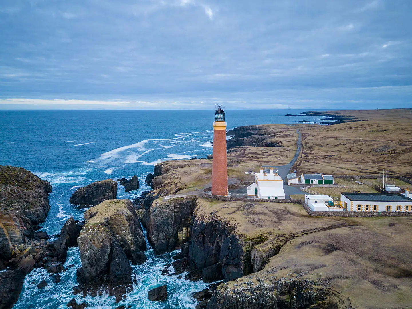
Image by ImageryBT The Hebridean Way is Scotland’s island-hopping long-distance trail: 252 km from Vatersay to Stornoway, crossing 10 Outer Hebridean islands by causeway and CalMac ferry. It suits walkers who want remoteness, Atlantic beaches, machair and island culture more than summits or high mountain drama.
The route begins beside Vatersay’s white-shell beaches, then works north through Barra, Eriskay, the Uists and Benbecula, where sand, crofting townships, lochans and flower-rich machair dominate the walking. Progress is broken by two sea crossings: Ardmhor to Eriskay across the Sound of Barra, and Berneray to Leverburgh across the Sound of Harris.
Harris changes the feel of the walk, with western beaches around Horgabost and nearby Luskentyre giving way to rougher ground, peat bog and the Old Coffin Road towards Tarbert. Lewis then brings the wildest stretch: broad, loch-strewn moor before the finish at Lews Castle in Stornoway.
This is not a technically hard trail, and its high point is only about 250 m on Barra. The challenge comes from long days, exposed Atlantic weather, single-track road walking, boggy or pathless sections, sparse services, Sunday closures and the need to line up beds, buses and ferry times carefully.
This guide covers stages, itineraries, accommodation, camping, food, transport, terrain, navigation, gear, costs, shorter sections and common mistakes.
Stage-by-Stage Guide
Distances are approximate and the two on-route CalMac ferries are part of the day-to-day planning. The Ardmhor–Eriskay ferry sits between Stages 1 and 2, and the Berneray–Leverburgh ferry sits between Stages 5 and 6; both timetables should be checked before travelling.
Stage 1: Vatersay to Ardmhor, Barra — approx. 25 km
The opening stage is one of the most varied days on the route: Vatersay beaches, causeway walking, rough moor, a low hill crossing, Castlebay services and the approach to the Sound of Barra ferry. It starts near the twin beaches of Vatersay, with Bàgh Siar on the Atlantic side and Bàgh a' Deas to the east, linked by a narrow tombolo.
After leaving Vatersay by road and crossing the causeway to Barra, the route leaves the road to cross the shoulder of Beinn Tangabhal. This is the early high point of the Hebridean Way, around 250 m, but the difficulty is not the height; it is the rough, pathless ground and the need to follow wooden waymarker posts carefully. In poor visibility this is one of the places where an OS map, compass and GPS are genuinely important.
The descent to Halaman Bay at Tangasdal is one of the best early rewards, before a second rough moorland crossing towards Loch an Duin. The final approach gives views over Tràigh Mhòr, the wide beach used as Barra Airport’s runway, before the route finishes by the quiet coast road to Aird Mhòr ferry terminal.
Food, water and accommodation: Castlebay / Bagh a' Chaisteil is the key service point, with a Co-op, cafés and accommodation. There is little at Ardmhor beyond the ferry terminal area, so do not plan on resupplying there. Accommodation is mainly in the Castlebay area, with B&Bs, hostel options and camping nearby; book ahead.
Transport and access: The stage ends at Aird Mhòr for the CalMac ferry to Eriskay. Crossings are not continuous, so check the timetable before setting out from Vatersay and allow enough time for the rough moor sections. Local road access is good at Castlebay and Ardmhor, but onward progress depends on the ferry.
Watch for: pathless moor over Beinn Tangabhal, exposed weather, wet ground after rain, and the risk of arriving at Ardmhor well before or after a ferry sailing.
Stage 2: Eriskay to Howmore, South Uist — approx. 30 km
This is the longest canonical stage by distance, but the walking is generally more straightforward than Stage 1. It begins after the CalMac crossing from Ardmhor to Eriskay, then crosses the small island before using the causeway onto South Uist.
Eriskay has strong historical and cultural interest: Coilleag a' Phrionnsa, Prince’s Cockleshell Strand, is associated with Bonnie Prince Charlie’s 1745 landing, and An Politician is named after the SS Politician, the whisky wreck that inspired Whisky Galore. After leaving Eriskay, the route settles into a long Atlantic-coast day of beaches, grassy paths and machair.
The west side of South Uist gives sustained low-level walking above white sand and flower-rich machair. In summer this can be one of the most colourful parts of the Hebridean Way, with red clover, orchids and corn marigold, and frequent coastal birds such as oystercatchers, lapwings and plovers.
Food, water and accommodation: Eriskay has a shop, B&B and pub before the crossing to South Uist. On South Uist, Kilbride Café and Polochar Inn are useful potential stops, and Daliburgh / Dalabrog is a practical detour for the Co-op, hotel and guesthouse options. Howmore / Tobha Mòr itself is small, with the Gatliff Trust hostel and modest accommodation, but no shop.
Freshwater streams are not a reliable assumption on the southern islands. Fill bottles at known service points before the longer coastal sections, especially in warm weather.
Transport and access: The ferry arrival and the South Uist road network make this a stage with several practical access points, but the distance is still substantial. Local buses serve the island spine; current times should be checked before travelling.
Watch for: a long day on tired feet, limited water away from settlements, exposed Atlantic weather and Sunday closures affecting shops and cafés.
Stage 3: Howmore to Baile nan Cailleach, Benbecula — approx. 23 km
This stage leaves the easy beach-and-machair feel and works through a wetter, more intricate landscape of lochs, bog and low moor. It is less dramatic than the previous coastal day but important for understanding the interior of South Uist.
From Howmore, the route passes close to Loch Druidibeag, a long-protected wildlife area on South Uist, picking a line through loch-studded ground and islands of firmer terrain. It then follows the southern side of Loch Bì and passes near Our Lady of the Isles, the large hillside statue above the main road.
Around Loch Bee the ground can be slow and wet, and the landscape can make wayfinding awkward. In wet weather, bog can be deep enough to be more than a nuisance, so waterproof footwear and patience matter more than speed.
Food, water and accommodation: Howmore has limited facilities, so start the day carrying what is needed. The end point, Baile nan Cailleach, is a quiet hamlet; most practical accommodation and resupply sit nearby around Creagorry / Creag Ghoraidh or Lionacleit / Liniclate, where there is a small supermarket. Check Sunday opening and accommodation availability before committing to this stage split.
Transport and access: The route crosses towards Benbecula by causeway, giving road access at the end of the stage and in nearby settlements. Local bus options on the island spine should be checked before travelling.
Watch for: boggy ground around Loch Bee, marker posts that require attention in water-dominated terrain, and the risk of arriving at a hamlet with no shop unless a detour or transfer has been planned.
Stage 4: Baile nan Cailleach to Lochmaddy, North Uist — approx. 27 km
This is a long but varied stage linking Benbecula, Grimsay and North Uist. It begins and ends with tarmac sections, but the middle of the day includes moorland, causeways and some of the best broad views of the central islands.
A key feature is Ruabhal, Benbecula’s highest hill at only 124 m. It is modest by mainland hill standards, but its position gives wide views over water, machair, low moor and the surrounding islands.
The route then crosses the causeways from Benbecula to Grimsay / Griomasaigh and onwards to North Uist. Grimsay is a small crofting island associated with fishing and creel work, while Carinish / Cairinis gives access to the area around Trinity Temple / Teampall na Trionaid, a medieval collegiate church.
Food, water and accommodation: Lochmaddy / Loch nam Madadh is the main service base on North Uist, with hotel, shops, B&Bs and hostel options. Langass Lodge near Loch Langass is a useful detour for food if it fits the day’s timing. As with the whole route, accommodation should be booked well ahead.
Transport and access: Lochmaddy has a CalMac ferry connection to Uig on Skye, making it a useful bail-out or access point. Road access is also straightforward at the causeways and settlements, with local bus times to be checked before travelling.
Watch for: a long day even though the terrain is not severe, fatigue on tarmac sections, and the need to pay attention on moorland links between clearer road and causeway walking.
Stage 5: Lochmaddy to Berneray — approx. 18 km
This is the shortest of the canonical walking stages and often feels like a natural easing-off day before the Sound of Harris crossing. Strong walkers sometimes combine it with adjacent mileage, but that only works if ferry times and accommodation line up.
The route leaves Lochmaddy on road before crossing moorland in the vicinity of Beinn Mhòr; the Hebridean Way does not summit the hill. The main reward is the widening view over North Uist’s sand flats, tidal channels and scattered islands.
Berneray / Beàrnaraigh is reached by causeway and is one of the most attractive small island stops on the route. Its west beach is a major highlight, and the village makes a good place to pause before entering Harris.
Food, water and accommodation: Berneray has a Gatliff hostel, shop/café and B&Bs, but capacity is limited. It is also an important resupply point before the Harris section. Stock up here or in Leverburgh, because the longest food gap of the Hebridean Way begins once you leave Leverburgh heading north.
Transport and access: The stage sets up the CalMac ferry from Berneray to Leverburgh across the Sound of Harris. The crossing takes about an hour and is operated seasonally to a timetable, so check sailing times and book foot-passenger space in advance. Missing the last ferry can force an unplanned overnight on Berneray.
Watch for: ferry timing, limited beds on Berneray, and the temptation to treat the short mileage too casually when onward transport controls the next stage.
Stage 6: Leverburgh to Horgabost, Harris — approx. 16 km
This is a short but important transition onto Harris. It often works well as a half-day after the Sound of Harris ferry, but only if the sailing time leaves enough daylight and accommodation has been arranged.
From Leverburgh / An t-Òb, the route begins with easier walking along the old peat road towards Finsbay. It then climbs through Gleann Uachdrach on a raised turf path, where the ground can be boggy and the going slower than the distance suggests.
The stage emerges above the west Harris beaches, with open views towards Horgabost and the famous sands of Luskentyre / Losgaintir nearby. The change from the Uists is immediate: Harris feels rougher, rockier and more enclosed by hill ground.
Food, water and accommodation: Leverburgh has a shop, B&Bs, The Anchorage restaurant and, seasonally, a food van. Once you leave Leverburgh, there is no grocery shop for approximately 43 km until Tarbert, so carry enough food for Stages 6 and 7. Horgabost has very limited accommodation, including a small campsite and a few B&Bs in the wider area; there is no shop at the stage end.
Transport and access: Leverburgh is the ferry arrival point from Berneray and has road access. Horgabost sits on the west Harris road, but public transport and pick-up options should be checked before travelling.
Watch for: the start of the Harris food gap, boggy raised turf underfoot, exposed weather above the beaches, and very limited accommodation at Horgabost.
Stage 7: Horgabost to Tarbert, Harris — approx. 22 km
This is the toughest stage for most walkers. It has the most sustained ascent, rougher terrain, more demanding navigation and a strong sense of remoteness despite passing through parts of settled Harris.
The historic Old Coffin Road is the defining feature. This ancient route was used to carry coffins from the rocky east side of Harris to the deeper machair soils of the west for burial, and it gives the day a distinctly different atmosphere from the beach stages farther south.
The route then works through the Bays of Harris, a complex landscape of bare Lewisian gneiss, small lochs, crofting townships and sections of the Golden Road. Road walking is part of the day, but so are old paths, boggy ground and rocky, exposed sections.
Tarbert / An Tairbeart is the practical reward. It is the main settlement on Harris, with shops including a Co-op, cafés, hotel and B&Bs, Harris Tweed shops, tourist information and the CalMac ferry port for Uig on Skye.
Food, water and accommodation: There is no grocery shop between Leverburgh and Tarbert, so leave Horgabost carrying enough food. Tarbert is the first full resupply point after the 43 km gap and should be used properly before continuing north. Accommodation is better than at Horgabost or Aline, but still needs advance booking.
Transport and access: Tarbert has road access and a CalMac ferry to Uig, making it a major entry, exit or rest point. Local bus options should be checked before travelling.
Watch for: sporadic waymarking, rough and boggy ground, exposure in poor weather, fatigue after the previous stage, and the absence of shops until Tarbert. Carry an OS map, compass and GPS, and do not rely on waymarkers alone.
Stage 8: Tarbert to Aline, Lewis — approx. 24 km
This stage leaves Tarbert by road, then climbs into a wilder mountain-feeling landscape on the old path up Gleann Lacasdall. Although the route remains low by mountain standards, the bealach crossing gives one of the bigger hill-country days of the Hebridean Way.
After the pass, the route descends towards the Maraig road before using an old, boggy grass track through the hills. The boundary from Harris into Lewis is not marked as a dramatic line on the ground, but the change is clear: the rockier Harris landscape gives way towards broader, peat-dominated Lewis moor.
Loch Seaforth / Loch Shiphoirt gives one of the best backdrops of the northern half of the route. Aline lies near the head of Loch Erisort and the Aline Community Woodland, where boardwalks and old tracks help negotiate ground that would otherwise be very wet.
Food, water and accommodation: Tarbert is the last reliable full-service start point for the stage, so leave with food. Aline has very limited accommodation and should not be assumed as an easy overnight stop. Many walkers need to arrange a pick-up, wild camp where appropriate, or alter the stage split.
Transport and access: Tarbert is the main access point at the start. Aline is a small hamlet with road access, but onward transport or collection should be arranged in advance; this should be checked before travelling.
Watch for: the bealach crossing in poor visibility, boggy grass tracks, limited end-of-stage accommodation and the increasingly remote feel of the route north of Harris.
Stage 9: Aline to Laxay, Lewis — approx. 22 km
The Lewis moor becomes the main character of the route on this stage. It starts through Aline Community Woodland, where boardwalk and old carriageway are important because the surrounding ground is extremely boggy.
Beyond the woodland, the route opens onto broad peat moor and passes through the Arivruaich area. Shielings — ruined summer livestock shelters — are scattered across the landscape and give context to the old patterns of seasonal grazing and settlement.
The route passes near Balallan / Baile Ailein, the largest village on Lewis’s east coast and a useful service stop. The Kinloch Historical Society café at Balallan offers simple refreshments, and roadside honesty boxes may provide cold drinks and snacks, but these should not replace carrying proper food.
Near Balallan, the Pairc Raiders monument commemorates the 1887 Pàirc deer raiders and the land struggles that shaped this part of the Hebrides. The stage then returns briefly to road near Laxay before a final short moor section.
Food, water and accommodation: Aline has little to rely on, so start supplied. Balallan is the best practical stopping point during the day. Laxay is a tiny hamlet with very limited accommodation; some walkers use Balallan, arrange lifts or taxis, or camp where appropriate.
Transport and access: Road access exists around Balallan and Laxay, but public transport and taxi availability should be checked before travelling. Do not assume late-day flexibility in such small settlements.
Watch for: boggy peat moor, posts that can be widely spaced, thinning waymarking compared with the southern islands, and limited accommodation at both ends of the stage. Compass and GPS backup are strongly recommended.
Stage 10: Laxay to Stornoway, Lewis — approx. 25 km
The final stage has two very different halves. The first heads north across open Lewis moor to Achamore: rough, wet, exposed and elemental, with more shielings and wide views to low hills. Navigation still matters here, particularly if mist or rain reduces visibility between marker posts.
At Achamore, near the junction with the A858, there is an optional detour to the Calanais / Callanish Standing Stones. The stones are about 1.5 km off-route, making roughly a 3 km round trip, and the visitor centre has a café and toilets. Allow extra time if adding this detour.
After the A858, the character changes sharply. The final section is largely tarmac: the Pentland Road, minor roads, then estate road through the wooded Lews Castle grounds into Stornoway / Steòrnabhagh. The last miles can feel road-heavy, but the approach through the castle estate gives a more satisfying finish than road walking alone.
The official finish is beside Lews Castle / Caisteal Leòdhais, marked by a tall metal waymarker post in the castle grounds. Stornoway is the main town of the Outer Hebrides and has the full range of end-of-route services.
Food, water and accommodation: Carry enough food from Laxay or Balallan for the moor crossing, unless using the Calanais detour facilities. Stornoway has supermarkets, restaurants, hotels, B&Bs and other town services, but accommodation should still be booked ahead in peak season.
Transport and access: Stornoway has the CalMac ferry terminal for Ullapool and an airport, making it the main departure point at the end of the walk. Road access is straightforward once the route reaches the A858 and the Pentland Road.
Watch for: rough boggy moor early in the day, a long final stretch of tarmac, Sunday service closures, and underestimating the time needed if adding the Calanais detour.
Recommended Itinerary
Distances on the Hebridean Way are approximate and should be checked against official mapping before booking accommodation. The main itinerary decision is whether to walk the standard 10 stages or add time around the longest days, the ferry crossings and the thinly serviced Harris and Lewis sections.
The two on-route CalMac ferries are part of the itinerary, not optional extras: Ardmhor to Eriskay after Stage 1, and Berneray to Leverburgh before Stage 6. Check current timetables before fixing overnight stops, especially in summer and around Sundays.
Standard 10-day itinerary
This is the classic end-to-end schedule. It suits fit walkers who are comfortable with repeated 22–30 km days, carrying enough food between services, and navigating boggy or thinly waymarked ground on Harris and Lewis.
| Day | From | To | Approx. distance | Why this stage makes sense | Services/accommodation notes |
|---|---|---|---|---|---|
| 1 | Vatersay | Ardmhor, Barra | 25 km | Starts from the Vatersay beaches, crosses to Barra and passes through Castlebay before reaching the north end of the island. This is also where the route reaches its approximate high point on Barra. | Ardmhor is a ferry terminal rather than a practical overnight base. Most walkers stay in or around Castlebay and use the Ardmhor–Eriskay ferry the next day. |
| 2 | Eriskay | Howmore, South Uist | 30 km | The longest standard day, beginning after the Sound of Barra ferry and continuing through flat machair, coastal roads and South Uist’s Atlantic-side landscapes. | Eriskay has limited services, including a small shop, B&B and the Am Politician pub. Daliburgh is the key mid-stage service point, with a hotel and good shop. Howmore has a basic Gatliff Trust hostel but no shop or pub. |
| 3 | Howmore | Baile nan Cailleach, Benbecula | 23 km | A more manageable day across South Uist and onto Benbecula by causeway, with machair, beaches and quiet roads. | The Baile nan Cailleach / Liniclate area has Otter’s Edge campsite, and Benbecula has a small Co-op supermarket. This is an important resupply opportunity before services thin out again. |
| 4 | Baile nan Cailleach | Lochmaddy, North Uist | 27 km | Crosses Grimsay by causeway and continues through mostly low, open island terrain towards one of the better-served settlements on the route. | Lochmaddy has a hotel, B&Bs, hostel and small shop. It is also a ferry access or exit point for Uig on Skye. |
| 5 | Lochmaddy | Berneray | 18 km | The shortest standard stage, giving a useful easier day before the Sound of Harris ferry and the rougher Harris stages. | Berneray has a Gatliff Trust hostel, a small community shop and limited accommodation. Book the Berneray–Leverburgh ferry in advance for the next stage. |
| 6 | Leverburgh, Harris | Horgabost | 16 km | After the Sound of Harris ferry, the route enters Harris and changes character quickly, with western beaches, Northton and Scarista, then rougher ground including the Old Coffin Road. | Leverburgh has a shop and small hotel/hostel. Horgabost has limited accommodation; some walkers use taxi transfers to Tarbert. This stage includes boggy ground and thinner waymarking. |
| 7 | Horgabost | Tarbert | 22 km | Completes the Harris section to the island’s main service centre, crossing varied ground between the west and east sides of Harris. | Tarbert is the best resupply point on Harris, with shops, hotel and B&Bs, plus the ferry terminal for Uig on Skye. Treat Leverburgh to Tarbert as a roughly 43 km resupply gap, as Horgabost has minimal services. |
| 8 | Tarbert | Aline, Lewis | 24 km | Crosses from Harris into Lewis and moves into the open, loch-strewn moorland that defines the northern half of the route. | Aline near Loch Seaforth has very limited accommodation; Vigadale House guesthouse is a noted option. OS map, compass and GPS are important here because waymarking is sparse on the Harris/Lewis moor sections. |
| 9 | Aline | Laxay, Lewis | 22 km | A remote day across Lewis peat moor, with exposed ground and few obvious escape points. This is one of the wildest parts of the trail. | Laxay is a very small settlement with limited accommodation. Advance booking or a camping plan is essential. |
| 10 | Laxay | Stornoway | 25 km | The final stage reaches Stornoway and finishes beside Lews Castle. Expect a more built-up and road-influenced finish than the earlier island sections. | Stornoway has the route’s fullest services: hotels, B&Bs, hostels, supermarkets, restaurants, airport and CalMac ferry to Ullapool. Some walkers use a bus for the final road miles into town. |
Slower 12–13 day itinerary
This is the better choice for most independent walkers, especially anyone relying on accommodation rather than camping. It gives more room around the longest Uist day, the limited Harris accommodation, ferry timing and weather delays.
A practical slower schedule keeps the same overall line but makes two key changes:
| Adjustment | Why it helps | Planning notes |
|---|---|---|
| Split Day 2 with a night at Daliburgh | Eriskay to Howmore is the longest standard stage at about 30 km. Stopping at Daliburgh turns it into two easier days and places a good shop and hotel within the schedule. | This is one of the most useful itinerary changes for walkers not wanting an early big-mileage day after the Barra ferry. |
| Add time around Harris, usually by building in Tarbert | The Leverburgh–Horgabost–Tarbert section has limited accommodation and a significant resupply gap. Extra time reduces pressure if ferry timing, weather or boggy ground slows progress. | Horgabost accommodation is limited, and taxi transfers to Tarbert are common. Book well ahead. |
| Add an extra night in Stornoway before travelling onward | Stornoway is the main transport and service hub at the end of the trail. An extra night protects onward ferry or flight plans if weather or tired legs delay the final stage. | Especially useful if continuing by the Stornoway–Ullapool ferry or flying out. |
A 12-stage / 13-night pattern is also used by some self-guided operators, reflecting the reality that accommodation spacing often shapes the itinerary as much as walking distance.
Faster 8-day variant
An 8-day crossing is only suitable for strong, experienced long-distance hikers who are comfortable combining stages into 30 km-plus days on sand, road, bog and pathless moor. It is not just a fitness question: the two CalMac ferry crossings gate progress and cannot be shortened by walking faster.
Do not plan a fast itinerary by simply dividing 252 km into equal days. Accommodation is sparse, shops often close on Sundays, and Harris and Lewis have long stretches where navigation and weather matter more than pace. Exact combined stages should be built from current ferry times, booked beds or realistic camping locations, and official mapping before booking.
Optional Butt of Lewis extension
Walkers wanting a more remote finish can continue north from Stornoway to the Butt of Lewis. The extension is about 48 km, fully waymarked, and is usually treated as two additional stages: Stornoway to New Tolsta, then New Tolsta to the Butt of Lewis.
Add at least two walking days, plus enough time to return from the Butt of Lewis or connect with onward transport. Accommodation, buses and services for this extension should be checked before travelling.
Planning the Route
How many days to allow
The standard waymarked Hebridean Way is normally planned over 10–13 walking days. The 10-day schedule follows the common guidebook structure, but it produces several long days because accommodation and settlements are spaced awkwardly rather than because those are ideal walking stages.
For most independent walkers, 12 days is the practical sweet spot. It gives more room for ferry timing, weather delays, boggy ground and the slower pace that the islands often demand. Strong walkers covering long days of 5–8 hours can complete the standard 10-stage itinerary, but it leaves little margin if a ferry is missed or a booked bed is off-route.
A faster 8-day schedule is possible for experienced, fit walkers who are comfortable with long daily distances and limited flexibility. A more leisurely 14-day schedule suits walkers wanting shorter days, more time on beaches and machair, or extra rest time around ferry crossings and exposed moorland sections.
The optional extension from Stornoway to the Butt of Lewis adds about 48 km, usually around two extra days. Build this in from the start rather than treating it as an afterthought, especially if onward transport or accommodation in Stornoway is already booked.
Let accommodation shape the itinerary
Accommodation is the main constraint on this route. The Hebridean Way has far fewer beds than better-known UK long-distance trails, and the obvious stage ends do not always have enough places to sleep.
Book accommodation before fixing the rest of the itinerary. In June to August, B&Bs, guesthouses and small hostels can fill 6–12 months ahead, and some places are seasonal or do not open until May. Carrying cash is sensible, as ATMs are rare and some small accommodation providers or campsites may not take cards.
Some stops need particular care. Around Howmore (Tobha Mòr) on South Uist, accommodation is very limited and the main option is a simple hostel; using a taxi transfer to or from a nearby B&B is a common workaround. On Berneray, the Gatliff Trust hostel operates on a first-come, first-served basis, so it should not be treated as a guaranteed booked bed.
A pure inn-to-inn Hebridean Way is possible, but it requires early booking and a willingness to use taxis where the available bed is not exactly at the stage end. Carrying a tent gives much more resilience if accommodation is full, seasonal, or poorly aligned with the day’s walk.
Ferry crossings are route gates
Two CalMac ferries sit directly on the walking route and control progress between stages:
| Crossing | Where it falls | Planning issue |
|---|---|---|
| Ardmhor, Barra to Eriskay | Between Stage 1 and Stage 2 | Check the last sailing if walking to Ardmhor late in the day. |
| Berneray to Leverburgh, Harris | Between Stage 5 and Stage 6 | Check the timetable carefully before booking accommodation either side. |
Foot passengers do not normally need to book these short on-route crossings, but the timetable matters. If the last ferry is missed, the next stage cannot begin and there may be no convenient accommodation at the ferry point.
Always check current CalMac timetables at calmac.co.uk before setting off and again during the walk. Weather disruption is a normal planning risk in the Outer Hebrides, not an exceptional one.
Sunday closures can break a plan
Sunday needs deliberate planning across the Outer Hebrides. On Harris and Lewis, the overwhelming majority of shops, cafés and local services close on Sundays; on Lewis this is especially strict. There is also no bus service on Sundays on any island.
Hotels may serve food on Sundays, but outside that the realistic option is usually food carried in advance. Plan food purchases and any bus-dependent movement around this, especially before the Harris and Lewis sections.
Avoid arriving in Stornoway, or beginning a long Lewis resupply stretch, on a Sunday unless food and onward plans are already sorted. A Saturday arrival or a Monday departure is often simpler.
Fast, steady or slow: which approach works best?
The Hebridean Way rewards a steady rather than aggressive schedule. The route is low-lying, but daily effort comes from sand, bog, wet moor, exposed road walking and Atlantic weather. A short day on paper can be slower than expected if the ground is saturated or the waymarking thins.
The Uists generally lend themselves to longer, flatter days, but accommodation spacing can force awkward distances. Harris has shorter standard stages, yet the walking can be tougher underfoot, especially where the route leaves easier coastal ground and crosses rougher, rockier terrain.
A slower itinerary also protects the best parts of the walk: beaches, machair, ferry crossings, small settlements and weather windows. Rushing the route leaves little margin for closed services, ferry delays or a day when headwinds make road sections much harder.
Shortening stages and using taxis
Shortening stages is practical, but it usually means using taxis rather than simply stopping in another village with several beds. This is normal on the Hebridean Way and can make an inn-to-inn itinerary work.
Useful strategies include:
- booking accommodation off-route and arranging a taxi pickup and return the next morning;
- splitting long Uist days around places such as Creagorry or Cula Bay where logistics allow;
- shortening the Horgabost to Tarbert day by arranging a split around Greosabhagh with a taxi to sleep in Tarbert;
- building spare time around the two ferry crossings rather than scheduling them at the limit of the day.
Taxi availability is not guaranteed at short notice, especially in peak season or on Sundays. This should be checked before travelling.
Section hiking the Hebridean Way
The route divides naturally into two halves:
| Section | Islands covered | Typical time |
|---|---|---|
| Vatersay to Berneray | Barra and the Uists | About 5–7 days |
| Leverburgh to Stornoway | Harris and Lewis | About 4–6 days |
This split works well because the Sound of Harris ferry separates the two halves. It is also a sensible approach for walkers who want the island experience without committing to the full end-to-end route in one trip.
Self-guided holiday companies, including Alpine Exploratory, offer packaged Hebridean Way sections with accommodation and transfer logistics arranged. This costs more than independent planning but removes much of the hardest booking work.
What to plan first
The Hebridean Way is not technically difficult, but the logistics are more demanding than the terrain profile suggests. Plan in this order:
| Priority | Why it matters |
|---|---|
| Accommodation | Beds are sparse, seasonal and often booked far ahead; this dictates realistic stage lengths. |
| CalMac ferry timetables | The Ardmhor–Eriskay and Berneray–Leverburgh ferries gate progress and can be affected by weather. |
| Sunday closures | Shops, cafés, buses and local services are very limited or closed, especially on Harris and Lewis. |
| Food resupply | The Harris stretch between Leverburgh and Tarbert has a notable resupply gap of roughly 43 km. |
| Navigation | Waymarking can thin on Harris and Lewis; OS map, compass and GPS are essential on open moor. |
| Weather | Atlantic fronts can change the day quickly; check forecasts daily and keep margin in the schedule. |
| Start and finish transport | Getting to Vatersay and leaving Stornoway requires ferry or flight planning alongside local buses. |
Navigation, maps and self-reliance
Do not rely on waymarks alone. The route is waymarked, but the open moorland of Harris and Lewis demands proper navigation, particularly in poor visibility or after long wet spells when trods across boggy ground become unclear.
Carry OS mapping, a compass and a reliable GPS option with offline mapping. A printed or offline route line is useful, but it should support navigation rather than replace map-and-compass judgement.
Permits and access
No walking permit is required for the Hebridean Way. Scotland’s access rights allow responsible access across most land, but walkers must follow the Scottish Outdoor Access Code.
For campers, that means small numbers, short stays, careful pitching away from buildings and enclosed working areas, and leaving no trace. This is particularly important on machair, crofting land and around small island communities where the route passes close to homes and livestock.
Towns, Villages and Overnight Stops
Accommodation on the Hebridean Way is sparse and unevenly spaced. Many settlements are crofting townships rather than service villages, so overnight planning is often dictated by where beds, hostels or campsites actually exist.
Book indoor accommodation well ahead, especially in summer. If using walk-in hostels or camping, carry enough flexibility in food, cash and timing to cope with full dorms, poor weather or missed ferries.
Sunday closures are a serious planning issue across the Outer Hebrides, particularly on Harris and Lewis. Shops, cafes, Co-ops and petrol stations may close, and Stornoway is especially affected; buy food and fuel before Sunday rather than expecting to resupply on the day.
Vatersay (Bhatarsaigh)
Vatersay is the southern start of the Hebridean Way, reached by causeway from Barra. The route begins near the twin Atlantic beaches, but Vatersay itself has no village centre, no shop and no practical walker accommodation.
Most walkers stay in Castlebay the night before starting, then travel out to Vatersay for the beginning of the route. Treat Vatersay as a start point rather than an overnight stop unless independent arrangements have been made.
Castlebay (Bagh a' Chaisteil), Barra
Castlebay is the main village on Barra and the most useful base before starting the walk. It is the arrival port for the CalMac ferry from Oban and has the best services before the route pushes north through Barra and towards the Sound of Barra ferry.
Accommodation includes the Castlebay Hotel, overlooking Kisimul Castle and the ferry terminal, Dunard Hostel & Lodge, plus several B&Bs and guesthouses. It is the natural Day 0 stop, and also a practical fallback if accommodation around Ardmhor is not available after the first walking day.
For supplies, Bùth Bharraigh community shop on the main street is especially useful for walkers, stocking food, camping gas cylinders and guidebooks, with a launderette, tourist information, bike hire and free WiFi. There is also a small supermarket to the west of the village, plus a bank, post office and tourist information centre.
Castlebay is the last substantial service point before South Uist. Buy enough food for the first stage and for any uncertainty around the Ardmhor–Eriskay ferry.
Ardmhor (Aird Mhòr), Barra
Ardmhor sits at the north end of Barra and is the ferry point for the on-route CalMac crossing across the Sound of Barra to Eriskay. It marks the end of the first standard stage from Vatersay.
There are no shops or walker services at Ardmhor itself. Overnight options are not concentrated here, so walkers either arrange nearby B&B accommodation, return towards Castlebay, or cross to Eriskay if the ferry timetable allows.
The ferry is a hard logistical gate on the route. Check the Ardmhor–Eriskay timetable before booking accommodation, as a late finish, bad weather or timetable change can affect where it is realistic to sleep.
Eriskay (Eiriosgaigh)
Eriskay is the first island after the Sound of Barra ferry and the start of the second standard walking stage. It is small, but more useful than its size suggests because it has a community shop and a pub/bar.
Eriskay Community Shop sells everyday goods, local products and crafts. AM Politician is the island’s pub/bar, named after the SS Politician associated with the whisky cargo behind Whisky Galore.
Accommodation is very limited, mainly a small number of B&Bs and self-catering cottages. Book early if planning to stay here; Eriskay is not a major overnight hub.
The ferry terminal has toilets and a coin-operated shower, which can be useful if camping or waiting between transport connections. If supplies are short, remember that the nearest Co-op is at Daliburgh on South Uist, not on Eriskay.
Daliburgh (Dalabrog), South Uist
Daliburgh is not directly on the main line of the route but is an important service detour, about 1 km off route and roughly 7 km from the Eriskay causeway. For many walkers it is the first proper resupply stop after Castlebay.
The village has a Co-op supermarket, a hotel and B&B accommodation. The Co-op is one of the main resupply points on South Uist and is worth using before continuing north through the machair and scattered townships.
Daliburgh is particularly useful if the previous night was spent on Eriskay or if the long Eriskay-to-Howmore day is being split. Check Sunday opening before relying on it.
Howmore (Tobha Mòr), South Uist
Howmore is a tiny crofting township on South Uist and the usual overnight stop at the end of the second standard stage. It sits amid machair and medieval chapel ruins, but its main practical value is the hostel.
Gatliff Hebridean Hostel at Howmore is a traditional thatched croft on the route. It has 16 beds in three shared rooms, a self-catering kitchen and coal-burning stove, with camping available on site.
The hostel does not take advance bookings and accepts cash or cheque only. Current prices and arrangements should be checked before travelling, but walkers should arrive with cash and a backup plan in case it is full.
There are very few other services in Howmore, though B&Bs are scattered in the wider area. Do not arrive expecting a shop, pub or full village facilities.
Creagorry (Creag Ghoraidh) / Lionacleit (Liniclate), Benbecula
Creagorry and nearby Lionacleit form one of the more useful mid-route service areas. This is the practical Benbecula stop between South Uist and North Uist, especially for food, accommodation and transport connections.
Creagorry has a Co-op and the Isle of Benbecula House Hotel, which offers accommodation and a restaurant. Lionacleit, a short distance north, has the Dark Island Hotel with restaurant and family lounge, plus a petrol station and sports centre with gym and swimming pool open to visitors.
Benbecula Airport has flights connecting with Glasgow and Stornoway, making this area useful for section hikers joining or leaving the route. It is also a good point to reset after the longer South Uist stages before continuing north through Grimsay and North Uist.
Grimsay (Griomasaigh)
Grimsay is the low causeway-linked island between Benbecula and North Uist. The Hebridean Way passes through it as part of the northbound chain of islands.
There are no significant walker services to plan around here. Treat Grimsay as a through-section rather than an overnight or resupply stop.
Carinish (Cairinis), North Uist
Carinish is one of the North Uist settlements passed on the way towards Lochmaddy. It is useful chiefly as a route marker rather than a major service base.
Do not rely on Carinish for accommodation, food or transport without making specific arrangements in advance. Most walkers aim for Lochmaddy for the main North Uist overnight stop.
Lochmaddy (Loch nam Madadh), North Uist
Lochmaddy is the main settlement on North Uist and a key overnight hub at the end of the fourth standard stage. It is also a CalMac ferry port for Uig on Skye, which can be useful for section hikers, although this is not one of the two on-route Hebridean Way ferry crossings.
Accommodation options include Lochmaddy Hotel, Redburn House and Uist Outdoor Centre. Lochmaddy Hotel has en suite rooms and serves local seafood, while Uist Outdoor Centre provides a more budget-oriented option.
Taigh Chearsabhagh, the arts centre, museum, café and shop, is a useful stop in the village. A Co-op and garage are about 2 miles from the village centre, so plan the extra distance if resupplying there.
Lochmaddy is one of the better places to pause, wash kit, eat properly and restock before the shorter stage to Berneray. Book early in peak season.
Berneray (Beàrnaraigh)
Berneray is linked to North Uist by causeway and is the overnight stop before the Sound of Harris ferry to Leverburgh. The ferry pier is the key logistical feature here, and timings affect the start of the Harris section.
Budget accommodation is unusually important on Berneray. Gatliff Hebridean Hostel Berneray is a traditional thatched croft on the beach overlooking the Sound of Harris, with 21 beds across three dorms and a self-catering kitchen; it does not take advance bookings. John’s Bunkhouse is a modern blackhouse-style bunkhouse accommodating eight people, with underfloor heating, drying room, bike shed, peat-burning stove and WiFi.
Food options on Berneray are limited. Arrive with supplies, or eat and shop before leaving Lochmaddy if continuing over the causeway.
This is not a place to cut ferry timing fine. Check the Berneray–Leverburgh timetable before booking the next night on Harris.
Leverburgh (An t-Òb), Harris
Leverburgh is the first village reached after the Sound of Harris ferry and the start of the Harris walking stages. It is a key point for resupply because the route then has a long gap before Tarbert.
Harris Community Co-op sells food, fuel and crafts. The Isle of Harris Brewery restaurant offers locally sourced food and also has a deli-style shop.
Accommodation includes Lingay House B&B in the village, Am Bothan bunkhouse overlooking the Sound of Harris, and Anglers View holiday cottage. Lingay House is notable for offering breakfast, packed lunch, dinner and a licensed bar seven days a week, which is unusual in the islands.
Leverburgh is the place to stock up before the west-coast Harris section. The gap from Leverburgh to Tarbert is roughly 43 km with essentially no reliable shops in between, apart from limited seasonal facilities at Horgabost campsite.
Horgabost, Harris
Horgabost is a small west-coast settlement and the natural overnight point for walkers carrying a tent between Leverburgh and Tarbert. It sits opposite the sands of Luskentyre and Seilebost, but its practical role is the campsite.
Horgabost Campsite is directly on the beach and accepts tents, caravans and motorhomes. Facilities are basic, with toilets and coin-operated showers; there is also a small shop and summer burger van. The campsite is open May 1 to September 30.
There is no indoor accommodation in Horgabost village itself. Walkers without camping gear need to arrange another overnight plan, commonly by continuing, using pre-booked transport, or staying elsewhere.
Do not treat the campsite shop or burger van as a guaranteed resupply. Carry food from Leverburgh for the Harris section, especially outside summer or near Sundays.
Tarbert (An Tairbeart), Harris
Tarbert is Harris’s main settlement and one of the most important service hubs on the whole route. It comes after the demanding Harris west-coast and Old Coffin Road section and is the first proper restock point after Leverburgh.
Accommodation includes Harris Hotel, Hotel Hebrides, Backpackers Stop hostel, plus B&Bs and self-catering. Backpackers Stop is close to the ferry, shops and restaurants, with a self-catering kitchen, lounge and dorms, making it well suited to walkers.
Food options include hotel restaurants and bar meals, Hotel Hebrides takeaway, Harris Inn bar meals and First Fruits Tearoom during its daytime April–September, Monday–Saturday opening. Tarbert also has main-street shops and mobile shops serving parts of the island.
Tarbert has a CalMac ferry to Uig on Skye, making it useful for section hikers. It is also the last major service point before the route turns into the more remote Harris and Lewis moorland stages.
Aline / Loch Seaforth, Lewis
Aline and the Loch Seaforth area mark the remote transition from Harris into Lewis. This is not a village stop in the normal sense; the stage end has no services.
Most walkers treating this as a standard stage need to be self-sufficient. Aline/Loch Seaforth is primarily a wild camping or bivvy area, and the approach from Tarbert crosses some of the most remote terrain on the route.
Nearby Balallan (Baile Ailein) is a small village with minimal walker services. Balallan Bistro is a possible food stop, but current opening should be checked before travelling.
Do not leave Tarbert short of food, stove fuel, waterproofing or navigation backup. This part of the route has no meaningful service safety net.
Laxay (Lacasaigh), Lewis
Laxay is a small village on the shores of Loch Erisort and the usual stage end before the final walk into Stornoway. It has very limited services and should not be treated as a standard accommodation hub.
There is no dedicated hiker accommodation to rely on in Laxay. Wild camping may be possible on adjacent moorland, but walkers wanting a bed need to arrange accommodation or transport in advance.
This is one of the places where a 10-day schedule can feel logistically tight. Check the next day’s plan into Stornoway carefully, particularly if arriving late, in bad weather or on a Sunday.
Stornoway (Steòrnabhagh), Lewis
Stornoway is the finish of the Hebridean Way and the only true town in the Outer Hebrides. The route ends beside Lews Castle and its wooded grounds, with full town services nearby.
Accommodation is much broader here than elsewhere on the route, including hotels, Lews Castle accommodation, B&Bs, guesthouses, apartments and campsites. Even so, book ahead in the main season, especially if finishing on a weekend or before onward travel.
Stornoway has supermarkets, shops, restaurants, cafes, bars, petrol stations and outdoor clothing shops. The Good Food Boutique is an independent deli-café serving coffee, sandwiches, salads, artisan cheeses, whiskies and gins.
Transport links are the best on the islands. CalMac ferries run from Stornoway to Ullapool, Stornoway Airport has flights to Glasgow, Edinburgh, Inverness and other Scottish cities, and W10/W1 bus services connect with other parts of Lewis.
Sunday planning matters more here than many walkers expect. Almost everything in Stornoway closes on Sundays, so do not finish on a Sunday expecting to buy groceries, replace kit or celebrate with normal town services.
For walkers continuing beyond the official finish, the optional extension heads towards the Butt of Lewis. The Calanais Standing Stones are also a major detour from this northern end of the route.
Getting to the Start
The standard start is at Vatersay Community Hall (Talla Bhàtarsaigh), near the Vatersay beaches on the most southerly inhabited island of the Outer Hebrides. Most walkers reach it either by ferry to Castlebay on Barra, then bus or taxi to Vatersay, or by flying to Barra Airport and continuing by local transport.
By train
The usual rail approach is to travel to Glasgow, then take the ScotRail West Highland Line from Glasgow Queen Street to Oban. The Glasgow–Oban journey takes about 3 hours 7 minutes, with up to 6 trains per day and no change required.
Oban station is about 400 m from the CalMac ferry terminal, roughly a 5-minute walk. This makes the train-and-ferry connection straightforward, but it still needs planning around the ferry timetable rather than the train alone.
From Oban, take the CalMac ferry to Castlebay (Bagh a' Chaisteil) on Barra. The crossing takes about 4 hours 45 minutes, with around 7 crossings per week in summer, usually daily in high season. Foot passenger singles have been around £19.70, and advance rail fares from Glasgow to Oban around £25.40 one way; current fares should be checked before booking.
CalMac advises booking ahead even as a foot passenger. Foot passengers normally need to check in 30 minutes before departure, and late check-in can mean space is reallocated. This should be checked before travelling, especially around the change between summer and winter timetables.
By bus
From Castlebay, Vatersay is 5–6 miles / 8–9 km away by road, linked to Barra by causeway. The local W33 bus runs between Castlebay and Vatersay, taking about 15 minutes.
The W33 is a limited service, typically running 3 times a day from Monday to Saturday only. There is no Sunday service, so a Sunday ferry arrival usually means using a taxi or walking the road to Vatersay. Current times should be checked through Traveline Scotland before travelling.
If the bus does not connect with the ferry, taxis are the practical fallback. Barra has a small number of taxi operators, so arranging a pickup in advance is sensible, particularly after an evening ferry or on Sundays. Known local taxi contacts include Cursty Peigi, Neil James and Asti, but availability and phone numbers should be checked before travelling.
Walking from Castlebay to Vatersay is possible if transport fails. It is about 5.3 miles / 8.5 km on road and takes under 2 hours for most walkers, but it is an extra road walk before the official route has begun.
By car
Driving all the way to Vatersay is usually a poor fit for this walk. The route is a long south-to-north traverse ending in Stornoway, and leaving a car at the southern start for 10–13 days creates an awkward return journey.
A more practical option is to drive to Oban, leave the car in long-stay parking, and continue as a foot passenger on the CalMac ferry to Castlebay. Long-stay options in Oban include Tweeddale Street Car Park, Tesco Oban car park and Atlantis Leisure, all within walking distance of the station and ferry area.
The ferry terminal car park in Oban is not suitable for long-stay parking and may not have space. Long-stay parking in Oban is limited in peak season, so it should be pre-booked where possible and current arrangements checked before travelling.
Taking a car on the Oban–Castlebay ferry adds cost and availability issues, and it does not solve the point-to-point problem unless a separate vehicle retrieval plan is in place. Most independent walkers are better served by public transport at the start and ferry or flight connections from Stornoway at the end.
From the nearest airport
The nearest airport to the start is Barra Airport (BRR) at Traigh Mhòr, served by Loganair flights from Glasgow. The flight takes about 1 hour, with a small aircraft and a tide-dependent timetable because the runway is on the beach.
This is the fastest way to reach Barra, but seats are limited and departure times vary with the tides. Flights should be booked well ahead, and the exact departure and arrival window should be checked close to travel.
Barra Airport is about 3 miles from Castlebay. From there, continue by bus or taxi to Vatersay; depending on timings, a taxi may be the simplest way to reach the official start.
Flying into Glasgow or Edinburgh can also work for longer-distance travellers, but the final approach still needs to be built around either the Glasgow–Oban train plus CalMac ferry, or the Glasgow–Barra flight.
Where to stay before starting
Many walkers stay in Oban the night before the ferry because the Oban–Castlebay sailing time varies by day and some departures are early. Oban has hostels, B&Bs, guesthouses and hotels, and staying near the station or ferry terminal keeps the morning connection simple.
Castlebay is the main settlement on Barra and is the most useful island base if arriving the day before starting. It keeps the final transfer to Vatersay short and gives more flexibility if the ferry or flight arrives too late for an immediate start.
At Vatersay Community Hall, the official start area has 24-hour toilets, coin-operated showers and a seasonal café. Do not rely on the café being open without checking locally, especially outside the main season or on Sundays.
Accommodation on Barra and Vatersay is limited, and the same applies across much of the route. Book beds well ahead in summer, and build the first day around the ferry, bus and taxi timings rather than assuming a same-day arrival and full walking stage will fit.
Getting Home from the Finish
The Hebridean Way finishes in Stornoway (Steòrnabhagh), beside Lews Castle. For onward travel, Stornoway is the simplest place in the Outer Hebrides: the ferry terminal, bus station, town-centre accommodation, shops and food options are all close together, while Stornoway Airport is about 4 km east of town.
By train
There is no railway on Lewis, and no train from Ullapool. If travelling home by rail, the usual sequence is:
- CalMac ferry from Stornoway to Ullapool.
- Coach from Ullapool to Inverness.
- Train from Inverness to Edinburgh, Glasgow, London or elsewhere.
Inverness is the rail hub for this journey. ScotRail runs services from Inverness to Edinburgh Waverley and Glasgow Queen Street, with journey times typically around 4 hours 25 minutes to Edinburgh and around 3 hours 15 minutes to Glasgow, depending on the service and any changes. For London, use daytime LNER services or the Caledonian Sleeper.
Inverness bus station at Farraline Park is a short walk or taxi ride from Inverness railway station. If booking same-day rail tickets after the ferry and coach, allow a realistic buffer for weather-related ferry disruption and coach delays.
By bus
For most foot passengers, the standard way home is the CalMac ferry from Stornoway to Ullapool, followed by a coach to Inverness.
The Stornoway ferry terminal is in the town harbour, with the bus station adjacent. CalMac operates the Stornoway–Ullapool crossing on the MV Loch Seaforth; the crossing of the Minch takes about 2 hours 40–45 minutes and can be rough in any season.
There are usually around two sailings per day, with typical Stornoway departures around 07:00 and mid-afternoon, but times vary by season and Sunday services may be reduced or absent. This should be checked before travelling. CalMac recommends booking online in advance even as a foot passenger; vehicle spaces should be booked well ahead in summer.
Check-in is important: foot passengers normally need to check in 30 minutes before departure, while vehicles need 45 minutes. The early ferry therefore means being at the terminal by about 06:30.
From Ullapool, Scottish Citylink service 961 runs to Inverness, with services generally timed to meet the Stornoway ferry. The journey to Inverness takes about 1 hour 20 minutes. Ember also operates coaches between Ullapool and Inverness; check current times before relying on a connection.
Book the Ullapool–Inverness coach in advance in July and August, as services can fill. Current fares and timetables should be checked before booking onward rail or flights.
If leaving the Hebridean Way before Stornoway, Tarbert (An Tairbeart) on Harris has a CalMac ferry to Uig on Skye. This is a mid-route exit rather than the standard finish logistics.
By car/taxi
Driving logistics are awkward because the route is point-to-point across the full island chain. Leaving a car at Vatersay or Barra for the full walk is not usually the easiest plan unless a local arrangement has been made.
A more practical car-based option is to leave a vehicle at or near Ullapool, travel out to the start by public transport or flight/ferry, then finish in Stornoway and return to Ullapool on the ferry. Long-stay parking options in Ullapool should be checked with Ullapool Harbour Trust or local parking providers before travelling.
If taking a car on the Stornoway–Ullapool ferry, book the CalMac crossing well ahead, especially in summer. Vehicle check-in is normally 45 minutes before departure.
Taxis are useful within Stornoway for the airport or late arrivals at accommodation, but a taxi or shuttle all the way back towards the southern start would be complicated and expensive. For walkers using a self-guided operator, ask whether vehicle logistics or transfers are included before booking.
From the nearest airport
Stornoway Airport (SYY) is about 4 km east of the town centre. It is the fastest way off Lewis if travelling to Glasgow, Edinburgh or Inverness, and avoids the ferry-plus-coach chain to Inverness.
Loganair operates flights from Stornoway to Glasgow, Edinburgh and Inverness. Typical flight times are about 1 hour to Glasgow, about 45 minutes to Inverness, and about 1 hour 5 minutes to Edinburgh.
Book early for summer travel, as island flights can become expensive. Check baggage limits carefully: damp boots, camping gear and food leftovers can make a pack heavier than expected, and fuel canisters cannot be carried on flights.
Taxis are available in Stornoway for the airport transfer. Local W-numbered buses may serve the airport, but the current Western Isles Transport timetable should be checked before relying on one.
Where to stay at the finish
Staying at least one night in Stornoway after finishing is strongly recommended. The final stage from Laxay is a full walking day, and many walkers arrive too late or too tired to make onward connections comfortably.
An overnight stop also makes the early ferry realistic. The 07:00 sailing requires an early start and check-in around 06:30, while the afternoon ferry gives time for a slower morning in town or a short visit around Lews Castle grounds.
Stornoway has the best accommodation choice on the Hebridean Way, including B&Bs, hotels and hostels. Options include Heb Hostel near the ferry terminal, Hebridean Guest House and Stornoway Bed and Breakfast on Kenneth Street; all accommodation should still be booked ahead in the main walking season.
The town has supermarkets, cafés, restaurants, pubs and other services, making it the easiest place on the route to clean up kit, replace supplies and recover before the journey home. Sunday opening can still be limited in the Outer Hebrides, so plan food and onward travel around the day of the week.
Which Direction Should You Walk?
The Hebridean Way is best walked south to north: Vatersay to Stornoway. This is the standard direction used by the official route material, the Cicerone guidebook structure and self-guided walking operators, and it is also how the waymarking is primarily set up.
Reverse walking is possible, but it adds avoidable difficulty on a route where weather, distance, ferries, sparse accommodation and navigation already require careful planning.
South to north: Vatersay to Stornoway
South to north gives the cleanest overall journey. You start at the remote southern end, reached via Barra and the Vatersay causeway, then work steadily up the island chain through the Uists, Harris and Lewis before finishing in Stornoway, the largest settlement in the Western Isles.
It is also the better direction for the prevailing weather. The Outer Hebrides are exposed, with little tree cover or shelter, and the prevailing wind is south-westerly. Walking north means the wind is more often behind or across you rather than directly in your face, which matters on open machair, beaches, road sections and the peat moor of Lewis.
This is not a guarantee. Atlantic weather changes quickly, and north-easterly winds can make a northbound walk feel hard. Even so, over a full 10–13 day itinerary, the prevailing south-westerly is a strong argument for walking from Vatersay to Stornoway.
The waymarking also favours the northbound direction. In South Uist and Barra, posts are marked both ways, but in Harris and Lewis many signs and disks are positioned for walkers heading north. Reverse walkers can find themselves looking at the backs of posts, especially where the route crosses open, thinly marked ground.
Navigation should not be treated casually in either direction. On the moorland sections of Harris and Lewis, waymarking thins regardless, and an OS map, compass and GPS are essential.
Transport is easier with Stornoway as the finish
The southern start is more awkward to reach, but that is one reason it works well as the beginning. Most walkers can deal with the longer access journey while fresh, then finish in a much easier onward-travel hub.
At the south end, the main approach is by CalMac ferry from Oban to Castlebay on Barra, taking about 5 hours direct or up to around 7 hours via Lochboisdale. Oban is linked with Glasgow by rail and bus. From Castlebay, Vatersay is reached by causeway; buses run, but services are limited, so this should be checked before travelling.
At the north end, Stornoway has shops, restaurants, accommodation and onward transport. The main exit is the CalMac ferry from Stornoway to Ullapool, taking about 2 hours 45 minutes, with onward bus links to Inverness and rail connections beyond. Flying out of Stornoway Airport is also an option.
Walking north to south reverses this convenience. Starting in Stornoway is straightforward, but finishing on quiet Vatersay leaves a longer onward journey via Barra and the ferry back to Oban.
Scenery builds better northbound
The south-to-north direction gives the route a natural progression. It opens with the twin beaches of Vatersay and Barra’s Atlantic coast, then moves through the machair, beaches, lochs and crofting townships of the Uists.
After the Sound of Harris ferry, the character changes sharply. The route crosses from the white western beaches around Horgabost and nearby Luskentyre over the Old Coffin Road towards rockier east Harris, then pushes into the wide, austere peat moor of Lewis.
The finish into Stornoway through the wooded grounds of Lews Castle is a satisfying contrast after so much open ground. The official end is marked in the castle grounds, giving the walk a clearer conclusion than simply turning up at the remote southern beaches in reverse.
Does direction affect the climbs?
Not meaningfully. The Hebridean Way is low-lying, with no climbing or scrambling and a high point of about 250 m early on Barra. The difficulty comes from long days, exposed weather, bog, sand, tarmac and navigation, not from steep ascent.
There is therefore no strong climbing-based reason to choose one direction over the other. Wind, waymarking and transport matter far more.
Accommodation and itinerary flow
Accommodation is sparse in both directions and must be booked well ahead. Walking south to north makes it easier to follow the standard stage structure, with the two on-route ferry crossings falling neatly between stages: Ardmhor to Eriskay after the Barra stage, and Berneray to Leverburgh between North Uist and Harris.
Reverse walkers do not gain any accommodation advantage. They still need to fit beds, buses, Sunday closures and CalMac sailings together, but without the benefit of the route’s usual direction and waymarking logic.
Reverse direction: possible, but harder
A north-to-south walk can work for experienced, self-reliant walkers who are comfortable navigating without reliable visible waymarks. It also gives a scenic final day on Vatersay’s beaches.
The trade-offs are substantial: more awkward end-of-walk transport, less helpful waymarking on Harris and Lewis, a greater chance of walking into the prevailing wind, and a less convenient finish for onward travel.
Recommendation
Walk the Hebridean Way south to north, from Vatersay to Stornoway. It matches the official and guidebook direction, gives the best chance of favourable wind, follows the waymarking as intended, fits the standard ferry-and-stage flow, and finishes in the most practical transport hub on the route.
Accommodation Along the Route
Accommodation is one of the main planning constraints on the Hebridean Way. Bed numbers are small across the islands, distances between settlements can be long, and the most useful overnight stops can fill months ahead in summer.
Book early for June to August, and do not assume that availability will appear once you are on the islands. Carrying a tent is strongly recommended, even if the plan is to use B&Bs, hotels and hostels, because it gives a fallback when a key stop is full.
Booking strategy
Book the awkward nights first: Castlebay on Barra, Howmore or Daliburgh on South Uist, Berneray, Leverburgh, the Harris–Lewis transition around Scaladale / Aline, and the Lewis interior before Stornoway. Castlebay is particularly tight, especially on Saturday nights.
Many B&Bs and small guesthouses in the Outer Hebrides are not listed on major booking platforms. Use Visit Outer Hebrides listings and contact properties directly where needed.
The Gatliff Trust hostels at Howmore, Berneray and Rhenigidale do not take advance bookings. They are first-come, first-served, so they are useful budget options but poor fixed anchor points for a fully pre-booked itinerary.
Sunday closures can affect more than shops. Check check-in arrangements and evening meals in advance, particularly on Harris and Lewis, where food options may be limited near your accommodation.
Approximate costs, in GBP, are usually in these broad ranges: camping £8–£15, budget hostel or bunkhouse bunks £20–£30, Gatliff hostel bunks around £25, pods or glamping £30–£60+, B&Bs and guesthouses around £50–£100 per person per night, and hotels from roughly £80–£130+ per room. Current prices should be checked before booking.
Accommodation table
| Place | Accommodation level | Best for | Notes |
|---|---|---|---|
| Castlebay, Barra | Limited | First night before starting, or a short first stage | Dunard Hostel is the main budget option; B&Bs and guesthouses fill fast; book very early |
| Croft 183 / mid-Barra | Limited | Campers and backpackers | Campsite, yurt and private rooms; useful if splitting the Barra stage; pickup from the route endpoint can be arranged |
| Howmore, South Uist | Limited | Flexible budget walkers | Gatliff hostel is walk-in only with no bookings; camping on site is available, but it can be full in peak season |
| Daliburgh, South Uist | Good | Walkers wanting a guaranteed bed | Uist Travel Accommodation is bookable and directly off the route; Borrodale Hotel is another option |
| Benbecula: Linicleat / Creagorry | Good | Mid-route comfort night | Otter's Edge Campsite, Dark Island Hotel, Isle of Benbecula House Hotel and other options make this one of the easier areas to plan |
| Carinish / Lochmaddy, North Uist | Good | Slower itineraries, rest days, bookable beds | Temple View Hotel, Moorcroft Holidays and Hamersay Hotel are useful; Moorcroft is a strong campsite option |
| Berneray | Limited | End of Stage 5 before the Sound of Harris ferry | Gatliff hostel is walk-in only; John's Bunkhouse is bookable but has only 8 places |
| Leverburgh, Harris | Very limited | Night before or after the Sound of Harris ferry | Lingay House guesthouse is a key option and offers evening meals; Am Bothan Bunkhouse should not be relied on without checking current status |
| Horgabost, Harris | Limited | Campers | Horgabost Campsite is about 1 mile off the route, with beach access; limited wind shelter and sloping pitches can be an issue |
| Tarbert, Harris | Good | Mid-Harris comfort night | Hotel Hebrides is the premium stop with restaurant; book well ahead |
| Scaladale / Ardvourlie, Harris | Good for hostel beds | Harris–Lewis transition | Scaladale Centre is a bookable 28-bed hostel and one of the most reliable options between Tarbert and Lewis |
| Rhenigidale, Harris | Limited | Flexible, self-sufficient walkers | Remote Gatliff hostel; walk-in only, cash only, no card or internet |
| Lewis interior: Aline–Laxay | Very limited | Campers or walkers using transfers | Westend B&B at Achmore is one of the few options; otherwise expect wild camping or a taxi transfer |
| Stornoway, Lewis | Good | Finish night, recovery night, onward travel | Best range on the route, including Heb Hostel, Stornoway Bed and Breakfast and Hebridean Guest House |
South end: Barra, Eriskay and South Uist
Most walkers need a night on Barra before or after starting, but Castlebay is one of the hardest places to book. Dunard Hostel & Lodge in Castlebay is a practical budget base, close to the ferry terminal and the Co-op, with bunks and private rooms.
Barra Holidays at Croft 183 offers camping, a yurt and private rooms, and can work well for walkers splitting the first stage. It is also useful if accommodation in Castlebay is full.
After the Sound of Barra ferry to Eriskay, the next important accommodation decision is South Uist. Howmore Gatliff Hostel is a memorable stop in the machair beside old monastery ruins, but it is walk-in only and cannot be used as a guaranteed booking.
Daliburgh gives more certainty. Uist Travel Accommodation has en-suite rooms, flats and cabins directly off the Hebridean Way, while Borrodale Hotel is another bookable option in the area.
Benbecula and North Uist
Benbecula is one of the stronger accommodation areas on the walk. Around Linicleat and Creagorry, options include Otter's Edge Campsite, Dark Island Hotel and Isle of Benbecula House Hotel, making it a sensible place for a planned indoor night.
Otter's Edge Campsite has facilities including a washing machine, with the Dark Island Hotel nearby for food and drink. This can be a useful point for laundry and recovery after the longer South Uist days.
North Uist is also relatively workable if planned carefully. Temple View Hotel at Carinish is on the route, Moorcroft Holidays at Cairinis has camping, hobbit houses and a hostel option, and Lochmaddy has the Hamersay Hotel.
Other North Uist options include Clachan Sands Campsite, Balranald Campsite in the RSPB Balranald nature reserve, Struan House B&B at Sollas, The Tractor Shed at Paible and The Creel Yard Camping Pods on Grimsay. These can help walkers shorten or reshape stages, but exact positioning against the route should be checked before booking.
Berneray and the Sound of Harris
Berneray is a classic bottleneck. The Gatliff hostel has a superb seaside setting, but it does not take bookings, does not permit camping at the site, and payment is by cash or cheque only.
John's Bunkhouse is the key bookable alternative on Berneray, with an 8-person capacity, bike shed and drying room. Because capacity is small, secure it early if the plan depends on sleeping on Berneray before the Sound of Harris ferry.
The ferry from Berneray to Leverburgh gates the next section. Accommodation and meal arrangements on both sides of the crossing should be aligned with the sailing timetable; this should be checked before travelling.
Harris: Leverburgh, Horgabost, Tarbert and Scaladale
Leverburgh has very limited accommodation, so do not arrive expecting choice. Lingay House guesthouse is a useful option because it accepts one-night stays and offers evening meals, which matters where food options are limited.
Horgabost is mainly a camping stop. Horgabost Campsite is around 1 mile off the main route, with beach access, showers and a small on-site shop, but pitches can be exposed in wind.
Tarbert is the main comfort stop on Harris. Hotel Hebrides is a well-appointed hotel with restaurant and is often used as a reward night, but it should be booked well ahead.
Between Tarbert and Lewis, Scaladale Centre at Ardvourlie is especially useful. It is a bookable 28-bed hostel with kitchen and communal space, and is one of the most reliable ways to break the transition from Harris towards the Lewis moorland.
Rhenigidale Gatliff Hostel is another Harris option, but it is remote and walk-in only. It is best treated as a flexible backup or a deliberate low-certainty hostel stop, not the foundation of a fixed itinerary.
Lewis and Stornoway
The Lewis interior is the sparsest accommodation section of the Hebridean Way. Between Scaladale / Aline and Stornoway, many walkers rely on wild camping or arrange a transfer away from the route for the night.
Westend B&B at Achmore is one of the few useful options on the Laxay–Stornoway stretch. It provides kitchen facilities for walkers and cyclists, and evening meals are available by pre-booking.
Stornoway has the best accommodation range on the whole route. Budget walkers can look at Heb Hostel near the ferry terminal, while central B&B and guesthouse options include Stornoway Bed and Breakfast and Hebridean Guest House.
Camping, wild camping and hostels
Scotland's Outdoor Access Code permits responsible wild camping, and this is an important part of Hebridean Way planning. It is particularly useful on the Lewis stages and when formal accommodation is full or too far apart.
Campsites and camping-friendly stops are spread unevenly. Useful examples include Croft 183 on Barra, Howmore on South Uist, Otter's Edge on Benbecula, Moorcroft Holidays and Balranald on North Uist, and Horgabost on Harris.
The Gatliff hostels are atmospheric and good value, but the no-booking rule is a major limitation. Treat Howmore, Berneray and Rhenigidale as opportunistic stops unless carrying a tent or having a backup plan.
Does the Hebridean Way work inn-to-inn?
The Hebridean Way is not a natural inn-to-inn walk without compromises. It can be done using beds, but only with early booking, flexible stage lengths and, in places, taxi transfers away from the line of the route.
The hardest sections for a guaranteed bed are Howmore, Berneray and the Lewis interior. Where Gatliff hostels are the obvious stop, the lack of advance booking means they cannot guarantee an itinerary.
Self-guided walking operators such as Alpine Exploratory and Hebridean Hopscotch Holidays can make a non-camping trip more realistic by matching stages to available accommodation and arranging transfers where needed. Independent ad-hoc baggage transfer across the islands is limited, so any luggage or taxi arrangement should be agreed before the walk starts.
Camping and Wild Camping
Camping is one of the most practical ways to walk the Hebridean Way. Beds are limited, settlements are far apart, and several overnight points have little or no commercial accommodation, so many walkers carry a tent even if they use hostels, B&Bs or hotels for some nights.
A tent also gives useful flexibility around the two CalMac crossings at Ardmhor–Eriskay and Berneray–Leverburgh, and around the long, exposed moorland stages on Harris and Lewis. It does not remove the need for planning: food, fuel, ferry times, Sunday closures and wet-weather pitch options still need to be thought through in advance.
Wild camping rules in the Outer Hebrides
Responsible wild camping is legal in Scotland under the Land Reform (Scotland) Act 2003 and the Scottish Outdoor Access Code. The Outer Hebrides are not a national park and there is no permit system for wild camping on this route.
The access rights only apply when camping responsibly. On the Hebridean Way that means:
- keep groups small and tents lightweight;
- stay no more than 2–3 nights in one place, and usually just one night on a through-hike;
- camp well away from houses, roads, enclosed fields, livestock, crops and crofting activity;
- avoid fragile machair, dunes and boggy ground where a tent will cause damage;
- remove all litter and waste;
- bury solid human waste 30 cm deep and at least 30 m from water, and pack out toilet paper;
- use a stove rather than an open fire;
- move on each morning and leave no sign of the camp.
If a site is close to a house, croft, agricultural land or managed facility, ask locally or choose somewhere else. Access rights are generous, but they rely on low-impact behaviour.
Campsites and useful camping stops, south to north
Campsites are not evenly spaced, and some are seasonal. Prices, opening dates and facilities change, so current details should be checked before travelling.
| Area | Camping option | Practical notes |
|---|---|---|
| Barra | Scurival Campsite | On Barra, towards the north end of the island. Useful before or after the first stage depending on arrival plans. |
| Barra / Ardmhor | Croft 183 / Barra Holidays at Croft 183 | Near Ardmhor, close to the end of Stage 1 and the Sound of Barra ferry. Camping has been around £8 per night, with other options such as yurts; current prices should be checked before booking. |
| South Uist | Kilbride Campsite | On or near the route on South Uist. A useful formal camping option before the long South Uist crossing towards Howmore. |
| South Uist / Howmore | Wild camping / simple hostel area | Howmore has very limited facilities. Wild camping is possible in the wider area, including near the Our Lady of the Isles statue, but choose ground carefully and stay clear of crofting land. |
| Benbecula | Otter’s Edge / Otters Edge Campground, Linacleit | Central Benbecula and directly useful for the route. Facilities include washing and nearby food options; camping has been around £11 per night, but check current prices. |
| North Uist | Moorcroft Holidays | A well-equipped North Uist camping stop with showers, laundry, WiFi and a camper’s kitchen. Camping has been around £13 per night; check current prices. |
| North Uist | Balranald Caravan and Campsite | Slightly off-route, near RSPB Balranald Nature Reserve and beach access. Seasonal catering may be available. Prices have varied roughly from £8–£20; confirm before relying on it. |
| North Uist | Clachan Sands Campsite | Simple spacious pitches beside sand. Camping has been around £22 per night; check current prices and access from the route. |
| Berneray | Berneray hostel area | The Gatliff hostel is the main established overnight stop. There is no dedicated campsite, but responsible wild camping is possible on Berneray. |
| Harris / Horgabost | Horgabost Campsite | One of the best-placed campsites on the whole Hebridean Way, directly on the route at the end of the Leverburgh–Horgabost stage. Usually open 1 May–30 September, with beach/sea-view pitches, coin-operated showers and chemical disposal. Prices are typically in the £10–£20 range; check current details. |
| Harris | Minch View Campsite, Plocrapool | Around 5 minutes off-route, but it may be closed. This should be checked before travelling. |
| Harris / Tarbert area | Lickisto Blackhouse Camping and Yurts | Off-route on the east side of Harris, but potentially useful for walkers adapting the Tarbert section. |
| Lewis / Stornoway | Laxdale Holiday Park | Finish-end option near Stornoway, with pitches and other accommodation such as a bunkhouse and wigwams. Prices have been from about £24; check current details. |
| Lewis, off the main route | Galson Campsite, Mardanan’s Croft Campsite, Eilean Fraoich Camp Site | These are Lewis options away from the main Hebridean Way line. They are more relevant for section-hikers, rest days or walkers extending towards north Lewis and the Butt of Lewis. |
Where wild camping works best
The Uists are generally the easiest part of the route for wild camping. The flatter machair and coastal ground can offer more options than the rockier sections of Harris, but machair is fragile and should be treated with care. Avoid flower-rich or visibly sensitive areas, and use already durable ground where possible.
Harris is more awkward for wild camping than it looks on the map. The western beaches around Horgabost are well served by the campsite, while the route towards Tarbert and onward into the rockier east gives fewer easy, flat pitches.
The Lewis moor is the wildest part of the Hebridean Way and can suit self-reliant campers, including around the Laxay end of the penultimate stage. It is also wet, exposed and often hard to read underfoot, so do not assume a dry, flat pitch will appear exactly where wanted.
Boggy peat dominates parts of Harris and Lewis. Peat can look firm and still be treacherous, and pitching on saturated ground is uncomfortable as well as damaging. Aim for slightly raised, well-drained ground rather than hollows, rushy patches or the edges of burns and lochs.
Water for camping
Running water from burns and lochs is common on many sections, especially across Harris and Lewis moorland, but it should be treated. A filter is strongly recommended, with purification tablets as a backup.
Do not rely on untreated streams in grazed or agricultural areas. Fill up at campsites, shops and settlements whenever possible, particularly before long road or moor sections.
In dry summer conditions, small burns may be low or absent. Carry enough capacity for several litres where the next reliable supply is uncertain, and never pitch right beside a burn or loch: heavy rain can raise water levels quickly overnight.
Wind, midges and tent choice
The Outer Hebrides are persistently windy, and Atlantic gales can arrive in any season. A low-profile three-season or four-season tent is much more suitable than a tall family or festival-style tent.
Use long storm pegs; 9-inch pegs are a sensible minimum. Standard pegs pull out easily in sand and soft ground, so sand anchors or broad storm stakes are useful for beach and dune-edge pitches.
Look for natural shelter such as a shallow bowl of ground, dune slack or low hillside, but avoid wind funnels, hilltops and exposed ridges. Do not pitch in drainage lines, even if they are dry when you arrive.
Midges can be a problem from late June, especially in calm, humid weather, with July and August usually worst. Breezy coastal pitches are often more comfortable than still ground near lochs, bogs or scrub at dawn and dusk. Carry repellent, and a midge head net is a useful backup.
Fires, stoves and protected ground
Use a stove throughout the route. Open fires should not be made on peat, machair or dunes: they damage vegetation, expose sand and can leave long-lasting scars.
The Luskentyre and Seilebost area is especially sensitive, with protected landscape and habitat designations nearby. Disposable barbecues are strongly discouraged on the islands and have caused damage to machair.
If there is any doubt, do not light a fire. A small stove is cleaner, safer in wind, and far easier to manage responsibly on this route.
Practical Leave No Trace points for this route
Remote sections have no bins, toilets or recycling points, so pack out what you carry in. This includes food packaging, broken gear, hygiene products and toilet paper.
Camp away from houses, roads and working crofts, and keep a low profile. The Hebridean Way passes through lived-in island communities as well as open country, and good campsite choice matters.
Avoid camping on the most delicate machair, dune vegetation and wet peat. These surfaces are part of what makes the route special, but they recover slowly from trampling, fires and repeated tent pitching.
Food, Water and Resupply
Food and water planning is one of the main logistical challenges on the Hebridean Way. Shops are sparse, opening hours can be short or seasonal, and Sunday closures can affect an entire day’s plan, especially on Harris and Lewis.
The safest approach is to resupply at every realistic opportunity and carry food for the current day plus at least one spare day. On Harris and Lewis, the carry becomes more serious: there is a major grocery gap between Leverburgh and Tarbert, followed by remote Lewis moorland where shops are effectively absent until Stornoway.
Resupply strategy
Castlebay, Daliburgh, Creagorry, Lochmaddy, Leverburgh, Tarbert and Stornoway are the key places to think about food. Creagorry is particularly useful because the route passes a full-size Co-op, while Stornoway has the broadest choice at the end of the walk.
Do not rely on cafés, food vans or seasonal stops as primary resupply. They are useful bonuses when open, but many island services operate reduced hours outside the main season, and some do not open until May. Current opening times should be checked before travelling.
A practical food carry pattern is:
- Normal stages: carry the day’s food plus one emergency day.
- Leverburgh to Tarbert: carry two days of food from Leverburgh, as there is no grocery store for about 43 km.
- Tarbert to Stornoway: carry food from Tarbert for the Lewis moorland stages, unless meals and packed lunches are firmly arranged with accommodation.
- Sunday risk: avoid arriving in Tarbert on a Sunday expecting to buy food; A.D. Munro is closed Sundays.
Snack food is usually more useful than specialist expedition rations: oatcakes, cheese, nuts, chocolate, energy bars and quick lunches that can be eaten in wind or rain. In the larger settlements, petrol stations may also help supplement food, particularly around Benbecula.
Main food stops, south to north
| Section | Food availability | Water availability | Notes |
|---|---|---|---|
| Vatersay – Castlebay – Ardmhor, Barra | Castlebay has a Co-op supermarket plus pubs, cafés and a hotel. This is the main Stage 1 resupply. | Use taps at accommodation or businesses where available. Natural water on beach and machair sections is less reliable. | Castlebay is the last proper shop before Daliburgh/Creagorry, so leave Barra with enough food for the ferry crossing and the next day. |
| Eriskay – Daliburgh – Howmore, South Uist | Eriskay has a small shop with limited stock and the Blue Lobster pub/café. Daliburgh has a Co-op at 292 Daliburgh, HS8 5SS. Howmore has very little in the way of shops. | Carry 1.5–2 litres for the long Eriskay to Howmore stage. Filter from fast-flowing burns on the higher moor sections if needed. | Daliburgh is the key resupply before Howmore. Do not arrive at Howmore expecting to buy a full food carry. |
| Howmore – Creagorry / Lionacleit – Lochmaddy | Creagorry has a full-size Co-op Food, HS7 5PG, directly on the route. Lochmaddy has a shop, plus hotel/pub facilities and a youth hostel. | Taps at accommodation are the most dependable source. Natural water exists but should be treated where there is grazing or settlement runoff. | Creagorry is one of the best resupply points on the whole route. Listed opening is Mon–Sat 07:00–22:00 and Sunday 12:30–22:00; check current hours before relying on this. |
| Lochmaddy – Berneray | Lochmaddy is the main place to buy before heading north. Berneray has a community shop and bistro, closed Sundays. | Water is available at accommodation, including the Gatliff Hostel on Berneray. | Berneray is a useful stop before the Sound of Harris ferry, but Sunday closure matters. Buy enough before crossing to Harris if timing is uncertain. |
| Leverburgh – Horgabost – Tarbert, Harris | Leverburgh has a shop and a seasonal Butty Van. Horgabost has no dedicated shop or café. Tarbert has A.D. Munro grocery shop, plus food and drink at places such as the Harris Hotel, the Pierhouse at Hotel Hebrides and Harris Distillery Canteen. | Carry at least 1.5 litres. Streams come down from the Harris hills, but filter or treat water before drinking. | This is the critical Harris gap: no grocery store for about 43 km between Leverburgh and Tarbert. The Bays Centre Café at Leac a’Li is seasonal and just off-route, so it should not be relied on as resupply. |
| Tarbert – Aline – Laxay – Stornoway, Lewis | Tarbert is the last practical resupply before the Lewis moorland. Aline and Laxay have almost nothing for walkers. Stornoway has multiple supermarkets, including a large Co-op at 8 Macaulay Road and a Tesco near the harbour, plus pubs, cafés and restaurants. | The Lewis moorland has many lochs and burns, but it is exposed. Carry 2 litres and filter from fast-flowing burns where needed. | From Tarbert to Stornoway is roughly 71 km over the canonical final three stages. Carry enough food from Tarbert unless meals are pre-arranged with accommodation. |
Sunday closures and seasonal hours
Sunday closures are a serious planning issue. They are strongest on Lewis and Harris, where most retail businesses close on Sundays; hotels and accommodation may remain open, but they do not always serve non-residents.
North Uist is less severe but still affected, so individual businesses should be checked. South Uist and Barra have fewer Sunday closures, and the Co-ops at Daliburgh and Creagorry are useful exceptions, with Creagorry’s Sunday hours particularly valuable for walkers.
If the schedule puts Stage 7 into Tarbert on a Sunday, buy food on Saturday in Leverburgh and carry through. This is one of the most common resupply mistakes on the route.
Water on the Hebridean Way
There are no dedicated trail-wide water points in the way walkers may be used to on some long-distance routes. The dependable sources are taps at accommodation, hostels, campsites, cafés and shops where access is available.
Natural water is common in the Outer Hebrides, especially on the moorland stages, but quality varies by terrain. Fast-flowing burns away from houses, roads and livestock are the best natural sources. Peat-stained brown or orange water is common and not automatically polluted, but very slow-moving water, still loch edges and water below grazing or settlements should be avoided or treated.
A filter or purification method is strongly recommended. Giardia risk in Scotland is low compared with many countries, but filtering is still sensible on a multi-day walk where stomach illness could end the trip.
For most stages, 1.5–2 litres capacity is adequate if topping up at accommodation and filtering when needed. On the long Lewis moorland stages, carry 2 litres minimum, because burns between lochs can be less convenient in dry summer spells and the terrain is exposed.
Terrain, Conditions and Difficulty in Practice
The Hebridean Way is not difficult because of altitude. It is difficult because 252 km of low-level island walking includes soft sand, wet machair, peat bog, long tarmac sections, exposed causeways and remote moor where the line can be faint.
There is no scrambling, no exposed ridge walking and no technical climbing. The high point is only about 250 m on Barra, and total ascent is modest for a route of this length, but daily progress can still feel slow when sand, bog and wind combine.
Underfoot: what you actually walk on
Expect constant changes of surface. The route uses white-shell beaches, sand dunes, machair, crofting tracks, raised turf paths, short boardwalk sections, open moorland, peat bog, single-track roads and settlement lanes.
The southern islands are generally the easiest underfoot. Vatersay and Barra begin with beaches and hillier moorland, while Eriskay, South Uist, Benbecula and North Uist bring long, low-level stretches of machair, sandy tracks, causeways and wet interior ground.
Harris is the most rugged section. It has more rock, more climbing and descending, rougher moor, steeper ground and the most demanding navigation of the whole route.
Lewis is less rocky than Harris but has the most extensive peat moor. The central Lewis stages can be wet, faint underfoot and mentally tiring, especially in poor visibility or strong wind.
Beaches, machair and dunes
Beach walking is a major part of the character of the route, especially from Vatersay through the Uists and around West Harris. Firm shell sand can be fast and pleasant; soft or wet sand is much slower and harder on calves and ankles.
Machair is usually easier: low, grassy, mostly level coastal ground formed where Atlantic shell sand meets peaty soil. In summer it can be flower-rich and dry enough for efficient walking, but after rain it can still hold water in hollows and wheel ruts.
Dune sections are physically harder than they look. Scarista and other sandy sections can feel disproportionately tiring with a full pack, particularly in wet or windy weather when the surface gives way underfoot.
Moorland, peat and bog
Bog is part of the route, not an occasional inconvenience. The interior of the Outer Hebrides is heavily peat-based, and wet ground affects almost every stage to some degree.
Raised turf paths have been built on some wetter sections, especially on Benbecula, North Uist and Lewis. These are grass ridges with drainage channels beside them, intended to keep walkers out of the worst ground, but they can still be waterlogged after heavy rain.
The toughest boggy walking is on Harris and Lewis. On Harris, the Leverburgh to Horgabost stage includes rough, sometimes pathless moor and a very steep final descent. On Lewis, the central moorland stages between Tarbert, Aline and Laxay cross wide, wet peat country where progress can be slow.
After sustained rain, peat tracks and moorland lines may become saturated. Trekking poles are very useful for testing soft ground and for balance on rough descents.
Road walking and causeways
Road walking is a significant part of the Hebridean Way. It appears throughout the route: through crofting townships, between settlements, across causeways and on the approaches to larger places such as Stornoway.
Most road sections are on single-track roads. They are often quiet, but local traffic can still be fast, and there may be limited verge space in places.
Tarmac makes navigation simple and avoids bog, but it can be hard on feet, knees and hips over repeated long days. Footwear needs to cope with both wet moor and long firm road sections.
Causeway crossings are straightforward walking but exposed. In strong Atlantic winds they can feel far more demanding than their gradients suggest.
Harris: the hardest terrain on the route
Harris is where many walkers find the difficulty rating becomes real. The route shifts from the flatter machair and road walking of the Uists into rocky, hilly and more remote ground.
The Leverburgh to Horgabost stage is especially demanding. It includes a low hill crossing, soft dunes around Scarista, a long rough moorland section and a steep final descent.
The Coffin Road from Horgabost towards Tarbert crosses the Bealach Eorabhat. The path is initially clear but can become wet and indistinct higher up, with blue posts marking the way. Ground improves once over the bealach, before the route later becomes wetter and rougher again approaching Tarbert.
East Harris is different again: rockier, broken, lochan-studded terrain, with the Harris Walkway giving good gritty tracks in places. A working quarry near Tarbert requires walkers to follow the safety instructions on the signs before proceeding.
Lewis: wide peat moor and exposed walking
Lewis has gentler relief than Harris, but the walking can be slower because of bog and exposure. The central Lewis moor is broad, open and sparsely featured, with faint or trackless sections.
This is the part of the route where weather and navigation matter most. In mist, low cloud or heavy rain, the landscape can feel empty and difficult to read, and blue-topped waymarks may be spaced widely or affected by weather and livestock.
Aline Community Woodland provides some relief underfoot, including boardwalk sections. The final approach to Stornoway involves more road walking and is less wild, but the tarmac can feel tiring at the end of the walk.
Waymarking, gates and minor obstacles
The route is waymarked with blue-topped posts, but do not treat it as a route that can be followed by waymarks alone. On open moorland, especially on Harris and Lewis, posts can be sporadic and the walked line may be faint or absent.
An OS map, compass and GPS are essential for the moorland stages. They are not optional back-ups for poor visibility; they are part of the standard navigation kit for this walk.
There are gates through crofting land and at least one stile on the Coffin Road above Loch Creabhat. Leave gates as found and expect the occasional fence or boundary feature to slow progress, especially with a large pack.
Climbs and descents
The route is low-lying overall, but it is not completely flat. Barra has the highest ground of the walk at about 250 m, and Harris includes the most noticeable climbs and descents.
The steepest and most awkward descent is on the Leverburgh to Horgabost stage. In wet conditions, this is exactly the kind of ground where poles, grippy footwear and unhurried foot placement make a difference.
Elsewhere, the main physical strain comes less from gradient and more from accumulated distance: long days on sand, bog and road, often in wind.
Seasonal conditions
April to October is the normal walking season. Summer usually gives drier ground and the best machair flowers, but rain and wind remain normal island conditions at any time.
Winter walking is possible for capable walkers, but it makes the route substantially harder. Bog is worse, daylight is short and services are more limited.
After heavy rain, expect saturated peat, standing water, slippery grassy banks and slower progress on raised turf paths. A stage that looks moderate on paper can become much harder when every step sinks or slides.
Practical difficulty verdict
For a fit walker carrying normal long-distance kit, the Hebridean Way is a moderate route with several hard days rather than a technical expedition. The easier parts are the level machair, settlement tracks and road sections; the harder parts are soft beaches, dunes, boggy moor, exposed causeways and the rougher Harris ground.
Waterproof boots, gaiters, reliable waterproofs, warm layers and trekking poles are strongly recommended. Trail shoes are poorly suited to the amount of bog, wet grass and rough moorland on this route.
Plan daily distances conservatively if carrying a full pack. The official stages include several long days, and terrain that looks flat on a map can still take time when it is sandy, saturated or exposed to wind.
Weather and Best Time to Walk
The Hebridean Way is best planned as a May to September walk. The route is low-lying, but it is fully exposed to Atlantic weather, so wind, rain and poor visibility can affect progress more than ascent.
Expect changeable conditions in any month. A dry forecast can still become a day of showers and strong gusts, and full waterproofs plus a windproof layer should be carried even in summer.
Best months
| Period | What to expect | Planning judgement |
|---|---|---|
| April | Early-season option, with fewer midges but wet ground still likely after winter. Some services and accommodation may not yet be open. | Possible for well-prepared walkers, but check every overnight stop and service before booking travel. |
| May to early June | Long daylight, drying ground, fewer midges and generally quieter conditions. Machair flowers are not yet at their peak in May, but conditions are often very practical for walking. | One of the best windows for the full route. |
| Late June to July | Warmest period, longest days and peak machair colour, especially from mid-June into August with July often strongest for flowers. Visitor pressure and midge risk increase. | Excellent for scenery and daylight, but book accommodation well ahead. |
| August | Still a viable summer month, but midges are at their worst and accommodation demand is high. | Good if booked early and equipped for midges. |
| September | Quieter, with midges largely reduced by mid-month and crisp clear days possible. Days are shorter and some services or accommodation may begin to reduce. | A strong late-season choice, provided logistics are checked carefully. |
| October | Weather deteriorates, storms become more likely, daylight shortens quickly and facilities may close. | Possible for hardy walkers, but marginal and not recommended for a first attempt. |
| November to March | Very short days, frequent wet and windy weather, reduced services and difficult boggy ground. | Not realistic for most thru-hikers. |
Wind and rain matter more than cold
Summer temperatures are generally around 10–16°C, with spring and autumn around 6–14°C. Winter is usually around 1–8°C; the Gulf Stream keeps the islands milder than their latitude suggests, but winter conditions are often raw, wet and stormy rather than deeply cold.
The route is traditionally walked south to north, which gives the best chance of using the prevailing south or south-westerly wind as a tailwind. This is not guaranteed, but it can make a real difference on long road, beach and causeway sections.
Strong winds are a major planning factor. Exposed sections on Harris and Lewis, open causeways, Atlantic beaches and the peat moors offer little shelter, and gusts can make walking tiring even on easy gradients.
Rain falls year-round. October to January is the wettest period, with nearly half of annual rainfall falling in that four-month window, so bogs and wet paths are at their worst then.
Ground conditions by season
The trail uses sand, grass, raised turf paths, tracks, single-track roads and boggy or sometimes pathless moor. Even in summer, the Lewis moorland can remain wet underfoot.
Spring walking can still be boggy after winter, although conditions usually improve through May. Summer is generally drier underfoot, but wet spells still make the moorland slower and messier.
The pathless and boggy ground on Harris and Lewis is the section most affected by poor weather. Low cloud, heavy rain or mist can make navigation harder where waymarking thins, so an OS map, compass and GPS should not be treated as optional.
Ferries and weather delays
The two on-route CalMac ferry crossings — Ardmhor to Eriskay across the Sound of Barra, and Berneray to Leverburgh across the Sound of Harris — are exposed to wind and can be cancelled at short notice in poor conditions. There is no walking alternative around these crossings.
Build slack into the itinerary if fixed accommodation, buses or onward ferries depend on making a crossing. CalMac timetables and service updates should be checked repeatedly in the days before and during the walk.
Daylight
May, June and July give the easiest walking days for distance. May and early June have around 17 hours of daylight, while June and July can offer up to about 18 hours of usable light, with sunset after 10pm.
September is still manageable, but the shorter days make late starts and long stages less forgiving. October becomes increasingly marginal for a full crossing, especially if weather slows progress.
Winter daylight can be as little as 6–8 hours in December and January, which is a major reason the full route is not a practical winter thru-hike.
Midges
Midges are present in the Outer Hebrides, though the Atlantic breeze often makes them less severe than in sheltered parts of mainland Scotland. The season runs roughly from late April or May into September or October, with the worst period in July and August.
Sheltered bogs, woodland edges, still humid evenings and camps near standing water are the main problem areas. Exposed beaches and breezy coastal camps are usually much better.
Carry repellent such as Smidge and a head net if walking or camping between late spring and early autumn. April, May and September are the better months for keeping midge exposure low.
Accommodation and seasonal services
Accommodation is limited throughout the Outer Hebrides and should be booked well ahead in the main walking season, especially from late June through August. September can be easier, but availability still needs careful planning.
Outside the main season, many guesthouses, B&Bs, cafes and shops close or reduce hours from October into April or May. Sunday closures are also common on the islands at any time of year, so food and accommodation plans should not assume every service will be open daily. This should be checked before travelling.
Forecasts to use
Use the Met Office for general island forecasts and Hebridean Weather for local conditions. MWIS is useful if plans include higher ground in the Harris hills.
For this route, a good forecast check should include wind speed and direction, rain bands, visibility, and ferry disruption notices — not just temperature.
Safety Notes
The Hebridean Way is not a mountain route, but it is remote, exposed and often underfoot harder than the elevation profile suggests. The main risks are Atlantic weather, long road sections, patchy mobile signal, boggy/pathless moorland on Harris and Lewis, and limited services between settlements.
Emergency contacts
| Need | Contact |
|---|---|
| Emergency services | 999 or 112 |
| Mountain Rescue | Call 999 and ask for Police, then Mountain Rescue |
| Non-emergency police | 101 |
| NHS 24 medical advice | 111 |
| CalMac ferries | 0800 066 5000 |
| Western Isles Hospital, Stornoway | 01851 704704 |
| Uist and Barra Hospital, Balivanich, Benbecula | 01870 603600 |
| St Brendan’s Hospital, Castlebay, Barra | 01871 812021 |
| Tarbert medical practice | 01859 502421 |
| South Harris / Leverburgh medical practice | 01859 520278 |
| Lochmaddy / North Uist medical practice | 01876 500463 |
There is no A&E hospital between Castlebay on Barra and Stornoway on Lewis. For the Uist stages, Uist and Barra Hospital at Balivanich, Benbecula is the key medical facility.
Mobile signal and remote sections
Mobile coverage is patchy throughout the Outer Hebrides. Even 3G is not guaranteed, and 4G is sparse outside towns; South Uist has historically had very poor mobile data coverage despite some improvements.
Do not rely on a phone alone for navigation or emergency contact. Download maps for offline use, carry a charged power bank, and use aeroplane mode when signal is not needed to preserve battery.
The moorland sections of Harris and Lewis can have little or no signal. Solo walkers, and anyone crossing the more remote Lewis moor, should consider carrying a PLB, which can alert rescue services by satellite without mobile reception.
Share a detailed itinerary with someone off-route and set a clear check-in plan. It is also sensible to tell accommodation each evening where you intend to walk the next day.
Navigation on moorland
Waymarking is generally more straightforward on the Uists than on Harris and Lewis. Further north, marker posts can be sparse, damaged, knocked over or hard to see in poor weather.
The key navigation areas are:
- Stage 1 on Barra: rougher hill ground early in the route, with the high point of the Hebridean Way at about 250 m.
- Harris around Stage 7: waymarking above Seilebost can be unreliable.
- Lewis on Stages 9–10: moorland south of Stornoway can be faint, including near Achmore.
Carry OS mapping, a compass and a GPS/phone with offline maps. A GPX file from an official or established walking source is strongly recommended, but it should support — not replace — map-and-compass navigation.
If the route is lost in cloud, rain or featureless moor, backtrack to the last definite waymark or known location rather than pressing on across bog. In poor visibility, navigation on the moor is a serious safety issue, not just an inconvenience.
Road walking and causeways
Road walking is a real part of the Hebridean Way. The route averages several miles of tarmac per day, with the most serious hazard on Lewis, where stages from Tarbert towards Stornoway include stretches of the A859.
The A859 carries faster traffic, including lorries, coaches and motorhomes. Use any old-road diversions that keep you off the main carriageway, stay visible, and avoid walking these sections in poor light where possible.
On roads without a pavement, walk on the right-hand side facing oncoming traffic. Step well clear when vehicles approach, take extra care on bends and brows, and use a headtorch or reflective clothing in dull weather.
The causeways linking islands such as Eriskay and Berneray have no footway. Treat them as shared road space and stay alert to traffic and wind exposure.
Weather exposure, cold and heat
There is very little tree cover on this route, so wind and rain hit directly across beaches, machair, moor and road. Atlantic weather can change quickly, and severe blustery days can occur even in summer.
Check the forecast every morning for the specific island group you are walking through — Barra, Uist, Harris or Lewis — rather than relying on a general mainland forecast. In very poor weather, use a road alternative or the W-numbered island buses rather than committing to exposed moorland.
Hypothermia is a genuine risk in wet, windy conditions, including in summer. Carry full waterproofs, warm layers, gloves or a warm hat, and enough food to cope with delays.
Heat is usually a lesser risk than wind and rain, but the open machair, beaches and road sections offer little shade. On bright days, carry enough water, protect skin from sun and wind, and avoid underestimating long road miles.
Walking outside April to September brings shorter days, stronger storms, wetter ground and a thinner local support network. If walking in the shoulder seasons, plan more conservatively and build in escape options.
Water safety
Burns and streams are common in moorland areas, but natural water may be peat-stained and can be contaminated by sheep or cattle. Filter or treat water taken from open sources.
Carry enough water capacity for stages where villages and services are scarce. This is especially important before committing to moorland or long road sections where there may be few reliable places to refill.
Ticks, midges and biting insects
Ticks are a significant issue on the Hebridean Way, particularly across North Uist, South Uist and Benbecula, where Lyme disease incidence is much higher than the Scottish national average. Ticks occur in heather, long grass and croft land, including near settlements.
Wear long trousers tucked into socks when crossing grass, heather and moor. Use insect repellent and check carefully at the end of every day, especially around the hairline, waist, groin, armpits and behind the knees.
Remove ticks promptly with a tick tool or fine-tipped tweezers, gripping close to the skin and pulling steadily. Seek medical advice if an expanding rash, flu-like illness or other concerning symptoms develop after a bite.
Midges are usually less severe than on the Scottish mainland because of Atlantic wind, but they can still be troublesome from June to September in still conditions, especially morning and evening near standing water. Carry repellent and consider a midge net if camping.
Livestock and croft land
Cattle and sheep graze in unfenced areas throughout the route, including crofting townships and open ground. Give livestock space and avoid separating cows from calves.
If cattle approach, stay calm, move steadily away and do not run. If genuinely threatened, making yourself look larger and moving towards a safe exit is better than turning your back; dropping a pack as a distraction is a last resort.
Sheep on roads are common. They are not usually a direct hazard to walkers, but they can distract drivers on single-track roads, so stay alert.
Solo hiking
Personal security risk is low in the Western Isles, but the practical risk for solo walkers is an injury or navigation problem with no mobile signal. This matters most on the Harris and Lewis moorland sections.
Carry independent navigation, a first-aid kit, spare food, warm layers and a way to summon help beyond a mobile phone. A PLB is a sensible safety margin for solo walkers on remote days.
Apps such as What3words can help describe a location to rescuers where signal allows, but they should not be treated as a substitute for map skills or a satellite emergency device.
Practical emergency planning
Keep some cash available in case card payments, phone batteries or mobile banking fail. ATMs are available at Castlebay, Creagorry, Lochmaddy, Leverburgh, Tarbert and Stornoway; carrying at least £100 is a sensible buffer on a remote island route.
Sunday closures affect shops and some services across the islands, especially on Lewis and Harris. Do not assume food, transport or supplies will be available on a Sunday without checking first.
Daily safety checklist
Before setting off each morning, check:
- Island-specific weather forecast and wind strength.
- Ferry status and timetable if crossing the Sound of Barra or Sound of Harris.
- Daylight, expected walking time and any realistic bus escape option.
- Whether the day includes exposed moorland, the A859 or causeways.
- Offline maps, GPS battery, power bank and compass.
- Waterproofs, warm layers, food and water capacity.
- Tick tool, repellent and first-aid kit.
- Accommodation or camping plan for the night.
- Shop opening times, especially around Sundays and in smaller settlements.
Gear Recommendations
The Hebridean Way is not a high mountain route, but it is hard on kit. Expect long days over a mix of peat bog, wet moor, machair, beach sand, tracks and single-track road, with exposed Atlantic wind and rain throughout the islands. Gear choices should prioritise dry feet, reliable waterproofing, navigation in poor visibility and enough carrying capacity for sparse services.
Footwear
Sturdy waterproof hiking boots are the safest choice for the full route. Walking shoes and trainers are poorly suited to the wet moor, bog, wet grass and rougher pathless sections, especially on Harris and Lewis.
Boots should be well broken in before arriving. The official stages include several long days of roughly 18–30 km, and new or stiff boots are a common way to make the route harder than it needs to be.
Gaiters are strongly recommended for the boggy moor sections and wet grass. Lightweight low gaiters are enough for many walkers, while full-length gaiters are more useful for campers carrying heavier packs or anyone walking after prolonged rain.
Waterproof socks, such as SealSkinz or similar, are worth considering for the peat and bog sections. They are not a substitute for good boots, but they can make a wet day on Lewis or Harris much more manageable.
A light pair of trainers or camp shoes is useful in the evening. Even inn-to-inn walkers benefit from a dry alternative after long road and moor days.
Waterproofs and wind protection
A good waterproof jacket and waterproof trousers are non-negotiable on this route. The Outer Hebrides are exposed, and rain can arrive with strong wind and little shelter on beaches, open machair and moor.
Re-proof waterproof clothing before the trip if the durable water repellent has started to fail. Waterproof trousers with ankle zips are much easier to pull on over boots during sudden rain.
Wind protection matters as much as rain protection. A hood that stays secure in gusts, adjustable cuffs and a jacket long enough to cover the waist belt area all help on exposed road, beach and moorland sections.
Warm layers
Carry a fleece or insulating mid-layer even in summer. The route is low-lying, but wind, damp air and sudden temperature changes can make rest stops and evenings cold.
A beanie or Buff and lightweight gloves should be in the pack year-round. A Buff is particularly useful because it can work as wind protection, light sun protection on bright beach days and a neck layer in cold rain.
Campers should add a warm base layer top and bottom for evenings and cold mornings. Damp ground and wind exposure make island camping feel colder than the altitude suggests.
Navigation and electronics
Do not rely on waymarking alone. The route is waymarked, but navigation becomes more serious where the path thins on Harris and Lewis, especially across pathless or boggy moor.
Carry paper maps, a compass and the skill to use them. The route is covered by OS Landranger 1:50,000 mapping across several sheets (Barra and the south on sheet 31, the Uists and Benbecula on 22 and 18, and Harris and Lewis on the northern sheets such as 13, 14 and 8); the exact sheets needed should be checked before travelling, and OS Explorer 1:25,000 gives more detail on the boggy moorland. A waterproof map case is essential in frequent rain.
A GPS device or offline mapping app is highly recommended, particularly for the moorland stages from Tarbert (An Tairbeart) towards Aline, Laxay and Stornoway (Steòrnabhagh). Apps such as OS Maps, komoot or Hiiker can be useful, but mobile signal is unreliable in remote areas, especially on Lewis moor.
Carry a power bank, and do not assume daily charging will be easy. Charging opportunities are limited in smaller villages and accommodation may not always have convenient sockets available for every device.
The Cicerone guidebook, The Hebridean Way by Richard Barrett, is a useful route companion alongside maps and GPS. Keep any paper guide protected from rain.
Water and food carry
Carry capacity for at least 2–3 litres of water. Inn-to-inn walkers should still carry at least 1.5–2 litres between villages, as some stretches run for 15–20 km without facilities.
Campers should carry a water filter, such as a squeeze filter, with purification tablets as backup. Moor and peat water can be discoloured or variable in quality, so treatment is sensible rather than optional when camping away from services.
Food planning is part of the gear system on this route. Shops are sparse in places, many island services close on Sundays, and the Harris section between Leverburgh and Tarbert has a significant resupply gap. Carry enough food to cover delayed ferries, closed shops or a longer-than-planned day.
Trekking poles
Trekking poles are useful but not essential. They are most valuable on boggy peat, long flat beach sections and extended road walking, where they help with stability and reduce fatigue.
Campers with heavier packs will usually benefit more from poles than lightweight inn-to-inn walkers. Fast or minimalist walkers may choose to leave them behind, but wet peat and tussocky ground are easier with at least one pole.
Camping-specific gear
Many walkers carry a tent because accommodation is limited and far apart. A tent for the Hebridean Way should be low-profile and able to cope with Atlantic wind rather than simply being the lightest possible shelter.
Use pegs suitable for the ground you expect. Standard pegs can pull out of dry sand, so sand stakes or sand anchors are useful for beach or dune camping, while wet peat may need careful placement and extra security.
A 3-season sleeping bag is recommended even in summer. Pair it with an insulating sleeping mat with a good R-value, as wet or cold ground can draw heat through the tent floor.
Pack dry bags inside the rucksack, especially for sleeping gear and warm layers. A rucksack rain cover helps, but wind-driven rain can still find its way into exposed pockets and seams.
A groundsheet or footprint is useful on wet peat and rougher camping spots. It adds weight, but it helps protect the tent floor and keeps the sleeping area drier.
A stove and enough fuel should be planned before starting. Gas canisters are commonly used and may be available in Stornoway and some larger island shops, but availability should not be assumed on a stage-by-stage basis.
Typical pack sizes are around 65–75 litres for campers and 40–50 litres for walkers without camping gear. The right size depends on food carry, sleeping system and whether any luggage transfer is being used.
Inn-to-inn walkers
Inn-to-inn walkers can keep packs significantly lighter, but the essential bad-weather and navigation kit should not be reduced. Full waterproofs, warm layers, midge protection, map, compass, offline GPS and a power bank still belong in the day pack.
A 40–50 litre pack is usually enough without camping gear. If using a self-guided operator with luggage transfer, a smaller day pack may be sufficient, but waterproofs, insulation, food, water and navigation must stay with the walker, not in the transferred bag.
Light evening shoes are worth carrying even when staying in B&Bs, hostels or hotels. Wet boots may not dry fully overnight in damp weather.
Fast and section hikers
Fast hikers should not treat the low elevation as a reason to strip out safety kit. The main risks are exposure, poor visibility, wet ground, long road sections and limited services, not altitude.
For day sections, carry the same core kit as a full-route walker: waterproofs, warm layer, map or offline navigation, power bank, water, food, headtorch and midge protection in season. Mobile signal cannot be relied on to solve route-finding or transport problems.
Section hikers linking walks to buses or ferries should allow space for extra food and warm clothing if a connection is missed or a ferry delay changes the day. This should be checked before travelling.
Midges, ticks and sun
Midges are a serious issue from mid-May to mid-September, with July and August usually the worst period. Carry a fine-mesh midge head net designed for midges or no-see-ums; standard mosquito mesh is often too coarse.
Smidge is a common repellent choice for Scottish midges and is widely used by walkers. Repellent is especially useful when camping on machair, beside wet ground or on still evenings.
Ticks are also a consideration. Long trousers tucked into socks reduce exposure, and a tick remover is a small, worthwhile addition to the first-aid kit.
Sun protection still matters despite frequent cloud. Sunglasses and sun cream are useful on bright days, especially on reflective white-shell beaches and open machair.
Seasonal adjustments
Spring walkers should carry warmer insulation, as cold wind and chilly mornings remain likely, while midge pressure is usually lower than in summer.
Summer walkers need full midge protection, sun protection and enough water capacity for long exposed sections. Waterproofs remain essential even in settled spells.
Autumn walkers should prepare for wetter conditions, shorter daylight and reduced services. A reliable headtorch becomes more important as days shorten.
Winter is not recommended for most walkers on the Hebridean Way. Many services close between November and March, daylight is short and Atlantic weather makes the exposed moor and road sections more committing.
Budget and Costs
Prices on the Hebridean Way are in pound sterling (£). Costs vary sharply depending on whether you camp, rely on sparse indoor accommodation, use taxis, or book a self-guided package. Confirm current prices before booking, especially ferry fares, accommodation rates and seasonal opening dates.
Typical total budgets
| Style | Likely cost on the trail | What this usually means |
|---|---|---|
| Budget camping / self-catering | £30–£50 per day, plus travel to and from the islands | Wild camping and low-cost campsites, cooking most meals, minimal taxis, careful resupply |
| Mid-range independent | £70–£100 per day | Mix of hostels, occasional B&Bs, some café/pub meals where available |
| Comfortable independent | £100–£150+ per day | B&Bs or hotels most nights, eating out when services are open, more contingency for taxis or short transfers |
| Self-guided package | About £2,400 per person for 13 nights | Accommodation with breakfast, baggage transfer, ferries, taxi transfers and route materials; usually excludes travel to/from the route, lunches, dinners and insurance |
At the very lean end, a camping-heavy two-week trip can come in at around £600 all-in, including food, campsite fees, ferries and mainland travel. That requires carrying camping kit, cooking, avoiding taxis and accepting limited indoor backup.
Accommodation costs
Accommodation is the biggest variable. Beds are limited across Barra, the Uists, Harris and Lewis, and peak-season availability can disappear well ahead of time. Booking late usually pushes walkers towards higher-cost options, awkward stage breaks or taxis.
| Accommodation type | Typical cost | Notes |
|---|---|---|
| Wild camping | Free | Legal in Scotland when done responsibly; useful because accommodation is sparse |
| Campsites | Around £8–£15 per night | Examples include Barra Holidays at £8, Horgabost Campsite at £8, Otter’s Edge on Benbecula from £11, Moorcroft Holidays on North Uist at £13, and Howmore Gatliff Hostel camping at £15 |
| Hostel / bunkhouse dorms | Around £20–£25 per night | Dunard Hostel in Castlebay has dorm bunks from £20; Howmore, Berneray and No 5 Hostel on Harris are around £25 dorm-bed level |
| Private hostel room | From about £42 | Dunard Hostel lists private rooms from this level |
| B&B / guesthouse | Typically £60–£100+ per person per night | Often the main indoor option between settlements, but availability is thin |
| Hotels | Around £95–£120+ per room per night | Limited supply; book early, especially in summer |
Useful low-cost accommodation points include Castlebay, Howmore, Berneray and Harris, but they do not solve every stage. Berneray Gatliff Hostel has dorm beds, but camping is not permitted there.
Food and resupply costs
Food costs depend on how much is carried and cooked. Eating out every night is not a reliable plan because cafés, pubs and hotel restaurants are not evenly spaced along the route and Sunday closures are widespread.
| Food style | Planning cost |
|---|---|
| Budget self-catering | £10–£15 per day |
| Mixed shops, cafés and self-catering | £20–£30 per day |
| Comfortable, with pub/hotel meals where available | £30–£45 per day |
The main resupply points for independent walkers include Castlebay, Eriskay, Benbecula around Liniclate, Lochmaddy, Tarbert and Stornoway. Benbecula is one of the most reliable mid-route resupply points, with a Co-op supermarket at Liniclate.
The key food-carry section is Harris: there is about 43 km between Leverburgh and Tarbert with no reliable resupply in the middle. Carry enough food for that stretch, and also plan around Sunday, when nearly all shops and many services on the islands may be closed.
Ferry and access costs
There is no single ferry ticket for the whole route. Each CalMac crossing is booked separately. The two on-route ferries are small but essential pieces of the itinerary, so check sailing times before fixing accommodation.
Adult foot-passenger single fares for summer 2026 are:
| Ferry | Adult single fare |
|---|---|
| Oban to Castlebay, Barra | £19.70 |
| Ardmhor, Barra to Eriskay | £4.20 |
| Berneray to Leverburgh, Harris | £4.90 |
| Stornoway, Lewis to Ullapool | £12.75 |
Using the common south-to-north access pattern of Oban to Castlebay and Stornoway to Ullapool, the ferry total is about £41.55 for an adult foot passenger before mainland rail or bus travel. Vehicles cost extra and must be reserved separately. Inter-island ferry tickets can often be bought on the day, but advance booking is sensible in peak season.
Mainland transport and local travel
A common public-transport approach is train or coach to Oban, ferry to Castlebay, then ferry from Stornoway to Ullapool and bus onwards to Inverness. As planning figures, Glasgow to Oban by train takes about 3 hours and is typically around £15–£30 depending on when it is booked. Ullapool to Inverness by bus takes about 2 hours and is roughly £12–£18.
A taxi from Ullapool to Inverness is much more expensive, around £60–£80 one way. Island taxis can be useful for missed connections, bad-weather changes or awkward accommodation gaps, but availability is limited and fares should be checked before travelling.
Flights with Loganair to Stornoway, Benbecula or Barra can simplify one-way logistics or mid-route access. Fares vary widely; budget roughly £80–£200+ return depending on route and booking window.
Local W-numbered buses run along the island chain and can help with section hiking or contingency plans. Current fares and timetables should be checked before travelling.
Luggage transfer and package costs
Independent baggage transfer across the Outer Hebrides is limited. Where available, allow roughly £15–£30 per day above accommodation costs, but availability and coverage should be checked before relying on it.
Self-guided packages are the simplest way to include baggage transfer. Alpine Exploratory lists a 12-stage, 13-night Hebridean Way package for 2026 from about £2,400 per person, with a single supplement of about £910. It includes accommodation with breakfast, baggage transfer, ferry crossings, taxi transfers, maps and GPS materials, but not travel to and from the route, lunches, dinners or travel insurance.
Other guided or supported operators, including companies such as Let’s Go Walking and Maximum Adventure, should be contacted directly for current prices and inclusions.
Cost-saving priorities
The best way to control the budget is to carry a tent and combine wild camping, campsites and hostels. That also gives more flexibility where there is no bed at the end of a standard stage.
Book any required B&Bs or hostels early, especially on Barra, Harris and smaller settlements where there may be very few alternatives. Late changes can force expensive taxis or higher-priced rooms.
Plan food carries around Castlebay, Benbecula, Tarbert and Stornoway, and never assume a Sunday resupply. A missed shop opening can cost more than expected if it leads to a taxi, an extra meal out or an unplanned overnight stop.
Luggage Transfer, Guided Tours and Support Services
Support services are useful on the Hebridean Way, but they are not as simple to arrange as on busier mainland trails. The route crosses a long chain of islands, accommodation is sparse, and the two CalMac ferry crossings at Ardmhor–Eriskay and Berneray–Leverburgh control how each itinerary fits together.
For many walkers, the key decision is whether to book a self-guided package with luggage transfer included, or to walk independently and carry all overnight kit. A standalone baggage-courier network is not a reliable planning assumption for this route.
Luggage transfer for independent walkers
There is no well-established, dedicated Hebridean Way baggage-transfer service equivalent to those on routes such as the West Highland Way. Independent walkers should not plan on being able to book a simple daily bag move from Vatersay to Stornoway without using a walking-holiday company.
Some accommodation hosts may be able to help informally with local bag forwarding or taxi contacts, particularly where an overnight stop sits off the line of the trail. Ask when booking, but treat this as a bonus rather than the basis of the itinerary.
If walking independently and wanting certainty, the practical options are:
- carry a full pack, especially if camping;
- book a self-guided package that includes daily luggage transfer;
- use taxis selectively for off-route accommodation or awkward transport links;
- build shorter stages around available beds rather than expecting bags to be moved to an exact trailhead.
Self-guided packages with baggage transfer
Self-guided operators are the main way to walk the Hebridean Way with luggage moved between overnight stops. These packages usually combine accommodation booking, daily bag transfer, route notes or GPX files, and help fitting the itinerary around ferries and off-route accommodation.
| Operator | Typical Hebridean Way offering | Useful details |
|---|---|---|
| Alpine Exploratory | Full self-guided Hebridean Way, 12 stages / 13 nights, covering 166 miles | From £2,400 per person for 2026. Includes daily baggage transfer, breakfasts, taxis to and from accommodation where needed, printed waterproof routecards, topographical maps, GPX tracks, both ferry crossings and UK phone support 8am–8pm. Does not accept solo walkers on self-guided trips, though solo walkers can join guided trips. |
| Let’s Go Walking | Flexible self-guided itineraries, 10 to 18 days, 177 miles | Includes luggage transfer, accommodation in guesthouses, inns and small hotels, a Cicerone guidebook, and support during the walking season. Luggage is aimed for delivery by 4pm, though road conditions can delay this. Routes are offered April to 15 October and can be walked in either direction. Walkers still need to be confident map readers. |
| Macs Adventure | Supported Outer Hebrides walking holidays | Offers self-guided Outer Hebrides trips with accommodation, luggage transfers, route notes and GPS mapping, but listed formats include drive-and-hike or scenic walking rather than necessarily a full Hebridean Way thru-hike. Check the current itinerary carefully before booking if the aim is to walk the complete route. |
Prices, inclusions and departure windows change, so current details should be checked before booking. Pay particular attention to whether both on-route ferry crossings are included, whether taxi transfers to off-route accommodation are part of the package, and whether the company accepts solo walkers.
Guided and supported tours
Guided tours suit walkers who want the island logistics handled and prefer to walk with a leader or small group. They are also useful for anyone who is less confident with navigation on the boggier and more open sections of Harris and Lewis.
| Operator | Style | Useful details |
|---|---|---|
| Thistle Trekking | Guided “Highlights of the Hebridean Way” | 9 days, with 7 walking days and about 80 miles. From £1,699 per adult. Includes a qualified Mountain Leader guide, trek manager, B&B accommodation, luggage transfer, support vehicle, ferry tickets and an information pack. Maximum group size is 8 walkers. Departures are seasonal and start in Stornoway (reached by the Ullapool ferry); exact dates should be checked before booking. |
| EasyWays | Guided Outer Hebrides group tour | Around 72 miles over 10 days / 9 nights, with a maximum of 8 walkers. Includes hotel accommodation with breakfast, welcome dinner, minibus transport, ferry transfers, daily baggage transfer up to 20kg, GPS mapping app and tour pack. This is a partial/highlights itinerary rather than the full 252 km Hebridean Way. |
A guided highlights trip is not the same as completing the full waymarked trail from Vatersay to Stornoway. Check the route length, start and finish points, and whether the tour includes the sections most important to you.
Taxis and local transfers
Taxis are often part of Hebridean Way logistics because accommodation can sit away from the trail and public transport does not always line up neatly with walking stages. Package operators usually build these transfers into the itinerary where needed.
Hebridean Travel covers Stornoway and the wider Outer Hebrides, with vehicles for up to 8 passengers. It operates Monday to Saturday and can be contacted via hebrideantravel.co.uk, 01851 701111 or [email protected]. Its services include private hire and Hebridean Way cycle transfers, but walker baggage transfer should be checked directly before relying on it.
There are also island taxi companies across the chain, and Visit Outer Hebrides lists taxi contacts for getting around the islands. Book taxis ahead wherever possible, especially around ferry times, Sundays, and busy summer dates.
Booking advice
Accommodation is the limiting factor on this route, not the walking difficulty. Beds are limited across Barra, the Uists, Harris and Lewis, and summer itineraries should be arranged months ahead.
The HebCelt Festival in Stornoway creates acute pressure at the northern end; for 2026 it runs 15–18 July. If finishing in Stornoway around festival dates, book very early or choose different dates.
Support services are most valuable if you want to avoid carrying camping kit, need help linking accommodation with ferries, or are not comfortable organising taxis and contingency plans across multiple islands. Strong independent walkers with a tent and flexible food planning can manage without them, but should assume they will be carrying their own pack for the full route.
Shorter Hikes and Best Sections
The Hebridean Way works well as a section hike, but logistics still need careful planning. The most useful entry and exit points are the ferry ports at Castlebay, Lochboisdale, Lochmaddy, Leverburgh, Tarbert and Stornoway, with W10, W16 and W17 buses running Monday to Saturday along the island chain and linking with ferries. There are no Sunday buses, and many island services also close on Sundays.
CalMac ferry times can shape the whole itinerary, especially on the on-route crossings from Ardmhor to Eriskay and Berneray to Leverburgh. Timetables, bus connections and accommodation availability should be checked before travelling.
| Best for | Section | Approx. distance | Why choose it |
|---|---|---|---|
| Best day walk | Berneray to Seilebost / Horgabost | 21 km / 13 miles to Seilebost | Harris beaches, Taransay views, North Harris mountain backdrop |
| Best weekend | Leverburgh to Tarbert | c.41 km over 2 days | The strongest concentration of Harris scenery, with bus fallback |
| Best 3–5 days | Lochmaddy to Tarbert | c.60 km plus ferry | North Uist, Berneray, Sound of Harris ferry and west Harris beaches |
| Best for beginners | Daliburgh to Howmore | 11.5 miles / c.4 hours | The flattest, easiest official section, through machair |
| Best southern-half sample | Vatersay to Berneray | c.130 km / 5–6 days | Beaches, machair, Barra, Eriskay and the Uists |
| Best wilder section | Leverburgh to Stornoway | c.120 km / 5 days | Harris highlights followed by the remote moors of Lewis |
Best day walk: Berneray to Seilebost or Horgabost
For a single big day, the Harris section from Berneray to Seilebost gives the most dramatic compressed taste of the route. It is about 13 miles / 21 km to Seilebost, takes around 6–7 hours, and is graded Difficult.
The day starts with the CalMac ferry from Berneray to Leverburgh across the Sound of Harris, then follows the west side of Harris past the beaches of Scarista, Horgabost and Luskentyre. There are views to Taransay and towards the North Harris mountains.
This is not an easy beach stroll. Expect wet, boggy moorland, rough paths and some single-track road walking. Accommodation at the Seilebost end is very limited, so many walkers either continue to Horgabost or use the bus towards Tarbert.
Transport is the main complication. The ferry from Berneray and the onward bus from Seilebost or Horgabost need to line up, and there are no Sunday buses.
Best weekend section: Leverburgh to Tarbert
The strongest two-day section is Leverburgh to Tarbert on Harris, roughly 41 km in total. It combines the west Harris beaches with the Old Coffin Road crossing into Tarbert, making it one of the most rewarding short versions of the whole trail.
A practical split is Leverburgh to Horgabost, then Horgabost to Tarbert. The first day takes in rougher, wetter ground and the famous beach scenery; the second crosses from the Atlantic-facing west coast over the Old Coffin Road, with views back over Seilebost and Luskentyre Sands.
Leverburgh can be reached by the CalMac ferry from Berneray, or by bus from Tarbert. Tarbert is the main settlement on Harris and has a CalMac ferry to Uig on Skye, making this one of the easiest short sections to enter and leave.
Accommodation is still limited and should be booked early. Leverburgh has a hostel and B&Bs, Horgabost has a campsite and limited B&B accommodation, and Tarbert has hotels, B&Bs and a hostel. Bus W10 provides useful fallback transport along this part of Harris, but this should be checked before travelling.
Best 3–5 day section: Lochmaddy to Tarbert
For a short trip that still feels like a proper Hebridean Way journey, Lochmaddy to Tarbert is the most transport-friendly choice. The walking distance is about 60 km, plus the CalMac ferry from Berneray to Leverburgh.
This section links the turquoise coast of North Uist, Berneray, the Sound of Harris crossing, the west Harris beaches and the Old Coffin Road into Tarbert. It gives a strong mix of island travel, beach walking, rough moorland and village stops without committing to the full 252 km route.
Lochmaddy is reached by CalMac ferry from Uig on Skye, and Tarbert also has a CalMac ferry to Uig. This makes the section unusually neat for public transport planning compared with more remote parts of the route.
A common outline is Lochmaddy to Berneray, ferry to Leverburgh, Leverburgh to Horgabost or Seilebost, then Horgabost to Tarbert. The Harris day from Leverburgh is still demanding, with boggy ground and rough paths, so this is better for walkers who are already comfortable with full days on uneven terrain.
Best section for beginners: Daliburgh to Howmore
The gentlest official section is Daliburgh to Howmore on South Uist. It is about 11.5 miles and around 4 hours, and is graded Easy.
This is the flattest part of the Hebridean Way, crossing machair coastal grassland with much easier terrain than the Harris and Lewis moors. In summer, the machair is one of the most distinctive landscapes on the route, with flower-rich grassland near the South Uist coast and around the Loch Druidibeag area.
This section suits walkers who want a low-commitment taste of the Hebridean Way without the harder mileage and navigation demands farther north. Howmore has a Gatliff Trust hostel, but it can be busy and should be booked ahead where possible.
Access is via South Uist. Lochboisdale is served by ferry from Mallaig or Oban, and W-buses link settlements along the island chain from Monday to Saturday.
Best section for scenery: the Harris west coast and Old Coffin Road
For scenery alone, the Harris stretch from Leverburgh through Horgabost to Tarbert is the standout. It includes white Atlantic beaches, views towards Luskentyre and Taransay, then the crossing over the Old Coffin Road into Tarbert.
Horgabost to Tarbert is around 22 km and works as a strong single-day walk if accommodation and transport are arranged. It is also more straightforward logistically than starting from Berneray, because Tarbert is a transport hub for Harris and bus W10 serves the road back towards Leverburgh.
The ground is still serious enough to require proper hillwalking kit, navigation and weather judgement. This is exposed Hebridean walking, not a sheltered coastal promenade.
Best southern-half section: Vatersay to Berneray
Walkers wanting the beach-and-machair character of the Hebridean Way without the wilder Lewis moors should look at the southern half from Vatersay to Berneray. It is roughly 130 km over stages 1–5 and is generally flatter, with the coast a bigger part of the experience.
This section includes the twin-beach start on Vatersay, Castlebay and Kisimul Castle on Barra, the ferry from Ardmhor to Eriskay, and the long machair and beach sections through Eriskay and the Uists. It suits a 5–6 day trip for walkers who are comfortable with distance but prefer easier gradients and more coastal terrain.
The usual access point is Castlebay on Barra, reached by ferry from Oban or Mallaig. From Berneray, the onward option is the ferry to Leverburgh, then bus connections on Harris. Ferry and bus links should be checked before booking accommodation.
Best wilder section: Leverburgh to Stornoway
The northern half from Leverburgh to Stornoway is about 120 km and gives the route its wilder character. The Harris stages provide the most dramatic scenery, while the Lewis stages become more remote, moorland-heavy and navigationally serious.
This is a better choice for confident walkers than for beginners. The central Lewis moors can feel relentless, with boggy and sometimes pathless ground, and an OS map, compass and GPS are essential.
Leverburgh is reached from Berneray by the Sound of Harris ferry, or by bus from Tarbert. Stornoway has a ferry to Ullapool and flights to Glasgow, Inverness and Edinburgh, so the northern section has a clear finish and onward transport options.
Best for public transport: Lochmaddy to Tarbert
Lochmaddy to Tarbert is the cleanest section for public transport because both ends connect with CalMac ferries to Uig on Skye. It also uses the on-route Berneray to Leverburgh ferry, giving a full island-hopping experience without needing to arrange the entire trail.
W10, W16 and W17 buses run Monday to Saturday along the spine of the islands and are integrated with ferries at key points such as Berneray and Leverburgh. They are useful for shortening days, reaching accommodation or escaping poor weather, but there are no Sunday services.
Anyone relying on buses should plan around the current timetable rather than assuming frequent services. This should be checked before travelling.
Best for villages and accommodation: Leverburgh to Tarbert
For a short section with the best balance of scenery and practical overnight stops, Leverburgh to Tarbert is the strongest option. Leverburgh has hostel and B&B accommodation, Horgabost has a campsite and limited B&B accommodation, and Tarbert has the widest range on this section, including hotels, B&Bs and a hostel.
This still does not mean accommodation is plentiful. Beds on Harris are limited, and the Horgabost area in particular needs early booking.
The advantage is that the section has useful transport fallback. Bus W10 serves the Leverburgh–Tarbert corridor, and Tarbert has ferry connections to Uig on Skye.
Best for camping: Leverburgh to Tarbert via Horgabost
Camping is useful on the Hebridean Way because accommodation is sparse and often far apart. For a short camping-based trip, Leverburgh to Tarbert via Horgabost is the most practical option because Horgabost has a campsite and sits in the middle of the two-day Harris highlight section.
This allows a strong weekend route without needing to secure scarce indoor accommodation at the halfway point. It also gives access to the west Harris beaches and the Old Coffin Road while keeping Tarbert as a clear finish with food, accommodation and onward transport.
A tent should not be treated as a substitute for planning. Ferry times, bus times, campsite opening and food availability should all be checked before travelling, especially outside peak season and around Sundays.
Highlights and Points of Interest
The Hebridean Way is strongest as a landscape journey: shell-sand beaches, machair, ferries, crofting settlements, rocky Harris hill country and the empty peat moor of Lewis. If time is available, the best places to slow down are Vatersay and Barra, the Uist machair, West Harris, Tarbert, Stornoway, and the optional Calanais or Butt of Lewis add-ons.
Vatersay twin beaches
The walk begins outside Vatersay village hall, close to the twin white-sand beaches that sit either side of the island. One faces the Atlantic; the other is more sheltered, with machair grassland behind the sand.
Vatersay is the most southerly inhabited island in the Outer Hebrides and is linked to Barra by a causeway. It is worth arriving with enough daylight to walk the beach area before starting the main route north.
Castlebay and Kisimul Castle, Barra
Castlebay / Bagh a' Chaisteil is the main settlement on Barra and one of the early places where extra time is easily justified. The classic view is across the harbour to Kisimul Castle, which sits on a small rocky islet in the bay.
Kisimul Castle is a MacNeil clan stronghold and one of Scotland’s oldest surviving castles, managed by Historic Environment Scotland. It is reached by small boat from the pier; access and opening arrangements should be checked before travelling.
North of Barra, the Ardmhor to Eriskay CalMac ferry is the first of the two on-route ferry crossings. It is more than transport: it marks the shift from Barra into the Uists and should be treated as a fixed timing point in the walking schedule.
Eriskay, South Uist and Benbecula: machair and Atlantic beaches
The Uists contain some of the finest machair walking on the route. Machair is a rare shell-sand-enriched coastal grassland, found mainly on the Atlantic-facing coasts of the Hebrides and north-west Ireland.
In summer the machair can be full of thrift, red clover, eyebright, yellow rattle and corn marigold, with corncrakes calling from the grass. The route passes through and alongside machair on Eriskay, South Uist’s west coast and Benbecula.
South Uist has several natural-interest sections worth slowing for. The Loch Druidibeg area, formerly a National Nature Reserve, remains important for wildlife, with breeding greylag geese, corncrake, hen harrier, merlin, golden eagle over the moorland edge and otters along the coast.
Geirnish Beach and Machair is another notable South Uist feature on the Hebridean Way. Loch Bee is also a good area to watch for otters, especially if walking quietly and allowing time rather than pushing through on a long stage.
Sound of Harris ferry: Berneray to Leverburgh
The Berneray to Leverburgh ferry is one of the most memorable transitions on the Hebridean Way. The crossing takes about 1 hour and threads through the shallow Sound of Harris among small islets.
This is the second on-route CalMac ferry and separates the flatter Uist landscape from the more rugged walking on Harris. Timetables should be checked before travelling, as this crossing can shape the whole day’s walking plan.
West Harris beaches: Horgabost, Seilebost and Luskentyre
West Harris gives the route some of its most striking coastal scenery. Horgabost and Seilebost sit among wide shell-sand beaches, dunes and machair, with the hills of Harris behind them.
Luskentyre is close to the route and is the main beach detour to consider if time and weather allow. It is a broad sweep of white sand and turquoise water, and is one of the clearest places on the trail to understand the contrast between the fertile western machair and the rockier eastern side of Harris.
The Old Coffin Road, Harris
The Old Coffin Road is one of the most important historic and walking sections of the route. It crosses Harris from the Seilebost area towards Tarbert over the Bealach Eorabhat.
The route was historically used by east-coast Harris communities evicted during the Clearances, who had to carry their dead over the pass to burial grounds on the west side. Today it gives some of the finest hill walking on the Hebridean Way, without being a high mountain section.
East Harris is a sharp contrast to the beaches: rocky, bare, lochan-scattered and with very little soil. The route follows this harder landscape towards Tarbert / An Tairbeart, the main settlement on Harris and the key resupply point between Leverburgh and the next long stretch north.
Central Lewis peat moorland
The central Lewis moor is the wildest and most remote part of the Hebridean Way. It is vast, low, peat-covered and scattered with freshwater lochs, with very little shelter and few obvious landmarks in poor visibility.
On a clear day, views can stretch across the width of Lewis, from the mainland hills to the east to Great Bernera off the west coast. In bad weather it is a serious navigation section: waymarking thins, and an OS map, compass and GPS are essential.
This is not a conventional viewpoint section with a single summit to aim for. Its value is the scale of the moor itself, especially between Aline, Laxay and the approach towards Stornoway.
Stornoway finish and Lews Castle
The Hebridean Way finishes in Stornoway / Steòrnabhagh beside Lews Castle / Caisteal Leòdhais and its wooded grounds. The official finish marker is a monolith near the Woodlands Centre café.
The setting is deliberately different from the previous days: woodland, harbour views and the facilities of the Outer Hebrides’ main town after long stretches of exposed moor and coast. Cuddy Point gives a good final view over Stornoway harbour.
Lews Castle is a Victorian Gothic revival building dating from 1847 and now houses a hotel and museum. Stornoway is also the best base for optional post-walk trips on Lewis.
Optional detour: Calanais Standing Stones
Calanais I, also known as the Callanish Standing Stones, lies about 15 km west of Stornoway near Loch Roag. It is not on the main Hebridean Way line, but it is one of the strongest cultural detours from the finish.
The main site is a Neolithic stone circle and avenue of gneiss stones, generally dated to around 2900–2600 BCE and so roughly 5,000 years old. The stones are free to visit and open year-round, regardless of visitor centre arrangements.
The Hebridean Way mapping also includes a Callanish Walk linking Calanais I, II and III. The Calanais Visitor Centre has been affected by redevelopment, so current facilities should be checked before travelling.
Optional extension: Butt of Lewis
The official waymarked Hebridean Way ends at Stornoway, but some walkers continue north to the Butt of Lewis lighthouse. This adds roughly 48 km and usually about 2 extra days.
The appeal is geographic rather than logistical: it takes the walk to the true northern tip of the island chain. Expect largely flat northern Lewis walking through machair and moorland rather than a continuation of the official main route.
Common Mistakes and Planning Tips
Leaving accommodation too late
Mistake: Treating the Hebridean Way like a mainland trail where another B&B, hostel or inn will usually appear a few miles further on. Accommodation is sparse across the Outer Hebrides, fills quickly in June–August, and there are genuine bed deserts, especially around the long Harris section between Leverburgh and Tarbert.
Fix: Book the full overnight itinerary before leaving home, particularly if not carrying camping gear. Summer walkers commonly need to book months ahead. A tent gives valuable backup, but it should not be treated as a substitute for planning where camping is practical each night.
Assuming 10 stages means 10 easy days
Mistake: Seeing the low high point and modest ascent, then underestimating the route. The difficulty comes from repeated long days, sand, bog, wet moor, tarmac and exposed Atlantic weather rather than climbing.
Fix: Treat the 10-stage schedule as efficient, not relaxed. The Uists include several 23–30 km days, and the Lewis moorland is slow when wet or poorly marked. A 12–13 day plan is more forgiving, with a rest or shorter day around places such as Lochmaddy or Tarbert if accommodation allows.
Missing the Vatersay start logistics
Mistake: Arriving in Castlebay and assuming onward transport to Vatersay can be arranged on the spot. The waymarked route starts near the Vatersay beaches, across the causeway from Barra.
Fix: The community bus from Castlebay to Vatersay must be booked by 5pm the day before travel on 07506 072309. This should be checked before travelling. If the bus is not available, the alternatives are a taxi or walking the causeway, which adds avoidable distance before the official route has properly begun.
Misreading the two on-route ferry crossings
Mistake: Planning stages without building in the CalMac crossings at Ardmhor–Eriskay and Berneray–Leverburgh. Missing a sailing can mean losing a day or being stranded on the wrong side of the water for the next stage.
Fix: Download the current CalMac timetables for the Sound of Barra and Sound of Harris before setting off, then check them again close to travel. Foot passengers on these inter-island crossings usually have simpler logistics than vehicles, but the sailing times still control the walking day. Seasonal timetables and disruption should always be checked at calmac.co.uk.
Forgetting Sunday closures
Mistake: Planning food and resupply as if every settlement will have normal seven-day services. Sunday closures are especially significant on Harris and Lewis, where the Sabbath is widely observed.
Fix: Mark the day of the week against every overnight stop before booking. Do not arrive in Tarbert or Leverburgh on a Saturday evening expecting to resupply on Sunday morning. Buy Sunday food before Saturday afternoon, and check current shop and café opening hours before travelling.
Underestimating the Leverburgh to Tarbert food carry
Mistake: Assuming there will be a reliable shop between Leverburgh and Tarbert. This Harris stretch is about 43 km, and services between the two are very limited.
Fix: Stock up fully in Leverburgh before leaving, especially if walking on or near a Sunday. Carry enough food for two days and do not rely on cafés or casual resupply en route. Tarbert has the next reliable grocery resupply.
Relying only on waymarks
Mistake: Expecting the whole trail to be marked as consistently as the southern islands. Waymarking is generally stronger from Vatersay to Berneray, but it becomes sparser on Harris and across much of Lewis, where posts can be missing, blown over or hard to spot in poor visibility.
Fix: Carry proper navigation. The route is covered by OS Landranger 1:50,000 mapping across several sheets (including 31, 22, 18 and the northern Harris/Lewis sheets such as 13, 14 and 8), or the equivalent OS Explorer mapping; check the exact sheets you need before travelling. A compass and the ability to use it are important, and a current GPX should be downloaded from the official Hebridean Way website or another reputable source before departure.
Using an old GPX without checking the line
Mistake: Following an outdated GPS track blindly. Route changes and local deviations may not appear on older files, and a phone line on a map is not enough on pathless peat moor.
Fix: Use a current GPX and cross-check it with OS mapping and on-the-ground waymarks. Pay particular attention on Harris and Lewis, including the Scarista beach deviation and the Laxay exit towards Stornoway, where older files may not match the current walked route.
Running out of cash
Mistake: Assuming card payment will work everywhere. Small accommodation providers, village shops and cafés may be cash-only or may strongly prefer cash.
Fix: Carry a sensible cash reserve in GBP (£). ATMs are available at Castlebay, Creagorry, Lochmaddy, Leverburgh, Tarbert and Stornoway, but there can be several days between them depending on the itinerary. Withdrawing around £100–150 early in the route and topping up at each ATM town is a practical approach.
Not training for loaded road miles
Mistake: Preparing only for soft trail walking. A significant share of the Hebridean Way is on tarmac, including causeways, single-track roads and the final approach into Stornoway.
Fix: Train with the footwear and pack intended for the route, including back-to-back days on hard surfaces. Boots or trail shoes need to cope with both wet moor and long road sections. Trekking poles can help reduce impact on knees and feet during the longer tarmac stretches.
Ignoring midges when camping
Mistake: Assuming the Atlantic wind will solve the problem everywhere. Midges are most common from July to September, particularly in calm, overcast conditions, and they can be severe in sheltered places and around still water.
Fix: Pack a midge head net and effective repellent. When camping, choose breezy ground where possible and avoid sheltered hollows or pitches close to standing water. Around wooded or sheltered areas, including near Lews Castle in Stornoway, be prepared before stopping.
Leaving return travel from Stornoway unbooked
Mistake: Finishing in Stornoway and only then looking for onward transport. Summer ferry and flight availability can be tight, especially around weekends.
Fix: Book the return plan before starting the walk. The main options are the CalMac ferry from Stornoway to Ullapool or flights from Stornoway, but times, availability and prices should be checked before travelling. Build in enough margin for a delayed final walking day, especially if crossing Lewis in poor weather.
Planning around ascent instead of conditions
Mistake: Treating the Hebridean Way as easy because the route is low-lying and has no scrambling or mountain passes. The highest point is only around 250 m, but wet peat, pathless moor, sand and wind can make progress much slower than the profile suggests.
Fix: Check the forecast daily and keep stage plans flexible. On exposed moorland, poor visibility and strong Atlantic weather can turn a moderate day into a navigation problem. Carry waterproofs, warm layers and navigation tools even when the map profile looks benign.
Final Advice
Who it suits
The Hebridean Way is best for walkers with moderate-to-good fitness who are comfortable covering long days for 10–13 days in exposed weather. It is not a mountain route, but it is not an easy coastal stroll either: the challenge comes from distance, bog, sand, road walking, sparse services and the need to keep moving through poor weather.
It particularly suits self-reliant walkers who want remote island walking, machair, beaches, crofting townships and open moor rather than summits. It is less suitable for anyone who needs frequent cafés, reliable daily shops, short stages or consistently obvious waymarking.
Plan accommodation and transport first
Accommodation is the main constraint. Beds are limited and far apart, especially from May to August, so book well ahead or carry a tent and plan camping options carefully.
The two on-route CalMac ferry crossings are also critical: Ardmhor to Eriskay across the Sound of Barra, and Berneray to Leverburgh across the Sound of Harris. Check current timetables before committing to stage dates, and book early in summer where bookings apply.
Food planning needs equal care. Many island shops and services close on Sundays, and the Harris section has a long resupply gap between Leverburgh and Tarbert of about 43 km with very limited food options. Carry cash as well as cards; card machines can be unreliable, and ATMs are concentrated in larger places such as Castlebay, Lochmaddy, Tarbert and Stornoway.
Full route or section hike?
The route is at its best as a full south-to-north thru-hike. The real appeal is the sense of crossing the Outer Hebrides as a chain: 10 islands, 6 causeways and 2 ferries, with the landscape gradually shifting from southern beaches and machair to the wilder peat moors of Harris and Lewis.
Section hiking is still practical. The route often meets the main island road spine, and W-numbered buses serve the main settlements, making it possible to walk selected stages, return by bus and continue another day.
Two natural sections work especially well:
| Section | Character |
|---|---|
| Vatersay to Berneray | Flatter, more coastal, with beaches, machair and the Uists dominating |
| Leverburgh to Stornoway | Wilder and more remote, with Harris and Lewis moorland forming the toughest-feeling walking |
There is no formal trail passport or completion ceremony; the reward is the journey itself.
The most rewarding stretch
For many walkers, the defining experience is the change from the white Atlantic beaches and summer machair of the southern Uists to the open, loch-strewn peat moor of Lewis. The ferries across the Sound of Barra and Sound of Harris add a genuine island-to-island sense of progress, rather than just a transfer between stages.
The Harris west coast around Horgabost and nearby Luskentyre is the visual high point for many itineraries, while the final arrival in Stornoway beside Lews Castle feels properly earned after the remote Lewis days.
Final warnings
Walk south to north unless there is a strong reason not to; this is the waymarked direction and usually gives a better chance of having the prevailing wind behind you.
Do not rely solely on waymark posts. Navigation becomes more serious on Harris and Lewis, where markers thin out and sections can be boggy, faint or pathless. Carry OS mapping, compass and a GPS device or app, and know how to use them.
Keep full waterproofs accessible, not buried in the pack. Atlantic weather can change quickly, and even low-level walking becomes draining when wind, rain and soft ground combine.
Expect midges from June to August, especially if camping. Insect repellent and a head net are small items that can make camp life far more tolerable.
Arrive fit. The first stage from Vatersay to Ardmhor is about 25 km, so there is no gentle warm-up. If the legs are tired late in the route, using local buses to reduce tarmac-heavy sections towards Stornoway is a sensible backup, not a failure.
The journey begins on the southern island of Vatersay, known for its pristine beaches and windswept dunes. After exploring Vatersay, hikers cross the causeway to Barra, traversing quiet minor roads and footpaths with scenic coastal views before reaching the bustling harbor village of Castlebay, the main settlement on Barra.
Leaving Castlebay, the route heads north across Barra, passing peaceful lochs and beaches along the island’s west coast to the ferry terminal at Ardmhor. Here, hikers take the ferry across the Sound of Barra to Eriskay, a small island marked by open moorland and wildlife.
Crossing the causeway to South Uist, today's hike features gently rolling terrain, open machair, and traditional crofting settlements. The route follows quiet roads and sectioned off-road paths, leading north to the village of Daliburgh.
From Daliburgh, the trail continues north through expansive moorland and wetland areas before reaching Howmore, a village noted for its thatched blackhouses and scenic mountain backdrop. Birdlife is abundant in this remote and peaceful section.
Heading north, hikers proceed through the middle of South Uist, crossing causeways onto Benbecula. The landscape shifts from moorland to lochs and bog, with Lionacleit providing access to facilities, shops, and accommodation.
The route crosses another causeway to North Uist, passing through Grimsay en route. Walkers encounter patchwork croft land, wetlands, and a series of lochs, eventually reaching Carinish toward the north end of the island.
Today’s stage winds through the northern reaches of North Uist, crossing wide tidal flats and machair before reaching the causeway to Berneray. The island is celebrated for its picturesque villages and historical sites.
A ferry crossing over the Sound of Harris brings hikers to Leverburgh, the southern gateway to Harris. The day’s route weaves through rocky hills and coastal scenery, with views for miles as the route progresses north.
This stage explores the heart of Harris, with rugged hills, mountain passes, and wild lochs characterizing the terrain. Hikers may detour to Luskentyre Beach before finishing in Tarbert, a key stop with amenities and ferry services.
From Tarbert the route crosses into Lewis, leaving the hills of Harris for the wide, loch-strewn peat moor that dominates the island's interior. This is a long, remote and largely pathless stretch with few facilities, so most walkers break the Lewis section over two days.
The final stage continues across moorland and through scattered villages to finish at Stornoway, the islands' main town, beside Victorian Lews Castle and its wooded grounds. The Calanais (Callanish) Standing Stones and the lighthouse at the Butt of Lewis lie off the main line as optional extensions for those with extra time.
Useful Links
Hand-picked external resources for planning and researching the The Hebridean Way — official trail sites, maps and GPX downloads, baggage transfer and local information. Each link opens in a new tab.
Official & reference
-
 Hebridean Way Walking Route — Visit Outer Hebrides (official) visitouterhebrides.co.uk
The official tourism-board page for the waymarked Hebridean Way, with the full island-by-island route overview, planning advice, pit stops, diversions/advisories and an accommodation search across all 10 islands.
Maps & GPX
-
 Hebridean Way — LDWA Long Distance Paths ldwa.org.uk
The Long Distance Walkers Association entry lists the exact Ordnance Survey Landranger/Explorer map sheets needed for the route, plus a downloadable GPX route file and the official guidebook details.
-
 Hebridean Way Hiking Collection — komoot komoot.com
A 12-stage hiking collection with interactive maps, distance/ascent stats and per-stage difficulty for the walking route, each stage downloadable as GPX for turn-by-turn navigation offline.
Planning & logistics
- Getting here by ferry — Visit Outer Hebrides visitouterhebrides.co.uk
Official ferry guidance for reaching and crossing the islands on CalMac, including the two inter-island sailings the walk relies on — Sound of Barra (Ardmhor–Eriskay) and Sound of Harris (Berneray–Leverburgh) — plus booking advice.
-
 Hebridean Way self-guided walking holiday — Alpine Exploratory alpineexploratory.com
A reputable self-guided operator covering the full Vatersay-to-Stornoway route with door-to-door baggage transfer, booked B&B/inn accommodation, the two ferry crossings and route maps/GPX — useful given the sparse accommodation and resupply gaps.
External links are provided for convenience and are not affiliated with HikeList. Always check official sources for the latest trail conditions before you set out.
Reviews
How would you rate The Hebridean Way?
Tap a star to start your review — you could be the first.