GR68 (Tour of Cévennes National Park)
How would you rate GR68 (Tour of Cévennes National Park)?
Tap a star to share your experience and help other hikers.
GR68 Tour du Mont Lozère: Cévennes Loop Guide
HikeList Score
GR68 (Tour of Cévennes National Park) scored 92/100 on HikeList's trail-quality metrics.
See score breakdownHide breakdown
- Ideal length 96
- Balanced challenge 84
- Scenery & wildness 90
- Varied terrain 100
- Accommodation 92
- Food & support 88
- Path quality 98
- Season flexibility 89
Computed from length, challenge, scenery & wildness, terrain variety, accommodation, food & support, path quality and season flexibility.
The GR68 is a waymarked Grande Randonnée loop around the Mont Lozère massif in the Cévennes National Park and UNESCO Causses & Cévennes area of France. It is about 116.5 km, usually walked in 6-7 days, with roughly 4,338 m of ascent and a high point on the Sommet de Finiels at 1,699 m. Expect a hard mountain walk, despite some official sources rating it moderate, suited to fit hikers comfortable with exposed upland terrain and long, self-sufficient stages.
Route Overview
The loop starts and finishes in Villefort, not Florac. A common line runs Villefort → Altier → Cubières / Cubiérettes → Le Bleymard → Chalet du Mont Lozère → Sommet de Finiels → La Fage → Florac → Le Pont-de-Montvert → Cassagnas / Saint-Maurice-de-Ventalon → L'Aubaret → Villefort. Because it is a loop, there is no end-to-end transfer once you reach Villefort. The five-stage split is demanding; most walkers divide it into 6-7 shorter days using gîtes, guesthouses, small hotels, huts and campsites. For other French routes, compare the Chartreuse Trail GR9 segment, Ballons des Vosges Park Trails or the much gentler Canal du Midi Towpath.
Agro-pastoral Cévennes, Camisards and Stevenson
Mont Lozère has been shaped by Mediterranean agro-pastoralism for some three millennia, with transhumant flocks moving along drailles between lowland and high summer pasture. This cultural landscape is part of the UNESCO Causses & Cévennes World Heritage listing. Le Pont-de-Montvert is also tied to the Camisard uprising: the killing of the Abbé du Chayla there in 1702 helped trigger the war. Robert Louis Stevenson later popularised the region in Travels with a Donkey in the Cévennes; today the GR70 overlaps the GR68 around Le Pont-de-Montvert and Mont Lozère.
Notable highlights
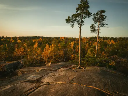
- Sommet de Finiels / Mont Lozère (1,699 m): The highest point in the Cévennes and the Mont Lozère massif. The GR68 crosses exposed granite upland here, with wide views in clear weather.
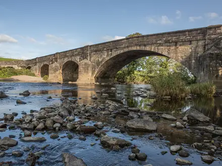
- Le Pont-de-Montvert: A historic granite village on the Tarn with an old arched bridge and tower. It is important for both the Camisard history and the overlap with Stevenson's GR70 route.
- Drailles and transhumance heritage: The route follows ancient drove roads marked by dry-stone walls and montjoie cairns. These tracks link the walk directly to the UNESCO-listed agro-pastoral landscape.
- Chestnut groves and terraced Cévenol hillsides: Lower southern stages pass old sweet-chestnut groves and stone-walled terraces, a marked contrast with the open Mont Lozère plateau.
- Heather moorland and high peat bogs: The high ground carries heather moors and Atlantic high-altitude peat bogs, with specialised plants and birdlife including capercaillie.
- Florac and the Tarn valley: Florac is a lively small town at the meeting of three rivers, gateway to the Tarn gorges and home to the Cévennes National Park headquarters in the Château de Florac.
Challenges to expect
The GR68 is not technically extreme, but the cumulative ascent, 25-28 km stage options and exposed Mont Lozère high ground make it strenuous. Expect rocky and stony drailles, dirt and grass tracks, cols, forest, moorland and terraced hillsides. Snow and fog can make winter and early spring hazardous on Mont Lozère. Some stages have limited services, so carry food, water and bad-weather gear.
HikeList Score
GR68 (Tour of Cévennes National Park) scored 92/100 on HikeList's trail-quality metrics.
See score breakdownHide breakdown
- Ideal length 96
- Balanced challenge 84
- Scenery & wildness 90
- Varied terrain 100
- Accommodation 92
- Food & support 88
- Path quality 98
- Season flexibility 89
Computed from length, challenge, scenery & wildness, terrain variety, accommodation, food & support, path quality and season flexibility.
 France
Show more data Show less
- Mountainous
- Moorland
- Forest
- Valley
- Terraced Hillsides
- Dirt
- Rocky
- Stony
- Grass
- Old Paved Drove Roads
- GîTes
- Guesthouses
- Hotels
- Huts
- Campsites
- Regulated Bivouac
- Family Friendly
- Pet Friendly
- Water Sources
- Campsites
- Shelters
- Picnic Areas
Download Our Full Guide to GR68 (Tour of Cévennes National Park) FREE!
Get our comprehensive guide to this hike for free. Save it for later reading or print out at home.
In these collections
Photos from hikers
Taken on the trail by people who've reviewed GR68 (Tour of Cévennes National Park).
GR68 (Tour of Cévennes National Park): The Complete Guide
 i
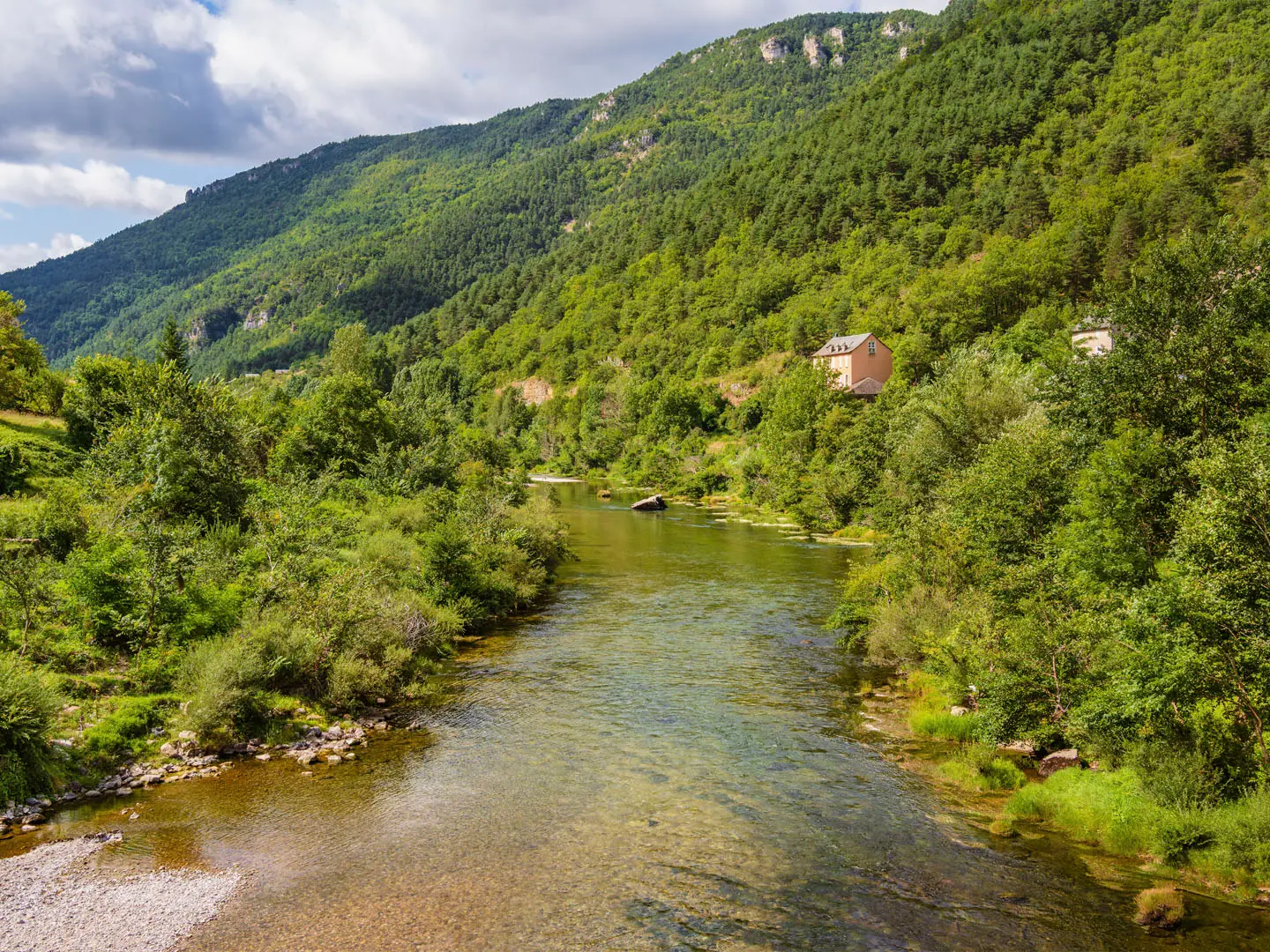
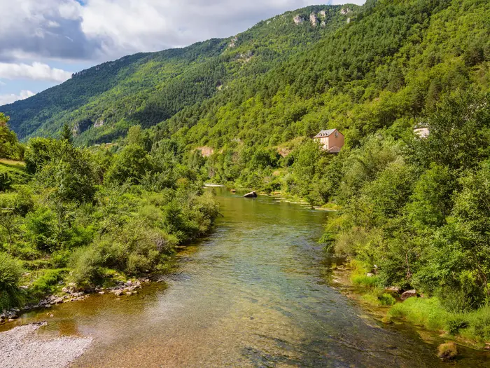
Image by SerFF79
i
Image by SerFF79 The GR68 Tour du Mont Lozère is a 116.5 km loop from Villefort in Lozère, circling the Mont Lozère massif through the Cévennes National Park. It is a hard 6–7 day mid-mountain walk for fit hikers who want a quiet, self-sufficient circuit rather than a busy point-to-point trail.
Its strength is contrast. The route climbs from railway-town Villefort to exposed granite upland, heather moorland and the Sommet de Finiels at about 1,699 m, then drops through Tarn-side settlements, chestnut groves and terraced Cévenol hillsides.
This is not just a mountain circuit. The path crosses the UNESCO-listed Causses & Cévennes agro-pastoral landscape, following sections of ancient drailles, or drove roads, once used for transhumance to Mont Lozère’s summer pastures and still marked by dry-stone walls and montjoie cairns.
The cultural layer is unusually strong for a GR route. Around Le Pont-de-Montvert the walk touches Camisard history and overlaps with the GR70, Stevenson’s Chemin de Stevenson, while Florac brings a practical valley stop and the Cévennes National Park headquarters at the Château de Florac.
Do not be misled by moderate ratings sometimes used in French route descriptions. Around 4,338 m of total ascent, exposed weather on the Finiels plateau, rocky old tracks and possible 25–28 km stages make this a serious walk, although a 7-day split makes the logistics and effort far more manageable.
Logistics are better than the terrain suggests: Villefort has an SNCF station on the Ligne des Cévennes, the loop removes any end-to-end transfer, and accommodation ranges from gîte d’étape, or walker’s hostel, to chambre d’hôtes, small hotels, campsites and regulated bivouac under park rules. This guide covers stages, daily planning, accommodation, food and water, transport, terrain, gear and common mistakes.
Stage-by-Stage Guide
The stage notes below follow the demanding 5-day HikeList split. For most walkers, the standard 6-day format is the better planning template: break Stage 4 at Mijavols and Stage 5 at Gourdouze, rather than trying to cover the two 28 km southern stages back-to-back.
Distances vary slightly by map, GPX track and local variant, so treat all stage lengths as approximate. The GR68 is waymarked throughout with red-and-white GR balisage, but several GR routes overlap around Mont Lozère, Florac and the Bougès ridge, so junctions need close attention.
Stage 1: Villefort to Le Bleymard
Approximate distance: 23-25 km
Start / finish: Villefort, about 591 m, to Le Bleymard, about 1,068 m
Key places: Villefort, L'Habitarelle / Altier, Bergognon, Cubières, Cubiérettes, Col du Sautel, Le Bleymard
This is a long opening stage with a substantial cumulative climb out of the Villefort valley. The route leaves a genuine railway town behind and moves quickly into Cévenol hill country: mixed forest, pasture, stone hamlets and rougher stony tracks.
The main climb builds towards the Col du Sautel at about 1,195 m, before descending to Le Bleymard in the upper Lot valley. Early in the day there can be views back towards Lac de Villefort, while Cubières and Cubiérettes give the stage its characteristic stone-village feel.
Underfoot, expect a mixture of rocky paths, forest tracks, grassy sections and older stony ways. There are no technical difficulties, but this is not a gentle first day: the climb, distance and heat in summer can make it harder than the map suggests.
Food and resupply should be treated as start-and-finish logistics. Villefort has services before departure, while Le Bleymard has useful hiker facilities including a Carrefour Express, bakery, butcher, tobacconist, restaurant, post office, ATM and doctor. Do not rely on finding a proper shop between the two.
Water is not documented as a major problem on this stage, but natural sources should be treated before drinking. Carry enough from Villefort to cover the climb and any warm-weather delays.
Le Bleymard is a key overnight stop with gîtes and other accommodation in and around the village. Options include Gîte Chez le Poulitou, Gîte de l'Escoutal at Bonnetès on the GR68 / GR70 / GR7 junction, Gîtes de France properties and village gîtes. Book ahead in the main walking season, especially if using baggage transfer.
Public transport is strongest at the start: Villefort has an SNCF station on the Ligne des Cévennes, useful for both arrival and departure because the GR68 is a loop. Le Bleymard has road access, but public transport for stage starts or bail-outs is limited. This should be checked before travelling.
Navigation is generally straightforward once on the GR, but take care leaving Villefort and at path junctions around hamlets. A late start is a poor choice on the 25 km version; the first day is long enough to justify an early departure.
Stage 2: Le Bleymard to La Fage
Approximate distance: 22.5-25 km
Start / finish: Le Bleymard, about 1,068 m, to La Fage, about 1,212 m
Key places: Le Bleymard, Chalet du Mont Lozère, Sommet de Finiels, Signal des Laubies, La Fage
This is the highest and most exposed stage of the GR68. From Le Bleymard the route climbs onto Mont Lozère, passes the Chalet du Mont Lozère at about 1,420 m and continues over the Sommet de Finiels, the highest point of the loop at about 1,699 m.
The character changes completely from the previous day. The walking is across open granite upland, heather moorland, peat bogs and rocky granite terrain, with wide views across the Cévennes and Massif Central in clear weather. The descent towards La Fage passes the Signal des Laubies, twisted pines and high meadows.
This stage overlaps the GR70 Stevenson Trail in the Mont Lozère / Finiels area. Le Pont-de-Montvert is an important GR70 village nearby and can be reached by diverting, but it is not a standard overnight on the main GR68 loop.
The Finiels plateau is the most serious weather section on the route. Wind, fog, thunderstorms and lingering spring snow can all make navigation and exposure much more difficult. Do not commit to the high ground in a thunderstorm, and carry map, compass and a working GPS track rather than relying only on painted marks in mist.
Water is limited on the high plateau. Fill up in Le Bleymard before the climb, and do not assume that upland sources will be usable. La Fage has a village fountain.
There is no major resupply between Le Bleymard and La Fage, so carry food for the full day. The Chalet du Mont Lozère is a useful waypoint on the high route, but it should not be treated as a guaranteed resupply stop without checking current opening and services.
La Fage is a small but important overnight stop. Gîte de la Fage, in a granite building at about 1,200 m, is a key accommodation option on this stage, with basic hiker facilities including kitchen and washing facilities. Booking is strongly advised because alternatives nearby are limited.
Road access exists at both Le Bleymard and La Fage, but this is not a stage to plan around easy public transport. Any taxi, shuttle or pick-up arrangement should be booked in advance. Baggage operators such as Transbagages and La Malle Postale cover the Tour du Mont Lozère and can make this exposed stage easier by reducing pack weight.
Navigation needs particular care where GR68, GR70 and other long-distance routes converge. After the Finiels crossing, follow the GR68 towards La Fage rather than drifting onto a GR70 line towards Le Pont-de-Montvert.
Stage 3: La Fage to Florac
Approximate distance: 16 km
Start / finish: La Fage, about 1,212 m, to Florac, about 546 m
Key places: La Fage, Champlong de Bougès forestry house, Trois Communes menhir, Fage menhir, Échine d'Aze, Col du Valat et des Ganses, Florac
This is the shortest stage of the 5-day itinerary and is mainly a descent from the upland edge into Florac. It is often the natural easier day in the schedule, useful for recovery after the Mont Lozère crossing or for spending extra time in Florac.
The route drops roughly 670 m overall, using forest paths and stony tracks before the final approach into the Tarn valley. Some sections on the descent can be rocky and steep underfoot, so tired legs still need attention despite the shorter distance.
The stage has strong landscape interest rather than high-mountain drama. It passes prehistoric standing stones, including the Trois Communes menhir and the Fage menhir, before descending towards Florac and the river valleys.
A water point is available at the Champlong de Bougès forestry house. Florac has full town services, so this is the best place on the loop to reset food, water, cash and equipment.
Florac is the main resupply hub of the GR68. Expect supermarkets, bakeries, cafés, restaurants, pharmacy, tourist office and ATM facilities. The Maison du Parc in the Château de Florac, the Cévennes National Park headquarters, is also useful for maps, guidebooks and local information.
Accommodation choice is much wider here than on the smaller village stages. Florac has hotels, gîtes, chambres d'hôtes and camping; examples include the Grand Hôtel du Parc, Gîte Carline-presbytère and Camping le Val des Cévennes. Prices and availability should be checked before booking.
Florac has road access and is one of the easier places on the loop to pause, rest or reorganise plans. The summer Lozère bus line 261 links Florac, Le Pont-de-Montvert and Col de Finiels from early July to the end of August, but timetables and operating dates should be checked before travelling.
Navigation into and out of Florac deserves care because multiple routes converge, including the GR70. Follow GR68 markings closely at junctions and do not assume every red-and-white waymark is taking the same onward line.
Stage 4: Florac to Saint-Maurice-de-Ventalon
Approximate distance: 28 km on the 5-day split
Start / finish: Florac, about 546 m, to Saint-Maurice-de-Ventalon, about 1,090 m
Key places: Florac, Col du Sapet, Signal du Bougès, Col de la Planette, Signal de Ventalon, Col de la Croix-de-Berthel, L'Aubaret, Saint-Maurice-de-Ventalon
This is the longest and most demanding day in the 5-stage itinerary. It climbs from the low point of the loop at Florac onto the Bougès ridge, with around 1,315 m of ascent if walked through to Saint-Maurice-de-Ventalon.
Most walkers should split this section at Mijavols, making Florac to Mijavols about 14.5 km in the standard 6-day itinerary. Gîte de Mijavols is the natural overnight break and turns a very hard mountain day into a much more manageable stage.
Leaving Florac, the route climbs steeply towards the Col du Sapet at about 1,080 m. The col is an important viewpoint over the southern Cévenol valleys and is associated with standing stones in the surrounding landscape.
The route then continues over the Bougès high ground, reaching the Signal du Bougès at about 1,421 m, the highest point on the southern half of the loop. From there it follows a col-and-ridge sequence via Col de la Planette, Signal de Ventalon and Col de la Croix-de-Berthel before reaching the L'Aubaret and Saint-Maurice-de-Ventalon area.
Terrain is a mix of forest paths, rocky tracks, ridge walking and old drailles, the traditional drove roads of the Cévennes. Views can be excellent from the higher ground, but the day is physically serious because the climbing continues after the first big ascent.
Food should be carried from Florac for the full day unless an overnight and meal have been booked at Mijavols. There is no reliable full resupply on the ridge section.
Water is limited on the high parts of the route. Fill up in Florac before leaving. L'Aubaret has water; if using a variant that passes Bédouès, water may be available at the cemetery, but this should not be relied on unless it is on the exact route being walked.
Accommodation near the end includes Gîte des Bastides at Saint-Maurice-de-Ventalon and La Cavale du Ventalon in the wider area. In the 6-day split, Gîte de Mijavols is the key midway stop. Book all of these in advance, as this is not a section with abundant last-minute options.
Road access exists at cols and villages, but public transport is not a practical assumption for this ridge stage. If a bail-out, pick-up or baggage transfer is needed, arrange it before leaving Florac.
Navigation is important on the Bougès and Ventalon ridges because GR and GR de Pays routes intersect. Watch the red-and-white balisage at every junction, especially in forest where a wrong turn can cost significant time.
If attempting the full 28 km stage, start very early. A late arrival in poor weather or fading light would be a serious planning error, particularly with limited services beyond Florac.
Stage 5: Saint-Maurice-de-Ventalon to Villefort
Approximate distance: 28 km on the 5-day split
Start / finish: Saint-Maurice-de-Ventalon, about 1,090 m, to Villefort, about 591 m
Key places: Saint-Maurice-de-Ventalon / L'Aubaret, Gourdouze, Tourèves, Col de Rabuzat, Belvédère des Bousèdes, Villefort
The final stage closes the loop back to Villefort, but it is not an easy walk-out. In the 5-day format it is another long day, with about 1,020 m of ascent and a walking time often in the 10-11 hour range.
The standard 6-day itinerary makes better use of Gourdouze as the overnight stop. That split usually turns the southern finish into Mijavols to Gourdouze, then Gourdouze to Villefort, with the final day still a solid 22 km.
The route passes through the L'Aubaret and Gourdouze area before crossing towards Tourèves near Génolhac, briefly entering the Gard department. It then climbs or traverses towards the Col de Rabuzat at about 1,099 m before the final descent towards Villefort.
Terrain is mixed: forest paths, ridge sections, stony tracks and long descents through the Malmontet state forest. The Belvédère des Bousèdes gives a final viewpoint before the return to Villefort.
There are useful intermediate accommodation and meal options if the full stage is too long. Gourdouze has chambre d'hôtes / gîte accommodation with table d'hôtes and bivouac facilities, while Tourèves has a recognised gîte d'étape and chambres d'hôtes with dormitory, guest rooms, meals and packed lunches available by arrangement. Current opening, meals and prices should be confirmed before booking.
Food and water planning depends heavily on whether the stage is split. Carry enough from Saint-Maurice-de-Ventalon if walking through to Villefort, and do not count on casual resupply unless accommodation or meals have been booked at Gourdouze or Tourèves.
Génolhac provides a practical alternative break or bail-out point with transport links in the wider Tourèves area. Villefort, at the end of the stage, has the main railway advantage: its SNCF station on the Ligne des Cévennes allows departure without arranging an end-to-end transfer.
Navigation is generally well waymarked, but tiredness is a real risk on this final long stage. Pay attention around hamlets, forest junctions and the approach to the final descent, where a missed turn can add unwelcome distance late in the day.
The main warning is time. Do not leave Saint-Maurice-de-Ventalon late if intending to reach Villefort in one push; if weather, pace or accommodation plans are uncertain, split the stage at Gourdouze or Tourèves instead.
Recommended Itinerary
The GR68 is a loop, so the most straightforward plan is to start and finish in Villefort, using its SNCF station on the Ligne des Cévennes for arrival and departure. The route can be walked in either direction, but the anticlockwise split below (Villefort → Le Bleymard → La Fage → Florac, then the southern return) is the most common and gives a logical progression over Mont Lozère early in the walk.
Distances are approximate. Stage-guide totals for the six-day itinerary add up to slightly more than the 116.5 km GPS loop distance, which is normal where guides include minor approach or village variations. Check official mapping before booking accommodation, especially if shortening or re-dividing stages.
A gîte d'étape is a walker’s hostel, usually with dormitory accommodation and often half-board. A chambre d'hôtes is closer to a guesthouse or B&B. On this route, several overnight stops have very limited choice, so the itinerary should be built around confirmed beds rather than assumed village services.
Standard 6-day itinerary — best for most walkers
This is the sensible default for fit hikers: still demanding, but better balanced than the five-day version. It keeps the long Mont Lozère crossing as a full mountain day and avoids combining too many 25 km-plus stages back-to-back.
| Day | From | To | Approx. distance | Why this stage makes sense | Services/accommodation notes |
|---|---|---|---|---|---|
| 1 | Villefort | Le Bleymard | ~23 km | A substantial opening stage from the rail-access start, ending at a natural overnight village on the GR network before the high Mont Lozère crossing. | Villefort has the station, shops, restaurants, hotels and tourist information. Le Bleymard has gîte options and a bakery, but limited shops; book ahead, especially in July–August when GR70 Stevenson walkers also pass through. |
| 2 | Le Bleymard | La Fage | ~22.5 km | The key mountain stage: the route climbs via the Chalet du Mont Lozère and crosses the Sommet de Finiels at about 1,699 m, the highest point in the Cévennes. | The Chalet du Mont Lozère can provide accommodation and meals, but it is often treated as a waypoint rather than the end of the day. La Fage has very limited services; the gîte is essentially the overnight option and there are no shops, so meals or provisions must be planned in advance. |
| 3 | La Fage | Florac | ~16 km | The shortest and easiest walking day, useful after the exposed Finiels stage. The descent towards Florac gives a natural recovery stage and reaches the main service town on the loop. | Florac is the best resupply point: supermarket, bakery, butcher, restaurants, cafés, hotels, gîtes d'étape, chambres d'hôtes, pharmacy, outdoor/hiking gear shop and tourist information. The Cévennes National Park headquarters are at the Château de Florac. |
| 4 | Florac | Mijavols | ~14.5 km | A short stage out of Florac, allowing time for a slower morning, resupply or route admin before heading back into smaller hamlets. It also positions the walk before the long Mijavols to Gourdouze stage. | Mijavols is very limited. Expect rural gîte-style accommodation rather than a village with shops or restaurants; advance booking is essential. Le Pont-de-Montvert is a useful alternative overnight/service point when re-dividing this part of the route. |
| 5 | Mijavols | Gourdouze | ~25 km | The longest day of the standard itinerary and one of the tougher days overall, but it works because the previous stage is short. Expect a more committing rural stage with fewer services. | Gourdouze has gîte/chambre d'hôtes accommodation in old granite buildings, table d'hôtes, packed lunches and a bivouac camping option. Do not rely on ordinary shops on this stage. |
| 6 | Gourdouze | Villefort | ~22.1 km | A final full walking day closing the loop back to Villefort, with enough distance to be serious but not as long as the previous day. | Villefort has rail departure, accommodation, restaurants and shops. Génolhac, also on the Ligne des Cévennes, is a useful alternative break or bail-out point near the final part of the loop. |
Faster 5-day itinerary — strong walkers only
The five-day split matches the more demanding stage pattern used on the HikeList route data. It is only suitable for strong, experienced walkers who are comfortable with 25–28 km days on mid-mountain terrain and with limited services between overnight stops.
| Day | From | To | Approx. distance | Why this stage makes sense | Services/accommodation notes |
|---|---|---|---|---|---|
| 1 | Villefort | Le Bleymard | ~25 km | A hard opening day that reaches the main overnight base before the Mont Lozère crossing. | Start with food and water organised in Villefort. Le Bleymard has gîte accommodation and a bakery, but it is not a full resupply town. |
| 2 | Le Bleymard | La Fage | ~25 km | A long, exposed high-level day crossing the Sommet de Finiels at about 1,699 m via the Chalet du Mont Lozère. This is the decisive mountain stage of the route. | No services at the summit. The Chalet du Mont Lozère is the main waypoint before the high ground. La Fage has no shops; the gîte and table d'hôtes arrangements should be booked before setting out. |
| 3 | La Fage | Florac | ~16 km | A shorter recovery stage into the main town on the loop, useful after two demanding days. | Florac is the best place for laundry, food resupply, pharmacy, outdoor kit and a proper meal. It is also the most logical place to adjust plans if weather or fatigue is becoming a problem. |
| 4 | Florac | Saint-Maurice-de-Ventalon | ~28 km | A very long stage that compresses the eastern/southern side of the loop. This should not be treated as an easy valley day despite starting in Florac. | Services are limited after Florac. Saint-Maurice-de-Ventalon has limited gîte accommodation, including Gîte Les Bastides in route descriptions; book ahead and carry food as needed. |
| 5 | Saint-Maurice-de-Ventalon | Villefort | ~28 km | Another very long day to close the loop, with significant cumulative fatigue after the previous 28 km stage. | Finish in Villefort for rail departure or an overnight stay. This final day should only be attempted with a confirmed weather window, early start and enough food and water. |
Slower 7-day variant — more recovery and flexibility
A seven-day plan is best for walkers who want more time in Florac, prefer a lower-pressure schedule, or need flexibility around weather on the Mont Lozère high ground. The simplest seven-day version keeps the standard walking stages but adds an extra night in Florac, the only town on the loop with broad services.
| Day | From | To | Approx. distance | Why this stage makes sense | Services/accommodation notes |
|---|---|---|---|---|---|
| 1 | Villefort | Le Bleymard | ~23 km | Follows the standard first stage and reaches the best-positioned overnight before Mont Lozère. | Villefort is the rail-access start. Le Bleymard has gîtes and a bakery, but accommodation should be booked early in the main season. |
| 2 | Le Bleymard | La Fage | ~22.5 km | Keeps the Sommet de Finiels crossing as a dedicated mountain day rather than splitting the high section awkwardly. | La Fage is very limited and has no shops. Reserve accommodation and meals in advance. |
| 3 | La Fage | Florac | ~16 km | A shorter descent into the main service town, giving time for resupply on arrival. | Florac has the widest choice of accommodation, food shops, restaurants, pharmacy and hiking supplies on the GR68. |
| 4 | Florac | Florac | 0 km rest/service day | Adds recovery after the high crossing and creates a buffer before the more remote southern stages. This is the best place on the loop for a rest day. | Use the day for resupply, laundry, repairs, visiting the Château de Florac and checking the next accommodation bookings. Many walkers use Florac as the place to decide whether to continue, shorten or re-divide the loop. |
| 5 | Florac | Mijavols | ~14.5 km | A short restart after the rest day, avoiding a rushed departure from Florac. | Mijavols has very limited services and rural gîte accommodation. There should be no assumption of shops or restaurants beyond the booked overnight. |
| 6 | Mijavols | Gourdouze | ~25 km | Still the longest walking stage in this version, but it comes after a rest day and a short stage rather than being stacked into a compressed schedule. | Gourdouze offers accommodation, table d'hôtes, packed lunches and a bivouac option. Reserve ahead; capacity is limited. |
| 7 | Gourdouze | Villefort | ~22.1 km | A final full day back to Villefort, completing the loop without needing an onward trail transfer. | Villefort has the SNCF station, accommodation and town services. Génolhac can be used as an alternative break or exit near this side of the loop. |
If the aim is to reduce walking distance rather than add a rest day, split the Mijavols to Gourdouze section with a mid-stage gîte, or re-divide the Florac side of the route using Le Pont-de-Montvert as an overnight. Exact distances and current accommodation availability for these custom splits should be checked before travelling.
Booking implications
Accommodation is the main constraint on the GR68. Le Bleymard, La Fage, Mijavols and Gourdouze do not all function like full resupply towns, and some stops depend on one or two small gîtes. In July and August, aim to book several weeks ahead; at quieter times, still contact each gîte before committing to a stage plan.
Baggage transfer is possible with operators such as Transbagages and La Malle Postale. Transbagages lists Tour du Mont Lozère luggage transport from about €7.50 per bag per stage with a 15 kg limit; current prices, booking cut-offs and eligible stages should be checked before travelling.
Planning the Route
How many days to allow
The GR68 is best planned as a 6-day walk for most fit hikers. This is the standard FFRandonnée and local tourism split, and it gives a sensible balance between long mountain days and realistic accommodation stops.
A 7-day itinerary is often the better choice if you want time in Florac, a less rushed crossing of Mont Lozère, or shorter days around Le Pont-de-Montvert and the Cévenol valleys. Some walkers stretch the loop to 8 days by adding nights around Le Pont-de-Montvert or L'Aubaret.
A 5-day itinerary is possible, but it is a hard version of the route. The common 5-stage split includes two days of about 28 km, including Florac to Saint-Maurice-de-Ventalon and the final return towards Villefort, which leaves little margin for heat, storms or slow-going terrain.
| Pace | Typical use | Planning note |
|---|---|---|
| 5 days | Strong, fast walkers | Demanding; expect long 25–28 km days and limited recovery time. |
| 6 days | Standard full route | Best default for most hikers booking gîtes and walking the full loop. |
| 7 days | More comfortable | Better for hot weather, photography, village time and shorter daily loads. |
| 8 days | Slow itinerary | Works by adding extra nights at places such as Le Pont-de-Montvert or L'Aubaret. |
Standard 6-day stage plan
The 6-day split is the most practical starting point because it follows the natural accommodation rhythm of the loop. Distances vary slightly by mapping source and local variant, so treat them as approximate when booking.
| Day | Stage | Approx. distance | Planning notes |
|---|---|---|---|
| 1 | Villefort → Le Bleymard | 23 km | A full first day from the railway-town start; book Le Bleymard accommodation ahead. |
| 2 | Le Bleymard → La Fage | 22.5 km | The high Mont Lozère day, via the Chalet du Mont Lozère and Sommet de Finiels; carry food and water. |
| 3 | La Fage → Florac | 16 km | Shorter day and a useful recovery window; Florac is the best service and resupply point. |
| 4 | Florac → Mijavols | 14.5 km | Shorter stage after Florac, useful before the tougher southern high ground. |
| 5 | Mijavols → Gourdouze | 25 km | Longer and more committing; check food, water and accommodation before leaving. |
| 6 | Gourdouze → Villefort | 22.1 km | Closes the loop back to the SNCF station at Villefort. |
Should it be walked fast or slowly?
This route rewards a slower plan. The Finiels summit, Le Pont-de-Montvert, the Tarn valley and Florac are not places to rush through simply to save a night.
Fast itineraries also leave less margin for weather. Mont Lozère is exposed, and in July and August the lower Cévenol valleys can be very hot; pushing 28 km stages in heat is a poor trade-off unless fitness, pack weight and accommodation logistics are all firmly under control.
The loop format removes one common pressure: there is no separate end-point transfer to catch. Once back in Villefort, the same railway access used at the start is available for onward travel, subject to train timetables.
Accommodation dictates the route
Daily stages are strongly shaped by where beds exist. This is not a route where every valley has several convenient fallback options, and services are thin on several sections.
The high ground between Le Bleymard and La Fage is the clearest example. The route crosses the Mont Lozère plateau via the Chalet du Mont Lozère and the Sommet de Finiels, but there are no shops or village services on the summit plateau itself.
Between Florac and Saint-Maurice-de-Ventalon, the route crosses the Signal du Bougès area, again with limited opportunities to change plans once committed. The practical overnight bases include Villefort, Le Bleymard, La Fage, Florac, Mijavols, Gourdouze, Saint-Maurice-de-Ventalon and L'Aubaret, with Génolhac also useful because it has accommodation and a railway station.
Advance booking is the single most important planning task, especially from June to September and particularly in July–August. Gîtes d'étape — walkers' hostels often offering dinner and breakfast — and chambres d'hôtes, or guesthouses, can fill quickly on popular stage combinations.
The Cévennes-Mont Lozère tourist office can assist with accommodation planning and provides the local 'Voyage au cœur du Mont Lozère' material. Contact details: [email protected] / +33 (0)4 66 45 81 94. Current opening times and booking arrangements should be checked before travelling.
Food and resupply
Plan food around gîte meals, not shops. Many walkers use demi-pension — dinner and breakfast at the gîte — and carry lunch and snacks for the day.
Florac is the strongest resupply point on the loop, with town services and a supermarket. Le Bleymard has more limited services. On the high plateau day from Le Bleymard to La Fage, carry enough food before leaving because there are no shops on Mont Lozère.
For remote stages, start the day with lunch already packed. Do not rely on finding an open shop, café or refuge at exactly the right time unless it has been checked directly before setting off.
Water planning
Water needs careful management on Mont Lozère and the more exposed upland sections. Streams and springs exist, but they are not something to depend on in dry summer conditions.
Carry at least 1.5–2 litres from the last reliable source before heading onto the summit plateau. Treat or filter mountain water if there is any doubt about its quality.
Hot weather changes the calculation quickly. In July and August, the lower valleys can be demanding, so increase carrying capacity if walking long stages or using a fast itinerary.
Navigation and maps
The GR68 is marked with red-and-white GR balisage, the standard painted waymarking used on French long-distance trails. It is generally straightforward to follow in normal visibility.
Navigation becomes more serious on the exposed Finiels ridge and the Mont Lozère high ground. Mist, low cloud, snow patches or storm conditions can make the plateau disorientating, so do not rely on waymarks alone.
Carry the IGN 2739OT map, which covers Mont Lozère and Florac at 1:25,000, and use the FFRandonnée topoguide T481 / FFRP 631, 'Tours du Mont Lozère et du Causse Méjean', for stage descriptions and accommodation listings. A GPX/KML file is available from the Cévennes National Park route page and is a useful backup, but it should not replace map-reading ability.
Transport planning
Villefort is the key access point because it has an SNCF station on the Ligne des Cévennes, also known as Le Cévenol. TER trains link it with Clermont-Ferrand and Nîmes/Montpellier-Saint-Roch, making this one of the more practical French mountain loops to reach without a car.
Because the GR68 returns to Villefort, there is no end-to-end transfer problem. The main transport task is choosing train times that fit the first and final night, and checking current SNCF or regional journey planners before booking accommodation.
Génolhac also has a station on the Ligne des Cévennes, which makes it useful for section hiking or shortening the loop. Florac is reachable by bus line 251 between Mende, Florac and Alès. In July–August, seasonal lines 261, 253 and 254 serve areas including Le Bleymard, Le Pont-de-Montvert and Mont Lozère; outside summer, these options are much more limited and this should be checked before travelling.
Taxis by reservation can fill gaps where buses do not run. Do not design an exit from an intermediate village without checking the actual timetable or pre-booking onward transport.
Shortening, extending and section hiking
Section hiking is practical, but it needs more transport planning than the full loop. Villefort and Génolhac are the strongest rail-based access points, while Florac works for bus-based access when timetables align.
A simple way to divide the route is to walk Villefort to Florac over one trip, then Florac back to Villefort on another. This keeps the loop logic while avoiding the need to complete the whole circuit in one holiday.
Shorter local variants also exist. A 3-day Génolhac triangle uses Génolhac → Villefort (14 km), Villefort → Gourdouze (17.2 km) and Gourdouze → Génolhac (10.8 km), making a compact weekend-style sample of the southern side.
A 4-day northern option runs Villefort → Altier (12.1 km), Altier → Le Bleymard (16.8 km), Le Bleymard → Mas de la Barque (22.5 km) and Mas de la Barque → Villefort (13.3 km). This focuses planning around the Mont Lozère side of the route.
Experienced long-distance walkers can extend the GR68 by linking it with nearby GR routes. The GR70, the Stevenson trail, overlaps around Le Pont-de-Montvert and Mont Lozère, while GR6, GR7 and GR44 connections open up longer Cévennes itineraries.
Baggage transfer and shuttles
Baggage transfer is available and can make the longer stages much more manageable. This is particularly useful on the Finiels crossing and the 25 km-plus stages, where carrying a full multi-day pack adds significantly to the effort.
Transbagages serves the Tour du Mont-Lozère and lists baggage transfer at about €7.50 per bag per stage, with a 15 kg limit, booking by the day before and luggage ready by 08:00. Current prices, limits and booking deadlines should be confirmed before booking.
La Malle Postale also provides luggage transfer and passenger shuttle services for the route. Current rates and reservations are available via +33 04 71 04 21 79 or [email protected].
Bivouac rules and permits
No special permit is required to walk the GR68. The main regulation that affects planning is bivouac, or lightweight overnight camping, inside the Cévennes National Park core zone.
Bivouac is permitted only under strict conditions: within 50 metres of a marked GR or GRP trail, between 19:00 and 09:00, for one night only, by non-motorised hikers, and with a low tent that does not allow standing inside. Certain sensitive areas prohibit bivouac entirely, including sections near Finiels on the GR70 overlap.
Fire and stove rules are also controlled; use a portable stove only where permitted and keep more than 200 metres from woodland. The park's dynamic regulatory map should be checked before planning any night outside formal accommodation.
Weather windows
Late May–June and September–October are usually the best planning windows: cooler than midsummer, less crowded than peak season, and often clearer on the high ground. Accommodation is also generally easier to secure than in July–August.
July and August are viable but require more heat management and earlier booking. Afternoon thunderstorms are common in summer, so high sections such as the Finiels ridge should be started early and avoided in unstable weather.
Winter and early spring are poor choices for most walkers. Snow and fog can make Mont Lozère hazardous, and snow can linger on the summit into May.
Planning priorities checklist
| Priority | Why it matters on the GR68 |
|---|---|
| Accommodation | Beds are limited on several stages; book gîtes and guesthouses ahead, especially June–September. |
| Food | Shops are sparse outside key settlements; rely on gîte meals and carry lunches for remote days. |
| Water | The Mont Lozère plateau can be dry in summer; carry enough before exposed sections. |
| Navigation | Waymarking is good, but Finiels and other high ground can be confusing in mist or snow. |
| Transport | Villefort rail access is excellent for a loop; section hikes need careful bus, rail or taxi planning. |
| Weather | Heat, storms, fog and lingering snow can all affect stage timing. |
| Bivouac rules | Legal camping is restricted inside the national park core zone; check the park map before relying on it. |
Towns, Villages and Overnight Stops
Accommodation on the GR68 is mostly in gîtes d'étape, chambres d'hôtes, small hotels, campsites and occasional mountain-style stops. Services are uneven: Florac is the only place on the loop with full supermarket resupply, while several overnight hamlets have no shop at all.
Book ahead from June to September, especially in Le Bleymard, La Fage, Florac, Le Pont-de-Montvert and the smaller stops between Florac and Villefort. Many gîtes offer a table d'hôtes evening meal, but this normally needs reserving when the bed is booked.
Baggage transfer is possible on the Tour du Mont Lozère with operators such as Transbagages and La Malle Postale. Transbagages lists the route from about €7.50 per bag per stage with a 15 kg limit; current prices and booking conditions should be checked before travelling.
Villefort
Villefort is the start and finish of the loop, and the most practical place to arrive the night before walking. It has an SNCF station on the Ligne des Cévennes, served by TER trains on the Clermont-Ferrand to Nîmes / Montpellier-Saint-Roch axis, making it the natural public-transport gateway for the GR68.
For a small mountain town, Villefort is useful for pre-walk logistics. Services include an 8 à Huit convenience store, pharmacy, tourist office and a range of local accommodation, including Camping Lac de Villefort, chambres d'hôtes, gîtes ruraux and small hotel or B&B options.
It is the best place to buy last-minute food, gas availability should be checked locally, and train times should be checked before committing to a same-day start. Most walkers will be better served by sleeping in Villefort and beginning Stage 1 early, especially if continuing all the way to Le Bleymard.
Altier / L'Habitarelle
Altier and L'Habitarelle come early on the first day out of Villefort, on the approach towards Cubières and Le Bleymard. They can be useful for walkers deliberately shortening the first stage, but they are not reliable resupply points.
Accommodation in and around the Altier commune is mainly rural gîte-style lodging. There is no dependable village shop on the route here, so food for the day should be carried from Villefort.
This area sits close to the Cévennes National Park boundary, so bivouac rules matter if using a tent rather than booked accommodation. In the park core zone, regulated bivouac is allowed only between 19:00 and 09:00, within 50 m of a marked GR or GRP trail, using a low tent and with no open fires; some sensitive sections are closed to bivouac entirely.
Cubières and Cubiérettes
Cubières and Cubiérettes are small neighbouring settlements on Stage 1 between Altier and Le Bleymard. They are useful waypoints, but should not be treated as food stops.
Cubières has gîte provision, including Les Alpiers gîte d'étape, and there are also holiday gîte options in the area. This makes the area a possible break point for walkers who do not want to complete the full Villefort to Le Bleymard stage in one push.
Resupply is very limited. Carry food and enough water from Villefort unless accommodation has specifically arranged meals.
Le Bleymard
Le Bleymard is one of the key overnight stops on the GR68 and the usual end of the first stage on both the demanding 5-day version and the standard 6-day split. It sits at about 1,060 m and is the last substantial village before the Mont Lozère crossing.
This is a proper trail crossroads: the GR68, GR70 Stevenson Trail, GR44 and GR7 all converge here. That makes it lively in walking season, but it also means beds can fill quickly.
Le Bleymard has real services, including shops in the village centre, a doctor, post office and ATM. It is the place to buy food for the next day, as the route then climbs towards the Chalet du Mont Lozère and the Sommet de Finiels.
Accommodation includes gîtes d'étape such as Chez le Poulitou and L'Escoutal, as well as Village Gîtes du Bleymard and other gîte listings. Book well ahead in summer, and reserve dinner if relying on a gîte meal.
Chalet du Mont Lozère and Sommet de Finiels
The Chalet du Mont Lozère, at about 1,420 m, is a high-level waypoint on the Le Bleymard to La Fage stage. It is not the usual overnight stop for GR68 walkers, but it can be a useful shelter or service point on the climb towards the high plateau.
Opening status and facilities should be checked before relying on it. The route continues over the Sommet de Finiels at about 1,699 m, the highest point of the GR68 and of the Cévennes.
There is no ordinary village resupply on this section. Leave Le Bleymard with food, water capacity and weather protection suitable for exposed upland terrain; fog, wind and poor visibility can make this stage significantly more serious than its distance alone suggests.
Le Pont-de-Montvert
Le Pont-de-Montvert is one of the most worthwhile stops on or close to the GR68 line, particularly where the route overlaps with the GR70 Stevenson Trail around Mont Lozère. Depending on the stage split, it may be a passage point rather than a formal overnight, but it has enough services to make it a practical halt.
The village sits on the Tarn and is strongly linked to the Camisard uprising: the assassination of the Abbé du Chayla in 1702 took place here. The arched bridge and defensive tower are listed historic monuments, and the Stevenson connection brings additional walker traffic.
Shops are around 300 m from the trail, and the village has hotel, auberge and gîte options. Accommodation includes Hôtel Aux Sources du Tarn and Auberge des Cévennes, along with holiday gîtes and rentals.
The local tourist office, Office de Tourisme Des Cévennes au Mont Lozère, is in the village. Le Pont-de-Montvert is a good place for a longer break even if not overnighting, but accommodation should still be booked ahead in season.
La Fage
La Fage is the usual overnight after the Mont Lozère crossing. It is an isolated mountain hamlet at about 1,200 m, in the commune of Saint-Étienne-du-Valdonnez, and should be treated as a booked gîte stop rather than a service village.
The main accommodation is the Gîte de La Fage, offering gîte d'étape and chambres d'hôtes-style lodging. It has small rooms, shared facilities in some rooms, kitchen facilities and a table d'hôtes by reservation.
There is no village shop, so the practical choice is to book dinner in advance or carry food from Le Bleymard. La Fage works well as a quiet recovery stop after the exposed Finiels crossing, but it requires planning because alternatives nearby are limited.
Florac
Florac, officially Florac Trois Rivières, is the main town on the GR68 and the most important resupply point on the entire loop. It sits low in the valley at about 546 m, at the meeting of the Tarn, Tapoul and Mimente, and is the natural rest-day option.
This is the only place on the route with full supermarket resupply. Carrefour Market and Intermarché Super are available, along with bakeries including La Gourmandine, the Biojour organic shop, and a Thursday morning market; in July and August there is also a Tuesday night market.
Accommodation is far broader than in the smaller villages. Options include the Grand Hôtel du Parc, Centre d'Accueil des Cévennes, Camping le Val des Cévennes about 1.5 km from town on the Tarn, plus multiple chambres d'hôtes and holiday rentals.
Florac also houses the Cévennes National Park headquarters at the Château de Florac, along with the Maison du Tourisme et du Parc National des Cévennes. Bus line 251 links Mende, Florac and Alès, and Florac is also served by the liO bus network; current timetables should be checked before using it as an access or exit point.
Stock up carefully here for the next section over the Signal du Bougès and onwards towards Saint-Maurice-de-Ventalon, Mijavols or Gourdouze, depending on the chosen split. After Florac, services become thin again.
Col du Sapet and Signal du Bougès
The climb out of Florac towards the Col du Sapet and Signal du Bougès is a strenuous, exposed part of the eastern side of the loop. These are route features rather than overnight stops.
Do not count on shops or accommodation on the high ground itself. Carry food from Florac, check the weather, and allow for a long day if walking the 5-day version from Florac to Saint-Maurice-de-Ventalon.
Cassagnas / Saint-Maurice-de-Ventalon
Cassagnas and Saint-Maurice-de-Ventalon sit on the long section after Florac, once the route has crossed the higher ground around the Signal du Bougès. On the demanding 5-day HikeList split, Saint-Maurice-de-Ventalon is the listed Stage 4 overnight after roughly 28 km from Florac.
Services are limited. Cassagnas is a small hamlet on the GR70, while Saint-Maurice-de-Ventalon has gîtes and chambres d'hôtes in the wider commune but no reliable village shop on the GR68 line.
Accommodation in the area includes rural gîtes and chambres d'hôtes, with the Gîte des Bastides referenced as a local landmark and Hôtel La Remise noted nearby within the national park. Exact availability, meal provision and pick-up arrangements should be checked before travelling.
This is one of the sections where booking ahead matters most. Walkers without a reservation should not assume there will be spare beds or evening food available.
Mijavols and Gourdouze
The standard 6-day itinerary uses additional intermediate stops at Mijavols and Gourdouze between Florac and Villefort. These help break up the long final half of the loop, avoiding the very demanding back-to-back 28 km stages of the 5-day version.
These are small hamlet stops with basic gîte provision rather than full-service villages. Food, dinner and breakfast arrangements should be made directly with the accommodation when booking.
For most walkers, the 6-day split is the more sensible way to handle this part of the GR68. It gives more margin for weather, fatigue and the cumulative ascent of the route.
Col de la Croix-de-Berthel and L'Aubaret
The Col de la Croix-de-Berthel and L'Aubaret fall on the later part of the loop as the route works back towards the southern and western side of Mont Lozère. They are useful route markers, but should not be treated as guaranteed resupply points.
Accommodation or services in this section are sparse and scattered. If planning to stop around L'Aubaret rather than continue to a better-established village or booked gîte, arrangements should be made in advance.
This is also a section where carrying a little spare food is sensible. The route is not remote by high-mountain standards, but the service pattern is thin enough that a closed gîte or missed meal can cause problems.
Vialas / Génolhac area
The final approach back towards Villefort passes through or near the Vialas and Génolhac area, a lower, more wooded part of the loop. This area is useful not only for accommodation but also for section-hiking logistics.
Génolhac is the important practical point because it has an SNCF station on the Ligne des Cévennes. It can be used as an alternative entry or exit point for walkers splitting the GR68, shortening the loop, or needing to leave the route before returning to Villefort.
Accommodation in the area includes Toureves gîte at Génolhac, with rooms, dormitory space, kitchen facilities and an independent rural gîte, plus other gîtes and B&Bs in the wider area. Vialas also has holiday-rental accommodation nearby, though access to shops and the exact position relative to the trail should be checked when booking.
The section from this area back to Villefort is the closing part of the loop. If using Génolhac as a rail exit, train times should be checked carefully, as rural services may not suit a late finish.
Getting to the Start
Villefort is the start and finish of the GR68, so the main task is getting to Villefort rather than arranging a through-transfer. The town has its own SNCF station on the Ligne des Cévennes, and the trail leaves from close to the station, making rail the simplest approach for most hikers.
Arriving the evening before starting is strongly recommended. The first stage out of Villefort is a long mountain day towards Le Bleymard, and rural transport in Lozère is limited enough that same-day connections can leave very little margin.
By train
Gare de Villefort is on the Ligne des Cévennes, also known as Le Cévenol, between Clermont-Ferrand and Nîmes. It is served by TER Occitanie and TER Auvergne-Rhône-Alpes services, including Clermont-Ferrand ↔ Nîmes trains and a Mende ↔ Nîmes service.
This is the best public-transport option for the GR68. Villefort station is in the start town itself, has a car park, and the GR68 heads north from near the station, so no onward transfer is normally needed once you arrive.
Typical rail approaches are:
| Starting point | Usual route to Villefort | Typical journey time |
|---|---|---|
| Nîmes | Direct TER to Villefort | about 1 hr 30 min |
| Montpellier-Saint-Roch | TER to Nîmes, then TER to Villefort | about 3 hr 05 min |
| Clermont-Ferrand | TER south on the Ligne des Cévennes | about 3.5–4 hr |
| Paris | TGV from Paris Gare de Lyon to Nîmes, then TER to Villefort | about 5–6 hr total |
Nîmes is the key interchange, with TGV connections from Paris, Lyon, Marseille and Avignon, and frequent regional trains from Montpellier-Saint-Roch. For many international travellers, the simplest rail plan is to reach Nîmes first, then take the TER up the Cévennes line to Villefort.
Services are not frequent. There are typically around five trains per day between Villefort and Nîmes, with slightly better coverage in summer, but timings vary by direction and season. This should be checked before travelling.
Use SNCF Connect for current timetables and disruption notices. The Ligne des Cévennes is a rural mountain railway and can be affected by engineering works or service changes, so do not rely on old printed timetables when planning the first walking day.
Génolhac, the next station south of Villefort on the same line, can be useful as a fallback or for alternative section plans because the GR68 also passes through the Vialas/Génolhac area later in the loop. If arriving at Génolhac for a Villefort start, a taxi is the practical onward option; walking between Génolhac and Villefort is possible via the GR700, but it adds a separate approach walk.
By bus
Bus access exists, but it is much less convenient than the train. Lozère bus services are limited outside summer and should be treated as useful backups or section-hiking links rather than the main way to reach the official start.
liO line 254 links Mende, Le Bleymard, Lac de Villefort and La Garde Guérin, serving Villefort and the GR68 village of Le Bleymard. It runs only on limited days, approximately Tuesday, Thursday and Saturday, and timetables change seasonally. This should be checked before travelling.
In July and August, extra liO services improve access to the Mont Lozère area. These include seasonal lines serving Florac, Le Pont-de-Montvert, Mont Lozère, Bagnols-les-Bains and Le Bleymard, which can be useful for joining or leaving the route away from Villefort.
Line 251 links Mende, Florac and Alès year-round, but it does not go directly to Villefort. It is more relevant for hikers joining the GR68 at Florac or combining the route with another itinerary.
For current bus times, use the liO Occitanie journey planner at plan.lio-occitanie.fr. Rural bus frequency is sparse, so a missed connection can mean losing most of a day.
Taxis are useful for filling gaps in public transport, especially from Génolhac station, from a gîte outside town, or if a bus does not run on the required day. Villefort has local taxi operators, including Taxi Transport Jean-Louis and Taxi Thomas Fabien; advance reservation is strongly advised. The Office de Tourisme Mont Lozère can help with local contacts.
By car
Driving to Villefort is straightforward and gives the most flexibility, particularly if aiming for an early start. The town sits on the D901 and D906, but roads through the Cévennes are winding, so allow extra time for the final approach.
Approximate road approaches are:
| From | Approximate distance / time |
|---|---|
| Nîmes | 96 km / about 1 hr 35 min |
| Montpellier | 148 km / about 2 hr 15 min |
| Lyon | 265 km / about 3 hr |
| Le Puy-en-Velay | 85 km south |
| Mende | 55 km west |
| Alès | 55 km south |
Because the GR68 is a loop, leaving a car in Villefort is much simpler than on a point-to-point trail. The station has a free car park, which is a practical place to start and finish the walk.
Before leaving a vehicle for 6–7 days, check current long-stay arrangements with the station or mairie. This should be checked before travelling, especially in holiday periods or if planning to leave a vehicle outside the railway car park.
From the nearest airport
Nîmes Alès Camargue Cévennes Airport is the closest useful airport for many walkers, about 85 km from Villefort, but it has limited international routes. From there, travel into Nîmes for the TER to Villefort, or hire a car.
Montpellier Méditerranée Airport is around 150 km from Villefort and is better connected internationally. The usual public-transport route is airport transfer to Montpellier-Saint-Roch, train to Nîmes, then TER to Villefort.
Other workable airport approaches include Marseille Provence, with good onward rail links towards Nîmes, and Lyon Saint-Exupéry, usually via TGV and then the TER connection from Nîmes. Le Puy-en-Velay Airport is closer by distance but has very limited scheduled services, so it is mainly useful for travellers already within the region.
For many UK visitors, Montpellier or Nîmes plus train to Villefort is the simplest plan. For travellers already in France, Paris Gare de Lyon to Nîmes by TGV, then Nîmes to Villefort by TER, is often the fastest rail-based approach.
Where to stay before starting
A pre-walk night in Villefort is strongly advised. It avoids the risk of a late rural rail connection and gives time to buy food, check the forecast for Mont Lozère, and start the long first stage without rushing.
Villefort is a small railway town but has the key pre-walk basics: accommodation, shops, restaurants and access to the station. Book ahead in the main walking season, as services in the Cévennes are limited compared with major alpine trailheads.
Useful options in or near Villefort include:
| Accommodation | Notes |
|---|---|
| Ô Dormant | Gîte d'étape and chambres d'hôtes at 14 avenue de la Gare, close to the station and well placed for walkers |
| Le Mas de l'Affenadou | Chambre d'hôtes and table d'hôtes on the GR68 on the outskirts of Villefort; independent gîte also available |
| Le Mas des Sédariès | 3-star campsite in the Villefort area |
The Office de Tourisme Mont Lozère can help with current accommodation availability and local taxi contacts. Prices, opening periods and meal availability should be checked before booking.
Getting Home from the Finish
The GR68 finishes where it starts: Villefort. That makes the end logistics much simpler than a point-to-point trek — there is no end-to-end transfer to arrange, and anyone who parked in Villefort returns to the same town.
The main planning issue is timing. Villefort is on a real railway line, but services are limited compared with major towns, so do not assume there will be a convenient late-afternoon or evening departure after the final stage.
By train
Villefort has its own SNCF station, Gare de Villefort, on the Ligne des Cévennes, also known as Le Cévenol. This is the best onward option for most walkers finishing the GR68 without a car.
Direct destinations from Villefort include Nîmes, Montpellier-Saint-Roch, Mende, Clermont-Ferrand and Langogne. The line is operated by TER services and is scenic, running through the Cévennes rather than acting like a fast intercity route.
Typical onward options include:
| Destination | Practical use |
|---|---|
| Nîmes | Main southern rail hub; useful for onward TGV and airport connections |
| Montpellier-Saint-Roch | Larger city hub; reachable directly or via Nîmes depending on the service |
| Clermont-Ferrand | Useful for central and northern France connections |
| Mende | Local Lozère connection |
| Langogne | Useful for onward regional links, including bus connections towards Le Puy-en-Velay, Saint-Étienne and Lyon |
Villefort to Nîmes is roughly 2 hours by train. Villefort to Montpellier is typically about 2–3 hours, often via Nîmes. Clermont-Ferrand takes several hours, so allow a full travel day if heading north.
Book and check times through SNCF Connect or TER Occitanie. Services on this rural line are limited — around several trains per day on the full line, with more in summer — so check the current timetable before travelling and avoid building plans around a train that leaves soon after the final walking stage.
If the final day into Villefort is long, exposed or delayed by poor weather, staying overnight in Villefort is often the safer choice than trying to catch the last train.
By bus
Public bus options around Villefort exist, but they are more useful for local movement than for long-distance travel home. The train is normally the stronger onward choice.
Bus line 254 serves the Mende – Le Bleymard – Lac de Villefort – La Garde Guérin corridor. A seasonal navette operated by Taxi Transports Jean-Louis runs from around mid-April to the end of September; routes and times should be checked directly before relying on it.
The Agence Lozérienne des Mobilités maintains the département mobility information for rural Lozère. Bus services in this area can be sparse, seasonal or timetable-dependent, so check current connections before travelling.
By car/taxi
If a car was left in Villefort at the start, the loop format is straightforward: finish the trail, collect the car and leave directly. Street parking is available in Villefort, but longer-stay restrictions should be checked before leaving a vehicle for several days.
For more secure or suitable long-stay parking, ask accommodation in Villefort or the Office de Tourisme Mont Lozère before the trip. Lac de Villefort also has parking nearby, but suitability for multi-day parking should be checked before relying on it.
Road access is via the D906, which links south towards Alès and Nîmes via the N106, and north towards Langogne and Mende. Nîmes is about 100 km south by road, roughly 1 hour 30 minutes in normal conditions; Mende is about 60 km north.
Taxis are useful if the final stage finishes too late for the train, or if connecting to Mende, Alès, Nîmes or another larger town. Local options include Taxi Transport Jean-Louis in Villefort and Taxi Thomas Fabien. Agree the fare in advance, especially for longer transfers, as distances from Villefort to major towns are substantial.
From the nearest airport
For most walkers flying home, the practical airport route is to use the train from Villefort to a larger city, then connect to the airport.
Nîmes-Alès-Camargue-Cévennes Airport is about 100 km south of Villefort, around 1 hour 30–40 minutes by road. The usual public-transport approach is to take the TER train to Nîmes, then use the local airport transfer, taxi or car hire.
Montpellier Airport is farther south, around 155 km from Villefort and about 2 hours by road. Villefort has TER access to Montpellier-Saint-Roch, usually taking about 2–3 hours, followed by onward transport to the airport.
Lyon-Saint-Exupéry can work for walkers heading towards northern Europe, using rail and regional connections via Clermont-Ferrand or Langogne. Paris airports require a longer rail journey, typically via Clermont-Ferrand and then onward to Paris; check SNCF Connect before fixing flight times.
Do not book a tight flight connection on the same day as finishing unless the train timetable gives a comfortable margin. Weather, fatigue and limited rural transport can all make the final-day schedule less predictable.
Where to stay at the finish
Staying in Villefort after completing the GR68 is a sensible option, particularly before an early train, a long rail journey or an airport connection. The town has year-round basic services including food shops, a pharmacy, restaurants and cafés.
Accommodation options include gîtes, chambres d’hôtes and small local stays. Gîte Le Mas des Sédaries is on the GR68 at the south exit of Villefort, and Mas de l’Affenadou offers chambres d’hôtes near Villefort Lake. Other options are listed through Lozère Tourisme and the local tourist office.
The Office de Tourisme Mont Lozère is at 43 place du Bosquet in Villefort and can advise on local accommodation, services and transport contacts. Availability, opening dates and transport times should be checked before travelling, especially outside the main walking season.
Which Direction Should You Walk?
The GR68 is normally walked anticlockwise from Villefort: Villefort → Le Bleymard → Sommet de Finiels → La Fage → Florac → Signal de Bougès → Saint-Maurice-de-Ventalon → Villefort. This is the traditional direction used by the FFRandonnée topoguide and the standard tourism stage descriptions.
The route can be walked clockwise, but there is little practical advantage for most hikers. Because the GR68 is a loop starting and finishing at Villefort, transport works the same either way: you return to the same SNCF station on the Ligne des Cévennes.
Standard anticlockwise direction
Walking anticlockwise gives the route a sensible physical progression. The first stage climbs out of Villefort through the western foothills and valleys towards Le Bleymard, via places such as L'Habitarelle, Altier, Cubières and the Col du Sautel. It is still a long mountain stage, but it works well as a first-day introduction before the highest ground.
The main advantage is that the Sommet de Finiels crossing comes early, usually on the second walking day from Le Bleymard to La Fage via the Chalet du Mont Lozère. This puts the route's high point, at about 1,699 m, before cumulative fatigue has built up.
After the Finiels stage, the descent to Florac gives a natural mid-route reset. Florac is the largest and most useful service stop on the circuit, so reaching it around the middle of the walk makes sense for food, rest and any adjustments to plans.
The final part of the anticlockwise circuit still has serious walking: the Signal de Bougès plateau, chestnut valleys and southern Cévenol terrain should not be treated as an easy run-in. But psychologically, the highest and most exposed crossing is already behind you.
Clockwise reverse direction
Walking clockwise means leaving Villefort towards the southern/eastern side of the loop first, climbing towards L'Aubaret and the Bougès area before reaching Florac later in the itinerary. This front-loads some demanding southern Cévennes walking without the more gradual western approach.
In the reverse direction, the Mont Lozère high crossing comes near the end of the trip rather than early on. That makes the Sommet de Finiels stage a finale, but it also means tackling the most exposed ground when legs may already be tired.
Florac also falls later in the walk rather than acting as a halfway service point. This is not a deal-breaker, but it makes the overall logistics less neat than the standard sequence.
Weather and wind considerations
Mont Lozère is exposed, and the direction matters most on the high ground. Prevailing weather in the Cévennes and Lozère is often associated with west and north-west Atlantic systems, so crossing Finiels eastwards in the standard anticlockwise direction generally puts that wind more behind or across you rather than directly in your face.
In autumn, the Cévennes can also be affected by intense Mediterranean rainfall episodes. For a normal anticlockwise itinerary, the highest ground is crossed in the first two days, which is preferable if a good weather window is available at the start of the trip.
Accommodation and stage planning
The accommodation flow is simplest anticlockwise because the usual stage descriptions and booking pattern follow that direction: Villefort, Le Bleymard, La Fage, Florac, then the southern return towards Saint-Maurice-de-Ventalon and Villefort. Gîtes d'étape and other overnight stops can still be used in reverse, but the published stage logic is built around the anticlockwise circuit.
If using baggage transfer or passenger shuttles from operators such as Transbagages or La Malle Postale, check the current arrangements before booking, especially if walking a non-standard or reverse itinerary. Services may be available, but timings and accepted stage plans can change.
| Direction | Main advantages | Main drawbacks |
|---|---|---|
| Anticlockwise: Villefort → Le Bleymard → Finiels → Florac → Villefort | Standard published direction; gentler first-day progression; Finiels crossed early; Florac works as a mid-route stop; transport is straightforward | The first two days are still demanding, with the high point reached very early |
| Clockwise: Villefort → Bougès/Florac → Finiels → Le Bleymard → Villefort | Possible if accommodation availability dictates it; turns Finiels into a late dramatic finale | Less common; harder-feeling progression for many walkers; Florac comes later; Finiels is tackled when fatigue has accumulated |
Recommendation
Walk the GR68 anticlockwise from Villefort unless there is a specific accommodation or scheduling reason to reverse it. It is the traditional and most practical direction, gives the best progression of terrain and services, crosses the exposed Sommet de Finiels while walkers are fresh, and has no transport disadvantage because the route finishes back at Villefort.
Accommodation Along the Route
The GR68 works well as an inn-to-inn walk, but only if the thin stages are booked before travel. Villefort and Florac have genuine choice; La Fage, Mijavols, Gourdouze and L'Aubaret are the places where a full gîte can force a major rethink.
For most walkers, the standard 6-day split is the easiest accommodation plan: Villefort → Le Bleymard → La Fage → Florac → Mijavols → Gourdouze → Villefort. The tougher 5-stage version can work, but accommodation around Saint-Maurice-de-Ventalon / Cassagnas should be checked before travelling.
Peak pressure is highest in July and August, with early June to mid-September also busy. The GR68 is quieter than the neighbouring GR70 Stevenson route, but the two share accommodation pressure around Le Bleymard, Mont Lozère and Florac. Many smaller gîtes close after mid-October, so autumn walkers should not assume year-round opening.
Accommodation by place
| Place | Accommodation level | Best for | Notes |
|---|---|---|---|
| Villefort | Good | Start/finish nights, rail arrival, final recovery night | Best-served point with gîtes, chambres d'hôtes, small hotels and seasonal camping. Gîte d'étape Ô Dormant is central and close to the SNCF station; Gîte du Mas des Sédariès and Camping le Mas des Sédariès are seasonal options near the village. |
| Le Bleymard | Limited | First night on the standard 6-day route | Small village at the foot of Mont Lozère. Options include Gîte Chez le Poulitou, Gîte d'étape L'Escoutal near the GR7/GR70/GR68 junction, and Gîte Chez Lionel. Shops are limited, so book dinner where offered. |
| Chalet du Mont Lozère | Limited | Splitting the high Mont Lozère stage | High-altitude hotel/inn at about 1,420 m, useful if the Le Bleymard → La Fage stage over the Sommet de Finiels is too long or weather-sensitive. Seasonal opening should be checked before travelling. |
| La Fage | Limited | Key overnight after crossing the Sommet de Finiels | Gîte de La Fage is the main stop, with 4 rooms and capacity for 14 guests. It is effectively the critical booking on this part of the route; reserve bed, dinner, breakfast and picnic in advance. |
| Florac | Good | Resupply, rest night, easier booking margin | The best resupply point on the GR68, with hotels, B&Bs, restaurants, supermarket and pharmacy. L'Étape, the communal gîte d'étape, has 75 beds and half-board; other options include Gîte La Carline and many listings in and around Florac. |
| Mijavols | Limited | Shorter fourth stage in the 6-day split | Gîte d'étape de Mijavols is the main stage stop, with capacity for 14 people in two dormitories. It has kitchen facilities, showers and common rooms; book early for weekends and peak season. |
| Gourdouze | Limited | Southern stages and regulated camping comfort | Offers chambres d'hôtes rooms and a formal bivouac area with showers, toilets and electricity. Meals and packed lunches are available by arrangement. A practical stop before the return towards Villefort. |
| L'Aubaret | Limited | Small parties, alternative southern-stage night | Gîte de L'Aubaret sits on the GR7/GR68 junction in the Cévennes National Park core zone. Capacity is only 4 people, with seasonal opening and no pets, so it must be booked early if used. |
| Vialas / Génolhac area | Limited | Variants, re-spacing stages, southern access | The Vialas area includes Gîte d'étape La Donzelenche with gîtes, chambres d'hôtes, a hiking gîte and eco-camping. Génolhac is just off route or via a variant and has additional B&B-style options. |
| Saint-Maurice-de-Ventalon / Cassagnas area | Limited | Walkers using the demanding 5-stage split | Do not assume spare beds on arrival. Accommodation should be checked before travelling, especially if using the 28 km Florac → Saint-Maurice-de-Ventalon stage shown in the shorter itinerary. |
| Sommet de Finiels, Signal du Bougès and high cols | None | Day sections only | There is no accommodation on the exposed high ground itself. Use Le Bleymard, Chalet du Mont Lozère, La Fage, Florac, Mijavols or Gourdouze to break the route sensibly. |
Where to book first
Book the scarce stops before committing to train tickets or baggage transfer. La Fage, Mijavols and L'Aubaret have very small capacities, and Gourdouze should also be secured early if it forms part of the itinerary.
Le Bleymard is less isolated than La Fage but still small, and shared GR70 traffic can fill walker accommodation in summer. Villefort and Florac are the safety valves: both have a wider range of beds and are the best places to add a rest night.
For gîtes d'étape, book the evening meal at the same time as the bed. Table d'hôtes dinners are the normal arrangement in small trail villages, and relying on shops between Villefort and Florac is a poor plan. Packed lunches should also be requested ahead where available.
Practical notes on key stops
Villefort is the easiest place to organise the beginning and end of the walk because it has the SNCF station as well as accommodation. Staying the night before the first stage is sensible if arriving by train, especially before the long first day to Le Bleymard.
Le Bleymard is the normal first-stage stop on the standard route. It is not a large service town, so walkers should treat the gîte meal as part of the plan rather than an optional extra.
La Fage is the most important reservation on the northern half of the loop. Gîte de La Fage is a small mountain stop at about 1,200 m, with half-board, breakfast, dinner and picnic options; animals are not accepted. Fill water here and avoid arriving without a booking.
Florac is the strongest mid-route hub. It is the place to wash kit, replace food, use a pharmacy, eat independently and reset the itinerary if weather has delayed the Mont Lozère crossing.
Mijavols and Gourdouze make the 6-day version more balanced than the hard 5-stage split. They also reduce the need to push through long southern stages when accommodation is scarce or weather is poor.
Baggage transfer and awkward gaps
Baggage transfer is available on the Tour du Mont Lozère and makes the GR68 much easier as an inn-to-inn walk. It is particularly useful on the longer 22–28 km days and on the exposed Mont Lozère crossing, where carrying a heavy pack adds noticeably to the effort.
Transbagages covers the route, with published pricing from about €7.50 per bag per stage, a 15 kg maximum and soft luggage only. Bags must be ready at the accommodation by 08:00, and booking is normally required by the day before. Confirm current prices and conditions before booking.
La Malle Postale also covers the Tour du Mont Lozère, with published pricing from about €9.80 per bag per stage, a 13 kg maximum and soft luggage only. Booking is normally required by 18:00 the day before, with a surcharge for late requests. Confirm current prices and conditions before booking.
Baggage transfer does not solve a full gîte: beds still need to be reserved first. If accommodation gaps require a lift or passenger shuttle to rejoin the route, arrange it in advance with a local operator; this should be checked before travelling.
Bivouac and camping
Regulated bivouac is allowed in the Cévennes National Park core zone along long-distance GR and GRP trails, but it is controlled. It is permitted only from 19:00 to 09:00, within 50 m of the marked GR, for one night per spot, using a lightweight tent, bivvy bag or no tent. Standing-height tents are not allowed.
Fires are prohibited. Camping stoves are permitted only when used more than 200 m from forests, farms and reforestation areas. Some sensitive GR sections are closed to bivouac, so the Cévennes National Park dynamic map or downloadable bivouac information should be checked before setting out.
Bivouac should be treated as a backup or deliberate lightweight plan, not as a substitute for proper stage planning. The Mont Lozère plateau, the Finiels ridge and other high ground can be cold, windy and foggy even in the main walking season.
The formal bivouac facility at Gourdouze is the most comfortable camping-style option on the route, with paid access to showers, toilets and electricity. It is useful for walkers who want one low-cost night without relying on a wild bivouac.
Camping and Wild Camping
The GR68 can be walked with a tent, but it needs more planning than a simple gîte-to-gîte itinerary. Campsites exist at useful points such as Le Bleymard, Le Pont-de-Montvert, Florac, Vialas and the Villefort area, while bivouac is permitted in the Cévennes National Park core zone only under strict conditions.
This is not a route where walkers should expect to pitch anywhere at will. The Mont Lozère high ground, river valleys, grazing land and protected national park rules all affect where a legal and low-impact night is possible.
Campsites on or near the GR68
The most straightforward camping strategy is to combine official campsites with the occasional legal bivouac. Opening dates, prices and services vary by season, so current details should be checked before travelling, especially outside July and August.
| Place | Camping option | Usefulness for GR68 walkers | Notes |
|---|---|---|---|
| Villefort / Pourcharesses | Camping Lac de Villefort / Camping Sédaries; Camping La Palhère | Useful before starting or after finishing the loop | Near the Villefort start/finish area. Good for a relaxed arrival or recovery night. |
| Le Bleymard | Camping Municipal La Gazelle | Very useful first-night option on the Villefort → Le Bleymard stage | Municipal site beside the Lot, around 200 m from the village. Approximate season April to mid-October; facilities include water, laundry, Wi-Fi and electric hook-ups. |
| Le Pont-de-Montvert | Camping Municipal du Gilliaou | Useful if breaking the Mont Lozère section or adding a shorter stage | Village campsite on the Tarn, with a long season from early April to November. Around 92 pitches, with laundry and basic leisure facilities. Dogs and donkeys are accepted. |
| Florac | Camping Pont du Tarn / Camping Le Pont du Tarn | Useful around the La Fage → Florac stage or for a rest/base night | Paid campsite on the road towards Le Pont-de-Montvert, with Tarn access, pool, restaurant and mobile homes. The wild-bivouac ban at “Pont du Tarn” is a separate national park restriction and does not make this official campsite illegal. |
| Saint-Maurice-de-Ventalon area | Camping du Ventalon | Useful on the long Florac → Saint-Maurice-de-Ventalon stage split | Farm campsite on a draille, welcoming walkers, cyclists, horse-riders and donkey walkers. Packed lunches may be available. Opening dates and prices should be checked directly. |
| Vialas | Camping La Rêverie | Useful for walkers re-dividing the southern stages | Small hosted campsite with a handful of pitches, dry toilets, solar showers, potable water and shared fridge. Contact ahead; capacity is limited. |
| Chasseradès / Bagnols-les-Bains area | Municipal campsites | Alternative options around the wider Le Bleymard / Mont Lozère sector | These are not necessarily as convenient as Le Bleymard itself for the standard GR68 stages, but may suit walkers using variants or side roads. This should be checked before travelling. |
Le Bleymard is the cleanest camping fit for the standard first stage. Florac and the Villefort area are also practical nodes because they have more services than the smaller hamlets on the route.
Bivouac rules inside the Cévennes National Park
In the Cévennes National Park core zone, bivouac is allowed for non-motorised walkers on GR and GRP routes, but only within the park’s rules. These rules matter on the GR68 because much of the route runs through or close to protected national park terrain.
A legal bivouac in the core zone must follow all of these conditions:
- Pitch within 50 m of a marked GR or GRP trail.
- Use a lightweight low tent only; no tall tents that can be stood up in.
- Stay one night only in the same place.
- Pitch only between 19:00 and 09:00.
- Use no motorised vehicle access.
- Do not light an open fire.
- Use a stove only where permitted, and only if it can be lit at least 200 m from forests, farms and reforestation areas.
Several areas are specifically closed to bivouac even for GR walkers. For the GR68, the two most important are the Finiels sector on the Mont Lozère high ground and Pont du Tarn near Le Pont-de-Montvert. Do not plan to camp on the summit plateau around Sommet de Finiels or in the Pont du Tarn prohibited sector.
Outside the national park core zone, normal French wild-camping rules apply. Bivouac is generally tolerated on uncultivated land where it is not expressly forbidden and where it is not close to an official campsite, but landowner permission is legally required. If in doubt, ask locally or use an official campsite.
Where camping works best on this route
The best camping approach is to avoid relying on the exposed high plateau and instead plan nights around villages, campsites and lower sheltered ground. Mont Lozère can be windy, cold and foggy even in the walking season, and the most attractive high ground around Finiels is not available for bivouac.
The forested middle and southern stages are more realistic for a legal bivouac, provided the site is outside any prohibited section and complies with the 50 m rule. The long Florac → Saint-Maurice-de-Ventalon stage through the Bougès massif has the most obvious scope for a carefully chosen permitted bivouac in sheltered terrain.
River-valley camping is tempting, especially near the Tarn and Lot, but the Pont du Tarn restriction must be respected. Official campsites at Le Pont-de-Montvert and near Florac are the better solution if the aim is to sleep close to the Tarn legally and comfortably.
Water for campers
Water is generally easier on the GR68 than on many dry southern French trails, with the Tarn, Lot and smaller tributaries across the massif. In spring, streams and cascades are usually more reliable; in summer, exposed upland sections can still be dry.
Carry at least 1.5–2 litres on long stages, and more in hot weather if cooking at camp. The Mont Lozère high traverse is the key place to plan ahead: fill at Le Bleymard or the Chalet du Mont Lozère before the climb over the Finiels ridge.
Wild water should be filtered or treated. Cattle, horses and wild boar use the upland drailles and grazing areas, so clear-looking springs and streams can still carry contamination.
Villages and overnight stops usually provide opportunities to refill, and Florac has fountains. Do not assume every hamlet has a public tap available in late season; this should be checked locally if planning a dry camp.
Fire, stove and summer-risk rules
Open fires are strictly prohibited in the national park core zone. This is not a negotiable Leave No Trace preference; it is a park rule.
Camping stoves are tolerated for bivouackers only with the required clearance from forests, farms and reforestation areas. That can be awkward on a route with long woodland sections, so many campers will find it easier to cook at official campsites or eat in villages when possible.
In July and August, fire risk can also affect areas outside the core zone. Follow local notices, campsite instructions and any temporary restrictions in force during hot, dry or windy periods.
Practical camping cautions
Expect heavy condensation on clear nights, especially in open hollows and near water. A pitch with airflow but some shelter is usually better than a still, damp valley floor.
Processionary caterpillars can be a problem on warm south-facing slopes in spring and early summer. Avoid pitching directly below affected pines, and take particular care with dogs.
The GR68 is best suited to experienced camping hikers who are happy to carry extra weight, filter water and adapt the itinerary around legal sites. For many walkers, the most efficient plan is a hybrid: campsites at Le Bleymard, Florac or Villefort, with gîtes d'étape used where camping would force an awkward or prohibited stop.
Food, Water and Resupply
Food planning on the GR68 is straightforward in the larger villages and unforgiving on the remote stages. Villefort, Le Bleymard, Le Pont-de-Montvert and Florac are the main places to buy food; La Fage, Saint-Maurice-de-Ventalon and Gourdouze should be treated as meal-by-reservation stops, not resupply points.
Water is generally easier than food, as Lozère is spring-rich and many villages have fountains. The exceptions are the exposed Mont Lozère plateau and the ridgeline sections towards Signal du Bougès, where long dry stretches can catch walkers out in hot weather.
Main resupply points
Villefort is the best place to stock up before starting. It has Carrefour Express, Vival, La Petite Boutique on Avenue de la Gare, and a boulangerie. This is also the obvious place for a final shop when the loop returns to town.
Le Bleymard is the key early resupply point and the last reliable shop before the high Mont Lozère crossing. Carrefour Express at Quartier la Remise is open year-round and stocks general groceries, regional products, hiker basics, camping gas, and has an ATM and 24/7 laundromat. Le Bleymard also has a boulangerie, tabac-presse, boucherie and restaurant options.
Le Pont-de-Montvert is well served for its size and is an important mid-route food stop around the GR68/GR70 overlap. You’ll find cafés and restaurants, Boulangerie-pâtisserie Vincent, Boucherie-charcuterie Folcher, Épicerie Chez Fab and La Sout des Cévennes. It is the best practical resupply between Le Bleymard and Florac.
Florac is the main resupply hub of the whole route. It has Carrefour Market, Intermarché, Bio’Jour organic shop, bakeries including La Gourmandine and D. Soula, several cafés and restaurants, and a Thursday morning market at the mairie square. Tuff’s Aventure is useful for outdoor and hiking supplies.
Génolhac is not the standard overnight on the GR68 but can be useful if using a variant, detouring or exiting the route. It has Épicerie Régordane, Boulangerie-pâtisserie Gautier, Café de l’Union and a station on the Ligne des Cévennes. Shop opening days should be checked, especially outside July and August.
Places not to rely on for food
L’Habitarelle / Altier is very small and should not be relied on for resupply.
La Fage has no food shops. There is a fountain, but food depends on a pre-booked gîte meal or food carried from Le Bleymard or Le Pont-de-Montvert.
Saint-Maurice-de-Ventalon has no confirmed food shops in the village. The nearest listed services are in Saint-Privat-de-Vallongue and Vialas, so walkers staying in the area should book table d’hôtes dinner and a picnic lunch in advance.
Gourdouze is an accommodation meal stop rather than a shop. Dinner, breakfast and picnic lunches may be available by reservation; example prices are around €25 for dinner, €8 for breakfast and €12 for a picnic lunch. Confirm current prices before booking.
Gîte meals and picnic lunches
On the quieter southern and upland sections, gîtes d’étape are often the practical resupply system. A table d’hôtes is a shared evening meal, usually cooked for guests, and it normally needs to be reserved in advance.
Do not arrive in a remote hamlet expecting dinner without booking. Many gîtes need notice the day before, and some small places cannot easily provide extra meals at short notice.
Packed picnic lunches are worth arranging whenever the next day has no dependable shop. This is particularly important before the longer Florac to Saint-Maurice-de-Ventalon and Saint-Maurice-de-Ventalon to Villefort stages.
Water on the GR68
Village fountains are the most reliable water points. Confirmed fountain locations include Villefort, Le Bleymard, La Fage, Le Pont-de-Montvert, Florac and Vialas.
Natural water is common in spring and early summer, with streams, cascades and freshwater basins on lower forested sections, and abundant water around the Tarn valley near Florac. The Aubaret stream is a useful water point on the descent towards Florac.
Do not assume every mapped stream will be flowing in high summer. Carry more water before exposed ridges, especially on the Mont Lozère plateau and around Signal du Bougès.
Natural sources should be filtered or treated. Streams and springs may be shared with livestock on the drailles, and some small springs, such as the one near Plo de la Nassette campsite, are also used by animals.
Stage-by-stage food and water summary
| Section | Food availability | Water availability | Notes |
|---|---|---|---|
| Villefort → Le Bleymard | Stock up in Villefort before leaving. L’Habitarelle / Altier should not be treated as a resupply point. Le Bleymard has Carrefour Express, bakery, butcher and restaurant options. | Fill in Villefort; streams and fountains may be available en route; fill again at Le Bleymard. | Start with a full day’s food. Le Bleymard is the key shop before Mont Lozère. |
| Le Bleymard → La Fage | Major stock-up required at Le Bleymard. Chalet du Mont Lozère has hotel, bar and restaurant services when open. Le Pont-de-Montvert has bakery, butcher, grocery and cafés. La Fage has no shops. | Fill at Le Bleymard. Water is available at Chalet du Mont Lozère and Le Pont-de-Montvert when services are open; La Fage has a fountain. | This is the most exposed food-and-water stage. Carry at least 2 litres from Le Bleymard, more in heat, and do not rely on La Fage for food. |
| La Fage → Florac | No reliable food before Florac. Florac has supermarkets, bakeries, restaurants, organic shop, Thursday market and outdoor supplies. | La Fage fountain, Aubaret stream on the descent, and fountains in Florac. | Shorter stage, but still leave La Fage with enough food until Florac. Use Florac for the biggest resupply of the walk. |
| Florac → Saint-Maurice-de-Ventalon | Stock up properly in Florac. No dependable shop on the stage; Vialas has a café, épicerie and butcher if your line or detour passes that way. Saint-Maurice-de-Ventalon has no confirmed food shops. | Fill in Florac. Vialas has fountains. Ridgeline water can be scarce. | Long stage with limited services. Book a gîte dinner and picnic lunch ahead if staying around Saint-Maurice-de-Ventalon. |
| Saint-Maurice-de-Ventalon → Villefort | Arrange breakfast and a picnic from accommodation where possible. No dependable shop on the standard line until Villefort. Génolhac is a possible detour/exit with grocery, bakery and café. | Fill before leaving. Vialas fountains are useful if passing through; carry enough before ridges and remote sections. Villefort has full services at the finish. | Remote final push. Do not leave without food for the day unless deliberately detouring to Génolhac. |
Sunday, Monday and seasonal closures
Rural French shops often close on Sunday afternoon and all day Monday. This matters on the GR68 because several stages have only one practical shop, and missing it can mean carrying on without resupply.
Génolhac’s épicerie closes on Mondays except in July and August. Bio’Jour in Florac closes on Sundays. The Chalet du Mont Lozère is seasonal, so its restaurant and bar should be checked before being relied on outside the main walking season.
Off-season, especially October to April, village opening hours can reduce sharply. Before walking outside late spring to early autumn, check current shop and gîte meal times with the relevant tourist office or accommodation before travelling.
Terrain, Conditions and Difficulty in Practice
The GR68 is strenuous mid-mountain walking rather than a technical mountain route. There is no scrambling, via ferrata or fixed-rope ground, but the loop is hard in practice because it combines long stages, repeated climbs and descents, exposed high ground and rough underfoot conditions.
Treat the route as a self-sufficient mountain walk. The total ascent is about 4,338 m over 116.5 km, with a similar amount of descent, and the harder 5-stage version includes two 28 km days.
Underfoot: what the walking is actually like
The route changes character repeatedly. On Mont Lozère the walking is open, high and granite-based; on the southern Cévenol slopes it becomes more enclosed, forested and terraced, with schist underfoot.
Common surfaces include:
- Drailles — old livestock drove roads, often broad and stony, sometimes bordered by dry-stone walls and marked by montjoie cairns. These are usually straightforward when dry, but can feel long and exposed on the plateau.
- Rocky granite paths — especially on the approach to and crossing of the Sommet de Finiels. Expect loose stones, granite blocks and rougher footing at altitude.
- Forest tracks and paths — through conifer forest, chestnut and oak woodland. These are often easy to follow but can become muddy after rain, and fallen trees can occasionally obstruct narrower paths.
- Old paved mule tracks — firm, historic sections around lower settlements and old route corridors.
- Narrow sentiers — single-track paths through fern, heather, blueberry and woodland, including more intimate descent sections.
- Grass and moorland paths — on the upper plateau and open landes, which can become wet or spongy after rain.
- Short tarmac sections — mostly through Villefort, Le Bleymard, hamlets and road crossings. The GR68 generally avoids sustained road walking.
The granite high ground tends to give rough but stable footing. The schist sections lower down can be more slippery when wet, particularly on steeper paths, terraced hillsides and shaded woodland descents.
Boggy, muddy and wet sections
The upper Mont Lozère plateau contains fragile tourbières — Atlantic peat bogs — and wet ground can extend beyond the obvious bog areas after rain. Stay strictly on the marked path across these habitats; they are sensitive, and stepping around puddles can damage the margins.
Mud is most likely on forest and agricultural tracks after rain, especially on the Villefort to Le Bleymard side of the loop. Streams and drainage lines can also spread across the path in wet conditions.
Waterlogged ground is not the defining difficulty of the GR68, but after a wet spell it slows the pace and makes descents more tiring. Waterproof footwear or quick-drying trail shoes with good grip both work, but smooth-soled footwear is a poor choice.
Exposed high ground
The main exposed section is the crossing of Mont Lozère from Le Bleymard towards La Fage, via the Chalet du Mont Lozère and the Sommet de Finiels at about 1,699 m. This is bare granite upland with little natural shelter, and conditions can change quickly.
Fog, strong wind and lingering spring snow patches are the main hazards here. Even in summer, a windproof layer should be carried for the Finiels ridge.
The Signal du Bougès and the Crêtes du Bougès area later in the loop also give open ridge walking. These sections are not technically difficult, but they are exposed to wind and have limited water, so they should not be treated like lowland forest paths.
Climbs and descents by stage
The difficulty varies sharply by stage. The shorter La Fage to Florac day can feel like a recovery stage on paper, but it still includes a sustained descent; the longer Florac to Saint-Maurice-de-Ventalon and Saint-Maurice-de-Ventalon to Villefort days are much more demanding.
| Stage | Terrain and effort in practice |
|---|---|
| Villefort → Le Bleymard | A tough opening day from Villefort at about 591 m, with roughly 1,100 m of ascent and the crossing of Col du Sautel at about 1,195 m. Expect chestnut, heathland and mid-slope traverses above the Altier valley, followed by descent towards Le Bleymard. Wet conditions can make forest and agricultural tracks muddy. |
| Le Bleymard → La Fage | The key high-mountain-feeling day of the GR68. The route climbs steadily from Le Bleymard to the Chalet du Mont Lozère, then to the Sommet de Finiels at about 1,699 m. The summit area is rocky, open and wind-exposed, with bare moorland and possible snow patches in spring. The descent towards La Fage includes rocky and conifer-forest paths. |
| La Fage → Florac | Shorter in distance but dominated by descent from high ground towards Florac at about 546 m. The initial descent is steep in places, with stony woodland paths through the upper Tarn-side landscape. Poles can be useful here if carrying a full pack. |
| Florac → Saint-Maurice-de-Ventalon | Usually the hardest day on the 5-stage split: about 28 km and roughly 1,400 m of ascent. The route climbs from the Florac valley floor through Col du Sapet towards Signal du Bougès, then follows exposed crest terrain before a very steep descent from the Signal de Ventalon area to Col de la Croix-de-Berthel. Severe storms can damage ravines and drainage lines, including around Ravin de Malerivière; current path conditions should be checked before travelling after major Cévenol rain events. |
| Saint-Maurice-de-Ventalon → Villefort | Another long day, with rocky outcrops around the Rochers de Trenze and a steep descent on the Sentier des Bouzèdes. This south-facing section can be hot in summer. The final ridges towards Villefort are generally good walking, but the cumulative descent back to about 591 m is hard on knees and feet. |
A 6-day itinerary reduces the pressure, especially around the long Florac–Saint-Maurice-de-Ventalon–Villefort section. The terrain does not become easier, but shorter days give more margin for heat, storms, slower descents and navigation pauses.
Navigation and waymarking
The GR68 is a red-and-white waymarked GR route, using standard French balisage. In normal visibility, navigation is generally straightforward for walkers used to long-distance trails.
Do not rely on waymarks alone. The first kilometres out of Villefort can be less obvious than later sections, and forest tracks can create ambiguity where multiple paths meet. Carry the official map/topoguide or a reliable offline GPX, and follow the ground waymarking where it differs from an old digital line.
Fog on Mont Lozère is the main navigation complication. On the open plateau, poor visibility can make cairns, tracks and path junctions harder to read, so a phone-only navigation set-up without backup is a weak plan.
Livestock, gates and field boundaries
The GR68 crosses a living pastoral landscape. Sheep graze the upper Mont Lozère drailles during the transhumance season, broadly June to September, and flocks may be protected by patous — large livestock guardian dogs.
When meeting a flock, slow down, give the animals a wide berth and do not walk directly through the sheep. Keep dogs under close control and away from both livestock and guardian dogs.
Dry-stone walls, wire fences, gates and kissing gates occur along the route. These are normal field-boundary features rather than serious obstacles, but all gates should be left as found.
Seasonal conditions
Spring: snow patches can remain around Finiels into late April or May, and forest/agricultural tracks can be muddy after wet weather. Early-season walkers should be prepared for cold wind on the plateau as well as soft ground lower down.
Summer: the high ground is often the most comfortable part of the route, but the lower Cévenol slopes can be hot. South-facing schist descents, especially on the Sentier des Bouzèdes, justify early starts in July and August.
Autumn: the Cévennes can receive violent rain during an épisode cévenol. These storms can overwhelm drainage, damage paths, disturb dry-stone terraces and make ravines hazardous. Weather forecasts and local trail conditions should be checked carefully before setting out.
Winter and early spring: snow, ice and fog can make Mont Lozère hazardous. The GR68 is not best treated as a winter backpacking route unless conditions, equipment and mountain judgement are appropriate.
What makes the GR68 hard
The route is hard because the difficulties stack up rather than because any single move is technical. Long days, rough stone, steep descents, exposed ridges, wet ground and limited services all add fatigue.
The most demanding walkers’ problems are usually pace management and recovery: climbing strongly in the morning, descending carefully in the afternoon and still having enough time to reach booked accommodation. Strong hikers may manage the 5-stage split, but most independent walkers will find the 6-day version more realistic and more enjoyable.
Also take small hazards seriously. Pine areas can contain processionary caterpillars, which should not be touched and are dangerous to dogs. On hot days, exposed slopes increase water needs, while on the plateau wind and fog can make conditions feel far colder than the valley forecast suggests.
Weather and Best Time to Walk
The safest and most practical walking season for the GR68 is mid-May to mid-September. Within that window, June and early September are usually the best choices: long daylight, clear high ground, open accommodation and more comfortable temperatures than peak summer.
This is not a lowland French walking route. The loop crosses the exposed Mont Lozère plateau and the Sommet de Finiels at about 1,699 m, where weather can be cold, wet, windy and foggy even when the valleys around Florac or Le Pont-de-Montvert feel settled.
Best months at a glance
| Period | Walking conditions | Planning advice |
|---|---|---|
| January–February | Winter conditions on Mont Lozère; snow and ice likely on the plateau; fog and white-out risk. | Not recommended as a hiking route. Many gîtes d'étape are closed. |
| March | Snow may linger on the upper plateau, especially around Finiels and northern slopes. | Only realistic for experienced winter mountain walkers with suitable kit. Accommodation can be limited. |
| April | Lower stages may be clearing, but snow patches can remain on the Finiels crossing. Cold rain and fog are still possible. | Marginal. Check both weather and accommodation before committing. |
| May | A good late-spring option, especially from mid-month onwards. Valleys are milder; the summit plateau can still be cold and windy. | Quieter than summer. Most gîtes are more likely to be open by mid-to-late May, but availability should be checked before travelling. |
| June | One of the strongest months for the GR68: long daylight, generally clear trails, spring flowers and manageable temperatures. | Recommended. Still plan early starts if thunderstorms are forecast. |
| July–August | Warmest and busiest period. Valleys can become hot in heatwaves; the plateau is cooler but exposed to sun and storms. | Book accommodation ahead. Start early, carry extra water and avoid being on open high ground during afternoon storms. |
| September | Early September is often excellent: cooler than August and still within the main walking season. Risk rises later in the month. | Aim for early September where possible. Watch forecasts closely for épisodes cévenols. |
| October–November | Higher risk of violent Cévennes rainfall events, muddy paths and fast-rising rivers. Many gîtes close by late October or early November. | Possible for experienced walkers only with flexible plans. Not ideal for a first GR68 attempt. |
| December | Winter returns to the high plateau; snow, ice and fog are realistic hazards. | Not recommended for normal long-distance hiking. |
Heat, storms and water in summer
July and August bring the warmest conditions. Valley temperatures can reach 28–32°C during heatwaves, particularly on lower stages through forest, chestnut terraces and sheltered valleys. The Mont Lozère plateau is cooler, but it is also exposed to sun, wind and sudden weather changes.
In hot weather, early starts matter. The longer GR68 stages include sustained climbing and exposed sections, so walking the hardest kilometres before midday is usually the safest approach. Carry more water than usual in dry summers, especially on lower forest and chestnut-country stages where dependable water can be sparse.
Afternoon thunderstorms are a regular summer risk in the Cévennes. The Le Bleymard to La Fage stage, crossing the Chalet du Mont Lozère and the Finiels high ground, should be started early if storms are forecast. There is little shelter on the open plateau.
Fog, wind and snow on Mont Lozère
The Finiels crossing is the weather-critical section of the GR68. The plateau above roughly 1,400 m has a much harsher feel than the valleys, with cool temperatures, strong wind and thick fog possible at any time of year.
In winter and early spring, snow can make the old drailles and cairned lines difficult to follow. The Le Bleymard Mont Lozère ski area operates in winter conditions, which is a useful indication of how different the high ground can be from the villages below.
Even in summer, cloud can drop quickly over the Finiels ridge. A map, compass and/or GPS track are sensible for this stage, and the crossing should not be treated as a simple fair-weather stroll just because the route is waymarked with GR red-and-white balisage.
Autumn rainfall and épisodes cévenols
The main regional weather hazard is the épisode cévenol, a severe Mediterranean rainfall event affecting the Cévennes, especially from September to November. Warm, moist air is forced up against the Cévennes, producing extremely intense rain; in severe events, rainfall can reach 200–300 mm in 24 hours.
For GR68 walkers, this is not just unpleasant weather. Rivers such as the Tarn around Le Pont-de-Montvert and Florac, and watercourses in the Altier valley, can rise very quickly. Low-lying paths may flood, tracks can become slippery or damaged, and continuing over cols or exposed ground may be unsafe.
Check Météo France Vigilance before each walking day in autumn. A yellow or orange rain alert should be taken seriously when planning the next stage; a red alert means staying put.
Spring conditions, livestock and ticks
Late May and June can be excellent, with fresh conditions, spring flowers and narcissus meadows on Mont Lozère. Expect a real temperature difference between the valleys and the summit plateau: in May, valley floors may reach around 15–18°C, while the high ground can still feel cold at roughly 8–12°C with wind.
Livestock returns to the upper plateau from around 15 May to 15 November, and livestock guardian dogs may be present. Give flocks a wide berth, slow down, avoid sudden movements and keep dogs under close control where dogs are permitted.
Ticks are active from spring through early autumn in heathland, bracken and forest. Long trousers, repellent and a daily tick check are sensible precautions on this route.
Accommodation and daylight by season
Accommodation availability is closely tied to the walking season. Most gîtes d'étape are more useful from mid-to-late May through September, while many close outside the main season or reduce availability. Booking ahead is particularly important in July, August and early September.
June gives the best daylight margin, with around 15.5 hours of daylight at this latitude. That is valuable on a route with long stage options of 25–28 km and more than 4,000 m of total ascent. By late September and October, shorter days combine with wetter weather and more accommodation closures, so stages need more conservative planning.
Is the GR68 realistic in winter?
For normal long-distance hiking, November to March is not recommended. Snow, ice, fog, wind and closed accommodation make the GR68 a very different undertaking, especially over the Finiels plateau.
A winter crossing belongs in the realm of experienced mountain travel rather than standard GR walking. Anyone considering it needs winter navigation skills, suitable equipment, flexible accommodation plans and up-to-date local weather information before setting out.
Safety Notes
The GR68 is a hard mid-mountain walk rather than a technical alpine route, but its safety margin depends on weather, navigation and self-sufficiency. The most serious risks are on the exposed Mont Lozère high ground, especially the Sommet de Finiels crossing, and on the longer stages where escape options and services are limited.
Emergency numbers and medical help
Use 112 for emergencies in France, especially in remote or mountain terrain. It is the pan-European emergency number and can be routed through any available mobile network where a signal exists.
Other French emergency numbers are useful to know:
| Number | Service |
|---|---|
| 112 | General emergency / mountain emergency routing |
| 15 | SAMU medical emergency / ambulance |
| 18 | Sapeurs-Pompiers, fire brigade and first responders |
| 17 | Police / Gendarmerie |
Emergency departments are available at Mende and Alès. Around the route, medical services and pharmacies are found in places such as Florac, Le Pont-de-Montvert, Génolhac and Le Collet-de-Dèze, but opening times and on-call arrangements should be checked before relying on them.
Useful local contacts to save before setting off include:
| Service | Contact |
|---|---|
| Florac Health Centre | +33 (0)4 66 31 31 81 |
| Doctors around Collet de Dèze / Vialas / Le Pont-de-Montvert | +33 (0)4 11 29 00 10 |
| Le Pont-de-Montvert nursing | +33 (0)4 66 45 95 71 |
| Cévennes National Park HQ, Florac | +33 (0)4 66 49 53 02 |
| Villefort tourism | +33 (0)4 66 46 87 30 |
Mobile signal and communications
Do not rely on mobile coverage for either navigation or rescue contact. Lozère has patchy rural coverage, and signal can be poor or absent on the Mont Lozère plateau, in forest sections and between smaller hamlets.
Signal is more likely near larger settlements such as Villefort, Florac and Le Bleymard, but this is not guaranteed. If using a phone as part of the safety plan, carry a power bank and download maps before leaving accommodation.
A sensible minimum is an offline GPX track, an offline mapping app and a paper backup. Carry the FFRandonnée topo-guide T481 and a 1:25,000 IGN map rather than depending solely on a phone screen.
Solo walkers, or anyone walking outside the main season, should tell someone the day’s route and expected arrival point. A PLB or satellite communicator is worth considering for solo shoulder-season trips, when stages may be quiet and self-rescue from the plateau would be difficult.
Weather exposure on Mont Lozère
The most exposed ground is the Le Bleymard → La Fage stage over Chalet du Mont Lozère and the Sommet de Finiels at about 1,699 m. This is open granite upland with little shelter for several kilometres, and the plateau crossing can take several hours.
Fog can form quickly and reduce visibility to near zero. In poor visibility, montjoie cairns and GR balisage may be the only visual guides, so a GPS track and paper map should already be accessible before conditions deteriorate.
Summer thunderstorms can build rapidly in the afternoon. The Finiels ridge and other open high ground are bad places to be in lightning, hail or sudden temperature drops, so start the high crossing early and aim to be off exposed ground by early afternoon in unstable weather.
The Signal du Bougès area, around 1,421 m, is another exposed section where wind and weather can make progress harder. Strong winds on these ridges can affect balance and increase the effort of a long day.
Check the Météo-France mountain forecast for Mont Lozère before every stage, and be particularly strict before crossing Finiels. In winter and early spring, snow and ice can make the high-level route dangerous or impassable; the route is not a suitable November–April objective without winter mountain skills and equipment.
Heat, cold and daily timing
In July and August, heat can be severe in the lower Cévenol valleys and on open ridges. Heat exhaustion is a real risk on the longer 25–28 km stage options, especially where water points are far apart.
Carry at least 2–3 litres in hot conditions when leaving a reliable water point. Start early, avoid lingering on exposed ground during the hottest part of the day, and use gîtes or villages to refill whenever possible.
Outside summer, conditions can still change quickly above 1,400–1,500 m. A warm layer, waterproof jacket, hat and gloves are sensible even when the valley forecast looks benign.
Navigation and getting lost
The GR68 is a waymarked GR route, but waymarking should not be treated as fail-safe. Some sections can be easy to miss, especially narrow paths between fields, old drailles and junctions in forest.
On the high plateau, do not continue blindly in fog. If the route is lost, stop, return to the last confirmed waymark or known point, and avoid descending into unknown terrain simply because it looks easier.
Before leaving each morning, check the day’s stage on the map and note any cols, villages, road crossings and likely escape points. Tell the gîte host or accommodation owner where you intend to finish that day.
Water safety
The GR68 crosses active grazing and farming land, so streams should not automatically be treated as safe drinking water. Avoid drinking untreated water downstream of flocks, cattle, farm buildings or visibly muddy areas.
Carry a lightweight filter or purification tablets for uncertain sources. This is particularly useful on hot days and on higher sections where the distance between reliable water points can feel longer than expected.
Known drinking-water points include Finiels village, the Chalet du Mont Lozère area, Champlong de Bougès forestry house, L’Hermet and Saint-Maurice-de-Ventalon by short detour. Main-stage settlements such as Villefort, Le Bleymard and Florac have normal accommodation-based water access.
Livestock guardian dogs: patous
The Cévennes National Park has grazing flocks protected by patous, large white Pyrenean Mountain Dogs used to guard sheep from predators. They are working dogs, not pets, and may approach walkers assertively if they think the flock is threatened.
Give flocks a wide berth. Stay calm, slow down, avoid eye contact, do not run, do not shout and do not wave poles or sticks at the dog.
If a patou approaches, stop or move away slowly while facing slightly sideways. If walking with a dog, keep it on a short lead and do not allow it to approach the flock or guardian dogs.
Ticks, vipers and minor trail hazards
Ticks are present in woodland, bracken, tall grass, heather and grazing areas, with the highest risk from May to October. Wear long trousers, consider tucking trousers into socks in overgrown sections, use repellent and check carefully each evening.
Remove ticks promptly with a tick-removal tool, twisting rather than crushing or burning. Seek medical advice if an expanding bull’s-eye rash or flu-like symptoms appear after a bite.
Aspic vipers are also present in the Cévennes. They usually avoid people but may strike if stood on or handled, so watch foot placement on rocky, sunny slopes, stone walls and when stepping over logs or through scrub.
If bitten by a snake, keep the person calm, immobilise the limb and call 15 or 112. Do not cut the wound, suck it or apply a tourniquet.
Road walking
Some parts of the GR68 use narrow country lanes and D-roads. Traffic is generally light, but bends, stone walls and forest edges can reduce visibility.
Walk facing traffic where safe, stay alert on blind bends and wear bright clothing in low light, fog, rain or at dawn and dusk. A small high-visibility item is useful if starting early or finishing late.
Bivouac and fire safety
Regulated bivouac is permitted in the Cévennes National Park core zone under park rules: pitch only between 19:00 and 09:00, within 50 m of a marked GR or GRP trail, using a low tent. This is not the same as using a serviced campsite, so plan conservatively and do not depend on finding help or shelter at night.
Fires are not allowed in the national park. Dry summer conditions can create serious fire risk, and penalties apply.
Before setting off each day
Run through a short safety check before leaving accommodation:
- Check the Météo-France Mont Lozère mountain forecast, especially for wind, fog and thunderstorms.
- Confirm the day’s water plan and carry 2–3 litres in heat.
- Download or open the offline map before losing signal.
- Tell someone your intended destination and expected arrival time.
- Carry a first-aid kit with blister care, pain relief, an elastic bandage and a tick remover.
- Keep waterproofs and a warm layer accessible, not buried at the bottom of the pack.
- Start early for the Finiels crossing and any long 25–28 km stage.
Gear Recommendations
The GR68 is a mid-mountain route rather than a technical alpine trek, but gear should be chosen for long, exposed days, rough drailles, forest tracks and rapid weather changes on Mont Lozère. Pack as for a hard self-sufficient mountain walk, even if sleeping in gîtes d'étape each night.
Footwear
Wear supportive hiking shoes or lightweight boots with a reliable sole. The route uses rocky and stony drailles, old paved drove roads, forest paths and grass tracks; thin-soled trail shoes can become uncomfortable over repeated 25–28 km stages.
Waterproof footwear is useful in spring, after rain, and across the high peat bog and moorland sections. In hotter summer conditions, breathable footwear may be preferable, but it still needs enough grip for loose stone and wet granite.
Gaiters are optional rather than essential. They can be useful in wet heather, long grass or muddy forest sections, but most walkers will manage without them in settled summer weather.
Waterproofs and warm layers
A proper waterproof jacket is essential. The crossing of Mont Lozère and the Finiels high ground reaches about 1,699 m, where wind, fog and rain can turn a straightforward path into a cold, slow day.
Carry waterproof trousers as well as a jacket, especially outside high summer or if the forecast is unsettled. The exposed granite plateau offers limited shelter, and long stages leave little margin for waiting out bad weather.
A warm mid-layer should be packed even in summer. A fleece or light insulated jacket is usually appropriate for early starts, windy cols, stops on the plateau and cooler evenings in gîtes or campsites.
Navigation
The GR68 is a waymarked GR route with red-and-white balisage, but do not rely on paint marks alone. Fog on Mont Lozère, forestry tracks, old drove roads and variant lines can make navigation less obvious than the waymarking suggests.
Carry at least one offline navigation option:
| Navigation item | Why it matters on the GR68 |
|---|---|
| FFRandonnée GR68 topoguide T481 | The most useful paper reference for the official route and stage planning. |
| Offline GPX on a phone or GPS device | Helpful for checking position quickly on open upland and in forest. |
| Paper map or printed backup | Important if a phone fails, loses charge or becomes unusable in rain. |
| Compass | Lightweight backup for poor visibility on the high ground. |
Download maps before leaving larger settlements, and keep the phone protected from rain. A power bank is strongly recommended for anyone using a phone for navigation, photos and accommodation contact.
Water and food carry
Services are thin on some stages, so start each day with enough water for the whole morning and be ready to carry more across the longer 25–28 km sections. A practical capacity for most walkers is around 2 litres, with extra capacity in hot weather or if camping.
Do not assume cafés, shops or reliable refill points will appear at convenient intervals between villages. Water availability, opening hours and gîte facilities should be checked when booking or before setting off each day.
Carry lunch and emergency food on every stage. Even inn-to-inn walkers should have snacks, a spare meal or high-energy backup for delays, weather diversions or closed services.
Trekking poles
Trekking poles are strongly recommended. The total ascent is substantial, and the repeated climbs and descents over cols, forest tracks and stony drailles can be hard on knees over several days.
Poles are particularly useful on the long days into or out of Florac, across the Mont Lozère high ground, and when descending on loose stone or old paved sections after rain.
Gear by hiking style
| Hiking style | Pack approach | Key extra considerations |
|---|---|---|
| Inn-to-inn hikers | Keep the pack compact and weatherproof, but do not strip out safety gear. | Carry waterproofs, warm layer, navigation backup, lunch, snacks and sufficient water every day. A sleeping bag liner may be useful for gîtes d'étape; check requirements when booking. |
| Campers / bivouac hikers | Expect a heavier pack and slower days, especially on the 25 km-plus stages. | Use a stable lightweight shelter, warm sleeping system and a stove only where permitted. Regulated bivouac is allowed within the national park under park rules, but current rules and permitted locations should be checked before travelling. |
| Fast or section hikers | Lightweight kit works only with disciplined weather and navigation planning. | Do not treat the route like a lowland trail run: carry waterproofs, insulation, offline maps, emergency food and enough water for gaps between services. |
Camping and bivouac kit
Campers should prioritise a robust but lightweight shelter that can cope with wind on exposed ground. A small tent or tarp system must be chosen with the national park rules in mind; bivouac is regulated, not a free-for-all.
A warm sleeping bag or quilt is needed outside the warmest summer nights, particularly near the higher parts of the route. A sleeping mat with decent insulation is worth carrying, as campsites and bivouac spots can feel much colder than valley accommodation.
If carrying a stove, check fire and stove restrictions before travelling and again locally in dry periods. Wildfire risk and national park rules can change, and open flames may be restricted.
Sun, insects and seasonal extras
Sun protection is important on the open Mont Lozère plateau and exposed cols. Carry a hat, sunglasses, sunscreen and enough water capacity for hot afternoons.
Insect protection is sensible in warmer months, especially near woodland, damp ground and evening camps. A head net is rarely essential, but repellent and long sleeves can make camps and rest stops more comfortable.
For late spring and autumn, add gloves, a warm hat and a more reliable insulating layer. Snow and fog can make winter and early spring hazardous on Mont Lozère, so those periods require proper winter judgement and equipment rather than a standard three-season hiking kit.
Small items worth carrying
A few compact items make this route easier and safer without adding much weight:
- Headtorch, even when staying in accommodation.
- Blister kit and basic first aid supplies for long stony days.
- Dry bags or a pack liner for clothing and electronics.
- Earplugs for shared gîte rooms.
- Cash and a bank card, as small villages may have limited services.
- Phone charger and power bank.
- Lightweight sit mat for exposed or damp rest stops.
Pack weight matters on the GR68, but under-packing is the bigger mistake. The route rewards a light, efficient kit list that still covers bad weather, navigation failure and long self-supported stretches between villages.
Budget and Costs
The GR68 can be walked cheaply, but costs vary sharply with sleeping style. A camping or regulated bivouac itinerary is the low-cost approach; gîtes d'étape with meals are the practical middle ground; chambres d'hôtes, small hotels, luggage transfer and taxis make it a much more comfortable trip.
Do not assume that every stage has the same choice of services. Accommodation and meals should be booked ahead in season, especially on the thinner sections between Villefort, Le Bleymard, La Fage, Florac, Saint-Maurice-de-Ventalon and the return to Villefort.
Main cost items
| Cost item | What to budget for | Planning notes |
|---|---|---|
| Accommodation | Campsites or regulated bivouac are cheapest; gîtes d'étape are usually the best-value indoor option; chambres d'hôtes and small hotels cost more. | Exact prices vary by village, season and meal package. Confirm current prices before booking. |
| Food | Self-catering and carried lunches keep costs down; demi-pension in gîtes increases the daily spend but reduces resupply pressure. | Services are thin on some stages, so budget for carrying food rather than buying everything en route. |
| Rail to/from Villefort | Villefort has an SNCF station on the Ligne des Cévennes, served by TER trains between Clermont-Ferrand and Nîmes/Montpellier-Saint-Roch, plus a Mende–Nîmes service. | Rail fares change with route, date and booking conditions. This should be checked before travelling. |
| End-of-walk transfer | Normally none. The GR68 is a loop and returns to Villefort. | This is a useful saving compared with point-to-point trails. |
| Luggage transfer | Transbagages lists Tour du Mont-Lozère baggage transfer from about €7.50 per bag per stage, with a 15 kg limit. La Malle Postale also serves the route. | For 5–7 walking stages, that is roughly €37.50–€52.50 per bag if used every stage. Confirm current prices, luggage limits and collection points before booking. |
| Local taxis or shuttles | Useful for shortening a stage, skipping bad weather on Mont Lozère, or reaching off-route accommodation. | Availability and prices are local and variable. This should be checked before travelling. |
| Maps and guidebook | Many walkers will want the official GR68 topoguide/map or equivalent navigation backup. | Current retail prices should be checked before buying. |
Budget approach
The cheapest realistic plan is to travel by train to Villefort, carry food, avoid baggage transfer and sleep mainly at campsites or under the Cévennes National Park's regulated bivouac rules where permitted. This keeps cash costs low but increases pack weight and demands more self-sufficiency.
This approach suits fit hikers who are comfortable carrying camping kit over long 25–28 km stage options and exposed high ground around Mont Lozère. It is less forgiving if weather closes in or if a planned bivouac spot does not work out, so the rules and permitted locations should be checked before travelling.
Mid-range approach
Most independent walkers should budget around gîtes d'étape, with demi-pension where available and packed lunches for the longer days. This is the best balance of cost, pack weight and reliability on a route where services are not continuous.
Adding luggage transfer for all stages is a modest but real extra cost: at the quoted Transbagages rate, allow about €37.50 for a 5-stage itinerary, about €45 for a 6-stage itinerary, or about €52.50 for a 7-stage itinerary per bag, before any updated pricing or special conditions. This can make the harder stages more manageable, especially the Mont Lozère crossing and the longer final sections.
Comfortable approach
A higher-comfort plan uses private rooms in chambres d'hôtes or small hotels where available, gîte meals or restaurant meals, luggage transfer, and taxis or shuttles if a stage needs shortening. Florac is the most obvious place on the loop to plan a slightly more comfortable stop, but accommodation should still be booked ahead.
This style reduces pack weight and recovery stress, but it is not a guarantee of easy logistics. The GR68 passes through small mountain villages and high, sparsely serviced terrain, so private rooms, evening meals and transport should be reserved rather than left to chance.
How to build a realistic trip budget
For a practical estimate, add up the trip in blocks rather than relying on a single advertised figure:
| Budget line | Calculation |
|---|---|
| Nights before/during/after the walk | Number of nights × chosen accommodation type |
| Meals | Breakfasts, trail lunches, evening meals and carried emergency food |
| Rail | Home or airport connection to Villefort and return from Villefort |
| Baggage transfer | Number of stages × number of bags × current operator price |
| Contingency | Spare night, taxi/shuttle, bad-weather change, replacement food or kit |
The biggest variables are accommodation style and whether meals are included. Transport is comparatively simple because the trail starts and finishes at Villefort, but SNCF fares and any local taxi or shuttle costs should be checked before travelling.
Luggage Transfer, Guided Tours and Support Services
The GR68 can be walked fully independently, but support services are useful because the loop has several long stages, limited intermediate services and a strenuous crossing of Mont Lozère. The main practical options are baggage transfer, passenger shuttles and arranged self-guided itineraries built around pre-booked accommodation.
Because the route starts and finishes in Villefort, there is no need for an end-to-end transfer if you complete the full loop. Support is most useful for reducing pack weight, shortening a demanding stage, or linking to accommodation slightly away from the GR.
Luggage transfer
Baggage transfer is available on the Tour du Mont Lozère through operators including Transbagages and La Malle Postale. These services typically move one main bag between pre-booked overnight stops while you walk with a daypack.
Transbagages lists the Tour du Mont-Lozère with luggage transfer from about €7.50 per bag per stage, with a 15 kg bag limit. Current prices, weight limits, collection times and exact coverage should be checked when booking, as they can change by season and itinerary.
Luggage transfer works best if your accommodation is fixed in advance at gîtes d'étape, chambres d'hôtes or hotels in places such as Le Bleymard, La Fage, Florac, Saint-Maurice-de-Ventalon and Villefort. It is less straightforward if you plan to bivouac or change overnight stops at short notice, because couriers need a clear delivery address and access arrangements.
Book luggage transfer at the same time as accommodation, especially in the main walking season. Do not assume a courier can add remote stops, campsites or off-route lodgings without advance agreement.
| Service type | Providers supported by the route information | Best for | Key planning point |
|---|---|---|---|
| Baggage transfer | Transbagages; La Malle Postale | Walkers using gîtes, guesthouses or hotels who want to carry only a daypack | Book all overnight stops first, then give the courier the exact itinerary |
| Passenger shuttle | Transbagages; La Malle Postale | Shortening a stage, reaching off-route accommodation, or recovering from a missed/abandoned section | Times, pick-up points and availability should be checked before travelling |
| Fully independent | No operator required | Strong walkers carrying full kit, bivouac users, or those keeping plans flexible | Requires more food, bad-weather gear and tolerance for long self-sufficient days |
Passenger shuttles and taxis
Passenger shuttles are useful on this route, but they should be treated as pre-arranged support rather than something to rely on spontaneously from every village. Transbagages and La Malle Postale offer shuttle support on the Tour du Mont Lozère alongside baggage services.
A shuttle can be useful if the 25–28 km stage options are too long, if accommodation is full on-route, or if bad weather makes the Mont Lozère crossing or the higher Bougès section unwise. It can also help walkers rejoin the route after stopping at Villefort, Florac or the Génolhac area.
Local taxi options may exist around the larger settlements, but availability in the Cévennes can be limited and should not be assumed late in the day. This should be checked before travelling, particularly for Sundays, public holidays and out-of-season trips.
Self-guided walking arrangements
For many walkers, the most practical supported format is a self-guided trip: pre-booked accommodation, baggage transfer and walking with maps/GPX rather than with a guide. This suits experienced hikers who are comfortable navigating GR balisage but do not want to carry a full multi-day pack.
A self-guided arrangement should be built around the stage split you intend to walk. The standard 6-day structure is easier to support than an aggressive 5-day plan, because it reduces the pressure created by the longer 25–28 km days.
Before paying for any package or transfer schedule, check that it matches the actual GR68 loop from Villefort and not a shorter Mont Lozère variant. Also check whether accommodation is on the trail or requires a shuttle link at the start or end of the day.
Guided walking
The GR68 does not require a guide for competent, self-sufficient walkers: it is a waymarked GR route, and the main challenges are endurance, weather exposure and logistics rather than technical mountaineering. A guide may still be worthwhile for groups, families, less experienced walkers, or anyone wanting interpretation of the Cévennes National Park, transhumance drailles and Mont Lozère landscape.
Guided availability is more variable than baggage transfer. If a guided or accompanied option is needed, it should be arranged well ahead, with the provider confirming the exact itinerary, group size, language, accommodation plan and what happens in poor weather on the high ground.
When support is worth paying for
Luggage transfer is most valuable on the Le Bleymard to La Fage crossing over Mont Lozère and on the longer closing stages towards Villefort, where carrying a heavy pack makes the cumulative ascent more punishing. It is also sensible for walkers using the 5-stage version of the route, where daily distances are demanding.
Support is less necessary for strong hikers walking the 6-day itinerary with lightweight kit and confirmed accommodation. It is also less useful for flexible bivouac-based itineraries, where the freedom to stop independently is part of the plan.
The essential items to book ahead are accommodation, baggage transfer and any shuttle needed to reach off-route lodging. The less essential items are guided services and taxis, but these still need advance planning if the trip depends on them.
Shorter Hikes and Best Sections
The GR68 is a loop, but it breaks naturally at the main stage villages: Villefort, Le Bleymard, La Fage, Florac, Mijavols and Gourdouze. Shorter itineraries are practical, but they need planning because only Villefort has confirmed rail access and many intermediate starts or finishes require a pre-booked taxi, shuttle or private transfer.
Companies such as Transbagages and La Malle Postale offer baggage transfer and passenger shuttles on the Tour du Mont-Lozère. Availability, timings and current prices should be checked before travelling, especially outside the main walking season.
Quick Picks
| Best for | Suggested section | Approx. distance | Why choose it | Transport notes |
|---|---|---|---|---|
| Best day walk | La Fage → Florac | 16 km | The shortest standard GR68 stage, finishing in Florac in the Tarn valley. A good way to sample the route without committing to the high Mont Lozère crossing. | Needs a drop-off at La Fage or an overnight there. Florac has accommodation and services, but onward transport should be arranged in advance. |
| Best big mountain day | Le Bleymard → La Fage via Chalet du Mont Lozère and Sommet de Finiels | 22.5–25 km | The most iconic high-level section, crossing the exposed Mont Lozère massif and the Sommet de Finiels, the highest point in the Cévennes at about 1,699 m. | Neither end should be assumed to have easy public transport. Arrange a shuttle, taxi or overnight accommodation at both ends. Avoid this section in poor visibility, snow or strong winds. |
| Best weekend section | Le Bleymard → Florac via La Fage | About 38.5 km over 2 days | A strong two-day itinerary combining the Finiels crossing with the easier descent towards Florac. Overnight at or near La Fage. | Start and finish transfers need arranging unless you have a support vehicle. Passenger-shuttle availability should be checked before booking accommodation. |
| Best 3-day mini-trek | Villefort → Florac via Le Bleymard and La Fage | About 61.5 km over 3 days | The strongest short version of the northern half: railway start at Villefort, a full Mont Lozère crossing, then a finish in Florac. | Villefort is the easiest access point by train. The return from Florac to Villefort or onward travel from Florac must be arranged separately. |
| Best for scenery | Le Bleymard → La Fage | 22.5–25 km | Granite upland, heather moorland, the Chalet du Mont Lozère, the Finiels ridge and wide summit views in clear weather. | Treat it as a mountain stage, not a casual walk. Transport at both ends should be pre-booked. |
| Best for beginners | La Fage → Florac | 16 km | The most manageable standard stage length and a sensible first taste for fit walkers who do not want a 25 km day. It still requires normal mountain-walking competence. | Best done with accommodation or a pre-arranged transfer at La Fage and Florac. This should be checked before travelling. |
| Best for public transport | Villefort → Le Bleymard | About 23–25 km | Starts directly from the GR68’s confirmed railhead at Villefort, on the Ligne des Cévennes. Useful if you want to begin by train and walk one substantial stage. | Only the start is rail-served. Return or onward transport from Le Bleymard needs pre-booking, so this is not a simple rail-to-rail day. |
| Best for villages and accommodation | Villefort → Florac via Le Bleymard and La Fage | About 61.5 km over 3 days | Links the main early-stage overnight stops and finishes in Florac, the largest trail town on the route and home to the Cévennes National Park headquarters at the Château de Florac. | Book gîtes d'étape, chambres d'hôtes or hotels ahead in season. Arrange transport out of Florac before committing to dates. |
| Best for camping or bivouac-style planning | Le Bleymard → Florac via La Fage | About 38.5 km over 2 days | Short enough to test a lightweight camping or bivouac approach without taking on the full loop, while still including the exposed high ground. | Regulated bivouac is allowed within the national park under park rules, but the exact rules, locations and campsite options should be checked before travelling. Do not rely on camping high on the Finiels ridge in bad weather. |
Practical Section-Hiking Notes
The most convenient short itineraries either start at Villefort or finish in Florac. Villefort has the clear advantage for access because it has an SNCF station on the Ligne des Cévennes; Florac is useful for services and accommodation, but onward transport should not be improvised at the end of a long day.
For a first visit, the best balance is usually either La Fage to Florac as a single day, or Le Bleymard to Florac as a two-day walk. The first is the easiest standard stage; the second gives the full Mont Lozère experience, including the Sommet de Finiels, but demands better fitness and weather judgement.
Walkers wanting the strongest shorter trek should choose Villefort to Florac over three days. It keeps the logistical benefit of arriving by train at Villefort and covers the route’s highest and most distinctive terrain before finishing in a proper trail town.
The southern and return sections towards Saint-Maurice-de-Ventalon, L'Aubaret, the Vialas/Génolhac area and Villefort are better suited to walkers already committed to a longer itinerary. They include long stage options and thinner services, so they are less convenient as stand-alone short breaks unless transfers and accommodation are fixed in advance.
Highlights and Points of Interest
The GR68 is strongest where its landscapes change abruptly: granite upland to river valley, open draille to chestnut woodland, exposed summit to terraced Cévenol hillside. The places below are the ones most worth building time around if stages allow.
| Highlight | Where it fits into the walk | Why spend extra time |
|---|---|---|
| Sommet de Finiels / Mont Lozère | Le Bleymard → La Fage | Highest point of the Cévennes at about 1,699 m, with the most open mountain terrain on the route. |
| Chalet du Mont Lozère and Finiels ridge | Le Bleymard → La Fage | A key high-level crossing and a useful landmark before the exposed summit ground. |
| Le Pont-de-Montvert | Around the Mont Lozère / Tarn section | Historic granite village on the Tarn, linked to the 1702 Camisard uprising and the GR70 Stevenson route. |
| Florac and the Tarn valley | La Fage → Florac / Florac stopover | Best town stop on the loop, with the Cévennes National Park headquarters at the Château de Florac. |
| Drailles and transhumance landscape | Throughout the loop, especially open upland sections | Old drove roads, dry-stone walls and montjoie cairns give the route much of its cultural character. |
| Signal du Bougès and Col du Sapet | Florac → Saint-Maurice-de-Ventalon | A demanding upland stage with high ground, cols and broad Cévennes terrain. |
| Chestnut groves and terraced hillsides | Lower southern stages towards Vialas / Génolhac area and Villefort | A marked contrast with the exposed granite plateau, and a strong expression of Cévenol rural landscape. |
Sommet de Finiels and the Mont Lozère high ground
The crossing of Mont Lozère is the defining mountain section of the GR68. From Le Bleymard the route climbs via the Chalet du Mont Lozère, at about 1,420 m, before continuing over the Finiels ridge to the Sommet de Finiels, the high point of the Cévennes at about 1,699 m.
In clear weather this is the best viewpoint section of the loop, with wide horizons across the Cévennes uplands. It is also the place where conditions matter most: fog, wind, snow patches outside the main season and poor visibility can make navigation and pacing much more serious than the technical difficulty suggests.
Allow time here rather than treating it as just another pass. The exposed granite plateau, heather moorland and high peat bogs are a major part of the route’s character, and the descent towards La Fage passes through a different upland feel, including twisted pines and narcissus meadows around the Signal des Laubies area.
Le Pont-de-Montvert and the Tarn
Le Pont-de-Montvert is one of the most distinctive cultural stops associated with the route. It is a historic granite village on the Tarn, known for its old arched bridge and tower, and for its connection with the 1702 Camisard uprising.
This is also where the GR68 shares wider trail history with the GR70, the Stevenson route linked to Travels with a Donkey. Walkers interested in the Cévennes beyond the physical route should allow time here for the village, the river setting and the historic context rather than rushing through on a long day.
Florac and the Tarn valley
Florac is the most substantial town stop on the loop and a natural place to pause, resupply and recover. It sits in the Tarn valley at the meeting of three rivers and gives the route a clear change of pace after the high ground and more remote walking.
The Château de Florac houses the Cévennes National Park headquarters, making the town particularly relevant for understanding the landscapes crossed on the GR68. If planning to visit any park information facilities, current opening arrangements should be checked before travelling.
Florac is also the best place on the route to build in extra time without disrupting the walk too much. For hikers using a 6- or 7-day itinerary, a shorter day into Florac can make the following long upland stage more manageable.
Drailles, transhumance and the UNESCO landscape
Much of the GR68 follows or crosses drailles, the old drove roads used in transhumance. These tracks, along with dry-stone walls and montjoie cairns, are not just scenic details: they are central to the agro-pastoral landscape recognised by UNESCO in the Causses & Cévennes.
The best way to appreciate this part of the route is to look beyond the waymarking. Stony tracks, walled alignments and open grazing landscapes help explain why the GR68 feels different from a purely mountain or forest walk.
These sections are also practical walking terrain. Drailles can be rocky, stony and tiring underfoot, so they are worth noting not only as heritage features but as part of the route’s physical challenge.
Signal du Bougès, Col du Sapet and the eastern uplands
The Florac to Saint-Maurice-de-Ventalon stage is one of the tougher parts of the route, with a long distance and high ground around the Col du Sapet and Signal du Bougès. It lacks the single headline status of Finiels, but it is one of the most satisfying sections for walkers who enjoy open Cévennes terrain.
The Signal du Bougès reaches about 1,421 m and gives this part of the loop a sustained upland feel. Treat it as a major walking day rather than a simple transfer between overnight stops.
Chestnut groves and terraced Cévenol hillsides
The lower southern stages bring a strong contrast with Mont Lozère. Around the Vialas / Génolhac area and on the return towards Villefort, the route passes through chestnut groves, conifer forest, stone-walled terraces and more enclosed Cévenol hillsides.
These sections are often less dramatic on paper than the Finiels crossing, but they round out the route. The shift from open granite upland to wooded, worked hillside is one of the clearest expressions of the Cévennes landscape.
Wildlife and upland habitats
The high Atlantic peat bogs, heather moorland and summit areas support specialised upland plants and birdlife. These habitats are sensitive, so keeping to the marked GR line and avoiding disturbance is especially important on the open upland sections.
Wildlife interest is greatest for walkers who move quietly and do not expect guaranteed sightings. The main value is the habitat itself: bogs, moorland, pines and exposed granite ground create a very different walking environment from the lower river valleys and chestnut slopes.
Common Mistakes and Planning Tips
| Common mistake | Why it causes problems on the GR68 | Better plan |
|---|---|---|
| Treating the route as “moderate” because it is not technical | The GR68 is a strenuous mid-mountain loop with about 4,338 m of ascent, rough drailles, exposed upland and several long stage options. A fit hillwalker will find it manageable; an under-prepared walker can quickly fall behind schedule. | Plan it as a hard mountain walk. Build in realistic daily distances, carry proper bad-weather kit, and avoid making the first long-distance hike a 5-day GR68 attempt. |
| Forcing the route into 5 days | The 5-stage split includes days of roughly 25–28 km, including sustained climbing and exposed ground. This leaves little margin for poor weather, tired legs or slower rocky sections. | Most walkers should look at the 6-day split: Villefort → Le Bleymard, Le Bleymard → La Fage, La Fage → Florac, Florac → Mijavols, Mijavols → Gourdouze, Gourdouze → Villefort. A 7-day schedule is sensible if carrying camping kit or wanting shorter days. |
| Not booking accommodation early enough | Gîtes d'étape, chambres d'hôtes, small hotels, huts and campsites are available, but services are thin in parts of the loop and capacity can be limited in season. Arriving without a bed arranged can create a long onward walk. | Book overnight stops before committing to travel dates, especially at smaller stage ends. Ask each accommodation about evening meals, breakfast and packed lunches before relying on them. |
| Assuming every village has food, fuel or an open shop | The route passes real villages, but not every settlement on the GR68 should be treated as a reliable resupply point. Seasonal opening, rest days and Sunday closures can affect small rural services. | Carry enough food for the day and a reserve snack or meal. Check current shop, café and restaurant opening before travelling, and arrange demi-pension or picnic lunches with gîtes where possible. |
| Underestimating the Le Bleymard → La Fage high crossing | This stage crosses Mont Lozère via the Chalet du Mont Lozère and the Sommet de Finiels, the high point of the route at about 1,699 m. Fog, wind, snow or cold rain can turn a straightforward path into a serious navigation and exposure problem. | Check the mountain forecast before leaving Le Bleymard. Carry warm layers, waterproofs, gloves and a map/offline route. In winter and early spring, snow and fog can make the high ground hazardous. |
| Using only the red-and-white waymarks | The GR balisage is the main on-trail guide, but relying on paint marks alone is a poor plan in fog, poor light, forest sections or where multiple GR routes and local paths meet. | Carry a proper map or the FFRandonnée/IGN topoguide, plus an offline GPX from a current source such as Mon GR® or the Cévennes National Park route page. Keep enough phone battery for navigation, but do not make the phone the only tool. |
| Getting confused by GPX elevation data | Some digital tracks show a lower maximum around the Signal du Bougès or on partial variants, which can make the route look less demanding than it is. The GR68 crosses the Sommet de Finiels on the Mont Lozère massif. | Treat the high point as the Sommet de Finiels at about 1,699 m and plan the Le Bleymard → La Fage stage accordingly. If importing GPX files, check that the track follows the intended GR68 line over Finiels. |
| Ignoring the loop logistics at Villefort | The GR68 starts and finishes at Villefort, which has an SNCF station on the Ligne des Cévennes. Planning it like a point-to-point trail can lead to unnecessary transfers. | Use Villefort as the cleanest start/finish if travelling by public transport. Check TER timings on the Clermont-Ferrand–Nîmes/Montpellier-Saint-Roch axis before booking accommodation. |
| Leaving baggage transfer too late | Operators such as Transbagages and La Malle Postale serve the Tour du Mont Lozère, but luggage movements depend on booked stages and current operating arrangements. | Arrange baggage transfer after finalising accommodation, not after arriving in Villefort. Transbagages lists baggage transfer from about €7.50 per bag per stage with a 15 kg limit; current prices and conditions should be checked before booking. |
| Pitching a bivouac without checking park rules | The route lies within the Cévennes National Park area, where bivouac is regulated rather than a free-for-all. Rules can depend on location, season and local restrictions. | If bivouacking, check the current Cévennes National Park rules before travelling and follow them closely. Do not assume that any flat patch near the trail is acceptable. |
| Starting too late on the long days | The 25–28 km options leave little slack for climbs, rough stony tracks, heat, weather changes or a long meal stop. Finishing after services close can also be a problem in smaller places. | Start early on the longer stages, especially Villefort → Le Bleymard, Le Bleymard → La Fage and Florac → Saint-Maurice-de-Ventalon if using the demanding split. Keep the short La Fage → Florac day as a recovery and resupply opportunity. |
| Treating Florac as the only place that matters | Florac is the largest and most useful town on the loop, with the Cévennes National Park headquarters at the Château de Florac, but the walking difficulty is spread around the whole circuit. The final stages over the Bougès and towards Villefort still require proper planning. | Use Florac to reset: buy food, check weather, review the next stages and confirm accommodation. Do not assume the harder walking is over once Mont Lozère has been crossed. |
Practical planning tips that prevent most problems
- Choose the stage plan after checking beds, not before. The GR68 can be divided in different ways, but accommodation availability should decide the final itinerary.
- Keep one bad-weather margin in the schedule if possible. A spare half-day or shorter stage is valuable if fog, snow or strong wind affects Mont Lozère.
- Carry more than town-walking kit. Waterproofs, insulation and reliable navigation are needed even in the main walking season because the route reaches exposed high ground.
- Use Villefort’s rail access properly. The loop format means there is no end-to-end transfer at the finish, but train times should still be checked before travelling.
- Confirm meals and packed lunches. On thin-service stages, this is as important as confirming the bed itself.
Final Advice
The GR68 is best suited to fit, experienced hikers who are comfortable linking long days, thin services and exposed upland terrain without relying on frequent bail-out options. It is not technically extreme, but the combination of roughly 4,338 m of ascent, stony drailles, forest tracks, high cols and the Mont Lozère crossing makes it a serious mid-mountain route rather than a casual village-to-village walk.
The single most important planning decision is the itinerary. The 5-stage version is demanding, with two days around 28 km and little margin for poor weather or a slow start. Most walkers will have a better trip using the standard 6-day split, or stretching the route to 7 days if accommodation availability, weather or fitness makes that sensible.
Accommodation should be booked ahead in season, especially in smaller stage points where gîtes d'étape, chambres d'hôtes and other walker-friendly options are limited. If using baggage transfer, operators such as Transbagages and La Malle Postale can make the route more manageable, but luggage limits, stage coverage and prices should be checked before booking.
The most rewarding section is the Le Bleymard to La Fage crossing over Mont Lozère via the Chalet du Mont Lozère and Sommet de Finiels. In clear weather it gives the route its strongest mountain character: open granite upland, high moorland, big Cévennes views and the satisfaction of crossing the highest point of the massif. It is also the section where fog, wind, snow outside the main season and navigation mistakes matter most.
As a full loop, the GR68 works particularly well because Villefort has rail access and there is no end-to-end transfer to arrange. Completing the circuit also gives the best sense of the route’s contrasts: the Tarn valley and Florac, exposed high ground, chestnut and conifer forest, terraced Cévenol hillsides and the old transhumance landscape of the UNESCO-listed Causses & Cévennes.
Section hiking is still practical if time is short or conditions are uncertain. The route can be divided around the main villages and service points, and shorter variants are possible, but onward transport between smaller places may be limited. This should be checked before travelling.
Do not underestimate water, food and weather logistics. Carry enough for long self-sufficient stretches, start early on the longer stages, and treat the Mont Lozère plateau as mountain terrain even in summer. In winter and early spring, snow and fog can make the high ground hazardous.
For most hikers, the strongest recommendation is simple: walk it in six days, book beds early, carry proper mountain layers and navigation, and keep enough flexibility to delay the Finiels crossing if conditions turn poor. Planned that way, the GR68 is one of the most satisfying compact mountain circuits in the Cévennes.
A long opening stage from Villefort towards Le Bleymard, passing via the Col de Bourbon and Col de Sautel.
The main Mont Lozère stage, climbing past Chalet du Mont Lozère and crossing the Sommet de Finiels before continuing to La Fage.
A shorter stage from La Fage to Florac, reaching the Tarn valley and a key service town on the loop.
A demanding stage from Florac towards Saint-Maurice-de-Ventalon, with the route passing via Signal de Bouges.
The final long stage returns to Villefort via L'Aubaret, completing the GR68 loop.
Useful Links
Hand-picked external resources for planning and researching the GR68 (Tour of Cévennes National Park) — official trail sites, maps and GPX downloads, baggage transfer and local information. Each link opens in a new tab.
Official & reference
-
 FFRandonnée – GR® 68, le tour du Mont Lozère ffrandonnee.fr
The French Hiking Federation's official page for the GR68, the body that waymarks and manages the route. It summarises the loop and points to the official topoguide and the MonGR interactive map for planning.
-
 Wikipedia – Sentier de grande randonnée 68 fr.wikipedia.org
The Wikipedia article on the GR68, with a waypoint-by-waypoint itinerary around Mont Lozère, the cols and summits crossed, and background on the trail's creator Raymond Senn.
Maps & GPX
-
 Cévennes National Park – GR®68 Tour du Mont Lozère (Destination Cévennes) destination.cevennes-parcnational.fr
The national park's official trek page for the GR68 with free GPX and KML downloads, a printable PDF, an elevation profile, weather, and 25 heritage points along the route. The single most useful mapping and planning resource for this loop.
-
 komoot – Tour du Mont Lozère (GR 68) komoot.com
An interactive komoot map of the full GR68 loop (around 117 km, 6-11 days) with an elevation profile, curated highlights and a downloadable GPX track for GPS or smartphone navigation.
Planning & logistics
-
 randonnée-montlozère.com – Voyage au cœur du Mont Lozère randonnee-montlozere.com
A dedicated Mont Lozère hiking site offering nine loop itineraries of 2-6 days built around the GR68 and its connecting GRs, with stage distances, accommodation and resupply notes, and practical mountain-safety guidance.
-
 Transbagages – baggage transfer, Tour du Mont-Lozère transbagages.com
A baggage-transfer service covering the Tour du Mont-Lozère, moving your bag (up to 15 kg) between accommodations from about €7.50 per stage, plus optional passenger shuttles and vehicle transfers so you can walk light.
-
 La Malle Postale – Tour du Mont-Lozère luggage & shuttle lamallepostale.com
A well-known Cévennes operator offering bag carrying and transport along the GR de Pays / GR68 Tour du Mont-Lozère, including transfers back to the start or to train stations at the end of the loop.
External links are provided for convenience and are not affiliated with HikeList. Always check official sources for the latest trail conditions before you set out.
Reviews
How would you rate GR68 (Tour of Cévennes National Park)?
Tap a star to start your review — you could be the first.