GR441 (Clermont-Ferrand Circuit)
How would you rate GR441 (Clermont-Ferrand Circuit)?
Tap a star to share your experience and help other hikers.
GR441: Tour de la Chaîne des Puys Hiking Guide
HikeList Score
GR441 (Clermont-Ferrand Circuit) scored 92/100 on HikeList's trail-quality metrics.
See score breakdownHide breakdown
- Ideal length 93
- Balanced challenge 100
- Scenery & wildness 98
- Varied terrain 71
- Accommodation 92
- Food & support 88
- Path quality 98
- Season flexibility 89
Computed from length, challenge, scenery & wildness, terrain variety, accommodation, food & support, path quality and season flexibility.
The GR441, officially the Tour de la Chaîne des Puys, is a 115 km waymarked GR loop in the Puy-de-Dôme department of Auvergne, France. Starting and ending in Volvic — not Clermont-Ferrand — it circles the volcanic Chaîne des Puys inside the Parc naturel régional des Volcans d’Auvergne and the UNESCO-listed Chaîne des Puys–Limagne Fault. Allow 6 days. The route is moderate, with repeated short, steep climbs over volcanic puys, forest tracks, gravel paths and open pasture.
Route Overview
The GR441 is a loop from Volvic, usually described clockwise but walkable in either direction. The standard 6-stage line runs Volvic → Fontètes → Laschamps → Lac de Servières → Mazaye → Saint-Ours-les-Roches → Volvic, with key points including the Puy de Dôme, Col de Ceyssat, Puy de Pariou, Lac de Servières and Saint-Ours. Clermont-Ferrand is the practical gateway city: arrive there by train, then transfer to Volvic for the trailhead. Carry the FFRandonnée topo-guide, IGN mapping or GPX, and follow the red-and-white GR blazes. For other French mountain walking, compare the Chartreuse Trail GR9 segment or the Cirque de Gavarnie Trails.
History of the GR441 and the Chaîne des Puys
The GR441 belongs to France’s Grande Randonnée network, developed by the FFRandonnée from the late 1940s. It was created to loop the Chaîne des Puys, a volcanic chain long tied to Auvergne life: Volvic lava stone was used in local churches and buildings, and the Puy de Dôme summit holds the Roman Temple de Mercure. The Chaîne des Puys and Limagne Fault were inscribed as a UNESCO World Heritage Site in 2018 for their geological importance.
Notable highlights
- Puy de Dôme (1,465 m) & Temple de Mercure: The highest point of the Chaîne des Puys and the route’s major summit objective. The ruins of the Roman Temple de Mercure sit on top; walkers reach the summit via the muleteers’ path from the Col de Ceyssat, or can use the Panoramique des Dômes cog railway.
- Chaîne des Puys–Limagne Fault UNESCO site: The GR441 loops through an alignment of scoria cones, lava domes and maars recognised by UNESCO as an outstanding example of continental rifting and plate tectonics.
- Puy de Pariou: A distinctive double scoria cone with a deep crater and protected access paths. It is one of the most recognisable volcanic forms on the route.
- Lac de Servières: A circular maar lake ringed by forest and pasture, used as a stage end on the standard 6-day itinerary.
- Basilique Notre-Dame d’Orcival: A major Romanesque church of Auvergne in the village of Orcival, just off the route near Lac de Servières.
- Volvic: The trailhead town, known for volcanic mineral water and dark pierre de Volvic lava stone quarried in the area.
Challenges to expect
The GR441 is moderate rather than technical, but the work adds up: about 3,050 m of ascent comes from repeated short, steep climbs over volcanic puys. Expect dirt, rocky and gravel surfaces, forest shade, open pasture and exposed summit weather. Water and resupply are generally village-based; plan extra water on the drier Volvic–Laschamps section. Avoid winter conditions, snow and closures. For lower mountain terrain in France, see the Ballons des Vosges Park Trails or Alsace Vineyard Trail.
HikeList Score
GR441 (Clermont-Ferrand Circuit) scored 92/100 on HikeList's trail-quality metrics.
See score breakdownHide breakdown
- Ideal length 93
- Balanced challenge 100
- Scenery & wildness 98
- Varied terrain 71
- Accommodation 92
- Food & support 88
- Path quality 98
- Season flexibility 89
Computed from length, challenge, scenery & wildness, terrain variety, accommodation, food & support, path quality and season flexibility.
 France
Show more data Show less
- Mountainous
- Forest
- Dirt
- Rocky
- Gravel
- Hotels
- Hostels
- Campsites
- Wild Camping Spots
- Family Friendly
- Pet Friendly
- Restrooms
- Water Sources
- Campsites
- Shelters
- Picnic Areas
Download Our Full Guide to GR441 (Clermont-Ferrand Circuit) FREE!
Get our comprehensive guide to this hike for free. Save it for later reading or print out at home.
In these collections
Photos from hikers
Taken on the trail by people who've reviewed GR441 (Clermont-Ferrand Circuit).
GR441 (Clermont-Ferrand Circuit): The Complete Guide
 i
Image by Bernard 63
i
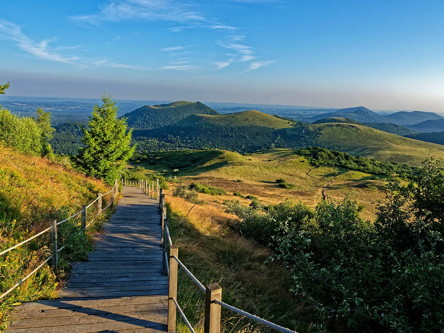
Image by Bernard 63 The GR®441 Tour de la Chaîne des Puys is a 114 km volcanic loop through the Puy-de-Dôme, starting and ending at Volvic rather than Clermont-Ferrand. Clermont-Ferrand is the practical rail gateway; the walking begins at the Volvic trailhead, then threads through the Parc naturel régional des Volcans d'Auvergne and the UNESCO-listed Chaîne des Puys–Limagne Fault.
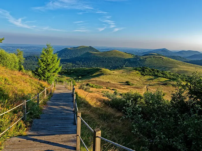
This is not a long walk of big Alpine passes or coastal drama, but of repeated volcanic forms underfoot: dark scoria, lava-stone villages, forest tracks, open estives and crater rims. The puys rise from the plateau in quick succession, each with its own shape and colour, from the deep crater of Puy de Pariou to the reddish-black open mouths of Puy de la Vache and Puy de Lassolas.
The central landmark is the Puy de Dôme, 1,465 m, climbed on foot from the Col de Ceyssat by the chemin des Muletiers. Its summit, crowned by the ruined Roman Temple de Mercure, gives the walk its clearest sense of scale: the chain of volcanoes stretching away across the Massif Central.
The route suits reasonably fit walkers who want a distinctive multi-day GR without technical ground. It is moderate rather than severe, but the effort accumulates through many short, steep climbs and descents, with published total-ascent figures varying from roughly 2,600 m to 3,050 m depending on the source.
Most hikers take six days, though faster schedules, gentler itineraries and 3–4 day half-loops using the GR441A and GR441B variants are possible. Accommodation, luggage transfer and transport links make it a practical independent walk, especially if summer beds are booked ahead.
This guide covers the stages, daily planning, accommodation, food and water, transport, terrain, weather, navigation, gear, shorter options and common mistakes.
Stage-by-Stage Guide
The notes below follow the standard 6-stage FFRandonnée itinerary: Volvic → Fontètes → Laschamps → Lac de Servières → Mazaye → Saint-Ours-les-Roches → Volvic. Distances and times are planning figures, not a substitute for the current topo-guide, IGN 2531E / 2531ET mapping and a live GPX track.
Red-and-white GR waymarks are used throughout, but the route crosses many forest junctions, volcanic paths and village lanes. Carry enough water capacity for the dry northern stages, and check current access to the Puy de Dôme summit before leaving Fontètes.
Stage 1: Volvic to Fontètes — 16 km, about 4 hours
The circuit begins at the Volvic trailhead, usually taken as the Parking de la Société des Eaux de Volvic; the Parking du Centre Historique on Rue Chancelas is another practical town-side starting point. Volvic is the last proper service point before the first night, so fill bottles, buy food and sort any last-minute supplies before leaving town.
The route heads south from Volvic and quickly enters the wooded northern flanks of the Chaîne des Puys. The first serious work comes on the ascent of Puy de la Nugère, a short but steep volcanic climb that sets the tone for the opening two days.
Beyond Puy de la Nugère the stage continues through the northern chain, with Puy de Jume, Puy de la Coquille and the Belvédère du Puy des Gouttes giving a mix of forest walking, open volcanic ground and views towards Vulcania and the puys ahead. Expect dirt paths, forest tracks and occasional rockier volcanic sections rather than technically difficult ground.
Water is the main planning issue. Carry water from Volvic; reliable sources are sparse on this northern section, and any old fountain noted at a col should not be relied on without checking locally.
Fontètes, more precisely Les Fontètes in the commune of Saint-Ours-les-Roches, is a small hamlet rather than a village with a full range of services. There are several gîtes, including the Gîte d'Étape at 6 Rue de la Commenille, Les Garettes-Crouzeix at 15 Rue de la Commenille and Gîte Cercy at 10 Rue de la Chapelle. Some gîtes can help with shopping from nearby Saint-Ours, around 3 km away, but this needs arranging in advance.
Do not expect cafés or restaurants in Fontètes itself. Plan to self-cater or book an evening meal with the accommodation.
Road access is possible via the D941c and minor roads linking Les Fontètes with Saint-Ours-les-Roches and the Vulcania area. Public transport for a stage bailout is limited and should be checked before travelling; pre-booked taxis or GR441 shuttle services are more realistic than turning up and hoping for a bus.
Navigation is generally straightforward from Volvic through the northern chain, but keep an eye on waymarks at forest junctions. There is no accommodation between Volvic and Laschamps apart from Fontètes, so missing the stage end creates an awkward logistical problem.
Stage 2: Fontètes to Laschamps — 21 km, about 5 hours 30 minutes
This is one of the hardest and most important days on the GR441. The route continues south through the densest concentration of volcanic summits, and much of the loop's climbing is packed into the Volvic-to-Laschamps section.
From Fontètes the path works through more scoria cones and volcanic woodland before reaching the area of Puy de Pariou. This double scoria cone, with its deep crater, is one of the signature landscapes of the circuit. Access is protected, so stay on the authorised paths and respect any signs around the crater and erosion-control works.
The route then drops to the Col de Ceyssat, the key pass on the western shoulder of the Puy de Dôme. This is the decision point for the summit, and it should be treated as a mountain section rather than a casual viewpoint detour.
The Puy de Dôme summit stands at 1,465 m and is the high point of the GR441. The ruined Roman Temple de Mercure and the 360-degree views over Clermont-Ferrand, the Limagne plain and the whole Chaîne des Puys make it the major summit objective of the route.
The GR441 climbs to the summit from the Col de Ceyssat by the historic chemin des Muletiers, which carries the red-and-white GR waymarks (the GR4 and GR441 share this section). The path is built on friable domite and has a history of rockfall and maintenance closures, so its current status should be checked before travelling. When it is closed, the chemin des Chèvres from the Maison de Site parking is the usual marked alternative on foot, and the Panoramique des Dômes cog railway also reaches the summit. Check summit access, weather and railway times before the stage.
The descent towards Laschamps is on the eastern flank, with forest paths and some eroded or gravelly sections. In cloud or poor weather, the Puy de Dôme area can become confusing, so IGN 2531ET and a GPX track are particularly useful on this stage.
Carry at least 3 litres of water capacity for this day. Water is notably scarce between Fontètes and Laschamps, and the combination of exposed volcanic ground, steep climbing and summer heat can make this section much harder than its distance suggests.
Laschamps is a small village at around 1,000 m in the commune of Saint-Genès-Champanelle. The two main trailside options are Archipel Volcans, a hotel and gîte-auberge on Route de Clermont, and Espace Volcan, an auberge and gîte de séjour in the same hamlet; both are close to the GR4 and GR441 and serve meals. Meals and prices should be confirmed before booking.
Food options in Laschamps are limited, so arrange dinner with accommodation or carry what is needed. The seasonal Navette Volcans serves the Chaîne des Puys area, including the Col de Ceyssat, during summer and autumn school holidays, but timetables and stops should be checked before relying on it.
The GR441A variant links the Col de Ceyssat with Olby and can be used by walkers planning a shorter half-loop. For the full GR441, stay with the red-and-white waymarks towards Laschamps.
Stage 3: Laschamps to Lac de Servières — 23 km, about 5 hours 40 minutes
This is the longest stage by distance and moves from the busier central volcanoes into the more pastoral southern chain. It is still a full mountain-walking day, with forest paths, open estives — high summer pastures — and further volcanic cones before the finish at Lac de Servières.
From Laschamps the route passes through or near Lac de la Cassière. Swimming is forbidden there for conservation reasons, so treat it as a landscape feature rather than a bathing stop.
Further south, the GR441 passes between or close to Puy de la Vache and Puy de Lassolas. These twin scoria cones are among the youngest volcanoes in the Chaîne des Puys and have distinctive eroded craters and lava-flow scenery.
The ground south of the Puy de la Vache and Puy de Lassolas area includes gravelly descent with hairpin bends. It is not technical, but it can be slippery with a loaded pack, especially after rain or when loose volcanic material rolls underfoot.
The route passes through the Saint-Genès-Champanelle area and near Pessade, where a café can be a useful refreshment stop. Do not rely on every small settlement for supplies; carry enough food and water between known services.
Lac de Servières is a circular maar — a volcanic crater lake — ringed by forest and pasture at about 1,200 m. The first view of the lake through the trees is one of the best moments of the southern half of the loop.
Swimming is prohibited at Lac de Servières because the lake supplies drinking water to regional villages. Discreet bivouac is permitted near the shoreline outside designated areas, but fires are not allowed.
The main stage-end accommodation is the Café, Auberge and Gîte du Lac Servières, around 200 m from the lake at the junction of the GR441 and GR30. It operates in a simple mountain-refuge style and serves traditional Auvergne dishes such as truffade and omelettes; book ahead in summer.
Water is available at villages and services such as Pessade, but there are long stretches where nothing is guaranteed. Fill up whenever possible.
Navigation needs attention around Lac de Servières because the GR441 shares or intersects routes including the GR30. Check waymarks carefully at junctions, particularly if arriving late in the day or in mist.
Stage 4: Lac de Servières to Mazaye — 15 km, about 4 hours 50 minutes
After the demanding first half of the circuit, this stage feels gentler and more varied. It leaves the high lake setting and descends towards Orcival and the Sioulot valley before crossing pastoral country and small settlements towards Mazaye.
The descent from Lac de Servières towards Orcival is relatively easy underfoot compared with the volcanic cone stages. The landscape becomes less exposed, with grassy paths, farm tracks, minor roads and rolling valley scenery.
Orcival is the key stop of the day and one of the most useful resupply points on the southern loop. The Basilique Notre-Dame d'Orcival, one of the major Romanesque churches of Auvergne, is just off or adjacent to the route and is worth the short detour.
Use Orcival for water and food where available. Small shops in the village are useful for local supplies such as Saint-Nectaire cheese and sausage before the quieter western stages.
After Orcival the route passes through the grounds or parkland area of Château de Cordès, then continues through hamlets including Farges, Polagnat and Olby. This is cattle-farming country, so close gates, give livestock space and keep dogs on a lead where animals are present.
The walking is not technically difficult, but do not switch off completely. Village lanes and farm-track junctions can be easy places to miss a waymark, and short road sections require normal traffic awareness.
Mazaye is a small stage-end village, with Mazaye Basse and its lavoir — public washhouse — providing a useful water point. Water is also associated with the cemetery area, but availability should be checked locally.
Accommodation is available at the Auberge de Mazayes, which also provides meals. Bivouac is possible at the meadow edge outside the village, but keep it discreet, avoid fires and leave no trace.
The GR441B variant joins or leaves the route around the Récoleine / Olby area for walkers making a shorter southern half-loop. Check the map carefully here if not following the full circuit.
Stage 5: Mazaye to Saint-Ours-les-Roches — 15 km, about 4 hours 30 minutes
This stage crosses the quieter western side of the chain, with a different feel from the summit-heavy northern and central sections. The route leaves Mazaye through the enclosed Mazaye valley, where the early-morning air can be noticeably cooler than on the surrounding open ground.
Expect mixed forest, beech woodland, farm tracks and minor tarmac lanes. The western flank of the Chaîne des Puys is generally less visited, so this is a good day for steady, quiet walking rather than big summit drama.
The route passes near or through Saint-Pierre-le-Chastel. The settlement is associated with an oppidum, an old fortified site, perched above the valley, and the small Église Saint-Pierre-aux-Liens.
Forest sections in the Pontgibaud–Saint-Ours area can be attractive but require concentration. Waymarks may be less obvious in heavy leaf cover, and paths can feel less busy than on the central puys.
There can be marshy ground in valley-bottom sections near Mazaye. Waterproof footwear is useful after wet weather, and poles can help on muddy or uneven farm tracks.
Vulcania, the large volcano-themed science park in the commune of Saint-Ours-les-Roches, lies close to the GR441. The parking area has toilets and water taps that can be useful for walkers; entering the park itself requires a ticket and depends on seasonal opening, so current hours and prices should be checked before travelling.
Saint-Ours-les-Roches is the stage end, though accommodation may be spread across the commune rather than concentrated in the village centre. Options include gîtes around Les Fontètes and the Vulcania / Lemptégy area, as well as private gîtes listed locally. Use the current Compagnons de Route accommodation list before booking, and check exact location carefully.
Food in Saint-Ours-les-Roches is limited. Some gîtes can help with shopping if asked ahead, but do not arrive without provisions unless dinner has been arranged.
Water points include the cemetery in Saint-Ours, taps at the Vulcania parking area and public fountains. As always on this route, refill when the opportunity appears.
Road access is straightforward by local roads around Saint-Ours-les-Roches and Vulcania, making this a practical point for taxis, luggage transfer or support vehicles. Public transport should be checked before travelling.
In autumn, especially October and November, wear orange or other high-visibility clothing because hunting takes place in rural and forested areas. Ticks are also common in long grass and estives, so check carefully at the end of the day.
Stage 6: Saint-Ours-les-Roches to Volvic — 22 km, about 5 hours 30 minutes
The final stage is a long closing day back to Volvic. It heads north and then works around the western and north-western side of the chain before returning to the volcanic stone town where the circuit began.
The terrain is a mix of forest tracks, open paths, minor lanes and renewed puy country in the northern section. Although the hardest climbing is usually behind you by now, the distance is still significant, especially with tired legs and a multi-day pack.
One of the main landmarks of the day is Château de Tournoël, a medieval fortified castle on the commune of Volvic, perched above the Limagne plain. It is a strong visual marker on the approach back towards Volvic.
Notre-Dame de la Garde provides a final elevated viewpoint near Volvic before the descent into town. From here the route gradually loses its mountain character and returns to streets, lanes and the town-side trailhead.
The final descent through Volvic needs a little care, not because it is technically hard, but because town navigation can be less intuitive than open trail walking. Follow the waymarks closely to return to the correct finish point at the Parking du Centre Historique or the Parking de la Société des Eaux de Volvic.
Volvic has the best services on the loop after Clermont-Ferrand, with bakeries, restaurants and a small supermarket. It is the right place to plan a final meal, overnight stay or onward rail connection.
Accommodation in Volvic includes L'Orée des Sources, a gîte and chambres d'hôtes with family rooms, a 12-bed dormitory, kitchen, lounge, bar and private secure parking for walkers leaving a car during the full loop. There are also other gîtes and B&Bs in and around Volvic; book ahead in peak season.
Water is readily available in Volvic, and the town is closely associated with the Sources de Volvic mineral-water spring. The Maison de la Pierre is a worthwhile add-on if time allows, especially for understanding the dark pierre de Volvic lava stone seen around the area.
Volvic SNCF station gives the practical rail link back towards Clermont-Ferrand. If using luggage transfer, shuttle services or taxis at the finish, agree the exact pick-up point in advance because Volvic has more than one sensible trailhead or parking location.
Recommended Itinerary
The standard GR441 itinerary is a 6-day clockwise loop from Volvic, not Clermont-Ferrand. Clermont-Ferrand is the rail gateway; the walking route starts and finishes at the waymarked trailhead in Volvic.
Standard 6-day itinerary
This is the best schedule for most walkers: it follows the FFRandonnée staging, keeps the Puy de Dôme ascent early in the route, and uses the main trailside overnight stops.
| Day | From | To | Approx. distance | Why this stage makes sense | Services/accommodation notes |
|---|---|---|---|---|---|
| 1 | Volvic | Fontètes | 16 km | A manageable first day out of Volvic, with enough distance to settle into the volcanic terrain without starting with one of the harder stages. It also positions you for the Puy de Dôme stage on Day 2. | Volvic has the strongest services on the loop: rail access, shops, bakeries, restaurants and accommodation. Fontètes is a small hamlet with limited accommodation, so book this night early using the FFRandonnée Compagnons de Route list. Carry food and adequate water from Volvic. |
| 2 | Fontètes | Laschamps | 21 km | This is the headline stage, taking in the approach to the Col de Ceyssat and the ascent of the Puy de Dôme by the chemin des Muletiers. It is not technical, but the climb to the route’s high point makes it one of the key physical days. | Water is limited between Volvic, Fontètes and the Puy de Dôme area; carry 2–3 L rather than relying on intermediate sources. Laschamps is one of the most useful overnight stops, with accommodation and food options including Archipel Volcans and Espace Volcan. A restaurant is also available on the Puy de Dôme summit seasonally. |
| 3 | Laschamps | Lac de Servières | 23 km | The longest standard stage by time, crossing varied volcanic country south of the Puy de Dôme. It is a substantial day, but it gives the route a logical middle section and finishes at one of the best natural stage ends on the circuit. | Lac de Servières has gîte/auberge accommodation close to the lake, with half-board and self-catering options; prices and availability should be checked before booking. Saulzet-le-Froid has a potable spring at the village entrance, and Pessade has basic refreshments at Le Petit Balladou. Swimming in Lac de Servières is prohibited. |
| 4 | Lac de Servières | Mazaye | 15 km | A shorter day after the long Laschamps–Lac de Servières stage. It also gives time for the worthwhile detour to Orcival and the Basilique Notre-Dame d’Orcival. | Orcival is just off-route and has food options, including local Auvergne produce. Mazaye has limited services, but accommodation and dinner are available at Auberge de Mazayes. There is water at Mazaye Basse fountain and a lavoir water point. |
| 5 | Mazaye | Saint-Ours-les-Roches | 15 km | Another moderate-distance day, keeping the final return to Volvic from becoming too long. It works well as a transitional stage before the last 22 km back to the trailhead. | Saint-Ours-les-Roches has limited services, so accommodation should be booked ahead. Camping Bel Air offers pizza and snacks, and there are gîtes and holiday rentals in the area. A public fountain is available in the village. |
| 6 | Saint-Ours-les-Roches | Volvic | 22 km | A longer final day, but it finishes back at the same trailhead, removing the need for onward transport from a different village. This stage completes the loop and returns you to Volvic’s services and rail connections. | Volvic has shops, food, accommodation and the SNCF station for TER trains to Clermont-Ferrand. Check current train times before committing to a same-day onward journey. |
Slower 7–8 day options
A slower schedule suits walkers who want shorter days, families, hot-weather trips, or anyone carrying full overnight kit. The best stages to split are Day 2 and Day 3, because they contain the Puy de Dôme ascent and the longest standard walking day.
| Option | How to adapt the route | Who it suits | Booking notes |
|---|---|---|---|
| 7 days | Split either Fontètes → Laschamps or Laschamps → Lac de Servières. Possible stopping areas include Lemptégy or Saulzet-le-Froid, depending on accommodation availability. | Walkers who want to reduce the hardest day, allow more time around the Puy de Dôme, or avoid a long day in hot weather. | Exact stage distances depend on the chosen stop. Check official mapping before booking and make sure accommodation is available before fixing the split. |
| 8 days | Split both of the longer middle stages, keeping the Puy de Dôme day and the southern volcanic section more relaxed. | Families, first-time multi-day walkers, or hikers combining the GR441 with visits to Vulcania, Orcival or the Puy de Dôme summit. | Accommodation is not evenly spaced, especially around Fontètes and the smaller hamlets. Use the current FFRandonnée Compagnons de Route list and book ahead in summer. |
Faster 4-day option
A 4-day GR441 is possible, but it is a demanding schedule for fit, experienced walkers only. It works best for hikers carrying bivouac gear or those who have secured accommodation and luggage arrangements in advance.
| Day | From | To | Approx. distance | Why this stage makes sense | Services/accommodation notes |
|---|---|---|---|---|---|
| 1 | Volvic | Laschamps | About 37 km | Combines the first two standard stages into one very long day, including the approach to the Puy de Dôme sector. This is a major physical start and should not be treated as a normal first day. | Start early from Volvic with food and 2–3 L of water. Laschamps has the strongest accommodation base after Volvic, but beds must be booked ahead. |
| 2 | Laschamps | Lac de Servières | 23 km | Keeps the standard longest middle stage intact after the hard opening day. The terrain remains cumulative, with repeated volcanic climbs and descents. | Use known refreshment and water opportunities on this section, including Saulzet-le-Froid and Pessade, where appropriate. Lac de Servières accommodation or bivouac arrangements should be fixed in advance. |
| 3 | Lac de Servières | Saint-Ours-les-Roches | Check official mapping before booking | A very long day combining the western and northern return stages via Mazaye. This is the crux of the fast itinerary and leaves little margin for poor weather, heat or tiredness. | Mazaye has limited services and water points; Saint-Ours-les-Roches has limited accommodation and a campsite. Do not rely on finding a bed without a booking. |
| 4 | Saint-Ours-les-Roches | Volvic | 22 km | Returns to Volvic on the final standard stage and completes the loop. It remains a full walking day after three hard days, so avoid tight onward travel plans. | Volvic has onward TER rail connections to Clermont-Ferrand. Current train times should be checked before travelling. |
For any itinerary using bivouac camping, follow the rules of the Parc naturel régional des Volcans d’Auvergne and protected Chaîne des Puys sites. Bivouac is a lightweight, single-night arrangement, not campsite-style camping; fires are not appropriate, and local restrictions should be checked before travelling.
Planning the Route
How many days to allow
Most walkers should plan the GR441 over 6 days. This is the standard FFRandonnée staging and keeps the daily distances manageable while still allowing time for the repeated volcanic climbs, the Puy de Dôme ascent and short detours such as Orcival.
A faster itinerary is possible, but the route is rarely as quick as the map distance suggests. Much of the walking sits around 750–1,100 m, with the summit of the Puy de Dôme at 1,465 m, and the effort comes from many short, steep climbs over puys rather than from one long mountain pass.
| Time available | Best suited to | Planning implications |
|---|---|---|
| 4–5 days | Fast, fit walkers travelling light | Long days; less time for summits, village stops and poor-weather delays. Accommodation needs careful checking. |
| 6 days | Most independent walkers | The most practical balance of distance, ascent and overnight stops. |
| 7–8 days | Leisurely walkers, families on selected stages, or anyone adding detours | Easier pacing, more time at Lac de Servières, Orcival and the Puy de Dôme, but more accommodation nights to secure. |
Walking it slowly is usually the better plan for a first full circuit. Optional ascents and viewpoints can add noticeable height gain, and hot summer days can make the exposed volcanic sections slower than expected.
Staging and accommodation shape the route
The GR441 is a village-to-village route, so daily stages are strongly shaped by where accommodation exists. The standard 6-day plan uses overnight points such as Fontètes, Laschamps, the Lac de Servières area, Mazaye and Saint-Ours-les-Roches before returning to Volvic.
The middle of the route needs the most attention. The Laschamps and Lac de Servières stages are among the longer days, and splitting them is only sensible if accommodation has been arranged in advance.
Use the FFRandonnée Puy-de-Dôme Compagnons de Route accommodation list when building an itinerary. It is the key planning document for the route and should be checked before booking, especially for seasonal opening dates, meals and whether a place is directly on the GR or slightly off it.
Known overnight areas include Volvic, the Fontètes area, Laschamps, the Lac de Servières / Saulzet-le-Froid area, Mazaye and Saint-Ours-les-Roches. Orcival, just off-route near Lac de Servières, is also a useful option if you want to include the Romanesque basilica and adjust the southern stages.
Book ahead for July and August, ideally 2–3 months in advance. May, June, September and October usually give more flexibility, but accommodation, restaurants and small village services can still have limited opening days.
Shortening, extending and variants
The loop format makes the GR441 easier to adapt than a linear trail. The two main official variants are useful if time is short or if weather makes the full circuit unattractive.
- GR441A links the Col de Ceyssat area with Olby via Ceyssat. It can be used to create a shorter northern circuit focused on the volcanic summit section.
- GR441B links the Puy de Lassolas area with Olby via Nébouzat. It shortens the southern part of the route and can be combined with the GR441A for a reduced circuit.
These variants make a 3–4 day half-loop realistic for strong walkers. They also allow a more selective itinerary if the main goal is the Chaîne des Puys rather than the full Volvic-to-Volvic circuit.
Extending the walk is straightforward if extra nights are available. The most worthwhile places to allow time are the Puy de Dôme summit, the protected paths around Puy de Pariou, Lac de Servières and the detour to Orcival.
Section hiking and transport planning
Section hiking is practical, but it needs planning around transport rather than assuming every village has an easy exit. The route starts and ends at Volvic, not Clermont-Ferrand; Clermont-Ferrand is the gateway city, with Volvic reached by a short SNCF train journey of about 26 minutes.
The loop has useful road-access points, including the Col de Ceyssat area, Vulcania and Orcival. In the summer and autumn school holidays, the Navette Volcans links Clermont-Ferrand SNCF station / Place de Jaude with the Chaîne des Puys, including the Col de Ceyssat / Goules parking area and Vulcania.
There are also bus services between Clermont-Ferrand and Volvic, but frequency is limited and this should be checked before travelling. For anything beyond the simplest Volvic-based start or finish, plan the exit point first, then build the walking day around the available transport.
La Malle Postale provides baggage transfer and shuttle services on the GR441, and local taxi firms also offer luggage portage. These services are useful if you want to walk with a daypack, but they must be booked around fixed accommodation rather than arranged casually during the walk.
Food and water planning
Food and water require more thought than on some village-heavy European GR routes. Do not assume every settlement has an open shop, café or reliable fountain when you pass through.
Volvic is the best place to stock up before starting. Laschamps has food service at Archipel Volcans, Pessade has Le Petit Balladou for café/snack options, Orcival has small village services, and Mazaye has the Auberge de Mazayes plus a communal fountain at Mazaye Basse.
The section between Volvic and the Puy de Dôme area deserves particular care. Water can be scarce, and the fountain at the Col de Ceyssat should not be relied on. Carry enough water for a hot, exposed day, especially in summer.
Many villages in the area have lavoirs and municipal fountains, but availability and drinkability should be checked locally. The Terra Volcana water-points PDF is worth downloading before departure.
Navigation and route documents
The GR441 is waymarked with the standard French white-and-red GR blazes, and navigation is generally straightforward in normal visibility. Even so, a current GPX is strongly recommended because the route has had deviations in recent years, including sections using the GR30 tracé.
Use a current GPX from a reputable route source alongside the FFRandonnée TopoGuide Volcans et Lacs d’Auvergne. IGN 1:25,000 mapping, including sheet 2531ET for the northern section, is useful for variants, bad-weather decisions and off-route accommodation approaches.
Do not rely only on an old printed map or an old downloaded track. Exact distances and ascent totals vary between publications, and small route changes can affect the length of a day.
Weather, season and ground conditions
Spring, summer and autumn are the main walking seasons. Summer gives long daylight but can be hot on exposed ground; spring and early autumn are often better for walking if accommodation is open.
The high ground can turn cold and exposed, particularly around the Puy de Dôme and the open estives, or high summer pastures. Avoid planning a winter circuit unless snow, access and accommodation conditions have been checked carefully.
Ticks are a real consideration in the forested and pastoral sections, especially in high summer. Use repellent, cover legs where practical and check carefully each evening.
October brings hunting-season considerations in rural France. Wear bright, visible colours and pay attention to local notices.
Permits, access and bivouac
No permit is required to walk the GR441, and there is no entrance fee for the Parc naturel régional des Volcans d’Auvergne. The Puy de Dôme can be climbed free on foot via the chemin des Muletiers from the Col de Ceyssat.
A fare applies if using the Panoramique des Dômes cog railway instead of walking to the summit. Current operating dates and prices should be checked before travelling.
Bivouac camping is possible in appropriate places, but it is not a licence to camp anywhere. Keep it discreet, avoid volcanic summits and protected sensitive areas, do not light fires, respect private land, and leave early, generally before 08:00.
The planning priorities that matter most
- Accommodation first: build the itinerary around confirmed lodging, especially in July and August.
- Water second: carry more than usual on dry, exposed days and do not rely on a single fountain.
- Use current navigation: take a current GPX, FFRandonnée route information and IGN mapping.
- Check transport before fixing stages: Volvic is straightforward by train, but mid-route exits need planning.
- Allow for weather and heat: the volcanic terrain is exposed in places and daily distance understates the effort.
- Check seasonal services: cafés, shops, shuttles, accommodation and the Panoramique des Dômes can vary by date.
Towns, Villages and Overnight Stops
The GR441 is not a village-to-village trail with shops at every stage end. Volvic and Saint-Ours-les-Roches are the main places for proper resupply; several of the standard overnight stops are small hamlets, isolated gîtes or refuge-style accommodation where meals and beds must be arranged in advance.
For the standard 6-day itinerary, the practical stage ends are Fontètes, Laschamps, Lac de Servières, Mazaye and Saint-Ours-les-Roches, returning to Volvic. Accommodation can be adapted using variants and transfers, but do not assume that a listed stage end has a shop, restaurant or spare bed on arrival.
| Place | Role on the route | Practical services |
|---|---|---|
| Volvic | Start and finish | Best resupply point; SNCF station; hotels, gîtes and campsite |
| Fontètes | Standard Stage 1 end | Very limited; private gîte; no shops |
| Laschamps | Standard Stage 2 end | Strong accommodation for its size; meals available; few/no shops |
| Lac de Servières | Standard Stage 3 end | Remote lake stop; small auberge/refuge; book ahead |
| Orcival | Off-route near Lac de Servières | Better services, bakery, hotel, restaurant and chambres d’hôtes |
| Mazaye | Standard Stage 4 end | Communal gîte d’étape; self-catering; limited food options |
| Saint-Ours-les-Roches | Standard Stage 5 end / near Vulcania | Bakery, grocery, butcher, restaurants and accommodation |
Volvic
Volvic is the real start and finish of the GR441, even though Clermont-Ferrand is the main gateway city. The waymarked trailhead is at the Parking de la Société des Eaux de Volvic, 63530 Volvic, with the town itself providing the best services anywhere on the circuit.
This is the sensible place to arrive the day before walking, buy food, check kit and organise parking or luggage transfer. Volvic has an SNCF station, with trains from Clermont-Ferrand taking about 26 minutes, so it also works well for walkers arriving by rail.
Services include boulangeries, grocery shops, a butcher-charcutier, post office, tourist office and other small-town facilities. It is the best point on the loop for full resupply; once on the intermediate stages, food planning becomes much tighter.
Accommodation is mixed, with hotels, gîtes and Camping Pierre & Sources, a 3-star campsite nearby. A particularly useful GR441 base is L’Orée des Sources, positioned at the trailhead, with private rooms, dormitories, kitchen, laundry, drying space, repair basics, water access and local route information.
L’Orée des Sources also offers private on-site parking for the duration of a multi-day trek, which is useful on a circular walk. Early breakfast and packed lunches are available on request. Room prices are listed at about €80–€120 depending on season and occupancy; confirm current prices before booking.
Volvic is also useful at the end of the walk, especially if a late finish would make onward travel awkward. The town is known for its mineral water springs and dark pierre de Volvic lava stone, with the Maison de la Pierre and Sources de Volvic nearby, but its main value for hikers is logistical.
Saint-Ours-les-Roches
Saint-Ours-les-Roches is one of the most practical villages on the GR441 and is used as the penultimate overnight stop on the standard 6-day schedule before the final return to Volvic. It also appears in some alternative stagings as an earlier overnight stop, depending on accommodation availability.
For walkers, its main advantage is services. The village has a boulangerie-pâtisserie, grocery shop, butcher-charcutier and restaurants, making it one of the few intermediate places where resupply is straightforward.
Accommodation options in and around Saint-Ours-les-Roches include Hôtel-Lodges de Lemptégy, Gîte Gastronomique de l’Ours and L’Ours des Roches. The area is also close to Vulcania and the Volcan de Lemptégy, so beds can be under pressure in holiday periods.
There is no direct rail access, but the village has road connections towards Clermont-Ferrand, roughly 20 km away. If using taxis, shuttles or baggage transfer, this is one of the easier intermediate places to coordinate a pick-up or drop-off.
Fontètes
Fontètes is the standard first overnight stop after Volvic, about 16 km into the 6-day itinerary. It is a small hamlet in the commune of Saint-Ours-les-Roches, close to the volcanic chain and about 2 km from Vulcania.
This is a quiet and practical stop only if accommodation and food are organised in advance. There is no real village centre and no shop, so walkers should carry dinner, breakfast and next-day food unless their accommodation arrangement covers meals.
The key local accommodation is Gîte Les Fontètes, a private Gîtes de France property near Vulcania. It has three bedrooms, a kitchen, living space, WiFi, parking and a washing machine, making it best suited to small groups or walkers happy with self-catering.
Fontètes works well as a short first stage from Volvic, allowing a controlled start before the more demanding volcanic crest section. Solo walkers should pay particular attention to booking conditions, as some self-catering gîtes are more practical for groups than for single-night individual stays.
Col de Ceyssat
Col de Ceyssat is not a normal village overnight stop, but it is one of the key logistical points on the route. It sits below the Puy de Dôme and is the access point for the chemin des Muletiers, the historic muleteers’ path used for the summit ascent.
Most walkers pass through rather than stay here. The main planning issue is time and weather: the climb to the Puy de Dôme summit adds effort and exposure, and the onward stage to Laschamps should not be underestimated after the ascent.
The Panoramique des Dômes cog railway runs from the Col de Ceyssat car park area to the Puy de Dôme summit. A seasonal Navette Volcans shuttle links Clermont-Ferrand with the Chaîne des Puys, including Col de Ceyssat / Goules parking and Vulcania during the summer and autumn school holidays. Timetables should be checked before travelling.
Puy de Dôme summit
The Puy de Dôme summit is the high point of the GR441 and a major route objective, but it is not a practical overnight base for walkers. Treat it as an exposed mountain section rather than a service stop.
The summit is reached on foot from Col de Ceyssat by the chemin des Muletiers. The Panoramique des Dômes cog railway also serves the summit, which can be useful in poor weather, for non-walking companions or for adjusting plans, but the walking route still needs to be planned around conditions and daylight.
There is no reason to carry overnight plans around the summit itself. The logical stage destination after this part of the route is Laschamps.
Laschamps
Laschamps is the standard second overnight stop, about 21 km after Fontètes. It sits in the commune of Saint-Genès-Champanelle, close to the foot of the Puys and around 3 km south of the Puy de Dôme summit.
For its size, Laschamps is one of the best accommodation points on the GR441. It is useful after the Puy de Dôme section because walkers arrive in a recognised hiking village rather than an isolated hamlet.
Espace Volcan is the main hiker-friendly base, operating as an auberge and gîte d’étape. It has 62 beds in rooms of 2–6 people, additional rooms in a second building, meals on site, a bar, lounge, games room, indoor climbing wall and cyclist workshop. It is generally open from April to November, with year-round opening for groups.
Typical meal prices listed by Espace Volcan include a menu du jour at €22.50, picnic at €13.00 and breakfast at €10.30 for adults; confirm current prices before booking. Having meals available on site is important because Laschamps has little in the way of normal village shops.
Archipel Volcans, a 3-star hotel in Laschamps, provides a more hotel-style option with regional food. As with all small-stage accommodation on the GR441, summer booking ahead is strongly advised.
Saint-Genès-Champanelle area
Laschamps lies within the wider Saint-Genès-Champanelle area, which is useful to understand when searching for accommodation or arranging transfers. Listings may use the commune name rather than Laschamps itself.
This area is close to several of the route’s busiest mountain access points, including the Puy de Dôme and the Col de Ceyssat. It can work well for alternative staging, but exact distances and pick-up points should be checked against the current GR441 route and accommodation location before booking.
Do not assume that a property described as being in Saint-Genès-Champanelle is directly on the trail. The commune covers multiple settlements, and a transfer may be needed if the accommodation is not in Laschamps or beside the GR441.
Lac de Servières
Lac de Servières is the standard third stage end, about 23 km from Laschamps. It is a circular maar, a volcanic crater lake, at about 1,200 m, surrounded by forest and pasture in the commune of Orcival.
This is one of the more remote overnight points on the circuit. There are very limited services at the lake itself, so the stage must be planned around a confirmed bed and meal arrangement.
The key stop is Café du Lac Servières, a gîte and auberge-style mountain refuge about 400 m from the lake at Servières Haut, 63210 Orcival. It has small shared dormitories with capacity for about 20 people, evening meals for gîte guests, home cooking using local products, bike storage and basic food supplies.
The café normally operates daytime service from Thursday to Sunday, with weekday service by reservation. Overnight stays and meals should be booked ahead; this is not a place to arrive speculatively in peak season.
If the Café du Lac is full, alternatives usually involve staying off-route in Orcival, Vernines, Saulzet-le-Froid or nearby hamlets and arranging a transfer. This should be checked before travelling, as the lake stage ends far from a proper town.
Orcival
Orcival is not directly on the main GR441 line but sits close to the Lac de Servières stage and is a useful off-route option. The village is typically 2–3 km off-route and is the best nearby place for services if the lake accommodation does not suit.
For walkers, Orcival’s value is practical as much as cultural. It has a boulangerie-pâtisserie, places to eat, accommodation and small food options, making it much more serviceable than Lac de Servières itself.
L’Ajasserie d’Orcival is a useful hiker-oriented stop, with chambres d’hôtes, restaurant, bar/tea salon, épicerie, regional products, take-away meal boxes and sandwiches, and WiFi. Hôtel-Restaurant Notre Dame provides a hotel option in the village, and there are other gîtes in and around Orcival.
The village is also known for the 12th-century Basilique Notre-Dame d’Orcival, one of the notable Romanesque churches of Auvergne. If diverting for the basilica, factor the extra distance into the following day rather than treating it as a free add-on.
Orcival has no rail station. Road access is via the surrounding local network, with Rochefort-Montagne and Clermont-Ferrand as wider reference points; taxi or accommodation transfer arrangements should be made in advance.
Mazaye
Mazaye is the standard fourth overnight stop, about 15 km after Lac de Servières. It is a small village on the GR441 in the southern sector of the loop, at around 800 m altitude.
The main walker accommodation is the communal gîte d’étape de Mazayes at 1 rue des écoles, Mazayes Basse, 63230 Mazaye. It has 18 beds in dormitory-style accommodation, with a self-catering kitchen, showers, fridge, microwave, free WiFi and parking.
The gîte is listed as open from 1 April to 30 September and reservations are required through the mairie (outside that period it takes groups only). The listed price is around €16.50 per adult per night (less for under-18s); confirm current prices and opening arrangements before booking.
Food planning is the main issue in Mazaye. There is no restaurant at the communal gîte, and the kitchen is self-catering, so carry food for dinner and breakfast unless a separate arrangement has been made.
Private gîte options include Gîte Chez Blaise and Gîte de Rongères. There are no supermarkets or pharmacies in the village, so do not leave essential resupply until arrival here.
Back to Volvic
The final stage returns from Saint-Ours-les-Roches to Volvic, about 22 km on the standard itinerary. This is a longer finishing day, but it ends at the best-serviced town on the circuit.
Returning to the same trailhead makes the GR441 simpler than a linear route if a vehicle has been left at Volvic. L’Orée des Sources is particularly convenient for walkers using its on-site parking, while rail travellers can connect again from Volvic station to Clermont-Ferrand.
If finishing late, booking a final night in Volvic avoids pressure to meet a specific train connection after a full walking day. It also gives a safety margin if weather, fatigue or a long lunch stop at Saint-Ours-les-Roches slows the final stage.
Getting to the Start
The GR441 starts at Volvic, not in Clermont-Ferrand. The waymarked trailhead is at the Parking de la Société des Eaux de Volvic, at the western exit of Volvic, 63530 Volvic.
Clermont-Ferrand is the practical gateway city for most walkers. From there, the usual approach is a short TER train to Volvic–Luzet station, followed by a taxi or a walk into Volvic.
By train
For long-distance rail travel, aim first for Clermont-Ferrand. Direct Intercités services from Paris usually leave from Paris-Bercy and the fastest journeys take about 3 hours 27 minutes, though many services are closer to 4 hours. Advance fares can be much cheaper than walk-up fares; current times and prices should be checked before booking.
Clermont-Ferrand is also served by regional TER services from cities including Lyon and Bordeaux. Lyon to Clermont-Ferrand is typically around 1 hour 30 minutes to 2 hours by train, making Lyon a useful rail gateway for international arrivals.
From Clermont-Ferrand, take the TER regional train to Gare de Volvic–Luzet. The journey is about 26–27 minutes, with only a handful of trains per day, so the connection needs planning rather than assuming a turn-up-and-go service.
Typical Clermont-Ferrand to Volvic TER fares are around €3–6 one way. Tickets can be bought through SNCF Connect or at Clermont-Ferrand station. This should be checked before travelling, especially outside weekday commuter times and during seasonal timetable changes.
Volvic station is not in the town centre. Gare de Volvic–Luzet is roughly 5 km from central Volvic, and the GR441 trailhead is at the western side of the town, so many hikers use a local taxi rather than starting the route with an extra road walk.
Taxi Volvicois is the local option listed for Volvic transfers: +33 4 73 33 81 40 / +33 6 80 01 66 65. Pre-booking is sensible if arriving on a limited TER service, late in the day, or with a group.
By bus
Bus is less convenient than train for reaching the Volvic trailhead. There is no direct city-centre bus from Clermont-Ferrand to the Parking de la Société des Eaux de Volvic.
Bus line 20 links the Clermont-Ferrand area with Volvic, but the journey is around 1 hour 18 minutes and is usually less practical than the TER train plus taxi. Timetables and stopping points should be checked before travelling.
The seasonal Navette Volcans is useful for the Chaîne des Puys, but it is not a direct way to reach the Volvic start. It runs from Clermont-Ferrand SNCF station and city stops towards places such as Parking des Goules, Vulcania and Volcan de Lemptégy, rather than Volvic town.
For GR441 logistics, the Navette Volcans is most relevant for accessing the Puy de Dôme / Col de Ceyssat corridor or joining the route part-way round, not for starting Day 1 from Volvic. It runs during selected spring, summer and autumn holiday periods, with limited daily frequency; this should be checked before travelling.
By car
Volvic is straightforward to reach by road. From Clermont-Ferrand it is about 14 km, usually around 17 minutes by car, via the D943 towards Sayat and then the D450 to Volvic.
For longer approaches, Clermont-Ferrand is on the A71 from Paris and the A89 from Bordeaux. Useful motorway exits for Volvic include A71 exit 13 at Riom, A89 exit 27 at Manzat and A89 exit 26 at Bromont-Lamothe.
The trailhead car park is the Parking de la Société des Eaux de Volvic at the western exit of Volvic. It is a free public car park used by day visitors and GR441 walkers, but for leaving a vehicle for the full loop, a secure or agreed local arrangement is preferable.
A common solution is to stay at L'Orée des Sources in Volvic before and/or after the walk. This gîte d'étape is close to the GR441 departure point and offers secure private parking for guests for the duration of the loop.
There is also free parking at the Centre Historique parking on Rue Chancelas in Volvic. It is convenient for the town but is not secured, so it is better treated as ordinary public parking rather than a guaranteed long-stay solution.
Because the GR441 is a loop, returning to the same car is logistically simple if parking is arranged properly before setting off. Avoid leaving valuables in the vehicle, and confirm any long-stay arrangement directly with the accommodation or local provider.
From the nearest airport
The nearest airport is Clermont-Ferrand Auvergne International Airport, at Aulnat, about 12 km from central Clermont-Ferrand and about 25 km from Volvic. It is close to the route but has a limited flight schedule.
Direct services are limited, so it is not usually the best arrival airport for international walkers. Routes and airlines change, so this should be checked before travelling.
From Clermont-Ferrand Auvergne Airport to Volvic, a taxi normally takes about 23–30 minutes and costs roughly €45–60. There is no direct public-transport link to the Volvic trailhead.
For many international hikers, Lyon-Saint Exupéry Airport is more practical. Lyon has better European flight connections, and onward rail travel to Clermont-Ferrand is typically around 1 hour 30 minutes to 2 hours.
Paris Charles de Gaulle is another workable option, especially when combining flights or Eurostar with French rail. From Paris, transfer to the Intercités service to Clermont-Ferrand, usually from Paris-Bercy, then continue by TER to Volvic.
For UK walkers avoiding flights, the rail route is Eurostar to Paris, then Intercités to Clermont-Ferrand and TER to Volvic. A London to Clermont-Ferrand rail journey is commonly around 5–6 hours before the final Volvic transfer, depending on the Paris connection.
Where to stay before starting
Staying in Volvic the night before the walk is the cleanest option, especially if starting the first stage early or leaving a car. It also avoids relying on the limited morning TER service from Clermont-Ferrand.
| Option | Best for | Practical notes |
|---|---|---|
| L'Orée des Sources, 16 Rue des Sources, Volvic | GR441 walkers, groups, drivers | Gîte d'étape near the departure/arrival point; rooms and dormitories; secure private parking for guests; breakfast, packed lunch and laundry facilities available |
| Logis Hôtel du Commerce, Volvic | Hotel stay in town | Hotel with restaurant and bar in Volvic town centre |
| Volvic'Home | Guest-house stay | Maison d'hôtes option in Volvic |
| Gîtes de France properties in Volvic | Self-catering or private gîte stays | Several gîte and holiday-cottage options in and around Volvic |
| Clermont-Ferrand hotels | Late arrivals by train or wider choice | Broad range of hotels; take an early TER to Volvic the next morning, then taxi from Volvic–Luzet station if needed |
Volvic accommodation should be booked ahead in summer, especially from June to September, when demand around the Chaîne des Puys and Vulcania is higher. The FFRandonnée Puy-de-Dôme Compagnons de Route list is a useful planning reference for GR441-friendly accommodation.
Room prices in Volvic can vary substantially by season and room type. As a rough planning figure, private rooms in gîte-style accommodation may be around €100–130 per night, with dormitory places usually cheaper; current prices should be confirmed before booking.
Getting Home from the Finish
The GR441 finishes where it starts: at Volvic, not in Clermont-Ferrand. Clermont-Ferrand is the main rail and onward-transport hub, but the first practical step after finishing is usually to get from Volvic to Clermont-Ferrand.
The final standard stage from Saint-Ours-les-Roches to Volvic is about 22 km, so transport timing matters. With a limited train service and a last departure in the early evening, late finishers should either pre-book a taxi or stay overnight in Volvic.
By train
Volvic SNCF station is the key departure point. It is on the TER Auvergne-Rhône-Alpes regional line between Clermont-Ferrand, Volvic, Pontgibaud, Les Ancizes and Saint-Gervais-d'Auvergne.
| Route | Operator | Typical journey time | Service level | Notes |
|---|---|---|---|---|
| Volvic → Clermont-Ferrand | TER Auvergne-Rhône-Alpes / SNCF | About 26–29 minutes | About 7 trains per day | Main way home from the GR441 finish |
Volvic station has ticket machines and basic facilities. Staffed hours vary, so check current station information before relying on in-person ticket sales. Tickets can be bought at the station machine, via SNCF Connect, the TER Auvergne-Rhône-Alpes app or Trainline.
The service is useful but not turn-up-and-go. The first train from Volvic is around 06:54 and the last is around 19:29, but timetables change by season and weekday, so this should be checked before travelling.
Regional fares for this short hop are usually low, commonly under about €5–10, but check current prices before booking. If finishing on a summer weekend, buying ahead is sensible.
From Clermont-Ferrand, onward rail options are much stronger:
| Destination | Typical route | Notes |
|---|---|---|
| Paris | Intercités from Clermont-Ferrand | Around 6 trains per day; fastest services are typically about 3h16–3h27. Trains may arrive at Paris Bercy, Paris Austerlitz or Paris Gare de Lyon depending on the service. |
| Lyon | Intercités / TER connections | Check SNCF Connect for current routings and journey times. |
| UK via Eurostar | Train to Paris, then onward connection | Allow enough time for the Paris station transfer before continuing to London St Pancras. |
By bus
Bus options are less useful than the train for leaving the finish. The T2C urban network serves the Clermont-Ferrand area but does not extend to Volvic, so it is not the normal Volvic–Clermont-Ferrand solution.
Line X51 serves Volvic SNCF station westwards towards Pontgibaud, Les Ancizes and Saint-Gervais-d'Auvergne. This may help with onward local travel, but it is not the Clermont-Ferrand direction.
The seasonal Navette Volcans links Clermont-Ferrand with the Chaîne des Puys, including the Col de Ceyssat / Parking des Goules area and Vulcania. It is useful for accessing or leaving the middle of the GR441, particularly around the Puy de Dôme section, but it does not serve Volvic and should not be relied on for getting home from the finish.
By car/taxi
Taxis from Clermont-Ferrand serve Volvic, and local taxi/private-hire operators work in the Puy-de-Dôme. Volvic does not have a guaranteed permanent taxi rank at the station, so pre-booking is strongly advised, especially for groups or anyone likely to finish after the last train.
A taxi from Volvic to central Clermont-Ferrand is typically around €25–40, depending on timing, pick-up point and operator. Agree the fare or ensure the meter arrangement is clear before setting off.
Taxi and transfer contacts can be found through local Puy-de-Dôme taxi directories, the Terra Volcana tourist office, or booking platforms such as montransport.com. La Malle Postale also offers GR441 luggage transport, shuttles, vehicle transfer and luggage storage; this can be useful if a car or bags need repositioning around the loop.
Self-drive walkers have the simplest finish logistics because the route returns to Volvic. If leaving a vehicle at the start, check local regulations before leaving it for several days at the Parking de la Société des Eaux de Volvic. L'Orée des Sources, close to the GR441 start/finish, offers private secure parking for walkers staying there, which is often the cleaner option for a full-loop itinerary.
From the nearest airport
The nearest airport is Clermont-Ferrand Auvergne Airport (CFE), at Aulnat, about 6 km east of Clermont-Ferrand city centre. From Volvic, first travel to Clermont-Ferrand by TER train or taxi, then continue to the airport.
From Clermont-Ferrand to the airport, the practical options are:
| Option | Typical journey | Notes |
|---|---|---|
| T2C Bus Line 20 | About 30–40 minutes | €1.60 standard fare; operating hours vary by day. |
| Train to Gare d'Aulnat-Aéroport | About 10 minutes | The airport station is around 5 minutes' walk from the terminal; fare around €1.90. |
| Taxi | About 10 minutes | Usually around €20–30 from Clermont-Ferrand city centre. |
Flight options from Clermont-Ferrand are limited. From 27 March 2026, Ryanair no longer operates from Clermont-Ferrand, including the former London Stansted route, so direct UK flights are no longer available from CFE.
Most international and UK-bound walkers should plan to use Paris as the main air hub, travelling between Clermont-Ferrand and Paris by Intercités train. Current flight routes, fares and airport transfer times should be checked before booking.
Where to stay at the finish
Staying in Volvic after the final stage is often the safest plan if the last day runs long, if the weather slows progress, or if onward train timings are awkward. It also avoids the pressure of trying to catch one of the limited evening departures after a 22 km final stage.
Volvic has accommodation suitable for GR441 finishers, including L'Orée des Sources near the start/finish, Gîte le Petit Mas in the village, Gîte François in the Chaîne des Puys area, and VOLVIC HOME. The FFRandonnée Puy-de-Dôme “Compagnons de Route” partner-accommodation list gives current GR441 accommodation options and should be checked when booking.
Volvic is a small town with cafés and basic services, but evening food choices are limited. If arriving late, book accommodation that can advise on dinner options, or carry enough food to avoid being caught out after the final stage.
Which Direction Should You Walk?
The GR441 is a loop, so it can be walked in either direction. The standard and most widely used direction is clockwise from Volvic, following the six-day order: Volvic → Fontètes → Laschamps → Lac de Servières → Mazaye → Saint-Ours-les-Roches → Volvic.
That direction puts the volcanic ridge first and the gentler western return second. The reverse direction is fully possible, but it changes the character of the walk: the route builds more slowly and saves the biggest volcanic terrain for the final days.
Standard direction: clockwise, eastern ridge first
In the standard direction, the walk starts hard. The first stage leaves Volvic and heads south through the eastern volcanic chain, taking in a succession of puys including Puy de la Nugère, Puy de Jumes, Puy de la Coquille, Puy Chopine and Puy des Gouttes before reaching Fontètes.
Day 2 continues the same theme, with the approach to the Puy de Dôme from the Col de Ceyssat by the chemin des Muletiers. This is the route’s defining climb: 1.9 km with around 350 m of ascent on the old muleteers’ path, before continuing towards Laschamps.
The practical advantage is that the most demanding, water-scarce and accommodation-thin part of the circuit comes while legs are fresh. The Volvic–Fontètes–Laschamps section needs more careful planning than the western side, especially in hot weather, so tackling it early is sensible.
The trade-off is scenic pacing. The most dramatic volcanic terrain arrives almost immediately, and the second half of the loop becomes more pastoral, forested and valley-based as the route swings back through Lac de Servières, Mazaye and Saint-Ours-les-Roches.
Reverse direction: anticlockwise, western side first
Walking anticlockwise from Volvic sends you first towards Saint-Ours-les-Roches, Mazaye and the western side of the chain. This gives a gentler start through more pastoral and forested country, including the broader Sioule valley corridor, before the route builds towards the volcanic ridge.
The main appeal is the sense of progression. Instead of meeting the Puy de Dôme early, the reverse direction saves the Chaîne des Puys crossing for the final part of the walk, with the Puy de Dôme becoming a psychological high point near the end.
This can be a very satisfying way to experience the circuit, particularly for walkers who prefer a gradual build rather than an immediate test. The downside is that the steepest and most exposed ground comes after several days of walking, when fatigue may be higher.
Reverse walkers should also be more self-reliant with navigation. The GR red-and-white waymarks can still be followed, but route descriptions, luggage-transfer itineraries and many stage plans are most commonly presented in the standard clockwise order.
Direction comparison
| Factor | Standard clockwise | Reverse anticlockwise |
|---|---|---|
| Usual direction | Most common and traditional staging | Less common, but legitimate |
| First terrain | Volcanic ridge and repeated puy climbs | Gentler western, pastoral and forested sections |
| Hardest days | Early: Volvic–Fontètes–Laschamps | Late: volcanic ridge and Puy de Dôme near the finish |
| Puy de Dôme | Reached on Day 2 in the standard six-day itinerary | Saved until near the end of the loop |
| Accommodation flow | Thin early, especially around the first two stages | Easier start, with more settled villages earlier |
| Water planning | The water-poor Volvic–Laschamps section comes early | The same section comes late, when tiredness may matter more |
| Scenery progression | Big volcanic scenery first, gentler return later | Builds towards the most dramatic terrain |
| Transport | Same start and finish at Volvic | Same start and finish at Volvic |
Transport and baggage logistics
Direction makes little difference to public transport because the route starts and finishes at the same place: Volvic. Clermont-Ferrand remains the practical rail gateway, with the short onward train connection to Volvic SNCF.
Baggage transfer and shuttle services, including La Malle Postale and local operators, are set up for the GR441. Standard-direction itineraries are the normal default, but reverse-direction support is often possible; confirm this directly when booking.
Weather and exposure
The Chaîne des Puys sits in an Atlantic-influenced weather zone, with prevailing weather often coming from the west. This is worth remembering on exposed summit and pasture sections, but it is not a strong enough reason by itself to choose one direction over the other.
In the standard direction, the eastern ridge comes early and the more open western return comes later. In reverse, the exposed volcanic ground is saved for the final days, so poor weather at the end of the walk can affect the most important scenery and the Puy de Dôme climb.
Recommendation
For most walkers, the standard clockwise direction from Volvic is the best default. It follows the usual staging, matches the way most accommodation and baggage logistics are arranged, and tackles the demanding, water-scarce Volvic–Laschamps section while energy levels are highest.
Choose the reverse direction if scenic build-up matters more than logistical simplicity. It gives a gentler opening and makes the Puy de Dôme feel like a finale, but it also leaves the toughest volcanic terrain until late in the walk.
In practical terms: first-time GR441 walkers, hot-weather hikers and anyone using luggage transfer should normally go clockwise. Stronger, independent walkers who want the most satisfying dramatic finish may prefer the anticlockwise circuit.
Accommodation Along the Route
The GR441 works well as an inn-to-inn walk, but it is not a route where every stage village has a wide choice. Volvic, Laschamps and the Lac de Servières/Orcival area are the strongest overnight stops; Fontètes and Mazaye are the main pinch points and should be booked first.
Accommodation is a mix of hotels, gîtes d'étape (hikers' lodges), gîtes de séjour (group lodges), chambres d'hôtes (B&Bs), farmstays, holiday gîtes, refuges and campsites. Some places offer table d'hôtes (set evening dinner), but this normally has to be reserved in advance.
For current listings, use the FFRandonnée Puy-de-Dôme annual Compagnons de Route partner-accommodation list and MonGR.fr stage listings before booking. Opening dates, meal availability and prices change, so confirm current details directly with each accommodation before travelling.
| Place | Accommodation level (good/limited/none) | Best for | Notes |
|---|---|---|---|
| Volvic | Good | Start/finish, vehicle parking, first or final night | L'Orée des Sources is directly at the GR441 departure/arrival point, with hiker packages, laundry/drying facilities and secure parking for the loop. La Rose des Vents and other gîtes/holiday rentals add choice. |
| Fontètes | Limited | Day 1 stop | Small number of gîtes, farmstay and chambre d'hôtes options in the Fontètes/Saint-Pierre-le-Chastel area. Book early, especially in summer. |
| Laschamps | Good | Day 2 stop, Puy de Dôme approach | Archipel Volcans is a large gîte de séjour in the Laschamps area with restaurant, drying room and hiker-friendly facilities. A strong strategic stop before or after the Puy de Dôme section. |
| Lac de Servières / Orcival | Good | Day 3 stop, GR441/GR30 junction, Orcival side-trip | Café-Gîte du Lac Servières is close to the lake and serves hikers, with dormitory accommodation, evening meals for gîte guests and packed lunches. Orcival has additional chambres d'hôtes and holiday rentals just off the GR441. |
| Mazaye / Mazayes | Limited | Day 4 stop | The communal gîte is the key village option: simple, self-catering and seasonal. Weekend closure rules make advance booking essential. A few private gîtes and chambres d'hôtes may help if the communal gîte is full. |
| Saint-Ours-les-Roches | Moderate | Day 5 stop, Vulcania/Lemptégy area | Ô Refuge des Puys offers simple self-catering refuge accommodation. Le 441 du Vauriat, Les Lodges de Lemptégy and Camping Bel Air de Saint-Ours add alternatives nearby. |
| La Cassière / Aydat | Moderate | Alternative stop between Laschamps and Lac de Servières | Auberge Entre Lacs et Volcans is a useful off-route/variant option on the GR441/GR30/GR4 corridor near Lac de la Cassière, with meals and packed lunches available by arrangement. |
Booking strategy
Book the limited stops first: Fontètes and Mazaye. These are the places most likely to force a change of itinerary if beds are unavailable.
July and August, French school holidays, bank-holiday weekends and fine-weather summer weekends are the busiest periods. The Chaîne des Puys is close to Clermont-Ferrand and attracts day walkers as well as multi-day hikers, so accommodation around the best-known sites can fill even when the GR441 itself feels quiet.
If walking the standard 6-day itinerary, make all overnight bookings before setting out. This is especially important where evening meals or packed lunches are needed, because several gîtes and chambres d'hôtes only provide dinner by reservation.
Volvic: best base for the first and final night
Volvic is the practical accommodation anchor for the route. Although Clermont-Ferrand is the gateway city, the GR441 starts and finishes at Volvic, so staying in Volvic avoids an extra transfer on the first walking morning.
L'Orée des Sources is particularly useful for GR441 hikers. It is at 16 rue des Sources, close to the departure and return point, and offers a specific Formule Randonneur GR 441 with one night, breakfast and optional packed lunch. It has 7 family rooms plus a 12-person dormitory, with total capacity for 38 people.
Its most useful feature for drivers is private secured car parking for the duration of the full loop, up to 6 days. Laundry facilities, a drying room and packed lunches make it a practical start/finish stop rather than just a hotel bed.
La Rose des Vents is another hotel option in Volvic, and there are additional gîtes and holiday rentals in the town. Volvic is therefore the easiest place to add a buffer night if arriving late, recovering after the walk or linking the trail with rail travel via Clermont-Ferrand.
Fontètes: limited choice after Day 1
Fontètes is the first accommodation bottleneck on the standard itinerary. There are small gîtes, private rooms and farmstay-style options in the Fontètes and Saint-Pierre-le-Chastel area, but this is not a large service village.
Options associated with this area include Le Bamet at Saint-Pierre-le-Chastel, an Accueil paysan farmstay offering accommodation, breakfast and meals, along with small gîtes such as Le Moulin and Les Rosiers and guest rooms such as Le Coudi. Exact walking access, meal arrangements and current availability should be checked before travelling.
Do not leave Fontètes accommodation until the last minute in high season. If there is no bed available, a taxi transfer or luggage-transfer operator may be the simplest way to sleep slightly off the trail and return to the GR441 the next morning.
Laschamps: strong stop below the Puy de Dôme
Laschamps is one of the easier places to plan around. It sits well for the Puy de Dôme section and has larger-capacity hiker accommodation than most of the smaller villages on the loop.
Archipel Volcans, at 19 route de Clermont in the Saint-Genès-Champanelle/Laschamps area, is a gîte de séjour with capacity for 78 people in rooms for 2–7. Published room prices have been around €75–95 per room per night, but current prices should be confirmed before booking.
Facilities include a restaurant with terrace, regional food including truffade, parking, bike storage, secure storage, WiFi and a clothes drying room. It generally opens from 1 May to 19 December, with groups accepted year-round by reservation; peak-season group restrictions should be checked direct.
Lac de Servières and Orcival: good hiker stop, but reserve meals
Lac de Servières is a natural stage end because it lies on the GR441/GR30 corridor and breaks the southern part of the loop neatly. The area also gives easy access to Orcival, known for the Basilique Notre-Dame d'Orcival, just off the route.
Café-Gîte du Lac Servières, at Servières-Haut near Orcival, is about 400 m from the lake and is set up for walkers. It has small shared dormitories with capacity up to about 20 people, home cooking, packed lunches, bike garage and food supplies.
Evening meals are reserved for gîte guests, which is important if arriving late after the Laschamps stage. Regular opening is Thursday to Sunday, with daily opening by reservation, so midweek stays should be arranged in advance.
Orcival has additional chambres d'hôtes and holiday rentals. It can be a useful alternative if the lake gîte is full, or if adding time for the basilica.
Mazaye / Mazayes: the key pinch point
Mazaye is the most important stage to secure early. Accommodation is limited, and the communal gîte is the main straightforward hiker option in the village.
The Gîte d'Étape Communal de Mazayes is above the town hall, on the GR441, at about 800 m altitude. It is simple and self-catering, with kitchen, showers and microwaves.
Published pricing is €16 per person per night including tourist tax. It opens from 1 April to 30 September, Monday to Friday, and is closed at weekends unless booked in advance. Current opening and price details should be confirmed with the mairie before travelling.
This weekend rule matters. Walkers arriving on a Saturday or Sunday must arrange the gîte ahead of time or book one of the private options in the commune, such as an eco-gîte, chambre d'hôtes or holiday gîte where available.
Saint-Ours-les-Roches and Lemptégy: moderate choice near Vulcania
Saint-Ours-les-Roches is better served than Fontètes or Mazaye, but it is still worth booking ahead. The area is useful for walkers finishing the fifth stage and for those using variant itineraries around Lemptégy.
Ô Refuge des Puys, at Les maisons rouges on the D941 between Vulcania and Pontgibaud, is a small gîte d'étape near the GR4 and GR441. It has 3 rooms with bunk beds or single beds, with maximum capacity for 12 guests.
Published pricing is €20 per person per night, plus sheet hire and tourist tax, making the total about €26 per person. It has an equipped self-catering kitchen opening onto a common room, but meals are not provided.
Other options include Le 441 du Vauriat, a rural holiday gîte sleeping 6, Les Lodges de Lemptégy near the open-air volcano site, and Camping Bel Air de Saint-Ours. Lemptégy appears as a stage end on some operator itineraries, so accommodation searches may need to include both Saint-Ours-les-Roches and Lemptégy.
Using transfers to solve awkward gaps
La Malle Postale offers luggage transport and shuttles on the GR441, and local taxi firms also provide luggage portage in the area. This makes the route practical for walkers who prefer gîtes and chambres d'hôtes over carrying camping gear.
Transfers are especially useful where the best available bed is slightly off the GR441, such as Orcival, La Cassière/Aydat or another nearby village. They can also rescue the itinerary if Fontètes or Mazaye is full, but this is much easier when arranged before the trip rather than on the day.
Luggage transfer does not remove the need to book beds. It simply widens the range of realistic accommodation and allows lighter walking over the repeated volcanic climbs.
Camping and bivouac options
Formal camping is limited but useful where available, with Camping Bel Air de Saint-Ours a known option on the loop. Some walkers also use bivouac nights to avoid limited gîte availability.
In the Parc naturel régional des Volcans d'Auvergne, bivouac is permitted for non-motorised hikers between 19:00 and 08:00 for one night only. Fires, motorised camping and mineral collection are not allowed, and local restrictions should be checked before travelling.
A gas stove may be tolerated in some circumstances, but do not rely on being able to cook everywhere. In dry or protected areas, carry food that can be eaten without cooking and follow any posted local rules.
Camping and Wild Camping
Camping is a realistic way to walk the GR441, but it needs more planning than on some lowland long-distance routes. The loop passes through the Parc naturel régional des Volcans d'Auvergne and the UNESCO-listed Chaîne des Puys–Limagne Fault, so overnight stops are governed by protected-area rules, private land and sensitive volcanic terrain.
A mixed approach works best for many walkers: use established campsites at Volvic, near Orcival and at Saint-Ours-les-Roches, then use a legal, discreet bivouac only where it fits the stage and the park rules.
Established campsites on or near the GR441
There are not campsites at every standard stage end, but there are useful formal options at the start/finish and on the southern and northern parts of the loop. In July and August, book ahead and confirm opening dates before relying on any campsite.
| Place | Campsite | Use on the GR441 | Key details |
|---|---|---|---|
| Volvic | Camping Onlycamp Pierre & Sources, Rue de Chancelas, 63530 Volvic | Natural first or last night for the loop, as Volvic is the GR441 start and finish | 3-star site with pitches, chalets, lodges and tents. 2026 opening for camping pitches: 30 April to 27 September; chalets open year-round. 2026 tent pitch from €15 low season / €24 peak season for one pitch, equipment and 2 people. Swimming pool, showers, dog-friendly with lead and vaccination requirements. Contact: +33 (0)4 73 33 50 16 / [email protected] |
| Orcival / Fléchat | Camping de Fléchat, Lieu-dit Fléchat, 63210 Orcival | Useful around the Lac de Servières / Orcival part of the standard itinerary; Orcival is just off-route | One of the few formal campsites directly on or very close to the GR441 corridor south of Volvic. Fishing pond, snack-bar/restaurant, mobile homes, free WiFi and pet-friendly. Typically open from the April holidays to the All Saints’ holidays. Phone: 04 73 65 82 96 |
| Saint-Ours-les-Roches | Camping Bel Air, 63230 Saint-Ours | Fits the standard Stage 5 overnight at Saint-Ours-les-Roches | 2026 opening: 11 April to 13 September. At about 800 m, so nights can be cool even in summer. Heated covered swimming pool, BBQ area, playground, VTT trails, snack bar/café/pizzeria and accessible facilities. Phone: 04 73 88 72 14 |
These sites make the route much easier for tent-carrying walkers because they provide showers, reliable water and a legal overnight option at key points. They also reduce the need to carry food for every evening, especially if combining campsite nights with village resupply.
Bivouac rules in the Parc naturel régional des Volcans d'Auvergne
The local distinction matters: a bivouac is a one-night, temporary stop by an itinerant, non-motorised walker; camping sauvage means setting up a more permanent or recreational wild camp. Bivouac is tolerated in the park only under strict conditions, while camping sauvage is not.
For a compliant bivouac on the GR441:
- pitch for one night only in any location;
- put the tent up no earlier than sunset, around 20:00 in summer;
- dismantle and leave by 08:00 the next morning;
- obtain the landowner’s permission, whether municipal or private land;
- choose the edge of woodland or a forest border rather than open pasture;
- use a gas stove only;
- carry out all waste, including toilet paper;
- keep dogs on a lead.
Do not bivouac on the summits, craters or slopes of the puys. This includes the Puy de Dôme, Puy de Pariou and the other volcanic cones that make the route so distinctive. The crater formations and summit paths are fragile, heavily visited and protected.
Also avoid hay meadows, estives (high summer pastures), agricultural land and any area where livestock, crops or mowing are present. If the route is extended or adapted southwards, note that bivouac is also prohibited near or within sensitive protected areas such as the Lac Guéry natural reserve and the Chaudefour reserve.
Non-compliance can lead to a €135 fine. Rangers are active in the Chaîne des Puys in summer, particularly around the most visited volcanic sites.
Fire, stoves and dogs
Open fires should be treated as prohibited throughout the route. Fires are banned by prefectural decree in Puy-de-Dôme, and the safest planning assumption is: no campfires, no fire pits and no burning rubbish.
A small gas stove is the appropriate cooking setup for a GR441 bivouac. Use it on durable ground, keep it stable in wind and avoid cooking in dry grass, forest litter or pasture.
Dogs are welcome on the GR441 but must be kept on a lead through mountain pastures and protected sites. This is especially important around livestock and on the popular volcanic cones.
Practical bivouac areas on the standard stages
The best bivouac options are generally away from the volcanic summits and close to woodland edges near villages, where water and an early-morning exit are easier. These are not official campsites, so local signs, landowner permission and mairie advice take priority.
| Stage area | Practical notes |
|---|---|
| Laschamps | A discreet forest-edge bivouac may be possible around the village outskirts. Walkers commonly look near the old school area, where there are tables and a boules court, but this is not a formal campsite. Check locally before using any water point for drinking. |
| Lac de Servières | The pine forest near the lake is a popular overnight area for itinerant walkers, but care is essential. Do not camp on pasture, do not damage the lake shore and do not treat the lake as a casual bathing or washing place. Swimming at Lac de Servières has been prohibited since 2018 because the lake supplies drinking water to surrounding villages. |
| Mazaye | The area around the village lavoir and Fontaine de Mazaye Basse can be useful for a discreet overnight stop, subject to local permission and signage. Fountain water should be checked locally before drinking. |
| Volvic and Saint-Ours-les-Roches | Use the formal campsites where possible. They are better choices than trying to bivouac close to settlements at the start, finish or main stage stops. |
The sections around the Puy de Dôme, Col de Ceyssat and Puy de Pariou are poor choices for camping despite being scenic. They are exposed, busy, protected and closely associated with the most sensitive volcanic landforms on the route.
Water for camping
Water planning is one of the main camping challenges on the GR441. Carry at least 2 litres between reliable sources in warm weather; gaps of 8–12 km without a dependable refill can occur on some stages.
Village fountains are useful, but do not assume they are potable. Look for eau potable or eau non potable signage, and ask at the mairie or a local business if unsure. Treat unlabelled water before drinking.
Known useful water points include the village areas at Laschamps and Mazaye, including the Fontaine de Mazaye Basse and the lavoir area at Mazaye. These should still be checked locally, especially outside the main season.
Natural streams and small rivers occur in wooded sections, but volcanic and agricultural land can affect water quality. Carry a filter or purification tablets if planning to bivouac.
Do not rely on Lac de Servières as a drinking-water source. It is a drinking-water catchment, swimming is prohibited, and any emergency use should involve thorough filtration and treatment.
Does the GR441 suit camping walkers?
Yes, for experienced walkers who are comfortable with low-impact bivouac practice and who understand French protected-area rules. The route’s forest sections and village spacing make a camping itinerary possible, but the volcanic summits themselves are off-limits for overnight stops.
The main limitations are legal and practical rather than technical: landowner permission is required, fires are prohibited, summer visitor pressure is high, and water cannot always be assumed between villages. A camping pack also makes the repeated short, steep climbs over volcanic ground more demanding.
A sensible 6-day camping plan is to use Camping Onlycamp Pierre & Sources at Volvic at the start or finish, Camping de Fléchat near Orcival for the Lac de Servières / Orcival area, and Camping Bel Air at Saint-Ours-les-Roches. Bivouac can then fill the middle-stage gaps where suitable woodland-edge locations and local permission are available.
Leave No Trace in the Chaîne des Puys
The GR441 crosses a protected volcanic landscape, not just ordinary countryside. Camp as if the site must be invisible the next morning.
- Leave no trace of the tent site.
- Do not dig drainage channels or alter the ground.
- Do not remove rocks, minerals or fossils.
- Keep well away from craters, summit slopes and marked protected access paths.
- Carry out all litter and food waste.
- Bury human waste at least 15 cm deep and at least 50 m from any water source, path, pasture or building.
- Pack out toilet paper and hygiene products.
- Use only a gas stove; never light a fire.
If a location feels marginal, too visible, too close to livestock, too close to water or too close to a protected volcanic feature, move on. On this route, good camping practice is not just courtesy — it is part of protecting the landscape that the GR441 exists to visit.
Food, Water and Resupply
Food and water need more planning on the GR441 than on a heavily serviced village-to-village trail. The route crosses a rural volcanic plateau where many places are small hamlets rather than dependable resupply stops, and rural French opening hours can catch walkers out: long lunch closures, Sunday closures and Monday closures are common.
The simplest strategy is to book gîtes d'étape, auberges or hotels with evening meals, then pre-order a packed lunch where offered. Independent campers and self-caterers should carry more food than the map might suggest, especially on the northern half of the loop.
Main resupply points
Volvic is the best place to buy provisions before starting. It is the only point on the standard loop that should be treated as a proper small-town resupply, with a SPAR supermarket on Grand'Rue, bakeries including Le Fournil d'Emma and Borges Lopes, an épicerie at Place de la Grande Fontaine, and cafés or bars.
The Puy de Dôme summit is the key mid-route food stop on the exposed northern section. The Panoramique des Dômes summit buildings have a self-service bar/café and the brasserie La Table d'Épicure, with drinks, snacks and meals; opening is seasonal and current times should be checked before relying on it.
Orcival is the most useful service village after the Puy de Dôme section, although it sits just off the GR441 near the Lac de Servières part of the route. It has cafés/restaurants and grocery-style provision through places such as L'Ajasserie d'Orcival, which is useful for regional products and picnic supplies.
Laschamps, Mazaye and Saint-Ours-les-Roches have eating options, but they should not be treated as supermarket resupply points. Book meals ahead where possible, especially outside peak summer or if arriving late.
Food and water by section
| Section | Food availability | Water availability | Notes |
|---|---|---|---|
| Volvic → Fontètes | Stock up in Volvic before leaving. Do not assume meaningful resupply at Fontètes. | Scarce. Leave Volvic with at least 2–3 litres. | This is one of the weakest water sections of the whole loop. Potential minor sources west of Volvic or at Fontaines des Pères should not be relied on; treat any water taken from pasture areas. |
| Fontètes → Laschamps, via Col de Ceyssat and Puy de Dôme | Best option is the Puy de Dôme summit café/brasserie. Laschamps has limited village dining, including Archipel Volcans and Espace Volcan, but seasonal opening should be checked. | A fountain between Puy de Dôme and Grand Suchet may be dry or out of service. Water is available at the Puy de Dôme summit facilities. Laschamps has a village fountain; treat unless clearly signed potable. | Carry enough from the start of the day to reach the summit facilities without depending on fountains. |
| Laschamps → Lac de Servières | Limited en route. Petit Balladou in Pessade can be useful for snacks and drinks when open. Around Lac de Servières, gîte/auberge meal options are the practical solution. | Ruisseau de Chevalard is a natural source and should be filtered or treated. Saulzet-le-Froid has potable water at the village entrance from the GR. Lac de Servières water can be treated, but bathing is prohibited. | Carry 1.5–2 litres out of Laschamps and plan to refill at Saulzet-le-Froid. |
| Lac de Servières → Mazaye | Orcival, just off-route, is the best food stop: cafés, restaurants and picnic supplies. Mazaye has Auberge de Mazayes for meals but no supermarket-style resupply. | Reliable options in Orcival. Mazaye Basse has a lavoir and public fountain; the Mazaye cemetery is also noted as a water point. | This is the day to top up snacks and lunch food before the quieter western side of the loop. |
| Mazaye → Saint-Ours-les-Roches | No dependable grocery resupply. Saint-Ours-les-Roches/Vulcania area has restaurants and camping food options, including pizzas, snacks or meals depending on where staying. Vulcania catering requires park entry. | Water is noted at Saint-Ours-les-Roches cemetery. Camping Bel Air has treated drinking water available for a fee. | Carry the day’s food from Mazaye or from supplies bought earlier in Orcival. |
| Saint-Ours-les-Roches → Volvic | Food becomes easy again at Volvic. Some variants towards Pontgibaud may give access to bread and café options, but do not plan the standard stage around this unless using that variant. | Carry enough for the final stage, up to 22 km. Refill early where available, then finish at Volvic. | Start with adequate water rather than assuming a mid-stage refill. |
How much food to carry
Walkers using half-board accommodation can usually manage with breakfast, a pre-ordered pique-nique and snacks. Ask for packed lunches the evening before; small gîtes and auberges may not be able to improvise for late arrivals.
Autonomous hikers should carry at least one full day of food after each proper resupply. The longest practical food gap is the northern section from Volvic towards Laschamps and Orcival, where the Puy de Dôme summit is the only reliable mid-route stop and opening must be checked.
For trail food, Orcival is a good place to buy local Auvergne produce such as Saint-Nectaire cheese, saucisson d'Auvergne and other picnic items. Truffade, the local potato-and-cheese dish, is common on auberge menus but is an evening meal rather than portable trail food.
Water treatment and carrying capacity
Carry purification tablets or a compact filter. Many minor fountains, basins and natural sources sit in or near estives, the high summer pastures, where livestock contamination is a realistic risk.
A sign reading eau potable is the safest baseline for drinking untreated water. If a fountain is unsigned, stagnant, in a lavoir, or close to grazing land, treat it.
As a practical minimum, leave Volvic with 2–3 litres. On most later stages 1.5–2 litres is usually sensible, with more in hot weather, if walking the 21–23 km stages slowly, or if staying away from accommodation with guaranteed water.
Opening-hours cautions
Do not rely on a village shop simply because it appears on a map. In this part of rural France, small épiceries, bakeries and cafés may close at lunchtime, close on Sunday afternoon or all day Sunday, and often close on Monday.
Restaurant and gîte meals should be booked ahead in summer and checked outside the main season. For any stage where the evening meal is uncertain, carry a backup dinner and breakfast from Volvic or Orcival.
Terrain, Conditions and Difficulty in Practice
The GR441 is best understood as a rolling volcanic circuit rather than a high-mountain traverse. It does not involve scrambling, ropes or technical alpine ground, but the repeated climbs over and around the puys make it more tiring than the headline distance suggests.
Most walkers will find the route moderate if they are comfortable walking 15–25 km days with ascent. The challenge is cumulative: short steep climbs, loose volcanic descents, forest mud after rain, and exposed summit weather, especially around the Puy de Dôme.
Path surfaces underfoot
The dominant surfaces are dirt paths, gravel tracks and forest roads. In dry summer conditions these are generally straightforward and fast-moving, with long sections suitable for a steady walking rhythm.
The more distinctive ground is volcanic. Around the puys, paths can be rocky, friable and loose underfoot, particularly where scoria, ash and domite rock break down into small unstable stones. Descents on this surface can be more awkward than the climbs, and trekking poles are strongly advised.
The route also crosses or skirts cheires: ancient solidified lava flows with chaotic rock, roots and dense vegetation. These sections can feel slower and more enclosed than the open puys, with uneven footing and less obvious line-of-sight navigation.
Forest sections, including beech and mixed woodland on the flanks of the chain, are shaded and pleasant in warm weather. After rain, they can become muddy on earthen paths and slippery where roots or volcanic stones are exposed.
The volcanic climbs
The route’s ascent figure is substantial for 114 km. Depending on mapping method and exact variant, published totals sit roughly between 2,600 m and 3,050 m, with 2,807 m used by FFRandonnée and about 3,050 m used in the HikeList listing.
The climbs are rarely long in alpine terms, but many are steep for their height. Puys are typically climbed over short horizontal distances, so the gradient can feel sharp even where the elevation gain is only a few hundred metres.
The hardest single objective is the Puy de Dôme, reached from the Col de Ceyssat by the Chemin des Muletiers. This ascent gains about 350–365 m in roughly 1.9 km, with a series of switchbacks on exposed volcanic ground. The descent needs care because loose stones can roll underfoot.
The Chemin des Muletiers is built on friable domite and has a history of rockfall and safety closures, with periodic maintenance works. Check the current status before travelling, especially outside the main summer season; the Chemin des Chèvres from the Maison de Site is the usual alternative summit access when the Muletiers path is closed.
Other puys, including Puy de Pariou and the red scoria cone terrain around Puy de la Vache and Puy de Lassolas, bring short steep ascents on loose volcanic material and open ground. These are not technical, but they are leg-heavy and can be slippery in wet or frosty conditions.
Exposure and weather on the high ground
Most of the GR441 alternates between woodland, pasture and sheltered tracks, but the summit areas are exposed. The upper approach to the Puy de Dôme above the Col de Ceyssat, from roughly 1,100 m to the 1,465 m summit, is open to wind, full sun and sudden weather changes.
Other puy summits and crater-rim areas are similarly exposed, though usually for shorter periods. In summer, heat and dehydration can be an issue on open volcanic slopes. In July and August, afternoon thunderstorms are a serious reason to avoid being high on the puys late in the day.
The route repeatedly drops back into forest or pasture between summits, so exposure is intermittent rather than continuous. Even so, waterproofs, warm layers and sun protection all belong in the pack in spring, summer and autumn.
Cheires, forests and navigation
The cheires are among the most characterful and potentially confusing parts of the walk. Solidified lava flows create broken, uneven terrain, with dense vegetation limiting views and making junctions less obvious.
Waymarking on the GR441 is generally good, using the standard red-and-white GR blazes. However, the cheires and some forest junctions reward close attention to the marks and a live GPX track, particularly in poor visibility or after forestry work.
The Cheire de Côme near Saint-Ours-les-Roches and the lava-flow terrain around the wider chain are slower than ordinary forest tracks. Expect roots, rocks, short changes of direction and occasional uncertainty about the best line through the path corridor.
Pastures, livestock and route furniture
The GR441 crosses estives — high summer pastures — where Salers cattle and other livestock may be present from spring through autumn. These sections are generally straightforward walking, but require normal care around animals.
Keep dogs on a lead near livestock and through protected areas. Close all gates behind you, and use the marked pass-through points where electric fencing or pasture boundaries cross the route.
Gates are more common than difficult stiles. Some échaliers — French-style stiles — may be encountered, along with gates, kissing-gates and reinforced paths or boardwalk-style protection near heavily visited volcanic sites such as the Puy de Dôme plateau and Puy de Pariou access areas.
Road walking and village links
The GR441 is primarily off-road, but it is not a pure mountain path. Some connectors use tarmac minor roads, village lanes and farm tracks through agricultural land.
The most noticeable road walking is around the Mazaye–Orcival / Pont-Gibaud area, including sections on the D569 and D983. These are rural departmental roads rather than busy urban walking, but they still require attention, especially on bends and in poor visibility.
Road sections are useful for making progress between trail areas, but they can feel hard on the feet during a multi-day walk. Footwear with enough cushioning for both rocky paths and tarmac is preferable to very minimal trail shoes.
Seasonal conditions
| Season | Practical conditions |
|---|---|
| Spring, April–May | Increasingly passable from mid-April, but snow can linger on summit ground and upper paths into late April, occasionally May. Forest paths and earthen tracks can be wet and muddy. Pastures are greening, with livestock activity building through the season. |
| Summer, June–August | Usually the firmest and driest underfoot. Heat is the main difficulty on exposed puy slopes, especially the Puy de Dôme switchbacks. Weekends and school holidays bring more walkers around the major summits. Thunderstorms can develop in the afternoons, so early starts are sensible on summit days. |
| Autumn, September–October | Often one of the best periods for the route: cooler temperatures, fewer crowds and good walking conditions. Nights are colder, morning mist is possible in valleys, and early frosts can make rocky volcanic descents slippery. From October, rain can make forests muddier. |
| Winter, November–March | Not recommended for the full route unless conditions are mild and the walker has appropriate winter judgement. Snow and ice can affect the Puy de Dôme and higher paths, summit access is weather-dependent, and accommodation availability may be reduced. Check path closures before setting out. |
Where the route feels hardest
The standard Fontètes to Laschamps stage is usually the most demanding in practice because it combines distance, multiple puy sections and the Puy de Dôme summit climb. It is the day where loose volcanic descents, exposed upper ground and cumulative ascent are most noticeable.
The calmer walking generally comes on the forested western-flank stages around Mazaye and Saint-Ours-les-Roches, where gradients are more moderate. These sections can still be muddy or awkward in cheire terrain, but they are less dominated by summit climbing.
The easiest-feeling terrain is around Lac de Servières, a maar — a volcanic crater lake — where paths through forest and along the lake edge are generally well-surfaced. Even here, weather and wet ground can change the feel of the day.
Difficulty in real terms
Fit beginners can complete the GR441 if they are used to full walking days and have sensible pacing. The route is better suited, however, to walkers with some multi-day experience, because tired legs make the short steep climbs and loose descents more demanding as the week goes on.
No specialist technical equipment is required, but trekking poles are very useful, particularly for the Puy de Dôme descent and rocky volcanic paths. A GPX track is worth carrying alongside the waymarks for cheires and forest junctions.
The route becomes significantly harder in bad weather. Wet volcanic rock, muddy woodland, low cloud on exposed puys and thunderstorm risk can all turn an otherwise moderate day into a slow and tiring one.
Weather and Best Time to Walk
The practical walking season for the GR441 is May to October, with June and September the best all-round months for most hikers. The route is not technically difficult, but its weather is more mountain-like than the modest distances suggest: Volvic sits at about 550 m, while the Puy de Dôme reaches 1,465 m, and the exposed puys can be cold, windy, foggy or storm-prone even when Clermont-Ferrand is warm and clear.
The GR441 is technically accessible year-round, but a full winter circuit is not recommended for ordinary multi-day hikers. Snow and ice can affect the higher cones and the Puy de Dôme, accommodation is very limited outside the main season, and the exposed summit sections can become serious without winter equipment.
Best months at a glance
| Period | What to expect | Practical verdict |
|---|---|---|
| May | Green landscapes and spring flowers, but often the wettest month. Forest tracks can be muddy after rain. | Viable, attractive, but check accommodation opening dates carefully. |
| June | Warmer, long daylight, improving trail surfaces and fewer peak-season crowds. | One of the best months for the full loop. |
| July–August | Warmest period, most reliable services, but heat and afternoon thunderstorms become more important. | Good, but start exposed stages early and book accommodation well ahead. |
| September | Often warm without being hot, clearer air, lower humidity and fewer crowds. | Usually the best single month for the route. |
| October | Autumn colour, cooler days and shorter daylight. Some gîtes and auberges begin closing. | Excellent in settled weather, but plan shorter days and check beds in advance. |
| November–March | Cold, reduced daylight, snow or ice on higher ground, limited accommodation. | Not suitable for a standard GR441 thru-hike without winter skills and equipment. |
| April | Spring conditions begin, but weather remains unsettled and services may not yet be fully open. | Better for day walks or short sections than a full circuit. |
Puy de Dôme: the key weather decision
The Puy de Dôme stage is the most weather-sensitive part of the GR441. The summit is typically 5–8°C cooler than Clermont-Ferrand, and it is exposed to wind, fog and rapidly developing storms.
Fog and low cloud are common on the summit, and temperature inversions can leave the Puy de Dôme in cloud while the valleys are clear. Before walking from the Col de Ceyssat up the chemin des Muletiers, check a mountain forecast and the Puy de Dôme webcams where available.
In July and August, hot afternoons can produce convective thunderstorms. On days with storm risk, aim to be off the Puy de Dôme and other exposed volcanic ridges before early afternoon, especially around 13:00–14:00.
The Panoramique des Dômes cog railway serves the summit and operates year-round, with more frequent services in the April–September peak season and reduced winter frequency. It should not be treated as a substitute for weather planning, but it can be relevant if conditions change or if a party decides not to complete the summit on foot. Timetables should be checked before travelling.
Spring: May and early June
Spring is a rewarding time on the Chaîne des Puys, with open puys, meadows and woodland edges at their most vivid. Wildflowers are at their best from April to June, including spring heath on open ground and orchids in meadows.
The main drawback is wet ground. May is often the wettest month, and while volcanic cinder paths generally drain well, forest tracks and access tracks to accommodation can become muddy after heavy rain.
Accommodation can be uneven early in the season. Some gîtes open from Easter or 1 May, but others may not be fully operating until later in May or June, so every night should be booked or checked before committing to a full circuit.
Ticks become active from April onwards and are a genuine issue in Auvergne-Rhône-Alpes. High grass in the estives, bracken beside forest paths and woodland edges are the main risk areas.
Summer: June to August
June is one of the strongest months for the full GR441: the days are long, temperatures are usually suitable for walking, and trail surfaces improve markedly after the wetter spring period. Daylight can reach around 15 hours in June, giving useful flexibility on the longer stages.
July and August bring the warmest and sunniest conditions. Clermont-Ferrand averages around 25°C in July, but heatwaves can push temperatures above 30°C, and the exposed volcanic ground offers limited shade.
Start early in hot weather, carry enough water between villages, and avoid lingering on open summits when thunderstorm risk is forecast. Afternoon storms are the main summer hazard on the Puy de Dôme, Puy de Pariou and other exposed sections.
This is also the busiest accommodation period. Gîtes, auberges, campsites and village services are generally at their most reliable, but July and August beds should be reserved well in advance, especially on the standard 6-day staging.
Mosquitoes and horseflies can be present in lower wooded sections in July and August, but the open volcanic summits are generally too dry and exposed for major mosquito problems. Tick checks remain essential throughout summer.
Autumn: September and October
September is often the most dependable month for the GR441. Temperatures are usually comfortable, humidity is lower, the summer crowds ease, and accommodation is normally still available if booked ahead.
The forests on the eastern flanks begin to colour into autumn, and walking conditions are often excellent on dry volcanic paths. September also avoids much of the peak heat and the highest tourist pressure of July and August.
October can be beautiful, with golden beech and oak woodland, but it requires more conservative planning. Daylight shortens rapidly, daytime temperatures are often around 8–12°C, and the first frosts can affect high ground from mid-October.
Bring a warm mid-layer, gloves and reliable waterproofs for October. Some accommodation, particularly around Lac de Servières and the Orcival area, may have limited availability by late October; this should be checked before travelling.
Winter: why the full loop is not recommended
From November to March, the GR441 becomes a specialist proposition rather than a standard long-distance walk. Snow can persist on the higher scoria cones and on the Puy de Dôme, and the chemin des Muletiers from the Col de Ceyssat can become icy and slippery.
Winter snowshoe routes exist in parts of the wider area, but that is different from completing the 114 km GR441 as a multi-day backpacking route. A winter attempt would require proper winter equipment, cold-weather navigation skills and a realistic plan for very limited accommodation.
Most GR441 gîtes d'étape and auberges reduce services or close during the November–March period. Wild or bivouac camping in snow conditions should be treated as a serious winter mountain undertaking, not a fallback option.
Trail surfaces by season
| Season | Surface conditions |
|---|---|
| Spring | Volcanic scoria drains reasonably well, but forest tracks can be muddy after rain. Expect soft ground near pastures and accommodation access tracks. |
| Summer | Generally firm, dry and fast underfoot on cinder, rock and gravel. Exposed sections dry quickly after showers. |
| Autumn | September is often similar to summer. In October, leaf cover, wetter ground and early frost make descents more slippery. |
| Winter | Paths may be icy, snow-covered or waterlogged, especially above the forests and on the Puy de Dôme approaches. |
Forecasts, fog and daily checks
Use Météo-France for national and mountain forecasts and Météoblue for multi-day wind, cloud and convection forecasts around the Chaîne des Puys. For the Puy de Dôme stage, webcams and summit weather data are particularly useful because valley conditions can be misleading.
Check the forecast each evening and again in the morning before committing to exposed ground. The decision points that matter most are the climb from the Col de Ceyssat to the Puy de Dôme, open pasture sections, and any day with hot, humid weather that could develop into afternoon storms.
Tick precautions
Ticks are active from April to September, with the highest practical risk in late spring and early summer. On the GR441, the main habitats are high-grass pastures, bracken, forest edges and the more wooded eastern parts of the loop.
Wear long socks or gaiters, consider long trousers in high vegetation, and use a suitable repellent. Carry a tick remover and do a full check at the end of each walking day, removing any tick promptly.
Safety Notes
The GR441 is a moderate, non-technical trail, but it is still a mountain-country route with exposed volcanic summits, quiet forest sections and repeated steep ground. The main safety issues are weather on the Puy de Dôme and open ridges, inconsistent water, loose volcanic surfaces, road sections and livestock in the estives (high summer pastures).
Emergency numbers in France
For any emergency on the GR441, call 112. This is the European emergency number and is the best number to use from a mobile phone.
Other French emergency numbers are:
| Number | Service |
|---|---|
| 112 | All emergencies from a mobile phone |
| 15 | SAMU medical emergency / ambulance |
| 17 | Gendarmerie / police |
| 18 | Pompiers / fire brigade, who also respond to rescue incidents |
If calling for help, give your GPS coordinates, altitude if known, the route you are on, the nearest named place or feature, the number of people involved and the nature of the incident. Mountain rescue in France is handled through the Gendarmerie or CRS; in this area, call 112 rather than trying to contact a specialist rescue unit directly.
Mobile signal and navigation
Mobile coverage is patchy in rural Puy-de-Dôme, especially on the forested flanks of the Chaîne des Puys and between villages. Summit areas such as the Puy de Dôme and Puy de Pariou may have better reception because of their height, but this should not be relied on for navigation or emergency contact.
Download offline mapping and the GPX before setting off. Carry the FFRandonnée topo-guide or another reliable offline route source, as waymarking can be harder to follow in forest in poor light or bad weather.
A power bank is strongly recommended, particularly for solo walkers. Phones drain faster when repeatedly searching for signal.
Weather and exposure
The Puy de Dôme summit at 1,465 m is fully exposed. Conditions can change quickly, and a warm, calm start from the Col de Ceyssat can become cold, windy and wet by the summit.
Thunderstorms are a serious hazard on the open volcanic ridges, summit slopes and crater rims. If cumulonimbus clouds build or thunder is heard, descend promptly; do not remain on the bald summit, near crater edges or under isolated trees.
Summer heat is also a risk. Valley temperatures can reach the mid-30s °C, and the exposed scoria slopes offer little shade. Start early in hot weather, carry more water than usual and avoid pushing hard through the hottest part of the afternoon.
In spring and autumn, snow or ice can affect the higher ground, including the Puy de Dôme summit. Check the summit forecast before the stage over the Puy de Dôme; real-time summit weather and webcams are available via the Observatoire de Physique du Globe de Clermont-Ferrand, and general summit forecasts are also available online.
Terrain hazards
The chemin des Muletiers from the Col de Ceyssat to the Puy de Dôme is steep and can be loose underfoot. Volcanic scoria is crumbly, and descents can become slippery after rain.
Some volcanic slopes on the route are heavily eroded, with steep, greasy sections in wet conditions. Trekking poles are useful for the repeated short descents, especially with a multi-day pack.
The first part of the Puy de Dôme access route from the Col de Ceyssat runs close to the Panoramique des Dômes railway line and road. Stay on the marked footpath and keep clear of the railway infrastructure.
Stay strictly on marked paths around protected volcanic sites such as Puy de Pariou. Ropes, signs and fixed paths are there to prevent erosion as well as to keep walkers off unstable ground.
Water and dehydration
Water availability is inconsistent on the GR441. Volcanic ground drains quickly, so do not assume springs or streams will be present between villages.
The most important gap is the stretch from Volvic towards the Puy de Dôme summit across Days 1–2 of the standard itinerary. There is no reliable water resupply on this section, so leave Volvic with enough water for the conditions and your pace.
Carry at least 2 litres per person at all times, and more in hot weather. Natural water should be filtered or treated before drinking, and village fountains should not be assumed potable unless clearly marked or checked locally.
Do not plan around the former fountain between the Puy de Dôme and Petit Suchet; it is out of service. Vulcania, near Saint-Ours-les-Roches, may be useful in an emergency if accessible, but it should not replace proper stage-by-stage water planning.
Livestock, dogs and wildlife
Salers cattle graze the estives across parts of the route, particularly north of the Puy de Dôme and through the central section. Pass quietly, give cattle a wide berth, close gates and never approach calves.
Dogs must be kept on a lead through pastures and protected sites. Specific lead restrictions apply on sensitive volcano sites including Puy de Pariou and Puy de Côme, and at Lac de Servières.
Wild boar are present in the forested sections. They usually avoid people, but food should not be left accessible around camps or bivouacs, especially at night.
Road walking and traffic
The GR441 includes several tarmac sections, including between Mazaye and Orcival and on approach roads between villages. These are generally rural roads, but visibility can be poor at dawn, dusk or in rain.
Wear visible clothing for road sections and walk defensively on bends. The access area around the Col de Ceyssat and the Puy de Dôme can be busier in summer because of tourist traffic for the summit railway and car parks.
Hunting season
In Puy-de-Dôme, the hunting season typically runs from mid-September to late February. Dates and local arrangements change, so check notices locally if walking in autumn or winter.
Wear a high-visibility orange layer during hunting season, especially in forest. Be alert for “Chasse en cours” signs, and take extra care on Wednesday afternoons, weekends and public holidays when hunting activity is often higher.
Solo hiking
The GR441 is suitable for competent solo walkers, but some forested stretches are quiet and feel remote. Leave a clear itinerary with someone at home, including overnight stops and expected arrival times.
Tell each accommodation host where you intend to finish the next stage. If plans change, update the person following your itinerary before signal disappears.
Bivouac and fire safety
Bivouacking is prohibited on the summits, slopes, craters and caves of the volcanoes. This is both a conservation rule and a safety issue, as summit weather can become severe quickly.
In the wider Parc naturel régional des Volcans d'Auvergne, bivouac may be tolerated only as a low-impact overnight stop, set up after 20:00 and packed down before 08:00, for one night only. Local restrictions apply in protected areas, so this should be checked before travelling.
Campfires are prohibited throughout the park. Use a stove only where permitted and safe, and be especially careful in dry summer conditions.
Daily safety checks
Before setting off each morning, check:
- the current weather forecast, especially before the Puy de Dôme stage;
- water availability for the day, particularly between Volvic and Laschamps;
- that offline maps, GPX and phone battery are ready;
- that someone knows the day’s intended destination;
- whether hunting notices or local restrictions affect the route;
- that dogs are on a lead where required;
- that enough daylight remains for the planned stage.
The route is well within the reach of fit walkers, but it rewards conservative planning: start with enough water, keep an eye on summit weather, and do not rely on phone signal as the primary safety net.
Gear Recommendations
The GR441 is not technically difficult, but its gear demands are shaped by volcanic ground: loose scoria, eroded domite, steep puy climbs, exposed summit wind and long dry stretches between reliable water points. Pack for repeated short climbs rather than alpine climbing, but do not treat it as a lowland village-to-village path.
Footwear
Wear proper hiking footwear with an aggressive lug-pattern sole. The route uses dirt, rocky and gravel paths, forest tracks, open estives and eroded volcanic surfaces, and grip matters most on the steep descents from the puys.
Ankle support is strongly recommended for the full loop. The chemin des Muletiers to the Puy de Dôme has switchbacks at around 20% gradient and gains roughly 365 m over the steepest 1.9 km; the domite underfoot is fragile, uneven and can be slippery after rain.
Low-cut trail shoes may work for confident fast hikers in dry summer conditions, but this is not an ideal route for lightweight shoes if you are carrying camping kit or have weak ankles. Gaiters are useful because loose volcanic grit and scoria can work into shoes on exposed sections.
In spring, after heavy rain, or on any winter attempt, waterproof boots are the safer choice. Snow and verglas can make summit approaches and shaded paths slippery outside the main walking season.
Waterproofs, Warm Layers and Weather Protection
Carry a waterproof shell and a warm mid-layer even in summer. Weather changes quickly on the Chaîne des Puys, and the Puy de Dôme summit can feel cold and exposed in wind even when the lower forest and villages are warm.
Summer heat is also a real issue. Open estives and puy slopes can reach 34–35°C, while many summit and upper-slope sections have little shade. A sun hat, UV-blocking sunglasses, high-SPF sunscreen and light sun-protective clothing are essential for July and August stages.
Thunderstorms can build quickly over the Puy de Dôme and other exposed high points. In settled summer weather, plan early starts and aim to be off the main summits by early afternoon where possible.
Navigation
The GR441 is waymarked with red-and-white GR markings, but carry independent navigation. Forested sections, variants such as the GR441A and GR441B, and village approaches are much easier to manage with both a paper map and a downloaded digital route.
Useful navigation items for this route include:
| Item | Why it matters on the GR441 |
|---|---|
| FFRandonnée topo-guide “Volcans et Lacs d’Auvergne” | The official paper guide for the GR4, GR30 and GR441 area |
| IGN 1:25,000 map sheet 2531ET | Detailed mapping for the Chaîne des Puys terrain |
| Offline mapping app using IGN mapping, such as IphiGénie | Useful when mobile signal drops in forested sections |
| Downloaded GPX track | Helps at variant junctions and on village exits |
| Power bank | Essential if relying on a phone for navigation across 6 days |
Do not rely on mobile reception alone. Preload maps before leaving Clermont-Ferrand or Volvic, and keep the phone battery for navigation and emergency use rather than constant photography.
Water Capacity
A 3 litre carrying capacity is recommended, especially in summer or if camping. There is no reliable water resupply between Volvic and the Puy de Dôme summit on autonomous sections, and natural water in the mountains should not be treated as dependable because of livestock in the estives.
Refill whenever possible in villages and at accommodation. Known village resupply points include Orcival, Laschamps, Mazaye and Saint-Ours-les-Roches, but opening times and access should still be checked before travelling.
A hydration bladder is useful on hot stages because the repeated climbs encourage steady drinking. Carrying one large bottle and one smaller reserve bottle also works well, provided total capacity is high enough for exposed summer sections.
Food Carry
Inn-to-inn walkers normally need only lunch, snacks and emergency food for the day, provided accommodation and meals are booked ahead. Do not assume every village shop or café will be open when you pass; Sunday and off-season closures are common in rural France.
Campers and more self-sufficient hikers should carry 1–2 days of food between resupply opportunities. High-energy snacks such as dried fruit, nuts and bars are useful because the day-to-day ascent is steady even when individual climbs are short.
Trekking Poles
Trekking poles are highly recommended. They are most useful on the steep, loose descents over volcanic scoria and on the chemin des Muletiers, where the gradient and eroded domite can make footing awkward.
Poles also reduce fatigue over the full loop, which has roughly 2,807–3,050 m of total ascent depending on the source used. They are particularly worthwhile for hikers carrying camping kit or walking in wet conditions.
Camping and Bivouac Gear
Camping is relevant on the GR441, but the Parc naturel régional des Volcans d’Auvergne has important restrictions. Bivouac is tolerated in some areas, but not on volcano summits or slopes, inside craters, in designated reserves, or in pâturages / estives around the Puy de Dôme.
Where bivouac is allowed, pitch late and leave early: after 20:00 and before 08:00. Use forest-edge locations, obtain the landowner’s permission on private land, and leave no trace.
Open fires are prohibited throughout the Puy-de-Dôme department. A gas stove is tolerated when used carefully in a stable place away from flammable vegetation, but no campfire should be planned at any time.
For spring to autumn, a 3-season tent is the sensible baseline. A 0°C-rated sleeping bag is a practical minimum for summer because high-altitude nights can cool sharply; choose a warmer bag for spring or autumn. Winter attempts need true winter camping equipment and are not the normal way to walk the route.
Different Set-Ups by Hiking Style
| Hiking style | Best gear approach |
|---|---|
| Inn-to-inn hikers | Keep the pack light but not minimal: hiking boots or sturdy shoes, waterproof shell, warm layer, 3 L water capacity, lunch, snacks, paper/digital navigation and power bank. Book accommodation ahead and do not rely on buying food during the day. |
| Campers | Prioritise carrying capacity, warmth and water. Add a 3-season shelter, 0°C-rated sleeping bag, sleeping mat, stove, 1–2 days of food and enough water for dry sections. Follow bivouac restrictions carefully and never light a fire. |
| Fast or section hikers | Light shoes are only suitable for strong hikers in dry conditions. Still carry waterproofs, a warm layer, offline navigation, power bank and enough water. For summit-focused day sections, start early to avoid afternoon thunderstorm risk. |
Seasonal Extras
| Season | Add or emphasise |
|---|---|
| Spring | Waterproof boots, full waterproofs, warm layers and caution on muddy forest paths. Snow can linger at summit level into April or May. |
| Summer | 3 L water capacity, sun hat, sunglasses, high-SPF sunscreen, breathable clothing and an early-start plan for exposed summits. Afternoon thunderstorms are the main weather hazard. |
| Autumn | Warmer insulation, waterproofs and an orange or high-visibility layer from October during the hunting season. |
| Winter | Winter boots, microspikes or walking crampons for icy sections, warmer layers and equipment matched to snow conditions. Winter snow and closures can make the route unsuitable; this should be checked before travelling. |
Small Safety Items
Carry a basic first-aid kit, blister treatment and an emergency layer that can be used while stationary in wind. The European emergency number is 112; solo hikers should leave their planned stage and accommodation details with someone before setting off.
A defibrillator is available at the Maison de Site at the Col de Ceyssat base station. This is useful to know, but it is not a substitute for carrying the normal safety basics and making conservative decisions in heat, storms or icy conditions.
Budget and Costs
All costs on the GR441 are in euros (€). Prices in rural France change by season and booking channel, so use the figures below as planning ranges and check current prices before booking.
The GR441 itself is free to walk. There is no permit fee for the trail and no entry charge for the Parc naturel régional des Volcans d'Auvergne. The main costs are accommodation, food, rail travel to Volvic, and optional extras such as luggage transfer, the Panoramique des Dômes cog railway or a visit to Vulcania.
Typical total cost for the 6-day loop
These estimates are per person and assume the standard 6-day GR441 circuit, with travel via Clermont-Ferrand and Volvic. They exclude flights, insurance and new hiking gear.
| Style | Likely total | What it usually includes |
|---|---|---|
| Budget / camping-focused | €160–330 | Advance rail fares, self-catering, campsite or bivouac nights, FFRandonnée topo-guide, few paid extras |
| Mid-range / gîte d'étape | €430–510 | Rail travel, gîte d'étape half board most nights, packed lunches and snacks, topo-guide, optional Puy de Dôme train |
| Comfortable / private rooms | €860–1,050 | Rail travel, chambres d'hôtes or hotels, meals in auberges or cafés, more flexibility for extras |
| Self-guided package | €900–1,400 | Usually accommodation, luggage transfer, route notes and maps; meals vary by operator |
A gîte d'étape is a hikers' hostel, usually with dormitory beds and simple shared facilities. Demi-pension means half board: bed, evening meal and breakfast. A chambre d'hôte is a B&B-style private room, often including breakfast.
Accommodation costs
Accommodation is limited at some stage ends, especially in summer, so the cheapest beds are not always available at short notice. The FFRandonnée Puy-de-Dôme Compagnons de Route partner list is the key accommodation planning document for the GR441.
| Accommodation type | Typical cost | Notes |
|---|---|---|
| Gîte d'étape dormitory bed | €18–28 per person per night | The standard GR option; book ahead in July and August |
| Gîte d'étape with demi-pension | €38–55 per person per night | Often the best-value option where shops are limited |
| Chambre d'hôte | €55–90 per room per night | More common in Volvic, Orcival and route-adjacent villages |
| Budget hotel | €57–70 per room per night | Mainly useful at Volvic and larger stops |
| Mid-range hotel | €90–130 per room per night | Availability is more limited mid-route |
| Campsite pitch | €7–15 per pitch per night | Facilities and opening seasons vary |
| Bivouac / wild camping | €0 | Broadly tolerated in the regional park outside protected zones, but with no facilities |
Useful gîte and hostel-style options along the GR441 corridor include Archipel Volcans in the Saint-Genès-Champanelle area, Espace Volcan around Laschamps, Gîte Café du Lac near the Orcival / Lac de Servières area, Gîte d'étape du Pont in Orcival, the communal gîte d'étape at Mazaye, and Gîte d'étape Le Soleil in the Volvic area. Opening periods, meal availability and booking terms should be checked before travelling.
Volvic can work well for a pre-walk or post-walk night because it is the actual start and finish of the loop. Clermont-Ferrand has a wider hotel and supermarket choice, but it is the gateway city rather than the trailhead.
Food and drink budget
Food costs depend heavily on whether accommodation includes demi-pension. Some stage-end villages have limited or no shop choice, so carrying lunch supplies from Volvic, Clermont-Ferrand or larger villages is often cheaper and safer than relying on finding an open épicerie each day.
| Food style | Typical daily cost | Practical notes |
|---|---|---|
| Self-catering / packed lunches | €15–25 per day | Cheapest option; allow for higher prices in small village shops |
| Demi-pension plus packed lunch | €25–40 per day | Good balance for gîte-based walkers |
| Eating out most meals | €40–60 per day | Depends on auberge opening times and stage-end options |
A stand-alone gîte or auberge evening meal is typically €15–20. A village plat du jour or set lunch is often around €12–18 where available. Regional food to expect includes Saint-Nectaire cheese, truffade, potée auvergnate and local charcuterie.
Auberges along or near the route include Auberge des Gros Manaux, Auberge du Petit Balladou and Auberge de Mazayes. Rural opening hours can be seasonal and irregular, so do not rely on a meal stop without checking ahead.
Transport to and from the trail
The route starts and finishes at Volvic, not Clermont-Ferrand. Clermont-Ferrand is the practical rail gateway, then a short TER train ride gets you to Volvic.
| Journey | Typical cost | Notes |
|---|---|---|
| Paris to Clermont-Ferrand | From about €15–21 advance; often €25–55 standard | Intercités and TGV options; peak and last-minute fares can be higher |
| Clermont-Ferrand to Volvic | About €3.50–5 each way | TER regional train, around 26–27 minutes |
| Volvic to Clermont-Ferrand return | About €3.50–5 | Same TER journey at the end of the loop |
SNCF advance fares are usually much cheaper than buying close to departure, especially for Paris–Clermont-Ferrand. The Clermont-Ferrand–Volvic TER fare is low and generally less sensitive to advance booking.
The seasonal Navette Volcans shuttle links Clermont-Ferrand SNCF station and Place de Jaude with Col de Ceyssat, Goules parking and Vulcania during summer and autumn school holidays. It can be useful for reaching the Puy de Dôme area without a car, but dates and fares change; this should be checked before travelling.
Luggage transfer, taxis and shuttles
La Malle Postale runs luggage transport and shuttle services on the GR441. It requires the full accommodation itinerary, and booking at least one week ahead is sensible.
As a working estimate, allow about €8–15 per bag per stage transfer, although the final price depends on the exact itinerary. Bags must be soft-sided, with a maximum weight of 13 kg and maximum length of 120 cm. Collection is by 8am and delivery is before 6pm.
A last-minute surcharge of €3 per bag can apply for next-day bookings on selected routes. Current availability and prices should be checked directly before booking.
Local taxi firms also offer luggage portage and shuttle arrangements, with operators listed by the Terra Volcana tourist office. Taxi prices vary by pick-up point, time and distance, so this should be checked before travelling.
Optional paid extras
The main walk does not require paid attractions, but two extras are common on this route.
| Extra | Cost | Notes |
|---|---|---|
| Panoramique des Dômes cog railway | Adult return about €18.60 (peak); child 4–17 return about €11.70; under 4 free; dog about €5.50 | Optional for the Puy de Dôme summit; walkers can use the chemin des Muletiers for free |
| Vulcania | Adult €28–33; child 6–16 €23–27.50; under 3 free | Optional visit near Saint-Ours-les-Roches; not part of walking the GR441 |
| FFRandonnée topo-guide | About €15–20 | Worth budgeting for alongside GPX/navigation tools |
The Panoramique des Dômes is seasonal and can close in winter. Vulcania prices vary by date category and ticket type, so check current opening dates and fares before committing an itinerary around either.
Cost-saving tips
Book Paris–Clermont-Ferrand rail tickets as soon as walking dates are fixed. The saving on advance fares can be significant compared with peak or last-minute travel.
Use demi-pension strategically. On stages with limited shops, half board can be better value than trying to assemble meals from small rural épiceries or paying for taxis to resupply.
Carry lunches from Volvic, Clermont-Ferrand or larger villages when possible. Not every stage end has reliable shop access, and rural opening hours can make same-day resupply risky.
Book gîtes d'étape early for July and August. If the cheapest dormitory beds are full, the budget can quickly move towards chambre d'hôte or hotel prices.
Treat luggage transfer as a comfort upgrade rather than a necessity. It can make the repeated volcanic climbs easier, but carrying a light pack is usually cheaper for experienced multi-day walkers.
Luggage Transfer, Guided Tours and Support Services
The GR441 is practical to organise independently, but support services are useful if you want to avoid carrying a full pack over the repeated volcanic climbs. The main decisions are whether to book baggage transfer, whether to join a guided bivouac tour, and whether to use public shuttles to access or leave sections of the loop.
Book accommodation first, then arrange luggage movement around the actual places you are staying. The standard HikeList/FFRandonnée staging uses Volvic, Fontètes, Laschamps, Lac de Servières, Mazaye, Saint-Ours-les-Roches and Volvic, while some operators use slightly different overnight points.
Luggage transfer on the GR441
La Malle Postale is the main dedicated baggage-transfer operator for the GR441. It offers luggage transport on a 6-stage version of the loop from Volvic via Lemptégy, Laschamps, Saulzet, Mazaye and Saint-Ours, returning to Volvic.
This is best suited to walkers booking hotels, gîtes, guest rooms or campsites and walking with a day pack only. It is particularly useful for anyone who wants to complete the full loop without carrying 12–15 kg over the short, steep climbs of the Chaîne des Puys.
| Provider | What it offers | Key planning points |
|---|---|---|
| La Malle Postale | Dedicated GR441 baggage transfer, shuttles, bicycle transport, vehicle transfer, minibus rental, parking/luggage storage on request | Book at least 1 week before the start date; all accommodation must be confirmed before booking; bags are collected by 08:00 and delivered by 18:00 |
| LRC Bagagerie | Regional door-to-door luggage transport across Auvergne-Rhône-Alpes | Useful for non-standard luggage moves, trekking equipment or camping gear; delivery is generally 24–48 hours on working days, with mountain areas sometimes needing longer. GR441 coverage should be checked before travelling. |
La Malle Postale has strict bag rules. Use a soft bag rather than a hard suitcase, keep it to a maximum of 13 kg and 120 cm, and attach the label supplied by email. Extra weight is treated as an additional bag and charged separately.
La Malle Postale does not cover private accommodation booked through Airbnb-type platforms. If using baggage transfer, choose accommodation types that the courier can serve and make sure each host accepts luggage drop-off before the walker arrives.
Prices for GR441 luggage transfer are quoted by itinerary rather than as a fixed public tariff. Contact La Malle Postale directly for a current quote: 04 71 04 21 79 or [email protected].
Taxi transfers and local portage
Local taxi firms can be useful for one-off transfers, missed stages, emergency exits, or moving a bag where a standard courier itinerary does not match your overnight stops. Terra Volcana tourist office lists operators offering luggage portage and GR441 transport support on its Preparing your GR441 page.
Taxi transfer is also the most flexible option if you are using the GR441A or GR441B variants, walking only a northern or southern half-loop, or starting away from Volvic. Prices, availability and luggage capacity vary, so these should be checked before travelling.
Guided GR441 tours
Le Banquier Randonneur, run by David Blondeau in Royat, offers a guided full GR441 circuit. This is a small-group bivouac trip rather than an inn-to-inn holiday: expect camping in nature, group walking and local guiding, not luggage-forwarded hotel stages.
The format suits walkers who want geological and landscape interpretation of the UNESCO-listed Chaîne des Puys, solo walkers looking for company, and anyone less confident navigating alone in French mountain terrain. It is less suitable if you want private rooms, restaurant meals each night or a classic self-guided walking-holiday package.
Typical details include:
- 6-day GR441 circuit from Volvic
- Small groups, maximum 8 people
- Bivouac-style camping
- Around 22 km per day and roughly 500 m ascent per day
- Free carpooling from Clermont-Ferrand may be possible
- Hiking and bivouac equipment hire available
- Private groups and bespoke dates available by arrangement
Published summer dates have been in June, July and August, with example 2026 departures on 1–6 June, 14–19 July and 11–16 August. A price of around €295 per person has been advertised, but dates, group sizes and rates should be checked directly before booking at lebanquierrandonneur.fr or by phone on 06 41 15 82 75.
Self-guided walking packages
The GR441 is usually arranged as a self-organised walk rather than through a mainstream UK-style self-guided inn-to-inn package. The practical model is to book accommodation stage by stage, use the FFRandonnée resources for route planning, and add luggage transfer through La Malle Postale if required.
The key free accommodation-planning resource is FFRandonnée Puy-de-Dôme’s Compagnons de Route 2026 partner-accommodation PDF. It covers the 6-day loop and lists partner gîtes, hotels and campsites. Book ahead in summer, especially if relying on baggage transfer or walking to the standard stage ends.
High Point Holidays offers a self-drive, centre-based walking holiday in the Auvergne Volcanoes region covering the GR4, GR30 and GR441 area. It is not a linear GR441-specific package and requires a car, so it is better suited to day-walkers than to hikers completing the Volvic-to-Volvic circuit on foot.
Public shuttles for section access
The Navette des Volcans is a seasonal public shuttle run through the Clermont Métropole transport network. It links Clermont-Ferrand SNCF station with the Chaîne des Puys area, including stops useful for GR441 section walkers.
Key stops include Parking des Goules, useful for accessing the Puy de Dôme and Col de Ceyssat area, and Vulcania, useful for the Saint-Ours-les-Roches side of the loop. The route does not serve Volvic directly; use the SNCF train from Clermont-Ferrand to Volvic for the official trailhead.
For 2026 the shuttle returns from early April, running daily during the summer holidays and otherwise on weekends and public holidays, plus the Toussaint (autumn) break. The standard T2C fare is €1.60 per journey, free for children under 5. Exact dates, stops and fares should be checked before travelling.
This is a public bus, not a luggage-transfer service. It is useful for day walks, section-hiking, reaching the Puy de Dôme sector, or leaving the circuit early, but not for moving bags between accommodation.
Vulcania also runs its own shuttle from Clermont-Ferrand to the theme park. That service is mainly relevant if adding a Vulcania visit before, during or after the walk.
When support services are worth booking
Luggage transfer is worth considering if the full loop is the objective but carrying a heavy pack would make the repeated climbs unpleasant. It also helps if using fixed accommodation rather than bivouac gear, or if injury, age or disability makes pack weight a limiting factor.
A guided tour is worthwhile if local interpretation, company and bivouac logistics matter more than independent pacing. The GR441’s geology and volcanic landforms are a major part of the route, so a knowledgeable guide can add value beyond route-finding.
Support is less necessary for fit, experienced multi-day hikers who are comfortable carrying a lightweight pack, booking French accommodation and navigating with the FFRandonnée topo-guide, IGN maps and GPX. Strong walkers camping light can complete the loop without formal support, provided weather, water and overnight arrangements are planned carefully.
Booking checklist
- Book accommodation first, then arrange luggage transfer around the exact overnight stops.
- Check whether your accommodation accepts courier luggage drop-off.
- Keep luggage within the courier’s weight and bag-type rules.
- Contact La Malle Postale at least 1 week before starting.
- Use Terra Volcana’s current GR441 information for taxi and local portage contacts.
- Check Navette des Volcans dates and times if relying on it for access or exit.
- Carry independent navigation even on a supported walk: the FFRandonnée topo-guide, IGN maps 2531ET and 2531E, MaRando® or a GPX track are the practical tools for this route.
Shorter Hikes and Best Sections
The GR441 is easy to shorten because it is a loop with two official shortcut variants: GR441A and GR441B. These let you make a 3–4 day northern or southern half-loop rather than committing to the full 114 km circuit.
Volvic remains the most practical base for most shorter plans because it has SNCF access from Clermont-Ferrand. The seasonal Navette Volcans also makes the Puy de Dôme, Parking des Goules / Col des Goules, Col de Ceyssat and Vulcania area useful for car-free day walks, but operating dates and stops should be checked before travelling.
Quick chooser
| Best for | Start and end | Approx distance | Why choose it | Transport notes |
|---|---|---|---|---|
| Best single day walk | Col de Ceyssat / Maison de Site → Puy de Dôme → return | ~6 km from Maison de Site, or 1.9 km one-way from Col de Ceyssat | The route’s high point, Temple de Mercure and full Chaîne des Puys panorama | Seasonal Navette Volcans from Clermont-Ferrand serves the Puy de Dôme / Goules area; Panoramique des Dômes cog railway can be used for one direction |
| Best short volcano walk | Parking des Goules → Puy de Pariou loop → Parking des Goules | ~5.8 km | The most recognisable crater walk on the northern chain | Seasonal Navette Volcans stops at Parking des Goules; access paths are protected and must be followed |
| Easiest taster | Lac de Servières circuit | ~2 km | Gentle lake circuit around a maar lake at 1,202 m | No direct rail access; expect to use a car, taxi or arranged lift |
| Best weekend section | Volvic → Fontètes → Laschamps | ~37 km over 2 days | Concentrated volcanic terrain and the Puy de Dôme summit | Start by train to Volvic; return from Laschamps normally needs taxi, or extend to Col de Ceyssat / Goules area for the seasonal shuttle |
| Best 3-day scenery section | Volvic → Vulcania area → Laschamps → Lac de Servières area | ~51–52 km | Northern and central puys, Puy de Dôme, Puy de Lassolas, Puy de la Vache and Lac de Servières | Start at Volvic SNCF; finish transport from Lac de Servières / Pessade area is limited and usually needs taxi or pre-arranged transfer |
| Best 3–4 day half-loop | Northern half via GR441A | ~50–60 km | Most summit-heavy part of the route, with the greatest concentration of puys | Use Volvic as the rail access point; check the GR441A junctions and current GPX before setting off |
| Best villages and accommodation section | Laschamps → Lac de Servières → Mazaye → Saint-Ours-les-Roches → Volvic | ~55–65 km if used as a southern half-loop | Quieter terrain, village stops, Orcival nearby and a more even accommodation pattern | Transport is easier at Volvic than in the middle of the section; taxis or baggage-transfer shuttles may be needed |
Official shortcut variants: GR441A and GR441B
The GR441A shortcut links the Col de Ceyssat area with Olby. It is the usual way to make a northern half-loop, keeping the most volcanic and summit-focused part of the route while avoiding the full circuit.
The GR441B shortcut links the Récoleine area with Olby. It is the more useful cut for a southern half-loop, taking in the Lac de Servières, Mazaye and Saint-Ours-les-Roches side of the chain.
Both variants are best planned with the current FFRandonnée topo-guide or topocarte and a live GPX track. Exact distances depend on the chosen start point, the direction walked and how the return to Volvic is arranged.
Best day walk: Puy de Dôme by the chemin des Muletiers
For a single GR441-style day, the Puy de Dôme ascent from Col de Ceyssat is the strongest choice. The chemin des Muletiers is the historic muleteers’ path to the summit and gives the clearest short version of the whole route: steep volcanic climbing, open summit ground, the Temple de Mercure ruins and the 360° view over the Chaîne des Puys.
From the Maison de Site, allow roughly 6 km return with about 531 m of ascent. From Col de Ceyssat itself, the summit ascent is about 1.9 km one way with around 350 m of climbing, usually taking 45–60 minutes uphill.
The Panoramique des Dômes cog railway also reaches the summit, which makes it possible to walk up and ride down, or ride up and descend on foot. The chemin des Muletiers can be closed for maintenance or safety reasons, including rockfall concerns, so the path status should be checked before visiting.
For car-free access, use the seasonal Navette Volcans from Clermont-Ferrand towards the Puy de Dôme / Goules area. The T2C urban fare has been €1.60 per journey, but current fares and dates should be checked before travelling.
Best half-day volcano walk: Puy de Pariou
Puy de Pariou is the best short walk for the classic crater view. The standard loop from Parking des Goules is about 5.8 km with roughly 230 m of ascent and usually takes around 1 hour 50 minutes.
This is a good option for walkers who want a volcanic summit without the longer pull up Puy de Dôme. The crater and access paths are sensitive protected terrain, so stay on the marked route; descent into the crater is not available.
Parking des Goules is served by the seasonal Navette Volcans from Clermont-Ferrand. A longer circuit linking Puy de Dôme and Puy de Pariou is about 13.5 km and is a better choice for fit walkers wanting a full day out.
Best weekend section: Volvic to Laschamps
The strongest 2-day section is the opening of the full trail from Volvic to Laschamps, usually split at Fontètes or the Vulcania area. It covers about 37 km across two days and gives the densest concentration of volcanic climbing on the GR441.
Day 1 from Volvic to Fontètes is about 16–17 km. Day 2 from Fontètes / Vulcania to Laschamps is about 16–21 km depending on the exact staging and includes the Puy de Dôme summit if walked by the GR line via Col de Ceyssat.
This is not the easiest weekend option, because the ascents add up quickly, but it is the best short version for walkers who want the main summit and the northern puys. Accommodation at Laschamps includes Archipel Volcans, while Volvic is the practical rail-access start.
Return transport from Laschamps is the weak point. In practice, plan on a taxi, a pre-arranged transfer, or extend/adjust the finish towards the Col de Ceyssat / Goules area when the Navette Volcans is running.
Best 3-day section: Volvic to Lac de Servières area
For a 3-day hike with the best balance of scenery and effort, use the northern and central GR441: Volvic → Vulcania area → Laschamps → Puy de la Vache / Puy de Lassolas → Lac de Servières area. The total is roughly 51–52 km.
This plan includes Puy de la Nugère, Puy des Gouttes, Puy de la Coquille, Puy de Côme, Puy de Dôme, Puy de Lassolas and Puy de la Vache. It also moves from the tighter northern volcanic chain into the more open southern landscapes around Lac de Servières.
The drawback is exit transport. From the Lac de Servières / Pessade area there is no simple direct rail option, so arrange a taxi, baggage-transfer shuttle or lift in advance.
Best 3–4 day half-loop: the northern chain via GR441A
The northern half-loop is the best choice for experienced walkers with only a long weekend. A typical version uses Volvic, Fontètes, Laschamps, the Col de Ceyssat area and the GR441A connection towards Olby to avoid the full southern loop.
Expect roughly 50–60 km over 3–4 days, depending on the exact connection used. This part of the GR441 contains a large share of the route’s elevation gain, with repeated climbs over the puys and the Puy de Dôme as the main summit.
This is the most dramatic shortened itinerary, but not the most relaxing. It suits fit walkers who are comfortable with consecutive days of short, steep volcanic ascents and descents.
Best quieter section: the southern half via GR441B
The southern half is the better choice for a quieter 3–4 day walk. It links the Laschamps / Lac de Servières side with Mazaye, Saint-Ours-les-Roches and Volvic, using GR441B where needed to make a shorter loop.
Allow roughly 55–65 km depending on the exact variant. Highlights include Puy de Lassolas, Puy de la Vache, the cheire lava-field landscapes, Lac de Servières and the nearby village of Orcival with the Basilique Notre-Dame d’Orcival.
This side is generally more pastoral and has shorter standard stages, especially Lac de Servières to Mazaye and Mazaye to Saint-Ours-les-Roches at about 15 km each. It is still hill country, but the walking is less relentlessly summit-focused than the northern chain.
Best section for beginners
For beginners wanting a very short taster, the Lac de Servières circuit is the safest recommendation: about 2 km around the lake, usually 30–40 minutes, with attractive maar-lake scenery and no need to commit to a full GR stage.
For a first proper stage on the GR441, the southern stages from Lac de Servières to Mazaye and Mazaye to Saint-Ours-les-Roches are the most manageable on distance, at about 15 km each. They are still mountain-country walks and need normal hillwalking kit, weather awareness and enough water.
Avoid choosing the Volvic to Laschamps weekend as a first multi-day hike unless fitness is already good. It is excellent, but the repeated northern puy climbs make it more demanding than its distance suggests.
Best section for public transport
The most practical public-transport section is the northern side from Volvic towards the Puy de Dôme / Col de Ceyssat / Goules area. Volvic has an SNCF station about 26 minutes by train from Clermont-Ferrand, and the seasonal Navette Volcans links Clermont-Ferrand with the Chaîne des Puys, including the Goules / Col de Ceyssat and Vulcania area.
A car-free plan can therefore start at Volvic, follow the GR441 through the first northern stages, climb Puy de Dôme, then return to Clermont-Ferrand by seasonal shuttle if the finish is adjusted to a served stop. This works best in summer and school-holiday periods; outside shuttle dates, taxis or private transfers are usually needed.
Best section for villages and accommodation
The southern half has the better spread of useful overnight places for a shorter multi-day hike. Laschamps, the Lac de Servières / Orcival area, Mazaye, Saint-Ours-les-Roches and Volvic give more natural stopping points than a pure summit-focused itinerary.
Orcival is just off the route and is worth considering if accommodation availability matters, as well as for the Basilique Notre-Dame d’Orcival. Mazaye has village accommodation and a water point at Mazaye Basse, while Volvic has the widest trailhead services.
Book ahead in summer, especially if relying on gîtes, auberges or baggage transfer. The official Compagnons de Route partner-accommodation list is the best planning companion for current overnight options.
Best option for camping and bivouac-style planning
Camping is possible on parts of the GR441 through a mix of campsites and limited bivouac-style options, but it should not be planned casually. The route crosses protected volcanic landscapes, estives and sensitive access areas, so local rules must be checked before relying on wild camping.
For a shorter camping-style itinerary, the southern half is the more forgiving choice because the standard stages are shorter and the village spacing is easier to manage. Lac de Servières, Mazaye, Saint-Ours-les-Roches and Volvic give more practical places to shape a conservative itinerary around legal overnight options.
Do not plan to camp on protected summit ground such as Puy de Dôme or Puy de Pariou. In high season, reserve campsites or authorised accommodation in advance rather than assuming a pitch will be available.
Highlights and Points of Interest
The GR441 is strongest when treated as more than a through-walk: several of its best places reward an early finish, a longer lunch stop or a deliberate detour. The key planning decision is where to build in extra time, especially around the Puy de Dôme, Lac de Servières, Orcival and Volvic.
Puy de Dôme and the Temple de Mercure
The Puy de Dôme is the route’s summit centrepiece and the highest point of the Chaîne des Puys at 1,465 m. It dominates much of the circuit visually, so the ascent feels like the natural focus of the walk rather than just another climb.
The usual walking ascent from the GR441 is via the chemin des Muletiers from the Col de Ceyssat. This is a short but sustained climb: around 1.9 km with roughly 350–365 m of ascent, taking about 45–60 minutes, with a series of hairpin bends on exposed volcanic ground. The path is broad and maintained, but it is still exposed summit walking in poor weather.
At the top, the ruined Roman Temple de Mercure is the main cultural landmark. This was the largest mountain sanctuary in Roman Gaul, built in the 2nd century AD and dedicated to Mercury, god of travellers and merchants. The remains sit just below the summit area and are reached by stairs.
On a clear day, the panorama extends south towards the Sancy massif and the Cantal mountains. The Panoramique des Dômes cog railway also reaches the summit, which can be useful if weather, time or tired legs make a one-way walking ascent or descent more sensible; operating dates and ticket prices should be checked before travelling.
Chaîne des Puys–Limagne Fault UNESCO landscape
The wider highlight of the GR441 is the volcanic landscape itself. The route crosses the UNESCO-listed Chaîne des Puys–Limagne Fault tectonic arena, inscribed in 2018 for its exceptional illustration of continental rifting.
Along the loop, you see the three main volcanic forms that make the area so distinctive: scoria cones, lava domes and maars. This is not a single-summit route; much of the interest comes from moving repeatedly between rounded puys, crater rims, dark lava stone, forest tracks and open estives, the high summer pastures.
The chain contains around 80 closely associated volcanoes arranged in a north–south alignment of about 25 km. For walkers, that geological compactness is what makes the GR441 unusual: the scenery changes quickly, and several volcanic landforms can often be read from one viewpoint.
Puy de Pariou
Puy de Pariou is one of the most recognisable volcanoes on the circuit, with a symmetrical cone and a deep, well-defined crater. It is often described as the “perfect volcano” because its form is so clear from the surrounding viewpoints.
Its nested double crater makes it especially interesting geologically. Access is managed because the site is sensitive, so walkers should stay on the marked paths and use the protected routes rather than cutting across the slopes.
The Puy de Pariou area is most relevant around the Col de Ceyssat / central-chain section of the walk. If conditions are clear, it is worth allowing time here rather than rushing straight through to the next stage stop.
Puy de la Vache and Puy de Lassolas
Puy de la Vache and Puy de Lassolas offer some of the most dramatic colour contrasts on the route. Puy de la Vache has an open, breached crater with burgundy and ochre scoria, while the adjacent Puy de Lassolas is another cinder cone with rim walking and viewpoints.
The lava flows associated with this area helped shape parts of the landscape now covered by forest on the eastern flank of the chain. The mix of dark lava rock, rust-red scoria and green woodland is one of the strongest visual signatures of the GR441.
Use the signed paths and viewpoints rather than entering closed or recovering crater-floor areas. These are fragile volcanic sites as well as scenic ones.
Puy Chopine and Puy des Gouttes
The northern and central sections also give views towards Puy Chopine and Puy des Gouttes. Puy Chopine is a trachyte dome, a very different shape from the classic scoria cones, and helps explain why the Chaîne des Puys is more varied than a simple line of craters.
Puy des Gouttes is a useful viewpoint summit for the northern chain and the Volvic side of the loop. These summits are worth noting when planning breaks, as the best appreciation of the route often comes from looking back across the puys already crossed.
Lac de Servières
Lac de Servières is the main lake highlight of the GR441 and the stage end on the standard Laschamps to Lac de Servières day. It sits at about 1,202 m and is a maar: a volcanic explosion crater that filled with water after magma met the water table.
The lake covers about 15.5 ha and reaches 26 m deep. It is ringed by mixed forest and estives, giving a quieter, enclosed contrast to the exposed summit areas of the central chain.
A circuit of the lake takes around 30–45 minutes, making it one of the easiest places on the GR441 to justify an extra short walk after arrival. The site is protected as an Espace Naturel Sensible, swimming is prohibited, and fishing is regulated by permit.
Basilique Notre-Dame d’Orcival
Orcival is just off the route near the Lac de Servières section and is the main architectural detour on the southern half of the GR441. The Basilique Notre-Dame d’Orcival is one of the five major Romanesque churches of Auvergne, alongside Notre-Dame-du-Port in Clermont-Ferrand, Saint-Austremoine in Issoire, Saint-Nectaire and Saint-Saturnin.
Built between 1146 and 1178, the basilica has the characteristic Auvergne Romanesque features: thick walls, round arches, carved capitals, barrel vaulting and a layered chevet. It also houses a venerated Virgin statue, originally a Black Madonna and restored to pale colours in 1960.
The annual Assumption procession on 15 August remains an active pilgrimage tradition. Walkers interested in churches, stonework or local history should plan Orcival as more than a quick glance from the road.
Volvic: stone, water and the real trailhead
Volvic is the actual start and finish of the GR441, at the Parking de la Société des Eaux de Volvic, not Clermont-Ferrand. It is worth treating as part of the route rather than simply a logistics point.
The town’s identity is built around two volcanic legacies: pierre de Volvic and Volvic mineral water. Pierre de Volvic is a dark trachyandesite lava stone quarried from the Puy de la Nugère lava flow; it has been worked since the 13th century and gives many local buildings their dark grey character.
The Maison de la Pierre, in a former underground quarry, is the most relevant visit before or after the walk. It explains the quarrying heritage, the lava flow and the link between the local geology and the water filtered through volcanic rock.
Vulcania near Saint-Ours-les-Roches
Vulcania sits near Saint-Ours-les-Roches on the loop and is the most obvious non-walking attraction connected to the route. It is a volcano-themed science park and museum, partly underground, with exhibits on volcanology, plate tectonics and the Chaîne des Puys.
It suits walkers who want a deeper explanation of the landscape they have just crossed, but it needs time. A proper visit is better treated as a half-day stop or an add-on before or after a stage, not a brief roadside pause.
The park usually opens from April to November and closes in winter, with peak activity in July and August. Current opening dates and entry prices should be checked before travelling; recent adult prices have been around €28–32.
Villages, lava-stone architecture and local food
One of the quieter pleasures of the GR441 is the consistency of the village architecture. Volvic, Saint-Ours-les-Roches, Mazaye and other settlements on the loop use dark volcanic stone, giving the route a strong local identity even away from the summits.
Traditional fours à pain, or village bread ovens, appear in several villages. The route also passes through Saint-Nectaire cheese country, so local meals and packed lunches often have a clear Auvergne character.
The eastern, Clermont-Ferrand-facing side of the chain gives more shaded forest-track walking. These sections are less dramatic than the crater viewpoints, but they provide a useful change of pace and shelter between the more open volcanic ridges.
Wildlife, estives and open pasture
The high estives are a major part of the route’s character. Salers cattle, the rust-red long-horned Auvergne breed, graze many of the summer pastures, and dogs should be kept on a lead through pasture and protected areas.
The volcanic soils support pasture and flora distinct from many other French walking regions. The contrast between dark basalt, green or gold grassland and open crater slopes is a constant visual theme.
Raptors are a common reason to keep looking up as well as ahead. Red kite, known locally as milan royal, is a notable species, with buzzards, peregrine and other birds of prey also associated with the open and forest-edge sections.
Best places to allow extra time
| Place | Why it is worth slowing down | Practical note |
|---|---|---|
| Puy de Dôme | Route high point, Temple de Mercure, major panorama over the volcanic chain and towards the Sancy and Cantal | The chemin des Muletiers climb from Col de Ceyssat takes about 45–60 minutes; summit weather can be cold and exposed |
| Puy de Pariou | Deep crater, classic cone shape and one of the clearest volcanic viewpoints | Stay on protected marked paths |
| Puy de la Vache / Puy de Lassolas | Striking red scoria, breached crater and lava-flow landscape | Use signed rim trails and viewpoints; avoid closed or recovering ground |
| Lac de Servières | Maar lake, forest and pasture setting, quieter southern-stage atmosphere | The lake circuit takes around 30–45 minutes; swimming is prohibited |
| Orcival | Major Auvergne Romanesque basilica and active pilgrimage village | Just off-route near the Lac de Servières section; allow extra time in the day plan |
| Volvic | Trailhead town, pierre de Volvic, mineral-water heritage and Maison de la Pierre | Best visited before starting or after finishing the loop |
| Vulcania | Volcanology and Chaîne des Puys interpretation near Saint-Ours-les-Roches | Plan a half-day; opening dates and prices should be checked before travelling |
Common Mistakes and Planning Tips
Treating Clermont-Ferrand as the trailhead
The GR441 does not start in Clermont-Ferrand. The waymarked loop starts and finishes at the Parking de la Société des Eaux de Volvic, 63530 Volvic; Clermont-Ferrand is the practical rail gateway.
Fix: plan the Clermont-Ferrand–Volvic transfer before booking the first night. Volvic SNCF station is about 26 minutes by train from Clermont-Ferrand, but a late arrival can still make it awkward to start walking the same day. For a clean start, stay in or near Volvic the night before Day 1.
Underestimating water between Volvic and the Puy de Dôme area
Water is one of the main practical traps on the northern part of the route. There can be no reliable resupply between Volvic and the Puy de Dôme summit area, and village fountains on the GR441 may be seasonal or not potable.
The Puy de Dôme summit fountain has been out of service since 2024, so it should not be treated as a guaranteed source. In July and August, exposed volcanic ground can be very hot, with temperatures around 30–35°C in heatwaves.
Fix: carry at least 3 litres of water capacity on the longer, more exposed stages, and refill whenever a definite potable source is available. Check the latest fountain and water-point information in the current FFRandonnée topo-guide or on MonGR.fr before setting off.
Assuming every stage village has food
The GR441 passes through small volcanic villages, not service towns. Places such as Fontètes and some other stage ends have limited or no shops, cafés or bakeries, and rural opening hours can be short.
Sunday closures are a particular issue in the Puy-de-Dôme countryside. Even where a shop or restaurant exists, it may not be open when walkers arrive.
Fix: carry enough food for the day before leaving Volvic or any larger resupply point. Keep at least one emergency meal in the pack, and do not rely on demi-pension at a gîte d'étape unless it has been booked in advance. Laschamps has on-site meals at Archipel Volcans and Espace Volcan, but other food stops on the northern stages are sparse.
Leaving accommodation too late
Accommodation capacity is limited in several GR441 stage villages, especially at Fontètes, Laschamps and around Lac de Servières. The route is popular in summer, and the finite network of gîtes, chambres d'hôtes, auberges, refuges and campsites can fill weeks or months ahead in July and August.
If the obvious stage-end accommodation is full, the alternative may mean a detour, a taxi or a changed itinerary rather than simply walking to the next hotel.
Fix: book the full sequence before travelling in high summer. Use the FFRandonnée Puy-de-Dôme Compagnons de Route accommodation list as well as normal booking channels, and confirm meals where needed. In spring and autumn there may be more flexibility, but turning up unannounced is still a poor plan on this route.
Not checking the Puy de Dôme ascent route
The GR441 reaches the Puy de Dôme via the chemin des Muletiers from the Col de Ceyssat. This path is built on friable domite and is subject to occasional rockfall and planned maintenance closures, so its status can change from one season to the next.
Fix: check the current status with FFRandonnée Puy-de-Dôme or the Conseil Départemental before the Puy de Dôme stage. If the chemin des Muletiers is closed, use an authorised alternative such as the chemin des Chèvres from the Maison de Site, or the Panoramique des Dômes cog railway for the summit section. Do not pass closure notices.
Overestimating what the Panoramique des Dômes solves
The Panoramique des Dômes is useful, but it is not a full-stage shortcut. It serves the Puy de Dôme summit from the Col de Ceyssat area and does not remove the need to manage the approach, onward walking, water or timing.
It is also seasonal, with more frequent services in the main season and reduced operation outside it. Missing the last train can leave a long descent or an expensive taxi problem.
Fix: check the current timetable, first and last departures, and ticket prices before the summit day. In high season, book ahead if using the railway. If planning to walk one way and take the train the other, confirm which walking descent is open at the time.
Planning summer stages too aggressively
The standard six-day itinerary includes longer days such as Fontètes to Laschamps at about 21 km and Laschamps to Lac de Servières at about 23 km. These distances are not extreme on paper, but the repeated volcanic climbs, open estives and exposed summit ground make them harder in heat.
The official six-day schedule is achievable for fit walkers, but it leaves little slack for high temperatures, tired legs, navigation delays or time on the Puy de Dôme.
Fix: start by 07:00 on hot days and aim to clear the most exposed sections before noon. If pace, heat or accommodation availability is a concern, plan a slower 7–8 day version or use the GR441A / GR441B variants to create a shorter loop.
Relying only on paint marks
The GR441 uses red-and-white GR waymarks and is generally well marked, but that is not enough on its own. The route has forested sections on the eastern flanks of the Chaîne des Puys, shares corridors with other GR routes such as the GR30 and GR4, and mobile signal can be patchy.
Outdated GPX files are a further risk, particularly after route changes or re-marking work.
Fix: carry the current FFRandonnée topo-guide for Volcans et Lacs d'Auvergne, plus the relevant IGN 1:25,000 mapping, including 2531E and 2531ET. Load a current GPX from FFRandonnée Puy-de-Dôme or MonGR.fr into an offline-capable navigation app before leaving, and do not rely on mobile data for route-finding.
Ignoring bivouac restrictions on the puys
Wild camping is tightly controlled in the Parc naturel régional des Volcans d'Auvergne. Bivouac may be tolerated only under strict conditions: pitch after 20:00, leave before 08:00, one night only in the same place, at the forest edge, and no fire.
Camping is prohibited on or near volcano summits, slopes and craters, and some grazing estives are also off-limits. This rules out many of the most tempting viewpoints on the GR441.
Fix: use official campsites where possible, especially around summit-area stages. If bivouacking, choose a discreet forest-edge location that respects the park rules, avoid active pasture, and check the current Parc naturel régional des Volcans d'Auvergne guidance before travelling.
Forgetting that Lac de Servières is protected
Lac de Servières is a maar lake and a protected nature area, not a swimming stop. In hot weather it is easy to assume that a lake-stage finish means a swim, but bathing is prohibited there.
Fix: treat Lac de Servières as a scenic stage end rather than a recreation beach. Stay on permitted paths and respect local protection signs around the lake and pasture.
Not booking luggage transfer early
Luggage transfer and shuttle services are available on the GR441 through operators such as La Malle Postale and local taxi firms listed by Terra Volcana. They are not something to improvise on the morning of a stage in peak season.
Coverage and availability can vary by stage, and July–August demand is high.
Fix: arrange the full baggage-transfer sequence before departure, especially if walking back-to-back stages. Confirm which operator covers each overnight stop and what the collection/drop-off rules are. This should be checked before travelling.
Bringing a dog without planning for leads and livestock
Dogs are welcome on the GR441, but the route crosses protected sites and active estives with cattle and sheep. A loose dog creates problems for livestock, other walkers and conservation areas.
Fix: keep dogs on a lead throughout the mountain pasture and protected sections. Carry enough water for the dog as well as for the walker, because the same unreliable water gaps apply.
Treating autumn as low-risk
Autumn can be an excellent season for the GR441, but October and November overlap with hunting activity in forested areas. Access to some tracks can also be affected on particular days.
Fix: wear high-visibility clothing in forest sections during hunting season, read local notices, and ask accommodation hosts or tourist offices about any access restrictions before the next stage. This should be checked before travelling.
Final Advice
Who the GR441 is best for
The GR441 is a strong choice for moderately fit to experienced hikers who want a compact mountain circuit with good access, proper volcanic terrain and manageable daily distances. It is not technical, but the repeated short, steep climbs over the puys make it more tiring than its 114–115 km distance suggests.
It is less suitable as a first-ever multi-day walk unless daily hill fitness is already solid. Families with older children can enjoy individual stages, but the full six-day loop is better matched to walkers with some trail mileage behind them.
Dogs are welcome, but should be kept on a lead, particularly through estives, protected sites and livestock areas. In practice, plan for lead walking throughout sensitive sections of the Chaîne des Puys.
The main thing to plan carefully
Accommodation is the key booking risk. Gîtes d'étape, auberges and other village beds are limited at some stage ends, especially Fontètes and Laschamps, and June to September weekends can fill several weeks ahead.
Download the FFRandonnée Puy-de-Dôme Compagnons de Route 2026 partner-accommodation list before fixing dates, then book every night before travel. Do not start the loop expecting to find a bed on arrival at the end of each stage.
Remember that the trailhead is Volvic, not Clermont-Ferrand. Clermont-Ferrand is the rail gateway; Volvic is reached by local SNCF train in about 26 minutes, but current timetables should be checked before travelling.
Full loop or section hike?
The full six-day boucle is the best way to experience the route. The circuit gives a complete traverse of the Chaîne des Puys landscape: forested flanks, open high pastures, volcanic cones, maars and the Puy de Dôme summit.
Section hiking still works well if time is short. The GR441A between Col de Ceyssat and Olby, and the GR441B between Récoleine and Olby, allow shorter northern or southern half-loops of roughly 3–4 days without simply retracing the same ground.
For a single standout stage, Fontètes to Laschamps is the obvious choice, with the Puy de Dôme reached from the Col de Ceyssat by the Chemin des Muletiers. Treat it as a proper mountain day, not just a sightseeing walk.
The most rewarding part
The summit of the Puy de Dôme is the route’s main physical and scenic high point. The Chemin des Muletiers is steep, gaining roughly 350 m in about 1.9 km, and the summit at 1,465 m is exposed to wind, mist and rain even in summer.
On a clear day, the reward is the full line of the Chaîne des Puys and the ruined Roman Temple de Mercure on the summit. Puy de Pariou and Lac de Servières are the other sections most walkers should prioritise if time or weather forces choices.
September and October can be excellent, with cooler air, quieter accommodation and strong forest colour. May and June are also good for long daylight and spring growth; July and August bring the busiest trails and the hottest conditions.
Final cautions before committing
Plan effort using the higher end of published ascent figures. Total ascent is variously given at about 2,600–3,050 m, so the GR441 should be paced as a sustained hill walk rather than an easy lowland circuit.
Carry at least 2 litres of water when leaving each overnight stop, especially before high-pasture and summit sections. Reliable water points are not always conveniently spaced on the exposed parts of the route.
Waymarking is generally good with red-and-white GR balisage, but carry an IGN 1:25,000 map and a downloaded GPX. Forest junctions and variant links are much easier to manage with a live position check.
Bivouacking is not permitted on the summits or slopes of the puys, and it is restricted around protected areas. Any lower valley or forest bivouac should be checked locally and agreed with the landowner; arrive late, leave early and leave no trace.
Fires are prohibited by prefectural decree throughout the area. Avoid late October to March unless equipped and experienced for winter mountain conditions, as high tracks and summit approaches can be icy, snowy or closed.
Leave Volvic, the official trailhead, and begin the clockwise GR441 loop through the volcanic landscape of the Chaîne des Puys.
Continue towards Laschamps, with the route moving through forest and volcanic terrain on the eastern side of the chain.
A longer stage linking Laschamps with Lac de Servières, a maar lake that makes a natural mid-route stopping point.
Head from the lake towards Mazaye, with Orcival and its Romanesque basilica lying just off the route near this section.
Walk north towards Saint-Ours-les-Roches, close to Vulcania, the volcano-themed science park on the loop.
Complete the loop back to Volvic, closing the Tour de la Chaîne des Puys at the official start and finish town.
Useful Links
Hand-picked external resources for planning and researching the GR441 (Clermont-Ferrand Circuit) — official trail sites, maps and GPX downloads, baggage transfer and local information. Each link opens in a new tab.
Official & reference
-
 FFRandonnée Puy-de-Dôme – GR441 Tour de la Chaîne des Puys puy-de-dome.ffrandonnee.fr
Official page from the FFRandonnée Puy-de-Dôme committee, the body that waymarks and maintains the GR441. Covers the 114 km / 6-day loop and links to the official TopoGuide, Topocarte, partner accommodation list and the MaRando app for route planning.
-
 Sentier de grande randonnée 441 – Wikipedia (FR) fr.wikipedia.org
Wikipedia article for the GR441, summarising the loop from Volvic to Lac de Servières, its distance and elevation, the Puy de Dôme high point, and the GR441A / GR441B short-cut variants.
Maps & GPX
-
 VisuGPX – GR441 Tour de la Chaîne des Puys (GPX track) visugpx.com
Free downloadable GPX/KML track for the GR441 with an interactive map, 3D view and full elevation profile. Useful for loading the route onto a GPS or phone before walking (this version is a slightly extended trace, so cross-check stages against the official topo-guide).
Planning & logistics
-
 Combrailles Auvergne Tourisme – GR441 (English) en.combrailles-auvergne-tourisme.fr
Official local tourist-office page (in English) for the GR441 starting from Volvic. Gives the Volvic trailhead/parking, marking, year-round free access, dogs-on-leash rules, the GR441A/B short versions and what to carry.
Local area & national parks
-
 Conseil départemental du Puy-de-Dôme – Chaîne des Puys hiking volcan.puy-de-dome.fr
Official departmental site for the Puy de Dôme / Chaîne des Puys area, with visitor and hiking information, the Panoramique des Dômes cog railway and walks around the volcanoes the GR441 crosses.
-
 Parc naturel régional des Volcans d'Auvergne parcdesvolcans.fr
Official site of the regional nature park the GR441 runs through, including the Chaîne des Puys–Limagne Fault UNESCO area. Has nature, heritage and visiting information plus the Maison du Parc in the heart of the chain.
External links are provided for convenience and are not affiliated with HikeList. Always check official sources for the latest trail conditions before you set out.
Reviews
How would you rate GR441 (Clermont-Ferrand Circuit)?
Tap a star to start your review — you could be the first.