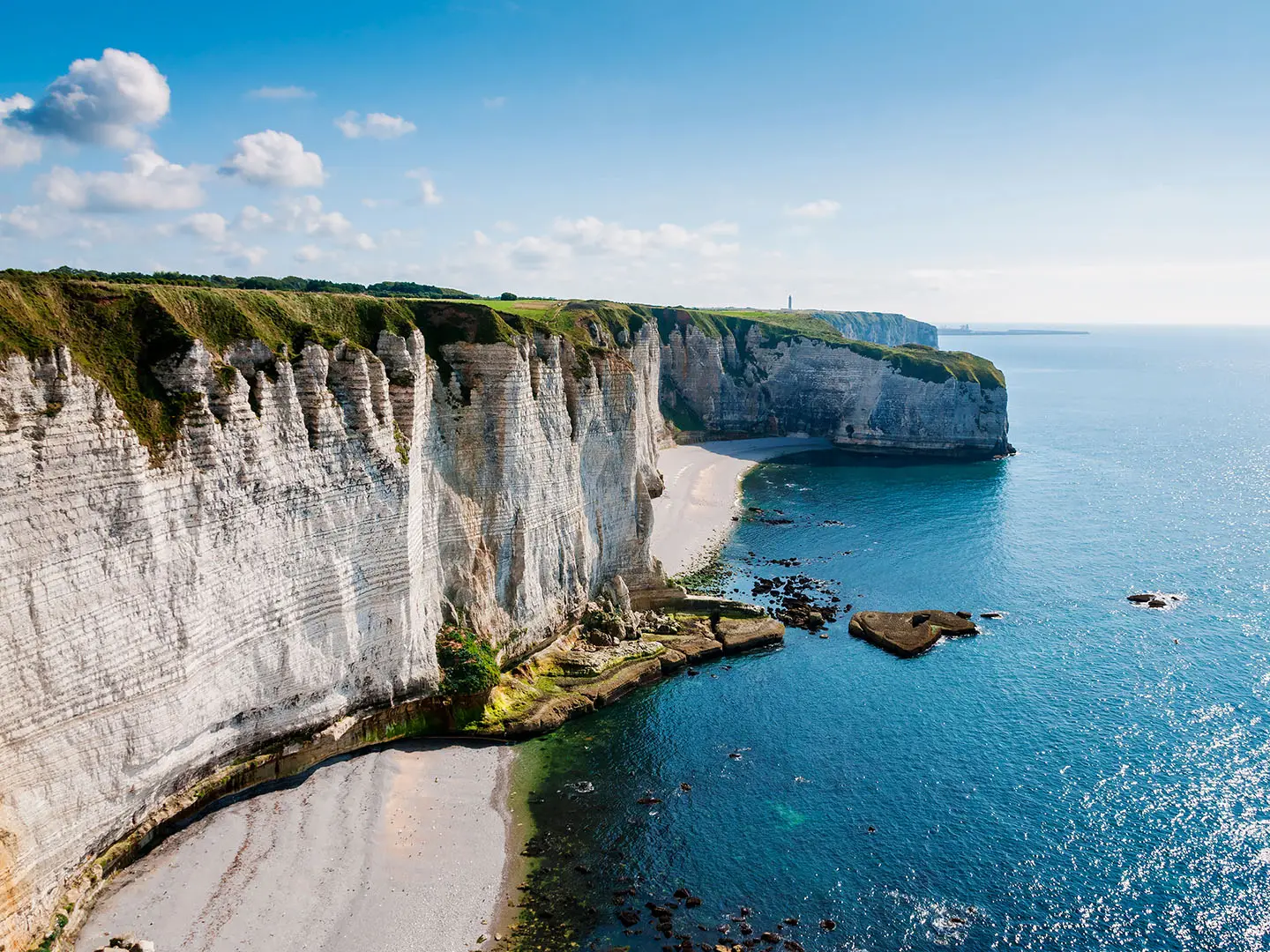
GR21 (Alabaster Coast Path)
How would you rate GR21 (Alabaster Coast Path)?
Tap a star to share your experience and help other hikers.
GR21 (Alabaster Coast Path): Normandy’s Cliff-Top GR
HikeList Score
GR21 (Alabaster Coast Path) scored 87/100 on HikeList's trail-quality metrics.
See score breakdownHide breakdown
- Ideal length 96
- Balanced challenge 100
- Scenery & wildness 71
- Varied terrain 83
- Accommodation 83
- Food & support 88
- Path quality 98
- Season flexibility 89
Computed from length, challenge, scenery & wildness, terrain variety, accommodation, food & support, path quality and season flexibility.
The GR21 is a waymarked French GR trail along the Alabaster Coast of Normandy, France, running about 190 km from Le Tréport to Le Havre. Allow around 9 days for the standard itinerary. It is a moderate, point-to-point coastal walk: non-technical underfoot, but with repeated short climbs through dry valleys, exposed chalk clifftops, Channel weather and some long town-to-town stages. It suits hikers who want a scenic, well-marked French thru-hike with regular villages, ports and accommodation.
Route Overview
The GR21 runs north-east to south-west from Le Tréport, beside Mers-les-Bains, to Le Havre at the mouth of the Seine. It can be walked in either direction, though Le Tréport to Le Havre is the common framing. The route follows the Côte d’Albâtre through or near Criel-sur-Mer, Dieppe, Varengeville-sur-Mer, Veules-les-Roses, Saint-Valery-en-Caux, Fécamp, Étretat, Le Tilleul, Gonneville-la-Mallet and Montivilliers. This is a linear walk, so plan start/end transport and overnight stops carefully. For more French coastal walking, compare the Bordeaux to Arcachon Trail; for another Normandy history-focused route, see the D-Day Beaches Circuit.
Coast, ports and wartime history
The Côte d’Albâtre is a long chalk coastline used as a landmark by Channel sailors, with ports such as Dieppe and Fécamp active in fishing and trade since the Middle Ages. Its cliffs and light attracted Impressionist painters, including Monet at Étretat. During the Second World War the coast formed part of the German Atlantic Wall; Dieppe was the scene of the 1942 Allied raid, Operation Jubilee. Le Havre was largely destroyed in the war and rebuilt by Auguste Perret. The GR21 was voted France’s favourite GR in 2020.
Notable highlights
- Étretat (chalk arches and Needle): The route’s signature scenery is the clifftop walk past Porte d’Aval, Porte d’Amont, Manneporte and the free-standing Aiguille. These white chalk formations were famously painted by Claude Monet.
- Veules-les-Roses (Plus Beaux Villages de France): A pretty village on the Veules, reputedly France’s shortest river at about 1.1 km. Restored watermills and watercress beds add a gentle contrast to the exposed cliffs.
- Dieppe (historic Channel port): Dieppe has a clifftop castle and strong Second World War associations. Memorials and a Canadian war cemetery recall the 1942 Dieppe Raid.
- Fécamp (harbour and Cap Fagnet): A former fishing and cod-fleet port, Fécamp is known for the Palais Bénédictine. Above the harbour, Cap Fagnet has Atlantic Wall bunkers and broad Channel views.
- Le Tréport and Mers-les-Bains (northern trailhead): Le Tréport sits below high chalk cliffs, while neighbouring Mers-les-Bains is known for its colourful Belle Époque seafront villas.
- Le Havre (southern terminus): The finish is a UNESCO World Heritage Site recognised for Auguste Perret’s post-war reconstruction. Its long beach promenade makes a straightforward end to the walk.
Challenges to expect
The GR21 is not technical, but the effort adds up: about 2,800 m of ascent in repeated short, steep drops and climbs through the valleuses. Clifftop sections are exposed to wind, rain and sea fog, and visibility can matter near cliff edges. Some stages can be long, and recent re-routings mean current maps, GPS or the official topo-guide are useful. For an inland French contrast, see the Châteaux of the Loire Circuit.
HikeList Score
GR21 (Alabaster Coast Path) scored 87/100 on HikeList's trail-quality metrics.
See score breakdownHide breakdown
- Ideal length 96
- Balanced challenge 100
- Scenery & wildness 71
- Varied terrain 83
- Accommodation 83
- Food & support 88
- Path quality 98
- Season flexibility 89
Computed from length, challenge, scenery & wildness, terrain variety, accommodation, food & support, path quality and season flexibility.
 France
Show more data Show less
- Coastal
- Clifftop
- Farmland
- Dirt
- Grass
- Gravel
- Hotels
- Guesthouses
- Campsites
- Family Friendly
- Pet Friendly
- Restrooms
- Water Sources
- Campsites
- Picnic Areas
Download Our Full Guide to GR21 (Alabaster Coast Path) FREE!
Get our comprehensive guide to this hike for free. Save it for later reading or print out at home.
Photos from hikers
Taken on the trail by people who've reviewed GR21 (Alabaster Coast Path).
GR21 (Alabaster Coast Path): The Complete Guide
 i
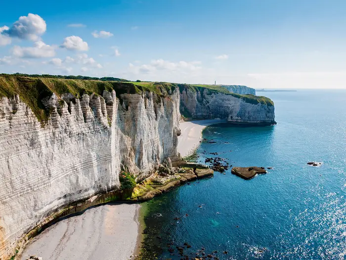
Image by Wolfgang Zwanzger
i
Image by Wolfgang Zwanzger The GR21 is Normandy’s classic clifftop thru-hike: a 190 km waymarked trail along the Côte d'Albâtre from Le Tréport to Le Havre. It suits walkers who want big coastal scenery, regular towns and villages, and a proper point-to-point journey without technical mountain terrain.
The route keeps returning to the edge of the chalk plateau, with white cliffs, pebble beaches and the English Channel below. Étretat gives the headline views — Porte d’Aval, Porte d’Amont, the Manneporte and l’Aiguille — but the quieter days through ports, farmland and valleuses are just as important to the walk’s rhythm.
This is a practical coastal GR rather than a wilderness route. Dieppe, Saint-Valery-en-Caux, Fécamp, Étretat and Le Havre make accommodation, food and transport planning manageable, while buses and rail hubs give useful options for splitting stages.
The challenge is not altitude: the route barely rises above the cliff plateau. What wears walkers down is the repeated drop to beach level and climb back out through the valleuses, plus exposed paths where wind, rain, mud and sea fog can make the clifftops feel much more serious.
This guide covers stages, days, accommodation, food, transport, terrain and the common planning mistakes to avoid.
Stage-by-Stage Guide
The stage split below follows the practical 8-stage itinerary used on this page. It is a relatively brisk schedule, with several days over 20 km and repeated short climbs through the valleuses. Walkers wanting easier days can split the route into 10–12 stages using the coastal villages and transport hubs, especially around Dieppe, Saint-Valery-en-Caux, Fécamp and Étretat.
Distances on the GR21 vary slightly with cliff-path diversions and local re-routings. Carry an up-to-date map, GPX or current FFRandonnée topo-guide, and check local notices where erosion has forced the path back from the cliff edge.
Stage 1: Le Tréport to Criel-sur-Mer — 21 km
The GR21 begins in the cliff-foot port town of Le Tréport, beside Mers-les-Bains, and immediately introduces the character of the route: a climb from sea level onto the chalk clifftop, followed by open coastal walking above the English Channel. The colourful Belle Époque seafront of Mers-les-Bains and the high chalk escarpment above Le Tréport make this one of the more dramatic starts to a French GR.
Terrain is mostly cliff-top path, grass and dirt track, with the first of many short descents and re-ascents where the plateau is cut by valleuses. After rain, the grassy and earthen sections can be slippery, and the exposed cliff edge should be treated with real caution in wind or sea fog.
Food and water are most reliable at the start in Le Tréport and Mers-les-Bains, then at the finish in Criel-sur-Mer. Do not assume frequent daytime resupply between the main settlements; carry enough water and snacks for the full stage, especially outside summer.
Criel-sur-Mer is a practical overnight halt with accommodation options typical of the coast: small hotels, chambres d'hôtes, gîtes and seasonal camping nearby. Availability can tighten in summer and during weekends, so booking ahead is sensible.
Le Tréport has a station with TER links via Abbeville/Beauvais and onward connections towards Paris and Amiens, plus bus links towards Dieppe. Criel-sur-Mer has road access and is on the coastal transport corridor, but current regional bus times should be checked before travelling.
Navigation is straightforward in normal visibility, following the red-and-white GR balises. The main planning point is not complexity but exposure: stay back from unfenced cliff edges, and follow any signed diversion rather than trying to keep to an eroded clifftop line.
Stage 2: Criel-sur-Mer to Dieppe — 25 km
This is a longer coastal stage with a classic GR21 rhythm: high chalk cliff, descent through a valleuse or settlement, then another climb back to the plateau. Berneval-le-Grand lies on the line towards Dieppe and provides a useful intermediate reference point on an otherwise open section of coast.
The walking is non-technical but cumulative. Expect grass, dirt and gravel paths, occasional enclosed tracks and some approach walking into the larger port at Dieppe. Mud can linger on shaded or worn sections after rain.
Views are broad and open for much of the day, with the Channel on one side and farmland or enclosed meadows on the other. The approach to Dieppe gives a strong sense of arrival into one of the route’s main towns, with the cliffs framing the historic port.
Food and water should be planned carefully. Criel-sur-Mer and Dieppe are the dependable service points, while smaller places en route may have limited or seasonal options. Carry a full day’s supply unless opening times have been checked.
Dieppe is one of the best overnight stops on the GR21, with a wider choice of hotels, chambres d'hôtes and other accommodation than the smaller villages. It is also a good place to resupply before the next long stage.
Dieppe is a key transport hub on the route, with regional transport links and buses serving the coastal corridor. This makes it a useful place to start, end or pause a section hike. Current train and cars Nomad bus services should be checked before travelling.
Navigation into and out of Dieppe requires a little more attention than the open cliff sections because of town streets, harbour approaches and promenades. The GR waymarking remains the main guide, but an up-to-date GPX or map helps avoid missing turns where urban walking replaces open path.
Stage 3: Dieppe to Saint-Valery-en-Caux — 27 km
This is one of the longest and most varied stages on the itinerary, linking Dieppe with Saint-Valery-en-Caux via a sequence of coastal villages. The route passes through or near Varengeville-sur-Mer, Sainte-Marguerite-sur-Mer, Quiberville, Saint-Aubin-sur-Mer, Sotteville-sur-Mer, Veules-les-Roses and Manneville-ès-Plains before reaching Saint-Valery-en-Caux.
The day combines cliff-top walking, valleys down to the coast, village lanes, farmland edges and sections around pebble beaches and small seaside settlements. Although the maximum altitude is low, the repeated drops and climbs make this a tiring stage, particularly with a full pack.
Varengeville-sur-Mer is one of the notable cultural stops on the GR21, with its seaman’s church, clifftop cemetery and the Bois des Moutiers gardens. Later, Veules-les-Roses is a major highlight: a Plus Beaux Villages de France on the river Veules, with restored watermills and watercress beds.
Food and water opportunities are better than on some remoter-feeling stages because several villages break up the route. Even so, services may be seasonal or closed on certain days, so do not rely on every village having open provisions. Start from Dieppe with enough water and food to cover long gaps.
Saint-Valery-en-Caux is a natural mid-route halt, set in a break in the cliffs with fishing and yachting harbour facilities. Accommodation is generally more available here than in the smaller clifftop villages, but advance booking remains wise in peak season and shoulder-season weekends.
Road access is available at the villages along the stage, and regional buses serve many coastal settlements in Seine-Maritime. Dieppe and Saint-Valery-en-Caux are both useful transport points for shortening the walk, though current cars Nomad timetables should be checked before travelling.
Navigation is mostly uncomplicated, but this is a day where fatigue can cause mistakes. Take care where the GR drops into villages and climbs back out, as it is easy to follow local paths, beach access tracks or roads instead of the red-and-white balises. Cliff-edge caution is essential throughout.
Stage 4: Saint-Valery-en-Caux to Fécamp — 25 km
This stage continues south-west along the Côte d'Albâtre from one important harbour town to another. Between Saint-Valery-en-Caux and Fécamp, the route passes coastal settlements including Veulettes-sur-Mer, Saint-Pierre-en-Port and Criquebeuf-en-Caux.
The walking is a mix of open clifftop, short inland-feeling sections across the plateau, descents through valleuses and approaches to small seaside villages. Underfoot is mostly dirt, grass and gravel, with mud possible after rain and exposed sections where wind can make progress feel slower than the distance suggests.
The key pattern is repetition rather than technical difficulty. Each descent to a village or beach level removes height that must soon be regained, and the stage’s effort is best judged by the cumulative climbing rather than the modest altitude.
Food and water are available at the larger settlements at either end, with possible options in intermediate villages. Because smaller coastal services can be seasonal, walkers should carry enough for the full day unless opening times have been checked.
Fécamp is one of the main overnight and resupply stops on the GR21. It has a wider accommodation base than the smaller villages, including hotels, chambres d'hôtes, gîtes and campsites in or around the town.
Fécamp is also a transport hub for the route, making this a practical place to break the itinerary or join the trail for a shorter section. Regional buses serve much of the coast, but current services should be checked before travelling.
On arrival at Fécamp, the route is associated with Cap Fagnet above the harbour, the highest named clifftop landmark on the Alabaster Coast at roughly 105–110 m. The area also has Atlantic Wall bunkers and a radar site, giving broad Channel views when visibility is good.
Stage 5: Fécamp to Étretat — 21 km
This is one of the signature stages of the GR21, linking Fécamp with Étretat via Yport and Vattetot-sur-Mer. It is shorter than several earlier days but should not be underestimated, as the cliff-and-valleuse terrain remains physically demanding.
The route leaves Fécamp and returns to high coastal ground, alternating between cliff-top paths, grassy tracks, enclosed sections and village approaches. Yport provides a useful intermediate coastal stop before the path continues towards the celebrated cliffs around Étretat.
The highlight is the approach to Étretat, where the chalk architecture of the Côte d'Albâtre becomes most famous. The GR21 gives access to views of the arches Porte d'Aval, Porte d'Amont and the Manneporte, as well as the free-standing needle, l'Aiguille.
Food and water are dependable at Fécamp and Étretat, with possible services at Yport and other settlements depending on season and opening days. Carrying a packed lunch is still the safest approach, as the walking between villages can be exposed and there are limited sheltered alternatives in poor weather.
Étretat is a major tourist village and a key overnight halt. Accommodation demand can be high in summer and at weekends, so booking ahead is particularly important here.
Public transport and road access are available at the main settlements, with Fécamp acting as the stronger hub. Buses along the coastal corridor can help split the stage, but timetables should be checked before travelling.
Navigation around Étretat needs care because there are many local paths, viewpoints and visitor routes. Stay on the marked GR line and obey cliff-edge barriers or diversion signs; the cliffs are unfenced in places, subject to erosion, and dangerous in wind or poor visibility.
Stage 6: Étretat to Saint-Jouin-Bruneval — 18 km
This is a shorter stage on paper, but it begins in some of the busiest and most exposed scenery on the route. Leaving Étretat, the GR21 continues along the cliff system before passing Le Tilleul and reaching Saint-Jouin-Bruneval.
Expect more clifftop walking, field-edge paths, short climbs and descents, and sections where the route moves slightly inland around the broken coastline. The path remains non-technical, but the exposure is real, especially near viewpoints and cliff-top bends.
The early part of the day is dominated by the Étretat cliffs and their chalk formations. Once away from the village, the route becomes quieter and more practical in character, crossing between coastal edge, rural plateau and small settlements.
Food and water are easiest to arrange in Étretat before departure. Le Tilleul and Saint-Jouin-Bruneval are smaller, so check current services and accommodation before relying on them. Carry enough supplies for the full stage.
Saint-Jouin-Bruneval is a smaller overnight stop than Étretat, Dieppe or Fécamp. Accommodation may be thinner, so this is a stage where booking ahead matters, or where some walkers may choose to adjust the itinerary using nearby transport.
Road access is available at the named villages, and regional buses may be useful for linking or shortening stages. Current cars Nomad services should be checked before travelling.
Navigation is generally simple where the red-and-white balises are clear, but local paths near Étretat and any cliff diversions can complicate the start. Do not use informal cliff-edge trods to shortcut the waymarked route.
Stage 7: Saint-Jouin-Bruneval to Montivilliers — 23 km
This stage marks a change in feel as the route heads away from the most continuous cliff scenery and towards the approaches to Le Havre. From Saint-Jouin-Bruneval, the itinerary passes Gonneville-la-Mallet before reaching Montivilliers.
The terrain is more mixed, with coastal plateau, farmland, enclosed paths, village lanes and more inland-feeling walking. There may be less constant sea view than on the earlier stages, but the day remains part of the GR21’s point-to-point progression towards the Seine estuary.
Because the walking is less dominated by obvious cliff-edge navigation, pay closer attention to waymarks at road crossings, field edges and village exits. Red-and-white GR balises are the primary guide, but a map or GPX is useful where the route threads through lanes and rural tracks.
Food and water should be planned from the start. Saint-Jouin-Bruneval and Gonneville-la-Mallet are smaller places than the main ports, while Montivilliers is the more substantial end point. Services and opening times should be checked before travelling.
Montivilliers is a practical overnight halt before the final approach to Le Havre. Accommodation options may include town-based hotels and guest accommodation, but availability and location relative to the GR should be checked before booking.
Road access is better on this more settled section, and Montivilliers has stronger onward transport possibilities than the smaller villages behind it. For public transport connections, current regional services should be checked before travelling.
The main warnings are ordinary but important: watch for road sections and crossings, keep to the marked route through agricultural land, and expect mud on field paths after wet weather. This is not the most dramatic stage, but it is still a full walking day.
Stage 8: Montivilliers to Le Havre — 14 km
The final stage is the shortest in this itinerary and leads from Montivilliers into the urban finish at Le Havre. It passes towards Sainte-Adresse before reaching the long beach promenade and the rebuilt port city at the mouth of the Seine.
Terrain changes noticeably from rural and suburban approaches to promenade and city walking. The stage is easier in distance terms than earlier days, but hard surfaces can be tiring after a week of coastal paths.
Sainte-Adresse provides the last coastal approach before Le Havre, with the finish framed by the Baie de Seine and the city’s seafront. Le Havre’s UNESCO World Heritage centre, rebuilt after the Second World War by Auguste Perret, is the major urban landmark at the end of the GR21.
Food and water are much less of a concern than on the remote-feeling cliff stages, as Montivilliers, Sainte-Adresse and Le Havre are settled areas. Even so, start with water and do not rely on every café or shop being open at the exact point where the GR passes.
Le Havre has the broadest accommodation choice at the southern end of the route, from hotels to other town-based options. It is the logical place to book a final night, especially if onward trains are planned for the following day.
Le Havre is a major SNCF station with direct trains to Paris-Saint-Lazare and Rouen. Montivilliers and Sainte-Adresse also have road and local transport access, but current services should be checked before travelling.
Navigation becomes urban rather than wild. Follow the red-and-white GR markings carefully through built-up areas, where signs, street furniture and local paths can make waymarks easier to miss than on the open cliffs. The final kilometres are not technically difficult, but they require attention until the route reaches its Le Havre finish.
Recommended Itinerary
The GR21 is easy to divide because it regularly drops into ports and resort villages, but the stage lengths can still feel harder than they look. The repeated descents and climbs through the valleuses make 25 km on this coast noticeably more tiring than a flat coastal promenade.
Distances vary depending on current routing and cliff-path diversions, so treat the figures below as planning distances and check current GR mapping before booking accommodation.
Standard itinerary: 8 walking days between main hubs
| Day | From | To | Approx. distance | Why this stage makes sense | Services/accommodation notes |
|---|---|---|---|---|---|
| 1 | Le Tréport | Criel-sur-Mer | 21 km | A practical first day out of the northern trailhead, climbing straight from the seafront onto the chalk clifftop and settling into the route’s pattern of cliff path, valley dips and coastal villages. | Le Tréport has start-of-walk services and transport links. Criel-sur-Mer is a smaller overnight stop, so book ahead rather than assuming late availability. |
| 2 | Criel-sur-Mer | Dieppe | 25 km | A longer second stage, with the route continuing along the exposed Côte d’Albâtre before reaching the major Channel port of Dieppe. | Dieppe is one of the best places on the route for accommodation, food and onward transport. It is a useful place to recover, resupply or join/leave the trail. |
| 3 | Dieppe | Saint-Valery-en-Caux | 27 km | This is one of the longest standard days and should not be underestimated. It passes a string of coastal villages including Varengeville-sur-Mer, Sainte-Marguerite-sur-Mer, Quiberville, Saint-Aubin-sur-Mer, Sotteville-sur-Mer and Veules-les-Roses before reaching Saint-Valery-en-Caux. | Saint-Valery-en-Caux is a natural mid-route halt with port-town services. If 27 km is too much, this is one of the best stages to split; check accommodation and bus options in the intermediate villages before committing. |
| 4 | Saint-Valery-en-Caux | Fécamp | 25 km | Another substantial coastal day, continuing through valleuses and smaller settlements such as Veulettes-sur-Mer, Saint-Pierre-en-Port and Criquebeuf-en-Caux before dropping into Fécamp. | Fécamp is a main transport and accommodation hub. It is a sensible place for a rest evening, resupply or an itinerary break. |
| 5 | Fécamp | Étretat | 21 km | A classic GR21 stage, leaving Fécamp via the high cliffs around Cap Fagnet and continuing through Yport and Vattetot-sur-Mer towards Étretat. | Étretat is the most famous stop on the route and accommodation demand can be high. Book ahead, especially in holiday periods and at weekends. |
| 6 | Étretat | Saint-Jouin-Bruneval | 18 km | A shorter day after the major scenery around Étretat, giving time to handle the clifftop sections without rushing. The route passes Le Tilleul before continuing towards Saint-Jouin-Bruneval. | Services become thinner after Étretat. Saint-Jouin-Bruneval is a smaller overnight, so accommodation should be arranged in advance. |
| 7 | Saint-Jouin-Bruneval | Montivilliers | 23 km | A useful penultimate stage that positions the walk close to Le Havre without making the final day too long. The route continues via Gonneville-la-Mallet before reaching Montivilliers. | Montivilliers is a practical overnight before the urban finish. Check current local transport if using this as a join/leave point. |
| 8 | Montivilliers | Le Havre | 14 km | A short final stage into Le Havre, allowing an unhurried finish via Sainte-Adresse and the approach to the city. | Le Havre has the best end-of-route transport, with a major SNCF station and direct rail links to Paris-Saint-Lazare and Rouen. |
Slower variant: 10–12 walking days
A 10–12 day schedule suits walkers who prefer shorter days, want time in places such as Dieppe, Veules-les-Roses, Fécamp and Étretat, or are carrying heavier packs. It is also the safer choice in poor weather, when exposed clifftop walking and muddy paths can slow progress.
Use the standard itinerary above, then split one or more of the longer days. The most useful places to consider are shown below; exact stage distances should be checked against current GR mapping before booking.
| Day | From | To | Approx. distance | Why this stage makes sense | Services/accommodation notes |
|---|---|---|---|---|---|
| Optional split | Criel-sur-Mer | Berneval-le-Grand or another intermediate stop before Dieppe | Check official mapping before booking | Breaks the 25 km approach to Dieppe into an easier section. | Accommodation is thinner outside the larger ports; book before relying on this split. |
| Optional split | Dieppe | Quiberville or Veules-les-Roses | Check official mapping before booking | Reduces the demanding 27 km Dieppe to Saint-Valery-en-Caux stage and gives more time for Varengeville-sur-Mer and the villages east of Saint-Valery. | Village accommodation and buses should be checked before travelling. Veules-les-Roses is a popular stop, so advance booking is sensible. |
| Optional split | Saint-Valery-en-Caux | Veulettes-sur-Mer or Saint-Pierre-en-Port | Check official mapping before booking | Breaks the 25 km stage to Fécamp, useful if conditions are windy or the valleuse climbs are taking longer than expected. | Smaller coastal overnights have fewer options than Fécamp or Saint-Valery-en-Caux. Confirm accommodation before fixing the day. |
| Optional split | Fécamp | Yport | Check official mapping before booking | Allows a shorter day over the high ground around Cap Fagnet and avoids rushing the Fécamp to Étretat section. | Yport is a smaller coastal stop; book ahead and check onward options. |
Faster variant: 6–7 walking days
A faster schedule is only suitable for fit walkers who are comfortable with repeated 30 km-plus coastal days and do not need much time in the towns. It is easier with a light pack and settled weather, but there is little advantage in rushing the most scenic sections around Fécamp and Étretat.
| Day | From | To | Approx. distance | Why this stage makes sense | Services/accommodation notes |
|---|---|---|---|---|---|
| Fast option | Saint-Jouin-Bruneval | Le Havre, via Montivilliers | 37 km | Combines the final two standard stages into one long finish. This is the cleanest way to reduce the itinerary by a day using the stage distances above. | Le Havre has strong end-of-route transport and accommodation, but the day is long; start early and carry enough food and water for the full section. |
| Very fast option | Fécamp | Saint-Jouin-Bruneval, via Étretat | 39 km | Combines two scenic stages and keeps the itinerary moving quickly, but it is a hard day with no margin for lingering around Étretat. | Only for strong walkers. Accommodation at Saint-Jouin-Bruneval should be secured before attempting this, as services are thinner after Étretat. |
For most independent walkers, the best balance is the standard hub-based plan with one extra split day added to either Dieppe–Saint-Valery-en-Caux or Saint-Valery-en-Caux–Fécamp. That keeps the itinerary close to the usual 9-day rhythm while avoiding the toughest back-to-back long stages.
Planning the Route
How many days to allow
Most walkers should plan around 9 walking days for the full GR21. That gives enough time for the repeated valleuse descents and climbs without turning every stage into a long forced march, and it fits the natural spacing of the main coastal towns.
A 10–12 day schedule is often more comfortable, especially if booking smaller guesthouses, walking outside high summer, or wanting time in Dieppe, Fécamp, Étretat and Le Havre. Fit walkers can complete the core line in fewer days, but the route is more tiring than its low altitude suggests: the walking is never high-mountain, but it is constantly up and down between clifftop and sea-level breaks in the chalk.
Do not plan stages purely by map distance. A 20–25 km day on the Côte d'Albâtre can feel longer in wet grass, wind, sea fog or after several repeated climbs out of valleuses.
Stage planning and accommodation spacing
Daily stages are largely dictated by where there is accommodation. The useful overnight bases are the ports and resort villages such as Dieppe, Saint-Valery-en-Caux, Fécamp, Étretat and Le Havre, with smaller options in coastal settlements between them.
Accommodation is generally easier near the larger towns, but thinner on some clifftop stretches. Book ahead if walking in the shoulder seasons, at weekends, or if relying on campsites, chambres d'hôtes or smaller gîtes rather than hotels.
The practical choice is usually between:
| Schedule style | Best for | Planning implications |
|---|---|---|
| Faster schedule | Fit walkers with light packs | Longer town-to-town stages; less flexibility if weather deteriorates |
| Standard schedule | Most thru-hikers | Uses the main accommodation hubs; still includes several substantial days |
| Slower 10–12 day schedule | Walkers wanting shorter days or more time in towns | Requires more careful accommodation planning in smaller villages |
Where a day looks awkward on paper, check whether a nearby village, campsite, guesthouse or bus link can break the stage. This should be checked before travelling, as accommodation availability and regional bus timetables change.
Walking direction
The GR21 can be walked either from Le Tréport to Le Havre or from Le Havre to Le Tréport. The north-to-south direction used here starts in the smaller cliff-foot port of Le Tréport and finishes in the larger transport hub of Le Havre, which can make the end-of-walk journey simpler.
Walking south to north is equally valid, particularly if train connections into Le Havre work better for the start. Direction is less important than securing accommodation and checking transport at the less frequent end of the route.
Shortening, splitting and section hiking
The GR21 is well suited to section hiking. Dieppe and Fécamp are the key intermediate transport hubs, while regional buses serve many coastal villages along the route.
This makes it practical to walk the route in two or three blocks rather than as one continuous thru-hike. A common approach is to use the larger towns as start or finish points for sections, then use local buses or rail links to return to accommodation or continue onward.
Do not assume every village has frequent transport every day. Cars Nomad/Seine-Maritime bus services and SNCF/TER rail times should be checked before travelling, especially on Sundays, public holidays and outside the main visitor season.
The route can also be shortened by walking only the central or southern sections around Fécamp and Étretat, where the clifftop scenery is especially concentrated. Extending beyond Le Havre is no longer the GR21 itself; onward coastal walking belongs to other route planning and should be based on an up-to-date map or guide.
Navigation and current route line
The GR21 is a waymarked French Grande Randonnée, using red-and-white GR blazes. In settled weather, navigation is usually straightforward, especially where the path follows obvious clifftop or coastal links between towns.
Even so, carry current mapping or a recent GPX. The coast is active and exposed, and cliff-path diversions or re-routings can affect the exact line. Older route files may not match the safest or current waymarked route.
The current FFRandonnée topo-guide covering the GR21/GR223 is useful for detailed planning. It is especially worth having if splitting the route into non-standard stages or relying on smaller accommodation stops.
Food, water and daily resupply
This is not a wilderness route, but daily resupply still needs thought. The GR21 repeatedly leaves the towns for open clifftop, farmland, meadows and valleuses, where there may be no services until the next settlement.
Carry enough water and food for the full walking day, not just to the next village name on the map. Seasonal openings, lunch closures and smaller village facilities should be checked before travelling.
Larger stops such as Dieppe, Saint-Valery-en-Caux, Fécamp, Étretat and Le Havre are the most reliable places to restock and reset. On shorter-stage itineraries, avoid assuming that every overnight village will have evening meals, shops or late-opening services.
Weather and cliff-edge planning
Weather is one of the main planning factors on the GR21. The route is low, but the clifftops are exposed to wind, rain and sea fog, and the chalk edge is dangerous where paths run close to unfenced drops.
Build flexibility into the itinerary where possible. A stage that is manageable in calm weather can become slow and uncomfortable in strong wind or poor visibility, especially when the path is muddy after rain.
Avoid walking close to cliff edges, even where a trodden line appears tempting. Follow the waymarked route and any local diversion signs, particularly around eroding or unstable cliff sections.
Permits and access
No special hiking permit is required for walking the GR21. The main administrative planning is practical rather than bureaucratic: accommodation reservations, transport times, current route information and weather conditions.
Wild camping rules and campsite availability are not fixed by the route itself and should be checked locally before relying on them. For most walkers, the simplest plan is to book recognised accommodation or campsites in advance along the main coastal stops.
Towns, Villages and Overnight Stops
Accommodation is generally easiest in the ports and resort villages rather than on the open clifftop sections. The strongest overnight bases are Le Tréport, Dieppe, Saint-Valery-en-Caux, Fécamp, Étretat and Le Havre, with Criel-sur-Mer, Saint-Jouin-Bruneval and Montivilliers useful for breaking the route into practical walking days.
On the smaller village stops, do not assume year-round accommodation, evening meals or open shops. Book ahead in the shoulder seasons, and check current opening days for restaurants, campsites and chambres d'hôtes before committing to a stage.
| Place | Best use for hikers |
|---|---|
| Le Tréport / Mers-les-Bains | Start or finish logistics, first/last night, rail and bus access |
| Criel-sur-Mer | Practical early overnight stop between Le Tréport and Dieppe |
| Dieppe | Major service and transport hub; good restock and accommodation base |
| Saint-Valery-en-Caux | Natural mid-route port stop with stronger services than the clifftop villages |
| Fécamp | Major overnight and transport hub before or after Cap Fagnet |
| Étretat | Essential scenic stop; book early in busy periods |
| Saint-Jouin-Bruneval | Useful overnight after Étretat on shorter-stage itineraries |
| Montivilliers | Inland final-stage stop before Le Havre |
| Le Havre | End or start logistics, major rail hub, full city services |
Le Tréport
Le Tréport is the northern trailhead used for the Le Tréport to Le Havre direction. The GR21 leaves the cliff-foot port town and climbs straight onto the chalk clifftop, so it is worth staying here the night before if starting early.
It is one of the better places on the northern end for accommodation, food and last-minute supplies. Mers-les-Bains sits immediately beside it, so the two towns can be treated together for booking purposes.
Le Tréport has a station on the TER network, with links via Abbeville or Beauvais towards Paris and Amiens, and bus links towards Dieppe. Timetables should be checked before travelling, especially if arriving late or outside the main holiday season.
Local notes for walkers are simple: start with water and food for the first day, because the route becomes more exposed once it leaves the seafront. The funicular and high chalk cliffs above the town are useful orientation points, but the GR waymarking should be followed rather than improvised cliff-edge shortcuts.
Mers-les-Bains
Mers-les-Bains is beside Le Tréport at the northern end of the walk. It is not a separate logistical problem from Le Tréport, but it can widen the accommodation search if beds in Le Tréport are limited.
The town is known for its Belle Époque seafront villas and is a useful first or last evening stop rather than a major stage break. Food and accommodation are generally more realistic here than in the small clifftop settlements further south, but current availability should still be checked before travelling.
For transport, use the Le Tréport arrangements unless an accommodation provider gives a more convenient local option. Walkers starting here should allow time to reach the GR21 trailhead and climb out of the town onto the cliff route.
Criel-sur-Mer
Criel-sur-Mer is the standard first overnight stop on the route profile used here, around a full walking day south-west of Le Tréport. It is a practical halt before the longer stage towards Dieppe.
Accommodation is available in and around the coastal settlements on the GR21, but it is thinner than in the main ports. Book ahead rather than arriving without a reservation, particularly if walking outside summer or at weekends.
Treat Criel-sur-Mer as a functional resupply and overnight point, not a guaranteed late-opening service centre. Check restaurant and shop opening times before relying on them for dinner or next-day provisions.
Regional buses along the Seine-Maritime coast may help with stage splitting or escape logistics from this part of the route. Current cars Nomad/Seine-Maritime services should be checked before travelling.
Berneval-le-Grand
Berneval-le-Grand lies between Criel-sur-Mer and Dieppe. For most thru-hikers it is a passing village or a possible way to shorten the Criel-sur-Mer to Dieppe day, rather than a primary overnight base.
Accommodation and food options should not be assumed without booking. If using Berneval-le-Grand to split the stage, secure the bed and evening meal first, then plan the walking day around it.
Bus possibilities on this coast can be useful, but specific services and frequencies change. This should be checked before travelling.
Dieppe
Dieppe is one of the most important stops on the GR21. It is a historic Channel port, a natural overnight base, and one of the main transport hubs along the route.
This is a strong place for hotels, chambres d'hôtes, restaurants, cafés and shopping compared with the smaller coastal villages. It is also a sensible restock point before continuing towards Varengeville-sur-Mer, Quiberville, Veules-les-Roses and Saint-Valery-en-Caux.
Dieppe has regional transport links and is served by buses along the coast, making it useful for section hikers or for changing plans in poor weather. Check current rail and cars Nomad/Seine-Maritime timetables before building an itinerary around a connection.
Walkers may also choose to pause here for the Château de Dieppe and the Second World War history associated with Operation Jubilee. From a practical point of view, its main value is that it gives a full-service stop after the more limited northern villages.
Varengeville-sur-Mer
Varengeville-sur-Mer is south-west of Dieppe on the clifftop part of the route. It is a worthwhile stop for walkers who want a shorter day out of Dieppe or who are building a slower itinerary through this section.
Accommodation may be possible in or near the village, but it should be booked in advance. Do not rely on turning up and finding a room, especially in smaller villages where chambres d'hôtes and gîtes may have limited capacity.
Food and shop availability should be checked before travelling. If staying here, arrange dinner as part of the booking plan or confirm where the nearest open restaurant is.
The village is known for its seaman's church, clifftop cemetery and the Bois des Moutiers gardens. These are useful reasons to slow the stage, but the logistics need to be fixed before arrival.
Sainte-Marguerite-sur-Mer
Sainte-Marguerite-sur-Mer is one of the smaller coastal villages between Dieppe and the Saint-Valery-en-Caux area. It can help divide the longer Dieppe to Saint-Valery-en-Caux section if accommodation is available.
This is not one of the main service hubs on the route. Carry food and water from Dieppe unless current local options have been checked.
Regional coastal buses may be useful nearby, but frequencies and stops should be checked before travelling. For most walkers, Sainte-Marguerite-sur-Mer is best treated as a planned, pre-booked stop rather than a flexible fallback.
Quiberville
Quiberville is another coastal settlement between Dieppe and Saint-Valery-en-Caux. It may suit walkers who prefer shorter daily distances or who want to avoid making the full Dieppe to Saint-Valery-en-Caux stage in one push.
Accommodation, restaurants and small services can be seasonal in places of this size. Book and confirm meal options in advance.
As with the other villages in this section, Quiberville is useful only if it fits a confirmed overnight plan. Otherwise, carry enough supplies to continue to a larger stop.
Saint-Aubin-sur-Mer
Saint-Aubin-sur-Mer sits on the same Dieppe to Saint-Valery-en-Caux stretch. It is a smaller route village rather than a primary GR21 hub.
Use it as a possible intermediate stop only with confirmed accommodation. Food and shops should be checked before relying on them.
For transport or stage-shortening, check current regional bus arrangements before travelling. Do not plan a tight connection here without verifying the timetable.
Sotteville-sur-Mer
Sotteville-sur-Mer is a small coastal village before Veules-les-Roses and Saint-Valery-en-Caux when walking south-west. It is useful mainly for walkers creating a shorter custom itinerary.
Accommodation may exist in the area, but availability should be checked and booked ahead. Expect fewer services than in Dieppe or Saint-Valery-en-Caux.
If passing through, treat it as part of a longer walking day with food already carried. If stopping overnight, confirm dinner and breakfast options before arrival.
Veules-les-Roses
Veules-les-Roses is one of the most attractive village stops on the GR21 and a good candidate for a shorter-stage overnight if the standard day is too long. It lies before Saint-Valery-en-Caux when walking from Dieppe.
The village is recognised as one of Les Plus Beaux Villages de France and sits on the River Veules, often cited as France's shortest river at about 1.1 km. Restored watermills and watercress beds make it a worthwhile place to pause, but it can also be popular, so accommodation should be booked ahead.
Food and cafés are more plausible here than in the smallest clifftop villages, but opening times remain important. Confirm current restaurant and shop availability before relying on the village for an evening meal or next-day supplies.
Regional bus options may help with section walking in this area. This should be checked before travelling.
Manneville-ès-Plains
Manneville-ès-Plains lies shortly before Saint-Valery-en-Caux on the route list. It is best regarded as a minor intermediate settlement rather than a main overnight stop.
Use it only for a split stage if accommodation has been confirmed in advance. Do not assume shops, restaurants or frequent transport.
Most walkers will continue to Saint-Valery-en-Caux for stronger services and a more practical overnight halt.
Saint-Valery-en-Caux
Saint-Valery-en-Caux is one of the key overnight stops on the GR21. It is a traditional fishing and yachting port set in a break in the cliffs, making it a natural place to end a stage.
Accommodation and food options are generally stronger here than in the neighbouring villages. It is a sensible place to restock, eat properly and reset before the next section towards Veulettes-sur-Mer, Saint-Pierre-en-Port and Fécamp.
The port setting also means a descent into town and a climb back out on the next leg, in keeping with the repeated valleuse pattern of the route. Allow for that effort when planning the following day.
Regional buses may serve this part of the coast and can be useful for section hikers. Check current cars Nomad/Seine-Maritime timetables before relying on them.
Veulettes-sur-Mer
Veulettes-sur-Mer lies between Saint-Valery-en-Caux and Fécamp. It can be used to shorten the stage if accommodation is available, but it is not one of the principal service hubs.
Confirm beds, meals and any shop opening times before planning to stop here. If walking through, carry enough food and water from Saint-Valery-en-Caux or another confirmed source.
Transport options along the coast may exist, but they should be checked before travelling. This is especially important if using Veulettes-sur-Mer as an exit point in bad weather.
Saint-Pierre-en-Port
Saint-Pierre-en-Port is another intermediate coastal village on the Saint-Valery-en-Caux to Fécamp section. It may suit walkers dividing the route into shorter days.
Accommodation should be booked ahead, and evening food should be confirmed at the same time. Smaller villages on this coast can be awkward if a planned restaurant is closed.
Most walkers on a standard itinerary will continue to Fécamp, where services and transport are stronger.
Criquebeuf-en-Caux
Criquebeuf-en-Caux sits close to Fécamp on the approach from the north-east. It is a minor stop for route planning rather than a major overnight base.
Use it only if accommodation and meals are confirmed. Otherwise, plan to continue into Fécamp for a more reliable choice of beds, restaurants and onward transport.
The practical issue on this part of the GR21 is timing the arrival into Fécamp after a full coastal day, with repeated descents and climbs through the valleuses. Carry adequate food and water until the town is reached.
Fécamp
Fécamp is one of the main hubs on the GR21 and a very practical overnight stop. It is a former cod-fishing port and a strong place for accommodation, food, resupply and transport.
Walkers often use Fécamp as a firm stage end before the clifftop section towards Yport and Étretat. It is also one of the best places on the route to adjust plans, take a shorter day, or leave and rejoin the trail by regional transport.
Fécamp is a main transport hub on the route, with regional buses serving the coastal corridor. Current rail and bus details should be checked before travelling.
Above the harbour, Cap Fagnet is the highest named clifftop landmark on the route, at about 105-110 m, with Atlantic Wall bunkers and a radar site. The height is modest, but the climb out of town still counts at the end or start of a walking day.
Yport
Yport lies between Fécamp and Étretat. It is a useful intermediate stop for walkers who want to break up this popular section or avoid arriving in Étretat late in the day.
Accommodation may be available, but it should be booked ahead. Étretat can be busy, so Yport can also be considered as a practical alternative if beds there are full, provided onward logistics still work.
Food and café options should be checked before relying on them. If walking through, carry supplies from Fécamp or continue to a confirmed meal stop.
Vattetot-sur-Mer
Vattetot-sur-Mer sits on the Fécamp to Étretat stretch. It is a smaller settlement and is most useful for custom itineraries rather than standard overnight planning.
Accommodation and services should be confirmed in advance. Do not assume a shop or restaurant will be open when passing through.
This section is scenic but still physically repetitive, with the usual Côte d'Albâtre descents and climbs. If staying in Vattetot-sur-Mer, check how far the accommodation sits from the GR and whether meals are available.
Étretat
Étretat is the signature scenic stop on the GR21 and one of the places most walkers will want to spend a night. The route passes the famous chalk arches, including Porte d'Aval, Porte d'Amont and the Manneporte, as well as the free-standing Aiguille.
Because Étretat is popular, accommodation should be booked early in busy periods. It is a better service base than the smaller villages on either side, with more realistic options for eating, resupply and recovery after the Fécamp approach.
The clifftop paths around Étretat are also some of the most visited parts of the trail. Stay on the waymarked route, keep well back from unfenced cliff edges, and take extra care in wind or sea fog.
Regional buses may help with access or stage splitting, but current services should be checked before travelling. If using Étretat as a start or finish for a shorter section, build in time for busy-season crowds and accommodation pressure.
Le Tilleul
Le Tilleul lies just beyond Étretat when heading towards Saint-Jouin-Bruneval. It can be useful for walkers who want to stay near Étretat without necessarily sleeping in the busiest centre.
Accommodation should be checked and booked in advance. Food and shop availability should not be assumed.
For most itineraries, Le Tilleul is a passing or overflow option rather than a core stage end. It can still be valuable if it creates a better-balanced day after Étretat.
Saint-Jouin-Bruneval
Saint-Jouin-Bruneval is a practical overnight stop on the route south-west of Étretat. In the stage pattern used here it follows an approximately 18 km day from Étretat, making it a useful way to avoid pushing too far after the busiest scenic section.
Accommodation is more limited than in Étretat, Fécamp or Le Havre, so book before setting out. Confirm evening meal options at the same time.
Regional bus links may be useful for section walking or exit logistics, but timetables should be checked before travelling. This is not a place to rely on for spontaneous onward transport without checking.
Gonneville-la-Mallet
Gonneville-la-Mallet is inland of the immediate cliff line on the route towards Montivilliers. It is mainly useful for splitting the Saint-Jouin-Bruneval to Montivilliers section.
Accommodation and food should be confirmed in advance. Services are likely to be less extensive than in the larger ports and city stops.
This part of the route begins to feel more like a transition towards the Le Havre urban area, with less emphasis on resort-village logistics. Carry what is needed for the day unless definite resupply has been checked.
Montivilliers
Montivilliers is the main overnight stop before the final approach to Le Havre in the stage pattern used here. It sits inland from the immediate coast and makes the last day into Le Havre comparatively short.
It is a useful place to stop if avoiding a long final push into the city. Accommodation and food options should still be booked and checked in advance, especially if arriving late.
For transport, do not assume details without checking current local services. Its practical value for hikers is as a staging point before the final section to Sainte-Adresse and Le Havre.
Sainte-Adresse
Sainte-Adresse lies on the final approach into Le Havre. It is best treated as part of the finishing corridor rather than a necessary overnight stop, unless accommodation there suits a particular itinerary.
Food, cafés and city-edge services may be more available than in the smaller coastal villages, but exact options and opening times should be checked before relying on them. Walkers ending in Le Havre will usually continue to the city for a wider choice of beds, restaurants and transport.
The route into the finish includes the long beach promenade towards Le Havre. It is a good place to slow down at the end, but the main logistical target remains Le Havre station and city accommodation.
Le Havre
Le Havre is the southern terminus of the GR21 and the strongest transport hub on the route. It has a major SNCF station with direct trains to Paris-Saint-Lazare and Rouen, making it the easiest end for onward travel.
As a large port city, it offers the broadest choice of accommodation, restaurants, shops and services. It is the most practical place to build in a buffer night, especially if connecting to long-distance trains or travelling after a full final walking day.
The rebuilt city centre by Auguste Perret is a UNESCO World Heritage site, and the route finishes by the mouth of the Seine on the Baie de Seine. For hikers, the key planning point is simple: finish with confirmed accommodation or a realistic train connection, and check current SNCF times before travelling.
Getting to the Start
The GR21 is framed here from Le Tréport to Le Havre. Le Tréport is a workable public-transport start, but it is not a high-frequency mainline railhead, so the safest plan is to arrive the day before walking rather than trying to connect straight into the first stage.
By train
Le Tréport has a railway station and is served by TER regional trains, with connections via Abbeville or Beauvais and onward links towards Paris and Amiens. Journey times and connection patterns vary, and missed connections can have a real impact on the start of the hike. This should be checked before travelling.
From the station, the GR21 starts in the cliff-foot port town of Le Tréport, beside Mers-les-Bains, and climbs from the seafront onto the chalk clifftop. If arriving late in the day, staying in Le Tréport or Mers-les-Bains is more practical than beginning the first 21 km stage to Criel-sur-Mer immediately.
Walkers starting at the opposite end can use Le Havre, which is the stronger railhead, with direct SNCF trains to Paris-Saint-Lazare and Rouen. The route is commonly walked in either direction, so Le Havre is the simpler start if rail convenience is the priority.
By bus
Le Tréport has bus links to Dieppe, and regional services in Seine-Maritime are useful for moving along the coast. Cars Nomad / Seine-Maritime buses serve many coastal towns and villages on or near the GR21, including key hubs such as Dieppe and Fécamp.
For the start itself, buses are best treated as a back-up or as part of a section-hiking plan rather than assumed as a turn-up-and-go service. Evening, Sunday and shoulder-season services may be limited. This should be checked before travelling.
By car
Driving to Le Tréport is straightforward in principle, but the route is point-to-point and finishes in Le Havre, so a car left at the start creates an end-of-walk retrieval problem. For a full thru-hike, it is usually cleaner to travel by public transport, or to park at one end and return by train and/or regional bus after finishing.
Long-stay parking arrangements in Le Tréport should not be assumed. Check local parking rules, maximum stay limits and whether overnight parking is allowed before leaving a vehicle for several days. This should be checked before travelling.
A taxi can be useful if a late train connection, reduced bus timetable or accommodation location leaves an awkward gap, especially outside the larger towns. Pre-booking is sensible for early starts, evenings and Sundays.
From the nearest airport
There is no trailhead airport that functions as a simple start point for the GR21. International arrivals will generally need to connect into the French rail network, most commonly via Paris, then continue by TER towards Le Tréport.
Allow generous transfer time between airport arrival, the Paris rail network and the final regional train connection. For many itineraries, arriving in France and travelling to Le Tréport on the same day is possible in theory but tight in practice; building in a pre-walk night removes a lot of risk. Current rail times and transfer requirements should be checked before travelling.
Where to stay before starting
The most practical pre-walk bases are Le Tréport itself or neighbouring Mers-les-Bains. Both put you close to the seafront start, the first climb onto the clifftop and the opening stage towards Criel-sur-Mer.
Booking ahead is sensible in the main walking season and at weekends, particularly if arriving by late train. Starting with food and water already sorted is also worthwhile, as the first day leaves the port and moves onto exposed chalk-cliff walking with repeated ups and downs through the coastal valleys.
Getting Home from the Finish
By train
Le Havre is the easiest end of the GR21 for onward travel. The city has a major SNCF station with direct trains to Paris-Saint-Lazare and Rouen, making it the natural place to finish if you want the simplest public-transport exit.
Do not assume there will be a suitable late train after a full final walking day. Check current SNCF/TER times before fixing the last stage, especially on Sundays, public holidays and outside the main summer season.
If you are walking the GR21 in the opposite direction and finishing at Le Tréport, onward rail is less straightforward. Le Tréport has a station with TER links via Abbeville/Beauvais and connections towards Paris and Amiens, but services are less frequent than from Le Havre and should be planned carefully before travelling.
By bus
Regional buses are useful along the Côte d'Albâtre, but Le Havre’s main advantage at the finish is its rail access. Cars Nomad/Seine-Maritime services connect many coastal settlements on or near the GR21, and can be useful if you stop short, need to leave from an intermediate town, or are returning to accommodation elsewhere on the coast.
Bus timetables are timetable-dependent and can be limited in the evening, at weekends and outside peak season. This should be checked before travelling, particularly if you are relying on a bus after finishing late.
By car/taxi
If being collected by car, Le Havre is a practical finish because it is a large port city rather than a small cliff village. Build in flexibility, as the final approach includes urban walking and the exact meeting point should be agreed in advance.
Taxis are the simplest fallback if you finish tired, in poor weather or after the most convenient public transport has gone. For longer transfers back up the coast, pre-booking is sensible; availability and prices should be confirmed before booking.
From the nearest airport
The GR21 is better suited to a rail exit than an airport transfer directly from the trail. Most international travellers should plan to leave Le Havre by train towards Paris or Rouen, then connect onward from there.
Airport rail and transfer details change, so any same-day flight connection should be planned with a generous margin. This should be checked before travelling.
Where to stay at the finish
Staying overnight in Le Havre is often the most comfortable option, especially after a long final day or if the weather has slowed progress on the clifftops. It removes the pressure of catching a specific evening train and gives more flexibility for onward travel the next morning.
Le Havre is a major city, so accommodation choice is broader than in the smaller coastal villages earlier on the route. Even so, book ahead in busy periods and confirm arrival times if finishing late.
Which Direction Should You Walk?
The GR21 works well in either direction. Le Tréport → Le Havre is the direction used for this guide, but Le Havre → Le Tréport is also common and does not change the technical difficulty of the walk.
There is no major altitude logic to the direction choice. The route stays on the chalk cliff plateau, with the effort coming from repeated descents through valleuses to ports and beaches, then climbs back to the clifftop. Those ups and downs are unavoidable whichever way you walk.
| Direction | Best for | Main drawback |
|---|---|---|
| Le Tréport → Le Havre | Easier onward travel at the finish; a strong scenic build-up towards Fécamp, Étretat and Le Havre | Getting to the start at Le Tréport can take more planning |
| Le Havre → Le Tréport | Simple access to the start via Le Havre’s major SNCF station; Étretat comes early | The finish at Le Tréport has less frequent rail connections than Le Havre |
Le Tréport to Le Havre
This is the most practical direction for many walkers using the itinerary on this page. Le Tréport has a station and public transport links, but it is not as straightforward a railhead as Le Havre, so dealing with the more awkward journey at the beginning can make the finish easier.
The scenery also builds well in this direction. After leaving Le Tréport and Mers-les-Bains, the route passes through the Channel ports and cliff villages towards Dieppe, Saint-Valery-en-Caux and Fécamp, before reaching the signature cliffs and arches of Étretat late in the walk. Finishing with the long approach through Sainte-Adresse into Le Havre gives a clear urban endpoint, with good onward train options.
For accommodation planning, the standard hub-to-hub flow works naturally: Le Tréport, Criel-sur-Mer, Dieppe, Saint-Valery-en-Caux, Fécamp, Étretat, Saint-Jouin-Bruneval, Montivilliers and Le Havre. The longer town-to-town stages still need booking ahead, especially outside the main summer season.
Le Havre to Le Tréport
Walking north-east from Le Havre is a strong alternative if transport or accommodation availability suits it better. Le Havre is the easier trailhead to reach by train, with direct services to Paris-Saint-Lazare and Rouen, so it can be a simpler place to begin.
The main trade-off is that Étretat and Fécamp come early rather than forming a late-route climax. The walk then continues through the quieter central and northern sections of the Côte d'Albâtre before ending at Le Tréport and Mers-les-Bains below the high chalk cliffs.
The reverse direction is also useful for section hikers. Dieppe and Fécamp are the main transport hubs along the trail, and regional buses serve many coastal villages, so stages can be joined or shortened from either end. Current train and bus times should be checked before travelling.
Weather and exposure
Direction does not remove the GR21’s main weather issue: exposure. The clifftop path is open to Channel wind, rain and sea fog, and unfenced cliff edges demand care in poor visibility or strong gusts.
There is no reliable direction that makes the route consistently easier in bad weather. If a strong forecast wind would make one direction much more comfortable for a short section or weekend, it can be worth reversing that section, but for a full thru-hike the overall logistics usually matter more.
Recommendation
For a full GR21 thru-hike, Le Tréport → Le Havre is the better default direction. It gives a satisfying westward progression along the Alabaster Coast, places Étretat and Fécamp later in the walk, and finishes at the best-connected transport hub on the route.
Choose Le Havre → Le Tréport if it gives better accommodation availability, easier arrival travel, or if starting with Étretat and the southern cliffs is more appealing. The walking difficulty is essentially the same both ways.
Accommodation Along the Route
The GR21 works well as an inn-to-inn walk. Accommodation is concentrated in the ports, seaside resorts and larger towns, with hotels, chambres d'hôtes, gîtes and campsites available in varying supply along the coast.
The strongest bases are Le Tréport, Dieppe, Saint-Valery-en-Caux, Fécamp, Étretat and Le Havre. These are the easiest places to plan around if you want reliable evening food, transport options and a better choice of rooms.
The awkward sections are not remote in a mountain sense, but choice thins noticeably between the main towns. Smaller coastal villages can be useful for splitting stages, but they should not be treated as turn-up-and-find-a-bed stops, especially outside the busiest holiday period when some seasonal places may close.
Best overnight stops
For the standard long-stage approach, the practical overnight chain is:
- Le Tréport — good for the night before starting, with nearby Mers-les-Bains as an additional option.
- Criel-sur-Mer — useful first-stage halt, but more limited than the larger ports.
- Dieppe — one of the strongest accommodation and transport hubs on the route.
- Saint-Valery-en-Caux — a natural mid-route halt in a break in the cliffs.
- Fécamp — a strong overnight stop with good services and onward transport options.
- Étretat — essential to book ahead in busy periods; it is the route’s most popular scenic stop.
- Saint-Jouin-Bruneval — useful for keeping the onward stage manageable, but choice is limited.
- Montivilliers — practical before the final approach to Le Havre.
- Le Havre — the easiest finish for a wide range of hotels and onward transport.
Walkers wanting shorter 10–12 day itineraries can look at intermediate stops such as Varengeville-sur-Mer, Sainte-Marguerite-sur-Mer, Quiberville, Veules-les-Roses, Veulettes-sur-Mer, Saint-Pierre-en-Port, Yport, Le Tilleul or Gonneville-la-Mallet. Availability in these places is more variable, so each night should be booked before fixing the walking schedule.
Accommodation by place
| Place | Accommodation level | Best for | Notes |
|---|---|---|---|
| Le Tréport / Mers-les-Bains | Good | Night before starting or after finishing if walking south to north | One of the easiest northern bases; useful if arriving the day before the first climb onto the cliffs. |
| Criel-sur-Mer | Limited | Breaking the first long coastal stage | Practical first-night stop, but book ahead rather than relying on late availability. |
| Berneval-le-Grand | Limited | Possible stage adjustment | More useful as a spacing option than as a primary accommodation hub. |
| Dieppe | Good | Rest, resupply, transport connections, flexible staging | One of the best places on the GR21 for hotels, food and public transport options. |
| Varengeville-sur-Mer / Sainte-Marguerite-sur-Mer | Limited | Shortening the Dieppe to Saint-Valery-en-Caux section | Useful for a slower itinerary, but accommodation should be arranged before committing to the stage. |
| Quiberville / Saint-Aubin-sur-Mer / Sotteville-sur-Mer | Limited | Splitting the long central coastal section | Small coastal stops; check current availability and food options before relying on them. |
| Veules-les-Roses | Limited | Scenic shorter-stage halt | A desirable stop, so advance booking is sensible in season. |
| Saint-Valery-en-Caux | Good | Mid-route overnight, services, harbour stop | One of the most practical anchors between Dieppe and Fécamp. |
| Veulettes-sur-Mer / Saint-Pierre-en-Port | Limited | Shortening the Saint-Valery-en-Caux to Fécamp section | Useful if avoiding a long day, but do not assume wide choice. |
| Criquebeuf-en-Caux | Limited | Stage spacing close to Fécamp | Better treated as a planning option than a guaranteed overnight base. |
| Fécamp | Good | Overnight, resupply, transport, rest | A strong accommodation hub and a sensible place to pause before the Étretat cliffs. |
| Yport | Limited | Shorter day between Fécamp and Étretat | Conveniently placed, but smaller than both Fécamp and Étretat. |
| Vattetot-sur-Mer | Limited | Stage adjustment | Check accommodation and evening meal options before planning around it. |
| Étretat | Good | Main scenic overnight, rest, photography, shorter staging | Popular and often busy; book well ahead for summer, weekends and holiday periods. |
| Le Tilleul | Limited | Alternative to staying in Étretat | Can help if Étretat is full, but availability should be checked before travelling. |
| Saint-Jouin-Bruneval | Limited | Breaking the route between Étretat and the Le Havre approach | Useful on the standard staging, but accommodation choice is not comparable with the larger towns. |
| Gonneville-la-Mallet | Limited | Inland stage spacing | A practical planning point for walkers splitting the southern stages. |
| Montivilliers | Limited | Penultimate-night stop before Le Havre | Useful before the final approach into Le Havre; check current options before fixing the itinerary. |
| Sainte-Adresse | Limited | Alternative final-night or finish approach | Close to the Le Havre end of the route, but Le Havre gives far more choice. |
| Le Havre | Good | Finish, onward travel, hotels | The simplest southern base, with the broadest accommodation choice at the end of the walk. |
| Open clifftop sections between villages | None | Not suitable as overnight stops | The route crosses exposed clifftop, farmland, valleuses and beach-level breaks; plan nights in settlements, not between them. |
Booking strategy
Book the whole route ahead if walking during summer, French holiday periods or at weekends. This is particularly important for Étretat and the smaller villages, where limited accommodation can make a neat walking stage impossible if everything is full.
Shoulder-season walkers should still book ahead. The coast is easier to walk outside peak heat and crowds, but some accommodation and campsites may operate seasonally, and evening food can be less predictable in smaller places.
If using campsites, check opening dates directly before building an itinerary around them. The brief accommodation pattern is mixed rather than campsite-dominated, so a tent does not remove the need for planning.
Dealing with awkward gaps
The GR21 has regular towns and villages, but the repeated valleuses make some stages more tiring than the map suggests. If a preferred village has no suitable bed, it is usually better to adjust the stage to a larger hub such as Dieppe, Saint-Valery-en-Caux, Fécamp, Étretat or Le Havre rather than force an overlong day.
Regional buses serving many coastal villages can help with splitting or escaping stages, and Dieppe and Fécamp are the main intermediate transport hubs. Timetables should be checked before travelling, especially if using a bus to reach off-route accommodation.
Taxi transfers can be a practical solution where accommodation is full on the coast or where a stage needs shortening. Arrange these locally in advance; availability and prices should be checked before booking.
Dedicated baggage transfer is not something to assume on the GR21 unless arranged through accommodation providers, a local taxi or a walking-holiday operator. If luggage support is essential, confirm the service for every overnight stop before committing to the itinerary.
Camping and Wild Camping
Campsites and camping suitability
The GR21 can be walked with camping gear, but it is not a wilderness-style route. The practical approach is to use official campsites in or near the regular coastal towns and resort villages, with hotels, chambres d’hôtes and gîtes as fallbacks where camping is awkward or unavailable.
Campsites are part of the accommodation mix around the main hubs, including Dieppe, Saint-Valery-en-Caux, Fécamp and Étretat. They are generally more useful around the ports and resort villages than on the exposed clifftop sections between them, where the route crosses open cliff plateau, farmland, enclosed meadows and valleuses.
Book or check ahead in spring and autumn, when seasonal sites may have reduced opening periods. Summer gives the best chance of open campsites, but the popular resort sections, especially around Étretat and the larger coastal towns, can be busy.
Wild camping
Do not assume wild camping is permitted on the GR21. The route passes through private farmland, village edges, tourist beaches, cliff-top paths and exposed coastal land where local rules may vary by commune, landowner and protected or managed area. This should be checked before travelling.
The practical reality is also poor for discreet camping. Much of the route is open, visible and wind-exposed, with dangerous unfenced cliff edges and repeated steep valleuses. Pebble beaches may look tempting on a map, but they are not reliable or appropriate camping spots without clear local permission and current safety advice.
If a campsite is not available at the end of a planned stage, use nearby accommodation or shorten the day using the coastal villages and transport hubs rather than relying on an unofficial pitch. Dieppe and Fécamp are especially useful as service and transport points for adjusting an itinerary.
Where camping works best
Camping works best where the route already passes through established coastal towns and resorts. The most sensible planning anchors are the larger overnight stops on the standard itinerary: Dieppe, Saint-Valery-en-Caux, Fécamp, Étretat and the approach to Le Havre.
The thinner sections are the long clifftop and village-to-village stages, especially where the GR21 leaves a port and spends several hours on open plateau before the next substantial settlement. On these days, plan the night before walking, not at the end of the afternoon.
Water, food and resupply
There is no reliable wild water information for the clifftop sections, so carry enough water between settlements. The route repeatedly drops into ports and villages, which is useful for cafés, shops and accommodation services, but opening times can vary outside peak season.
Do not depend on streams or beach access for drinking water. The landscape is a chalk-cliff coast with dry hanging valleys, towns and farmland rather than a mountain route with regular natural sources.
Fires, stoves and impact
Open fires are unsuitable on this route and should not be used. The GR21 crosses farmland, grass, cliff-top paths and managed coastal areas, and local fire restrictions may apply in dry or windy weather. This should be checked before travelling.
Use a stove only where it is permitted and safe, preferably on an official campsite. Keep well back from cliff edges, avoid pitching or cooking on unstable ground, and leave no trace: take all rubbish out, use toilets in towns or campsites, and never damage fences, crops or cliff-top vegetation.
Food, Water and Resupply
The GR21 is not a wilderness route, but it should still be treated as a town-to-town coastal walk rather than a trail with guaranteed services every few kilometres. The safest routine is to leave each overnight stop with lunch, snacks and a full bottle load, then resupply properly in the larger ports and resort towns.
Food is easiest in Le Tréport, Dieppe, Saint-Valery-en-Caux, Fécamp, Étretat and Le Havre. Smaller villages and beach settlements along the Côte d'Albâtre may have cafés, seasonal restaurants or small shops, but opening hours can be limited and should not be relied on for a full resupply unless checked before travelling.
How much to carry
For most stages, carry a packed lunch plus high-energy snacks from the start of the day. Several standard stages are over 20 km, and the repeated descents and climbs through the valleuses make them slower and hungrier than the map profile suggests.
A typical water carry is 1.5–2 litres per person in mild conditions. In summer heat, strong wind or when walking a long stage with uncertain daytime services, carry more. The clifftop is exposed, and there may be long stretches where the route is away from reliable public taps or open businesses.
Water refills
The most dependable water is from accommodation, cafés, restaurants and public facilities in towns where available. Refill before leaving each overnight stop, especially before the longer stages into Dieppe, Saint-Valery-en-Caux and Fécamp.
Natural water should not be relied on. The route follows chalk cliffs, farmland, villages and beaches; any streams, short rivers or drainage channels may be affected by agriculture, settlement or the coast. If natural water is used in an emergency, it should be filtered and treated, but planning should be based on carrying enough treated tap water between towns.
Closures and seasonal hours
Sunday and Monday closures can affect food planning in rural France, and small shops often have lunch breaks or reduced opening outside the main holiday season. Restaurants in smaller places may also be seasonal. Buy breakfast and lunch supplies the evening before whenever possible, especially if leaving early.
Do not assume every village listed on the route has a shop open when you arrive. This should be checked before travelling, particularly in spring and autumn or when walking a shorter/custom stage that ends away from the main accommodation hubs.
| Section | Food availability | Water availability | Notes |
|---|---|---|---|
| Le Tréport / Mers-les-Bains → Criel-sur-Mer | Good at the start in Le Tréport and Mers-les-Bains; limited to uncertain between settlements; resupply again at Criel-sur-Mer if available. | Fill before leaving Le Tréport or Mers-les-Bains; use accommodation or open businesses at the end. | Start with lunch already bought. The route climbs straight from the seafront onto the clifftop, so do not leave water until later. |
| Criel-sur-Mer → Dieppe | Best provision is at the start and in Dieppe; any intermediate village services should be treated as a bonus. | Carry enough from Criel-sur-Mer to reach Dieppe unless a planned stop is open. | A long stage at around 25 km. Dieppe is one of the main places on the GR21 for a proper food shop and evening meal. |
| Dieppe → Saint-Valery-en-Caux | Strong resupply in Dieppe; possible but not guaranteed cafés or small services in coastal villages; good planning point at Saint-Valery-en-Caux. | Fill fully in Dieppe; refill only from open businesses or accommodation en route. | This is one of the longer standard days at around 27 km. Buy lunch before leaving Dieppe. |
| Saint-Valery-en-Caux → Fécamp | Best supplies at Saint-Valery-en-Caux and Fécamp; smaller places such as Veulettes-sur-Mer, Saint-Pierre-en-Port and Criquebeuf-en-Caux may have limited or seasonal options. | Start full from Saint-Valery-en-Caux and do not depend on natural water. | Around 25 km with repeated coastal undulations. Fécamp is a major resupply and transport hub on the route. |
| Fécamp → Étretat | Good food options at Fécamp and Étretat; Yport may offer services, but opening should be checked before relying on it. | Fill in Fécamp; top up only where businesses or accommodation are available. | A shorter standard stage at around 21 km, but still exposed and hilly through valleuses. Étretat is busy in season, so evening food is usually easier than in smaller villages. |
| Étretat → Saint-Jouin-Bruneval | Good at Étretat; more limited beyond Le Tilleul and towards Saint-Jouin-Bruneval. | Leave Étretat with a full carry; refill at open businesses or accommodation only. | Do not rely on tourist services once away from Étretat. Carry lunch even though the stage is around 18 km. |
| Saint-Jouin-Bruneval → Montivilliers | Limited rural and village provision; better resupply at Montivilliers. | Fill before leaving Saint-Jouin-Bruneval; carry enough for the day. | Around 23 km and less dominated by resort-town services. Check food availability at both ends before booking this stage. |
| Montivilliers → Sainte-Adresse → Le Havre | Better services as the route approaches the Le Havre urban area; strongest choice in Le Havre. | Fill in Montivilliers; top-ups become easier nearer Sainte-Adresse and Le Havre where services are open. | The final stage is shorter at around 14 km, but still start with water. Le Havre is the simplest place for onward food, accommodation and transport logistics. |
Terrain, Conditions and Difficulty in Practice
The GR21 is a moderate walk in technical terms, but it is not a flat seaside stroll. The route stays low — the maximum altitude is only about 130 m — yet it accumulates roughly 2,800 m of ascent through repeated short drops and climbs between the cliff plateau, ports, valleuses and beach-level settlements.
The main challenge is repetition. A single descent through a valleuse is not difficult; doing it many times across 20–27 km stages, often with an exposed Channel wind, is what makes the route tiring.
Path surfaces
Underfoot, expect a mix of dirt, grass and gravel clifftop paths, field-edge tracks, enclosed meadow paths, wooded sections, harbour streets, promenades and some town walking. The GR21 is waymarked with the standard red-and-white GR balises, so the navigation is generally straightforward, but an up-to-date map, GPX or current topo-guide is still useful because coastal paths can be re-routed.
There is no sustained scrambling or alpine-style terrain. The route is non-technical, and the climbs are short rather than mountainous. Walking poles are still useful, especially on repeated descents, muddy paths and long hard-surface approaches into towns.
After rain, the dirt and grass sections can become muddy and slippery. Chalky coastal ground can be particularly awkward when wet, so shoes or boots with reliable grip are more important than heavy mountain footwear.
Cliffs, exposure and safety
The most serious terrain risk is the unfenced chalk cliff edge. The Côte d'Albâtre is high, open and exposed, and the safe line is not always right beside the drop. Stay well back from the edge, especially in strong wind, poor visibility or sea fog.
Do not cut corners on clifftop bends or step beyond waymarked paths for photographs. The signature scenery around Étretat, including the arches and l'Aiguille, attracts many walkers, but the same cliff-edge rules apply there as anywhere else on the route.
Live cliff-path diversions should be checked before travelling. Recent re-routings mean older GPX files or guidebook descriptions may not exactly match the current safe line.
Climbs, descents and daily effort
The GR21’s climbing is cumulative rather than dramatic. The route repeatedly drops through valleuses to ports, beaches or low settlements, then climbs back to the chalk plateau. These climbs are usually short, but they can be steep enough to break rhythm and slow the day.
This matters most on longer stages. The Criel-sur-Mer to Dieppe stage is about 25 km, Dieppe to Saint-Valery-en-Caux about 27 km, and Saint-Valery-en-Caux to Fécamp about 25 km; with valleuse climbs included, these are full walking days rather than simple coastal ambles.
Fit walkers will find the route manageable, but tired legs can make the final climbs into or out of coastal towns feel harder than the map suggests. Anyone planning shorter days should use the regular ports and villages to split stages where accommodation and transport allow.
Road, town and promenade walking
The route is not purely wild clifftop. It passes through ports, resort villages and larger towns including Dieppe, Saint-Valery-en-Caux, Fécamp, Étretat and Le Havre, so there are sections on streets, harbour roads and promenades.
These sections are useful for services and bad-weather escape options, but they add hard-surface walking. On a multi-day hike, the contrast between soft clifftop paths and pavement can be noticeable on feet and knees.
Mud, grass and farmland sections
Between settlements, the GR21 crosses open clifftop ground, farmland margins, enclosed meadows and some woodland. In dry summer weather these sections are generally straightforward; after rain they can be slow, greasy and more tiring than their gradients imply.
Expect vegetation and field-edge paths to hold moisture in spring and autumn. Waterproof footwear is useful in wet spells, but the route does not require bog-specific equipment.
Pebble beaches and beach-level sections
The coast is known for galet pebble beaches, and the route repeatedly reaches beach level in ports and valleuses. Pebbles are slower and less stable than firm path or promenade, so allow extra time where the line uses or crosses beach approaches.
These sections are not technically difficult, but they can be awkward under a multi-day pack. Take care when stepping off promenades, harbour edges or sloping access points onto loose stones.
Seasonal conditions
Spring, summer and autumn are the main walking seasons. Spring brings fresher vegetation and potentially muddy field paths after rain; autumn can offer cooler walking but more unsettled weather and reduced daylight for the longer stages.
Summer usually gives the easiest underfoot conditions, but exposure remains an issue. The clifftop offers little shelter from wind or sun, and popular areas such as Étretat can be busy, which may slow progress on narrow or scenic sections.
Sea fog can make navigation and cliff-edge judgement more difficult at any time of year. In poor visibility, follow the waymarks carefully, keep well inland from cliff edges and do not rely on visual landmarks alone.
How hard is it in practice?
For a reasonably fit walker carrying a normal day pack or light overnight kit, the GR21 sits firmly in the moderate category. The route is well waymarked, low in altitude and non-technical, with frequent settlements compared with many long-distance trails.
It becomes harder with a heavy pack, wet ground, strong coastal wind, poor visibility or back-to-back long stages. The walkers most likely to underestimate it are those who focus on the low high point and overlook the repeated valleuse descents and climbs.
The best preparation is regular hill walking rather than technical mountain training: practise repeated short climbs, long days on mixed surfaces and walking in windy, exposed conditions.
Weather and Best Time to Walk
The GR21 is best treated as a spring, summer or autumn walk. The route is low — the cliff plateau only reaches about 130 m — but it is fully exposed to English Channel weather, so wind, rain and sea fog matter far more than altitude.
The most comfortable periods are usually the shoulder parts of the main walking season, when there is enough daylight for long town-to-town stages but fewer heat and accommodation pressures than peak holiday periods. High summer is perfectly feasible, but exposed clifftop walking gives little shelter and the popular resort sections, especially around Étretat, Fécamp and Dieppe, need advance booking.
Seasonal planning
| Season | What to expect | Planning advice |
|---|---|---|
| Spring | Good walking season, with changeable coastal weather and potentially muddy paths after rain. | Allow flexibility for wet or windy days. Book shoulder-season accommodation ahead, as openings can be thinner outside the main holiday period. |
| Summer | Long daylight and the easiest season for services, but exposed clifftops can feel hot, windy or crowded in popular places. | Carry enough water between towns and do not rely on shade. Book accommodation early in the busier coastal resorts. |
| Autumn | Often a strong choice for a thru-hike, with cooler walking conditions but increasing risk of rain, wind and shorter days. | Start stages early, especially on the longer 23–27 km days. Check accommodation availability before committing to a stage plan. |
| Winter | Possible in sections for well-prepared walkers, but not the natural season for the full route. | Short daylight, storms, mud, closed or reduced accommodation, and exposed cliff edges make a continuous winter walk a poor choice for most hikers. This should be checked before travelling. |
Wind, fog and cliff safety
Wind is the main weather hazard on the GR21. Much of the route follows open chalk clifftops with unfenced edges, and gusts can make exposed sections unsafe, particularly near headlands, cliff viewpoints and the approaches to valleuses.
Sea fog is also a serious issue. In poor visibility, keep well back from cliff edges and take extra care where the path crosses open grass or farmland above the shore. If the clifftop route feels unsafe, use the nearest village, port or road access to wait, reroute or shorten the day.
Rain, mud and trail surface
Underfoot, the GR21 is mostly dirt, grass and gravel, with town and promenade walking through the ports and resorts. After rain, the chalk-cliff paths, field edges and wooded sections can become slippery or muddy, and the repeated descents and climbs through the valleuses become more tiring than the route profile suggests.
Waterproof footwear with reliable grip is more useful than heavy mountain boots for most walkers. Trekking poles can help on wet valleuse descents, especially with a multi-day pack.
Heat, cold and daylight
The route has no high mountain exposure, but it is not sheltered. In warm weather, long open sections above the cliffs can leave walkers exposed for hours, with limited shade between settlements. Carry water before leaving towns such as Dieppe, Saint-Valery-en-Caux, Fécamp and Étretat, rather than assuming there will be easy refills on the plateau.
Cold is mainly a wind-and-rain problem rather than an altitude problem. Even outside winter, a waterproof jacket and a warm layer should be carried; a bright morning on the seafront can become a much colder walk once the route climbs onto the clifftop.
Daylight matters because several standard stages are long, including Criel-sur-Mer to Dieppe, Dieppe to Saint-Valery-en-Caux and Saint-Valery-en-Caux to Fécamp. In the shorter days of autumn and winter, late starts leave little margin for navigation, mud, café closures or weather delays.
Storms, diversions and closures
There is no single seasonal closure of the GR21, but this is an eroding chalk coast and cliff-path diversions can occur. Recent re-routings make an up-to-date map, GPX or current topo-guide genuinely useful.
Before walking, check current trail diversions, local weather and accommodation availability, especially if planning shoulder-season or winter stages. In strong winds, sea fog or storm conditions, the safest decision may be to delay, use regional transport to skip a section, or walk a lower-level alternative where one is available.
Safety Notes
The GR21 is a non-technical coastal GR, but its main hazards are very real: exposed chalk cliff edges, sudden weather changes on the Channel coast, slippery mud after rain and cumulative fatigue from repeated valleuse descents and climbs. Treat it as a long coastal hike, not as an easy promenade.
Emergency help
In France, call 112 for emergency assistance. Save it in your phone before starting, and carry the details of your accommodation and intended stage in case someone else needs to raise the alarm.
Mobile coverage is generally more likely near towns, ports and resort villages, but should not be relied on everywhere, especially in dips, wooded sections, valleuses and below cliffs. Carry an offline map or GPX as well as following the red-and-white GR waymarks.
Cliff-edge safety
The Côte d'Albâtre cliffs are high, chalky and often unfenced. Stay well back from the edge, especially in strong wind, sea fog, poor visibility or when stopping for photographs.
Do not assume a visible trod near the cliff lip is the safest line. Use the waymarked GR route and obey any local diversions, barriers or closure signs, as cliff-path re-routings can change. Live cliff-path diversions should be checked before setting off each day.
Avoid sheltering, picnicking or walking directly below the chalk cliffs on pebble beaches. Falling rock is an obvious coastal hazard, and beach-level shortcuts should not be used as substitutes for the marked clifftop route.
Weather exposure
Much of the route is on open clifftop, with limited shelter between villages. Wind, rain and sea fog can make navigation and footing much harder, even though the route never rises above about 130 m.
After rain, dirt and grass paths can become muddy and slippery, particularly on descents into valleuses and climbs back out. Trekking poles can be useful for these repeated short, steep sections.
In summer, the exposed cliff plateau can feel hotter than expected, with long stretches between shops or cafés. Carry enough water for the whole stage, plus food, even on days that finish in sizeable towns such as Dieppe, Saint-Valery-en-Caux, Fécamp or Étretat.
In spring and autumn, wind chill and wet conditions can be more significant than the low altitude suggests. Pack a proper waterproof layer and a warm layer rather than relying on town-to-town proximity.
Road, town and promenade sections
The GR21 includes some town, port and promenade walking, plus connecting sections through villages and farmland. Use pavements and marked crossings where available, and take extra care when leaving or entering busier places such as Dieppe, Fécamp, Étretat and Le Havre.
On rural lanes without a pavement, walk facing oncoming traffic, stay visible and avoid listening to music at a volume that masks vehicles. In poor weather or fading light, a small rear light or reflective detail is useful.
Livestock and farmland
The route passes through farmland, enclosed meadows and rural tracks. Close gates, keep to the marked line and give livestock plenty of space.
Dogs should be kept under close control wherever animals, crops or nesting areas may be present. Local restrictions can vary, so signage should be followed on the day.
Water and beach safety
The GR21 is a cliff-and-coast walking route, not a beach-walking itinerary. When the route drops to pebble beaches or ports, remain aware of slippery stones, harbour edges and waves on exposed seafronts.
Do not enter the water in rough conditions or use swimming as part of the hiking plan. Local beach warnings and access restrictions should be followed, and current conditions should be checked locally before swimming or spending time at the shoreline.
Solo hiking
Solo hikers are common on well-waymarked GR routes, but the GR21 still has exposed stretches where a fall, sprain or sudden weather change could become serious. Share the day’s planned start and finish point with someone, especially on longer stages between accommodation hubs.
Carry a charged phone, offline navigation, basic first aid, a headtorch and enough food and water to continue to the next town if a café, shop or bus connection is unavailable. Regional buses can be useful for shortening or escaping stages, but current services should be checked before travelling.
Daily pre-walk checks
Before leaving each morning, check:
- the weather forecast, especially wind, rain and fog;
- any local cliff-path closures or GR21 diversions;
- the length of the day’s stage and the position of valleuse descents and climbs;
- food and water availability before the next town or village;
- bus or rail options if the stage needs to be shortened;
- accommodation check-in arrangements, particularly in smaller villages;
- phone battery, offline map/GPX and emergency contact details.
The safest approach is to start early, keep well back from the cliffs, and treat each stage as a full walking day rather than a sequence of short coastal strolls.
Gear Recommendations
The GR21 does not need technical mountain equipment, but it does reward careful kit choices. The main gear problems are coastal exposure, slippery chalk or mud after rain, repeated steep valleuse descents and climbs, and long town-to-town sections where services may not appear exactly when needed.
Footwear
Choose footwear with reliable grip on wet grass, dirt, gravel and chalky paths. The route repeatedly drops to pebble beaches and ports before climbing back to the cliff plateau, so shoes need to handle both firm tracks and short, steep, potentially slippery slopes.
Lightweight hiking boots or sturdy trail shoes both work, depending on ankle support preference and pack weight. For inn-to-inn walkers with a light pack, grippy trail shoes can be enough in settled weather; campers carrying more weight may prefer boots or more supportive hiking shoes.
Avoid smooth-soled travel shoes. Wet chalk, mud after rain and steep valleuse paths can be surprisingly awkward despite the low altitude.
Waterproofs and wind protection
Pack a proper waterproof jacket even in summer. This is an exposed English Channel coast, and clifftop weather can change quickly with wind, rain and sea fog.
Waterproof trousers are strongly recommended for spring, autumn and unsettled forecasts. They are also useful when long grass or muddy field edges are wet early in the day.
A windproof layer is one of the most useful items on the GR21. The route spends long periods on open cliff tops where a cool sea wind can make mild temperatures feel much colder.
Warm layers
Carry at least one warm mid-layer, even outside the colder months. The trail never rises above the chalk plateau, but exposure matters more than altitude here.
A lightweight fleece or synthetic insulated layer is usually enough for daytime stops in spring and autumn. Campers should add a warmer evening layer, as coastal campsites and open ground can feel cold once the wind picks up.
Navigation
The GR21 is very well waymarked with red-and-white GR balises, but navigation should not rely on paint marks alone. Recent re-routings and cliff-path diversions make an up-to-date map, GPX file or current FFRandonnée topo-guide genuinely useful.
A phone with offline mapping is practical, especially around towns, ports and any diversion away from the cliff edge. Carry a power bank if using the phone for navigation across full walking days.
In fog, keep well back from unfenced cliff edges and use navigation to stay on the correct inland line where the trail has been diverted. Do not cut corners towards the cliff for a view or photograph.
Water and food carry
The GR21 passes regular ports and resort villages, including larger stops such as Dieppe, Saint-Valery-en-Caux, Fécamp, Étretat and Le Havre. Even so, some clifftop stretches are thin on services, and cafés or small shops may not be open when needed, especially outside peak season.
Carry enough water to finish the day’s stage without relying on an unplanned refill. On warm, windy days the exposed cliff walking can be dehydrating despite the modest altitude.
A simple lunch and emergency snacks are sensible on every stage. Do not assume there will be food exactly at the halfway point, particularly on longer days between accommodation hubs.
Trekking poles
Trekking poles are optional but useful. The total ascent is built from many short descents and climbs through valleuses rather than one big mountain pass, and poles can reduce fatigue over several consecutive days.
They are most helpful after rain, on steep grassy or muddy exits from valleys, and for campers carrying a heavier pack. Fast walkers with light kit may choose to leave them behind, but should still use footwear with dependable grip.
For inn-to-inn hikers
Inn-to-inn walkers can keep the pack relatively light: waterproofs, spare warm layer, water, food, navigation, basic first aid and evening essentials are the priorities. A small pack is a major advantage on the repeated climbs out of the valleuses.
Because accommodation is plentiful near the main towns but thinner on some stretches, carry enough clothing to stay comfortable if a stage takes longer than planned in poor weather. Shoulder-season accommodation and food stops should be booked or checked ahead.
For campers
Camping is possible using the campsites found in the regular coastal towns and resort villages, but camping options are not evenly spaced along every clifftop stretch. Plan each night before setting out and check seasonal opening dates before travelling.
A compact tent, warm sleeping system and robust rain protection are more important than ultralight minimalism if the forecast is unsettled. Expect wind exposure near the coast and avoid pitching anywhere unsafe close to cliff edges.
Wild-camping rules and local restrictions are not detailed here. This should be checked before travelling.
For fast and section hikers
Fast hikers and section walkers should not strip the kit down too far. Even short sections can be exposed, foggy or wet, and the cliff-edge terrain leaves little margin for poor visibility or slippery footwear.
A lightweight waterproof, warm layer, offline navigation, charged phone and enough water for the chosen section should be treated as minimum kit. Dieppe and Fécamp are useful transport hubs for splitting the route, but current train and bus times should be checked before travelling.
Sun, sea wind and seasonal extras
In summer, pack sun cream, sunglasses and a brimmed cap or hat. Much of the walking is open clifftop with limited shade, and the sea breeze can make sun exposure easy to underestimate.
In spring and autumn, add warmer gloves or a hat if the forecast is windy or wet. Mud protection is also more useful in these seasons, particularly after rain on field paths and chalky descents.
Basic insect repellent can be useful in warmer months around campsites, meadows and wooded sections, but insects are not a defining challenge of the route. Prioritise protection from wind, rain, sun and slippery ground.
Budget and Costs
The GR21 is best budgeted as a village-to-village coastal walk rather than a remote hut trek. The main costs are accommodation, meals, transport to and from the route, and any taxis or luggage support used to shorten or simplify stages. All costs are in EUR (€), and current prices should be checked before booking.
Main cost drivers
Accommodation is the biggest variable. Hotels, chambres d'hôtes, gîtes and campsites are available in the regular ports and resort villages, including Dieppe, Saint-Valery-en-Caux, Fécamp and Étretat, but choice is thinner on some clifftop stretches and in smaller villages.
Season matters. Summer, weekends and holiday periods around popular places such as Étretat are likely to be more expensive and more heavily booked. Shoulder-season walkers should still book ahead where the stage ends in a smaller settlement, as not every village has a large choice of beds.
The number of nights has a direct impact on the total budget. A fit walker using longer stages may spend less overall on accommodation, while a 10–12 day version will usually be more comfortable but more expensive.
Budget styles
| Style | How to keep costs under control | Trade-offs |
|---|---|---|
| Budget | Use campsites where they fit the stage, choose simple gîtes or basic rooms, buy food from bakeries and shops in the larger towns, and use buses/trains rather than taxis. | Requires more planning around campsite locations, food resupply and public transport timings. Some stages may still need paid accommodation. |
| Mid-range | Mix chambres d'hôtes, small hotels and occasional campsites or gîtes. Eat simple evening meals in towns and carry picnic lunches. | The most practical approach for many independent walkers, but advance booking is still sensible in Étretat, Fécamp, Dieppe and smaller stage-end villages. |
| Comfortable | Book private hotel rooms throughout, eat most meals in restaurants, allow for taxis where buses do not suit, and consider baggage support if available. | Gives the most flexibility on comfort, but costs rise quickly on popular coastal sections and during peak season. |
Accommodation costs
Do not assume every stage has the same level of accommodation. Dieppe, Saint-Valery-en-Caux, Fécamp, Étretat and Le Havre give more choice; smaller places such as Criel-sur-Mer, Saint-Jouin-Bruneval or villages between the larger ports may have fewer options.
Campsites can reduce costs where they align with the day’s route, but availability is seasonal and not every stage-end village will have a convenient site. This should be checked before travelling.
For hotels, chambres d'hôtes and gîtes, compare the actual stage ends before fixing the itinerary. A cheaper bed several kilometres off-route may stop being cheap once a taxi is added.
Food and drink
The cheapest approach is to buy breakfast and lunch supplies in towns, then carry food over the more open clifftop sections. Bakeries, small shops and supermarkets are most useful in the larger settlements; do not rely on every small village having suitable opening hours.
Restaurant meals are easiest in the ports and resort towns. If arriving late after a long valleuse-heavy stage, check whether the accommodation offers dinner or whether there is somewhere open nearby.
Carry enough water and food for each walking day. The GR21 is not wilderness, but long clifftop stretches between villages can make an “on the way” resupply less reliable than it looks on a map.
Transport costs
Both ends are reachable by public transport, but the simplest route is not always the cheapest or fastest. Le Havre has a major SNCF station with direct trains to Paris-Saint-Lazare and Rouen; Le Tréport has a station with TER links via Abbeville/Beauvais and onward connections towards Paris and Amiens. Current SNCF and TER fares should be checked before travelling.
Dieppe and Fécamp are the main transport hubs along the route. Regional buses, including cars Nomad/Seine-Maritime services, are useful for splitting stages, escaping bad weather or returning to accommodation, but timetables can be sparse outside busy periods. This should be checked before travelling.
Taxis are best treated as a contingency or a planned link to off-route accommodation, not as the default daily transport. In smaller villages, book ahead rather than assuming a car will be available at the end of the stage.
Luggage transfer and package costs
The GR21 can be walked independently with ordinary accommodation booking and public transport planning. If using luggage transfer, confirm that the service covers the specific villages on the chosen itinerary, not just the larger towns.
Self-guided or supported walking packages may appeal to walkers who want accommodation and baggage arranged in advance. Compare what is included carefully: nights, meals, luggage transfer, maps or GPX files, transport to the start/end, and any emergency support. Current package prices should be checked before booking.
Practical budgeting advice
Build the budget from the actual itinerary rather than using a single daily average. Price each night first, then add food, rail travel, any local bus links, taxis and optional baggage support.
For a lower-cost trip, avoid peak weekends in the best-known resort sections, book simpler accommodation early, and use Dieppe or Fécamp to split or adjust the walk by public transport if needed. For a more comfortable trip, budget extra for private rooms in the smaller stage-end settlements and for taxi flexibility where bus timings do not suit the walking day.
Luggage Transfer, Guided Tours and Support Services
Luggage transfer on the GR21
The GR21 is practical to walk independently, but luggage transfer can make the route much more comfortable. The repeated descents and climbs through the valleuses are short rather than alpine, yet they become tiring over consecutive days with a full pack, especially on the longer town-to-town stages into Dieppe, Saint-Valery-en-Caux and Fécamp.
There is no single universally recognised baggage service for the whole Le Tréport–Le Havre route that should be assumed available without checking. Most walkers who want luggage moved should arrange it through one of three routes:
- a self-guided walking-holiday package, where baggage transfer is usually included;
- accommodation hosts who can suggest or arrange local taxi transfers;
- direct bookings with taxis between overnight stops.
This should be arranged before committing to accommodation, particularly if staying in smaller coastal villages rather than the larger hubs. Some stages pass through places with limited overnight capacity, and a luggage plan that works between Dieppe, Saint-Valery-en-Caux, Fécamp and Étretat may be less straightforward for smaller intermediate stops.
When booking baggage transfer, confirm the exact pick-up and delivery addresses, bag limits, delivery time and what happens if the day’s walking route changes because of a cliff-path diversion. The Côte d'Albâtre is prone to local re-routings near unstable cliff edges, so a service that only works to fixed accommodation addresses is usually simpler than trying to arrange flexible mid-stage support.
Self-guided walking packages
Self-guided packages are the easiest supported option for walkers who want the GR21 experience without managing every hotel booking and transfer. These normally suit visitors travelling from outside France, walkers with limited French, or anyone walking in peak season when accommodation in places such as Étretat, Fécamp, Saint-Valery-en-Caux and Dieppe can be in demand.
A typical self-guided arrangement may include accommodation booking, daily route notes or GPX files, baggage transfer and local assistance. Exact inclusions, season dates and prices vary, so current details should be checked before booking.
Self-guided support is most useful if walking the full route over a fixed number of days. It is less necessary for experienced independent hikers who are comfortable booking hotels, chambres d'hôtes, gîtes or campsites directly and using regional transport where needed.
Guided walking options
The GR21 is well waymarked with red-and-white GR balises and does not normally require a guide for navigation. Most fit walkers with an up-to-date map, GPX track or current FFRandonnée topo-guide should be able to walk it independently in good visibility.
A guided trip can still be worthwhile for groups, less confident walkers, or visitors who want interpretation of the coast’s heritage, such as the Dieppe Raid memorials, the Atlantic Wall remains around Cap Fagnet, and Le Havre’s post-war reconstruction. Guided availability is more likely to be seasonal and may focus on selected sections, especially the better-known coastal stretches around Étretat, rather than the entire 190 km trail. This should be checked before travelling.
Taxi transfers and public-transport support
Taxis are the most flexible back-up for missed connections, shortened days, luggage moves or accommodation placed off the GR21. They are especially useful where a stage ends in a smaller village and the next realistic overnight option is farther along the coast.
For wider transport support, Dieppe and Fécamp are the main intermediate hubs, while Le Havre is the strongest rail gateway at the southern end. Le Tréport also has a station, and regional buses serve many coastal villages along the Seine-Maritime coast. Timetables, operating days and connections should be checked before travelling, especially outside summer or at weekends.
Public transport also makes the GR21 easier to section-hike. A walker short on time can base plans around the larger hubs, using buses or trains to leave or rejoin the trail, rather than committing to the full point-to-point walk in one continuous trip.
When support is worth paying for
Support services are most valuable on the GR21 if:
- walking long stages with limited recovery time;
- travelling with a heavy pack or camping equipment;
- booking accommodation in smaller villages where onward transport is limited;
- walking in peak holiday periods when rooms need securing well ahead;
- needing a fixed itinerary with baggage moved daily.
They are less essential if staying in the main towns, carrying a light pack and keeping the itinerary flexible. The route’s regular ports, resort villages and transport links make independent logistics realistic, provided accommodation and current bus or train times are checked before setting out.
Shorter Hikes and Best Sections
The GR21 works well as a section hike because the coast is broken by regular ports and resort villages. The most useful bases and access points are Le Havre, Dieppe and Fécamp, with Le Tréport also having a station; regional cars Nomad/Seine-Maritime buses serve many coastal villages, but timetables and Sunday/shoulder-season services should be checked before travelling.
Distances below use the standard stage distances on this page. Exact mileage can vary with cliff-path diversions and current GR21 re-routings.
| Best for | Section | Approx. distance | Why choose it | Transport notes |
|---|---|---|---|---|
| Best day walk | Fécamp to Étretat | 21 km | The strongest single-day sample of the GR21: Cap Fagnet above Fécamp, open chalk clifftops, Yport, Vattetot-sur-Mer and the approach to Étretat’s arches and l’Aiguille. | Fécamp is one of the main transport hubs on the route. Étretat has regional bus links, but onward times should be checked before committing to a same-day return. |
| Best weekend | Fécamp to Saint-Jouin-Bruneval via Étretat | 39 km | A compact two-day section with the route’s best-known scenery on day one and quieter clifftop walking south-west of Étretat on day two. Étretat is the natural overnight stop. | Start from Fécamp. Finish transport from Saint-Jouin-Bruneval is less straightforward than from the larger towns, so bus connections should be checked before booking. |
| Best 3–5 day section | Dieppe to Étretat | 73 km | The most balanced short version of the route: Dieppe, Varengeville-sur-Mer, Veules-les-Roses, Saint-Valery-en-Caux, Fécamp, Cap Fagnet and Étretat all fall within one continuous stretch. | Dieppe and Fécamp are key transport hubs. Étretat is served by regional buses, but check current timetables, especially outside summer. |
| Best scenery | Fécamp to Étretat | 21 km | This is the classic highlight day: high cliff views from Cap Fagnet, repeated valleuse climbs and the famous chalk architecture around Étretat. | Good as a point-to-point day if bus timings work; otherwise stay overnight in Étretat and continue or return the next day. |
| Best for beginners | Montivilliers to Le Havre | 14 km | The shortest listed stage, with a straightforward finish through Sainte-Adresse and into Le Havre. It is less wild than the exposed cliff stages, but it is a sensible first taste of the GR21’s waymarking and logistics. | Le Havre has a major SNCF station with direct trains to Paris-Saint-Lazare and Rouen. Local access to Montivilliers should be checked before travelling. |
| Best for public transport | Dieppe to Fécamp | 52 km | A practical two-stage or three-stage section between the route’s two main mid-route transport hubs, with coastal villages and possible escape points along the way. | Dieppe and Fécamp are the easiest mid-route anchors. Regional buses serve many villages between them, useful for shortening stages or leaving the route. |
| Best for villages and accommodation | Dieppe to Fécamp | 52 km | This section strings together many of the route’s most useful overnight places: Varengeville-sur-Mer, Sainte-Marguerite-sur-Mer, Quiberville, Saint-Aubin-sur-Mer, Sotteville-sur-Mer, Veules-les-Roses, Saint-Valery-en-Caux and smaller coastal stops before Fécamp. | Accommodation is generally more available around towns and resort villages, but shoulder-season nights should still be booked ahead. |
| Best for camping | Dieppe to Étretat | 73 km | Campsites are most useful where the route passes established ports and resort villages, and this section keeps you close to several of them, including Dieppe, Saint-Valery-en-Caux, Fécamp and Étretat. | Do not assume every clifftop stretch has a camping option. Check campsite opening dates and locations before fixing daily distances. |
If you only have one day
Choose Fécamp to Étretat if fitness and transport allow. It is a full walking day at around 21 km, with the usual GR21 pattern of descents through valleuses and climbs back to the cliff plateau, so it should not be treated as a flat coastal stroll.
For a shorter and more urban/logistically simple day, Montivilliers to Le Havre is the easier option. It gives a defined end point at a major rail city, which is useful if you need to leave the coast the same evening.
If you have a long weekend
The best two-day plan is Fécamp to Étretat, then Étretat to Saint-Jouin-Bruneval. This gives the strongest scenery-to-time ratio, with Étretat as the overnight halt and no need to commit to a much longer itinerary.
The drawback is the finish at Saint-Jouin-Bruneval, where onward transport needs planning. If buses do not line up, ending at Étretat after the first day is the safer option.
If you want the best short thru-hike
For three to five days, Dieppe to Étretat is the standout section. It is long enough to feel like a real journey along the Côte d'Albâtre, but short enough to fit into a compact holiday with major transport at the start and useful services along the way.
Strong walkers can follow the standard stage pattern through Saint-Valery-en-Caux and Fécamp. If 25–27 km coastal days are too much, split the route using intermediate villages such as Quiberville, Veules-les-Roses or the smaller stops between Saint-Valery-en-Caux and Fécamp, subject to accommodation availability.
Highlights and Points of Interest
The GR21 is strongest as a coastal landscape walk: high chalk cliff-tops, repeated drops through valleuses, pebble beaches and working or former fishing ports. Its best extra-time stops are the places where that scenery overlaps with history, architecture or reliable services.
| Place / section | Why it stands out | Planning value |
|---|---|---|
| Le Tréport and Mers-les-Bains | High chalk cliffs above the northern trailhead, a funicular up the cliff, and the colourful Belle Époque seafront villas of Mers-les-Bains. | Worth arriving early if starting in Le Tréport, especially if travelling in by train or bus the same day. |
| Dieppe | Historic Channel port with the Château de Dieppe on the cliffs; memorials to the 1942 Allied raid, Operation Jubilee, and the Canadian war cemetery. | One of the main transport hubs on the route and a strong candidate for a shorter day or rest stop. |
| Varengeville-sur-Mer | Cliff-edge village with the seaman’s church, clifftop cemetery where Georges Braque is buried, and the Bois des Moutiers gardens. | A good place to slow down on the Dieppe to Saint-Valery-en-Caux section rather than treating it as only a transit day. |
| Veules-les-Roses | Plus Beaux Villages de France on the river Veules, reputedly France’s shortest river at about 1.1 km, with restored watermills and watercress beds. | One of the most attractive village stops on the GR21; allow time off the main walking rhythm. |
| Saint-Valery-en-Caux | Traditional fishing and yachting port set in a break in the cliffs. | A natural mid-route halt with a different feel from the open cliff sections. |
| Fécamp and Cap Fagnet | Former cod-fishing port known for the Palais Bénédictine; Cap Fagnet above the harbour is the highest named cliff landmark on the Côte d’Albâtre, with Atlantic Wall bunkers, a radar site and wide Channel views. | One of the best combinations of town services, maritime history and high-level views. |
| Étretat | The signature GR21 scenery: clifftop views over the Porte d’Aval, Porte d’Amont, the Manneporte and the free-standing needle l’Aiguille, famously painted by Claude Monet. | The obvious place to spend extra time, but also one where accommodation should be planned ahead in busy periods. |
| Le Havre | Southern terminus with a UNESCO World Heritage city centre rebuilt after the Second World War by Auguste Perret, plus a long beach promenade into the finish. | Worth not treating purely as a transport exit, particularly for walkers interested in post-war architecture. |
Étretat: the essential clifftop scenery
Étretat is the visual centrepiece of the GR21. The path passes the chalk arches of Porte d’Aval and Porte d’Amont, the larger Manneporte, and l’Aiguille, the slender free-standing chalk needle just offshore.
This is also one of the places where the route’s cliff-edge exposure feels most obvious. In wind, rain or sea fog, keep well back from the edge and do not rely on informal trods close to the drop.
The Côte d’Albâtre cliffs and valleuses
The Alabaster Coast is not a flat seaside promenade. The route repeatedly leaves the cliff plateau, drops through valleuses to beaches, ports or lower ground, then climbs back to the next headland.
These short descents and climbs are a defining feature of the walk. They also create many of the best views: looking back along scalloped white cliffs, down to pebble beaches, or across the Channel from open grass and chalk paths.
Fécamp, Cap Fagnet and wartime remains
Fécamp gives the route one of its most rewarding town-and-cliff combinations. The town is a former cod-fishing port and is known for the Palais Bénédictine, while Cap Fagnet rises above the harbour to roughly 105–110 m.
Cap Fagnet is the highest named clifftop landmark on the Côte d’Albâtre. Its Atlantic Wall bunkers and radar site add a clear Second World War layer to what is otherwise a natural viewpoint.
Dieppe and the memory of Operation Jubilee
Dieppe is more than a convenient overnight stop. The Château de Dieppe occupies a clifftop position above the port, and the town is closely associated with the 1942 Allied raid, Operation Jubilee.
Memorials in the area and the Canadian war cemetery make this one of the main historical stops on the GR21. It is also one of the better places to build in flexibility, as Dieppe is a main transport hub on the route.
Varengeville-sur-Mer and the cliff-edge cemetery
Varengeville-sur-Mer is a quieter highlight between Dieppe and the central coast villages. Its seaman’s church and clifftop cemetery give the section a strong sense of place, with the grave of Georges Braque adding an art-historical connection.
The Bois des Moutiers gardens are another reason to pause here. Opening days and times should be checked before travelling.
Veules-les-Roses and the river Veules
Veules-les-Roses is one of the most attractive village stops on the GR21. It is classed among the Plus Beaux Villages de France and sits on the river Veules, reputedly France’s shortest river at about 1.1 km.
The restored watermills and watercress beds make it a useful contrast to the exposed clifftop walking. If the itinerary allows only one slower village stop between Dieppe and Fécamp, this is a strong candidate.
Ports, promenades and end points
Le Tréport and Mers-les-Bains make a memorable northern start: cliffs, harbour, funicular and Belle Époque seafront architecture sit close together. Starting the walk without rushing allows time to enjoy the transition from town to cliff-top.
Saint-Valery-en-Caux is a practical and atmospheric mid-route port, set where the cliffs open to the sea. Further south, the finish into Le Havre changes the character again, with the long beach promenade leading towards Auguste Perret’s UNESCO-listed post-war city centre.
Common Mistakes and Planning Tips
Underestimating the valleuses
Mistake: Treating the GR21 as an easy coastal stroll because the high point is only about 130 m.
Fix: Plan for repeated short, steep descents and climbs through the valleuses. The total ascent is roughly in the 2,500–3,000 m+ range depending on routing, and it is spread across many small climbs rather than one obvious mountain day. Keep daily distances realistic, especially on the longer town-to-town stages into Dieppe, Saint-Valery-en-Caux and Fécamp.
Booking too late in the smaller overnight stops
Mistake: Assuming accommodation will always be easy because the route passes regular ports and resort villages.
Fix: Book key nights ahead, especially in shoulder season, at weekends and around the popular Étretat section. Dieppe, Saint-Valery-en-Caux, Fécamp, Étretat and Le Havre have the broadest choice, but smaller places such as Criel-sur-Mer, Saint-Jouin-Bruneval and inland alternatives can be thinner. If using a 10–12 day version, check that each proposed stop has somewhere to sleep before fixing the stage plan.
Planning from distance alone
Mistake: Comparing stages only by kilometres and missing the effect of the cliffs, town exits and repeated beach-level drops.
Fix: Read each day with ascent, services and escape options in mind. A 21 km day with several valleuses can feel harder than the number suggests, while shorter days near the end may still involve exposed clifftop walking and navigation through built-up areas. Build in time for slow climbs out of ports and for the Étretat clifftop section, where walkers often stop frequently.
Assuming every village has food and water available
Mistake: Setting off with minimal supplies because the route passes many named villages.
Fix: Treat the main ports and larger settlements as the reliable resupply points: Le Tréport, Dieppe, Saint-Valery-en-Caux, Fécamp, Étretat and Le Havre are the safest planning anchors. Smaller clifftop villages and resort hamlets may have limited or seasonal services, and opening hours can be short. Carry lunch, snacks and enough water to finish the day if a café or shop is closed; this should be checked before travelling.
Ignoring Sunday, holiday and seasonal closures
Mistake: Assuming shops, restaurants, buses and small accommodations operate on the same pattern every day.
Fix: Check opening days before relying on a small village for dinner, breakfast supplies or transport. This matters most outside summer and on Sundays or French public holidays. If arriving late, arrange an evening meal with accommodation in advance or carry food from the previous larger town.
Relying only on red-and-white waymarks
Mistake: Trusting that the GR balises will solve every navigation decision.
Fix: Carry an up-to-date map, GPX or the current FFRandonnée topo-guide as well as following the waymarks. The GR21 is well signed, but recent re-routings mean old GPX tracks and older printed notes can send walkers towards closed or changed cliff paths. If waymarks and a digital line disagree, follow current local signage and diversions rather than forcing the old line.
Using an old GPX without checking diversions
Mistake: Downloading a route line once and treating it as fixed.
Fix: Check for live cliff-path diversions before starting and again during the walk if weather or erosion has affected the coast. The Côte d'Albâtre is an active chalk-cliff landscape, so paths can be moved inland. A route described as 179 km, 185 km or 190 km may still be the GR21 depending on the line and any current re-routings.
Standing too close to the cliff edge
Mistake: Walking, resting or taking photographs near unfenced chalk edges, especially in wind or sea fog.
Fix: Give the cliff edge a wide margin at all times. The danger is not technical scrambling but exposure: grass can end abruptly, visibility can drop quickly, and gusts on the Channel coast can be strong. If fog or wind makes the clifftop uncomfortable, slow down, keep inland of the path edge and be prepared to use a signed diversion or road alternative where necessary.
Forgetting that Le Tréport is less straightforward by rail
Mistake: Planning transport as if both ends have equally frequent mainline connections.
Fix: Use Le Havre as the easier rail anchor: it has a major SNCF station with direct trains to Paris-Saint-Lazare and Rouen. Le Tréport has a station, with TER links via Abbeville or Beauvais and onward links towards Paris and Amiens, but it is not a frequent direct mainline trailhead. Train and bus times should be checked before booking accommodation or committing to a late finish.
Missing the value of Dieppe and Fécamp for splitting stages
Mistake: Treating the GR21 as an all-or-nothing thru-hike and forcing unsuitable stage lengths.
Fix: Use Dieppe and Fécamp as practical transport hubs if the standard schedule is too compressed. Regional buses serve many coastal villages, and the route can be split into shorter sections or escaped from in poor weather. Services change, so cars Nomad and SNCF/TER timings should be checked before travelling.
Overpacking for a remote trail
Mistake: Carrying expedition-style loads for a route that is fundamentally a town-to-town coastal GR.
Fix: Pack for exposed weather, mud and repeated climbs, not wilderness isolation. Waterproofs, warm layers, sun protection, good footwear and enough food and water for a full day are more useful than excessive spare equipment. Heavy packs make the valleuse climbs more tiring and increase the strain on long paved or promenade sections through ports and towns.
Leaving Étretat logistics too loose
Mistake: Treating Étretat as just another overnight stop.
Fix: Plan Étretat early. It is the route’s most famous section, with the Porte d'Aval, Porte d'Amont, the Manneporte and l'Aiguille drawing many visitors. Accommodation and restaurants can be busy, and the clifftop paths are more crowded than quieter sections north and south of town. Book ahead and start early if walking through during peak season.
Not allowing for weather exposure
Mistake: Checking only rain and temperature, then being caught out by wind, sea fog or slippery chalk-path conditions.
Fix: Check the coastal forecast, especially wind strength and visibility. The GR21 is low in altitude but often very exposed, with long open clifftop sections and little shelter between villages. After rain, expect mud on dirt and grass paths, and keep extra time for slower footing.
Final Advice
The GR21 is best suited to walkers who want a scenic, well-waymarked coastal route with regular towns, guesthouses and transport options, but who are still ready for full walking days. It is not technically difficult, yet the repeated descents and climbs through the valleuses make it more tiring than the modest altitude suggests.
The main planning priority is accommodation. Places such as Dieppe, Saint-Valery-en-Caux, Fécamp and Étretat give useful stage anchors, but some stretches between them are thinner on services, and shoulder-season availability should not be assumed. Book key nights ahead, especially around Étretat and the smaller coastal villages.
The most rewarding section for many walkers is the central and southern part of the route, particularly Fécamp to Étretat and onward along the high chalk cliffs. Étretat’s arches, l’Aiguille and the exposed clifftop walking are the signature moments of the GR21, but the quieter ports and villages before and after them are what make the route work as a proper multi-day hike rather than a single viewpoint walk.
As a full thru-hike, the GR21 gives a satisfying end-to-end journey along the Côte d’Albâtre, with enough transport access to avoid feeling locked in. It also works very well as a section hike: Dieppe and Fécamp are the most useful mid-route transport hubs, and regional buses can help split longer stages or leave the trail in poor weather. Current TER/SNCF and cars Nomad services should be checked before travelling.
The final caution is the cliff edge. The route is coastal, open and sometimes unfenced, and wind, rain, mud or sea fog can quickly make the path feel more serious. Stay back from the chalk edge, use an up-to-date map or GPX because coastal re-routings can occur, and treat the waymarking as guidance rather than an excuse to stop paying attention.
Starting in the seaside town of Le Tréport, the GR21 quickly ascends to the cliffs overlooking the Channel. Hikers enjoy panoramic coastal views as they follow chalky paths through open countryside, passing through Mers-les-Bains before descending to the quaint village of Criel-sur-Mer. Highlight sights include the colorful Victorian villas of Mers-les-Bains and the sweeping cliff vistas. This initial section establishes the undulating terrain and exposed conditions typical of the Alabaster Coast.
Leaving Criel-sur-Mer, the route continues along the high cliffs, moving through quiet farmland and occasional wooded patches. The trail approaches the estuary of the River Bresle before passing through the village of Le Bois de Cise and heading onward to Dieppe. This section offers a mix of rural and seaside scenery, concluding in the bustling port town of Dieppe, known for its historic château and seafood restaurants.
Departing Dieppe, the trail ascends again to the clifftops, offering broad sea views and passing through small coastal villages including Varengeville-sur-Mer and Veules-les-Roses, one of France’s most picturesque villages. The paths are mostly dirt and gravel with some rocky steps as the route winds through meadows, small woods, and along the famous white chalk cliffs. The day's hike ends at Saint-Valery-en-Caux, a traditional fishing port.
Leaving Saint-Valery-en-Caux, the GR21 traces the meandering lines of the cliff tops, interspersed with gentle descents into coastal valleys and farmland. The walk passes through Sotteville-sur-Mer and Les Grandes Dalles, and continues with uninterrupted views of the English Channel. The destination is Fécamp, a historic harbor town famous for its Benedictine Palace and lively marina.
From Fécamp, the trail continues over some of the Alabaster Coast’s most dramatic cliff scenery, including Cap Fagnet. Walkers traverse remote pastures and isolated hamlets before arriving at Étretat, celebrated for its iconic white chalk arches and needle formations. The approach to Étretat features some of the most photographed cliffs in Normandy.
Leaving the bustling tourist hub of Étretat, walkers enjoy more stunning cliff-top walking with several dips into green valleys. The route passes notable viewpoints, crosses through small seaside villages, and offers glimpses of World War II bunkers along the coast. This day finishes in Saint-Jouin-Bruneval, a village set inland from the seafront.
On this penultimate day, the GR21 leads hikers along more undulating coastline, traversing open fields and pockets of woodland before approaching the outskirts of Le Havre. The trail passes through several smaller communities and ends at Sainte-Adresse, a suburb with excellent views over the Baie de Seine.
The final section involves a short and pleasant walk from Sainte-Adresse into the urban center of Le Havre. This concluding stage follows coastal promenades and city paths, eventually reaching the port of Le Havre, where the GR21 officially ends at the revitalized Docks Quarter and UNESCO-listed city center.
Reviews
How would you rate GR21 (Alabaster Coast Path)?
Tap a star to start your review — you could be the first.