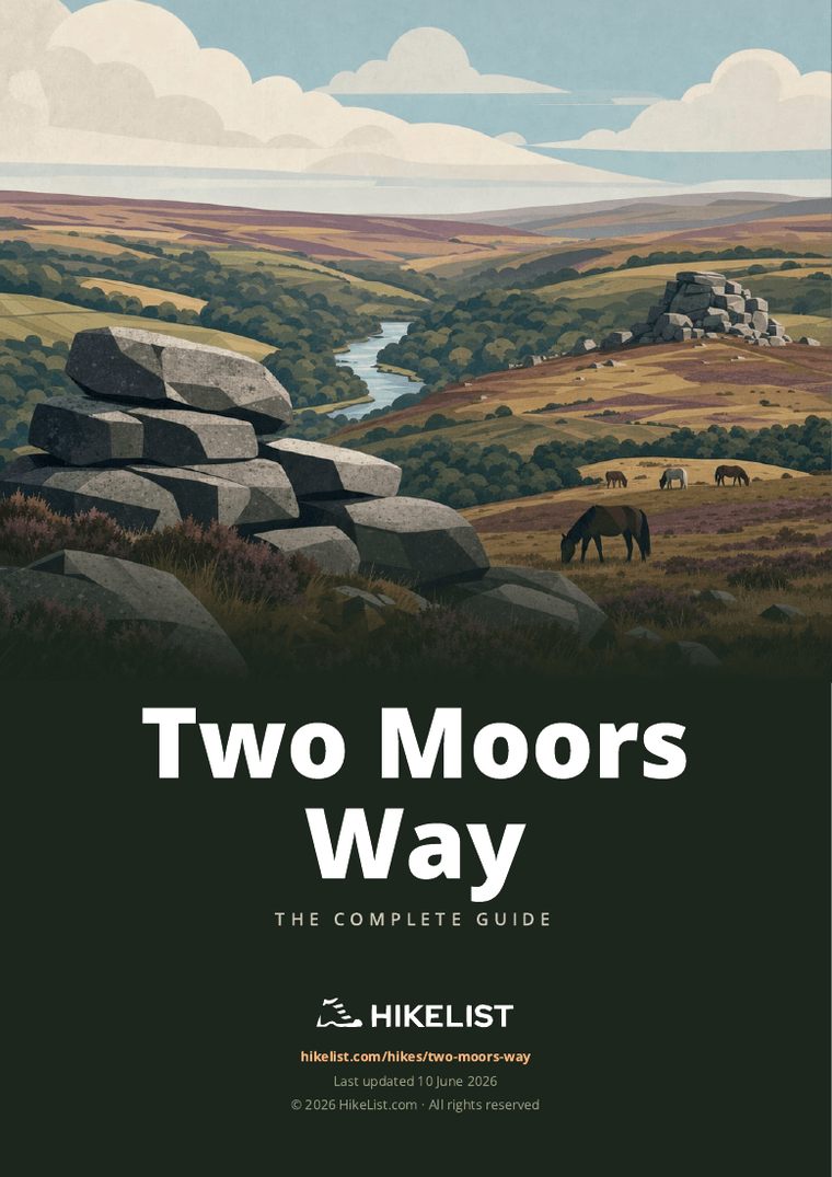
Two Moors Way
How would you rate Two Moors Way?
Tap a star to share your experience and help other hikers.
Two Moors Way: Devon’s Coast-to-Coast Hike
HikeList Score
Two Moors Way scored 91/100 on HikeList's trail-quality metrics.
See score breakdownHide breakdown
- Ideal length 94
- Balanced challenge 100
- Scenery & wildness 85
- Varied terrain 83
- Accommodation 92
- Food & support 88
- Path quality 98
- Season flexibility 89
Computed from length, challenge, scenery & wildness, terrain variety, accommodation, food & support, path quality and season flexibility.
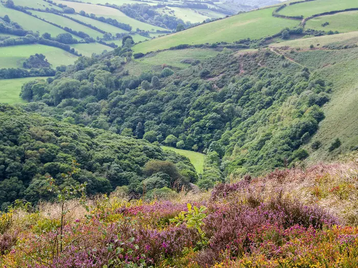
The Two Moors Way is a 188 km waymarked long-distance walk across Devon in England, linking Dartmoor and Exmoor from Wembury Bay to Lynmouth. Allow 8–12 days for the full coast-to-coast route. It is moderate overall, but the open moorland crossings on southern Dartmoor and Exmoor can be exposed, boggy and navigation-heavy in poor visibility. It suits fit walkers who want a varied point-to-point trail with moorland, river valleys, villages and flexible B&B or camping logistics.
Route Overview
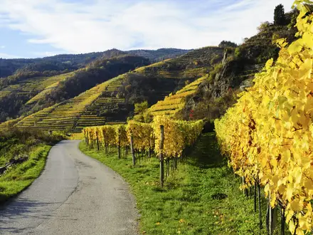
The full route runs south to north from Wembury Bay on the south Devon coast to Lynmouth on the north Devon coast, via Ivybridge, Dartmoor, mid-Devon and Exmoor. Most walkers go Wembury to Lynmouth for a gentler start and prevailing winds behind them. Key places include Yealmpton, Ivybridge, Holne, Hameldown, Chagford, Teign Gorge, Morchard Bishop, Witheridge, Knowstone, Tarr Steps, Withypool, Simonsbath and the East Lyn valley. This is a point-to-point trail, so plan start and finish logistics carefully; luggage-transfer services run along the route. For related Devon walking, compare the Dartmoor Way, Dartmoor Discovery Trail and South West Coast Path.
History of the Two Moors Way
The Two Moors Way was devised by the Ramblers’ Association and officially opened on 29 May 1976, originally running from Ivybridge to Lynmouth across Dartmoor and Exmoor while avoiding northern Dartmoor’s military training area. In 2005 it was linked with the Erme-Plym Trail to create the full Wembury-to-Lynmouth coast-to-coast crossing of Devon. Devon County Council maintains the route, supported by the Two Moors Way Association, which was revived in 2016.
Notable highlights
- Tarr Steps: An ancient clapper bridge over the River Barle on Exmoor, with 17 unmortared stone spans over roughly 55 m. It is a Grade I listed building and scheduled monument, officially medieval in origin, though older dating has been disputed.
- Hameldown: The highest ground on the route at about 532 m, on a broad Dartmoor ridge with Bronze Age cairns and barrows. It is one of the key open-moorland sections of the walk.
- Castle Drogo and the Teign Gorge: The route passes below Castle Drogo, an early-20th-century granite castle designed by Edwin Lutyens, above the wooded Teign Gorge near Chagford.
- Exmoor ponies: Hardy free-roaming native ponies are commonly seen on Withypool Common and Exmoor’s open moor. Dartmoor ponies are also part of the southern moorland landscape.
- Cow Castle: A small Iron Age hillfort in the Barle valley near the trail between Withypool and Simonsbath, adding a clear historic landmark to the Exmoor section.
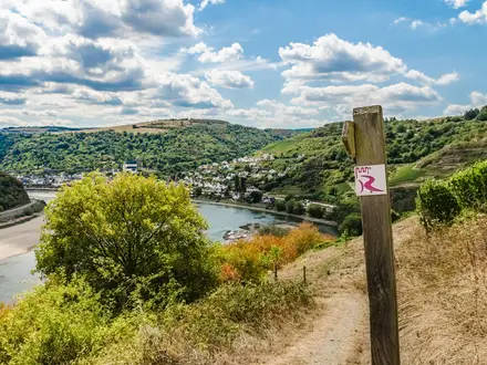
- East Lyn valley finish: The final approach drops from Exmoor through the steep, wooded East Lyn river valley into Lynmouth on the north Devon coast.
Challenges to expect
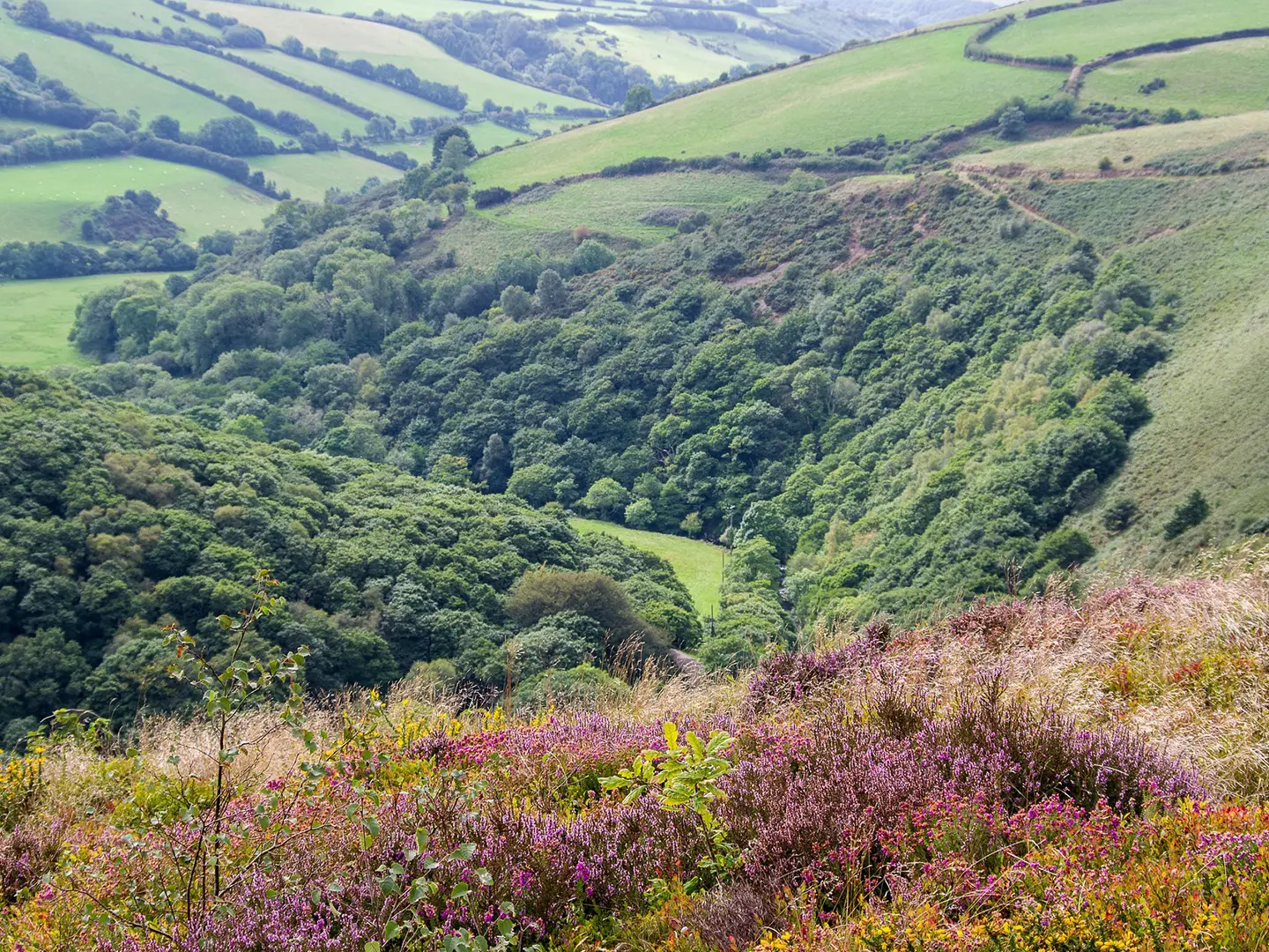
Expect mixed Devon terrain: high granite moorland on Dartmoor, heather and sandstone uplands on Exmoor, wooded combes, farmland, river valleys and quiet lanes. The hardest sections are the exposed southern Dartmoor crossing from Ivybridge to Holne and The Chains on Exmoor, both of which can be boggy and difficult in cloud. Map-and-compass skills are important, though low-level alternatives exist for the toughest moorland sections.
HikeList Score
Two Moors Way scored 91/100 on HikeList's trail-quality metrics.
See score breakdownHide breakdown
- Ideal length 94
- Balanced challenge 100
- Scenery & wildness 85
- Varied terrain 83
- Accommodation 92
- Food & support 88
- Path quality 98
- Season flexibility 89
Computed from length, challenge, scenery & wildness, terrain variety, accommodation, food & support, path quality and season flexibility.
Show more data Show less
- Mountainous
- Forest
- Grassland
- Dirt
- Rocky
- Muddy
- Guesthouses
- Hotels
- Campsites
- Wild Camping Spots
- Family Friendly
- Dog Friendly On Leash
- Restrooms
- Potable Water Sources
- Established Campsites
- Shelters
- Picnic Areas
Download Our Full Guide to Two Moors Way FREE!
Get our comprehensive guide to this hike for free. Save it for later reading or print out at home.
In these collections
Photos from hikers
Taken on the trail by people who've reviewed Two Moors Way.
Two Moors Way: The Complete Guide
 i
Image by Sweetaholic
i
Image by Sweetaholic The Two Moors Way is Devon’s coast-to-coast walk: 188 km / 117 miles from Wembury on the south coast to Lynmouth on the north coast, linking Dartmoor and Exmoor in one varied point-to-point journey. It suits reasonably fit walkers who want quieter countryside, proper moorland and a route that feels more independent than a busy National Trail.
The southern approach starts at Wembury Beach before following the Erme–Plym Trail to Ivybridge, where the original Two Moors Way begins. From there the route climbs onto southern Dartmoor, crosses open granite moor past Harford Moor and Huntingdon Warren, then drops towards Holne and the River Dart.
Beyond Dartmoor, the walk changes character through Chagford, the Teign Gorge, mid-Devon lanes, farmland and small villages before rising again towards Exmoor. The final stages take in Tarr Steps, Withypool, Cow Castle, The Chains and the steep wooded East Lyn valley down to Lynmouth, where The Walker sculpture marks the finish.
This is not a technically difficult trail, but it is not a casual waymarked stroll either. The southern Dartmoor crossing and The Chains can be boggy, exposed and pathless in places, so competent navigation, hill kit and flexible planning matter, especially in poor visibility.
This guide covers stages, day planning, accommodation, food, transport, terrain and the common mistakes to avoid.
Stage-by-Stage Guide
The stages below follow the 8-day Wembury to Lynmouth schedule used in the route summary. Distances are approximate, and this is a fairly brisk itinerary: walkers wanting shorter days commonly split the longer central stages or start at Ivybridge for the original Two Moors Way.
Stage 1: Wembury to Ivybridge — approx. 26 km
This opening stage is the Devon Coast to Coast extension rather than the original named Two Moors Way. It starts at Wembury Beach beside St Werburgh’s Church, then follows the signed Erme–Plym Trail / Devon Coast to Coast inland through the South Hams towards Ivybridge.
The walking is a useful warm-up before Dartmoor: field paths, lanes, tracks and village approaches rather than high moorland. The route passes through or near Brixton, Yealmpton and Ermington before reaching Ivybridge on the southern edge of Dartmoor.
Underfoot, expect a mix of farmland paths, enclosed lanes and potentially muddy field sections after rain. Navigation is generally less serious than on the moors, but junctions through villages, fields and lanes still need attention, especially where signs are shared with local paths.
Food and water are most straightforward at the start and finish, with intermediate villages offering the best chance of supplies. Opening hours should be checked before relying on a pub, shop or café, and it is sensible to carry a full day’s food and water rather than planning around every village.
Ivybridge is the most practical rail access point on the whole route, with a mainline station on the Plymouth–Exeter line. This also makes it the logical start for anyone walking only the original Ivybridge to Lynmouth Two Moors Way.
Accommodation is more available in and around Ivybridge than on many later stages, but it should still be booked ahead. The following day crosses southern Dartmoor, so avoid leaving kit, maps or food purchasing until the morning if an early start is needed.
Stage 2: Ivybridge to Holne — approx. 21 km
This is the first serious moorland stage and one of the key committing days of the route. From Ivybridge the Two Moors Way climbs onto southern Dartmoor, crossing Harford Moor and the open ground around the old Redlake china-clay tramway and Huntingdon Warren before descending towards Holne.
The character changes quickly from town-edge paths to exposed granite moorland. In clear weather this is one of the wildest sections of the walk; in low cloud it can become a navigation exercise rather than a straightforward waymarked trail.
The route is waymarked overall, but this stage includes open and sometimes pathless ground. Wet ground and boggy sections are likely outside very dry spells, so boots and gaiters are a practical choice. A map, compass and the ability to use them are essential if visibility deteriorates.
There are no large settlements between Ivybridge and Holne. Treat food and water availability after leaving Ivybridge as limited and carry what is needed for the full crossing. Streams and moorland water should not be treated as a dependable drinking supply without suitable treatment.
Holne is a small granite moorland village above the River Dart and is a welcome stopping point after the open moor. Accommodation at or near Holne is limited compared with larger towns, so book early and check whether any evening meal arrangements are needed.
Road access is more restricted than on the lower-level stages, though the route eventually returns to lanes and village access near Holne. In poor weather, use the available low-level alternative for the hardest moor section if navigation, daylight or conditions are not suitable.
Stage 3: Holne to Chagford — approx. 27 km
This is another substantial Dartmoor day, combining river country, open moor, prehistoric sites and the highest point of the whole route. It is one of the most varied stages, but it is still a proper hill day and should not be underestimated.
From Holne the route heads towards the Dart valley area, passing New Bridge and near Dartmeet before continuing through the central Dartmoor landscape. A spur gives access towards Widecombe-in-the-Moor, while the main line of the route continues towards Grimspound and Hameldown.
Grimspound is one of the standout landmarks of the day: a Bronze Age settlement of stone hut circles within a boundary wall. Beyond it, the route climbs towards Hameldown and Broad Barrow, the trail’s high point at about 532 m.
The Hameldown ridge gives broad upland walking, with prehistoric barrows and wide views in good conditions. The high ground is exposed to wind and poor visibility, and the distinction between clear tracks, trods and open moor can become less obvious in mist.
Food and water should be treated as limited between Holne and Chagford unless using a planned diversion or known stop. Carry enough for the day, especially if choosing not to leave the main route for any village facilities.
Chagford is one of the more useful overnight stops on the route and is the best place to reset after the Dartmoor crossing. Accommodation should still be booked ahead, particularly in busy walking periods.
Bennett’s Cross is passed before the final approach towards Chagford. Road access exists at points on this stage, but the moorland nature of the day means escape options are not as simple as on the mid-Devon lanes and field-path sections.
Stage 4: Chagford to Morchard Bishop — approx. 33 km
This is the longest stage in the 8-day schedule and a major change of character. After Dartmoor, the route moves through wooded valleys, farmland, quiet lanes and rolling mid-Devon countryside on the way towards Morchard Bishop.
The early part of the stage includes Castle Drogo and the Teign Gorge, one of the strongest lowland highlights of the whole route. Castle Drogo stands above the wooded gorge near Chagford, and the walking here is likely to feel enclosed and wooded after the open moor.
Beyond the Teign Gorge, the route continues through smaller Devon settlements and countryside including Drewsteignton, Hittisleigh, Colebrooke, Coleford and Morchard Road before reaching Morchard Bishop. Expect a patchwork of field paths, woodland, lanes and village links.
Although this stage avoids the most exposed moorland, it is physically demanding because of the distance and the accumulated ascent and descent through combes and rolling farmland. Mud, wet grass and awkward field margins can slow progress after rain.
Food and water planning matters on this stage. There are villages en route, but services in small Devon settlements can be limited or irregular, so do not assume that every place named on the map has food available when needed.
Morchard Road is a useful mid-route access point because it is on the Tarka Line between Exeter and Barnstaple. This makes it one of the better places for section walkers to join or leave the route, or for anyone needing to shorten the long Chagford to Morchard Bishop day.
Accommodation around Morchard Bishop is sparse compared with Chagford. Book well ahead and check whether the accommodation is directly on the route or requires a pick-up, road walk or local transfer.
Navigation is less about compass work than careful attention to rights of way through farmland and lane junctions. Keep the map accessible rather than assuming the waymarks will be enough through every field and village edge.
Stage 5: Morchard Bishop to Witheridge — approx. 13 km
This is the shortest stage in the 8-day itinerary and gives a useful recovery day after the long walk from Chagford. It continues through mid-Devon countryside rather than moorland, with field paths, quiet lanes and small settlements.
The route passes through or near Black Dog and Washford Pyne before reaching Witheridge. The walking is typically rural and undramatic compared with Dartmoor and Exmoor, but it still requires steady navigation through farmland and lanes.
Wet grass, mud and livestock fields are the main practical concerns rather than exposure. Take normal care around animals, close gates properly and avoid relying on a fast pace if fields are churned up after prolonged rain.
Food and water availability should be checked in advance. The shorter distance makes this stage easier to manage with supplies carried from Morchard Bishop or arranged for Witheridge, but small-place opening hours can be a weak point in a day plan.
Witheridge is an important accommodation stop before the route turns towards Exmoor. Overnight options remain limited in this part of Devon, so booking ahead is still essential even though the day itself is short.
Road access is generally more practical here than on the open moors, but public transport details for this stage should be checked before travelling. This is not a section to plan around assumed frequent services.
Stage 6: Witheridge to Withypool — approx. 26 km
This stage carries the route north from mid-Devon towards Exmoor, finishing at Withypool on the River Barle. It is a full day again, with a gradual shift from farmland and lanes into more open Exmoor country.
The route passes Knowstone and Hawkridge before reaching Tarr Steps, one of the major landmarks of the Two Moors Way. Tarr Steps is an ancient clapper bridge of unmortared stone slabs over the River Barle and is both Grade I listed and a scheduled monument.
From Tarr Steps the route continues towards Withypool. The walking includes riverside and valley sections as well as open country, and conditions can be muddy or slippery after wet weather, particularly near wooded or river sections.
Food and water should be planned carefully. Knowstone, Hawkridge, Tarr Steps and Withypool are the key named places, but services can be limited and seasonal, so carry sufficient food for the day and check any intended stop before relying on it.
Withypool is a small riverside Exmoor village and a key overnight halt. It is also associated with Withypool Common, where free-roaming Exmoor ponies are often seen on the open common.
Accommodation in and around Withypool should be secured in advance. If staying off-route, check transfer arrangements before booking, as the next stage to Simonsbath is short but crosses rural Exmoor country.
Navigation is generally less severe than The Chains stage later on, but do not treat Exmoor as lowland walking. Weather can change quickly, and open common or moor sections can be confusing in poor visibility.
Stage 7: Withypool to Simonsbath — approx. 11 km
This is a short Exmoor stage, but it should be valued for the Barle valley rather than dismissed as a half-day filler. It links Withypool with Simonsbath through classic Exmoor river and hillfort country.
The route passes Landacre Bridge and Cow Castle. Cow Castle is a small Iron Age hillfort set on a knoll in the Barle valley, and it is one of the most distinctive archaeological features on the northern half of the walk.
Underfoot, expect valley paths, moor-edge tracks and potentially wet ground depending on recent weather. The shorter distance makes the day more forgiving, but the terrain is still rural and exposed enough to require proper waterproofs and navigation kit.
Food and water options between Withypool and Simonsbath should be treated as limited. Carry snacks and water even if planning a short walking day, and check current opening times for any intended food stop at either end.
Simonsbath is the staging point before the crossing of The Chains and the final descent to Lynmouth. Accommodation is limited and should be booked early, especially because this is not a place where it is sensible to arrive without a plan.
Road access exists at Simonsbath, but public transport should not be assumed without checking. For many walkers, this stage is also a chance to conserve energy, dry kit and prepare maps for the exposed final day.
Stage 8: Simonsbath to Lynmouth — approx. 19 km
The final stage is one of the most serious days of the route because it crosses The Chains before descending through the East Lyn valley to the coast. It is not the longest stage, but it includes remote, boggy open moorland where navigation matters.
The Chains is a high, wet and exposed part of Exmoor near the route’s watershed. In mist, it can be difficult to hold a line, and the ground can be slow going even when the weather is fair.
A map and compass are essential for this stage, and the low-level alternative should be considered if visibility, wind, rain or underfoot conditions make the high route unsuitable. Do not rely on waymarks alone across open moorland.
After the high ground, the route passes the Hoar Oak area and descends into the East Lyn valley. The finish through the steep, wooded river gorge gives a dramatic final approach to Lynmouth, where the route ends at the harbour village by “The Walker” sculpture.
Food and water availability between Simonsbath and Lynmouth should be treated as very limited. Carry what is needed for the full day, including extra food in case slow boggy ground or poor visibility delays progress.
Lynmouth has no railway station. The usual onward public transport is via Lynton and the 309/310 bus to Barnstaple, then the Tarka Line train to Exeter; the Lynton & Lynmouth Cliff Railway links the two villages when operating. Timetables and operating dates should be checked before travelling.
Accommodation is available in the Lynmouth/Lynton area, but book ahead if finishing in the main walking season. After a wet crossing of The Chains, having a confirmed room and onward travel plan is far preferable to trying to improvise at the coast.
Recommended Itinerary
The 8-day itinerary below is the most compact practical schedule for the full Wembury–Lynmouth Devon Coast to Coast version. It is a brisk plan, not an easy one: it includes several 26–33 km days, sparse accommodation, and two open-moorland sections where poor weather can slow progress significantly.
Most walkers who want a steadier trip should use the slower variant below and add one or more nights, especially in mid-Devon or before the Exmoor crossing.
Standard itinerary: 8 days, Wembury to Lynmouth
| Day | From | To | Approx. distance | Why this stage makes sense | Services/accommodation notes |
|---|---|---|---|---|---|
| 1 | Wembury | Ivybridge | 26 km | Links the south-coast start at Wembury with Ivybridge, where the original Two Moors Way begins. This is the Erme–Plym Trail / Devon Coast to Coast link and makes the first day a self-contained approach to Dartmoor. | Wembury has no railway station, so arrival logistics need sorting in advance. Ivybridge has a mainline station and is the easiest practical rail start for walkers doing the original Ivybridge–Lynmouth route. |
| 2 | Ivybridge | Holne | 21 km | The first major upland day, crossing southern Dartmoor from the Ivybridge edge over open moorland towards Holne. It is shorter than several later stages but can be slow in mist, wet ground or poor visibility. | Holne is a small moorland village, so accommodation should be booked early. Carry enough food and water for the day; this is not a stage to rely on frequent services. |
| 3 | Holne | Chagford | 27 km | A full Dartmoor stage passing the Dartmeet area, Grimspound and the high Hameldown / Broad Barrow ridge before dropping towards Chagford. It is one of the most rewarding days, but exposed weather on the moor can make it harder than the distance suggests. | Chagford is a key overnight stop before the route leaves Dartmoor. If accommodation is limited, look at nearby options or taxi links, but confirm arrangements before booking the rest of the itinerary. |
| 4 | Chagford | Morchard Bishop | 33 km | This is the longest day in the 8-day schedule, moving from Chagford through the Castle Drogo / Teign Gorge area and out into the quieter mid-Devon countryside. It works for strong walkers, but it is the first stage many people should consider splitting. | Accommodation and services are spread out through this middle section. Morchard Road, on the Tarka Line, is useful for section hikers or for breaking the route, but train times should be checked before travelling. |
| 5 | Morchard Bishop | Witheridge | 13 km | A deliberately short recovery day after the long Chagford–Morchard Bishop stage. It keeps the itinerary moving north while giving time to manage supplies, laundry or a late start if accommodation dictated the previous day. | Witheridge is an important overnight halt before the longer approach to Exmoor. Do not assume there will be frequent services between villages in this section. |
| 6 | Witheridge | Withypool | 26 km | A substantial day from mid-Devon towards Exmoor, passing the Knowstone and Hawkridge area and reaching the River Barle at Tarr Steps before continuing to Withypool. It positions the next day well for the heart of Exmoor. | Withypool is a useful Exmoor base, but accommodation is limited and should be booked well ahead. Tarr Steps is a natural break in the day, but onward plans should not depend on unconfirmed services. |
| 7 | Withypool | Simonsbath | 11 km | A short but valuable positioning day through Exmoor, with Landacre Bridge and Cow Castle before Simonsbath. Keeping this day short leaves a safer, fresher start for the final exposed moorland crossing. | Simonsbath is the logical overnight before The Chains and the East Lyn valley finish. Because it is a small Exmoor settlement, secure accommodation early. |
| 8 | Simonsbath | Lynmouth | 19 km | The final stage crosses The Chains, a remote, boggy and navigationally serious part of Exmoor, before descending through the East Lyn valley to Lynmouth. In poor visibility this can be one of the most demanding days of the whole route. | Lynmouth has no railway station. Usual onward travel is via Lynton and the 309/310 bus to Barnstaple, then the Tarka Line train to Exeter; current timetables should be checked before travelling. |
Slower variant: 10–12 days
A 10–12 day schedule suits most walkers carrying overnight gear, anyone wanting shorter days, and anyone who prefers a weather margin for Dartmoor and Exmoor. This is also the better choice if accommodation availability forces shorter or uneven stages.
Good places to consider adding nights are:
| Where to slow down | Why it helps | Planning note |
|---|---|---|
| Between Wembury and Ivybridge, around the Brixton, Yealmpton or Ermington section | Breaks the 26 km first day and makes the south-coast start less rushed. | Exact stopping points depend on accommodation and transport; check official mapping before booking. |
| Between Holne and Chagford, using options around Dartmeet, the Widecombe-in-the-Moor spur, Bennett's Cross or nearby villages | Reduces the long Dartmoor day and gives more flexibility if visibility is poor on the high ground. | The route and any spur accommodation need careful planning; check official mapping before booking. |
| Between Chagford and Morchard Bishop, around Drewsteignton, Coleford, Morchard Road or nearby settlements | Splits the 33 km longest day and makes the mid-Devon section far more manageable. | Morchard Road is on the Tarka Line, which can help with section-hiking logistics. Timetables should be checked before travelling. |
| Between Witheridge and Withypool, around Knowstone, Hawkridge or Tarr Steps | Shortens the approach to Exmoor and avoids arriving at Withypool late after a long rural day. | Accommodation is sparse; do not rely on turning up without a booking. |
| Keep Withypool to Simonsbath as a short day | Leaves fresh legs for The Chains and the final descent to Lynmouth. | This is a sensible safety margin if the Exmoor forecast is unsettled. |
Faster variant: 7 days or an Ivybridge start
A faster schedule is only sensible for strong walkers with reliable navigation, light packs, pre-booked accommodation and a good forecast for both moorland crossings.
There are two practical ways to shorten the trip:
| Faster option | Who it suits | Cautions |
|---|---|---|
| Start at Ivybridge and walk the original Two Moors Way to Lynmouth | Walkers who want the named Two Moors Way rather than the full coast-to-coast, or who need the easiest rail-access start. | This omits the Wembury–Ivybridge Devon Coast to Coast link, so it is not the full Wembury–Lynmouth route. |
| Walk the full route in 7 days by combining Withypool–Simonsbath and Simonsbath–Lynmouth into one long final Exmoor day | Very fit walkers comfortable with a long, exposed finish over The Chains and down the East Lyn valley. | This creates a roughly 30 km final day using the standard stage distances. It should be avoided in poor visibility or if accommodation timing forces a late start. |
Planning the Route
Planning the Two Moors Way is mainly about matching your daily stages to accommodation, transport and the two exposed moorland crossings. The route is waymarked, but it is not a walk where you can assume there will be a village, shop or bed at the end of every convenient distance.
Most walkers are best served by allowing 10–12 days for the full Wembury–Lynmouth Devon Coast to Coast. A fit walker with pre-booked accommodation can complete it in around 8 days, but that creates several long days and leaves little margin for poor visibility on Dartmoor or Exmoor. A 10–14 day schedule gives more realistic room for shorter moorland days, late starts caused by weather, and time to manage sparse services.
Choosing your start: Wembury or Ivybridge
There are two practical versions to plan:
| Version | Start | Finish | Best for |
|---|---|---|---|
| Full Devon Coast to Coast | Wembury | Lynmouth | The complete south-coast to north-coast journey, starting at Wembury Beach and following the Erme–Plym Trail to Ivybridge before joining the original Two Moors Way |
| Original Two Moors Way | Ivybridge | Lynmouth | A shorter and simpler rail-access version, starting from Ivybridge on the Plymouth–Exeter mainline |
Starting at Wembury gives the full 188 km / 117 mile crossing, but it adds a longer first day to reach Ivybridge and requires bus access from Plymouth. Starting at Ivybridge cuts out the coastal link and is logistically easier by rail, but it misses the south-coast start of the Devon Coast to Coast.
The route is usually walked south to north. This gives a gentler South Hams approach, keeps the most dramatic final descent for the East Lyn valley into Lynmouth, and works well with the main rail-access point at Ivybridge for those not starting at Wembury.
How many days to allow
An 8-day itinerary is possible but should be treated as a brisk schedule for strong walkers. It includes long days such as Wembury to Ivybridge, Holne to Chagford and Chagford to Morchard Bishop, and it gives limited flexibility if the moorland crossings are slow underfoot.
A 10-day itinerary is a good target for many experienced long-distance walkers. It reduces pressure on the longest middle stages and makes it easier to work around accommodation availability.
A 12-day itinerary is often the most comfortable choice for walkers carrying full kit, using public transport, or wanting more time on Dartmoor and Exmoor. It also provides a better buffer for bad weather, especially where the route crosses open, boggy ground.
Staging and accommodation constraints
Daily stages are not dictated by neat, evenly spaced towns. The route passes through or near useful villages and roadheads, but accommodation is spread unevenly, particularly across the moors and the mid-Devon section between Dartmoor and Exmoor.
Key overnight areas often used in route planning include Ivybridge, Holne, Chagford, Morchard Bishop, Witheridge, Withypool, Simonsbath and Lynmouth, with Wembury or nearby options needed before the full coastal start. Availability can shape the itinerary more than the walker’s preferred daily mileage, so accommodation should be booked before committing to travel.
Do not assume that a shorter walking day will always be easy to arrange. In places, splitting a stage may depend on limited accommodation, a lift, a taxi, or using a campsite where available. This should be checked before travelling.
Fast, moderate or slow schedules
A fast schedule suits walkers who are comfortable with repeated long days, can navigate open moorland efficiently, and have all accommodation fixed in advance. It is less suitable in unsettled weather because the hardest navigation sections are also the places where delays are most likely.
A moderate schedule is the safest default. It allows the southern Dartmoor crossing from Ivybridge towards Holne and the Exmoor crossing over The Chains to be treated as serious hill days rather than just another waymarked path.
A slower schedule is worthwhile if carrying camping gear, relying on public transport at either end, or wanting more time in places such as Chagford, the Teign Gorge, Tarr Steps, Withypool and the East Lyn valley. It also reduces the risk of having to rush through wet, boggy moorland late in the day.
Shortening or extending the walk
The simplest way to shorten the route is to start at Ivybridge rather than Wembury. This follows the original Two Moors Way and removes the Wembury–Ivybridge coastal-link section while keeping both Dartmoor and Exmoor in the walk.
Shortening individual days is more complicated because services are not evenly spaced. Where a planned stage feels too long, the solution is usually to redesign the accommodation pattern rather than rely on finding an easy intermediate stop on the day.
Extending the walk is straightforward in principle by adding time at the start, finish or in the national parks, but any additional walking should be planned separately. The Two Moors Way itself is a point-to-point route, not a loop, so extra mileage usually means side trips, rest days or onward walking rather than a natural circular extension.
Section hiking
Section hiking is practical, but it needs more transport planning than a route with regular rail access. Ivybridge is the easiest rail-access point and works well as a start for the original route. Morchard Road is on the Tarka Line between Exeter and Barnstaple and can be useful for breaking the middle of the walk.
At the north end, Lynmouth has no railway station. The onward public-transport plan is to reach Lynton, then use the 309/310 bus to Barnstaple and the Tarka Line train to Exeter. The Lynton & Lynmouth Cliff Railway links Lynmouth and Lynton, but operating dates and times should be checked before travelling.
Away from these access points, public transport becomes a significant constraint. Bus and train times, especially for the Wembury start, the Lynton/Barnstaple exit and any mid-route split, should be checked before booking a section.
What matters most in planning
Accommodation: Book early, especially for the moorland and mid-Devon sections where there are fewer choices. Build the itinerary around confirmed beds or campsites rather than assuming each day can be adjusted later.
Food: Resupply is limited by the small size of many settlements on the route. Carry enough food for the day and do not depend on every village having a shop, pub meal or late-opening service. Opening times should be checked before travelling.
Water: Plan water around known villages, accommodation and reliable service points rather than relying casually on the next settlement. On the moors, exposed conditions can make dehydration a risk even when the ground is wet underfoot.
Navigation: Carry proper mapping and know how to use it. The route is waymarked, but the southern Dartmoor crossing from Ivybridge towards Holne and the Exmoor crossing over The Chains can be pathless, boggy and confusing in mist. Recommended mapping includes the Harvey XT40 route map, the Cicerone guidebook/map booklet, or the relevant Ordnance Survey Explorer sheets.
Weather: Treat Dartmoor and Exmoor as upland terrain. Low cloud, wind, heavy rain and saturated ground can turn a manageable stage into a slow navigation day. Check forecasts before setting out, and use the low-level alternatives for the hardest moor sections when conditions make the open route unsuitable.
Transport: There is no railway station at either coastal end. Wembury is reached by bus from Plymouth; Ivybridge is the easiest rail start; Lynmouth requires onward bus travel via Lynton and Barnstaple. Current timetables should be checked before travelling.
Access and restrictions: The route avoids northern Dartmoor’s military firing ranges, but Dartmoor and Exmoor access, weather-related warnings and any local restrictions should still be checked before setting out. Permit planning is not usually the limiting factor on this walk; practical access, weather and accommodation are more important.
Towns, Villages and Overnight Stops
Accommodation planning matters on the Two Moors Way. The route passes few large settlements, and the moorland and mid-Devon sections have long gaps where you should not assume there will be food, shops or last-minute beds.
For most walkers, the most practical overnight hubs are Wembury or Plymouth for the start, Ivybridge, Holne, Chagford, Morchard Bishop or Morchard Road, Witheridge, Withypool, Simonsbath and Lynmouth or Lynton. Book ahead, then build each day around where beds and evening meals are actually available.
| Place | Role on the route | Overnight usefulness | Transport note |
|---|---|---|---|
| Wembury | South-coast start of the full Devon Coast to Coast | Useful start base, but check availability early | Bus from Plymouth; no railway station |
| Ivybridge | Start of the original Two Moors Way; end of the Wembury link | Very useful overnight and rail-access point | Mainline station on the Plymouth–Exeter line |
| Holne | First Dartmoor overnight after the southern moor crossing | Important stage stop | Public transport should be checked before relying on it |
| Chagford | Key Dartmoor-edge stop after Hameldown | One of the best-positioned overnight stops | Public transport should be checked before relying on it |
| Morchard Road / Morchard Bishop | Mid-Devon accommodation and access area | Useful for breaking the long central section | Morchard Road is on the Tarka Line |
| Witheridge | Practical mid-route stop before Exmoor | Important overnight hub | Public transport should be checked before relying on it |
| Withypool | Exmoor village near the River Barle | Important overnight hub | Public transport should be checked before relying on it |
| Simonsbath | Last main overnight before the Exmoor crossing and Lynmouth | Important final-stage stop | Public transport should be checked before relying on it |
| Lynmouth / Lynton | North-coast finish area | Best finish base | 309/310 bus from Lynton to Barnstaple; then Tarka Line train to Exeter |
Wembury
Wembury is the south-coast start of the full 188 km / 117 mile Devon Coast to Coast version of the route. The trail begins at Wembury Beach beside St Werburgh’s Church, then follows the Erme–Plym Trail inland towards Ivybridge.
It is a useful place to start if you want to walk the full coast-to-coast rather than the shorter Ivybridge–Lynmouth Two Moors Way. There is no railway station at Wembury, so most walkers need to reach it by bus from Plymouth or arrange a lift.
If staying locally before the first day, book early and make sure breakfast and onward timing work with a long first stage to Ivybridge. Food, shop and evening-meal options should be checked before travelling rather than assumed.
Brixton, Yealmpton and Ermington
Brixton, Yealmpton and Ermington sit on the lower-level South Hams approach between Wembury and Ivybridge. They are useful route-settlement markers on the first day rather than core Two Moors Way accommodation hubs.
They may help with a more relaxed start or a broken first stage, but do not rely on walk-up accommodation or food without checking in advance. This section is gentler than the moorland days, but the Wembury–Ivybridge stage is still about 26 km, so an early start and firm food plan are sensible.
Ivybridge
Ivybridge is one of the most important logistics points on the whole walk. It is the end of the Wembury approach and the start of the original named Two Moors Way to Lynmouth.
For walkers using public transport, Ivybridge is the easiest practical rail start because it has a mainline station on the Plymouth–Exeter line. It is also a good place to spend the night before tackling southern Dartmoor, especially if weather on the moor is poor or if arriving by train later in the day.
Accommodation should still be booked ahead, but Ivybridge is a more practical access and resupply point than the smaller moorland villages that follow. Before leaving, carry enough food and water for the open Dartmoor crossing towards Holne, as the next section is one of the more exposed parts of the route.
Harford and Huntingdon Warren
Harford is passed as the route leaves Ivybridge for the southern Dartmoor crossing. Beyond it, the walk becomes much more committing, heading across open ground towards the Redlake china-clay tramway area and Huntingdon Warren.
These are not overnight hubs in the normal sense. Treat this as a remote moorland stage where navigation, weather and underfoot conditions matter more than village services.
The practical decision is whether to commit to the high-level crossing to Holne or use a lower-level alternative in poor conditions. This should be checked before travelling, especially if visibility, wind or rain are forecast.
Holne
Holne is a very useful stop after the southern Dartmoor crossing from Ivybridge. It sits above the River Dart and makes a logical first overnight on Dartmoor for many south-to-north itineraries.
Accommodation is limited compared with a town, so this is a place to book well in advance rather than leave flexible. Evening meals and any food supplies should also be checked before travelling.
Arriving at Holne also gives a useful reset after the most remote early stage of the walk. If conditions on southern Dartmoor are poor, a night here can be valuable before continuing towards the central Dartmoor section around Dartmeet, Grimspound and Hameldown.
Dartmeet and Widecombe-in-the-Moor
The route passes near Dartmeet and has a spur option towards Widecombe-in-the-Moor. These are useful names to know when planning a slower Dartmoor crossing or when bad weather makes a strict schedule difficult.
Do not assume that a spur will be quick or that accommodation will be available at short notice. If using Widecombe-in-the-Moor as part of an itinerary, build in the extra walking and check beds, meals and transport before committing.
This area is better treated as a flexible planning zone than a guaranteed service stop. The next major practical overnight hub for most walkers is Chagford.
Chagford
Chagford is one of the key overnight stops on the Dartmoor half of the route. It comes after the climb past Grimspound and over Hameldown / Broad Barrow, the highest point of the walk.
It is a strong place to plan a proper overnight, especially after the exposed Dartmoor mileage from Holne. Accommodation, inns, guesthouses and small-hotel style options may be available in and around the village, but capacity is limited and should be booked ahead.
Chagford is also a sensible place to organise food before the long central Devon stage towards Morchard Bishop. Check evening-meal availability when booking accommodation, particularly outside the busiest walking season.
Drewsteignton, Hittisleigh, Colebrooke and Coleford
These villages and hamlets sit through the central Devon section after Chagford, where the route leaves Dartmoor country for farmland, lanes, woodland and rolling mid-Devon walking. They are important for route planning because the Chagford to Morchard Bishop stage is long at about 33 km in the standard 8-day schedule.
They can be useful for breaking the day if accommodation is available, but they should not be treated as guaranteed service hubs. Any plan to stop here needs advance booking, plus a clear arrangement for evening food and breakfast.
This is one of the sections where walkers often underestimate logistics. Carry food for the day and avoid depending on finding a shop or pub open at the exact point needed.
Morchard Road
Morchard Road is especially useful because it sits on the Tarka Line between Exeter and Barnstaple. It is one of the few mid-route rail access points and can be valuable for section-hikers, bail-outs or joining the trail part-way through.
It is close to the Morchard Bishop area used in many itineraries, but rail convenience does not remove the need to plan accommodation. If ending or starting a section here, check train times before travelling and allow for the walk between the trail, the station and any booked bed.
Morchard Bishop
Morchard Bishop is a practical overnight stop in the middle of Devon, especially after the long day from Chagford. It is also well placed before the shorter onward stage to Witheridge in an 8-day schedule.
Accommodation and food should be arranged in advance. This is not a part of the route where a flexible, turn-up-and-find-a-room approach is reliable.
For walkers on a 10–12 day itinerary, Morchard Bishop can help split the central section more comfortably. It is also a sensible place to reassess supplies before the route turns towards Exmoor.
Witheridge
Witheridge is one of the main mid-route overnight hubs and a practical staging point before the walk north towards Knowstone, Hawkridge, Tarr Steps and Withypool. In the 8-day schedule it follows the shorter Morchard Bishop to Witheridge day, which can help recover after the longer central Devon stage.
This is a useful place to secure accommodation, meals and any next-day food. As elsewhere on the route, opening times and availability should be checked before travelling.
Leaving Witheridge, the route becomes increasingly committed as it approaches Exmoor. Carry sufficient supplies for the day and avoid assuming services will appear at convenient intervals.
Knowstone, Hawkridge and Tarr Steps
Knowstone and Hawkridge are useful route settlements on the approach to Exmoor. Tarr Steps is a major landmark on the River Barle and a natural pause point on the way to Withypool.
This section is important for pacing rather than for guaranteed services. If planning to stop overnight in or near any of these places, book in advance and confirm food arrangements directly with the accommodation.
Tarr Steps is worth allowing time for, but it should not be used as the only food or resupply assumption for the day. Check current options before travelling.
Withypool
Withypool is a key Exmoor overnight stop and one of the most useful villages in the northern part of the walk. It sits by the River Barle, with the route continuing over Exmoor country towards Landacre Bridge, Cow Castle and Simonsbath.
It is a good place to stop before the shorter Withypool to Simonsbath stage. Accommodation is limited and should be booked well ahead, particularly because options become sparse on Exmoor.
Confirm evening meals, breakfast and packed-lunch options when booking. The following day may be shorter in distance, but the terrain and weather on Exmoor still require proper hill preparation.
Simonsbath
Simonsbath is the last main overnight stop before the final stage to Lynmouth. It is a particularly important logistics point because the route north crosses remote Exmoor ground, including The Chains, before descending through the East Lyn valley.
Book accommodation early and make sure evening food and breakfast are arranged. This is not a place to reach late in the day without a confirmed bed.
Before leaving Simonsbath, check the forecast carefully. The Chains can be boggy, exposed and difficult to navigate in mist, and a low-level alternative may be the better choice in poor conditions.
Lynmouth and Lynton
Lynmouth is the finish of the route on the north Devon coast, where the end is marked by “The Walker” sculpture near the harbour village. Many walkers will want accommodation here or in nearby Lynton after the final descent through the East Lyn valley.
There is no railway station at Lynmouth. The usual public-transport exit is via the 309/310 bus from Lynton to Barnstaple, then the Tarka Line train towards Exeter; current timetables should be checked before travelling.
The Lynton & Lynmouth Cliff Railway links the two villages, but operating dates and times vary and should be checked before relying on it. If finishing late in the day, book a final night locally rather than assuming an easy same-day onward connection.
Getting to the Start
The Two Moors Way has two practical starting points, and transport planning depends on which version is being walked. The full Devon Coast to Coast starts at Wembury Beach beside St Werburgh's Church on the south Devon coast, then follows the Erme–Plym Trail to Ivybridge. The original named Two Moors Way starts at Ivybridge, which is much easier to reach by rail.
By train
There is no railway station at Wembury, so walkers starting the full Wembury–Lynmouth route normally travel by train to Plymouth and continue by bus or taxi to Wembury. This is the most practical public-transport approach for the coastal start.
For the shorter original Two Moors Way, Ivybridge station is the easiest rail start. Ivybridge is on the Plymouth–Exeter mainline, making it a straightforward option for walkers who want to begin directly on the named Two Moors Way and avoid the Wembury–Ivybridge link.
If travelling from elsewhere in the UK, plan around rail connections into Exeter or Plymouth, then continue to either Ivybridge or Plymouth depending on your start point. Train times and engineering works should be checked before travelling.
By bus
Wembury is reached by bus from Plymouth. This is the key public-transport link for the full Devon Coast to Coast start, as there is no station at the coast.
Bus frequency, evening services and Sunday/Bank Holiday timetables can change, so this should be checked before travelling. If the first walking day is planned as Wembury to Ivybridge, allow enough time for the bus journey, the walk down to the official coastal start, and the full day’s mileage to Ivybridge.
If arriving late, or if bus times do not fit, a pre-booked taxi from Plymouth to Wembury is the simplest fallback. Do not assume taxis will be readily available at short notice in the smaller villages.
By car
Driving to the start is possible, but the route is a point-to-point walk ending at Lynmouth, not a loop. Leaving a car at Wembury creates a long retrieval journey at the end of the hike, and Lynmouth itself has no railway station.
If using a car, the cleaner options are usually to be dropped off at Wembury, use a taxi from Plymouth, or start at Ivybridge and travel by rail. Any plan to leave a vehicle near the coastal start needs checking carefully for current local parking rules, maximum stays and security. This should be checked before travelling.
Walkers starting at Ivybridge have the advantage of rail access, so a car is usually less necessary unless accommodation or luggage arrangements require it.
From the nearest airport
Exeter Airport is the nearest airport for the route. From Exeter, continue by rail on the Exeter–Plymouth line towards either Ivybridge for the original start or Plymouth for onward bus or taxi access to Wembury.
Bristol is the larger regional hub and may offer more flight options, but it adds onward travel time by public transport. Flight, rail and bus connections should be checked together before booking, especially if trying to reach Wembury and start walking the same day.
Where to stay before starting
For the full Wembury start, Plymouth is often the most practical pre-walk base because it has rail access and the onward bus link to Wembury. Staying in or near Wembury may put you closer to the official start, but onward public transport and accommodation availability are more limited and should be arranged well ahead.
For the original Ivybridge start, staying in Ivybridge keeps logistics simple: arrive by train, overnight locally, then begin the Dartmoor crossing the next morning. This is especially sensible because the first moorland stage from Ivybridge towards Holne is one of the more exposed sections of the route and should not be started late in poor conditions.
Whichever start is chosen, book accommodation before travelling. Services and beds are sparse once the route leaves the larger transport hubs, and the first few days can be awkward to reorganise at short notice.
Getting Home from the Finish
The Two Moors Way finishes in Lynmouth, which has no railway station. The standard public-transport exit is to get up to Lynton, take the 309/310 bus to Barnstaple, then continue by train on the Tarka Line to Exeter.
Services from this part of Exmoor are timetable-dependent and can be limited, especially late in the day. If the final stage from Simonsbath to Lynmouth may finish in the afternoon or evening, it is usually safer to stay overnight in Lynmouth or Lynton and travel the next morning.
By train
There is no station at Lynmouth or Lynton. The practical rail route is via Barnstaple, then the Tarka Line to Exeter.
From Exeter, onward rail connections are available to other parts of Devon and the wider UK rail network. Exact journey times, connections and last trains should be checked before travelling, particularly if linking the bus from Lynton with an onward train from Barnstaple.
By bus
Use the 309/310 bus from Lynton to Barnstaple. Lynmouth and Lynton are separate villages, and the Lynton & Lynmouth Cliff Railway links them when operating; its running dates and times should be checked before relying on it.
The key planning point is the last bus of the day. The final descent through the East Lyn valley can take longer than expected in poor weather or on tired legs, so do not plan a tight connection unless the current timetable gives a comfortable margin.
By car/taxi
Because this is a point-to-point walk, leaving a car at Lynmouth only solves the finish logistics; it still leaves the problem of getting to Wembury or Ivybridge at the start. Most walkers using public transport are better served by the Lynton–Barnstaple bus and Tarka Line rail connection.
Taxis can be useful for a late finish, for reaching accommodation, or for connecting to Barnstaple when buses do not fit. They should be booked ahead, especially for evenings, Sundays and holiday periods, as Lynmouth and Lynton are small Exmoor settlements rather than large transport hubs.
From the nearest airport
Exeter is the nearest airport for this route. From the finish, the usual public-transport approach is to travel from Lynton to Barnstaple by bus, then take the Tarka Line towards Exeter and arrange the airport connection from there.
Bristol is the larger regional airport, but it is less direct from Lynmouth. For flights after the walk, build in a buffer night unless current bus, train and airport-connection times line up comfortably.
Where to stay at the finish
Staying in Lynmouth or Lynton after finishing is often the most practical option. It removes pressure from the final day, gives a weather buffer after the Exmoor crossing and avoids dependence on late public transport out of a small coastal village.
Accommodation should be booked ahead in busy periods. If using the Cliff Railway to move between Lynmouth and Lynton for accommodation or transport, check its current operating dates and hours before travelling.
Which Direction Should You Walk?
The Two Moors Way is normally walked south to north, from Wembury to Lynmouth for the full Devon Coast to Coast, or from Ivybridge to Lynmouth for the original named Two Moors Way. This is the direction used by the route’s south-to-north sectioning and it gives the most natural progression across Devon: coast, South Hams lanes and fields, Dartmoor, mid-Devon countryside, Exmoor, then the final descent through the East Lyn valley to the sea.
Reverse walking is entirely possible, but it is less convenient for most hikers and gives a harder opening psychologically and logistically. Starting at Lynmouth means beginning from a village with no railway station, then tackling Exmoor and The Chains early in the walk rather than building up to them.
| Direction | Main advantages | Main drawbacks |
|---|---|---|
| South to north: Wembury/Ivybridge to Lynmouth | Traditional and most common direction; prevailing winds are more likely to be behind you; scenery builds towards Exmoor and the East Lyn valley; the toughest Exmoor section comes late, when legs are stronger; Lynmouth makes a strong coastal finish beside “The Walker” sculpture | No railway at Lynmouth, so the finish requires onward bus travel via Lynton/Barnstaple before joining the Tarka Line |
| North to south: Lynmouth to Wembury/Ivybridge | Can work if accommodation availability dictates; ending at Ivybridge is convenient if walking only the original route, as Ivybridge has a mainline station | Awkward start from Lynmouth; exposed Exmoor comes almost immediately; the route’s scenery progression feels less satisfying; the full coast-to-coast finish at Wembury still has no railway station |
Transport and logistics
For the full Wembury–Lynmouth route, south to north is usually simpler at the start. Wembury is reached by bus from Plymouth, while Ivybridge — the start of the original Two Moors Way — has its own mainline station on the Plymouth–Exeter line.
The trade-off is the finish. Lynmouth has no railway station, so onward travel is via the 309/310 bus from Lynton to Barnstaple, then the Tarka Line train towards Exeter. Bus and train times should be checked before travelling, especially if finishing late in the day.
In reverse, the transport challenge moves to the start. Reaching Lynmouth before beginning the walk is less straightforward than reaching Ivybridge or Plymouth/Wembury, and it can make the first walking day more constrained.
Terrain and effort
The total climbing is essentially the same in either direction, so direction does not turn the route from moderate into easy. The bigger difference is where the harder ground falls in the schedule.
South to north gives a useful warm-up if starting at Wembury, with the first major open-moorland test on southern Dartmoor between Ivybridge and Holne. The second major navigational section, The Chains on Exmoor, comes near the end, after several days of walking fitness and route rhythm.
North to south puts Exmoor early. That means a reverse walker can face exposed, boggy, navigation-dependent ground before settling into the trail, and may then finish with the lower, more settled country towards Ivybridge or Wembury.
Weather and wind
South to north has the practical advantage of more often putting the prevailing wind behind you. This is not something to rely on in a fixed itinerary, especially on Dartmoor and Exmoor where weather can change quickly, but it is one of the reasons the standard direction makes sense.
In either direction, the two open-moorland sections need proper hill kit, waterproofs and navigation ability. Poor visibility on southern Dartmoor or The Chains is a more important planning factor than the direction of travel.
Accommodation flow
Accommodation is sparse in places whichever way you walk, especially across the moors and through the mid-Devon middle. South-to-north itineraries tend to align more naturally with the usual route descriptions and common stopping points such as Ivybridge, Holne, Chagford, Morchard Bishop, Witheridge, Withypool and Simonsbath.
Reverse itineraries can use the same places, but booking needs just as much care. Do not assume that a village with a name on the map has multiple beds, evening food or a shop; accommodation and key resupply points should be fixed before committing to daily distances.
Recommendation
Walk the Two Moors Way south to north unless there is a strong accommodation or transport reason to do otherwise. For the full Devon Coast to Coast, that means Wembury to Lynmouth; for the original route, Ivybridge to Lynmouth is the most practical rail-based start.
This direction gives the better build-up, keeps the prevailing wind more often behind you, places the Exmoor high ground late in the walk, and delivers the strongest finish: the descent through the East Lyn valley to Lynmouth and the north Devon coast.
Accommodation Along the Route
Accommodation is one of the main planning constraints on the Two Moors Way. The route uses small Devon villages, moorland settlements and a few larger overnight bases rather than a continuous chain of towns, so beds are sparse in several places and should be booked well ahead.
The strongest practical overnight bases are Ivybridge, Chagford and Lynmouth, with Wembury also useful if starting from the coast. Elsewhere, expect a limited mix of inns, guesthouses, B&Bs, small hotels and campsites, with some stretches where there is little or nothing directly on the line of the route.
Best overnight stops
Most walkers build an itinerary around the main accommodation hubs used by standard stage plans: Wembury, Ivybridge, Holne, Chagford, Morchard Bishop, Witheridge, Withypool, Simonsbath and Lynmouth. These stops fit the geography of the trail and avoid finishing in the most awkward open-moorland sections.
The southern Dartmoor crossing between Ivybridge and Holne is particularly important to plan carefully. There are no meaningful settlement options in the middle of that open moorland stage, so accommodation at both ends needs to be secure before setting out.
The same applies on Exmoor around Withypool, Simonsbath and the final crossing towards the East Lyn valley. These are not places where a walker should rely on finding a spare bed on arrival, especially in the main walking season or at weekends.
| Place | Accommodation level | Best for | Notes |
|---|---|---|---|
| Wembury | Limited | Full Devon Coast to Coast start | Useful if starting from Wembury Beach rather than Ivybridge. Book ahead, as this is a small coastal start point rather than a large trail town. |
| Brixton / Yealmpton / Ermington | Limited | Breaking up the Wembury–Ivybridge link | Possible intermediate options may help slower schedules on the Erme–Plym Trail section. Availability should be checked before building a stage around them. |
| Ivybridge | Good | Easiest practical rail start; first major overnight base | The most practical starting point for the original Two Moors Way and a sensible place to stay before the southern Dartmoor crossing. |
| Harford / Huntingdon Warren | None | Not an overnight base | This is part of the exposed southern Dartmoor crossing. Do not plan to finish here unless using a pre-arranged transfer. |
| Holne | Limited | End of the southern Dartmoor crossing | A key overnight stop after the open moor. Capacity is limited, so book early or arrange a transfer if full. |
| Dartmeet / Widecombe-in-the-Moor spur | Limited | Alternative staging around central Dartmoor | May help with custom itineraries, but using a spur or transfer can add complexity. Check current availability before relying on it. |
| Chagford | Good | Main Dartmoor-side service base | One of the stronger accommodation bases on the route and a logical stop after the Hameldown / Broad Barrow section. |
| Drewsteignton / Teign Gorge area | Limited | Shorter stages from Chagford | Useful for walkers splitting the Chagford–Morchard Bishop section, but options are limited and should be booked in advance. |
| Coleford / Morchard Road / Morchard Bishop | Limited | Mid-Devon staging | Important for breaking the long rural middle of the walk. Morchard Road also has rail access on the Tarka Line, which can help section walkers. |
| Witheridge | Limited | Mid-route overnight base | A standard practical stop before heading towards Knowstone, Hawkridge and Tarr Steps. Book ahead. |
| Knowstone / Hawkridge / Tarr Steps | Limited | Breaking up the approach to Exmoor | Rural options may suit slower schedules, but do not assume availability close to the trail. Transfers may be needed. |
| Withypool | Limited | Exmoor village stop | A key Exmoor overnight halt before the route continues over Withypool Common and towards the Barle valley. Capacity is limited. |
| Simonsbath | Limited | Final Exmoor overnight base | The natural stop before The Chains and the East Lyn valley approach. Secure accommodation before committing to the stage. |
| The Chains / Hoar Oak / East Lyn valley | None | Not an overnight base | Remote moorland and valley walking. Plan to pass through rather than stop, unless using an agreed off-route pick-up. |
| Lynmouth | Good | Finish of the route | Best place to stay at the northern end, especially if transport out by bus and train is being taken the following day. |
Booking strategy
For an inn-to-inn walk, book the whole route before travel rather than arranging each night as you go. This is especially important at Holne, Morchard Bishop, Withypool and Simonsbath, where limited capacity can dictate the shape of the itinerary.
Spring, summer and autumn are the normal walking seasons, and pressure on small village accommodation can be high during weekends and holiday periods. If a preferred stop is full, it is often easier to adjust the walking schedule early than to solve the problem late in the planning process.
Flexible itineraries work best when they allow for short transfers. A pre-arranged taxi or accommodation pick-up can solve awkward gaps where the nearest available bed is off-route, but this should be agreed before arrival rather than left to the end of a long walking day.
Camping and luggage transfer
Camping is possible on some itineraries, using campsites where available, but the route is not a simple campsite-to-campsite trail. Wild camping is possible on parts of Dartmoor’s commons under local byelaws, but the rules, access position and weather conditions should be checked before travelling.
Luggage transfer can make the Two Moors Way much more comfortable, particularly on the longer mid-Devon and moorland stages. Companies such as Luggage Transfers offer baggage services for the route, but coverage, booking requirements and current prices should be confirmed before booking accommodation around them.
Overall, the route works well for inn-to-inn walkers who plan early and accept that some nights may require a small village B&B, an inn, a campsite or an off-route transfer. It is much less suitable for turning up without reservations, especially across Dartmoor, mid-Devon and Exmoor.
Camping and Wild Camping
Camping is possible on the Two Moors Way, but it needs more planning than on busier National Trails. The route crosses long stretches of open moor, farmland and small Devon villages where accommodation and services are spread out, so a camping itinerary should be built around known campsites, permitted wild-camping areas and reliable resupply points rather than assumed overnight stops.
Most walkers using a tent will still need to mix campsites with occasional indoor accommodation, especially through the mid-Devon section between Dartmoor and Exmoor. Campsites exist on or near parts of the route, but spacing is uneven and opening seasons vary, so every overnight stop should be checked before travelling.
Campsites on or near the route
The most practical approach is to identify campsites around the main overnight hubs used by walkers: Ivybridge, Holne, Chagford, Morchard Bishop, Witheridge, Withypool, Simonsbath and Lynmouth. Do not assume there will be a campsite in every village or within easy walking distance of the trail.
Because the Two Moors Way passes few large settlements, a campsite that looks close on a map may still mean a detour at the end of a long day. This matters particularly on the 26–33 km stages often used between Wembury, Ivybridge, Holne, Chagford and Morchard Bishop.
Before committing to a camping schedule, check:
- whether the campsite accepts backpacking tents;
- seasonal opening dates;
- whether advance booking is required;
- distance from the actual Two Moors Way line;
- food availability nearby;
- whether there is a realistic wet-weather fallback.
Wild camping: what is realistic here
Wild camping should not be treated as available across the whole route. Much of the walk crosses private farmland, lanes, villages, river valleys and protected landscapes where camping without permission is not appropriate.
Dartmoor is the main exception: some wild camping is possible on Dartmoor commons under local byelaws. This does not mean camping is allowed anywhere in Dartmoor National Park, and the permitted areas and any temporary restrictions must be checked before travelling.
The southern Dartmoor crossing from Ivybridge towards Holne is the section where a self-sufficient hiker is most likely to consider a legal wild camp, provided the chosen location is within an area where backpack camping is allowed. The ground can be boggy, exposed and pathless in places, so this is only suitable for walkers with proper hill kit, navigation skills and a shelter that can handle wind and rain.
Exmoor should be treated differently. The route crosses remote open country around Withypool, Landacre Bridge, Cow Castle, Simonsbath and The Chains, but wild camping should only be done with landowner permission or where a recognised campsite or permitted arrangement is in place. This should be checked locally before travelling.
Sections that suit camping best
Camping works best where it reduces long accommodation gaps, but the harder moorland sections are also the places where poor weather has the biggest consequences.
| Route section | Camping practicality |
|---|---|
| Wembury to Ivybridge | Possible only with planned campsite or accommodation stops; do not assume informal camping on the coastal or village approach. |
| Ivybridge to Holne | The most relevant section for permitted Dartmoor backpack camping, but exposed and navigationally serious in poor visibility. |
| Holne to Chagford | Better planned around booked accommodation or a confirmed campsite; the route passes moorland, villages and river valleys where permissions matter. |
| Chagford to Witheridge | Least suited to casual camping because the route crosses mid-Devon farmland, lanes and small settlements; use booked campsites or indoor stops. |
| Witheridge to Withypool | A long transition onto Exmoor; camping needs to be pre-arranged and should not rely on finding an informal pitch. |
| Withypool to Simonsbath | Shorter stage, but still remote and exposed in places; use confirmed camping or accommodation. |
| Simonsbath to Lynmouth | The Chains and East Lyn valley make this a serious final day; wild camping should not be assumed. |
Water and resupply for campers
Do not rely on untreated moorland water. The route passes rivers and streams, including the River Dart, River Barle and East Lyn, but water may run through livestock areas, boggy ground or farmland and must be treated if used.
Carry enough water to cross the exposed moor sections without depending on a source at a particular grid reference. This is especially important between Ivybridge and Holne, and across The Chains on Exmoor, where navigation and weather may slow progress.
Food resupply is also limited. A camping plan should allow for carrying meals between larger villages and overnight hubs, rather than expecting a shop at the end of every stage.
Leave No Trace and fire rules
Camp only where it is legal, permitted or booked. Keep groups small, pitch late, leave early, and avoid camping close to buildings, livestock, roads, archaeological features, riverbanks or enclosed fields.
Fires are not appropriate on this route. Use a small stove only where safe, keep it off dry vegetation and never leave scorch marks or litter. Pack out all waste, including food scraps, wipes and toilet paper.
On Dartmoor and Exmoor, the route passes sensitive upland habitats and historic sites such as Grimspound, Broad Barrow on Hameldown, Tarr Steps and Cow Castle. Camp well away from archaeological remains and avoid any action that could damage vegetation, stonework or peat.
Seasonal and weather considerations
The usual walking season is spring, summer and autumn, but campers should be prepared for cold, wet and windy conditions on both moors at any time. The high open ground can be boggy even outside winter, and the exposed crossings are poor places to be caught with inadequate shelter.
Before relying on any wild-camping plan, check current Dartmoor and Exmoor access information, weather forecasts and any local restrictions. If conditions are poor, use the low-level alternatives for the hardest moor sections and switch to booked accommodation where necessary.
Food, Water and Resupply
Food and water planning matters on the Two Moors Way because the route is rural for long stretches and crosses two exposed moorland areas where there may be no reliable facilities during the walking day. Do not plan this like a National Trail with frequent cafés and shops; carry a packed lunch on most days and check village opening hours before relying on any stop.
Ivybridge is the most practical resupply point at the southern end of the original Two Moors Way. Chagford, Morchard Bishop, Witheridge, Withypool, Simonsbath and Lynmouth are the main overnight settlements used in many itineraries, but services are limited and rural opening times can be short, seasonal or affected by Sunday trading.
How much food to carry
Most walkers should start each stage with a full day’s hill food: lunch, snacks and an emergency reserve. This is especially important on the southern Dartmoor crossing from Ivybridge to Holne, the Holne to Chagford day across central Dartmoor, the long Chagford to Morchard Bishop stage, the Witheridge to Withypool stage, and the final Simonsbath to Lynmouth day over The Chains.
If accommodation provides packed lunches, book them in advance rather than assuming food can be bought in the morning. Where the route uses small villages rather than towns, evening meals may also need booking ahead, particularly outside summer and on Sundays.
Water and refills
Reliable refills are normally easiest at accommodation, cafés, pubs and other staffed stops. On remote moorland days, leave with enough water for the full crossing, because natural water is not the same as safe drinking water.
The route passes rivers and wet ground on both Dartmoor and Exmoor, including the River Dart, River Barle and East Lyn valley sections, but livestock, peat, bog and agricultural runoff mean untreated water should not be drunk. If planning to use streams, carry a proper filter or treatment method and avoid stagnant, peaty or heavily grazed sources.
In warm weather, 1.5–2 litres is a sensible starting point for many walkers on a typical stage, with more needed for hot days, slower parties or long moorland crossings. In poor weather, water demand may be lower, but exposed ground can still make it difficult to stop comfortably, so keep drink and snacks accessible.
Food and water by section
| Section | Food availability | Water availability | Notes |
|---|---|---|---|
| Wembury to Ivybridge | Better than the moorland stages because the route passes settlements including Brixton, Yealmpton and Ermington before reaching Ivybridge. Exact shops, pubs and opening hours should be checked before travelling. | Refill before leaving Wembury and again at staffed stops or accommodation where available. | This is the longest southern approach stage in the 8-day schedule, so do not assume every village will have food available when you arrive. |
| Ivybridge to Holne | Very limited once beyond Ivybridge and Harford. Carry lunch, snacks and an emergency reserve for the open Dartmoor crossing. | Start with enough water for the day. Moorland streams should be filtered or treated if used. | This is one of the route’s key remote sections, with exposed, boggy ground and no dependable resupply on the moor. |
| Holne to Chagford | Limited and unreliable during the walking day. The route passes near Dartmeet and has a spur option to Widecombe-in-the-Moor, but food should still be carried from the start. | Fill up at Holne before departure and use staffed stops only where available. Treat any natural water. | A demanding Dartmoor day via Grimspound and Hameldown / Broad Barrow. Bad weather can make breaks and detours less appealing, so pack self-sufficiently. |
| Chagford to Morchard Bishop | Chagford is an important resupply point before the long mid-Devon stage. After leaving, food options are sparse through small villages and countryside. | Refill in Chagford and at accommodation or staffed village stops where possible. | This is the longest stage in the sample 8-day itinerary, so carry a full day’s food even though the route is no longer high moorland throughout. |
| Morchard Bishop to Witheridge | Shorter stage, but still rural. Do not rely on finding food en route without checking current village services. | Fill at Morchard Bishop and again at Witheridge. | The shorter distance makes this a useful recovery day, but closures can still affect lunch and evening meal plans. |
| Witheridge to Withypool | Limited. The route heads through quiet country towards Exmoor via places such as Knowstone, Hawkridge and Tarr Steps; carry food for the full day. | Start with sufficient water and refill only at reliable staffed stops. Treat water from rivers or streams. | This is a long day into Exmoor country. Tarr Steps is a landmark, but food availability should not be assumed. |
| Withypool to Simonsbath | Limited despite the shorter distance. Carry snacks or lunch, especially if walking outside main visitor hours. | Refill before leaving Withypool and again at Simonsbath. Natural water should be treated. | The route follows remote Exmoor ground via Landacre Bridge and Cow Castle. Short distance does not mean frequent services. |
| Simonsbath to Lynmouth | No dependable food resupply should be assumed between Simonsbath and Lynmouth. Carry enough for the crossing and final descent. | Leave Simonsbath with enough water for The Chains and the East Lyn valley. Treat any natural source. | The Chains is remote, boggy and exposed; poor visibility or slow going can extend the day. Lynmouth is the first reliable end-of-route service point. |
Practical resupply tips
- Check opening hours for village shops, pubs and cafés before setting off, particularly on Sundays, bank holidays and outside the main walking season.
- Ask accommodation in advance about evening meals, packed lunches and breakfast times; many places on rural routes need notice.
- Carry at least one extra meal or substantial emergency food item across Dartmoor and Exmoor, where delays from weather, navigation or boggy ground are realistic.
- Do not depend on natural water unless carrying treatment equipment and knowing how to use it.
- If using baggage transfer, keep lunch, snacks, waterproofs, warm layers, map, compass, phone and water with you; do not send all food and spare drink ahead in the luggage.
Terrain, Conditions and Difficulty in Practice
The Two Moors Way is usually moderate underfoot, but it is not uniformly easy. Its difficulty comes from contrast: straightforward field paths and lanes can be followed by exposed, wet moorland where the line is less obvious and the weather matters much more than the mileage.
Most of the route is not technically difficult. There is no sustained scrambling, and much of the walking is on field paths, woodland tracks, riverside paths, country lanes and moorland tracks. The two sections that change the character of the walk are the southern Dartmoor crossing from Ivybridge towards Holne and the Exmoor crossing over The Chains, both of which can be pathless in places, boggy and serious in poor visibility.
Underfoot by terrain type
| Terrain type | Where it matters most | What to expect in practice |
|---|---|---|
| Open granite moorland | Southern Dartmoor from Ivybridge, Harford Moor, Huntingdon Warren and onwards towards Holne | Exposed ground, indistinct paths in places, wet sections and a real need for map-and-compass navigation if mist drops. This is one of the route’s hardest sections. |
| Dartmoor ridges and tors | Around Grimspound, Hameldown and Broad Barrow | Higher, more open walking on grass and heather moor. Broad Barrow on Hameldown is the high point at about 532 m, but the challenge is exposure and weather rather than altitude alone. |
| Wooded combes and river valleys | Teign Gorge, the Barle valley, East Lyn valley | Often more sheltered, but paths can be muddy and slippery after rain. The final approach to Lynmouth involves a steep wooded descent through the East Lyn valley. |
| Farmland and rolling mid-Devon countryside | Between Chagford, Drewsteignton, Hittisleigh, Coleford, Morchard Bishop, Witheridge and Knowstone | Field paths, lanes, gates and likely livestock fields. Navigation is generally less committing than on the open moor, but small path junctions, field exits and waymarks still need attention. |
| Country lanes | Scattered through the mid-Devon sections and village approaches | Usually straightforward walking, but harder on feet over a long day. Take care on narrow rural lanes where verges may be limited. |
| Exmoor heather, grass moor and sandstone upland | Around Withypool Common, Landacre Bridge, Simonsbath, The Chains and Hoar Oak | Open, exposed and potentially wet. The Chains is the key difficulty: remote, boggy and demanding in mist. |
The two serious moorland sections
The first demanding section comes soon after Ivybridge, where the route leaves the easier south-coast and South Hams approach behind and crosses southern Dartmoor. The ground around Harford Moor and Huntingdon Warren is much wilder than the waymarked lowland sections, with open moor, wet ground and stretches where the trod may be unclear.
This section should be treated as a proper hill day. Carry full waterproofs, warm layers, map and compass, and allow for slower progress than the distance alone suggests. In poor visibility, the waymarking is not a substitute for navigation skills.
The second serious section is on Exmoor, crossing The Chains between Simonsbath and the route towards Hoar Oak and the East Lyn valley. This is high, boggy and remote ground where mist, wind or heavy rain can make route-finding much harder.
Low-level alternatives exist for the hardest moor sections. If using an alternative, check the current route details, access position and weather before committing to the day.
Climbs, descents and daily effort
The total ascent is roughly 4,545 m over the full Wembury to Lynmouth route, so the climbing is cumulative rather than alpine. The route rarely feels mountainous, but repeated rises out of valleys, rolling farmland and moorland undulations make long days tiring.
The climb onto Hameldown is one of the more notable height gains, with Broad Barrow forming the route’s highest point. The reward is open ridge walking, but in bad weather that same openness makes the section feel harder and more exposed.
The final descent through the East Lyn valley into Lynmouth is one of the most memorable parts of the route, but it should not be underestimated at the end of the walk. Steep woodland paths can be slippery in wet conditions, especially when legs are tired.
Mud, bog and wet ground
Mud is likely after rain on woodland paths, riverside sections, field paths and valley approaches. The wettest and slowest ground is most likely on Dartmoor and Exmoor, especially where the route crosses open moor and boggy grass or heather.
Boots are a sensible default for most walkers, particularly outside dry summer spells. Gaiters are useful on the moorland stages and after prolonged rain, where wet vegetation, mud and boggy patches can make trail shoes less comfortable.
Road walking, fields and obstacles
The route includes quiet country lanes, especially through the lower and middle parts of Devon. These sections are generally easy to follow but can be wearing underfoot, and care is needed on narrow lanes with bends and limited verge space.
Across farmland, expect a mix of gates, field edges, pasture and waymarked paths. Livestock fields are part of the character of the route, so dogs should be kept under close control and any local signs followed. Field navigation can be surprisingly slow where waymarks are partly obscured by vegetation or where several field exits look similar.
Stiles, gates and fences are normal on the lowland and farmland sections. They are not the main difficulty, but they add to fatigue over consecutive days and can slow progress for walkers carrying a heavy pack.
Seasonal conditions
Spring can bring good walking temperatures, but also wet ground, muddy fields and changeable weather on both moors. Moorland visibility can deteriorate quickly, so clear conditions at the start of a day should not be relied on.
Summer gives the best chance of drier underfoot conditions, but the open moors remain exposed to wind, rain and poor visibility. In dry spells, the route is substantially easier, especially across Dartmoor and The Chains.
Autumn can be excellent, but shorter daylight, wetter ground and colder wind on the uplands make timing more important. Long stages such as Holne to Chagford or Chagford to Morchard Bishop should be planned with daylight and weather in mind.
Winter is not the normal recommended season for this route. The combination of short days, saturated moorland, poor visibility and limited services makes the exposed sections significantly more serious.
What makes the route easier or harder
The route feels easiest where waymarking, field paths and lanes combine through the lower countryside. Progress is usually steady here, and the main issues are accommodation spacing, hard surfaces and occasional muddy fields.
It feels hardest when distance, exposure and navigation coincide. The southern Dartmoor crossing and The Chains are the key examples: both can be straightforward in clear, dry weather, but slow and committing in mist, wind or heavy rain.
Fitness matters, but judgement matters more. A walker comfortable with UK hill weather, boggy ground and map-and-compass navigation will usually find the Two Moors Way a manageable long-distance route. A walker expecting a fully engineered, always-obvious trail may find the moorland days much more demanding than the overall moderate rating suggests.
Weather and Best Time to Walk
The Two Moors Way is best planned for spring, summer or autumn, when daylight is usable for long stages and accommodation, buses and local services are more likely to fit a multi-day itinerary. The route is not technically high by mountain standards, with a high point of 532 m at Broad Barrow on Hameldown, but Dartmoor and Exmoor both behave like exposed upland country in poor weather.
The key weather issue is not altitude alone: it is exposure, wet ground and visibility. The southern Dartmoor crossing from Ivybridge towards Holne and the Exmoor crossing over The Chains can be pathless, boggy and difficult to navigate in mist, rain or low cloud. These sections should be treated as serious hill days, not simply as waymarked countryside walking.
Best months
Late spring to early autumn is the most practical window for most walkers. Spring brings longer days and generally better ground conditions than winter, while summer gives the longest daylight for the bigger stages, including the longer mid-Devon and moorland days. Early autumn can also be excellent, provided daylight is factored into the schedule and accommodation is arranged in advance.
Summer is the easiest season for daylight, but it is not a guarantee of easy walking. The open moors can still be windy, wet and cold in poor conditions, and exposed sections offer little shelter. Carry waterproofs, warm layers, map, compass and a reliable navigation plan even in settled-looking weather.
Months to treat with caution
Winter is realistic only for experienced walkers who are comfortable with short daylight, wet and boggy ground, poor visibility and exposed moorland navigation. The route’s field paths, riverside tracks and lanes may remain straightforward, but the open moor crossings become a much bigger undertaking when mist, wind, heavy rain or cold conditions combine.
If walking outside the main spring-to-autumn season, plan shorter days and be willing to use the low-level alternatives for the hardest moor sections. Current Dartmoor and Exmoor access conditions, weather warnings and any local restrictions should be checked before travelling.
Ground conditions by season
The moors can be wet and boggy outside very dry spells, especially on the open Dartmoor and Exmoor sections. Boots are strongly recommended, and gaiters are useful when the route crosses wet grass, heather and softer moorland ground.
After prolonged rain, expect slower progress on field paths, woodland paths and riverside sections as well as on the moors. The final descent through the East Lyn valley to Lynmouth is steep and wooded, so allow extra care if surfaces are wet underfoot.
Fog, wind and navigation
Poor visibility is the main weather-related risk on this route. Waymarking helps across much of the Two Moors Way, but it is not enough to rely on alone for the more remote open moorland sections.
The Ivybridge–Holne crossing on southern Dartmoor and The Chains on Exmoor both require confident map-and-compass navigation in poor visibility. If the forecast is for mist, low cloud, strong wind or persistent rain, consider delaying the stage, shortening the day, or using a lower-level alternative where available.
Accommodation and seasonal planning
Accommodation is sparse and spread out, especially across the moors and the mid-Devon middle of the route. In the main walking season, book well ahead rather than relying on finding rooms or pitches on arrival.
Outside the main season, availability can be more limited and local services may run to different patterns. This should be checked before travelling, particularly if the itinerary depends on specific overnight stops, baggage transfer, buses or the Lynton and Lynmouth end-of-route logistics.
Safety Notes
The Two Moors Way is not technically difficult for most of its length, but it does include two serious open-moorland sections: southern Dartmoor between Ivybridge and Holne, and The Chains on Exmoor. These areas can be pathless, boggy, exposed and difficult to navigate in mist, so treat them as hill days rather than ordinary countryside walking.
In an emergency in the UK, call 999 or 112 and ask for Police, then Mountain Rescue if the incident is on moorland or difficult ground. Carry a charged phone, but do not assume continuous mobile signal, especially in remote moorland, wooded combes and valleys.
Navigation and remote ground
Waymarking is generally good, but it is not a substitute for proper navigation on Dartmoor and Exmoor. Carry paper mapping as well as any GPS or phone app, and know how to use a compass in poor visibility.
The highest and most exposed parts of the route, including Hameldown / Broad Barrow and The Chains, can become confusing in low cloud. If visibility is poor, wind is severe or ground conditions are very wet, use the available low-level alternatives for the hardest moor sections rather than pressing on across open ground.
Solo walkers should be especially cautious on the Ivybridge–Holne and Simonsbath–Lynmouth sections. Leave a route plan with someone reliable, include your intended overnight stop, and update them if plans change.
Weather exposure
Dartmoor and Exmoor can feel much more severe than their height suggests. Wind, rain, mist and sudden temperature drops are all realistic hazards on the open moors, even in the main walking season.
Carry waterproofs, warm layers, hat and gloves, plus enough food to cope with delays. Boots and gaiters are sensible outside very dry spells because boggy ground is common on the moorland crossings, especially around The Chains.
In hot weather, the risk is different: long sections have limited shade and services are sparse. Start early, carry more water than usual, and do not depend on every small village having food or drink available when you arrive.
Roads, lanes and settlements
The route uses field paths, tracks and quiet Devon lanes as well as moorland. On road sections, walk facing oncoming traffic where safe, take extra care on bends and be visible in dull weather.
Small lanes can be narrow, with limited verges. Do not assume drivers will expect walkers, particularly near villages, farm entrances and on twisting rural roads.
Livestock and animals
The route crosses farmland and open common where livestock may be present. Give cattle, sheep and horses plenty of space, close gates properly, and avoid getting between animals and their young.
Exmoor ponies may be seen around Withypool Common and other open areas. They should be treated as semi-wild animals: keep distance, do not feed them and keep dogs under close control.
Rivers, bridges and wet ground
The route follows or crosses several river valleys, including the Dart, Teign, Barle and East Lyn. Normal walking conditions do not require river fords, but riverside paths, bridges, wet stones and steep wooded descents can be slippery after rain.
Take particular care around Tarr Steps, the East Lyn valley and any riverside path in spate conditions. If a path, bridge approach or stepping area is flooded or unsafe, turn back and find a safer alternative rather than attempting to force a crossing. This should be checked before travelling during or after prolonged heavy rain.
Checks before setting off each day
Before leaving each morning, check:
- the latest weather forecast for Dartmoor or Exmoor if heading onto the moors;
- visibility, wind and rain risk before committing to open ground;
- whether a low-level alternative is the safer choice for the day;
- accommodation arrival arrangements, especially where villages are small and services limited;
- food and water availability for the full stage;
- public transport options if the day needs to be cut short;
- any Dartmoor or Exmoor access, weather or military-firing notices relevant to your route. The Two Moors Way avoids northern Dartmoor’s firing ranges, but conditions and notices should still be checked before setting out.
Carry enough battery power for navigation and communication, but keep a paper map accessible. On the longest stages and the open-moor days, start with a realistic turnaround plan rather than relying on being able to improvise late in the day.
Gear Recommendations
The Two Moors Way is not a technical trail, but it is a proper hill-and-moorland walk. Kit should be chosen for wet ground, exposed moorland, poor visibility and long gaps between services, rather than for a simple waymarked lowland path.
The two sections that most affect packing are the southern Dartmoor crossing from Ivybridge towards Holne and the Exmoor crossing over The Chains. Both can be boggy, pathless in places and difficult to navigate in mist, so carry full hill kit even if most of the route looks pastoral on the map.
Footwear
Waterproof walking boots are the safest default for most walkers. The route includes field paths, lanes, riverside tracks, open moor, rough grass and boggy ground, and boots give better ankle support and wet-ground protection than lightweight shoes.
Gaiters are strongly recommended outside very dry spells, especially for Dartmoor, The Chains and wet field sections in mid-Devon. Trail shoes can work for experienced fast walkers in settled summer weather, but they are a poor choice if the forecast is wet or if tackling the open moorland crossings with a full pack.
Waterproofs and warm layers
Carry a reliable waterproof jacket and waterproof trousers, not just a shower shell. Dartmoor and Exmoor are exposed, and conditions can change quickly even when the route is not especially high by mountain standards.
A warm mid-layer, hat and gloves are sensible in spring and autumn, and still worth carrying in summer for the open moor sections. Broad Barrow on Hameldown is the high point of the route, but wind exposure is the real issue rather than altitude.
Navigation
Do not rely on waymarking alone. The route is signed, but the open moorland sections can be hard to follow in mist, rain or low cloud, and parts are pathless or indistinct.
Carry proper mapping and know how to use it with a compass. Suitable options include the single-sheet Harvey XT40 Two Moors Way map, the Cicerone guidebook/map booklet, or Ordnance Survey mapping: Explorer OL9 for Exmoor, OL28 for Dartmoor, OL20 for South Devon, plus Explorer 113, 114 and 127 for the mid-Devon section. Landranger 191, 201 and 202 also cover much of the route, with 180/181 useful towards the Exmoor coast.
A GPS app or handheld device is useful, but it should be treated as a backup or companion to paper navigation, not the only system. Carry a power bank if using a phone for mapping, accommodation details, transport and weather checks.
Water and food carry
Plan each day assuming there may be long stretches without shops or cafés. The route passes villages and small settlements, but services are sparse and unevenly spaced, particularly across the moors and the mid-Devon middle.
Most walkers should start each day with enough water for the full stage unless a definite resupply point has been planned. Food should be carried for lunch, snacks and an emergency margin, especially on the Ivybridge–Holne, Witheridge–Withypool and Simonsbath–Lynmouth stages where upland or rural walking limits easy resupply.
A lightweight water filter or purification method can be useful for campers or slower walkers, but it should not replace proper planning. Water sources, access and livestock contamination vary, so drinking-water availability should be checked before travelling.
Trekking poles
Trekking poles are useful on this route rather than essential. They help with balance on boggy ground, reduce strain on longer lane-and-field days, and are particularly helpful on steep or slippery descents such as the final wooded East Lyn valley approach to Lynmouth.
They are also worth considering if carrying camping gear, as the repeated small climbs and mixed surfaces can be tiring over an 8–12 day schedule.
For inn-to-inn walkers
Inn-to-inn walkers can keep pack weight moderate, especially if using baggage transfer, but should still carry hill essentials each day. The day pack should include waterproofs, warm layer, map and compass, headtorch, first-aid basics, food, water and a charged phone or power bank.
Do not pack as if every stage is a village-to-village stroll. On the moorland days, poor visibility or a navigation error can make the day longer and colder than expected, even when accommodation is booked ahead.
For campers
Campers need to be more conservative with weight because the route includes boggy moor, rough tracks and several long rural stages. A robust waterproof shelter, warm sleep system and reliable stove setup are more important than ultralight minimalism if walking outside high summer.
Campsites are part of the accommodation mix, and some wild camping is possible on Dartmoor's commons under local byelaws. Current access rules, byelaws and any restrictions should be checked before travelling, and camping plans should be made carefully because services and formal pitches are not evenly distributed along the route.
Campers should carry extra food capacity and a realistic water plan. A power bank becomes more important if using a phone for mapping, weather, bookings and emergency contact over several nights.
For fast and section hikers
Fast walkers and section hikers can go lighter, but should not strip out navigation or weather protection. The exposed crossings of southern Dartmoor and The Chains still require map, compass, waterproofs and warm spare clothing even on a single-day push.
For rail-based section walking, Ivybridge and Morchard Road are the most useful named rail access points on the route, but onward connections and bus times can be limited. Carry enough food, water and phone battery to handle a missed connection or a slower-than-expected stage.
Seasonal extras
Spring and autumn walkers should expect colder wind, wetter ground and shorter daylight, so a headtorch and warm spare layer are important. Summer walkers still need waterproofs, but should add sun protection and enough water capacity for exposed moor and lane sections.
Insect repellent can be useful in warmer months, particularly around wooded valleys, riverside paths and still, damp evenings. After wet weather, gaiters and dry socks become more valuable than extra clothing changes.
Budget and Costs
All budgeting for the Two Moors Way should be in GBP (£). Prices on this route vary heavily by season, room availability, how far ahead beds are booked, and whether accommodation is on the line of the trail or requires a lift or taxi. Current prices should be checked before booking.
The biggest cost is usually accommodation. The route passes few large settlements, especially across Dartmoor, mid-Devon and Exmoor, so there is less price competition than on busier National Trails. Booking late can force more expensive rooms or off-route accommodation with taxi costs.
Main cost factors
| Cost area | What to budget for | Route-specific notes |
|---|---|---|
| Accommodation | Inns, guesthouses, B&Bs, small hotels, campsites | Sparse in places, especially on and between the moors. Book well ahead rather than assuming there will be multiple same-day options. |
| Food and drink | Breakfasts, packed lunches, evening meals, snacks | Some accommodation may include breakfast, but resupply is limited on several stages. Carry lunch and spare food for the open moorland days. |
| Public transport | Travel to Wembury or Ivybridge, and onward travel from Lynmouth | Wembury is reached by bus from Plymouth. Ivybridge has a mainline station and is the easiest rail start. From Lynmouth, use the 309/310 bus from Lynton to Barnstaple, then the Tarka Line train to Exeter. Times and fares should be checked before travelling. |
| Local taxis | Off-route accommodation, missed buses, shortening a stage | Taxis can become a significant extra cost if accommodation is not available on the route. Pre-booking is sensible in rural Devon. |
| Luggage transfer | Daily bag movement between booked accommodation | Companies such as Luggage Transfers serve the Two Moors Way. Prices depend on itinerary, number of bags and party size, so current quotes should be checked before booking. |
| Maps and guidebooks | Harvey XT40 route map, Cicerone guidebook/map booklet, or OS mapping | A single route map is usually simpler than carrying multiple OS Explorer sheets, but many walkers still prefer detailed OS mapping for the open moorland sections. |
| Packages | Self-guided walking-holiday itineraries | Operators offer 8, 10 and 12-day schedules. Compare what is included: accommodation booking, luggage transfer, route notes, meals and transport are not always packaged in the same way. |
Budget approach
A lower-cost Two Moors Way relies on camping where practical, using public transport, carrying more food, and avoiding luggage transfer. Starting at Ivybridge rather than Wembury also removes the Wembury–Ivybridge link if the original Two Moors Way is the aim rather than the full Devon Coast to Coast.
This approach needs careful planning because campsites are not evenly spaced along the route. Wild-camping is possible on parts of Dartmoor’s commons under local byelaws, but this is not a route-wide camping solution and current access rules should be checked before travelling.
Budget walkers should allow extra food capacity for the southern Dartmoor crossing, the mid-Devon stretches and Exmoor. Saving money by avoiding pubs and cafés only works if supplies have been bought before the quieter sections.
Mid-range approach
A typical mid-range plan uses B&Bs, inns and guesthouses, with pub meals or accommodation meals where available. This is the most straightforward way to walk the full Wembury–Lynmouth route over 8–12 days, provided beds are booked early.
The main risk to a mid-range budget is being pushed off-route by lack of accommodation. A cheaper room several miles away can become more expensive once taxi transfers are added.
Comfortable approach
A more comfortable budget adds private rooms throughout, luggage transfer, occasional taxis, and possibly a self-guided package. This reduces the load on the two demanding open-moorland crossings and makes the logistics easier, especially on the longer stages into or out of Chagford, Withypool and Simonsbath.
Comfortable itineraries are not automatically easier underfoot: The Chains on Exmoor and the southern Dartmoor crossing still require proper hill kit and navigation ability. The extra spend mainly buys convenience, not guaranteed easy walking.
Costs that are easy to underestimate
Allow for more than just beds and evening meals. Rural bus connections, taxi transfers, packed lunches, replacement snacks, laundry, map coverage and contingency nights can all add to the final total.
The end of the route needs particular attention. Lynmouth has no railway station, so onward travel normally involves reaching Lynton, taking the 309/310 bus to Barnstaple, then the Tarka Line train towards Exeter. The Lynton & Lynmouth Cliff Railway may be useful between the two villages, but operating dates and fares should be checked before relying on it.
For most walkers, the safest budget method is to price the itinerary night by night, then add food, maps, start/end transport, and a contingency for taxis or changed plans. On the Two Moors Way, accommodation availability drives the budget more than mileage does.
Luggage Transfer, Guided Tours and Support Services
Luggage transfer
Baggage transfer is a practical option on the Two Moors Way, especially for walkers using B&Bs, inns and guesthouses rather than camping. The route has long days, limited accommodation in places and two exposed moorland crossings, so walking with only a day pack can make the itinerary much more manageable.
Companies such as Luggage Transfers offer baggage transfer for the Two Moors Way. Services typically move one main bag between pre-booked overnight stops, but exact coverage, bag limits, collection times, prices and whether they cover the full Wembury–Lynmouth Devon Coast to Coast or only the Ivybridge–Lynmouth route should be checked before booking.
Luggage transfer does not remove the need to carry proper hill kit. On the Ivybridge–Holne Dartmoor crossing and the Exmoor section over The Chains, you should still carry waterproofs, warm layers, food, water, map, compass and emergency supplies, as there may be no easy road support once committed to the open moor.
Book accommodation before arranging bag movement. Many overnight stops are small villages or isolated rural places, and luggage couriers need a clear, accessible delivery address for each night.
Self-guided walking packages
Self-guided packages suit walkers who want the logistics handled but still prefer to walk independently. Operators offer schedules of around 8, 10 or 12 days, usually combining accommodation booking, daily route information and baggage transfer.
Check carefully which version of the route is included. Some itineraries may start at Ivybridge on the original Two Moors Way, while others cover the full Wembury to Lynmouth Devon Coast to Coast via the Erme–Plym Trail.
A package can be particularly useful on this route because accommodation is sparse across Dartmoor, mid-Devon and Exmoor. It is less necessary for experienced UK long-distance walkers who are comfortable booking rural accommodation directly and arranging luggage transfer separately.
Prices, inclusions, single supplements, rest-day options and cancellation terms vary, so current details should be checked with the operator before booking.
Guided walking options
Fully guided trips are not essential for the Two Moors Way, which is waymarked for much of its length. However, navigation confidence matters on the open moorland sections, especially in mist, rain or poor visibility.
A guided option, walking-holiday leader or local navigation support may suit walkers who are uneasy about pathless or boggy ground on Dartmoor and Exmoor. Availability of guided departures or private guiding should be checked before travelling.
Even on a guided trip, the route should be treated as a proper hill walk rather than a lowland trail. Boots, waterproofs and warm layers remain important, particularly on the moors.
Taxi transfers and local support
Taxis can be useful for filling gaps between accommodation and the trail, shortening a day, or reaching an off-route overnight stop where on-route beds are full. They are also useful at the start or finish if public transport times do not fit your walking schedule.
Do not assume taxis will be available at short notice in small villages such as Holne, Chagford, Morchard Bishop, Witheridge, Withypool or Simonsbath. Pre-book any essential taxi move, especially if it affects accommodation, onward travel or a long moorland day.
The most useful transport anchors for support planning are Ivybridge station, Morchard Road on the Tarka Line, and the Lynmouth/Lynton area for onward travel via the 309/310 bus to Barnstaple and then the Tarka Line. Current public transport times should be checked before travelling.
What to arrange well ahead
- Accommodation for every night, particularly on and around Dartmoor, mid-Devon and Exmoor.
- Luggage transfer dates, addresses and bag limits.
- Any off-route taxi transfers to or from accommodation.
- Whether a package starts at Wembury or Ivybridge.
- Current prices, availability and operating conditions for any walking-holiday, luggage or taxi service.
Support services make the Two Moors Way easier to organise, but they should not be treated as a substitute for self-sufficiency. The route crosses quiet country and exposed moorland, where weather, visibility and distance between services can still dictate the day.
Shorter Hikes and Best Sections
The Two Moors Way works well as a section-hike, but the easiest logistics are not always on the most scenic stretches. Ivybridge and Morchard Road are the most useful rail access points on or near the line of the route; Wembury is reached by bus from Plymouth, and Lynmouth is left via Lynton and the 309/310 bus to Barnstaple for the Tarka Line.
Distances below use the stage distances in this guide. Check your map before committing to any variant, spur or low-level alternative.
| Best for | Section | Approx distance | Why choose it | Transport notes |
|---|---|---|---|---|
| Best day walk | Withypool to Simonsbath | 11 km | A compact Exmoor day following the Barle valley area, with Landacre Bridge and Cow Castle on the line of the route. It gives a strong flavour of the northern half without taking on The Chains. | Neither end has a railway station. Arrange a lift, taxi or accommodation transfer, and check local transport before travelling. |
| Best weekend section | Ivybridge to Chagford, usually via Holne | 48 km over 2 days | The strongest short version of the original Two Moors Way: southern Dartmoor, Holne, the Dart valley area, Grimspound, Hameldown and Broad Barrow, the route’s high point. This is a rewarding but serious weekend, not a soft introduction. | Ivybridge has a mainline station, making the start straightforward by rail. Chagford has no station; onward travel should be arranged in advance. Accommodation around Holne and Chagford is limited and should be booked early. |
| Best 3–5 day section | Morchard Bishop to Lynmouth | 69 km over 4 days | A good northern-section itinerary using the later guide stages: Morchard Bishop to Witheridge, Witheridge to Withypool, Withypool to Simonsbath, then Simonsbath to Lynmouth. It includes Tarr Steps, Withypool, Cow Castle, The Chains and the final East Lyn valley descent. | Morchard Road is the useful Tarka Line rail access in this part of Devon, but local links to Morchard Bishop should be checked before travelling. From Lynmouth, use Lynton and the 309/310 bus to Barnstaple, then the Tarka Line. |
| Best section for scenery | Simonsbath to Lynmouth | 19 km | The most dramatic final day: remote Exmoor over The Chains, Hoar Oak, then the steep wooded East Lyn valley down to Lynmouth. It is one of the finest endings on the route. | Lynmouth has no station. Leave via Lynton for the 309/310 bus to Barnstaple and the Tarka Line. The Chains can be boggy and difficult to navigate in mist, so do not treat this as an easy day just because the distance is moderate. |
| Best for beginners | Wembury to Ivybridge | 26 km, best split if needed | The gentlest introduction to the full Devon Coast to Coast, following the Erme–Plym Trail link through south Devon before the route reaches open Dartmoor. It avoids the two hardest moorland crossings. | Wembury is reached by bus from Plymouth and Ivybridge has a mainline station. If 26 km is too long for one day, check accommodation and current bus options along the south Devon villages before booking. |
| Best for public transport | Wembury to Ivybridge | 26 km | The cleanest public-transport section because both ends have practical connections: bus at the coast and rail at Ivybridge. It is also a logical way to sample the coast-to-coast extension without committing to the full route. | Use the Plymouth bus connection for Wembury and the Plymouth–Exeter mainline at Ivybridge. Bus and train times should be checked before travelling. |
| Best for villages and accommodation | Chagford to Witheridge | 46 km over 2 days | A more settled mid-Devon section linking Chagford, the Castle Drogo / Teign Gorge area, Morchard Bishop and Witheridge. It suits walkers who want village overnights rather than the most remote moorland days. | Morchard Road on the Tarka Line is the key rail access point in the middle of this section. Chagford and Witheridge still need planned local transport or taxi arrangements, and accommodation remains limited. |
| Best for camping | Ivybridge to Holne, or continue to Chagford | 21 km to Holne; 48 km to Chagford | The most relevant camping section is southern Dartmoor, where some wild camping is possible on Dartmoor commons under local byelaws. It is also one of the most exposed parts of the route, with pathless and boggy ground in places. | Ivybridge is the practical rail start. Camping permissions, Dartmoor access rules and weather conditions should be checked before travelling; onward transport from Holne or Chagford needs advance planning. |
For a first taste of the route, choose Wembury to Ivybridge if transport is the priority, or Withypool to Simonsbath if scenery matters more and a taxi or lift can be arranged. For the best short expedition, the northern Exmoor finish into Lynmouth is hard to beat, but The Chains demands proper hill navigation and should not be saved for bad weather or poor visibility.
Highlights and Points of Interest
The Two Moors Way is at its best when the route changes character: south-coast paths give way to Dartmoor granite, then to quiet mid-Devon lanes and villages, before Exmoor delivers open moor, the River Barle and the wooded East Lyn descent to Lynmouth. If building in shorter days or rest time, the most rewarding places to slow down are Chagford, Withypool, Simonsbath and Lynmouth, with extra time also worthwhile around Castle Drogo and the Teign Gorge.
South Devon coast and the Wembury start
Wembury Beach and St Werburgh’s Church make a memorable start for the full Devon Coast to Coast. The route begins beside the south Devon shore, in a National Trust area on the South West Coast Path, below the medieval clifftop church.
This is the main reason to start at Wembury rather than Ivybridge if time allows. The original named Two Moors Way begins inland at Ivybridge, but the Wembury start gives the route its full coast-to-coast shape before joining the Erme–Plym Trail towards Ivybridge.
Southern Dartmoor: the first wild crossing
The section from Ivybridge over Harford Moor towards Huntingdon Warren and Holne is one of the defining parts of the walk. It is open, exposed and more remote than the field-and-lane walking elsewhere, with the old Redlake china-clay tramway adding a strong sense of Dartmoor’s industrial past.
This is not a section to rush in poor visibility. The moor can be wet and pathless in places, so clear weather makes a major difference to both enjoyment and navigation.
Holne is a natural place to pause after the crossing. It is a granite moorland village above the River Dart and feels like a proper arrival point after the exposed southern moor.
Dartmoor archaeology and high ground
North of the Dart valley, the route passes some of Dartmoor’s strongest historic landmarks. Grimspound is a Bronze Age settlement of stone hut circles enclosed by a boundary wall, reached on the climb towards Hameldown.
The high point of the whole route is Broad Barrow on Hameldown, at about 532 m. It is a broad heather-and-grass ridge with prehistoric barrows, and the summit cairn gives one of the most significant upland moments of the walk.
Nearby Hameldown Tor is slightly lower than Broad Barrow, but the whole ridge is worth treating as more than just a pass-through. In good weather it is one of the best places on the route to appreciate the scale of Dartmoor before the trail drops towards Chagford.
Chagford, Castle Drogo and the Teign Gorge
Chagford is one of the most useful and attractive stops on the route, especially after the Dartmoor stages. It works well as a place to build in extra time if accommodation and itinerary allow.
West of the village, Castle Drogo and the Teign Gorge are major points of interest. Castle Drogo is Edwin Lutyens’ early-20th-century granite castle, managed by the National Trust and often described as the last castle built in England.
The wooded Teign Gorge gives a marked change from the open moor. This part of the route is a good reminder that the Two Moors Way is not just an upland walk: its best sections also include deep river valleys, woodland and historic estates.
Mid-Devon villages and quiet countryside
Between Dartmoor and Exmoor, the route crosses a quieter agricultural middle through places such as Drewsteignton, Hittisleigh, Colebrooke, Coleford, Morchard Bishop, Black Dog, Washford Pyne, Witheridge and Knowstone. This is less dramatic than the national park sections, but it is important to the character of the walk.
The main interest here is the steady progression through small Devon villages, field paths, lanes and rolling countryside. It is also the part where planning matters: services and accommodation are spread out, so overnight stops should be arranged before committing to a schedule.
Exmoor: Tarr Steps, Withypool and the River Barle
Tarr Steps is one of the standout historic features of the whole route. It is an ancient clapper bridge of unmortared stone slabs across the River Barle, protected as a Grade I listed structure and scheduled monument.
From Tarr Steps the route enters one of its most rewarding Exmoor sections. Withypool is a strong candidate for extra time: it is a riverside village, close to Withypool Common, where hardy free-roaming Exmoor ponies are often seen on the open ground.
Between Withypool and Simonsbath, Cow Castle adds another important archaeological stop. This small Iron Age hillfort sits on a knoll in the Barle valley and is a worthwhile place to pause before continuing through the Exmoor interior.
Simonsbath and The Chains
Simonsbath is the key staging point before the final high moorland crossing. It sits well for walkers tackling The Chains, one of the route’s most remote and demanding sections.
The Chains is memorable for its open Exmoor atmosphere, but it is also a serious navigation section in mist. It can be boggy and exposed, so this is a highlight to approach with proper hill kit rather than as a casual stroll.
East Lyn valley and the finish at Lynmouth
The final descent through the East Lyn valley is one of the most dramatic endings to any Devon long-distance walk. After the open ground of Exmoor, the route drops through a steep, wooded river gorge towards the sea.
Lynmouth is the finish of the route and worth lingering in if travel plans allow. The walk ends at the harbour village, where The Walker sculpture marks the northern end of the Two Moors Way.
The Lynton & Lynmouth Cliff Railway links Lynmouth with Lynton above, but operating dates and times should be checked before travelling.
Common Mistakes and Planning Tips
| Common mistake | Why it causes problems on the Two Moors Way | Better planning fix |
|---|---|---|
| Confusing the Wembury start with the Ivybridge start | The full Devon Coast to Coast is Wembury to Lynmouth, while the original named Two Moors Way starts at Ivybridge. Mixing the two can leave accommodation, baggage transfer and transport booked for the wrong distance. | Decide early whether the walk is the full Wembury–Lynmouth route or the shorter Ivybridge–Lynmouth route, then make every booking against that version. Ivybridge is the easier rail start; Wembury requires onward local transport from Plymouth. |
| Leaving accommodation too late | The route passes few sizeable places, and accommodation is sparse across the moors and through mid-Devon. A single full B&B or inn can force an awkward extra distance or a taxi transfer. | Book the overnight stops before committing to travel dates, especially around Holne, Chagford, Morchard Bishop, Witheridge, Withypool and Simonsbath. If using baggage transfer, check that the chosen stops can be served before paying deposits. |
| Planning stages only from mileage, not terrain | A 20 km day on southern Dartmoor or across The Chains is not the same as a 20 km day on lanes and field paths. Bog, open ground, poor visibility and ascent can slow progress sharply. | Build shorter, more flexible days around the two exposed crossings: Ivybridge to Holne on Dartmoor, and Simonsbath towards Lynmouth via The Chains on Exmoor. Keep the longest mid-Devon stages realistic, particularly the Chagford to Morchard Bishop section if following an 8-day schedule. |
| Assuming waymarks remove the need for navigation | Much of the route is waymarked, but the open-moorland sections are pathless in places and can be confusing in mist. Waymarks are not a substitute for route-finding on Dartmoor or Exmoor. | Carry proper mapping for the whole route and know how to use it with a compass. The Harvey XT40 route map, the relevant OS Explorer sheets, and a guidebook/map booklet are all practical options; a phone or GPS should be a backup, not the only navigation tool. |
| Treating Dartmoor and Exmoor as lowland walking | The route’s hardest ground is exposed, wet and boggy in places. The southern Dartmoor crossing and The Chains can feel remote even though the overall trail is graded moderate. | Pack hillwalking kit: waterproofs, warm layers, gloves or hat in cooler seasons, boots with good grip, and gaiters outside dry spells. Check Dartmoor and Exmoor weather before committing to exposed stages. |
| Having no poor-weather alternative | Low cloud, wind or heavy rain can make the moorland crossings slow and difficult. Pressing on because accommodation is fixed can turn a moderate trail into a serious navigation day. | Know the low-level alternatives for the hardest moor sections before starting. If bad weather is forecast, adjust the day rather than trying to improvise on the hill. Any access, weather or military-firing notices should be checked before travelling. |
| Assuming every village has reliable food supplies | Many settlements on the route are small, and services are spread out. A pub, café or shop may not be open when needed, especially outside peak season or on quieter days of the week. | Carry lunch and emergency snacks between overnight stops. Check food options at each stop before setting off for the day, and confirm evening meals where staying in small villages. This should be checked before travelling. |
| Underestimating the finish logistics at Lynmouth | Lynmouth has no railway station, so the end of the walk is not as simple as stepping onto a train. Tired walkers can be caught out by limited onward transport. | Plan the exit before starting the trail. The usual public-transport route is via the 309/310 bus from Lynton to Barnstaple, then the Tarka Line train to Exeter; times should be checked before travelling. The Lynton & Lynmouth Cliff Railway can be useful between Lynmouth and Lynton when operating. |
| Booking travel around an over-optimistic final day | The final approach through the East Lyn valley comes after the Exmoor crossing, and delays on The Chains can affect arrival time in Lynmouth. Tight train or bus connections add unnecessary pressure. | Avoid booking a time-critical onward journey immediately after the final walking day. If same-day departure is necessary, allow a generous margin and check the current 309/310 bus and Tarka Line timetable. |
| Relying on old route notes or a single downloaded track | Long-distance routes can have local diversions, temporary closures or waymarking changes. On the Two Moors Way, a wrong turn on moorland or in farmland can cost time quickly. | Use current mapping and check the official Two Moors Way information before departure. If using GPX, load it alongside proper maps and check it against waymarks and ground conditions rather than following it blindly. |
| Forgetting that baggage transfer does not solve day-pack planning | Having luggage moved makes the walk easier, but it does not help during long gaps between services or on exposed moorland. Weather, food and water still have to be managed on the day. | Carry a self-sufficient day pack with waterproofs, insulation, food, water, map, compass and a charged phone. Treat the Dartmoor and Exmoor days as hill days even if the main bag is being transferred. |
| Making assumptions about wild camping | Dartmoor has some wild-camping possibilities on commons under local byelaws, but that does not mean camping is unrestricted along the whole route. Exmoor, farmland and village sections need different arrangements. | If camping, plan around established campsites or clearly permitted locations. Dartmoor wild-camping rules and any local restrictions should be checked before travelling. |
| Ignoring the difference between official sections and practical walking days | The official route sections and an 8–12 day itinerary do not always divide the trail in the same way. Accommodation availability often matters more than neat daily distances. | Plan from bed to bed, not just from section to section. Use the route sections for navigation and structure, but let available accommodation, terrain and transport shape the actual itinerary. |
Final Advice
The Two Moors Way is best suited to reasonably fit walkers who want a quieter long-distance route with real variety: coast, farmland, wooded valleys, Dartmoor, Exmoor and a strong north-coast finish. It is not technically difficult for most of its length, but it should not be treated as a simple waymarked lowland trail. The southern Dartmoor crossing from Ivybridge to Holne and the Exmoor crossing over The Chains are the sections that decide whether the route is enjoyable or stressful.
The single most important planning job is securing accommodation and workable stage lengths before committing to travel. Villages and services are spread out, especially across the moors and the mid-Devon middle, so do not assume that a flexible “find somewhere on the day” approach will work. If using baggage transfer, confirm current coverage and collection points before booking the rest of the trip.
For most walkers, the full Wembury to Lynmouth Devon Coast to Coast is the most satisfying version, because it gives the route a true sea-to-sea shape. Starting at Ivybridge is still a very practical option, especially by rail, and keeps the walk focused on the original Two Moors Way. Section-hiking also works well, with Ivybridge and Morchard Road the most useful rail-linked points mentioned on the route, but public transport at the coastal ends needs careful checking.
The most rewarding walking comes from the contrast between the two moors and the final descent through the East Lyn valley to Lynmouth. Dartmoor gives the route its wild, open character early on; Exmoor brings Tarr Steps, Withypool, Cow Castle, The Chains and the dramatic finish to the harbour. Saving the East Lyn descent for the final day is one reason the south-to-north direction is the natural choice.
Carry proper hill kit even in settled weather: waterproofs, warm layers, boots, gaiters outside dry spells, a map, compass and the ability to use them. GPS is useful, but poor visibility and boggy, pathless ground on the moorland crossings make traditional navigation essential. Check Dartmoor and Exmoor weather, access information and current transport times before travelling, particularly the 309/310 bus from Lynton to Barnstaple and onward Tarka Line connections.
With accommodation booked, transport checked and the moorland days treated seriously, this is one of Devon’s most rewarding long-distance walks: quiet, varied and demanding enough to feel like a proper journey without needing specialist mountaineering skills.
Your journey begins at Wembury on the south Devon coast, starting with scenic coastal walking before heading inland through rolling countryside and farmland. You’ll pass through the villages of Brixton and Yealmpton, navigating quiet country lanes and wooded sections. The day concludes with a gradual ascent towards Ivybridge, the gateway to Dartmoor National Park.
From Ivybridge, the route enters Dartmoor proper, traversing open moorland with wide views and remote landscapes. The path skirts the edges of tors and follows old tracks across the high ground near Harford and Pupers Hill. After passing along the River Dart valley, hikers finally descend into the picturesque moorland village of Holne.
Setting out from Holne, the route continues through the heart of central Dartmoor. The path passes through Buckfastleigh Moor, the enchanting valley of Dartmeet, and onto Widecombe-in-the-Moor. After tackling more moorland paths and several river crossings, you’ll end the day in the historic town of Chagford, nestled on the northeastern edge of Dartmoor.
Leaving Dartmoor behind, the trail follows riverside paths and lanes, meandering through rural villages such as Hittisleigh and Colebrooke. Farmland predominates, with undulating hills and occasional wooded patches. The section concludes in Morchard Bishop, a traditional mid-Devon rural community.
This stage travels further into the Devon heartlands, navigating quiet country lanes, patchwork fields, and sections of woodland. You’ll head through villages such as Black Dog and Washford Pyne, with generally gentle gradients throughout the day. Arriving in Witheridge offers a well-earned rest in another small rural village.
Continuing north, this moderate section leads you through scenic farmland, quiet tracks, and small hamlets. The landscape gradually becomes hillier and more exposed as you near the edge of Exmoor National Park. Knowstone marks the transition between the rolling Devon countryside and the approach to moorland farther north.
From Knowstone, the route climbs onto the southern fringes of Exmoor, entering more open moorland terrain with extensive views. You’ll pass through the tiny settlement of Hawkridge, navigating the high ground and descending into the village of Withypool, located beside the River Barle.
The final stage follows the River Barle north into the heart of Exmoor, crossing wild moorland and wooded valleys. After passing the historic Tarr Steps and ascending onto high open ground, the route makes a dramatic descent through the lush East Lyn Valley, finishing at the picturesque seaside town of Lynmouth on the Exmoor coast.
Useful Links
Hand-picked external resources for planning and researching the Two Moors Way — official trail sites, maps and GPX downloads, baggage transfer and local information. Each link opens in a new tab.
Official & reference
-
 Two Moors Way Association (official website) twomoorsway.org
The official site for Devon's coast-to-coast route, run by the Two Moors Way Association with Dartmoor and Exmoor national parks and Devon County Council. It breaks the 117-mile (188 km) route into eleven sections and offers maps, accommodation and dining listings, tips/FAQs and the Two Moors Way Passport.
-
 Two Moors Way – Wikipedia en.wikipedia.org
Encyclopaedic overview of the trail: its 1976 origins, the 2005 extension via the Erme–Plym Trail to make the Wembury-to-Lynmouth coast-to-coast crossing, the full route through Dartmoor and Exmoor, and waymarking and alternative-route notes.
Maps & GPX
-
 Two Moors Way (Devon's Coast to Coast) – LDWA ldwa.org.uk
The Long Distance Walkers Association's definitive record of the route (188 km / 117 miles, ~4,545 m ascent) with an elevation profile, waymark details and a downloadable GPX route file for navigation and planning.
-
 Two Moors Way map, GPS files and statistics – Walking Englishman walkingenglishman.com
A walker's guide to the route with Google and OpenStreetMap maps, downloadable GPX and Google Earth KMZ files, recommended Ordnance Survey sheets, and stage-by-stage statistics for elevation and distance.
Planning & logistics
-
 Luggage transfer for the Two Moors Way luggagetransfers.co.uk
A door-to-door baggage-transfer service covering the Two Moors Way and the surrounding Dartmoor and Exmoor area, so you can walk with a day pack. The page also includes a useful 10-day itinerary with daily distances and waypoints.
Local area & national parks
-
 Two Moors Way (Devon's Coast to Coast) – Explore Devon exploredevon.info
Devon County Council's official tourism page for the trail, with route description, the specific OS Landranger and Explorer map references you need, public-transport options at towns along the way, and an accessibility PDF.
External links are provided for convenience and are not affiliated with HikeList. Always check official sources for the latest trail conditions before you set out.
Reviews
How would you rate Two Moors Way?
Tap a star to start your review — you could be the first.