GR128 (Flanders Trail)
How would you rate GR128 (Flanders Trail)?
Tap a star to share your experience and help other hikers.
GR128 (Flanders Trail): Wissant to Bailleul
HikeList Score
GR128 (Flanders Trail) scored 88/100 on HikeList's trail-quality metrics.
See score breakdownHide breakdown
- Ideal length 98
- Balanced challenge 100
- Scenery & wildness 74
- Varied terrain 100
- Accommodation 83
- Food & support 81
- Path quality 84
- Season flexibility 89
Computed from length, challenge, scenery & wildness, terrain variety, accommodation, food & support, path quality and season flexibility.
The GR128 (Flanders Trail) in northern France is the 152 km waymarked French section of the wider Vlaanderenroute, running from Wissant on the Opal Coast to Bailleul near the Belgian border. Allow 7-9 days. It is a moderate point-to-point walk: mostly gentle lowland terrain, but long daily distances, rolling Monts de Flandre hills and mud after rain make it more than a casual stroll. It suits hikers who want rural Flanders, coast-to-interior walking and towns with easy cultural interest.
Route Overview
Walk west-to-east from Wissant, Pas-de-Calais, leaving the sandy bay of the Côte d'Opale for inland farmland, woods and low hills. The key line runs through Guînes, Licques, Watten on the Canal de la Haute Colme, north of Saint-Omer, then Cassel, Steenvoorde and Bailleul. This is a point-to-point route, so plan separate start and finish logistics rather than a loop. From Bailleul the GR128 continues towards Kemmel / Heuvelland in Belgium; it does not turn south to Comines or Armentières. For other French long-distance options, compare the Alsace Vineyard Trail, Canal du Midi Towpath or Burgundy Canal Towpath.
History of the GR128 in French Flanders
The GR128 follows old merchant and farming routes across Flanders, a long-standing crossroads between France and the Low Countries. Much of this countryside also lay close to First World War front lines, and the wider region still has cemeteries, memorials and rebuilt towns from that period. Bailleul is a clear example: the French finish was rebuilt in Flemish neo-Renaissance style after wartime destruction. The route is now waymarked as part of the French Grande Randonnée network maintained by FFRandonnée.
Notable highlights
- Wissant and the Opal Coast: The trail starts on a sandy bay between Cap Gris-Nez and Cap Blanc-Nez, with dunes, cliffs and English Channel views before turning inland.
- Cassel / Mont Cassel (176 m): A hilltop town on the highest hill in French Flanders, crowned by the Kasteel Meulen windmill and known for wide views over the plains.
- Mont des Cats abbey: A Trappist monastery near the route in the Monts de Flandre, associated with Mont des Cats cheese and a quiet detour with open views.
- Steenvoorde: A Flemish village near Cassel, known for working windmills such as the Noordmeulen and traditional giant-effigy folklore.
- Bailleul: The French finish, rebuilt after the First World War in Flemish neo-Renaissance style, with a belfry and lace-making heritage before the GR128 crosses towards Belgium.
Challenges to expect
The GR128 French section is not high or technical, but it is still 152 km of continuous walking. Expect mixed sand, dirt, gravel and paved surfaces, with lowland clay paths becoming muddy in wet weather. The Monts de Flandre add modest but real rolling ascent. Navigation should follow GR waymarks, but the FFRandonnée topo-guide is recommended, especially around towns and the Belgian-border continuation.
HikeList Score
GR128 (Flanders Trail) scored 88/100 on HikeList's trail-quality metrics.
See score breakdownHide breakdown
- Ideal length 98
- Balanced challenge 100
- Scenery & wildness 74
- Varied terrain 100
- Accommodation 83
- Food & support 81
- Path quality 84
- Season flexibility 89
Computed from length, challenge, scenery & wildness, terrain variety, accommodation, food & support, path quality and season flexibility.
 France
Show more data Show less
- Coastal
- Hilly
- Rural
- Farmland
- Forest
- Sand
- Dirt
- Gravel
- Paved
- Hotels
- Guesthouses
- Campsites
- Family Friendly
- Pet Friendly
- Campsites
- Water Sources
- Picnic Areas
Download Our Full Guide to GR128 (Flanders Trail) FREE!
Get our comprehensive guide to this hike for free. Save it for later reading or print out at home.
Photos from hikers
Taken on the trail by people who've reviewed GR128 (Flanders Trail).
GR128 (Flanders Trail): The Complete Guide
 i
Image by JohnLynchFreelance
i
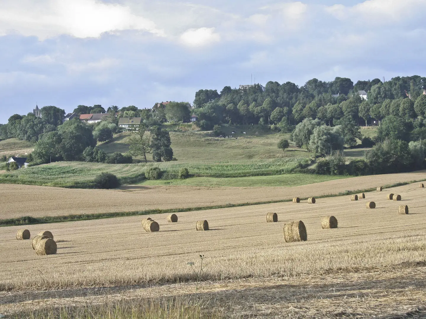
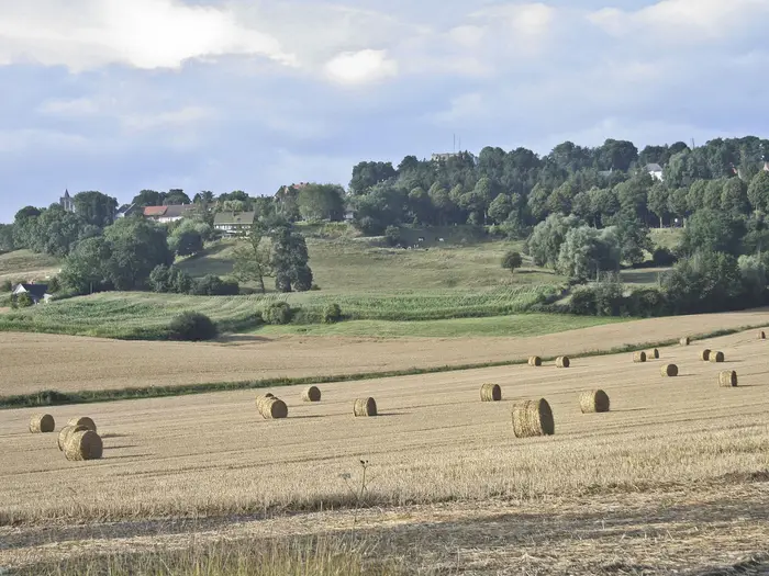
Image by JohnLynchFreelance The GR128 across French Flanders is a 152 km coast-to-border walk from Wissant on the Côte d'Opale to Bailleul near Belgium. It suits walkers who want a well-waymarked, culturally rich traverse of northern France without technical mountain terrain.
The route starts between Cap Gris-Nez and Cap Blanc-Nez, then turns inland through farmland, woods, hedgerows and quiet lanes. Guînes, Licques, Watten and the marshes north of Saint-Omer give the middle stages a distinctly rural, lowland character.
The final third brings the modest but memorable Monts de Flandre, with Cassel and Mont Cassel forming the high point of the walk. Windmills, Flemish brick towns, abbey hills and border-country folklore give this section much of its identity.
This is a moderate trail rather than a hard one, but it still asks for steady daily mileage, sensible stage planning and footwear that can cope with clay paths after rain. Accommodation and services are easier in the towns than between them, so rural overnights are best arranged ahead.
This guide covers stages, days, accommodation, food, transport, terrain and the common planning mistakes to avoid.
Stage-by-Stage Guide
The stage split below uses the practical seven-day Wissant to Bailleul itinerary. Distances are approximate, and the exact GR128 line can change, so carry the current FFRandonnée GR128 topo-guide or relevant IGN mapping and follow the white-and-red GR balises on the ground.
Stage 1: Wissant to Guînes — approx. 21 km
This opening stage gives the strongest coast-to-interior contrast of the whole route. It starts at Wissant on the Côte d'Opale, with the broad sandy bay between Cap Gris-Nez and Cap Blanc-Nez, then turns inland towards the Pays des Caps and the rural edge of French Flanders.
Underfoot, expect a mix of sandy or firm coastal paths near Wissant, then dirt tracks, field paths, gravel and quiet lanes as the route leaves the coast. In wet weather, the inland lowland sections can become sticky and slow, especially where clay paths cross farmland.
The main landmark is Wissant itself, followed by the gradual loss of sea views as the GR128 heads east-south-east. The day ends in Guînes, a useful small town near the Forêt de Guînes and within the Parc naturel régional des Caps et Marais d'Opale.
Food and water are best treated as town-based on this stage: start stocked from Wissant and plan to resupply in Guînes. Do not assume frequent services between the two, particularly outside the main summer season.
Accommodation is generally more realistic at the stage ends than in the rural middle of the day. Guînes has a better chance of hotels, chambres d'hôtes or gîtes than the farmland in between, but booking ahead is sensible.
For access, Wissant has no railway station and is reached by bus from the Calais area, with Calais-Ville and Calais-Fréthun the nearest railheads. Guînes is a practical road-access point, but any onward public transport should be checked before travelling.
Navigation is usually straightforward where the GR balises are visible, but the first day includes a real change of landscape, so pay attention at field-edge junctions and lane crossings. After rain, allow extra time for mud rather than judging the day by distance alone.
Stage 2: Guînes to Licques — approx. 18 km
This is a shorter inland stage through the rural Boulonnais and the wooded-farmland country behind the Opal Coast. It is less dramatic than the start but useful for settling into the rhythm of the GR128: fields, hedgerows, small roads and pockets of woodland.
The Forêt de Guînes is the key landscape feature near the start, after which the route works through quiet countryside towards Licques. Gradients are generally modest, but the walking is not always fast if the paths are wet or churned.
Licques is the main place at the end of the stage. It is known for its poultry tradition, especially dinde de Licques, and for the remains of its former abbey, making it one of the more distinctive rural stops on the western half of the route.
Carry food and water from Guînes unless accommodation or a booked stop has advised otherwise. Rural services between Guînes and Licques should not be relied on for a full day’s supplies.
Accommodation options are thinner here than in larger towns, so Licques is a place to book ahead rather than arrive late and improvise. Chambres d'hôtes, gîtes or small hotels in and around the village are the most likely styles.
Road access is via the local rural road network, but this is not one of the stronger public-transport stages of the route. If using this as a section walk, arrange transport in advance and check current regional bus options before travelling.
Navigation is mainly a matter of staying alert through farmland, woodland margins and lane junctions. Mud is the main practical warning: waterproof footwear and gaiters are useful after prolonged rain.
Stage 3: Licques to Watten — approx. 22 km
This stage continues east across the inland countryside and begins the transition towards the Audomarois. It is a longer day than the previous one, with a steady mix of tracks, agricultural paths, woods and quiet lanes rather than any technical difficulty.
The approach to Watten introduces a different landscape, with the Aa valley, the Canal de la Haute Colme and the wooded Montagne de Watten giving the stage a more defined finish. Watten itself is a useful canal-side town below the hill, with the old abbey and mill above.
The walking is moderate but can feel wearing if the ground is wet. Lowland clay, farm tracks and paved sections mean the pace can vary sharply from one hour to the next.
Licques and Watten are the reliable supply points for the day. Carry a full day’s food and water from the start unless a definite stop has been planned, as intermediate rural services are not guaranteed.
Watten is one of the better overnight points on the western half of the GR128, with accommodation possible in or near the town. It is still worth booking ahead, especially if walking during holiday periods or planning a precise stage schedule.
Watten-Éperlecques has an SNCF/TER station, making Watten a useful entry or exit point for section-walkers. Confirm current train times before relying on the connection.
Navigation is helped by the clear end target of Watten, but do not treat the canal and valley area as a substitute for mapping. The GR may use minor lanes and field paths as it approaches the town, and re-routes should be followed where signed.
Stage 4: Watten to Saint-Omer area — approx. 18 km
This is a shorter stage around the edge of the Audomarois, with the GR128 moving from Watten towards the marsh country north of Saint-Omer. It is a good day for allowing time through the canal and marshland landscape rather than rushing the distance.
The main features are the Canal de la Haute Colme near Watten and the Marais Audomarois, the Saint-Omer marshes, a UNESCO Biosphere reserve of waterways and market-garden landscapes. The route passes to the north of Saint-Omer rather than simply making a direct town-centre approach.
Terrain is generally low-level, with paths, tracks, lanes and potentially damp ground. After wet weather, expect mud and soft margins, particularly where the route crosses lowland paths near marsh or agricultural land.
Food and water planning is easier here than on the more rural stages, because Watten and the Saint-Omer area are both service centres. Even so, carry enough for the day: the GR line may skirt rather than enter the most convenient streets.
Accommodation is available in the Saint-Omer area, and this is one of the more flexible overnight zones on the route. Decide in advance whether to stay on or near the GR line or to use Saint-Omer itself, as that may affect the next morning’s walking.
Public transport is relatively strong for this section. Watten-Éperlecques and Saint-Omer both have SNCF/TER stations, making this a useful stage for joining, leaving or shortening the route. Train times should be checked before travelling.
Navigation needs attention because the route skirts a larger urban area and a complex marsh landscape. Avoid assuming that every obvious road or canal-side path is the GR128; follow the balises and mapping closely.
Stage 5: Saint-Omer area to Cassel — approx. 24 km
This is one of the longest and most important stages of the French GR128. It leaves the Audomarois and works towards the Monts de Flandre, finishing with the climb to Cassel on Mont Cassel, the high point of the route at around 176 m.
The day begins in lowland country and gradually becomes more rolling as the route approaches the Flemish hills. Underfoot, expect the usual mix of dirt, gravel, lanes and field paths, with mud after rain and some paved walking.
Cassel is the major highlight: a hilltop town with cobbled streets, a large Grand'Place, the Kasteel Meulen windmill and wide views over the Flemish plain. The height gain is modest by mountain standards, but it is noticeable at the end of a 24 km day.
Food and water should be planned conservatively. Start with enough for a full stage from the Saint-Omer area, and do not depend on frequent rural resupply before Cassel.
Accommodation in Cassel should be booked ahead. It is a popular and characterful stop, and the hilltop location means alternatives may not be as simple as they look on a map once the day’s walking is finished.
Cassel has a small TER station on the Lille–Hazebrouck–Dunkerque line, but the station is around 2–3 km below the town and involves a steep walk. That matters both for section-walkers arriving by train and for anyone considering ending the day at the station rather than in the town.
Navigation is usually not difficult if the balises are followed, but this stage is long enough for small errors to matter. Leave early in poor weather, keep water accessible, and expect the final climb to feel harder if the preceding farmland has been muddy.
Stage 6: Cassel to Steenvoorde — approx. 16 km
This is a shorter stage through the Monts de Flandre country, giving a gentler day after the longer approach to Cassel. The walking remains moderate, with rolling terrain rather than steep or technical ground.
The route leaves the hilltop setting of Cassel and moves through Flemish farmland, low hills, lanes and tracks towards Steenvoorde. Views can open widely across the plain, especially in clear weather on the higher ground.
Mont des Cats, with its Trappist abbey and open views, lies close to the route but a little off the main line. It can make a worthwhile detour if time, weather and accommodation plans allow, but the extra distance and return to the GR should be planned on the map rather than added casually.
Steenvoorde is the stage-end village, known for Flemish windmills such as the Noordmeulen and Drievenmeulen, and for its géants folklore and carnival traditions. It is a practical stop before the final push to Bailleul.
Food and water are easiest to manage at Cassel and Steenvoorde. Carry what is needed for the day, particularly if adding Mont des Cats or walking outside normal service hours.
Accommodation around Steenvoorde is more limited than in larger towns, so book ahead. If no suitable lodging is available on the intended date, the stage plan may need adjusting before the walk begins.
Public transport is less straightforward here than at Cassel, Saint-Omer or Bailleul. Treat Steenvoorde primarily as a walking-stage stop and check any bus or taxi options before travelling.
Navigation is mainly a matter of watching for GR turns through farmland and minor roads. Mud remains the most common underfoot problem, while road sections require normal care with visibility and traffic.
Stage 7: Steenvoorde to Bailleul — approx. 18 km
The final French stage continues through the Monts de Flandre and the borderland countryside towards Bailleul. It is a moderate-distance finish, with no technical terrain but enough rolling ground and mixed surfaces to remain a proper walking day.
Expect farmland, hedgerows, quiet lanes and low hills, with the landscape gradually becoming more settled as Bailleul approaches. In wet conditions, the same clay-path issue applies: some sections can be slow, greasy and hard on footwear.
Bailleul is the end of the French section and a strong finish point. The town was rebuilt after the First World War in Flemish neo-Renaissance style and has a notable belfry, part of the UNESCO-listed belfries of Belgium and France, as well as lace-making heritage and the Musée Benoît-De-Puydt.
Carry food and water from Steenvoorde unless a definite stop is planned. Bailleul has town services at the end, but the countryside between should not be treated as guaranteed resupply.
Accommodation is available in Bailleul, making it a sensible place to finish, rest or continue into Belgium on the wider international GR128. Booking ahead is still advisable if arriving at the end of a fixed itinerary.
Bailleul has its own TER station on the Lille–Armentières–Hazebrouck–Dunkerque line, with onward connections possible at Hazebrouck and Lille. Confirm current SNCF/TER times before committing to a same-day onward journey.
Navigation remains important to the end, especially where the GR uses lanes and field paths close to a larger town. If continuing beyond Bailleul towards the Belgian section of the GR128, use current mapping for the cross-border route rather than assuming the waymarking and stage information are unchanged.
Recommended Itinerary
The most practical default is a 7-day walk using the main service points in order: Wissant, Guînes, Licques, Watten, the Saint-Omer area, Cassel, Steenvoorde and Bailleul. This keeps most days in the moderate 18-24 km range, with the longest day placed before Cassel and the shorter Cassel-Steenvorde stage after the climb onto Mont Cassel.
Distances are approximate and can vary with the exact current GR line, accommodation access and any off-route detours. Check official mapping before booking, especially where staying outside the town or village centre.
Standard itinerary: 7 days
| Day | From | To | Approx. distance | Why this stage makes sense | Services/accommodation notes |
|---|---|---|---|---|---|
| 1 | Wissant | Guînes | c. 21 km | A full but manageable opening day, leaving the Côte d'Opale and moving inland towards the Pays des Caps and the Guînes area. | Wissant has no railway station, so the start is normally reached by bus from the Calais railheads. Guînes is a sensible first overnight with town services; book ahead rather than assuming rural availability nearby. |
| 2 | Guînes | Licques | c. 18 km | A shorter rural stage after the first day, continuing through the inland Pas-de-Calais countryside and keeping the next Watten stage within range. | Licques is a village stop rather than a large town. Accommodation supply can be limited, so this is a stage to reserve in advance. |
| 3 | Licques | Watten | c. 22 km | One of the longer lowland days, carrying the route east towards the Audomarois and the Canal de la Haute Colme. | Watten is a useful overnight point, with the Watten-Éperlecques TER station giving a practical rail access point for section-walkers. Check the position of accommodation against the GR before booking. |
| 4 | Watten | Saint-Omer area | c. 18 km | A moderate day past the marshland fringe north of Saint-Omer, giving a shorter stage before the longer push to Cassel. | The route passes north of Saint-Omer rather than simply finishing in the city centre. Accommodation in the Saint-Omer area is useful, but the exact location matters; avoid adding an unplanned off-route walk at the end of the day. |
| 5 | Saint-Omer area | Cassel | c. 24 km | The longest standard day and a key transition into the Monts de Flandre, finishing on the hilltop at Cassel / Mont Cassel, the high point of the French section. | Cassel has accommodation and services, but the TER station is below the hilltop town, around a steep 2-3 km away. Factor that into any rail arrival, departure or section-walk plan. |
| 6 | Cassel | Steenvoorde | c. 16 km | A deliberately easier day after the Cassel stage, useful for absorbing the rolling terrain of the Monts de Flandre without overloading the itinerary. | Steenvoorde is a practical Flemish village stop, but rural accommodation should still be arranged ahead. This is also the day where detours around the Monts de Flandre can lengthen the walk. |
| 7 | Steenvoorde | Bailleul | c. 18 km | A moderate final day into Bailleul, ending at a town with rail connections and onward options towards Hazebrouck, Lille and Dunkerque. | Bailleul has its own TER station and is the cleanest finish point for the French section. Confirm current TER times before relying on a same-day onward connection. |
Slower variant: 8-9 days
An 8-day schedule suits walkers who prefer shorter days, are travelling with heavier packs, or expect muddy lowland paths after rain. The simplest approach is to keep the main towns but split the Saint-Omer area to Cassel stage, as the standard c. 24 km day is the longest and ends with the approach to Mont Cassel.
| Day | From | To | Approx. distance | Why this stage makes sense | Services/accommodation notes |
|---|---|---|---|---|---|
| 1 | Wissant | Guînes | c. 21 km | Keeps the first coastal-to-inland section intact. | Book Guînes accommodation ahead. |
| 2 | Guînes | Licques | c. 18 km | A moderate rural day. | Licques is a smaller overnight point; reserve in advance. |
| 3 | Licques | Watten | c. 22 km | Still a substantial day, but a logical move to the Audomarois edge. | Watten is useful for rail access via Watten-Éperlecques. |
| 4 | Watten | Saint-Omer area | c. 18 km | Leaves time to manage the marshland fringe and position for the Cassel approach. | Choose accommodation carefully because the GR passes north of Saint-Omer. |
| 5 | Saint-Omer area | Rural overnight before Cassel | Check official mapping before booking | Breaks the longest standard stage. | This only works if suitable accommodation is available near the route; do not assume there will be a bed at an even mileage split. |
| 6 | Rural overnight before Cassel | Cassel | Check official mapping before booking | Allows a shorter arrival onto Mont Cassel. | Cassel is the better service stop; its TER station sits below the hilltop town. |
| 7 | Cassel | Steenvoorde | c. 16 km | Keeps the post-Cassel day easy. | Book rural accommodation ahead. |
| 8 | Steenvoorde | Bailleul | c. 18 km | Finishes with a moderate day to the rail-served endpoint. | Bailleul has TER connections; check times before travelling. |
For 9 days, add a second split to one of the longer rural stages, most likely Wissant-Guînes or Licques-Watten, depending on where accommodation is available. The exact stop should be chosen from current mapping and confirmed lodging, not from distance alone.
Faster variant: 6 days
A 6-day itinerary is realistic only for fit walkers comfortable with one long final stage and consecutive full days on mixed lowland surfaces. It is not the best choice after prolonged rain, when clay paths can slow progress and increase fatigue.
| Day | From | To | Approx. distance | Why this stage makes sense | Services/accommodation notes |
|---|---|---|---|---|---|
| 1 | Wissant | Guînes | c. 21 km | Standard opening stage from coast to inland Flanders. | Wissant is bus-access only; confirm transport from Calais before travel. |
| 2 | Guînes | Licques | c. 18 km | Keeps the early route balanced rather than overloading the first two days. | Reserve Licques accommodation ahead. |
| 3 | Licques | Watten | c. 22 km | A longer rural stage to a useful canal-side and rail-access area. | Watten-Éperlecques station makes this a practical bailout or section point. |
| 4 | Watten | Saint-Omer area | c. 18 km | A moderate day before the longer Cassel approach. | Check accommodation position carefully around the Saint-Omer area. |
| 5 | Saint-Omer area | Cassel | c. 24 km | The key long day into the Monts de Flandre and onto the route high point. | Cassel is a good overnight, but the station is below town and involves a steep access walk. |
| 6 | Cassel | Bailleul via Steenvoorde | c. 34 km | Combines the standard Cassel-Steenvoorde and Steenvoorde-Bailleul stages into one demanding final day. | Only sensible with an early start and a secured finish plan at Bailleul. Confirm TER times if leaving by train the same day. |
Planning the Route
How many days to allow
Most walkers should plan the French GR128 over 7 to 9 days. A 7-day schedule works well if you are comfortable with repeated stages of roughly 18–24 km and can secure accommodation in the main overnight hubs.
An 8- or 9-day plan is more forgiving. It gives more margin for muddy lowland paths after rain, the rolling ground around the Monts de Flandre, and any detours such as Mont des Cats near the route. Slowing the itinerary is often more comfortable than trying to walk the route quickly, because the challenge here is cumulative distance rather than any single hard climb.
Stage planning and overnight stops
Daily stages are shaped less by terrain and more by where accommodation and transport exist. The most practical planning line uses the towns and villages already sitting on or close to the GR: Wissant, Guînes, Licques, Watten, the Saint-Omer area, Cassel, Steenvoorde and Bailleul.
| Planning stage | Typical overnight logic |
|---|---|
| Wissant to Guînes | Start from the bus-served coast and move inland to the first substantial service town. |
| Guînes to Licques | A shorter rural stage through the Pays des Caps / Boulonnais area. |
| Licques to Watten | A longer inland stage ending at a canal-side town with rail access nearby. |
| Watten to Saint-Omer area | Useful for breaking the Audomarois section and avoiding an overlong push to Cassel. |
| Saint-Omer area to Cassel | One of the bigger days, finishing with the climb to the hilltop town. |
| Cassel to Steenvoorde | A shorter day across the Monts de Flandre area. |
| Steenvoorde to Bailleul | Final moderate stage to the rail-served finish near the Belgian border. |
Rural accommodation is thinner between these hubs, so do not assume a flexible “walk until tired” approach will work. Book rural nights ahead, especially where the route crosses farmland between the larger towns.
Fast, slow or split into sections?
The route can be walked quickly by strong walkers, but it is not especially rewarding to over-compress. Long days across farmland and lanes leave little margin for mud, weather or transport timing, and the stage into Cassel is better planned with some spare time rather than treated as a late-day climb.
Section hiking is practical. Watten-Éperlecques, Saint-Omer, Cassel and Bailleul all provide useful rail access points, although Cassel’s station is a steep walk of roughly 2–3 km below the town. Wissant has no railway station, so the western end needs a bus connection from Calais, using Calais-Ville or Calais-Fréthun as the nearest railheads.
Shortening individual days may be possible, but it depends on accommodation and local transport rather than on obvious trail shelters or dense village services. Any plan using smaller intermediate stops should be checked before travelling.
Extending the walk is straightforward in route terms: from Bailleul the wider international GR128 continues across the Belgian border towards Kemmel / Heuvelland. Transport, accommodation and mapping for the Belgian continuation should be planned separately.
Accommodation, food and water planning
Accommodation is mixed: hotels, chambres d’hôtes, gîtes and campsites are the main options. Supply is reasonable in and around Wissant, Guînes, Watten, the Saint-Omer area, Cassel, Steenvoorde and Bailleul, but thinner in the open rural stretches between them.
Food planning should be based around the same named towns rather than assumed village-by-village resupply. Carry lunch and snacks for each walking day, and do not rely on finding cafés or shops on the line between overnight stops unless opening times have been checked.
Water is best filled before leaving accommodation or the larger settlements. This is lowland walking, not remote mountain terrain, but farmland sections can still be long enough that starting the day short of water is poor planning.
Navigation and maps
The French section is waymarked with the white-and-red GR balises, but a map or GPS track is still important. GR routes can be re-routed, and lowland paths through fields, woods and lanes are easy places to miss a turn in poor visibility or after agricultural change.
Use the current FFRandonnée GR128 topo-guide where available, plus the relevant IGN 1:25,000 sheets: 2103ET, 2203E, 2204E, 2303E and 2303O. Check the current waymarked line before committing accommodation to a tight stage plan.
Transport checks
Public transport makes this route easier to plan than many rural point-to-point walks, but the timetable details matter. Wissant is bus-only from Calais; Watten-Éperlecques and Saint-Omer have SNCF/TER access; Cassel has a small TER station below the town; and Bailleul has its own TER station on the Lille–Armentières–Hazebrouck–Dunkerque line.
Confirm current SNCF/TER train times and Hauts-de-France regional bus times before relying on them, especially for first-day access to Wissant, section breaks and Sunday or public-holiday travel.
Weather and ground conditions
Spring, summer and autumn are the main walking seasons. The route has no mountain weather problem, but exposed farmland, the Opal Coast start and the Monts de Flandre can all feel very different in wind and rain.
Mud is the main underfoot issue. The lowland clay paths can become slow and slippery after wet weather, so waterproof footwear and realistic daily distances matter more than technical gear.
Permits and formalities
There is no special route permit planning highlighted for this walk. The practical priorities are accommodation, transport, up-to-date mapping and allowing enough margin for muddy paths and rural service gaps.
Towns, Villages and Overnight Stops
Accommodation on the French GR128 is most straightforward when the walk is planned around the established service centres: Wissant, Guînes, Watten, the Saint-Omer area, Cassel, Steenvoorde and Bailleul. Between them the route crosses farmland, woods, lanes and smaller settlements where beds and evening food can be thinner, so rural nights are best booked ahead rather than left to arrival.
For a 7-day crossing, Licques is a useful overnight point even though services are likely to be more limited than in the larger towns. If walking shorter stages over 8–9 days, check carefully that any intermediate village has both accommodation and evening meals before committing to it.
Wissant
Wissant is the start village on the Côte d’Opale, set on the sandy bay between Cap Gris-Nez and Cap Blanc-Nez. It is the natural place to sleep before day one if arriving the day before, particularly because the route leaves the coast and heads inland immediately.
Accommodation is available in and around the village, with a mix of small hotels, chambres d’hôtes and camping-style options typical of a coastal settlement. Summer and holiday periods can be busy, so advance booking is sensible.
For food and supplies, treat Wissant as the last coastal service stop before the inland stages through the Pays des Caps. Opening hours can be seasonal, especially for restaurants and smaller shops, so check before relying on a late arrival meal or an early breakfast.
Wissant has no railway station. Access is by bus from Calais, where Calais-Ville and Calais-Fréthun are the nearest railheads; current Hauts-de-France bus times should be checked before travelling.
Guînes
Guînes is the first main inland stop after leaving Wissant, sitting on the transition from the Opal Coast hinterland into the Parc naturel régional des Caps et Marais d’Opale. It works well as a first overnight for walkers using the common Wissant–Guînes opening stage.
The town has a more practical service role than the smaller rural settlements around it, with accommodation available in or near the town. It is a good place to reset after the coast-to-inland stage, especially if the first day has been affected by wind or wet ground.
Food and basic resupply should be planned here rather than assumed in the countryside beyond. As with many French small towns, restaurant and shop opening hours can be limited on certain days, so confirm current options when booking accommodation.
Public transport should not be improvised at the end of the walking day. Local bus or taxi options for Guînes should be checked before travelling if using it as a section start or finish.
Licques
Licques is the logical overnight between Guînes and Watten on the standard west-to-east split. It sits in the rural Boulonnais hills and is useful because it breaks what would otherwise be a long inland section.
Accommodation is likely to be more limited than in the larger towns, so this is one of the places where advance booking matters. Do not assume there will be several fallback options within easy walking distance.
Licques is known for its poultry tradition and the remains of its former abbey, but for hikers its main value is practical: it keeps the early part of the route to manageable day lengths. Check evening meal arrangements when booking, particularly if staying outside the village centre.
Transport links are not a major strength of this stop. If starting or ending a section here, local bus or taxi arrangements should be checked before travelling.
Watten
Watten is a strong overnight stop at the edge of the Audomarois, near the Canal de la Haute Colme and the Aa valley. It is also a useful transport point, with Watten-Éperlecques served by SNCF/TER trains.
Accommodation is available in or near Watten, making it one of the more dependable stops on the western half of the route. It is a good place to plan a proper overnight after the rural Licques–Watten stage.
Food and resupply are more realistic here than in the smaller farmland settlements on either side. Confirm restaurant opening times if arriving late, and carry enough food for the approach in case rural cafés or shops are closed.
The Montagne de Watten, old abbey and mill above the valley add interest, but the main planning advantage is access: Watten can work well for section-walkers joining or leaving the GR128 by rail. Check current SNCF/TER times before relying on a same-day connection.
Saint-Omer area
The GR128 passes north of Saint-Omer, skirting the Marais Audomarois rather than simply making a town-centre crossing. Overnight planning here therefore depends on the exact accommodation chosen relative to the current waymarked line.
The Saint-Omer area is one of the better-served parts of the route for accommodation and food. It is a sensible place to build in a shorter day, take a more comfortable night, or split the route for walkers not following the 7-day schedule.
Because the route runs near the marshes north of the town, check whether your accommodation requires an off-route walk, taxi or local bus connection. This is especially important if arriving after a long day from Watten or planning an early start towards Cassel.
Saint-Omer has an SNCF/TER station, giving useful access for section-walkers. Confirm current train times before booking a tight itinerary.
Cassel
Cassel is the key overnight in the Monts de Flandre section and one of the best places to pause on the whole French GR128. The route passes through the hilltop town on Mont Cassel, the high point of the route and the highest hill in French Flanders.
Accommodation and food options are more favourable here than in the surrounding countryside, but Cassel is a popular small town and should still be booked ahead. It is an especially good stop after the longer stage from the Saint-Omer area.
The hilltop position matters for logistics. Cassel’s small TER station is on the Lille–Hazebrouck–Dunkerque line, but the village itself is a steep roughly 2–3 km above the station, so allow time and energy if using rail access.
Cassel is worth stopping in for more than convenience: the Grand’Place, cobbled streets, Kasteel Meulen windmill and views over the Flemish plain make it the most distinctive overnight on the route. It is also a sensible place to check weather and ground conditions before continuing through the rolling, often muddy Monts de Flandre.
Steenvoorde
Steenvoorde is the usual overnight between Cassel and Bailleul, set in the Flemish border country east of the main Mont Cassel section. It helps keep the final two walking days moderate rather than forcing a long push to the finish.
Accommodation is available in or near Steenvoorde, though it should still be booked ahead because this is a smaller service centre than Cassel or Bailleul. Check whether your lodging is in the village itself or requires extra road walking at the end of the day.
Food and basic services are more dependable here than in the intervening countryside, but opening times still need checking. If staying in a chambre d’hôtes or gîte, confirm whether dinner is available or whether restaurants are within practical walking distance.
Steenvoorde is known for windmills and Flemish géants folklore, but for walkers it is above all a practical final-night stop before Bailleul. Public transport options should be checked before travelling if using Steenvoorde as a section break.
Bailleul
Bailleul is the finish of the French section of the GR128, close to the Belgian frontier. It is the easiest place on the route to finish cleanly, with accommodation, food and onward rail access in the same town.
The town has a good range of overnight options compared with the rural sections, useful if arriving late from Steenvoorde or staying before continuing into Belgium on the wider international GR128. Booking ahead is still recommended in busy periods.
Bailleul’s centre gives a practical end point with cafés, restaurants and shops, as well as interest for walkers with time to stay: the Flemish neo-Renaissance rebuild, belfry, Musée Benoît-De-Puydt and lace-making heritage are all part of the town’s identity.
Bailleul has its own TER station on the Lille–Armentières–Hazebrouck–Dunkerque line, with onward connections at Hazebrouck and Lille. Check current SNCF/TER times before fixing onward travel, especially on Sundays, public holidays or when connecting to international transport.
Getting to the Start
The GR128 French section starts in Wissant, a seaside village on the Côte d’Opale between Cap Gris-Nez and Cap Blanc-Nez. Wissant has no railway station, so most walkers reach the start via Calais and complete the final leg by regional bus or taxi.
By train
The nearest railheads for Wissant are Calais-Ville and Calais-Fréthun. Both are practical arrival points for the start of the walk, with Calais acting as the main transfer point for local onward travel to Wissant.
From elsewhere in northern France, route first to Calais, then continue by bus or pre-booked taxi to Wissant. Current SNCF/TER train times should be checked before booking onward connections, especially if arriving late in the day.
By bus
Wissant is reached by regional bus from Calais, including Pas-de-Calais services linking the coast with the Calais railheads. This is the usual public-transport solution for walkers starting the route without a car.
Bus frequency can be limited compared with train services, and timetables may vary by season, weekday and school-holiday period. This should be checked before travelling. If the bus timing does not match a train arrival, allow for a wait in Calais or arrange a taxi in advance.
By car
Driving to Wissant is straightforward for reaching the start, but less convenient for a point-to-point walk ending in Bailleul. Leaving a vehicle at the start means returning from Bailleul to Wissant after the hike, which usually requires a combination of trains to Calais and onward local transport.
Do not assume long-stay parking is available in the centre of Wissant or near accommodation. Parking rules, duration limits and seasonal restrictions should be checked before travelling. If using a hotel, chambre d’hôtes or campsite before the first stage, ask directly whether they can offer or advise on multi-day parking.
From the nearest airport
No airport sits directly on the route. The simplest air approach is to choose an airport with onward rail access to the Hauts-de-France network, then travel by train to Calais and continue to Wissant by bus or taxi.
Lille is a useful regional rail hub for this part of northern France, but airport-to-trail logistics depend heavily on flight times and rail connections. This should be checked before travelling, and late arrivals may need an overnight stop before continuing to Wissant.
Where to stay before starting
Wissant is the most convenient place to sleep before day one, as the trail starts in the village and heads inland towards Guînes. Staying there avoids a morning transfer from Calais and gives a clean start for the first stage.
Accommodation in Wissant includes the mixed provision typical of the route — hotels, chambres d’hôtes and other small-scale options — but it is a coastal village, so booking ahead is sensible in busy periods. If transport connections into Wissant are awkward, an overnight near the Calais railhead followed by an early bus or taxi is the practical fallback.
Getting Home from the Finish
By train
Bailleul is a straightforward finish by rural-trail standards because the town has its own TER station. Gare de Bailleul is on the Lille–Armentières–Hazebrouck–Dunkerque line, giving practical onward links towards Lille, Hazebrouck and Dunkerque.
For most walkers, Lille is the most useful onward hub. Hazebrouck is also useful for changing trains, particularly for journeys back across inland Flanders or towards the coast. Current SNCF/TER Hauts-de-France times should be checked before fixing accommodation or buying onward tickets, especially for evenings, Sundays and public holidays.
If returning to the start at Wissant, allow this as a separate travel leg rather than assuming a simple direct connection. Wissant has no railway station; the nearest rail access is via Calais, with onward regional bus travel to Wissant. Train and Hauts-de-France bus times should be checked before travelling.
By bus
Bus is not usually the simplest way to leave Bailleul compared with the TER station. Local and regional bus services may be useful for short onward movements, but they are timetable-dependent and can be limited outside commuter periods.
Do not rely on an evening bus from the finish without checking the current Hauts-de-France regional timetable. This should be checked before travelling.
By car/taxi
If being collected by car, Bailleul is a much easier pick-up point than many of the rural stage ends on the route, with the finish town and its railway station both providing practical meeting points. Agree the exact pick-up location in advance, as the GR finish and the station may not be the same point.
Taxis are a sensible fallback for short transfers to accommodation, the station or a nearby rail hub, but availability should not be assumed late in the day. Book ahead where possible, particularly if finishing on a Sunday, a public holiday or after the main train services have thinned out.
Leaving a car at Wissant and returning to it from Bailleul is possible in planning terms, but it involves combining TER rail travel with the bus leg back to Wissant. Build in contingency time and check both train and bus times before committing to a same-day return.
From the nearest airport
Airport access is best planned around the rail network rather than the trail itself. From Bailleul, use TER services towards a larger hub such as Lille or Hazebrouck, then connect onward as required.
The exact airport transfer depends on flight choice and current public transport links, so this should be checked before travelling. For an early flight, staying the final night in Bailleul or moving on to the departure city the same evening is usually safer than relying on a very early rural connection.
Where to stay at the finish
Bailleul has accommodation options and is one of the more practical places on the route to stop rather than rush away. This is especially useful if the final day from Steenvoorde is wet, muddy or slower than expected, or if onward trains no longer line up well by the time you arrive.
Book ahead in busy periods and if finishing at the weekend. Staying in Bailleul also gives a cleaner buffer for onward rail travel the next morning, rather than forcing a late-day connection after completing the full Wissant to Bailleul section.
Which Direction Should You Walk?
The GR128 French section is normally planned west to east, from Wissant to Bailleul. That is the natural direction of the route as described: it starts on the Côte d'Opale at Wissant, heads inland across French Flanders, then reaches Bailleul near the Belgian border, where the wider international GR128 continues towards Kemmel / Heuvelland and beyond.
Walking it in reverse is perfectly practical, but it changes the logistics and the feel of the journey.
Wissant to Bailleul: the standard direction
This is the best default for most walkers. It gives a clear coast-to-interior progression: Wissant and the sandy bay first, then the Pays des Caps and Boulonnais around Guînes and Licques, the Watten and Saint-Omer marsh country, and finally the Monts de Flandre through Cassel, Steenvoorde and Bailleul.
Transport also works well this way. Wissant has no railway station, so the bus link from Calais needs to be dealt with at the start, when timing delays are less disruptive. At the end, Bailleul has its own TER station, giving a simpler exit by rail towards Hazebrouck, Lille, Armentières or Dunkerque. Current SNCF/TER and Hauts-de-France bus times should be checked before travelling.
The psychological shape of the walk is good too. The first days ease you inland through lowland rural terrain, while the more distinctive hilltop section around Cassel and the Monts de Flandre comes later. Bailleul makes a satisfying finish, especially if the walk is being linked with the onward Belgian section of the GR128.
Bailleul to Wissant: the reverse option
The reverse direction has one obvious attraction: finishing at the sea. Starting from Bailleul by train is straightforward, and the final arrival at Wissant gives a strong coastal endpoint between Cap Gris-Nez and Cap Blanc-Nez.
The trade-off is onward transport. Ending in Wissant means relying on the bus connection back towards Calais rather than simply stepping onto a train at the finish. For walkers with a fixed return journey, that can make the final day less forgiving.
Reverse walking also puts the Monts de Flandre and Cassel earlier in the route, followed by a long westward transition through marshes, farmland and the Boulonnais before the coast. That is not a problem, but the scenery progression feels less like a natural build across French Flanders.
Climbs, weather and daily stages
There is no significant climbing advantage in either direction. The route is moderate rather than mountainous, with the main ascent coming in the rolling Monts de Flandre and the high point at Mont Cassel, around 176 m. The direction will not materially change the difficulty.
Weather exposure should be treated as a route-wide issue rather than a directional one. The coast, open farmland and lowland clay paths can all be affected by wind, rain and mud, especially after wet weather. No direction avoids that.
Accommodation flow is broadly similar both ways because the same practical overnight hubs are used: Wissant, Guînes, Licques, Watten, the Saint-Omer area, Cassel, Steenvoorde and Bailleul. Rural supply is thinner between towns, so accommodation should be booked ahead whichever direction is chosen.
| Direction | Best for | Main drawback |
|---|---|---|
| Wissant → Bailleul | Standard route direction, easier finish by train, natural coast-to-Flanders progression, onward continuation into Belgium | Requires arranging bus access to Wissant at the start |
| Bailleul → Wissant | Easy rail access to the start, attractive coastal finish | Final transport from Wissant is bus-dependent |
Recommendation
For most hikers, walk the GR128 French section from Wissant to Bailleul. It follows the standard west-to-east logic of the route, handles the bus-only Wissant access at the beginning, gives a stronger landscape progression, and ends with straightforward rail connections from Bailleul. Reverse it only if a sea finish at Wissant is more important than easy end-of-walk transport.
Accommodation Along the Route
The GR128 French section works well as an inn-to-inn walk, provided accommodation is planned around the main service towns rather than assumed in every village. The practical overnight spine is Wissant, Guînes, Licques, Watten, the Saint-Omer area, Cassel, Steenvoorde and Bailleul, which matches a sensible 7-day split of roughly 16–24 km per day.
Accommodation is mixed: small hotels, chambres d’hôtes, gîtes and campsites. Choice is generally better in or near Wissant, Guînes, Watten, the Saint-Omer area, Cassel, Steenvoorde and Bailleul, while the rural farmland between them is much thinner. Licques is a logical stage stop but should be treated as a limited-choice overnight rather than a place to arrive without a booking.
Best overnight stops
| Place | Accommodation level | Best for | Notes |
|---|---|---|---|
| Wissant | Good | Start night; coast arrival; avoiding a rushed first morning | Seaside village on the Côte d’Opale, so summer weekends and holiday periods can be busy. Book ahead if starting in peak season. |
| Guînes | Good | First inland overnight after Wissant | A practical service town before the more rural Boulonnais and Pays des Caps sections. |
| Licques | Limited | Breaking Guînes to Watten into a manageable stage | A useful village stop, but rural supply is thinner. Book ahead and avoid relying on same-day availability. |
| Watten | Good | Canal-side overnight; access to rail at Watten-Éperlecques | One of the more practical mid-route bases, especially for section-walkers using the TER network. |
| Saint-Omer area | Good | Restock, extra accommodation choice, flexible staging | The GR passes north of Saint-Omer, so check the exact location of any booking against the current route line and allow for access time if staying off-trail. |
| Cassel | Good | Key overnight in the Monts de Flandre; shorter onward stage to Steenvoorde | Popular hilltop town and one of the strongest overnight choices on the route. The station is below the town, so do not confuse rail access with being beside the overnight stop. |
| Steenvoorde | Good | Penultimate night before Bailleul | A practical Flemish village stop between Cassel and Bailleul. Book ahead at weekends or if walking with a group. |
| Bailleul | Good | Finish night; onward rail travel | Strong finish-point choice with its own TER station, useful if finishing late or continuing into Belgium on the wider GR128. |
Booking strategy
For a 7-day itinerary, book every night in advance unless walking outside busy periods with a very flexible schedule. The route is not remote, but it crosses long stretches of farmland where the next suitable bed may be in the next town rather than the next village.
The most important places to secure early are Wissant in summer, Cassel at weekends, and any rural overnight such as Licques. Small chambres d’hôtes and gîtes may have limited rooms, may not take one-night stays at all times, and may require advance communication.
Campsites can be part of the mix, but they should not be treated as a guaranteed fallback in every stage town. Opening dates, pitch availability and distance from the GR should be checked before travelling, especially outside high summer.
Handling awkward gaps
Most walkers can keep the route straightforward by using the main town-to-town stages. If accommodation is full, the easiest fix is usually to shorten or lengthen a stage into the next accommodation hub, or to use a taxi transfer between the trail and an off-route bed.
Do not assume a dedicated luggage-transfer service is available throughout this French section. If walking with bags transported, arrange this directly through accommodation providers, a walking-holiday operator or local taxi firms before departure. This should be checked before travelling.
Section-walking accommodation
The route is also practical for section-walkers because Watten-Éperlecques, Saint-Omer, Cassel and Bailleul have rail access, with Wissant reached by bus from the Calais railheads. This makes it possible to base in a larger town for one or two nights and use public transport or taxis to cover individual sections.
Train and regional bus times change, and some rural connections may not suit early starts or late finishes. Confirm current SNCF/TER and Hauts-de-France bus timetables before building an accommodation plan around public transport.
Camping and Wild Camping
Camping is possible on the GR128 French section, but it needs more planning than on a mountain trail with obvious backpacking sites. This is a lowland route through villages, farmland, woods, marsh-edge country and the Monts de Flandre, so the most reliable approach is to use established campsites in or near the main overnight hubs rather than assuming there will be informal places to pitch.
Campsites form part of the wider accommodation mix on this route, alongside hotels, chambres d’hôtes and gîtes. Availability is better around the larger stops such as Wissant, Guînes, Watten, the Saint-Omer area, Cassel, Steenvoorde and Bailleul, and thinner across the rural farmland between them. Book or at least phone ahead in summer, at weekends and on public holidays.
Does the GR128 suit camping?
The route can suit a lightweight camping itinerary, especially for walkers comfortable carrying gear over 18–24 km days. The terrain is not technical, but a full camping pack makes the muddy clay paths, paved lanes and rolling climbs around the Monts de Flandre more tiring than the modest height profile suggests.
Camping works best if stages are planned around known service towns rather than fixed distances alone. Rural stretches between Guînes, Licques, Watten, Cassel and Steenvoorde can feel open and agricultural, with fewer obvious legal pitch options and less evening supply.
Campsite planning by section
| Section | Camping notes |
|---|---|
| Wissant and the Côte d’Opale | The start area is one of the more practical places to begin with a campsite night, as Wissant is a seaside village with visitor infrastructure. Check opening dates before travelling, especially outside the main season. |
| Guînes and Licques | Useful inland staging points, but rural accommodation is thinner than on the coast. Do not leave this section to chance if camping; contact campsites or tourist offices ahead. |
| Watten and the Saint-Omer area | One of the more logical areas for a camping stop because it sits around larger settlements and the canal/marsh-edge landscape. Avoid assuming that marsh or canal-side ground is available for camping. |
| Cassel and the Monts de Flandre | A scenic but more exposed and settled hill-country section. Plan a legal overnight in or near a town rather than expecting discreet wild pitches around Mont Cassel. |
| Steenvoorde to Bailleul | Shorter final stages make it feasible to use fixed accommodation or a campsite near the route and finish by train from Bailleul. Check current campsite availability before building an itinerary around this end section. |
Wild camping and bivouac
Do not assume wild camping is allowed on the GR128. Much of the French section crosses private farmland, village edges, managed woodland, natural areas and the marsh-edge country north of Saint-Omer, where informal pitching may be restricted or inappropriate.
Rules can vary by commune, landowner and protected area. If planning to bivouac, ask the local mairie, tourist office or landowner first; wild-camping legality for a specific spot should be checked locally before relying on it.
The Parc naturel régional des Caps et Marais d’Opale covers part of the western route area, and the Marais Audomarois is a UNESCO Biosphere reserve. In these landscapes, stay on marked paths, avoid dunes, wetlands, crops and sensitive habitats, and use established accommodation wherever possible.
Water and supplies for campers
Carry enough water between towns, particularly on warm days and across open farmland. The route passes named water landscapes such as the Canal de la Haute Colme and the Saint-Omer marshes, but canal, ditch and marsh water should not be treated as a dependable drinking source.
The most reliable water and food points are the main settlements on the stage sequence: Wissant, Guînes, Licques, Watten, the Saint-Omer area, Cassel, Steenvoorde and Bailleul. Rural shops and cafés may have limited hours, so campers should not plan evening meals around late arrivals without checking opening times.
Practical camping etiquette
Use established campsites where available, pitch only where permitted, and keep noise low near villages and farms. Leave no litter, do not damage crops or hedges, and avoid blocking farm tracks, field entrances or access routes.
Open fires are not appropriate on this route. Use a stove only where it is permitted and safe, and be especially cautious in dry weather, woodland, dunes and protected natural areas.
Spring and autumn can bring wet ground and heavy mud on lowland clay paths, so a waterproof tent footprint and dry packing system are useful. In summer, campsite demand can rise around the coast and popular towns, making advance booking the safer option.
Food, Water and Resupply
The GR128’s French section is not a wilderness route, but it is a rural lowland walk with long farmland sections between service towns. Food planning is straightforward if accommodation stops are aligned with Wissant, Guînes, Watten, the Saint-Omer area, Cassel, Steenvoorde and Bailleul; it becomes more awkward if stages finish in smaller rural settlements or out-of-town accommodation.
Do not assume that every village on or near the line has a usable shop, café or evening meal. Rural opening hours in northern France can be limited, with lunchtime closures, early closing, Monday closures and reduced Sunday trading all possible. This should be checked before travelling, especially if walking outside the main holiday season or arriving late after a long stage.
Where resupply is easiest
Wissant, Guînes, Watten, the Saint-Omer area, Cassel, Steenvoorde and Bailleul are the main practical resupply and meal-planning points on the French section. These are the places to prioritise for buying the next day’s lunch, topping up snacks and arranging an evening meal.
The Saint-Omer area is potentially useful for a larger resupply, but the GR128 skirts north of Saint-Omer rather than simply walking through the town centre. If relying on Saint-Omer services, check the exact accommodation location and the walking line before assuming shops or restaurants are directly on the route.
Cassel and Bailleul are also good points to reset food supplies before the final Monts de Flandre stages or before continuing beyond the French section into Belgium. Cassel is a hilltop town, so avoid leaving all food shopping until a late or tired arrival if staying below the town or using the station area.
Where food is more limited
The more rural stretches are Wissant to Guînes, Guînes to Licques, Licques to Watten, and the farmland sections between the Saint-Omer area, Cassel, Steenvoorde and Bailleul. Licques is a sensible overnight village in the planning split, but it should be treated as a smaller rural stop rather than a guaranteed full resupply point unless current services have been checked.
For these sections, carry lunch and snacks from the previous known service town. If accommodation includes dinner or breakfast, confirm this when booking; rural chambres d’hôtes and gîtes do not always provide meals, and nearby restaurant choice may be limited.
Water planning
Plan to refill from accommodation, cafés, restaurants and public-facing services in towns rather than from the landscape. The route crosses farmland, woods, canals and the Audomarois marsh area, but canal, ditch, marsh and agricultural runoff water should not be treated as normal drinking water.
Most walkers should start each stage with enough water for the full day’s walking, especially on 18–24 km stages where reliable mid-stage refills are uncertain. In mild conditions this usually means carrying a full day capacity rather than a token bottle; in warm summer weather, carry more and top up whenever a staffed service is available.
A filter or purifier can be carried as a backup, but it should not be the main water plan for this route. If forced to use natural water, treat it and choose the cleanest possible flowing source away from obvious agricultural or canalised water; this is an emergency fallback, not a routine strategy.
Resupply by section
| Section | Food availability | Water availability | Notes |
|---|---|---|---|
| Wissant to Guînes | Start in Wissant with lunch and snacks; Guînes is the next main service town. | Fill before leaving Wissant and refill at accommodation or services in Guînes. | Do not rely on finding food during the rural inland transition unless checked in advance. |
| Guînes to Licques | Guînes is the best place to buy the day’s food; Licques is a smaller rural overnight stop. | Leave Guînes with enough water for the stage; refill at the overnight stop. | Confirm evening meal and breakfast arrangements in Licques before booking. |
| Licques to Watten | Carry lunch from Licques or buy before leaving if services are open; Watten is the next stronger resupply point. | Start with a full day’s water; use Watten for refilling. | A longer rural stage, so avoid depending on unplanned cafés or shops en route. |
| Watten to Saint-Omer area | Watten offers the main start-point resupply; services increase around the Saint-Omer area depending on exact lodging. | Refill in Watten and again at accommodation or services near Saint-Omer. | The route passes the canal and marsh area, but this water is not suitable as a normal drinking source. |
| Saint-Omer area to Cassel | Buy food before leaving the Saint-Omer area; Cassel is the next important stop. | Carry enough water for the full stage and refill in Cassel. | This is one of the longer planning stages; check whether the route and accommodation actually pass convenient shops. |
| Cassel to Steenvoorde | Cassel is the best place to stock up before the short Monts de Flandre stage; Steenvoorde is a practical end point. | Fill in Cassel and refill in Steenvoorde. | Opening hours matter: buy lunch the evening before if leaving early. |
| Steenvoorde to Bailleul | Buy the final day’s food in Steenvoorde; Bailleul has finish-town services. | Start with enough water for the day and refill on arrival in Bailleul. | If continuing on the wider GR128 into Belgium, use Bailleul to resupply properly before crossing the border. |
Practical carrying strategy
For a hotel or B&B-based traverse, carry one day of walking food at a time: lunch, high-energy snacks and a small spare item in case a café or shop is closed. For camping or self-catering, carry more flexibility, especially before rural overnights where evening food is not guaranteed.
The safest routine is to buy the next day’s lunch on arrival, not the following morning. This avoids problems with early starts, closed bakeries or shops, and villages where the only useful food stop keeps short hours.
On Sundays and public holidays, be more conservative. Carry food bought the previous day, confirm any evening meal when booking, and do not plan a long stage around an unverified shop, petrol station or restaurant.
Terrain, Conditions and Difficulty in Practice
What the walking is actually like
The GR128’s French section is a lowland coast-to-border walk, not a mountain route. The underfoot mix is varied: sand and dune-edge paths around Wissant, then dirt tracks, farm paths, gravel, woodland paths and paved lanes through the Pays des Caps, the Audomarois and the Monts de Flandre.
The route is well waymarked with white-and-red GR balises, and there is no technical terrain, scrambling or high-altitude exposure. The real difficulty comes from keeping up steady 18–24 km days over 152 km, especially when wet clay paths become slow and slippery.
Some road and lane walking is part of the route. This is a rural French Flanders walk through villages, farmland and small towns, so expect practical connecting sections on quiet roads rather than continuous wilderness footpath.
Terrain by section
| Section | Terrain in practice | What makes it harder |
|---|---|---|
| Wissant to Guînes | Starts on the Côte d’Opale around sandy bay and dunes, then turns inland through the Pays des Caps towards Guînes and the Forêt de Guînes. | Sand and softer ground can slow the first kilometres; the transition inland brings more farm tracks and lanes. |
| Guînes to Licques | Rural Boulonnais countryside with farmland, hedgerows, woods and quiet lanes. | Easy gradients, but surfaces can become muddy after rain and village-to-village distances still add up. |
| Licques to Watten | Rolling inland terrain towards Watten, with farmland, tracks and lanes leading towards the Aa valley area. | One of the longer practical days in a typical 7-day split; mud and hard paved stretches can both be tiring. |
| Watten to the Saint-Omer area | Canal and marsh-edge country around the Canal de la Haute Colme and the Audomarois north of Saint-Omer. | Flatter walking, but lowland paths are more affected by wet weather; expect slower progress after prolonged rain. |
| Saint-Omer area to Cassel | The route leaves the flatter Audomarois side and works towards the Monts de Flandre, finishing with the climb to hilltop Cassel. | This is likely to feel like one of the more demanding days because it combines distance with the approach to Mont Cassel. |
| Cassel to Steenvoorde | Rolling Monts de Flandre country, with Cassel already high on the route and Mont des Cats nearby but slightly off the line. | Shorter on a standard split, but still undulating compared with the flatter central sections. |
| Steenvoorde to Bailleul | Rural French Flanders into Bailleul near the Belgian border, with more farmland, lanes and village approaches. | Not technically difficult, but fatigue is often the limiting factor by the final day. |
Climbs, descents and overall effort
The route’s total ascent is about 1,659 m, spread across 152 km. That makes the GR128 physically moderate rather than steep: there are no long mountain climbs, but the cumulative rise and fall is enough to matter over a week.
Mont Cassel is the named high point at about 176 m, and the hilltop town gives the clearest sense of climbing on the route. The surrounding Monts de Flandre are modest in height, but after several days of lowland walking the rolling ground towards Cassel, Steenvoorde and Bailleul feels noticeably more tiring.
The route should not be judged only by elevation. A 22–24 km day on clay, gravel and lanes can be harder on feet and legs than the profile suggests, particularly with a full pack or in wet conditions.
Mud, wet ground and seasonal conditions
Lowland clay is the main underfoot problem. After rain, farm paths and dirt tracks can become sticky, slippery and slow; in dry spells the same sections are straightforward.
Spring, summer and autumn are the practical walking seasons. Spring can give softer ground; autumn rain can make the clay sections more demanding; summer usually offers firmer paths, though the amount of paved and open farmland walking still makes footwear comfort important.
Waterproof boots or trail shoes with good grip are more useful than heavy mountain boots for most walkers. In wet periods, gaiters can be worthwhile simply to keep mud off socks and trousers.
Road, farmland and woodland walking
This is not a continuous enclosed footpath. The GR128 links villages, woods, fields, canalside areas and small towns, so the rhythm alternates between rural tracks, short woodland sections, lanes and paved approaches into places such as Guînes, Watten, Cassel, Steenvoorde and Bailleul.
Road walking is not the dominant challenge, but it is enough to affect footwear choice and fatigue. Shoes need to be comfortable on tarmac as well as grippy on mud.
The route crosses working farmland and hedgerow country, but it is not a British-style upland route defined by stiles, stone walls or open moorland fences. Any gates, field edges or farm access points should be treated as working rural infrastructure: leave everything as found and keep to the waymarked line.
Technical difficulty and exposure
There is no scrambling, no rocky mountain terrain and no sustained exposed ridge walking. The coastal start around Wissant has dunes, cliffs and Channel views in the wider landscape, but the route soon turns inland and the main hazards are ordinary walking hazards: slippery mud, uneven farm tracks, hard road surfaces and fatigue.
Navigation is helped by the GR waymarking, but an up-to-date FFRandonnée topo-guide or current mapping remains important because GR routes can be re-routed. The exact current waymarked line should be checked before travelling.
Weather and Best Time to Walk
The GR128 French section is best planned as a spring, summer or autumn walk. Its difficulty is not altitude — the high point is Mont Cassel at about 176 m — but the combination of long days, exposed lowland walking and paths that can become very muddy after rain.
Best time to walk
For most hikers, the most comfortable window is late spring through early autumn, when daylight is long enough for 18–24 km stages and rural services are more likely to fit a multi-day itinerary. Summer gives the longest daylight and generally the easiest logistics, but open farmland, lanes and the Monts de Flandre can feel exposed in warm weather, so carry enough water between villages.
Spring and autumn can be excellent if the weather is settled, especially for section-walkers using the railway points at Watten-Éperlecques, Saint-Omer, Cassel and Bailleul. The main drawback is surface condition: the route includes lowland clay paths, dirt tracks and farmland sections that turn slippery and tiring after rain.
Rain, mud and underfoot conditions
Mud is the main weather-related issue on this route. After wet spells, expect heavier going on clay paths, field-edge tracks and wooded sections, particularly away from paved lanes and gravel surfaces.
Waterproof footwear with good grip is more useful than lightweight road-style shoes in wet periods. Gaiters can be worthwhile outside dry summer conditions, especially if walking consecutive days with limited drying time overnight.
The opening coastal section from Wissant includes sand and dune-edge terrain before the route turns inland. Inland, the mix becomes farmland, hedgerows, woods, quiet lanes, canal-side and marsh-edge walking, then the rolling Monts de Flandre around Cassel, Steenvoorde and Bailleul.
Wind, visibility and storms
The start at Wissant on the Côte d’Opale is exposed to coastal weather, and the inland farmland offers little shelter in places. A windproof layer is useful even outside cold weather, particularly on open lanes and higher ground around Mont Cassel.
Fog, low cloud or heavy rain can reduce visibility across the plains and around the Monts de Flandre. The GR is waymarked with white-and-red balises, but walkers should still carry the current FFRandonnée guide or relevant IGN mapping and not rely only on seeing the next waymark in poor conditions.
Thunderstorms are mainly a summer planning issue. On hot or unsettled days, avoid being committed to long exposed farmland sections late in the afternoon where possible, and check the local forecast before leaving towns such as Guînes, Watten, Cassel or Steenvoorde.
Winter practicality
The route is physically possible in winter because it has no technical mountain terrain and no high passes. However, winter is the least attractive season for an end-to-end walk: daylight is short, wet lowland paths can be very muddy, and rural accommodation or transport options may be less convenient.
A winter traverse is better suited to experienced walkers who are comfortable with short daylight windows, road walking in poor visibility and flexible stage planning. Current accommodation opening dates, SNCF/TER trains and Hauts-de-France bus times should be checked before travelling.
Accommodation and seasonal logistics
Accommodation is reasonable in and near Wissant, Guînes, Watten, the Saint-Omer area, Cassel, Steenvoorde and Bailleul, but thinner in rural sections between them. Book rural overnights ahead in any season, because a wet-weather detour or a closed guesthouse can create a long day.
In summer and during holiday periods, advance booking is especially sensible in the better-known towns and coastal start area. Outside the main season, the issue is less crowding and more whether individual chambres d’hôtes, gîtes, campsites and local services are open; this should be checked before travelling.
Safety Notes
The French section of the GR128 is not a technical or mountain route, but it still needs sensible day-to-day judgement. The main risks are long stages, muddy lowland paths after rain, road and lane sections, exposure across open farmland, and the canal and marshland areas around Watten and north of Saint-Omer.
Emergency help
For emergency assistance in France, call 112. Keep the phone charged and carry a small power bank if using it for navigation, train times or accommodation calls.
Mobile coverage should be treated as useful but not guaranteed, especially away from towns and in wooded or rural sections. Download offline mapping before leaving each overnight stop and carry the relevant paper map or guidebook rather than relying solely on a live data connection.
Navigation and waymarking
The route is waymarked with the white-and-red GR balises, but GR lines can be re-routed and markings can be missed at field edges, junctions and village exits. Check the current FFRandonnée topo-guide, IGN mapping and any local diversion notices before setting off.
Take extra care leaving larger route points such as Wissant, Guînes, Watten, the Saint-Omer area, Cassel, Steenvoorde and Bailleul, where streets, lanes and minor paths can make the first kilometre of a stage more confusing than the open countryside.
Mud, footing and fatigue
Lowland clay paths can become very muddy in wet weather. This is more likely to slow progress than create serious danger, but it can turn a 20 km day into a tiring one, particularly on consecutive stages.
Wear footwear with enough grip for wet field paths and carry poles if they help with balance. Build in time for slower going after rain, especially on the longer Watten–Saint-Omer area and Saint-Omer area–Cassel stages.
Roads and lanes
The GR128 includes some paved surfaces, quiet lanes and farmland access sections. Walk facing oncoming traffic where there is no pavement, use verges carefully, and take particular care on bends, in poor visibility and near village approaches.
A small flashing light or high-visibility detail is useful in dull weather, early starts or late finishes. Do not assume drivers will expect walkers on narrow rural lanes.
Weather exposure
Much of the route crosses open farmland, hedgerows and broad Flemish countryside rather than sheltered upland terrain. Wind, rain and sun can all feel stronger on exposed sections, even though the hills are modest.
Carry waterproofs in all seasons and enough warm layers for stops, especially in spring and autumn. In summer, start early on hot days, carry sufficient water between villages and use sun protection on open sections.
Water, canals and marshland
The canal-side and marshland areas around Watten, the Canal de la Haute Colme and the Audomarois north of Saint-Omer deserve straightforward caution. Stay on the path, keep back from steep or slippery banks, and take care on wet grass, towpaths and bridges.
Do not treat canal or marsh water as drinking water. Plan drinking water around accommodation, shops, cafés or public services in the towns and villages; availability in rural sections should be checked before each day’s walk.
Livestock, farming and field paths
This is an agricultural route, so expect field margins, farm tracks and occasional livestock where land use allows. Close gates, keep to the marked line, and give animals plenty of space.
Dogs should be kept under close control, particularly around livestock, farmyards and narrow paths. Follow any local signs, temporary diversions or access restrictions.
Solo walking
Solo walking is realistic on this route because it is lowland, waymarked and passes regular towns and villages, but long rural stretches still require self-sufficiency. Share the day’s destination with someone reliable and avoid pushing on late if weather, mud or fatigue has slowed progress.
The easiest safety margins are simple: start with a charged phone, carry food and water, know the day’s exit options, and book or confirm the night’s accommodation before leaving the previous stop.
Before setting off each day
Check the following each morning:
- Current weather, especially heavy rain, heat, strong wind or poor visibility.
- The day’s distance and likely pace if paths are muddy.
- The current GR line, local diversions and the next reliable resupply point.
- Accommodation check-in arrangements and any need to arrive before a set time.
- Public transport options if shortening the day becomes necessary; current SNCF/TER and Hauts-de-France bus times should be checked before relying on them.
- Phone battery, offline maps, water, food, waterproofs and a basic first-aid kit.
Gear Recommendations
The GR128 through French Flanders does not need mountain equipment, but it does need kit that copes with long lowland days, wet clay paths and mixed surfaces. Expect sand and dunes near Wissant, dirt and gravel tracks, quiet lanes, farmland paths, wooded sections and paved stretches through towns such as Guînes, Watten, Cassel, Steenvoorde and Bailleul.
Footwear
Choose footwear for mud and distance rather than rock or scrambling. Waterproof trail shoes or lightweight boots are the most practical choice for spring and autumn, when the lowland clay paths can become sticky after rain.
In drier summer conditions, breathable trail shoes are often enough, provided they have a secure tread for wet grass, farm tracks and the rolling Monts de Flandre. Very stiff mountain boots are unnecessary for the modest gradients, but flimsy road-running shoes are a poor choice once the route leaves tarmac.
Gaiters are worth considering after wet weather, especially on rural farmland sections between the main towns. They are not essential, but they help keep mud and wet vegetation out of footwear on long days.
Waterproofs and Layers
Carry a proper waterproof jacket throughout the walking season. The route is low and non-technical, but it crosses exposed coast, open farmland and hilltop ground around Cassel where wind and rain can make a moderate stage feel much harder.
Waterproof trousers are sensible in spring and autumn, or for any forecast involving prolonged rain. A lightweight windproof or softshell layer is useful on the Côte d'Opale and across open sections of the Flemish plain.
Pack at least one warm layer even in summer. The high point is only Mont Cassel at around 176 m, but long days in wet or windy weather still demand reliable insulation during breaks and at the end of the stage.
Navigation
The French section is waymarked with the white-and-red GR balises, but navigation should not rely on paint marks alone. Rural junctions, field edges, forestry tracks and occasional re-routes make a map or offline digital mapping important.
The FFRandonnée GR128 topo-guide is the most relevant route-specific guide to check before departure. The relevant IGN 1:25,000 sheets listed for the route are 2103ET, 2203E, 2204E, 2303E and 2303O.
Download offline maps before starting, especially if walking between accommodation hubs or using public transport to join and leave the route. The exact current waymarked line can change, so this should be checked before travelling.
Water and Food Carry
This is a town-to-town route rather than a remote wilderness walk, but do not assume there will be a shop, café or water point exactly when needed. Carry enough water for a full stage, particularly on the longer days between Licques and Watten, and between the Saint-Omer area and Cassel.
Food planning should be based around the overnight hubs: Wissant, Guînes, Licques, Watten, the Saint-Omer area, Cassel, Steenvoorde and Bailleul. Rural stretches between them can be thin on services, so a packed lunch and emergency snacks are sensible on every stage.
A small sit mat or lightweight break layer is useful because many sections pass through farmland, woods and lanes where comfortable stopping places are not guaranteed.
Trekking Poles
Trekking poles are optional but useful. They help on muddy clay paths, wet field edges and the rolling climbs of the Monts de Flandre, especially when carrying a multi-day pack.
They are less necessary for fast section walkers with light packs, and they can be awkward on paved town sections. Collapsible poles are the most versatile option.
Electronics and Power
Carry a power bank if using a phone for mapping, bookings, train times or bus information. This is especially useful for section hikers using SNCF/TER stations at Watten-Éperlecques, Saint-Omer, Cassel or Bailleul, and for anyone relying on the bus connection to Wissant from the Calais area.
A waterproof phone case or dry bag is a small but worthwhile addition. Rain, mud and damp clothing are more likely hazards here than cold-weather battery failure.
Sun, Insect and Comfort Items
Sun protection matters on the exposed beach, dunes, open farmland and hilltop sections. Carry sunglasses, sun cream and a cap or brimmed hat in late spring and summer.
Insect repellent is useful in warm conditions around wooded areas and the Audomarois marshes north of Saint-Omer. It is not a defining hazard of the route, but it can make evening stops and damp lowland sections more comfortable.
A small first-aid and foot-care kit is more important than specialist emergency gear. Blister plasters, tape and spare socks are particularly relevant because the main physical challenge is repeated 18–24 km days rather than steep ascent.
Inn-to-Inn Hikers
Keep the pack compact and comfortable. Accommodation is mixed, with hotels, chambres d'hôtes, gîtes and campsites in or near the main towns, so inn-to-inn walkers do not need cooking gear or a sleeping system unless a specific booking requires it.
The priority is wet-weather reliability: waterproofs, dry spare socks, a change of base layer and a way to keep evening clothing dry inside the pack. A light pair of clean shoes or sandals can be useful for accommodation and town evenings, but they are optional.
Campers
Camping is possible in principle because campsites form part of the wider accommodation mix, but availability is not even along the route. Rural overnights should be planned and booked ahead rather than left to chance.
Campers should carry a shelter that performs well in rain and wind rather than an ultralight fair-weather setup. The route is not high mountain country, but exposed farmland and wet ground can be uncomfortable with poor camping equipment.
A compact stove and simple food system may be useful if staying away from the main towns, but resupply planning should still be tied to Wissant, Guînes, Licques, Watten, the Saint-Omer area, Cassel, Steenvoorde and Bailleul. Any campsite facilities, opening dates and rules should be checked before travelling.
Fast and Section Hikers
Fast walkers and section hikers can travel very light, especially when using rail access at Watten-Éperlecques, Saint-Omer, Cassel or Bailleul. Even so, the route should not be treated like a short urban walk: carry waterproofs, water, food, offline navigation and a charged phone.
For single-day sections, prioritise comfortable footwear for mixed surfaces and a small pack that keeps essentials accessible. Cassel station sits below the town, so section plans involving Cassel should allow for the extra steep walk between station and village.
Seasonal Extras
Spring and autumn demand the most mud-ready setup: waterproof footwear, spare socks, gaiters if conditions are wet, and reliable waterproof clothing. Paths through lowland farmland can stay wet and heavy underfoot after rain.
Summer kit can be lighter, but do not drop waterproofs entirely. Add sun protection, extra water capacity for exposed days and insect repellent for warm, still conditions near woods and marshland.
The route is best considered a spring-to-autumn walk. Winter-specific advice is not central to this itinerary, but outside the main season accommodation, campsites, buses and daylight all need extra checking before committing to stages.
Budget and Costs
The GR128 French section is not an expensive mountain route, but it is not a guaranteed shoestring walk either. Costs vary mainly with accommodation: towns such as Wissant, Guînes, Watten, the Saint-Omer area, Cassel, Steenvoorde and Bailleul give a mix of hotels, chambres d’hôtes, gîtes and campsites, while the rural gaps between them have fewer options and can force a paid transfer or a dearer overnight if places are full.
All costs below are in euros and should be treated as planning ranges. Check current prices before booking, especially in summer on the Côte d’Opale and in popular stops such as Cassel.
Typical total budget
These estimates cover walking the 152 km route over 7–9 days and exclude travel to France, new gear, insurance, sightseeing entries and significant taxi use.
| Style | Typical approach | Daily cost per person | 7-day walk | 9-day walk |
|---|---|---|---|---|
| Budget | Campsites where available, simple gîtes, supermarket food, occasional café stop | €35–65 | €245–455 | €315–585 |
| Mid-range | Chambres d’hôtes or modest hotels, picnic lunches, simple evening meals | €80–130 | €560–910 | €720–1,170 |
| Comfortable | Private rooms throughout, restaurant meals, more flexibility with taxis or off-route accommodation | €130–220+ | €910–1,540+ | €1,170–1,980+ |
Solo walkers using private rooms should expect the upper end of the mid-range or comfortable bands, because room costs are not split. Two walkers sharing rooms can usually keep the per-person cost lower.
Accommodation costs
Accommodation is the biggest variable. Campsites and simple gîte-style stays are the cheapest approach, but they need careful planning because campsites are not guaranteed at every logical stage end. Do not build an itinerary around camping without checking each night in advance.
Chambres d’hôtes and small hotels are the most practical choice for many walkers. They are more readily found in and near the main route towns, but rural overnights should be booked ahead rather than left to the day, particularly if walking a fixed 7-day schedule.
As a broad planning guide, allow roughly:
| Accommodation type | Planning range |
|---|---|
| Campsite pitch / basic camping night | €10–25 per person |
| Simple gîte-style bed where available | €25–45 per person |
| Chambre d’hôtes or modest hotel room | €70–130+ per room |
| More comfortable hotel or B&B room | €100–160+ per room |
Prices can rise in busier periods, and availability matters as much as price on the thinner rural sections between the main towns.
Food and drink
Food costs are manageable if lunches are bought from bakeries, small shops and supermarkets where available. The practical issue is timing: some villages have limited opening hours, so carry enough food and water between towns rather than relying on finding an open shop exactly on route.
A realistic daily food budget is:
| Food style | Daily range |
|---|---|
| Mostly supermarket / bakery food | €10–20 |
| Picnic lunch plus café stops or a simple evening meal | €25–45 |
| Restaurant meals and drinks most days | €45–70+ |
Breakfast may be included at some chambres d’hôtes or hotels, but this should be checked when booking. If leaving early, confirm whether breakfast is available early enough or budget for buying food the evening before.
Transport costs
Budget separately for getting to Wissant and leaving Bailleul. Wissant has no railway station, so most walkers need rail travel to Calais-Ville or Calais-Fréthun, followed by a regional bus connection to Wissant. Bailleul has its own TER station, with onward rail connections via places such as Hazebrouck and Lille.
Mid-route railway access at Watten-Éperlecques, Saint-Omer, Cassel and Bailleul makes section walking cheaper and more flexible than on many rural routes. Cassel’s station is below the hilltop town, so either allow time and energy for the steep walk or budget for a short local transfer if needed.
Train and bus fares depend on route, timing and ticket type. Confirm current SNCF/TER and Hauts-de-France bus times and fares before relying on them.
Taxis, luggage and package costs
Local taxis can be useful if accommodation is off-route, if a bus connection fails, or if the Cassel station climb is inconvenient with luggage. They should not be treated as automatically available in small rural places at short notice; book ahead where possible and confirm the fare before travelling.
Do not assume a dedicated route-wide luggage-transfer service. If luggage movement is needed, arrange it stage by stage through accommodation providers or local taxis and price it before committing to the itinerary.
A fully independent walk is the normal budget-friendly approach on this well-waymarked GR. If using a self-guided or guided package, compare exactly what is included: accommodation standard, breakfasts, evening meals, luggage transfer, maps, emergency support and transport to or from Wissant and Bailleul can all change the real cost.
Luggage Transfer, Guided Tours and Support Services
Luggage transfer
There is no well-established, route-wide baggage-transfer system for the French Wissant to Bailleul section of the GR128 in the way you might find on major Alpine or Camino-style trails. Most walkers should plan either to carry their own overnight kit or to arrange ad hoc transfers between accommodation providers and local taxis.
This matters most on the longer rural stages, particularly between Licques, Watten, the Saint-Omer area and Cassel, where accommodation is more spread out and public transport may not line up neatly with walking days. If luggage transfer is essential, book accommodation first, then ask each host whether they can hold luggage, receive bags, or recommend a local taxi. This should be checked before travelling.
A practical approach is to keep baggage light and use town-based overnights at Wissant, Guînes, Licques, Watten, the Saint-Omer area, Cassel, Steenvoorde and Bailleul. These places give the best chance of arranging local help if needed, but rural pick-ups should never be assumed on the day.
Self-guided walking packages
Self-guided packages may be possible through French or regional walking-holiday operators, usually as a customised itinerary rather than a standard mass-market product. A typical package would include accommodation booking, route notes or GPX files, and sometimes luggage movement by local taxi, but availability, dates and inclusions vary.
This option suits walkers who want the independence of following the GR balises without managing every hotel, bus and taxi detail themselves. It is most useful if walking the full 152 km in one trip, especially in peak holiday periods or when staying in smaller rural chambres d'hôtes and gîtes.
Before booking, check exactly what is included: whether the route follows the current GR128 line, whether the Saint-Omer overnight is on or near the route, whether Cassel accommodation is in the hilltop town rather than down by the station, and whether luggage transfers cover every stage. Current prices and cancellation terms should be confirmed before booking.
Guided walking
A fully guided end-to-end GR128 trip on this French section is not something to rely on as a standard scheduled service. The route is moderate, well waymarked and logistically manageable for independent walkers, so most hikers will not need a guide for navigation or terrain.
A guide may still be worthwhile for groups wanting interpretation of the Opal Coast, the Parc naturel régional des Caps et Marais d'Opale, the Audomarois marshes, the Monts de Flandre, Flemish heritage or First World War history around Bailleul and the border area. In that case, look for a local walking guide or regional tour operator and arrange the itinerary in advance. This should be checked before travelling.
Taxi transfers and public-transport back-up
Taxis are the most realistic private support option for this route, especially for moving between off-route accommodation and the GR, shortening a day, or dealing with bad weather, injury or a missed bus. They are particularly useful around the more rural sections between Guînes, Licques, Watten, Cassel and Steenvoorde, where services can be thinner than in the larger towns.
Do not rely on finding a taxi at short notice in every village. Book the previous evening where possible, and give precise pick-up points, as rural lanes, farm tracks and forest edges can be awkward for drivers to identify.
Public transport is also a useful support tool. Watten-Éperlecques, Saint-Omer, Cassel and Bailleul have rail access, while Wissant is reached by bus from the Calais area. Cassel’s station is below the hilltop town, so allow for the steep approach or arrange a transfer if arriving tired or with heavy luggage. Current SNCF/TER and Hauts-de-France bus times should be checked before travelling.
When support is unnecessary
Fit walkers carrying a light pack can complete the route without formal support. The GR128 has no technical mountain terrain, no remote high passes and no need for specialist guiding; the main challenges are daily distance, mud on lowland clay paths after rain, and the cumulative effort of walking for a week or more.
For many hikers, the best balance is to carry a compact overnight bag, pre-book accommodation in the smaller places, and keep taxi numbers or transport options as a back-up rather than as the core plan.
Shorter Hikes and Best Sections
The GR128 French section is easy to break at its main service points: Wissant, Guînes, Licques, Watten, the Saint-Omer area, Cassel, Steenvoorde and Bailleul. The most practical shorter walks use the railheads at Watten-Éperlecques, Saint-Omer, Cassel and Bailleul, while Wissant needs a bus connection from Calais.
Approximate distances below use the planning stages for this route. Always check the current FFRandonnée/IGN line, SNCF/TER times and Hauts-de-France bus times before committing to a one-way section.
| Best for | Start → end | Approx. distance | Why choose it | Transport notes |
|---|---|---|---|---|
| Best day walk / easiest rail-based taster | Watten → Saint-Omer area | 18 km | A manageable day with canal-side walking near the Canal de la Haute Colme, the edge of the Audomarois marshes and no major climbing. Good if you want a single GR128 day without arranging a full baggage or accommodation plan. | Watten-Éperlecques and Saint-Omer both have SNCF/TER stations. The GR skirts north of Saint-Omer, so the exact link between the trail and Saint-Omer station should be checked before travelling. |
| Best weekend section | Cassel → Steenvoorde → Bailleul | 34 km | The strongest two-day section for Flemish character: Mont Cassel, the rolling Monts de Flandre, windmills and folklore around Steenvoorde, then the rebuilt Flemish-style finish at Bailleul. Daily distances are moderate at roughly 16 km and 18 km. | Cassel has a TER station, but it is a steep 2–3 km below the hilltop town. Bailleul has its own TER station. Accommodation is reasonable in and near Cassel, Steenvoorde and Bailleul, but book ahead. |
| Best 3–5 day section | Wissant → Guînes → Licques → Watten → Saint-Omer area | 79 km | The best short version of the western half: Opal Coast start, inland farmland, Forêt de Guînes, Licques, Watten and the approach to the Saint-Omer marshes. It gives the coast-to-interior transition without requiring the full 152 km. | Wissant is bus-only, typically reached from Calais. Watten-Éperlecques and Saint-Omer are useful railheads if you want to shorten the section. Transport from Guînes or Licques should be checked before travelling. |
| Best section for scenery | Wissant → Guînes | 21 km | The most distinctive contrast in a single stage: Wissant’s sandy bay between Cap Gris-Nez and Cap Blanc-Nez, then the turn inland towards the Pays des Caps and the Forêt de Guînes. | Reach Wissant by bus from Calais. Guînes is useful as an overnight stop, but onward public transport for a one-day walk should be checked before travelling. |
| Best for beginners | Cassel → Steenvoorde | 16 km | The shortest named planning stage, with a clear end point and plenty of interest for the effort: Mont Cassel, Flemish countryside and the approach to Steenvoorde. It is still a proper lowland walking day, and clay paths can be muddy after rain. | Cassel station is below the town, adding a steep access walk if arriving by train. Public transport from Steenvoorde is not detailed here and should be checked before travelling; this section is easiest with a booked overnight or arranged pick-up. |
| Best for public transport | Watten → Saint-Omer area → Cassel → Steenvoorde → Bailleul | 76 km | The most rail-friendly multi-day block, with several realistic access or exit points and a strong mix of Audomarois marshland, Mont Cassel, the Monts de Flandre and Bailleul. | Rail access is available at Watten-Éperlecques, Saint-Omer, Cassel and Bailleul. Cassel station is a steep 2–3 km below the town; the Saint-Omer link from the GR should be checked before travelling. |
| Best for villages and accommodation | Cassel → Bailleul | 34 km | A practical two-day choice with characterful towns and better accommodation prospects than the more rural farmland sections. Cassel, Steenvoorde and Bailleul all work as service or overnight points. | Use Cassel and Bailleul TER stations as the main railheads. Book rural overnights ahead, especially if staying outside the main towns. |
| Best camping-friendly taster | Watten → Saint-Omer area | 18 km | Camping is possible on the wider route through established sites in or near some towns, but the GR128 is not a remote wild-camping itinerary. This short section keeps logistics simple by staying close to larger service points. | Use Watten-Éperlecques and Saint-Omer stations. Exact campsite locations, opening dates and booking rules should be checked before travelling. |
Highlights and Points of Interest
The GR128’s French section is not a wilderness route; its interest comes from the sequence of landscapes and Flemish towns between the Channel and the Belgian border. The most rewarding places to slow down are Wissant, Watten, Cassel and Bailleul, with the Audomarois marshes and the Monts de Flandre providing the strongest landscape contrast inland.
Wissant and the Côte d’Opale
Wissant gives the route its coastal opening on a wide sandy bay between Cap Gris-Nez and Cap Blanc-Nez. This is the clearest sea-and-sky section of the walk, with dunes, cliffs and English Channel views before the GR turns inland.
If time allows, this is one of the best places to add a spare half-day before starting. Once the route leaves the coast, the character changes quickly to farmland, lanes and wooded country.
Guînes and the Forêt de Guînes
Guînes marks the transition from the Côte d’Opale hinterland into the rural interior of Pas-de-Calais. The nearby Forêt de Guînes gives this early part of the trail a more wooded feel than the open farmland that follows.
The area also sits close to the historic Field of the Cloth of Gold, associated with the 1520 meeting between Henry VIII of England and Francis I of France. Anyone with an interest in Tudor or Franco-English history may want to allow time here rather than treating Guînes only as an overnight stop.
Licques and the Boulonnais hills
Licques is a quieter rural stop in the Boulonnais hills, known for its poultry tradition, particularly the dinde de Licques. It is also associated with the remains of a former abbey.
This is not a major sightseeing town, but it is a useful place to appreciate the inland farming character of the route. The surrounding walking is gentler and more pastoral than dramatic, with the appeal lying in the small-scale rural landscape rather than big views.
Watten, the Aa valley and the Canal de la Haute Colme
Watten is one of the more varied points on the route, combining canal, valley and hill. The GR reaches the Canal de la Haute Colme near the town, with the Montagne de Watten rising above the Aa valley.
The wooded hill, old abbey and mill above Watten make this a worthwhile place to pause, especially after several days of lowland walking. It also marks the western edge of the Audomarois landscape, where waterways and marshes begin to shape the route.
Marais Audomarois and the Saint-Omer area
The GR128 passes north of Saint-Omer and skirts the Marais Audomarois, a UNESCO Biosphere reserve of market-garden waterways. This is one of the key natural landscapes on the route and a sharp contrast with both the coastal dunes at Wissant and the hilltop towns farther east.
Walkers interested in wetland landscapes should avoid rushing this section. The route itself remains a walking traverse rather than a dedicated marsh exploration, so any extra visits or local access points should be checked before travelling.
Cassel and Mont Cassel
Cassel is the standout hill town of the French section. The GR passes through the town on Mont Cassel, the highest hill in French Flanders at about 176 m, and the high point of the route.
The reward is not altitude but position: the hill rises sharply from the surrounding plain and gives broad views across French Flanders. The Kasteel Meulen windmill, cobbled streets and Grand’Place make Cassel one of the best overnight stops on the trail.
Cassel is worth extra time if the schedule allows. It is also a practical point to note that the TER station is below the hill town, with a steep walk of roughly 2–3 km between station and centre.
Mont des Cats Abbey
Mont des Cats lies near the route in the Monts de Flandre, with its Trappist abbey at around 164 m. It is known for Mont des Cats cheese and gives another good high-ground perspective over the surrounding Flemish countryside.
This is best treated as an optional detour rather than an essential line of the GR128. The exact approach and how it fits into a day’s stage should be checked against the current map or topo-guide before committing to it.
Steenvoorde and Flemish folklore
Steenvoorde brings the route deeper into French Flanders, close to the Belgian borderlands. It is known for working windmills, including the Noordmeulen and Drievenmeulen, and for its giant-effigy folklore and carnival traditions.
This is a good place to notice the cultural shift in the route: Flemish names, windmills, brick villages and local festivals become part of the walking experience. Event dates and access to individual mills should be checked locally before planning a visit around them.
Bailleul and the Belgian border
Bailleul is a strong finish to the French section, with a Flemish-style townscape and direct rail access. The town was rebuilt after the First World War in Flemish neo-Renaissance style, giving it a distinct architectural character.
Its belfry is part of the UNESCO-listed belfries of Belgium and France, and the town also has lace-making heritage and the Musée Benoît-De-Puydt. For walkers continuing into Belgium on the wider international GR128, Bailleul is the natural place to rest, resupply and reset before crossing the frontier.
Common Mistakes and Planning Tips
Mistake: treating the GR128 as one single route without checking the section
The GR128 is an international trail continuing beyond Bailleul into Belgium, the Netherlands and Germany. Planning with material for the Belgian Vlaanderenroute can put you on the wrong section entirely.
Fix: make sure every map, GPX file, guidebook page and accommodation plan is for the French section from Wissant to Bailleul. Use the current FFRandonnée GR128 topo-guide and the relevant IGN 1:25,000 mapping, and check the latest waymarked line before setting off.
Mistake: assuming Wissant has a railway station
Wissant is the start of the French section, but it is not a railhead. The nearest practical rail access is via Calais, with onward bus travel to Wissant.
Fix: plan the first day as a bus-and-walk day, not a train-to-trailhead day. Check current SNCF/TER services to Calais-Ville or Calais-Fréthun, then confirm the Hauts-de-France regional bus timetable to Wissant before booking accommodation or onward connections.
Mistake: leaving rural accommodation until the last minute
Accommodation is reasonable in and near the larger stops such as Wissant, Guînes, Watten, the Saint-Omer area, Cassel, Steenvoorde and Bailleul, but the rural farmland sections are thinner. A 152 km point-to-point route gives limited flexibility if one overnight stop is full.
Fix: book rural overnights ahead, especially if following the common 7-day split. If accommodation is unavailable exactly on the line, check whether a short transfer, bus link or adjusted stage is realistic before committing.
Mistake: planning only by the total ascent figure
The GR128 is not mountainous, and the high point at Mont Cassel is only around 176 m, but that can make the route look easier than it feels. The real difficulty is several consecutive days of 18–24 km, mixed surfaces, road and farmland sections, and muddy clay after rain.
Fix: plan by daily distance and underfoot conditions, not just elevation. The Saint-Omer area to Cassel stage is one of the longer planning days at around 24 km and finishes with the climb into a hilltop town, so avoid making that day unnecessarily longer.
Mistake: underestimating mud on lowland paths
French Flanders is low, agricultural and often clay-based. After wet weather, paths that look easy on the map can become slow, sticky and tiring.
Fix: choose footwear for mud rather than speed. Waterproof boots or shoes with reliable grip are more useful than lightweight road-focused footwear after rain, and gaiters can be worthwhile in spring or autumn.
Mistake: assuming every village will solve food and water planning
The route links useful towns and villages, but it also crosses quiet farmland, woods, lanes and marsh-edge country. Services between the named stage stops should not be assumed.
Fix: start each day with enough water and food to reach the next dependable stop. Check opening times for shops, cafés and restaurants before relying on them, particularly outside peak summer or on quieter rural days. This should be checked before travelling.
Mistake: relying only on GR waymarks
The route is waymarked with white-and-red GR balises, but GR routes can be re-routed and waymarks can be missed at junctions, field edges or road crossings. A wrong turn across lowland farmland can cost time even when the terrain is not difficult.
Fix: carry the current topo-guide, relevant IGN sheets or an up-to-date offline map/GPX as a backup to the waymarks. Do not rely on an old GPX file without checking it against the current GR128 line.
Mistake: treating Cassel station as if it were in the hilltop town
Cassel has a TER station, but the town itself is a steep 2–3 km above it. This matters if using Cassel as a section break or if arriving late with a full pack.
Fix: build the station approach into the day’s walking plan. If ending or starting a section at Cassel by train, allow time and effort for the climb or descent between the station and the town.
Mistake: making transport plans without checking current timetables
The route has good public transport for a rural walk, with useful rail access at Watten-Éperlecques, Saint-Omer, Cassel and Bailleul. However, regional train and bus times are still timetable-dependent and can affect stage starts, late arrivals and bail-out options.
Fix: check current SNCF/TER and Hauts-de-France bus times before relying on them. This is especially important for the Wissant start, any mid-route section break, and the finish at Bailleul.
Mistake: overloading the itinerary with detours
The route already covers 152 km and includes long moderate stages. Nearby places such as Mont des Cats can be worthwhile, but detours add distance to days that may already be 18–24 km.
Fix: add side trips only where the day’s distance, accommodation and transport still work. If visiting Mont des Cats from the Monts de Flandre section, treat it as extra walking rather than assuming it is included in the standard GR128 distance.
Mistake: ignoring the weather because the route is low-level
There is no mountain terrain, but the route crosses open farmland, the Côte d’Opale start, marsh-edge country near Saint-Omer and the rolling Monts de Flandre. Wind, rain and poor visibility can still make navigation and pacing harder.
Fix: check the forecast daily and keep waterproofs accessible, not buried at the bottom of the pack. After sustained rain, expect slower progress on dirt and clay paths and adjust stage timings accordingly.
Final Advice
The GR128 from Wissant to Bailleul is best suited to walkers who enjoy a cultural, lowland traverse rather than a wilderness or mountain route. Its strengths are variety and accessibility: coast, farmland, canal country, marsh edge, Flemish hill towns and a well-waymarked GR line that can be tackled without technical difficulty.
The main thing to plan carefully is accommodation. Wissant, Guînes, Watten, the Saint-Omer area, Cassel, Steenvoorde and Bailleul make sensible overnight anchors, but rural options between them are thinner, so book ahead rather than assuming every stage will have a spare bed or gîte at the right distance.
Public transport makes the route unusually practical for a 152 km point-to-point walk. Wissant needs a bus connection from the Calais railheads, while Watten-Éperlecques, Saint-Omer, Cassel and Bailleul give useful rail access for joining, leaving or section-walking the trail. Current SNCF/TER train times and Hauts-de-France bus times should be checked before travelling.
The most rewarding stretch for many walkers will be the move into the Monts de Flandre, especially Cassel and Mont Cassel, where the route gains its highest ground and opens wide views across French Flanders. The Opal Coast start at Wissant and the Audomarois around Watten and Saint-Omer add strong contrast, so the route works well as a complete coast-to-border journey.
A full thru-hike over 7–9 days gives the best sense of progression, but the GR128 is also very well suited to section walking because of the rail and bus access. Shorter stages are a good choice after wet weather, when lowland clay paths can become slow, muddy and tiring despite the modest height gain.
Take the navigation seriously even on a well-marked GR. Carry the current FFRandonnée GR128 topo-guide or reliable mapping, check the present waymarked line before departure, and expect occasional reroutes on any long-distance trail. The route is moderate, not difficult, but long days, mud, paved sections and limited rural services will punish poor planning.
Reviews
How would you rate GR128 (Flanders Trail)?
Tap a star to start your review — you could be the first.