Sandlings Walk
How would you rate Sandlings Walk?
Tap a star to share your experience and help other hikers.
Sandlings Walk: Suffolk Heaths to Southwold Pier
HikeList Score
Sandlings Walk scored 83/100 on HikeList's trail-quality metrics.
See score breakdownHide breakdown
- Ideal length 85
- Balanced challenge 50
- Scenery & wildness 78
- Varied terrain 100
- Accommodation 100
- Food & support 88
- Path quality 92
- Season flexibility 100
Computed from length, challenge, scenery & wildness, terrain variety, accommodation, food & support, path quality and season flexibility.
The Sandlings Walk is a 92 km waymarked long-distance footpath in Suffolk, eastern England, running from the outskirts of Ipswich to Southwold Pier. Allow 4–6 days, with about 5 days typical. It is easy in terrain, but the full length makes it a moderate multi-day commitment. Expect lowland heath, conifer forest, river valleys, marsh paths and a coastal section between Sizewell and Dunwich. It suits walkers who want wildlife-rich lowland walking with serviced accommodation rather than huts or wild camping.
Route Overview
This is a linear, point-to-point walk, usually described from Rushmere Heath on the edge of Ipswich, with an alternative start at Purdis Heath / St Augustine’s, to Southwold Pier. The two Ipswich starts merge at Foxhall Heath before the route continues via Martlesham Heath, Woodbridge and the River Deben, Sutton Heath, Rendlesham Forest, Tunstall Forest, Friston, North Warren, Thorpeness, Sizewell, Minsmere, Dunwich Heath, Walberswick and Southwold. Because it is not a loop, plan separate access at each end. For more coast-focused British itineraries, compare the Anglesey Coastal Path, Ayrshire Coastal Path or Arran Coastal Way.
History of the Sandlings
The name “Sandlings” refers to the sandy lowland-heath belt of coastal Suffolk. For centuries it was used for sheep walks, rabbit warrens, bracken and gorse cutting, before much of the habitat was lost to farming and forestry. The Sandlings Walk was created to link the surviving heathland fragments. It is documented in Larks Press and Cicerone guidebooks and promoted by the Suffolk Coast & Heaths body and Discover Suffolk.
Notable highlights
- Nightjar waymarks and sculptures: The trail is marked with silver plaques showing a stylised nightjar, a rare ground-nesting heathland bird associated with the Sandlings. There are also 11 Henry Tebbutt sculptures along the route showing a nightjar pursuing a moth.
- Rendlesham and Tunstall Forests: These large conifer forests on sandy soils give long, shaded walking on forest tracks. Rendlesham Forest is also known for the 1980 “Rendlesham Forest Incident” UFO claims and its heritage trail.
- Snape Maltings: Near the route on the River Alde, this Victorian malting complex is now a concert hall and arts/retail hub linked to Benjamin Britten and the Aldeburgh Festival.
- Thorpeness and the House in the Clouds: Thorpeness is a distinctive early-20th-century holiday village. Its best-known landmark, the House in the Clouds, is a water tower disguised as a tall house and is visible from the heath.
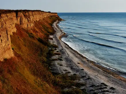
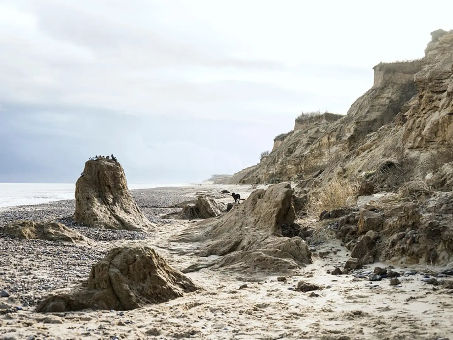
- Minsmere RSPB and Dunwich Heath: Minsmere is a major reserve of reedbed, heath and lagoons, known for bitterns, avocets, marsh harriers and nightjars. Nearby Dunwich Heath adds open heather, sea views and access to the story of Dunwich, a medieval port largely lost to coastal erosion.
- Southwold: The walk finishes at this traditional Suffolk seaside resort, known for its white lighthouse, pier and colourful beach huts.
Challenges to expect
The Sandlings Walk has little ascent, but navigation can still slow you down at forest and heath junctions; carry a map or GPS as well as following the nightjar waymarks. Sandy tracks, marsh paths and woodland sections can become muddy after rain, while open heath and coast can feel exposed in winter. From late 2025 into 2026, some Sizewell sections may be affected by Sizewell C construction closures.
HikeList Score
Sandlings Walk scored 83/100 on HikeList's trail-quality metrics.
See score breakdownHide breakdown
- Ideal length 85
- Balanced challenge 50
- Scenery & wildness 78
- Varied terrain 100
- Accommodation 100
- Food & support 88
- Path quality 92
- Season flexibility 100
Computed from length, challenge, scenery & wildness, terrain variety, accommodation, food & support, path quality and season flexibility.
Show more data Show less
- Lowland Heath
- Forest
- Riverside
- Marsh
- Coastal
- Quiet Lanes
- Sandy Tracks
- Forest Paths
- Grassy Field Paths
- Shingle
- Beach
- B&Bs
- Guesthouses
- Inns
- Campsites
- Family Friendly
- Dog Friendly On Leash
- Restrooms
- Established Campsites
- Picnic Areas
- Public Transport Access Points
Photos from hikers
Taken on the trail by people who've reviewed Sandlings Walk.
The Sandlings Walk begins at Rushmere St Andrew on the outskirts of Ipswich, heading northeast through village lanes and woodland corridors. The path skirts the edges of heathland and follows tracks through areas such as Foxhall and Martlesham Heath before reaching the riverside town of Woodbridge. This section features a mixture of open countryside and wooded sections, with the River Deben providing scenic views near Woodbridge. Public transport links and refreshments can be found at the day's endpoint.
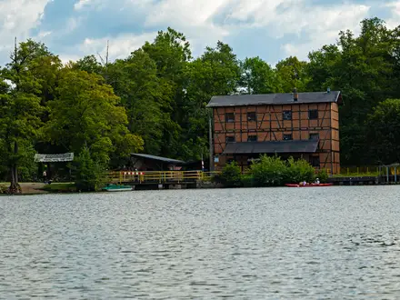
Leaving Woodbridge, the trail heads through Melton and gradually transitions into the heart of Rendlesham Forest, offering long, sandy trails and fragrant pine woodland. Traversing the forest, the route then emerges onto open heath and follows rural byways towards the famous cultural site of Snape Maltings. This stretch rewards hikers with frequent wildlife sightings, especially in early morning or dusk, and ends at the heritage craft and arts hub of Snape Maltings.
The route continues from Snape Maltings, skirting the River Alde and following reed-fringed marshes, with vast skies overhead. After crossing rural landscapes and serene birdwatching spots, the path heads east towards the Suffolk coastline, culminating in the seaside town of Aldeburgh. This section offers gentle walking and sweeping views across tidal creeks and salt marsh habitat. Aldeburgh provides plenty of amenities for rest and resupply.
After leaving Aldeburgh, the trail follows a beautiful stretch of Suffolk coast, winding past Thorpeness and the iconic House in the Clouds, before entering the Minsmere RSPB Reserve known for its diverse birdlife. The route traverses sand dunes, shingle beaches, and marshy ground, offering a rich variety of landscapes. It concludes in the historic village of Dunwich, where ancient ruins and coastal views mark the end of the day’s walk.
From Dunwich, the final stage follows inland heath and coastal marsh before passing through the wooded stretches of Dunwich Forest. The trail crosses the River Blyth via a footbridge near Walberswick and heads towards the final destination at Southwold. This segment features diverse habitats and views of the iconic Southwold Pier and lighthouse, signaling the route’s northern endpoint on the North Sea. Facilities in Southwold offer a comfortable conclusion to the journey.
Reviews
How would you rate Sandlings Walk?
Tap a star to start your review — you could be the first.