Gaustatoppen Summit Trail
How would you rate Gaustatoppen Summit Trail?
Tap a star to share your experience and help other hikers.
Gaustatoppen Summit Trail: Telemark’s Classic Peak Hike
HikeList Score
Gaustatoppen Summit Trail scored 73/100 on HikeList's trail-quality metrics.
See score breakdownHide breakdown
- Ideal length 55
- Balanced challenge 74
- Scenery & wildness 98
- Varied terrain 52
- Accommodation 66
- Food & support 68
- Path quality 98
- Season flexibility 76
Computed from length, challenge, scenery & wildness, terrain variety, accommodation, food & support, path quality and season flexibility.
The Gaustatoppen Summit Trail is a hard 8.6 km out-and-back day hike to Telemark’s highest mountain, Gaustatoppen, at 1,883 m in south-east Norway. The classic route starts at Stavsro car park by Heddersvatn and gains about 700 m on a mix of broad track and rough quartzite boulders. It suits fit hikers who want a short but serious summit route, with an airy final ridge and big views in clear weather.
Route Overview
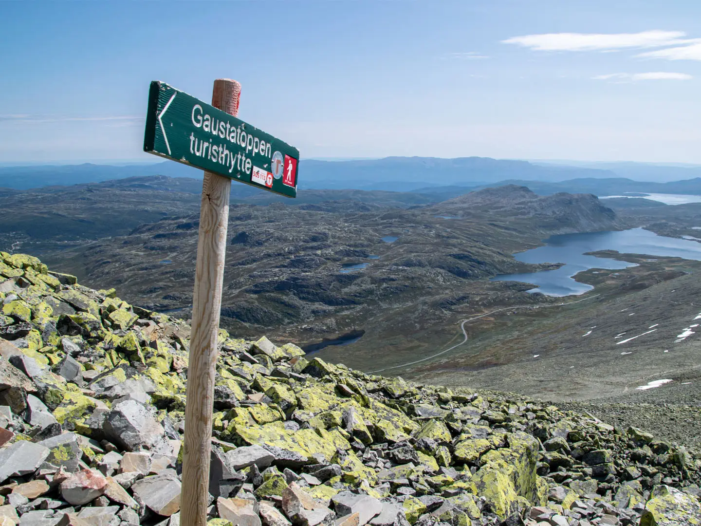
Start and finish at the paid Stavsro car park at Heddersvatn, already high on the Gausta plateau. The route climbs first on a wide, well-maintained gravel and stone track, then becomes rougher as it reaches the open upper mountain. Red Norwegian Trekking Association “T” marks lead over bare quartzite blocks to Gaustatoppen Turisthytte, the DNT summit cabin at about 1,830 m, before the trail continues a short way north along the ridge to the true summit cairn at 1,883 m. Return by the same route. The Gaustabanen funicular offers a non-walking alternative near the top; for other Norwegian classics, compare Besseggen Ridge, Galdhøpiggen Summit Trail and the longer Hardangervidda Traverse.
Gaustatoppen’s Cabin and Cold War Railway
Gaustatoppen has long been a landmark tourist peak in Telemark. Gaustatoppen Turisthytte, the stone summit cabin, was built in 1893 from rock quarried on the mountain and reflects the early growth of Norwegian mountain tourism. During the Cold War, the Gaustabanen funicular was built inside the mountain between 1954 and 1959 with American military funding to serve a summit radio relay station. It later opened to the public and now carries tourists near the top.
Notable highlights
- Summit panorama (clear-weather reward): From Gaustatoppen, the view can cover roughly 60,000 km², close to one-sixth of mainland Norway. This is the main reason the peak is such a prized Telemark objective.
- Gaustatoppen Turisthytte (DNT summit cabin): This stone cabin sits just below the top and serves waffles, coffee and light meals to day hikers. It also sleeps up to 11 by advance booking through DNT.
- Summit ridge (airy final approach): The last section follows an open ridge of bare quartzite blocks. It is the most memorable part of the walk, but it is exposed and unsuitable for hikers uneasy with heights.
- Quartzite boulder field (rough upper terrain): The upper mountain is capped with hard quartzite, creating large blocks and boulders underfoot. Sturdy hiking boots are strongly advised.
- Gaustabanen funicular (non-walking option): Built inside the mountain in the 1950s for a military radio relay station, it now takes tourists near the summit in about 15 minutes.
- Stavsro trailhead (high start): The standard route begins at Heddersvatn at roughly 1,170–1,200 m, which keeps the total ascent to about 700 m despite the 1,883 m summit.
Challenges to expect
Expect a short but physically demanding mountain hike: about 700 m of ascent, rough quartzite blocks, and an exposed final ridge. Navigation is straightforward in clear weather thanks to red “T” waymarks, but the open ridge becomes risky in fog, storm or poor visibility. Proper hiking boots are needed, and the route is not ideal for anyone with a fear of heights.
HikeList Score
Gaustatoppen Summit Trail scored 73/100 on HikeList's trail-quality metrics.
See score breakdownHide breakdown
- Ideal length 55
- Balanced challenge 74
- Scenery & wildness 98
- Varied terrain 52
- Accommodation 66
- Food & support 68
- Path quality 98
- Season flexibility 76
Computed from length, challenge, scenery & wildness, terrain variety, accommodation, food & support, path quality and season flexibility.
 Norway
Show more data Show less
- Mountainous
- Gravel
- Rocky
- Huts
- Hotels
- Family Friendly
- Pet Friendly
- Restrooms
- Shelters
Photos from hikers
Taken on the trail by people who've reviewed Gaustatoppen Summit Trail.
Reviews
How would you rate Gaustatoppen Summit Trail?
Tap a star to start your review — you could be the first.