Heart of England Way
How would you rate Heart of England Way?
Tap a star to share your experience and help other hikers.
Heart of England Way: A Midlands Thru-Hike Guide
HikeList Score
Heart of England Way scored 90/100 on HikeList's trail-quality metrics.
See score breakdownHide breakdown
- Ideal length 98
- Balanced challenge 100
- Scenery & wildness 85
- Varied terrain 83
- Accommodation 83
- Food & support 81
- Path quality 98
- Season flexibility 89
Computed from length, challenge, scenery & wildness, terrain variety, accommodation, food & support, path quality and season flexibility.
The Heart of England Way is a 163 km waymarked long-distance footpath across the English Midlands, linking Cannock Chase with Bourton-on-the-Water in the Cotswolds. Usually walked in 6-10 days, it is a moderate point-to-point route suited to hikers who want gentle but sustained lowland walking: heath, woodland, farmland, river paths and rolling Cotswold hills. It is one of the quieter long-distance walks in England, marked by green-and-white oak-leaf discs and maintained by the Heart of England Way Association.
Route Overview
The conventional direction is north to south, starting at Milford Common near Stafford and Shugborough, on the northern edge of Cannock Chase, and finishing at Bourton-on-the-Water in Gloucestershire. The route passes Castle Ring, Lichfield, Hints, Kingsbury Water Park, Meriden, Berkswell, Balsall Common, Baddesley Clinton, Henley-in-Arden, Alcester, Bidford-on-Avon, Mickleton, Meon Hill, Chipping Campden, Longborough, the Slaughters and Swell. It is a linear point-to-point walk, though many hikers break it into day or weekend sections using the linked circular walks and public transport. For other Midlands walking ideas, compare the Ashby Canal Trail and Amber Valley Route.
History of the Heart of England Way
The Heart of England Way was devised in the late 1970s and opened around 1980 as a recreational long-distance path using existing public rights of way across the Midlands. Its aim was to link Cannock Chase with the Cotswold Way. The corridor is far older than the trail itself: Castle Ring is an Iron Age hillfort, the Forest of Arden was a medieval royal forest, and Cotswold towns such as Chipping Campden grew wealthy on the medieval wool trade.
Notable highlights
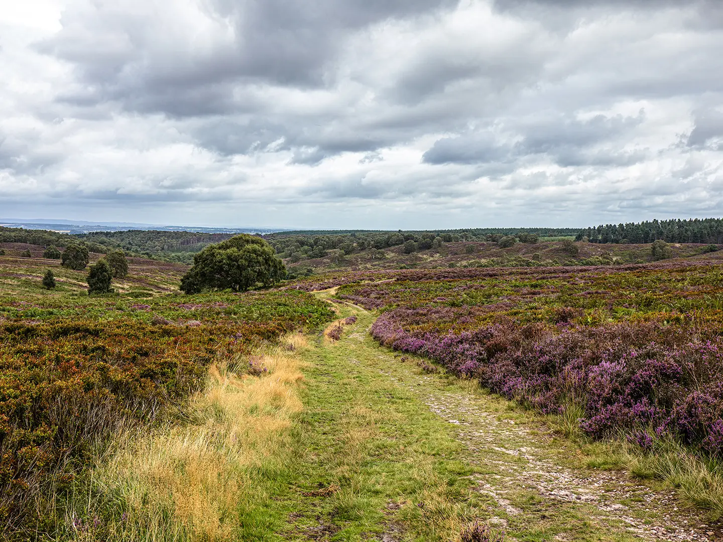
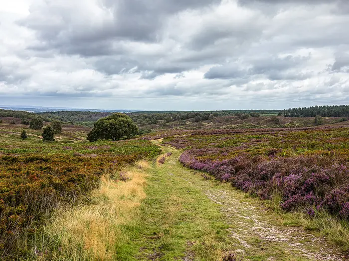
Cannock Chase AONB and Castle Ring: The walk begins across lowland heath and forest on Cannock Chase. Castle Ring is an Iron Age hillfort and, at 242 m, the high point of the route.
Lichfield Cathedral: The trail passes through Lichfield, a cathedral city with a 13th-14th-century Gothic cathedral. Its three spires make it a distinctive landmark on this lowland route.
Kingsbury Water Park: This country park has lakes formed from former gravel pits beside the River Tame. It gives an easy, level section and is known as a birdwatching site.
Forest of Arden and Henley-in-Arden: The middle section crosses wooded Warwickshire countryside associated with Shakespeare’s Forest of Arden. It passes Baddesley Clinton and the historic market town of Henley-in-Arden.
Chipping Campden and the Cotswolds: The southern stages enter the Cotswolds at Chipping Campden, a medieval wool-trade market town built in Cotswold stone, before continuing over limestone hills.
Bourton-on-the-Water: The route ends at this Cotswold village on the River Windrush, crossed by low stone footbridges and widely known as the “Venice of the Cotswolds”.
Challenges to expect
There are no mountains, but 163 km and about 2,100 m of total ascent make a continuous walk a moderate undertaking. Expect muddy grass field paths after rain, especially on low-lying farmland and riverside sections, and some urban-edge, lane and towpath walking. Waymarking is good, but carry an up-to-date map or GPS for rural field sections. Book overnights around towns and villages such as Lichfield, Alcester, Chipping Campden and Bourton-on-the-Water.
HikeList Score
Heart of England Way scored 90/100 on HikeList's trail-quality metrics.
See score breakdownHide breakdown
- Ideal length 98
- Balanced challenge 100
- Scenery & wildness 85
- Varied terrain 83
- Accommodation 83
- Food & support 81
- Path quality 98
- Season flexibility 89
Computed from length, challenge, scenery & wildness, terrain variety, accommodation, food & support, path quality and season flexibility.
 United Kingdom
 England
Show more data Show less
- Forest
- Grassland
- Hills
- Dirt
- Gravel
- Grass
- Hotels
- Guesthouses
- Campsites
- Family Friendly
- Dog Friendly On Leash
- Restrooms
- Picnic Areas
- Public Transport Access Points
Download Our Full Guide to Heart of England Way FREE!
Get our comprehensive guide to this hike for free. Save it for later reading or print out at home.

In these collections
Photos from hikers
Taken on the trail by people who've reviewed Heart of England Way.
Heart of England Way: The Complete Guide
 i
Image by Garry
i
Image by Garry The Heart of England Way is a quiet 101-mile crossing of the English Midlands, linking Cannock Chase with the northern Cotswolds. It suits walkers who want a well-waymarked long-distance path with real variety, without mountains, technical ground or the crowds of better-known national trails.
From Milford Common the route threads heath, forest and the Iron Age hillfort of Castle Ring before reaching Lichfield and its three-spired cathedral. South of the city it becomes a gentler mix of farmland, riverside paths, canal towpath and Warwickshire woodland through places such as Kingsbury Water Park, Meriden and Henley-in-Arden.
The character changes again beyond the Avon valley, where Bidford-on-Avon, Chipping Campden, Longborough and the Slaughters lead into limestone hills, dry-stone walls and Cotswold villages. The finish at Bourton-on-the-Water gives the walk a clear destination, with the River Windrush running through the village centre.
This is a moderate route, not a hard mountain trek, but the full end-to-end still needs planning. Expect consecutive long days, muddy field and riverside sections after rain, thinner accommodation between the main hubs, and current diversion information to check before setting off.
This guide covers stages, daily pacing, accommodation, food, transport, terrain and the common mistakes to avoid.
Stage-by-Stage Guide
Stage 1: Milford Common to Lichfield — 24 km
The opening stage leaves Milford Common on the northern edge of Cannock Chase, close to Shugborough, and gives the route its most heathland-and-forest character. It is a varied first day: open Chase tracks, woodland, higher ground around Castle Ring, then a gradual transition towards the lower farmland and settlement edge approaching Lichfield.
Underfoot, expect a mix of firm forest and heath tracks, field paths and lanes. Cannock Chase drains better than the lower farmland later on, but paths can still be wet after prolonged rain, and the way into Lichfield is more lowland and mixed in feel.
Castle Ring is the key high point and landmark of the day: an Iron Age hillfort on the southern edge of Cannock Chase and the most prominent named summit on the route. The wider appeal of this stage is the sense of starting in open country, with lowland heath, forest and the possibility of deer and birdlife before the Way heads south-east.
Milford Common is not a full-service trailhead, so start with enough water and food for the first part of the day. Lichfield is the practical overnight base, with shops, food options and a good range of accommodation compared with the rural sections beyond.
For access, Milford Common is reached by bus from Stafford, which has a West Coast Main Line station; local services such as the 825/826 run out towards Milford and Cannock Chase. Lichfield has both Lichfield City and Lichfield Trent Valley stations, making this one of the easiest stages to use for a day walk or section break.
Navigation is generally straightforward on the signed route, using the Heart of England Way’s green-and-white oak-tree discs. Carry mapping or a GPX track as well, especially where the route leaves the open Chase for lanes and field paths around the edge of settlements.
The main practical warning is not severity but length: 24 km is a meaningful first day, particularly with a full pack. Do not underestimate the cumulative effect of lowland miles, small climbs and variable surfaces.
Stage 2: Lichfield to Kingsbury Water Park — 24 km
This stage leaves the cathedral city of Lichfield and moves into the more rural, lowland Midlands landscape of fields, lanes and village approaches. The route passes through or near Hints and Drayton Bassett before reaching the lakes and level ground of Kingsbury Water Park beside the River Tame.
The walking is gentler than the Cannock Chase section but can be muddier. Field edges, grass paths and low-lying stretches are likely to hold water after rain, so waterproof footwear is useful outside dry summer conditions.
Lichfield Cathedral is the major landmark at the start of the day, with its distinctive three spires. The finish at Kingsbury Water Park is a complete change of scene: former gravel pits now forming a country park of lakes, with birdwatching interest and easy, level walking around the water.
Lichfield is the best place to stock up before leaving. Services between Lichfield and Kingsbury Water Park are more limited and should not be relied on without checking current opening hours and exact locations.
Accommodation at the end is less straightforward than in Lichfield or the larger towns later on. Kingsbury Water Park is a useful stage end because of its position on the route, but walkers should book accommodation or onward transport in advance rather than assuming there will be plenty of choice immediately beside the trail.
Public transport and road access are generally better in this part of the Midlands than on more remote long-distance paths, but specific bus options around Kingsbury should be checked before travelling. Lichfield’s rail links make the start of the stage easy to reach.
Navigation is usually uncomplicated, but the mix of field paths, lanes and settlement-edge walking means attention is needed at path junctions and around field boundaries. This is also one of the sections where current route information matters: HS2 construction has affected parts of the central and Warwickshire route, so check the Heart of England Way Association for current diversions before setting out.
Stage 3: Kingsbury Water Park to Meriden — 26 km
This is a longer central stage across Warwickshire, starting with the lakes and level paths of Kingsbury Water Park before continuing through lower, more settled countryside. Shustoke is the main named place on the route before the Way pushes on towards Meriden.
The terrain remains moderate, with no technical difficulty, but this is classic sustained lowland walking: field paths, lanes, grass tracks and sections influenced by river-valley and canal-side country. After wet weather, expect mud on farmland and softer ground near watercourses.
The day’s character is quieter and less scenic in the obvious sense than Cannock Chase or the Cotswolds, but it is an important linking stage through the heart of the Midlands. Kingsbury Water Park provides the strongest landscape feature, while Shustoke and the surrounding countryside break up the route before Meriden.
Carry enough food and water to be self-sufficient between confirmed stops. Meriden is the practical end point, but walkers should check current food, shop and accommodation options before committing to a schedule.
Accommodation in this central section can be thinner than in the major towns and Cotswold villages. If walking end to end, book Meriden or nearby accommodation ahead and have a clear plan for reaching it from the trail if it is not directly on the line.
Public transport in the wider area is usable for section walkers, but exact bus times and stopping points should be checked before travelling. Road access is generally more frequent than on upland routes, which can help with taxi pick-ups or shorter day sections.
Navigation deserves care on this stage. The landscape is a patchwork of fields, lanes and urban-edge corridors, and waymarks can be easier to miss where paths thread around development or temporary works. HS2-related diversions are a genuine issue on the central part of the Heart of England Way; use the official association updates alongside map or GPX navigation.
The chief warning is fatigue rather than exposure. At 26 km, this is a full day on mixed surfaces, and mud can make the mileage feel longer than it looks on paper.
Stage 4: Meriden to Henley-in-Arden — 27 km
This is the longest listed stage and one of the most important planning days on the route. From Meriden the Way continues through the Warwickshire countryside and the historic Forest of Arden landscape, passing Berkswell, Balsall Common, Baddesley Clinton and Rowington before finishing in Henley-in-Arden.
The walking is varied but still firmly lowland: field paths, woodland, lanes and some more enclosed stretches through the Arden countryside. Expect a steady rhythm of short sections rather than one single major climb, with mud possible on field and woodland paths after rain.
Baddesley Clinton is the main named heritage landmark of the day, known for its moated medieval manor. The wider highlight is the Forest of Arden character: wooded Warwickshire, small settlements and older field patterns, giving the stage a more enclosed and historic feel than the open Chase or the later Cotswold wolds.
Food and water planning matters on this long day. Meriden and Henley-in-Arden are the reliable planning anchors, while anything in between should be treated as a bonus unless current opening times have been checked.
Henley-in-Arden is one of the better overnight stops on the Heart of England Way, with accommodation clustered around the town and its long single street. It is a sensible place to pause, resupply and recover after the route’s longest standard stage.
Henley-in-Arden is on the Stratford line, making it useful for public transport access and section walking. For intermediate settlements such as Berkswell, Balsall Common and Rowington, current bus or rail details should be checked before travelling rather than assumed.
Navigation is more intricate than the distance profile suggests. Field exits, woodland edges and lane junctions can come frequently, so follow waymarks carefully and keep an eye on the broader direction of travel.
This is also a stage where current diversion information is important because of works affecting the central/Warwickshire part of the route. Check the Heart of England Way Association before relying on an older map line or downloaded track.
Stage 5: Henley-in-Arden to Bidford-on-Avon — 21 km
This is a slightly shorter and more forgiving day, moving south from Henley-in-Arden through Warwickshire towards Alcester and the Avon valley. The finish at Bidford-on-Avon marks a clear change in character, with the Way crossing the River Avon by the old multi-arched bridge.
The terrain is still moderate lowland walking, mixing field paths, woodland, lanes and village approaches. After wet weather, expect soft and muddy going on farmland and riverside paths, especially closer to the Avon.
Alcester is the main town passed before Bidford-on-Avon and is significant in the history of the route, which grew from a late-1970s proposal by Alcester Civic Society. Bidford itself is the day’s strongest landmark, with its bridge across the River Avon in the Vale of Evesham.
Henley-in-Arden is a good place to stock up before setting out. Alcester may provide a useful mid-stage break, but current food and shop options should be checked before relying on them.
Bidford-on-Avon is one of the named accommodation hubs for the route, though choice is still more limited than in larger tourist centres. Book ahead, particularly if walking at weekends or during summer.
Public transport is generally available across this part of the Midlands, but specific services for Alcester and Bidford-on-Avon should be checked before travelling. Road access is relatively practical, which helps if splitting the route into shorter sections.
Navigation should be straightforward in good visibility, but the approach to towns and river-valley paths can include several path changes. Take care not to follow local riverside or field paths away from the waymarked line.
The main warning is mud on low-lying ground. This stage is not exposed or mountainous, but wet grass, churned field paths and riverside sections can slow progress significantly.
Stage 6: Bidford-on-Avon to Chipping Campden — 23 km
This stage carries the Heart of England Way out of the Avon valley and towards the northern Cotswolds. From Bidford-on-Avon the route heads through the Vale of Evesham area, passing Mickleton and Upper Quinton / Lower Quinton before reaching Chipping Campden.
The terrain begins to feel hillier as the Way approaches the Cotswold edge. Expect a mix of field paths, lanes and firmer limestone-influenced tracks, with more undulation than on the central Warwickshire stages.
The main highlight is the arrival in Chipping Campden, one of the finest Cotswold market towns, built in honey-coloured stone and long associated with the medieval wool trade. It is also where the Heart of England Way links with the Cotswold Way, making it an important long-distance walking junction.
Bidford-on-Avon is the best place to prepare before leaving. Mickleton and the Quinton villages break up the day, but walkers should check current food, water and shop options before relying on them.
Chipping Campden is a major overnight stop for walkers, with accommodation, food and services compared with the more rural approach. It is popular, especially in the main walking season, so booking ahead is strongly advised.
Public transport should be planned in advance. Chipping Campden is an important trail town but onward bus and rail connections need checking before travelling, particularly if using it as a section start or finish.
Navigation becomes more Cotswold in character, with the route crossing open farmland, lanes and village edges before entering a busier walking area around Chipping Campden. Keep following the Heart of England Way waymarks rather than assuming every signed long-distance path is the same route, especially near the Cotswold Way connection.
The practical challenge is the transition into hillier country after several days of lower-level walking. The climbs are not mountainous, but they can feel sharper with a full pack near the end of a 23 km day.
Stage 7: Chipping Campden to Bourton-on-the-Water — 26 km
The final stage is one of the most scenic and sustained days of the route, crossing the northern Cotswolds from Chipping Campden to Bourton-on-the-Water. It passes near Batsford, then through Longborough, Lower Swell and Lower Slaughter before finishing beside the River Windrush.
This is rolling limestone country: dry-stone walls, open wolds, wooded combes, stone villages and firmer Cotswold paths mixed with lanes and field tracks. It is hillier than the Midlands sections, and the cumulative ascent can be felt even though the ground is never technical.
The Cotswold villages are the main landmarks. Longborough and Lower Swell lead the route southwards, while Lower Slaughter, with the little River Eye, stone footbridges and watermill setting, is one of the final highlights before Bourton-on-the-Water.
Bourton-on-the-Water provides a clear and satisfying finish, with low stone bridges crossing the shallow River Windrush through the village centre. It is also busy and popular, so do not leave accommodation or onward transport planning until arrival.
Chipping Campden is the best place to stock up before starting. Villages along the way may have services, but opening times and availability should be checked before travelling; carry enough food and water for the whole stage if in doubt.
Accommodation is available in the Cotswold end of the route, but demand can be high. Chipping Campden, Lower Slaughter and Bourton-on-the-Water are in a popular visitor area, so book well ahead for weekends, holidays and summer dates.
Bourton-on-the-Water has no railway station. The practical exit is by Pulhams 801 bus to Moreton-in-Marsh, which has a station on the Cotswold Line, or towards Cheltenham; current timetables should be checked before travelling.
Navigation is generally pleasant but still needs attention. The Cotswolds have many attractive paths, lanes and village links, and it is easy to be drawn onto a different right of way if not watching the waymarks.
The main warnings are distance, undulation and popularity. This is a long final day with more hill country than earlier stages, and the finish area can be busy, which makes pre-booked accommodation and transport particularly important.
Recommended Itinerary
Standard 7-day itinerary
This is the most practical end-to-end schedule for fit walkers who are comfortable with repeated 21–27 km days on lowland paths. It uses the main service hubs and the stage pattern commonly used for the route, while keeping the Cotswold finish to a single full day from Chipping Campden to Bourton-on-the-Water.
Book accommodation before fixing daily mileage, especially around Kingsbury Water Park, Meriden and the rural Warwickshire/Cotswold sections where overnight options are thinner than in Lichfield, Henley-in-Arden, Bidford-on-Avon, Chipping Campden and Bourton-on-the-Water.
| Day | From | To | Approx. distance | Why this stage makes sense | Services/accommodation notes |
|---|---|---|---|---|---|
| 1 | Milford Common | Lichfield | 24 km | A strong opening day across Cannock Chase and its southern edge, with the route moving from heath and forest towards a proper overnight hub. It gets the start logistics out of the way and finishes in a cathedral city with better facilities than the smaller settlements north of it. | Milford Common has no railway station; most walkers reach the start by bus from Stafford. Lichfield is one of the easier places on the route for accommodation, food and rail access via Lichfield City and Lichfield Trent Valley. |
| 2 | Lichfield | Kingsbury Water Park | 24 km | A steady lowland day through the Staffordshire/Warwickshire fringe, passing places such as Hints and Drayton Bassett before reaching the lakes and level paths around Kingsbury Water Park. The distance is substantial but not excessive after the first day. | Lichfield is the best place to resupply before setting out. Accommodation around Kingsbury Water Park and nearby settlements should be checked before committing to this as an overnight stop. |
| 3 | Kingsbury Water Park | Meriden | 26 km | This is one of the longer central stages, crossing quieter Warwickshire countryside and linking the Tame-side country park area with Meriden. It works well as a through-walk day because there are fewer obvious large overnight hubs between the two. | Treat this as a day where food, water and confirmed accommodation matter. Options are more scattered than in the larger towns; if staying outside Meriden, check how far the lodging sits from the line of the Way. |
| 4 | Meriden | Henley-in-Arden | 27 km | The longest standard day takes the route through the Forest of Arden landscape, passing the Berkswell, Balsall Common, Baddesley Clinton and Rowington area before reaching Henley-in-Arden. It is a logical stage because Henley is a strong overnight base after a rural stretch. | Henley-in-Arden has rail access on the Stratford line and is one of the more useful transport and accommodation points on the route. This is a good place to build in a shorter following day if the first four stages have been tiring. |
| 5 | Henley-in-Arden | Bidford-on-Avon | 21 km | A shorter recovery day after the Meriden–Henley section, continuing through south Warwickshire via Alcester towards the River Avon. The finish at Bidford-on-Avon is a sensible stopping point before the route turns towards the Cotswolds. | Henley-in-Arden, Alcester and Bidford-on-Avon are all useful planning points, but accommodation should still be booked ahead. Bidford-on-Avon is the key overnight before the climb towards Chipping Campden. |
| 6 | Bidford-on-Avon | Chipping Campden | 23 km | A varied day from the Avon valley through the Mickleton and Quinton area into the northern Cotswolds. Chipping Campden makes an excellent overnight hub and marks the point where the Way meets classic Cotswold limestone country. | Chipping Campden is popular and accommodation can be in demand, especially in spring, summer and early autumn. Book early and check whether evening food requires a reservation. |
| 7 | Chipping Campden | Bourton-on-the-Water | 26 km | A final full day through the northern Cotswolds, passing the Batsford area, Longborough, Lower Swell and Lower Slaughter before finishing at Bourton-on-the-Water. Although the terrain is not technical, this is a hillier and more sustained finish than the early lowland miles. | Bourton-on-the-Water has no railway station. The usual onward public transport is the Pulhams 801 bus towards Moreton-in-Marsh railway station or Cheltenham; times should be checked before travelling. Accommodation in Bourton-on-the-Water is also best booked well ahead. |
Slower 8–10 day itinerary
An 8–10 day schedule suits walkers who prefer shorter days, want more time in Lichfield, Henley-in-Arden, Chipping Campden or the Cotswold villages, or are carrying camping gear. It is also the better choice after prolonged rain, when field paths, riverside sections and low-lying farmland can be muddy and slower than the distances suggest.
The easiest way to slow the route down is to break one or more of the 26–27 km days rather than shortening every day equally. Good areas to investigate for extra overnights include the Shustoke/Meriden section, the Berkswell–Balsall Common–Rowington area, Alcester between Henley-in-Arden and Bidford-on-Avon, the Mickleton/Quinton area before Chipping Campden, and the Longborough/Lower Swell/Lower Slaughter approach to Bourton-on-the-Water.
Do not assume every village has suitable accommodation on the night needed. Check official mapping and current accommodation availability before booking, and allow for any HS2-related diversions in the central Warwickshire section.
Faster 6-day itinerary
A 6-day crossing is possible for strong walkers who are used to consecutive long lowland days and are not relying on short daylight windows. It is not the most forgiving schedule: the route has no mountains, but the repeated mileage, muddy fields after rain, towpath and lane sections, and the hillier Cotswold finish make it harder than the raw ascent figure suggests.
For a faster plan, expect to push beyond at least one of the standard overnight stops or rebalance the central stages around available accommodation. Exact daily distances will depend on where beds are available, so check official mapping before booking rather than simply dividing the total distance into six equal days.
The faster option is best kept for summer or settled weather, with luggage kept light and accommodation fixed in advance. If public transport is being used to start or leave the route, also check the Stafford–Milford bus options and the Pulhams 801 from Bourton-on-the-Water before committing to a tight final-day schedule.
Planning the Route
How many days to allow
Most walkers should plan the Heart of England Way as a 7 or 8 day walk. The common 7-stage pattern works well because it links the main overnight hubs, but several days sit around the mid-20 km mark, so it is better suited to fit walkers who are comfortable with sustained lowland mileage on consecutive days.
A 6-day itinerary is possible only by combining longer sections and reducing margin for mud, navigation delays and transport connections. A 9 or 10 day itinerary gives a more relaxed pace, especially if time is wanted for Lichfield, Henley-in-Arden, Chipping Campden or the Cotswold villages near the finish.
The route is not technically difficult, but it is not a casual stroll when walked end to end. Field paths, riverside sections and low-lying Warwickshire farmland can be slow after rain, and the final third becomes hillier as the Way rises into the northern Cotswolds.
Stage planning and overnight stops
Daily stages are shaped mainly by accommodation and transport hubs, not by the terrain. The practical overnight stops are the towns and larger villages on or near the line: Lichfield, Henley-in-Arden, Alcester, Bidford-on-Avon, Chipping Campden and Bourton-on-the-Water are especially useful.
The standard 7-day structure is:
| Day | Section | Approx. distance | Planning note |
|---|---|---|---|
| 1 | Milford Common to Lichfield | 24 km | Good first target with rail access in Lichfield for late arrivals or section walkers. |
| 2 | Lichfield to Kingsbury Water Park | 24 km | Lowland and river-valley walking; accommodation needs checking carefully around the day end. |
| 3 | Kingsbury Water Park to Meriden | 26 km | A longer central stage where services are less evenly spaced. |
| 4 | Meriden to Henley-in-Arden | 27 km | One of the longer days; consider shortening only if accommodation or transport allows. |
| 5 | Henley-in-Arden to Bidford-on-Avon | 21 km | A more manageable stage through the Arden and Avon countryside. |
| 6 | Bidford-on-Avon to Chipping Campden | 23 km | The route enters the Cotswolds; book ahead in popular villages. |
| 7 | Chipping Campden to Bourton-on-the-Water | 26 km | A hillier finish through the northern Cotswolds and Cotswold villages. |
Do not assume that every village has suitable beds, evening food or easy resupply. Accommodation is clustered around the larger places, while the rural stretches through the Arden countryside, Avon valley and Cotswolds can be thin. Book early for the Cotswold end, particularly Chipping Campden and Bourton-on-the-Water.
Walking fast or taking it slowly
The route suits a steady, efficient pace rather than a rushed schedule. Waymarking is generally good, and there are no mountains or technical sections, but progress can be slower than the map suggests where paths cross wet fields, riverside grass, lanes, woodland edges and canal towpaths.
A faster itinerary works best for walkers carrying light packs and using booked accommodation each night. A slower itinerary is better if relying on public transport to reach off-route accommodation, if walking in wetter months, or if combining the Way with sightseeing in Lichfield, Henley-in-Arden, Chipping Campden or the Slaughters.
Section hiking and shortening the walk
The Heart of England Way is well suited to section hiking. Lichfield has both Lichfield City and Lichfield Trent Valley stations, and Henley-in-Arden is on the Stratford line, making these useful access points for weekend sections or a split end-to-end walk.
Neither end has a railway station. For the northern start, use Stafford as the rail hub and continue by bus towards Milford and Cannock Chase, with local services such as the 825/826. From Bourton-on-the-Water, the Pulhams 801 bus links to Moreton-in-Marsh for the Cotswold Line or to Cheltenham. Timetables should be checked before travelling.
The walk can also be extended. At Cannock Chase it links into the Staffordshire Way, and at Chipping Campden it meets the start of the Cotswold Way. That makes it practical to build a longer Midlands-to-Cotswolds journey, although accommodation and transport planning becomes more important.
Navigation and diversions
The route is waymarked with green-and-white oak-tree discs, but a map or GPS track is still important. The Way crosses a long sequence of field paths, lanes, woodland edges, waterways and village approaches where missed turns can add unnecessary distance.
HS2 construction has caused temporary diversions on the central Warwickshire section. Check the Heart of England Way Association updates before relying on any printed map or older GPX line, especially between the Midlands sections around the route’s middle.
The route spans several OS Explorer sheets, so a digital OS map or a current GPX can be more practical than carrying every paper sheet. If using paper mapping, make sure it covers the full line from Cannock Chase through Warwickshire to the northern Cotswolds.
Food, water and daily logistics
Food planning is straightforward in the larger towns but less reliable between them. Carry enough food for the walking day, especially on the longer central stages and across the more rural sections between Meriden, Henley-in-Arden, Alcester, Bidford-on-Avon and Chipping Campden.
Water should be treated as a normal day-walking responsibility rather than something to improvise from streams or rivers. Start each day with enough for the full stage, then top up where accommodation, cafés, pubs or shops are available. This should be checked locally each day, particularly on Sundays and bank holidays.
Baggage transfer may be possible through local walking-holiday providers or accommodation networks, but arrangements vary by season and exact itinerary. This should be checked before travelling.
Weather, ground conditions and timing
Spring, summer and autumn are the natural seasons for this walk. Summer gives the longest daylight for the 24–27 km days, while spring and autumn can be very pleasant but may bring slower going on muddy field paths and riverside sections.
The main weather issue is not exposure at altitude but underfoot conditions. After rain, lowland farmland, grass paths, towpaths and river-valley sections can become sticky and tiring, so waterproof footwear and realistic daily distances matter more than technical mountain kit.
Route-specific permits are not a significant planning constraint here. Temporary closures, HS2 diversions, accommodation availability and public transport connections are the planning points that most affect whether the walk runs smoothly.
Towns, Villages and Overnight Stops
Accommodation on the Heart of England Way works best when planned around the larger hubs rather than assuming every village has beds or evening food. The most practical overnight bases are Lichfield, Henley-in-Arden, Alcester, Bidford-on-Avon, Chipping Campden and Bourton-on-the-Water, with rural options thinner between them.
Book ahead for the Cotswold end, especially Chipping Campden, the Slaughters and Bourton-on-the-Water. If using public transport to shorten or split stages, check current train and bus times before travelling, as the start and finish do not have railway stations.
Milford Common
Milford Common is the northern start of the route, on the edge of Cannock Chase near Shugborough. It is primarily a trailhead rather than a natural overnight base, so most walkers will arrive from Stafford on the day they start.
Stafford has a West Coast Main Line station, and local bus services such as the 825/826 run out towards Milford and Cannock Chase. Timetables and stopping points should be checked before travelling, especially for an early start.
Food, shops and accommodation should not be assumed at the trailhead itself. Arrive with water, lunch and any first-day supplies already sorted.
Cannock Chase, Castle Ring and Cannock Wood
The opening section crosses Cannock Chase, with heath, forest tracks and the climb towards Castle Ring on the southern edge of the Chase. This is one of the more open and exposed-feeling parts of the northern route, though the walking remains non-technical.
Cannock Wood is the nearest named village on this part of the Way. It can be useful for breaking the first day if arranging a shorter start, but accommodation and food options are not as reliable as in Lichfield, so any overnight plan here needs booking in advance.
Do not treat the Chase section as a service corridor. Carry enough food and water from the start, and allow for muddy tracks after wet weather.
Lichfield
Lichfield is the first major overnight stop and one of the best places to build into an end-to-end itinerary. It sits after the Cannock Chase opening stage and gives a practical first night after the Milford Common to Lichfield leg.
This is one of the strongest service points on the route, with accommodation, places to eat and urban supplies. It is also useful for anyone section-walking, as Lichfield has both Lichfield City and Lichfield Trent Valley stations.
The cathedral city is a good place to reset before the more rural Warwickshire stages. If walking a 7-day schedule, this is the obvious first overnight halt.
Hints and Drayton Bassett
Hints and the area near Drayton Bassett sit on the Lichfield to Kingsbury Water Park section. These are smaller settlements rather than dependable overnight hubs.
They may be useful for local pick-ups, short section walks or a lunch stop if a suitable pub or shop is open, but services should not be relied on without checking ahead. Accommodation is likely to be more limited than in Lichfield or later route towns.
This part of the route includes lowland field and countryside paths, which can be slow and muddy after rain. Carry enough food and water to bridge the gap between Lichfield and the next confirmed stop.
Kingsbury Water Park
Kingsbury Water Park is a practical stage end on a 7-day itinerary, reached after the Lichfield section. The route passes through a landscape of lakes beside the River Tame, with generally level walking compared with the later Cotswold miles.
It is a useful waypoint, but it should not be treated like a full town service centre. Overnight options nearby need to be checked and booked before committing to this as a stopping point.
If no suitable accommodation is available, walkers may need to adjust the stage, arrange a transfer, or use public transport from a nearby settlement. This should be checked before travelling.
Shustoke
Shustoke lies between Kingsbury Water Park and Meriden. It is a rural village stop rather than a main accommodation hub.
It can be helpful when splitting the Kingsbury Water Park to Meriden stage, but evening food and accommodation should not be assumed. Check opening days for any pub or local service before planning a short day around it.
This is the kind of mid-route village where carrying a backup lunch matters. Field paths and lanes make progress straightforward, but services are spaced out.
Meriden
Meriden is a useful overnight stop in the central section, especially on the standard stage pattern from Kingsbury Water Park. It sits before the route continues south-west through Berkswell, Balsall Common and the Forest of Arden countryside towards Henley-in-Arden.
Accommodation and food availability should be checked in advance, as Meriden is less dependable than the larger towns on the Way. It is still a practical place to break the route because it sits at a natural stage point.
For public transport, do not assume simple end-of-day connections without checking current timetables. This should be checked before travelling.
Berkswell and Balsall Common
Berkswell and Balsall Common sit on the Meriden to Henley-in-Arden leg. They are useful intermediate settlements on one of the longer standard stages.
These places may help with food, drinks or transport logistics, but accommodation planning should be done carefully. They are better thought of as support points than guaranteed overnight bases unless a specific booking has been made.
For walkers finding the Meriden to Henley-in-Arden day too long, this area is the logical place to look for a shorter-stage solution. Public transport options should be checked before relying on them.
Baddesley Clinton and Rowington
Baddesley Clinton and Rowington bring the route into classic Forest of Arden countryside. The section is attractive but more rural, so it is not the easiest place to improvise an overnight stop.
Baddesley Clinton is a useful landmark on the Henley-in-Arden approach, with the moated medieval manor nearby. Rowington is another small settlement where any food or accommodation plan needs checking before the day begins.
This part of the Way rewards slower walking, but it also needs sensible provisioning. Carry food from the previous hub if no confirmed stop has been arranged.
Henley-in-Arden
Henley-in-Arden is one of the best overnight stops on the Heart of England Way. It sits at the end of the Meriden to Henley-in-Arden stage and before the route turns towards Alcester and the Avon valley.
The town has accommodation clustered around it and is a practical place for evening food and resupply. It is also on the Stratford line, making it one of the more useful rail-served stops for section-walkers.
Because it works so well as a stage break, accommodation can be worth booking early. This is especially sensible if walking at weekends or during popular holiday periods.
Alcester
Alcester is a strong service town between Henley-in-Arden and Bidford-on-Avon. It is a sensible overnight alternative if the standard stage pattern needs shortening or if accommodation in Bidford is unavailable.
The town has accommodation clustered around it and should offer better practical options than the smaller villages either side. It is also historically important to the route, as the Heart of England Way grew from a proposal by Alcester Civic Society.
For walkers not following the 7-day schedule exactly, Alcester is one of the most useful places to redesign the middle of the itinerary. Check onward transport and accommodation before fixing the stage.
Bidford-on-Avon
Bidford-on-Avon is the main overnight stop in the Avon valley and a natural halt before the route heads towards the northern Cotswolds. The Way crosses the River Avon here by the old multi-arched bridge.
Accommodation is clustered around Bidford-on-Avon, making it a practical stage end after Henley-in-Arden or Alcester. Food and basic walker services are more realistic here than in the smaller rural settlements to the south.
This is a good place to prepare for the transition into hillier Cotswold terrain. The next stage towards Chipping Campden is longer and more exposed to the spacing of village services, so carry enough food and water when leaving.
Mickleton, Upper Quinton and Lower Quinton
Mickleton and the Quinton villages sit between Bidford-on-Avon and Chipping Campden. They are useful intermediate points before the route reaches the Cotswold stone towns and villages.
These settlements can help break up the day, but they should not be treated as guaranteed overnight stops unless accommodation has been booked. Food and pub availability can vary, so opening hours should be checked before relying on them.
This section is a common place to feel the change in character from the Midlands lowlands to the Cotswold fringe. Allow enough time for steadier climbing and do not leave all supplies until Chipping Campden.
Chipping Campden
Chipping Campden is one of the most important overnight stops on the route. It sits where the Heart of England Way enters the Cotswolds and is also the start of the Cotswold Way, making it a busy walking town.
Accommodation, pubs, cafés and walker services are clustered here, but demand can be high. Book well ahead, particularly in spring, summer, autumn weekends and holiday periods.
This is the best place to regroup before the final stage to Bourton-on-the-Water. The last day crosses rolling Cotswold country past smaller villages, so Chipping Campden is the practical point for resupply and an early start.
Batsford and Longborough
Batsford lies near the route south of Chipping Campden, with Batsford Arboretum nearby. Longborough is one of the main named villages on the Cotswold section towards Bourton-on-the-Water.
This is attractive walking through limestone hills, dry-stone-wall country and wooded valleys, but services are thinner than the scenery might suggest. Accommodation and food should be booked or checked rather than assumed.
Longborough can be useful for splitting the final Chipping Campden to Bourton-on-the-Water stage if a shorter itinerary is needed. Any such plan needs firm accommodation and transport arrangements in advance.
Lower Swell
Lower Swell comes late on the route as the Way approaches the Slaughters and Bourton-on-the-Water. It is a small Cotswold village rather than a major service base.
It can be useful as a waypoint on the final day, but most walkers will continue to Lower Slaughter or Bourton-on-the-Water rather than stop here. If planning to stay, book ahead and check evening food options.
The Cotswold lanes and stone paths in this area are usually straightforward, but the final day is still a full walking day on the standard schedule. Do not underestimate it simply because the finish is close.
Lower Slaughter
Lower Slaughter is one of the key Cotswold villages near the end of the route, set on the little River Eye with stone footbridges and a working watermill. It is a memorable final-day waypoint before Bourton-on-the-Water.
Accommodation in and around the Slaughters can be limited and popular, so book early if planning a final night here rather than at Bourton. Food options should also be checked before relying on them for an evening meal.
For many walkers, Lower Slaughter is better used as a scenic pause on the way to the finish. Keep enough time in hand for the remaining walk into Bourton-on-the-Water.
Bourton-on-the-Water
Bourton-on-the-Water is the southern finish of the Heart of England Way, on the River Windrush. It is the most practical place to end the walk, celebrate, stay overnight and connect back to the rail network by bus.
The village has accommodation, food and visitor services, but it is a very popular Cotswold destination. Book beds well ahead and do not assume last-minute availability in peak walking months or at weekends.
There is no railway station at Bourton-on-the-Water. The Pulhams 801 bus links the village with Moreton-in-Marsh, which has a station on the Cotswold Line, and with Cheltenham; current bus times should be checked before travelling.
If finishing late in the day, confirm the onward bus or book accommodation in Bourton. Missing the final public transport connection can turn an otherwise simple finish into an expensive taxi problem.
Getting to the Start
The Heart of England Way starts at Milford Common, on the northern edge of Cannock Chase near Stafford and close to Shugborough. It is not a railway-station trailhead, so the usual approach is to travel to Stafford first, then continue by local bus or taxi to Milford.
By train
Stafford is the practical railhead for the start. It is on the West Coast Main Line, making it the best target station for walkers arriving from elsewhere in the UK.
From Stafford station, continue to Milford Common by bus or taxi. Allow enough time between the train and onward connection, especially if starting the first walking day straight away, as the opening stage to Lichfield is a full day rather than a short warm-up.
Train times and any engineering work should be checked before travelling.
By bus
Local bus services such as the 825/826 run from Stafford towards Milford and Cannock Chase. These are the key public-transport links for reaching the start without using a car.
Aim to alight in or near Milford, then walk to the waymarked start on Milford Common close to Shugborough. The exact stop, service pattern and weekend or bank-holiday frequency should be checked before travelling.
If the bus timetable does not fit an early start, use a taxi from Stafford. Pre-booking is sensible if arriving early, late, on a Sunday, or with a group carrying multi-day packs.
By car
Milford Common can be reached by road via the Stafford and Cannock Chase area, but this is a point-to-point walk finishing at Bourton-on-the-Water, not a circular route. Leaving a car at the start creates a long return journey at the end, as Bourton-on-the-Water has no railway station.
For a full end-to-end walk, it is usually simpler to arrive by public transport or be dropped at the start. If driving to Milford, check current parking rules, time limits and overnight suitability before committing to leave a vehicle. This should be checked before travelling.
A practical alternative is to park where long-stay arrangements are available in a transport hub such as Stafford, then use bus or taxi to reach Milford Common. Current long-stay parking availability and prices should be checked before booking.
From the nearest airport
Airport access is best planned by connecting into the national rail network and travelling to Stafford, then continuing by bus or taxi to Milford Common. No airport is directly on the route or at the trailhead.
Flight, rail and onward local transport connections should be planned together, as a delayed arrival can make the bus connection to Milford impractical. This should be checked before travelling.
Where to stay before starting
Stafford is the most practical pre-walk base because it has the main railway station and the onward bus or taxi link to Milford Common. Staying there also avoids relying on a same-morning long-distance rail journey before a substantial first day on foot.
Milford and the Shugborough/Cannock Chase area may suit walkers being dropped off or those wanting to start directly from the trailhead, but local accommodation and evening transport options are more limited. Availability should be checked before booking.
If starting late in the day, consider whether it is better to overnight near Stafford or Milford and begin walking the next morning. The first standard stage continues to Lichfield, so a rushed afternoon start is rarely the cleanest option for an end-to-end itinerary.
Getting Home from the Finish
By train
Bourton-on-the-Water has no railway station, so the usual public-transport exit is by bus or taxi to Moreton-in-Marsh, which has a station on the Cotswold Line. This is the most straightforward railhead for many walkers finishing the Heart of England Way.
The other practical public-transport direction is Cheltenham, reached by bus from Bourton-on-the-Water. Use Cheltenham if it gives better onward connections for the journey home, but check the current bus and rail times before committing to a same-day connection.
Do not plan around a tight train after the final stage. The last day from Chipping Campden to Bourton-on-the-Water is a full walking day, and late finishes are easy if paths are muddy, navigation slows in the Cotswolds, or stops in the Slaughters take longer than expected.
By bus
The key service from the finish is the Pulhams 801 bus, which links Bourton-on-the-Water with Moreton-in-Marsh and Cheltenham. It is the main non-car way out of the village at the end of the walk.
Treat the 801 as a timetable-dependent rural service rather than something to improvise around. Evening, Sunday and public-holiday options may be limited; this should be checked before travelling.
If finishing late in the day, the safest plan is either to stay in Bourton-on-the-Water or to pre-book a taxi to Moreton-in-Marsh or Cheltenham. Do not assume there will be a useful bus after an unhurried final stage.
By car/taxi
A taxi is the simplest fallback from Bourton-on-the-Water if bus times do not line up with onward trains. For a planned rail exit, book a taxi to Moreton-in-Marsh station; for some onward journeys, Cheltenham may be more convenient.
Pre-booking is strongly advised, especially at weekends, in peak Cotswold visitor periods, or if finishing in the evening. Bourton-on-the-Water is a popular village, but that does not mean taxis will be immediately available when needed.
If leaving a car at the finish, check current parking rules, charges and overnight restrictions before the trip. Bourton-on-the-Water can be busy, and long-stay parking should not be left to chance at the end of a multi-day walk.
From the nearest airport
No airport is directly useful from the trail finish. For walkers flying home, the practical first step is still to get from Bourton-on-the-Water to Moreton-in-Marsh or Cheltenham, then continue by rail or coach to the chosen airport.
Airport choice and transfer times are highly timetable-dependent and should be checked before booking flights. Avoid booking an evening flight on the same day as the final stage unless transport from Bourton-on-the-Water has been fixed in advance.
Where to stay at the finish
Bourton-on-the-Water has accommodation, but it is one of the best-known villages in the Cotswolds and should be booked well ahead, especially in spring, summer and early autumn. Staying overnight is often the most relaxed option after the final stage, particularly if public transport timings are awkward.
An overnight finish also removes pressure from the Chipping Campden to Bourton-on-the-Water day. It allows a slower final walk through the northern Cotswolds and avoids depending on the last useful bus out of the village.
Which Direction Should You Walk?
The Heart of England Way works well in either direction, and the official guide describes the route both ways. For a full end-to-end walk, however, the natural and most practical direction is north to south: Milford Common to Bourton-on-the-Water.
Standard direction: Milford Common to Bourton-on-the-Water
Walking south gives the route its best sense of progression. It starts on the open heath and forest tracks of Cannock Chase, passes through the cathedral city of Lichfield, crosses the quieter Warwickshire and Forest of Arden countryside, follows river-valley and towpath sections, then rises into the northern Cotswolds before finishing among the stone villages around Lower Slaughter and Bourton-on-the-Water.
This direction also makes the finish feel more distinct. Bourton-on-the-Water is a strong psychological endpoint, with the River Windrush, village centre and Cotswold setting giving the walk a clear destination rather than simply stopping at a bus-access point near Cannock Chase.
Transport is workable in this direction. Stafford has a West Coast Main Line station, with local buses such as the 825/826 running out towards Milford and Cannock Chase; the finish at Bourton-on-the-Water has no railway station, but Pulhams 801 links the village with Moreton-in-Marsh on the Cotswold Line and with Cheltenham. Bus and train times should be checked before travelling.
The main planning issue is accommodation at the southern end. Chipping Campden and Bourton-on-the-Water are popular Cotswold stops, so southbound walkers should book the final nights well ahead, especially in spring, summer and early autumn.
Reverse direction: Bourton-on-the-Water to Milford Common
Walking northbound front-loads the Cotswold section. That can suit walkers who want the hillier limestone country, dry-stone walls and Cotswold villages early in the trip, but it does mean the final days are more lowland and urban-edge in feel, ending at Milford Common rather than in a major town or village centre.
Reverse logistics are not difficult, but they are slightly less satisfying for many end-to-end walkers. You would need to reach Bourton-on-the-Water by bus before starting, then leave Milford Common by bus towards Stafford at the end. As neither endpoint has a railway station, the reverse direction does not remove the need for a bus connection.
Northbound can make sense for section hikers, especially if accommodation availability or rail connections around Lichfield, Henley-in-Arden, Moreton-in-Marsh or Cheltenham dictate the plan. It can also be useful if the Cotswold accommodation is easier to secure at the start of the trip than at the end.
Are the climbs easier one way?
Gradient should not decide the direction. The Heart of England Way has around 2,100 m of ascent over 163 km, with no mountains or technical ground. The southern third is hillier as the route reaches the northern Cotswolds, so southbound walkers meet the more rolling terrain after several days of trail fitness, while northbound walkers tackle it early.
The more important underfoot issue is mud rather than steepness. Low-lying farmland, field paths and riverside sections can be slow after rain in either direction, so daily distance and daylight matter more than whether the route is walked northbound or southbound.
Recommendation
For most walkers, the best direction is Milford Common to Bourton-on-the-Water. It gives the strongest landscape progression, a more rewarding finish, and a natural build from Cannock Chase and Warwickshire into the northern Cotswolds. Walk it in reverse only if accommodation, public transport timings or section-walking plans make that more convenient.
Accommodation Along the Route
The Heart of England Way works well as an inn-to-inn walk, but it is not a route where accommodation is evenly spaced. The strongest choice is in the main towns and larger villages: Lichfield, Henley-in-Arden, Alcester, Bidford-on-Avon, Chipping Campden and Bourton-on-the-Water.
The awkward sections are the quieter farmland and Forest of Arden stretches between those hubs, plus the Cotswold villages near the end where rooms can be scarce despite the area being popular. A 7-day itinerary is possible, but it leaves some long days and makes overnight availability at places such as Kingsbury Water Park and Meriden especially important.
Book ahead rather than improvising day by day, especially for Friday and Saturday nights, bank holidays, school holidays and the Cotswold end of the route. Chipping Campden and Bourton-on-the-Water should be treated as high-demand stops in the main walking season.
Best overnight bases
| Place | Accommodation level | Best for | Notes |
|---|---|---|---|
| Milford Common / Shugborough area | Limited | Start logistics | The trailhead is not a major accommodation hub. Many walkers will find it simpler to arrange the first night around transport to the start; current local options should be checked before travelling. |
| Lichfield | Good | Night 1 on a standard 7-day itinerary | One of the strongest early-route bases, with a wider choice than the rural sections either side. Also useful for section walkers because the city has rail access. |
| Kingsbury Water Park | Limited | Breaking the long Lichfield to Meriden section | A practical stage end, but not a town with a deep accommodation market. Check availability before committing to this as an overnight stop, and have a taxi fallback if needed. |
| Meriden | Limited | Central-route overnight stop | Useful for the standard stage plan, but accommodation choice is thinner than in Lichfield, Henley-in-Arden or the Cotswold towns. Book early if using it as a fixed night. |
| Henley-in-Arden | Good | Strong mid-route base | One of the best accommodation hubs on the Warwickshire section, and a sensible place to pause after the Forest of Arden countryside. The town is also useful for public-transport sectioning. |
| Alcester | Good | Alternative or extra night between Henley-in-Arden and Bidford-on-Avon | A useful town for walkers taking a slower schedule or adjusting the Henley-in-Arden to Bidford-on-Avon stage. It can help shorten days through the Avon valley section. |
| Bidford-on-Avon | Good | Final night before the Cotswolds on a 7-day plan | A natural stop before the route turns towards Mickleton, the Quinton villages and Chipping Campden. Book ahead in the main season. |
| Mickleton / Upper Quinton / Lower Quinton | Limited | Shortening the Bidford-on-Avon to Chipping Campden day | Useful only if suitable accommodation is available. These villages can make the southern approach more flexible, but availability should be checked before travelling. |
| Chipping Campden | Good but busy | Key Cotswold overnight stop | One of the strongest and most popular places to stay on the route. It is also where the Cotswold Way begins, so rooms can be under pressure in walking season. Book well ahead. |
| Longborough / Lower Swell / Lower Slaughter | Limited | Splitting the final Cotswold stage | These villages can help divide the Chipping Campden to Bourton-on-the-Water section, but do not assume last-minute availability. They are best used with a confirmed booking. |
| Bourton-on-the-Water | Good but busy | Finish-night accommodation | A popular Cotswold village and the official finish. Book ahead if staying after the walk, or plan onward travel by the Pulhams 801 bus towards Moreton-in-Marsh or Cheltenham. |
Booking strategy
For a straightforward 7-day walk, secure the rural and high-demand nights first: Kingsbury Water Park or nearby alternatives, Meriden, Chipping Campden and Bourton-on-the-Water. Lichfield, Henley-in-Arden, Alcester and Bidford-on-Avon usually give more planning flexibility, but should still be booked in advance for weekends and holiday periods.
An 8- to 10-day schedule is often easier to fit around accommodation because it allows shorter stages and more use of Alcester, the Quinton area, Mickleton, Longborough, Lower Swell or Lower Slaughter. The trade-off is that smaller villages may have fewer rooms, so shorter days do not automatically mean easier booking.
Luggage transfer, taxis and awkward gaps
There is no continuous chain of trail-specific hostels or guaranteed walker accommodation along the Heart of England Way. Independent walkers should treat it as a B&B, inn and small-hotel route, with occasional campsites rather than camping at every stage.
Taxi transfers can make the route much easier where accommodation is thin. This is particularly useful around Kingsbury Water Park, Meriden, the smaller Arden villages and the Cotswold villages between Chipping Campden and Bourton-on-the-Water. Pre-book taxis where possible; rural pick-ups and evening availability should not be assumed.
Luggage transfer may be possible through local arrangements, but no single route-wide service should be assumed. If walking without a full pack is important, confirm baggage movement between every booked stop before paying for accommodation.
Camping
Camping is possible only where suitable campsites line up with the itinerary, and they are not frequent enough to plan this as a simple campsite-to-campsite trail without checking each night in advance. Campers should confirm opening dates, booking rules and walking access before travelling, particularly outside summer.
Camping and Wild Camping
Camping is possible on parts of the Heart of England Way, but it is not the easiest way to walk the route end to end. This is a lowland Midlands trail through farmland, villages, country parks, river valleys and the northern Cotswolds rather than a route with regular walkers’ campsites at stage ends.
Most hikers will find accommodation in inns, B&Bs, guesthouses and hotels easier to plan. If camping, treat campsites as individual fixed bookings rather than assuming there will be a convenient site at the end of each day.
Campsites and practical planning
There are some campsites on or near the wider route corridor, but they are not evenly spaced. The most practical approach is to plan around the main service hubs and then check whether a campsite lies close enough to the Way for that particular stage.
Useful places to start looking include the larger towns and villages on or near the line of the walk, such as Lichfield, Henley-in-Arden, Alcester, Bidford-on-Avon, Chipping Campden and Bourton-on-the-Water. Availability can be tighter at the Cotswold end, especially around Chipping Campden and Bourton-on-the-Water, so camping pitches should be booked ahead in busy periods.
Do not assume a campsite shown on an old map or listing is still open, accepts small backpacking tents, or allows one-night stays. This should be checked before travelling.
Does the route suit a camping itinerary?
The Heart of England Way suits a mixed accommodation plan better than a pure camping trip. A practical lightweight itinerary might combine occasional campsite nights with indoor accommodation in towns where camping options are thin or poorly placed.
Camping becomes harder on the longer rural stretches through farmland and Arden countryside, where the route may pass villages without a convenient legal place to pitch. It is also less straightforward in the popular northern Cotswolds, where accommodation demand is high and small rural sites may book up early.
A tent also adds weight on a route with muddy field paths, riverside sections after rain, lanes and towpaths. The walking is not mountainous, but a full camping load will make the 21–27 km stage lengths feel more demanding.
Wild camping
Wild camping is not a normal legal option on this route. In England, camping on private land generally requires the landowner’s permission, and the Heart of England Way crosses extensive farmland, woodland edges, village fringes and managed countryside.
The start through Cannock Chase is particularly sensitive: it is a protected National Landscape with heath, forest and wildlife habitats, and it should not be treated as a place to pitch discreetly without permission. The same practical rule applies through the Warwickshire countryside, the Avon valley and the Cotswold villages: arrange a legal campsite or an agreed private pitch.
If permission is granted by a landowner, keep the camp small, arrive late, leave early, and avoid livestock, crops, field entrances, footpaths, gateways and watercourses. Never light an open fire.
Water and resupply for campers
Do not rely on natural water along the route. The Way follows or crosses river and lowland sections, including the River Tame, River Avon, River Eye and River Windrush, but this is agricultural and settled country, so untreated river water is a poor planning assumption.
Carry enough water between settlements and refill from accommodation, campsites, cafés, pubs or shops where available. In warm weather, the exposed field sections and Cotswold climbs can feel dry even though the route passes through many villages.
Leave No Trace and fire rules
Use established campsites wherever possible and leave no visible trace of a pitch. Pack out all litter, food waste and hygiene products, and avoid camping anywhere that would disturb residents, livestock or wildlife.
Open fires are inappropriate on this route, especially on heathland, woodland edges, dry grass and farmland. If a stove is permitted at a campsite or by a landowner, use it carefully on a stable surface and follow any local fire restrictions.
After wet weather, expect muddy approaches to fields, riverside paths and campsite pitches. In spring and autumn, a tent with a reliable groundsheet and footwear that can handle saturated grass and clay will matter more than on a dry summer itinerary.
Food, Water and Resupply
The Heart of England Way is not a wilderness route, but it is a lowland rural walk with long stretches of farmland, woodland, towpath and Cotswold country between service points. Food planning is straightforward if each day is treated as a full walking day: leave the overnight stop with breakfast sorted, carry lunch and snacks, and assume that anything found en route is a bonus unless opening hours have been checked.
Food is easiest in the larger stage towns and villages: Lichfield, Henley-in-Arden, Alcester, Bidford-on-Avon, Chipping Campden and Bourton-on-the-Water. Meriden, Balsall Common and other villages on or near the line may also be useful, but rural opening times can be limited and should be checked before travelling.
Carrying food
For the common 7-day schedule, daily stages are mostly around 21-27 km. Carry enough food to complete each day without relying on a lunchtime pub, café or shop being open. A sensible daily carry is:
- breakfast if your accommodation does not provide it;
- a packed lunch or equivalent ready-to-eat food;
- high-energy snacks for the afternoon;
- an emergency spare meal or substantial snack, especially on the quieter rural sections.
Sunday trading, seasonal hours, midweek closures and short rural pub food-serving windows matter on this route. Do not assume that a pub will serve food all day, that a village shop will open late, or that a café will be open outside the main visitor season. This is especially important around the Arden countryside, the Avon valley villages and the northern Cotswolds.
Water
Plan to refill with treated water at accommodation, cafés, pubs and other open businesses. There are rivers and watercourses along the route, including the River Tame, River Avon, River Eye and River Windrush, but these pass through agricultural, village and urban-edge landscapes. Natural water should not be treated as a routine drinking source; if used in an emergency, it should be filtered and treated appropriately.
Most walkers should start each stage with enough water to cover several hours of walking between reliable refill points. In mild conditions, 1.5-2 litres is a practical starting carry for many hikers; in hot weather, on exposed field paths, or where opening hours are uncertain, carry more. The Cotswold stages can feel drier underfoot than the earlier riverside and lowland sections, so do not wait until late in the day to refill.
| Section | Food availability | Water availability | Notes |
|---|---|---|---|
| Milford Common to Lichfield | Limited at the start and through Cannock Chase; easier once in Lichfield. | Start with water before leaving Milford Common; refill reliably at the end of the day in Lichfield. | Carry lunch and snacks from the outset. Do not rely on finding food on the Chase itself. |
| Lichfield to Kingsbury Water Park | Good at Lichfield before setting out; limited and village-based after that. | Fill up in Lichfield; later refills depend on open businesses or facilities. | Field and riverside walking can be slow and muddy after rain, so carry enough food and water for the full stage. |
| Kingsbury Water Park to Meriden | Food options are intermittent through the rural and urban-edge sections. | Refill opportunities depend on open services in villages or at the overnight stop. | Treat this as a full self-supported walking day unless current facilities and opening times have been checked. |
| Meriden to Henley-in-Arden | Possible services around Meriden, Berkswell, Balsall Common and Henley-in-Arden, but do not assume continuous availability. | Fill in Meriden and refill where open businesses allow. | This is one of the longer standard stages, so carry a proper lunch and enough water for several hours. |
| Henley-in-Arden to Bidford-on-Avon | Better at Henley-in-Arden and Bidford-on-Avon; more limited between rural villages. | Treated water from accommodation or open businesses; avoid relying on the River Avon as a drinking source. | Alcester and Bidford-on-Avon are the key practical resupply points in this part of the walk. |
| Bidford-on-Avon to Chipping Campden | Food is easiest at Bidford-on-Avon and Chipping Campden, with limited village options between. | Fill before leaving Bidford-on-Avon; refill where services are open before the Cotswold climb. | This stage enters hillier Cotswold country, so leave with food for the full day. |
| Chipping Campden to Bourton-on-the-Water | Good at Chipping Campden and Bourton-on-the-Water; limited through the smaller Cotswold villages. | Fill in Chipping Campden; later refills depend on open pubs, cafés or accommodation. | Longborough, Lower Swell and Lower Slaughter are useful waypoints, but opening hours should be checked before relying on them. Carry enough to finish the day. |
Practical resupply strategy
The simplest approach is to buy or arrange food in the overnight hubs and carry it from the start of each stage. Lichfield, Henley-in-Arden, Bidford-on-Avon, Chipping Campden and Bourton-on-the-Water are the most useful planning anchors; smaller villages should be treated as conditional resupply points rather than guaranteed ones.
If walking with accommodation booked ahead, ask each night’s host about packed lunches, nearby evening food and breakfast times. On a point-to-point walk with several 20 km-plus days, missing an evening meal or morning resupply can make the next stage much harder than the terrain suggests.
For section hikers, resupply is usually easier because many sections start or finish near towns, villages or public-transport links. Even then, carry water and food from the start of the day rather than building the plan around a single rural pub or café.
Weather and Best Time to Walk
The Heart of England Way is best planned for spring, summer or autumn. It is a lowland route with no mountain terrain, but weather still matters because much of the walking is on field paths, riverside ground, woodland tracks, canal towpath and lanes that change noticeably after rain.
The most reliable all-round windows are usually late spring to early summer and early autumn. These give useful daylight, better underfoot conditions than winter, and less pressure on accommodation than the busiest summer weeks in the Cotswolds.
Best months
| Period | What to expect | Planning advice |
|---|---|---|
| April to June | Often the best balance of daylight, milder conditions and fresh countryside. Woodland and field paths are generally more pleasant than in winter, though rain can still make low-lying sections muddy. | A strong choice for a full 6–10 day walk. Book rural accommodation ahead, especially towards Chipping Campden and Bourton-on-the-Water. |
| July to August | Long days suit the longer stages, but hot spells can make open farmland, lanes and Cotswold climbs tiring. The Cotswold end is also likely to be busier. | Start early in hot weather, carry enough water between villages, and book accommodation well ahead. |
| September to early October | Often one of the best periods for settled walking, with cooler temperatures and still-useful daylight. Field edges and riverside paths can become softer after wet spells. | A good choice for an end-to-end walk if accommodation is arranged in advance. |
| Late October to March | Shorter days, colder starts, mud, wet grass, slippery stiles and occasional fog or ice make progress slower. Snow is not a routine obstacle, but wintry weather can affect higher or more exposed sections. | Realistic for experienced walkers and section hikes, but less suitable for a first continuous end-to-end walk. Check transport times and accommodation availability before committing. |
Rain, mud and underfoot conditions
Mud is the main weather issue on this route. The briefest summary is simple: after sustained rain, expect muddy field paths, wet grass and slower going, particularly across low-lying farmland, riverside sections and parts of the Warwickshire and Avon valley countryside.
Cannock Chase gives firmer heath and forest tracks in places, while the northern Cotswolds bring more stone tracks and limestone country. Even so, the route is not all hard-surfaced: waterproof boots or trail shoes with reliable grip are more useful than lightweight road-style footwear after rain.
Canal towpath, lanes and village sections can give relief from mud, but they do not remove the need for proper wet-weather planning. Gaiters are optional in dry summer conditions but useful in spring, autumn and winter.
Heat, sun and water planning
Summer heat can be more awkward than the route profile suggests. The Way has no mountains, but it includes long stretches through farmland, lanes and open Cotswold country where shade may be intermittent.
On hot days, plan an early start and avoid assuming that every small village will provide easy resupply at the exact time needed. Carry enough water for the full stage, especially on the longer 24–27 km days between the main overnight hubs.
Wind, fog, storms and winter weather
The route’s highest and most exposed walking is modest by upland standards, but wind can still be felt on Cannock Chase and across the open Cotswold wolds. In poor visibility, field paths and waymarks can be easier to miss, so a map or offline navigation is important even though the Way is waymarked.
Fog is most likely to affect early starts, river-valley sections and colder months. It is rarely a reason to abandon the route, but it can slow navigation across fields and near road crossings.
Thunderstorms are a summer risk on any long inland route. If storms are forecast, avoid lingering on exposed ground and be cautious around woodland edges and isolated trees.
Daylight and stage length
The standard stages include several days of roughly full-day walking. In late spring and summer this is straightforward for a fit walker; in winter, the same distances leave much less margin for navigation errors, café stops, transport connections or muddy ground.
If walking outside the main season, shorten the itinerary, start promptly, and avoid building a plan that depends on finishing in the dark. This matters especially where accommodation is thinner between the main hubs.
Accommodation and busy periods
Accommodation is available in towns and villages such as Lichfield, Henley-in-Arden, Alcester, Bidford-on-Avon, Chipping Campden and Bourton-on-the-Water, but it is unevenly spaced. The open farmland and Arden countryside between hubs has fewer convenient overnight options.
The Cotswold end is the section most likely to need advance booking, particularly in summer, at weekends and during holiday periods. Chipping Campden, the Slaughters and Bourton-on-the-Water are popular walking and visitor areas, so do not leave those nights to chance.
In winter, some services may run shorter hours or have reduced availability. This should be checked before travelling.
Insects, ticks and vegetation
Ticks can be a practical concern on grassy, heathland and woodland sections, particularly around Cannock Chase and other deer or livestock country. Use normal tick precautions: long socks or trousers in rough vegetation, a check at the end of the day, and prompt removal if needed.
In summer, field edges and lesser-used paths can become overgrown. Lightweight long trousers can be useful where nettles, brambles or wet vegetation would otherwise slow progress.
Seasonal closures and diversions
There are no special seasonal access requirements in the route information for the Heart of England Way. The more important planning issue is temporary diversion: HS2 construction has affected parts of the central Warwickshire section, so the current line should be checked on the Heart of England Way Association site before walking.
Safety Notes
The Heart of England Way is a moderate lowland route rather than a mountain walk, but it still needs proper day-by-day judgement. The main risks are long mileage, muddy field and riverside paths after rain, lane walking, route changes around construction works, livestock, and exposed weather on open farmland and the Cotswold wolds.
Emergency help
In the UK, call 999 or 112 for police, ambulance, fire or mountain rescue assistance. If there is mobile signal, give the clearest location possible: nearest village, road, grid reference, What3Words reference if available, or a named feature such as Cannock Chase, Kingsbury Water Park, Bidford-on-Avon or Chipping Campden.
Mobile reception is generally better than on remote upland trails, but it should not be relied on everywhere. Rural woodland, shallow valleys, enclosed lanes and the more open countryside between settlements can all produce weak or patchy signal. Carry offline mapping, a charged phone and a power bank.
Navigation and route changes
The Way is waymarked with green-and-white oak-tree discs, but do not rely on waymarks alone. Field edges, urban fringes, canal towpaths and temporary diversions can be easy places to miss a turn, especially in poor light or after long days.
HS2 construction has affected the central Warwickshire section, so the current official diversion information should be checked before setting off. A printed map, offline GPX and the latest route notes are sensible, particularly if walking a long stage where a missed turn could add unwanted distance.
Roads, lanes and urban-edge walking
Some lane and urban-edge walking is part of the route. Use pavements where available, face oncoming traffic on narrow roads where it is safe to do so, and take extra care on bends, at farm entrances and when crossing roads between villages.
Early starts and late finishes can put walkers on lanes in poor light. A small headtorch and a reflective item are useful on a multi-day walk, even outside winter.
Mud, riverside paths and towpaths
Low-lying farmland, grass paths and riverside sections can become muddy and slippery after rain. This is most relevant along field paths, river-valley walking and canal towpaths through Warwickshire and the Avon valley, but it can happen anywhere on the route after prolonged wet weather.
Waterproof footwear with decent tread is more useful than lightweight road shoes in wet periods. Trekking poles can help on greasy field edges, wet stone, eroded banks and tired final miles.
Do not attempt to walk through floodwater. Rivers, lakes at Kingsbury Water Park, canals and shallow village watercourses are normally straightforward hazards, but banks, bridges and towpaths can be slippery after rain or in frost.
Weather exposure
There are no mountains on the Heart of England Way, but much of the route crosses open farmland, heath and higher Cotswold ground. Wind, rain, hot sun and cold starts can all be felt strongly on exposed sections away from villages.
Carry waterproofs in spring and autumn, even when the forecast looks settled. In summer, carry enough water between service points, use sun protection and do not underestimate heat on open fields, lanes and pale Cotswold tracks.
Livestock and farmland
The route uses rights of way through working farmland. Keep gates as found, follow the walked line across fields, and give livestock plenty of space.
Dogs should be kept under close control, and on a lead where livestock, ground-nesting birds or signed restrictions require it. Never get between cattle and calves, and leave a field calmly if animals become unsettled.
Solo walking
The trail is suitable for independent walkers, but some sections between towns and villages are quiet. Solo walkers should share the day’s intended route and overnight stop with someone reliable, especially on the longer 24–27 km stages.
Avoid pushing on into darkness to reach a booked stop. If delayed, use the nearest safe village, road access or public transport link rather than continuing tired on lanes or muddy paths.
Daily safety checks before setting off
Before each stage, check:
- the current route line and any HS2 or local diversions;
- the weather forecast, including wind, heavy rain and heat;
- daylight hours for the planned distance;
- whether the day includes long gaps between villages or shops;
- phone battery, offline maps and emergency contact details;
- water carried for the full stage, especially in warm weather;
- public transport options if the stage needs to be shortened.
The route is not technically difficult, but the full 163 km is sustained. Most problems are avoided by starting with enough daylight, keeping navigation up to date, and treating muddy lowland miles with the same planning discipline as hillier routes.
Gear Recommendations
The Heart of England Way is not a high-mountain route, but it is a long, exposed-to-weather lowland walk with plenty of muddy fields, riverside paths, lanes, towpaths and stony Cotswold tracks. Gear should be chosen for repeated full days on mixed ground rather than technical terrain.
Footwear
Waterproof trail shoes or lightweight walking boots suit most walkers. The route has no scrambling or rough mountain ground, but the low-lying farmland, riverside sections and field paths can become muddy after rain, especially through Warwickshire and the Avon valley.
Boots are worth considering for an end-to-end walk in spring or autumn, or for anyone carrying a heavier pack. Trail shoes are fine in drier summer conditions if they have reliable grip on wet grass, mud and compacted towpath.
Gaiters are useful but not essential. Short gaiters can keep mud, grass seed and splash out of footwear on field-edge paths and after wet weather.
Waterproofs and Layers
Carry a proper waterproof jacket on every stage. Much of the Way crosses open farmland, heath, canal-side ground and Cotswold wolds, where there may be limited shelter once rain sets in.
Waterproof trousers are sensible for an end-to-end itinerary, particularly outside high summer. They are also useful for wet crops, long grass and muddy field paths, where legs can become soaked even when rain has stopped.
A simple layering system is enough: walking top, warm mid-layer and waterproof shell. The route’s highest ground is modest, but long days of 21–27 km can feel cold in wind and rain, especially on the more open Cotswold sections between Chipping Campden and Bourton-on-the-Water.
Navigation
The Way is waymarked with green-and-white oak-tree discs, but do not rely on signs alone. Carry offline mapping or a GPX route, plus enough battery to use it all day.
Temporary diversions, especially around HS2 construction in the central Warwickshire section, mean the current line should be checked on the Heart of England Way Association site before setting off. This matters particularly if using an older guidebook, printed map notes or a downloaded GPX file.
If navigating by paper OS maps, the route spans several sheets: Explorer 244, 245, 232, 220, 221, 205 and OL45. For most walkers, offline digital mapping is more practical than carrying the full paper-map set, though a paper backup for key sections is still wise.
Water and Food Carry
Services are clustered around towns and larger villages such as Lichfield, Henley-in-Arden, Alcester, Bidford-on-Avon, Chipping Campden and Bourton-on-the-Water. Between these hubs the Way crosses quieter farmland, woodland and river-valley country where cafés, shops and pubs should not be assumed.
Start each day with enough water and food for the full stage unless a resupply stop has been deliberately planned. This is especially important on the longer practical stages, including Meriden to Henley-in-Arden and Chipping Campden to Bourton-on-the-Water.
In warm weather, carry more water than would be needed for a short lowland walk. Field paths, lanes and Cotswold sections can be exposed, and there is no guarantee of water access between settlements.
Trekking Poles
Trekking poles are optional rather than essential. They are useful for multi-day walkers carrying a pack, for slippery mud after rain, and for the rolling limestone hills and wooded combes in the northern Cotswolds.
For fast section hikers travelling light, poles can easily be left behind unless wet ground or knee support is a concern.
Power and Electronics
A power bank is recommended for end-to-end walkers using phone navigation. Long stages, offline maps, photos and transport checks can drain a phone before the end of the day.
Keep GPX files, accommodation details and onward transport information available offline. Mobile signal can vary in rural farmland, woodland and Cotswold villages, so essential logistics should not depend on live data.
Sun, Insects and Seasonal Extras
Sun protection is needed in spring, summer and early autumn. The Way has woodland and village sections, but also long stretches of open farmland, heath, lanes and Cotswold wold walking.
Insect repellent can be useful around riverside paths, woodland edges, lakes and still-water areas such as Kingsbury Water Park, particularly in warm, calm conditions.
In autumn, add a head torch even if planning to finish in daylight. Shorter days, slower muddy going and navigation around diversions can push arrival times later than expected.
Inn-to-Inn Walkers
Inn-to-inn walkers can keep gear relatively light, but should still carry waterproofs, spare warm layer, food, water, first-aid basics, blister treatment, phone power and navigation backup. Do not strip the pack down as if this were a town-to-town promenade; several sections cross quiet countryside where quick escape or resupply may not be convenient.
Book accommodation ahead in thinner rural sections and at the popular Cotswold end. If using luggage transfer, keep the daypack complete enough to finish the stage independently in poor weather.
Campers
Camping is possible only where suitable campsites or booked camping arrangements fit the itinerary. Campsites are not evenly spread along the route, so camping plans need more advance work than an inn-to-inn schedule.
Use lightweight, compact camping gear suited to lowland England: a reliable waterproof tent or shelter, warm enough sleep system for the season, and cooking kit only where it is appropriate to use it. Do not assume that every stage end has a campsite, shop or evening food option; this should be checked before travelling.
A heavier camping pack makes footwear choice more important. Supportive shoes or boots and poles are more useful when carrying tent, sleeping gear and several meals.
Fast and Section Hikers
Fast walkers and section hikers can travel light, but the essentials still matter: waterproof shell, offline navigation, phone power, water, snacks and a warm layer. The route’s moderate grade can be deceptive because the practical stages are still long sustained walking days.
For single-day sections using public transport, carry a small margin of kit for missed connections, route diversions or slower muddy ground. The start at Milford Common and the finish at Bourton-on-the-Water both require bus links rather than direct rail access, so transport timings should be checked before travelling.
Budget and Costs
The Heart of England Way is usually a moderate-cost UK long-distance walk, but the total can vary sharply depending on whether you camp, use B&Bs, eat in pubs and how early you book the Cotswold end. Prices below are practical planning ranges in GBP; check current prices before booking, especially in Chipping Campden, the Slaughters and Bourton-on-the-Water.
Typical daily costs
| Style | Likely spend per person per day | What it usually means |
|---|---|---|
| Budget | £40–£75 | Camping where available, supermarket food, limited pub meals, careful use of buses and trains |
| Mid-range | £90–£150 | B&Bs, inns or modest hotels, café/pub food, occasional taxi for awkward links |
| Comfortable | £160+ | Better hotels or sought-after village accommodation, regular pub dinners, taxis or luggage help |
These figures exclude long-distance travel to Stafford and home from Moreton-in-Marsh or Cheltenham. They also assume a 7–8 day crossing; walking it more slowly increases accommodation and food costs even if the daily walking is easier.
Accommodation
Accommodation is the largest cost. The route has a good spread of hotels, inns, guesthouses and B&Bs in the main overnight hubs such as Lichfield, Henley-in-Arden, Alcester, Bidford-on-Avon, Chipping Campden and Bourton-on-the-Water, but rural sections between them have fewer choices.
As a rough guide, expect campsites to be the cheapest option where they fit the stage plan, with B&Bs and inns forming the normal mid-range choice. Popular Cotswold places near the southern end can be noticeably more expensive and should be booked early in spring, summer and autumn.
A fully camping-based itinerary should not be assumed without checking each night’s stop. There are some campsites, but the Heart of England Way is not a continuous wild-feeling trail with camping at every convenient stage end.
Food and drink
Budget walkers can keep food costs down by using shops in towns and larger villages, carrying lunch, snacks and breakfast supplies. A supermarket-style day with a simple packed lunch may sit around £10–£20, depending on how much is bought en route.
A more typical B&B-and-pub approach is likely to cost around £25–£45 per day for lunch, snacks and an evening meal, more if cafés, drinks and desserts are added. Do not rely on every small village having an open shop or pub at the exact time you pass; carry enough food for the quieter farmland and Arden sections.
Transport to and from the trail
There is no railway station at either end, so budget for short onward public-transport links as well as the main rail journeys.
- Start: travel by rail to Stafford, then use a local bus towards Milford Common and Cannock Chase, such as the 825/826 services. Timetables and fares should be checked before travelling.
- Finish: Bourton-on-the-Water has no station. The Pulhams 801 bus links Bourton-on-the-Water with Moreton-in-Marsh railway station and Cheltenham. Check the current timetable before fixing return trains.
- Section walking: Lichfield and Henley-in-Arden are useful rail-served access points, making it possible to split the route into shorter trips.
Long-distance rail fares can vary widely. Booking in advance, travelling off-peak and using railcards where eligible can make a substantial difference.
Taxis and baggage
Local taxis can be useful for rural accommodation, missed buses, or reaching a room slightly off the line. Short local hops may be affordable, but repeated taxi use will quickly push the walk into a comfortable budget. Pre-book taxis for evening arrivals and rural pick-ups rather than assuming availability on the day.
Do not assume a dedicated luggage-transfer service will cover the whole route in the way it might on busier national trails. Some walkers may be able to arrange bag movement through accommodation providers or local taxi firms, but this should be checked before travelling and priced directly with the operator.
Packages and guided options
The Heart of England Way is a quieter regional route and is less package-oriented than the best-known UK national trails. Self-guided arrangements may be possible through walking-holiday companies or bespoke booking services, but availability, inclusions and baggage options should be checked before committing.
A self-booked itinerary will usually be cheaper and more flexible. A packaged or comfortable version may cost more, but can reduce the time spent coordinating accommodation, taxis and any luggage arrangements.
Other costs to allow for
Mapping can add a small but real cost because the full route spans several OS Explorer sheets: 244, 245, 232, 220, 221, 205 and OL45. Digital mapping may be more economical for an end-to-end walk, while paper maps may make better sense for section walkers buying only the sheets they need.
Allow a small contingency for wet-weather changes, bus gaps, diversions and extra food. HS2-related diversions have affected parts of the central Warwickshire section, so check the official Heart of England Way Association updates before relying on an older map line.
Luggage Transfer, Guided Tours and Support Services
The Heart of England Way is best treated as a lightly supported regional trail rather than a heavily packaged national-trail corridor. It is straightforward to walk independently, but baggage transfer and organised support need more planning than on busier routes such as the Cotswold Way.
Luggage transfer
Do not assume there will be a route-wide daily baggage-transfer service available at short notice. If walking end to end with a day pack, arrange luggage movement before booking the whole itinerary.
The most practical approach is usually one of the following:
| Option | Best for | Practical notes |
|---|---|---|
| Local taxi transfers between overnight stops | Walkers booking their own accommodation | Ask accommodation hosts in hubs such as Lichfield, Henley-in-Arden, Bidford-on-Avon, Chipping Campden and Bourton-on-the-Water which local firms they use. Book each transfer in advance and agree collection times, bag labels and drop-off points. |
| Accommodation-to-accommodation bag movement | Shorter sections or rural overnights | Some B&Bs, inns and guesthouses may help with onward luggage by arrangement, but this should never be assumed. Check before booking, especially in the quieter Arden and farmland sections. |
| Self-guided walking-holiday package | Walkers wanting accommodation and baggage handled together | A package operator, where available, typically arranges accommodation, route notes or GPX files, luggage transfers and a support contact. Check that the itinerary covers the full Milford Common to Bourton-on-the-Water route, not just the Cotswold section. |
| Carrying everything | Independent walkers, campers and flexible section-hikers | The terrain is moderate rather than mountainous, so carrying a full pack is realistic for fit walkers. Muddy field paths and longer 24–27 km days make pack weight more noticeable after rain. |
If using taxis for baggage, build the walking schedule around reliable overnight hubs. The common stage pattern uses Lichfield, Kingsbury Water Park, Meriden, Henley-in-Arden, Bidford-on-Avon, Chipping Campden and Bourton-on-the-Water, but rural accommodation availability may require short transfers off-route.
Self-guided walking holidays
A self-guided package suits walkers who want the route logistics handled but do not need a leader on the path. This can be useful on the Heart of England Way because accommodation is unevenly spread: towns and villages have services, while some open farmland and Arden countryside sections have fewer obvious overnight choices.
Before booking, check exactly what is included:
- whether the package covers the complete 163 km / 101 mile route from Milford Common to Bourton-on-the-Water;
- whether baggage transfer is included every walking day;
- whether maps, route notes or GPX files account for current HS2 diversions on the Warwickshire section;
- whether the first night includes practical access to Milford Common, which has no railway station;
- whether the final transfer from Bourton-on-the-Water is included or left to the Pulhams 801 bus towards Moreton-in-Marsh or Cheltenham.
Prices, dates and minimum group sizes vary, so current details should be checked when booking.
Guided walking options
A guide is not essential for most competent walkers on this route. The Heart of England Way is waymarked with green-and-white oak-tree discs, the terrain is non-technical, and the main challenge is sustained daily distance, wet ground after rain and keeping to the correct line through fields, lanes and urban-edge sections.
Guided options are more likely to suit groups, walkers new to multi-day navigation, or anyone wanting local interpretation through Cannock Chase, the Forest of Arden, the Avon valley and the northern Cotswolds. Scheduled guided departures should be checked before travelling, as this route is less commonly offered as a fixed-date guided holiday than better-known long-distance paths.
Taxi and public-transport support
Taxi support is most useful for three situations: reaching accommodation slightly off the trail, shortening a long day, or moving luggage where no formal baggage service is available. Book ahead rather than relying on finding a taxi at the end of the walking day, particularly around smaller villages and at weekends.
Public transport can reduce the need for private transfers on some sections. Lichfield and Henley-in-Arden are useful rail-served points on or near the route, and the finish at Bourton-on-the-Water is linked by the Pulhams 801 bus to Moreton-in-Marsh and Cheltenham. The start at Milford Common is reached by bus from Stafford, so arrival logistics should be planned carefully if starting early.
What to book ahead
Book accommodation first, then organise luggage and taxi support around the confirmed overnight stops. This is especially important for the quieter rural sections and the popular Cotswold end around Chipping Campden and Bourton-on-the-Water.
Also check current route diversions before issuing luggage instructions or arranging pick-ups. Temporary HS2 works have affected the central Warwickshire section, and any change to the walking line can affect where taxis or accommodation transfers need to meet you.
Shorter Hikes and Best Sections
The Heart of England Way is easy to break into shorter outings because it passes through regular towns and villages, although the two trailheads both need a bus connection rather than a train. Distances below use the practical stage distances for the route; temporary HS2 diversions in the central Warwickshire section can alter the exact line, so check the Heart of England Way Association updates before setting out.
| Best for | Section | Approx distance | Why choose it | Transport notes |
|---|---|---|---|---|
| Best day walk | Milford Common to Lichfield | 24 km | The strongest one-day sample of the northern route: Cannock Chase heath and forest, Castle Ring, then the finish in cathedral-city Lichfield. | Reach Milford Common by bus from Stafford; local services such as the 825/826 run out towards Milford and Cannock Chase. Lichfield has Lichfield City and Lichfield Trent Valley stations. |
| Best weekend section | Henley-in-Arden to Chipping Campden, via Bidford-on-Avon | 44 km | A good two-day southern section with Warwickshire villages, the Avon crossing at Bidford-on-Avon, then the approach to the Cotswolds and Chipping Campden. | Henley-in-Arden is on the Stratford line. Public transport from Chipping Campden should be checked before travelling. Book accommodation early in Bidford-on-Avon and Chipping Campden. |
| Best 3-day section | Henley-in-Arden to Bourton-on-the-Water | 70 km | The best compact version of the full walk: Forest of Arden country, the River Avon, Chipping Campden, then the northern Cotswolds through Longborough, Lower Swell and Lower Slaughter. | Start from Henley-in-Arden by rail. Bourton-on-the-Water has no station; use the Pulhams 801 bus towards Moreton-in-Marsh railway station or Cheltenham. |
| Best scenery | Chipping Campden to Bourton-on-the-Water | 26 km | The most concentrated Cotswold section, with limestone hills, dry-stone-wall country, wooded valleys, Lower Slaughter and the River Windrush finish at Bourton-on-the-Water. | Transport to Chipping Campden should be checked before travelling. From Bourton-on-the-Water, the Pulhams 801 bus links to Moreton-in-Marsh or Cheltenham. |
| Best for beginners | Henley-in-Arden to Bidford-on-Avon | 21 km | A manageable first taste of the route, with village infrastructure, no technical ground and a clear end point on the River Avon. Expect field paths and possible mud after rain. | Henley-in-Arden has a railway station. Onward travel from Bidford-on-Avon should be checked before travelling. |
| Best for public transport | Milford Common to Lichfield | 24 km | The cleanest public-transport day because the start is reachable from Stafford and the finish is a rail-served city. It also avoids relying on rural onward buses at the end of the walk. | Stafford is on the West Coast Main Line; buses such as the 825/826 serve Milford and Cannock Chase. Lichfield has Lichfield City and Lichfield Trent Valley stations. |
| Best for villages and accommodation | Bidford-on-Avon to Bourton-on-the-Water, via Chipping Campden | 49 km | A strong two-day or relaxed three-day choice using the better-known overnight hubs at Bidford-on-Avon, Chipping Campden and Bourton-on-the-Water, with the Cotswold villages saved for the final stretch. | Transport to Bidford-on-Avon should be checked before travelling. Bourton-on-the-Water has the Pulhams 801 bus to Moreton-in-Marsh or Cheltenham. Accommodation in the Cotswold section should be booked well ahead. |
Camping and lightweight options
Camping is possible on parts of the Heart of England Way, but this is not a route where every stage can be assumed to have a convenient campsite at exactly the right point. Campsites are part of the wider accommodation mix around some towns and villages, while the open farmland and Arden countryside between hubs is thinner.
For a camping-based shorter hike, the safest approach is to choose a section only after fixing each overnight stop in advance. The Bidford-on-Avon to Bourton-on-the-Water section works well on paper for hikers who want the Cotswold end and established village hubs, but individual campsite availability, opening dates and distances from the trail should be checked before travelling.
Highlights and Points of Interest
The Heart of England Way is at its best when treated as a sequence of contrasting Midlands landscapes rather than a route built around one dramatic summit. The main reasons to slow down are Cannock Chase at the start, Lichfield, the Arden countryside, the Avon crossing at Bidford, and the Cotswold villages in the final third.
Cannock Chase and Castle Ring
The route begins on the northern edge of Cannock Chase National Landscape, giving an immediate stretch of heath, forest tracks and open country. This is the largest area of open country in the West Midlands and one of the better wildlife sections of the Way, with deer and birdlife among the reasons to take the first day slowly.
Castle Ring, on the southern edge of Cannock Chase, is an Iron Age hillfort and the high point of the Chase at 242 m. Treat it as the route’s most prominent named high ground rather than as a mountain objective: the value is in the sense of space, history and transition from Chase country into the more settled Midlands lowlands.
Lichfield and Lichfield Cathedral
Lichfield is the first major urban stop and one of the most worthwhile places to allow extra time. The cathedral is the standout landmark: it is the only English medieval cathedral with three spires.
For walkers splitting the route, Lichfield is also one of the most practical pause points because it has rail access via Lichfield City and Lichfield Trent Valley stations. If planning to visit the cathedral or build in a longer lunch stop, check current opening times before fixing the day’s schedule.
Kingsbury Water Park and the River Tame
Kingsbury Water Park gives a change of pace after the early Staffordshire and Warwickshire field paths. The country park is made up of lakes formed from former gravel pits beside the River Tame, so this is one of the route’s easier, level waterside sections.
It is also a well-known birdwatching site, making it a good place for a slower break rather than just a mileage marker. Paths around low-lying water and riverside ground can be muddy after rain, so this section is not always as clean underfoot as it may look on the map.
Forest of Arden, Baddesley Clinton and Henley-in-Arden
The middle of the Way crosses the wooded Warwickshire countryside associated with Shakespeare’s Forest of Arden. This is not a wilderness section; its appeal is a mix of woodland, lanes, field paths, small settlements and historic interest.
Baddesley Clinton, a moated medieval manor near the route, is the main heritage stop in this part of Warwickshire. Anyone intending to detour or visit properly should check access and opening times before travelling.
Henley-in-Arden is one of the best overnight bases on the central section. Its long single street gives it a stronger sense of place than many smaller trail villages, and it works well as a point to pause before the Way turns south-west towards Alcester and the Avon valley.
Bidford-on-Avon and the Vale of Evesham
Bidford-on-Avon is the key river crossing on the route. The Way crosses the River Avon by the old multi-arched bridge, placing the trail firmly in the Vale of Evesham before it starts to feel more Cotswold-bound.
This is a useful place to slow the itinerary if the previous Arden stages have been wet or muddy. It also makes a natural break before the longer-feeling transition towards Mickleton, the Quinton villages and Chipping Campden.
Chipping Campden and the northern Cotswolds
Chipping Campden is one of the headline stops of the whole walk. It is a medieval wool-trade market town built in honey-coloured Cotswold stone, and it marks the point where the Way enters the Cotswolds in earnest.
It is also where the Cotswold Way begins, so accommodation and services can be in demand. Walkers who want time to explore the town rather than arrive late and leave early should consider making this a shorter day or booking an extra night.
South of Chipping Campden, the character changes again: rolling limestone hills, dry-stone walls, stone paths and wooded combes replace much of the lower Warwickshire farmland. Batsford Arboretum lies nearby, while Longborough and Lower Swell help give the final section its Cotswold village character.
Lower Slaughter, the River Eye and Bourton-on-the-Water
Lower Slaughter and the neighbouring Slaughters are among the most attractive settlements on the final approach. The villages sit on the little River Eye, with stone footbridges and a working watermill adding local interest.
Bourton-on-the-Water gives the route a memorable finish on the River Windrush. Its low stone footbridges and shallow river channel through the village centre are the reason it is often called the Venice of the Cotswolds.
This final Cotswold stretch is the section most likely to reward spare time, but it is also one of the busiest parts of the route for visitors. Accommodation at the southern end should be booked well ahead in popular walking seasons.
Best places to spend extra time
| Place | Why pause here | Practical note |
|---|---|---|
| Cannock Chase | Heath, forest, open country, wildlife and Castle Ring | Best appreciated by not rushing the opening day |
| Lichfield | Cathedral city and three-spired medieval cathedral | Good rail-served break point; check cathedral opening times |
| Kingsbury Water Park | Lakes, River Tame setting and birdwatching | Expect potentially muddy low-lying paths after rain |
| Henley-in-Arden | Historic Warwickshire stop in the Forest of Arden section | Strong central overnight base |
| Bidford-on-Avon | River Avon crossing by the old multi-arched bridge | Natural pause before the Cotswold approach |
| Chipping Campden | Cotswold stone market town and start of the Cotswold Way | Book early if staying overnight |
| Lower Slaughter and Bourton-on-the-Water | River Eye villages, watermill, stone bridges and River Windrush finish | Popular Cotswold area; accommodation can fill quickly |
Common Mistakes and Planning Tips
Treating the route as “easy” because it has no mountains
The Heart of England Way is moderate, not trivial. The walking is mostly lowland, but 163 km / 101 miles and around 2,100 m of cumulative ascent still make it a sustained end-to-end walk.
Fix: build the itinerary around repeatable daily distances rather than the absence of high ground. A 7–8 day schedule suits most fit walkers; a 6-day crossing leaves less margin for mud, navigation, transport links and tired legs.
Leaving accommodation too late
Accommodation is clustered around the main towns and larger villages, including Lichfield, Henley-in-Arden, Alcester, Bidford-on-Avon, Chipping Campden and Bourton-on-the-Water. Between these hubs, the route crosses quieter farmland and Arden countryside where convenient overnight options can be thinner.
Fix: book the rural nights first, then fill in the easier town stops. The Cotswold end, especially Chipping Campden and Bourton-on-the-Water, should be booked well ahead in spring, summer and autumn.
Assuming the start and finish have railway stations
Neither end of the route has a railway station. Milford Common is normally reached by bus from Stafford, while Bourton-on-the-Water is left by bus, commonly the Pulhams 801 towards Moreton-in-Marsh railway station or Cheltenham.
Fix: plan the first and last day as transport days, not just walking days. Local Stafford–Milford services such as the 825/826 and the Pulhams 801 from Bourton-on-the-Water should be checked before travelling, especially for weekends, bank holidays and evening arrivals.
Using an old GPX line without checking diversions
Temporary HS2 construction diversions have affected the central Warwickshire section. Older GPX files, printed route notes or app lines may not match the current legal and waymarked route on the ground.
Fix: check the Heart of England Way Association’s current route information before relying on any downloaded line. Carry a map or offline mapping as well as the GPX, and follow signed diversions where they are in place.
Relying only on waymarks
The route is waymarked with green-and-white oak-tree discs, but lowland paths can be harder to follow through fields, field margins, woodland edges, lanes and urban fringes. Missing one turn can add unnecessary road walking or put you on the wrong side of a field boundary.
Fix: use the waymarks as confirmation, not as the only navigation tool. Keep offline mapping available, particularly around farmland crossings, canal and river sections, and the approaches to towns such as Lichfield, Henley-in-Arden and Bidford-on-Avon.
Underestimating mud on “gentle” terrain
The route includes field paths, riverside sections, towpaths and low-lying farmland. After rain, these can be slow, slippery and tiring even though the gradients are modest.
Fix: allow more time after wet weather, especially on days through Warwickshire and the Avon valley. Waterproof footwear with good grip is more useful here than lightweight shoes chosen only for dry summer paths.
Planning food and water around every village name on the map
The Way passes many villages and smaller settlements, but not every one should be treated as a reliable resupply point. Opening hours can be limited, and some stretches between service hubs are rural.
Fix: carry enough food and water to reach the next definite town or planned stop. Lichfield, Henley-in-Arden, Alcester, Bidford-on-Avon, Chipping Campden and Bourton-on-the-Water are the safer points to build resupply planning around, but current opening hours should still be checked before travelling.
Making the stage endings too rigid
The common 7-stage pattern works well on paper, but some stage ends are practical hubs rather than guaranteed accommodation solutions for every walker. Kingsbury Water Park, for example, needs careful checking for where exactly you will sleep or how you will connect onward.
Fix: plan each night around actual accommodation and transport, not just the named stage endpoint. If a lodging option is off-route, include the extra walking or transfer in the day’s total.
Forgetting that the southern third becomes hillier
The route saves some of its more undulating walking for the northern Cotswolds, after Bidford-on-Avon, Chipping Campden, Longborough, Lower Swell and Lower Slaughter. Tired walkers who have treated the earlier lowland miles as a warm-up can find the final days slower than expected.
Fix: keep the Cotswold stages realistic. The Chipping Campden to Bourton-on-the-Water leg is not technical, but it is a full final day with rolling limestone hills, stone paths and village-to-village walking.
Ignoring Sunday and evening logistics
Rural buses, pubs, cafés and shops can run reduced hours or close earlier than expected, particularly on Sundays and outside peak visitor periods. This matters most at the start, the finish, and on evenings between smaller villages.
Fix: check transport times, food options and check-in arrangements for each day before setting off. Where timings are tight, carry an extra meal and avoid depending on the last possible bus connection.
Final Advice
The Heart of England Way suits walkers who want a long, waymarked route with real end-to-end satisfaction but without mountain terrain, exposure or technical difficulty. It is a strong choice for a first multi-day walk if daily distances are kept sensible, and it also works well for experienced hikers looking for quiet lowland miles through the Midlands, Arden countryside and the northern Cotswolds.
The main planning task is not navigation difficulty, but logistics. Accommodation is unevenly spaced outside the larger hubs such as Lichfield, Henley-in-Arden, Alcester, Bidford-on-Avon, Chipping Campden and Bourton-on-the-Water, so overnight stops should be booked before setting out — especially on the Cotswold end. Transport also needs attention because neither Milford Common nor Bourton-on-the-Water has a railway station; check current bus times before travelling.
Underfoot, treat this as a sustained countryside walk rather than an easy stroll. Field paths, riverside sections and low-lying farmland can be muddy after rain, and the cumulative distance is enough to expose weak footwear, over-heavy packs and over-ambitious schedules. The central Warwickshire section should also be checked against current Heart of England Way Association updates before relying on any map line, as HS2 works have caused temporary diversions.
The most rewarding finish is the southern third, where the route leaves the Avon valley, reaches Chipping Campden and continues through the northern Cotswolds towards Longborough, Lower Slaughter and Bourton-on-the-Water. That said, the earlier sections through Cannock Chase, Lichfield and the Forest of Arden give the route much of its identity, and should not be treated merely as an approach to the Cotswolds.
For a continuous walk, 7–8 days is the most balanced schedule for fit walkers; 9–10 days gives more margin for mud, short winter daylight at the edge of the season, and relaxed starts around accommodation availability. As a section hike, it is especially practical because the Way passes or nears several rail-served places, including Lichfield and Henley-in-Arden, with bus links needed at the start and finish.
Final recommendation: walk it with good waterproof footwear, current route notes, pre-booked beds and realistic expectations. The Heart of England Way is not dramatic in the mountain-trail sense, but it is a satisfying, varied and very achievable long-distance crossing of the English Midlands into the Cotswolds when planned with care.
Useful Links
Hand-picked external resources for planning and researching the Heart of England Way — official trail sites, maps and GPX downloads, baggage transfer and local information. Each link opens in a new tab.
Official & reference
-
 Heart of England Way Association (official site) heartofenglandway.org
The official website of the association that maintains the trail. Essential for checking current route changes, HS2 diversions and temporary closures before you set off, plus details of organised walks.
-
 Heart of England Way - Wikipedia en.wikipedia.org
A concise overview of the 160 km route through Staffordshire, Warwickshire and Gloucestershire, including the places it passes and the other long-distance paths it connects with.
Maps & GPX
-
 Heart of England Way - LDWA Long Distance Paths ldwa.org.uk
The Long Distance Walkers Association entry with a detailed route description, an elevation profile and downloadable GPX, MemoryMap and Tracklogs route files (kept up to date with recent route adjustments).
-
 Heart of England Way - Walking Englishman (map and GPS) walkingenglishman.com
A full route guide with interactive Google and OpenStreetMap viewers, downloadable GPX and Google Earth KMZ files, trail statistics and the relevant Ordnance Survey map references.
-
 Heart of England Way - komoot stage collection komoot.com
A curated komoot collection breaking the whole walk into seven interactive stages from Milford to Bourton-on-the-Water, each with maps, distances, elevation data and trail photos for planning daily sections.
Local area & national parks
-
 Cannock Chase National Landscape cannock-chase.co.uk
Official visitor site for the Cannock Chase National Landscape (AONB) where the trail begins, with walking information, visitor centres and practical details for the northern start of the route.
External links are provided for convenience and are not affiliated with HikeList. Always check official sources for the latest trail conditions before you set out.
Reviews
How would you rate Heart of England Way?
Tap a star to start your review — you could be the first.