Forth & Clyde/Union Canal Towpath
How would you rate Forth & Clyde/Union Canal Towpath?
Tap a star to share your experience and help other hikers.
Forth & Clyde/Union Canal Towpath: Easy Coast-to-Coast Canal Walk
HikeList Score
Forth & Clyde/Union Canal Towpath scored 75/100 on HikeList's trail-quality metrics.
See score breakdownHide breakdown
- Ideal length 78
- Balanced challenge 50
- Scenery & wildness 49
- Varied terrain 94
- Accommodation 100
- Food & support 94
- Path quality 74
- Season flexibility 100
Computed from length, challenge, scenery & wildness, terrain variety, accommodation, food & support, path quality and season flexibility.
The Forth & Clyde/Union Canal Towpath is a 106 km (66 mile) point-to-point walk across Scotland’s central belt, linking Bowling Harbour with Lochrin Basin in central Edinburgh. Usually walked in around 4 days, it is an easy, entirely off-road route on level canal towpaths, suited to first-time multi-day hikers and anyone wanting a low-climbing city-to-city crossing. It joins the Forth & Clyde Canal and Union Canal, is one of Scotland’s Great Trails, and appears in our Scotland hiking guides.
Route Overview
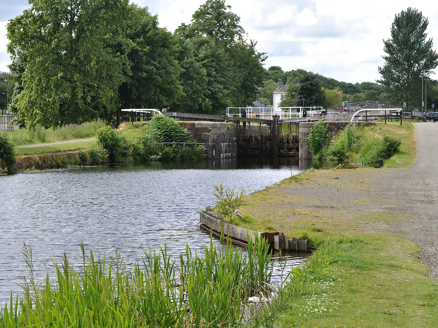
Walk east from Bowling Harbour in West Dunbartonshire, following the Forth & Clyde Canal through Clydebank, Maryhill Locks, Kirkintilloch and Twechar towards Falkirk. At Falkirk the route reaches the Falkirk Wheel, where the Forth & Clyde Canal connects with the Union Canal. The towpath then continues east via Linlithgow, Broxburn and Ratho to Lochrin Basin / Edinburgh Quay in central Edinburgh. This is a point-to-point, fully off-road canal walk and also forms part of National Cycle Network Route 754, so expect shared use with cyclists. For another easy canal-based walk, compare the Ashby Canal Trail; for Scottish coastal contrast, see the Arran Coastal Way or Ayrshire Coastal Path.
Canals, Closure and the Millennium Link
The Forth & Clyde Canal was completed in 1790 and the Union Canal in 1822, creating an inland waterway link across central Scotland for trade between the coasts. Both canals later declined and were largely closed by the 1960s. Their modern revival came through the Millennium Link restoration project, which reopened and reconnected the waterways. The Falkirk Wheel opened in 2002 to rejoin the Forth & Clyde and Union Canals.
Notable highlights
- Falkirk Wheel: The world’s only rotating boat lift, opened by Queen Elizabeth II on 24 May 2002. It connects the Forth & Clyde and Union Canals, replacing 11 locks and bridging a 35 m height difference.
- The Kelpies: Two 30 m-high steel horse-head sculptures at The Helix near Grangemouth. Created by Andy Scott and completed in 2013, they celebrate the heavy horses linked with Scotland’s canals and industry.
- Antonine Wall: The Forth & Clyde Canal closely follows the line of this Roman frontier, now a UNESCO World Heritage Site. Visible sections lie near Twechar.
- Avon Aqueduct: A major Union Canal structure near Linlithgow, around 250 m long and 26 m high. It is the longest aqueduct in Scotland and a memorable high-level towpath crossing.
- Linlithgow Palace: A ruined royal palace beside the canal town of Linlithgow. It is known as the birthplace of Mary, Queen of Scots.
- Kirkintilloch: Known as the “Canal Capital of Scotland”, it is a key waypoint on the Forth & Clyde section.
Challenges to expect
This is an easy route, but 106 km still adds up over 4 days. The main challenge is sustained daily distance rather than terrain: the towpath is mostly level, tarmac or compacted, with muddier rural sections after rain. It is a shared path, so stay alert for cyclists. Navigation is generally straightforward and waymarked, but winter walking means shorter daylight and potentially wetter surfaces.
HikeList Score
Forth & Clyde/Union Canal Towpath scored 75/100 on HikeList's trail-quality metrics.
See score breakdownHide breakdown
- Ideal length 78
- Balanced challenge 50
- Scenery & wildness 49
- Varied terrain 94
- Accommodation 100
- Food & support 94
- Path quality 74
- Season flexibility 100
Computed from length, challenge, scenery & wildness, terrain variety, accommodation, food & support, path quality and season flexibility.
 United Kingdom
 Scotland
Show more data Show less
- Canal
- Lowland
- Urban
- Rural
- Tarmac
- Compacted Path
- Mud
- B&Bs
- Guesthouses
- Inns
- Hotels
- Wheelchair Accessible
- Stroller Accessible
- Family Friendly
- Dog Friendly On Leash
- Restrooms
- Non Potable Water Sources
- Picnic Areas
- Public Transport Access Points
In these collections
Photos from hikers
Taken on the trail by people who've reviewed Forth & Clyde/Union Canal Towpath.
The first section starts at Bowling Basin near the River Clyde’s mouth and follows the Forth & Clyde Canal east. Passing through Clydebank, the route offers glimpses of industrial history and rejuvenated waterfronts, before winding northwards past the Maryhill Locks and the edge of Glasgow. The towpath then continues through Bishopbriggs’ leafy outskirts, eventually arriving in Kirkintilloch, a town known as the 'Canal Capital of Scotland.' Surfaces are primarily tarmac or well-maintained path, with good signposting throughout. Cafés and shops are available in most of the settlements, giving regular opportunities for rest and resupply.
Leaving Kirkintilloch, the towpath traverses quieter, rural stretches, threading through farmland and small villages such as Twechar and Bonnybridge. The trail is predominantly flat and easy-going, hugging the canal amidst woodlands and open countryside. As you approach Falkirk, canal engineering marvels become apparent: the journey culminates at the iconic Falkirk Wheel, which connects the Forth & Clyde and Union Canals. The path is generally level with sections that may be more rugged or muddy after rain, and Falkirk itself provides a range of amenities for overnight rest.
This stretch follows the Union Canal, starting from the Falkirk Wheel and heading east along leafy towpaths with minimal ascent. The rural landscape is punctuated by aqueducts, including the impressive Avon Aqueduct just before Linlithgow. The route passes through peaceful villages like Polmont, offering pleasant walking alongside tranquil water. Linlithgow, with its historic palace and welcoming town centre, makes for a convenient and interesting stopover. Expect frequent benches, sections of shade, and well-maintained path.
The last day leads from Linlithgow to Edinburgh along the Union Canal’s tranquil waters. The path meanders through West Lothian’s countryside, passing settlements like Broxburn and Ratho, before entering the suburbs of Scotland’s capital. The towpath remains mainly flat with urban cycling and walking infrastructure improving as you approach the city. The journey concludes at Lochrin Basin in the heart of Edinburgh, close to shops and public transport links. This section can be broken up with stops in intermediate villages if desired.
Reviews
How would you rate Forth & Clyde/Union Canal Towpath?
Tap a star to start your review — you could be the first.