Dutch Coastal Path (Hollands Kustpad)
How would you rate Dutch Coastal Path (Hollands Kustpad)?
Tap a star to share your experience and help other hikers.
Dutch Coastal Path (Hollands Kustpad): North Sea Dunes and Beach Walking
HikeList Score
Dutch Coastal Path (Hollands Kustpad) scored 88/100 on HikeList's trail-quality metrics.
See score breakdownHide breakdown
- Ideal length 83
- Balanced challenge 90
- Scenery & wildness 74
- Varied terrain 100
- Accommodation 100
- Food & support 88
- Path quality 98
- Season flexibility 89
Computed from length, challenge, scenery & wildness, terrain variety, accommodation, food & support, path quality and season flexibility.
The Dutch Coastal Path (Hollands Kustpad) is a 233 km waymarked North Sea walk in the Netherlands, from Hoek van Holland to Den Helder through South Holland and North Holland. It is the central section of the Nederlands Kustpad (LAW 5-2), part of the E9 European Coastal Path, and Wandelnet divides it into 16 day-stages. Difficulty is moderate: the route is flat and non-technical, but long beach and dune sections on soft sand make full days tiring. It suits walkers who want coastal scenery with easy town-based logistics.
Route Overview
This point-to-point route is commonly walked south to north, although the white-and-red LAW waymarks are signed both ways. From Hoek van Holland it follows the dune coast past Monster/Ter Heijde, Kijkduin and Scheveningen into Den Haag, then continues via Katwijk aan Zee, Noordwijk, Zandvoort and the Haarlem area. North of IJmuiden it crosses Kennemerduinen / Nationaal Park Zuid-Kennemerland, then Castricum aan Zee, Egmond aan Zee, Bergen aan Zee, the Schoorlse Duinen, Petten, Callantsoog and Julianadorp before Den Helder. The coast is well served by trains and buses, and accommodation in the resort towns is plentiful. For inland Dutch walking, compare the Groene Hart Pad, Amstel River Trail and Floris V Trail.
Coast, Dunes and Dutch Sea Defence
The route follows a Dutch coastline shaped over millennia by rivers, sea and wind, with dunes reinforced as vital sea defence for a low-lying country. The modern Hollands Kustpad was formed by joining two older coastal paths, the Visserspad and the Duin- en Polderpad. Around 2013 to 2014 it was linked with neighbouring coastal paths into the larger Nederlands Kustpad (LAW 5). Den Helder, the northern terminus, has been the principal base of the Royal Netherlands Navy since the early 19th century.
Notable highlights
- Schoorlse Duinen (highest dune belt): The route crosses the widest and highest dune belt in the Netherlands. Its tallest dune is about 55.4 m above sea level, the high point of the trail, with views over forest, heath and the North Sea.
- Scheveningen, The Hague: The Netherlands’ best-known seaside resort is reached directly from the dunes. Expect a long pier, broad boulevard and busy city beach.
- Nationaal Park Zuid-Kennemerland / Kennemerduinen: This protected dune national park between IJmuiden and Zandvoort mixes dune lakes, woodland and grazing wildlife including European bison and Highland cattle.
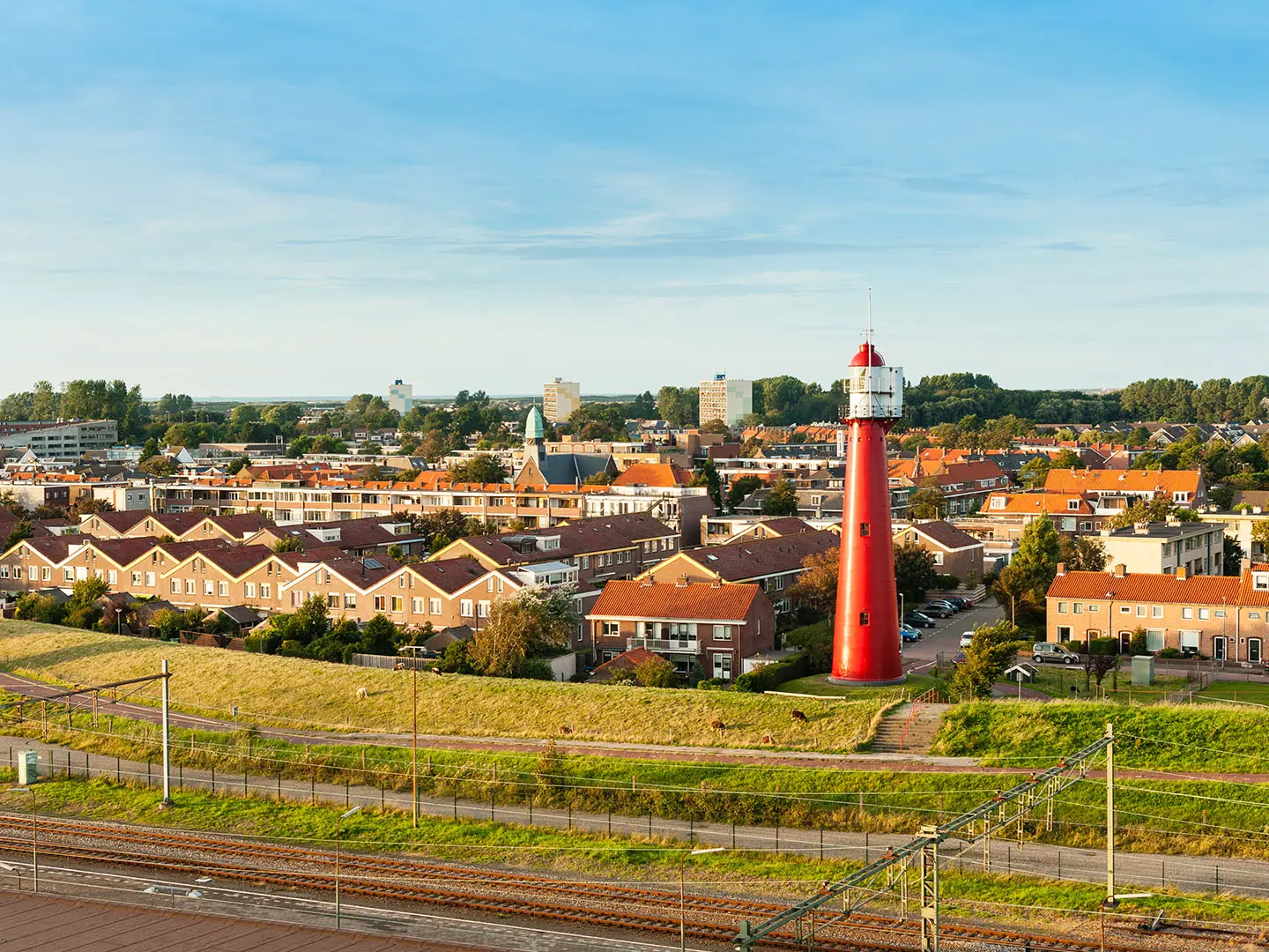
- Egmond aan Zee lighthouse: The red-and-white Van Speijk lighthouse marks this old fishing village on the dune front and is a useful visual landmark for walkers.
- Spring bulb fields near Noordwijk: In April and May, tulips, hyacinths and daffodils colour the Bollenstreek just inland from the dunes.
- Den Helder naval port: The northern end of the trail is a Dutch naval port, with maritime museums and the ferry departure point for Texel.
Challenges to expect
The Hollands Kustpad is flat, with no technical ground and no altitude issue, but do not underestimate the soft sand. Long beach and dune sections can slow daily mileage, especially in wind. Much of the route is exposed to North Sea weather, and summer resort areas can be busy. Navigation is straightforward on white-and-red LAW waymarks, signed both directions. Resupply and accommodation are generally easy in the coastal towns.
HikeList Score
Dutch Coastal Path (Hollands Kustpad) scored 88/100 on HikeList's trail-quality metrics.
See score breakdownHide breakdown
- Ideal length 83
- Balanced challenge 90
- Scenery & wildness 74
- Varied terrain 100
- Accommodation 100
- Food & support 88
- Path quality 98
- Season flexibility 89
Computed from length, challenge, scenery & wildness, terrain variety, accommodation, food & support, path quality and season flexibility.
 Netherlands
Show more data Show less
- Coastal
- Dunes
- Beach
- Forest
- Polder
- Sand
- Unpaved Paths
- Boardwalk
- Some Paved Promenade
- Hotels
- Guesthouses
- Campsites
- Hostels
- Family Friendly
- Pet Friendly
- Restrooms
- Water Sources
- Campsites
- Picnic Areas
Download Our Full Guide to Dutch Coastal Path (Hollands Kustpad) FREE!
Get our comprehensive guide to this hike for free. Save it for later reading or print out at home.
Photos from hikers
Taken on the trail by people who've reviewed Dutch Coastal Path (Hollands Kustpad).
Dutch Coastal Path (Hollands Kustpad): The Complete Guide
 i
Image by Demid
i
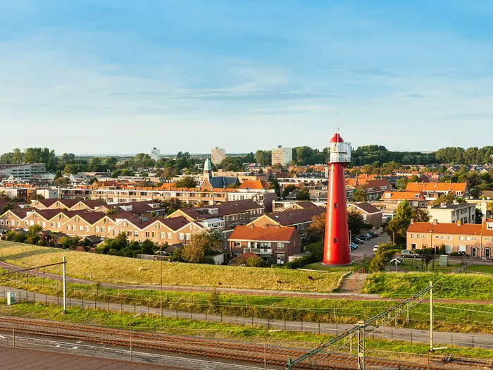
Image by Demid The Dutch Coastal Path (Hollands Kustpad) is a 233 km waymarked walk from Hoek van Holland to Den Helder, following the North Sea coast through Zuid-Holland and Noord-Holland. It is the central section of the Nederlands Kustpad (LAW 5-2) and part of the E9 European Coastal Path / North Sea Trail.
This is a strong choice for walkers who want a first long-distance trail with clear white-and-red LAW waymarks, regular towns and excellent public transport. The route is flat and non-technical, but still feels like a proper end-to-end coastal journey.
The character changes constantly: wide beaches, dune paths, resort boulevards, city fringes around Den Haag and Haarlem, then wilder dune country through the Kennemerduinen and Schoorlse Duinen. In spring, the Bollenstreek near Noordwijk adds bulb fields just inland from the dunes.
The challenge is not ascent; the trail gains only about 200 m in total and reaches roughly 55 m in the Schoorlse Duinen. What matters is the cumulative effort of soft sand, exposed North Sea weather, little natural shade and full days on open coast.
This guide covers stages, days, accommodation, food, transport, terrain and common mistakes.
Stage-by-Stage Guide
The stages below follow the Hoek van Holland to Den Helder coastal line used on this page. Distances are approximate: on this trail, wind direction and the amount of soft sand underfoot can affect the day more than the map profile, which is almost flat throughout.
Stage 1: Hoek van Holland to Monster — 22 km
The route starts at Hoek van Holland (Hook of Holland), by the beach near Hoek van Holland Strand and the mouth of the Nieuwe Waterweg. From here the white-and-red LAW waymarks lead north into the dune coast, with Ter Heijde and Monster as the main settlements on the stage.
Expect a straightforward but exposed first day: wide beach, dune paths, sandy tracks and little natural shade. The walking is non-technical, but 22 km is a full day if the sand is soft or the North Sea wind is against you.
Food and water are best treated as town-based. Hoek van Holland and Monster are the reliable places to plan around, with Ter Heijde also on the line of the route; carry enough water for the exposed sections between built-up areas.
Accommodation at Monster or nearby coastal settlements should be booked ahead in summer. If local availability is limited, Den Haag and the larger resort areas further along the coast give more choice, but onward transport should be checked before travelling.
Hoek van Holland Strand is reached by RET Metro line B from Rotterdam. Local transport from Monster should be checked before travelling, especially if using this as a section-walk start or finish.
Navigation is simple in principle: keep the sea to the west and follow the LAW waymarks through the dune belt. The main warning is exposure rather than complexity — carry sun, wind and rain protection even on a flat forecast.
Stage 2: Monster to Scheveningen (Den Haag) — 18 km
This stage continues north along the South Holland dune coast, passing Kijkduin before reaching the built-up beach front of Scheveningen. The day has a clear change of character, from open dune and beach walking into the Netherlands’ best-known seaside resort.
Terrain remains mostly sand, dune path and promenade. Through Kijkduin and Scheveningen there is more hard surface, more people and more urban navigation, but the route remains well waymarked.
Scheveningen is the major landmark, with its long pier, the historic Kurhaus and broad boulevard. It is also one of the best places on the whole route for food, water, accommodation and rest-day logistics.
Services are available at Monster, Kijkduin and Scheveningen, so this is one of the easier days for resupply. Do not rely on every beach-front facility being open outside the main season; opening times should be checked before travelling.
Den Haag (The Hague) is a major public-transport hub, and Scheveningen has strong city access. This makes the stage useful for anyone joining or leaving the trail, or for walkers who prefer to stay in Den Haag rather than directly on the beach.
The main navigation issue is not getting distracted by the resort layout. Follow the white-and-red markers carefully where dune paths, promenades, roads and beach accesses intersect.
Stage 3: Scheveningen to Katwijk aan Zee — 19 km
Leaving Scheveningen, the trail returns to the dune fringe north of Den Haag. This is a more open coastal stage again, with dune estates and parks such as Meijendel forming part of the landscape before the route reaches Katwijk aan Zee.
The walking is mostly dune path, sandy track and exposed coastal terrain. Underfoot conditions can vary from firm paths to energy-sapping sand, so the moderate distance should not be underestimated.
The stage’s appeal is the contrast between the busy resort start and the quieter dune belt beyond Den Haag. Views are typically wide and open, with the North Sea close by and little shelter from wind.
Food and water are straightforward at Scheveningen and Katwijk aan Zee. Between them, carry what is needed for the full crossing of the dune section, as facilities inside dune areas should not be assumed.
Katwijk aan Zee has accommodation and resort services. As with the whole coast, July and August are peak holiday months, so beds should be booked early.
Den Haag gives strong access at the southern end of the stage. Katwijk aan Zee is served by local transport rather than being one of the main rail hubs on the route; connections should be checked before travelling.
Navigation is generally easy on the LAW markings, but pay attention where multiple dune paths and access tracks meet. In poor weather or strong wind, avoid adding unnecessary beach distance unless it is clearly part of the signed route.
Stage 4: Katwijk aan Zee to Noordwijk — 11 km
This is one of the shortest stages in the published split and works well as a half-day, a recovery day or part of a longer combined walk. It follows the coast from Katwijk aan Zee to Noordwijk, staying within the familiar pattern of dune, beach and resort-edge walking.
The terrain is flat and uncomplicated, but still sandy in places. On a windy day it can feel less easy than the distance suggests, especially if the route uses open beach or soft dune paths.
Noordwijk brings the route close to the Bollenstreek, where spring bulb fields just inland of the dunes colour the landscape in April and May. The exact impression depends on season; outside spring, this remains primarily a coastal dune day.
Food and water are available at both Katwijk aan Zee and Noordwijk. Because the stage is short, most walkers will not need much intermediate resupply, but water should still be carried in warm or windy weather.
Noordwijk has a good range of coastal accommodation compared with smaller stops. Book ahead for weekends and the summer holiday peak.
Public transport is by local connections rather than direct reliance on a named mainline station at the beach. This should be checked before travelling, particularly for evening departures.
Navigation is simple, but this is a stage where it is easy to drift onto parallel beach or promenade routes. Stay with the LAW waymarks if following the official line.
Stage 5: Noordwijk to Zandvoort — 18 km
From Noordwijk the route continues north through the dune coast, with De Zilk on the inland side of the route corridor before reaching Zandvoort. This is a good stage for seeing the relationship between the beach, the dune belt and the bulb-growing country inland.
Expect a mixture of dune tracks, sandy paths and exposed coastal walking. There is very little climbing, but repeated soft sections can make the day slower than its 18 km distance implies.
In spring, the Bollenstreek near Noordwijk is the key seasonal highlight. Later in the day, the approach to Zandvoort brings the trail back into a busy resort environment with strong services.
Food and water are available at Noordwijk and Zandvoort, with De Zilk offering an inland service point where the route passes that area. Carry enough water for the dune stretches, as shade and facilities are limited away from settlements.
Zandvoort is one of the more convenient overnight stops, with accommodation and a rail connection. It is also a practical place to shorten, join or leave the walk.
Zandvoort is a named rail hub on the route; local and NS times should be checked before travelling. In summer, accommodation demand can be high because Zandvoort is a major beach destination.
Navigation is generally reliable on the white-and-red markings. Take care at resort approaches, car parks, access tracks and dune entrances, where several paths can run in similar directions.
Stage 6: Zandvoort to IJmuiden — 16 km
This stage is one of the most varied on the route, linking Zandvoort with IJmuiden through the dune landscape around Bloemendaal aan Zee, Overveen, Haarlem and Santpoort. The wider area includes Nationaal Park Zuid-Kennemerland and the Kennemerduinen, one of the finest dune reserves on the Dutch coast.
Terrain alternates between dune paths, woodland and heath sections, sandy tracks, urban edges and paved sections near settlements. It is still a low-level day, but the underfoot variety makes it different from the more beach-dominated stages further south.
The protected dunes between Zandvoort and IJmuiden are the main highlight. The area is known for dune lakes, woodland and grazing wildlife, including European bison in the Kraansvlak and Highland cattle.
Food and water are easiest to plan at Zandvoort, Bloemendaal aan Zee, Overveen, Haarlem, Santpoort and IJmuiden. If taking a quieter dune-reserve line between service points, carry enough water rather than relying on facilities inside the reserve.
There is accommodation at Zandvoort and IJmuiden, with broader city options around Haarlem. IJmuiden is a practical overnight stop before the longer next stage north.
Zandvoort and Haarlem are useful rail hubs for access. IJmuiden is generally reached by local public transport rather than by a central NS station on the trail; this should be checked before travelling.
Navigation needs more attention here than on the open beach stages because the route passes through a busier network of dune, park, town and access paths. Dune-reserve access rules and seasonal closures should be checked before travelling; do not assume every side path through wildlife areas is open, especially around the Kraansvlak bison area.
Stage 7: IJmuiden to Castricum aan Zee — 22 km
This is one of the longer coastal days, running north from IJmuiden towards Castricum aan Zee with Wijk aan Zee as the main named place between them. It is a classic endurance stage for this trail: flat, well signed and not technical, but potentially tiring underfoot.
The walking is dominated by beach, dune and dune-reserve paths. Long exposed stretches mean wind, sun and soft sand can be the deciding factors in how hard the day feels.
Wijk aan Zee breaks the stage and is the obvious place to plan around between IJmuiden and Castricum aan Zee. Beyond the settlements, the attraction is the open dune coast and the sense of leaving the busier Zuid-Kennemerland corridor behind.
Food and water are available at IJmuiden, Wijk aan Zee and Castricum aan Zee. Carry enough between these points, particularly outside the main beach season when coastal services may be reduced.
Castricum aan Zee has coastal accommodation options, while the wider Castricum area is also useful for transport. Accommodation should be booked ahead in peak summer.
Castricum is a named rail access point on the route corridor, but the beach settlement and station are not the same place. Local bus or onward transport arrangements should be checked before travelling.
Navigation is usually clear, but pay attention at dune entrances, beach exits and reserve boundaries. If the weather is poor, stay disciplined with the waymarks rather than improvising long beach alternatives.
Stage 8: Castricum aan Zee to Egmond aan Zee — 15 km
This is a moderate coastal stage through the dune country north of Castricum aan Zee to Egmond aan Zee. The route stays within the familiar dune-and-beach pattern, with Egmond’s seafront providing a clear end point.
Underfoot conditions are mostly sandy paths, dune tracks and occasional firmer surfaces near settlements. The day is not long, but the lack of shade and the cumulative effect of sand walking still matter.
Egmond aan Zee is the main highlight, especially the red-and-white Van Speijk lighthouse on the dune front. It is a strong visual landmark and one of the recognisable features of this part of the coast.
Food and water are available at Castricum aan Zee and Egmond aan Zee. Carry water for the dune section, as services between the two should not be relied on.
Egmond aan Zee is a well-established coastal overnight stop with accommodation. It is also a logical place for walkers wanting a shorter day after the longer IJmuiden to Castricum aan Zee stage.
Public transport is by local connections to the wider rail network, including the Castricum and Alkmaar/Heerhugowaard area rail corridors. This should be checked before travelling.
Navigation is straightforward on the LAW markers, with the usual need to watch for beach exits and dune-path junctions. Dune-reserve rules should be respected, including any signed restrictions on paths or protected areas.
Stage 9: Egmond aan Zee to Bergen aan Zee — 10 km
This short stage links two neighbouring seaside settlements: Egmond aan Zee and Bergen aan Zee. It is a useful recovery day, an easy late start, or a stage that stronger walkers may choose to combine with the day before or after.
The terrain is coastal dune and beach-edge walking, with sand underfoot for much of the way. Although the distance is modest, the route remains exposed to wind and sun.
The Van Speijk lighthouse at Egmond aan Zee is the key landmark at the start. The stage then settles into quieter dune walking before reaching Bergen aan Zee.
Food and water are available at both ends. Because the stage is short, a full resupply strategy is rarely needed, but water should still be carried in warm weather.
Bergen aan Zee has accommodation, though availability can be tight in the summer holiday period. If beds are limited, nearby resort and inland options may be needed; this should be checked before travelling.
Local public transport provides access to the wider rail network, with the Alkmaar/Heerhugowaard area the main regional rail corridor named for this part of the route. Check current connections before relying on them.
Navigation is simple, but do not treat the short distance as a reason to ignore weather. A strong headwind on open sand can turn a short coastal stage into slow walking.
Stage 10: Bergen aan Zee to Schoorl — 12 km
This stage turns into one of the most distinctive landscapes on the whole walk: the Schoorlse Duinen. The trail reaches the highest and broadest dune belt in the Netherlands, with the route high point at about 55 m above sea level.
The terrain is still low by mountain standards, but more varied than the flat beach stages. Expect sandy dune paths, forest and heath, with short climbs and descents over dune ridges rather than any sustained ascent.
The main highlight is the view from the Schoorlse Duinen, where the landscape opens over forest, heath and the North Sea. This is the closest the Dutch Coastal Path comes to a hillwalking feel, despite the modest height.
Food and water should be planned at Bergen aan Zee and Schoorl. Within the dune belt, carry what is needed for the day and do not assume frequent services.
Schoorl is a practical overnight stop before the route continues towards Groet and Petten. Accommodation is more limited than in the larger resorts, so early booking is sensible in peak periods.
Public transport is by local connections to the wider regional network. This should be checked before travelling, particularly if using Schoorl as a section endpoint.
Navigation is generally good, but the Schoorlse Duinen contain many paths, so follow the LAW waymarks carefully at junctions. Stay on permitted routes and respect any local dune-management signs.
Stage 11: Schoorl to Petten — 18 km
From Schoorl the route continues through the northern dune country, passing Groet before reaching Petten. This stage keeps the sand-and-dune character but begins to move towards the more engineered sea-defence landscape that becomes important near Petten.
The day combines dune paths, sandy tracks and exposed coastal walking. The distance is moderate, but soft surfaces and wind exposure remain the main physical challenge.
Groet is the main named place between Schoorl and Petten. Near Petten, the Hondsbossche Zeewering becomes the key landmark: a major sand-reinforced sea defence protecting the low-lying coast where the natural dunes give out.
Food and water are available at Schoorl, Groet and Petten. Carry enough for the dune sections between settlements, particularly outside the busiest holiday weeks.
Petten is a smaller overnight stop than places such as Scheveningen, Zandvoort or Egmond aan Zee. Accommodation should be arranged in advance, with fallback transport checked if staying elsewhere.
Local public transport is the practical access option at Petten. This should be checked before travelling, especially for weekend or evening services.
Navigation is not difficult, but pay attention where the route transitions between natural dune paths and sea-defence infrastructure. The open coast near Petten can be very exposed in strong winds.
Stage 12: Petten to Callantsoog — 14 km
This stage continues north from Petten to Callantsoog along a coast where the relationship between dunes and sea defences is especially clear. It is a manageable-distance day, but still fully exposed in places.
Terrain is a mix of dune, beach-edge and sea-defence walking, with firm and soft surfaces alternating. The profile remains flat, so pace is governed more by wind and sand than by ascent.
The Hondsbossche Zeewering remains the defining feature around Petten, after which the route moves back towards the resort character of Callantsoog. The views are open and simple: sea, sand, dunes and low-lying land behind.
Food and water are available at Petten and Callantsoog. Do not rely on frequent intermediate services unless current opening times have been checked.
Callantsoog is a recognised seaside accommodation stop on the route. Book well ahead for July and August, when the North Holland coast is busy.
Public transport is by local bus connections rather than a direct mainline station at the beach. This should be checked before travelling.
Navigation is usually clear, but exposed sea-defence sections can feel featureless in poor weather. Keep to the signed route and avoid making assumptions from parallel tracks or beach accesses.
Stage 13: Callantsoog to Julianadorp — 16 km
North of Callantsoog the route begins to change character. The dunes gradually give way towards a more open polder and sea-defence landscape on the approach to Julianadorp and Den Helder.
The walking remains flat, but there is often less shelter and less visual variety than in the larger dune reserves further south. Expect exposed paths, beach or dune-edge sections and open coastal infrastructure.
The main interest is the transition from the classic resort-and-dune coast to the lower, more engineered northern landscape. On a clear day the openness gives broad views, but in wind it can feel austere.
Food and water are available at Callantsoog and Julianadorp. Carry enough for the full stage, as intermediate services should not be assumed.
Julianadorp is a practical final-night stop before Den Helder, but it is smaller than the major resorts further south. Accommodation availability should be checked and booked ahead in the summer peak.
Local transport connects Julianadorp with the wider Den Helder area, but current routes and times should be checked before travelling. This is especially important if ending the day away from the exact trail line.
Navigation is generally straightforward, though open polder and sea-defence sections can make the waymarks more important than the landscape. In poor visibility or strong wind, stay alert at road crossings, access tracks and path junctions.
Stage 14: Julianadorp to Den Helder — 13 km
The final stage is a relatively short walk from Julianadorp to Den Helder, passing towards Huisduinen and the northern tip of the North Holland mainland. It finishes in the naval port area of Den Helder, with the Texel ferry nearby for those continuing beyond the mainland.
Terrain is mostly flat coastal walking with open sea-defence, dune-edge and urban approaches. Compared with the wilder dune stages, this is more about arrival: the coast becomes more built-up and maritime in character.
Huisduinen and the Lange Jaap lighthouse are the key landmarks before the finish. Den Helder itself has been the main base of the Royal Netherlands Navy since the early 19th century and gives the route a distinctly maritime endpoint.
Food and water are available at Julianadorp, Huisduinen and Den Helder, with the finish offering the strongest services. Carry normal day supplies, but this is not a remote stage.
Den Helder has the best end-of-walk logistics on the northern part of the route, including accommodation, onward rail and ferry access. It is also a sensible place to build in a spare night if continuing to Texel.
Den Helder has its own NS station at the end of the line from Amsterdam via Alkmaar. Bus 33 and the TESO ferry serve the Texel connection; current train, bus and ferry times should be checked before travelling.
Navigation becomes more urban near the finish, so follow the LAW waymarks rather than simply aiming for the town centre. If ending at the ferry or station rather than the exact trail finish, allow time for the final transfer across Den Helder.
Recommended Itinerary
The most practical schedule for most independent walkers is a 14-day itinerary following the stage split below. It keeps the longest days to about 22 km, uses the main coastal towns for overnight stops, and avoids turning the softer sandy sections into unnecessarily long slogs.
Distances are approximate. Use the current Wandelnet LAW 5-2 mapping or guidebook when booking accommodation, especially where a stay is slightly inland from the signed line.
Standard 14-day itinerary
| Day | From | To | Approx. distance | Why this stage makes sense | Services/accommodation notes |
|---|---|---|---|---|---|
| 1 | Hoek van Holland | Monster | 22 km | A full but manageable opening day north from the Nieuwe Waterweg into the dune-and-beach rhythm of the route. Starting at Hoek van Holland Strand is straightforward by RET Metro line B. | Hoek van Holland is the easiest start-point to reach. Monster is a sensible first overnight, but accommodation choice should be checked before committing to this split. |
| 2 | Monster | Scheveningen (Den Haag) | 18 km | A moderate day through the coastal fringe via Kijkduin towards the major resort and city services of Scheveningen and Den Haag. | Scheveningen and Den Haag have the strongest choice of accommodation, food and transport on the southern part of the trail. This is a good place to replace kit or adjust plans. |
| 3 | Scheveningen | Katwijk aan Zee | 19 km | A well-balanced stage leaving the city beach behind and continuing through dune country towards Katwijk aan Zee. The distance is long enough to make progress without forcing an early over-long sandy day. | Katwijk aan Zee is a coastal resort with accommodation and food options. Book ahead in July and August. |
| 4 | Katwijk aan Zee | Noordwijk | 11 km | A deliberately short stage, useful after three consecutive coastal days. It also gives time for a slower morning, bad-weather delay or a look inland towards the Bollenstreek in spring. | Noordwijk has plentiful seaside accommodation. This short day can be combined with the next stage by fitter walkers. |
| 5 | Noordwijk | Zandvoort | 18 km | A solid coastal stage continuing north through dunes and beach sections towards one of the main resort towns on this part of the coast. | Zandvoort has good accommodation, food and rail connections. It is a practical resupply and rest point before the Kennemerduinen section. |
| 6 | Zandvoort | IJmuiden | 16 km | This stage gives time for the protected dune landscape around Nationaal Park Zuid-Kennemerland and the Kennemerduinen without making the day too long. | Zandvoort is well served at the start of the day. Check current accommodation and local transport options for IJmuiden before booking. |
| 7 | IJmuiden | Castricum aan Zee | 22 km | One of the longer days, continuing through the northern dune belt towards Castricum aan Zee. The distance is flat, but soft sand and wind can make it feel longer than the profile suggests. | Castricum has rail access inland, while Castricum aan Zee is on the coast. Check the exact location of accommodation and onward bus/train links before booking. |
| 8 | Castricum aan Zee | Egmond aan Zee | 15 km | A shorter, sensible recovery day after the 22 km stage, finishing at the clear coastal landmark of Egmond aan Zee and the Van Speijk lighthouse. | Egmond aan Zee is a popular seaside overnight stop with accommodation and food options. Summer booking is strongly advised. |
| 9 | Egmond aan Zee | Bergen aan Zee | 10 km | A short coastal day that keeps the itinerary relaxed through the resort section and leaves margin for poor weather, tired legs or an easy half-day. | Bergen aan Zee has accommodation, but availability can tighten sharply in peak holiday periods. This day is easy to combine with either Day 8 or Day 10 on a faster schedule. |
| 10 | Bergen aan Zee | Schoorl | 12 km | A short but important stage into the Schoorlse Duinen, the highest dune belt on the route. The modest distance leaves time for the dune paths and views rather than rushing through them. | Schoorl is a useful inland dune-base stop. Book ahead, particularly in summer and at weekends. |
| 11 | Schoorl | Petten | 18 km | A more substantial day north from the Schoorlse Duinen towards the exposed sea-defence landscape near Petten. Expect the flat profile to feel slower if the wind is against you. | Petten is a logical overnight before the final North Holland coast stages. Check accommodation availability before fixing this as a stop. |
| 12 | Petten | Callantsoog | 14 km | A moderate day along the coast past the Hondsbossche Zeewering area towards Callantsoog, without overloading the schedule after the Schoorl and Petten sections. | Callantsoog is one of the established seaside accommodation stops on the route. Reserve early for July-August. |
| 13 | Callantsoog | Julianadorp | 16 km | A steady penultimate stage as the dunes begin to give way towards more open polder and sea-defence landscapes. The distance is enough for progress while keeping the final day short. | Julianadorp is a practical last overnight before Den Helder. Check exact accommodation location against the trail and local transport. |
| 14 | Julianadorp | Den Helder | 13 km | A short final day into Huisduinen and Den Helder, leaving time for the naval port, the Lange Jaap lighthouse area and onward travel. | Den Helder has an NS station on the line from Amsterdam via Alkmaar. Bus 33 and the TESO ferry serve onward travel towards Texel; current times should be checked before travelling. |
Slower variant: 15-16 days
A slower schedule suits walkers who want shorter sandy days, more time in the dune reserves, or extra flexibility for wind and rain. It is also sensible in hot, exposed summer weather, when shade is limited and beach walking can be draining.
The easiest way to slow the route down is to add one or two extra nights at strong service points rather than trying to force very small village-to-village stages. Good places to pause or split the rhythm include Scheveningen/Den Haag, Zandvoort or Haarlem, Egmond aan Zee or Bergen aan Zee, Schoorl, and Callantsoog. Public transport access along much of the coast makes this a workable approach for rest days or partial-stage days, but exact connections should be checked before travelling.
Faster variant: 11-13 days
A faster itinerary is realistic for fit walkers who are comfortable with repeated 20 km-plus days on sand and exposed dune paths. The route is flat and well waymarked, but faster schedules should not be planned from distance alone: headwinds, soft beach sections and lack of shade can slow progress significantly.
The obvious stages to combine are the shorter resort days, for example Katwijk aan Zee to Zandvoort via Noordwijk at roughly 29 km, or Castricum aan Zee to Bergen aan Zee via Egmond aan Zee at roughly 25 km. Another possible consolidation is around Egmond aan Zee, Bergen aan Zee and Schoorl, where the listed stages are short individually.
Avoid combining too many northern stages back-to-back unless accommodation and transport are firmly arranged. The final section towards Julianadorp and Den Helder is flatter and more open, but exposure to North Sea wind remains the main factor.
Planning the Route
How many days to allow
Wandelnet divides the official route into 16 day-stages, but many independent walkers plan a 13–16 day trip depending on pace, accommodation availability and how much beach walking they want in a day. A 14-day schedule is a practical compromise if you are comfortable with regular full walking days and a few shorter stages through the resort towns.
This is not a route where ascent dictates the schedule. The main limiter is the cumulative effort of soft sand, dune paths, wind and exposure, especially on longer coastal days such as Hoek van Holland to Monster and IJmuiden to Castricum aan Zee.
A slower itinerary suits walkers who want time in Den Haag, Haarlem, Nationaal Park Zuid-Kennemerland, the Schoorlse Duinen or the seaside towns. A faster itinerary is realistic for fit walkers, but only if accommodation and transport links line up cleanly.
Let the towns shape the itinerary
Daily planning is naturally town-based. The route passes regular coastal resorts, villages and cities, so overnight stops usually fall at places such as Scheveningen, Katwijk aan Zee, Noordwijk, Zandvoort, IJmuiden, Egmond aan Zee, Bergen aan Zee, Schoorl, Petten, Callantsoog, Julianadorp and Den Helder.
The shorter stages around Katwijk aan Zee, Noordwijk, Egmond aan Zee, Bergen aan Zee and Schoorl are the easiest to combine. The longer, sandier stages are less attractive to extend unless conditions are kind: soft beach and a strong North Sea wind can make a flat 18–22 km day feel much longer than expected.
In July and August, accommodation availability can dictate the route more than walking fitness. Book well ahead in the beach-holiday peak, particularly in the popular resort towns and at weekends.
Shortening, extending and section hiking
This is one of the easier long-distance walks in the Netherlands to break into sections. The route passes major rail and bus corridors, with useful access around Den Haag, Haarlem, Zandvoort, Castricum, the Alkmaar/Heerhugowaard area and Den Helder, plus local Connexxion buses serving many coastal places.
For a short trip, the strongest sections are the dune-and-resort stretches around Scheveningen, Katwijk aan Zee and Noordwijk; the Kennemerduinen between Zandvoort and IJmuiden; and the northern dune country around Egmond aan Zee, Bergen aan Zee and the Schoorlse Duinen. These can be walked as long weekends using train-plus-bus access.
Extending north is straightforward in concept because Den Helder has the TESO ferry to Texel, but ferry times and onward plans should be checked before travelling. The wider Nederlands Kustpad / E9 context also gives options beyond this section, though the Den Helder finish is the line used for this route.
Transport planning
The start is reached via RET Metro line B to Hoek van Holland Strand. NS no longer runs a train to Hoek van Holland; that connection became part of the Rotterdam Metro network and now reaches the beach.
The finish at Den Helder has an NS station on the line from Amsterdam via Alkmaar. Bus 33 links with the TESO ferry for Texel.
For stage-by-stage access, plan each day with current NS, RET and Connexxion times rather than assuming every coastal village has equally frequent service. This matters most if you are using one base for multiple day walks or if accommodation forces an overnight stop away from the trail.
Accommodation and luggage
Hotels, pensions, hostels and campsites are widely available along the coast, especially in the resorts and in Den Haag and Haarlem. Availability is the main planning issue, not remoteness.
The Netherlands does not have the same established baggage-transfer culture as some UK National Trails. Unless a private arrangement is made with accommodation or a local provider, plan to carry overnight kit or use public transport to walk stages from a fixed base. This should be checked before travelling.
Food and water
Resupply is generally easy because the route regularly reaches towns, resort boulevards and city sections. Even so, do not rely on finding water or food in the middle of dune reserves, beach stretches or quieter polder sections north of Callantsoog.
Carry enough water for a full exposed day, especially in warm weather. Shade is limited on much of the coast, and wind can hide how quickly you are drying out.
Navigation and access rules
Navigation is usually straightforward. The Hollands Kustpad is marked with white-and-red LAW waymarks and is signed in both directions, but a map, guidebook or offline GPS track is still worth carrying through dune reserves, urban edges and any temporary diversions.
Dune-reserve access rules should be checked before travelling. In Nationaal Park Zuid-Kennemerland, the Kraansvlak bison area has seasonal access restrictions, with the bison route closed during the breeding season, roughly March to August.
Weather and daily timing
Plan days around exposure rather than elevation. There is very little climbing, but there is also little natural shelter on beach, dune and dyke sections.
Wind, rain, sun and blown sand can all slow progress. Start longer sandy days with enough margin to avoid rushing for transport or late check-in, and keep flexible options where rail and bus links make that possible.
Towns, Villages and Overnight Stops
Accommodation is one of the easier parts of planning the Dutch Coastal Path, provided bookings are made early in the July-August beach-holiday peak. The most reliable overnight bases are the resort towns and cities: Scheveningen, Den Haag, Katwijk aan Zee, Noordwijk, Zandvoort, Haarlem, Egmond aan Zee, Bergen aan Zee, Callantsoog and Den Helder.
Smaller dune-edge villages can be useful stage ends, but should not be assumed to have the same choice of beds, evening food or shops. For those places, book accommodation before committing to the stage plan and check current opening times before travelling. There is no standard luggage-transfer system to rely on, so most walkers should plan to carry their kit or use the strong public transport network to base themselves off-route where necessary.
Hoek van Holland (Hook of Holland)
Hoek van Holland is the practical start point, with the route beginning near Hoek van Holland Strand by the mouth of the Nieuwe Waterweg. It works best as an arrival point or first-night base if travelling in the day before the walk.
The key transport link is RET Metro line B from Rotterdam to Hoek van Holland Strand. NS no longer runs a train to Hoek van Holland; the former railway became part of the Rotterdam Metro and the line was extended to the beach in 2023.
Food and accommodation should be arranged before arrival if starting early, especially outside the main beach season. From here the white-and-red LAW waymarks lead north into the dune coast.
Ter Heijde
Ter Heijde sits on the early Zuid-Holland coastal stretch between Hoek van Holland and Monster. It is more useful as a small coastal waypoint than as a core overnight base.
Do not assume a full range of hiker services here. Food, accommodation and shop opening times should be checked before travelling, particularly outside summer.
Monster
Monster is the first listed stage-end on the published stage plan, after the opening walk north from Hoek van Holland. It is a useful overnight stop for walkers keeping to the standard pacing.
Accommodation and evening food should be booked or checked in advance, as Monster is not one of the larger resort bases named for plentiful accommodation. Local public transport connections in this coastal belt are generally useful, but exact Connexxion bus times should be checked before travelling.
Kijkduin
Kijkduin is reached as the route approaches the Den Haag coast. It is a convenient place to pause before the more urban Scheveningen and Den Haag section.
For most through-walkers, Kijkduin is better treated as a services stop or access point rather than a main overnight anchor. If planning to stay here, check accommodation and food options before travelling.
Scheveningen
Scheveningen is one of the strongest overnight stops on the whole route. It is Den Haag’s major seaside resort, reached directly off the dunes, and has a broad city beach and boulevard.
Accommodation choice is among the best on the trail, including hotels, guesthouses and other visitor accommodation, but summer demand is high. Book well ahead for July and August.
Food and cafés are much easier here than on the quieter dune stretches. Scheveningen also works well for walkers who want a rest night with city-level services close by, while still staying on the coast.
Den Haag (The Hague)
Den Haag is one of the major logistics hubs for the southern half of the walk. The route skirts the dune fringe and city beach area, while the wider city gives access to far more accommodation, shops and transport than the smaller coastal villages.
It is a good option for a rest day, bad-weather buffer or split-stage base. Den Haag is also a major rail hub, making it one of the easiest places to join, leave or section-hike the route.
Staying in Den Haag rather than directly on the beach may give more choice outside peak holiday periods. Use local transport to connect between the city and the coastal section as required; current times should be checked before travelling.
Katwijk aan Zee
Katwijk aan Zee is a strong overnight stop and a natural stage end after the Scheveningen section. It is one of the seaside towns where accommodation is generally plentiful, with hotels, pensions, hostels and campsites forming part of the wider coastal accommodation mix.
It is a practical place for food and resupply before continuing north to Noordwijk. As with all resort towns on this route, book early for summer weekends and the July-August peak.
Noordwijk
Noordwijk is another reliable coastal base and a common overnight stop. The stage into Noordwijk is comparatively short on the published plan, which makes it useful for a lighter day, a late start or recovery after sand-heavy walking.
Accommodation and food options are generally good for a seaside resort, but demand rises sharply in the beach season. In spring, this area is also useful for walkers interested in the Bollenstreek bulb fields just inland of the dunes.
De Zilk
De Zilk lies inland of the dune coast near the Bollenstreek section around Noordwijk. It is not one of the main coastal overnight anchors, but it can be relevant for walkers adjusting stages or looking inland for accommodation.
Any stay here should be planned in advance. Check food, shop and public transport options before relying on De Zilk as a stage end.
Zandvoort
Zandvoort is one of the best-served overnight stops on the route. It has plentiful coastal accommodation and is one of the named rail access points, making it particularly useful for section-hikers.
The town works well as a base before or after the Nationaal Park Zuid-Kennemerland and Kennemerduinen section. Food and resupply are generally much easier here than in the quieter dune areas to the north and south.
Zandvoort can be very busy in good weather and during the summer holiday period. Book beds ahead and check train times if using it as a public-transport base.
Bloemendaal aan Zee
Bloemendaal aan Zee sits on the coast between Zandvoort and the Kennemerduinen area. It is useful as a coastal stop, especially when breaking up the Zandvoort to IJmuiden section.
For overnight planning, it is less robust than Zandvoort or Haarlem unless accommodation has been booked in advance. Food and seasonal opening times should be checked before relying on it for an evening stop.
Overveen
Overveen sits inland of the coastal dunes and is relevant for access to the Haarlem side of the route. It can be useful when Zandvoort or the immediate coast is full, or when planning a town-based night before continuing through the Kennemerduinen.
Treat Overveen as an access and accommodation option rather than a guaranteed service centre. Current transport and food options should be checked before travelling.
Haarlem
Haarlem is one of the most practical inland overnight bases on the route. The trail includes a Haarlem city section, and the city is one of the major rail hubs threaded by the route.
Accommodation, food and shops are much more dependable here than in the smaller dune villages. Haarlem is a sensible rest-day location, a bad-weather fallback and an easy place to start or finish a section walk.
It is also useful if coastal accommodation around Zandvoort or Bloemendaal aan Zee is expensive or full. Use the rail and local bus network to manage stage starts and finishes; current timetables should be checked before travelling.
Santpoort
Santpoort lies between Haarlem and IJmuiden on the northward line of travel. It is useful as a quieter staging point around the Kennemerduinen and the approach to IJmuiden.
It is not listed among the main resort towns with plentiful accommodation, so any overnight plan here should be booked in advance. Check food and transport options before using Santpoort as a fixed stage end.
IJmuiden
IJmuiden is a major practical stop between Zandvoort and Castricum aan Zee. It is the published stage end after Zandvoort and a sensible place to overnight before the longer next stage north.
Accommodation should be available in the wider town/coastal area, but book ahead in busy periods. Food and resupply are more realistic here than in the open dune sections immediately around it.
This is also a good point to check access rules for the dune reserves ahead, especially around Nationaal Park Zuid-Kennemerland and the Kennemerduinen. Seasonal restrictions can affect specific wildlife areas, including the Kraansvlak bison route, so current access information should be checked before travelling.
Wijk aan Zee
Wijk aan Zee is a coastal village north of IJmuiden and a useful waypoint on the exposed beach-and-dune stretch towards Castricum aan Zee. It may help walkers break up the longer day if accommodation is available.
Do not rely on it without a booking. Food, shops and onward local transport should be checked before travelling, particularly outside the main holiday season.
Castricum aan Zee
Castricum aan Zee is the listed stage end between IJmuiden and Egmond aan Zee. It is a useful coastal overnight point, especially because Castricum is one of the named rail access points for the route area.
Accommodation on or near the coast should be arranged in advance, as the rail-linked town and the beach area are not the same thing for practical planning. Check current bus or local transport connections between the station area and the coast before relying on them.
This stop is well placed before the walk north to Egmond aan Zee. It is also a sensible place to leave or join the trail when section-walking.
Egmond aan Zee
Egmond aan Zee is one of the most dependable overnight towns on the northern half of the route. It is a recognised seaside base with plentiful accommodation in the wider coastal mix.
The Van Speijk lighthouse is a clear local landmark on the dune front, useful for orientation as the route enters or leaves the village. Food and evening services are more likely here than in the smaller dune settlements, though peak-season booking remains important.
Egmond aan Zee is a good place to pause before the shorter stage to Bergen aan Zee. It also works well for walkers wanting to reduce daily distance through this dune section.
Bergen aan Zee
Bergen aan Zee is another strong overnight stop and a published stage end. Accommodation is generally part of the plentiful seaside-town provision on this coast, but summer booking is still essential.
The next stage towards Schoorl enters some of the most distinctive dune terrain on the route, so Bergen aan Zee is a useful place to organise food, water and weather protection before setting off. Check current food and shop options if travelling outside the main season.
Schoorl
Schoorl is an important overnight stop because it sits by the Schoorlse Duinen, the highest and broadest dune belt in the Netherlands. The trail’s high point, around 55 m, is in this area.
It is a practical place to stop before or after crossing the bigger dune landscape. Accommodation and food should be booked or checked ahead, particularly in holiday periods.
Walkers should expect sand, wind exposure and more tiring going than the modest height gain suggests. Carry enough water before leaving the village for the dune section.
Groet
Groet lies close to Schoorl and is useful for walkers adjusting stages around the Schoorlse Duinen. It can serve as an alternative local stopping point if accommodation is available.
Do not assume full services without checking. Food, accommodation and transport details should be checked before travelling.
Petten
Petten is a published stage end after Schoorl and a practical stop before continuing to Callantsoog. It is especially relevant because the route passes the Hondsbossche Zeewering near here, where the natural dune coast gives way to major sand-reinforced sea defence.
Accommodation and food should be arranged ahead, as Petten is not one of the largest named resort bases on the route. This is a good place to review the next day’s conditions, because the coast northwards becomes increasingly open.
Callantsoog
Callantsoog is one of the better overnight bases in the northern section and is specifically listed among the seaside towns with plentiful accommodation. It is a natural stop before the route continues towards Julianadorp and the open polder and sea-defence landscape leading to Den Helder.
Food and visitor services are generally more reliable here than in the smaller villages, but the summer peak is busy. Book accommodation early, especially for July and August.
Callantsoog is also an important planning point because route variants and longer LAW connections can affect onward plans in this part of Noord-Holland. For the Den Helder finish described here, check current waymarking and maps before setting out.
Julianadorp
Julianadorp is the last listed overnight stop before Den Helder on the published stage plan. It is useful for keeping the final day short and controlled.
Accommodation and food should be booked or checked before travelling. This northern stretch is more open than the resort-heavy central coast, so do not rely on frequent shelter or services between stops.
Huisduinen
Huisduinen sits near the finish at Den Helder and is associated with the Lange Jaap lighthouse. It is best treated as a final approach landmark or a quiet local stop rather than the main end-of-walk base.
If planning to stay in Huisduinen itself, book ahead and check food options. Den Helder is the stronger transport and accommodation anchor immediately beyond.
Den Helder
Den Helder is the practical finish and the main transport hub at the northern end of the walk. It has its own NS station at the end of the line from Amsterdam via Alkmaar, making onward travel straightforward.
The town is a sensible final-night base, especially if arriving late, continuing to Texel or visiting the naval port area. Den Helder has been the main base of the Royal Netherlands Navy since the early 19th century, and the maritime setting is part of the character of the finish.
For onward travel, bus 33 connects with the TESO ferry to Texel. Ferry and bus times should be checked before travelling, particularly if planning a same-day connection after finishing the trail.
Getting to the Start
The Dutch Coastal Path starts at Hoek van Holland (Hook of Holland), by the beach near Hoek van Holland Strand at the mouth of the Nieuwe Waterweg. The simplest approach is by public transport via Rotterdam, using the RET Metro rather than the national rail network.
By train
There is no longer an NS train service to Hoek van Holland. The former railway was converted to the Rotterdam Metro from 2017, with the line extended to Hoek van Holland Strand in 2023.
From Rotterdam, take RET Metro line B to Hoek van Holland Strand. From there, you are close to the beach start, where the white-and-red LAW waymarks lead north along the dune coast.
If travelling from elsewhere in the Netherlands, first use NS trains to reach Rotterdam, then change onto RET Metro line B. Current NS and RET times, engineering works and ticketing should be checked before travelling.
By bus
Bus is not the main access method for the trail start. For most walkers, the metro to Hoek van Holland Strand is more direct and reliable than trying to piece together local bus connections.
If staying away from the metro line or arriving from a nearby coastal village, local bus options may be useful, but routes and frequencies change. This should be checked before travelling.
By car
Driving to Hoek van Holland is possible, but it is usually less convenient for a through-hike because the route finishes far to the north in Den Helder. Unless someone is collecting the vehicle, you will need to return from Den Helder to Hoek van Holland after the walk.
No specific long-stay parking arrangement at the start should be assumed. If leaving a car for multiple days, check current parking rules, maximum stay limits and charges before committing. For most end-to-end walkers, public transport is the cleaner option.
From the nearest airport
For flight arrivals, the practical plan is to reach Rotterdam first, then take RET Metro line B to Hoek van Holland Strand. The best airport will depend on available flights and onward public transport connections.
Allow time for the final metro transfer, especially if arriving late in the day or starting the walk immediately after travel. Airport-to-Rotterdam connections and evening metro times should be checked before travelling.
Where to stay before starting
The most convenient pre-walk base is Hoek van Holland, as it puts you close to the beach start and avoids an early transfer before the first stage. Rotterdam is also practical if you prefer a larger transport hub, provided the metro timing works for your planned start.
Accommodation along the Dutch coast is busy in the July-August beach-holiday peak, so book well ahead if starting in summer. If beginning with the full Hoek van Holland to Monster stage, staying near the start the night before is preferable to adding a long morning journey.
Getting Home from the Finish
By train
Den Helder has its own NS station, making it one of the easiest Dutch coastal trail finishes to leave by public transport. It is the end of the railway line from Amsterdam via Alkmaar, so most onward journeys start by taking the train south from Den Helder.
The walking finish is at the northern end of the North Holland mainland, near Huisduinen and the Lange Jaap lighthouse, rather than necessarily at the station door. Allow time at the end of the final stage to get from the coast into Den Helder for the train, especially if arriving tired after a windy or sandy day.
Use the current NS planner before committing to a same-day departure, particularly for evening connections, engineering works or onward international travel. Timetable-dependent details should be checked before travelling.
By bus
Local bus connections are useful for the last move between the coastal finish area, Den Helder station and the ferry terminal. Bus 33 serves Den Helder and links with the TESO ferry for Texel.
This is also the practical option if finishing at Huisduinen and not wanting to walk on into the station area. Check current Connexxion times before the final day, as bus frequency and evening coverage are timetable-dependent.
By car/taxi
A pick-up by car is straightforward in principle because the route ends in Den Helder, a road-served naval port rather than a remote trailhead. Exact pick-up points near Huisduinen, the Lange Jaap lighthouse or the station should be agreed in advance to avoid confusion at the end of the walk.
A taxi is most useful for the short transfer from the coastal finish into Den Helder station or to overnight accommodation, especially if finishing late, in poor weather or after public transport has thinned out. Taxi availability and prices should be checked before travelling.
From the nearest airport
For flights after the hike, first get onto the NS rail network at Den Helder and travel south towards Amsterdam, usually via Alkmaar. Build in a generous buffer if connecting to a flight the same day, as the finish is at the far northern end of the railway line and any missed connection can quickly eat into airport time.
Specific airport rail connections and journey times are timetable-dependent and should be checked before travelling.
Where to stay at the finish
Staying overnight in Den Helder is the safest plan if the final stage is being walked at a relaxed pace, if the weather is poor, or if onward travel requires several rail connections. It also avoids rushing the finish around Huisduinen, the Lange Jaap lighthouse and the naval port area.
If continuing to Texel, Den Helder is the transfer point for the TESO ferry, so it can work either as a final overnight stop or as the place to connect onward to the island. Ferry times should be checked before booking a tight onward itinerary.
Which Direction Should You Walk?
The standard direction for this page is south to north, from Hoek van Holland (Hook of Holland) to Den Helder. That is the cleanest way to follow the route description here, and it gives the walk a natural coastal progression from the Nieuwe Waterweg and the South Holland dune coast towards the naval port and ferry point at the northern tip of the North Holland mainland.
The route is waymarked in both directions with white-and-red LAW markers, so walking north to south is entirely practical. There is no technical or navigational reason why the Hollands Kustpad must be walked one way.
South to north: Hoek van Holland to Den Helder
This is the best default direction for most through-walkers. The start is straightforward from Rotterdam using RET Metro line B to Hoek van Holland Strand, and the finish at Den Helder has its own NS station, with onward options including bus 33 and the TESO ferry to Texel.
The scenery also builds well in this direction. The route begins with open beach and dune walking, passes the busy resort and city sections around Kijkduin, Scheveningen and Den Haag (The Hague), then moves through the Bollenstreek near Noordwijk, the Kennemerduinen, the dune villages around Egmond aan Zee and Bergen aan Zee, and finally the broader northern dune and sea-defence landscapes towards Huisduinen and Den Helder.
The finish has a clear sense of arrival. Den Helder is a proper endpoint rather than just another beach access, with the naval port, Huisduinen, the Lange Jaap lighthouse and the ferry connection to Texel giving the final day a useful objective.
North to south: Den Helder to Hoek van Holland
Walking in reverse works well if your travel plans start in the north, if accommodation availability is better in that order, or if you are linking the walk with Texel or another coastal trip. Den Helder is easy to reach by NS train from Amsterdam via Alkmaar, so it is not a difficult start point.
The reverse direction gives a more gradual move from the quieter northern coast into the busier resort and city sections. Some walkers may prefer finishing near Rotterdam at Hoek van Holland Strand, especially if onward travel from Rotterdam is more convenient than from Den Helder.
The main drawback is psychological rather than practical. Hoek van Holland is an efficient transport finish, but Den Helder generally feels like the stronger long-distance endpoint because it sits at the northern tip of the mainland coast and has the Texel ferry beyond it.
Wind, sand and gradient
Gradient should not influence your choice. The Hollands Kustpad is almost flat, with only around 200 m of total ascent and a high point of about 55 m in the Schoorlse Duinen, so there is no easier climbing direction.
Wind matters much more than height. Long beach and dune sections are exposed to North Sea weather, and soft sand can feel significantly harder with a headwind. For a full through-walk, the wind will vary over two weeks; for section walks, check the forecast and consider walking the day’s stage in the direction that gives the least punishing wind.
Accommodation and stage flow
Accommodation is spread well enough along the coast that either direction can work. The main planning issue is not direction but availability, especially in the July-August beach-holiday peak in places such as Scheveningen, Katwijk aan Zee, Noordwijk, Zandvoort, Egmond aan Zee, Bergen aan Zee and Callantsoog.
If booking late in summer, let available beds decide the direction. The public transport network makes this easier than on many long-distance trails, with rail hubs and local buses allowing stages to be adjusted or reversed where needed.
Recommendation
Walk south to north, from Hoek van Holland to Den Helder, unless transport or accommodation gives a clear reason to reverse it. This direction matches the route presentation, has simple start and finish logistics, gives a satisfying progression up the Dutch coast, and ends at the stronger natural endpoint of Den Helder and the Texel ferry.
Accommodation Along the Route
The Dutch Coastal Path works well as an inn-to-inn or town-based walk. The route passes a regular chain of seaside resorts, coastal villages and larger towns, so most walkers can sleep indoors every night without carrying camping equipment.
Choice is strongest in Scheveningen, Den Haag (The Hague), Katwijk aan Zee, Noordwijk, Zandvoort, Egmond aan Zee, Bergen aan Zee, Callantsoog, Haarlem and Den Helder. These are the best places to build a flexible itinerary around, with a mix of hotels, pensions, hostels and campsites along or close to the coast.
The main pressure point is seasonality. Book well ahead for July and August, when the Dutch coast is in full beach-holiday mode, and avoid assuming that resort towns will have last-minute rooms at sensible prices. Spring weekends, especially around the Bollenstreek flowering period near Noordwijk, can also be busy enough that accommodation should be arranged before travelling.
Best overnight bases
For a straightforward through-walk, use the published stage ends where accommodation is available, then adjust with public transport where a village has limited choice. Den Haag, Haarlem and Den Helder are particularly useful for rest nights because they have stronger services and rail connections.
The coastal resort towns make the easiest overnight stops: Scheveningen, Katwijk aan Zee, Noordwijk, Zandvoort, Egmond aan Zee, Bergen aan Zee and Callantsoog. They sit naturally on the line of the route and reduce the need for evening transfers.
Some smaller stage ends need more care. Monster, Petten and Julianadorp may work, but availability should be checked before building a fixed itinerary around them. If accommodation is full or unsuitable, the strong public transport network usually makes it possible to sleep in a nearby larger town and return to the trail the next morning.
Accommodation planning table
| Place | Accommodation level | Best for | Notes |
|---|---|---|---|
| Hoek van Holland | Limited | Starting the walk without an early transfer | Useful for a relaxed first morning from Hoek van Holland Strand. Availability should be checked before travelling. |
| Monster | Limited | First-stage overnight on the official line | A practical stage end, but not one of the main accommodation hubs. Book ahead or be ready to use transport to a nearby alternative. |
| Scheveningen / Den Haag (The Hague) | Good | Wide hotel choice, rest night, easy logistics | One of the strongest bases on the route, with city and seaside accommodation. Good for walkers wanting a short urban break after the first coastal stages. |
| Katwijk aan Zee | Good | Classic seaside overnight | A convenient coastal stop with good suitability for inn-to-inn walkers. Book early in the summer peak. |
| Noordwijk | Good | Seaside stop and Bollenstreek access | Stronger choice than many smaller villages. Spring can be busy because of the bulb-field season inland from the dunes. |
| Zandvoort | Good | Resort overnight with transport options | A major coastal resort and one of the easiest places to find accommodation, though demand is high in beach season. |
| Haarlem | Good | Rest night, city services, rail access | Not a beach overnight, but a useful larger base near the route corridor, especially if coastal rooms are full. |
| IJmuiden | Limited | Breaking the Zandvoort–Castricum aan Zee section | Works as a stage end, but check accommodation before relying on it. Public transport can help if a better overnight base is needed. |
| Wijk aan Zee | Limited | Alternative coastal stop north of IJmuiden | Potentially useful for adjusting stage lengths, but availability should be checked before travelling. |
| Castricum aan Zee | Limited | Dune-stage overnight | A logical stage end between IJmuiden and Egmond aan Zee, but not one of the main accommodation centres. Check options in advance. |
| Egmond aan Zee | Good | Seaside overnight and lighthouse section | One of the better coastal bases north of the Kennemerduinen. Suitable for hotels, pensions and campsites. |
| Bergen aan Zee | Good | Shorter day into the Schoorlse Duinen area | A strong overnight option before the dune and forest sections around Schoorl. Summer booking is strongly advised. |
| Schoorl / Groet | Limited | Access to the Schoorlse Duinen | Good position for the trail’s highest dune area, but check availability before fixing dates. Nearby alternatives may be needed in peak periods. |
| Petten | Limited | Breaking the Hondsbossche Zeewering section | A useful stage end where the landscape changes from dune coast to sea-defence country. Accommodation should be checked in advance. |
| Callantsoog | Good | Northern coastal resort stop | One of the stronger accommodation choices in the northern part of the route. Book ahead in July and August. |
| Julianadorp | Limited | Penultimate overnight before Den Helder | Practical for the final approach, but check availability before travelling. Den Helder can be used as a stronger base if needed. |
| Huisduinen | Limited | Final coastal night near Den Helder | Close to the route’s final coastal landmarks, but accommodation choice should be checked. Den Helder is the safer logistics base. |
| Den Helder | Good | Finish, onward travel, Texel connection | Best end-point base, with its own NS station and onward links including the TESO ferry to Texel. |
Booking strategy
For a summer through-walk, book every night in advance rather than trying to improvise along the beach towns. The route is logistically easy, but the same qualities that make it attractive to walkers also make it popular with holidaymakers.
Outside the July-August peak, there is usually more flexibility, but the smaller places should still be treated carefully. If a stage end has limited accommodation, secure that night first, then arrange the easier resort and city nights around it.
Walkers using hostels or campsites should check opening dates, booking rules and current prices before travelling. Coastal campsites can be seasonal, and availability changes with school holidays and good-weather periods.
Transfers, luggage and awkward gaps
There is no established luggage-transfer culture on this route in the way found on some UK National Trails. Do not plan around a standard bag-moving service unless a specific provider has been arranged directly; this should be checked before travelling.
The practical workaround is public transport. The route passes major rail and bus corridors around Den Haag, Haarlem, Zandvoort, Castricum, the Alkmaar/Heerhugowaard area and Den Helder, so it is often possible to sleep off-route and return to the same point the next morning.
Taxis can also solve a difficult accommodation gap, particularly where a smaller village is full, but they should be pre-booked rather than assumed late in the day. This is most relevant around the less accommodation-heavy stops such as Monster, Castricum aan Zee, Petten and Julianadorp.
Camping and Wild Camping
Camping is a realistic way to keep costs down on the Dutch Coastal Path, but it works best as a campsite-based trip, not as a wild-camping route. The coast is busy, developed in places, and heavily protected through long dune reserves, so pitches need planning rather than improvisation.
Formal campsites are found on or near the route in many of the resort and seaside areas, including places such as Scheveningen, Katwijk aan Zee, Noordwijk, Zandvoort, Egmond aan Zee, Bergen aan Zee and Callantsoog. Availability is the main issue: July and August are the Dutch beach-holiday peak, and coastal campsites can fill quickly, so booking ahead is strongly advised.
Is the route suitable for camping?
Yes, if using established campsites and keeping daily stages flexible. The trail is flat and public transport is strong, so it is possible to shorten a day, leave the route to reach a campsite, or use a train and bus connection where the day’s accommodation does not line up perfectly.
The main drawback is carrying camping gear through long sections of soft sand. A heavier pack makes the beach and dune days noticeably harder, especially between the larger towns and through the exposed dune belts. A lightweight tent, wind-stable pitch and compact cooking set-up are more useful here than full mountain camping kit.
Some sections are more convenient for camping than others. The resort stretches around Scheveningen, Katwijk aan Zee, Noordwijk, Zandvoort, Egmond aan Zee, Bergen aan Zee and Callantsoog generally offer better camping logistics than the more protected dune-reserve sections or the urban passages through Den Haag and Haarlem.
Wild camping
Do not plan this trail around wild camping. The practical reality is poor: much of the route crosses beaches, dunes, protected nature areas, resort edges, private land and managed sea-defence landscapes where an informal tent is highly visible and likely to be inappropriate.
The most sensitive sections include the dune reserves such as Nationaal Park Zuid-Kennemerland / Kennemerduinen, the Noord-Hollands Duinreservaat and the Schoorlse Duinen. These areas are managed for nature protection, access and erosion control, and walkers should stay on permitted routes and use official overnight options outside the reserves.
Local rules can vary between municipalities, nature managers and campsites. Wild camping, bivvying, beach sleeping and pitching in dunes should only be considered where a landowner, campsite or managing authority explicitly allows it. This should be checked before travelling.
Water, food and campsite logistics
Water is straightforward in towns and at formal accommodation, but should not be assumed inside dune sections. The route is exposed, sandy and often without shade, so start longer days with enough water, especially in warm weather or with a camping load.
Natural water sources should not be relied on. Dune lakes, canals, drainage water and reserve water bodies are not practical resupply points for walkers and may be protected habitats.
Most camping itineraries will need short detours from the LAW route to reach a campsite, supermarket or public transport stop. This is normal on this trail: the coast has good services, but the footpath itself often stays in the dune belt or on the beach rather than passing directly through every facility.
Fires, cooking and low-impact camping
Open fires are not appropriate on this route outside designated campsite facilities. The dune landscape is dry, exposed and ecologically sensitive, and fire rules may tighten in warm or windy periods. Use campsite cooking areas or a controlled stove only where allowed.
Leave No Trace matters particularly in the dunes. Do not pitch on marram grass, dune vegetation or fenced restoration areas; avoid disturbing wildlife; take all litter out; and use toilets at campsites, cafés, beach pavilions or towns rather than the dunes.
In protected areas, follow posted access rules carefully. Seasonal closures can affect parts of the dune reserves, including wildlife areas, so reserve rules and any route restrictions should be checked before relying on a particular overnight plan.
Food, Water and Resupply
Resupply is one of the easier parts of the Dutch Coastal Path. The route is town-based rather than wilderness-based, with regular resort towns, villages and city sections including Scheveningen, Den Haag (The Hague), Katwijk aan Zee, Noordwijk, Zandvoort, Haarlem, IJmuiden, Egmond aan Zee, Bergen aan Zee, Schoorl, Callantsoog and Den Helder.
The main planning point is not carrying several days of food, but avoiding being caught short in the dune reserves, on exposed beach sections or outside seasonal opening hours. Treat each stage as a full walking day: leave with lunch, snacks and enough water, even if the map shows towns at either end.
Food availability
Most walkers can resupply daily. The larger towns and resort centres are the best places to buy breakfast supplies, lunch food and evening meals, while smaller coastal villages are better treated as useful but not guaranteed resupply points.
Food is easiest around Hoek van Holland, Scheveningen, Den Haag (The Hague), Katwijk aan Zee, Noordwijk, Zandvoort, Haarlem, IJmuiden and Den Helder. Between these places, the route often spends long stretches in dunes, woodland, beach or open sea-defence landscape, where food may be limited to seasonal cafés or nothing at all.
Beach cafés and resort services can be strongly seasonal, especially outside summer and away from the larger towns. Sunday opening, winter hours and evening food availability should be checked before travelling, particularly if relying on a small village for dinner.
Water
Do not rely on natural water along this route. The North Sea is obviously unusable, and dune lakes, canals or reserve water should not be treated as normal drinking sources. Filtering is not a practical resupply strategy for this trail; it is better to refill from accommodation, cafés, restaurants and town facilities whenever available.
Carry enough water for the whole exposed part of the day. A typical stage usually warrants at least 1.5–2 litres, with 2–3 litres sensible in hot, sunny or windy conditions, especially on long sandy sections where progress is slower and there is little shade.
Refill before entering the quieter dune areas, including the stretches around Nationaal Park Zuid-Kennemerland / Kennemerduinen, the Noord-Holland dune coast north of IJmuiden, the Schoorlse Duinen and the more open coast towards Den Helder.
| Section | Food availability | Water availability | Notes |
|---|---|---|---|
| Hoek van Holland to Scheveningen / Den Haag | Generally good at the start/end towns and resort areas such as Hoek van Holland, Monster, Kijkduin, Scheveningen and Den Haag. | Refill in towns, accommodation and cafés before dune or beach stretches. | Do not assume every beach service is open outside the main season. |
| Scheveningen to Noordwijk | Good at Scheveningen, Katwijk aan Zee and Noordwijk; limited while crossing dune and coastal sections between them. | Start each stage with enough water and refill in the towns. | The short Katwijk aan Zee to Noordwijk stage is easy logistically, but still exposed. |
| Noordwijk to Zandvoort | Food is available at Noordwijk and Zandvoort; intermediate options should not be relied on without checking. | Carry enough water for the full dune/beach crossing. | This is a classic section where logistics look easy but services may be sparse between resort centres. |
| Zandvoort to IJmuiden | Good at Zandvoort and IJmuiden, with Haarlem also on the route system nearby; limited through the protected dune landscape. | Refill before leaving Zandvoort and again at IJmuiden. | Nationaal Park Zuid-Kennemerland / Kennemerduinen is not a place to depend on food or water. |
| IJmuiden to Castricum aan Zee | Food is reliable at IJmuiden; Castricum aan Zee is a smaller coastal endpoint, so check current facilities if arriving late or out of season. | Carry enough water from IJmuiden for the exposed day. | One of the longer listed stages, with tiring sand and dune walking. |
| Castricum aan Zee to Bergen aan Zee | Food is available at the coastal endpoints, with Egmond aan Zee a useful resort stop between Castricum aan Zee and Bergen aan Zee. | Refill at accommodation, cafés or restaurants in the towns. | Egmond aan Zee is a practical place to eat or top up on the way north. |
| Bergen aan Zee to Schoorl | Food is available at Bergen aan Zee and Schoorl; options in between should be checked. | Fill up before entering the Schoorlse Duinen. | The Schoorlse Duinen are the highest and broadest dune belt in the Netherlands, but not a reliable resupply area. |
| Schoorl to Petten | Food is available at Schoorl and Petten; Groet may be useful, but small-place opening hours should be checked. | Carry water from Schoorl and top up where possible before continuing. | Expect exposed dune and coastal walking rather than frequent shop access. |
| Petten to Callantsoog | Food is available at Petten and Callantsoog, though seasonal hours matter. | Refill before leaving Petten. | The Hondsbossche Zeewering area is a sea-defence landscape, not a natural water source. |
| Callantsoog to Den Helder | Food is available at Callantsoog, Julianadorp and Den Helder. | Refill at the towns and carry enough for the open coastal sections. | Den Helder has full town services at the finish; check opening hours if arriving on a Sunday or late in the day. |
Practical resupply strategy
For most hikers, the simplest system is to buy lunch and snacks each morning or the evening before, then eat a proper meal in the next town. There is no need to carry multi-day food unless camping or walking with a very specific diet.
Always leave the overnight stop with water already filled. Waiting for the first café can be a mistake on windy, sandy days, because soft beach and dune paths make the distance feel longer than it looks.
In July and August, accommodation and restaurants in the beach resorts can be busy. Booking beds ahead is already wise on this trail; if arriving late, it is also worth knowing where dinner will come from before setting off.
Terrain, Conditions and Difficulty in Practice
The Hollands Kustpad is physically straightforward in the technical sense: it is low, non-rocky, well waymarked and has almost no sustained climbing. Its difficulty comes from repetition — long days on sand, open dune paths, North Sea wind and limited shade — rather than from navigation, altitude or scrambling.
Most walkers should treat it as a moderate long-distance walk, not an easy beach stroll. A 16–22 km day on firm pavement feels very different from the same distance alternating between soft beach sand, loose dune tracks and exposed coastal paths.
Path surfaces
The route is dominated by coastal surfaces:
| Surface | Where it occurs | Practical effect |
|---|---|---|
| Wide North Sea beach | Repeatedly along the coast between Hoek van Holland and Den Helder | Can be fast on firm sand but slow and tiring in softer sections |
| Soft dune sand and grassed dune paths | Throughout the dune belt, especially away from resorts | The main source of fatigue; poles can help maintain rhythm |
| Unpaved dune-reserve paths, woodland and heath tracks | Areas such as Nationaal Park Zuid-Kennemerland / Kennemerduinen and the Schoorlse Duinen | Usually non-technical, but more varied underfoot than the boulevards |
| Boardwalks and constructed paths | In dune and beach-access areas | Easy walking, though exposed to wind and sun |
| Paved promenades, boulevards and urban paths | Resort and city sections such as Scheveningen, Den Haag, Zandvoort and Haarlem | Fast, simple walking with services nearby, but busier and less wild |
| Dyke, sea-defence and open polder landscape | North of Callantsoog towards Julianadorp, Huisduinen and Den Helder | Open, exposed and flatter still; wind can be the main challenge |
There is no significant rocky or technical ground. Foot placement is easy, but the softer the sand, the more effort each kilometre takes.
Sand, wind and exposure
Soft sand is the defining underfoot challenge. Beach sections vary from firm, quick walking to loose, energy-sapping sand, while dune paths can be dry and soft underfoot in warm weather.
The whole coast is exposed to North Sea weather. A headwind can make a flat day feel disproportionately hard, especially on beach and dyke sections where there is little shelter. In strong wind, progress may be slower than the distance suggests.
Shade is limited on many coastal days. Even though the route passes towns and resorts regularly, walkers should not rely on constant cover between them. Carry water, sun protection and windproof layers, particularly on longer exposed stages.
Climbs and descents
The total ascent is only about 200 m over the full route, and the high point is a dune top in the Schoorlse Duinen at roughly 55 m above sea level. There are no mountain-style climbs, no long descents and no altitude-related difficulties.
Short rises and dips through the dunes still add effort. These are usually brief, but repeated sandy undulations can be tiring late in the day, especially in the broader dune landscapes around the Kennemerduinen and Schoorlse Duinen.
Road walking, towns and resort sections
This is not a remote wilderness route. It passes through or beside major seaside towns and city edges, including Scheveningen, Den Haag, Haarlem, Zandvoort and a chain of coastal resorts.
These sections make the walk logistically easy: surfaces are firmer, navigation is generally simple, and food, water and public transport are often close by. The trade-off is busier promenades, paved walking and more urban noise, particularly in the beach-holiday season.
Road walking is not the main character of the trail, but paved urban and resort sections are part of the experience. Footwear should be comfortable on both pavement and sand; very stiff mountain boots are usually unnecessary unless preferred for support.
Mud, wet ground and obstacles
Mud and bog are not major features of this route. The coastal dunes drain well compared with inland wetland or upland routes, and the trail is not defined by wet fields, river crossings or boggy moorland.
There are no significant rocky scrambles, exposed ridges, river fords or technical obstacles. This is also not a stile-heavy livestock-field walk in the British sense; access is more often managed through dune paths, reserves, promenades and constructed beach approaches.
In protected dune areas, follow signed paths and current access rules. In Nationaal Park Zuid-Kennemerland, grazing wildlife such as European bison in the Kraansvlak and Highland cattle may be present in the wider area; keep distance and respect any seasonal closures or diversions. This should be checked before travelling.
Seasonal conditions
Spring, summer and autumn are the natural walking seasons. Each changes the feel of the route more through weather, wind, visitor pressure and vegetation than through technical difficulty.
| Season | What to expect in practice |
|---|---|
| Spring | Often good walking temperatures, with exposed coastal wind still a factor. The Bollenstreek near Noordwijk is at its most colourful in April and May. Check current access rules in dune reserves, especially where seasonal wildlife closures apply. |
| Summer | Long daylight and easy logistics, but the coast is busy in July and August. Heat, glare, little shade and soft dry sand can make full stages harder than expected. Accommodation should be booked well ahead. |
| Autumn | Often quieter than summer and still suitable for the route. Wind and rain become more significant planning factors, and exposed beach or dyke sections can feel bleak in poor weather. |
Winter is not listed as the main season for this route. The terrain remains low and non-technical, but short daylight, colder wind and exposed coastal weather make it less attractive for most long-distance walkers.
How hard is it in real life?
The route is easy to follow and forgiving to organise, with frequent towns, strong public transport links and no serious mountain hazards. For a first long-distance walk, those factors make it a sensible and confidence-building choice.
The main mistake is underestimating flat coastal walking. A day of soft sand, no shade and a headwind can be more tiring than a hillier inland stage on firm tracks. Plan daily distances conservatively if carrying a full pack, walking in warm weather or linking several beach-heavy stages together.
Experienced walkers will not find the terrain technical, but the cumulative effect of 233 km of coastal exposure should be respected. The best preparation is not hill fitness so much as the ability to walk repeated medium-length days on mixed firm and soft surfaces, with feet conditioned for sand, pavement and promenade walking.
Weather and Best Time to Walk
Best walking window
The Dutch Coastal Path is best planned for spring, summer or autumn. For most walkers, the most comfortable periods are the shoulder seasons, when the route still has enough daylight for full stages but the beach resorts are less crowded than in the main holiday peak.
April and May have a particular advantage around Noordwijk and the Bollenstreek, where the bulb fields just inland of the dunes are at their most colourful. Summer gives the longest days, but the route is exposed, sandy and often shadeless, so heat, glare and wind can make even flat stages feel harder than expected.
Month-by-month planning priorities
| Period | What it means for hikers |
|---|---|
| Spring | A strong choice, especially April–May for the Bollenstreek near Noordwijk. Expect exposed coastal conditions and carry windproof and waterproof layers. Check seasonal dune-reserve access rules before setting out. |
| Summer | Good daylight and easy logistics, but the coast is busy. Accommodation in Scheveningen, Katwijk aan Zee, Noordwijk, Zandvoort, Egmond aan Zee, Bergen aan Zee and Callantsoog should be booked well ahead for July–August. Carry sun protection and enough water for long, open dune and beach sections. |
| Autumn | Often a practical quieter-season option, with less pressure on accommodation than in July–August. North Sea wind and rain become more important planning factors, especially on beach, dyke and open dune sections. |
| Winter | Possible for short sections because the route is flat and public transport access is strong, but it is not the natural season for a full through-walk. Short daylight, exposed wind and weather, and reduced certainty around coastal services make winter less convenient. This should be checked before travelling. |
Wind, rain and exposure
The main weather challenge is not altitude but North Sea exposure. Much of the route runs over open beach, dune paths, boulevard and later polder or sea-defence landscape, with little natural shelter on long stretches.
A headwind on soft sand can slow progress noticeably, especially on the longer days such as Hoek van Holland to Monster, IJmuiden to Castricum aan Zee, and the northern approach towards Callantsoog, Julianadorp and Den Helder. Build in realistic daily distances rather than judging the walk only by its flat profile.
Waterproofs and a windproof layer are worth carrying even in settled seasons. In poor weather, navigation remains straightforward thanks to the white-and-red LAW waymarking, but visibility and comfort on exposed dune tops, beaches and dykes can deteriorate quickly.
Heat, sun and water
There is little shade across many dune and beach sections. In warm weather, the combination of reflected light from sand, wind and long open stages can be dehydrating even when temperatures do not feel extreme.
Carry water before leaving larger places such as Scheveningen, Noordwijk, Zandvoort, IJmuiden, Egmond aan Zee, Bergen aan Zee and Callantsoog. Do not rely on every beach facility being open outside the main season; this should be checked before travelling.
Sun hat, sunglasses and sunscreen are practical essentials in summer. Long sleeves can be more comfortable than exposed skin on windy, bright days.
Trail surface by season
The route is flat and non-technical year-round, but the surface is often tiring. Soft beach sand, loose dune sand and unpaved dune paths make the walking slower than the map suggests, particularly over consecutive days.
After wet weather, unpaved dune paths and boardwalk approaches may be damp or slippery in places, though the route does not become mountainous or technically difficult. In dry, windy periods, loose sand can be the bigger issue, especially where the line uses beach or open dune tracks.
Seasonal access and nature areas
Check current access rules for dune reserves before walking, especially through protected areas such as Nationaal Park Zuid-Kennemerland and the Kennemerduinen. Some nature routes have seasonal restrictions.
The Kraansvlak bison area in Zuid-Kennemerland has a seasonal closure during the breeding period, roughly March to August. If planning to use any optional bison-viewing route or local variant, confirm current access before travelling.
Safety Notes
This is a low-altitude, non-technical coastal walk, but it should not be treated as risk-free. The main safety issues are exposure, soft sand fatigue, long open dune sections, changing weather and the need to respect protected dune areas and grazing wildlife.
Emergency help
The emergency number in the Netherlands is 112 for police, ambulance and fire. If calling from the dunes or beach, give the nearest place name, beach entrance, landmark, LAW waymark location if useful, and whether access is from the beach side, a dune path or an inland road.
Carry a charged phone and a power bank on longer stages. Do not rely on live data for navigation: download maps before setting off and carry the official route information or another offline map source.
Weather and exposure
Much of the Hollands Kustpad is fully exposed to North Sea wind, rain and sun. Even on flat ground, a strong headwind and soft sand can make a planned short day feel considerably longer.
In warm weather, the main risks are sun exposure, dehydration and glare from sand and sea. Carry more water than would normally be needed for a flat walk, use sun protection and do not assume there will be shade between resort towns.
In cooler seasons, wind chill is the issue. A waterproof and windproof layer is worth carrying even when the forecast looks settled, especially for beach, dyke and open dune sections.
Sand, dunes and fatigue
The route has very little ascent, but long stretches of soft beach and dune sand are tiring. Plan stages conservatively if carrying a full pack, and avoid grouping too many sandy days together unless fitness and footwear are already tested.
Sand also slows escape to transport or accommodation. Build in extra time before evening check-ins, last buses or trains, especially on stages through the Kennemerduinen, Schoorlse Duinen and the more open coast north towards Den Helder.
Protected dune areas and wildlife
Stay on marked paths in dune reserves and follow local signs. Dunes are fragile landscapes, and closures may apply for nature protection, path works or seasonal management.
In Nationaal Park Zuid-Kennemerland, walkers may encounter grazing animals including European bison in the Kraansvlak and Highland cattle. Keep a generous distance, never feed or approach animals, and do not place yourself between livestock and an obvious exit route.
The Kraansvlak bison route has seasonal access restrictions, with closures during the breeding season roughly from March to August. Current access rules should be checked before travelling.
Beach and sea-defence sections
The route does not require river fords or technical water crossings. The relevant water risk is the exposed North Sea edge, especially in bad weather, high wind or poor visibility.
Avoid walking close to the surf line in rough conditions and take care on sea-defence structures such as the Hondsbossche Zeewering near Petten. Wet sand, concrete, stone and wind-blown spray can all make footing less secure than the flat profile suggests.
Roads, promenades and shared paths
Most of the route is on beach, dune paths, boardwalks, unpaved tracks and promenades, but it also passes through busy resort and city areas including Scheveningen, Den Haag, Zandvoort, Haarlem and IJmuiden. Expect cyclists, service vehicles, beach traffic and crowded promenades in holiday periods.
On paved sections and approaches to towns, pay attention at road crossings and shared-use paths. Dutch cycle traffic can be fast and quiet, particularly near stations, boulevards and resort centres.
Solo hiking
Solo walkers are well suited to this route because navigation is straightforward and public transport access is strong, but basic precautions still matter. Tell someone the day’s planned stage, carry offline navigation, keep enough water for exposed sections and know the nearest realistic exit point before leaving a town.
If walking outside the busiest summer period, do not assume every beach facility or café will be open. Resupply and opening times should be checked before setting off each day.
Daily checks before setting off
Before each stage, check:
- the day’s weather, especially wind strength, rain and heat;
- dune-reserve access rules and any temporary path closures;
- seasonal access for the Kraansvlak bison area if relevant;
- water and food availability between towns;
- the last practical train, metro or Connexxion bus from the intended finish or escape point;
- accommodation check-in times during the July-August peak;
- TESO ferry times only if continuing from Den Helder to Texel.
The safest approach is to treat the route as logistically easy but physically cumulative: flat terrain reduces technical risk, while sand, wind and exposure are what catch walkers out.
Gear Recommendations
The Hollands Kustpad is not a mountain route, but it is harder on feet and clothing than its flat profile suggests. Gear should be chosen for long days on soft sand, exposed dunes, salt wind, showers and bright sun rather than for altitude or technical terrain.
Footwear
Lightweight trail shoes or low walking shoes are usually the best fit for this route. The path is flat and non-technical, with only about 200 m of total ascent, so heavy mountain boots are rarely necessary unless preferred for ankle support.
Soft beach and dune sand are the main footwear issue. Shoes should be comfortable for repeated flexing, have enough grip for unpaved dune paths and boardwalk approaches, and drain or dry reasonably well after wet sand or rain.
Short gaiters are useful if sand repeatedly gets into shoes, especially on longer beach-heavy days. They are not essential, but they can reduce rubbing and the need to stop and empty footwear.
Carry blister treatment even if the route looks easy on paper. Sand walking changes stride and increases friction, and a full day into a headwind can be more tiring than the distance suggests.
Waterproofs, wind protection and warm layers
A good waterproof jacket is worth carrying throughout spring, summer and autumn. The North Sea coast is exposed, and there are long sections where there is little natural shelter once weather comes in across the beach or dunes.
A windproof layer is just as important as rain protection. Even in dry weather, sustained coastal wind can make rest stops cold and can turn an easy sandy stage into a slow one.
Pack a light insulating layer for mornings, evenings and exposed breaks. Inn-to-inn walkers can keep this minimal, but it should still be accessible during the day rather than buried at the bottom of the pack.
Waterproof trousers are optional for fair-weather summer walkers but sensible in spring, autumn or any unsettled forecast. Umbrellas are less useful here than on sheltered lowland routes because wind exposure is a constant factor.
Sun, sand and exposure
There is little natural shade on many beach and dune sections, so sun protection is not optional in clear weather. A brimmed cap or sun hat, sunglasses and high-factor sunscreen are all practical items rather than extras.
Lip balm with sun protection is useful in wind and salt air. A buff or light neck covering also helps against sun, wind-blown sand and cooler conditions on exposed promenades or dykes.
Protect electronics and paper maps from sand and salt. A simple dry bag or zip pouch for a phone, power bank and guidebook pages is worthwhile, even for walkers staying in hotels every night.
Navigation
The route is very well waymarked with white-and-red LAW markers and is signed in both directions, but do not rely on waymarks alone. Carry an offline map or GPS track on a phone, and consider the official LAW 5-2 guidebook with topographic maps if walking the full route.
A phone is adequate for many walkers on this trail because settlements and public transport are frequent, but battery management still matters. Wind, cold, navigation apps and photography can drain a phone quickly over a full day.
A small power bank is recommended for through-walkers and anyone section-hiking by public transport. It is especially useful if using NS trains, RET Metro services, Connexxion buses or accommodation bookings on the same device.
Dune-reserve access rules and any seasonal closures, including in parts of Nationaal Park Zuid-Kennemerland, should be checked before travelling. If a marked or mapped line is temporarily closed, follow local signs rather than forcing the route.
Water and food carry
Carry enough water for a full exposed stage, not just for the distance on the map. Towns and resorts are frequent overall, but once committed to a beach or dune-reserve section there may be limited shade and few immediate refill points.
For most walkers, around 1.5–2 litres is a sensible starting capacity in mild weather, with more needed on hot, sunny or windy days. Do not plan to use natural water sources.
Food carry can stay light compared with remote long-distance trails. The route passes or approaches many service towns, including Scheveningen, Katwijk aan Zee, Noordwijk, Zandvoort, IJmuiden, Egmond aan Zee, Bergen aan Zee, Callantsoog and Den Helder.
Still carry lunch or substantial snacks before entering longer dune or beach sections. Resort facilities can be seasonal, busy or spaced awkwardly for a walking schedule, so do not assume that a café will appear exactly when needed.
Trekking poles
Trekking poles are optional but genuinely useful on this trail. They help maintain rhythm through soft sand, reduce calf strain on long beach stretches and add stability in strong coastal wind.
Light folding poles are enough; there is no need for heavy mountain poles. Rubber tips are useful on promenades and paved resort sections, while standard tips are better in sand and unpaved dunes.
Gear for inn-to-inn walkers
Inn-to-inn walkers should keep the pack light. The route’s strong public transport and frequent accommodation mean there is no need to carry expedition-style loads.
A practical kit includes comfortable trail shoes, waterproof and windproof layers, a warm layer, sun protection, offline navigation, a power bank, water for the day and blister care. A small dry bag for spare clothing is useful in wet or sandy weather.
There is no standard baggage-transfer culture on this route comparable with some UK National Trails, so plan on carrying personal gear unless a specific accommodation or private arrangement has been made. This should be checked before travelling.
Gear for campers
Campers can use the route’s coastal campsites and resort infrastructure, but summer demand is high on the Dutch coast. Sites and prices should be checked before travelling, especially in July and August.
Keep camping gear compact because sand walking becomes noticeably harder with a heavy pack. A lightweight tent, warm-enough sleep system for coastal nights, reliable waterproof storage and a stove or simple cold-food plan are more useful than extra clothing.
Sand pegs or a pitch system that works in soft ground may be helpful on coastal campsites. Also expect damp, wind and salt air, and pack so that sleeping gear stays dry even if the outer pack gets wet.
Wild camping rules are not detailed here, so do not assume it is permitted in dunes, reserves or beach areas. Use established campsites unless current local rules clearly allow otherwise.
Gear for fast and section hikers
Fast walkers and day-section hikers can travel very light, but the essentials should still be carried. The common mistake on this route is underestimating exposure because the terrain is flat and close to towns.
For a single stage, take a windproof or waterproof shell, water, snacks, sun protection, a charged phone with offline mapping and a small first-aid kit. If finishing by train or bus, keep enough battery for live travel information and tickets.
Running shoes or light trail shoes can work well for fast sections, provided they cope with sand and do not rub when damp. A small pack or running vest is suitable, but it should have enough capacity for extra water on warm, shadeless days.
Seasonal extras
In spring and autumn, prioritise windproofing, a warm layer and waterproofs. Conditions can change quickly on the coast, and exposed dune paths offer limited shelter between towns.
In summer, prioritise water capacity, sunscreen, sunglasses and a hat. The July–August beach-holiday peak also means accommodation and campsites should be booked well ahead.
After wet weather, expect damp boardwalks, muddy dune paths in places and wetter sand near the beach. After dry or windy weather, expect loose sand to slow progress and increase foot fatigue.
Budget and Costs
The Dutch Coastal Path is logistically straightforward but not automatically cheap. The route follows a popular North Sea holiday coast, so accommodation in places such as Scheveningen, Katwijk aan Zee, Noordwijk, Zandvoort, Egmond aan Zee, Bergen aan Zee, Callantsoog and Den Helder can rise sharply in the July-August beach season.
There is no single “trail cost” for the Hollands Kustpad. Your total spend will mainly depend on whether you camp, use hostels and simple pensions, or book hotels in the busier resorts and cities.
Main cost categories
| Cost item | What to budget for |
|---|---|
| Accommodation | The biggest variable. Hotels, guesthouses, hostels and campsites are available along much of the coast, but prices vary heavily by season and resort. Book well ahead for July-August and check current prices before booking. |
| Campsites | A good way to reduce costs where they fit your stage plan. Availability and opening dates vary, especially outside summer. This should be checked before travelling. |
| Food and drink | Resupply is generally easy because the route passes many resort towns and cities, including Den Haag, Haarlem, Zandvoort, IJmuiden, Egmond aan Zee and Den Helder. Eating out every evening will push costs up; supermarket lunches and self-catering keep the route much cheaper. |
| Transport to the start | Hoek van Holland Strand is reached from Rotterdam by RET Metro line B. Current fares should be checked before travelling. |
| Transport from the finish | Den Helder has an NS station, with rail connections back via the Alkmaar/Amsterdam corridor. Current NS fares should be checked before travelling. |
| Stage access and bail-out transport | Strong public transport keeps costs manageable for section-hikers. Many stages can be linked by NS train plus local Connexxion buses, but timetables and fares should be checked before relying on them. |
| Taxis | Usually optional rather than essential. They may be useful for late arrivals, off-route accommodation or missed bus connections, but coastal taxis can be expensive for short transfers. Check local prices before booking. |
| Luggage transfer | Do not plan on a standard baggage-transfer system. The Netherlands does not have the same luggage-transfer culture as some UK National Trails, so most independent walkers carry their own kit or use fixed-base day walks with public transport. |
| Ferry to Texel | Only relevant if continuing beyond Den Helder. The TESO ferry runs from Den Helder to Texel; check current fares and sailing times before travelling. |
| Maps and guidebook | The official Wandelnet LAW 5-2 guidebook with topographic maps is useful if you want paper mapping alongside the white-and-red waymarks and digital navigation. Check the current retail price before buying. |
Budget approach
A lower-cost trip is most realistic if you camp where campsites align with the stages, use hostels or simple guesthouses when available, buy supermarket breakfasts and lunches, and limit restaurant meals in the beach resorts.
The strong public transport network also helps keep costs down. Section-hikers can base themselves in places with rail access, such as Den Haag, Haarlem, Zandvoort, Castricum, Alkmaar/Heerhugowaard area or Den Helder, and use trains and buses to reach individual stages rather than moving accommodation every night.
The main risk to a tight budget is summer accommodation. In July and August, cheap beds near the beach can disappear early, forcing walkers into higher-priced hotels or longer public-transport transfers inland.
Mid-range approach
A mid-range plan usually means pensions, modest hotels or private rooms, with some meals out and some supermarket resupply. This suits the route well because the trail passes frequent towns and resorts rather than remote huts or isolated villages.
For a 13-16 day through-walk, book the busier resort stops first: Scheveningen, Zandvoort, Egmond aan Zee, Bergen aan Zee and Callantsoog are the places where holiday demand can affect both price and availability. Den Haag and Haarlem have broader accommodation markets, but city prices can still be high at busy times.
Comfortable approach
A comfortable itinerary is straightforward to arrange independently: hotels in the seaside towns, regular restaurant meals, and occasional taxis to reach accommodation away from the line of the route.
This approach reduces logistical friction but can become expensive in peak summer. If choosing hotels close to the beach every night, confirm cancellation terms and current prices before booking, especially on weekends and during Dutch holiday periods.
Costs that are easy to overlook
Soft sand and exposed weather can make some days more tiring than the distance suggests, so budget for extra drinks and café stops rather than assuming every day can be done on minimal supplies. Long shadeless dune and beach sections also make sunscreen, wind protection and adequate water carrying practical necessities, not optional extras.
If using public transport frequently to shorten stages or reach off-route accommodation, add those fares into the trip budget from the start. The route’s excellent transport access is a major advantage, but repeated train, metro and bus journeys still add up over a two-week walk.
Any dune-reserve access rules, seasonal closures or local access requirements should be checked before travelling. If a particular area requires a paid ticket or alternative route at the time of travel, allow a small contingency in the budget.
Luggage Transfer, Guided Tours and Support Services
Luggage transfer
Do not plan this trail as if it were a UK-style National Trail with a well-established daily baggage-transfer network. The Dutch Coastal Path has excellent public transport and plenty of coastal accommodation, but there is no standard route-wide luggage-transfer operator for the Hollands Kustpad.
That does not make the walk difficult to organise. Most walkers either carry a light pack, base themselves in towns and use public transport to reach stages, or book accommodation directly and ask each hotel or guesthouse whether it can help arrange a local taxi for luggage on a particular day. Any ad-hoc luggage movement should be agreed in advance, with collection times, delivery address and costs clearly confirmed before booking.
For a fully baggage-supported trip, the simplest option is usually to book a self-guided walking-holiday package that explicitly includes luggage transfer. Check the exact stage endpoints carefully, as route versions and day splits can vary, and make sure the package follows the coastal line to Den Helder if that is the itinerary required.
Self-guided walking packages
Self-guided packages are the most realistic supported option for hikers who want accommodation booked, route notes supplied and luggage handled. A typical package may include overnight stays, breakfast, baggage transfer between hotels and emergency contact support, but inclusions vary and current details should be checked before booking.
These trips suit walkers who want the independence of walking alone without managing every overnight stop, especially in the July-August beach-holiday peak when places such as Scheveningen, Zandvoort, Egmond aan Zee, Bergen aan Zee and Callantsoog can be busy. They are less necessary for hikers comfortable with Dutch public transport and direct accommodation booking.
Before committing, check three practical points:
- Stage length and surface: flat does not mean effortless; long beach and dune-sand days are tiring with wind exposure.
- Exact route variant: make sure the itinerary matches the Hoek van Holland to Den Helder route rather than another LAW 5-2 continuation.
- Luggage terms: confirm bag weight limits, pick-up windows, delivery times and what happens if an accommodation change is needed.
Guided walks
This route is well waymarked with white-and-red LAW markers, signed in both directions, and does not require a guide for navigation or terrain. A fully guided tour is therefore a convenience rather than a safety requirement.
Guided options may appeal to walkers who want a social group, interpretation of the dune landscapes, or help managing the logistics of a multi-day Dutch coastal walk. For most independent hikers, a guide is unnecessary: the main challenges are booking accommodation, dealing with soft sand, and managing exposed North Sea weather rather than route-finding or technical ground.
Taxi transfers and local support
Taxis are best treated as a back-up or short-link solution, not the main transport plan for the whole trail. They can be useful where a coastal stage ends away from a railway station, where buses are infrequent at the time needed, or where bad weather, injury or fatigue makes it sensible to cut a day short.
For example, many stages can be managed with NS trains plus local Connexxion buses, using rail hubs such as Den Haag, Haarlem, Zandvoort, Castricum, the Alkmaar/Heerhugowaard area and Den Helder. Where the day finishes in a smaller coastal place, a taxi can bridge the gap between the beach village and the nearest practical public-transport connection.
Book taxis ahead for early starts, late finishes, Sundays, public holidays and peak summer weekends. Confirm the fare, pick-up point and whether card payment is accepted before relying on a transfer.
When support is worth paying for
Support services are most useful if walking in peak summer, travelling with heavier luggage, or trying to keep to a fixed 13-16 day schedule without spending time rearranging buses and hotels. They also make sense for walkers who prefer resort accommodation every night and want a single booking rather than a chain of separate reservations.
They are least necessary for lightweight walkers happy to carry their own kit. The route’s strong public transport makes section-hiking straightforward, and many stages can be walked as day walks from larger bases such as Den Haag, Haarlem, Zandvoort, Alkmaar-area towns or Den Helder.
Whatever level of support is chosen, book accommodation early for July and August, and check current RET Metro, NS train, Connexxion bus and any onward TESO ferry times before travelling.
Shorter Hikes and Best Sections
The Hollands Kustpad is easy to split because it passes frequent seaside towns and several major public-transport hubs. Distances below follow the stage distances used on this guide and should be treated as approximate, especially where sand, wind or dune-route variants affect walking time.
For all shorter trips, check current NS, RET Metro and Connexxion bus times before travelling. Some dune-reserve access rules and seasonal closures can also affect exact routing, particularly in protected areas such as Nationaal Park Zuid-Kennemerland.
| Best for | Section | Approx. distance | Why choose it | Transport notes |
|---|---|---|---|---|
| Best day walk | Zandvoort to IJmuiden | 16 km | A compact taste of the route’s dune character, with protected dune landscape between the resort coast and the IJmuiden end of the stage. | Zandvoort is a rail hub. IJmuiden is served by local buses; check current connections before setting out. |
| Best easy day / beginners | Katwijk aan Zee to Noordwijk | 11 km | Short, flat and coastal, with enough resort infrastructure to keep the day simple. In April and May, the Bollenstreek bulb fields near Noordwijk add one of the route’s best seasonal sights. | Both ends require local bus planning rather than relying on a station at the beach. This should be checked before travelling. |
| Best weekend section | Hoek van Holland to Scheveningen | 40 km over 2 days | A practical first bite of the trail: start at the official southern end, follow the dune coast north, and finish at the Netherlands’ best-known seaside resort. | Start via RET Metro line B to Hoek van Holland Strand. Scheveningen sits within Den Haag, a major transport hub; check local onward connections. |
| Best 3–5 day section | Zandvoort to Schoorl | 75 km over 5 stages | The strongest short through-hike for varied dune scenery: Zandvoort, IJmuiden, Castricum aan Zee, Egmond aan Zee, Bergen aan Zee and the approach to the Schoorlse Duinen. | Zandvoort has rail access. Castricum and the Alkmaar/Heerhugowaard area provide useful rail links inland, with local buses serving coastal starts and finishes. Check current bus times. |
| Best scenery | Zandvoort to Schoorl | 75 km over 5 stages | Links the Kennemerduinen dune landscape with the lighthouse at Egmond aan Zee, Bergen aan Zee and the high dune country of the Schoorlse Duinen. This is the best section for walkers who want the wildest dune feel rather than resort promenades. | Good for a linear trip using rail hubs at or inland from Zandvoort, Castricum and the Alkmaar/Heerhugowaard area, plus Connexxion buses. |
| Best for public transport | Scheveningen to Zandvoort | 48 km over 3 stages | A manageable short trip through the busy central coast, with Den Haag behind you and Zandvoort at the finish. It includes Katwijk aan Zee, Noordwijk and the dune-and-bulb-field belt near Noordwijk. | Den Haag and Zandvoort are the key hubs. Intermediate coastal towns are best handled with local buses; check timetables before booking accommodation. |
| Best for villages and accommodation | Castricum aan Zee to Bergen aan Zee | 25 km over 2 stages | A relaxed two-day coastal section with Egmond aan Zee as the natural overnight stop, the Van Speijk lighthouse, and an easy finish in Bergen aan Zee. | Castricum has rail access inland from the coast. Coastal transfers rely on local buses; this should be checked before travelling. |
| Best for camping logistics | Noordwijk to Zandvoort, or Egmond aan Zee to Callantsoog | 18 km / 54 km | These sections pass resort and seaside towns where campsites are part of the wider accommodation mix. They suit walkers carrying camping gear who still want regular services nearby. | Campsites on the Dutch coast can be seasonal and busy in July–August. Book ahead and check opening dates before committing to a stage plan. |
Recommended short options in more detail
Zandvoort to IJmuiden, 16 km, is the best single-day sample of the trail. It gives a full day of dune walking without requiring a multi-day commitment, and Zandvoort’s rail access makes the start straightforward. Allow extra time if the wind is strong or the route uses soft sand for long stretches.
Hoek van Holland to Scheveningen is the cleanest weekend introduction. The logistics are simple at the start because RET Metro line B reaches Hoek van Holland Strand, and the finish places you in the Den Haag urban area. The two stages are still a proper coastal walk, with exposed beach and dune sections rather than a purely urban promenade.
Zandvoort to Schoorl is the best short through-hike. Over five walking days it captures much of what makes the Hollands Kustpad distinctive: dune reserve, beach resort, fishing-village landmarks and the high dunes of the Schoorlse Duinen. It is also a sensible length for walkers who want a real point-to-point trip without committing to the full Hoek van Holland to Den Helder route.
Katwijk aan Zee to Noordwijk is the best low-pressure first stage. At about 11 km, it is short enough for slower walkers, families or anyone testing footwear on sand. In spring, the nearby Bollenstreek bulb fields make this one of the most rewarding short walks on the route.
Castricum aan Zee to Bergen aan Zee works well for comfort-based walkers. With Egmond aan Zee between the two, the section fits naturally into a two-day plan using established seaside accommodation. It also avoids overcomplicating the trip with very long days, while still giving classic dune-front walking and the Van Speijk lighthouse landmark.
Highlights and Points of Interest
The Hollands Kustpad is strongest when it contrasts busy beach resorts with quiet dune reserves. The best places to slow down are the dune parks, Den Haag/Scheveningen, the spring bulb-field area near Noordwijk, the Schoorlse Duinen and the naval finish at Den Helder.
| Highlight | Where it fits on the route | Why it is worth time | Planning note |
|---|---|---|---|
| Nieuwe Waterweg and Hoek van Holland Strand | Start | The route begins at the mouth of the Nieuwe Waterweg, where the white-and-red LAW waymarks lead straight from the North Sea beach into the dune coast. | A good place to start early if walking the first full stage to Monster. |
| Den Haag dune fringe and Scheveningen | Monster to Scheveningen / Scheveningen to Katwijk aan Zee | The trail skirts Den Haag (The Hague) through dune estates and parks such as Meijendel before reaching Scheveningen, with its long pier, historic Kurhaus, broad beach and boulevard. | This is one of the best places to add a night if you want restaurants, transport and a full seaside-city stop. |
| Bollenstreek bulb fields near Noordwijk | Around Noordwijk and De Zilk | In April and May, tulips, hyacinths and daffodils colour the fields just inland from the dunes. | The display is seasonal; outside spring this is mainly a straightforward coastal walking section. |
| Zandvoort and Bloemendaal aan Zee | Noordwijk to Zandvoort / Zandvoort to IJmuiden | These resort sections give the route its classic Dutch beach character before the wilder protected dunes north of Zandvoort. | Zandvoort is a practical overnight or stage break because it sits directly on the coast and has strong onward transport. |
| Nationaal Park Zuid-Kennemerland and the Kennemerduinen | Between Zandvoort, Bloemendaal aan Zee and IJmuiden | One of the natural high points of the route: protected dunes, dune lakes, woodland and grazing wildlife, including European bison in the Kraansvlak and Highland cattle. | Access to wildlife areas can be seasonal; the Kraansvlak bison route is closed during the breeding season, roughly March to August. This should be checked before travelling. |
| Haarlem | Inland city section around Overveen and Haarlem | Haarlem provides a useful contrast to the beach resorts and dune paths, and is one of the obvious urban stops on the route. | Best used as a rest, resupply or accommodation stop rather than as a wilderness section. |
| Egmond aan Zee and the Van Speijk lighthouse | Castricum aan Zee to Egmond aan Zee | The red-and-white Van Speijk lighthouse is one of the clearest coastal landmarks on the trail, standing above the old fishing village and dune front. | A compact, easy place to pause without losing the coastal line. |
| Bergen aan Zee and Schoorl | Egmond aan Zee to Bergen aan Zee / Bergen aan Zee to Schoorl | The route moves into a quieter, broader dune landscape, with good access to the Schoorlse Duinen. | Worth giving time to if the aim is to experience the best dune walking rather than only cover distance. |
| Schoorlse Duinen high point | Around Schoorl and Groet | The highest and broadest dune belt in the Netherlands, with the trail’s high point at about 55 m and views over forest, heath and the North Sea. | The height is modest, but soft sand makes this section more tiring than the elevation suggests. |
| Hondsbossche Zeewering | Near Petten | A major sand-reinforced sea defence where the natural dune chain gives out, marking a clear change in the character of the coast. | This is a good place to notice the shift from dune walking towards more open sea-defence and polder landscape. |
| Open northern coast towards Den Helder | Callantsoog, Julianadorp and Huisduinen | North of Callantsoog the route feels more open and exposed as dunes give way to polder and dyke-influenced coastal scenery. | Wind exposure can be more noticeable here; plan food, water and layers rather than relying on shade or shelter. |
| Den Helder, Huisduinen and Lange Jaap | Finish | Den Helder has been the main base of the Royal Netherlands Navy since the early 19th century. The finish area includes maritime museums, the Lange Jaap lighthouse at Huisduinen and the TESO ferry link to Texel. | A natural place to add a final night, especially if continuing to Texel. Ferry times should be checked before travelling. |
Common Mistakes and Planning Tips
The Dutch Coastal Path is logistically straightforward, but it is easy to make the wrong plan because the walking looks flat and urban on the map. The main traps are sand, wind, seasonal pressure on accommodation, and using route information that does not match the Hoek van Holland to Den Helder line.
| Common mistake | Better plan |
|---|---|
| Treating the route as easy because the total ascent is only about 200 m | Plan for slow, tiring days on soft beach and dune sand. Flat does not mean effortless on this coast. |
| Booking late in July and August | Reserve hotels, guesthouses, hostels or campsites well ahead in resort towns such as Scheveningen, Katwijk aan Zee, Noordwijk, Zandvoort, Egmond aan Zee, Bergen aan Zee and Callantsoog. |
| Combining too many short stages without allowing for sand and exposure | Group stages conservatively, especially on beach-heavy days and in strong wind. The 13–16 day range suits most walkers better than an over-compressed schedule. |
| Assuming every stage has shade and easy shelter | Carry sun protection, windproof layers and enough water for exposed dune and beach sections. Much of the route has little natural shade. |
| Relying only on white-and-red LAW waymarks | Use the waymarks, but carry a current map, guidebook or offline GPX as a back-up, especially around resorts, dune reserves and urban transitions. |
| Using old or mismatched route files | Check that your route follows the Hoek van Holland to Den Helder coastal line. Some LAW 5-2 descriptions continue inland from Callantsoog towards Den Oever, with Den Helder treated differently. |
| Misunderstanding the start transport | Use RET Metro line B to Hoek van Holland Strand. NS no longer runs the former train service to Hoek van Holland; it became part of the Rotterdam Metro and now reaches the beach. |
| Leaving the finish logistics vague | Den Helder has an NS station, with onward links via Amsterdam and Alkmaar. If continuing to Texel, check bus 33 and the TESO ferry times before travelling. |
Do not underestimate the sand
The route is non-technical and very well waymarked, but long sandy sections are the real difficulty. Soft beach sand and dune paths can make a 15–20 km day feel much longer than the same distance on firm tracks.
Build in margin on days such as Hoek van Holland to Monster, IJmuiden to Castricum aan Zee, and the exposed northern stages towards Callantsoog, Julianadorp and Den Helder. A strong North Sea headwind can slow progress more than the profile suggests.
Book the coast, not just the cities
Accommodation is generally plentiful because the trail passes major resorts and towns, including Den Haag, Haarlem, Zandvoort, Egmond aan Zee and Bergen aan Zee. The problem is demand, not lack of beds.
In the July–August beach-holiday peak, the coast can be busy and prices can rise. Book early if walking in summer, and avoid assuming that the next seaside village will always have a convenient last-minute room.
Carry more water than the map makes you think
This is not a remote wilderness route, but the dune belt can still feel dry and exposed between towns. Long sections through dunes, beach and sea-defence landscape offer little shade, and wind can hide how quickly you are dehydrating.
Start each stage with enough water rather than relying on beach cafés or resort services being open exactly when needed. Opening times and seasonal services should be checked before travelling.
Check dune-reserve access before walking
Parts of the route pass through protected dune landscapes, including Nationaal Park Zuid-Kennemerland and the Kennemerduinen. Access rules can change, and some areas have seasonal restrictions.
The Kraansvlak bison area in Zuid-Kennemerland is subject to seasonal closure around the breeding season, roughly March to August. Check current dune-reserve information before relying on a specific line through protected areas.
Use current navigation, even on a well-marked LAW
The white-and-red LAW markers are a major strength of this trail and are signed in both directions. They are still not a substitute for a current map or offline navigation, particularly where the path threads through Scheveningen, Den Haag, Haarlem, IJmuiden and busy resort fronts.
Route descriptions for Nederlands Kustpad / LAW 5-2 can vary in distance and stage count. For this hike, keep the plan aligned to the 233 km Hoek van Holland to Den Helder coastal route, and check that any GPX, guidebook or app route matches that choice.
Plan transport stage by stage
Public transport is strong throughout the route, but it still needs planning. The start is reached by RET Metro line B to Hoek van Holland Strand, while later sections use a mix of NS rail hubs and local Connexxion buses.
Den Haag, Haarlem, Zandvoort, Castricum, the Alkmaar/Heerhugowaard area and Den Helder all help with section-hiking or escape plans. Check live NS, RET and Connexxion times before committing to a tight schedule, especially if ending a stage away from a railway station.
Do not overpack for mountains
This is a low, coastal walk with a high point of only about 55 m in the Schoorlse Duinen. Heavy mountain kit is usually unnecessary and will be punished by soft sand.
Prioritise comfortable footwear for sand and firm dune paths, sun and wind protection, waterproofs for exposed weather, and a light enough pack for repeated resort-to-resort walking. If carrying camping gear, keep weight under control because there is no standard luggage-transfer culture to depend on along this route.
Leave room for weather changes
The coast is fully exposed in many places, and North Sea wind is part of the walking. A forecast that looks manageable inland can feel harsher on open beach, dune tops and dyke sections near the northern end.
Check the forecast each evening and be ready to shorten, split or swap a stage if strong wind or poor weather makes a beach-heavy day unreasonable. The public transport network makes this easier than on many long-distance trails.
Final Advice
The Dutch Coastal Path is best for walkers who want a long-distance route with simple navigation, frequent towns and strong public transport, but still want the rhythm of a proper multi-day coastal walk. It is also a good first European thru-hike: the route is flat, waymarked in both directions and rarely remote, yet the soft sand, wind and exposure make it more demanding than the elevation profile suggests.
The main planning task is accommodation. The coast is busy in July and August, especially around resort towns such as Scheveningen, Katwijk aan Zee, Noordwijk, Zandvoort, Egmond aan Zee, Bergen aan Zee and Callantsoog, so beds and campsites should be booked well ahead for peak summer. Transport is usually straightforward, but RET Metro, NS train, Connexxion bus and TESO ferry times should be checked before travelling, especially when linking stages or continuing to Texel.
The most rewarding walking is where the route leaves the busier boulevards and enters the big dune landscapes: Nationaal Park Zuid-Kennemerland, the Kennemerduinen and the Schoorlse Duinen. These sections give the route its real character, with dune lakes, woodland, heath, high sand ridges and wide North Sea views. Spring walkers also get the added bonus of the Bollenstreek bulb fields near Noordwijk.
A full thru-hike from Hoek van Holland to Den Helder works well because resupply and transport remove many of the usual long-distance complications. It is also an excellent section hike: rail hubs and local buses around Den Haag, Haarlem, Zandvoort, Castricum, Alkmaar/Heerhugowaard area and Den Helder make it easy to walk selected stretches without committing to the whole coast.
The final warning is simple: do not underestimate the beach days. Carry enough water, sun protection and windproof layers, and expect soft sand to slow the pace even on short-looking stages. Check dune-reserve access rules and seasonal closures before setting out, particularly around sensitive wildlife areas such as the Kraansvlak bison area in Nationaal Park Zuid-Kennemerland.
Begin your journey at Hoek van Holland, following the North Sea coast northward. The route leads through open sandy beaches, hard-packed gravel paths, and protective dunes. Pass classic beach pavilions as you enter the quiet seaside village of Ter Heijde, finishing in Monster with its wide, relaxed coastal promenade.
From Monster, head north on sandy coastal trails and boardwalks, exploring the South Holland dunes. The trail passes the open beach stretches of Kijkduin and then enters the lively city beach of Scheveningen in The Hague, a vibrant area of piers, cafés, and historic landmarks.
The trail leaves the city bustle behind, following peaceful dunes and scenic open coastline north from Scheveningen. Pass nature reserves and tranquil stretches before reaching the picturesque fishing village of Katwijk aan Zee.
Begin the day along soft sand and grassy dunes, with wildflowers and ocean views as constant companions. Arrive in Noordwijk, a beach resort known for its bustling boulevards, towering dunes, and nearby bulb fields in spring.
Hike further through nature reserves such as Noordvoort and dune landscapes with panoramic sea views. The route alternates between beach walks and well-maintained paths, reaching the famous seaside town of Zandvoort, a popular destination for sunbathers and motorsport fans.
Follow the coastline through winding dune trails and broad beaches. Pass Bloemendaal aan Zee, known for beach clubs, before reaching the port city of IJmuiden, where you can observe maritime activity at the harbor.
Leaving IJmuiden, the trail merges with nature in Kennemerduinen National Park and passes freshwater lakes amid dunes. The path meanders through forested and sandy terrain, ending at Castricum aan Zee, a spot renowned for its wide beach.
This stage features varied stretches of forest, heath, and dunes, occasionally detouring inland for peaceful countryside views. Arrive in Egmond aan Zee, centered on its distinctive lighthouse and maritime atmosphere.
Walk some of the quietest dunes of the trail through the Noordhollands Duinreservaat. The scenery is dominated by tall dune grasses and views of the North Sea, finishing in the artsy coastal town of Bergen aan Zee.
Continue through diverse dune systems, including the highest in the Netherlands at Schoorlse Duinen. Enjoy sweeping viewpoints and wild forested areas as the trail leads to the peaceful village of Schoorl.
Journey over shifting dunes and past expansive sandy beaches. The trail passes through small coastal hamlets and scenic farmland, ending in Petten, a community with impressive sea defenses.
Move through grassy dunes and stretches of agricultural land, especially colorful during bulb season. Arrive in Callantsoog, a laid-back seaside destination known for its sandy beach and nature reserves.
Continue north along quiet, undisturbed beaches and scenic nature reserves. The trail alternates between dunes, rural villages, and open stretches, ending in Julianadorp with its inviting beach pavilions.
On the final push to the trail's end, hike through panoramic dunes and natural landscapes, including dune parks and sea defenses. Reach Den Helder, a harbor city at the northernmost tip of the mainland Dutch coast.
Useful Links
Hand-picked external resources for planning and researching the Dutch Coastal Path (Hollands Kustpad) — official trail sites, maps and GPX downloads, baggage transfer and local information. Each link opens in a new tab.
Official & reference
- Nederlands Kustpad Deel 2 (LAW 5-2) — Wandelnet (official) wandelnet.nl
The official page from Wandelnet, the Dutch long-distance path authority: the 233 km Hoek van Holland–Den Helder route in 16 day-stages, with stage details, route news and diversions, and the guidebook. In Dutch, but the primary planning source.
- Nationaal Park Zuid-Kennemerland (official) np-zuidkennemerland.nl
Official site for the dune national park the route crosses between IJmuiden and Zandvoort — dune lakes, woodland and free-roaming European bison and Highland cattle — with visitor rules, entrances and trail conditions.
- Schoorlse Duinen — Staatsbosbeheer (official) staatsbosbeheer.nl
The state forestry service's page for the highest and widest dune belt in the Netherlands — the trail's 55 m high point — covering access, the visitor centre at Schoorl and any local path closures in the fragile dunes.
Maps & GPX
-
 Dutch Coastal Path part 2 — Komoot collection with maps and GPX komoot.com
A stage-by-stage Komoot collection for the second part of the Dutch Coastal Path, with interactive maps, elevation profiles and downloadable GPX for each day (the collection continues slightly beyond Den Helder to Den Oever, with a few alternative stages).
Planning & logistics
- NS — Dutch Railways journey planner (English) ns.nl
Official rail planner for reaching Hoek van Holland from Rotterdam and returning from Den Helder, which has direct Intercity trains towards Amsterdam. Most stage towns along the coast are reachable by train or connecting bus, making section walking easy.
Local area & national parks
- Hollands Kustpad — Wikipedia nl.wikipedia.org
Encyclopedic background on the trail, including how it was formed from the older Visserspad and Duin- en Polderpad and folded into the national Kustpad. Only available in Dutch.
-
 E9 European Coastal Path — Wikipedia en.wikipedia.org
English-language context for the continental route the Hollands Kustpad belongs to: the E9 runs along Europe's Atlantic and Baltic coasts, and this Dutch section is one of its best-waymarked stretches.
External links are provided for convenience and are not affiliated with HikeList. Always check official sources for the latest trail conditions before you set out.
How long is the Dutch Coastal Path (Hollands Kustpad)?
The Hollands Kustpad runs 233 km along the North Sea coast from Hoek van Holland to Den Helder, and Wandelnet divides it into 16 day-stages. It forms the central part of the Nederlands Kustpad (LAW 5-2), which in turn belongs to the E9 European Coastal Path. Walked in one go it takes just over two weeks; most Dutch walkers do it as a series of day or weekend sections.
How hard is the Hollands Kustpad?
It is moderate: completely non-technical and essentially flat, with the high point only about 55 m in the Schoorlse Duinen, the highest dune belt in the Netherlands. The effort comes from long stretches of soft beach sand and exposure to North Sea wind, which can make full days genuinely tiring. Fit beginners and families manage it comfortably by keeping stages short.
Which direction should you walk the Dutch Coastal Path, and is it waymarked?
The route is waymarked in both directions with the white-and-red stripes used on all Dutch LAW long-distance paths, so either way works; most walkers go south to north, from Hoek van Holland towards Den Helder. Navigation is straightforward along the coast, and stage maps and GPX tracks are available through Wandelnet and Komoot.
How do you get to the start of the Hollands Kustpad, and back from the end?
Both ends are easy by public transport: Hoek van Holland is reached by metro and train connections from Rotterdam, while Den Helder has direct Intercity trains towards Alkmaar and Amsterdam. The resort towns in between — Scheveningen, Katwijk, Noordwijk, Zandvoort, Egmond and the rest — are served by trains and buses, so you can join or leave the path at almost any stage.
Where do you stay on the Dutch Coastal Path?
Accommodation is town-based and plentiful: hotels, guesthouses, hostels and campsites in the seaside resorts spaced a day's walk apart. Prices are in euro and rise sharply in the July–August beach season, when booking ahead is essential at the coast. Many walkers simply base themselves in one town for a few nights and use trains and buses between stages.
When is the best time of year to walk the Hollands Kustpad?
Spring and early summer are ideal — in April and May the bulb fields of the Bollenstreek near Noordwijk are in full colour just inland from the dunes. High summer brings busy resort beaches, while autumn offers quiet paths and dramatic seas. The coast is exposed to wind and showers in any month, so pack for changeable North Sea weather.
Are dogs allowed on the Dutch Coastal Path?
Dogs can walk much of the route, but rules change section by section: resort beaches restrict dogs in the summer season, and the protected dune reserves such as Nationaal Park Zuid-Kennemerland and the Schoorlse Duinen generally require leads. Check the signage at each beach entrance and reserve gate, and note that grazing animals roam some dune areas.
Can you walk the Hollands Kustpad in sections or day trips?
Yes — this is one of the easiest long-distance paths in Europe to section-walk. Each of the 16 official stages starts and ends within reach of a train station or bus stop, so day trips from Den Haag, Haarlem, Alkmaar or Rotterdam are simple. Through-walkers with limited time also commonly skip urban stretches by hopping one stage ahead by rail.
Reviews
How would you rate Dutch Coastal Path (Hollands Kustpad)?
Tap a star to start your review — you could be the first.