Cetățile Ponorului Circuit
How would you rate Cetățile Ponorului Circuit?
Tap a star to share your experience and help other hikers.
Cetățile Ponorului Circuit: Short, Steep Karst Loop
HikeList Score
Cetățile Ponorului Circuit scored 70/100 on HikeList's trail-quality metrics.
See score breakdownHide breakdown
- Ideal length 55
- Balanced challenge 80
- Scenery & wildness 78
- Varied terrain 64
- Accommodation 67
- Food & support 52
- Path quality 98
- Season flexibility 89
Computed from length, challenge, scenery & wildness, terrain variety, accommodation, food & support, path quality and season flexibility.
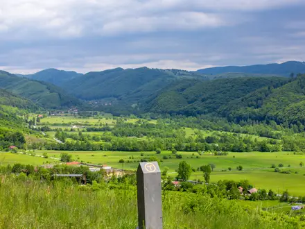
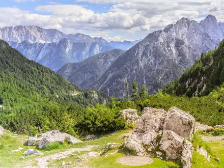
The Cetățile Ponorului Circuit is a short, hard karst loop in the Padiș area of Apuseni Natural Park, western Romania. The signed short variant is about 5.5 km from Cabana Cetățile Ponorului and takes roughly 2–3 hours, but the terrain is steep, exposed and technical. Expect forest, limestone scree, fixed steel cables, metal ladders and balcony viewpoints over three huge dolines. It suits sure-footed hikers who want a compact half-day route, not families with young children.
Route Overview
This is a loop from Cabana Cetățile Ponorului, reached by car via Boga or on foot from Glăvoi/Padiș. Follow the blue dot waymarking down through forest beside Valea Cetăților, including a cabled section on the left slope, to Doline I and the great cave portal. The route continues towards Doline III via metal stairs, then climbs out to the four suspended balcoane viewing platforms above Dolines II and III before returning to the cabana. Do not confuse this short circuit with the longer 12 km Padiș circuit, which also adds Poiana Ponor, the Ponor emergence and La Grajduri. For comparison, see the Bihor Peak Summit Trail or the Bucegi Plateau Circuit.
History of Cetățile Ponorului
Cetățile Ponorului was first documented in 1886 by Nagy Sándor. The suspended viewing balconies were laid out in the 19th century by Hungarian tourism pioneer Czárán Gyula, giving hikers a safer way to look into the dolines from above. The underground River Cetăților was explored to its final siphon by Cluj-based speleologists in the tradition of Emil Racoviță by 1957. The system has been surveyed to about -301 m.
Notable highlights
- Doline I cave portal (~70 m high, ~30 m wide): The huge entrance pierces the wall of the first doline and is cited as the tallest cave entrance in Romania.
- Doline I (~300 m deep, over 1,000 m across): A vast forested depression that feels like a natural amphitheatre as you descend into the karst.
- Doline II: A circular aven about 200 m deep and around 70 m in diameter, with two “windows” linking parts of the system.
- Doline III: A triangular sinkhole with sides of about 300 m and a vertical wall exceeding 200 m; it gives access to the active gallery.
- Balcoane viewing platforms: Four suspended wooden balconies sit above Dolines II and III, giving the best surface views without entering the cave.
- Râul Cetăților underground river: The River of the Fortresses runs through the cave system, forming waterfalls and rapids before surfacing briefly from the karst.
Challenges to expect
The difficulty comes from terrain, not distance. The descent is steep and can be slippery on scree, mud and forest path, especially after rain. Fixed steel cables, metal ladders and rock steps require balance and confidence with exposure. Summer is safest; spring and autumn need settled weather. Do not attempt it in winter, when cables and ladders can ice up and the river may be high.
HikeList Score
Cetățile Ponorului Circuit scored 70/100 on HikeList's trail-quality metrics.
See score breakdownHide breakdown
- Ideal length 55
- Balanced challenge 80
- Scenery & wildness 78
- Varied terrain 64
- Accommodation 67
- Food & support 52
- Path quality 98
- Season flexibility 89
Computed from length, challenge, scenery & wildness, terrain variety, accommodation, food & support, path quality and season flexibility.
 Romania
Show more data Show less
- Forest
- Karst
- Rocky
- Dirt
- Huts
- Campsites
- Wild Camping Spots
- Family Friendly
- Pet Friendly
- Restrooms
- Campsites
Photos from hikers
Taken on the trail by people who've reviewed Cetățile Ponorului Circuit.
Start and finish at Cabana Cetățile Ponorului. Descend through forest beside Valea Cetăților, use the cabled section, visit Doline I and the cave portal, continue via metal stairs towards Doline III, then climb to the four balcoane viewpoints above Dolines II and III before returning to the cabana.
Reviews
How would you rate Cetățile Ponorului Circuit?
Tap a star to start your review — you could be the first.