Ceiriog Valley Walk
How would you rate Ceiriog Valley Walk?
Tap a star to share your experience and help other hikers.
Ceiriog Valley Walk: A Quiet Berwyn Foothills Loop
HikeList Score
Ceiriog Valley Walk scored 86/100 on HikeList's trail-quality metrics.
See score breakdownHide breakdown
- Ideal length 55
- Balanced challenge 100
- Scenery & wildness 98
- Varied terrain 100
- Accommodation 83
- Food & support 88
- Path quality 84
- Season flexibility 89
Computed from length, challenge, scenery & wildness, terrain variety, accommodation, food & support, path quality and season flexibility.
The Ceiriog Valley Walk is a 22.5 km waymarked circular day walk from Llanarmon Dyffryn Ceiriog in north-east Wales. It explores Dyffryn Ceiriog in the foothills of the Berwyn range, using valley paths, lanes, bridleways, riverside sections and open moorland. With about 930 m of ascent, steep climbs and wet ground after rain, it is a moderate walk best suited to fit day hikers who want a quieter alternative to busier Welsh hill routes.
Route Overview
This page covers the circular upper-valley loop that starts and finishes at Llanarmon Dyffryn Ceiriog, not the separate linear Chirk-to-Llanarmon route with a similar name. The loop tours the upper Ceiriog Valley, passing Pandy, following and crossing the River Ceiriog, then climbing onto hill and moorland on the edge of the Berwyn range before returning to the village. Allow a full day. Public transport is limited in the upper valley; the wider valley is served by bus from Chirk, which has a railway station on the Shrewsbury–Chester line. For other Welsh routes, compare the waterfall-focused Aber Falls Walk, the coastal Anglesey Coastal Path, or the longer mountain traverse of the Beacons Way.
Ceiriog Valley history and heritage
Dyffryn Ceiriog is closely associated with the Welsh poet and folk-song collector John Ceiriog Hughes, born near Llanarmon Dyffryn Ceiriog. Slate quarrying shaped the valley economy, with the narrow-gauge Glyn Valley Tramway carrying slate and passengers between Chirk and Glyn Ceiriog from the 19th century. In 1923, a proposal to flood the valley for reservoirs was defeated in Parliament; David Lloyd George spoke against the scheme, helping ensure villages such as Tregeiriog, Llanarmon and Pentre survived.
Notable highlights
- River Ceiriog: The trout river that gives the valley its name. The loop follows and crosses it, with riverside walking and views along the water.
- Llanarmon Dyffryn Ceiriog: The start and finish village at the head of the valley. The Hand and the 15th-century West Arms make it the natural place to eat, drink or stay.
- Berwyn foothills and moorland: The route climbs from the valley onto open hill and moor on the edge of the Berwyn range. This is where most of the ascent and the wider valley views come.
- Ceiriog waterfalls: Upper-valley paths pass rushing waterfalls and steep wooded gorge scenery fed by streams running off the hills.
- Glyn Valley Tramway heritage: In the wider valley, old tramway and quarrying remains recall the narrow-gauge line that once served the slate industry between Chirk and Glyn Ceiriog.
Challenges to expect
Expect a long day rather than a casual valley stroll: the loop is about 22.5 km with roughly 930 m of ascent. Several climbs are steep, and moorland or riverside ground can be boggy, slippery or waterlogged after rain. Waymarking helps, but carry a map or GPS because paths, bridleways and lanes can be confusing in poor visibility. Facilities are concentrated in valley villages, especially Llanarmon Dyffryn Ceiriog.
HikeList Score
Ceiriog Valley Walk scored 86/100 on HikeList's trail-quality metrics.
See score breakdownHide breakdown
- Ideal length 55
- Balanced challenge 100
- Scenery & wildness 98
- Varied terrain 100
- Accommodation 83
- Food & support 88
- Path quality 84
- Season flexibility 89
Computed from length, challenge, scenery & wildness, terrain variety, accommodation, food & support, path quality and season flexibility.
 United Kingdom
 Wales
WalesShow more data Show less
- Valley
- Hills
- Moorland
- Forest
- Riverside
- Dirt
- Gravel
- Grass
- Paved
- Inns/Pubs
- Hotels
- B&Bs
- Family Friendly
- Pet Friendly
- Restrooms
- Water Sources
- Campsites
- Picnic Areas
Download Our Full Guide to Ceiriog Valley Walk FREE!
Get our comprehensive guide to this hike for free. Save it for later reading or print out at home.
Photos from hikers
Taken on the trail by people who've reviewed Ceiriog Valley Walk.
Ceiriog Valley Walk: The Complete Guide
 i
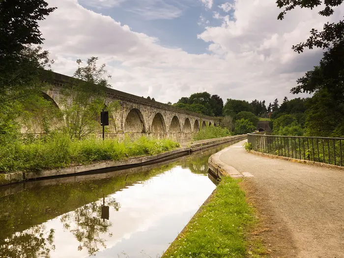
Image by David Pimborough
i
Image by David Pimborough The Ceiriog Valley Walk on this page is the waymarked Upper Ceiriog Trail: a full-day circular route from Llanarmon Dyffryn Ceiriog into the quiet upper Dyffryn Ceiriog. It suits fit walkers looking for a rugged Welsh hill-and-valley day rather than a busy summit objective.
The loop leaves the village past The Hand Hotel, works through meadows, lanes and woodland, then reaches Pandy and the River Ceiriog. From there it climbs towards rougher Berwyn-edge ground, using old bridleways, a packhorse route and the ancient hill road of Sarn Sws.
The rewards are broad valley views, riverside sections, remote moorland and small historical details: Pandy Mill Gallery, Pen-y-Bryn Farm and the high watershed near Cefn-hir-fynydd. Llanarmon Dyffryn Ceiriog makes the natural base, with its two old coaching inns at the start and finish.
Do not treat this as an easy valley stroll. At about 22.5 km with several steep climbs, exposed moorland, boggy ground after rain and limited phone signal higher up, it needs proper footwear, hill-day clothing, food, water and reliable navigation.
This guide covers the route stages, day planning, accommodation, food, transport, terrain and the common mistakes to avoid.
Stage-by-Stage Guide
Stage 1: Llanarmon Dyffryn Ceiriog to Llanarmon Dyffryn Ceiriog via Pandy, Sarn Sws and Pen-y-Bryn
This is a full circular hill day from Llanarmon Dyffryn Ceiriog, normally tackled anti-clockwise from the village past The Hand Hotel. Although it begins and ends in a settled valley, the middle of the route is much wilder: expect steep climbs, open Berwyn-edge moorland, rough bridleways and stretches where the waymarking must be backed up with map or GPS navigation.
The first part leaves Llanarmon DC and works out through the upper Ceiriog Valley towards Cefn-y-braich-uchaf and Pandy. Lower down, the walking mixes lanes, tracks, meadows and wooded valley ground, with the River Ceiriog / Afon Ceiriog close by in places. Near Pandy the route crosses the River Ceiriog by bridge and passes the Pandy Mill Gallery area, where the building has long associations with the valley’s woollen and fulling-mill history.
From the Pandy side the route becomes more committing as it climbs away from the valley. The Upper Ceiriog Trail follows old hill routes, including an ancient packhorse route across the Berwyns and the old road of Sarn Sws, also known as “The Kissing Way”. This is where most walkers will feel the character of the route change from valley ramble to exposed hill walking.
Underfoot, expect a mixed surface: tarmac lanes and minor roads, grassy and stony tracks, bridleways, a conifer-plantation climb, and moorland paths that can be rutted, wet or slippery. After rain, riverside ground and the higher moor can hold water, so waterproof footwear is strongly preferable. The higher western and southern parts of the loop reach roughly 460–479 m, with broad views across the enclosing hills of the upper valley and towards the Cefn-hir-fynydd watershed between the Ceiriog and Tanat catchments.
The moorland section is one of the main rewards of the day, but also the section that needs the most care. The route is waymarked at junctions with the Upper Ceiriog Trail stirrup symbol on named/orange arrows, with blue bridleway waymarkers and reflector posts on the moorland, but paths, lanes and bridleways can still be confusing in poor visibility. Carry OS mapping and/or a reliable GPS route rather than depending on posts alone, especially on the higher ground where phone signal can be poor.
Beyond the open ground the route returns towards the valley via Saron, Pen yr Allt and Pen-y-Bryn. Pen-y-Bryn Farm is notable as the birthplace of John Ceiriog Hughes, the 19th-century Welsh poet and folk-song collector. The final approach brings the walk back down into Llanarmon Dyffryn Ceiriog, returning over a bridge into the village.
Food and water should be planned as for a self-sufficient day walk. Llanarmon DC is the natural place to eat, drink or stay, with The Hand Hotel and the West Arms in the village, but there should be no assumption of reliable refreshments once out on the loop. Carry enough water and food for 6–8 hours, particularly in warm weather or if the ground is slow.
Accommodation is concentrated back at Llanarmon Dyffryn Ceiriog, where the two historic inns, B&Bs and nearby farm or guesthouse accommodation make the village the most practical base. Glyn Ceiriog, further down the valley, has additional services and accommodation options, but it is not the start or finish of this circular loop. Booking ahead is sensible, especially if relying on food at the end of the walk.
Public transport is limited in the upper valley. The nearest railway station is Chirk, on the Shrewsbury–Chester line, and Tanat Valley Coaches service 64 links Chirk, Glyn Ceiriog and Llanarmon DC from Monday to Saturday, excluding Bank Holidays except Good Friday. Times are infrequent and should be checked before travelling; many walkers will find driving simpler. Parking is available in Llanarmon DC and at other “park and start” points on the loop, but current availability should be checked before travelling.
The main warnings are exposure, wet ground, livestock and navigation. The route crosses working farmland and hill pasture, so dogs should be kept under close control and on leads near livestock, with particular care during lambing in March and April. The moorland offers little shelter in poor weather, and the combination of steep climbs, rutted bridleways and boggy patches makes this a tougher day than the valley setting may suggest.
Recommended Itinerary
Standard itinerary: one-day circular walk
The Ceiriog Valley Walk covered here is best planned as a single full-day circuit from Llanarmon Dyffryn Ceiriog. Although the distance is modest for a long day walk, the rough moorland, steep climbs and potentially wet ground make it a genuine 6–8 hour hill day for most walkers.
| Day | From | To | Approx. distance | Why this stage makes sense | Services/accommodation notes |
|---|---|---|---|---|---|
| 1 | Llanarmon Dyffryn Ceiriog | Llanarmon Dyffryn Ceiriog, via Cefn-y-braich-uchaf, Pandy, Saron, Pen yr Allt, Pen-y-Bryn and the Sarn Sws moorland | 22.5 km / 14 miles | This is the complete waymarked Upper Ceiriog Trail loop, normally walked anti-clockwise out of the village past The Hand Hotel. It keeps the logistics simple, returns to the start without needing a pick-up, and gives enough daylight for the river, valley, old packhorse route and higher Berwyn-edge moorland sections. | Llanarmon Dyffryn Ceiriog is the natural base, with The Hand Hotel, the West Arms, B&Bs and nearby farm/guesthouse accommodation. Carry food and water for the day; mid-route facilities should not be relied on. Glyn Ceiriog further down the valley has further hotels and shops, but it is not on the main loop. |
Slower and faster options
There is no obvious village-to-village stage split on this circular route, so most walkers should not try to turn it into a multi-day walk unless arranging private transport or accommodation away from the loop. If using any of the advertised “park and start” points along the route, check the official mapping before booking or committing to a shortened day.
| Option | Who it suits | Practical notes |
|---|---|---|
| Slower / more comfortable | Walkers using public transport, anyone wanting a relaxed start, or those unsure about the climbs and boggy ground | Stay in or near Llanarmon Dyffryn Ceiriog the night before, start early, and consider staying again after the walk. This avoids relying on a same-day bus connection in the upper valley after a long hill day. |
| Standard | Fit day walkers comfortable with 22.5 km, around 750–930 m of ascent, open moorland and mixed navigation | Complete the full loop in one day from Llanarmon Dyffryn Ceiriog. This is the most straightforward and sensible itinerary. |
| Faster | Strong walkers moving efficiently in good conditions | The route can be walked more quickly than 6–8 hours by fit parties, but it should still be treated as a full hill day rather than a short valley ramble. Poor visibility, wet moorland and rutted tracks can slow progress considerably. |
Planning the Route
How many days to allow
Plan the Ceiriog Valley Walk as a single full hill day, not as a multi-day trail. The loop starts and finishes in Llanarmon Dyffryn Ceiriog, so there is no natural stage break or need to move accommodation each night.
Most fit walkers should allow a full day on foot, especially in wet conditions or poor visibility. The route is waymarked, but the combination of steep climbs, rutted tracks, boggy moorland and riverside ground makes it better treated as a steady 6–8 hour outing rather than a fast valley walk.
Starting early is sensible. This gives enough margin for slower going on the open Berwyn-edge sections, navigation pauses at bridleway and lane junctions, and a relaxed return into Llanarmon DC before evening transport or pub meal arrangements.
Fast or slow?
This is a route to walk steadily rather than rush. The harder work is not just the distance, but the repeated climbing out of the valley and the slower ground on the higher moorland.
In dry summer conditions, strong walkers may move efficiently, but after rain the route can feel much slower. Boggy sections, slippery riverside paths and deeply rutted tracks all add time, particularly where the route crosses open ground above the valley.
The waymarking helps at junctions, but it is still worth pausing to check the line regularly. The Upper Ceiriog Trail uses stirrup-symbol markers, named/orange arrows, blue bridleway waymarks and reflector posts on the moorland; missing one can lead to an unnecessary detour on lanes, bridleways or farm tracks.
Stages and accommodation planning
There are no practical daily stages to plan on this loop. Accommodation is best treated as a base in or near the valley, with Llanarmon Dyffryn Ceiriog the most convenient start-and-finish location.
Llanarmon DC has two historic coaching inns, The Hand Hotel and the West Arms, plus B&Bs and nearby farm or guesthouse accommodation. Glyn Ceiriog, further down the valley, has additional hotels and shops, but it is not the start of this loop.
Because this is a day walk, accommodation planning is mostly about securing a bed before and after the walk if travelling from outside the area. Confirm current availability and prices before booking, especially at weekends and in the main walking season.
Shortening, extending and section hiking
The route is not naturally designed to be split into stages. It is a circular Upper Ceiriog Trail loop, and most walkers will get the best experience by completing it in one outing from Llanarmon DC.
There are parking and “park and start” points along the loop, so starting somewhere other than Llanarmon DC may be possible. This is more useful for local walkers than for visitors relying on public transport, and current parking arrangements should be checked before travelling.
Shortening the walk is possible only with careful map planning. The route crosses lanes and bridleways, but there is no single obvious official short version, and cutting across the valley may remove the waymarked logic of the walk.
Extending the day should be approached carefully. Several routes in the Ceiriog Valley have similar names, including the separate linear Chirk-to-Llanarmon route and the longer Ceiriog Trail / Llwybr Ceiriog. Make sure any extension is planned from the correct Upper Ceiriog Trail map rather than mixing routes by name.
Section hiking is therefore only moderately practical. Limited public transport in the upper valley, few on-route services and the circular format all make it simpler to walk the whole loop in one day from a fixed base.
Transport planning
Transport is one of the main planning constraints. There is no railway in the valley itself; the nearest station is Chirk, on the Shrewsbury–Chester line.
Tanat Valley Coaches service 64 links Llangollen, Froncysyllte, Chirk railway station, Pontfadog, Dolywern, Glyn Ceiriog and Llanarmon DC. It runs Monday–Saturday, not Bank Holidays except Good Friday, but it is infrequent, so current bus and train times should be checked before travelling.
Many walkers will find driving simpler. Parking is available in Llanarmon DC and at other park-and-start points on the loop, but current parking availability should be checked before setting off.
If relying on the bus, build the walk around the last realistic return service rather than the first convenient arrival. The high ground has poor phone signal, so do not assume it will be easy to rearrange transport from the moorland.
Food and water
Carry a full day’s food from the start. The route passes farms, hamlets and Pandy, but it should not be planned around on-route resupply.
Llanarmon DC is the natural place for food and drink before or after the walk, with Glyn Ceiriog offering further valley services if staying or travelling through there. Opening times should be checked before relying on any pub, shop or café-style stop.
Carry enough drinking water for the whole day. The River Ceiriog and upland streams are part of the landscape, but they should not be treated as dependable drinking-water sources without appropriate treatment.
Navigation and maps
Take a proper map and/or GPS track even though the route is waymarked. The loop uses a mix of lanes, minor roads, bridleways, tracks, old packhorse routes, plantation edges and open moorland, and junctions can be confusing in poor visibility.
Useful mapping includes OS Landranger 125 and 126, and OS Explorer 255. The exact sheet coverage for any planned variation should be checked before travelling.
The route is commonly walked anti-clockwise from Llanarmon DC, leaving the village past The Hand Hotel, then passing Cefn-y-braich-uchaf, Pandy, Saron, Pen yr Allt and Pen-y-Bryn before returning over a bridge into Llanarmon DC. Keep the route identity clear: this page’s walk is the Upper Ceiriog Trail loop, not the separate linear Ceiriog Valley Walk from Chirk.
Weather, ground conditions and timing
The best planning window is late spring to early autumn, when daylight is longer and the moorland is more likely to be firm. Even then, the upper valley and Berwyn foothills can be wet underfoot, exposed and windy.
After rain, expect slower progress on boggy moorland, rutted vehicle tracks and slippery riverside sections. Waterproof footwear, spare layers and a realistic pace matter more here than lightweight road-walking assumptions.
Take extra care during lambing time in March and April, and keep dogs on leads near livestock. Any access, forestry or local diversion notices should be checked before travelling.
Towns, Villages and Overnight Stops
This is a one-day circular hill walk, so it does not naturally break into overnight stages. Most walkers either stay in Llanarmon Dyffryn Ceiriog before or after the walk, or base themselves lower down the Ceiriog Valley and travel to the start.
Accommodation and food are concentrated in the valley villages. Once the route leaves Llanarmon Dyffryn Ceiriog, treat the loop as a self-contained hill day with no reliable resupply until returning to the village.
Llanarmon Dyffryn Ceiriog
Llanarmon Dyffryn Ceiriog, often shortened to Llanarmon DC, is the start and finish of the Upper Ceiriog Trail loop. The route normally leaves the village past The Hand Hotel and returns over a bridge into the village.
This is the best overnight base for the walk. The village has two historic coaching inns, The Hand Hotel and the West Arms, plus B&Bs and nearby farm or guesthouse accommodation. The West Arms dates back to the 15th century.
Llanarmon DC is also the most practical place for a pre-walk meal, post-walk drink or overnight stop, because the rest of the route is rural and exposed. Accommodation should be booked ahead, especially if travelling without a car or walking at weekends or holiday periods.
Public transport is limited but possible with planning. Tanat Valley Coaches service 64 links Llanarmon DC with Glyn Ceiriog, Chirk railway station and Llangollen on Monday–Saturday, excluding Bank Holidays except Good Friday. Times are infrequent, so current bus times should be checked before travelling.
There is parking in Llanarmon DC, and the village is the simplest start point if driving. Parking availability and any local restrictions should be checked before relying on a specific place to leave a vehicle.
Useful local note: St Garmon’s church in the village has a preaching mound and old yew trees, but for walkers the main practical value of Llanarmon DC is its accommodation, food and direct access to the loop.
Cefn-y-braich-uchaf
Cefn-y-braich-uchaf is a farm passed on the early part of the route after leaving Llanarmon Dyffryn Ceiriog. It is a route landmark rather than a village stop.
Do not plan on accommodation, food, shops or public transport here. Carry everything needed for the day before leaving Llanarmon DC.
As with the rest of the valley farmland, expect livestock and keep dogs under close control. Take particular care during lambing time in March and April.
Pandy
Pandy is the main hamlet reached on the loop away from Llanarmon Dyffryn Ceiriog. The route passes near Pandy Mill Gallery and crosses the River Ceiriog by bridge in this part of the valley.
Pandy is useful as a navigation and rest point, especially before or after the riverside and climbing sections, but it should not be treated as a guaranteed resupply stop. No reliable walker services are specified here, so food, water and wet-weather gear should already be carried.
The Pandy Mill Gallery building, formerly The Woolpack Inn, is a notable local landmark. The route also crosses a short old tramway/permissive bridleway near Pandy, but the wider Glyn Valley Tramway heritage belongs mainly to the lower valley rather than this upper loop.
Saron
Saron is passed on the route around the upper Ceiriog Valley, with Saron Presbyterian church marking the locality. For walkers, it is best treated as a waypoint rather than a practical stop.
There are no specified accommodation, food, shop or public transport facilities for walkers at Saron on this route. Continue to plan the day around Llanarmon Dyffryn Ceiriog as the main service point.
This part of the walk sits within the more rural middle section of the loop, where lanes, tracks and bridleways can be confusing in poor visibility. Keep the map or GPS available rather than relying only on waymarks.
Pen yr Allt
Pen yr Allt is another rural point on the loop rather than a settlement with walker services. It sits on the route between the valley and the higher, more open ground.
Do not expect accommodation, food, shops or transport links here. It is a place to pass through, not an overnight or resupply option.
The practical consideration around this part of the route is navigation and underfoot condition. Tracks and bridleways may be rutted, wet or slippery after rain, and the higher ground beyond is more exposed.
Pen-y-Bryn
Pen-y-Bryn is a farm near the moorland edge and is notable as the birthplace of the Welsh poet and folk-song collector John Ceiriog Hughes, born in 1832. The route returns towards Llanarmon Dyffryn Ceiriog past this area.
It is not a practical overnight stop unless separate farm or guesthouse accommodation has been arranged in advance nearby. Do not rely on finding food, shops or transport at Pen-y-Bryn itself.
For walkers, Pen-y-Bryn is mainly a landmark on the final part of the circuit, when the route is returning from the higher Berwyn-edge ground towards the head of the valley.
Glyn Ceiriog
Glyn Ceiriog is not on the Upper Ceiriog Trail loop, but it is the most useful nearby village lower down the Ceiriog Valley. It has further hotels and shops, making it a practical alternative base if accommodation in Llanarmon Dyffryn Ceiriog is full or if public transport timings work better.
The Tanat Valley Coaches 64 bus links Glyn Ceiriog with Llanarmon DC, Chirk railway station and Llangollen. Because the service is infrequent, do not assume an easy same-day connection without checking current times.
Staying in Glyn Ceiriog can work for walkers who are comfortable arranging the short valley transfer to and from Llanarmon DC. For the smoothest logistics, Llanarmon DC remains the more convenient base because the loop starts and finishes there.
Getting to the Start
The Ceiriog Valley Walk covered here starts and finishes in Llanarmon Dyffryn Ceiriog, usually shortened to Llanarmon DC, at the head of the upper Ceiriog Valley. The route leaves the village past The Hand Hotel, so overnighting or parking in Llanarmon DC is the simplest arrangement if you want an early start.
Public transport reaches the valley, but it is limited. Anyone relying on trains and buses should check the day’s connections carefully before committing to the walk, especially for a full-day hill route with little margin for missed services.
By train
The nearest railway station is Chirk, on the Shrewsbury–Chester line. From there, the onward journey into the Ceiriog Valley is by bus or pre-booked taxi.
Chirk is the practical railhead for walkers coming from the wider rail network via Shrewsbury or Chester. There is no railway in the Ceiriog Valley itself, and Llanarmon DC is some way up the valley beyond Glyn Ceiriog, so the train is only the first part of the journey.
If using rail for a same-day start, allow generous time for the bus or taxi connection from Chirk to Llanarmon DC. Current Chirk train times should be checked before travelling.
By bus
Tanat Valley Coaches service 64 links Llangollen, Froncysyllte, Chirk railway station, Pontfadog, Dolywern, Glyn Ceiriog and Llanarmon DC. This is the key public-transport link for the upper valley.
The service runs Monday–Saturday, not on Bank Holidays except Good Friday, and is infrequent. This should be checked before travelling. For a 6–8 hour hill day, the last return bus is a critical planning point; missing it may leave a long wait or require a pre-arranged taxi.
For most walkers using public transport, the simplest plan is:
| Step | Practical option |
|---|---|
| 1 | Train to Chirk station |
| 2 | Tanat Valley Coaches 64 towards Glyn Ceiriog and Llanarmon DC |
| 3 | Start the loop from Llanarmon Dyffryn Ceiriog |
A taxi from Chirk or the Llangollen area may be a useful fallback, but it should be booked in advance rather than assumed on arrival. Mobile reception can be poor on the higher sections of the route, so do not rely on arranging onward transport from the moorland or late in the day.
By car
Driving is the most flexible way to reach Llanarmon DC, and many walkers use a car because public transport in the upper valley is limited. The village lies at the head of the Ceiriog Valley, south of Glyn Ceiriog and near Chirk and Llangollen.
There is parking in Llanarmon DC, and there are other “park and start” points along the loop. Exact availability, any restrictions and suitability for a full-day stay should be checked before travelling, particularly at busy times or if leaving a vehicle for most of the day.
Because this is a circular walk, there is no end-to-start transfer to organise if parking in Llanarmon DC. Starting from another park-and-start point is possible, but it changes the order of the day and may affect where the steep climbs fall.
From the nearest airport
No airport connection is needed for most walkers, as this is primarily a regional day walk reached by car or by rail to Chirk followed by bus or taxi. If flying in, the practical onward plan is to reach the Shrewsbury–Chester rail line, travel to Chirk, then continue into the valley by bus or pre-booked taxi.
Airport-to-trail public transport will involve multiple connections and should not be left to chance. This should be checked before travelling.
Where to stay before starting
Llanarmon Dyffryn Ceiriog is the most convenient place to stay before the walk, as the loop starts and finishes in the village. The village has two historic coaching inns, The Hand Hotel and the West Arms, plus B&Bs and nearby farm or guesthouse accommodation.
Glyn Ceiriog, further down the valley, has additional accommodation and shops, but staying there means arranging transport up to Llanarmon DC for the start. This is manageable by bus on operating days or by taxi, but timings should be checked before booking.
For an early start, staying in Llanarmon DC removes the main transport risk. That is particularly useful in poor weather, during shorter daylight months, or if walking at the slower end of the 6–8 hour estimate.
Getting Home from the Finish
This is a circular walk, so the finish is back in Llanarmon Dyffryn Ceiriog (Llanarmon DC), the same small upper-valley village where the route starts. That makes the end logistics simple if a car is parked in the village, but public transport remains limited and should be planned before setting out.
By train
There is no railway station in Llanarmon Dyffryn Ceiriog or elsewhere in the upper Ceiriog Valley. The nearest station is Chirk, on the Shrewsbury–Chester line.
To leave by train, walkers need to get from Llanarmon DC to Chirk station first, either by the Tanat Valley Coaches 64 bus when times work, or by a pre-arranged taxi. Chirk gives rail connections towards Shrewsbury and Chester, with onward links to larger parts of the UK rail network.
Do not assume an easy same-day train connection after the walk. The loop is a full hill day, and a late finish can easily miss the last practical bus or make onward travel awkward. Current train and bus times should be checked before travelling.
By bus
Tanat Valley Coaches service 64 links Llanarmon DC with Glyn Ceiriog, Chirk railway station and Llangollen, via villages including Pontfadog and Dolywern. It runs Monday–Saturday, not Bank Holidays except Good Friday, and is infrequent.
This service is the key public-transport option for getting out of the upper valley after the walk. It is useful if timed carefully, but it is not a turn-up-and-go service, especially after a long day on the hill.
If relying on the bus, build the day around the timetable rather than hoping to catch one after finishing. Allow a buffer for slow going on boggy moorland, navigation delays, poor weather and the final descent back into Llanarmon DC. Current 64 bus times should be checked before travelling.
By car/taxi
Driving is the simplest way to leave the finish because the route returns to Llanarmon DC. There is parking in Llanarmon DC and at other “park and start” points along the loop, but current parking availability should be checked before travelling.
If returning by taxi, arrange it in advance rather than trying to book from the finish. Phone signal can be poor on the higher ground, and Llanarmon DC is a small village in a rural valley, so availability late in the day cannot be assumed.
For groups, a practical option is to base transport in Llanarmon DC, walk the loop, then leave directly after eating or changing. If the weather is poor or the ground is slow, having a car at the finish avoids pressure to rush for the final bus.
From the nearest airport
No airport serves the Ceiriog Valley directly. Anyone flying in will still need onward rail, bus or taxi travel to reach the valley, with Chirk the nearest railway station and the 64 bus providing the onward link to Llanarmon DC when the timetable works.
Airport choice, train connections and final taxi or bus arrangements are timetable-dependent and should be checked before travelling. For this route, the important planning point is not the airport itself but the last leg into and out of the upper valley, where public transport is limited.
Where to stay at the finish
Staying in Llanarmon Dyffryn Ceiriog is often the most convenient option, especially if using public transport or if the walk may finish late. The village has two historic coaching inns, The Hand Hotel and the West Arms, plus B&Bs and nearby farm or guesthouse accommodation.
Glyn Ceiriog, further down the valley, has additional hotels and shops. It can work as a base if transport to and from Llanarmon DC is arranged, but the walk itself starts and finishes in Llanarmon DC.
An overnight stay at the finish removes the need to match a 6–8 hour hill day to an infrequent bus timetable. Accommodation in the valley should be booked ahead, particularly at weekends and during the main walking season.
Which Direction Should You Walk?
The Ceiriog Valley Walk covered here is a circular loop, so transport, accommodation and end-of-day logistics are essentially the same whichever way you walk it. The usual and most practical direction is anti-clockwise from Llanarmon Dyffryn Ceiriog, leaving the village past The Hand Hotel and looping via Cefn-y-braich-uchaf, Pandy, Saron, Pen yr Allt and Pen-y-Bryn before returning to Llanarmon DC.
Anti-clockwise: the standard choice
Anti-clockwise is the direction that best matches the established Upper Ceiriog Trail description and the normal flow of the waymarked route. It takes you out of Llanarmon DC, down towards Pandy and the River Ceiriog, then onto the higher Berwyn-edge ground by the old packhorse route and Sarn Sws before the return towards Pen-y-Bryn and the village.
This gives a sensible progression for a full hill day: lower valley walking early on, the main exposed moorland and ridge sections once you are warmed up, then the psychological pull of returning to Llanarmon DC at the end. It also keeps the route’s named sequence of farms, hamlets and historic points in the expected order, which makes cross-checking against route notes, map names and waymarks easier.
The climbs are still substantial in this direction. The route is not made “easy” by walking it anti-clockwise, but the standard line avoids adding unnecessary navigational friction on a route where lanes, bridleways and moorland tracks can already be confusing in poor visibility.
Clockwise: possible, but less natural
Walking clockwise is perfectly possible as a circular walk, provided you are confident with map or GPS navigation and do not rely solely on following the described order of landmarks. It reverses the normal sequence, taking you towards the Pen-y-Bryn side first and leaving Pandy and the lower Ceiriog valley for later in the day.
The practical drawbacks are mainly navigational rather than logistical. Waymarks at junctions should still help, but most walkers will find the route easier to follow in the standard anti-clockwise direction because it matches the usual route description and the expected order of places.
Clockwise may appeal if the forecast makes it useful to tackle a particular exposed section earlier or later in the day. The higher moorland remains exposed whichever way you walk, and there is no reliable direction choice that avoids bad weather; start time, visibility and carrying proper navigation matter more.
| Direction | Best for | Main trade-off |
|---|---|---|
| Anti-clockwise | Following the established route, easier landmark order, natural valley-to-moorland progression | Still involves steep climbs and exposed ground |
| Clockwise | Confident walkers with a reason to reverse the day’s timing | Less intuitive against standard route descriptions |
Transport and accommodation
Direction does not affect public transport planning. Llanarmon Dyffryn Ceiriog is both the start and finish, with the Tanat Valley Coaches 64 bus linking the village with Glyn Ceiriog, Chirk railway station and Llangollen on its operating days. Current bus times should be checked before travelling, especially because services are limited.
Accommodation flow is also unchanged. Most walkers stay in or near Llanarmon DC, where the two historic inns make the village the natural base before and after the walk. There is no advantage in reversing the loop for overnight logistics.
Recommendation
Walk the Ceiriog Valley Walk anti-clockwise from Llanarmon Dyffryn Ceiriog. It is the traditional and most straightforward direction, fits the way the Upper Ceiriog Trail is normally described, gives a clear progression from village and river valley to open moorland, and makes the final return to Llanarmon DC feel logical at the end of a long hill day.
Accommodation Along the Route
The Ceiriog Valley Walk covered here is a one-day circular loop, so accommodation planning is mainly about choosing a base rather than arranging a point-to-point itinerary. Llanarmon Dyffryn Ceiriog is the natural overnight stop because the route starts and finishes in the village, leaving past The Hand Hotel and returning over the bridge into the village.
Accommodation is concentrated in the valley villages, not out on the moorland sections. Once the route has climbed above the upper Ceiriog Valley onto the Berwyn-edge tracks and open ground, there are no practical overnight stops on the trail, and walkers should treat the loop as a full hill day with all food, water and bad-weather kit carried from the start.
| Place | Accommodation level | Best for | Notes |
|---|---|---|---|
| Llanarmon Dyffryn Ceiriog | Good | Best base for the whole loop | Start/finish village with two historic coaching inns, The Hand Hotel and the 15th-century West Arms, plus B&Bs and nearby farm/guesthouse accommodation. Book ahead, especially for weekends and busier walking periods. |
| Glyn Ceiriog | Limited to good | Staying lower down the valley if Llanarmon DC is full | Further hotels and shops are available down the valley. It is not on the loop itself, so walkers need to plan the approach to Llanarmon DC by car, bus or taxi. Current transport options should be checked before travelling. |
| Pandy | Limited / not a reliable overnight stop | Passing point only | The route passes Pandy and Pandy Mill Gallery, but it should not be treated as a dependable overnight stop for this loop unless accommodation has been arranged in advance nearby. |
| Higher moorland, Sarn Sws and Pen-y-Bryn area | None | No overnight use | Exposed hill and moorland terrain with farms and tracks rather than walker accommodation. There are no services to rely on during the high-level part of the route. |
Best place to stay
For most walkers, Llanarmon Dyffryn Ceiriog is by far the most practical base. Staying in the village avoids an early transfer into the upper valley, gives direct access to the waymarked loop, and makes it easy to eat and rest immediately after the walk.
The two village inns are also useful because the route passes through the settlement at both the start and finish. Check current room availability, meal times and any closure days before booking, as small rural inns can change opening arrangements outside peak periods.
Booking ahead
Advance booking is strongly advised. The upper Ceiriog Valley is small, accommodation is not spread evenly along the route, and options become limited quickly if the village inns and local B&Bs are full.
Weekends, public-holiday periods and good-weather spells in spring, summer and autumn are the times most likely to create pressure. Lambing season in March and April can also affect how walkers plan the trip, particularly those bringing dogs, although this is more an access and livestock-management issue than an accommodation issue.
Using Glyn Ceiriog as a base
Glyn Ceiriog can work if accommodation in Llanarmon Dyffryn Ceiriog is unavailable, or if walkers want access to additional valley services. It is further down the valley rather than on the circular loop, so the day needs an extra transfer to and from the start.
The Tanat Valley Coaches 64 bus links Chirk, Glyn Ceiriog and Llanarmon DC on limited days and times, but it is infrequent and should not be assumed to fit a full hill-day schedule. Current bus times, taxi availability and any return arrangements should be checked before travelling.
Inn-to-inn and luggage transfers
This route is not well suited to inn-to-inn walking. It is a single circular day walk rather than a linear trail with logical overnight stages, and there are no meaningful accommodation gaps to solve along the high-level sections.
Luggage transfer is therefore unnecessary for the loop itself. If staying away from Llanarmon Dyffryn Ceiriog, a taxi or bus transfer may be useful for reaching the start, but availability in the upper valley is limited and should be arranged in advance.
Camping and Wild Camping
Does this route suit camping?
The Ceiriog Valley Walk / Upper Ceiriog Trail is best planned as a single-day hill walk, not as a camping route. At about 22.5 km with steep climbs, exposed moorland and boggy ground, most walkers will get more value from walking light and staying before or after the route in Llanarmon Dyffryn Ceiriog or elsewhere in the valley.
There is no obvious need to split the loop overnight. The higher ground is exposed, often wet underfoot and has poor phone signal, while the lower valley sections pass through working farmland, riverside ground and small settlements where camping would need permission.
Campsites and formal camping
No named campsite is available to recommend directly on the loop. Anyone wanting to camp nearby should check current options around Llanarmon Dyffryn Ceiriog, Glyn Ceiriog and the wider valley before travelling.
Llanarmon Dyffryn Ceiriog is better set up for inns, B&Bs and guesthouse-style accommodation than for route-side camping. If using public transport, remember that the Tanat Valley Coaches 64 bus is limited and should not be treated as a flexible late-evening fallback; current times should be checked before travelling.
Wild camping legality and permission
Wild camping in Wales is generally not a legal right without the landowner’s permission. That matters on this route because the loop uses bridleways, lanes, farmland, forestry/plantation tracks, riverside paths and open moorland rather than land where camping is automatically permitted.
Do not assume that open-looking moorland above the Ceiriog Valley is available for overnight pitching. If a discreet overnight camp is genuinely needed, permission should be obtained from the relevant landowner or occupier in advance. Where ownership or access rules are unclear, this should be checked locally before travelling.
Where not to camp
Avoid pitching in meadows, on field edges, near farm buildings, beside gates, on bridleways or on the old packhorse route and Sarn Sws where riders, cyclists, walkers and farm traffic may pass. The route is a multi-user trail, so keeping the line clear is important.
The River Ceiriog and the lower riverside ground near Pandy are not suitable places to assume a camping right. These areas can be damp, slippery or waterlogged after rain, and are likely to be part of working valley land.
The high moorland sections are also poor camping ground in practical terms: exposed to wind, potentially boggy, harder to navigate in poor visibility and with little or no phone signal. In March and April, take extra care around lambing and keep dogs on leads near livestock.
Water, fires and waste
The route has the River Ceiriog and smaller wet areas, but water should not be relied on as clean drinking water. Any water taken from streams or the river should be treated, and livestock or farmland runoff is a real consideration in the valley.
Do not light fires. Use a stove only where it is safe and permitted, keep it off dry vegetation, and avoid any impact on moorland, woodland or farm margins.
Follow strict Leave No Trace practice: arrive late and leave early only where permission has been granted, pack out all litter, bury nothing that animals may dig up, and carry out toilet paper and hygiene waste. The safest and simplest plan for this route is to camp legally elsewhere in the valley area, then complete the loop as a full day walk from Llanarmon Dyffryn Ceiriog.
Food, Water and Resupply
This is a one-day hill loop, not a route with regular resupply. Plan to leave Llanarmon Dyffryn Ceiriog with all food needed for the day and enough water to cover the exposed moorland sections, where there are no reliable facilities.
The easiest place to eat or drink on the route is Llanarmon Dyffryn Ceiriog itself, where The Hand Hotel and the West Arms are the natural start/finish options. Opening times, meal service and Sunday arrangements can vary in small rural villages, so check before relying on either for breakfast, lunch or a post-walk meal.
Glyn Ceiriog, further down the valley, has additional hotels and shops and can be useful before or after the walk if travelling by car or using the Tanat Valley Coaches 64 bus. It is not on the loop, so it should not be treated as an on-walk resupply point.
Food planning
Carry a full packed lunch plus snacks. The route is around 22.5 km with substantial ascent and boggy or rutted ground in places, so progress can be slower than the distance suggests.
There are no dependable shops, cafés or pubs listed on the loop after leaving Llanarmon Dyffryn Ceiriog. Pandy, Saron, Pen yr Allt and Pen-y-Bryn are route points rather than resupply stops for walkers.
For most walkers, practical food to carry is:
- a packed lunch that can be eaten on the hill;
- quick-access snacks for the climbs and moorland sections;
- an emergency food reserve in case poor ground, navigation or weather slows the day;
- anything needed for dietary requirements, as choice in the upper valley may be limited.
Water planning
Start with enough water for a full 6–8 hour hill day. For most walkers, around 1.5–2.5 litres is a sensible range, with more in warm weather and less only if reliable refills have been arranged.
The loop follows and crosses the River Ceiriog / Afon Ceiriog near Pandy and there are streams and wet ground in the wider valley and moorland. Natural water should not be treated as automatically drinkable: this is agricultural and moorland country with livestock, boggy ground and runoff after rain. If using river or stream water, filter or treat it first.
Do not depend on phone signal to solve a water or food problem on the high ground. Reception can be poor on the exposed moorland, so carry what is needed from the start.
| Section | Food availability | Water availability | Notes |
|---|---|---|---|
| Llanarmon Dyffryn Ceiriog start | Best on-route options: The Hand Hotel and the West Arms, subject to opening and meal times | Ask locally if using an inn or accommodation; otherwise start with full bottles | Check rural opening times, especially Sundays and Bank Holiday periods |
| Llanarmon Dyffryn Ceiriog to Pandy | No dependable resupply once out of the village | Natural water may be present in the valley, but should be filtered or treated | Eat and fill up before leaving; the route soon becomes a proper hill day |
| Pandy and River Ceiriog crossing | No reliable walker food stop to plan around | River Ceiriog is crossed by bridge; river water should be filtered or treated if used | Pandy is a route landmark, not a guaranteed resupply point |
| Pandy to Saron, Pen yr Allt and the moorland | No food availability on the hill sections | Streams or wet ground may be encountered, but there are no serviced refill points | This is the key section for carrying sufficient water and snacks |
| Sarn Sws / high moorland to Pen-y-Bryn | No resupply | Natural water is unreliable and should be treated | Exposed ground, slow going after rain and poor signal make self-sufficiency important |
| Return to Llanarmon Dyffryn Ceiriog | Food and drink available only when village businesses are open | Refill options depend on open businesses or accommodation | Do not assume late food service without checking in advance |
Practical resupply advice
Buy lunch supplies before reaching the upper valley if arriving late, early or on a Sunday. Llanarmon Dyffryn Ceiriog is small, and the briefed dependable food options are inns rather than a full range of shops.
If travelling by public transport, factor food shopping into the journey before taking the infrequent valley bus. Current bus times and village opening hours should be checked before travelling.
Terrain, Conditions and Difficulty in Practice
Underfoot terrain
The Ceiriog Valley Walk is not a technically difficult mountain route, but it is far more varied underfoot than a simple valley path. Expect a changing mix of tarmac lanes, minor roads, grassy and stony tracks, bridleways, meadow paths, woodland sections, a conifer-plantation climb, old packhorse route and open moorland.
Some sections use ancient hill roads such as Sarn Sws / Sarn Saeson, while other parts follow multi-user bridleway ground used by walkers, riders and cyclists. That means surfaces can be churned, deeply rutted or uneven, particularly where vehicles or animals have passed after wet weather.
There is some lane and minor-road walking. These sections are generally straightforward underfoot, but they still require care around bends and on narrow rural lanes where there may be no pavement.
Mud, bog and slippery ground
The main underfoot challenge is wet ground rather than rock. Riverside sections beside the River Ceiriog / Afon Ceiriog and higher moorland stretches can be boggy, slippery or waterlogged after rain.
Deep ruts on tracks can hold water and force slower walking, especially where the bridleway surface has been cut up. Waterproof boots or robust trail shoes with good grip are much more suitable than lightweight trainers in anything other than a dry spell.
The route crosses the River Ceiriog by bridge near Pandy, so the river itself is not a ford on the main line. Smaller wet areas and streamside ground can still make footing awkward after prolonged rain.
Climbs, descents and effort
The route’s moderate grade comes from cumulative effort: around 22.5 km with roughly 750–930 m of ascent, depending on how ascent is measured. That is a full hill day for most walkers, not a short scenic stroll from the village.
The harder work comes where the route climbs out of the valley onto the Berwyn-edge moorland, including the old packhorse route and higher hill roads. The high ground reaches roughly 460–479 m, so the altitude is not extreme, but the climbs are still steep enough to slow pace and increase the day’s effort.
Descents can be just as tiring in wet conditions. Grassy slopes, rutted tracks and muddy bridleways are more awkward when descending than when climbing, so allow time rather than judging the day purely by distance.
Exposure and navigation
The lower valley has shelter from woodland, hedges and farmed ground, but the upper sections are open and exposed. Wind, low cloud and rain feel much more serious on the moorland than they do in Llanarmon Dyffryn Ceiriog or Pandy.
The route is waymarked at junctions with the Upper Ceiriog Trail stirrup symbol, with blue bridleway waymarkers and reflector posts on the moorland. Even so, carry a map and/or GPS: lanes, tracks and bridleways can be confusing in poor visibility, and phone signal is poor on the higher ground.
This is not a scrambling route and there is no sustained rocky technical terrain. The practical difficulty is the combination of distance, ascent, wet ground, exposed moorland and navigation decisions.
Livestock, fields and farmed ground
The route passes through working hill-farm country, including meadows and land near farms such as Cefn-y-braich-uchaf and Pen-y-Bryn. Expect livestock in season and treat the walk as a rural access route, not a managed country-park path.
Keep dogs under close control, and on leads near livestock. Extra care is needed during local lambing time in March and April.
Expect normal rural gates, farm access points and field boundaries. Leave gates as found, avoid blocking farm tracks and follow the waymarks carefully where the line crosses farmed ground.
Seasonal conditions
Late spring to early autumn gives the best combination of longer daylight and generally firmer ground. The upper Ceiriog Valley can be drier than some surrounding hill areas, but the moorland still holds water and can remain wet long after rain.
Spring brings lambing considerations and potentially soft ground. Summer gives the easiest daylight margin, although rain can still make the rutted tracks and moorland slow.
Autumn can be excellent in settled weather, but shorter days leave less margin for delays on boggy ground or in poor visibility. In winter, the same route becomes a more serious hill outing because of short daylight, colder exposure and saturated surfaces; this should be treated as a full upland day rather than a casual valley walk.
Weather and Best Time to Walk
The best window for the Ceiriog Valley Walk is late spring to early autumn, when the days are long enough for a 6–8 hour hill day and the moorland sections are more likely to be firm underfoot. The upper Ceiriog Valley sits in something of a rain shadow, but this should not be treated as dry-country walking: the higher ground is exposed, and riverside, bridleway and moorland sections can become boggy, slippery or waterlogged after rain.
This is a year-round landscape rather than a route with a formal walking season, but winter conditions make the loop a much more serious proposition. Short daylight, cold wind, mist on the open moor and wet or frozen ground can turn a moderate waymarked walk into a demanding navigation day.
Season-by-season planning
| Season | What to expect | Practical advice |
|---|---|---|
| Spring | Improving daylight and fresh valley conditions, but March–April is local lambing time and the ground can still be wet. | A good season for fit walkers if the forecast is settled. Keep dogs on leads near livestock and take extra care around farms and fields. |
| Summer | The most reliable period for long daylight and firmer paths, though rain, wind and low cloud can still affect the moorland. | Usually the easiest season to plan the full loop. Start early enough to allow for the climbs, rough ground and navigation pauses. Carry enough water, as the exposed upper sections are not a place to rely on services. |
| Autumn | Often a good walking season, but daylight shortens quickly and wet ground becomes more likely after sustained rain. | Still very suitable in settled weather. Check sunset time, leave early, and expect slippery grass, rutted tracks and boggier sections on the higher ground. |
| Winter | Short days, cold wind, poor visibility, saturated ground and possible snow or ice on the Berwyn-edge moorland. | Realistic only for well-equipped hillwalkers with confident navigation. Do not rely on waymarks alone in mist or bad weather. Be prepared to shorten or abandon the walk if conditions deteriorate. |
Rain, bog and trail surface
Rain affects this route more through the ground conditions than through any single technical obstacle. The loop uses lanes, grassy and stony tracks, bridleways, a conifer-plantation climb, old hill roads and open moorland; after wet weather, the rougher sections can be slow and tiring.
Riverside ground near the River Ceiriog and the higher moorland sections are the places most likely to feel wet underfoot. Waterproof boots are strongly preferable outside dry summer spells, and gaiters are useful after rain.
Wind, fog and exposure
The high ground around the Berwyn foothills, including the moorland and ridge sections above the upper valley, is exposed. Even though the high point is only roughly 460–479 m, wind and low cloud can make navigation and temperature management difficult.
Carry a map/GPS and know how to use it. The route is waymarked at junctions, but paths, lanes and bridleways can be confusing in poor visibility, and phone signal can be poor on the higher ground.
Daylight and start time
The walk is best treated as a full hill day, not a short valley circuit. Fit walkers should still allow 6–8 hours because of the distance, cumulative ascent, rough sections and possible boggy ground.
In late autumn and winter, the available daylight may be too tight unless starting early and moving efficiently. A headtorch is sensible outside high summer, even if the intention is to finish well before dark.
Accommodation and services by season
Llanarmon Dyffryn Ceiriog has the main overnight options for this loop, including The Hand Hotel, the West Arms, B&Bs and nearby farm or guesthouse accommodation. Availability can be tighter at weekends and holiday periods, so booking ahead is sensible if staying in the valley.
Opening times for accommodation, food and local transport can change seasonally. Current availability, meal times and bus times should be checked before travelling.
Closures and local considerations
No fixed seasonal closure applies to the whole route, but local access, forestry or bridleway diversions can affect rural Welsh routes from time to time. This should be checked before travelling.
During lambing season, especially March–April, keep dogs under close control and on leads near livestock. After storms or prolonged rain, expect slower going and allow extra time rather than relying on summer walking speeds.
Safety Notes
Emergency help and mobile signal
In an emergency in the UK, call 999 or 112 and ask for the appropriate emergency service. On the higher moorland sections around the Berwyn foothills, mobile reception can be poor or absent, so do not rely on being able to make a call from every part of the route.
Carry a charged phone, but also take an offline map or GPS file and a paper map/compass. The route is waymarked, but lanes, bridleways and hill tracks can be confusing in mist, heavy rain or fading light.
Exposure, weather and daylight
This is a full hill day, not just a valley walk. The route climbs onto open, exposed moorland where wind, rain and low cloud can make navigation and progress much harder than in Llanarmon Dyffryn Ceiriog.
Check the forecast before setting off, including wind, rain and visibility on higher ground. In poor weather, allow extra time or shorten the day rather than committing late to the open sections.
Even in spring and summer, carry a waterproof jacket, warm layer, hat and gloves. In hot weather, the exposed sections can still be tiring because shade and services are limited away from the valley villages, so carry enough water for the full route.
Ground conditions underfoot
Expect a mix of tarmac lanes, minor roads, grassy and stony tracks, bridleways, woodland/plantation climbing and open moorland. Some tracks are deeply rutted, and riverside or moorland ground can be boggy, slippery or waterlogged after rain.
Wear footwear with good grip and ankle support if preferred. Trekking poles can be useful on the steeper climbs and descents, especially when the ground is wet.
Road walking and multi-user tracks
Parts of the route use minor roads and lanes. Walk facing oncoming traffic where there is no pavement, take care on bends and keep dogs close.
The Upper Ceiriog Trail is also a horse-riding and cycling route. Expect to meet riders or cyclists on bridleways and tracks; give horses plenty of room, slow down, and speak calmly so riders know you are there.
Rivers, streams and wet ground
The route follows and crosses the River Ceiriog / Afon Ceiriog by bridge near Pandy. Do not treat wet banks, riverside grass or slippery stonework casually, especially after heavy rain.
Avoid stepping onto unstable banks or trying to improvise crossings away from the route. If streams, drains or boggy sections are running high after prolonged rain, turn back or reroute rather than forcing a crossing.
Livestock and dogs
This is farming country, with fields, bridleways and moorland-edge farms along the loop. Keep gates as found, avoid disturbing stock, and give cattle and sheep a wide berth.
Dogs should be kept under close control at all times and on a lead near livestock. Take extra care during lambing season in March and April, when disturbance can cause real problems for farmers and animals.
Solo walking
Solo walkers should be comfortable with a long, quiet hill day and basic navigation. Tell someone the planned route, start time and expected return time, and check in again once back in Llanarmon Dyffryn Ceiriog.
Because phone signal is unreliable on the higher ground, leave a clear plan rather than relying on live location sharing. Carry enough food, water and spare clothing to cope with a delay.
Before setting off
Check the following on the morning of the walk:
- Weather forecast for the upper Ceiriog Valley and higher moorland.
- Daylight available for a 6–8 hour hill day.
- Current bus times if using Tanat Valley Coaches service 64 or train connections at Chirk.
- Parking arrangements in Llanarmon Dyffryn Ceiriog or any other intended start point.
- Any local access, forestry or bridleway diversions. This should be checked before travelling.
- Dog restrictions and livestock conditions during lambing season.
- Offline mapping, route file and battery level before leaving the village.
Gear Recommendations
The Ceiriog Valley Walk is a full hill day, not a short valley stroll. Pack for steep climbs, wet moorland, rutted tracks, riverside mud and exposed ground around 460 m, even if the weather looks settled in Llanarmon Dyffryn Ceiriog.
Footwear
Waterproof walking boots are the safest choice for most walkers, especially after rain. The route includes boggy moorland, slippery riverside ground, grassy bridleways, stony tracks, minor roads and deeply rutted vehicle sections.
Trail shoes can work in a dry spell for experienced walkers who are comfortable with wet feet and uneven ground, but they are a less forgiving option on the moorland and steep descents. Gaiters are useful in wet months and after prolonged rain.
Waterproofs and warm layers
Carry a proper waterproof jacket and waterproof trousers. The upper sections on the Berwyn-edge moorland are exposed, and conditions can change quickly above the valley.
A warm mid-layer is worth carrying even in spring and summer. In autumn, add gloves, a warm hat and a spare insulating layer, particularly if starting late or relying on public transport back out of the valley.
Navigation
The route is waymarked at junctions with the Upper Ceiriog Trail stirrup symbol, named/orange arrows, blue bridleway waymarks and reflector posts on the moorland. Do not rely on waymarks alone: lanes, bridleways, farm tracks and open moorland can be confusing in poor visibility.
Carry a map and compass, and have the route saved offline on a phone or GPS device. Relevant OS mapping includes Landranger 125 and 126, and Explorer 255. Phone reception can be poor on the higher ground, so offline mapping and a charged device matter.
A small power bank is sensible if using a phone for navigation, especially on a 6–8 hour day. Keep the phone protected from rain and cold.
Water and food
Carry enough water for the full day. There are villages and farms in the wider valley, but the walk should not be planned around guaranteed refills once away from Llanarmon Dyffryn Ceiriog.
Pack lunch and enough snacks for a long hill walk. Do not rely on buying food on the loop; most walkers should treat The Hand Hotel, the West Arms and other valley services as start/end options rather than mid-walk resupply.
Trekking poles
Trekking poles are useful on this route. They help on the steeper climbs, give stability on muddy riverside paths and rutted tracks, and reduce strain on the longer descents back towards Llanarmon Dyffryn Ceiriog.
They are not essential in dry summer conditions, but they are a good choice after rain or for walkers carrying a heavier daypack.
Sun, insects and seasonal extras
For late spring and summer, pack sun cream, sunglasses and a hat. The open moorland gives little shelter, while the lower meadows, woodland and riverside sections can also justify insect repellent.
A head torch is recommended outside the longest summer days, and is still a sensible emergency item at any time of year. The route is long enough that a slow pace, navigation errors or wet ground can push the finish later than planned.
During lambing season in March and April, dogs should be kept under close control and on leads near livestock. A short lead, spare water for the dog and a towel for muddy returns are practical additions.
Inn-based walkers
This is the simplest way to approach the route. Walkers staying in Llanarmon Dyffryn Ceiriog can usually treat it as a day walk and carry only hill-day essentials, leaving overnight luggage at accommodation where permitted.
That still means carrying waterproofs, insulation, navigation, food, water, a first-aid kit and a head torch. The circular layout makes it tempting to travel light, but the high moorland sections are remote enough that a minimal town-walk pack is not appropriate.
Campers
This is not normally planned as a camping route: the Upper Ceiriog Trail is short enough to complete in a day from Llanarmon Dyffryn Ceiriog. Carrying full camping kit will make the steep climbs and boggy sections noticeably harder.
Anyone intending to camp should arrange a legal overnight place in advance. This should be checked before travelling. Do not assume there will be suitable camping or resupply on the loop itself.
Fast and section hikers
Fast walkers can use a lighter pack, but should not strip the kit down to road-running levels. Waterproofs, warm layer, offline navigation, emergency light, food and water are still needed because the route crosses exposed moorland with limited phone signal.
Section hikers or anyone using public transport should be especially careful with timing. The Tanat Valley Coaches 64 bus links Llanarmon DC, Glyn Ceiriog, Chirk railway station and Llangollen, but services are limited and should be checked before travelling.
Budget and Costs
All local spending is in GBP (£). The Ceiriog Valley Walk / Upper Ceiriog Trail is a single-day circular route, so the budget is usually much simpler than for a point-to-point trail: transport, food, optional accommodation, and a contingency for limited valley transport.
Exact price ranges should be checked before booking. Local accommodation tariffs, bus fares, parking arrangements, taxi availability and pub opening times can change, and the upper valley has limited services.
Main cost items
| Cost item | What to allow for | Practical notes |
|---|---|---|
| Accommodation | Optional unless travelling from further afield | Llanarmon Dyffryn Ceiriog has The Hand Hotel, the West Arms, plus B&Bs and nearby farm or guesthouse accommodation. Glyn Ceiriog has further hotels and shops lower down the valley. Check current prices before booking. |
| Food and drink | Breakfast, packed lunch, hill snacks, post-walk meal | This is a 6–8 hour hill day for most fit walkers, so carry lunch and snacks rather than relying on finding food mid-route. Llanarmon DC is the natural place for a meal or drink before or after the walk; opening times should be checked. |
| Public transport | Train to Chirk, then Tanat Valley Coaches service 64 towards Glyn Ceiriog and Llanarmon DC | The bus is limited and does not run every day of the year. Check current train and bus times before relying on public transport, especially for a same-day return. |
| Driving and parking | Fuel plus any parking cost | Many walkers drive because the upper valley has limited public transport. There is parking in Llanarmon DC and at other “park and start” points along the loop, but availability and any charges should be checked before travelling. |
| Taxi contingency | Useful if bus connections fail or the walk takes longer than expected | A pre-booked local taxi can be a sensible backup, particularly if finishing late. Agree the fare and pick-up point in advance; phone signal is poor on higher ground. |
| Camping | Only if separately arranged | This route is not organised around campsites, and no campsite should be assumed at the start village or on the loop. If camping, identify a legal site in advance and check current availability. |
| Luggage transfer | Normally unnecessary | This is a day loop returning to Llanarmon DC, so luggage transfer is not a normal cost. Leave overnight bags at accommodation or in the car where appropriate. |
| Guided or self-guided packages | Not normally needed | The route is waymarked, but it is still a hill day requiring map or GPS skills in poor visibility. A guide is optional rather than part of the standard logistics. |
Budget approaches
Low-budget day walk: travel in and out the same day if transport timings work, carry all food, and avoid an overnight stay. The unavoidable costs are transport or fuel, plus any parking charge. This is the cheapest approach, but it depends heavily on current bus times if not driving.
Mid-range approach: book one night in Llanarmon Dyffryn Ceiriog or Glyn Ceiriog, eat locally, and start early without rushing public transport connections. This is often the most practical option for walkers coming from outside north-east Wales.
Comfortable approach: stay two nights in the valley, eat at one of the Llanarmon DC inns, and build in a taxi contingency if using public transport. This costs more, but it gives better flexibility for a long, wet or slow hill day and avoids needing to drive home immediately after the walk.
Cost traps to avoid
Do not base the day on a tight last-bus connection unless the timetable has been checked carefully. The route is long enough, and the moorland rough enough, for delays to be common in poor weather.
Do not assume food will be available during the walk. The loop passes small valley settlements and farms, not regular resupply points, so carry what is needed for the full day.
Do not rely on arranging taxis, lifts or accommodation from the high ground. Mobile reception can be poor on the exposed moorland sections, so key bookings and contingency plans should be made before setting off.
Luggage Transfer, Guided Tours and Support Services
Luggage transfer
Luggage transfer is not normally needed on the Ceiriog Valley Walk. This is a one-day circular route starting and finishing in Llanarmon Dyffryn Ceiriog, so most walkers either drive to the village or stay locally and carry only a day pack.
If staying in Llanarmon Dyffryn Ceiriog before or after the walk, ask the accommodation in advance whether bags can be left during the day. The village has The Hand Hotel, the West Arms and other nearby accommodation, but baggage storage arrangements are not standardised. This should be checked before travelling.
For anyone linking this loop with other walks in the Ceiriog Valley or using it as part of a longer trip, a bespoke taxi or accommodation-arranged bag move may be possible, but there is no established point-to-point luggage-transfer system for this circular day walk. Book any private arrangement ahead, especially outside the main visitor season.
Guided and self-guided walking options
This route is well suited to independent walkers who are comfortable with a full hill day, basic navigation and mixed terrain. The Upper Ceiriog Trail is waymarked at junctions with the stirrup symbol, but the higher moorland, bridleways and lanes can still be confusing in poor visibility, and phone signal may be poor.
A formal self-guided walking-holiday package is usually unnecessary for this single-day loop. Most walkers can organise it directly by booking accommodation in Llanarmon Dyffryn Ceiriog or Glyn Ceiriog, carrying an OS map or GPS route, and checking transport before travel.
A guided walk may be useful for groups, less confident navigators, or walkers wanting local interpretation of the valley, moorland routes and historical features such as Sarn Sws and Pen-y-Bryn. No specific guided-walk operator is listed for this route here, so availability, dates and prices should be checked before booking.
Taxi transfers and public-transport support
Because the walk is circular, transport logistics are simpler than on a linear trail: return transport is only needed to and from Llanarmon Dyffryn Ceiriog, not between daily stages. Many walkers drive and use parking in Llanarmon DC or other park-and-start points along the loop. Parking availability should be checked before travelling.
For public transport, the nearest railway station is Chirk, on the Shrewsbury–Chester line. Tanat Valley Coaches service 64 links Chirk, Glyn Ceiriog and Llanarmon Dyffryn Ceiriog, running Monday–Saturday and not on Bank Holidays except Good Friday. The service is infrequent, so current bus times should be checked before relying on it.
Taxi transfers can be useful if bus times do not work, if arriving by train at Chirk, or if bad weather forces a late change of plan. There is no named taxi provider for this route, so taxis should be booked in advance rather than assumed available on demand in the upper valley.
What to arrange before setting off
- Accommodation in Llanarmon Dyffryn Ceiriog or Glyn Ceiriog if staying locally.
- Permission to leave luggage at accommodation during the walking day, if needed.
- Current Tanat Valley Coaches service 64 times if arriving without a car.
- Any taxi transfer from Chirk station or Glyn Ceiriog to Llanarmon DC.
- Parking arrangements in Llanarmon DC or at an alternative park-and-start point.
- A proper map or GPS route, as support and phone signal are limited on the higher ground.
Shorter Hikes and Best Sections
The Upper Ceiriog Trail is a compact circular route rather than a linear long-distance trail, so it does not divide neatly into accommodation-to-accommodation stages. The most practical shorter options are self-contained tasters from Llanarmon Dyffryn Ceiriog, or selected sections tackled with a car, lift or pre-arranged pick-up.
For any shortened version, plot the exact line on OS mapping or a GPS before setting off. The waymarks help at junctions, but paths, lanes and bridleways can be confusing in poor visibility, and the higher ground has limited phone signal.
| Best for | Start and end | Approx. distance | Why choose it | Transport notes |
|---|---|---|---|---|
| Best full day walk | Llanarmon Dyffryn Ceiriog to Llanarmon Dyffryn Ceiriog, normally anti-clockwise out past The Hand Hotel | 22.5 km / 14 miles | This is the complete Upper Ceiriog Trail: valley lanes, River Ceiriog, Pandy, the old packhorse route, Sarn Sws moorland and the return past Pen-y-Bryn. | Easiest by car using Llanarmon DC as the start/finish, or by Tanat Valley Coaches service 64 from Chirk/Glyn Ceiriog if the timetable works. Check current bus times before relying on them. |
| Best short taster | Llanarmon Dyffryn Ceiriog to the lower valley section towards Pandy, then return the same way or arrange a lift | Variable — set your own turnaround | Gives a shorter sample of the valley character without committing to the full high-level circuit. Continue only as far as conditions, daylight and fitness allow. | Best from Llanarmon DC, where parking and the bus link are the most useful. Do not assume an easy public-transport exit from intermediate points; this should be checked before travelling. |
| Best section for scenery | Pandy / River Ceiriog area to the open moorland, Sarn Sws and Pen-y-Bryn, then on to Llanarmon DC or back to a pre-arranged vehicle | Variable — a substantial partial hill walk | This takes in the route’s strongest contrast: river valley, the climb onto Berwyn-edge moorland, old hill roads and wide views back towards the upper valley. | Treat this as a logistics-heavy section unless it forms part of the full loop. A lift, parked vehicle or agreed pick-up is needed; parking and access at any chosen start point should be checked before travelling. |
| Best for beginners | Llanarmon Dyffryn Ceiriog out-and-back on the lower, early part of the route, turning back before the exposed moorland | Variable — keep it deliberately short | A safer way to sample the route if the full 22.5 km and rough moorland are too much. Turn around early if the ground is wet, visibility drops or the pace is slower than expected. | Llanarmon DC is the simplest base. Beginners should not rely on mobile signal or improvised shortcuts on the higher ground. |
| Best for public transport | Llanarmon Dyffryn Ceiriog to Llanarmon Dyffryn Ceiriog | 22.5 km / 14 miles | The circular format suits a bus-assisted day because there is no need to link different trailheads. | Use Chirk railway station for rail access, then Tanat Valley Coaches service 64 towards Llanarmon DC. The service is limited and does not run every day of the year; check current times before travelling and allow enough time for a 6–8 hour hill day. |
| Best for villages and accommodation | Llanarmon Dyffryn Ceiriog as the base, with the full loop or a shorter out-and-back | 22.5 km / 14 miles for the full loop; variable for a shorter walk | Llanarmon DC has the strongest on-route accommodation and food options, including The Hand Hotel and the West Arms. Glyn Ceiriog further down the valley has more services, but it is not on the loop itself. | Staying in Llanarmon DC removes most transport risk. If staying in Glyn Ceiriog, plan the transfer to the start carefully around the limited valley bus service or use a car/taxi arrangement. |
Best weekend version
The most sensible weekend plan is to base yourself in Llanarmon Dyffryn Ceiriog for two nights and walk the full Upper Ceiriog Trail on the main day. This avoids trying to split a one-day circular route into awkward stages, and gives enough flexibility to choose the better weather window for the exposed moorland.
The walking distance remains 22.5 km / 14 miles unless an extra, self-planned local walk is added. Any additional route should be planned separately on the map rather than treated as part of the Upper Ceiriog Trail.
Best 3–5 day option
There is no natural 3–5 day section of this specific route. The Upper Ceiriog Trail is a single circular day walk, not a multi-day trail with spaced overnight stops.
Do not confuse it with the separate linear Ceiriog Valley Walk between Chirk and Llanarmon Dyffryn Ceiriog, or with the longer Ceiriog Trail / Llwybr Ceiriog. Those are different routes and need separate planning.
Camping
Camping is not a practical sectioning strategy for the Upper Ceiriog Trail. The route is normally completed as a day walk from Llanarmon Dyffryn Ceiriog, with accommodation concentrated in the valley villages rather than on the open moorland.
Any campsite availability, wild-camping permission or farm arrangement should be checked before travelling. Do not assume that the high ground can be used as an overnight stop.
Highlights and Points of Interest
Llanarmon Dyffryn Ceiriog
Llanarmon Dyffryn Ceiriog is more than just the start and finish point. It is the natural place to allow extra time before or after the walk, with two historic drovers’ inns: The Hand Hotel and the 15th-century West Arms.
The church of St Garmon is also worth a short look if time allows. Its churchyard has a preaching mound and yew trees said to be over 1,000 years old.
River Ceiriog / Afon Ceiriog
The River Ceiriog gives the valley its character, and the route keeps returning to views of the water as it links meadows, lanes and hill tracks. Near Pandy, the loop crosses the river by bridge, a useful landmark on the lower part of the walk.
After rain, the riverside and lower valley sections can be slippery or waterlogged. Good footwear matters here as much as on the higher moorland.
Pandy and Pandy Mill Gallery
Pandy is one of the most interesting lower-valley points on the loop. The route passes through the hamlet and crosses an old tramway/permissive bridleway near the River Ceiriog.
Pandy Mill Gallery occupies a building formerly known as The Woolpack Inn, dating back to 1365. It is said to have been the first fulling mill in Wales, producing Welsh flannel, making this one of the strongest heritage stops on the route.
Berwyn foothills and open moorland
The biggest views come once the trail climbs out of the enclosed valley onto the open ground on the edge of the Berwyn range. This is where the walk changes character from rural valley route to exposed hill day, with broad views back into the upper Ceiriog Valley.
This high ground is also the wildest part of the loop. Curlew, buzzard, raven and skylark may be seen or heard overhead, while the walking underfoot can be boggy, rutted and slow after wet weather.
Old packhorse route and Sarn Sws
One of the route’s most distinctive sections follows an old packhorse route across the Berwyns and the ancient hill road known as Sarn Sws, or “The Kissing Way”. This is an atmospheric part of the walk, especially in clear weather when the line of the old route across the moorland is easier to read.
Navigation deserves attention here. The Upper Ceiriog Trail is waymarked at junctions, but the mix of bridleways, lanes, old tracks and open moor can still be confusing in mist or low cloud.
Iron Age hillfort above the valley
From the moorland, look towards Llanarmon Dyffryn Ceiriog for the distinctive quartz-topped hill above the valley. Once thought to be a Roman camp, it is an Iron Age hillfort with earthwork fortifications.
This is not a reason to rush across the high ground. In clear conditions, the views back towards the village and surrounding hills are among the best on the loop.
Pen-y-Bryn Farm and John Ceiriog Hughes
Pen-y-Bryn is a notable cultural landmark on the return side of the circuit. The farm was the birthplace of John Ceiriog Hughes, the 19th-century Welsh poet and folk-song collector, born in 1832.
For walkers interested in the valley’s literary history, this is one of the key named places on the route. It also marks the transition back towards the upper valley and Llanarmon Dyffryn Ceiriog.
Cefn-hir-fynydd ridge
Cefn-hir-fynydd forms the high watershed on the southern edge of the trail, dividing the catchments of the Rivers Ceiriog and Tanat. It also marks the boundary between North and Mid Wales.
The related ridge route is associated with the 1165 retreat of King Henry II and the old hill road known as Sarn Saeson. On this walk, the main value for hikers is the sense of height, exposure and distance from the valley settlements below.
Common Mistakes and Planning Tips
| Common mistake | Practical fix |
|---|---|
| Following the wrong “Ceiriog Valley Walk” | Make sure the route being used is the Upper Ceiriog Trail: the circular loop from Llanarmon Dyffryn Ceiriog via Pandy, the River Ceiriog, the old packhorse route, Sarn Sws and Pen-y-Bryn. Do not mix it with the separate linear Chirk-to-Llanarmon route or the longer Ceiriog Trail / Llwybr Ceiriog. |
| Treating it as a short valley stroll | Allow a full hill day. At around 22.5 km / 14 miles with roughly 750–930 m of ascent, steep climbs and exposed moorland, it is much more demanding than the peaceful valley setting suggests. A fit walker should plan around 6–8 hours, not a quick half-day outing. |
| Relying only on the waymarks | The route is waymarked at junctions with the stirrup symbol and bridleway markers, but paths, lanes and tracks can be confusing in poor visibility. Carry a map and/or GPS, and know how to use it. OS Landranger 125/126 and OS Explorer 255 are the key map references to check when planning. |
| Underestimating the moorland sections | The high ground above the upper valley is exposed, wet underfoot and remote, with poor phone reception in places. Check the forecast before setting out, carry waterproofs and warm layers even in settled seasons, and avoid committing to the higher sections in poor visibility unless navigation skills are solid. |
| Expecting firm, fast-going paths throughout | Build in time for boggy, slippery or rutted ground, especially after rain and on riverside or moorland sections. Footwear with good grip is more suitable than light trainers, and poles can be useful on steep or greasy descents. |
| Assuming food and drink can be picked up en route | Carry enough food and water from Llanarmon Dyffryn Ceiriog for the full circuit. The route passes farms, lanes, moorland and small settlements, but it should not be planned around finding open shops or cafés on the loop. Glyn Ceiriog has shops further down the valley, but it is not a mid-walk resupply point on this circuit. |
| Leaving transport planning until the day | Public transport in the upper valley is limited. Chirk is the nearest railway station, and Tanat Valley Coaches service 64 links Chirk, Glyn Ceiriog and Llanarmon DC Monday–Saturday, but it is infrequent and does not run on Bank Holidays except Good Friday. Current bus and train times should be checked before travelling. |
| Assuming parking will be straightforward at any time | Llanarmon Dyffryn Ceiriog is a small village, and parking should be planned considerately. There are parking options in Llanarmon DC and other “park and start” points along the loop, but current availability and any local restrictions should be checked before setting off. |
| Booking accommodation too casually in the upper valley | Accommodation is concentrated in Llanarmon Dyffryn Ceiriog and nearby valley villages rather than spread along the route. The Hand Hotel, the West Arms and local B&B or farm/guesthouse options make Llanarmon DC the natural base, but rooms can be limited in a small village. Book ahead, especially for weekends or holiday periods. |
| Planning the walk with an old GPX or partial description | Use a current map or route file and cross-check it against the waymarked Upper Ceiriog Trail on the ground. Forestry, access or bridleway conditions can change, so any diversions should be checked before travelling. |
| Forgetting that this is a shared bridleway route | The Upper Ceiriog Trail is a multi-user route for walkers, riders and cyclists. Expect horses or bikes on lanes, bridleways and tracks; give horses plenty of space, keep dogs under close control and avoid blocking gates or narrow sections. |
| Letting dogs run loose near livestock | The valley and hill farms are working countryside. Dogs should be kept under close control throughout and on leads near livestock, with particular care during local lambing time in March and April. |
| Starting too late for the amount of ascent | An anti-clockwise circuit from Llanarmon DC still leaves plenty of climbing and slower ground later in the day. Start early enough to finish in daylight, particularly in spring and autumn when the moorland can feel remote once the light begins to fade. |
Final Advice
The Ceiriog Valley Walk is best treated as a full hill day for fit walkers, not as a short valley ramble. The distance is modest by long-distance standards, but the repeated climbing, rough bridleways, wet moorland and exposed high ground make it a route for hikers who are comfortable navigating beyond obvious surfaced paths.
The main thing to plan carefully is the start and finish logistics. Llanarmon Dyffryn Ceiriog is the natural base, with accommodation and food in the village, but public transport in the upper valley is limited; if using Chirk station and the Tanat Valley Coaches 64 bus, check current times before travelling and allow for an infrequent service.
Carry a proper map or GPS route, even though the Upper Ceiriog Trail is waymarked. The stirrup-symbol waymarks, bridleway markers and reflector posts are useful, but lanes, tracks and open moorland can still be confusing in poor visibility, and phone reception can be poor on the higher sections.
The most rewarding part of the walk is the contrast between the enclosed River Ceiriog valley and the higher Berwyn-edge moorland: the old packhorse route, Sarn Sws and the watershed around Cefn-hir-fynydd give the route its real hill-walking character. These sections are also where weather, wind and wet ground matter most, so waterproofs, warm layers and sturdy footwear are sensible even in a good forecast.
This is not a route that needs splitting into stages. It works best as a single circular day walk from Llanarmon Dyffryn Ceiriog, with an early start and enough daylight to avoid rushing the rougher ground. Section-walking only makes sense for walkers based locally or using one of the other park-and-start points, and any transport arrangement for that should be checked before travelling.
Final recommendation: choose a settled day, start early, keep dogs under close control around livestock, and do not underestimate the upper moorland simply because the walk begins and ends in a village. With sensible planning, this is a quiet, satisfying Welsh hill-and-valley circuit with far more substance than its gentle valley setting first suggests.
The waymarked loop leaves Llanarmon Dyffryn Ceiriog anticlockwise past The Hand Hotel, climbing to high tracks east of the valley before dropping past Cefn-y-braich-uchaf farm to cross the River Ceiriog on the old tramway bridleway into Pandy, beside the 14th-century Pandy Mill Gallery. A steep stone track then climbs through conifer plantation onto an old packhorse route over the Berwyn foothills, passing Saron chapel before gated tracks lead up to open moorland along Sarn Sws, 'The Kissing Way', an ancient road said to have run from Caersws to Chester. The return crosses the moor within sight of a quartz-topped Iron Age hillfort, reaches tarmac at Pen yr Allt and passes Pen-y-Bryn, home of the poet John Ceiriog Hughes, before a steep final descent to the bridge back into the village. Allow a full day on foot, expect rutted or boggy ground after rain, and carry OS Explorer 255, as phone reception on the high ground is poor.
Useful Links
Hand-picked external resources for planning and researching the Ceiriog Valley Walk — official trail sites, maps and GPX downloads, baggage transfer and local information. Each link opens in a new tab.
Official & reference
- Upper Ceiriog Trail — official route leaflet with map (PDF) thecottageinwales.com
The official leaflet for the waymarked loop this page describes, produced by the Chirk and Ceiriog Valley Partnership and the Wrexham and District Bridleways Association. It gives the full anticlockwise route description from Llanarmon DC, the map with park-and-start points, waymarking notes and local history.
-
 LDWA — Upper Ceiriog Trail (national long-distance path database) ldwa.org.uk
The Long Distance Walkers Association's authoritative entry: 22 km/14 miles, circular from Llanarmon Dyffryn Ceiriog (SJ157328), maximum height 479 m, about 746 m of ascent, stirrup waymarks and the relevant OS sheets. The quickest way to sanity-check the headline figures.
Maps & GPX
-
 GPS Routes — Upper Ceiriog Trail interactive map and GPX gps-routes.co.uk
An interactive Ordnance Survey and OpenStreetMap view of the 13.7-mile loop with an elevation profile and downloadable GPX file. Useful for following the route on a phone where waymarks cross open moorland.
Planning & logistics
- Bus Times — Tanat Valley Coaches service 64 (Llanarmon DC–Chirk–Llangollen) bustimes.org
Live timetable for the only bus into the upper valley, linking Llanarmon Dyffryn Ceiriog, Glyn Ceiriog, Chirk railway station and Llangollen. Services are infrequent, so check times here before relying on public transport.
Local area & national parks
-
 Wikipedia — Llanarmon Dyffryn Ceiriog en.wikipedia.org
Background on the start-and-finish village: its two historic inns, St Garmon's church with its ancient yews, and the poet John Ceiriog Hughes, whose home farm the loop passes at Pen-y-Bryn.
- Wrexham Council — the Ceiriog Trail riding route (PDF) wrexham.gov.uk
The county council's leaflet for the longer, separate Ceiriog Trail, a ~23-mile multi-user route that shares a short section with this loop. Handy if you want a second day's walking or riding in the same valley — but do not confuse its figures with this walk.
- Glyn Valley Tramway Trust — visiting the tramway heritage glynvalleytramway.org.uk
The heritage group for the narrow-gauge tramway that carried slate and passengers between Chirk and Glyn Ceiriog. Good context for the old tramway bridleway the loop uses near Pandy and the wider valley's quarrying past.
External links are provided for convenience and are not affiliated with HikeList. Always check official sources for the latest trail conditions before you set out.
How long is the Ceiriog Valley Walk?
The circular loop is about 22.5 km (14 miles), starting and finishing at Llanarmon Dyffryn Ceiriog. On foot it is a full day of roughly 6-8 hours, given the climbs and rough ground; horse riders can complete the same waymarked circuit in 3-4 hours. Most walkers go anticlockwise, the direction in which the route is described.
How hard is the Ceiriog Valley Walk?
It is a moderate but genuine hill day rather than a valley stroll, with roughly 750-930 m of total ascent and several steep climbs. Moorland and riverside ground can be boggy, slippery or deeply rutted after rain, and the higher sections are exposed. Fit day walkers will manage comfortably in decent conditions from late spring to early autumn.
Where does the Ceiriog Valley Walk start?
The loop starts and finishes in Llanarmon Dyffryn Ceiriog (grid reference SJ 157 328), heading south out of the village past The Hand Hotel. There is parking in the village and at park-and-start points around the loop, some of which are private and must be phoned ahead. The route follows public rights of way, so there is no charge to walk it.
Is the Ceiriog Valley Walk the same as the Upper Ceiriog Trail?
Yes — this circular 22.5 km loop from Llanarmon Dyffryn Ceiriog is the waymarked Upper Ceiriog Trail, a multi-user route devised by the Chirk and Ceiriog Valley Partnership and the Wrexham and District Bridleways Association. It should not be confused with the separate linear Ceiriog Valley Walk of about 12 miles from Chirk to Llanarmon, nor with the longer Ceiriog Trail of about 23 miles, which shares only a short section with this loop.
How do you get to Llanarmon Dyffryn Ceiriog by public transport?
There is no railway in the valley; the nearest station is Chirk, on the Shrewsbury-Chester line. The Tanat Valley Coaches service 64 links Llangollen, Chirk railway station, Glyn Ceiriog and Llanarmon Dyffryn Ceiriog from Monday to Saturday, but buses are infrequent, so check current times before travelling. Many walkers simply drive and park in the village.
How is the Upper Ceiriog Trail waymarked?
The trail is marked at every junction with a stirrup symbol on orange arrows, reflecting its origins as a bridleway route, and reflector posts guide the line across open fields and moor. The rights of way are well signposted, but lanes, tracks and bridleways can still confuse in poor visibility. Carry OS Explorer 255 (or Landranger 125 and 126) and a GPS, as phone reception on the high ground is usually poor.
Where can you stay in Llanarmon Dyffryn Ceiriog?
The village has two historic coaching inns, The Hand and the 15th-century West Arms, plus B&B and farm accommodation nearby, with more hotels and shops down the valley in Glyn Ceiriog. It is a small village, so book ahead, especially for summer weekends. Expect to pay in pounds sterling, with the inns also serving food and drink to walkers.
Can you take a dog on the Ceiriog Valley Walk?
Yes, the walk is dog-friendly, but the Ceiriog Valley country code asks for dogs to be kept on leads at all times because the loop passes through working sheep farmland and open grazing. Take particular care in the local lambing season during March and April. Gates and stiles are frequent, so a dog comfortable with farm terrain will fare best.
Reviews
How would you rate Ceiriog Valley Walk?
Tap a star to start your review — you could be the first.