Cambrian Way
How would you rate Cambrian Way?
Tap a star to share your experience and help other hikers.
Cambrian Way: Wales’ Strenuous Coast-to-Coast Mountain Traverse
HikeList Score
Cambrian Way scored 77/100 on HikeList's trail-quality metrics.
See score breakdownHide breakdown
- Ideal length 73
- Balanced challenge 52
- Scenery & wildness 68
- Varied terrain 94
- Accommodation 92
- Food & support 88
- Path quality 98
- Season flexibility 89
Computed from length, challenge, scenery & wildness, terrain variety, accommodation, food & support, path quality and season flexibility.
The Cambrian Way is a 479 km point-to-point thru-hike across upland Wales, from Cardiff Castle on the south coast to Conwy Castle on the north coast. It takes around 21 days and is a strenuous, advanced route with 22,460 m of ascent. This is not a beginner trail: expect exposed summits, open moorland, rocky ridges, faint tracks and long sections requiring confident navigation.
Route Overview
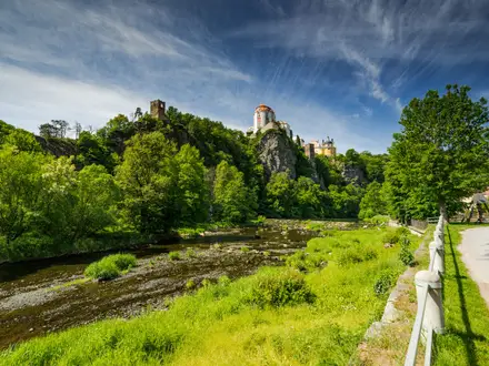
The route runs south to north from Cardiff Castle to Conwy Castle, linking much of upland Wales. From Cardiff it passes Castell Coch, Pontypool and Abergavenny, then climbs the Sugar Loaf into the Black Mountains. It crosses Pen y Fan in Bannau Brycheiniog, traverses the Carmarthen Fans to Llandovery, then heads through the Doethie and Towy valleys and Elenydd moorland to Plynlimon and Dylife. The northern half takes in Dinas Mawddwy, Cadair Idris, Barmouth, the Rhinogydd, Cnicht, Snowdon via the Watkin Path, the Glyderau, the Carneddau and Conwy Mountain. For related Welsh routes, compare the Beacons Way, Aber Falls Walk and Anglesey Coastal Path.
History of the Cambrian Way
The Cambrian Way was pioneered in the 1960s by Ramblers’ member and conservationist Tony Drake. A 1967 proposal to make it an official National Trail met landowner opposition, so the route remained unofficial for decades. Drake published the first guidebook in 1984 and continued updating it. Today the route is looked after by the Cambrian Way Trust and a Ramblers working group; it was officially recognised in 2019.
Notable highlights
- Snowdon / Yr Wyddfa (1,085 m): The highest mountain in Wales and the high point of the Cambrian Way. The route climbs it by the Watkin Path before continuing across the Snowdonia ranges.
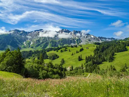
- Pen y Fan (886 m): The highest peak in southern Britain south of Snowdonia. It is the main summit crossing in the Brecon Beacons / Bannau Brycheiniog section.
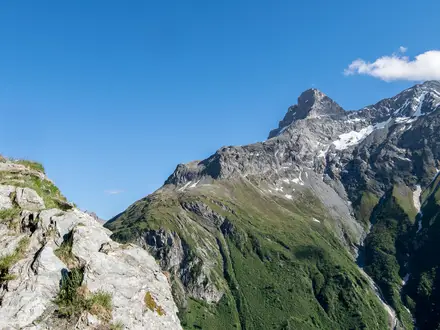
- Cadair Idris: A bold, glacially shaped mountain in southern Snowdonia, with crags and cwm lakes. It marks one of the major mountain days in the northern half of the trail.
- The Rhinogydd: A rough, little-trodden range of heather, rock and Cambrian gritstone. Hikers should expect slow, demanding ground here.
- Carmarthen Fans / Black Mountain: The wild western edge of the Brecon Beacons, including the curving escarpment of Fan Brycheiniog above Llyn y Fan Fach.
- Cardiff Castle to Conwy Castle: The route links two historic castles coast to coast: a Norman-and-Roman fortress in Cardiff and a medieval Edwardian castle in Conwy.
Challenges to expect
Expect a serious mountain route rather than a waymarked national trail. The Cambrian Way is largely unwaymarked, with pathless moorland, faint sheep tracks, rocky ridges and exposed summits. Navigation skills are essential. Wales is wet year-round, and remote stages may have little or no accommodation, so foul-weather kit, food planning and possible wild camping need to be built into the schedule.
HikeList Score
Cambrian Way scored 77/100 on HikeList's trail-quality metrics.
See score breakdownHide breakdown
- Ideal length 73
- Balanced challenge 52
- Scenery & wildness 68
- Varied terrain 94
- Accommodation 92
- Food & support 88
- Path quality 98
- Season flexibility 89
Computed from length, challenge, scenery & wildness, terrain variety, accommodation, food & support, path quality and season flexibility.
 United Kingdom
 Wales
WalesShow more data Show less
- Mountainous
- Open Moorland
- Rocky Ridges
- Exposed Summits
- Rocky
- Pathless
- Faint Sheep Tracks
- B&Bs
- Youth Hostels
- Bunkhouses
- Bothies
- Campsites
- Hotels
- Wild Camping Spots
- Family Friendly
- Dog Friendly On Leash
- Non Potable Water Sources
- Established Campsites
- Shelters
- Picnic Areas
Photos from hikers
Taken on the trail by people who've reviewed Cambrian Way.
Reviews
How would you rate Cambrian Way?
Tap a star to start your review — you could be the first.